
National Character Area 134
Dorset Downs and Cranborne Chase - Analysis: Ecosystem Services
Analysis supporting Statements of Environmental Opportunity
The following analysis section focuses on a selection of the key provisioning, regulating and cultural ecosystem goods and services for this NCA. These are underpinned by supporting services such as photosynthesis, nutrient cycling, soil formation and evapo-transpiration. Supporting services perform an essential role in ensuring the availability of all ecosystem services.
Bodiversity and geodiversity are crucial in supporting the full range of ecosystem services provided by this landscape. Wildlife and geologically-rich landscapes are also of cultural value and are included in this section of the analysis. This analysis shows the projected impact of Statements of Environmental Opportunity on the value of nominated ecosystem services within this landscape.
Further analysis on landscape attributes and opportunities for this NCA is contained in the Analysis: Landscape Attributes & Opportunities section.
Natural Capital
Further information on Natural Capital within this NCA is contained in the Natural Capital and Key Ecosystem Services section.
The Dorset Downs and Cranborne Chase NCA provides a wide range of benefits to society. Each is derived from the attributes and processes (both natural and cultural features) within the area. These benefits are realised through the ‘ecosystem services’ that flow from the ‘ecosystem assets’ or ‘natural capital’ of a place.
Natural capital means ‘the elements of nature that directly or indirectly produce value to people, including ecosystems, species, freshwater, land, minerals, the air and oceans, as well as natural processes and functions’ (Natural Capital Committee, 2017).
Ecosystem Services Main Beneficiaries
The below map displays the main beneficiaries of each ecosystem service identified within this NCA and neighbouring NCAs. These range from being of international importance to local importance. Some services have not been assessed within all NCAs, and therefore in some NCAs are displayed as “N/A” (not applicable).
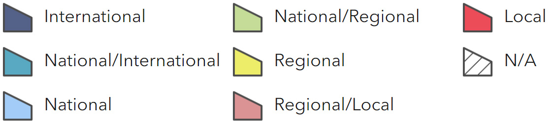
Main Beneficiaries Map
View Main Beneficiaries Map full screen in a new tab View Interactive Map HelpEcosystem service analysis
The following sections show the analysis used to determine key Ecosystem Service opportunities within the area. These opportunities have been combined with the analysis of landscape opportunities to create Statements of Environmental Opportunity. Please note that the following analysis is based upon available data and current understanding of ecosystem services. It does not represent a comprehensive local assessment. Quality and quantity of data for each service is variable locally and many of the services listed are not yet fully researched or understood. Therefore analysis and opportunities may change upon publication of further evidence and better understanding of the inter-relationship between services at a local level.
Note that numbers and figures in the body of the text are based on the 2014 profiles, unless otherwise stated.
Provisioning Services
Food provision
Assets/attributes: main contributors to service
- Cereals
- Oil seeds
- Dairy
- Livestock rearing
State – Agricultural census data (2010) indicates that the major farm types are cereals (31 per cent) 39,856 ha, grazing livestock (27 per cent) dairy (8 per cent) and specialist pigs (2 per cent). The trend appears to be a continuing reduction in livestock numbers (reductions between 2000 and 2009: sheep -23 per cent, cattle -24 per cent and pigs -17 per cent). Pigs are the most numerous livestock in the NCA at around 82,000 animals.
Land use shows a declining hectarage of grass (down by around 11 per cent or 4,677 ha) and a rise in cereals (up by about 2 per cent or 782 ha) and a large increase in oil seeds (up by 112 per cent or 5,000 ha). The current concentration upon cereals and oil seeds also results in a reduction in other arable crops, down by 10 per cent or 594 ha.
Many of the arable soils are low in organic matter and dependent upon annual applications of organic and inorganic manure and fertiliser.
Main beneficiary – Regional
Analysis – The current dominance of arable production in this NCA is a reflection of the suitability of the soils and the buoyancy of the world markets for cereals and oil seeds. The shift in production reflects increasing intensification of livestock management, a movement away from extensive, pasture-based grazing to intensive grain based systems (around 70 per cent of grain in industrialised nations is used for stock feeding (Reaping the Benefits: Science and the Sustainable Intensification of Global Agriculture, The Royal Society, 2009, accessed September 2013). In addition globalised markets have driven demand for cereals and oil seeds as food and for bio fuel.
The figures available do not indicate whether livestock are being concentrated on fewer farms as well as declining in total numbers. It is also possible that adjacent NCAs are ‘taking up the slack’ in stock numbers, allowing this NCA to exploit its soils more profitably. The resulting reduction of permanent grassland has and continues to exacerbate issues of rain water run-off, soil erosion, nutrient discharge (both nitrogen and phosphorus) and siltation.
While the move from pasture to more arable does not seriously impede or modify the character (which has evolved to include arable as a feature) it can both damage the context in which certain features are placed within (prehistoric sites, parks and gardens for example) and is reducing the availability of suitable stock (sheep and cattle) to graze the suite of semi- natural grasslands in the NCA.
Opportunities – Continued development of approaches which optimise the application of fertilisers, both in terms of effective crop nutrition and the reduction of the ‘escape’ of nutrients into surface and ground waters and adjacent semi-natural habitats.
Ensure that sufficient grazing animals are available to maintain valued aspects of the landscape, especially the areas of prehistoric monuments and semi- natural grassland that are entirely dependent upon sympathetic grazing.
Understanding of soils and their effective management needs to be disseminated and encouraged.
Principal services offered by opportunities
- Food provision
- Biodiversity
- Regulating water quality
- Regulating water flow
- Regulating soil erosion
- Regulating soil quality
- Water availability
Timber provision
Assets/attributes: main contributors to service
- Conifer plantations
- Broadleaved woodland
- Coppice
State – Woodland cover in the NCA is currently approximately 12,400 ha. Of this conifer plantation accounts for 2,000 ha and there is 8,300 ha of broadleaved and 1,000 ha of ‘mixed’ woodland.
Timber values are good at the present time (mid 2013). Saw logs, accounting for two-thirds of a tree, are the most valuable. The “”top third”” goes for pulp, fencing and wood fuel (depending on market availability). The burgeoning wood fuel market has meant that this top third is now saleable, whereas before this was not always the case. It is, however, low in value.
The markets are not always local, or even regional. Soft wood saw logs are sold into national markets by a few dealers (Euroforest, Tihill, and Selectfor). They provide structural timber and fibre for our national requirements (the UK consumes about 1 tonne of wood per person per year).
The broadleaved standard and coppice woodland is poorly utilised, having become ‘disconnected’ from the rural economics of the NCA. Some is used for fuel logs and some is used to produce ‘artisan’ products such as hurdles and stakes for thatching.
4,762 ha of this woodland are on ancient sites, of which 2,510 ha is ancient semi- natural woodland and 2,162 ha planted ancient woodland sites.
Main beneficiary – Regional
Analysis – The conifer plantation in the NCA is productive and economically viable, given high demand for saw timber and the buoyant fuel log market. However, the bulk of standing timber in the NCA is either underutilised or not used productively at all. This principally equates to the broadleaved stands, comprising both coppice and standard trees. This is because the traditional uses for timber have ceased or been replaced by modern materials or practices. These broadleaved woodlands are however a valuable future resource, over and above their current biodiversity and historical value. As world demand and prices rise for hardwood products (for example charcoal and timber) these woodlands will become financially viable sources of timber products.
Opportunities – Not all of the 2,000 and more hectares of planted ancient woodland sites will be restored to broadleaved, given the economics of conifer at the present time. However, key areas (considering landscape and the ‘Lawton Principles’) of planted ancient woodland should be restored.
Carry out an assessment, using the tripartite approach, developed by the Dorset AONB, for valuing woodlands for their biodiversity, timber and wood fuel identifying barriers or constraints to these, and maximising the benefits for each of these aspects while maintaining or improving the woodland’s contribution to landscape character.
Provide advice and support to woodland owners and managers with regard to bringing woodlands back into economic use.
Principal services offered by opportunities
- Timber provision
- Biomass energy
- Biodiversity
- Sense of place/inspiration
Water availability
Assets/attributes: main contributors to service
- Extensive chalk aquifer
- Suite of chalk winterbournes, streams and rivers
- Light permeable soils
State -The entire NCA overlies a chalk aquifer. Groundwaters are already subject to over- abstraction in the north of the area, while the central area has no water available for additional abstraction (Maps of water available for extraction: Hampshire Avon Catchment Abstraction Management Strategies and Dorset Catchment Abstraction Management Strategies, accessed September 2013).
Limited availability is found in the south (Map of water available for extraction, Dorset Catchment Abstraction Management Strategies, accessed September 2013).
Most water abstracted from both groundwater and a river source in the NCA is used for public water supply. Other use is mostly licensed to aquaculture and fish farming.
The Stour and the Allen both have ‘no water available’, with the upper Stour being over- licensed and the Allen having groundwater pumped into the river to support its flow.
There is a confined chalk aquifer beneath the Stour catchment but it is not sustainable to use as a public or private resource because it is difficult to access and would need some form of artificial recharge (Dorset Stour Catchment Abstraction Management Strategy, Environment Agency, 2004, accessed September 2013).
River flow is affected by abstraction from the chalk aquifer as the rivers are largely spring fed. In dry winters, the aquifer is unable to recharge fully, depriving chalk rivers and associated wetland habitats of their prime source of water.
Main beneficiary – Regional
Analysis -The chalk aquifers underlying this NCA are stressed in terms of recharge.
The levels of abstraction can and have, in places, exceeded the ability of the aquifers to recharge over dry winters.
Wessex Water’s ‘Water Supply Grid’ will, upon completion, address the major issues of getting water supplies to the major conurbation and towns in Dorset and beyond that have dependencies upon this source.
Many smaller supplies will remain dependent upon local ground or surface water sources. Additionally, the aquatic environment relies upon maintenance of minimum flows at all times of year, principally maintained by the ‘slow release’ of water from the aquifers.
To this end measures to increase natural recharge of the aquifers should be taken alongside the work on the Water Supply Grid.
Further pressures may arise as a result of climate change and increased water demand associated with the growth of Dorchester, as well as Bournemouth and Poole.
Opportunities – Increase area of semi-natural habitats including woodland, grassland and scrub to intercept and retain more precipitation into the groundwater reservoir.
Manage soils to restore permeable structure and water retentiveness – mainly via repairing and avoiding compaction and increasing soil organic content.
Manage farmland to minimise run-off, encouraging the use of contour ploughing, buffer and in- field strips, restored hedgerows and targeted scrub growth.
Principal services offered by opportunities
- Water availability
- Regulating water quality
- Biodiversity
- Regulating soil quality
- Climate regulation
- Regulating water flow
Genetic diversity
Assets/attributes: main contributors to service
- Wiltshire Horn and Dorset Horn sheep
- Dorset Down sheep
- White Park cattle
State – The Wiltshire Horn and Dorset Horn sheep are both ‘early’ breeds well suited to meat production under the conditions of open downland.
The Dorset Down is a later breed, bred as part of the move to increase wool production on the downs.
There are several White Park herds within the NCA.
The above are all categorised as ‘5. Minority’ by the Rare Breeds Survival Trust. This means there are between 1,500 and 3,000 animals in the breed flock/herd.
Main beneficiary – Local
Analysis – Two of the oldest breeds of native sheep.
The sheep of Dorset were known for their unusual ability to breed out of season as far back as the 17th century. The Dorset Horn sheep is one of the earliest recorded breeds of British sheep with the first Flock Book being established in 1892 (Dorset Horn factsheet, Rare Breeds Survival Trust, 2011, accessed September 2013).
The Wiltshire Horn is a short haired breed that fell out of popularity as a result of the focus on wool producing breeds. The breed’s ‘wool shedding’ habit makes it suitable for warmer climates (Wiltshire Horn factsheet, Rare Breeds Survival Trust, 2011, accessed September 2013).
The Dorset Down was developed in the late 19th century as a result of crossing Southdown rams onto Hampshire and Wiltshire ewes and using these to improve the native sheep of Dorset. The Breed Association was founded in Dorchester in 1905 and issued its first Flock Book in 1906 containing entries from 51 flocks totalling 21,376 sheep, all located in Dorset (Dorset Down factsheet, Rare Breeds Survival Trust, 2011, accessed September 2013).
These are robust breeds and could play an important part in managing semi-natural habitats and may be able to deal with changing conditions associated to climate change or arrival of new pathogens.
Opportunities – Promote the ability of these breeds to effectively exploit semi-natural habitats, particularly chalk downland.
Expand flock sizes of these important genetic resources to provide potential reservoirs of disease resistance and environmental tolerances.
Principal services offered by opportunities
- Genetic diversity
- Biodiversity
- Sense of history
- Sense of place / inspiration
Biomass energy
Assets/attributes: main contributors to service
- Existing conifer plantation, broadleaved and coppice woodland
State – Woodland cover in the NCA is currently approximately 12,400 ha (some 9.5 per cent of the NCA). Of this conifer plantation accounts for 2,000 ha with 8,300 ha of broadleaved woodland and 1,000 ha ‘mixed’ woodland.
A good proportion of this area is thought to be unmanaged and could, if brought into sensitive management, provide a large amount of wood fuel for local use.
While firewood is always a relatively low- value market it is healthier than it has been for some time.
Firewood logs have a good value but there is insufficient supply of good quality seasoned hardwood firewood.
Main beneficiary – Local
Analysis – Wood fuel from small to medium unmanaged woodlands is probably the most likely and suitable form of biomass production for the NCA.
Thriving local markets exist to supply the burgeoning domestic wood burning stove market.
The supply of cut and seasoned logs has not developed to the more complex supply of chip and pelleted wood, partly reflecting the low density of installed systems and the higher capital investment needed to establish such a business.
Biomass crops such as short rotation coppice (SRC) and miscanthus are not grown in the NCA and there are limited locations for new biomass plantings.
While the existing resource of broadleaved woodland is so underutilised and profitability of the arable sector is already high, the promotion of SRC and miscanthus would appear counter intuitive, especially given the landscape character impacts these crops can have.
For information on the potential landscape impacts of biomass plantings within the NCA, refer to the tables on the Natural England website.
Opportunities – Consider supporting the opening up of further woodlands to sensitive harvesting of timber for wood fuel.
Carry out an assessment, using the tripartite approach, developed by the Dorset AONB, for valuing woodlands for their biodiversity, timber and wood fuel identifying barriers or constraints to these, and maximising the benefits for each of these aspects while maintaining or improving the woodland’s contribution to landscape character.
Provide advice and support to woodland owners and managers with regard to bringing woodland.
Investigate the use of wood fuel in pyrolysis systems (Pyrolysis is a thermochemical decomposition of organic material at elevated temperatures in the absence of oxygen.) to release energy without releasing carbon. The resulting charcoal material can be used to condition the soils under arable use within the NCA.
Principal services offered by opportunities
- Biomass energy
- Biodiversity
- Sense of place / inspiration
Regulating Services
Climate regulation
Assets/attributes: main contributors to service
- Mineral soils
- Existing woodland
- Organic matter in soils
- Wetlands
- Semi-natural grassland
State – The mineral soils that dominate this NCA generally have a low soil carbon content of 0 to 5 per cent reflecting their low organic matter content, especially in areas under continuous arable cultivation.
There are also small areas with a soil carbon content of up to 10 per cent which may reflect areas under permanent grassland and areas of flood plain grazing marsh (covering 2,000 ha).
The woodland cover (12,400 ha) within this NCA will also play an important role in the sequestration and storage of carbon.
Work looking at the changes in vegetation cover and management over the last 70 years (Mapping to inform conservation: A case study of changes in semi-natural habitats and their connectivity over 70 years. Biological Conservation 145: 30-38, D.A.P. Hooftman and J.M. Bullock, 2012)indicate that many semi-natural habitats have been replaced by arable and intensively managed grasslands with a subsequent degradation of carbon capture and storage capacity.
Main beneficiary – Local
Analysis -With the expansion of arable production over the NCA, there is probably a net decrease in the soil organic matter/carbon content and thus climate regulating capacity of the soils.In these circumstances soil carbon sequestration and storage can be enhanced by increasing soil organic matter content and increasing the area under permanent grass and grass leys.
Increased permanent grassland and shallow tilling on archaeological sites, via Environmental Stewardship agreements may be encouraging greater soil carbon content.
Existing conifer woodland is probably fixing carbon more effectively than the broadleaved at the moment.
This being because the conifer is a managed crop and much is used for timber, while much broadleaved woodland is unmanaged and finds its way into the wood fuel market.
Shallow and no till systems may, if soil condition has been repaired, offer a greater chance at maintaining soil organic material and will reduce the fossil fuel energy required to establish and grow crops.
Opportunities – Increase the carbon/organic matter content of the NCA’s soils through an increasing in the area of permanent and ley pasture and semi-natural grassland, revising crop/soil management to increase the organic material in the soil structure.
Introduce novel systems of soil management – minimum or no till, direct drill and slurry injection – all aimed at minimising soil disturbance, erosion and compaction.
Bringing the broadleaved woodland resource into sensitive active management and trying to use as much timber as possible for non wood fuel uses.
Re-establish areas of marsh, swamp and tall herb habitats in flood plains, leading to creation of carbon-rich organic soils.
Principal services offered by opportunities
- Climate regulation
- Biodiversity
- Regulating water quality
- Regulating soil quality
Regulating coastal erosion and flooding
No information available.
Regulating water quality
Assets/attributes: main contributors to service
- Chalk aquifer
- Streams and rivers
- Semi-natural habitats
State – For information regarding the current state of water quality within this NCA, refer to the Environment Agency (Draft river basin management plan maps).
Main beneficiary – Local
Analysis -In freshwaters the impacts of elevated nitrate are considered a threat to drinking water quality.
Phosphate is an issue in the NCA’s rivers. Point sources, including sewage treatment works (STW), domestic septic tanks and diffuse agricultural sources are all major sources.
Diffuse sourced phosphate commonly enters streams and rivers bound to silt.
Excessive run-off from fields, road verges and roads into watercourses has caused this problem. In the highly permeable, karstic geology of the Dorset Downs and Cranborne Chase, leaching through the ground and into ground waters and back, via springs, into surface waters is also a significant pathway.
High levels of available phosphate can lead to algal blooms which can deplete dissolved oxygen (DO) and reduce light levels in the water column, smothering sensitive aquatic plant species. In severe cases, dissolved oxygen (DO) is exhausted and large scale die-off of aquatic species can occur.
A study of the Dorset Chalk aquifers concluded that: “”It is generally of high quality but is being progressively impacted by agrochemicals in unconfined areas, the evidence of which is found even in deeper ground waters. Waters of pristine pre- industrial quality are rare in the basin…””(Baseline Report Series: 4. The Chalk of Dorset, British Geological Survey and Environment Agency, 2002, accessed September 2013)
Because available phosphate in rivers is naturally very low, even small quantities (<1mg/l) can have an adverse impact on ecology. Additionally, phosphate bound to silt in watercourses can be released long after deposition, leading to elevated levels even after inputs have been significantly reduced (Freshwater eutrophication, Environment Agency, 2012, accessed September 2013).
Siltation with attendant turbidity and smothering issues, which can be especially damaging on spawning substrates, is an NCA wide issue as well. Maintenance of salmon and trout spawning sites often involves mechanical cleaning of the gravel/ sand substrate.
Efforts to reduce nitrate pollution of ground and surface waters are based on the extensive NVZ covering the bulk of the NCA. Measures to increase the efficiency, location and timing of fertiliser application are the main mechanisms employed to reduce pollution potential.
The catchments of the Frome, the Piddle, the Stour and the Ebble are Priority Catchments in the England Catchment Sensitive Farming Initiative (ECSFI).
Elements of this initiative actively seek to reduce pollution of surface and ground waters via a series of voluntary interventions by farmers.
Opportunities – Identify important areas for aquifer recharge and initiate land use/ management changes that will reduce the penetration of nitrogen and phosphate pollution.
Restore semi-natural grasslands or woodland and scrub to areas at risk from high levels of run-off and pollution into water courses.
Reduce compaction and subsequent erosion of soils and transport of silt and phosphate into watercourses.
Explain financial as well as environmental benefits of fertiliser use efficiency.
Principal services offered by opportunities
- Regulating water quality
- Regulating water flow
- Regulating soil erosion
- Regulating soil quality
- Water availability
- Biodiversity
Regulating water flow
Assets/attributes: main contributors to service
- Streams and rivers
- Semi-natural habitats
- River valley wet woodland
- Wetland habitats
- Geodiversity
State – The NCA has a history of flooding. Steep slopes at the top of the catchments of the Frome and the Piddle create fast run-off responses to rainfall events.
The upper catchments are underlain by chalk so water is absorbed quickly, though this may be offset by large areas of arable agriculture that increases run-off to watercourses. Further downstream there is mixed geology with water staying on the surface before discharging into rivers.
The Stour catchment has a varied geology. The upper catchment comprises impermeable clays creating shallow valleys and wide flood plains.
On the chalks of Cranborne Chase, valleys are steep with narrow flood plains while lower reaches run over semi-permeable sands, gravels and clays. Run-off and changes in water levels are rapid in the many streams on the clay making flooding common.
Principle river flood risks are from the Frome in Dorchester, and Maiden Newton, the Cerne at Cerne Abbas and the Stour at Blandford Forum.
An example was the flooding of Piddletrenthide, Maiden Newton and other hamlets in the winter of 2000-2001, caused by combined high groundwater, surface and river water after heavy rainfall.
Flood risk in this NCA is set to increase if climate change brings more frequent intense rainfall events (Dorset Stour Catchment Flood Management Plan, Environment Agency, 2012, accessed September 2013), (Frome and Piddle Catchment Flood Management Plan, Environment Agency, 2012, accessed September 2013).
Main beneficiary – Local
Analysis – It is likely that flooding has always been an issue in many parts of the NCA. The difference now is peoples’ tolerance of disruption and damage is much lower. Modern homes and infrastructure are also more vulnerable to flood damage.
The large scale switch from permanent pasture to arable systems increases compaction and the run-off of water from fields, which are traditionally large and without hedgerows. This quickly flows into field drains, streams and rivers.
Coupled to more frequent extreme weather events (2012 saw the second wettest summer on record, 133 per cent above average) it is clear that the rivers’ ability to contain flows within their banks will be more frequently exceeded.
Changes in land use and management practices could alleviate flood risk through the restoration of naturally functioning flood plains and the ability of the chalk aquifers to absorb and thereby moderate extremes of precipitation.
More effort must be put into the creation of wetland habitats to manage run-off and slow flood waters and, more generally, the creation of ‘soft defences’ to store water and manage run- off in locations that provide overall flood risk reduction and/or environmental benefit.
The planting of trees and woodland to control water flows in flood plains and to reduce and arrest down-slope flows of water could provide a wide range of benefits over and above flood management (The Frome and Piddle Catchment Flood Management Plan, Environment Agency).
Opportunities – Working with the land owning and management community, initiate the large scale restoration of semi-natural grasslands on areas of slope currently under arable regimes. These should be selected both for their ability to prevent run-off and their function within wider grassland ecological networks.
In areas where the conditions, ecological networks and landscape character permit, areas of woodland and scrub should be established to fulfil similar functions.
River valleys should incorporate identified areas for storage of flood waters that can also fulfil ecological functions. Selection of vegetation communities, ranging from productive grasslands to wet woodland, should be arrived at via an assessment of the ecological network in that area, the landscape character and landowner preferences.
In areas where production of arable crops is still required, introduce techniques that help to slow flows and improve water penetration into the soil. This will include soil structure restoration, restoration of hedgerows, contour ploughing, continuous cover and minimal tillage systems.
Principal services offered by opportunities
- Regulating water flow
- Regulating water quality
- Regulating soil erosion
- Regulating soil quality
- Water availability
- Biodiversity
Regulating soil quality
Assets/attributes: main contributors to service
- Fertile soils cover the river flood plains.
- Well drained easily worked soils cover much of the plateau and dip slope.
- Heavier clay- with-flints in some parts of the plateau and dip slope
- Thin nutrient- poor soils in areas of unimproved grassland
State – There are 7 main soilscape types in this NCA (NSRI Soilscapes data).
- Shallow lime-rich soils over chalk, covering 50 per cent of the NCA.
- Freely draining slightly acid loamy soils (20 per cent).
- Freely draining lime-rich loamy soils (8 per cent).
- Freely draining slightly acid but base- rich soils (7 per cent).
- Slightly acid loamy and clayey soils with impeded drainage (7 per cent).
- Loamy and clayey flood plain soils with naturally high groundwater (4 per cent).
- Slowly permeable seasonally wet slightly acid but base-rich loamy and clayey soils (2 per cent).
Much of the area with the two greatest cover soil types, that are so important for aquifer recharge, is also the preferred area for intensive arable production. Issues of poor structure (low organic content), compaction (due to the highly mechanised nature of the agricultural operations) and erosion (due to greater extent and period of open soil conditions under the preferred arable systems) are issues for these soils.
Main beneficiary – National
Analysis -The shallow lime-rich soils over chalk (50 per cent) are typically shallow and droughty but due to their calcareous nature have a degree of natural resilience. These and the freely draining slightly acid loamy soils (20 per cent) are valuable for aquifer recharge requiring the maintenance of good structural conditions to aid water infiltration and requiring the matching of nutrients to needs to prevent pollution of the underlying aquifer.
There is the potential to increase organic matter content by management interventions to improve soil structure.
The catchments of the Frome, the Piddle, the Stour and the Ebble are Priority Catchments in the England Catchment Sensitive Farming Initiative (ECSFI).
Soil erosion is a specific issue within these catchments, particularly under maize cropping (the Frome catchment) and in the upper catchments where arable cultivation occurs on steeper slopes.
Opportunities – Ensure levels of long-established organic matter are maintained in higher-value agricultural soils, where found, minimising tillage operations where possible. Similarly, avoid any further ploughing of long established grasslands (regardless of biodiversity value) to ensure the soil structure, organic content and ecosystem services are maintained.
Rehabilitate soil quality and the services good soil structure provides by:
- Repairing compaction and seeking management techniques less reliant on heavy machinery in wetter parts of the year.
- Increasing organic matter and soil ecosystems through less intensive management and more targeted and ‘needs based’ use of biocides.
- Reduce erosion and run-off through sensitive crop selection and management, reestablishment of semi-natural buffer features (grassland, scrub and woodland).
- Use aspirations for large scale recreation and restoration of semi- natural grassland habitat networks to target (without compromising habitat network viability) areas of vulnerable soils.
Principal services offered by opportunities
- Regulating soil quality
- Regulating water flow
- Regulating water quality
- Regulating soil erosion
- Water availability
- Food provision
- Biodiversity
Regulating soil erosion
Assets/attributes: main contributors to service
- Soils
State – The 7 main soil types include:
- Shallow lime-rich soils over chalk, covering 50 per cent of the NCA.
- Freely draining slightly acid loamy soils (20 per cent).
- Freely draining lime-rich loamy soils (8 per cent).
- Freely draining slightly acid but base- rich soils (7 per cent).
- Slightly acid loamy and clayey soils with impeded drainage (7 per cent).
- Loamy and clayey flood plain soils with naturally high groundwater (4 per cent).
- Slowly permeable seasonally wet slightly acid but base-rich loamy and clayey soils (2 per cent).
The lime-rich and freely draining loamy soils are susceptible to erosion, especially on moderately or steeply sloping land where cultivated or soil is exposed. This is exacerbated where organic matter levels are low after continuous arable cultivation or where soils are compacted.
There is the potential for wind erosion on some fine textured cultivated variants.
The base-rich soils and the clayey soils with impeded drainage are susceptible to compaction and capping, leading to an increased risk of surface water run-off and subsequent erosion. These soils are easily compacted by machinery or livestock if accessed when wet.
The small areas of seasonally wet and flood plain soils are not susceptible to soil erosion.
Main beneficiary – Regional
Analysis -The relatively light soils that dominate the NCA are shallow, sometimes unstable and prone to loss through erosion. They are particularly at risk on sloping cultivated ground or where soil is exposed along tracks or areas of extensive bare ground created by outdoor pig rearing (most numerous livestock in the NCA). This is exacerbated where organic matter levels are low after continuous arable cultivation or where soils are compacted or capped.
The catchments of the Frome, the Piddle, the Stour and the Ebble are Priority Catchments in the England Catchment Sensitive Farming Initiative (ECSFI).
Soil erosion is a specific issue within these catchments, particularly under maize cropping (the Frome catchment) and in the upper catchments where arable cultivation occurs on steeper slopes.
Opportunities – Ensure levels of long-established organic matter are maintained in higher-value agricultural soils, where found, minimising tillage operations where possible. Similarly, avoid any further ploughing of long established grasslands (regardless of biodiversity value) to ensure the soil structure, organic content and ecosystem services are maintained.
Rehabilitate soil quality and resilience to erosion and compaction by:
- Repairing compaction and seeking management techniques less reliant on heavy machinery in wetter parts of the year.
- Increasing organic matter and soil ecosystems through less intensive management and more targeted and ‘needs based’ use of biocides.
- Reducing erosion and run-off through sensitive crop selection and management, cross-field hedgerows and arable margins, re-establishment of semi-natural buffer features
- (grassland, scrub, woodland).
Principal services offered by opportunities
- Regulating soil erosion
- Regulating soilquality
- Regulating water flow
- Regulating water quality
- Water availability
- Food provision
- Biodiversity
Pollination
Assets/attributes: main contributors to service
- Lowland calcareous grassland
- Semi-natural ancient woodland
- Tracks, byways and road verges
State – The existing network of semi- natural habitats provides an important habitat for pollinating insects. Unfortunately, the highly fragmented nature of many of the habitats in this NCA will make it difficult for these pollinators to have a widespread impact – being limited to a specific range from their host habitat. A general lack of hedgerows or other insect friendly boundary and connecting features (many are simply barbed wire fences) will also tend to reduce the ability of insects to pollinate widely.
Main beneficiary – Local
Analysis – Pollination of crops is undertaken by a range of insect species. The intensification of the arable landscape on the Dorset Downs and Cranborne Chase has inevitably eroded the extent and connectivity of semi-natural habitats that these species depend upon for shelter, food and dispersal.
The historical lack of an extensive network of hedgerows, copses and other ‘corridors’ and ‘stepping stones’ may also be a limiting factor on the availability of these species’ pollinating services to areas of farmland.
Opportunities – Measures aimed at enhancing the extent, quality and connectivity of a range of semi-natural habitats within the NCA (predominantly, though not exclusively, broadleaved woodland and calcareous grassland) will have a markedly positive impact on the availability of pollinators over the area.
More specific, localised measures, probably on a farm scale (arable margins, land left fallow or sown with annual nectar-rich species mixes, areas of scrub and long grass) will also be required to attract pollinators where major network features are not in close proximity.
Principal services offered by opportunities
- Pollination
- Pest regulation
- Biodiversity
- Sense of place/ inspiration
- Food provision
Pest regulation
Assets/attributes: main contributors to service
- Lowland calcareous grassland
- Semi-natural ancient woodland
- Tracks, byways and road verges
- Range of farmland bird species
State – The existing network of semi- natural habitats provides an important habitat for naturally pest predating species.
Unfortunately, the highly fragmented nature of many of the habitats in this NCA will make it difficult for these predators to have a widespread impact – being limited to a specific range from their host habitat.
A general lack of hedgerows or other predator friendly boundary features (many are simply barbed wire fences) will also tend to reduce the ability of these species to have a widespread impact on pests.
Main beneficiary – Local
Analysis – The natural regulation of pest species is undertaken by a range of native fauna. Insects and birds are probably the two most important groups that provide this service.
The intensification of the arable landscape on the Dorset Downs and Cranborne Chase has inevitably eroded the extent and connectivity of semi-natural habitats that these species depend upon for shelter, food and dispersal.
The historical lack of an extensive network of hedgerows, copses and other ‘corridors’ and ‘stepping stones’ may also be a limiting factor on the availability of these species’ pest regulating services to areas of farmland.
The suite of so called ‘farmland birds’ whose lifecycles had adapted to traditional farming techniques and cycles would have provided important services in pest regulation. Modern practices have however undermined their ability to survive on many farmed landscapes (other changes such as timing of insect prey will have played a part in this decline).
Work to arrest the decline of a suite of these species has been undertaken as part of the Environmental Stewardship (ES) under the South West Farmland Bird Initiative (SWFBI). This project encourages landowners to manage specific elements of their holding in a range of options aimed at providing forage for birds at specific key times of year (Natural England’s South West Farmland Bird Initiative, accessed September 2013).
Opportunities – Measures aimed at enhancing the extent, quality and connectivity of a range of semi-natural habitats within the NCA (predominantly, though not exclusively, broadleaved woodland and calcareous grassland) will have a markedly positive impact on the availability of pest regulating species over the area.
More specific, localised measures, probably on a farm scale (arable margins, land left fallow or sown with annual nectar rich species mixes, areas of scrub and long grass) will also be required to attract predators where major network features are not in close proximity.
Additionally, measures such as those currently promoted by the SWFBI will be required to maintain the farmland bird population at a stable or recovering population level.
Principal services offered by opportunities
- Pest regulation
- Pollination
- Biodiversity
- Sense of place/ inspiration
- Food production
Cultural Services
Sense of place/inspiration
Assets/attributes: main contributors to service
- Dominating scarp landscape on approach to the NCA’s northern and south- western boundaries
- Long views to south and east across the long dip slope
- Dramatic, rhythmic contrasts of plateau dissected by combes and steep-sided valleys
- Expansive plateau with gently undulating landscape, wide horizons punctuated by woodlands and hill top clumps
- Narrow, secluded river valleys with narrow flood plains and small linear settlements
- Ancient woodlands and grasslands
- Local vernacular cob, clunch, flint, brick and thatch
- Large skyscape and impact of various weather phenomena
- Agricultural cycles of seasonality juxtaposed against timelessness of some aspects of the landscape
State – This NCA still has a strong sense of identity, more so in Cranborne Chase, and its inspirational qualities are, though eroded in places, intact.
Most villages have retained their character, even with post- war expansion and changes in the demographic of their inhabitants. Dorchester and Blandford Forum still retain their prosperous market town character, at least in their historic cores, while the development of their ‘suburbs’ has somewhat eroded the peri-urban character of both.
The rapid wartime and post-war conversion from pastoral systems to arable production, urban expansion and increased density of ‘infrastructure’ have all degraded the character and sense of place in parts of the NCA.
However, in many places the essential qualities of openness, interaction between land use and landform and an essentially ‘uncluttered’ landscape have been maintained.
Cranborne Chase has a strong ‘estate landscape’ imposed upon the natural features with extensive coppice woodland, areas of permanent grassland on valley sides and a wealth of designed parklands and gardens providing the setting of stately homes.
Feelings of inspiration and escapism are likely to be associated with the open landscape and skyscape of the downland with its dramatic scarps slopes and spectacular, panoramic views of a largely rolling arable landscape.
These features combine to give a feeling of remoteness.
Contrast between the elemental expansiveness of the plateau and downland and sheltering embrace of the valley landscape creates a strong sensory dynamic.
The importance of the works of Thomas Hardy should not be underestimated in terms of the inspiration and sense of place people bring to this landscape. Along with the ‘blasted heaths’ of the Dorset Heaths NCA, the chalk downs are the key contextual and spiritual elements of most of Hardy’s writings.
Main beneficiary – National
Analysis -The obvious underlying factor giving a sense of place to this NCA is the chalk geology and geomorphology. This has defined the landforms, building materials, semi-natural vegetation and to a great degree the land use. The cultural identity of the NCA is less unified.
Cranborne Chase, due to its distinct royal links and forest law history, has a more ‘high profile’ historical identity than the Dorset Downs which have been more ‘quietly pastoral’. There is a sense that the people of Cranborne Chase are more aware of their identity than elsewhere in the NCA.
To some extent, the identity of this NCA is split between the two AONB that cover almost its entire area. This identity split is delineated by the atypically lowland pastoral character of the relatively wide Stour Valley and the town of Blandford Forum.
A unifying sense of place for the NCA is the predominance of arable agriculture which is of course a relatively recent change and represents a ‘new’ landscape character for the NCA. However, increased mechanisation and intensification of agricultural production and the semi-industrial nature of farm building complexes can impact on the character of the NCA. Similarly, while prominent clumps of trees and follies may be seen as enhancements to the landscape – in part due to their sensitivity to their surroundings – Modern energy and communications infrastructure insensitively placed on high points or ridgelines can be distracting, overwhelming and ultimately damaging to the landscape character.
Opportunities – The essential character forming landforms of the NCA should be protected and enhanced by decisions made regarding land use.
Reinforce the sense of place/character through restoration of areas of semi-natural grassland, scrub and woodland.
Maintaining and restoring/replacing hedgerows, shelterbelts, clumps, copses and coverts that contributes positively to the sense of place. Resist new planting that has No information available.rious effects on landscape.
Encourage and support the restoration and ongoing management of parks and gardens of the large houses within the NCA.
Avoid new and minimise the impact of current infrastructure, particularly that of utilities/telecoms.
Maintain the fabric and setting of heritage assets, ensuring their historic value and character setting qualities are maintained or, where degraded, enhanced.
Principal services offered by opportunities
- Sense of place/ inspiration
- Sense of history
- Biodiversity
Sense of history
Assets/attributes: main contributors to service
- High density of heritage assets
- Groups of barrows, defences and ancient track ways
- Hill forts in commanding positions
- Patterns of settlement substantially unchanged since Norman times
- Grand houses, gardens and parks
- General absence of intrusive modern developments
- Ancient woodlands and grasslands
- Strong literary references to the area in Thomas Hardy’s novels
- 24 Parks and registered gardens
- 1,100 Scheduled Monuments
- 2,825 Listed buildings
State – The NCA has a very strong sense of history, both in terms of having a great number of above and below ground heritage assets and having a suite of features that, more than almost anywhere else in the UK, represent the full record of human occupation and activity.
Much of the history is readily legible, having escaped the destruction wrought in other areas through a combination of low levels of development, stable land use patterns (until recently) and the persistence of forest law in Cranborne Chase.
The landscape also displays a diverse cross section of the major movements and trends that have shaped the English countryside, up to the present day.
Barrows, hill forts, field systems, tracks and earthworks are present across the NCA and in places, such as the South Dorset Ridgeway, their density is high (with more barrows in a mile-wide corridor around the SDR than there are in Stonehenge and Avebury World Heritage Site) and impact in the landscape significant.
In places like the Valley of the Stones National Nature Reserve, some 6,000 years of human occupation and agricultural history can be experienced in a relatively small area.
This historic character is further reinforced by the pattern of linear villages strung along valleys and spring lines and linked by ancient lanes. This pattern of settlement is largely unchanged since the time of Domesday Book.
The numerous historic houses and parks including Kingston Lacy, Waterston Manor, Rushmore and Charborough Parks mark both the rise and fall of ecclesiastical and subsequent replacement by secular commercial power over the landscape.
The legacy of the ancient hunting ground of Cranborne Chase is still to be seen in the NCA. While large areas of the wooded cover are centuries gone, the culture of the area is still strongly associated with field sports.
Main beneficiary – National
Analysis – The Dorset Downs and Cranborne Chase are well known for their historic assets. Many of the most popular and defining aspects of this NCA are historic features – hill forts including Hambledon Hill, Badbury Rings and Maiden Castle (the largest hill fort in England), barrows, visible banks of the Dorset Cursus and the Cerne Abbas Giant. These are all nationally or even internationally recognised features.
It is also significant that much of the development of early archaeological study was pioneered in this NCA.
While successive layers of land use history have sat side-by-side for the last 6,000 years, the land use changes of the last 100 years have been disproportionately destructive and still threaten to ‘erase’ signs of past land use. The Dorset Cursus is a good example of a massive landscape feature reduced, by ploughing, to a soil mark over most of its 10 km length.
English Heritage’s Heritage at Risk lists many earthworks at risk from principally agricultural (ploughing) activities, though many of these have or are being addressed through Environmental Stewardship.
The breakdown of main causes of damage are:
- Arable ploughing 140 sites, 174
- Animal burrowing 18 sites, 7
- Arable clipping 35 sites, 5 ha
Other causes 23 sites, 13.5 ha (Geographic Information System data from Heritage at Risk Register 2012 South West, English Heritage, 2012, accessed September 2013).
Opportunities – Continue to raise awareness of the value of the historic landscape to landowners, local people and visitors to the NCA.
Taking a project approach focus, within the ‘hotspot’ of the South Dorset Ridgeway, upon an integrated approach to the historic assets, biodiversity, landscape character and cultural identity of the area.
Continue to use English Heritage grants, agri-environment schemes and inputs from the private sector (for example Section106 agreements and Community Infrastructure Levy) to enhance both the material condition and the setting of historic assets.
Link the enhancement of historic assets and their setting to projects to increase areas of semi-natural grassland.
Protect ancient ways over the open downland summits from inappropriate and damaging vehicular use.
As well as protecting heritage assets, their interpretation and legibility should be enhanced where appropriate.
Management and restoration of historic parklands ensures continuity of their positive impact on sense of history and landscape character.
The areas where ancient, irregular field patterns still persist should be protected to ensure large scale arable intensification does not erase this form of land management and landscape character within the NCA.
Principal services offered by opportunities
- Sense of history
- Sense of place / inspiration
- Biodiversity
Tranquility
Assets/attributes: main contributors to service
- Low levels of development, including electricity and telecommunications infrastructure
- Few major roads
- Lack of major air traffic corridors
- Relatively ‘dark skies’ across much of the NCA
- Scale and open nature of landscape
Areas of semi- natural habitat supporting species highly characteristic of tranquillity
State – The NCA has experienced a significant decline in tranquillity since the 1960s. Since then undisturbed areas have decreased from 96 per cent to 74 per cent in 2007.
The lowest scores for tranquillity within the NCA are found, not surprisingly, around Dorchester, Blandford and along major A-road corridors such as the A354 and A350.
The various landscape types within the NCA convey differing forms of tranquillity. The varied river valleys with woodlands, hedged fields and flood meadows afford a more cocooned tranquillity, while the open downs and scarp offer a robust, expansive and remote sense of tranquillity.
Presence of species such as skylark, bees and livestock imbue areas of semi-natural habitat with a pastoral (even nostalgic) sensibility that many find relaxing and tranquil.
Dark night skies are a feature of the NCA, away from the larger urban areas of Dorchester and Blandford Forum. No ‘Dark Skies Reserves’ have yet been identified, but potential is there.
Main beneficiary – Regional
Analysis – Most of the NCA is still tranquil. There are temporal and seasonal variations (rush hours, harvest time – holiday and off seasons) which see marked increases in certain types of disturbance or intrusion.
The edges of urban areas can be made less intrusive by schemes of planting and landscaping but these can, if not carefully designed, have adverse visual impacts.
Roads visual (day and night) and acoustic impacts can be moderated through planting and landscaping. However, such schemes can also have negative visual impacts upon open views both from the road and across the landscape it crosses.
The major pressures upon tranquillity in the NCA are:
- Increasing industrialisation of arable agriculture;
- Greater traffic volume and 24 hour pressure (increasing demands for lighting) on the NCAs major roads;
- Increased urbanisation of the smaller villages and hamlets, again increasing calls for lighting;
- Greater vehicular use of lanes and byways;
- Farm business diversification leading to noisier, visually intrusive activities.
Opportunities – Create ‘softer’ edges to larger urban areas. Industrial areas/ units should be suitably massed and arranged to prevent high visibility and impact.
Resist calls for increased street lighting, and where possible implement strategies for reducing light intensity/ pollution and/or duration.
Ensure that any new developments both minimise their own adverse impact and seek to mitigate existing adverse impacts upon tranquillity.
Investigate mechanisms to reduce traffic on non-trunk roads.
Principal services offered by opportunities
- Tranquillity
- Sense of history
- Sense of place / inspiration
- Biodiversity
Recreation
Assets/attributes: main contributors to service
- South West Coast Path National Trail
- Open access land
- Public rights of way
- Extensive permissive access
- Hunting
State – The NCA offers an extensive network of rights of way totalling nearly 2,000 km at a density of over 1.5 km per km2.
There is a wealth of open access land covering over 4,000 ha or 3.6 per cent of the NCA. In addition, 15 km of the inland route of the South West Coast Path (known as the South Dorset Ridgeway) lies within the NCA.
Popular activities across the area include walking, riding, hunting and cycling.
The South Dorset Ridgeway (part of the South West Coast Path National Trail , running from West Bexington to Osmington Mills in the Weymouth Lowlands NCA is a particularly good example of the access both physical and visual that many of the public rights of way give to the heritage assets of the area.
The Hampshire / Wiltshire border is a maze of byways and bridleways – nearly all ancient droves.
Most of the chalk grassland is also open access land and the hills and valleys are well connected by cow droves and footpaths.
There is extensive permissive access in the Cranborne Chase woodlands around Tollard Royal and other woodland access is provided by the RSPB and Forestry Commission. The Chalke Valley has excellent networks of public rights of way. Some of the open access land has closure agreements for the shooting season.
Main beneficiary – National
Analysis – In the east of the NCA the pursuit of various hunting and hunting-derived activities is still popular with some even gaining in popularity.
The ‘pull’ of the coast certainly reduces the volume of day visits or longer holidays to the area and this may be seen in the less- well developed level of provision in the NCA.
A low density of public transport services means that often even local people (especially those with low disposable incomes) have quite poor access to their own environs.
The extensive byway and bridleway network around Whitsbury has seen the horse racing industry locate here for most of the last 100 years. There is currently one world-class stud and one large racing stable, along with a number of associated smaller equine businesses, racing enterprises and eventing stables.
In some areas, the public rights of way network is ‘severed’ by busy, fast main roads. This can be an issue for all users and can effectively deny access for certain user groups.
Opportunities – Seek to connect local people to their local countryside via enhanced access from within towns and villages to the wider countryside, possibly via semi-formalised areas of green infrastructure.
Work with Local Access Fora to identify and address issues with rights of way through Rights of Way Improvement Plans.
Principal services offered by opportunities
- Recreation
- Sense of place / inspiration
- Sense of history
Biodiversity
Assets/attributes: main contributors to service
- Semi-natural unimproved calcareous grassland
- Suite of lowland chalk streams and rivers.
- Broadleaf and ancient woodland
- Great Yews SSSI
- Rare yew woodland designated as a Special Area of Conservation (SAC)
- Some component sites of the West Dorset Alderwoods SAC
- SSI covering 3 per cent of NCA
- 1 Special Protection Area (SPA small part), 7 SAC and 1 Ramsar site
- Important farmland bird area
State -The areas of Ramsar and SPA in the NCA are small fragments of heathland sites predominantly located in the adjacent Dorset Heaths NCA.
The 3,000 ha of lowland calcareous grassland (This figure is derived from the NCA area plus a 1 km buffer to incorporate important scarp chalk downland sites in the transition zone between this NCA and the adjacent NCAs – principally NCAs 132, 133 and 138)is an internationally important concentration of a priority habitat. Much of this is SSSI and in several cases SAC; however a significant proportion is made up of a large number of small local sites (Sites of Nature Conservation Interest).
The chalk supports a range of locally common, characteristic species such as common rock-rose, quaking grass, chalk milkwort, carline thistle, marbled white butterfly and salad burnet.
Also found are species that have declined, over and above the declines of calcareous grassland, making them especially rare. The early gentian, marsh fritillary and silver-spotted skipper butterflies, juniper and Adonis blue butterfly.
Much of the woodland resource is undermanaged for biodiversity, especially as much of the coppice woodlands are now outside of that regime and succeeding to high forest.
The generally clear and unpolluted chalk rivers of the NCA support bullhead and brook lamprey, both species listed under the Habitats Directive (Annex II) and rafts of the rare river water- crowfoot.
The vast majority of SSSI are in favourable (or recovering) condition (98 per cent). Unfavourable sites account for 4 per cent of the total.
The condition of Sites of Nature Conservation Interest (SNCI) is not so well understood and their generally smaller size makes them more vulnerable to various perturbations.
Arable habitats support farmland birds while historic parklands are an important habitat supporting populations of bats, soil and deadwood fungi and rotting wood loving species of invertebrates.
Main beneficiary – International
Analysis – The rich mosaic of grassland, woodland and riverine habitats in the NCA supports many rare and internationally important wildlife species.
The quality, extent and connectivity of these habitats and the ecosystems that function within have declined markedly over the last 100 years.
This has principally been due to arable conversion and intensification of the farmed landscape and decoupling of valued biodiversity assets from mainstream agriculture.
The impacts have been widespread and not merely upon biodiversity. The services that the ecosystems provided have also suffered.
There are opportunities to re-create ecological networks to improve biodiversity connectivity, ecosystem function and ecosystem service provision.
Opportunities – Create significant new areas of semi-natural calcareous grassland, the location of which will meet the ‘Lawton Principles’ and strengthen the connectivity and resilience of the habitat.
Encourage land managers to pull arable production away from the edges of steep sided scarp, combe and valley slopes where chalk grassland is found to prevent nutrient run-off.
Bring ancient species- rich woodlands into management as a priority; restore their structure to encourage woodland floor recovery.
Understand ecological function within the NCA (and how this interacts with adjacent NCAs) and conserve areas using the ecosystem approach.
Continue to use environmental schemes as a way to secure populations of farmland birds, but also to include other mobile farmland biodiversity.
Principal services offered by opportunities
- Biodiversity
- Sence of place / inspiration
- Recreation
Geodiversity
Assets/attributes: main contributors to service
- Chalk geology illustrating various peri- glacial landforms and processes
- Geological SSSI and Local
- Geological Sites
- Quarries
- Isolated Tertiary deposits at Blackdown
- Sarsen ‘train’ at Valley of the Stones National Nature Reserve (NNR)
- Suite of chalk streams, winterbournes and rivers
- Local stone used in building
State – There are 6 (SSSI within the NCA with geological interests and a further 12 sites of local geological or geomorphological interest. The geological SSSI are designated mainly for their Cretaceous rocks (mainly Chalk) that outcrop over most of the area.
The layers of chalk contain bands of flint nodules, a common feature of the walls and buildings in downland villages.
There is an interesting ‘inlier’ of Greensand at Tarrant Crawford, below Martin Down.
The lack of active quarries may indicate a lack of good local exposures of chalk and other strata.
Main beneficiary – Regional
Analysis – The level of diversity in the geology of this NCA is low. It is almost entirely underlain by Chalk. The Chalk is also topped in a very few places, most notably at Blackdown, around Hardy’s Monument, by remnants of once extensive Tertiary gravels and sands, giving rise to an area of heathland and planted areas of conifer.
A short distance away is the Valley of the Stones NNR which features a Sarsen train, a collection of Sarsen stones (a material known as Silcrete – a silicacious concretion). These were brought down the slopes to the valley floor by the process of solufluction.
The overwhelmingly calcareous Chalk geology and geomorphology are the dominant influence upon the aesthetic and cultural qualities of the area.
Opportunities – Key features of the landscape which help understand and explain the processes of a karstic landscape should be protected from damage and made as visible and accessible as possible.
Highlight the fundamental connections between the geodiversity, history of human occupation and land use of the NCA.
Ensure that the most important quarry exposures are protected from infilling, re-vegetating and inappropriate uses.
Ensure that local materials are still available for both repairs to existing and new build vernacular buildings.
Installations of interpretation for archaeological and biodiversity assets should include references to underlying geology and geomorphology.
Principal services offered by opportunities
- Geodiversity
- Water availability
- Sense of place / inspiration
- Biodiversity
- Recreation