

National Character Area 27
Yorkshire Wolds - Analysis: Ecosystem Services
Analysis supporting Statements of Environmental Opportunity
The following analysis section focuses on a selection of the key provisioning, regulating and cultural ecosystem goods and services for this NCA. These are underpinned by supporting services such as photosynthesis, nutrient cycling, soil formation and evapo-transpiration. Supporting services perform an essential role in ensuring the availability of all ecosystem services.
Bodiversity and geodiversity are crucial in supporting the full range of ecosystem services provided by this landscape. Wildlife and geologically-rich landscapes are also of cultural value and are included in this section of the analysis. This analysis shows the projected impact of Statements of Environmental Opportunity on the value of nominated ecosystem services within this landscape.
Further analysis on landscape attributes and opportunities for this NCA is contained in the Analysis: Landscape Attributes & Opportunities section.
Natural Capital
Further information on Natural Capital within this NCA is contained in the Natural Capital and Key Ecosystem Services section.
The Yorkshire Wolds NCA provides a wide range of benefits to society. Each is derived from the attributes and processes (both natural and cultural features) within the area. These benefits are realised through the ‘ecosystem services’ that flow from the ‘ecosystem assets’ or ‘natural capital’ of a place.
Natural capital means ‘the elements of nature that directly or indirectly produce value to people, including ecosystems, species, freshwater, land, minerals, the air and oceans, as well as natural processes and functions’ (Natural Capital Committee, 2017).
Ecosystem Services Main Beneficiaries
The below map displays the main beneficiaries of each ecosystem service identified within this NCA and neighbouring NCAs. These range from being of international importance to local importance. Some services have not been assessed within all NCAs, and therefore in some NCAs are displayed as “N/A” (not applicable).
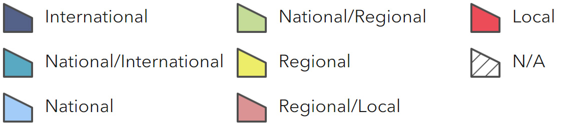
Main Beneficiaries Map
View Main Beneficiaries Map full screen in a new tab View Interactive Map HelpEcosystem service analysis
The following sections show the analysis used to determine key Ecosystem Service opportunities within the area. These opportunities have been combined with the analysis of landscape opportunities to create Statements of Environmental Opportunity. Please note that the following analysis is based upon available data and current understanding of ecosystem services. It does not represent a comprehensive local assessment. Quality and quantity of data for each service is variable locally and many of the services listed are not yet fully researched or understood. Therefore analysis and opportunities may change upon publication of further evidence and better understanding of the inter-relationship between services at a local level.
Note that numbers and figures in the body of the text are based on the 2014 profiles, unless otherwise stated.
Provisioning Services
Food provision
Assets/attributes: main contributors to service
- Livestock systems
- Cereal and oilseed
- Production
State – High percentage of Grade 2 and 3 agricultural land – dominated by arable production and livestock production (mainly pigs).
Main beneficiary – National
Analysis – Food provision is a significant service in the Wolds but intensive cultivation of land may also lead to loss of water quality due to nitrate inputs.
Extensive arable land and limited semi-natural habitats reduces the range of nectar sources for pollinating insects.
Soil regulation may be reduced if more land is cultivated and if it replaces semi-natural habitats such as species-rich grassland.
Opportunities – Encourage sustainable farming practices including compliance with nitrate vulnerable zone (NVZ) regulations.
Principal services offered by opportunities
- Food provision
- Biodiversity
- Climate regulation
- Regulating soil quality
- Regulating soil erosion
- Regulating water quality
- Water availability
Timber provision
Assets/attributes: main contributors to service
- Existing woodland
State – There is 6 per cent woodland cover with limited commerical timber produced, apart from that from the larger estates such as Sledmere.
Main beneficiary – Local
Analysis – Although woodland cover is low, there are limited opportunities for further woodland creation because of the potential impact on productive agricultural land, open landscape and expansive views.
Opportunities – Opportunities for commercial timber production are limited because land is more suited to agriculture.
Small woodland blocks could be created on higher land and steeper slopes in the west and conifer plantations to the north.
Much of the broadleaved woodland is of high nature conservation value and should be protected and maintained.
Principal services offered by opportunities
- Climate regulation
- Regulating soil erosion
- Regulating water quality
Water availability
Assets/attributes: main contributors to service
- Chalk aquifer
- Semi-natural chalk grasslands
State – Water is rarely found on the land surface but the chalk substrate forms a major aquifer supplying water to the Yorkshire and Humber region and some limited irrigation for agriculture.
There are no major rivers running through the NCA but streams and calcareous springs flow east feeding into the upper reaches of the River Hull Headwaters SSSI in the adjoining Holderness NCA
Main beneficiary – Regional
Analysis – There is little surplus water available, with the eastern coastal part of the aquifer considered to be over-licensed potentially creating a risk to the base flows in some rivers and streams in the west of the Character Area.
An increase in abstraction used for drinking water supplied to the region is likely to affect water availability in drought conditions.
Protecting streams and calcareous springs in this otherwise dry NCA, is essential for biodiversity and flows of the River Hull Headwaters in the adjoining Holderness NCA.
Opportunities – Maintaining and improving the chalk aquifer for public water supply, its long term resilience and water storage by working with the local farming community to adopt sustainable farming practices such as; compliance with NVZ regulations, creating or restoring grasslands on the valley slopes to improve filtration into the ground and reduce nutrient run- off and creation of grass buffer strips close to springs and chalk streams.
Principal services offered by opportunities
- Water availability
- Regulating water quality
- Food provision
- Biodiversity
- Regulating soil quality
Genetic diversity
No information available.
Biomass energy
Assets/attributes: main contributors to service
- Existing woodland
State – Limited woodland cover limits availability of existing woody biomass.
Main beneficiary – Local
Analysis – Improved woodland management could provide a local source of fire wood and woodchip.
There are limited locations for new biomass plantings.
The area offers medium potential yields for short rotation coppice (SRC) and miscanthus. For information on the potential landscape impacts of biomass plantings within the NCA, refer to http://archive.defra.gov.uk/ foodfarm/growing/crops/industrial/ energy/opportunities/index.htm.
Opportunities – Ensure existing woodlands are managed to produce surplus timber that could be used to provide local sources of biomass.
Principal services offered by opportunities
- Biomass energy
- Biodiversity
Regulating Services
Climate regulation
Assets/attributes: main contributors to service
- Woodland
- Semi-natural habitats
State – The majority of the NCA has a low carbon soil content (0-5 per cent), rising only to 5-10 per cent in a few patches in the west. These relatively thin chalk soils have low levels of organic matter and high use of fertilisers, necessary for arable production.
Main beneficiary – Local
Analysis – Soil cultivation involving high fertiliser use for arable production as well as livestock grazing (cattle), are likely to be a significant source of the greenhouse gas, nitrous oxide. The low woodland cover (4.5 per cent) contributes little to carbon storage.
Opportunities – Encourage sustainable cultivation practices such as green cover crops to reduce nitrate leaching, and extensive grazing regimes (cattle) to reduce methane production.
Encourage reduced fertiliser inputs on cultivated soils by ensuring Government guidelines (NVZ regulations) are followed by farmers and land managers.
Encourage management of hedges and hedgerow trees; filling in gaps and allowing them to fill out.
Encourage woodland creation within valleys or as shelterbelts around farmsteads where appropriate.
Principal services offered by opportunities
- Climate regulation
- Timber provision
- Regulating soil erosion
- Regulating soil quality
Regulating coastal erosion and flooding
Assets/attributes: main contributors to service
- Chalk cliffs
State – The narrow stretch of coast around Flamborough Head stands well above sea level and is not at risk of coastal flooding, although some erosion is occurring at a slow rate.
Main beneficiary – Local
Analysis – No Active Intervention has been recommended in the draft Shoreline Management Plan for Flamborough Head. There is an intention to allow the natural retreat of the cliff line, enabling internationally designated sites to evolve under natural processes. (The Seascape character area assessment for the East Inshore and East Offshore marine plan area can be seen here)
Opportunities – Allow natural coastal processes to continue
Principal services offered by opportunities
- Regulating coastal erosion and flooding
Regulating water quality
Assets/attributes: main contributors to service
- Chalk aquifer
- Semi-natural habitats
State – For information regarding the current state of water quality within this NCA, refer to the Environment Agency (Draft river basin management plan maps).
Main beneficiary – Regional
Analysis – Diffuse agricultural pollution through nitrates is likely to affect water quality of the groundwaters and the fragile northerly chalk streams of the NCA, as well as waterways in adjoining NCAs into which the streams feed.
Areas covered by semi-natural habitat in good ecological condition are generally less susceptible to high rates of run-off.
Opportunities – Reduce diffuse pollution by encouraging sustainable farming practices; avoiding overuse of fertilisers and pesticides (adhering to NVZ guidelines), and encouraging the creation of grasslands on valley slopes.
Seek opportunities for wider catchment woodland planting on the lower eastern slopes to help promote rainfall infiltration into the soil reduce water pollution and sediment run-off, creating grassland buffer strips or riparian woodland along watercourses.
Principal services offered by opportunities
- Regulating water quality
- Regulating soil erosion and quality
- Biodiversity
- Sense of place/ inspiration
- Timber provision
Regulating water flow
Assets/attributes: main contributors to service –
- Chalk aquifier
State – The permeable nature of the underlying Chalk ensures that there are no large areas at risk from river flooding.
Main beneficiary – Local
Analysis – Flooding is not an issue in the NCA.
Opportunities –
Principal services offered by opportunities –
- Regulating water flow
Regulating soil quality
Assets/attributes: main contributors to service
- Soils
- Sustainable farming practices
- Semi-natural chalk grasslands
- Geological processes
State – 45 per cent of the area is covered by shallow lime-rich soils, while 29 per cent are freely draining lime-rich loamy soils. These soil types are typically shallow and free-draining. Although they are vulnerable to drought, they also have a degree of natural resilience due to their calcareous nature.
These soils are valuable for aquifer recharge.
Main beneficiary – Regional
Analysis – Organic matter may be lost through frequent tillage associated with arable farming, however, cultivation of some arable crops such as potatoes can help retain organic matter.
Opportunities – Encourage sustainable farming practices; test soils to assess nutrient needs and encourage expansion of permanent grasslands and green cover crops to build up organic matter.
Principal services offered by opportunities
- Regulating soil quality
- Regulating soil erosion
- Regulating water quality
- Water availability
- Biodiversity
- Sense of place/ inspiration
Regulating soil erosion
Assets/attributes: main contributors to service
- Sustainable farming practices
- Semi-natural habitats
State – The thin, chalky tills of the NCA are resilient to soil erosion.
Main beneficiary – Regional
Analysis – The most vulnerable areas regarding soil erosion are on the steep valley slopes under arable production, particularly during frequent, high intensity downpours at a time when crops are establishing or being harvested.
Opportunities – Encourage efforts to increase green cover crops or establish permanent grassland on steep slopes.
Create grasslands on slopes, and grassland buffer strips along field margins and alongside watercourses, especially on the lower slopes on the east side of the Wolds.
Encourage extensive grazing regimes on soils most vulnerable to compaction.
Principal services offered by opportunities
- Regulating soil erosion
- Regulating soil quality
- Regulating water quality
- Water availability
- Climate regulation
- Biodiversity
- Sense of place/ inspiration
Pollination
Assets/attributes: main contributors to service
- Semi natural chalk grasslands
- Semi-natural woodlands
- Pollinating insects
State – Dominance of arable cultivation limits habitat for pollinating insects. Current semi-natural, non-wooded habitats cover only 2 per cent of the NCA.
Main beneficiary – Local
Analysis – Pollination of oilseed crops is essential for sustainable agricultural production, but monoculture of crops for arable farming and lack of semi-natural habitats provides less variety of plant species for pollinating insects. Semi-natural woodlands can also be a source of nectar, particularly early in the season.
Opportunities – Encourage sustainable farming practices; increase species-rich grasslands and plant nectar-rich seed mixes to create an ecological network of habitats. Extend the network of woodlands where appropriate.
Principal services offered by opportunities
- Food production
- Pollination
- Biodiversity
Pest regulation
No information available.
Cultural Services
Sense of place/inspiration
Assets/attributes: main contributors to service
- Long views of rolling hills and big skies
- Contrasting with enclosed steep- sided valleys
- Low tree cover
- Sheep-grazed unimproved or semi-improved calcareous grassland in steep-sided dry valleys and hillsides of floristically-rich grasslands
- Sparse settlement patterns
- Rugged coastline
- Time depth of evident historic interest
State – Open, undulating, simple, uniform, a much valued landscape that provides inspiration for creativity such as is seen in the work of landscape artist, David Hockney.
An area characterised by its gently rolling hills and un-commercial nature, which is contrasted against the neighbouring flat land towards Hull.
Dramatic steep chalk cliffs at the coast captured in the 120-meter high Flamborough Head and its high, open, long distant views.
Views of expansive skies over a large- scale landscape. The openness and perceived closeness to the sky makes people feel they have transcended their day-to-day lives.
There is a wide range of historic features from prehistory through medieval times to historic parklands.
Main beneficiary – Regional
Analysis – Continuity of long views and rolling hills provides a sense of openness and a landscape that has remained largely unchanged for many years. This is likely to have a strong effect on local identity. The lack of manmade structures in this lightly settled landscape creates a sense of escapism from the modern world.
By contrast to the top of the Wolds, the hidden, steep-sided valleys that divide the hills give a sense of intimacy and remoteness.
In the east, the underlying chalk reaches the North Sea forming a rugged coastline at Bempton and Flamborough Head where large colonies of breeding seabirds are iconic to the area providing an interesting wildlife spectacle for local people and visitors.
Opportunities – Ensure that development respects local settlement patterns, building materials, expansive viewpoints, enclosed, steep-sided valleys, wildlife, geology and historic evidence.
Encourage visitors to the NCA. Offer good quality interpretation at key sites and encourage opportunities for education of the natural environment (landscape, biodiversity, wildlife, geology and heritage) by working with schools and other educational institutions.
Principal services offered by opportunities
- Sense of place/ inspiration
- Recreation
- Sense of history
- Tranquillity
- Biodiversity
- Geodiversity
Sense of history
Assets/attributes: main contributors to service
- Prehistoric monuments, landscape features, and settlements, later settlement patterns and post-medieval landscape change
- Deserted medieval villages on open hills
- Estates and parklands
State – Rich, prehistoric remains and numerous bronze and iron-age monuments, especially in Great Wold Valley. Deserted medieval settlements on the open hills; large estates and parklands (six registered parks and gardens). Strong unifying local vernacular linked to the underlying geology, including limestone, chalk and red brick.
Main beneficiary – Regional
Analysis – This area has a rich and varied history resulting in a range of structures and features providing opportunities for tourism and education. There is also a need for its protection as some features may be damaged by deep ploughing of land.
Opportunities – Protect historic features by encouraging best agricultural practices such as through reversion of arable to grassland where land management threatens the integrity of earthworks and below-ground archaeology, encouraging scrub removal on earthworks (Neolithic, bronze- and iron-age monuments).
Develop a package of interpretation through partnership on key sites for visitors, school children and students.
Develop a package of visitor/ tourism opportunities.
Ensure developers respect the local vernacular regarding new buildings.
Maintain estates and parklands and protect ancient monuments at risk identifying opportunities through Environmental Stewardship.
Principal services offered by opportunities
- Sense of history
- Sense of place/ inspiration
- Recreation
- Tranquillity
Tranquility
Assets/attributes: main contributors to service
- Expansive, open views and enclosed steep-sided valleys
- Sparse settlement patterns and low population
- Long, distant sea views from coastline
State – An area with a strong sense of tranquillity. In 2007, 78 per cent of the NCA was classified as undisturbed (CPRE Intrusion Map).
Main beneficiary – Regional
Analysis – A very large proportion of the NCA contributes to the high sense of tranquillity due to elevated views, low proportion of manmade structures, sparse settlement patterns and lack of major towns and cities.
Opportunities – Encourage sensitive development respecting open and expansive viewpoints and strong rural character of the area.
Principal services offered by opportunities
- Tranquillity
- Sense of history
- Sense of place/ inspiration
- Recreation
Recreation
Assets/attributes: main contributors to service
- Network of Footpaths
- Yorkshire Wolds Way
- Transpennine Trail
- Heritage Coast
- Large estates and Parklands
- Historic sites
- National Cycle Routes
State – 2.5 per cent of the area is open access land, along with 682 km of rights of way at a density of 0.5 km per km2.
Main routes include a small section of the Transpennine Trail and the Yorkshire Wolds Way National Trail, the latter covering 117 km. There are a number of circular routes linking to them.
There are two national cycle routes; The Way of the Roses, running coast to coast from Morecambe Bay to Bridlington Bay and a circular route known as the Yorkshire Wolds Cycle Route. The coast at Flamborough offers recreation opportunities for visitors with its heritage coastline, caravan parks and RSPB Bempton Nature Reserve, as do the Country Estate and Parklands at Sledmere and Burton Agnes.
Main beneficiary – Regional
Analysis – Although the NCA has a low density of public rights of way, it offers varied recreation and access opportunities inland, along the coast and to sites of historical interest. However, there is scope for further joining up of main routes to the permissive paths.
Opportunities – There are opportunities to improve access by ensuring that paths are well maintained and signposted, and that some surfaced paths are provided for use by all levels of ability and interest in key locations.
Improve and extend access to recreation for a wide range of users by developing shorter circular routes linked to historic sites, cycle routes, bridleways, National Trails, development of easy access walks and educational packs.
Improve interpretation and development of green tourism opportunities.
Expansion of the coastal path in the long term to link to the Cleveland Way through the Coastal Access (from Filey to Speeton), which includes Flamborough Head.
Principal services offered by opportunities
- Recreation
- Tranquillity
- Sense of history
- Sense of place/ inspiration
- Biodiversity
- Geodiversity
Biodiversity
Assets/attributes: main contributors to service
- International and national designations
- Semi-natural/priority habitats (lowland calcareous grassland, broadleaved woodland, maritime cliffs and slope, chalk rivers and streams)
State – International and National Nature conservation designations currently cover the coast – Flamborough Head (SAC and SPA) and Bempton Cliffs (part of Flamborough Head SPA).
Flamborough is also designated as Heritage Coast.
There are 38 SSSI with the majority being in unfavourable recovering condition.
Main beneficiary – Local
Analysis – Improving the biological condition of the designated resource is likely to involve sustainable land management activities, principally through maintenance and increase in coverage of semi-natural habitats (creating buffer strips, extending grasslands along field margins and slopes, maintenance and improvement of natural hydrological systems, employing sensitive grazing regimes and creating a network of woodlands in appropriate places) These will also help to increase/improve regulating services such as water quality and soil erosion, while contributing to sense of place.
Opportunities – Protect SSSI and priority habitats; species-rich grasslands, broadleaved woodlands, maritime cliffs and slopes.
Buffer the designated resource by planting nectar-rich seed mixes and grassland strips to create an ecological network of habitats around and between farmland. This will also benefit butterflies and moths species such as marbled white, brown argus and cistus forester.
Restore and maintain cliff top habitats by creating buffer strips and reversion to grassland.
Encourage management practices to benefit farmland birds such as grey partridge, lapwing, turtle dove, yellow wagtail, tree sparrow, corn bunting, quail, barn owl and yellowhammer by providing bird seed crops (winter food source) and creating flower strips and grass margins (summer nesting habitats).
Increase chalk grasslands on sloping arable land where it is unsuitable for arable production.
Improve condition of chalk streams and associated riparian habitats by creating buffer strips alongside streams.
Principal services offered by opportunities
- Biodiversity
- Recreation
- Regulating soil erosion
- Regulating soil quality
- Regulating water quality
- Water availability
- Sense of place/ inspirationTranquillity
Geodiversity
Assets/attributes: main contributors to service
- Designated geological sites:
- Exposures in old quarries
- Flamborough head cliffs
State – There are currently 4 nationally designated geological sites and 4 of geological and biodiversity interest within the NCA. These consist mainly of man-made exposures (disused chalk quarries) and sea caves.
Main beneficiary – Local
Analysis – Designated sites provide important opportunities for interpretation, understanding and research into the geodiversity of the NCA. Exposure of these features contributes towards the sense of place, history and biodiversity.
Opportunities – Need to protect designated areas and interpret them to a wide audience while developing visitor opportunities and access where appropriate.
Principal services offered by opportunities
- Geodiversity
- Biodiversity
- Sense of history
- Sense of place/ inspiration
- Recreation