

National Character Area 23
Tees Lowlands - Analysis: Ecosystem Services
Analysis supporting Statements of Environmental Opportunity
The following analysis section focuses on a selection of the key provisioning, regulating and cultural ecosystem goods and services for this NCA. These are underpinned by supporting services such as photosynthesis, nutrient cycling, soil formation and evapo-transpiration. Supporting services perform an essential role in ensuring the availability of all ecosystem services.
Bodiversity and geodiversity are crucial in supporting the full range of ecosystem services provided by this landscape. Wildlife and geologically-rich landscapes are also of cultural value and are included in this section of the analysis. This analysis shows the projected impact of Statements of Environmental Opportunity on the value of nominated ecosystem services within this landscape.
Further analysis on landscape attributes and opportunities for this NCA is contained in the Analysis: Landscape Attributes & Opportunities section.
Natural Capital
Further information on Natural Capital within this NCA is contained in the Natural Capital and Key Ecosystem Services section.
The Tees Lowlands NCA provides a wide range of benefits to society. Each is derived from the attributes and processes (both natural and cultural features) within the area. These benefits are realised through the ‘ecosystem services’ that flow from the ‘ecosystem assets’ or ‘natural capital’ of a place.
Natural capital means ‘the elements of nature that directly or indirectly produce value to people, including ecosystems, species, freshwater, land, minerals, the air and oceans, as well as natural processes and functions’ (Natural Capital Committee, 2017).
Ecosystem Services Main Beneficiaries
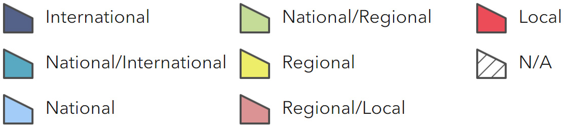
The below map displays the main beneficiaries of each ecosystem service identified within this NCA and neighbouring NCAs. These range from being of international importance to local importance. Some services have not been assessed within all NCAs, and therefore in some NCAs are displayed as “N/A” (not applicable).
Main Beneficiaries Map
View Main Beneficiaries Map full screen in a new tab View Interactive Map HelpEcosystem service analysis
The following sections show the analysis used to determine key Ecosystem Service opportunities within the area. These opportunities have been combined with the analysis of landscape opportunities to create Statements of Environmental Opportunity. Please note that the following analysis is based upon available data and current understanding of ecosystem services. It does not represent a comprehensive local assessment. Quality and quantity of data for each service is variable locally and many of the services listed are not yet fully researched or understood. Therefore analysis and opportunities may change upon publication of further evidence and better understanding of the inter-relationship between services at a local level.
Note that numbers and figures in the body of the text are based on the 2014 profiles, unless otherwise stated.
Provisioning Services
Food provision
Assets/attributes: main contributors to service –
- Topography
- Fertile, alluvial soils
- Estuary and coastal waters
State – Fertile soils enable the NCA to support high quality agricultural land with 67 per cent of the total land area grade 3 and 11 per cent grade 2.
The Tees Estuary retains an active fishing industry from Hartlepool, South Gare, Redcar and Marske.
Main beneficiary – Regional
Analysis – Fertile soils have led to intensive, predominantly arable farming over the majority of the area, with cereal crops predominating but with oilseed rape also occupying a sizeable area.
Intensification of agriculture during the latter half of the 20th century led to the loss of field boundaries, and of many wetland habitats as a result of drainage. Intensively farmed soils are vulnerable to compaction and erosion, and it will be important to maintain high levels of soil organic content and water infiltration to ensure soils remain productive.
Modern agricultural techniques such as precision farming can be used to increase yields while allowing semi-natural habitats to be maintained within the farmed environment.
Archaeological features providing evidence of past agricultural practices and settlement pattern are vulnerable to damage as a result of cultivation.
Fishing operates on a commercial but relatively small scale. However, North Sea fish stocks have historically been overfished and have recently collapsed. It will be essential to ensure that sustainable fishing techniques are used and quotas are adhered to if the industry is to continue
Opportunities – Use modern agricultural practices to increase yields while conserving biodiversity.
Manage soils to allow continued sustainable agricultural production by increasing soil organic content and water infiltration, for example use of grass buffers along watercourses and inclusion of fallow in crop rotation.
Seek opportunities to use alternative crops which are better adapted to climatic change.
Encourage fishing practices which ensure fish stocks are used sustainably.
Principal services offered by opportunities –
- Food provision
- Regulating water quality
- Water availability
- Regulating soil quality
- Sense of place/inspiration
- Sense of history
- Biodiversity
Timber provision
Assets/attributes: main contributors to service –
- Woodland
State – The area was largely cleared of woodland for agriculture more than 2000 years ago. Existing woodland cover is low (5 per cent) and restricted mainly to steep riverbanks, with some more extensive woodland in the area north of Billingham.
Woodland cover has increased as a result of planting schemes such as the Tees Community Forest, and a new area of Forestry Commission woodland has been created to the south-west of Stockton-on-Tees.
Main beneficiary – Local
Analysis – Continued woodland planting where appropriate will provide benefits for biodiversity and recreation (particularly around the conurbation), enhancement of the landscape, as well as timber provision. Planting of deciduous rather than coniferous woodland should be favoured, and woodland creation should be avoided where it may impact on other important habitats such as grazing marsh.
There is also the opportunity to harvest wood fuel from existing woodland areas, particularly in the north of the NCA, using sustainable management techniques such as coppicing. However, non intervention may be more appropriate in some woodlands.
Opportunities – Plant trees where appropriate, particularly around the fringe of urban areas.
Manage existing woodlands to allow the sustainable harvesting of timber.
Principal services offered by opportunities –
- Timber provision
- Climate regulation
- Biodiversity
Water availability
Assets/attributes: main contributors to service –
- Rainfall
- Groundwater bodies
- River Ttes, Leven and Skerne
State – Water flows into this NCA principally from the North Pennines to the west, where rainfall levels are high and where the River Tees has its source.
Part of the NCA overlays the Sherwood Sandstone aquifer which has ‘water available’ status, as do surface water resources in the Rivers Skerne and Leven.
Main beneficiary – Regional
Analysis – The principal use of water abstracted from the Tees catchment is industrial, with domestic (serving the populations of Teesside) and agricultural abstractions also taking place (The Tees Catchment Abstraction Management Strategy, Environment Agency, 2008). This part of the country is vulnerable to drought, and this may be exacerbated by the impacts of climate change, as high rainfall events and increased flashiness of streams may result in reduced infiltration rates. It will therefore be important to reduce the demand for irrigation through appropriate cultivation practices
Opportunities – Adopt agricultural practices that increase infiltration and reduce runoff, such as measures to increase the organic content of soils where arable cultivation dominates.
Increase the extent of semi-natural habitats and wet pasture to reduce run-off rates.
Principal services offered by opportunities –
- Water availability
- Geodiversity
- Biodiversity
Genetic diversity
Assets/attributes: main contributors to service –
- Semi-natural
- Traditional breeds and varieties
- Traditional orchards
State – The mudflats and salt marshes at Teesside have the potential to support wild varieties of cultivated plants.
The Shorthorn cattle breed originated from the border between this NCA and the Durham Magnesian Limestone plateau in 18th century.
There are a number of traditional orchards in the southern part of the NCA.
Main beneficiary – Local
Analysis – Semi-natural habitats supporting wild varieties of commonly cultivated plants represent important genetic stores of these species.
Traditional breeds can play a useful role in grazing conservation sites. Traditional orchards in the area support varieties of fruit which may no longer be grown on a commercial scale, but which provide a valuable genetic resource.
Opportunities – Protect and expand areas of mudflat and salt marsh.
Promote husbandry of traditional breeds of livestock and management of traditional orchards.
Principal services offered by opportunities –
- Genetic diversity
- Pollination
- Pest regulation
- Regulating coastal erosion and flooding
- Biodiversity
Biomass energy
Assets/attributes: main contributors to service –
- Woodland
- Biomass crops
State – Woodland cover is low (5 per cent).
The NCA has low to medium potential yield for short rotation coppice (SRC) around Middlesbrough but high potential further to the west. Some SRC wood is grown in this NCA for the Wilton 10 wood-burning power station at Teesside.
Potential miscanthus yield is high around the mouth of the Tees but medium over most of the NCA.
Main beneficiary – Local
Analysis – The NCA offers limited potential for the provision of biomass through the use of SRC. This is used to supply the Wilton 10 wood burning power station at Teesside. There is also potential to generate energy using biomass crops.
Information on the potential landscape impacts of biomass plantings within the NCA can be found in the tables on the Natural England website (Opportunities and optimum sitings for energy crops, Natural England, 2010).
Opportunities – Plant trees and woodland where appropriate.
Manage existing woodland (for instance through SRC) and plant biomass crops to meet local demand, for example power stations.
Principal services offered by opportunities –
- Biomass energy
Regulating Services
Climate regulation
Assets/attributes: main contributors to service –
- Mudflats
- Salt marsh
- Peaty fenland/carrs
- Woodland
State – Soil carbon levels are generally low (0-5 per cent) however, mudflats and salt marsh at Teesmouth and peaty fenland, carr and reedbeds at Skerne carrs have a high carbon content.
Soil carbon content is also higher in woodland, although woodland cover is low (5 per cent).
Main beneficiary – National
Analysis – The peaty fenland and carrs at Skerne carrs have been reduced markedly in area due to drainage for agriculture. Salt marshes and mudflats of the Tees Estuary have also been lost due to land take for industrial development. It will be important to protect the remaining areas. Carbon content of agricultural soils can also be increased by employing appropriate agricultural techniques.
Woodland cover is low and therefore plays a relatively unimportant role in climate regulation within this NCA; however there is the potential to increase this through woodland planting in appropriate areas.
Opportunities – Protect remaining areas of mudflat and salt marsh and allow them to naturally shift through coastal realignment, to prevent ongoing coastal squeeze and further loss of habitat.
Protect fenland and carr habitat in the Skerne carrs by working with farmers to manage water table levels and extend the area of grazing marsh.
Increase woodland cover through tree planting where appropriate, for example on riverbanks and in existing wooded areas in the north west of the NCA.
Adopt cultivation practices that maintain high levels of organic matter in soil to increase carbon storage, such as the use of permanent grassland and the inclusion of fallow in crop rotation.
Principal services offered by opportunities –
- Climate regulation
- Pollination
- Sense of place/inspiration
- Biodiversity
Regulating coastal erosion and flooding
Assets/attributes: main contributors to service –
- Coastline and estuary
State – Longshore drift moves sediment southwards in this NCA. The overall shape of the coast in this area is held by the natural physical features to either end of the frontage (the headlands at Hartlepool Bay and Saltburn) and by the breakwaters at the mouth of the Tees.
Main beneficiary – Regional
Analysis – As set out in the Shoreline Management Plan (SMP), the sea front of Hartlepool town will be sustained. Further south at Seaton Carew, there is opportunity as the existing defences deteriorate for some set back of the defence line, provided that this opportunity is not lost by inappropriate development.
Because of the control imposed at the mouth of the Tees by the breakwaters, the semi-natural dune frontages can be allowed to retreat under managed conditions, creating an opportunity for habitat development in an area quite unique to this section of the coastline.
At Redcar there are concerns that there will be a loss of beach and the Shoreline Management Plan recommends that, without undue constraint, management of this area should allow natural development of the coast to the west. Overall, there is little pressure at present on the frontage to the east of Redcar, although it will continue to erode. Within this context the defence of Marske and Saltburn appears sustainable (River Tyne to Flamborough Head SMP2, Non Technical Summary for Redcar & Cleveland Area, North East Authorities Group, 2007).
Opportunities – Maintain coastal defences protecting the towns of Hartlepool, Saltburn and Marske.
Allow intertidal habitats to shift through managed realignment at Seaton Carew and Coatham Sands.
Seek opportunities to create new areas of intertidal habitat.
Principal services offered by opportunities –
- Regulating coastal erosion and flooding
- Genetic diversity
- Biodiversity
Regulating water quality
Assets/attributes: main contributors to service –
- River Tees, Leven and Skerne
- Tees Estuary
- Sandstone aquifer
State – For information regarding the current state of water quality within this NCA, refer to the Environment Agency (Draft river basin management plan maps).
Main beneficiary – Regional
Analysis – Poor ecological and chemical water quality is reported in the lower sections of the rivers within the NCA, as well as groundwater, and is largely a result of the industrial legacy (Northumbria River Basin Management Plan, Environment Agency, 2009). However, this has improved markedly under the Urban Wastewater Directive. It will be important to ensure that sources of diffuse pollution are identified through monitoring and pollution prevention measures are put in place through targeted pollution prevention campaigns.
Use of fertiliser and high levels of run-off from agricultural land reduces water quality. This is likely to be exacerbated by climate change resulting in high rainfall events and increased flashiness of streams. It will be important to address this through appropriate agricultural practices.
Opportunities – Monitor sources of industrial pollution.
Promote measures to reduce pollution from industrial sources and remediation of former industrial sites.
Adopt agricultural practices that increase infiltration and reduce run-off, such as the use of grass buffers along watercourses to capture sediment.
Reduce the demand for fertiliser, for example through crop selection and increased soil analysis.
Principal services offered by opportunities –
- Regulating water quality
- Food provision
- Regulating soil quality
- Water availability
- Regulating water flow
- Biodiversity
Regulating water flow
Assets/attributes: main contributors to service –
- Rivers
- Soil
State – The River Tees headwaters drain remote moorland in the North Pennines (NCA 10) and flow through narrow, steep valleys over soils often saturated by heavy rainfall, resulting in downstream flood risk within this NCA at Middlesbrough/Tees Mouth, Billingham, Croft-on-Tees, and Yarm on the River Tees.
The River Skerne has its headwaters on the Durham Magnesian Limestone Plateau (NCA 15) while the River Leven rises in the North Yorkshire Moors and Cleveland Hills (NCA 25). These rivers pose a risk from fluvial flooding to a significant number of properties in Darlington and Stokesley respectively.
Tidal flood risk is also a significant issue in this NCA.
Natural river courses and flows have been altered by the creation of flood defence schemes that include works at Croft-on-Tees and the Tees Barrage. However, a section of the River Skerne north of Darlington has been restored with new meanders created (The River Restoration Centre, The River Restoration Centre, 2014).
Main beneficiary – Regional
Analysis – Flood risk is likely to be worsened by the increasing incidence of storm events associate with climate change and consequent flashiness of streams. There are also likely to be more frequent and severe coastal storm surges.
The Environment Agency’s preferred approach to river flood risk management includes promotion of upland land management practices in the Pennines aimed at increasing interception and reducing the rate of run-off, which may reduce flood risk downstream (Tees Catchment Flood Management Plan Summary Report, Environment Agency, 2009).
Further downstream, agricultural practices and provision of flood storage capacity upstream from major settlements, such as in the Skerne Lowlands north of Darlington, will help to address flood risk.
In urban areas, flood risk can be reduced by using permeable surfaces and sustainable drainage techniques and this has successfully reduced flood risk in Stockton-on-Tees and Darlington.
Opportunities – Restore the ecology of peat bogs and block the active grips upon heather moorland in the North Pennines to help preserve peat, increase interception and reduce run-off.
Restore minor rivers to their natural courses where appropriate.
Increase the area of wet pasture providing flood storage, for example in the Skerne carrs area, to provide flood storage upstream from Darlington.
Adopt agricultural practices that increase infiltration and reduce run-off, such as the use of grass buffers along watercourses.
Promote the use of sustainable drainage schemes in new development to reduce run-off, for example through the use of permeable surfaces and swales.
Principal services offered by opportunities –
- Regulating water flow
- Regulating water quality
- Regulating soil quality
- Regulating soil erosion
Regulating soil quality
Assets/attributes: main contributors to service –
- Fertile soils
State – This NCA has seven main soilscape types:
- Slowly permeable seasonally wet slightly acid but base-rich loamy and clayey soils, covering 77 per cent of the NCA.
- Freely draining slightly acid loamy soils (6 per cent).
- Loamy and clayey soils of coastal flats with naturally high groundwater (5 per cent).
- Slightly acid loamy and clayey soils with impeded drainage (3 per cent).
- Slowly permeable seasonally wet acid loamy and clayey soils (3 per cent).
- Freely draining flood plain soils (2 per cent).
- Loamy and clayey flood plain soils with naturally high groundwater (2 per cent).
Main beneficiary – Local
Analysis – The slowly permeable seasonally wet slightly acid but base-rich loamy and clayey soils (77 per cent) are easily damaged when wet and are vulnerable to compaction due to livestock trampling and machinery. In turn this may lead to increasingly poor water infiltration and diffuse pollution as a result of surface water run-off.
Increasing incidence of high rainfall events associated with climatic changes is likely to exacerbate problems associated with soil damage. Management measures that increase levels of organic matter can help reduce these problems. These include the use of permanent grassland strips, compost and manure, and winter stubbles. Minimum tillage techniques and the inclusion of fallow in crop rotation will also help to maintain soil organic levels. Avoiding the use of machinery during wet conditions will also help to reduce compaction.
Opportunities – Adopt cultivation practices that increase levels of organic matter in soil, such as the use of permanent grassland, incorporating compost and manure, winter stubbles, fallow and minimum tillage techniques, as well as appropriate timing of machinery use.
Principal services offered by opportunities –
- Regulating soil quality
- Food provision
Regulating soil erosion
Assets/attributes: main contributors to service –
- Fertile soils
State – Slowly permeable, seasonally wet, slightly acid but base-rich loamy and clayey soils.
Loamy and clayey soils of coastal flats with naturally high groundwater.
Slightly acid loamy and clayey soils with impeded drainage.
Slowly permeable seasonally wet acid loamy and clayey soils.
Freely draining flood plain soils.
Loamy and clayey flood plain soils with naturally high groundwater.
Main beneficiary – Regional
Analysis – The soils covering most (89 per cent) of this NCA are at low risk of erosion. Remaining higher risk areas are as follows:
The freely draining slightly acid loamy soils (6 per cent) can erode easily on steep slopes, especially where vegetation is removed or where organic matter levels are low after continuous cultivation. There is the potential for wind erosion on some coarse textured cultivated variants.
The slightly acid loamy and clayey soils with impeded drainage (3 per cent) are easily compacted by machinery or livestock if accessed when wet and are prone to capping or slaking, increasing the risks of soil erosion by surface water run-off, especially on steeper slopes.
The risk of erosion of agricultural soils can be minimised by using appropriate cultivation techniques such as the use of over-wintering stubbles, and by maintaining vegetated buffers alongside watercourses to trap sediment.
Soils are also vulnerable to coastal erosion and this is likely to be exacerbated by rising sea levels associated with climate change.
Opportunities – Adopt cultivation practices that increase infiltration and reduce soil compaction and run-off, such as the use of overwintering stubbles and grass buffers along watercourses.
Protect remaining areas of mudflat and salt marsh and allow them to shift through managed realignment, to maintain a natural buffer against coastal erosion.
Principal services offered by opportunities –
- Regulating soil erosion
- Food provision
- Regulating water flow
Pollination
Assets/attributes: main contributors to service –
- Semi-natural habitat in the farmed environment
- Previously developed land
State – Semi-natural habitats such as hedgerows, species-rich grassland and traditional orchards support pollinating insects, although these occupy a relatively low proportion of the farmed landscape.
Semi-natural habitats in and around urban areas, and previously developed land where semi-natural habitats are regenerating provide an important resource for pollinating insects.
Main beneficiary – Local
Analysis – It will be important to ensure that there is a network of semi-natural habitats across the farmed environment to provide habitat for pollinating insects close to where crops are grown, to help to increase yields of crops such as oil seed rape.
Semi-natural habitat can be created in and around urban areas as part of the green infrastructure network, and this will be particularly important where naturally regenerated sites are lost to new development.
Opportunities – Create linear strips of uncultivated land alongside hedgerows and watercourses, and links between existing areas of semi-natural habitat.
Promote the uptake of agri-environment schemes for the creation and appropriate management of hedgerows, species-rich meadows, uncultivated margins and other semi-natural features on agricultural land.
Protect and seek opportunities to expand wildlife-rich habitats in and around urban areas.
Principal services offered by opportunities –
- Pollination
- Food production
- Genetic diversity
- Pest regulation
- Biodiversity
Pest regulation
Assets/attributes: main contributors to service –
- Semi-natural habitat in the farmed environment
State – Semi-natural habitats such as hedgerows, species-rich grassland and traditional orchards, all provide suitable habitat for species which prey on agricultural pests.
Main beneficiary – Local
Analysis – Networks of semi-natural habitat across farmed areas, such as hedgerows, uncultivated buffer strips and beetle banks, will be important in controlling agricultural pests.
If the biological control of agricultural pests can be increased by providing suitable habitat for predator species, there will be a reduced requirement for chemical pesticides.
Opportunities – Create linear strips of uncultivated land alongside hedgerows and watercourses, and links between existing areas of semi-natural habitat.
Promote the creation and appropriate management of hedgerows, species-rich meadows, uncultivated margins and other semi-natural features on agricultural land.
Principal services offered by opportunities –
- Pest regulation
- Genetic diversity
- Pollination
- Biodiversity
Cultural Services
Sense of place/inspiration
Assets/attributes: main contributors to service –
- Broad, low-lying plain with meandering river channel, with wide views to distant hills
- Contrast between quiet rural area and large urban/industrial complex
- Heavy industry interspersed with internationally designated intertidal habitat
- Flat, peaty fenland and carrs
- ‘Beck Valleys’ forming green corridors into urban area.
State – A sense of place is provided by the broad, low-lying plain of open agricultural land with large fields, sparse woodlands and distinctive ‘green’ villages, with wide views to distant hills, dominated by the meandering River Tees and its tributaries.
A notable contrast is evident between the quiet rural areas and the dense urban development with large-scale industrial installations which form a distinctive skyline along the Tees Estuary, and have spread across the estuarine flats forming an almost continuous conurbation between Hartlepool and Redcar. Surviving amidst this industrial development are the distinctive mudflats and salt marshes of the Tees Estuary that, combined with artificially created lagoons, create habitats of international importance for wildfowl and a significant seal population.
Minor valleys and linear strips of open land extend as distinctive green corridors from rural farmland into the heart of the conurbation.
Distinctive areas of flat, peaty fenland and carrs are to be found at Skerne.
Main beneficiary – Regional
Analysis – The close juxtaposition of heavy industry and internationally designated intertidal habitats is a distinctive characteristic of this NCA, as is the contrast on a larger scale between the large conurbation around the estuary and the rural hinterland to the south and west.
There is a strong rural character to the area south-west of the Teesside conurbation, while localised areas such as the Skerne carrs have their own distinct character.
Opportunities – Conserve the character of the rural hinterland by planning new development to retain quiet rural areas between settlements.
Protect the internationally designated intertidal habitats and allow their natural realignment as a result of coastal retreat.
Protect and restore fenland and carr habitat in the Skerne carrs through appropriate management of the water table.
Principal services offered by opportunities –
- Sense of place/inspiration
- Tranquillity
- Biodiversity
- Sense of history
Sense of history
Assets/attributes: main contributors to service –
- Archaeological remains of former settlement pattern and agricultural practice
- Field pattern
- Green villages
- Disused railways
- Defence structures
- Teesside industry
- Tees Heritage Park
State – A sense of history is evident in the cropmarks and other remains from iron-age and Roman settlements and surviving and deserted medieval settlements and their associated ridge-and-furrow.
Evidence of historic land management and agricultural intensification is provided by the broad large-scale fields bounded by (usually lowcut) hedges, and courtyard farmsteads.
Aspects of history that are likely to be particularly evident to the general public are the the rural villages with farmsteads and cottages built of stone in the west of the area and brick in the east and with red pantile or grey slate roofs, built beside a central tree-lined green.
The history of early railway development is reflected in historic features such as disused railway lines and viaducts.
Also evident is the history of defence with the strategic siting of rifle section posts and pillboxes designed to prevent an invading force along the coast.
A sense of history is reinforced by the major industry of the Teesside conurbation which has its roots in rich local mineral reserves, good communication links and an estuarine and coastal location.
The Tees Heritage Park will provide interpretation of the landscape history around the River Tees.
Main beneficiary – Local
Analysis – Agriculture has influenced the landscape since pre-historic times and this is evident both from archaeological remains and settlement pattern. It will be important to ensure that modern agricultural practices allow for the retention of these historic features.
The more rapid industrial development has also left its mark on the landscape, and the remains of former railways are an indicator of the area’s rich railway heritage.
The Tees Heritage Park will provide further opportunities for interpretation of historical influences on the landscape.
Opportunities – Conserve the character of historic ‘green villages’ through careful planning of new development.
Management of cultivation practices to allow conservation of archaeological features, for example encouraging shallow cultivation and reversion to permanent grassland.
Conserve elements of the area’s industrial and railway heritage such as viaducts and disused railway lines.
Principal services offered by opportunities –
- Sense of history
- Sense of place/inspiration
- Food production
- Recreation
- Geodiversity
Tranquility
Assets/attributes: main contributors to service –
- Rural areas around slow-moving rivers Tees, Leven and Skerne.
- Estuary
State – Rural parts of the Tees, Leven and Skerne Valleys, and coastal parts of the estuary with expansive skies, are the most tranquil parts of the NCA. The Tees Lowlands has experienced a significant decline in tranquillity with undisturbed areas having decreased from 54 per cent in the 1960s to 30 per cent in 2007 according to CPRE Intrusion Map 2007.
Main beneficiary – Local
Analysis – The sense of tranquillity is dependent on the contrast between heavily disturbed urban and industrial areas and quiet rural areas. It will be important in particular to ensure that small, isolated areas of high tranquillity within the river valleys are protected from intrusion.
Opportunities – Plan to focus new development around existing urban/disturbed areas to maintain the contrast between these and the quiet rural areas.
Principal services offered by opportunities –
- Tranquillity
- Sense of place/inspiration
Recreation
Assets/attributes: main contributors to service –
- Rights of way
- Access land
- National Nature Reserve
- Country parks
- Registered Parks & Gardens
- Woods for People
- Local Nature Reserves
- Accessible greenspace
- Coastal recreation
- Caravan sites
- Tees Heritage Park
State – The NCA offers a network of rights of way totalling 1,206 km at a density of just under 1.2 km per km2, including the Teesdale Way footpath, as well as a small amount of open access land covering 14.25 ha or just 0.1 per cent of the NCA.
Teesmouth National Nature Reserve covers 102 ha within the Tees Estuary. The RSPB has also recently opened its Saltholme reserve.
Country Parks cover 646 or 1 per cent of the NCA, Registered Parks and Gardens 651 ha and Local Nature Reserves 432 ha. Woods for People cover 1,014 ha or approximately 1 per cent. The Tees Heritage Park will provide recreational facilities between Yarm and Stockton-on-Tees.
The NCA has opportunities for public access to local greenspace and green corridors in urban areas, such as the ‘Beck Valleys’ of Middlesbrough.
There are coastal recreational opportunities along the Redcar and Cleveland coast.
Main beneficiary – Local
Analysis – Although access to intertidal habitat is limited, Teesmouth National Nature Reserve allows people to experience and learn about the internationally important intertidal habitats in the Tees Estuary and the species they support, and the RSPB reserve at Saltholme provides further opportunities for access and interpretation.
The Teesdale Way footpath provides a route along the River Tees inland, and the Tees Heritage Park and River Tees Rediscovered landscape partnership will provide further recreational opportunities.
There is good provision of Country Parks and Woods for People, particularly in the area to the north-west of Billingham.
Provision of accessible natural greenspace is most important in and around urban areas. The close juxtaposition of these areas with the intertidal habitats of the Tees Estuary provides an opportunity for people to experience the natural environment in their local area.
Opportunities – Provide improved access along existing green corridors in urban areas, and join together existing green infrastructure assets to form a strategic green infrastructure network.
Ensure that new housing developments have access to natural greenspace.
Principal services offered by opportunities –
- Recreation
- Sense of place/inspiration
- Sense of history
Biodiversity
Assets/attributes: main contributors to service –
- Ramsar and SPA: 581 ha
- Coastal and flood plain grazing marsh (786 ha)
- Coastal sand dunes (332 ha)
- Reedbed (268 ha)
- Broadleaved mixed and yew woodland (3212 ha)
- Open mosaic habitat on previously developed land
State – Teesmouth and Cleveland Coast is designated as SPA and Ramsar on the basis of its intertidal habitats, coastal and flood plain grazing marsh, and internationally important numbers of little tern, sandwich tern, knot and redshank. It also has colonies of grey and common seals.
The total area of the NCA designated as SSSI, including this site, is 764 ha. Other BAP priority habitats include reedbed and broad-leaved woodland.
Early successional grassland and scrub that has emerged on slag substrates on previously developed ‘brownfield’ sites support a diverse range of wild flowers and notable invertebrate species such as grayling and dingy skipper.
The ‘Beck Valleys’ of Middlesbrough support populations of water vole and have recently been re-colonised by otter.
The NCA also supports significant numbers of farmland birds and a number of great crested newt populations.
Main beneficiary – International
Analysis – Large areas of intertidal habitat have already been lost through land reclamation associated with industrial development of the Tees Estuary. Protection of the remaining areas, and creating new intertidal habitat where appropriate as has been achieved at Saltholme, is therefore a priority. It will also be important to protect and expand undesignated areas of wetland habitat around the estuary which are also used by the waterfowl.
Remnants of semi-natural habitats within the farmed environment, such as hedgerows, uncultivated field margins, permanent pastures and ponds, support farmland birds, great crested newts and other species, and are important in allowing wildlife to move between larger areas of habitat. It will be important to manage these features for biodiversity benefit, for instance by increasing the species diversity of existing hedgerows, and to maintain links between them.
Similarly, ‘brownfield’ sites with early successional habitats on previously developed land provide valuable wildlife habitat, and green infrastructure corridors allow wildlife to move through urban areas.
Woodland has been cleared historically and large areas of wet woodland and reedbed have been lost due to agricultural intensification and drainage. Surviving remnants provide a valuable biodiversity resource. It will be important to protect these and increase their extent by promoting appropriate land management practices. A non-intervention approach to woodland management should be used where appropriate, and the retention of deadwood will help to enhance biodiversity in woodlands. Opportunities should also be sought to increase woodland cover in appropriate areas.
Opportunities – Protect remaining areas of mudflat and salt marsh, and allow them to shift through managed realignment, to prevent further net losses due to coastal squeeze. Seek opportunities to create new areas of intertidal habitat.
Promote creation and appropriate management of hedgerows, species-rich meadows, uncultivated margins, ponds and other semi-natural features on agricultural land.
Expand woodland cover where appropriate and manage existing woodland appropriately.
Protect, and create links between, wildlife-rich habitats in urban areas.
Protect remnants of wetland habitat in the Skerne carrs. Seek opportunities to restore ditches and wet pasture through appropriate management of the water table.
Principal services offered by opportunities –
- Biodiversity
- Genetic diversity
- Climate regulation
- Pollination
- Pest regulation
- Sense of place/inspiration
- Tranquillity
- Pollination
Geodiversity
Assets/attributes: main contributors to service –
- Hartlepool Submerged Forest
- Coastal sandstone outcrops
- Cleveland Dyke
- Geological SSSI
- Geomorphological processes
State – There are three geological SSSI in this NCA.
The Permo-Triassic mudstones and sandstones in this NCA are overlain by a thick layer of glacial and alluvial drift material which has formed low undulating hills of moraine to the south of the River Tees. Red sandstones formed the predominant vernacular building material in the area. Jurassic sandstones outcrop at the coast, most notably in the Lower Jurassic sequence at Redcar, and also form the Eston and Upleatham Hills near Guisborough.
The coastline is undergoing a dynamic system of erosion and accretion with material moving from north-west to south-east. At Hartlepool Submerged Forest SSSI, ancient peat shelves and the preserve the remains of mixed deciduous forests which have been subject to successive marine transgressions.
Cleveland Dyke is an intrusion of hard igneous material into the local strata, the geological features of which have been revealed by extraction. The Sherwood Sandstone aquifer also underlies the NCA.
Main beneficiary – National
Analysis – Dynamic processes continue to affect the geomorphology of the coast.
Coastal exposures provide an understanding of the geological history of the area. Providing access to these and other geological features can aid understanding of the processes which led to their creation.
Opportunities – Allow natural coastal processes to take place with a policy of ‘no active intervention’ away from urban areas.
Provide an appropriate level of access to features of geological interest to aid interpretation.
Continue to study natural geomorphological processes in order to improve understanding and inform management decisions.
Principal services offered by opportunities –
- Geodiversity
- Regulating coastal flooding and erosion
- Water availability
- Sense of place/inspiration
- Recreation