

National Character Area 49
Sherwood - Analysis: Ecosystem Services
Analysis supporting Statements of Environmental Opportunity
The following analysis section focuses on a selection of the key provisioning, regulating and cultural ecosystem goods and services for this NCA. These are underpinned by supporting services such as photosynthesis, nutrient cycling, soil formation and evapo-transpiration. Supporting services perform an essential role in ensuring the availability of all ecosystem services.
Bodiversity and geodiversity are crucial in supporting the full range of ecosystem services provided by this landscape. Wildlife and geologically-rich landscapes are also of cultural value and are included in this section of the analysis. This analysis shows the projected impact of Statements of Environmental Opportunity on the value of nominated ecosystem services within this landscape.
Further analysis on landscape attributes and opportunities for this NCA is contained in the Analysis: Landscape Attributes & Opportunities section.
Natural Capital
Further information on Natural Capital within this NCA is contained in the Natural Capital and Key Ecosystem Services section.
The Sherwood NCA provides a wide range of benefits to society. Each is derived from the attributes and processes (both natural and cultural features) within the area. These benefits are realised through the ‘ecosystem services’ that flow from the ‘ecosystem assets’ or ‘natural capital’ of a place.
Natural capital means ‘the elements of nature that directly or indirectly produce value to people, including ecosystems, species, freshwater, land, minerals, the air and oceans, as well as natural processes and functions’ (Natural Capital Committee, 2017).
Ecosystem Services Main Beneficiaries
The below map displays the main beneficiaries of each ecosystem service identified within this NCA and neighbouring NCAs. These range from being of international importance to local importance. Some services have not been assessed within all NCAs, and therefore in some NCAs are displayed as “N/A” (not applicable).
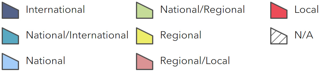
Main Beneficiaries Map
View Main Beneficiaries Map full screen in a new tab View Interactive Map HelpEcosystem service analysis
The following sections show the analysis used to determine key Ecosystem Service opportunities within the area. These opportunities have been combined with the analysis of landscape opportunities to create Statements of Environmental Opportunity. Please note that the following analysis is based upon available data and current understanding of ecosystem services. It does not represent a comprehensive local assessment. Quality and quantity of data for each service is variable locally and many of the services listed are not yet fully researched or understood. Therefore analysis and opportunities may change upon publication of further evidence and better understanding of the inter-relationship between services at a local level.
Note that numbers and figures in the body of the text are based on the 2014 profiles, unless otherwise stated.
Provisioning Services
Food provision
Assets/attributes: main contributors to service
- Soils – sandy soils which are predominantly grade 3 agricultural, supporting arable farming
State – The Sherwood area supports commercial scale, mainly arable farming. The sandy soils are mostly Grade 3 although irrigation and fertiliser inputs allow them to be used flexibly. The freely draining, slightly acid sandy soil does not become waterlogged in the winter, allowing good year round growing and lifting conditions. Root crops predominate and carrots from this area supply many UK supermarkets. Outdoor pig and poultry systems can also be seen. Pasture and dairying
is concentrated in the small area north of Worksop, though English Longhorn cattle are used to graze the ecologically sensitive wood pasture of the Sherwood NNR.
Main beneficiary – Local
Analysis – Food provision is an important service, and the root crops grown here make a significant contribution to local, regional, and national food resources. Farming activity can have a significant impact on other services particularly those relating to water and soils.
Irrigation is very important on the sandy soil, and has to be carefully managed so as not to lead to increased shortfalls in water resource. 100 per cent of the Sherwood NCA is designated as a Nitrate Vulnerable Zone to prevent excess nitrate entering the aquifer. Some farming practices can lead to increased rates of soil erosion, which have a detrimental effect on agricultural productivity over the long term.
Maintaining vegetation cover, avoiding soil compaction and creating wind breaks through hedgerows and tree belts are important measures within this NCA.
Opportunities – There is an opportunity to ensure agriculture is managed sustainably and does not have a significant detrimental effect on the value of other ecosystem services or assets such as water availability, water quality and soil quality. This will in turn bring benefits to agricultural land and assist with future provision of food.
Principal services offered by opportunities
- Food provision
- Water availability
- Regulating water quality
- Regulating soil erosion
Timber provision
Assets/attributes: main contributors to service
- Sherwood Forest Pines estate approximately 3,100 ha managed for timber alongside other interests
- Soils – poor grade soils
State – The Forestry Commission and several private landowners have a large estate in the Sherwood area managed for productive timber. Sherwood Forest Pines estate is approx 3,100 ha, which includes multiple use areas for recreation, wildlife conservation and timber production. Predicted softwood availability from all Forestry Commission estates for 2007-2011 across the whole of Central England region was forecast at 258,000 cubic metres in 2005.
Main beneficiary – Regional
Analysis – The timber woodland sites are associated with many of the NCA’s most important wildlife resources and provide valuable recreational opportunities, although the plantation woodlands are not in character with the traditional oak/ birch wooded nature of the area.
An increase in timber production could increase climate change regulation through increased carbon sequestration and bring local benefits to renewable energy through local heating energy sources. An increase in timber provision would require new land presently not wooded to be planted and this land would need to be appropriately sourced so as not to affect habitats, food provision or areas of archaeological resource. There may be potential for new woodland sites on some of the derelict land associated with the mining industry, on marginal agricultural land and land bordering existing woodland.
Opportunities – There is an opportunity to ensure timber-producing commercially managed forests are managed for multiple benefits (for example, recreation, biodiversity, timber). There may be opportunities to increase timber production within appropriate settings.
Principal services offered by opportunities
- Timber provision
- Biodiversity
- Recreation
Water availability
Assets/attributes: main contributors to service
- Aquifer – supplies 10 per cent of Environment Agency Midlands region
- Rivers
- Surface waters
State – The majority of the NCA overlays the East Midlands Sherwood Sandstone aquifer. The aquifer provides a strategically important groundwater resource, the source of significant public water supply (about 10 per cent of all water supplies in the Environment Agency’s Midlands region. Over-abstraction is a continuing issue for the aquifer, with abstraction levels greatly above those needed to obtain “good status” in line with the Water Framework Directive (Environment Agency, 2009).
Rivers in the NCA generally have an integrated ‘no water available’
Catchment Abstraction Management (CAMs) status, with the exception of the River Idle to the north which has been classified as ‘over abstracted.’ The closing of many of the collieries has also seen a marked reduction in watercourse levels, as it is no longer pumped from the mines for safety reasons.
Main beneficiary – Local
Analysis – Significant volumes of abstracted water are used for agricultural irrigation in Sherwood, and as a public water supply to the growing population of the East Midlands. This abstraction results in low groundwater levels and low base- flows in the relatively small number of rivers on the surface of this landscape. Water levels in the lakes of the Ducal estates, some of which are Sites of Special Scientific Interest (SSSI) are also low, and this is having an overall negative effect on the ecology of these waterbodies.
Increasing water availability (through greater capture/infiltration) and continuing to carefully manage abstraction is likely to reduce biodiversity loss in the wetland habitats and improve water quality, whilst maintaining water availability. This could also increase agricultural outputs during periods when water for irrigation is limited.
Opportunities – There is an opportunity to manage water within the NCA to slow runoff rates and increase infiltration rates into the aquifer. There is also an opportunity to manage over- abstraction from the aquifer and river systems through implementing careful and efficient use of water, and through development of alternative more sustainable sources of water supply where possible.
Managing crop types and cultivation methods also has potential to provide benefits (although it is recognised that many land managers already operate using environmentally sensitive practices).
Principal services offered by opportunities
- Water availability
- Regulating water quality
- Regulating soil erosion
Genetic diversity
No information available.
Biomass energy
Assets/attributes: main contributors to service
- Woodlands cover 20 per cent of area
- Stands of short rotation coppice, for example, along the A614
State – The existing very high woodland cover (22 per cent) offers an increased potential for the provision of biomass as a by-product of commercial timber production, as well as through bringing unmanaged woodland under management. There are currently prominent stands of short rotation coppice (SRC) beside the A614 in the NCA. For information on the potential landscape impacts of biomass plantings within the NCA, refer to the tables on the Natural England website.
Main beneficiary – Local
Analysis – Although a recent study suggested the NCA has medium potential for SRC but with some small areas of high potential, new sites for biomass would need to be carefully considered first. (Biomass production in the area is currently low; however the area has medium potential for SRC. Increased provision of SRC for fuel has the potential to sequest carbon and provide renewable supplies of energy, but could decrease provision of future food if placed on farmed areas. Major expansion could also affect sense of place if SRC becomes a major component of the landscape. There may be potential for new sites on previously derelict land from the mining industry, on marginal agricultural land and land bordering existing woodland.
Opportunities – There is an opportunity to increase production of biomass as a bi- product of existing commercial timber production and through introducing management in currently unmanaged woodlands. There is also an opportunity for small-scale biomass production through planting on sites including small parcels of land isolated by development and are not suitable for agriculture, spoil heaps and closed landfill sites.
Principal services offered by opportunities
- Biomass energy
- Biodiversity
- Regulating soil erosion
Regulating Services
Climate regulation
Assets/attributes: main contributors to service
- Woodland
- Soils (limited contribution)
State – The existing very high woodland cover (22 per cent) offers an increased potential for the provision of biomass as a by-product of commercial timber production, as well as through bringing unmanaged woodland under management. There are currently prominent stands of short rotation coppice (SRC) beside the A614 in the NCA. For information on the potential landscape impacts of biomass plantings within the NCA, refer to the tables on the Natural England website.
Main beneficiary – Regional
Analysis – Carbon storage in the woodland is currently relatively high (woodland cover 22 per cent), but may be increased by the planting of additional woodland, on appropriate sites, and through management. There is limited potential for increasing the carbon sequestration and storage capacity of the soils by increasing organic matter inputs and reducing the frequency / area of cultivation. If planted with native trees there is also potential to increase biodiversity services and recreation (if access is provided). Planting may also increase the sense of place by enhancing the woodland character of Sherwood.
Opportunities – There is an opportunity to increase the carbon storage potential of the area through the planting of new woodland (as referenced above in timber and biomass service provision). This would need to result in a net increase of the woodland cover and would only be appropriate if suitable sites could be found (see above).
Principal services offered by opportunities
- Climate regulation
- Timber provision
- Biodiversity
Regulating coastal erosion and flooding
No information available.
Regulating water quality
No information available.
Regulating water flow
Assets/attributes: main contributors to service
- Woodland
- Wetlands
- Rivers
- Surface waters
State -The main catchment within the NCA is the River Trent. The Environment Agency flood risk map indicates that for much of the NCA flooding is not generally a major issue.
Rainfall tends to soak quickly into the sandstone. However, flooding has caused significant localised damage in severe weather events, for example in Worksop in summer 2007 the River Idle flooded affecting 200 properties. The River Erewash in the south-east of the NCA and the River Meden and River Maun also experienced flooding at this time.
Many of the areas alongside the rivers in the NCA offer informal flood storage. The River Idle Washlands SSSI, located downstream of Bawtry, is the principal area of floodplain wet grassland in the catchment.
Main beneficiary – Local
Analysis – Flooding has not been a major issue in this NCA within the recent past The high woodland cover, as well as the porous nature of the soils and geology, help to ensure rainwater is intercepted and infiltrated effectively. However, actions in this NCA can impact flooding downstream in the Humberhead Levels and elsewhere within in the River Trent basin. Careful water management can help to reduce the severity of flooding events downstream.
Opportunities – There is an opportunity to increase vegetation cover and including wet woodland to create water storage areas, in accordance with sustainable urban drainage systems. There are opportunities to create and extend semi-natural floodplain habitats such as flood meadows, wet woodland and reedbed to mitigate the severity of downstream flood events.
Principal services offered by opportunities
- Regulating water flow
- Regulating water quality
- Regulating soil erosion
- Regulating soil quality
Regulating soil quality
No information available.
Regulating soil erosion
Assets/attributes: main contributors to service
- Semi-natural vegetation cover
- Hedgerows and tree belts (windbreaks)
- Woodland, copses, scrub
State –
The well-drained, acidic, sandy soils found in this NCA are at risk of wind and water based soil erosion, especially if the impact of climate change brings about drier summers, more intense rainfall events and higher wind speeds. These lighter textured soils have an enhanced risk of soil erosion on moderately or steeply sloping land where cultivated or bare soil is exposed, including that under outdoor pig rearing (a characteristic of this NCA). The intense use of the agricultural land for root crops could also increase the risk of soil erosion where it is not properly managed.
The slightly acid loam and clay soils with impeded drainage are prone to capping/slaking, leading to increased risk of erosion. These soils are easily compacted by machinery or livestock if accessed when wet, increasing the risks of soil erosion by surface water run-off, especially on steeper slopes.
Main beneficiary – Local
Analysis – The current rate of soil erosion is a significant issue in this NCA.
Increasing regulation of soil erosion by careful management of agricultural practices and by planting more permanent vegetation would help to reduce compaction, trap sediment and improve soil health.
This approach would offer benefits to biodiversity, climate regulation and agriculture in the long run, by helping bind the soil, reducing sedimentation in rivers and by storing limited amounts of carbon in the soil. This could help maintain fertility in the longer term.
Opportunities – There is potential to increase the semi-natural vegetation cover by restoring heathland and planting small areas of woodland /short rotation coppice. This may also help increase organic matter content of the freely draining slightly acid sandy soils that dominate this NCA. These management measures will improve soil structure, help increase water infiltration (aiding aquifer recharge) and reduce the risk of water and wind based erosion.
There are also opportunities to sustainably manage agricultural land management practices to reduce the impact on soil erosion, for example through types of crop rotations, use of machinery and timing of cropping.
Principal services offered by opportunities
- Regulating soil erosion
- Regulating soil quality
- Regulating water quality
- Water availability
Pollination
Assets/attributes: main contributors to service
Areas of semi- natural habitat, hedgerows, grass margins
State – The habitats in the area support a variety of pollinators, which are essential to maintaining the habitats and to agricultural production.
It is possible that the population of pollinators has fallen, with some species becoming isolated in pockets, due to the increase of commercial scale farming, the changing climate or use of chemicals, but the causes are unclear.
Main beneficiary – Local
Analysis – The hedgerows, heathland, acid grassland, wood pasture habitats found in Sherwood provide good habitats for pollinators and should be managed in good condition and expanded where possible to ensure this service continues effectively. A good network of semi-natural habitat should be developed throughout the NCA to ensure this service performs to maximum effect.
Opportunities – Pollination is not currently a service required by the predominant agricultural crop, however, there are pockets of agricultural land which do benefit from it and an increase in local populations of pollinating invertebrates may aid in affording a greater diversity of crop types to be grown in the future. A strong and wider network of semi natural habitats would bring significant benefit for biodiversity too.
Principal services offered by opportunities
- Pollination
- Biodiviersity
Pest regulation
Assets/attributes: main contributors to service
Areas of semi-natural habitat/ hedgerows/grass margins
State – The habitats in the area support a variety of species, such as beetles, which can regulate the populations of pests such as aphids.
Main beneficiary – Local
Analysis – The hedgerows, heathland, acid grassland, wood pasture habitats found in Sherwood provide good habitats for species which regulate pests and should be managed to afford a wide variety of niches and expanded where possible to ensure this service continues effectively.
Opportunities – A stronger and wider network of semi-natural habitats would bring benefit for pest regulation, as well as pollination and biodiversity services.
Principal services offered by opportunities
- Pollination
- Biodiviersity
- Pest regulation
Cultural Services
Sense of place/inspiration
Assets/attributes: main contributors to service
- Sherwood Forest NNR, containing the Major Oak and its fellow ancient oaks, and Sherwood Pines
- The Ducal Estates
- The mining heritage
State – The sense of place is most strongly shaped by the international legend of Robin Hood, which is intrinsically linked with Sherwood Forest and the City of Nottingham.
A sense of place is provided by the varied but distinctive patchwork enclosed arable land, large pine plantations, lowland woodland and heaths of the former medieval Sherwood Forest and wastes. The historic parklands and estates of the Dukeries and the built relicts of the former coal industry add to the sense of place. Feelings of inspiration and escapism are associated with the varying views of wooded skylines and open heaths creating a strong sense of enclosure in an otherwise urbanised landscape.
This landscape offers opportunities to escape into the past, or into a world of myths and legends. Sherwood Forest NNR, containing the Major Oak and its fellow ancient oaks, and Sherwood Pines, actively promotes this experiential quality, particularly for children’s activities associated with the legend of Robin Hood.
Main beneficiary – National/international
Analysis – Increasing sense of place has the potential to increase tourism.
Management to enforce sense of place is also likely to increase sense of history. Conserving and enhancing the distinct patchwork of landscape features is also likely to benefit biodiversity by enhancing or expanding available habitat.
Opportunities – There is an opportunity to maintain a sense of place, valued by local people and tourists, by conserving the patchwork and variety of landscape features which give the NCA its distinctive sense of place. Most prominently there are opportunities to conserve and promote the cultural association with Robin Hood, as it re- enforces the sense of place Sherwood has on an international scale.
There are also opportunities to strengthen the landscape pattern through increasing the hedgerow networks, and to expand areas of woodland and heathland as appropriate. This would bring benefits for other regulating services
Principal services offered by opportunities
- Sense of place/ inspiration
- Recreation
- Biodiversity
- Regulating soil erosion
Sense of history
Assets/attributes: main contributors to service
- The Dukeries
- Sherwood Forest ancient oaks
- Nottingham Castle and caves
- The mining heritage
State – A significant sense of history is engendered by the tracts of ancient woodlands: remnants of Sherwood Forest and their strong associations with Robin Hood. A sense of history is associated with the Dukeries, an extensive area of historic estates, parklands and ornamental gardens, and the northern sandstone estates. Notable estates include Clumber Park, Welbeck Abbey, Thoresby and Babworth Parks. This historic character is reinforced by the nucleated pattern of estate villages related to country houses within the Dukeries, such as Perlethorpe, and the dispersed pattern of villages, hamlets and farmsteads unaffected by coal mining elsewhere.
Other emblems of the area’s varied past are the conspicuous relics of the coal mining industry including pit heaps, mineral lines, the Chesterfield Canal, Nottingham as the centre of lace making from the 17th to 20th centuries, as well as cultural links to the Pilgrim Fathers. Nottingham Castle and the caves beneath it, have a long history and form a much visited tourist attraction.
Main beneficiary – National/international
Analysis – Maintaining, conserving and enhancing the sense of history, through increased interpretation and opportunities to interact with the history, may have potential to increase the service. This may lead to increased recreation and tourism in the area, although management would be needed to ensure this is sustainable and does not have a negative impact on the assets themselves. The reinforced sense of history could contribute strongly to sense of place in the landscape.
Opportunities – Sherwood Forest NNR and the surrounding area should continue to be managed for biodiversity and the sense of history they provide to ensure the area remains in suitable condition and provides a valuable recreational and tourism asset.
There is an opportunity to increase sense of history by protecting the character and historic resource of the large country houses and parklands found in the Dukeries, and elsewhere in the area; conserve their valuable parkland and lakeside habitats, protect the condition of the large houses, and conserve the historic estates for the cultural history they contribute to the landscape character.
Principal services offered by opportunities
- Sense of history
- Sense of place/ inspiration
- Recreation
Tranquility
Assets/attributes: main contributors to service
- High wooded nature of the area
- Pockets of undeveloped rural land away from settlements and major tourist attractions
State – The NCA has experienced a continued decline in tranquillity: areas of intrusion have increased from 42 per cent in the 1960s to 68 per cent in 2007, largely resulting from an increase in urbanisation. Characteristics of the landscape that are particularly important in conveying a sense of tranquillity are the narrow river corridors and pockets of deciduous woodland, contrasting strongly with the expansive arable fields and relics of a mining past. Tranquillity is reduced in other areas because of their proximity to Nottingham and other towns and large mining villages. The popularity of the area for tourism also has an impact on tranquillity levels.
Main beneficiary – National/international
Analysis – Preventing the decline of areas of tranquillity by screening new development with new planting and managing tourism sustainably would bring benefits for people’s enjoyment of Sherwood as a tranquil landscape. Increasing tranquillity through expanding areas of deciduous woodland could also increase biodiversity/natural beauty, sense of place.
Opportunities – There is an opportunity to protect areas, such as the core and northern areas of the NCA, where tranquillity and intrusion are presently low. This will allow people to feel connected to nature and contribute to wellbeing and health.
Reduce where possible the impact of settlement in the urban western areas and along roads by planting woodland shelter belts, strengthening the hedgerow pattern and ensuring new development on settlement fringes is sensitively designed.
Principal services offered by opportunities
- Tranquillity
- Sense of place/ inspiration
- Biodiversity
Recreation
Assets/attributes: main contributors to service
- Sherwood NNR
- Country Parks and Ducal Estates
- Historic sites such as Nottingham Castle
- Foot paths
- Open Access Land
State – The historical interest and the numerous recreational and access facilities means this is a landscape popular for recreational and education purposes. Clumber Park, Sherwood Forest
NNR, Sherwood Pines, Bestwood and Newstead, as well as the caves in Nottingham, are all significant attractions. Many schools bring children to undertake ranger and self guided activities at the Sherwood Forest NNR.
The area has a number of significant commercial visitor destinations including Center Parcs and the ducal estates which are now registered parks and gardens. Nottingham Castle, sitting on top of its outcrop of sandstone, offers long views over the city and is a well-visited attraction.
In the wider landscape the density and distribution of public rights of way is variable with a notably lower level of provision in areas traditionally managed as part of the ducal estates.
Recreation is supported by a network of rights of way totalling 390 km with a density of 0.73 km per km2, and a small proportion of open access land at 223 ha or approximately 0.5 per cent of the area of the NCA.
Main beneficiary – National/international
Analysis – Recreation is already a very significant service in this NCA. It is likely that recreational opportunity could be increased without significant effects on other services, so long as the assets were well managed for both biodiversity and recreation, especially those in the Sherwood Forest NNR and surroundings. Supporting proposals in the Nottinghamshire Rights of Way Improvement Plan would lead to increased recreation opportunity away from the major visitor attractions, which would benefit local residents.
Opportunities – There is an opportunity to conserve and enhance the many recreational opportunities offered in this NCA around Sherwood Forest NNR, Clumber Park, Rufford Country Park and Sherwood Pines Forest Park each year, while managing the impacts from tourism and recreation on the natural landscape.
In addition there are opportunities to promote the recreational and education opportunities offered by the public access to the large houses and ducal estates in the area.
Expanding the public rights of way network in areas traditionally managed as part of the ducal estates where the network is not as strong as in other areas would bring recreational benefits to the local population.
Increasing green infrastructure links from urban areas out to the recreational areas in the centre of the NCA would help make recreation “greener” and provide more assets.
Principal services offered by opportunities
- Recreation
Biodiversity
Assets/attributes: main contributors to service
- Semi-natural/habitats (species-rich grasslands, heathlands wetlands, deciduous woodlands)
- Arable margins
- Fallow areas
State – 3 per cent of the NCA has been designated for its biodiversity and this includes Birklands and Bilhaugh SAC, Sherwood Forest NNR and 1,757 ha of SSSI.
Approximately twice this area is covered by priority habitats. Semi natural habitats such as lowland heathland and acid grassland are under pressure from commercial scale farming, which is an important land use in this area. The loss of meadows is particularly evident along river corridors, which would have traditionally defined the river channels and distinguished them from the surrounding farmland.
Main beneficiary – National/international
Analysis – There is scope to improve biodiversity by working with land managers through conservation and environmental stewardship schemes.
Opportunities – Ensure areas of designated land remain in favourable condition and improve the condition in these designated areas where possible. Work with land owners to extend the area of land in Environmental Stewardship.
Principal services offered by opportunities
- Biodiversity
Geodiversity
Assets/attributes: main contributors to service
- Geology
- Exposed rock formations
- Designated geological sites
- Sandstone buildings
State – There are no nationally designated geological sites in Sherwood but there are 41 local sites (non-statutory designation) which are mostly quarries and river section sites. There are outcrops of Triassic Sandstone throughout the NCA, the most famous of which is Castle Rock in the centre of Nottingham. The network of caves under the castle is an important feature in the sandstone geology, although the caves are man- made.
The Coal Measures found in the area lead to significant mining activity, which has now left a distinct mining heritage.
Local sandstone is a distinct building material of the local vernacular.
Main beneficiary – National/international
Analysis – The sandstone geology of Sherwood gives it a sense of place clearly distinctive from surrounding NCAs. The assets, such as the caves and the rocky outcrops, provide opportunities for interpretation and access to the public. These features make a significant contribution to the sense of place and sense of history of the area.
Opportunities – There are opportunities to continue the access to the Nottingham caves, and other geological exposures, as tourist destinations to help increase understanding and enjoyment in the resource, and the history of the area. There are also opportunities to ensure new development is in keeping with the character of the area by using traditional building materials where possible.
Principal services offered by opportunities
- Geodiversity
- Sense of history
- Recreation