

National Character Area 127
Isle of Wight - Key Facts & Data
Landscape and nature conservation designations 
Note that numbers and figures in the body of the text are based on the 2014 profiles, unless otherwise stated. The maps contain live frequently updated datasets.
The Isle of Wight Area of Outstanding Natural Beauty (AONB) is 19,100 ha and forms nearly 50 per cent of the NCA. The AONB is divided into 5 separate land parcels across the island. The Isle of Wight also contains two Heritage Coasts: Tennyson (2,418 ha) and Hamstead (1,546 ha) totalling 10 per cent of the NCA (Natural England, 2011) .
National Landscape (AONB) Management Plans
National Landscapes (legally known as Areas of Outstanding Natural Beauty – AONBs) are nationally important landscapes, designated under the 1949 National Parks and Access to the Countryside Act. Their primary purpose is to ‘conserve and enhance natural beauty’. Clicking on the relevant National Landscape in the below map will also take you to that specific National Landscape website.
The following National Landscapes can be found within this NCA:
Each National Landscape has a statutory Management Plan to drive partnership action across their areas. The Plan also outlines the special qualities that underpin the designated landscape. These documents can be found on each individual National Landscape website by searching for “Management Plan”. Management Plans are updated every five years.

Relationship with the coast
The adjacent coastline is covered by the following Shoreline Management Plans:
- Isle of Wight
The adjacent coastline includes the following Marine Plan – Marine Character Areas (MCAs):
- The Solent
- South Wight
Isle of Wight Shoreline Management Plan
Shoreline Management Plans are developed by Coastal Groups with members mainly from local authorities and the Environment Agency. They identify the most sustainable approach to managing the flood and coastal erosion risks to the coastline in the short, medium and long term. This could inform actions within the NCA.

Description for the The Solent Marine Character Area
Seascape Character Assessments have been produced for all marine plan areas in England, extending along the coast to the High Water Mark. Information in the Seascape Character Assessments could inform actions along the coastline of the NCA.
The Marine Policy Statement (MPS, 2011) states that, when developing marine plans, visual, cultural, historical and archaeological impacts should be considered for all coastal areas. The MPS adds that any wider social and economic impacts of a development or activity on coastal landscapes and seascapes should also be considered, accounting for existing character and quality.
In addressing these requirements, the Marine Management Organisation (MMO) has produced Seascape Character Assessments for all marine plan areas in England, extending along the coast to the High Water Mark. Information from theses assessments could inform actions along the coastline of the NCA.
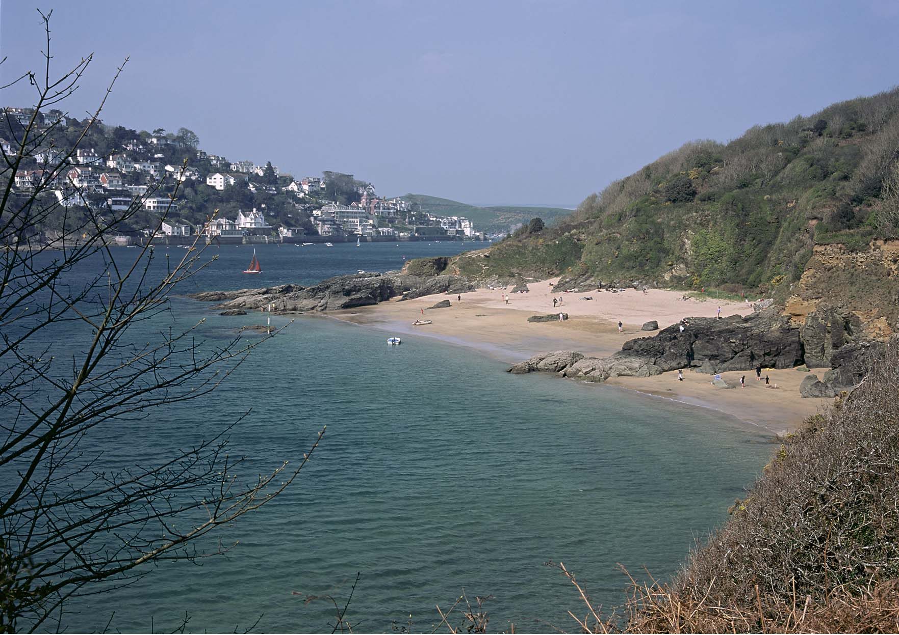
Description for the South Wight Marine Character Area
Seascape Character Assessments have been produced for all marine plan areas in England, extending along the coast to the High Water Mark. Information in the Seascape Character Assessments could inform actions along the coastline of the NCA.
The Marine Policy Statement (MPS, 2011) states that, when developing marine plans, visual, cultural, historical and archaeological impacts should be considered for all coastal areas. The MPS adds that any wider social and economic impacts of a development or activity on coastal landscapes and seascapes should also be considered, accounting for existing character and quality.
In addressing these requirements, the Marine Management Organisation (MMO) has produced Seascape Character Assessments for all marine plan areas in England, extending along the coast to the High Water Mark. Information from theses assessments could inform actions along the coastline of the NCA.
Designated nature conservation sites
The NCA includes the following statutory nature conservation designations (Natural England, Special Protection Areas; Special Area of Conservation; Ramsars; National Nature Reserves; Sites of Special Scientific Interest and Local Nature Reserves, 2021):
| wdt_ID | NCA_ID | NCA_Name | Area_NCA_ha | Designation tier | Designation type | Area (ha) 2021 | Percent of NCA (2021) |
|---|---|---|---|---|---|---|---|
| 1273 | 1 | North Northumberland Coastal Plain | 37,669.6 | International | Ramsar | 614.2 | 1.6 |
| 1274 | 2 | Northumberland Sandstone Hills | 72,694.6 | International | Ramsar | 28.1 | 0.0 |
| 1275 | 3 | Cheviot Fringe | 51,591.3 | International | Ramsar | 0.0 | |
| 1276 | 4 | Cheviots | 36,487.9 | International | Ramsar | 0.0 | |
| 1277 | 5 | Border Moors and Forests | 127,155.9 | International | Ramsar | 793.6 | 0.6 |
| 1278 | 6 | Solway Basin | 98,350.4 | International | Ramsar | 4,242.4 | 4.3 |
| 1279 | 7 | West Cumbria Coastal Plain | 49,293.3 | International | Ramsar | 1,958.0 | 4.0 |
| 1280 | 8 | Cumbria High Fells | 199,006.6 | International | Ramsar | 4.3 | 0.0 |
| 1281 | 9 | Eden Valley | 80,956.3 | International | Ramsar | 0.0 | |
| 1282 | 10 | North Pennines | 214,563.4 | International | Ramsar | 0.0 |
Please note: (i) Designated areas may overlap (ii) all figures are cut to Mean High Water Line, designations that span coastal/marine areas below this line will not be included.
Condition of designated sites
All designated sites within England are covered by Sites of Scientific Interest (SSSI) units. The condition to these SSSI units within the NCA are as follows (Natural England, Sites of Special Scientific Interest Units, 2021; 2023):
| wdt_ID | ncaid | ncaname | SSSI Condition | concatenate | Area (ha): 2021 | Total SSSI area (ha): 2021 | Percent of SSSI: 2021 | Area (ha): 2023 | Total SSSI area (ha): 2023 | Percent of SSSI: 2023 | Area change (ha): 2021-2023 | Percent change: 2021-2023 |
|---|---|---|---|---|---|---|---|---|---|---|---|---|
| 1 | North Northumberland Coastal Plain | FAVOURABLE | 1-FAVOURABLE | 524.0 | 1,452.9 | 36.1 | 599.1 | 1,451.6 | 41.3 | +75.1 | +5.21 | |
| 1 | North Northumberland Coastal Plain | UNFAVOURABLE DECLINING | 1-UNFAVOURABLE DECLINING | 92.5 | 1,452.9 | 6.4 | 6.2 | 1,451.6 | 0.4 | -86.2 | -5.94 | |
| 1 | North Northumberland Coastal Plain | UNFAVOURABLE NO CHANGE | 1-UNFAVOURABLE NO CHANGE | 46.9 | 1,452.9 | 3.2 | 8.5 | 1,451.6 | 0.6 | -38.3 | -2.64 | |
| 1 | North Northumberland Coastal Plain | UNFAVOURABLE RECOVERING | 1-UNFAVOURABLE RECOVERING | 789.6 | 1,452.9 | 54.3 | 837.7 | 1,451.6 | 57.7 | +48.1 | +3.36 | |
| 1 | North Northumberland Coastal Plain | PART DESTROYED | 1-PART DESTROYED | 0.0 | 1,452.9 | 0.0 | 0.0 | 1,451.6 | 0.0 | 0 | 0 | |
| 1 | North Northumberland Coastal Plain | DESTROYED | 1-DESTROYED | 0.0 | 1,452.9 | 0.0 | 0.0 | 1,451.6 | 0.0 | 0 | 0 | |
| 1 | North Northumberland Coastal Plain | NOT ASSESSED | 1-NOT ASSESSED | 0.0 | 1,452.9 | 0.0 | 0.0 | 1,451.6 | 0.0 | 0 | 0 | |
| 1 | North Northumberland Coastal Plain | Unknown | 1-Unknown | 0.0 | 1,452.9 | 0.0 | 0.0 | 1,451.6 | 0.0 | 0 | 0 | |
| 2 | Northumberland Sandstone Hills | FAVOURABLE | 2-FAVOURABLE | 559.9 | 7,103.8 | 7.9 | 519.5 | 7,102.2 | 7.3 | -40.4 | -0.57 | |
| 2 | Northumberland Sandstone Hills | UNFAVOURABLE DECLINING | 2-UNFAVOURABLE DECLINING | 9.2 | 7,103.8 | 0.1 | 3.8 | 7,102.2 | 0.1 | -5.4 | -0.08 | |
| 2 | Northumberland Sandstone Hills | UNFAVOURABLE NO CHANGE | 2-UNFAVOURABLE NO CHANGE | 97.2 | 7,103.8 | 1.4 | 101.8 | 7,102.2 | 1.4 | +4.7 | +0.07 | |
| 2 | Northumberland Sandstone Hills | UNFAVOURABLE RECOVERING | 2-UNFAVOURABLE RECOVERING | 6,437.6 | 7,103.8 | 90.6 | 6,477.0 | 7,102.2 | 91.2 | +39.5 | +0.58 | |
| 2 | Northumberland Sandstone Hills | PART DESTROYED | 2-PART DESTROYED | 0.0 | 7,103.8 | 0.0 | 0.0 | 7,102.2 | 0.0 | 0 | 0 | |
| 2 | Northumberland Sandstone Hills | DESTROYED | 2-DESTROYED | 0.0 | 7,103.8 | 0.0 | 0.0 | 7,102.2 | 0.0 | 0 | 0 | |
| 2 | Northumberland Sandstone Hills | NOT ASSESSED | 2-NOT ASSESSED | 0.0 | 7,103.8 | 0.0 | 0.0 | 7,102.2 | 0.0 | 0 | 0 | |
| 2 | Northumberland Sandstone Hills | Unknown | 2-Unknown | 0.0 | 7,103.8 | 0.0 | 0.0 | 7,102.2 | 0.0 | 0 | 0 | |
| 3 | Cheviot Fringe | FAVOURABLE | 3-FAVOURABLE | 240.3 | 1,084.3 | 22.2 | 240.3 | 1,084.5 | 22.2 | < -0.1 | < -0.01 | |
| 3 | Cheviot Fringe | UNFAVOURABLE DECLINING | 3-UNFAVOURABLE DECLINING | 32.3 | 1,084.3 | 3.0 | 36.1 | 1,084.5 | 3.3 | +3.8 | +0.35 | |
| 3 | Cheviot Fringe | UNFAVOURABLE NO CHANGE | 3-UNFAVOURABLE NO CHANGE | 267.8 | 1,084.3 | 24.7 | 285.9 | 1,084.5 | 26.4 | +18.1 | +1.66 | |
| 3 | Cheviot Fringe | UNFAVOURABLE RECOVERING | 3-UNFAVOURABLE RECOVERING | 543.9 | 1,084.3 | 50.2 | 522.2 | 1,084.5 | 48.2 | -21.7 | -2.01 | |
| 3 | Cheviot Fringe | PART DESTROYED | 3-PART DESTROYED | 0.0 | 1,084.3 | 0.0 | 0.0 | 1,084.5 | 0.0 | 0 | 0 | |
| 3 | Cheviot Fringe | DESTROYED | 3-DESTROYED | 0.0 | 1,084.3 | 0.0 | 0.0 | 1,084.5 | 0.0 | 0 | 0 | |
| 3 | Cheviot Fringe | NOT ASSESSED | 3-NOT ASSESSED | 0.0 | 1,084.3 | 0.0 | 0.0 | 1,084.5 | 0.0 | 0 | 0 | |
| 3 | Cheviot Fringe | Unknown | 3-Unknown | 0.0 | 1,084.3 | 0.0 | 0.0 | 1,084.5 | 0.0 | 0 | 0 | |
| 4 | Cheviots | FAVOURABLE | 4-FAVOURABLE | 578.5 | 3,970.9 | 14.6 | 321.5 | 3,970.8 | 8.1 | -257 | -6.47 | |
| 4 | Cheviots | UNFAVOURABLE DECLINING | 4-UNFAVOURABLE DECLINING | 9.4 | 3,970.9 | 0.2 | 69.9 | 3,970.8 | 1.8 | +60.5 | +1.52 | |
| 4 | Cheviots | UNFAVOURABLE NO CHANGE | 4-UNFAVOURABLE NO CHANGE | 13.6 | 3,970.9 | 0.3 | 22.1 | 3,970.8 | 0.6 | +8.5 | +0.21 | |
| 4 | Cheviots | UNFAVOURABLE RECOVERING | 4-UNFAVOURABLE RECOVERING | 3,369.4 | 3,970.9 | 84.9 | 3,557.2 | 3,970.8 | 89.6 | +187.9 | +4.73 | |
| 4 | Cheviots | PART DESTROYED | 4-PART DESTROYED | 0.0 | 3,970.9 | 0.0 | 0.0 | 3,970.8 | 0.0 | 0 | 0 | |
| 4 | Cheviots | DESTROYED | 4-DESTROYED | 0.0 | 3,970.9 | 0.0 | 0.0 | 3,970.8 | 0.0 | 0 | 0 | |
| 4 | Cheviots | NOT ASSESSED | 4-NOT ASSESSED | 0.0 | 3,970.9 | 0.0 | 0.0 | 3,970.8 | 0.0 | 0 | 0 | |
| 4 | Cheviots | Unknown | 4-Unknown | 0.0 | 3,970.9 | 0.0 | 0.0 | 3,970.8 | 0.0 | 0 | 0 | |
| 5 | Border Moors and Forests | FAVOURABLE | 5-FAVOURABLE | 9,117.7 | 17,066.8 | 53.4 | 8,677.0 | 17,051.1 | 50.9 | -440.7 | -2.54 | |
| 5 | Border Moors and Forests | UNFAVOURABLE DECLINING | 5-UNFAVOURABLE DECLINING | 34.1 | 17,066.8 | 0.2 | 4.0 | 17,051.1 | 0.0 | -30.1 | -0.18 | |
| 5 | Border Moors and Forests | UNFAVOURABLE NO CHANGE | 5-UNFAVOURABLE NO CHANGE | 566.3 | 17,066.8 | 3.3 | 32.7 | 17,051.1 | 0.2 | -533.6 | -3.13 | |
| 5 | Border Moors and Forests | UNFAVOURABLE RECOVERING | 5-UNFAVOURABLE RECOVERING | 7,348.7 | 17,066.8 | 43.1 | 8,337.5 | 17,051.1 | 48.9 | +988.8 | +5.84 | |
| 5 | Border Moors and Forests | PART DESTROYED | 5-PART DESTROYED | 0.0 | 17,066.8 | 0.0 | 0.0 | 17,051.1 | 0.0 | 0 | 0 | |
| 5 | Border Moors and Forests | DESTROYED | 5-DESTROYED | 0.0 | 17,066.8 | 0.0 | 0.0 | 17,051.1 | 0.0 | 0 | 0 | |
| 5 | Border Moors and Forests | NOT ASSESSED | 5-NOT ASSESSED | 0.0 | 17,066.8 | 0.0 | 0.0 | 17,051.1 | 0.0 | 0 | 0 | |
| 5 | Border Moors and Forests | Unknown | 5-Unknown | 0.0 | 17,066.8 | 0.0 | 0.0 | 17,051.1 | 0.0 | 0 | 0 | |
| 6 | Solway Basin | FAVOURABLE | 6-FAVOURABLE | 3,670.6 | 8,232.7 | 44.6 | 3,668.1 | 7,860.9 | 46.7 | -2.5 | +2.08 | |
| 6 | Solway Basin | UNFAVOURABLE DECLINING | 6-UNFAVOURABLE DECLINING | 246.1 | 8,232.7 | 3.0 | 236.3 | 7,860.9 | 3.0 | -9.9 | +0.02 | |
| 6 | Solway Basin | UNFAVOURABLE NO CHANGE | 6-UNFAVOURABLE NO CHANGE | 611.0 | 8,232.7 | 7.4 | 507.3 | 7,860.9 | 6.5 | -103.7 | -0.97 | |
| 6 | Solway Basin | UNFAVOURABLE RECOVERING | 6-UNFAVOURABLE RECOVERING | 3,695.7 | 8,232.7 | 44.9 | 3,439.9 | 7,860.9 | 43.8 | -255.8 | -1.13 | |
| 6 | Solway Basin | PART DESTROYED | 6-PART DESTROYED | 9.3 | 8,232.7 | 0.1 | 9.3 | 7,860.9 | 0.1 | < +0.1 | < +0.01 | |
| 6 | Solway Basin | DESTROYED | 6-DESTROYED | 0.0 | 8,232.7 | 0.0 | 0.0 | 7,860.9 | 0.0 | 0 | 0 | |
| 6 | Solway Basin | NOT ASSESSED | 6-NOT ASSESSED | 0.0 | 8,232.7 | 0.0 | 0.0 | 7,860.9 | 0.0 | 0 | 0 | |
| 6 | Solway Basin | Unknown | 6-Unknown | 0.0 | 8,232.7 | 0.0 | 0.0 | 7,860.9 | 0.0 | 0 | 0 | |
| 7 | West Cumbria Coastal Plain | FAVOURABLE | 7-FAVOURABLE | 1,609.1 | 3,306.1 | 48.7 | 1,809.7 | 3,306.3 | 54.7 | +200.6 | +6.06 | |
| 7 | West Cumbria Coastal Plain | UNFAVOURABLE DECLINING | 7-UNFAVOURABLE DECLINING | 197.3 | 3,306.1 | 6.0 | 143.5 | 3,306.3 | 4.3 | -53.8 | -1.63 | |
| 7 | West Cumbria Coastal Plain | UNFAVOURABLE NO CHANGE | 7-UNFAVOURABLE NO CHANGE | 562.8 | 3,306.1 | 17.0 | 425.5 | 3,306.3 | 12.9 | -137.3 | -4.15 | |
| 7 | West Cumbria Coastal Plain | UNFAVOURABLE RECOVERING | 7-UNFAVOURABLE RECOVERING | 865.4 | 3,306.1 | 26.2 | 897.9 | 3,306.3 | 27.2 | +32.5 | +0.98 | |
| 7 | West Cumbria Coastal Plain | PART DESTROYED | 7-PART DESTROYED | 0.0 | 3,306.1 | 0.0 | 0.0 | 3,306.3 | 0.0 | 0 | 0 | |
| 7 | West Cumbria Coastal Plain | DESTROYED | 7-DESTROYED | 29.5 | 3,306.1 | 0.9 | 29.7 | 3,306.3 | 0.9 | +0.1 | < +0.01 | |
| 7 | West Cumbria Coastal Plain | NOT ASSESSED | 7-NOT ASSESSED | 41.9 | 3,306.1 | 1.3 | 0.0 | 3,306.3 | 0.0 | -41.9 | -1.27 | |
| 7 | West Cumbria Coastal Plain | Unknown | 7-Unknown | 0.0 | 3,306.1 | 0.0 | 0.0 | 3,306.3 | 0.0 | 0 | 0 | |
| 8 | Cumbria High Fells | FAVOURABLE | 8-FAVOURABLE | 6,778.1 | 35,832.4 | 18.9 | 6,108.2 | 35,832.8 | 17.0 | -669.9 | -1.87 | |
| 8 | Cumbria High Fells | UNFAVOURABLE DECLINING | 8-UNFAVOURABLE DECLINING | 825.7 | 35,832.4 | 2.3 | 478.4 | 35,832.8 | 1.3 | -347.3 | -0.97 | |
| 8 | Cumbria High Fells | UNFAVOURABLE NO CHANGE | 8-UNFAVOURABLE NO CHANGE | 6,954.3 | 35,832.4 | 19.4 | 2,493.8 | 35,832.8 | 7.0 | -4460.5 | -12.45 | |
| 8 | Cumbria High Fells | UNFAVOURABLE RECOVERING | 8-UNFAVOURABLE RECOVERING | 21,272.8 | 35,832.4 | 59.4 | 26,752.4 | 35,832.8 | 74.7 | +5479.6 | +15.29 | |
| 8 | Cumbria High Fells | PART DESTROYED | 8-PART DESTROYED | 1.5 | 35,832.4 | 0.0 | 0.0 | 35,832.8 | 0.0 | -1.5 | < -0.01 | |
| 8 | Cumbria High Fells | DESTROYED | 8-DESTROYED | 0.0 | 35,832.4 | 0.0 | 0.0 | 35,832.8 | 0.0 | 0 | 0 | |
| 8 | Cumbria High Fells | NOT ASSESSED | 8-NOT ASSESSED | 0.0 | 35,832.4 | 0.0 | 0.0 | 35,832.8 | 0.0 | 0 | 0 | |
| 8 | Cumbria High Fells | Unknown | 8-Unknown | 0.0 | 35,832.4 | 0.0 | 0.0 | 35,832.8 | 0.0 | 0 | 0 | |
| 9 | Eden Valley | FAVOURABLE | 9-FAVOURABLE | 587.1 | 2,141.6 | 27.4 | 491.7 | 2,141.3 | 23.0 | -95.4 | -4.45 | |
| 9 | Eden Valley | UNFAVOURABLE DECLINING | 9-UNFAVOURABLE DECLINING | 91.1 | 2,141.6 | 4.3 | 52.0 | 2,141.3 | 2.4 | -39.1 | -1.83 | |
| 9 | Eden Valley | UNFAVOURABLE NO CHANGE | 9-UNFAVOURABLE NO CHANGE | 345.7 | 2,141.6 | 16.1 | 362.9 | 2,141.3 | 16.9 | +17.2 | +0.8 | |
| 9 | Eden Valley | UNFAVOURABLE RECOVERING | 9-UNFAVOURABLE RECOVERING | 1,117.6 | 2,141.6 | 52.2 | 1,234.7 | 2,141.3 | 57.7 | +117.1 | +5.48 | |
| 9 | Eden Valley | PART DESTROYED | 9-PART DESTROYED | 0.0 | 2,141.6 | 0.0 | 0.0 | 2,141.3 | 0.0 | 0 | 0 | |
| 9 | Eden Valley | DESTROYED | 9-DESTROYED | 0.0 | 2,141.6 | 0.0 | 0.0 | 2,141.3 | 0.0 | 0 | 0 | |
| 9 | Eden Valley | NOT ASSESSED | 9-NOT ASSESSED | 0.0 | 2,141.6 | 0.0 | 0.0 | 2,141.3 | 0.0 | 0 | 0 | |
| 9 | Eden Valley | Unknown | 9-Unknown | 0.0 | 2,141.6 | 0.0 | 0.0 | 2,141.3 | 0.0 | 0 | 0 | |
| 10 | North Pennines | FAVOURABLE | 10-FAVOURABLE | 15,381.7 | 100,818.5 | 15.3 | 13,983.6 | 100,819.3 | 13.9 | -1398.1 | -1.39 | |
| 10 | North Pennines | UNFAVOURABLE DECLINING | 10-UNFAVOURABLE DECLINING | 3,674.5 | 100,818.5 | 3.6 | 399.4 | 100,819.3 | 0.4 | -3275.1 | -3.25 | |
| 10 | North Pennines | UNFAVOURABLE NO CHANGE | 10-UNFAVOURABLE NO CHANGE | 2,476.4 | 100,818.5 | 2.5 | 385.7 | 100,819.3 | 0.4 | -2090.7 | -2.07 | |
| 10 | North Pennines | UNFAVOURABLE RECOVERING | 10-UNFAVOURABLE RECOVERING | 79,285.9 | 100,818.5 | 78.6 | 86,050.6 | 100,819.3 | 85.4 | +6764.7 | +6.71 | |
| 10 | North Pennines | PART DESTROYED | 10-PART DESTROYED | 0.0 | 100,818.5 | 0.0 | 0.0 | 100,819.3 | 0.0 | 0 | 0 | |
| 10 | North Pennines | DESTROYED | 10-DESTROYED | 0.0 | 100,818.5 | 0.0 | 0.0 | 100,819.3 | 0.0 | 0 | 0 | |
| 10 | North Pennines | NOT ASSESSED | 10-NOT ASSESSED | 0.0 | 100,818.5 | 0.0 | 0.0 | 100,819.3 | 0.0 | 0 | 0 | |
| 10 | North Pennines | Unknown | 10-Unknown | 0.0 | 100,818.5 | 0.0 | 0.0 | 100,819.3 | 0.0 | 0 | 0 | |
| 11 | Tyne Gap and Hadrian's Wall | FAVOURABLE | 11-FAVOURABLE | 2,098.5 | 2,715.2 | 77.3 | 2,028.2 | 2,714.8 | 74.7 | -70.3 | -2.58 | |
| 11 | Tyne Gap and Hadrian's Wall | UNFAVOURABLE DECLINING | 11-UNFAVOURABLE DECLINING | 23.4 | 2,715.2 | 0.9 | 23.0 | 2,714.8 | 0.8 | -0.4 | -0.01 | |
| 11 | Tyne Gap and Hadrian's Wall | UNFAVOURABLE NO CHANGE | 11-UNFAVOURABLE NO CHANGE | 0.0 | 2,715.2 | 0.0 | 2.2 | 2,714.8 | 0.1 | +2.2 | +0.08 | |
| 11 | Tyne Gap and Hadrian's Wall | UNFAVOURABLE RECOVERING | 11-UNFAVOURABLE RECOVERING | 593.3 | 2,715.2 | 21.8 | 661.4 | 2,714.8 | 24.4 | +68.1 | +2.51 | |
| 11 | Tyne Gap and Hadrian's Wall | PART DESTROYED | 11-PART DESTROYED | 0.0 | 2,715.2 | 0.0 | 0.0 | 2,714.8 | 0.0 | 0 | 0 | |
| 11 | Tyne Gap and Hadrian's Wall | DESTROYED | 11-DESTROYED | 0.0 | 2,715.2 | 0.0 | 0.0 | 2,714.8 | 0.0 | 0 | 0 | |
| 11 | Tyne Gap and Hadrian's Wall | NOT ASSESSED | 11-NOT ASSESSED | 0.0 | 2,715.2 | 0.0 | 0.0 | 2,714.8 | 0.0 | 0 | 0 | |
| 11 | Tyne Gap and Hadrian's Wall | Unknown | 11-Unknown | 0.0 | 2,715.2 | 0.0 | 0.0 | 2,714.8 | 0.0 | 0 | 0 | |
| 12 | Mid Northumberland | FAVOURABLE | 12-FAVOURABLE | 25.8 | 144.1 | 17.9 | 24.5 | 144.4 | 17.0 | -1.3 | -0.96 | |
| 12 | Mid Northumberland | UNFAVOURABLE DECLINING | 12-UNFAVOURABLE DECLINING | 0.0 | 144.1 | 0.0 | 0.0 | 144.4 | 0.0 | 0 | 0 | |
| 12 | Mid Northumberland | UNFAVOURABLE NO CHANGE | 12-UNFAVOURABLE NO CHANGE | 0.0 | 144.1 | 0.0 | 0.0 | 144.4 | 0.0 | 0 | 0 | |
| 12 | Mid Northumberland | UNFAVOURABLE RECOVERING | 12-UNFAVOURABLE RECOVERING | 118.3 | 144.1 | 82.1 | 119.9 | 144.4 | 83.0 | +1.6 | +0.96 | |
| 12 | Mid Northumberland | PART DESTROYED | 12-PART DESTROYED | 0.0 | 144.1 | 0.0 | 0.0 | 144.4 | 0.0 | 0 | 0 | |
| 12 | Mid Northumberland | DESTROYED | 12-DESTROYED | 0.0 | 144.1 | 0.0 | 0.0 | 144.4 | 0.0 | 0 | 0 | |
| 12 | Mid Northumberland | NOT ASSESSED | 12-NOT ASSESSED | 0.0 | 144.1 | 0.0 | 0.0 | 144.4 | 0.0 | 0 | 0 | |
| 12 | Mid Northumberland | Unknown | 12-Unknown | 0.0 | 144.1 | 0.0 | 0.0 | 144.4 | 0.0 | 0 | 0 | |
| 13 | South East Northumberland Coastal Plain | FAVOURABLE | 13-FAVOURABLE | 267.9 | 489.6 | 54.7 | 267.9 | 489.8 | 54.7 | < -0.1 | -0.03 | |
| 13 | South East Northumberland Coastal Plain | UNFAVOURABLE DECLINING | 13-UNFAVOURABLE DECLINING | 25.1 | 489.6 | 5.1 | 25.1 | 489.8 | 5.1 | < -0.1 | < -0.01 | |
| 13 | South East Northumberland Coastal Plain | UNFAVOURABLE NO CHANGE | 13-UNFAVOURABLE NO CHANGE | 14.4 | 489.6 | 2.9 | 14.4 | 489.8 | 2.9 | < +0.1 | < -0.01 | |
| 13 | South East Northumberland Coastal Plain | UNFAVOURABLE RECOVERING | 13-UNFAVOURABLE RECOVERING | 182.2 | 489.6 | 37.2 | 182.4 | 489.8 | 37.2 | +0.2 | +0.03 | |
| 13 | South East Northumberland Coastal Plain | PART DESTROYED | 13-PART DESTROYED | 0.0 | 489.6 | 0.0 | 0.0 | 489.8 | 0.0 | 0 | 0 | |
| 13 | South East Northumberland Coastal Plain | DESTROYED | 13-DESTROYED | 0.0 | 489.6 | 0.0 | 0.0 | 489.8 | 0.0 | 0 | 0 | |
| 13 | South East Northumberland Coastal Plain | NOT ASSESSED | 13-NOT ASSESSED | 0.0 | 489.6 | 0.0 | 0.0 | 489.8 | 0.0 | 0 | 0 | |
| 13 | South East Northumberland Coastal Plain | Unknown | 13-Unknown | 0.0 | 489.6 | 0.0 | 0.0 | 489.8 | 0.0 | 0 | 0 | |
| 14 | Tyne and Wear Lowlands | FAVOURABLE | 14-FAVOURABLE | 76.6 | 205.0 | 37.4 | 75.9 | 204.3 | 37.2 | -0.7 | -0.21 | |
| 14 | Tyne and Wear Lowlands | UNFAVOURABLE DECLINING | 14-UNFAVOURABLE DECLINING | 8.2 | 205.0 | 4.0 | 0.0 | 204.3 | 0.0 | -8.2 | -4.02 | |
| 14 | Tyne and Wear Lowlands | UNFAVOURABLE NO CHANGE | 14-UNFAVOURABLE NO CHANGE | 0.0 | 205.0 | 0.0 | 0.0 | 204.3 | 0.0 | 0 | 0 | |
| 14 | Tyne and Wear Lowlands | UNFAVOURABLE RECOVERING | 14-UNFAVOURABLE RECOVERING | 120.1 | 205.0 | 58.6 | 128.4 | 204.3 | 62.8 | +8.2 | +4.23 | |
| 14 | Tyne and Wear Lowlands | PART DESTROYED | 14-PART DESTROYED | 0.0 | 205.0 | 0.0 | 0.0 | 204.3 | 0.0 | 0 | 0 | |
| 14 | Tyne and Wear Lowlands | DESTROYED | 14-DESTROYED | 0.0 | 205.0 | 0.0 | 0.0 | 204.3 | 0.0 | 0 | 0 | |
| 14 | Tyne and Wear Lowlands | NOT ASSESSED | 14-NOT ASSESSED | 0.0 | 205.0 | 0.0 | 0.0 | 204.3 | 0.0 | 0 | 0 | |
| 14 | Tyne and Wear Lowlands | Unknown | 14-Unknown | 0.0 | 205.0 | 0.0 | 0.0 | 204.3 | 0.0 | 0 | 0 | |
| 15 | Durham Magnesian Limestone Plateau | FAVOURABLE | 15-FAVOURABLE | 532.6 | 962.6 | 55.3 | 457.8 | 946.5 | 48.4 | -74.7 | -6.96 | |
| 15 | Durham Magnesian Limestone Plateau | UNFAVOURABLE DECLINING | 15-UNFAVOURABLE DECLINING | 41.1 | 962.6 | 4.3 | 8.5 | 946.5 | 0.9 | -32.5 | -3.36 | |
| 15 | Durham Magnesian Limestone Plateau | UNFAVOURABLE NO CHANGE | 15-UNFAVOURABLE NO CHANGE | 26.9 | 962.6 | 2.8 | 14.3 | 946.5 | 1.5 | -12.6 | -1.28 | |
| 15 | Durham Magnesian Limestone Plateau | UNFAVOURABLE RECOVERING | 15-UNFAVOURABLE RECOVERING | 357.9 | 962.6 | 37.2 | 465.8 | 946.5 | 49.2 | +107.9 | +12.03 | |
| 15 | Durham Magnesian Limestone Plateau | PART DESTROYED | 15-PART DESTROYED | 0.0 | 962.6 | 0.0 | 0.0 | 946.5 | 0.0 | 0 | 0 | |
| 15 | Durham Magnesian Limestone Plateau | DESTROYED | 15-DESTROYED | 0.0 | 962.6 | 0.0 | 0.0 | 946.5 | 0.0 | 0 | 0 | |
| 15 | Durham Magnesian Limestone Plateau | NOT ASSESSED | 15-NOT ASSESSED | 0.0 | 962.6 | 0.0 | 0.0 | 946.5 | 0.0 | 0 | 0 | |
| 15 | Durham Magnesian Limestone Plateau | Unknown | 15-Unknown | 4.1 | 962.6 | 0.4 | 0.0 | 946.5 | 0.0 | -4.1 | -0.43 | |
| 16 | Durham Coalfield Pennine Fringe | FAVOURABLE | 16-FAVOURABLE | 123.1 | 417.5 | 29.5 | 91.1 | 417.3 | 21.8 | -32 | -7.65 | |
| 16 | Durham Coalfield Pennine Fringe | UNFAVOURABLE DECLINING | 16-UNFAVOURABLE DECLINING | 1.5 | 417.5 | 0.4 | 1.2 | 417.3 | 0.3 | -0.3 | -0.07 | |
| 16 | Durham Coalfield Pennine Fringe | UNFAVOURABLE NO CHANGE | 16-UNFAVOURABLE NO CHANGE | 0.0 | 417.5 | 0.0 | 0.0 | 417.3 | 0.0 | 0 | 0 | |
| 16 | Durham Coalfield Pennine Fringe | UNFAVOURABLE RECOVERING | 16-UNFAVOURABLE RECOVERING | 293.0 | 417.5 | 70.2 | 325.1 | 417.3 | 77.9 | +32.1 | +7.73 | |
| 16 | Durham Coalfield Pennine Fringe | PART DESTROYED | 16-PART DESTROYED | 0.0 | 417.5 | 0.0 | 0.0 | 417.3 | 0.0 | 0 | 0 | |
| 16 | Durham Coalfield Pennine Fringe | DESTROYED | 16-DESTROYED | 0.0 | 417.5 | 0.0 | 0.0 | 417.3 | 0.0 | 0 | 0 | |
| 16 | Durham Coalfield Pennine Fringe | NOT ASSESSED | 16-NOT ASSESSED | 0.0 | 417.5 | 0.0 | 0.0 | 417.3 | 0.0 | 0 | 0 | |
| 16 | Durham Coalfield Pennine Fringe | Unknown | 16-Unknown | 0.0 | 417.5 | 0.0 | 0.0 | 417.3 | 0.0 | 0 | 0 | |
| 17 | Orton Fells | FAVOURABLE | 17-FAVOURABLE | 668.5 | 3,862.7 | 17.3 | 624.3 | 3,859.1 | 16.2 | -44.2 | -1.13 | |
| 17 | Orton Fells | UNFAVOURABLE DECLINING | 17-UNFAVOURABLE DECLINING | 73.2 | 3,862.7 | 1.9 | 151.1 | 3,859.1 | 3.9 | +77.9 | +2.02 | |
| 17 | Orton Fells | UNFAVOURABLE NO CHANGE | 17-UNFAVOURABLE NO CHANGE | 985.0 | 3,862.7 | 25.5 | 146.3 | 3,859.1 | 3.8 | -838.7 | -21.71 | |
| 17 | Orton Fells | UNFAVOURABLE RECOVERING | 17-UNFAVOURABLE RECOVERING | 2,136.0 | 3,862.7 | 55.3 | 2,937.4 | 3,859.1 | 76.1 | +801.4 | +20.82 | |
| 17 | Orton Fells | PART DESTROYED | 17-PART DESTROYED | 0.0 | 3,862.7 | 0.0 | 0.0 | 3,859.1 | 0.0 | 0 | 0 | |
| 17 | Orton Fells | DESTROYED | 17-DESTROYED | 0.0 | 3,862.7 | 0.0 | 0.0 | 3,859.1 | 0.0 | 0 | 0 | |
| 17 | Orton Fells | NOT ASSESSED | 17-NOT ASSESSED | 0.0 | 3,862.7 | 0.0 | 0.0 | 3,859.1 | 0.0 | 0 | 0 | |
| 17 | Orton Fells | Unknown | 17-Unknown | 0.0 | 3,862.7 | 0.0 | 0.0 | 3,859.1 | 0.0 | 0 | 0 | |
| 18 | Howgill Fells | FAVOURABLE | 18-FAVOURABLE | 1,842.7 | 1,861.5 | 99.0 | 1,843.4 | 1,862.1 | 99.0 | +0.7 | < +0.01 | |
| 18 | Howgill Fells | UNFAVOURABLE DECLINING | 18-UNFAVOURABLE DECLINING | 0.0 | 1,861.5 | 0.0 | 0.0 | 1,862.1 | 0.0 | 0 | 0 | |
| 18 | Howgill Fells | UNFAVOURABLE NO CHANGE | 18-UNFAVOURABLE NO CHANGE | 18.8 | 1,861.5 | 1.0 | 18.7 | 1,862.1 | 1.0 | < -0.1 | < -0.01 | |
| 18 | Howgill Fells | UNFAVOURABLE RECOVERING | 18-UNFAVOURABLE RECOVERING | 0.0 | 1,861.5 | 0.0 | 0.0 | 1,862.1 | 0.0 | 0 | 0 | |
| 18 | Howgill Fells | PART DESTROYED | 18-PART DESTROYED | 0.0 | 1,861.5 | 0.0 | 0.0 | 1,862.1 | 0.0 | 0 | 0 | |
| 18 | Howgill Fells | DESTROYED | 18-DESTROYED | 0.0 | 1,861.5 | 0.0 | 0.0 | 1,862.1 | 0.0 | 0 | 0 | |
| 18 | Howgill Fells | NOT ASSESSED | 18-NOT ASSESSED | 0.0 | 1,861.5 | 0.0 | 0.0 | 1,862.1 | 0.0 | 0 | 0 | |
| 18 | Howgill Fells | Unknown | 18-Unknown | 0.0 | 1,861.5 | 0.0 | 0.0 | 1,862.1 | 0.0 | 0 | 0 | |
| 19 | South Cumbria Low Fells | FAVOURABLE | 19-FAVOURABLE | 715.2 | 4,125.0 | 17.3 | 2,635.3 | 4,124.5 | 63.9 | +1920.1 | +46.56 | |
| 19 | South Cumbria Low Fells | UNFAVOURABLE DECLINING | 19-UNFAVOURABLE DECLINING | 822.0 | 4,125.0 | 19.9 | 174.1 | 4,124.5 | 4.2 | -647.9 | -15.71 | |
| 19 | South Cumbria Low Fells | UNFAVOURABLE NO CHANGE | 19-UNFAVOURABLE NO CHANGE | 1,405.2 | 4,125.0 | 34.1 | 135.5 | 4,124.5 | 3.3 | -1269.7 | -30.78 | |
| 19 | South Cumbria Low Fells | UNFAVOURABLE RECOVERING | 19-UNFAVOURABLE RECOVERING | 1,182.6 | 4,125.0 | 28.7 | 1,179.6 | 4,124.5 | 28.6 | -3 | -0.07 | |
| 19 | South Cumbria Low Fells | PART DESTROYED | 19-PART DESTROYED | 0.0 | 4,125.0 | 0.0 | 0.0 | 4,124.5 | 0.0 | 0 | 0 | |
| 19 | South Cumbria Low Fells | DESTROYED | 19-DESTROYED | 0.0 | 4,125.0 | 0.0 | 0.0 | 4,124.5 | 0.0 | 0 | 0 | |
| 19 | South Cumbria Low Fells | NOT ASSESSED | 19-NOT ASSESSED | 0.0 | 4,125.0 | 0.0 | 0.0 | 4,124.5 | 0.0 | 0 | 0 | |
| 19 | South Cumbria Low Fells | Unknown | 19-Unknown | 0.0 | 4,125.0 | 0.0 | 0.0 | 4,124.5 | 0.0 | 0 | 0 | |
| 20 | Morecambe Bay Limestones | FAVOURABLE | 20-FAVOURABLE | 2,752.0 | 7,073.7 | 38.9 | 2,753.1 | 7,075.1 | 38.9 | +1 | < +0.01 | |
| 20 | Morecambe Bay Limestones | UNFAVOURABLE DECLINING | 20-UNFAVOURABLE DECLINING | 1,251.1 | 7,073.7 | 17.7 | 497.8 | 7,075.1 | 7.0 | -753.3 | -10.65 | |
| 20 | Morecambe Bay Limestones | UNFAVOURABLE NO CHANGE | 20-UNFAVOURABLE NO CHANGE | 200.6 | 7,073.7 | 2.8 | 140.9 | 7,075.1 | 2.0 | -59.7 | -0.85 | |
| 20 | Morecambe Bay Limestones | UNFAVOURABLE RECOVERING | 20-UNFAVOURABLE RECOVERING | 2,870.0 | 7,073.7 | 40.6 | 3,683.4 | 7,075.1 | 52.1 | +813.4 | +11.49 | |
| 20 | Morecambe Bay Limestones | PART DESTROYED | 20-PART DESTROYED | 0.0 | 7,073.7 | 0.0 | 0.0 | 7,075.1 | 0.0 | 0 | 0 | |
| 20 | Morecambe Bay Limestones | DESTROYED | 20-DESTROYED | 0.0 | 7,073.7 | 0.0 | 0.0 | 7,075.1 | 0.0 | 0 | 0 | |
| 20 | Morecambe Bay Limestones | NOT ASSESSED | 20-NOT ASSESSED | 0.0 | 7,073.7 | 0.0 | 0.0 | 7,075.1 | 0.0 | 0 | 0 | |
| 20 | Morecambe Bay Limestones | Unknown | 20-Unknown | 0.0 | 7,073.7 | 0.0 | 0.0 | 7,075.1 | 0.0 | 0 | 0 | |
| 21 | Yorkshire Dales | FAVOURABLE | 21-FAVOURABLE | 16,146.0 | 71,020.8 | 22.7 | 16,032.3 | 71,021.0 | 22.6 | -113.7 | -0.16 | |
| 21 | Yorkshire Dales | UNFAVOURABLE DECLINING | 21-UNFAVOURABLE DECLINING | 182.6 | 71,020.8 | 0.3 | 21.5 | 71,021.0 | 0.0 | -161.2 | -0.23 | |
| 21 | Yorkshire Dales | UNFAVOURABLE NO CHANGE | 21-UNFAVOURABLE NO CHANGE | 2,244.0 | 71,020.8 | 3.2 | 1,385.5 | 71,021.0 | 2.0 | -858.5 | -1.21 | |
| 21 | Yorkshire Dales | UNFAVOURABLE RECOVERING | 21-UNFAVOURABLE RECOVERING | 52,448.2 | 71,020.8 | 73.8 | 53,553.5 | 71,021.0 | 75.4 | +1105.4 | +1.56 | |
| 21 | Yorkshire Dales | PART DESTROYED | 21-PART DESTROYED | 0.0 | 71,020.8 | 0.0 | 0.0 | 71,021.0 | 0.0 | 0 | 0 | |
| 21 | Yorkshire Dales | DESTROYED | 21-DESTROYED | 0.0 | 71,020.8 | 0.0 | 0.0 | 71,021.0 | 0.0 | 0 | 0 | |
| 21 | Yorkshire Dales | NOT ASSESSED | 21-NOT ASSESSED | 0.0 | 71,020.8 | 0.0 | 28.2 | 71,021.0 | 0.0 | +28.2 | +0.04 | |
| 21 | Yorkshire Dales | Unknown | 21-Unknown | 0.0 | 71,020.8 | 0.0 | 0.0 | 71,021.0 | 0.0 | 0 | 0 | |
| 22 | Pennine Dales Fringe | FAVOURABLE | 22-FAVOURABLE | 146.5 | 558.1 | 26.2 | 181.3 | 558.2 | 32.5 | +34.9 | +6.24 | |
| 22 | Pennine Dales Fringe | UNFAVOURABLE DECLINING | 22-UNFAVOURABLE DECLINING | 2.7 | 558.1 | 0.5 | 0.0 | 558.2 | 0.0 | -2.7 | -0.48 | |
| 22 | Pennine Dales Fringe | UNFAVOURABLE NO CHANGE | 22-UNFAVOURABLE NO CHANGE | 8.8 | 558.1 | 1.6 | 0.0 | 558.2 | 0.0 | -8.8 | -1.58 | |
| 22 | Pennine Dales Fringe | UNFAVOURABLE RECOVERING | 22-UNFAVOURABLE RECOVERING | 400.2 | 558.1 | 71.7 | 376.9 | 558.2 | 67.5 | -23.4 | -4.19 | |
| 22 | Pennine Dales Fringe | PART DESTROYED | 22-PART DESTROYED | 0.0 | 558.1 | 0.0 | 0.0 | 558.2 | 0.0 | 0 | 0 | |
| 22 | Pennine Dales Fringe | DESTROYED | 22-DESTROYED | 0.0 | 558.1 | 0.0 | 0.0 | 558.2 | 0.0 | 0 | 0 | |
| 22 | Pennine Dales Fringe | NOT ASSESSED | 22-NOT ASSESSED | 0.0 | 558.1 | 0.0 | 0.0 | 558.2 | 0.0 | 0 | 0 | |
| 22 | Pennine Dales Fringe | Unknown | 22-Unknown | 0.0 | 558.1 | 0.0 | 0.0 | 558.2 | 0.0 | 0 | 0 | |
| 23 | Tees Lowlands | FAVOURABLE | 23-FAVOURABLE | 41.7 | 1,459.3 | 2.9 | 329.0 | 769.5 | 42.8 | +287.2 | +39.89 | |
| 23 | Tees Lowlands | UNFAVOURABLE DECLINING | 23-UNFAVOURABLE DECLINING | 12.3 | 1,459.3 | 0.8 | 0.0 | 769.5 | 0.0 | -12.3 | -0.84 | |
| 23 | Tees Lowlands | UNFAVOURABLE NO CHANGE | 23-UNFAVOURABLE NO CHANGE | 0.0 | 1,459.3 | 0.0 | 29.5 | 769.5 | 3.8 | +29.5 | +3.83 | |
| 23 | Tees Lowlands | UNFAVOURABLE RECOVERING | 23-UNFAVOURABLE RECOVERING | 7.8 | 1,459.3 | 0.5 | 398.1 | 769.5 | 51.7 | +390.3 | +51.2 | |
| 23 | Tees Lowlands | PART DESTROYED | 23-PART DESTROYED | 0.0 | 1,459.3 | 0.0 | 0.0 | 769.5 | 0.0 | 0 | 0 | |
| 23 | Tees Lowlands | DESTROYED | 23-DESTROYED | 0.0 | 1,459.3 | 0.0 | 12.9 | 769.5 | 1.7 | +12.9 | +1.68 | |
| 23 | Tees Lowlands | NOT ASSESSED | 23-NOT ASSESSED | 0.0 | 1,459.3 | 0.0 | 0.0 | 769.5 | 0.0 | 0 | 0 | |
| 23 | Tees Lowlands | Unknown | 23-Unknown | 1,397.5 | 1,459.3 | 95.8 | 0.0 | 769.5 | 0.0 | -1397.5 | -95.76 | |
| 24 | Vale of Mowbray | FAVOURABLE | 24-FAVOURABLE | 14.2 | 61.3 | 23.2 | 58.2 | 61.3 | 95.0 | +44 | +71.8 | |
| 24 | Vale of Mowbray | UNFAVOURABLE DECLINING | 24-UNFAVOURABLE DECLINING | 44.6 | 61.3 | 72.7 | 0.6 | 61.3 | 0.9 | -44 | -71.8 | |
| 24 | Vale of Mowbray | UNFAVOURABLE NO CHANGE | 24-UNFAVOURABLE NO CHANGE | 2.5 | 61.3 | 4.0 | 2.5 | 61.3 | 4.0 | < +0.1 | < +0.01 | |
| 24 | Vale of Mowbray | UNFAVOURABLE RECOVERING | 24-UNFAVOURABLE RECOVERING | 0.0 | 61.3 | 0.0 | 0.0 | 61.3 | 0.0 | < +0.1 | < +0.01 | |
| 24 | Vale of Mowbray | PART DESTROYED | 24-PART DESTROYED | 0.0 | 61.3 | 0.0 | 0.0 | 61.3 | 0.0 | 0 | 0 | |
| 24 | Vale of Mowbray | DESTROYED | 24-DESTROYED | 0.0 | 61.3 | 0.0 | 0.0 | 61.3 | 0.0 | 0 | 0 | |
| 24 | Vale of Mowbray | NOT ASSESSED | 24-NOT ASSESSED | 0.0 | 61.3 | 0.0 | 0.0 | 61.3 | 0.0 | 0 | 0 | |
| 24 | Vale of Mowbray | Unknown | 24-Unknown | 0.0 | 61.3 | 0.0 | 0.0 | 61.3 | 0.0 | 0 | 0 | |
| 25 | North York Moors and Cleveland Hills | FAVOURABLE | 25-FAVOURABLE | 5,492.2 | 47,303.7 | 11.6 | 5,091.7 | 47,305.7 | 10.8 | -400.5 | -0.85 | |
| 25 | North York Moors and Cleveland Hills | UNFAVOURABLE DECLINING | 25-UNFAVOURABLE DECLINING | 75.4 | 47,303.7 | 0.2 | 261.1 | 47,305.7 | 0.6 | +185.7 | +0.39 | |
| 25 | North York Moors and Cleveland Hills | UNFAVOURABLE NO CHANGE | 25-UNFAVOURABLE NO CHANGE | 133.4 | 47,303.7 | 0.3 | 128.9 | 47,305.7 | 0.3 | -4.5 | < -0.01 | |
| 25 | North York Moors and Cleveland Hills | UNFAVOURABLE RECOVERING | 25-UNFAVOURABLE RECOVERING | 41,568.9 | 47,303.7 | 87.9 | 41,824.0 | 47,305.7 | 88.4 | +255.1 | +0.54 | |
| 25 | North York Moors and Cleveland Hills | PART DESTROYED | 25-PART DESTROYED | 33.8 | 47,303.7 | 0.1 | 0.0 | 47,305.7 | 0.0 | -33.8 | -0.07 | |
| 25 | North York Moors and Cleveland Hills | DESTROYED | 25-DESTROYED | 0.0 | 47,303.7 | 0.0 | 0.0 | 47,305.7 | 0.0 | 0 | 0 | |
| 25 | North York Moors and Cleveland Hills | NOT ASSESSED | 25-NOT ASSESSED | 0.0 | 47,303.7 | 0.0 | 0.0 | 47,305.7 | 0.0 | 0 | 0 | |
| 25 | North York Moors and Cleveland Hills | Unknown | 25-Unknown | 0.0 | 47,303.7 | 0.0 | 0.0 | 47,305.7 | 0.0 | 0 | 0 | |
| 26 | Vale of Pickering | FAVOURABLE | 26-FAVOURABLE | 124.0 | 189.7 | 65.4 | 141.0 | 190.4 | 74.0 | +17 | +8.65 | |
| 26 | Vale of Pickering | UNFAVOURABLE DECLINING | 26-UNFAVOURABLE DECLINING | 16.9 | 189.7 | 8.9 | 0.0 | 190.4 | 0.0 | -16.9 | -8.91 | |
| 26 | Vale of Pickering | UNFAVOURABLE NO CHANGE | 26-UNFAVOURABLE NO CHANGE | 0.0 | 189.7 | 0.0 | 0.0 | 190.4 | 0.0 | 0 | 0 | |
| 26 | Vale of Pickering | UNFAVOURABLE RECOVERING | 26-UNFAVOURABLE RECOVERING | 48.7 | 189.7 | 25.7 | 49.4 | 190.4 | 26.0 | +0.7 | +0.26 | |
| 26 | Vale of Pickering | PART DESTROYED | 26-PART DESTROYED | 0.0 | 189.7 | 0.0 | 0.0 | 190.4 | 0.0 | 0 | 0 | |
| 26 | Vale of Pickering | DESTROYED | 26-DESTROYED | 0.0 | 189.7 | 0.0 | 0.0 | 190.4 | 0.0 | 0 | 0 | |
| 26 | Vale of Pickering | NOT ASSESSED | 26-NOT ASSESSED | 0.0 | 189.7 | 0.0 | 0.0 | 190.4 | 0.0 | 0 | 0 | |
| 26 | Vale of Pickering | Unknown | 26-Unknown | 0.0 | 189.7 | 0.0 | 0.0 | 190.4 | 0.0 | 0 | 0 | |
| 27 | Yorkshire Wolds | FAVOURABLE | 27-FAVOURABLE | 218.4 | 1,024.4 | 21.3 | 308.7 | 1,024.2 | 30.1 | +90.3 | +8.83 | |
| 27 | Yorkshire Wolds | UNFAVOURABLE DECLINING | 27-UNFAVOURABLE DECLINING | 71.7 | 1,024.4 | 7.0 | 4.8 | 1,024.2 | 0.5 | -66.9 | -6.53 | |
| 27 | Yorkshire Wolds | UNFAVOURABLE NO CHANGE | 27-UNFAVOURABLE NO CHANGE | 33.2 | 1,024.4 | 3.2 | 0.3 | 1,024.2 | 0.0 | -32.9 | -3.21 | |
| 27 | Yorkshire Wolds | UNFAVOURABLE RECOVERING | 27-UNFAVOURABLE RECOVERING | 701.1 | 1,024.4 | 68.4 | 710.3 | 1,024.2 | 69.4 | +9.2 | +0.91 | |
| 27 | Yorkshire Wolds | PART DESTROYED | 27-PART DESTROYED | 0.0 | 1,024.4 | 0.0 | 0.0 | 1,024.2 | 0.0 | 0 | 0 | |
| 27 | Yorkshire Wolds | DESTROYED | 27-DESTROYED | 0.0 | 1,024.4 | 0.0 | 0.0 | 1,024.2 | 0.0 | 0 | 0 | |
| 27 | Yorkshire Wolds | NOT ASSESSED | 27-NOT ASSESSED | 0.0 | 1,024.4 | 0.0 | 0.0 | 1,024.2 | 0.0 | 0 | 0 | |
| 27 | Yorkshire Wolds | Unknown | 27-Unknown | 0.0 | 1,024.4 | 0.0 | 0.0 | 1,024.2 | 0.0 | 0 | 0 | |
| 28 | Vale of York | FAVOURABLE | 28-FAVOURABLE | 785.6 | 1,293.5 | 60.7 | 399.1 | 1,236.8 | 32.3 | -386.5 | -28.46 | |
| 28 | Vale of York | UNFAVOURABLE DECLINING | 28-UNFAVOURABLE DECLINING | 79.3 | 1,293.5 | 6.1 | 22.5 | 1,236.8 | 1.8 | -56.8 | -4.31 | |
| 28 | Vale of York | UNFAVOURABLE NO CHANGE | 28-UNFAVOURABLE NO CHANGE | 0.7 | 1,293.5 | 0.1 | 0.0 | 1,236.8 | 0.0 | -0.7 | -0.05 | |
| 28 | Vale of York | UNFAVOURABLE RECOVERING | 28-UNFAVOURABLE RECOVERING | 427.9 | 1,293.5 | 33.1 | 815.2 | 1,236.8 | 65.9 | +387.3 | +32.83 | |
| 28 | Vale of York | PART DESTROYED | 28-PART DESTROYED | 0.0 | 1,293.5 | 0.0 | 0.0 | 1,236.8 | 0.0 | 0 | 0 | |
| 28 | Vale of York | DESTROYED | 28-DESTROYED | 0.0 | 1,293.5 | 0.0 | 0.0 | 1,236.8 | 0.0 | 0 | 0 | |
| 28 | Vale of York | NOT ASSESSED | 28-NOT ASSESSED | 0.0 | 1,293.5 | 0.0 | 0.0 | 1,236.8 | 0.0 | 0 | 0 | |
| 28 | Vale of York | Unknown | 28-Unknown | 0.0 | 1,293.5 | 0.0 | 0.0 | 1,236.8 | 0.0 | 0 | 0 | |
| 29 | Howardian Hills | FAVOURABLE | 29-FAVOURABLE | 44.4 | 141.3 | 31.4 | 49.6 | 141.8 | 35.0 | +5.2 | +3.54 | |
| 29 | Howardian Hills | UNFAVOURABLE DECLINING | 29-UNFAVOURABLE DECLINING | 0.0 | 141.3 | 0.0 | 7.6 | 141.8 | 5.4 | +7.6 | +5.4 | |
| 29 | Howardian Hills | UNFAVOURABLE NO CHANGE | 29-UNFAVOURABLE NO CHANGE | 2.1 | 141.3 | 1.5 | 3.8 | 141.8 | 2.7 | +1.7 | +1.19 | |
| 29 | Howardian Hills | UNFAVOURABLE RECOVERING | 29-UNFAVOURABLE RECOVERING | 94.8 | 141.3 | 67.1 | 80.7 | 141.8 | 56.9 | -14 | -10.13 | |
| 29 | Howardian Hills | PART DESTROYED | 29-PART DESTROYED | 0.0 | 141.3 | 0.0 | 0.0 | 141.8 | 0.0 | 0 | 0 | |
| 29 | Howardian Hills | DESTROYED | 29-DESTROYED | 0.0 | 141.3 | 0.0 | 0.0 | 141.8 | 0.0 | 0 | 0 | |
| 29 | Howardian Hills | NOT ASSESSED | 29-NOT ASSESSED | 0.0 | 141.3 | 0.0 | 0.0 | 141.8 | 0.0 | 0 | 0 | |
| 29 | Howardian Hills | Unknown | 29-Unknown | 0.0 | 141.3 | 0.0 | 0.0 | 141.8 | 0.0 | 0 | 0 | |
| 30 | Southern Magnesian Limestone | FAVOURABLE | 30-FAVOURABLE | 749.4 | 1,351.7 | 55.4 | 738.7 | 1,343.1 | 55.0 | -10.7 | -0.45 | |
| 30 | Southern Magnesian Limestone | UNFAVOURABLE DECLINING | 30-UNFAVOURABLE DECLINING | 108.8 | 1,351.7 | 8.0 | 101.6 | 1,343.1 | 7.6 | -7.2 | -0.48 | |
| 30 | Southern Magnesian Limestone | UNFAVOURABLE NO CHANGE | 30-UNFAVOURABLE NO CHANGE | 73.5 | 1,351.7 | 5.4 | 77.8 | 1,343.1 | 5.8 | +4.3 | +0.35 | |
| 30 | Southern Magnesian Limestone | UNFAVOURABLE RECOVERING | 30-UNFAVOURABLE RECOVERING | 419.3 | 1,351.7 | 31.0 | 424.3 | 1,343.1 | 31.6 | +5.1 | +0.57 | |
| 30 | Southern Magnesian Limestone | PART DESTROYED | 30-PART DESTROYED | 0.0 | 1,351.7 | 0.0 | 0.0 | 1,343.1 | 0.0 | 0 | 0 | |
| 30 | Southern Magnesian Limestone | DESTROYED | 30-DESTROYED | 0.7 | 1,351.7 | 0.0 | 0.7 | 1,343.1 | 0.1 | < +0.1 | < +0.01 | |
| 30 | Southern Magnesian Limestone | NOT ASSESSED | 30-NOT ASSESSED | 0.0 | 1,351.7 | 0.0 | 0.0 | 1,343.1 | 0.0 | 0 | 0 | |
| 30 | Southern Magnesian Limestone | Unknown | 30-Unknown | 0.0 | 1,351.7 | 0.0 | 0.0 | 1,343.1 | 0.0 | 0 | 0 | |
| 31 | Morecambe Coast and Lune Estuary | FAVOURABLE | 31-FAVOURABLE | 1,870.7 | 1,899.3 | 98.5 | 1,870.7 | 1,899.1 | 98.5 | < +0.1 | +0.01 | |
| 31 | Morecambe Coast and Lune Estuary | UNFAVOURABLE DECLINING | 31-UNFAVOURABLE DECLINING | 15.9 | 1,899.3 | 0.8 | 3.7 | 1,899.1 | 0.2 | -12.2 | -0.64 | |
| 31 | Morecambe Coast and Lune Estuary | UNFAVOURABLE NO CHANGE | 31-UNFAVOURABLE NO CHANGE | 0.0 | 1,899.3 | 0.0 | 0.0 | 1,899.1 | 0.0 | 0 | 0 | |
| 31 | Morecambe Coast and Lune Estuary | UNFAVOURABLE RECOVERING | 31-UNFAVOURABLE RECOVERING | 12.7 | 1,899.3 | 0.7 | 24.7 | 1,899.1 | 1.3 | +11.9 | +0.63 | |
| 31 | Morecambe Coast and Lune Estuary | PART DESTROYED | 31-PART DESTROYED | 0.0 | 1,899.3 | 0.0 | 0.0 | 1,899.1 | 0.0 | 0 | 0 | |
| 31 | Morecambe Coast and Lune Estuary | DESTROYED | 31-DESTROYED | 0.0 | 1,899.3 | 0.0 | 0.0 | 1,899.1 | 0.0 | 0 | 0 | |
| 31 | Morecambe Coast and Lune Estuary | NOT ASSESSED | 31-NOT ASSESSED | 0.0 | 1,899.3 | 0.0 | 0.0 | 1,899.1 | 0.0 | 0 | 0 | |
| 31 | Morecambe Coast and Lune Estuary | Unknown | 31-Unknown | 0.0 | 1,899.3 | 0.0 | 0.0 | 1,899.1 | 0.0 | 0 | 0 | |
| 32 | Lancashire and Amounderness Plain | FAVOURABLE | 32-FAVOURABLE | 2,479.9 | 2,741.8 | 90.4 | 2,477.5 | 2,743.4 | 90.3 | -2.4 | -0.14 | |
| 32 | Lancashire and Amounderness Plain | UNFAVOURABLE DECLINING | 32-UNFAVOURABLE DECLINING | 0.0 | 2,741.8 | 0.0 | 0.0 | 2,743.4 | 0.0 | 0 | 0 | |
| 32 | Lancashire and Amounderness Plain | UNFAVOURABLE NO CHANGE | 32-UNFAVOURABLE NO CHANGE | 95.6 | 2,741.8 | 3.5 | 196.2 | 2,743.4 | 7.2 | +100.5 | +3.66 | |
| 32 | Lancashire and Amounderness Plain | UNFAVOURABLE RECOVERING | 32-UNFAVOURABLE RECOVERING | 166.3 | 2,741.8 | 6.1 | 69.8 | 2,743.4 | 2.5 | -96.5 | -3.52 | |
| 32 | Lancashire and Amounderness Plain | PART DESTROYED | 32-PART DESTROYED | 0.0 | 2,741.8 | 0.0 | 0.0 | 2,743.4 | 0.0 | 0 | 0 | |
| 32 | Lancashire and Amounderness Plain | DESTROYED | 32-DESTROYED | 0.0 | 2,741.8 | 0.0 | 0.0 | 2,743.4 | 0.0 | 0 | 0 | |
| 32 | Lancashire and Amounderness Plain | NOT ASSESSED | 32-NOT ASSESSED | 0.0 | 2,741.8 | 0.0 | 0.0 | 2,743.4 | 0.0 | 0 | 0 | |
| 32 | Lancashire and Amounderness Plain | Unknown | 32-Unknown | 0.0 | 2,741.8 | 0.0 | 0.0 | 2,743.4 | 0.0 | 0 | 0 | |
| 33 | Bowland Fringe and Pendle Hill | FAVOURABLE | 33-FAVOURABLE | 391.9 | 2,267.9 | 17.3 | 339.0 | 2,266.9 | 15.0 | -52.9 | -2.33 | |
| 33 | Bowland Fringe and Pendle Hill | UNFAVOURABLE DECLINING | 33-UNFAVOURABLE DECLINING | 403.2 | 2,267.9 | 17.8 | 403.2 | 2,266.9 | 17.8 | < +0.1 | +0.01 | |
| 33 | Bowland Fringe and Pendle Hill | UNFAVOURABLE NO CHANGE | 33-UNFAVOURABLE NO CHANGE | 324.4 | 2,267.9 | 14.3 | 308.4 | 2,266.9 | 13.6 | -16 | -0.7 | |
| 33 | Bowland Fringe and Pendle Hill | UNFAVOURABLE RECOVERING | 33-UNFAVOURABLE RECOVERING | 1,148.4 | 2,267.9 | 50.6 | 1,216.3 | 2,266.9 | 53.7 | +67.9 | +3.02 | |
| 33 | Bowland Fringe and Pendle Hill | PART DESTROYED | 33-PART DESTROYED | 0.0 | 2,267.9 | 0.0 | 0.0 | 2,266.9 | 0.0 | 0 | 0 | |
| 33 | Bowland Fringe and Pendle Hill | DESTROYED | 33-DESTROYED | 0.0 | 2,267.9 | 0.0 | 0.0 | 2,266.9 | 0.0 | 0 | 0 | |
| 33 | Bowland Fringe and Pendle Hill | NOT ASSESSED | 33-NOT ASSESSED | 0.0 | 2,267.9 | 0.0 | 0.0 | 2,266.9 | 0.0 | 0 | 0 | |
| 33 | Bowland Fringe and Pendle Hill | Unknown | 33-Unknown | 0.0 | 2,267.9 | 0.0 | 0.0 | 2,266.9 | 0.0 | 0 | 0 | |
| 34 | Bowland Fells | FAVOURABLE | 34-FAVOURABLE | 844.0 | 14,635.0 | 5.8 | 850.1 | 14,635.3 | 5.8 | +6.1 | +0.04 | |
| 34 | Bowland Fells | UNFAVOURABLE DECLINING | 34-UNFAVOURABLE DECLINING | 1,941.3 | 14,635.0 | 13.3 | 3,233.8 | 14,635.3 | 22.1 | +1292.5 | +8.83 | |
| 34 | Bowland Fells | UNFAVOURABLE NO CHANGE | 34-UNFAVOURABLE NO CHANGE | 20.8 | 14,635.0 | 0.1 | 10.7 | 14,635.3 | 0.1 | -10.1 | -0.07 | |
| 34 | Bowland Fells | UNFAVOURABLE RECOVERING | 34-UNFAVOURABLE RECOVERING | 11,828.9 | 14,635.0 | 80.8 | 10,540.7 | 14,635.3 | 72.0 | -1288.2 | -8.8 | |
| 34 | Bowland Fells | PART DESTROYED | 34-PART DESTROYED | 0.0 | 14,635.0 | 0.0 | 0.0 | 14,635.3 | 0.0 | 0 | 0 | |
| 34 | Bowland Fells | DESTROYED | 34-DESTROYED | 0.0 | 14,635.0 | 0.0 | 0.0 | 14,635.3 | 0.0 | 0 | 0 | |
| 34 | Bowland Fells | NOT ASSESSED | 34-NOT ASSESSED | 0.0 | 14,635.0 | 0.0 | 0.0 | 14,635.3 | 0.0 | 0 | 0 | |
| 34 | Bowland Fells | Unknown | 34-Unknown | 0.0 | 14,635.0 | 0.0 | 0.0 | 14,635.3 | 0.0 | 0 | 0 | |
| 35 | Lancashire Valleys | FAVOURABLE | 35-FAVOURABLE | 72.8 | 122.8 | 59.3 | 70.6 | 74.6 | 94.6 | -2.2 | +35.23 | |
| 35 | Lancashire Valleys | UNFAVOURABLE DECLINING | 35-UNFAVOURABLE DECLINING | 1.7 | 122.8 | 1.4 | 0.0 | 74.6 | 0.0 | -1.7 | -1.41 | |
| 35 | Lancashire Valleys | UNFAVOURABLE NO CHANGE | 35-UNFAVOURABLE NO CHANGE | 47.9 | 122.8 | 39.0 | 0.0 | 74.6 | 0.0 | -47.9 | -39.02 | |
| 35 | Lancashire Valleys | UNFAVOURABLE RECOVERING | 35-UNFAVOURABLE RECOVERING | 0.3 | 122.8 | 0.2 | 4.1 | 74.6 | 5.4 | +3.8 | +5.21 | |
| 35 | Lancashire Valleys | PART DESTROYED | 35-PART DESTROYED | 0.0 | 122.8 | 0.0 | 0.0 | 74.6 | 0.0 | 0 | 0 | |
| 35 | Lancashire Valleys | DESTROYED | 35-DESTROYED | 0.0 | 122.8 | 0.0 | 0.0 | 74.6 | 0.0 | 0 | 0 | |
| 35 | Lancashire Valleys | NOT ASSESSED | 35-NOT ASSESSED | 0.0 | 122.8 | 0.0 | 0.0 | 74.6 | 0.0 | 0 | 0 | |
| 35 | Lancashire Valleys | Unknown | 35-Unknown | 0.0 | 122.8 | 0.0 | 0.0 | 74.6 | 0.0 | 0 | 0 | |
| 36 | Southern Pennines | FAVOURABLE | 36-FAVOURABLE | 661.8 | 28,516.1 | 2.3 | 328.2 | 21,026.9 | 1.6 | -333.6 | -0.76 | |
| 36 | Southern Pennines | UNFAVOURABLE DECLINING | 36-UNFAVOURABLE DECLINING | 591.5 | 28,516.1 | 2.1 | 1.4 | 21,026.9 | 0.0 | -590 | -2.07 | |
| 36 | Southern Pennines | UNFAVOURABLE NO CHANGE | 36-UNFAVOURABLE NO CHANGE | 3,888.8 | 28,516.1 | 13.6 | 920.2 | 21,026.9 | 4.4 | -2968.6 | -9.26 | |
| 36 | Southern Pennines | UNFAVOURABLE RECOVERING | 36-UNFAVOURABLE RECOVERING | 23,374.0 | 28,516.1 | 82.0 | 19,777.1 | 21,026.9 | 94.1 | -3596.9 | +12.09 | |
| 36 | Southern Pennines | PART DESTROYED | 36-PART DESTROYED | 0.0 | 28,516.1 | 0.0 | 0.0 | 21,026.9 | 0.0 | 0 | 0 | |
| 36 | Southern Pennines | DESTROYED | 36-DESTROYED | 0.0 | 28,516.1 | 0.0 | 0.0 | 21,026.9 | 0.0 | 0 | 0 | |
| 36 | Southern Pennines | NOT ASSESSED | 36-NOT ASSESSED | 0.0 | 28,516.1 | 0.0 | 0.0 | 21,026.9 | 0.0 | 0 | 0 | |
| 36 | Southern Pennines | Unknown | 36-Unknown | 0.0 | 28,516.1 | 0.0 | 0.0 | 21,026.9 | 0.0 | 0 | 0 | |
| 37 | Yorkshire Southern Pennine Fringe | FAVOURABLE | 37-FAVOURABLE | 39.7 | 63.6 | 62.4 | 36.0 | 63.6 | 56.6 | -3.7 | -5.81 | |
| 37 | Yorkshire Southern Pennine Fringe | UNFAVOURABLE DECLINING | 37-UNFAVOURABLE DECLINING | 0.2 | 63.6 | 0.3 | 0.0 | 63.6 | 0.0 | -0.2 | -0.32 | |
| 37 | Yorkshire Southern Pennine Fringe | UNFAVOURABLE NO CHANGE | 37-UNFAVOURABLE NO CHANGE | 0.0 | 63.6 | 0.0 | 0.0 | 63.6 | 0.0 | 0 | 0 | |
| 37 | Yorkshire Southern Pennine Fringe | UNFAVOURABLE RECOVERING | 37-UNFAVOURABLE RECOVERING | 23.1 | 63.6 | 36.3 | 27.0 | 63.6 | 42.5 | +3.9 | +6.13 | |
| 37 | Yorkshire Southern Pennine Fringe | PART DESTROYED | 37-PART DESTROYED | 0.0 | 63.6 | 0.0 | 0.0 | 63.6 | 0.0 | 0 | 0 | |
| 37 | Yorkshire Southern Pennine Fringe | DESTROYED | 37-DESTROYED | 0.6 | 63.6 | 0.9 | 0.6 | 63.6 | 0.9 | < -0.1 | < +0.01 | |
| 37 | Yorkshire Southern Pennine Fringe | NOT ASSESSED | 37-NOT ASSESSED | 0.0 | 63.6 | 0.0 | 0.0 | 63.6 | 0.0 | 0 | 0 | |
| 37 | Yorkshire Southern Pennine Fringe | Unknown | 37-Unknown | 0.0 | 63.6 | 0.0 | 0.0 | 63.6 | 0.0 | 0 | 0 | |
| 38 | Nottinghamshire, Derbyshire and Yorkshire Coalfield | FAVOURABLE | 38-FAVOURABLE | 839.4 | 1,021.3 | 82.2 | 221.3 | 377.3 | 58.7 | -618.1 | -23.54 | |
| 38 | Nottinghamshire, Derbyshire and Yorkshire Coalfield | UNFAVOURABLE DECLINING | 38-UNFAVOURABLE DECLINING | 30.4 | 1,021.3 | 3.0 | 33.8 | 377.3 | 9.0 | +3.4 | +5.99 | |
| 38 | Nottinghamshire, Derbyshire and Yorkshire Coalfield | UNFAVOURABLE NO CHANGE | 38-UNFAVOURABLE NO CHANGE | 4.1 | 1,021.3 | 0.4 | 6.2 | 377.3 | 1.6 | +2.2 | +1.25 | |
| 38 | Nottinghamshire, Derbyshire and Yorkshire Coalfield | UNFAVOURABLE RECOVERING | 38-UNFAVOURABLE RECOVERING | 136.0 | 1,021.3 | 13.3 | 104.5 | 377.3 | 27.7 | -31.5 | +14.39 | |
| 38 | Nottinghamshire, Derbyshire and Yorkshire Coalfield | PART DESTROYED | 38-PART DESTROYED | 0.0 | 1,021.3 | 0.0 | 0.0 | 377.3 | 0.0 | 0 | 0 | |
| 38 | Nottinghamshire, Derbyshire and Yorkshire Coalfield | DESTROYED | 38-DESTROYED | 11.4 | 1,021.3 | 1.1 | 11.4 | 377.3 | 3.0 | < -0.1 | +1.91 | |
| 38 | Nottinghamshire, Derbyshire and Yorkshire Coalfield | NOT ASSESSED | 38-NOT ASSESSED | 0.0 | 1,021.3 | 0.0 | 0.0 | 377.3 | 0.0 | 0 | 0 | |
| 38 | Nottinghamshire, Derbyshire and Yorkshire Coalfield | Unknown | 38-Unknown | 0.0 | 1,021.3 | 0.0 | 0.0 | 377.3 | 0.0 | 0 | 0 | |
| 39 | Humberhead Levels | FAVOURABLE | 39-FAVOURABLE | 929.1 | 5,762.8 | 16.1 | 660.6 | 5,756.3 | 11.5 | -268.5 | -4.65 | |
| 39 | Humberhead Levels | UNFAVOURABLE DECLINING | 39-UNFAVOURABLE DECLINING | 178.0 | 5,762.8 | 3.1 | 163.1 | 5,756.3 | 2.8 | -14.9 | -0.25 | |
| 39 | Humberhead Levels | UNFAVOURABLE NO CHANGE | 39-UNFAVOURABLE NO CHANGE | 352.3 | 5,762.8 | 6.1 | 300.3 | 5,756.3 | 5.2 | -52 | -0.9 | |
| 39 | Humberhead Levels | UNFAVOURABLE RECOVERING | 39-UNFAVOURABLE RECOVERING | 4,303.5 | 5,762.8 | 74.7 | 4,632.2 | 5,756.3 | 80.5 | +328.8 | +5.8 | |
| 39 | Humberhead Levels | PART DESTROYED | 39-PART DESTROYED | 0.0 | 5,762.8 | 0.0 | 0.0 | 5,756.3 | 0.0 | 0 | 0 | |
| 39 | Humberhead Levels | DESTROYED | 39-DESTROYED | 0.0 | 5,762.8 | 0.0 | 0.0 | 5,756.3 | 0.0 | 0 | 0 | |
| 39 | Humberhead Levels | NOT ASSESSED | 39-NOT ASSESSED | 0.0 | 5,762.8 | 0.0 | 0.0 | 5,756.3 | 0.0 | 0 | 0 | |
| 39 | Humberhead Levels | Unknown | 39-Unknown | 0.0 | 5,762.8 | 0.0 | 0.0 | 5,756.3 | 0.0 | 0 | 0 | |
| 40 | Holderness | FAVOURABLE | 40-FAVOURABLE | 234.4 | 544.5 | 43.0 | 248.2 | 543.8 | 45.6 | +13.8 | +2.6 | |
| 40 | Holderness | UNFAVOURABLE DECLINING | 40-UNFAVOURABLE DECLINING | 14.5 | 544.5 | 2.7 | 21.9 | 543.8 | 4.0 | +7.4 | +1.36 | |
| 40 | Holderness | UNFAVOURABLE NO CHANGE | 40-UNFAVOURABLE NO CHANGE | 158.6 | 544.5 | 29.1 | 123.3 | 543.8 | 22.7 | -35.3 | -6.45 | |
| 40 | Holderness | UNFAVOURABLE RECOVERING | 40-UNFAVOURABLE RECOVERING | 137.0 | 544.5 | 25.2 | 150.3 | 543.8 | 27.6 | +13.4 | +2.49 | |
| 40 | Holderness | PART DESTROYED | 40-PART DESTROYED | 0.0 | 544.5 | 0.0 | 0.0 | 543.8 | 0.0 | 0 | 0 | |
| 40 | Holderness | DESTROYED | 40-DESTROYED | 0.0 | 544.5 | 0.0 | 0.0 | 543.8 | 0.0 | 0 | 0 | |
| 40 | Holderness | NOT ASSESSED | 40-NOT ASSESSED | 0.0 | 544.5 | 0.0 | 0.0 | 543.8 | 0.0 | 0 | 0 | |
| 40 | Holderness | Unknown | 40-Unknown | 0.0 | 544.5 | 0.0 | 0.0 | 543.8 | 0.0 | 0 | 0 | |
| 41 | Humber Estuary | FAVOURABLE | 41-FAVOURABLE | 25.2 | 1,542.0 | 1.6 | 15.1 | 1,542.0 | 1.0 | -10.1 | -0.65 | |
| 41 | Humber Estuary | UNFAVOURABLE DECLINING | 41-UNFAVOURABLE DECLINING | 308.6 | 1,542.0 | 20.0 | 262.9 | 1,542.0 | 17.1 | -45.7 | -2.96 | |
| 41 | Humber Estuary | UNFAVOURABLE NO CHANGE | 41-UNFAVOURABLE NO CHANGE | 56.9 | 1,542.0 | 3.7 | 84.6 | 1,542.0 | 5.5 | +27.7 | +1.8 | |
| 41 | Humber Estuary | UNFAVOURABLE RECOVERING | 41-UNFAVOURABLE RECOVERING | 1,151.3 | 1,542.0 | 74.7 | 1,179.4 | 1,542.0 | 76.5 | +28.1 | +1.82 | |
| 41 | Humber Estuary | PART DESTROYED | 41-PART DESTROYED | 0.0 | 1,542.0 | 0.0 | 0.0 | 1,542.0 | 0.0 | 0 | 0 | |
| 41 | Humber Estuary | DESTROYED | 41-DESTROYED | 0.0 | 1,542.0 | 0.0 | 0.0 | 1,542.0 | 0.0 | 0 | 0 | |
| 41 | Humber Estuary | NOT ASSESSED | 41-NOT ASSESSED | 0.0 | 1,542.0 | 0.0 | 0.0 | 1,542.0 | 0.0 | 0 | 0 | |
| 41 | Humber Estuary | Unknown | 41-Unknown | 0.0 | 1,542.0 | 0.0 | 0.0 | 1,542.0 | 0.0 | 0 | 0 | |
| 42 | Lincolnshire Coast and Marshes | FAVOURABLE | 42-FAVOURABLE | 1,940.0 | 2,709.4 | 71.6 | 2,037.4 | 2,710.0 | 75.2 | +97.4 | +3.58 | |
| 42 | Lincolnshire Coast and Marshes | UNFAVOURABLE DECLINING | 42-UNFAVOURABLE DECLINING | 51.7 | 2,709.4 | 1.9 | 6.4 | 2,710.0 | 0.2 | -45.3 | -1.67 | |
| 42 | Lincolnshire Coast and Marshes | UNFAVOURABLE NO CHANGE | 42-UNFAVOURABLE NO CHANGE | 0.0 | 2,709.4 | 0.0 | 0.0 | 2,710.0 | 0.0 | 0 | 0 | |
| 42 | Lincolnshire Coast and Marshes | UNFAVOURABLE RECOVERING | 42-UNFAVOURABLE RECOVERING | 717.7 | 2,709.4 | 26.5 | 666.2 | 2,710.0 | 24.6 | -51.5 | -1.91 | |
| 42 | Lincolnshire Coast and Marshes | PART DESTROYED | 42-PART DESTROYED | 0.0 | 2,709.4 | 0.0 | 0.0 | 2,710.0 | 0.0 | 0 | 0 | |
| 42 | Lincolnshire Coast and Marshes | DESTROYED | 42-DESTROYED | 0.0 | 2,709.4 | 0.0 | 0.0 | 2,710.0 | 0.0 | 0 | 0 | |
| 42 | Lincolnshire Coast and Marshes | NOT ASSESSED | 42-NOT ASSESSED | 0.0 | 2,709.4 | 0.0 | 0.0 | 2,710.0 | 0.0 | 0 | 0 | |
| 42 | Lincolnshire Coast and Marshes | Unknown | 42-Unknown | 0.0 | 2,709.4 | 0.0 | 0.0 | 2,710.0 | 0.0 | 0 | 0 | |
| 43 | Lincolnshire Wolds | FAVOURABLE | 43-FAVOURABLE | 64.7 | 101.9 | 63.5 | 64.7 | 101.8 | 63.5 | < -0.1 | +0.03 | |
| 43 | Lincolnshire Wolds | UNFAVOURABLE DECLINING | 43-UNFAVOURABLE DECLINING | 5.8 | 101.9 | 5.7 | 3.7 | 101.8 | 3.6 | -2.1 | -2.07 | |
| 43 | Lincolnshire Wolds | UNFAVOURABLE NO CHANGE | 43-UNFAVOURABLE NO CHANGE | 9.7 | 101.9 | 9.5 | 9.6 | 101.8 | 9.4 | < -0.1 | -0.07 | |
| 43 | Lincolnshire Wolds | UNFAVOURABLE RECOVERING | 43-UNFAVOURABLE RECOVERING | 21.7 | 101.9 | 21.3 | 23.8 | 101.8 | 23.4 | +2.1 | +2.11 | |
| 43 | Lincolnshire Wolds | PART DESTROYED | 43-PART DESTROYED | 0.0 | 101.9 | 0.0 | 0.0 | 101.8 | 0.0 | 0 | 0 | |
| 43 | Lincolnshire Wolds | DESTROYED | 43-DESTROYED | 0.0 | 101.9 | 0.0 | 0.0 | 101.8 | 0.0 | 0 | 0 | |
| 43 | Lincolnshire Wolds | NOT ASSESSED | 43-NOT ASSESSED | 0.0 | 101.9 | 0.0 | 0.0 | 101.8 | 0.0 | 0 | 0 | |
| 43 | Lincolnshire Wolds | Unknown | 43-Unknown | 0.0 | 101.9 | 0.0 | 0.0 | 101.8 | 0.0 | 0 | 0 | |
| 44 | Central Lincolnshire Vale | FAVOURABLE | 44-FAVOURABLE | 304.0 | 1,153.4 | 26.4 | 311.6 | 1,152.2 | 27.0 | +7.6 | +0.69 | |
| 44 | Central Lincolnshire Vale | UNFAVOURABLE DECLINING | 44-UNFAVOURABLE DECLINING | 69.5 | 1,153.4 | 6.0 | 14.5 | 1,152.2 | 1.3 | -55 | -4.76 | |
| 44 | Central Lincolnshire Vale | UNFAVOURABLE NO CHANGE | 44-UNFAVOURABLE NO CHANGE | 0.0 | 1,153.4 | 0.0 | 0.0 | 1,152.2 | 0.0 | 0 | 0 | |
| 44 | Central Lincolnshire Vale | UNFAVOURABLE RECOVERING | 44-UNFAVOURABLE RECOVERING | 779.9 | 1,153.4 | 67.6 | 826.0 | 1,152.2 | 71.7 | +46.1 | +4.07 | |
| 44 | Central Lincolnshire Vale | PART DESTROYED | 44-PART DESTROYED | 0.0 | 1,153.4 | 0.0 | 0.0 | 1,152.2 | 0.0 | 0 | 0 | |
| 44 | Central Lincolnshire Vale | DESTROYED | 44-DESTROYED | 0.0 | 1,153.4 | 0.0 | 0.0 | 1,152.2 | 0.0 | 0 | 0 | |
| 44 | Central Lincolnshire Vale | NOT ASSESSED | 44-NOT ASSESSED | 0.0 | 1,153.4 | 0.0 | 0.0 | 1,152.2 | 0.0 | 0 | 0 | |
| 44 | Central Lincolnshire Vale | Unknown | 44-Unknown | 0.0 | 1,153.4 | 0.0 | 0.0 | 1,152.2 | 0.0 | 0 | 0 | |
| 45 | Northern Lincolnshire Edge with Coversands | FAVOURABLE | 45-FAVOURABLE | 159.4 | 459.2 | 34.7 | 135.3 | 459.2 | 29.5 | -24 | -5.23 | |
| 45 | Northern Lincolnshire Edge with Coversands | UNFAVOURABLE DECLINING | 45-UNFAVOURABLE DECLINING | 180.4 | 459.2 | 39.3 | 4.6 | 459.2 | 1.0 | -175.8 | -38.28 | |
| 45 | Northern Lincolnshire Edge with Coversands | UNFAVOURABLE NO CHANGE | 45-UNFAVOURABLE NO CHANGE | 49.6 | 459.2 | 10.8 | 48.2 | 459.2 | 10.5 | -1.4 | -0.31 | |
| 45 | Northern Lincolnshire Edge with Coversands | UNFAVOURABLE RECOVERING | 45-UNFAVOURABLE RECOVERING | 69.8 | 459.2 | 15.2 | 271.0 | 459.2 | 59.0 | +201.2 | +43.83 | |
| 45 | Northern Lincolnshire Edge with Coversands | PART DESTROYED | 45-PART DESTROYED | 0.0 | 459.2 | 0.0 | 0.0 | 459.2 | 0.0 | 0 | 0 | |
| 45 | Northern Lincolnshire Edge with Coversands | DESTROYED | 45-DESTROYED | 0.0 | 459.2 | 0.0 | 0.0 | 459.2 | 0.0 | 0 | 0 | |
| 45 | Northern Lincolnshire Edge with Coversands | NOT ASSESSED | 45-NOT ASSESSED | 0.0 | 459.2 | 0.0 | 0.0 | 459.2 | 0.0 | 0 | 0 | |
| 45 | Northern Lincolnshire Edge with Coversands | Unknown | 45-Unknown | 0.0 | 459.2 | 0.0 | 0.0 | 459.2 | 0.0 | 0 | 0 | |
| 46 | The Fens | FAVOURABLE | 46-FAVOURABLE | 4,924.6 | 8,947.2 | 55.0 | 4,919.8 | 8,943.0 | 55.0 | -4.8 | -0.03 | |
| 46 | The Fens | UNFAVOURABLE DECLINING | 46-UNFAVOURABLE DECLINING | 80.3 | 8,947.2 | 0.9 | 127.6 | 8,943.0 | 1.4 | +47.3 | +0.53 | |
| 46 | The Fens | UNFAVOURABLE NO CHANGE | 46-UNFAVOURABLE NO CHANGE | 2,067.7 | 8,947.2 | 23.1 | 2,039.9 | 8,943.0 | 22.8 | -27.8 | -0.3 | |
| 46 | The Fens | UNFAVOURABLE RECOVERING | 46-UNFAVOURABLE RECOVERING | 1,874.6 | 8,947.2 | 21.0 | 1,855.7 | 8,943.0 | 20.8 | -18.9 | -0.2 | |
| 46 | The Fens | PART DESTROYED | 46-PART DESTROYED | 0.0 | 8,947.2 | 0.0 | 0.0 | 8,943.0 | 0.0 | 0 | 0 | |
| 46 | The Fens | DESTROYED | 46-DESTROYED | 0.0 | 8,947.2 | 0.0 | 0.0 | 8,943.0 | 0.0 | 0 | 0 | |
| 46 | The Fens | NOT ASSESSED | 46-NOT ASSESSED | 0.0 | 8,947.2 | 0.0 | 0.0 | 8,943.0 | 0.0 | 0 | 0 | |
| 46 | The Fens | Unknown | 46-Unknown | 0.0 | 8,947.2 | 0.0 | 0.0 | 8,943.0 | 0.0 | 0 | 0 | |
| 47 | Southern Lincolnshire Edge | FAVOURABLE | 47-FAVOURABLE | 27.9 | 118.7 | 23.5 | 27.7 | 118.3 | 23.4 | -0.2 | -0.09 | |
| 47 | Southern Lincolnshire Edge | UNFAVOURABLE DECLINING | 47-UNFAVOURABLE DECLINING | 16.2 | 118.7 | 13.6 | 16.2 | 118.3 | 13.7 | < +0.1 | +0.04 | |
| 47 | Southern Lincolnshire Edge | UNFAVOURABLE NO CHANGE | 47-UNFAVOURABLE NO CHANGE | 6.8 | 118.7 | 5.7 | 0.0 | 118.3 | 0.0 | -6.8 | -5.7 | |
| 47 | Southern Lincolnshire Edge | UNFAVOURABLE RECOVERING | 47-UNFAVOURABLE RECOVERING | 67.8 | 118.7 | 57.2 | 74.4 | 118.3 | 62.9 | +6.6 | +5.74 | |
| 47 | Southern Lincolnshire Edge | PART DESTROYED | 47-PART DESTROYED | 0.0 | 118.7 | 0.0 | 0.0 | 118.3 | 0.0 | 0 | 0 | |
| 47 | Southern Lincolnshire Edge | DESTROYED | 47-DESTROYED | 0.0 | 118.7 | 0.0 | 0.0 | 118.3 | 0.0 | 0 | 0 | |
| 47 | Southern Lincolnshire Edge | NOT ASSESSED | 47-NOT ASSESSED | 0.0 | 118.7 | 0.0 | 0.0 | 118.3 | 0.0 | 0 | 0 | |
| 47 | Southern Lincolnshire Edge | Unknown | 47-Unknown | 0.0 | 118.7 | 0.0 | 0.0 | 118.3 | 0.0 | 0 | 0 | |
| 48 | Trent and Belvoir Vales | FAVOURABLE | 48-FAVOURABLE | 134.5 | 674.6 | 19.9 | 136.7 | 674.5 | 20.3 | +2.1 | +0.32 | |
| 48 | Trent and Belvoir Vales | UNFAVOURABLE DECLINING | 48-UNFAVOURABLE DECLINING | 1.8 | 674.6 | 0.3 | 11.3 | 674.5 | 1.7 | +9.5 | +1.4 | |
| 48 | Trent and Belvoir Vales | UNFAVOURABLE NO CHANGE | 48-UNFAVOURABLE NO CHANGE | 93.2 | 674.6 | 13.8 | 60.2 | 674.5 | 8.9 | -32.9 | -4.88 | |
| 48 | Trent and Belvoir Vales | UNFAVOURABLE RECOVERING | 48-UNFAVOURABLE RECOVERING | 445.1 | 674.6 | 66.0 | 466.3 | 674.5 | 69.1 | +21.3 | +3.16 | |
| 48 | Trent and Belvoir Vales | PART DESTROYED | 48-PART DESTROYED | 0.0 | 674.6 | 0.0 | 0.0 | 674.5 | 0.0 | 0 | 0 | |
| 48 | Trent and Belvoir Vales | DESTROYED | 48-DESTROYED | 0.0 | 674.6 | 0.0 | 0.0 | 674.5 | 0.0 | 0 | 0 | |
| 48 | Trent and Belvoir Vales | NOT ASSESSED | 48-NOT ASSESSED | 0.0 | 674.6 | 0.0 | 0.0 | 674.5 | 0.0 | 0 | 0 | |
| 48 | Trent and Belvoir Vales | Unknown | 48-Unknown | 0.0 | 674.6 | 0.0 | 0.0 | 674.5 | 0.0 | 0 | 0 | |
| 49 | Sherwood | FAVOURABLE | 49-FAVOURABLE | 221.7 | 1,757.0 | 12.6 | 193.0 | 1,757.3 | 11.0 | -28.6 | -1.63 | |
| 49 | Sherwood | UNFAVOURABLE DECLINING | 49-UNFAVOURABLE DECLINING | 7.3 | 1,757.0 | 0.4 | 1.7 | 1,757.3 | 0.1 | -5.5 | -0.32 | |
| 49 | Sherwood | UNFAVOURABLE NO CHANGE | 49-UNFAVOURABLE NO CHANGE | 87.0 | 1,757.0 | 5.0 | 11.1 | 1,757.3 | 0.6 | -75.9 | -4.32 | |
| 49 | Sherwood | UNFAVOURABLE RECOVERING | 49-UNFAVOURABLE RECOVERING | 1,441.0 | 1,757.0 | 82.0 | 1,551.5 | 1,757.3 | 88.3 | +110.4 | +6.27 | |
| 49 | Sherwood | PART DESTROYED | 49-PART DESTROYED | 0.0 | 1,757.0 | 0.0 | 0.0 | 1,757.3 | 0.0 | 0 | 0 | |
| 49 | Sherwood | DESTROYED | 49-DESTROYED | 0.0 | 1,757.0 | 0.0 | 0.0 | 1,757.3 | 0.0 | 0 | 0 | |
| 49 | Sherwood | NOT ASSESSED | 49-NOT ASSESSED | 0.0 | 1,757.0 | 0.0 | 0.0 | 1,757.3 | 0.0 | 0 | 0 | |
| 49 | Sherwood | Unknown | 49-Unknown | 0.0 | 1,757.0 | 0.0 | 0.0 | 1,757.3 | 0.0 | 0 | 0 | |
| 50 | Derbyshire Peak Fringe and Lower Derwent | FAVOURABLE | 50-FAVOURABLE | 98.5 | 650.7 | 15.1 | 98.1 | 532.1 | 18.4 | -0.3 | +3.31 | |
| 50 | Derbyshire Peak Fringe and Lower Derwent | UNFAVOURABLE DECLINING | 50-UNFAVOURABLE DECLINING | 4.4 | 650.7 | 0.7 | 8.8 | 532.1 | 1.7 | +4.4 | +0.98 | |
| 50 | Derbyshire Peak Fringe and Lower Derwent | UNFAVOURABLE NO CHANGE | 50-UNFAVOURABLE NO CHANGE | 6.3 | 650.7 | 1.0 | 0.0 | 532.1 | 0.0 | -6.3 | -0.97 | |
| 50 | Derbyshire Peak Fringe and Lower Derwent | UNFAVOURABLE RECOVERING | 50-UNFAVOURABLE RECOVERING | 540.9 | 650.7 | 83.1 | 425.2 | 532.1 | 79.9 | -115.7 | -3.23 | |
| 50 | Derbyshire Peak Fringe and Lower Derwent | PART DESTROYED | 50-PART DESTROYED | 0.0 | 650.7 | 0.0 | 0.0 | 532.1 | 0.0 | 0 | 0 | |
| 50 | Derbyshire Peak Fringe and Lower Derwent | DESTROYED | 50-DESTROYED | 0.6 | 650.7 | 0.1 | 0.0 | 532.1 | 0.0 | -0.6 | -0.09 | |
| 50 | Derbyshire Peak Fringe and Lower Derwent | NOT ASSESSED | 50-NOT ASSESSED | 0.0 | 650.7 | 0.0 | 0.0 | 532.1 | 0.0 | 0 | 0 | |
| 50 | Derbyshire Peak Fringe and Lower Derwent | Unknown | 50-Unknown | 0.0 | 650.7 | 0.0 | 0.0 | 532.1 | 0.0 | 0 | 0 | |
| 51 | Dark Peak | FAVOURABLE | 51-FAVOURABLE | 4,153.7 | 40,464.7 | 10.3 | 4,150.2 | 40,456.5 | 10.3 | -3.4 | < -0.01 | |
| 51 | Dark Peak | UNFAVOURABLE DECLINING | 51-UNFAVOURABLE DECLINING | 30.5 | 40,464.7 | 0.1 | 0.0 | 40,456.5 | 0.0 | -30.5 | -0.08 | |
| 51 | Dark Peak | UNFAVOURABLE NO CHANGE | 51-UNFAVOURABLE NO CHANGE | 991.4 | 40,464.7 | 2.5 | 647.2 | 40,456.5 | 1.6 | -344.2 | -0.85 | |
| 51 | Dark Peak | UNFAVOURABLE RECOVERING | 51-UNFAVOURABLE RECOVERING | 35,289.2 | 40,464.7 | 87.2 | 35,659.1 | 40,456.5 | 88.1 | +370 | +0.93 | |
| 51 | Dark Peak | PART DESTROYED | 51-PART DESTROYED | 0.0 | 40,464.7 | 0.0 | 0.0 | 40,456.5 | 0.0 | 0 | 0 | |
| 51 | Dark Peak | DESTROYED | 51-DESTROYED | 0.0 | 40,464.7 | 0.0 | 0.0 | 40,456.5 | 0.0 | 0 | 0 | |
| 51 | Dark Peak | NOT ASSESSED | 51-NOT ASSESSED | 0.0 | 40,464.7 | 0.0 | 0.0 | 40,456.5 | 0.0 | 0 | 0 | |
| 51 | Dark Peak | Unknown | 51-Unknown | 0.0 | 40,464.7 | 0.0 | 0.0 | 40,456.5 | 0.0 | 0 | 0 | |
| 52 | White Peak | FAVOURABLE | 52-FAVOURABLE | 3,546.7 | 5,037.1 | 70.4 | 3,574.8 | 5,042.0 | 70.9 | +28.1 | +0.49 | |
| 52 | White Peak | UNFAVOURABLE DECLINING | 52-UNFAVOURABLE DECLINING | 141.9 | 5,037.1 | 2.8 | 85.7 | 5,042.0 | 1.7 | -56.2 | -1.12 | |
| 52 | White Peak | UNFAVOURABLE NO CHANGE | 52-UNFAVOURABLE NO CHANGE | 161.9 | 5,037.1 | 3.2 | 95.5 | 5,042.0 | 1.9 | -66.4 | -1.32 | |
| 52 | White Peak | UNFAVOURABLE RECOVERING | 52-UNFAVOURABLE RECOVERING | 1,185.4 | 5,037.1 | 23.5 | 1,284.8 | 5,042.0 | 25.5 | +99.4 | +1.95 | |
| 52 | White Peak | PART DESTROYED | 52-PART DESTROYED | 1.2 | 5,037.1 | 0.0 | 1.2 | 5,042.0 | 0.0 | < +0.1 | < -0.01 | |
| 52 | White Peak | DESTROYED | 52-DESTROYED | 0.0 | 5,037.1 | 0.0 | 0.0 | 5,042.0 | 0.0 | 0 | 0 | |
| 52 | White Peak | NOT ASSESSED | 52-NOT ASSESSED | 0.0 | 5,037.1 | 0.0 | 0.0 | 5,042.0 | 0.0 | 0 | 0 | |
| 52 | White Peak | Unknown | 52-Unknown | 0.0 | 5,037.1 | 0.0 | 0.0 | 5,042.0 | 0.0 | 0 | 0 | |
| 53 | South West Peak | FAVOURABLE | 53-FAVOURABLE | 772.3 | 5,542.2 | 13.9 | 852.4 | 5,542.5 | 15.4 | +80.1 | +1.44 | |
| 53 | South West Peak | UNFAVOURABLE DECLINING | 53-UNFAVOURABLE DECLINING | 233.4 | 5,542.2 | 4.2 | 169.5 | 5,542.5 | 3.1 | -63.9 | -1.15 | |
| 53 | South West Peak | UNFAVOURABLE NO CHANGE | 53-UNFAVOURABLE NO CHANGE | 433.6 | 5,542.2 | 7.8 | 294.8 | 5,542.5 | 5.3 | -138.8 | -2.5 | |
| 53 | South West Peak | UNFAVOURABLE RECOVERING | 53-UNFAVOURABLE RECOVERING | 4,092.3 | 5,542.2 | 73.8 | 4,215.2 | 5,542.5 | 76.1 | +122.9 | +2.21 | |
| 53 | South West Peak | PART DESTROYED | 53-PART DESTROYED | 10.5 | 5,542.2 | 0.2 | 10.5 | 5,542.5 | 0.2 | < -0.1 | < -0.01 | |
| 53 | South West Peak | DESTROYED | 53-DESTROYED | 0.0 | 5,542.2 | 0.0 | 0.0 | 5,542.5 | 0.0 | 0 | 0 | |
| 53 | South West Peak | NOT ASSESSED | 53-NOT ASSESSED | 0.0 | 5,542.2 | 0.0 | 0.0 | 5,542.5 | 0.0 | 0 | 0 | |
| 53 | South West Peak | Unknown | 53-Unknown | 0.0 | 5,542.2 | 0.0 | 0.0 | 5,542.5 | 0.0 | 0 | 0 | |
| 54 | Manchester Pennine Fringe | FAVOURABLE | 54-FAVOURABLE | 36.0 | 98.6 | 36.5 | 4.1 | 66.2 | 6.2 | -31.9 | -30.32 | |
| 54 | Manchester Pennine Fringe | UNFAVOURABLE DECLINING | 54-UNFAVOURABLE DECLINING | 0.0 | 98.6 | 0.0 | 3.3 | 66.2 | 5.0 | +3.3 | +5.01 | |
| 54 | Manchester Pennine Fringe | UNFAVOURABLE NO CHANGE | 54-UNFAVOURABLE NO CHANGE | 18.4 | 98.6 | 18.7 | 24.2 | 66.2 | 36.6 | +5.9 | +17.98 | |
| 54 | Manchester Pennine Fringe | UNFAVOURABLE RECOVERING | 54-UNFAVOURABLE RECOVERING | 44.2 | 98.6 | 44.8 | 34.5 | 66.2 | 52.1 | -9.7 | +7.33 | |
| 54 | Manchester Pennine Fringe | PART DESTROYED | 54-PART DESTROYED | 0.0 | 98.6 | 0.0 | 0.0 | 66.2 | 0.0 | 0 | 0 | |
| 54 | Manchester Pennine Fringe | DESTROYED | 54-DESTROYED | 0.0 | 98.6 | 0.0 | 0.0 | 66.2 | 0.0 | 0 | 0 | |
| 54 | Manchester Pennine Fringe | NOT ASSESSED | 54-NOT ASSESSED | 0.0 | 98.6 | 0.0 | 0.0 | 66.2 | 0.0 | 0 | 0 | |
| 54 | Manchester Pennine Fringe | Unknown | 54-Unknown | 0.0 | 98.6 | 0.0 | 0.0 | 66.2 | 0.0 | 0 | 0 | |
| 55 | Manchester Conurbation | FAVOURABLE | 55-FAVOURABLE | 0.0 | 6.9 | 0.0 | 0.0 | 5.4 | 0.0 | 0 | 0 | |
| 55 | Manchester Conurbation | UNFAVOURABLE DECLINING | 55-UNFAVOURABLE DECLINING | 2.4 | 6.9 | 35.0 | 1.1 | 5.4 | 21.1 | -1.3 | -13.91 | |
| 55 | Manchester Conurbation | UNFAVOURABLE NO CHANGE | 55-UNFAVOURABLE NO CHANGE | 1.0 | 6.9 | 15.0 | 1.1 | 5.4 | 21.1 | < +0.1 | +6.15 | |
| 55 | Manchester Conurbation | UNFAVOURABLE RECOVERING | 55-UNFAVOURABLE RECOVERING | 3.5 | 6.9 | 50.0 | 3.1 | 5.4 | 57.7 | -0.4 | +7.77 | |
| 55 | Manchester Conurbation | PART DESTROYED | 55-PART DESTROYED | 0.0 | 6.9 | 0.0 | 0.0 | 5.4 | 0.0 | 0 | 0 | |
| 55 | Manchester Conurbation | DESTROYED | 55-DESTROYED | 0.0 | 6.9 | 0.0 | 0.0 | 5.4 | 0.0 | 0 | 0 | |
| 55 | Manchester Conurbation | NOT ASSESSED | 55-NOT ASSESSED | 0.0 | 6.9 | 0.0 | 0.0 | 5.4 | 0.0 | 0 | 0 | |
| 55 | Manchester Conurbation | Unknown | 55-Unknown | 0.0 | 6.9 | 0.0 | 0.0 | 5.4 | 0.0 | 0 | 0 | |
| 56 | Lancashire Coal Measures | FAVOURABLE | 56-FAVOURABLE | 60.1 | 201.1 | 29.9 | 85.7 | 202.0 | 42.4 | +25.6 | +12.54 | |
| 56 | Lancashire Coal Measures | UNFAVOURABLE DECLINING | 56-UNFAVOURABLE DECLINING | 31.8 | 201.1 | 15.8 | 3.1 | 202.0 | 1.6 | -28.7 | -14.27 | |
| 56 | Lancashire Coal Measures | UNFAVOURABLE NO CHANGE | 56-UNFAVOURABLE NO CHANGE | 1.3 | 201.1 | 0.6 | 35.1 | 202.0 | 17.4 | +33.8 | +16.72 | |
| 56 | Lancashire Coal Measures | UNFAVOURABLE RECOVERING | 56-UNFAVOURABLE RECOVERING | 103.6 | 201.1 | 51.5 | 73.8 | 202.0 | 36.5 | -29.8 | -14.98 | |
| 56 | Lancashire Coal Measures | PART DESTROYED | 56-PART DESTROYED | 0.0 | 201.1 | 0.0 | 0.0 | 202.0 | 0.0 | 0 | 0 | |
| 56 | Lancashire Coal Measures | DESTROYED | 56-DESTROYED | 4.3 | 201.1 | 2.1 | 4.3 | 202.0 | 2.1 | < -0.1 | < -0.01 | |
| 56 | Lancashire Coal Measures | NOT ASSESSED | 56-NOT ASSESSED | 0.0 | 201.1 | 0.0 | 0.0 | 202.0 | 0.0 | 0 | 0 | |
| 56 | Lancashire Coal Measures | Unknown | 56-Unknown | 0.0 | 201.1 | 0.0 | 0.0 | 202.0 | 0.0 | 0 | 0 | |
| 57 | Sefton Coast | FAVOURABLE | 57-FAVOURABLE | 796.3 | 2,186.4 | 36.4 | 653.8 | 2,185.2 | 29.9 | -142.5 | -6.5 | |
| 57 | Sefton Coast | UNFAVOURABLE DECLINING | 57-UNFAVOURABLE DECLINING | 142.3 | 2,186.4 | 6.5 | 146.1 | 2,185.2 | 6.7 | +3.8 | +0.18 | |
| 57 | Sefton Coast | UNFAVOURABLE NO CHANGE | 57-UNFAVOURABLE NO CHANGE | 226.9 | 2,186.4 | 10.4 | 368.3 | 2,185.2 | 16.9 | +141.4 | +6.48 | |
| 57 | Sefton Coast | UNFAVOURABLE RECOVERING | 57-UNFAVOURABLE RECOVERING | 1,020.9 | 2,186.4 | 46.7 | 1,017.0 | 2,185.2 | 46.5 | -3.9 | -0.15 | |
| 57 | Sefton Coast | PART DESTROYED | 57-PART DESTROYED | 0.0 | 2,186.4 | 0.0 | 0.0 | 2,185.2 | 0.0 | 0 | 0 | |
| 57 | Sefton Coast | DESTROYED | 57-DESTROYED | 0.0 | 2,186.4 | 0.0 | 0.0 | 2,185.2 | 0.0 | 0 | 0 | |
| 57 | Sefton Coast | NOT ASSESSED | 57-NOT ASSESSED | 0.0 | 2,186.4 | 0.0 | 0.0 | 2,185.2 | 0.0 | 0 | 0 | |
| 57 | Sefton Coast | Unknown | 57-Unknown | 0.0 | 2,186.4 | 0.0 | 0.0 | 2,185.2 | 0.0 | 0 | 0 | |
| 58 | Merseyside Conurbation | FAVOURABLE | 58-FAVOURABLE | 57.1 | 110.4 | 51.8 | 59.6 | 110.3 | 54.1 | +2.5 | +2.3 | |
| 58 | Merseyside Conurbation | UNFAVOURABLE DECLINING | 58-UNFAVOURABLE DECLINING | 27.2 | 110.4 | 24.6 | 0.7 | 110.3 | 0.7 | -26.4 | -23.95 | |
| 58 | Merseyside Conurbation | UNFAVOURABLE NO CHANGE | 58-UNFAVOURABLE NO CHANGE | 10.1 | 110.4 | 9.1 | 4.3 | 110.3 | 3.9 | -5.8 | -5.28 | |
| 58 | Merseyside Conurbation | UNFAVOURABLE RECOVERING | 58-UNFAVOURABLE RECOVERING | 16.0 | 110.4 | 14.5 | 45.6 | 110.3 | 41.4 | +29.7 | +26.92 | |
| 58 | Merseyside Conurbation | PART DESTROYED | 58-PART DESTROYED | 0.0 | 110.4 | 0.0 | 0.0 | 110.3 | 0.0 | 0 | 0 | |
| 58 | Merseyside Conurbation | DESTROYED | 58-DESTROYED | 0.0 | 110.4 | 0.0 | 0.0 | 110.3 | 0.0 | 0 | 0 | |
| 58 | Merseyside Conurbation | NOT ASSESSED | 58-NOT ASSESSED | 0.0 | 110.4 | 0.0 | 0.0 | 110.3 | 0.0 | 0 | 0 | |
| 58 | Merseyside Conurbation | Unknown | 58-Unknown | 0.0 | 110.4 | 0.0 | 0.0 | 110.3 | 0.0 | 0 | 0 | |
| 59 | Wirral | FAVOURABLE | 59-FAVOURABLE | 1,365.0 | 1,498.2 | 91.1 | 1,365.0 | 1,498.2 | 91.1 | < -0.1 | < -0.01 | |
| 59 | Wirral | UNFAVOURABLE DECLINING | 59-UNFAVOURABLE DECLINING | 11.4 | 1,498.2 | 0.8 | 22.8 | 1,498.2 | 1.5 | +11.4 | +0.76 | |
| 59 | Wirral | UNFAVOURABLE NO CHANGE | 59-UNFAVOURABLE NO CHANGE | 9.0 | 1,498.2 | 0.6 | 9.0 | 1,498.2 | 0.6 | < -0.1 | < -0.01 | |
| 59 | Wirral | UNFAVOURABLE RECOVERING | 59-UNFAVOURABLE RECOVERING | 112.7 | 1,498.2 | 7.5 | 101.3 | 1,498.2 | 6.8 | -11.4 | -0.76 | |
| 59 | Wirral | PART DESTROYED | 59-PART DESTROYED | 0.0 | 1,498.2 | 0.0 | 0.0 | 1,498.2 | 0.0 | 0 | 0 | |
| 59 | Wirral | DESTROYED | 59-DESTROYED | 0.0 | 1,498.2 | 0.0 | 0.0 | 1,498.2 | 0.0 | 0 | 0 | |
| 59 | Wirral | NOT ASSESSED | 59-NOT ASSESSED | 0.0 | 1,498.2 | 0.0 | 0.0 | 1,498.2 | 0.0 | 0 | 0 | |
| 59 | Wirral | Unknown | 59-Unknown | 0.0 | 1,498.2 | 0.0 | 0.0 | 1,498.2 | 0.0 | 0 | 0 | |
| 60 | Mersey Valley | FAVOURABLE | 60-FAVOURABLE | 429.4 | 1,585.5 | 27.1 | 534.0 | 1,585.4 | 33.7 | +104.6 | +6.6 | |
| 60 | Mersey Valley | UNFAVOURABLE DECLINING | 60-UNFAVOURABLE DECLINING | 0.0 | 1,585.5 | 0.0 | 24.2 | 1,585.4 | 1.5 | +24.2 | +1.53 | |
| 60 | Mersey Valley | UNFAVOURABLE NO CHANGE | 60-UNFAVOURABLE NO CHANGE | 341.2 | 1,585.5 | 21.5 | 63.6 | 1,585.4 | 4.0 | -277.6 | -17.51 | |
| 60 | Mersey Valley | UNFAVOURABLE RECOVERING | 60-UNFAVOURABLE RECOVERING | 814.9 | 1,585.5 | 51.4 | 963.5 | 1,585.4 | 60.8 | +148.6 | +9.38 | |
| 60 | Mersey Valley | PART DESTROYED | 60-PART DESTROYED | 0.0 | 1,585.5 | 0.0 | 0.0 | 1,585.4 | 0.0 | 0 | 0 | |
| 60 | Mersey Valley | DESTROYED | 60-DESTROYED | 0.0 | 1,585.5 | 0.0 | 0.0 | 1,585.4 | 0.0 | 0 | 0 | |
| 60 | Mersey Valley | NOT ASSESSED | 60-NOT ASSESSED | 0.0 | 1,585.5 | 0.0 | 0.0 | 1,585.4 | 0.0 | 0 | 0 | |
| 60 | Mersey Valley | Unknown | 60-Unknown | 0.0 | 1,585.5 | 0.0 | 0.0 | 1,585.4 | 0.0 | 0 | 0 | |
| 61 | Shropshire, Cheshire and Staffordshire Plain | FAVOURABLE | 61-FAVOURABLE | 1,528.2 | 3,431.8 | 44.5 | 1,567.6 | 3,438.3 | 45.6 | +39.5 | +1.06 | |
| 61 | Shropshire, Cheshire and Staffordshire Plain | UNFAVOURABLE DECLINING | 61-UNFAVOURABLE DECLINING | 193.8 | 3,431.8 | 5.6 | 129.8 | 3,438.3 | 3.8 | -64 | -1.87 | |
| 61 | Shropshire, Cheshire and Staffordshire Plain | UNFAVOURABLE NO CHANGE | 61-UNFAVOURABLE NO CHANGE | 859.8 | 3,431.8 | 25.1 | 669.8 | 3,438.3 | 19.5 | -190 | -5.57 | |
| 61 | Shropshire, Cheshire and Staffordshire Plain | UNFAVOURABLE RECOVERING | 61-UNFAVOURABLE RECOVERING | 846.5 | 3,431.8 | 24.7 | 1,063.2 | 3,438.3 | 30.9 | +216.8 | +6.26 | |
| 61 | Shropshire, Cheshire and Staffordshire Plain | PART DESTROYED | 61-PART DESTROYED | 0.0 | 3,431.8 | 0.0 | 4.3 | 3,438.3 | 0.1 | +4.3 | +0.12 | |
| 61 | Shropshire, Cheshire and Staffordshire Plain | DESTROYED | 61-DESTROYED | 3.5 | 3,431.8 | 0.1 | 3.5 | 3,438.3 | 0.1 | < +0.1 | < -0.01 | |
| 61 | Shropshire, Cheshire and Staffordshire Plain | NOT ASSESSED | 61-NOT ASSESSED | 0.0 | 3,431.8 | 0.0 | 0.0 | 3,438.3 | 0.0 | 0 | 0 | |
| 61 | Shropshire, Cheshire and Staffordshire Plain | Unknown | 61-Unknown | 0.0 | 3,431.8 | 0.0 | 0.0 | 3,438.3 | 0.0 | 0 | 0 | |
| 62 | Cheshire Sandstone Ridge | FAVOURABLE | 62-FAVOURABLE | 86.6 | 408.0 | 21.2 | 86.6 | 407.2 | 21.3 | < -0.1 | +0.04 | |
| 62 | Cheshire Sandstone Ridge | UNFAVOURABLE DECLINING | 62-UNFAVOURABLE DECLINING | 27.2 | 408.0 | 6.7 | 32.3 | 407.2 | 7.9 | +5.1 | +1.28 | |
| 62 | Cheshire Sandstone Ridge | UNFAVOURABLE NO CHANGE | 62-UNFAVOURABLE NO CHANGE | 155.6 | 408.0 | 38.1 | 155.5 | 407.2 | 38.2 | < -0.1 | +0.05 | |
| 62 | Cheshire Sandstone Ridge | UNFAVOURABLE RECOVERING | 62-UNFAVOURABLE RECOVERING | 138.6 | 408.0 | 34.0 | 132.8 | 407.2 | 32.6 | -5.8 | -1.37 | |
| 62 | Cheshire Sandstone Ridge | PART DESTROYED | 62-PART DESTROYED | 0.0 | 408.0 | 0.0 | 0.0 | 407.2 | 0.0 | 0 | 0 | |
| 62 | Cheshire Sandstone Ridge | DESTROYED | 62-DESTROYED | 0.0 | 408.0 | 0.0 | 0.0 | 407.2 | 0.0 | 0 | 0 | |
| 62 | Cheshire Sandstone Ridge | NOT ASSESSED | 62-NOT ASSESSED | 0.0 | 408.0 | 0.0 | 0.0 | 407.2 | 0.0 | 0 | 0 | |
| 62 | Cheshire Sandstone Ridge | Unknown | 62-Unknown | 0.0 | 408.0 | 0.0 | 0.0 | 407.2 | 0.0 | 0 | 0 | |
| 63 | Oswestry Uplands | FAVOURABLE | 63-FAVOURABLE | 32.5 | 125.0 | 26.0 | 45.1 | 125.8 | 35.8 | +12.5 | +9.82 | |
| 63 | Oswestry Uplands | UNFAVOURABLE DECLINING | 63-UNFAVOURABLE DECLINING | 2.0 | 125.0 | 1.6 | 0.9 | 125.8 | 0.7 | -1.1 | -0.92 | |
| 63 | Oswestry Uplands | UNFAVOURABLE NO CHANGE | 63-UNFAVOURABLE NO CHANGE | 8.5 | 125.0 | 6.8 | 5.8 | 125.8 | 4.6 | -2.7 | -2.17 | |
| 63 | Oswestry Uplands | UNFAVOURABLE RECOVERING | 63-UNFAVOURABLE RECOVERING | 81.9 | 125.0 | 65.5 | 74.0 | 125.8 | 58.8 | -8 | -6.73 | |
| 63 | Oswestry Uplands | PART DESTROYED | 63-PART DESTROYED | 0.0 | 125.0 | 0.0 | 0.0 | 125.8 | 0.0 | 0 | 0 | |
| 63 | Oswestry Uplands | DESTROYED | 63-DESTROYED | 0.0 | 125.0 | 0.0 | 0.0 | 125.8 | 0.0 | 0 | 0 | |
| 63 | Oswestry Uplands | NOT ASSESSED | 63-NOT ASSESSED | 0.0 | 125.0 | 0.0 | 0.0 | 125.8 | 0.0 | 0 | 0 | |
| 63 | Oswestry Uplands | Unknown | 63-Unknown | 0.0 | 125.0 | 0.0 | 0.0 | 125.8 | 0.0 | 0 | 0 | |
| 64 | Potteries and Churnet Valley | FAVOURABLE | 64-FAVOURABLE | 229.1 | 602.7 | 38.0 | 168.3 | 602.7 | 27.9 | -60.8 | -10.09 | |
| 64 | Potteries and Churnet Valley | UNFAVOURABLE DECLINING | 64-UNFAVOURABLE DECLINING | 8.2 | 602.7 | 1.4 | 3.4 | 602.7 | 0.6 | -4.8 | -0.79 | |
| 64 | Potteries and Churnet Valley | UNFAVOURABLE NO CHANGE | 64-UNFAVOURABLE NO CHANGE | 69.1 | 602.7 | 11.5 | 8.0 | 602.7 | 1.3 | -61.1 | -10.14 | |
| 64 | Potteries and Churnet Valley | UNFAVOURABLE RECOVERING | 64-UNFAVOURABLE RECOVERING | 296.4 | 602.7 | 49.2 | 423.1 | 602.7 | 70.2 | +126.7 | +21.01 | |
| 64 | Potteries and Churnet Valley | PART DESTROYED | 64-PART DESTROYED | 0.0 | 602.7 | 0.0 | 0.0 | 602.7 | 0.0 | 0 | 0 | |
| 64 | Potteries and Churnet Valley | DESTROYED | 64-DESTROYED | 0.0 | 602.7 | 0.0 | 0.0 | 602.7 | 0.0 | 0 | 0 | |
| 64 | Potteries and Churnet Valley | NOT ASSESSED | 64-NOT ASSESSED | 0.0 | 602.7 | 0.0 | 0.0 | 602.7 | 0.0 | 0 | 0 | |
| 64 | Potteries and Churnet Valley | Unknown | 64-Unknown | 0.0 | 602.7 | 0.0 | 0.0 | 602.7 | 0.0 | 0 | 0 | |
| 65 | Shropshire Hills | FAVOURABLE | 65-FAVOURABLE | 1,554.2 | 4,892.8 | 31.8 | 1,601.3 | 4,893.0 | 32.7 | +47.1 | +0.96 | |
| 65 | Shropshire Hills | UNFAVOURABLE DECLINING | 65-UNFAVOURABLE DECLINING | 32.8 | 4,892.8 | 0.7 | 17.0 | 4,893.0 | 0.3 | -15.8 | -0.32 | |
| 65 | Shropshire Hills | UNFAVOURABLE NO CHANGE | 65-UNFAVOURABLE NO CHANGE | 42.6 | 4,892.8 | 0.9 | 36.1 | 4,893.0 | 0.7 | -6.5 | -0.13 | |
| 65 | Shropshire Hills | UNFAVOURABLE RECOVERING | 65-UNFAVOURABLE RECOVERING | 3,261.4 | 4,892.8 | 66.7 | 3,236.7 | 4,893.0 | 66.2 | -24.7 | -0.51 | |
| 65 | Shropshire Hills | PART DESTROYED | 65-PART DESTROYED | 0.0 | 4,892.8 | 0.0 | 0.0 | 4,893.0 | 0.0 | 0 | 0 | |
| 65 | Shropshire Hills | DESTROYED | 65-DESTROYED | 1.9 | 4,892.8 | 0.0 | 1.9 | 4,893.0 | 0.0 | < +0.1 | < +0.01 | |
| 65 | Shropshire Hills | NOT ASSESSED | 65-NOT ASSESSED | 0.0 | 4,892.8 | 0.0 | 0.0 | 4,893.0 | 0.0 | 0 | 0 | |
| 65 | Shropshire Hills | Unknown | 65-Unknown | 0.0 | 4,892.8 | 0.0 | 0.0 | 4,893.0 | 0.0 | 0 | 0 | |
| 66 | Mid Severn Sandstone Plateau | FAVOURABLE | 66-FAVOURABLE | 805.3 | 2,536.1 | 31.8 | 677.2 | 2,542.8 | 26.6 | -128.2 | -5.12 | |
| 66 | Mid Severn Sandstone Plateau | UNFAVOURABLE DECLINING | 66-UNFAVOURABLE DECLINING | 82.8 | 2,536.1 | 3.3 | 178.1 | 2,542.8 | 7.0 | +95.3 | +3.74 | |
| 66 | Mid Severn Sandstone Plateau | UNFAVOURABLE NO CHANGE | 66-UNFAVOURABLE NO CHANGE | 47.0 | 2,536.1 | 1.9 | 14.9 | 2,542.8 | 0.6 | -32.1 | -1.27 | |
| 66 | Mid Severn Sandstone Plateau | UNFAVOURABLE RECOVERING | 66-UNFAVOURABLE RECOVERING | 1,597.7 | 2,536.1 | 63.0 | 1,670.7 | 2,542.8 | 65.7 | +73 | +2.71 | |
| 66 | Mid Severn Sandstone Plateau | PART DESTROYED | 66-PART DESTROYED | 1.7 | 2,536.1 | 0.1 | 1.7 | 2,542.8 | 0.1 | < +0.1 | < +0.01 | |
| 66 | Mid Severn Sandstone Plateau | DESTROYED | 66-DESTROYED | 1.6 | 2,536.1 | 0.1 | 0.2 | 2,542.8 | 0.0 | -1.5 | -0.06 | |
| 66 | Mid Severn Sandstone Plateau | NOT ASSESSED | 66-NOT ASSESSED | 0.0 | 2,536.1 | 0.0 | 0.0 | 2,542.8 | 0.0 | 0 | 0 | |
| 66 | Mid Severn Sandstone Plateau | Unknown | 66-Unknown | 0.0 | 2,536.1 | 0.0 | 0.0 | 2,542.8 | 0.0 | 0 | 0 | |
| 67 | Cannock Chase and Cank Wood | FAVOURABLE | 67-FAVOURABLE | 140.1 | 2,981.3 | 4.7 | 215.7 | 2,984.2 | 7.2 | +75.6 | +2.53 | |
| 67 | Cannock Chase and Cank Wood | UNFAVOURABLE DECLINING | 67-UNFAVOURABLE DECLINING | 900.9 | 2,981.3 | 30.2 | 13.1 | 2,984.2 | 0.4 | -887.9 | -29.78 | |
| 67 | Cannock Chase and Cank Wood | UNFAVOURABLE NO CHANGE | 67-UNFAVOURABLE NO CHANGE | 44.6 | 2,981.3 | 1.5 | 33.8 | 2,984.2 | 1.1 | -10.8 | -0.36 | |
| 67 | Cannock Chase and Cank Wood | UNFAVOURABLE RECOVERING | 67-UNFAVOURABLE RECOVERING | 1,895.7 | 2,981.3 | 63.6 | 2,721.7 | 2,984.2 | 91.2 | +826 | +27.62 | |
| 67 | Cannock Chase and Cank Wood | PART DESTROYED | 67-PART DESTROYED | 0.0 | 2,981.3 | 0.0 | 0.0 | 2,984.2 | 0.0 | 0 | 0 | |
| 67 | Cannock Chase and Cank Wood | DESTROYED | 67-DESTROYED | 0.0 | 2,981.3 | 0.0 | 0.0 | 2,984.2 | 0.0 | 0 | 0 | |
| 67 | Cannock Chase and Cank Wood | NOT ASSESSED | 67-NOT ASSESSED | 0.0 | 2,981.3 | 0.0 | 0.0 | 2,984.2 | 0.0 | 0 | 0 | |
| 67 | Cannock Chase and Cank Wood | Unknown | 67-Unknown | 0.0 | 2,981.3 | 0.0 | 0.0 | 2,984.2 | 0.0 | 0 | 0 | |
| 68 | Needwood and South Derbyshire Claylands | FAVOURABLE | 68-FAVOURABLE | 524.8 | 752.9 | 69.7 | 595.1 | 752.7 | 79.1 | +70.3 | +9.36 | |
| 68 | Needwood and South Derbyshire Claylands | UNFAVOURABLE DECLINING | 68-UNFAVOURABLE DECLINING | 1.0 | 752.9 | 0.1 | 9.0 | 752.7 | 1.2 | +8 | +1.06 | |
| 68 | Needwood and South Derbyshire Claylands | UNFAVOURABLE NO CHANGE | 68-UNFAVOURABLE NO CHANGE | 7.8 | 752.9 | 1.0 | 0.0 | 752.7 | 0.0 | -7.8 | -1.04 | |
| 68 | Needwood and South Derbyshire Claylands | UNFAVOURABLE RECOVERING | 68-UNFAVOURABLE RECOVERING | 219.1 | 752.9 | 29.1 | 148.5 | 752.7 | 19.7 | -70.7 | -9.38 | |
| 68 | Needwood and South Derbyshire Claylands | PART DESTROYED | 68-PART DESTROYED | 0.0 | 752.9 | 0.0 | 0.0 | 752.7 | 0.0 | 0 | 0 | |
| 68 | Needwood and South Derbyshire Claylands | DESTROYED | 68-DESTROYED | 0.0 | 752.9 | 0.0 | 0.0 | 752.7 | 0.0 | 0 | 0 | |
| 68 | Needwood and South Derbyshire Claylands | NOT ASSESSED | 68-NOT ASSESSED | 0.0 | 752.9 | 0.0 | 0.0 | 752.7 | 0.0 | 0 | 0 | |
| 68 | Needwood and South Derbyshire Claylands | Unknown | 68-Unknown | 0.0 | 752.9 | 0.0 | 0.0 | 752.7 | 0.0 | 0 | 0 | |
| 69 | Trent Valley Washlands | FAVOURABLE | 69-FAVOURABLE | 139.0 | 412.0 | 33.7 | 146.6 | 411.6 | 35.6 | +7.7 | +1.9 | |
| 69 | Trent Valley Washlands | UNFAVOURABLE DECLINING | 69-UNFAVOURABLE DECLINING | 4.1 | 412.0 | 1.0 | 13.7 | 411.6 | 3.3 | +9.6 | +2.33 | |
| 69 | Trent Valley Washlands | UNFAVOURABLE NO CHANGE | 69-UNFAVOURABLE NO CHANGE | 16.2 | 412.0 | 3.9 | 36.6 | 411.6 | 8.9 | +20.4 | +4.96 | |
| 69 | Trent Valley Washlands | UNFAVOURABLE RECOVERING | 69-UNFAVOURABLE RECOVERING | 252.7 | 412.0 | 61.3 | 213.0 | 411.6 | 51.7 | -39.7 | -9.59 | |
| 69 | Trent Valley Washlands | PART DESTROYED | 69-PART DESTROYED | 0.0 | 412.0 | 0.0 | 0.0 | 411.6 | 0.0 | 0 | 0 | |
| 69 | Trent Valley Washlands | DESTROYED | 69-DESTROYED | 0.0 | 412.0 | 0.0 | 1.7 | 411.6 | 0.4 | +1.7 | +0.41 | |
| 69 | Trent Valley Washlands | NOT ASSESSED | 69-NOT ASSESSED | 0.0 | 412.0 | 0.0 | 0.0 | 411.6 | 0.0 | 0 | 0 | |
| 69 | Trent Valley Washlands | Unknown | 69-Unknown | 0.0 | 412.0 | 0.0 | 0.0 | 411.6 | 0.0 | 0 | 0 | |
| 70 | Melbourne Parklands | FAVOURABLE | 70-FAVOURABLE | 174.0 | 311.5 | 55.8 | 171.4 | 311.9 | 55.0 | -2.5 | -0.88 | |
| 70 | Melbourne Parklands | UNFAVOURABLE DECLINING | 70-UNFAVOURABLE DECLINING | 0.0 | 311.5 | 0.0 | 0.0 | 311.9 | 0.0 | 0 | 0 | |
| 70 | Melbourne Parklands | UNFAVOURABLE NO CHANGE | 70-UNFAVOURABLE NO CHANGE | 10.7 | 311.5 | 3.4 | 27.4 | 311.9 | 8.8 | +16.7 | +5.34 | |
| 70 | Melbourne Parklands | UNFAVOURABLE RECOVERING | 70-UNFAVOURABLE RECOVERING | 110.2 | 311.5 | 35.4 | 105.2 | 311.9 | 33.7 | -5 | -1.64 | |
| 70 | Melbourne Parklands | PART DESTROYED | 70-PART DESTROYED | 0.0 | 311.5 | 0.0 | 0.0 | 311.9 | 0.0 | 0 | 0 | |
| 70 | Melbourne Parklands | DESTROYED | 70-DESTROYED | 16.6 | 311.5 | 5.3 | 7.8 | 311.9 | 2.5 | -8.8 | -2.81 | |
| 70 | Melbourne Parklands | NOT ASSESSED | 70-NOT ASSESSED | 0.0 | 311.5 | 0.0 | 0.0 | 311.9 | 0.0 | 0 | 0 | |
| 70 | Melbourne Parklands | Unknown | 70-Unknown | 0.0 | 311.5 | 0.0 | 0.0 | 311.9 | 0.0 | 0 | 0 | |
| 71 | Leicestershire and South Derbyshire Coalfield | FAVOURABLE | 71-FAVOURABLE | 1.7 | 14.7 | 11.6 | 1.7 | 14.5 | 11.8 | < +0.1 | +0.21 | |
| 71 | Leicestershire and South Derbyshire Coalfield | UNFAVOURABLE DECLINING | 71-UNFAVOURABLE DECLINING | 4.3 | 14.7 | 29.2 | 0.0 | 14.5 | 0.0 | -4.3 | -29.22 | |
| 71 | Leicestershire and South Derbyshire Coalfield | UNFAVOURABLE NO CHANGE | 71-UNFAVOURABLE NO CHANGE | 3.9 | 14.7 | 26.6 | 3.7 | 14.5 | 25.7 | -0.2 | -0.86 | |
| 71 | Leicestershire and South Derbyshire Coalfield | UNFAVOURABLE RECOVERING | 71-UNFAVOURABLE RECOVERING | 4.8 | 14.7 | 32.6 | 9.0 | 14.5 | 62.5 | +4.3 | +29.88 | |
| 71 | Leicestershire and South Derbyshire Coalfield | PART DESTROYED | 71-PART DESTROYED | 0.0 | 14.7 | 0.0 | 0.0 | 14.5 | 0.0 | 0 | 0 | |
| 71 | Leicestershire and South Derbyshire Coalfield | DESTROYED | 71-DESTROYED | 0.0 | 14.7 | 0.0 | 0.0 | 14.5 | 0.0 | 0 | 0 | |
| 71 | Leicestershire and South Derbyshire Coalfield | NOT ASSESSED | 71-NOT ASSESSED | 0.0 | 14.7 | 0.0 | 0.0 | 14.5 | 0.0 | 0 | 0 | |
| 71 | Leicestershire and South Derbyshire Coalfield | Unknown | 71-Unknown | 0.0 | 14.7 | 0.0 | 0.0 | 14.5 | 0.0 | 0 | 0 | |
| 72 | Mease/Sence Lowlands | FAVOURABLE | 72-FAVOURABLE | 32.2 | 139.1 | 23.1 | 32.2 | 139.1 | 23.1 | < -0.1 | < +0.01 | |
| 72 | Mease/Sence Lowlands | UNFAVOURABLE DECLINING | 72-UNFAVOURABLE DECLINING | 0.0 | 139.1 | 0.0 | 0.0 | 139.1 | 0.0 | 0 | 0 | |
| 72 | Mease/Sence Lowlands | UNFAVOURABLE NO CHANGE | 72-UNFAVOURABLE NO CHANGE | 31.8 | 139.1 | 22.8 | 31.7 | 139.1 | 22.8 | < -0.1 | -0.03 | |
| 72 | Mease/Sence Lowlands | UNFAVOURABLE RECOVERING | 72-UNFAVOURABLE RECOVERING | 75.2 | 139.1 | 54.0 | 75.2 | 139.1 | 54.1 | < +0.1 | +0.03 | |
| 72 | Mease/Sence Lowlands | PART DESTROYED | 72-PART DESTROYED | 0.0 | 139.1 | 0.0 | 0.0 | 139.1 | 0.0 | 0 | 0 | |
| 72 | Mease/Sence Lowlands | DESTROYED | 72-DESTROYED | 0.0 | 139.1 | 0.0 | 0.0 | 139.1 | 0.0 | 0 | 0 | |
| 72 | Mease/Sence Lowlands | NOT ASSESSED | 72-NOT ASSESSED | 0.0 | 139.1 | 0.0 | 0.0 | 139.1 | 0.0 | 0 | 0 | |
| 72 | Mease/Sence Lowlands | Unknown | 72-Unknown | 0.0 | 139.1 | 0.0 | 0.0 | 139.1 | 0.0 | 0 | 0 | |
| 73 | Charnwood | FAVOURABLE | 73-FAVOURABLE | 356.9 | 1,432.0 | 24.9 | 355.3 | 1,421.5 | 25.0 | -1.6 | +0.07 | |
| 73 | Charnwood | UNFAVOURABLE DECLINING | 73-UNFAVOURABLE DECLINING | 161.1 | 1,432.0 | 11.3 | 55.8 | 1,421.5 | 3.9 | -105.3 | -7.32 | |
| 73 | Charnwood | UNFAVOURABLE NO CHANGE | 73-UNFAVOURABLE NO CHANGE | 112.4 | 1,432.0 | 7.8 | 207.6 | 1,421.5 | 14.6 | +95.2 | +6.76 | |
| 73 | Charnwood | UNFAVOURABLE RECOVERING | 73-UNFAVOURABLE RECOVERING | 795.6 | 1,432.0 | 55.6 | 796.9 | 1,421.5 | 56.1 | +1.3 | +0.5 | |
| 73 | Charnwood | PART DESTROYED | 73-PART DESTROYED | 0.0 | 1,432.0 | 0.0 | 0.0 | 1,421.5 | 0.0 | 0 | 0 | |
| 73 | Charnwood | DESTROYED | 73-DESTROYED | 6.0 | 1,432.0 | 0.4 | 5.9 | 1,421.5 | 0.4 | -0.2 | < -0.01 | |
| 73 | Charnwood | NOT ASSESSED | 73-NOT ASSESSED | 0.0 | 1,432.0 | 0.0 | 0.0 | 1,421.5 | 0.0 | 0 | 0 | |
| 73 | Charnwood | Unknown | 73-Unknown | 0.0 | 1,432.0 | 0.0 | 0.0 | 1,421.5 | 0.0 | 0 | 0 | |
| 74 | Leicestershire and Nottinghamshire Wolds | FAVOURABLE | 74-FAVOURABLE | 1,570.4 | 1,945.5 | 80.7 | 162.5 | 1,946.0 | 8.3 | -1408 | -72.37 | |
| 74 | Leicestershire and Nottinghamshire Wolds | UNFAVOURABLE DECLINING | 74-UNFAVOURABLE DECLINING | 13.8 | 1,945.5 | 0.7 | 8.1 | 1,946.0 | 0.4 | -5.7 | -0.29 | |
| 74 | Leicestershire and Nottinghamshire Wolds | UNFAVOURABLE NO CHANGE | 74-UNFAVOURABLE NO CHANGE | 25.5 | 1,945.5 | 1.3 | 11.9 | 1,946.0 | 0.6 | -13.6 | -0.7 | |
| 74 | Leicestershire and Nottinghamshire Wolds | UNFAVOURABLE RECOVERING | 74-UNFAVOURABLE RECOVERING | 335.8 | 1,945.5 | 17.3 | 1,763.6 | 1,946.0 | 90.6 | +1427.8 | +73.37 | |
| 74 | Leicestershire and Nottinghamshire Wolds | PART DESTROYED | 74-PART DESTROYED | 0.0 | 1,945.5 | 0.0 | 0.0 | 1,946.0 | 0.0 | 0 | 0 | |
| 74 | Leicestershire and Nottinghamshire Wolds | DESTROYED | 74-DESTROYED | 0.0 | 1,945.5 | 0.0 | 0.0 | 1,946.0 | 0.0 | 0 | 0 | |
| 74 | Leicestershire and Nottinghamshire Wolds | NOT ASSESSED | 74-NOT ASSESSED | 0.0 | 1,945.5 | 0.0 | 0.0 | 1,946.0 | 0.0 | 0 | 0 | |
| 74 | Leicestershire and Nottinghamshire Wolds | Unknown | 74-Unknown | 0.0 | 1,945.5 | 0.0 | 0.0 | 1,946.0 | 0.0 | 0 | 0 | |
| 75 | Kesteven Uplands | FAVOURABLE | 75-FAVOURABLE | 357.2 | 673.9 | 53.0 | 359.7 | 674.1 | 53.4 | +2.6 | +0.38 | |
| 75 | Kesteven Uplands | UNFAVOURABLE DECLINING | 75-UNFAVOURABLE DECLINING | 33.9 | 673.9 | 5.0 | 33.9 | 674.1 | 5.0 | < +0.1 | < +0.01 | |
| 75 | Kesteven Uplands | UNFAVOURABLE NO CHANGE | 75-UNFAVOURABLE NO CHANGE | 28.9 | 673.9 | 4.3 | 33.3 | 674.1 | 4.9 | +4.4 | +0.65 | |
| 75 | Kesteven Uplands | UNFAVOURABLE RECOVERING | 75-UNFAVOURABLE RECOVERING | 253.9 | 673.9 | 37.7 | 247.0 | 674.1 | 36.6 | -6.9 | -1.03 | |
| 75 | Kesteven Uplands | PART DESTROYED | 75-PART DESTROYED | 0.0 | 673.9 | 0.0 | 0.0 | 674.1 | 0.0 | 0 | 0 | |
| 75 | Kesteven Uplands | DESTROYED | 75-DESTROYED | 0.0 | 673.9 | 0.0 | 0.0 | 674.1 | 0.0 | 0 | 0 | |
| 75 | Kesteven Uplands | NOT ASSESSED | 75-NOT ASSESSED | 0.0 | 673.9 | 0.0 | 0.0 | 674.1 | 0.0 | 0 | 0 | |
| 75 | Kesteven Uplands | Unknown | 75-Unknown | 0.0 | 673.9 | 0.0 | 0.0 | 674.1 | 0.0 | 0 | 0 | |
| 76 | North West Norfolk | FAVOURABLE | 76-FAVOURABLE | 102.4 | 745.4 | 13.7 | 95.5 | 745.8 | 12.8 | -6.8 | -0.93 | |
| 76 | North West Norfolk | UNFAVOURABLE DECLINING | 76-UNFAVOURABLE DECLINING | 56.1 | 745.4 | 7.5 | 16.3 | 745.8 | 2.2 | -39.8 | -5.33 | |
| 76 | North West Norfolk | UNFAVOURABLE NO CHANGE | 76-UNFAVOURABLE NO CHANGE | 23.6 | 745.4 | 3.2 | 23.2 | 745.8 | 3.1 | -0.4 | -0.06 | |
| 76 | North West Norfolk | UNFAVOURABLE RECOVERING | 76-UNFAVOURABLE RECOVERING | 563.3 | 745.4 | 75.6 | 610.8 | 745.8 | 81.9 | +47.5 | +6.32 | |
| 76 | North West Norfolk | PART DESTROYED | 76-PART DESTROYED | 0.0 | 745.4 | 0.0 | 0.0 | 745.8 | 0.0 | 0 | 0 | |
| 76 | North West Norfolk | DESTROYED | 76-DESTROYED | 0.0 | 745.4 | 0.0 | 0.0 | 745.8 | 0.0 | 0 | 0 | |
| 76 | North West Norfolk | NOT ASSESSED | 76-NOT ASSESSED | 0.0 | 745.4 | 0.0 | 0.0 | 745.8 | 0.0 | 0 | 0 | |
| 76 | North West Norfolk | Unknown | 76-Unknown | 0.0 | 745.4 | 0.0 | 0.0 | 745.8 | 0.0 | 0 | 0 | |
| 77 | North Norfolk Coast | FAVOURABLE | 77-FAVOURABLE | 3,979.5 | 4,141.2 | 96.1 | 4,102.2 | 4,141.2 | 99.1 | +122.7 | +2.96 | |
| 77 | North Norfolk Coast | UNFAVOURABLE DECLINING | 77-UNFAVOURABLE DECLINING | 0.0 | 4,141.2 | 0.0 | 0.0 | 4,141.2 | 0.0 | 0 | 0 | |
| 77 | North Norfolk Coast | UNFAVOURABLE NO CHANGE | 77-UNFAVOURABLE NO CHANGE | 0.0 | 4,141.2 | 0.0 | 0.0 | 4,141.2 | 0.0 | 0 | 0 | |
| 77 | North Norfolk Coast | UNFAVOURABLE RECOVERING | 77-UNFAVOURABLE RECOVERING | 161.7 | 4,141.2 | 3.9 | 38.9 | 4,141.2 | 0.9 | -122.7 | -2.96 | |
| 77 | North Norfolk Coast | PART DESTROYED | 77-PART DESTROYED | 0.0 | 4,141.2 | 0.0 | 0.0 | 4,141.2 | 0.0 | 0 | 0 | |
| 77 | North Norfolk Coast | DESTROYED | 77-DESTROYED | 0.0 | 4,141.2 | 0.0 | 0.0 | 4,141.2 | 0.0 | 0 | 0 | |
| 77 | North Norfolk Coast | NOT ASSESSED | 77-NOT ASSESSED | 0.0 | 4,141.2 | 0.0 | 0.0 | 4,141.2 | 0.0 | 0 | 0 | |
| 77 | North Norfolk Coast | Unknown | 77-Unknown | 0.0 | 4,141.2 | 0.0 | 0.0 | 4,141.2 | 0.0 | 0 | 0 | |
| 78 | Central North Norfolk | FAVOURABLE | 78-FAVOURABLE | 475.8 | 977.8 | 48.7 | 379.8 | 952.0 | 39.9 | -96 | -8.77 | |
| 78 | Central North Norfolk | UNFAVOURABLE DECLINING | 78-UNFAVOURABLE DECLINING | 23.4 | 977.8 | 2.4 | 98.7 | 952.0 | 10.4 | +75.2 | +7.97 | |
| 78 | Central North Norfolk | UNFAVOURABLE NO CHANGE | 78-UNFAVOURABLE NO CHANGE | 78.2 | 977.8 | 8.0 | 122.5 | 952.0 | 12.9 | +44.3 | +4.87 | |
| 78 | Central North Norfolk | UNFAVOURABLE RECOVERING | 78-UNFAVOURABLE RECOVERING | 400.4 | 977.8 | 41.0 | 351.1 | 952.0 | 36.9 | -49.3 | -4.07 | |
| 78 | Central North Norfolk | PART DESTROYED | 78-PART DESTROYED | 0.0 | 977.8 | 0.0 | 0.0 | 952.0 | 0.0 | 0 | 0 | |
| 78 | Central North Norfolk | DESTROYED | 78-DESTROYED | 0.0 | 977.8 | 0.0 | 0.0 | 952.0 | 0.0 | 0 | 0 | |
| 78 | Central North Norfolk | NOT ASSESSED | 78-NOT ASSESSED | 0.0 | 977.8 | 0.0 | 0.0 | 952.0 | 0.0 | 0 | 0 | |
| 78 | Central North Norfolk | Unknown | 78-Unknown | 0.0 | 977.8 | 0.0 | 0.0 | 952.0 | 0.0 | 0 | 0 | |
| 79 | North East Norfolk and Flegg | FAVOURABLE | 79-FAVOURABLE | 134.6 | 148.6 | 90.5 | 136.4 | 148.7 | 91.8 | +1.8 | +1.2 | |
| 79 | North East Norfolk and Flegg | UNFAVOURABLE DECLINING | 79-UNFAVOURABLE DECLINING | 10.4 | 148.6 | 7.0 | 7.9 | 148.7 | 5.3 | -2.5 | -1.71 | |
| 79 | North East Norfolk and Flegg | UNFAVOURABLE NO CHANGE | 79-UNFAVOURABLE NO CHANGE | 0.2 | 148.6 | 0.1 | 0.2 | 148.7 | 0.1 | < +0.1 | < -0.01 | |
| 79 | North East Norfolk and Flegg | UNFAVOURABLE RECOVERING | 79-UNFAVOURABLE RECOVERING | 3.4 | 148.6 | 2.3 | 4.2 | 148.7 | 2.8 | +0.8 | +0.51 | |
| 79 | North East Norfolk and Flegg | PART DESTROYED | 79-PART DESTROYED | 0.0 | 148.6 | 0.0 | 0.0 | 148.7 | 0.0 | 0 | 0 | |
| 79 | North East Norfolk and Flegg | DESTROYED | 79-DESTROYED | 0.0 | 148.6 | 0.0 | 0.0 | 148.7 | 0.0 | 0 | 0 | |
| 79 | North East Norfolk and Flegg | NOT ASSESSED | 79-NOT ASSESSED | 0.0 | 148.6 | 0.0 | 0.0 | 148.7 | 0.0 | 0 | 0 | |
| 79 | North East Norfolk and Flegg | Unknown | 79-Unknown | 0.0 | 148.6 | 0.0 | 0.0 | 148.7 | 0.0 | 0 | 0 | |
| 80 | The Broads | FAVOURABLE | 80-FAVOURABLE | 4,040.2 | 7,008.4 | 57.6 | 3,827.5 | 7,010.9 | 54.6 | -212.7 | -3.05 | |
| 80 | The Broads | UNFAVOURABLE DECLINING | 80-UNFAVOURABLE DECLINING | 250.4 | 7,008.4 | 3.6 | 204.4 | 7,010.9 | 2.9 | -45.9 | -0.66 | |
| 80 | The Broads | UNFAVOURABLE NO CHANGE | 80-UNFAVOURABLE NO CHANGE | 929.4 | 7,008.4 | 13.3 | 653.1 | 7,010.9 | 9.3 | -276.3 | -3.95 | |
| 80 | The Broads | UNFAVOURABLE RECOVERING | 80-UNFAVOURABLE RECOVERING | 1,788.5 | 7,008.4 | 25.5 | 2,325.8 | 7,010.9 | 33.2 | +537.4 | +7.66 | |
| 80 | The Broads | PART DESTROYED | 80-PART DESTROYED | 0.0 | 7,008.4 | 0.0 | 0.0 | 7,010.9 | 0.0 | 0 | 0 | |
| 80 | The Broads | DESTROYED | 80-DESTROYED | 0.0 | 7,008.4 | 0.0 | 0.0 | 7,010.9 | 0.0 | 0 | 0 | |
| 80 | The Broads | NOT ASSESSED | 80-NOT ASSESSED | 0.0 | 7,008.4 | 0.0 | 0.0 | 7,010.9 | 0.0 | 0 | 0 | |
| 80 | The Broads | Unknown | 80-Unknown | 0.0 | 7,008.4 | 0.0 | 0.0 | 7,010.9 | 0.0 | 0 | 0 | |
| 81 | Greater Thames Estuary | FAVOURABLE | 81-FAVOURABLE | 9,233.7 | 17,231.6 | 53.6 | 9,599.9 | 16,948.5 | 56.6 | +366.2 | +3.06 | |
| 81 | Greater Thames Estuary | UNFAVOURABLE DECLINING | 81-UNFAVOURABLE DECLINING | 701.4 | 17,231.6 | 4.1 | 444.5 | 16,948.5 | 2.6 | -256.9 | -1.45 | |
| 81 | Greater Thames Estuary | UNFAVOURABLE NO CHANGE | 81-UNFAVOURABLE NO CHANGE | 380.8 | 17,231.6 | 2.2 | 234.1 | 16,948.5 | 1.4 | -146.7 | -0.83 | |
| 81 | Greater Thames Estuary | UNFAVOURABLE RECOVERING | 81-UNFAVOURABLE RECOVERING | 6,739.9 | 17,231.6 | 39.1 | 6,657.8 | 16,948.5 | 39.3 | -82.1 | +0.17 | |
| 81 | Greater Thames Estuary | PART DESTROYED | 81-PART DESTROYED | 5.7 | 17,231.6 | 0.0 | 5.7 | 16,948.5 | 0.0 | < +0.1 | < +0.01 | |
| 81 | Greater Thames Estuary | DESTROYED | 81-DESTROYED | 6.6 | 17,231.6 | 0.0 | 6.6 | 16,948.5 | 0.0 | < +0.1 | < +0.01 | |
| 81 | Greater Thames Estuary | NOT ASSESSED | 81-NOT ASSESSED | 0.0 | 17,231.6 | 0.0 | 0.0 | 16,948.5 | 0.0 | 0 | 0 | |
| 81 | Greater Thames Estuary | Unknown | 81-Unknown | 163.6 | 17,231.6 | 0.9 | 0.0 | 16,948.5 | 0.0 | -163.6 | -0.95 | |
| 82 | Suffolk Coast and Heaths | FAVOURABLE | 82-FAVOURABLE | 3,259.7 | 9,080.4 | 35.9 | 3,390.5 | 9,086.1 | 37.3 | +130.8 | +1.42 | |
| 82 | Suffolk Coast and Heaths | UNFAVOURABLE DECLINING | 82-UNFAVOURABLE DECLINING | 274.0 | 9,080.4 | 3.0 | 561.5 | 9,086.1 | 6.2 | +287.5 | +3.16 | |
| 82 | Suffolk Coast and Heaths | UNFAVOURABLE NO CHANGE | 82-UNFAVOURABLE NO CHANGE | 566.8 | 9,080.4 | 6.2 | 247.6 | 9,086.1 | 2.7 | -319.2 | -3.52 | |
| 82 | Suffolk Coast and Heaths | UNFAVOURABLE RECOVERING | 82-UNFAVOURABLE RECOVERING | 4,973.6 | 9,080.4 | 54.8 | 4,881.8 | 9,086.1 | 53.7 | -91.8 | -1.05 | |
| 82 | Suffolk Coast and Heaths | PART DESTROYED | 82-PART DESTROYED | 5.4 | 9,080.4 | 0.1 | 3.9 | 9,086.1 | 0.0 | -1.5 | -0.02 | |
| 82 | Suffolk Coast and Heaths | DESTROYED | 82-DESTROYED | 0.8 | 9,080.4 | 0.0 | 0.8 | 9,086.1 | 0.0 | < -0.1 | < +0.01 | |
| 82 | Suffolk Coast and Heaths | NOT ASSESSED | 82-NOT ASSESSED | 0.0 | 9,080.4 | 0.0 | 0.0 | 9,086.1 | 0.0 | 0 | 0 | |
| 82 | Suffolk Coast and Heaths | Unknown | 82-Unknown | 0.0 | 9,080.4 | 0.0 | 0.0 | 9,086.1 | 0.0 | 0 | 0 | |
| 83 | South Norfolk and High Suffolk Claylands | FAVOURABLE | 83-FAVOURABLE | 448.6 | 1,112.1 | 40.3 | 414.5 | 1,113.3 | 37.2 | -34 | -3.1 | |
| 83 | South Norfolk and High Suffolk Claylands | UNFAVOURABLE DECLINING | 83-UNFAVOURABLE DECLINING | 67.4 | 1,112.1 | 6.1 | 67.4 | 1,113.3 | 6.1 | < -0.1 | < -0.01 | |
| 83 | South Norfolk and High Suffolk Claylands | UNFAVOURABLE NO CHANGE | 83-UNFAVOURABLE NO CHANGE | 29.7 | 1,112.1 | 2.7 | 35.1 | 1,113.3 | 3.2 | +5.4 | +0.49 | |
| 83 | South Norfolk and High Suffolk Claylands | UNFAVOURABLE RECOVERING | 83-UNFAVOURABLE RECOVERING | 562.7 | 1,112.1 | 50.6 | 592.3 | 1,113.3 | 53.2 | +29.6 | +2.61 | |
| 83 | South Norfolk and High Suffolk Claylands | PART DESTROYED | 83-PART DESTROYED | 3.7 | 1,112.1 | 0.3 | 3.9 | 1,113.3 | 0.3 | +0.2 | +0.01 | |
| 83 | South Norfolk and High Suffolk Claylands | DESTROYED | 83-DESTROYED | 0.0 | 1,112.1 | 0.0 | 0.0 | 1,113.3 | 0.0 | 0 | 0 | |
| 83 | South Norfolk and High Suffolk Claylands | NOT ASSESSED | 83-NOT ASSESSED | 0.0 | 1,112.1 | 0.0 | 0.0 | 1,113.3 | 0.0 | 0 | 0 | |
| 83 | South Norfolk and High Suffolk Claylands | Unknown | 83-Unknown | 0.0 | 1,112.1 | 0.0 | 0.0 | 1,113.3 | 0.0 | 0 | 0 | |
| 84 | Mid Norfolk | FAVOURABLE | 84-FAVOURABLE | 221.1 | 865.8 | 25.5 | 220.8 | 815.7 | 27.1 | -0.4 | +1.52 | |
| 84 | Mid Norfolk | UNFAVOURABLE DECLINING | 84-UNFAVOURABLE DECLINING | 0.0 | 865.8 | 0.0 | 1.4 | 815.7 | 0.2 | +1.4 | +0.17 | |
| 84 | Mid Norfolk | UNFAVOURABLE NO CHANGE | 84-UNFAVOURABLE NO CHANGE | 102.8 | 865.8 | 11.9 | 61.7 | 815.7 | 7.6 | -41.1 | -4.31 | |
| 84 | Mid Norfolk | UNFAVOURABLE RECOVERING | 84-UNFAVOURABLE RECOVERING | 541.9 | 865.8 | 62.6 | 531.9 | 815.7 | 65.2 | -10 | +2.62 | |
| 84 | Mid Norfolk | PART DESTROYED | 84-PART DESTROYED | 0.0 | 865.8 | 0.0 | 0.0 | 815.7 | 0.0 | 0 | 0 | |
| 84 | Mid Norfolk | DESTROYED | 84-DESTROYED | 0.0 | 865.8 | 0.0 | 0.0 | 815.7 | 0.0 | 0 | 0 | |
| 84 | Mid Norfolk | NOT ASSESSED | 84-NOT ASSESSED | 0.0 | 865.8 | 0.0 | 0.0 | 815.7 | 0.0 | 0 | 0 | |
| 84 | Mid Norfolk | Unknown | 84-Unknown | 0.0 | 865.8 | 0.0 | 0.0 | 815.7 | 0.0 | 0 | 0 | |
| 85 | The Brecks | FAVOURABLE | 85-FAVOURABLE | 16,511.9 | 40,368.3 | 40.9 | 16,867.0 | 40,369.3 | 41.8 | +355.1 | +0.88 | |
| 85 | The Brecks | UNFAVOURABLE DECLINING | 85-UNFAVOURABLE DECLINING | 255.2 | 40,368.3 | 0.6 | 244.3 | 40,369.3 | 0.6 | -10.9 | -0.03 | |
| 85 | The Brecks | UNFAVOURABLE NO CHANGE | 85-UNFAVOURABLE NO CHANGE | 530.4 | 40,368.3 | 1.3 | 404.9 | 40,369.3 | 1.0 | -125.5 | -0.31 | |
| 85 | The Brecks | UNFAVOURABLE RECOVERING | 85-UNFAVOURABLE RECOVERING | 23,050.1 | 40,368.3 | 57.1 | 22,835.4 | 40,369.3 | 56.6 | -214.7 | -0.53 | |
| 85 | The Brecks | PART DESTROYED | 85-PART DESTROYED | 3.0 | 40,368.3 | 0.0 | 0.0 | 40,369.3 | 0.0 | -3 | < -0.01 | |
| 85 | The Brecks | DESTROYED | 85-DESTROYED | 17.7 | 40,368.3 | 0.0 | 17.7 | 40,369.3 | 0.0 | < +0.1 | < +0.01 | |
| 85 | The Brecks | NOT ASSESSED | 85-NOT ASSESSED | 0.0 | 40,368.3 | 0.0 | 0.0 | 40,369.3 | 0.0 | 0 | 0 | |
| 85 | The Brecks | Unknown | 85-Unknown | 0.0 | 40,368.3 | 0.0 | 0.0 | 40,369.3 | 0.0 | 0 | 0 | |
| 86 | South Suffolk and North Essex Clayland | FAVOURABLE | 86-FAVOURABLE | 812.1 | 2,313.7 | 35.1 | 810.5 | 2,313.7 | 35.0 | -1.6 | -0.07 | |
| 86 | South Suffolk and North Essex Clayland | UNFAVOURABLE DECLINING | 86-UNFAVOURABLE DECLINING | 70.8 | 2,313.7 | 3.1 | 99.7 | 2,313.7 | 4.3 | +28.9 | +1.25 | |
| 86 | South Suffolk and North Essex Clayland | UNFAVOURABLE NO CHANGE | 86-UNFAVOURABLE NO CHANGE | 118.8 | 2,313.7 | 5.1 | 68.6 | 2,313.7 | 3.0 | -50.3 | -2.17 | |
| 86 | South Suffolk and North Essex Clayland | UNFAVOURABLE RECOVERING | 86-UNFAVOURABLE RECOVERING | 1,309.7 | 2,313.7 | 56.6 | 1,332.7 | 2,313.7 | 57.6 | +23 | +0.99 | |
| 86 | South Suffolk and North Essex Clayland | PART DESTROYED | 86-PART DESTROYED | 2.3 | 2,313.7 | 0.1 | 2.3 | 2,313.7 | 0.1 | < -0.1 | < +0.01 | |
| 86 | South Suffolk and North Essex Clayland | DESTROYED | 86-DESTROYED | 0.0 | 2,313.7 | 0.0 | 0.0 | 2,313.7 | 0.0 | 0 | 0 | |
| 86 | South Suffolk and North Essex Clayland | NOT ASSESSED | 86-NOT ASSESSED | 0.0 | 2,313.7 | 0.0 | 0.0 | 2,313.7 | 0.0 | 0 | 0 | |
| 86 | South Suffolk and North Essex Clayland | Unknown | 86-Unknown | 0.0 | 2,313.7 | 0.0 | 0.0 | 2,313.7 | 0.0 | 0 | 0 | |
| 87 | East Anglian Chalk | FAVOURABLE | 87-FAVOURABLE | 747.0 | 1,191.4 | 62.7 | 420.6 | 1,192.1 | 35.3 | -326.4 | -27.42 | |
| 87 | East Anglian Chalk | UNFAVOURABLE DECLINING | 87-UNFAVOURABLE DECLINING | 14.9 | 1,191.4 | 1.3 | 297.9 | 1,192.1 | 25.0 | +283 | +23.74 | |
| 87 | East Anglian Chalk | UNFAVOURABLE NO CHANGE | 87-UNFAVOURABLE NO CHANGE | 10.3 | 1,191.4 | 0.9 | 27.1 | 1,192.1 | 2.3 | +16.8 | +1.41 | |
| 87 | East Anglian Chalk | UNFAVOURABLE RECOVERING | 87-UNFAVOURABLE RECOVERING | 419.2 | 1,191.4 | 35.2 | 446.5 | 1,192.1 | 37.5 | +27.4 | +2.27 | |
| 87 | East Anglian Chalk | PART DESTROYED | 87-PART DESTROYED | 0.0 | 1,191.4 | 0.0 | 0.0 | 1,192.1 | 0.0 | 0 | 0 | |
| 87 | East Anglian Chalk | DESTROYED | 87-DESTROYED | 0.0 | 1,191.4 | 0.0 | 0.0 | 1,192.1 | 0.0 | 0 | 0 | |
| 87 | East Anglian Chalk | NOT ASSESSED | 87-NOT ASSESSED | 0.0 | 1,191.4 | 0.0 | 0.0 | 1,192.1 | 0.0 | 0 | 0 | |
| 87 | East Anglian Chalk | Unknown | 87-Unknown | 0.0 | 1,191.4 | 0.0 | 0.0 | 1,192.1 | 0.0 | 0 | 0 | |
| 88 | Bedfordshire and Cambridgeshire Claylands | FAVOURABLE | 88-FAVOURABLE | 1,533.0 | 2,704.3 | 56.7 | 1,510.9 | 2,703.7 | 55.9 | -22.1 | -0.81 | |
| 88 | Bedfordshire and Cambridgeshire Claylands | UNFAVOURABLE DECLINING | 88-UNFAVOURABLE DECLINING | 51.4 | 2,704.3 | 1.9 | 163.2 | 2,703.7 | 6.0 | +111.8 | +4.14 | |
| 88 | Bedfordshire and Cambridgeshire Claylands | UNFAVOURABLE NO CHANGE | 88-UNFAVOURABLE NO CHANGE | 46.7 | 2,704.3 | 1.7 | 28.5 | 2,703.7 | 1.1 | -18.2 | -0.67 | |
| 88 | Bedfordshire and Cambridgeshire Claylands | UNFAVOURABLE RECOVERING | 88-UNFAVOURABLE RECOVERING | 1,066.1 | 2,704.3 | 39.4 | 994.0 | 2,703.7 | 36.8 | -72 | -2.66 | |
| 88 | Bedfordshire and Cambridgeshire Claylands | PART DESTROYED | 88-PART DESTROYED | 0.0 | 2,704.3 | 0.0 | 0.0 | 2,703.7 | 0.0 | 0 | 0 | |
| 88 | Bedfordshire and Cambridgeshire Claylands | DESTROYED | 88-DESTROYED | 7.1 | 2,704.3 | 0.3 | 7.1 | 2,703.7 | 0.3 | < +0.1 | < +0.01 | |
| 88 | Bedfordshire and Cambridgeshire Claylands | NOT ASSESSED | 88-NOT ASSESSED | 0.0 | 2,704.3 | 0.0 | 0.0 | 2,703.7 | 0.0 | 0 | 0 | |
| 88 | Bedfordshire and Cambridgeshire Claylands | Unknown | 88-Unknown | 0.0 | 2,704.3 | 0.0 | 0.0 | 2,703.7 | 0.0 | 0 | 0 | |
| 89 | Northamptonshire Vales | FAVOURABLE | 89-FAVOURABLE | 111.7 | 1,647.6 | 6.8 | 629.5 | 1,648.0 | 38.2 | +517.8 | +31.41 | |
| 89 | Northamptonshire Vales | UNFAVOURABLE DECLINING | 89-UNFAVOURABLE DECLINING | 0.0 | 1,647.6 | 0.0 | 4.5 | 1,648.0 | 0.3 | +4.5 | +0.27 | |
| 89 | Northamptonshire Vales | UNFAVOURABLE NO CHANGE | 89-UNFAVOURABLE NO CHANGE | 709.3 | 1,647.6 | 43.1 | 13.5 | 1,648.0 | 0.8 | -695.8 | -42.23 | |
| 89 | Northamptonshire Vales | UNFAVOURABLE RECOVERING | 89-UNFAVOURABLE RECOVERING | 825.5 | 1,647.6 | 50.1 | 999.4 | 1,648.0 | 60.6 | +174 | +10.54 | |
| 89 | Northamptonshire Vales | PART DESTROYED | 89-PART DESTROYED | 0.0 | 1,647.6 | 0.0 | 0.0 | 1,648.0 | 0.0 | 0 | 0 | |
| 89 | Northamptonshire Vales | DESTROYED | 89-DESTROYED | 1.1 | 1,647.6 | 0.1 | 1.1 | 1,648.0 | 0.1 | < +0.1 | < +0.01 | |
| 89 | Northamptonshire Vales | NOT ASSESSED | 89-NOT ASSESSED | 0.0 | 1,647.6 | 0.0 | 0.0 | 1,648.0 | 0.0 | 0 | 0 | |
| 89 | Northamptonshire Vales | Unknown | 89-Unknown | 0.0 | 1,647.6 | 0.0 | 0.0 | 1,648.0 | 0.0 | 0 | 0 | |
| 90 | Bedfordshire Greensand Ridge | FAVOURABLE | 90-FAVOURABLE | 456.1 | 650.2 | 70.1 | 450.2 | 649.9 | 69.3 | -5.9 | -0.87 | |
| 90 | Bedfordshire Greensand Ridge | UNFAVOURABLE DECLINING | 90-UNFAVOURABLE DECLINING | 0.0 | 650.2 | 0.0 | 6.6 | 649.9 | 1.0 | +6.6 | +1.02 | |
| 90 | Bedfordshire Greensand Ridge | UNFAVOURABLE NO CHANGE | 90-UNFAVOURABLE NO CHANGE | 20.4 | 650.2 | 3.1 | 24.6 | 649.9 | 3.8 | +4.2 | +0.65 | |
| 90 | Bedfordshire Greensand Ridge | UNFAVOURABLE RECOVERING | 90-UNFAVOURABLE RECOVERING | 173.7 | 650.2 | 26.7 | 168.5 | 649.9 | 25.9 | -5.2 | -0.79 | |
| 90 | Bedfordshire Greensand Ridge | PART DESTROYED | 90-PART DESTROYED | 0.0 | 650.2 | 0.0 | 0.0 | 649.9 | 0.0 | 0 | 0 | |
| 90 | Bedfordshire Greensand Ridge | DESTROYED | 90-DESTROYED | 0.0 | 650.2 | 0.0 | 0.0 | 649.9 | 0.0 | 0 | 0 | |
| 90 | Bedfordshire Greensand Ridge | NOT ASSESSED | 90-NOT ASSESSED | 0.0 | 650.2 | 0.0 | 0.0 | 649.9 | 0.0 | 0 | 0 | |
| 90 | Bedfordshire Greensand Ridge | Unknown | 90-Unknown | 0.0 | 650.2 | 0.0 | 0.0 | 649.9 | 0.0 | 0 | 0 | |
| 91 | Yardley-Whittlewood Ridge | FAVOURABLE | 91-FAVOURABLE | 341.9 | 1,045.3 | 32.7 | 303.2 | 1,045.3 | 29.0 | -38.7 | -3.71 | |
| 91 | Yardley-Whittlewood Ridge | UNFAVOURABLE DECLINING | 91-UNFAVOURABLE DECLINING | 0.0 | 1,045.3 | 0.0 | 0.0 | 1,045.3 | 0.0 | 0 | 0 | |
| 91 | Yardley-Whittlewood Ridge | UNFAVOURABLE NO CHANGE | 91-UNFAVOURABLE NO CHANGE | 10.6 | 1,045.3 | 1.0 | 27.3 | 1,045.3 | 2.6 | +16.7 | +1.6 | |
| 91 | Yardley-Whittlewood Ridge | UNFAVOURABLE RECOVERING | 91-UNFAVOURABLE RECOVERING | 692.8 | 1,045.3 | 66.3 | 714.8 | 1,045.3 | 68.4 | +22 | +2.11 | |
| 91 | Yardley-Whittlewood Ridge | PART DESTROYED | 91-PART DESTROYED | 0.0 | 1,045.3 | 0.0 | 0.0 | 1,045.3 | 0.0 | 0 | 0 | |
| 91 | Yardley-Whittlewood Ridge | DESTROYED | 91-DESTROYED | 0.0 | 1,045.3 | 0.0 | 0.0 | 1,045.3 | 0.0 | 0 | 0 | |
| 91 | Yardley-Whittlewood Ridge | NOT ASSESSED | 91-NOT ASSESSED | 0.0 | 1,045.3 | 0.0 | 0.0 | 1,045.3 | 0.0 | 0 | 0 | |
| 91 | Yardley-Whittlewood Ridge | Unknown | 91-Unknown | 0.0 | 1,045.3 | 0.0 | 0.0 | 1,045.3 | 0.0 | 0 | 0 | |
| 92 | Rockingham Forest | FAVOURABLE | 92-FAVOURABLE | 133.8 | 1,093.3 | 12.2 | 137.6 | 1,092.5 | 12.6 | +3.9 | +0.36 | |
| 92 | Rockingham Forest | UNFAVOURABLE DECLINING | 92-UNFAVOURABLE DECLINING | 45.9 | 1,093.3 | 4.2 | 32.5 | 1,092.5 | 3.0 | -13.4 | -1.23 | |
| 92 | Rockingham Forest | UNFAVOURABLE NO CHANGE | 92-UNFAVOURABLE NO CHANGE | 25.2 | 1,093.3 | 2.3 | 40.2 | 1,092.5 | 3.7 | +14.9 | +1.37 | |
| 92 | Rockingham Forest | UNFAVOURABLE RECOVERING | 92-UNFAVOURABLE RECOVERING | 887.1 | 1,093.3 | 81.1 | 880.8 | 1,092.5 | 80.6 | -6.3 | -0.51 | |
| 92 | Rockingham Forest | PART DESTROYED | 92-PART DESTROYED | 0.0 | 1,093.3 | 0.0 | 0.0 | 1,092.5 | 0.0 | 0 | 0 | |
| 92 | Rockingham Forest | DESTROYED | 92-DESTROYED | 1.4 | 1,093.3 | 0.1 | 1.4 | 1,092.5 | 0.1 | < +0.1 | < +0.01 | |
| 92 | Rockingham Forest | NOT ASSESSED | 92-NOT ASSESSED | 0.0 | 1,093.3 | 0.0 | 0.0 | 1,092.5 | 0.0 | 0 | 0 | |
| 92 | Rockingham Forest | Unknown | 92-Unknown | 0.0 | 1,093.3 | 0.0 | 0.0 | 1,092.5 | 0.0 | 0 | 0 | |
| 93 | High Leicestershire | FAVOURABLE | 93-FAVOURABLE | 391.3 | 769.6 | 50.8 | 235.0 | 769.7 | 30.5 | -156.4 | -20.32 | |
| 93 | High Leicestershire | UNFAVOURABLE DECLINING | 93-UNFAVOURABLE DECLINING | 8.1 | 769.6 | 1.0 | 6.3 | 769.7 | 0.8 | -1.7 | -0.23 | |
| 93 | High Leicestershire | UNFAVOURABLE NO CHANGE | 93-UNFAVOURABLE NO CHANGE | 17.7 | 769.6 | 2.3 | 17.7 | 769.7 | 2.3 | < +0.1 | < -0.01 | |
| 93 | High Leicestershire | UNFAVOURABLE RECOVERING | 93-UNFAVOURABLE RECOVERING | 352.5 | 769.6 | 45.8 | 510.7 | 769.7 | 66.3 | +158.2 | +20.55 | |
| 93 | High Leicestershire | PART DESTROYED | 93-PART DESTROYED | 0.0 | 769.6 | 0.0 | 0.0 | 769.7 | 0.0 | 0 | 0 | |
| 93 | High Leicestershire | DESTROYED | 93-DESTROYED | 0.0 | 769.6 | 0.0 | 0.0 | 769.7 | 0.0 | 0 | 0 | |
| 93 | High Leicestershire | NOT ASSESSED | 93-NOT ASSESSED | 0.0 | 769.6 | 0.0 | 0.0 | 769.7 | 0.0 | 0 | 0 | |
| 93 | High Leicestershire | Unknown | 93-Unknown | 0.0 | 769.6 | 0.0 | 0.0 | 769.7 | 0.0 | 0 | 0 | |
| 94 | Leicestershire Vales | FAVOURABLE | 94-FAVOURABLE | 72.1 | 175.1 | 41.2 | 72.6 | 175.1 | 41.5 | +0.5 | +0.29 | |
| 94 | Leicestershire Vales | UNFAVOURABLE DECLINING | 94-UNFAVOURABLE DECLINING | 0.5 | 175.1 | 0.3 | 0.0 | 175.1 | 0.0 | -0.5 | -0.31 | |
| 94 | Leicestershire Vales | UNFAVOURABLE NO CHANGE | 94-UNFAVOURABLE NO CHANGE | 34.0 | 175.1 | 19.4 | 33.9 | 175.1 | 19.4 | < -0.1 | < -0.01 | |
| 94 | Leicestershire Vales | UNFAVOURABLE RECOVERING | 94-UNFAVOURABLE RECOVERING | 68.5 | 175.1 | 39.1 | 68.6 | 175.1 | 39.2 | < +0.1 | +0.02 | |
| 94 | Leicestershire Vales | PART DESTROYED | 94-PART DESTROYED | 0.0 | 175.1 | 0.0 | 0.0 | 175.1 | 0.0 | 0 | 0 | |
| 94 | Leicestershire Vales | DESTROYED | 94-DESTROYED | 0.0 | 175.1 | 0.0 | 0.0 | 175.1 | 0.0 | 0 | 0 | |
| 94 | Leicestershire Vales | NOT ASSESSED | 94-NOT ASSESSED | 0.0 | 175.1 | 0.0 | 0.0 | 175.1 | 0.0 | 0 | 0 | |
| 94 | Leicestershire Vales | Unknown | 94-Unknown | 0.0 | 175.1 | 0.0 | 0.0 | 175.1 | 0.0 | 0 | 0 | |
| 95 | Northamptonshire Uplands | FAVOURABLE | 95-FAVOURABLE | 454.9 | 586.5 | 77.6 | 459.3 | 586.4 | 78.3 | +4.4 | +0.77 | |
| 95 | Northamptonshire Uplands | UNFAVOURABLE DECLINING | 95-UNFAVOURABLE DECLINING | 0.0 | 586.5 | 0.0 | 0.0 | 586.4 | 0.0 | 0 | 0 | |
| 95 | Northamptonshire Uplands | UNFAVOURABLE NO CHANGE | 95-UNFAVOURABLE NO CHANGE | 43.6 | 586.5 | 7.4 | 43.6 | 586.4 | 7.4 | < -0.1 | < -0.01 | |
| 95 | Northamptonshire Uplands | UNFAVOURABLE RECOVERING | 95-UNFAVOURABLE RECOVERING | 88.0 | 586.5 | 15.0 | 83.5 | 586.4 | 14.2 | -4.5 | -0.77 | |
| 95 | Northamptonshire Uplands | PART DESTROYED | 95-PART DESTROYED | 0.0 | 586.5 | 0.0 | 0.0 | 586.4 | 0.0 | 0 | 0 | |
| 95 | Northamptonshire Uplands | DESTROYED | 95-DESTROYED | 0.0 | 586.5 | 0.0 | 0.0 | 586.4 | 0.0 | 0 | 0 | |
| 95 | Northamptonshire Uplands | NOT ASSESSED | 95-NOT ASSESSED | 0.0 | 586.5 | 0.0 | 0.0 | 586.4 | 0.0 | 0 | 0 | |
| 95 | Northamptonshire Uplands | Unknown | 95-Unknown | 0.0 | 586.5 | 0.0 | 0.0 | 586.4 | 0.0 | 0 | 0 | |
| 96 | Dunsmore and Feldon | FAVOURABLE | 96-FAVOURABLE | 337.9 | 470.3 | 71.9 | 338.6 | 471.0 | 71.9 | +0.6 | +0.04 | |
| 96 | Dunsmore and Feldon | UNFAVOURABLE DECLINING | 96-UNFAVOURABLE DECLINING | 0.0 | 470.3 | 0.0 | 0.0 | 471.0 | 0.0 | 0 | 0 | |
| 96 | Dunsmore and Feldon | UNFAVOURABLE NO CHANGE | 96-UNFAVOURABLE NO CHANGE | 0.0 | 470.3 | 0.0 | 0.0 | 471.0 | 0.0 | 0 | 0 | |
| 96 | Dunsmore and Feldon | UNFAVOURABLE RECOVERING | 96-UNFAVOURABLE RECOVERING | 132.4 | 470.3 | 28.1 | 132.4 | 471.0 | 28.1 | < -0.1 | -0.04 | |
| 96 | Dunsmore and Feldon | PART DESTROYED | 96-PART DESTROYED | 0.0 | 470.3 | 0.0 | 0.0 | 471.0 | 0.0 | 0 | 0 | |
| 96 | Dunsmore and Feldon | DESTROYED | 96-DESTROYED | 0.0 | 470.3 | 0.0 | 0.0 | 471.0 | 0.0 | 0 | 0 | |
| 96 | Dunsmore and Feldon | NOT ASSESSED | 96-NOT ASSESSED | 0.0 | 470.3 | 0.0 | 0.0 | 471.0 | 0.0 | 0 | 0 | |
| 96 | Dunsmore and Feldon | Unknown | 96-Unknown | 0.0 | 470.3 | 0.0 | 0.0 | 471.0 | 0.0 | 0 | 0 | |
| 97 | Arden | FAVOURABLE | 97-FAVOURABLE | 771.7 | 1,178.7 | 65.5 | 838.6 | 1,115.1 | 75.2 | +66.9 | +9.73 | |
| 97 | Arden | UNFAVOURABLE DECLINING | 97-UNFAVOURABLE DECLINING | 40.1 | 1,178.7 | 3.4 | 23.5 | 1,115.1 | 2.1 | -16.6 | -1.3 | |
| 97 | Arden | UNFAVOURABLE NO CHANGE | 97-UNFAVOURABLE NO CHANGE | 124.9 | 1,178.7 | 10.6 | 127.2 | 1,115.1 | 11.4 | +2.3 | +0.81 | |
| 97 | Arden | UNFAVOURABLE RECOVERING | 97-UNFAVOURABLE RECOVERING | 239.2 | 1,178.7 | 20.3 | 123.0 | 1,115.1 | 11.0 | -116.2 | -9.26 | |
| 97 | Arden | PART DESTROYED | 97-PART DESTROYED | 0.0 | 1,178.7 | 0.0 | 0.0 | 1,115.1 | 0.0 | 0 | 0 | |
| 97 | Arden | DESTROYED | 97-DESTROYED | 2.7 | 1,178.7 | 0.2 | 2.7 | 1,115.1 | 0.2 | < -0.1 | +0.01 | |
| 97 | Arden | NOT ASSESSED | 97-NOT ASSESSED | 0.0 | 1,178.7 | 0.0 | 0.0 | 1,115.1 | 0.0 | 0 | 0 | |
| 97 | Arden | Unknown | 97-Unknown | 0.0 | 1,178.7 | 0.0 | 0.0 | 1,115.1 | 0.0 | 0 | 0 | |
| 98 | Clun and North West Herefordshire Hills | FAVOURABLE | 98-FAVOURABLE | 73.0 | 614.4 | 11.9 | 73.8 | 574.9 | 12.8 | +0.8 | +0.96 | |
| 98 | Clun and North West Herefordshire Hills | UNFAVOURABLE DECLINING | 98-UNFAVOURABLE DECLINING | 72.2 | 614.4 | 11.7 | 0.0 | 574.9 | 0.0 | -72.2 | -11.74 | |
| 98 | Clun and North West Herefordshire Hills | UNFAVOURABLE NO CHANGE | 98-UNFAVOURABLE NO CHANGE | 136.4 | 614.4 | 22.2 | 209.6 | 574.9 | 36.5 | +73.2 | +14.26 | |
| 98 | Clun and North West Herefordshire Hills | UNFAVOURABLE RECOVERING | 98-UNFAVOURABLE RECOVERING | 332.8 | 614.4 | 54.2 | 291.5 | 574.9 | 50.7 | -41.4 | -3.47 | |
| 98 | Clun and North West Herefordshire Hills | PART DESTROYED | 98-PART DESTROYED | 0.0 | 614.4 | 0.0 | 0.0 | 574.9 | 0.0 | 0 | 0 | |
| 98 | Clun and North West Herefordshire Hills | DESTROYED | 98-DESTROYED | 0.0 | 614.4 | 0.0 | 0.0 | 574.9 | 0.0 | 0 | 0 | |
| 98 | Clun and North West Herefordshire Hills | NOT ASSESSED | 98-NOT ASSESSED | 0.0 | 614.4 | 0.0 | 0.0 | 574.9 | 0.0 | 0 | 0 | |
| 98 | Clun and North West Herefordshire Hills | Unknown | 98-Unknown | 0.0 | 614.4 | 0.0 | 0.0 | 574.9 | 0.0 | 0 | 0 | |
| 99 | Black Mountains and Golden Valley | FAVOURABLE | 99-FAVOURABLE | 663.3 | 1,365.6 | 48.6 | 176.1 | 1,365.6 | 12.9 | -487.2 | -35.68 | |
| 99 | Black Mountains and Golden Valley | UNFAVOURABLE DECLINING | 99-UNFAVOURABLE DECLINING | 0.0 | 1,365.6 | 0.0 | 43.1 | 1,365.6 | 3.2 | +43.1 | +3.15 | |
| 99 | Black Mountains and Golden Valley | UNFAVOURABLE NO CHANGE | 99-UNFAVOURABLE NO CHANGE | 396.9 | 1,365.6 | 29.1 | 3.9 | 1,365.6 | 0.3 | -393 | -28.78 | |
| 99 | Black Mountains and Golden Valley | UNFAVOURABLE RECOVERING | 99-UNFAVOURABLE RECOVERING | 305.4 | 1,365.6 | 22.4 | 1,142.5 | 1,365.6 | 83.7 | +837.1 | +61.3 | |
| 99 | Black Mountains and Golden Valley | PART DESTROYED | 99-PART DESTROYED | 0.0 | 1,365.6 | 0.0 | 0.0 | 1,365.6 | 0.0 | 0 | 0 | |
| 99 | Black Mountains and Golden Valley | DESTROYED | 99-DESTROYED | 0.0 | 1,365.6 | 0.0 | 0.0 | 1,365.6 | 0.0 | 0 | 0 | |
| 99 | Black Mountains and Golden Valley | NOT ASSESSED | 99-NOT ASSESSED | 0.0 | 1,365.6 | 0.0 | 0.0 | 1,365.6 | 0.0 | 0 | 0 | |
| 99 | Black Mountains and Golden Valley | Unknown | 99-Unknown | 0.0 | 1,365.6 | 0.0 | 0.0 | 1,365.6 | 0.0 | 0 | 0 | |
| 100 | Herefordshire Lowlands | FAVOURABLE | 100-FAVOURABLE | 393.3 | 1,249.6 | 31.5 | 325.7 | 1,248.9 | 26.1 | -67.6 | -5.39 | |
| 100 | Herefordshire Lowlands | UNFAVOURABLE DECLINING | 100-UNFAVOURABLE DECLINING | 33.5 | 1,249.6 | 2.7 | 5.0 | 1,248.9 | 0.4 | -28.5 | -2.28 | |
| 100 | Herefordshire Lowlands | UNFAVOURABLE NO CHANGE | 100-UNFAVOURABLE NO CHANGE | 206.8 | 1,249.6 | 16.6 | 258.2 | 1,248.9 | 20.7 | +51.3 | +4.12 | |
| 100 | Herefordshire Lowlands | UNFAVOURABLE RECOVERING | 100-UNFAVOURABLE RECOVERING | 615.9 | 1,249.6 | 49.3 | 660.0 | 1,248.9 | 52.8 | +44.1 | +3.56 | |
| 100 | Herefordshire Lowlands | PART DESTROYED | 100-PART DESTROYED | 0.0 | 1,249.6 | 0.0 | 0.0 | 1,248.9 | 0.0 | 0 | 0 | |
| 100 | Herefordshire Lowlands | DESTROYED | 100-DESTROYED | 0.0 | 1,249.6 | 0.0 | 0.0 | 1,248.9 | 0.0 | 0 | 0 | |
| 100 | Herefordshire Lowlands | NOT ASSESSED | 100-NOT ASSESSED | 0.0 | 1,249.6 | 0.0 | 0.0 | 1,248.9 | 0.0 | 0 | 0 | |
| 100 | Herefordshire Lowlands | Unknown | 100-Unknown | 0.0 | 1,249.6 | 0.0 | 0.0 | 1,248.9 | 0.0 | 0 | 0 | |
| 101 | Herefordshire Plateau | FAVOURABLE | 101-FAVOURABLE | 3.4 | 49.1 | 6.9 | 3.4 | 49.2 | 6.9 | < +0.1 | +0.04 | |
| 101 | Herefordshire Plateau | UNFAVOURABLE DECLINING | 101-UNFAVOURABLE DECLINING | 3.8 | 49.1 | 7.8 | 0.0 | 49.2 | 0.0 | -3.8 | -7.76 | |
| 101 | Herefordshire Plateau | UNFAVOURABLE NO CHANGE | 101-UNFAVOURABLE NO CHANGE | 0.0 | 49.1 | 0.0 | 2.1 | 49.2 | 4.3 | +2.1 | +4.3 | |
| 101 | Herefordshire Plateau | UNFAVOURABLE RECOVERING | 101-UNFAVOURABLE RECOVERING | 42.0 | 49.1 | 85.4 | 43.7 | 49.2 | 88.8 | +1.7 | +3.42 | |
| 101 | Herefordshire Plateau | PART DESTROYED | 101-PART DESTROYED | 0.0 | 49.1 | 0.0 | 0.0 | 49.2 | 0.0 | 0 | 0 | |
| 101 | Herefordshire Plateau | DESTROYED | 101-DESTROYED | 0.0 | 49.1 | 0.0 | 0.0 | 49.2 | 0.0 | 0 | 0 | |
| 101 | Herefordshire Plateau | NOT ASSESSED | 101-NOT ASSESSED | 0.0 | 49.1 | 0.0 | 0.0 | 49.2 | 0.0 | 0 | 0 | |
| 101 | Herefordshire Plateau | Unknown | 101-Unknown | 0.0 | 49.1 | 0.0 | 0.0 | 49.2 | 0.0 | 0 | 0 | |
| 102 | Teme Valley | FAVOURABLE | 102-FAVOURABLE | 104.4 | 329.1 | 31.7 | 105.1 | 329.6 | 31.9 | +0.7 | +0.16 | |
| 102 | Teme Valley | UNFAVOURABLE DECLINING | 102-UNFAVOURABLE DECLINING | 0.0 | 329.1 | 0.0 | 0.0 | 329.6 | 0.0 | 0 | 0 | |
| 102 | Teme Valley | UNFAVOURABLE NO CHANGE | 102-UNFAVOURABLE NO CHANGE | 120.4 | 329.1 | 36.6 | 120.4 | 329.6 | 36.5 | < +0.1 | -0.06 | |
| 102 | Teme Valley | UNFAVOURABLE RECOVERING | 102-UNFAVOURABLE RECOVERING | 104.3 | 329.1 | 31.7 | 104.1 | 329.6 | 31.6 | -0.2 | -0.1 | |
| 102 | Teme Valley | PART DESTROYED | 102-PART DESTROYED | 0.0 | 329.1 | 0.0 | 0.0 | 329.6 | 0.0 | 0 | 0 | |
| 102 | Teme Valley | DESTROYED | 102-DESTROYED | 0.0 | 329.1 | 0.0 | 0.0 | 329.6 | 0.0 | 0 | 0 | |
| 102 | Teme Valley | NOT ASSESSED | 102-NOT ASSESSED | 0.0 | 329.1 | 0.0 | 0.0 | 329.6 | 0.0 | 0 | 0 | |
| 102 | Teme Valley | Unknown | 102-Unknown | 0.0 | 329.1 | 0.0 | 0.0 | 329.6 | 0.0 | 0 | 0 | |
| 103 | Malvern Hills | FAVOURABLE | 103-FAVOURABLE | 459.1 | 1,024.2 | 44.8 | 425.6 | 1,024.3 | 41.6 | -33.5 | -3.27 | |
| 103 | Malvern Hills | UNFAVOURABLE DECLINING | 103-UNFAVOURABLE DECLINING | 0.0 | 1,024.2 | 0.0 | 0.0 | 1,024.3 | 0.0 | < -0.1 | < -0.01 | |
| 103 | Malvern Hills | UNFAVOURABLE NO CHANGE | 103-UNFAVOURABLE NO CHANGE | 4.3 | 1,024.2 | 0.4 | 4.3 | 1,024.3 | 0.4 | < +0.1 | < +0.01 | |
| 103 | Malvern Hills | UNFAVOURABLE RECOVERING | 103-UNFAVOURABLE RECOVERING | 560.8 | 1,024.2 | 54.8 | 594.3 | 1,024.3 | 58.0 | +33.5 | +3.27 | |
| 103 | Malvern Hills | PART DESTROYED | 103-PART DESTROYED | 0.0 | 1,024.2 | 0.0 | 0.0 | 1,024.3 | 0.0 | 0 | 0 | |
| 103 | Malvern Hills | DESTROYED | 103-DESTROYED | 0.0 | 1,024.2 | 0.0 | 0.0 | 1,024.3 | 0.0 | 0 | 0 | |
| 103 | Malvern Hills | NOT ASSESSED | 103-NOT ASSESSED | 0.0 | 1,024.2 | 0.0 | 0.0 | 1,024.3 | 0.0 | 0 | 0 | |
| 103 | Malvern Hills | Unknown | 103-Unknown | 0.0 | 1,024.2 | 0.0 | 0.0 | 1,024.3 | 0.0 | 0 | 0 | |
| 104 | South Herefordshire and Over Severn | FAVOURABLE | 104-FAVOURABLE | 494.8 | 950.0 | 52.1 | 503.8 | 950.1 | 53.0 | +9 | +0.94 | |
| 104 | South Herefordshire and Over Severn | UNFAVOURABLE DECLINING | 104-UNFAVOURABLE DECLINING | 40.8 | 950.0 | 4.3 | 13.4 | 950.1 | 1.4 | -27.4 | -2.89 | |
| 104 | South Herefordshire and Over Severn | UNFAVOURABLE NO CHANGE | 104-UNFAVOURABLE NO CHANGE | 0.0 | 950.0 | 0.0 | 5.7 | 950.1 | 0.6 | +5.7 | +0.6 | |
| 104 | South Herefordshire and Over Severn | UNFAVOURABLE RECOVERING | 104-UNFAVOURABLE RECOVERING | 414.3 | 950.0 | 43.6 | 427.2 | 950.1 | 45.0 | +12.8 | +1.35 | |
| 104 | South Herefordshire and Over Severn | PART DESTROYED | 104-PART DESTROYED | 0.0 | 950.0 | 0.0 | 0.0 | 950.1 | 0.0 | 0 | 0 | |
| 104 | South Herefordshire and Over Severn | DESTROYED | 104-DESTROYED | 0.0 | 950.0 | 0.0 | 0.0 | 950.1 | 0.0 | 0 | 0 | |
| 104 | South Herefordshire and Over Severn | NOT ASSESSED | 104-NOT ASSESSED | 0.0 | 950.0 | 0.0 | 0.0 | 950.1 | 0.0 | 0 | 0 | |
| 104 | South Herefordshire and Over Severn | Unknown | 104-Unknown | 0.0 | 950.0 | 0.0 | 0.0 | 950.1 | 0.0 | 0 | 0 | |
| 105 | Forest of Dean and Lower Wye | FAVOURABLE | 105-FAVOURABLE | 830.5 | 1,193.9 | 69.6 | 805.5 | 1,196.0 | 67.4 | -25 | -2.21 | |
| 105 | Forest of Dean and Lower Wye | UNFAVOURABLE DECLINING | 105-UNFAVOURABLE DECLINING | 14.3 | 1,193.9 | 1.2 | 0.2 | 1,196.0 | 0.0 | -14.1 | -1.18 | |
| 105 | Forest of Dean and Lower Wye | UNFAVOURABLE NO CHANGE | 105-UNFAVOURABLE NO CHANGE | 43.3 | 1,193.9 | 3.6 | 0.4 | 1,196.0 | 0.0 | -42.9 | -3.59 | |
| 105 | Forest of Dean and Lower Wye | UNFAVOURABLE RECOVERING | 105-UNFAVOURABLE RECOVERING | 305.9 | 1,193.9 | 25.6 | 389.9 | 1,196.0 | 32.6 | +84 | +6.98 | |
| 105 | Forest of Dean and Lower Wye | PART DESTROYED | 105-PART DESTROYED | 0.0 | 1,193.9 | 0.0 | 0.0 | 1,196.0 | 0.0 | 0 | 0 | |
| 105 | Forest of Dean and Lower Wye | DESTROYED | 105-DESTROYED | 0.0 | 1,193.9 | 0.0 | 0.0 | 1,196.0 | 0.0 | 0 | 0 | |
| 105 | Forest of Dean and Lower Wye | NOT ASSESSED | 105-NOT ASSESSED | 0.0 | 1,193.9 | 0.0 | 0.0 | 1,196.0 | 0.0 | 0 | 0 | |
| 105 | Forest of Dean and Lower Wye | Unknown | 105-Unknown | 0.0 | 1,193.9 | 0.0 | 0.0 | 1,196.0 | 0.0 | 0 | 0 | |
| 106 | Severn and Avon Vales | FAVOURABLE | 106-FAVOURABLE | 1,557.6 | 2,744.4 | 56.8 | 1,203.3 | 2,718.2 | 44.3 | -354.3 | -12.49 | |
| 106 | Severn and Avon Vales | UNFAVOURABLE DECLINING | 106-UNFAVOURABLE DECLINING | 368.7 | 2,744.4 | 13.4 | 182.3 | 2,718.2 | 6.7 | -186.4 | -6.73 | |
| 106 | Severn and Avon Vales | UNFAVOURABLE NO CHANGE | 106-UNFAVOURABLE NO CHANGE | 235.3 | 2,744.4 | 8.6 | 189.5 | 2,718.2 | 7.0 | -45.7 | -1.6 | |
| 106 | Severn and Avon Vales | UNFAVOURABLE RECOVERING | 106-UNFAVOURABLE RECOVERING | 581.1 | 2,744.4 | 21.2 | 1,143.1 | 2,718.2 | 42.1 | +562 | +20.88 | |
| 106 | Severn and Avon Vales | PART DESTROYED | 106-PART DESTROYED | 1.8 | 2,744.4 | 0.1 | 0.0 | 2,718.2 | 0.0 | -1.8 | -0.07 | |
| 106 | Severn and Avon Vales | DESTROYED | 106-DESTROYED | 0.0 | 2,744.4 | 0.0 | 0.0 | 2,718.2 | 0.0 | 0 | 0 | |
| 106 | Severn and Avon Vales | NOT ASSESSED | 106-NOT ASSESSED | 0.0 | 2,744.4 | 0.0 | 0.0 | 2,718.2 | 0.0 | 0 | 0 | |
| 106 | Severn and Avon Vales | Unknown | 106-Unknown | 0.0 | 2,744.4 | 0.0 | 0.0 | 2,718.2 | 0.0 | 0 | 0 | |
| 107 | Cotswolds | FAVOURABLE | 107-FAVOURABLE | 2,303.5 | 4,235.9 | 54.4 | 2,513.3 | 4,234.9 | 59.3 | +209.8 | +4.97 | |
| 107 | Cotswolds | UNFAVOURABLE DECLINING | 107-UNFAVOURABLE DECLINING | 155.3 | 4,235.9 | 3.7 | 95.6 | 4,234.9 | 2.3 | -59.8 | -1.41 | |
| 107 | Cotswolds | UNFAVOURABLE NO CHANGE | 107-UNFAVOURABLE NO CHANGE | 63.2 | 4,235.9 | 1.5 | 52.4 | 4,234.9 | 1.2 | -10.8 | -0.25 | |
| 107 | Cotswolds | UNFAVOURABLE RECOVERING | 107-UNFAVOURABLE RECOVERING | 1,713.8 | 4,235.9 | 40.5 | 1,573.6 | 4,234.9 | 37.2 | -140.2 | -3.3 | |
| 107 | Cotswolds | PART DESTROYED | 107-PART DESTROYED | 0.0 | 4,235.9 | 0.0 | 0.0 | 4,234.9 | 0.0 | 0 | 0 | |
| 107 | Cotswolds | DESTROYED | 107-DESTROYED | 0.0 | 4,235.9 | 0.0 | 0.0 | 4,234.9 | 0.0 | 0 | 0 | |
| 107 | Cotswolds | NOT ASSESSED | 107-NOT ASSESSED | 0.0 | 4,235.9 | 0.0 | 0.0 | 4,234.9 | 0.0 | 0 | 0 | |
| 107 | Cotswolds | Unknown | 107-Unknown | 0.0 | 4,235.9 | 0.0 | 0.0 | 4,234.9 | 0.0 | 0 | 0 | |
| 108 | Upper Thames Clay Vales | FAVOURABLE | 108-FAVOURABLE | 1,493.5 | 4,375.2 | 34.1 | 1,251.8 | 2,455.7 | 51.0 | -241.7 | +16.84 | |
| 108 | Upper Thames Clay Vales | UNFAVOURABLE DECLINING | 108-UNFAVOURABLE DECLINING | 53.7 | 4,375.2 | 1.2 | 146.2 | 2,455.7 | 6.0 | +92.6 | +4.73 | |
| 108 | Upper Thames Clay Vales | UNFAVOURABLE NO CHANGE | 108-UNFAVOURABLE NO CHANGE | 19.1 | 4,375.2 | 0.4 | 73.9 | 2,455.7 | 3.0 | +54.9 | +2.58 | |
| 108 | Upper Thames Clay Vales | UNFAVOURABLE RECOVERING | 108-UNFAVOURABLE RECOVERING | 741.1 | 4,375.2 | 16.9 | 975.1 | 2,455.7 | 39.7 | +234 | +22.77 | |
| 108 | Upper Thames Clay Vales | PART DESTROYED | 108-PART DESTROYED | 0.0 | 4,375.2 | 0.0 | 0.0 | 2,455.7 | 0.0 | 0 | 0 | |
| 108 | Upper Thames Clay Vales | DESTROYED | 108-DESTROYED | 8.6 | 4,375.2 | 0.2 | 8.6 | 2,455.7 | 0.4 | < +0.1 | +0.15 | |
| 108 | Upper Thames Clay Vales | NOT ASSESSED | 108-NOT ASSESSED | 0.0 | 4,375.2 | 0.0 | 0.0 | 2,455.7 | 0.0 | 0 | 0 | |
| 108 | Upper Thames Clay Vales | Unknown | 108-Unknown | 2,059.2 | 4,375.2 | 47.1 | 0.0 | 2,455.7 | 0.0 | -2059.2 | -47.07 | |
| 109 | Midvale Ridge | FAVOURABLE | 109-FAVOURABLE | 325.3 | 931.6 | 34.9 | 166.1 | 932.1 | 17.8 | -159.3 | -17.1 | |
| 109 | Midvale Ridge | UNFAVOURABLE DECLINING | 109-UNFAVOURABLE DECLINING | 10.0 | 931.6 | 1.1 | 10.2 | 932.1 | 1.1 | +0.3 | +0.03 | |
| 109 | Midvale Ridge | UNFAVOURABLE NO CHANGE | 109-UNFAVOURABLE NO CHANGE | 0.0 | 931.6 | 0.0 | 2.7 | 932.1 | 0.3 | +2.7 | +0.29 | |
| 109 | Midvale Ridge | UNFAVOURABLE RECOVERING | 109-UNFAVOURABLE RECOVERING | 589.4 | 931.6 | 63.3 | 753.1 | 932.1 | 80.8 | +163.7 | +17.53 | |
| 109 | Midvale Ridge | PART DESTROYED | 109-PART DESTROYED | 0.0 | 931.6 | 0.0 | 0.0 | 932.1 | 0.0 | 0 | 0 | |
| 109 | Midvale Ridge | DESTROYED | 109-DESTROYED | 0.0 | 931.6 | 0.0 | 0.0 | 932.1 | 0.0 | 0 | 0 | |
| 109 | Midvale Ridge | NOT ASSESSED | 109-NOT ASSESSED | 0.0 | 931.6 | 0.0 | 0.0 | 932.1 | 0.0 | 0 | 0 | |
| 109 | Midvale Ridge | Unknown | 109-Unknown | 6.9 | 931.6 | 0.7 | 0.0 | 932.1 | 0.0 | -6.9 | -0.74 | |
| 110 | Chilterns | FAVOURABLE | 110-FAVOURABLE | 2,527.3 | 3,717.7 | 68.0 | 2,365.5 | 3,672.0 | 64.4 | -161.9 | -3.56 | |
| 110 | Chilterns | UNFAVOURABLE DECLINING | 110-UNFAVOURABLE DECLINING | 20.0 | 3,717.7 | 0.5 | 18.4 | 3,672.0 | 0.5 | -1.5 | -0.04 | |
| 110 | Chilterns | UNFAVOURABLE NO CHANGE | 110-UNFAVOURABLE NO CHANGE | 78.3 | 3,717.7 | 2.1 | 47.2 | 3,672.0 | 1.3 | -31.1 | -0.82 | |
| 110 | Chilterns | UNFAVOURABLE RECOVERING | 110-UNFAVOURABLE RECOVERING | 1,044.6 | 3,717.7 | 28.1 | 1,240.8 | 3,672.0 | 33.8 | +196.2 | +5.69 | |
| 110 | Chilterns | PART DESTROYED | 110-PART DESTROYED | 0.0 | 3,717.7 | 0.0 | 0.0 | 3,672.0 | 0.0 | 0 | 0 | |
| 110 | Chilterns | DESTROYED | 110-DESTROYED | 0.0 | 3,717.7 | 0.0 | 0.0 | 3,672.0 | 0.0 | 0 | 0 | |
| 110 | Chilterns | NOT ASSESSED | 110-NOT ASSESSED | 0.0 | 3,717.7 | 0.0 | 0.0 | 3,672.0 | 0.0 | 0 | 0 | |
| 110 | Chilterns | Unknown | 110-Unknown | 47.5 | 3,717.7 | 1.3 | 0.0 | 3,672.0 | 0.0 | -47.5 | -1.28 | |
| 111 | Northern Thames Basin | FAVOURABLE | 111-FAVOURABLE | 3,420.8 | 6,493.6 | 52.7 | 3,356.6 | 6,156.0 | 54.5 | -64.2 | +1.85 | |
| 111 | Northern Thames Basin | UNFAVOURABLE DECLINING | 111-UNFAVOURABLE DECLINING | 128.8 | 6,493.6 | 2.0 | 119.6 | 6,156.0 | 1.9 | -9.2 | -0.04 | |
| 111 | Northern Thames Basin | UNFAVOURABLE NO CHANGE | 111-UNFAVOURABLE NO CHANGE | 343.8 | 6,493.6 | 5.3 | 372.4 | 6,156.0 | 6.0 | +28.6 | +0.76 | |
| 111 | Northern Thames Basin | UNFAVOURABLE RECOVERING | 111-UNFAVOURABLE RECOVERING | 2,595.7 | 6,493.6 | 40.0 | 2,302.9 | 6,156.0 | 37.4 | -292.8 | -2.56 | |
| 111 | Northern Thames Basin | PART DESTROYED | 111-PART DESTROYED | 3.7 | 6,493.6 | 0.1 | 3.7 | 6,156.0 | 0.1 | < -0.1 | < +0.01 | |
| 111 | Northern Thames Basin | DESTROYED | 111-DESTROYED | 0.8 | 6,493.6 | 0.0 | 0.8 | 6,156.0 | 0.0 | < +0.1 | < +0.01 | |
| 111 | Northern Thames Basin | NOT ASSESSED | 111-NOT ASSESSED | 0.0 | 6,493.6 | 0.0 | 0.0 | 6,156.0 | 0.0 | 0 | 0 | |
| 111 | Northern Thames Basin | Unknown | 111-Unknown | 0.0 | 6,493.6 | 0.0 | 0.0 | 6,156.0 | 0.0 | 0 | 0 | |
| 112 | Inner London | FAVOURABLE | 112-FAVOURABLE | 92.9 | 241.1 | 38.5 | 72.9 | 241.2 | 30.2 | -19.9 | -8.28 | |
| 112 | Inner London | UNFAVOURABLE DECLINING | 112-UNFAVOURABLE DECLINING | 0.0 | 241.1 | 0.0 | 1.6 | 241.2 | 0.6 | +1.6 | +0.65 | |
| 112 | Inner London | UNFAVOURABLE NO CHANGE | 112-UNFAVOURABLE NO CHANGE | 0.0 | 241.1 | 0.0 | 4.9 | 241.2 | 2.0 | +4.9 | +2.05 | |
| 112 | Inner London | UNFAVOURABLE RECOVERING | 112-UNFAVOURABLE RECOVERING | 148.2 | 241.1 | 61.5 | 161.7 | 241.2 | 67.1 | +13.5 | +5.58 | |
| 112 | Inner London | PART DESTROYED | 112-PART DESTROYED | 0.0 | 241.1 | 0.0 | 0.0 | 241.2 | 0.0 | 0 | 0 | |
| 112 | Inner London | DESTROYED | 112-DESTROYED | 0.0 | 241.1 | 0.0 | 0.0 | 241.2 | 0.0 | 0 | 0 | |
| 112 | Inner London | NOT ASSESSED | 112-NOT ASSESSED | 0.0 | 241.1 | 0.0 | 0.0 | 241.2 | 0.0 | 0 | 0 | |
| 112 | Inner London | Unknown | 112-Unknown | 0.0 | 241.1 | 0.0 | 0.0 | 241.2 | 0.0 | 0 | 0 | |
| 113 | North Kent Plain | FAVOURABLE | 113-FAVOURABLE | 3,521.2 | 4,819.3 | 73.1 | 3,004.3 | 4,520.6 | 66.5 | -517 | -6.61 | |
| 113 | North Kent Plain | UNFAVOURABLE DECLINING | 113-UNFAVOURABLE DECLINING | 68.0 | 4,819.3 | 1.4 | 49.9 | 4,520.6 | 1.1 | -18.1 | -0.31 | |
| 113 | North Kent Plain | UNFAVOURABLE NO CHANGE | 113-UNFAVOURABLE NO CHANGE | 226.9 | 4,819.3 | 4.7 | 231.0 | 4,520.6 | 5.1 | +4.1 | +0.4 | |
| 113 | North Kent Plain | UNFAVOURABLE RECOVERING | 113-UNFAVOURABLE RECOVERING | 920.0 | 4,819.3 | 19.1 | 1,235.5 | 4,520.6 | 27.3 | +315.5 | +8.24 | |
| 113 | North Kent Plain | PART DESTROYED | 113-PART DESTROYED | 0.0 | 4,819.3 | 0.0 | 0.0 | 4,520.6 | 0.0 | 0 | 0 | |
| 113 | North Kent Plain | DESTROYED | 113-DESTROYED | 0.0 | 4,819.3 | 0.0 | 0.0 | 4,520.6 | 0.0 | 0 | 0 | |
| 113 | North Kent Plain | NOT ASSESSED | 113-NOT ASSESSED | 0.0 | 4,819.3 | 0.0 | 0.0 | 4,520.6 | 0.0 | 0 | 0 | |
| 113 | North Kent Plain | Unknown | 113-Unknown | 83.2 | 4,819.3 | 1.7 | 0.0 | 4,520.6 | 0.0 | -83.2 | -1.73 | |
| 114 | Thames Basin Lowlands | FAVOURABLE | 114-FAVOURABLE | 690.0 | 901.6 | 76.5 | 528.3 | 900.5 | 58.7 | -161.7 | -17.86 | |
| 114 | Thames Basin Lowlands | UNFAVOURABLE DECLINING | 114-UNFAVOURABLE DECLINING | 0.0 | 901.6 | 0.0 | 0.0 | 900.5 | 0.0 | 0 | 0 | |
| 114 | Thames Basin Lowlands | UNFAVOURABLE NO CHANGE | 114-UNFAVOURABLE NO CHANGE | 0.0 | 901.6 | 0.0 | 0.0 | 900.5 | 0.0 | 0 | 0 | |
| 114 | Thames Basin Lowlands | UNFAVOURABLE RECOVERING | 114-UNFAVOURABLE RECOVERING | 211.6 | 901.6 | 23.5 | 372.2 | 900.5 | 41.3 | +160.6 | +17.86 | |
| 114 | Thames Basin Lowlands | PART DESTROYED | 114-PART DESTROYED | 0.0 | 901.6 | 0.0 | 0.0 | 900.5 | 0.0 | 0 | 0 | |
| 114 | Thames Basin Lowlands | DESTROYED | 114-DESTROYED | 0.0 | 901.6 | 0.0 | 0.0 | 900.5 | 0.0 | 0 | 0 | |
| 114 | Thames Basin Lowlands | NOT ASSESSED | 114-NOT ASSESSED | 0.0 | 901.6 | 0.0 | 0.0 | 900.5 | 0.0 | 0 | 0 | |
| 114 | Thames Basin Lowlands | Unknown | 114-Unknown | 0.0 | 901.6 | 0.0 | 0.0 | 900.5 | 0.0 | 0 | 0 | |
| 115 | Thames Valley | FAVOURABLE | 115-FAVOURABLE | 3,933.8 | 5,576.8 | 70.5 | 2,416.9 | 5,036.4 | 48.0 | -1516.9 | -22.55 | |
| 115 | Thames Valley | UNFAVOURABLE DECLINING | 115-UNFAVOURABLE DECLINING | 36.2 | 5,576.8 | 0.6 | 53.7 | 5,036.4 | 1.1 | +17.4 | +0.42 | |
| 115 | Thames Valley | UNFAVOURABLE NO CHANGE | 115-UNFAVOURABLE NO CHANGE | 17.6 | 5,576.8 | 0.3 | 6.7 | 5,036.4 | 0.1 | -10.9 | -0.18 | |
| 115 | Thames Valley | UNFAVOURABLE RECOVERING | 115-UNFAVOURABLE RECOVERING | 1,589.1 | 5,576.8 | 28.5 | 2,559.1 | 5,036.4 | 50.8 | +970 | +22.32 | |
| 115 | Thames Valley | PART DESTROYED | 115-PART DESTROYED | 0.0 | 5,576.8 | 0.0 | 0.0 | 5,036.4 | 0.0 | 0 | 0 | |
| 115 | Thames Valley | DESTROYED | 115-DESTROYED | 0.0 | 5,576.8 | 0.0 | 0.0 | 5,036.4 | 0.0 | 0 | 0 | |
| 115 | Thames Valley | NOT ASSESSED | 115-NOT ASSESSED | 0.0 | 5,576.8 | 0.0 | 0.0 | 5,036.4 | 0.0 | 0 | 0 | |
| 115 | Thames Valley | Unknown | 115-Unknown | 0.0 | 5,576.8 | 0.0 | 0.0 | 5,036.4 | 0.0 | 0 | 0 | |
| 116 | Berkshire and Marlborough Downs | FAVOURABLE | 116-FAVOURABLE | 652.5 | 2,317.9 | 28.2 | 623.6 | 2,319.3 | 26.9 | -28.9 | -1.26 | |
| 116 | Berkshire and Marlborough Downs | UNFAVOURABLE DECLINING | 116-UNFAVOURABLE DECLINING | 12.9 | 2,317.9 | 0.6 | 51.4 | 2,319.3 | 2.2 | +38.5 | +1.66 | |
| 116 | Berkshire and Marlborough Downs | UNFAVOURABLE NO CHANGE | 116-UNFAVOURABLE NO CHANGE | 91.6 | 2,317.9 | 4.0 | 75.3 | 2,319.3 | 3.2 | -16.3 | -0.7 | |
| 116 | Berkshire and Marlborough Downs | UNFAVOURABLE RECOVERING | 116-UNFAVOURABLE RECOVERING | 1,560.9 | 2,317.9 | 67.3 | 1,568.9 | 2,319.3 | 67.6 | +8 | +0.31 | |
| 116 | Berkshire and Marlborough Downs | PART DESTROYED | 116-PART DESTROYED | 0.0 | 2,317.9 | 0.0 | 0.0 | 2,319.3 | 0.0 | 0 | 0 | |
| 116 | Berkshire and Marlborough Downs | DESTROYED | 116-DESTROYED | 0.0 | 2,317.9 | 0.0 | 0.0 | 2,319.3 | 0.0 | 0 | 0 | |
| 116 | Berkshire and Marlborough Downs | NOT ASSESSED | 116-NOT ASSESSED | 0.0 | 2,317.9 | 0.0 | 0.0 | 2,319.3 | 0.0 | 0 | 0 | |
| 116 | Berkshire and Marlborough Downs | Unknown | 116-Unknown | 0.0 | 2,317.9 | 0.0 | 0.0 | 2,319.3 | 0.0 | 0 | 0 | |
| 117 | Avon Vales | FAVOURABLE | 117-FAVOURABLE | 97.5 | 330.2 | 29.5 | 102.9 | 330.0 | 31.2 | +5.4 | +1.64 | |
| 117 | Avon Vales | UNFAVOURABLE DECLINING | 117-UNFAVOURABLE DECLINING | 18.1 | 330.2 | 5.5 | 6.3 | 330.0 | 1.9 | -11.8 | -3.58 | |
| 117 | Avon Vales | UNFAVOURABLE NO CHANGE | 117-UNFAVOURABLE NO CHANGE | 5.1 | 330.2 | 1.6 | 5.3 | 330.0 | 1.6 | +0.1 | +0.04 | |
| 117 | Avon Vales | UNFAVOURABLE RECOVERING | 117-UNFAVOURABLE RECOVERING | 209.4 | 330.2 | 63.4 | 215.5 | 330.0 | 65.3 | +6.2 | +1.9 | |
| 117 | Avon Vales | PART DESTROYED | 117-PART DESTROYED | 0.0 | 330.2 | 0.0 | 0.0 | 330.0 | 0.0 | 0 | 0 | |
| 117 | Avon Vales | DESTROYED | 117-DESTROYED | 0.0 | 330.2 | 0.0 | 0.0 | 330.0 | 0.0 | 0 | 0 | |
| 117 | Avon Vales | NOT ASSESSED | 117-NOT ASSESSED | 0.0 | 330.2 | 0.0 | 0.0 | 330.0 | 0.0 | 0 | 0 | |
| 117 | Avon Vales | Unknown | 117-Unknown | 0.0 | 330.2 | 0.0 | 0.0 | 330.0 | 0.0 | 0 | 0 | |
| 118 | Bristol, Avon Valleys and Ridges | FAVOURABLE | 118-FAVOURABLE | 1,477.6 | 2,094.1 | 70.6 | 1,580.4 | 2,093.1 | 75.5 | +102.8 | +4.94 | |
| 118 | Bristol, Avon Valleys and Ridges | UNFAVOURABLE DECLINING | 118-UNFAVOURABLE DECLINING | 60.6 | 2,094.1 | 2.9 | 34.7 | 2,093.1 | 1.7 | -25.9 | -1.24 | |
| 118 | Bristol, Avon Valleys and Ridges | UNFAVOURABLE NO CHANGE | 118-UNFAVOURABLE NO CHANGE | 31.7 | 2,094.1 | 1.5 | 45.3 | 2,093.1 | 2.2 | +13.6 | +0.65 | |
| 118 | Bristol, Avon Valleys and Ridges | UNFAVOURABLE RECOVERING | 118-UNFAVOURABLE RECOVERING | 524.2 | 2,094.1 | 25.0 | 432.8 | 2,093.1 | 20.7 | -91.5 | -4.36 | |
| 118 | Bristol, Avon Valleys and Ridges | PART DESTROYED | 118-PART DESTROYED | 0.0 | 2,094.1 | 0.0 | 0.0 | 2,093.1 | 0.0 | 0 | 0 | |
| 118 | Bristol, Avon Valleys and Ridges | DESTROYED | 118-DESTROYED | 0.0 | 2,094.1 | 0.0 | 0.0 | 2,093.1 | 0.0 | 0 | 0 | |
| 118 | Bristol, Avon Valleys and Ridges | NOT ASSESSED | 118-NOT ASSESSED | 0.0 | 2,094.1 | 0.0 | 0.0 | 2,093.1 | 0.0 | 0 | 0 | |
| 118 | Bristol, Avon Valleys and Ridges | Unknown | 118-Unknown | 0.0 | 2,094.1 | 0.0 | 0.0 | 2,093.1 | 0.0 | 0 | 0 | |
| 119 | North Downs | FAVOURABLE | 119-FAVOURABLE | 3,186.5 | 5,198.8 | 61.3 | 2,908.7 | 5,206.3 | 55.9 | -277.8 | -5.42 | |
| 119 | North Downs | UNFAVOURABLE DECLINING | 119-UNFAVOURABLE DECLINING | 105.5 | 5,198.8 | 2.0 | 53.2 | 5,206.3 | 1.0 | -52.2 | -1.01 | |
| 119 | North Downs | UNFAVOURABLE NO CHANGE | 119-UNFAVOURABLE NO CHANGE | 141.1 | 5,198.8 | 2.7 | 148.8 | 5,206.3 | 2.9 | +7.7 | +0.14 | |
| 119 | North Downs | UNFAVOURABLE RECOVERING | 119-UNFAVOURABLE RECOVERING | 1,765.8 | 5,198.8 | 34.0 | 2,095.6 | 5,206.3 | 40.3 | +329.8 | +6.29 | |
| 119 | North Downs | PART DESTROYED | 119-PART DESTROYED | 0.0 | 5,198.8 | 0.0 | 0.0 | 5,206.3 | 0.0 | 0 | 0 | |
| 119 | North Downs | DESTROYED | 119-DESTROYED | 0.0 | 5,198.8 | 0.0 | 0.0 | 5,206.3 | 0.0 | 0 | 0 | |
| 119 | North Downs | NOT ASSESSED | 119-NOT ASSESSED | 0.0 | 5,198.8 | 0.0 | 0.0 | 5,206.3 | 0.0 | 0 | 0 | |
| 119 | North Downs | Unknown | 119-Unknown | 0.0 | 5,198.8 | 0.0 | 0.0 | 5,206.3 | 0.0 | 0 | 0 | |
| 120 | Wealden Greensand | FAVOURABLE | 120-FAVOURABLE | 5,293.4 | 9,160.9 | 57.8 | 3,682.0 | 9,156.0 | 40.2 | -1611.3 | -17.57 | |
| 120 | Wealden Greensand | UNFAVOURABLE DECLINING | 120-UNFAVOURABLE DECLINING | 87.3 | 9,160.9 | 1.0 | 74.6 | 9,156.0 | 0.8 | -12.7 | -0.14 | |
| 120 | Wealden Greensand | UNFAVOURABLE NO CHANGE | 120-UNFAVOURABLE NO CHANGE | 279.0 | 9,160.9 | 3.0 | 168.8 | 9,156.0 | 1.8 | -110.2 | -1.2 | |
| 120 | Wealden Greensand | UNFAVOURABLE RECOVERING | 120-UNFAVOURABLE RECOVERING | 3,501.3 | 9,160.9 | 38.2 | 5,230.6 | 9,156.0 | 57.1 | +1729.2 | +18.91 | |
| 120 | Wealden Greensand | PART DESTROYED | 120-PART DESTROYED | 0.0 | 9,160.9 | 0.0 | 0.0 | 9,156.0 | 0.0 | 0 | 0 | |
| 120 | Wealden Greensand | DESTROYED | 120-DESTROYED | 0.0 | 9,160.9 | 0.0 | 0.0 | 9,156.0 | 0.0 | 0 | 0 | |
| 120 | Wealden Greensand | NOT ASSESSED | 120-NOT ASSESSED | 0.0 | 9,160.9 | 0.0 | 0.0 | 9,156.0 | 0.0 | 0 | 0 | |
| 120 | Wealden Greensand | Unknown | 120-Unknown | 0.0 | 9,160.9 | 0.0 | 0.0 | 9,156.0 | 0.0 | 0 | 0 | |
| 121 | Low Weald | FAVOURABLE | 121-FAVOURABLE | 1,479.6 | 2,669.5 | 55.4 | 1,091.4 | 2,669.8 | 40.9 | -388.2 | -14.55 | |
| 121 | Low Weald | UNFAVOURABLE DECLINING | 121-UNFAVOURABLE DECLINING | 55.2 | 2,669.5 | 2.1 | 55.5 | 2,669.8 | 2.1 | +0.3 | +0.01 | |
| 121 | Low Weald | UNFAVOURABLE NO CHANGE | 121-UNFAVOURABLE NO CHANGE | 40.5 | 2,669.5 | 1.5 | 8.3 | 2,669.8 | 0.3 | -32.2 | -1.21 | |
| 121 | Low Weald | UNFAVOURABLE RECOVERING | 121-UNFAVOURABLE RECOVERING | 1,094.2 | 2,669.5 | 41.0 | 1,514.6 | 2,669.8 | 56.7 | +420.4 | +15.74 | |
| 121 | Low Weald | PART DESTROYED | 121-PART DESTROYED | 0.0 | 2,669.5 | 0.0 | 0.0 | 2,669.8 | 0.0 | 0 | 0 | |
| 121 | Low Weald | DESTROYED | 121-DESTROYED | 0.0 | 2,669.5 | 0.0 | 0.0 | 2,669.8 | 0.0 | 0 | 0 | |
| 121 | Low Weald | NOT ASSESSED | 121-NOT ASSESSED | 0.0 | 2,669.5 | 0.0 | 0.0 | 2,669.8 | 0.0 | 0 | 0 | |
| 121 | Low Weald | Unknown | 121-Unknown | 0.0 | 2,669.5 | 0.0 | 0.0 | 2,669.8 | 0.0 | 0 | 0 | |
| 122 | High Weald | FAVOURABLE | 122-FAVOURABLE | 1,582.8 | 5,438.5 | 29.1 | 1,520.7 | 5,433.9 | 28.0 | -62.1 | -1.12 | |
| 122 | High Weald | UNFAVOURABLE DECLINING | 122-UNFAVOURABLE DECLINING | 396.6 | 5,438.5 | 7.3 | 55.9 | 5,433.9 | 1.0 | -340.7 | -6.26 | |
| 122 | High Weald | UNFAVOURABLE NO CHANGE | 122-UNFAVOURABLE NO CHANGE | 138.8 | 5,438.5 | 2.6 | 142.7 | 5,433.9 | 2.6 | +3.9 | +0.07 | |
| 122 | High Weald | UNFAVOURABLE RECOVERING | 122-UNFAVOURABLE RECOVERING | 3,320.4 | 5,438.5 | 61.1 | 3,714.6 | 5,433.9 | 68.4 | +394.2 | +7.31 | |
| 122 | High Weald | PART DESTROYED | 122-PART DESTROYED | 0.0 | 5,438.5 | 0.0 | 0.0 | 5,433.9 | 0.0 | 0 | 0 | |
| 122 | High Weald | DESTROYED | 122-DESTROYED | 0.0 | 5,438.5 | 0.0 | 0.0 | 5,433.9 | 0.0 | 0 | 0 | |
| 122 | High Weald | NOT ASSESSED | 122-NOT ASSESSED | 0.0 | 5,438.5 | 0.0 | 0.0 | 5,433.9 | 0.0 | 0 | 0 | |
| 122 | High Weald | Unknown | 122-Unknown | 0.0 | 5,438.5 | 0.0 | 0.0 | 5,433.9 | 0.0 | 0 | 0 | |
| 123 | Romney Marshes | FAVOURABLE | 123-FAVOURABLE | 5,249.3 | 8,164.2 | 64.3 | 5,090.9 | 8,163.6 | 62.4 | -158.4 | -1.94 | |
| 123 | Romney Marshes | UNFAVOURABLE DECLINING | 123-UNFAVOURABLE DECLINING | 16.0 | 8,164.2 | 0.2 | 11.9 | 8,163.6 | 0.1 | -4.1 | -0.05 | |
| 123 | Romney Marshes | UNFAVOURABLE NO CHANGE | 123-UNFAVOURABLE NO CHANGE | 24.9 | 8,164.2 | 0.3 | 18.3 | 8,163.6 | 0.2 | -6.7 | -0.08 | |
| 123 | Romney Marshes | UNFAVOURABLE RECOVERING | 123-UNFAVOURABLE RECOVERING | 2,874.0 | 8,164.2 | 35.2 | 3,042.5 | 8,163.6 | 37.3 | +168.5 | +2.07 | |
| 123 | Romney Marshes | PART DESTROYED | 123-PART DESTROYED | 0.0 | 8,164.2 | 0.0 | 0.0 | 8,163.6 | 0.0 | 0 | 0 | |
| 123 | Romney Marshes | DESTROYED | 123-DESTROYED | 0.0 | 8,164.2 | 0.0 | 0.0 | 8,163.6 | 0.0 | 0 | 0 | |
| 123 | Romney Marshes | NOT ASSESSED | 123-NOT ASSESSED | 0.0 | 8,164.2 | 0.0 | 0.0 | 8,163.6 | 0.0 | 0 | 0 | |
| 123 | Romney Marshes | Unknown | 123-Unknown | 0.0 | 8,164.2 | 0.0 | 0.0 | 8,163.6 | 0.0 | 0 | 0 | |
| 124 | Pevensey Levels | FAVOURABLE | 124-FAVOURABLE | 0.0 | 3,559.3 | 0.0 | 0.0 | 3,559.3 | 0.0 | 0 | 0 | |
| 124 | Pevensey Levels | UNFAVOURABLE DECLINING | 124-UNFAVOURABLE DECLINING | 0.0 | 3,559.3 | 0.0 | 0.0 | 3,559.3 | 0.0 | 0 | 0 | |
| 124 | Pevensey Levels | UNFAVOURABLE NO CHANGE | 124-UNFAVOURABLE NO CHANGE | 0.0 | 3,559.3 | 0.0 | 0.0 | 3,559.3 | 0.0 | 0 | 0 | |
| 124 | Pevensey Levels | UNFAVOURABLE RECOVERING | 124-UNFAVOURABLE RECOVERING | 3,550.6 | 3,559.3 | 99.8 | 3,550.6 | 3,559.3 | 99.8 | 0 | < -0.01 | |
| 124 | Pevensey Levels | PART DESTROYED | 124-PART DESTROYED | 8.7 | 3,559.3 | 0.2 | 8.7 | 3,559.3 | 0.2 | < +0.1 | < +0.01 | |
| 124 | Pevensey Levels | DESTROYED | 124-DESTROYED | 0.0 | 3,559.3 | 0.0 | 0.0 | 3,559.3 | 0.0 | 0 | 0 | |
| 124 | Pevensey Levels | NOT ASSESSED | 124-NOT ASSESSED | 0.0 | 3,559.3 | 0.0 | 0.0 | 3,559.3 | 0.0 | 0 | 0 | |
| 124 | Pevensey Levels | Unknown | 124-Unknown | 0.0 | 3,559.3 | 0.0 | 0.0 | 3,559.3 | 0.0 | 0 | 0 | |
| 125 | South Downs | FAVOURABLE | 125-FAVOURABLE | 2,478.2 | 4,856.1 | 51.0 | 2,636.9 | 4,851.3 | 54.4 | +158.7 | +3.32 | |
| 125 | South Downs | UNFAVOURABLE DECLINING | 125-UNFAVOURABLE DECLINING | 254.3 | 4,856.1 | 5.2 | 29.9 | 4,851.3 | 0.6 | -224.5 | -4.62 | |
| 125 | South Downs | UNFAVOURABLE NO CHANGE | 125-UNFAVOURABLE NO CHANGE | 14.5 | 4,856.1 | 0.3 | 57.6 | 4,851.3 | 1.2 | +43 | +0.89 | |
| 125 | South Downs | UNFAVOURABLE RECOVERING | 125-UNFAVOURABLE RECOVERING | 2,106.5 | 4,856.1 | 43.4 | 2,124.5 | 4,851.3 | 43.8 | +18 | +0.41 | |
| 125 | South Downs | PART DESTROYED | 125-PART DESTROYED | 0.0 | 4,856.1 | 0.0 | 0.0 | 4,851.3 | 0.0 | 0 | 0 | |
| 125 | South Downs | DESTROYED | 125-DESTROYED | 2.5 | 4,856.1 | 0.1 | 2.5 | 4,851.3 | 0.1 | < +0.1 | < +0.01 | |
| 125 | South Downs | NOT ASSESSED | 125-NOT ASSESSED | 0.0 | 4,856.1 | 0.0 | 0.0 | 4,851.3 | 0.0 | 0 | 0 | |
| 125 | South Downs | Unknown | 125-Unknown | 0.0 | 4,856.1 | 0.0 | 0.0 | 4,851.3 | 0.0 | 0 | 0 | |
| 126 | South Coast Plain | FAVOURABLE | 126-FAVOURABLE | 788.5 | 1,688.8 | 46.7 | 932.4 | 1,688.2 | 55.2 | +143.9 | +8.54 | |
| 126 | South Coast Plain | UNFAVOURABLE DECLINING | 126-UNFAVOURABLE DECLINING | 114.5 | 1,688.8 | 6.8 | 20.4 | 1,688.2 | 1.2 | -94.2 | -5.57 | |
| 126 | South Coast Plain | UNFAVOURABLE NO CHANGE | 126-UNFAVOURABLE NO CHANGE | 151.3 | 1,688.8 | 9.0 | 26.8 | 1,688.2 | 1.6 | -124.5 | -7.37 | |
| 126 | South Coast Plain | UNFAVOURABLE RECOVERING | 126-UNFAVOURABLE RECOVERING | 632.6 | 1,688.8 | 37.5 | 706.7 | 1,688.2 | 41.9 | +74.2 | +4.41 | |
| 126 | South Coast Plain | PART DESTROYED | 126-PART DESTROYED | 0.0 | 1,688.8 | 0.0 | 0.0 | 1,688.2 | 0.0 | 0 | 0 | |
| 126 | South Coast Plain | DESTROYED | 126-DESTROYED | 1.9 | 1,688.8 | 0.1 | 1.9 | 1,688.2 | 0.1 | < +0.1 | < +0.01 | |
| 126 | South Coast Plain | NOT ASSESSED | 126-NOT ASSESSED | 0.0 | 1,688.8 | 0.0 | 0.0 | 1,688.2 | 0.0 | 0 | 0 | |
| 126 | South Coast Plain | Unknown | 126-Unknown | 0.0 | 1,688.8 | 0.0 | 0.0 | 1,688.2 | 0.0 | 0 | 0 | |
| 127 | Isle of Wight | FAVOURABLE | 127-FAVOURABLE | 1,330.5 | 2,987.6 | 44.5 | 1,509.1 | 2,986.8 | 50.5 | +178.5 | +5.99 | |
| 127 | Isle of Wight | UNFAVOURABLE DECLINING | 127-UNFAVOURABLE DECLINING | 201.2 | 2,987.6 | 6.7 | 304.8 | 2,986.8 | 10.2 | +103.6 | +3.47 | |
| 127 | Isle of Wight | UNFAVOURABLE NO CHANGE | 127-UNFAVOURABLE NO CHANGE | 156.5 | 2,987.6 | 5.2 | 12.5 | 2,986.8 | 0.4 | -144 | -4.82 | |
| 127 | Isle of Wight | UNFAVOURABLE RECOVERING | 127-UNFAVOURABLE RECOVERING | 1,291.9 | 2,987.6 | 43.2 | 1,152.1 | 2,986.8 | 38.6 | -139.8 | -4.67 | |
| 127 | Isle of Wight | PART DESTROYED | 127-PART DESTROYED | 5.2 | 2,987.6 | 0.2 | 5.2 | 2,986.8 | 0.2 | < +0.1 | < +0.01 | |
| 127 | Isle of Wight | DESTROYED | 127-DESTROYED | 2.2 | 2,987.6 | 0.1 | 3.1 | 2,986.8 | 0.1 | +0.9 | +0.03 | |
| 127 | Isle of Wight | NOT ASSESSED | 127-NOT ASSESSED | 0.0 | 2,987.6 | 0.0 | 0.0 | 2,986.8 | 0.0 | 0 | 0 | |
| 127 | Isle of Wight | Unknown | 127-Unknown | 0.0 | 2,987.6 | 0.0 | 0.0 | 2,986.8 | 0.0 | 0 | 0 | |
| 128 | South Hampshire Lowlands | FAVOURABLE | 128-FAVOURABLE | 233.9 | 1,150.9 | 20.3 | 362.2 | 1,149.9 | 31.5 | +128.3 | +11.17 | |
| 128 | South Hampshire Lowlands | UNFAVOURABLE DECLINING | 128-UNFAVOURABLE DECLINING | 24.5 | 1,150.9 | 2.1 | 46.2 | 1,149.9 | 4.0 | +21.7 | +1.89 | |
| 128 | South Hampshire Lowlands | UNFAVOURABLE NO CHANGE | 128-UNFAVOURABLE NO CHANGE | 146.8 | 1,150.9 | 12.8 | 77.7 | 1,149.9 | 6.8 | -69.1 | -6 | |
| 128 | South Hampshire Lowlands | UNFAVOURABLE RECOVERING | 128-UNFAVOURABLE RECOVERING | 741.9 | 1,150.9 | 64.5 | 658.0 | 1,149.9 | 57.2 | -83.9 | -7.24 | |
| 128 | South Hampshire Lowlands | PART DESTROYED | 128-PART DESTROYED | 0.0 | 1,150.9 | 0.0 | 0.0 | 1,149.9 | 0.0 | 0 | 0 | |
| 128 | South Hampshire Lowlands | DESTROYED | 128-DESTROYED | 3.8 | 1,150.9 | 0.3 | 5.8 | 1,149.9 | 0.5 | +2 | +0.18 | |
| 128 | South Hampshire Lowlands | NOT ASSESSED | 128-NOT ASSESSED | 0.0 | 1,150.9 | 0.0 | 0.0 | 1,149.9 | 0.0 | 0 | 0 | |
| 128 | South Hampshire Lowlands | Unknown | 128-Unknown | 0.0 | 1,150.9 | 0.0 | 0.0 | 1,149.9 | 0.0 | 0 | 0 | |
| 129 | Thames Basin Heaths | FAVOURABLE | 129-FAVOURABLE | 6,664.4 | 10,868.5 | 61.3 | 2,883.7 | 10,864.3 | 26.5 | -3780.7 | -34.78 | |
| 129 | Thames Basin Heaths | UNFAVOURABLE DECLINING | 129-UNFAVOURABLE DECLINING | 91.4 | 10,868.5 | 0.8 | 139.0 | 10,864.3 | 1.3 | +47.6 | +0.44 | |
| 129 | Thames Basin Heaths | UNFAVOURABLE NO CHANGE | 129-UNFAVOURABLE NO CHANGE | 225.3 | 10,868.5 | 2.1 | 276.4 | 10,864.3 | 2.5 | +51.1 | +0.47 | |
| 129 | Thames Basin Heaths | UNFAVOURABLE RECOVERING | 129-UNFAVOURABLE RECOVERING | 3,881.1 | 10,868.5 | 35.7 | 7,565.2 | 10,864.3 | 69.6 | +3684.1 | +33.92 | |
| 129 | Thames Basin Heaths | PART DESTROYED | 129-PART DESTROYED | 6.3 | 10,868.5 | 0.1 | 0.0 | 10,864.3 | 0.0 | -6.3 | -0.06 | |
| 129 | Thames Basin Heaths | DESTROYED | 129-DESTROYED | 0.0 | 10,868.5 | 0.0 | 0.0 | 10,864.3 | 0.0 | 0 | 0 | |
| 129 | Thames Basin Heaths | NOT ASSESSED | 129-NOT ASSESSED | 0.0 | 10,868.5 | 0.0 | 0.0 | 10,864.3 | 0.0 | 0 | 0 | |
| 129 | Thames Basin Heaths | Unknown | 129-Unknown | 0.0 | 10,868.5 | 0.0 | 0.0 | 10,864.3 | 0.0 | 0 | 0 | |
| 130 | Hampshire Downs | FAVOURABLE | 130-FAVOURABLE | 775.0 | 2,154.0 | 36.0 | 767.4 | 2,151.9 | 35.7 | -7.5 | -0.31 | |
| 130 | Hampshire Downs | UNFAVOURABLE DECLINING | 130-UNFAVOURABLE DECLINING | 133.8 | 2,154.0 | 6.2 | 247.9 | 2,151.9 | 11.5 | +114.1 | +5.31 | |
| 130 | Hampshire Downs | UNFAVOURABLE NO CHANGE | 130-UNFAVOURABLE NO CHANGE | 366.6 | 2,154.0 | 17.0 | 230.7 | 2,151.9 | 10.7 | -136 | -6.3 | |
| 130 | Hampshire Downs | UNFAVOURABLE RECOVERING | 130-UNFAVOURABLE RECOVERING | 875.7 | 2,154.0 | 40.7 | 905.9 | 2,151.9 | 42.1 | +30.2 | +1.44 | |
| 130 | Hampshire Downs | PART DESTROYED | 130-PART DESTROYED | 0.0 | 2,154.0 | 0.0 | 0.0 | 2,151.9 | 0.0 | 0 | 0 | |
| 130 | Hampshire Downs | DESTROYED | 130-DESTROYED | 3.0 | 2,154.0 | 0.1 | 0.0 | 2,151.9 | 0.0 | -3 | -0.14 | |
| 130 | Hampshire Downs | NOT ASSESSED | 130-NOT ASSESSED | 0.0 | 2,154.0 | 0.0 | 0.0 | 2,151.9 | 0.0 | 0 | 0 | |
| 130 | Hampshire Downs | Unknown | 130-Unknown | 0.0 | 2,154.0 | 0.0 | 0.0 | 2,151.9 | 0.0 | 0 | 0 | |
| 131 | New Forest | FAVOURABLE | 131-FAVOURABLE | 17,802.3 | 32,987.3 | 54.0 | 17,269.0 | 32,916.8 | 52.5 | -533.3 | -1.5 | |
| 131 | New Forest | UNFAVOURABLE DECLINING | 131-UNFAVOURABLE DECLINING | 729.0 | 32,987.3 | 2.2 | 328.7 | 32,916.8 | 1.0 | -400.3 | -1.21 | |
| 131 | New Forest | UNFAVOURABLE NO CHANGE | 131-UNFAVOURABLE NO CHANGE | 1,465.3 | 32,987.3 | 4.4 | 590.2 | 32,916.8 | 1.8 | -875.1 | -2.65 | |
| 131 | New Forest | UNFAVOURABLE RECOVERING | 131-UNFAVOURABLE RECOVERING | 12,988.2 | 32,987.3 | 39.4 | 14,726.5 | 32,916.8 | 44.7 | +1738.3 | +5.37 | |
| 131 | New Forest | PART DESTROYED | 131-PART DESTROYED | 0.0 | 32,987.3 | 0.0 | 0.0 | 32,916.8 | 0.0 | 0 | 0 | |
| 131 | New Forest | DESTROYED | 131-DESTROYED | 2.5 | 32,987.3 | 0.0 | 2.5 | 32,916.8 | 0.0 | < +0.1 | < +0.01 | |
| 131 | New Forest | NOT ASSESSED | 131-NOT ASSESSED | 0.0 | 32,987.3 | 0.0 | 0.0 | 32,916.8 | 0.0 | 0 | 0 | |
| 131 | New Forest | Unknown | 131-Unknown | 0.0 | 32,987.3 | 0.0 | 0.0 | 32,916.8 | 0.0 | 0 | 0 | |
| 132 | Salisbury Plain and West Wiltshire Downs | FAVOURABLE | 132-FAVOURABLE | 10,911.2 | 23,907.3 | 45.6 | 4,812.6 | 23,912.3 | 20.1 | -6098.6 | -25.51 | |
| 132 | Salisbury Plain and West Wiltshire Downs | UNFAVOURABLE DECLINING | 132-UNFAVOURABLE DECLINING | 25.2 | 23,907.3 | 0.1 | 18.6 | 23,912.3 | 0.1 | -6.7 | -0.03 | |
| 132 | Salisbury Plain and West Wiltshire Downs | UNFAVOURABLE NO CHANGE | 132-UNFAVOURABLE NO CHANGE | 227.2 | 23,907.3 | 1.0 | 233.0 | 23,912.3 | 1.0 | +5.7 | +0.02 | |
| 132 | Salisbury Plain and West Wiltshire Downs | UNFAVOURABLE RECOVERING | 132-UNFAVOURABLE RECOVERING | 12,467.9 | 23,907.3 | 52.2 | 18,848.1 | 23,912.3 | 78.8 | +6380.2 | +26.67 | |
| 132 | Salisbury Plain and West Wiltshire Downs | PART DESTROYED | 132-PART DESTROYED | 188.1 | 23,907.3 | 0.8 | 0.0 | 23,912.3 | 0.0 | -188.1 | -0.79 | |
| 132 | Salisbury Plain and West Wiltshire Downs | DESTROYED | 132-DESTROYED | 0.0 | 23,907.3 | 0.0 | 0.0 | 23,912.3 | 0.0 | 0 | 0 | |
| 132 | Salisbury Plain and West Wiltshire Downs | NOT ASSESSED | 132-NOT ASSESSED | 0.0 | 23,907.3 | 0.0 | 0.0 | 23,912.3 | 0.0 | 0 | 0 | |
| 132 | Salisbury Plain and West Wiltshire Downs | Unknown | 132-Unknown | 87.7 | 23,907.3 | 0.4 | 0.0 | 23,912.3 | 0.0 | -87.7 | -0.37 | |
| 133 | Blackmoor Vale and Vale of Wardour | FAVOURABLE | 133-FAVOURABLE | 301.9 | 1,201.1 | 25.1 | 303.8 | 1,198.5 | 25.3 | +1.8 | +0.21 | |
| 133 | Blackmoor Vale and Vale of Wardour | UNFAVOURABLE DECLINING | 133-UNFAVOURABLE DECLINING | 32.5 | 1,201.1 | 2.7 | 8.5 | 1,198.5 | 0.7 | -24 | -2 | |
| 133 | Blackmoor Vale and Vale of Wardour | UNFAVOURABLE NO CHANGE | 133-UNFAVOURABLE NO CHANGE | 43.0 | 1,201.1 | 3.6 | 49.3 | 1,198.5 | 4.1 | +6.3 | +0.53 | |
| 133 | Blackmoor Vale and Vale of Wardour | UNFAVOURABLE RECOVERING | 133-UNFAVOURABLE RECOVERING | 823.7 | 1,201.1 | 68.6 | 836.9 | 1,198.5 | 69.8 | +13.2 | +1.25 | |
| 133 | Blackmoor Vale and Vale of Wardour | PART DESTROYED | 133-PART DESTROYED | 0.0 | 1,201.1 | 0.0 | 0.0 | 1,198.5 | 0.0 | 0 | 0 | |
| 133 | Blackmoor Vale and Vale of Wardour | DESTROYED | 133-DESTROYED | 0.0 | 1,201.1 | 0.0 | 0.0 | 1,198.5 | 0.0 | 0 | 0 | |
| 133 | Blackmoor Vale and Vale of Wardour | NOT ASSESSED | 133-NOT ASSESSED | 0.0 | 1,201.1 | 0.0 | 0.0 | 1,198.5 | 0.0 | 0 | 0 | |
| 133 | Blackmoor Vale and Vale of Wardour | Unknown | 133-Unknown | 0.0 | 1,201.1 | 0.0 | 0.0 | 1,198.5 | 0.0 | 0 | 0 | |
| 134 | Dorset Downs and Cranborne Chase | FAVOURABLE | 134-FAVOURABLE | 1,884.3 | 3,514.1 | 53.6 | 1,597.5 | 3,461.4 | 46.2 | -286.7 | -7.47 | |
| 134 | Dorset Downs and Cranborne Chase | UNFAVOURABLE DECLINING | 134-UNFAVOURABLE DECLINING | 84.3 | 3,514.1 | 2.4 | 57.6 | 3,461.4 | 1.7 | -26.7 | -0.74 | |
| 134 | Dorset Downs and Cranborne Chase | UNFAVOURABLE NO CHANGE | 134-UNFAVOURABLE NO CHANGE | 21.2 | 3,514.1 | 0.6 | 19.3 | 3,461.4 | 0.6 | -1.9 | -0.05 | |
| 134 | Dorset Downs and Cranborne Chase | UNFAVOURABLE RECOVERING | 134-UNFAVOURABLE RECOVERING | 1,514.9 | 3,514.1 | 43.1 | 1,785.9 | 3,461.4 | 51.6 | +271 | +8.48 | |
| 134 | Dorset Downs and Cranborne Chase | PART DESTROYED | 134-PART DESTROYED | 0.0 | 3,514.1 | 0.0 | 0.0 | 3,461.4 | 0.0 | 0 | 0 | |
| 134 | Dorset Downs and Cranborne Chase | DESTROYED | 134-DESTROYED | 1.3 | 3,514.1 | 0.0 | 1.1 | 3,461.4 | 0.0 | -0.1 | < -0.01 | |
| 134 | Dorset Downs and Cranborne Chase | NOT ASSESSED | 134-NOT ASSESSED | 0.0 | 3,514.1 | 0.0 | 0.0 | 3,461.4 | 0.0 | 0 | 0 | |
| 134 | Dorset Downs and Cranborne Chase | Unknown | 134-Unknown | 8.1 | 3,514.1 | 0.2 | 0.0 | 3,461.4 | 0.0 | -8.1 | -0.23 | |
| 135 | Dorset Heaths | FAVOURABLE | 135-FAVOURABLE | 2,762.6 | 10,471.4 | 26.4 | 2,520.5 | 10,426.4 | 24.2 | -242.1 | -2.21 | |
| 135 | Dorset Heaths | UNFAVOURABLE DECLINING | 135-UNFAVOURABLE DECLINING | 640.9 | 10,471.4 | 6.1 | 506.8 | 10,426.4 | 4.9 | -134.1 | -1.26 | |
| 135 | Dorset Heaths | UNFAVOURABLE NO CHANGE | 135-UNFAVOURABLE NO CHANGE | 1,210.8 | 10,471.4 | 11.6 | 1,481.3 | 10,426.4 | 14.2 | +270.4 | +2.64 | |
| 135 | Dorset Heaths | UNFAVOURABLE RECOVERING | 135-UNFAVOURABLE RECOVERING | 5,841.0 | 10,471.4 | 55.8 | 5,904.1 | 10,426.4 | 56.6 | +63.2 | +0.85 | |
| 135 | Dorset Heaths | PART DESTROYED | 135-PART DESTROYED | 3.0 | 10,471.4 | 0.0 | 3.0 | 10,426.4 | 0.0 | < +0.1 | < +0.01 | |
| 135 | Dorset Heaths | DESTROYED | 135-DESTROYED | 13.1 | 10,471.4 | 0.1 | 10.7 | 10,426.4 | 0.1 | -2.5 | -0.02 | |
| 135 | Dorset Heaths | NOT ASSESSED | 135-NOT ASSESSED | 0.0 | 10,471.4 | 0.0 | 0.0 | 10,426.4 | 0.0 | 0 | 0 | |
| 135 | Dorset Heaths | Unknown | 135-Unknown | 0.0 | 10,471.4 | 0.0 | 0.0 | 10,426.4 | 0.0 | 0 | 0 | |
| 136 | South Purbeck | FAVOURABLE | 136-FAVOURABLE | 914.8 | 1,884.0 | 48.6 | 960.4 | 1,884.0 | 51.0 | +45.6 | +2.42 | |
| 136 | South Purbeck | UNFAVOURABLE DECLINING | 136-UNFAVOURABLE DECLINING | 4.4 | 1,884.0 | 0.2 | 4.4 | 1,884.0 | 0.2 | < -0.1 | < -0.01 | |
| 136 | South Purbeck | UNFAVOURABLE NO CHANGE | 136-UNFAVOURABLE NO CHANGE | 120.5 | 1,884.0 | 6.4 | 153.8 | 1,884.0 | 8.2 | +33.3 | +1.77 | |
| 136 | South Purbeck | UNFAVOURABLE RECOVERING | 136-UNFAVOURABLE RECOVERING | 844.2 | 1,884.0 | 44.8 | 765.4 | 1,884.0 | 40.6 | -78.7 | -4.18 | |
| 136 | South Purbeck | PART DESTROYED | 136-PART DESTROYED | 0.0 | 1,884.0 | 0.0 | 0.0 | 1,884.0 | 0.0 | 0 | 0 | |
| 136 | South Purbeck | DESTROYED | 136-DESTROYED | 0.0 | 1,884.0 | 0.0 | 0.0 | 1,884.0 | 0.0 | 0 | 0 | |
| 136 | South Purbeck | NOT ASSESSED | 136-NOT ASSESSED | 0.0 | 1,884.0 | 0.0 | 0.0 | 1,884.0 | 0.0 | 0 | 0 | |
| 136 | South Purbeck | Unknown | 136-Unknown | 0.0 | 1,884.0 | 0.0 | 0.0 | 1,884.0 | 0.0 | 0 | 0 | |
| 137 | Isle of Porland | FAVOURABLE | 137-FAVOURABLE | 169.1 | 391.0 | 43.2 | 169.2 | 391.4 | 43.2 | +0.1 | < -0.01 | |
| 137 | Isle of Porland | UNFAVOURABLE DECLINING | 137-UNFAVOURABLE DECLINING | 32.8 | 391.0 | 8.4 | 32.8 | 391.4 | 8.4 | < +0.1 | < -0.01 | |
| 137 | Isle of Porland | UNFAVOURABLE NO CHANGE | 137-UNFAVOURABLE NO CHANGE | 23.7 | 391.0 | 6.1 | 23.7 | 391.4 | 6.1 | < +0.1 | < -0.01 | |
| 137 | Isle of Porland | UNFAVOURABLE RECOVERING | 137-UNFAVOURABLE RECOVERING | 164.5 | 391.0 | 42.1 | 164.7 | 391.4 | 42.1 | +0.2 | +0.02 | |
| 137 | Isle of Porland | PART DESTROYED | 137-PART DESTROYED | 0.0 | 391.0 | 0.0 | 0.0 | 391.4 | 0.0 | 0 | 0 | |
| 137 | Isle of Porland | DESTROYED | 137-DESTROYED | 1.0 | 391.0 | 0.2 | 1.0 | 391.4 | 0.2 | < +0.1 | < -0.01 | |
| 137 | Isle of Porland | NOT ASSESSED | 137-NOT ASSESSED | 0.0 | 391.0 | 0.0 | 0.0 | 391.4 | 0.0 | 0 | 0 | |
| 137 | Isle of Porland | Unknown | 137-Unknown | 0.0 | 391.0 | 0.0 | 0.0 | 391.4 | 0.0 | 0 | 0 | |
| 138 | Weymouth Lowlands | FAVOURABLE | 138-FAVOURABLE | 495.0 | 875.8 | 56.5 | 493.5 | 875.7 | 56.4 | -1.4 | -0.16 | |
| 138 | Weymouth Lowlands | UNFAVOURABLE DECLINING | 138-UNFAVOURABLE DECLINING | 19.1 | 875.8 | 2.2 | 15.9 | 875.7 | 1.8 | -3.2 | -0.37 | |
| 138 | Weymouth Lowlands | UNFAVOURABLE NO CHANGE | 138-UNFAVOURABLE NO CHANGE | 41.4 | 875.8 | 4.7 | 33.8 | 875.7 | 3.9 | -7.5 | -0.86 | |
| 138 | Weymouth Lowlands | UNFAVOURABLE RECOVERING | 138-UNFAVOURABLE RECOVERING | 316.4 | 875.8 | 36.1 | 331.3 | 875.7 | 37.8 | +14.9 | +1.7 | |
| 138 | Weymouth Lowlands | PART DESTROYED | 138-PART DESTROYED | 1.0 | 875.8 | 0.1 | 1.0 | 875.7 | 0.1 | < -0.1 | < +0.01 | |
| 138 | Weymouth Lowlands | DESTROYED | 138-DESTROYED | 0.0 | 875.8 | 0.0 | 0.0 | 875.7 | 0.0 | 0 | 0 | |
| 138 | Weymouth Lowlands | NOT ASSESSED | 138-NOT ASSESSED | 0.0 | 875.8 | 0.0 | 0.0 | 875.7 | 0.0 | 0 | 0 | |
| 138 | Weymouth Lowlands | Unknown | 138-Unknown | 2.8 | 875.8 | 0.3 | 0.0 | 875.7 | 0.0 | -2.8 | -0.33 | |
| 139 | Marshwood and Powerstock Vales | FAVOURABLE | 139-FAVOURABLE | 561.6 | 932.5 | 60.2 | 552.6 | 932.6 | 59.3 | -9 | -0.97 | |
| 139 | Marshwood and Powerstock Vales | UNFAVOURABLE DECLINING | 139-UNFAVOURABLE DECLINING | 50.7 | 932.5 | 5.4 | 49.3 | 932.6 | 5.3 | -1.4 | -0.15 | |
| 139 | Marshwood and Powerstock Vales | UNFAVOURABLE NO CHANGE | 139-UNFAVOURABLE NO CHANGE | 55.0 | 932.5 | 5.9 | 62.2 | 932.6 | 6.7 | +7.3 | +0.78 | |
| 139 | Marshwood and Powerstock Vales | UNFAVOURABLE RECOVERING | 139-UNFAVOURABLE RECOVERING | 265.2 | 932.5 | 28.4 | 268.4 | 932.6 | 28.8 | +3.2 | +0.34 | |
| 139 | Marshwood and Powerstock Vales | PART DESTROYED | 139-PART DESTROYED | 0.0 | 932.5 | 0.0 | 0.0 | 932.6 | 0.0 | 0 | 0 | |
| 139 | Marshwood and Powerstock Vales | DESTROYED | 139-DESTROYED | 0.0 | 932.5 | 0.0 | 0.0 | 932.6 | 0.0 | 0 | 0 | |
| 139 | Marshwood and Powerstock Vales | NOT ASSESSED | 139-NOT ASSESSED | 0.0 | 932.5 | 0.0 | 0.0 | 932.6 | 0.0 | 0 | 0 | |
| 139 | Marshwood and Powerstock Vales | Unknown | 139-Unknown | 0.0 | 932.5 | 0.0 | 0.0 | 932.6 | 0.0 | 0 | 0 | |
| 140 | Yeovil Scarplands | FAVOURABLE | 140-FAVOURABLE | 289.9 | 397.6 | 72.9 | 288.9 | 369.3 | 78.2 | -1 | +5.33 | |
| 140 | Yeovil Scarplands | UNFAVOURABLE DECLINING | 140-UNFAVOURABLE DECLINING | 0.9 | 397.6 | 0.2 | 1.6 | 369.3 | 0.4 | +0.8 | +0.23 | |
| 140 | Yeovil Scarplands | UNFAVOURABLE NO CHANGE | 140-UNFAVOURABLE NO CHANGE | 4.1 | 397.6 | 1.0 | 3.2 | 369.3 | 0.9 | -0.9 | -0.17 | |
| 140 | Yeovil Scarplands | UNFAVOURABLE RECOVERING | 140-UNFAVOURABLE RECOVERING | 102.7 | 397.6 | 25.8 | 75.5 | 369.3 | 20.4 | -27.2 | -5.38 | |
| 140 | Yeovil Scarplands | PART DESTROYED | 140-PART DESTROYED | 0.0 | 397.6 | 0.0 | 0.0 | 369.3 | 0.0 | 0 | 0 | |
| 140 | Yeovil Scarplands | DESTROYED | 140-DESTROYED | 0.0 | 397.6 | 0.0 | 0.0 | 369.3 | 0.0 | 0 | 0 | |
| 140 | Yeovil Scarplands | NOT ASSESSED | 140-NOT ASSESSED | 0.0 | 397.6 | 0.0 | 0.0 | 369.3 | 0.0 | 0 | 0 | |
| 140 | Yeovil Scarplands | Unknown | 140-Unknown | 0.0 | 397.6 | 0.0 | 0.0 | 369.3 | 0.0 | 0 | 0 | |
| 141 | Mendip Hills | FAVOURABLE | 141-FAVOURABLE | 1,011.4 | 2,187.1 | 46.2 | 1,023.1 | 2,187.0 | 46.8 | +11.7 | +0.54 | |
| 141 | Mendip Hills | UNFAVOURABLE DECLINING | 141-UNFAVOURABLE DECLINING | 17.7 | 2,187.1 | 0.8 | 35.7 | 2,187.0 | 1.6 | +18 | +0.82 | |
| 141 | Mendip Hills | UNFAVOURABLE NO CHANGE | 141-UNFAVOURABLE NO CHANGE | 78.5 | 2,187.1 | 3.6 | 70.2 | 2,187.0 | 3.2 | -8.3 | -0.38 | |
| 141 | Mendip Hills | UNFAVOURABLE RECOVERING | 141-UNFAVOURABLE RECOVERING | 1,079.5 | 2,187.1 | 49.4 | 1,057.9 | 2,187.0 | 48.4 | -21.6 | -0.98 | |
| 141 | Mendip Hills | PART DESTROYED | 141-PART DESTROYED | 0.0 | 2,187.1 | 0.0 | 0.0 | 2,187.0 | 0.0 | 0 | 0 | |
| 141 | Mendip Hills | DESTROYED | 141-DESTROYED | 0.0 | 2,187.1 | 0.0 | 0.0 | 2,187.0 | 0.0 | 0 | 0 | |
| 141 | Mendip Hills | NOT ASSESSED | 141-NOT ASSESSED | 0.0 | 2,187.1 | 0.0 | 0.0 | 2,187.0 | 0.0 | 0 | 0 | |
| 141 | Mendip Hills | Unknown | 141-Unknown | 0.0 | 2,187.1 | 0.0 | 0.0 | 2,187.0 | 0.0 | 0 | 0 | |
| 142 | Somerset Levels and Moors | FAVOURABLE | 142-FAVOURABLE | 1,251.8 | 8,387.7 | 14.9 | 2,474.1 | 8,387.1 | 29.5 | +1222.3 | +14.57 | |
| 142 | Somerset Levels and Moors | UNFAVOURABLE DECLINING | 142-UNFAVOURABLE DECLINING | 5,822.9 | 8,387.7 | 69.4 | 316.3 | 8,387.1 | 3.8 | -5506.5 | -65.65 | |
| 142 | Somerset Levels and Moors | UNFAVOURABLE NO CHANGE | 142-UNFAVOURABLE NO CHANGE | 276.1 | 8,387.7 | 3.3 | 609.4 | 8,387.1 | 7.3 | +333.3 | +3.97 | |
| 142 | Somerset Levels and Moors | UNFAVOURABLE RECOVERING | 142-UNFAVOURABLE RECOVERING | 1,002.4 | 8,387.7 | 12.0 | 4,987.3 | 8,387.1 | 59.5 | +3984.9 | +47.51 | |
| 142 | Somerset Levels and Moors | PART DESTROYED | 142-PART DESTROYED | 34.5 | 8,387.7 | 0.4 | 0.0 | 8,387.1 | 0.0 | -34.5 | -0.41 | |
| 142 | Somerset Levels and Moors | DESTROYED | 142-DESTROYED | 0.0 | 8,387.7 | 0.0 | 0.0 | 8,387.1 | 0.0 | 0 | 0 | |
| 142 | Somerset Levels and Moors | NOT ASSESSED | 142-NOT ASSESSED | 0.0 | 8,387.7 | 0.0 | 0.0 | 8,387.1 | 0.0 | 0 | 0 | |
| 142 | Somerset Levels and Moors | Unknown | 142-Unknown | 0.0 | 8,387.7 | 0.0 | 0.0 | 8,387.1 | 0.0 | 0 | 0 | |
| 143 | Mid Somerset Hills | FAVOURABLE | 143-FAVOURABLE | 116.5 | 1,217.2 | 9.6 | 146.5 | 1,217.5 | 12.0 | +30.1 | +2.47 | |
| 143 | Mid Somerset Hills | UNFAVOURABLE DECLINING | 143-UNFAVOURABLE DECLINING | 828.0 | 1,217.2 | 68.0 | 16.8 | 1,217.5 | 1.4 | -811.2 | -66.65 | |
| 143 | Mid Somerset Hills | UNFAVOURABLE NO CHANGE | 143-UNFAVOURABLE NO CHANGE | 42.4 | 1,217.2 | 3.5 | 138.2 | 1,217.5 | 11.3 | +95.8 | +7.87 | |
| 143 | Mid Somerset Hills | UNFAVOURABLE RECOVERING | 143-UNFAVOURABLE RECOVERING | 228.9 | 1,217.2 | 18.8 | 916.0 | 1,217.5 | 75.2 | +687.1 | +56.43 | |
| 143 | Mid Somerset Hills | PART DESTROYED | 143-PART DESTROYED | 1.4 | 1,217.2 | 0.1 | 0.0 | 1,217.5 | 0.0 | -1.4 | -0.12 | |
| 143 | Mid Somerset Hills | DESTROYED | 143-DESTROYED | 0.0 | 1,217.2 | 0.0 | 0.0 | 1,217.5 | 0.0 | 0 | 0 | |
| 143 | Mid Somerset Hills | NOT ASSESSED | 143-NOT ASSESSED | 0.0 | 1,217.2 | 0.0 | 0.0 | 1,217.5 | 0.0 | 0 | 0 | |
| 143 | Mid Somerset Hills | Unknown | 143-Unknown | 0.0 | 1,217.2 | 0.0 | 0.0 | 1,217.5 | 0.0 | 0 | 0 | |
| 144 | Quantock Hills | FAVOURABLE | 144-FAVOURABLE | 934.8 | 2,322.4 | 40.3 | 236.9 | 2,322.5 | 10.2 | -697.9 | -30.05 | |
| 144 | Quantock Hills | UNFAVOURABLE DECLINING | 144-UNFAVOURABLE DECLINING | 306.4 | 2,322.4 | 13.2 | 77.9 | 2,322.5 | 3.4 | -228.5 | -9.84 | |
| 144 | Quantock Hills | UNFAVOURABLE NO CHANGE | 144-UNFAVOURABLE NO CHANGE | 194.9 | 2,322.4 | 8.4 | 122.1 | 2,322.5 | 5.3 | -72.8 | -3.13 | |
| 144 | Quantock Hills | UNFAVOURABLE RECOVERING | 144-UNFAVOURABLE RECOVERING | 800.3 | 2,322.4 | 34.5 | 1,885.7 | 2,322.5 | 81.2 | +1085.4 | +46.73 | |
| 144 | Quantock Hills | PART DESTROYED | 144-PART DESTROYED | 0.0 | 2,322.4 | 0.0 | 0.0 | 2,322.5 | 0.0 | 0 | 0 | |
| 144 | Quantock Hills | DESTROYED | 144-DESTROYED | 0.0 | 2,322.4 | 0.0 | 0.0 | 2,322.5 | 0.0 | 0 | 0 | |
| 144 | Quantock Hills | NOT ASSESSED | 144-NOT ASSESSED | 85.9 | 2,322.4 | 3.7 | 0.0 | 2,322.5 | 0.0 | -85.9 | -3.7 | |
| 144 | Quantock Hills | Unknown | 144-Unknown | 0.0 | 2,322.4 | 0.0 | 0.0 | 2,322.5 | 0.0 | 0 | 0 | |
| 145 | Exmoor | FAVOURABLE | 145-FAVOURABLE | 3,295.8 | 20,424.3 | 16.1 | 2,311.0 | 20,323.4 | 11.4 | -984.8 | -4.77 | |
| 145 | Exmoor | UNFAVOURABLE DECLINING | 145-UNFAVOURABLE DECLINING | 144.9 | 20,424.3 | 0.7 | 82.3 | 20,323.4 | 0.4 | -62.7 | -0.3 | |
| 145 | Exmoor | UNFAVOURABLE NO CHANGE | 145-UNFAVOURABLE NO CHANGE | 610.0 | 20,424.3 | 3.0 | 544.7 | 20,323.4 | 2.7 | -65.3 | -0.31 | |
| 145 | Exmoor | UNFAVOURABLE RECOVERING | 145-UNFAVOURABLE RECOVERING | 16,373.6 | 20,424.3 | 80.2 | 17,385.4 | 20,323.4 | 85.5 | +1011.8 | +5.38 | |
| 145 | Exmoor | PART DESTROYED | 145-PART DESTROYED | 0.0 | 20,424.3 | 0.0 | 0.0 | 20,323.4 | 0.0 | 0 | 0 | |
| 145 | Exmoor | DESTROYED | 145-DESTROYED | 0.0 | 20,424.3 | 0.0 | 0.0 | 20,323.4 | 0.0 | 0 | 0 | |
| 145 | Exmoor | NOT ASSESSED | 145-NOT ASSESSED | 0.0 | 20,424.3 | 0.0 | 0.0 | 20,323.4 | 0.0 | 0 | 0 | |
| 145 | Exmoor | Unknown | 145-Unknown | 0.0 | 20,424.3 | 0.0 | 0.0 | 20,323.4 | 0.0 | 0 | 0 | |
| 146 | Vale of Taunton and Quantock Fringes | FAVOURABLE | 146-FAVOURABLE | 316.1 | 594.6 | 53.2 | 151.5 | 594.0 | 25.5 | -164.6 | -27.65 | |
| 146 | Vale of Taunton and Quantock Fringes | UNFAVOURABLE DECLINING | 146-UNFAVOURABLE DECLINING | 116.4 | 594.6 | 19.6 | 8.6 | 594.0 | 1.4 | -107.9 | -18.15 | |
| 146 | Vale of Taunton and Quantock Fringes | UNFAVOURABLE NO CHANGE | 146-UNFAVOURABLE NO CHANGE | 4.1 | 594.6 | 0.7 | 5.9 | 594.0 | 1.0 | +1.9 | +0.31 | |
| 146 | Vale of Taunton and Quantock Fringes | UNFAVOURABLE RECOVERING | 146-UNFAVOURABLE RECOVERING | 158.0 | 594.6 | 26.6 | 428.1 | 594.0 | 72.1 | +270.1 | +45.49 | |
| 146 | Vale of Taunton and Quantock Fringes | PART DESTROYED | 146-PART DESTROYED | 0.0 | 594.6 | 0.0 | 0.0 | 594.0 | 0.0 | 0 | 0 | |
| 146 | Vale of Taunton and Quantock Fringes | DESTROYED | 146-DESTROYED | 0.0 | 594.6 | 0.0 | 0.0 | 594.0 | 0.0 | 0 | 0 | |
| 146 | Vale of Taunton and Quantock Fringes | NOT ASSESSED | 146-NOT ASSESSED | 0.0 | 594.6 | 0.0 | 0.0 | 594.0 | 0.0 | 0 | 0 | |
| 146 | Vale of Taunton and Quantock Fringes | Unknown | 146-Unknown | 0.0 | 594.6 | 0.0 | 0.0 | 594.0 | 0.0 | 0 | 0 | |
| 147 | Blackdowns | FAVOURABLE | 147-FAVOURABLE | 557.3 | 1,555.2 | 35.8 | 573.0 | 1,555.3 | 36.8 | +15.7 | +1.01 | |
| 147 | Blackdowns | UNFAVOURABLE DECLINING | 147-UNFAVOURABLE DECLINING | 52.0 | 1,555.2 | 3.3 | 63.7 | 1,555.3 | 4.1 | +11.7 | +0.75 | |
| 147 | Blackdowns | UNFAVOURABLE NO CHANGE | 147-UNFAVOURABLE NO CHANGE | 63.4 | 1,555.2 | 4.1 | 81.5 | 1,555.3 | 5.2 | +18.1 | +1.16 | |
| 147 | Blackdowns | UNFAVOURABLE RECOVERING | 147-UNFAVOURABLE RECOVERING | 882.5 | 1,555.2 | 56.7 | 837.1 | 1,555.3 | 53.8 | -45.4 | -2.92 | |
| 147 | Blackdowns | PART DESTROYED | 147-PART DESTROYED | 0.0 | 1,555.2 | 0.0 | 0.0 | 1,555.3 | 0.0 | 0 | 0 | |
| 147 | Blackdowns | DESTROYED | 147-DESTROYED | 0.0 | 1,555.2 | 0.0 | 0.0 | 1,555.3 | 0.0 | 0 | 0 | |
| 147 | Blackdowns | NOT ASSESSED | 147-NOT ASSESSED | 0.0 | 1,555.2 | 0.0 | 0.0 | 1,555.3 | 0.0 | 0 | 0 | |
| 147 | Blackdowns | Unknown | 147-Unknown | 0.0 | 1,555.2 | 0.0 | 0.0 | 1,555.3 | 0.0 | 0 | 0 | |
| 148 | Devon Redlands | FAVOURABLE | 148-FAVOURABLE | 1,826.2 | 3,191.1 | 57.2 | 1,730.9 | 3,193.6 | 54.2 | -95.2 | -3.03 | |
| 148 | Devon Redlands | UNFAVOURABLE DECLINING | 148-UNFAVOURABLE DECLINING | 108.9 | 3,191.1 | 3.4 | 61.4 | 3,193.6 | 1.9 | -47.5 | -1.49 | |
| 148 | Devon Redlands | UNFAVOURABLE NO CHANGE | 148-UNFAVOURABLE NO CHANGE | 62.7 | 3,191.1 | 2.0 | 62.2 | 3,193.6 | 1.9 | -0.5 | -0.02 | |
| 148 | Devon Redlands | UNFAVOURABLE RECOVERING | 148-UNFAVOURABLE RECOVERING | 1,193.4 | 3,191.1 | 37.4 | 1,339.1 | 3,193.6 | 41.9 | +145.7 | +4.53 | |
| 148 | Devon Redlands | PART DESTROYED | 148-PART DESTROYED | 0.0 | 3,191.1 | 0.0 | 0.0 | 3,193.6 | 0.0 | 0 | 0 | |
| 148 | Devon Redlands | DESTROYED | 148-DESTROYED | 0.0 | 3,191.1 | 0.0 | 0.0 | 3,193.6 | 0.0 | 0 | 0 | |
| 148 | Devon Redlands | NOT ASSESSED | 148-NOT ASSESSED | 0.0 | 3,191.1 | 0.0 | 0.0 | 3,193.6 | 0.0 | 0 | 0 | |
| 148 | Devon Redlands | Unknown | 148-Unknown | 0.0 | 3,191.1 | 0.0 | 0.0 | 3,193.6 | 0.0 | 0 | 0 | |
| 149 | The Culm | FAVOURABLE | 149-FAVOURABLE | 2,067.9 | 3,415.4 | 60.5 | 2,174.8 | 3,417.3 | 63.6 | +106.8 | +3.09 | |
| 149 | The Culm | UNFAVOURABLE DECLINING | 149-UNFAVOURABLE DECLINING | 218.6 | 3,415.4 | 6.4 | 202.0 | 3,417.3 | 5.9 | -16.7 | -0.49 | |
| 149 | The Culm | UNFAVOURABLE NO CHANGE | 149-UNFAVOURABLE NO CHANGE | 151.6 | 3,415.4 | 4.4 | 215.9 | 3,417.3 | 6.3 | +64.3 | +1.88 | |
| 149 | The Culm | UNFAVOURABLE RECOVERING | 149-UNFAVOURABLE RECOVERING | 967.6 | 3,415.4 | 28.3 | 815.1 | 3,417.3 | 23.9 | -152.5 | -4.48 | |
| 149 | The Culm | PART DESTROYED | 149-PART DESTROYED | 9.7 | 3,415.4 | 0.3 | 9.7 | 3,417.3 | 0.3 | < -0.1 | < -0.01 | |
| 149 | The Culm | DESTROYED | 149-DESTROYED | 0.0 | 3,415.4 | 0.0 | 0.0 | 3,417.3 | 0.0 | 0 | 0 | |
| 149 | The Culm | NOT ASSESSED | 149-NOT ASSESSED | 0.0 | 3,415.4 | 0.0 | 0.0 | 3,417.3 | 0.0 | 0 | 0 | |
| 149 | The Culm | Unknown | 149-Unknown | 0.0 | 3,415.4 | 0.0 | 0.0 | 3,417.3 | 0.0 | 0 | 0 | |
| 150 | Dartmoor | FAVOURABLE | 150-FAVOURABLE | 4,005.4 | 26,061.0 | 15.4 | 7,322.3 | 26,066.3 | 28.1 | +3316.9 | +12.72 | |
| 150 | Dartmoor | UNFAVOURABLE DECLINING | 150-UNFAVOURABLE DECLINING | 548.8 | 26,061.0 | 2.1 | 85.5 | 26,066.3 | 0.3 | -463.3 | -1.78 | |
| 150 | Dartmoor | UNFAVOURABLE NO CHANGE | 150-UNFAVOURABLE NO CHANGE | 8,845.2 | 26,061.0 | 33.9 | 35.6 | 26,066.3 | 0.1 | -8809.6 | -33.8 | |
| 150 | Dartmoor | UNFAVOURABLE RECOVERING | 150-UNFAVOURABLE RECOVERING | 12,661.5 | 26,061.0 | 48.6 | 18,622.7 | 26,066.3 | 71.4 | +5961.2 | +22.86 | |
| 150 | Dartmoor | PART DESTROYED | 150-PART DESTROYED | 0.1 | 26,061.0 | 0.0 | 0.1 | 26,066.3 | 0.0 | < +0.1 | < +0.01 | |
| 150 | Dartmoor | DESTROYED | 150-DESTROYED | 0.0 | 26,061.0 | 0.0 | 0.0 | 26,066.3 | 0.0 | 0 | 0 | |
| 150 | Dartmoor | NOT ASSESSED | 150-NOT ASSESSED | 0.0 | 26,061.0 | 0.0 | 0.0 | 26,066.3 | 0.0 | 0 | 0 | |
| 150 | Dartmoor | Unknown | 150-Unknown | 0.0 | 26,061.0 | 0.0 | 0.0 | 26,066.3 | 0.0 | 0 | 0 | |
| 151 | South Devon | FAVOURABLE | 151-FAVOURABLE | 1,437.8 | 2,135.7 | 67.3 | 1,351.0 | 2,136.2 | 63.2 | -86.8 | -4.08 | |
| 151 | South Devon | UNFAVOURABLE DECLINING | 151-UNFAVOURABLE DECLINING | 16.7 | 2,135.7 | 0.8 | 54.3 | 2,136.2 | 2.5 | +37.6 | +1.76 | |
| 151 | South Devon | UNFAVOURABLE NO CHANGE | 151-UNFAVOURABLE NO CHANGE | 54.9 | 2,135.7 | 2.6 | 38.7 | 2,136.2 | 1.8 | -16.2 | -0.76 | |
| 151 | South Devon | UNFAVOURABLE RECOVERING | 151-UNFAVOURABLE RECOVERING | 623.2 | 2,135.7 | 29.2 | 689.1 | 2,136.2 | 32.3 | +65.9 | +3.08 | |
| 151 | South Devon | PART DESTROYED | 151-PART DESTROYED | 3.1 | 2,135.7 | 0.1 | 3.2 | 2,136.2 | 0.1 | < +0.1 | < +0.01 | |
| 151 | South Devon | DESTROYED | 151-DESTROYED | 0.0 | 2,135.7 | 0.0 | 0.0 | 2,136.2 | 0.0 | 0 | 0 | |
| 151 | South Devon | NOT ASSESSED | 151-NOT ASSESSED | 0.0 | 2,135.7 | 0.0 | 0.0 | 2,136.2 | 0.0 | 0 | 0 | |
| 151 | South Devon | Unknown | 151-Unknown | 0.0 | 2,135.7 | 0.0 | 0.0 | 2,136.2 | 0.0 | 0 | 0 | |
| 152 | Cornish Killas | FAVOURABLE | 152-FAVOURABLE | 2,347.3 | 5,309.2 | 44.2 | 2,737.3 | 5,169.8 | 52.9 | +390 | +8.74 | |
| 152 | Cornish Killas | UNFAVOURABLE DECLINING | 152-UNFAVOURABLE DECLINING | 537.4 | 5,309.2 | 10.1 | 219.7 | 5,169.8 | 4.3 | -317.6 | -5.87 | |
| 152 | Cornish Killas | UNFAVOURABLE NO CHANGE | 152-UNFAVOURABLE NO CHANGE | 419.7 | 5,309.2 | 7.9 | 237.8 | 5,169.8 | 4.6 | -181.9 | -3.31 | |
| 152 | Cornish Killas | UNFAVOURABLE RECOVERING | 152-UNFAVOURABLE RECOVERING | 1,999.5 | 5,309.2 | 37.7 | 1,969.5 | 5,169.8 | 38.1 | -29.9 | +0.44 | |
| 152 | Cornish Killas | PART DESTROYED | 152-PART DESTROYED | 5.1 | 5,309.2 | 0.1 | 5.1 | 5,169.8 | 0.1 | < -0.1 | < +0.01 | |
| 152 | Cornish Killas | DESTROYED | 152-DESTROYED | 0.3 | 5,309.2 | 0.0 | 0.3 | 5,169.8 | 0.0 | < +0.1 | < +0.01 | |
| 152 | Cornish Killas | NOT ASSESSED | 152-NOT ASSESSED | 0.0 | 5,309.2 | 0.0 | 0.0 | 5,169.8 | 0.0 | 0 | 0 | |
| 152 | Cornish Killas | Unknown | 152-Unknown | 0.0 | 5,309.2 | 0.0 | 0.0 | 5,169.8 | 0.0 | 0 | 0 | |
| 153 | Bodmin Moor | FAVOURABLE | 153-FAVOURABLE | 205.7 | 5,389.9 | 3.8 | 188.5 | 5,389.6 | 3.5 | -17.1 | -0.32 | |
| 153 | Bodmin Moor | UNFAVOURABLE DECLINING | 153-UNFAVOURABLE DECLINING | 32.7 | 5,389.9 | 0.6 | 24.8 | 5,389.6 | 0.5 | -7.8 | -0.15 | |
| 153 | Bodmin Moor | UNFAVOURABLE NO CHANGE | 153-UNFAVOURABLE NO CHANGE | 1,023.9 | 5,389.9 | 19.0 | 70.2 | 5,389.6 | 1.3 | -953.7 | -17.69 | |
| 153 | Bodmin Moor | UNFAVOURABLE RECOVERING | 153-UNFAVOURABLE RECOVERING | 4,127.7 | 5,389.9 | 76.6 | 5,106.1 | 5,389.6 | 94.7 | +978.5 | +18.16 | |
| 153 | Bodmin Moor | PART DESTROYED | 153-PART DESTROYED | 0.0 | 5,389.9 | 0.0 | 0.0 | 5,389.6 | 0.0 | 0 | 0 | |
| 153 | Bodmin Moor | DESTROYED | 153-DESTROYED | 0.0 | 5,389.9 | 0.0 | 0.0 | 5,389.6 | 0.0 | 0 | 0 | |
| 153 | Bodmin Moor | NOT ASSESSED | 153-NOT ASSESSED | 0.0 | 5,389.9 | 0.0 | 0.0 | 5,389.6 | 0.0 | 0 | 0 | |
| 153 | Bodmin Moor | Unknown | 153-Unknown | 0.0 | 5,389.9 | 0.0 | 0.0 | 5,389.6 | 0.0 | 0 | 0 | |
| 154 | Hensbarrow | FAVOURABLE | 154-FAVOURABLE | 75.0 | 1,312.7 | 5.7 | 91.4 | 879.2 | 10.4 | +16.4 | +4.68 | |
| 154 | Hensbarrow | UNFAVOURABLE DECLINING | 154-UNFAVOURABLE DECLINING | 510.3 | 1,312.7 | 38.9 | 18.0 | 879.2 | 2.0 | -492.3 | -36.83 | |
| 154 | Hensbarrow | UNFAVOURABLE NO CHANGE | 154-UNFAVOURABLE NO CHANGE | 0.0 | 1,312.7 | 0.0 | 0.0 | 879.2 | 0.0 | 0 | 0 | |
| 154 | Hensbarrow | UNFAVOURABLE RECOVERING | 154-UNFAVOURABLE RECOVERING | 727.4 | 1,312.7 | 55.4 | 769.7 | 879.2 | 87.6 | +42.4 | +32.14 | |
| 154 | Hensbarrow | PART DESTROYED | 154-PART DESTROYED | 0.0 | 1,312.7 | 0.0 | 0.0 | 879.2 | 0.0 | 0 | 0 | |
| 154 | Hensbarrow | DESTROYED | 154-DESTROYED | 0.0 | 1,312.7 | 0.0 | 0.0 | 879.2 | 0.0 | 0 | 0 | |
| 154 | Hensbarrow | NOT ASSESSED | 154-NOT ASSESSED | 0.0 | 1,312.7 | 0.0 | 0.0 | 879.2 | 0.0 | 0 | 0 | |
| 154 | Hensbarrow | Unknown | 154-Unknown | 0.0 | 1,312.7 | 0.0 | 0.0 | 879.2 | 0.0 | 0 | 0 | |
| 155 | Carnmenellis | FAVOURABLE | 155-FAVOURABLE | 7.4 | 13.4 | 55.1 | 7.4 | 13.4 | 55.1 | < -0.1 | < -0.01 | |
| 155 | Carnmenellis | UNFAVOURABLE DECLINING | 155-UNFAVOURABLE DECLINING | 0.0 | 13.4 | 0.0 | 0.0 | 13.4 | 0.0 | 0 | 0 | |
| 155 | Carnmenellis | UNFAVOURABLE NO CHANGE | 155-UNFAVOURABLE NO CHANGE | 0.0 | 13.4 | 0.0 | 0.0 | 13.4 | 0.0 | 0 | 0 | |
| 155 | Carnmenellis | UNFAVOURABLE RECOVERING | 155-UNFAVOURABLE RECOVERING | 6.0 | 13.4 | 44.9 | 6.0 | 13.4 | 44.9 | < +0.1 | < +0.01 | |
| 155 | Carnmenellis | PART DESTROYED | 155-PART DESTROYED | 0.0 | 13.4 | 0.0 | 0.0 | 13.4 | 0.0 | 0 | 0 | |
| 155 | Carnmenellis | DESTROYED | 155-DESTROYED | 0.0 | 13.4 | 0.0 | 0.0 | 13.4 | 0.0 | 0 | 0 | |
| 155 | Carnmenellis | NOT ASSESSED | 155-NOT ASSESSED | 0.0 | 13.4 | 0.0 | 0.0 | 13.4 | 0.0 | 0 | 0 | |
| 155 | Carnmenellis | Unknown | 155-Unknown | 0.0 | 13.4 | 0.0 | 0.0 | 13.4 | 0.0 | 0 | 0 | |
| 156 | West Penwith | FAVOURABLE | 156-FAVOURABLE | 520.7 | 811.2 | 64.2 | 750.8 | 811.3 | 92.6 | +230.2 | +28.37 | |
| 156 | West Penwith | UNFAVOURABLE DECLINING | 156-UNFAVOURABLE DECLINING | 106.4 | 811.2 | 13.1 | 15.4 | 811.3 | 1.9 | -91 | -11.22 | |
| 156 | West Penwith | UNFAVOURABLE NO CHANGE | 156-UNFAVOURABLE NO CHANGE | 138.2 | 811.2 | 17.0 | 0.0 | 811.3 | 0.0 | -138.2 | -17.04 | |
| 156 | West Penwith | UNFAVOURABLE RECOVERING | 156-UNFAVOURABLE RECOVERING | 45.9 | 811.2 | 5.7 | 45.0 | 811.3 | 5.6 | -0.9 | -0.11 | |
| 156 | West Penwith | PART DESTROYED | 156-PART DESTROYED | 0.0 | 811.2 | 0.0 | 0.0 | 811.3 | 0.0 | 0 | 0 | |
| 156 | West Penwith | DESTROYED | 156-DESTROYED | 0.0 | 811.2 | 0.0 | 0.0 | 811.3 | 0.0 | 0 | 0 | |
| 156 | West Penwith | NOT ASSESSED | 156-NOT ASSESSED | 0.0 | 811.2 | 0.0 | 0.0 | 811.3 | 0.0 | 0 | 0 | |
| 156 | West Penwith | Unknown | 156-Unknown | 0.0 | 811.2 | 0.0 | 0.0 | 811.3 | 0.0 | 0 | 0 | |
| 157 | The Lizard | FAVOURABLE | 157-FAVOURABLE | 2,694.0 | 3,053.4 | 88.2 | 2,448.1 | 3,053.7 | 80.2 | -245.9 | -8.06 | |
| 157 | The Lizard | UNFAVOURABLE DECLINING | 157-UNFAVOURABLE DECLINING | 0.0 | 3,053.4 | 0.0 | 0.0 | 3,053.7 | 0.0 | 0 | 0 | |
| 157 | The Lizard | UNFAVOURABLE NO CHANGE | 157-UNFAVOURABLE NO CHANGE | 39.1 | 3,053.4 | 1.3 | 39.1 | 3,053.7 | 1.3 | < +0.1 | < -0.01 | |
| 157 | The Lizard | UNFAVOURABLE RECOVERING | 157-UNFAVOURABLE RECOVERING | 151.1 | 3,053.4 | 4.9 | 565.4 | 3,053.7 | 18.5 | +414.3 | +13.57 | |
| 157 | The Lizard | PART DESTROYED | 157-PART DESTROYED | 1.1 | 3,053.4 | 0.0 | 1.1 | 3,053.7 | 0.0 | < +0.1 | < -0.01 | |
| 157 | The Lizard | DESTROYED | 157-DESTROYED | 0.0 | 3,053.4 | 0.0 | 0.0 | 3,053.7 | 0.0 | 0 | 0 | |
| 157 | The Lizard | NOT ASSESSED | 157-NOT ASSESSED | 0.0 | 3,053.4 | 0.0 | 0.0 | 3,053.7 | 0.0 | 0 | 0 | |
| 157 | The Lizard | Unknown | 157-Unknown | 168.2 | 3,053.4 | 5.5 | 0.0 | 3,053.7 | 0.0 | -168.2 | -5.51 | |
| 158 | Isles of Scilly | FAVOURABLE | 158-FAVOURABLE | 288.5 | 494.8 | 58.3 | 249.4 | 492.9 | 50.6 | -39.1 | -7.69 | |
| 158 | Isles of Scilly | UNFAVOURABLE DECLINING | 158-UNFAVOURABLE DECLINING | 0.0 | 494.8 | 0.0 | 0.0 | 492.9 | 0.0 | 0 | 0 | |
| 158 | Isles of Scilly | UNFAVOURABLE NO CHANGE | 158-UNFAVOURABLE NO CHANGE | 0.0 | 494.8 | 0.0 | 0.0 | 492.9 | 0.0 | 0 | 0 | |
| 158 | Isles of Scilly | UNFAVOURABLE RECOVERING | 158-UNFAVOURABLE RECOVERING | 206.3 | 494.8 | 41.7 | 243.4 | 492.9 | 49.4 | +37.1 | +7.69 | |
| 158 | Isles of Scilly | PART DESTROYED | 158-PART DESTROYED | 0.0 | 494.8 | 0.0 | 0.0 | 492.9 | 0.0 | 0 | 0 | |
| 158 | Isles of Scilly | DESTROYED | 158-DESTROYED | 0.0 | 494.8 | 0.0 | 0.0 | 492.9 | 0.0 | 0 | 0 | |
| 158 | Isles of Scilly | NOT ASSESSED | 158-NOT ASSESSED | 0.0 | 494.8 | 0.0 | 0.0 | 492.9 | 0.0 | 0 | 0 | |
| 158 | Isles of Scilly | Unknown | 158-Unknown | 0.0 | 494.8 | 0.0 | 0.0 | 492.9 | 0.0 | 0 | 0 | |
| 159 | Lundy | FAVOURABLE | 159-FAVOURABLE | 165.2 | 336.5 | 49.1 | 140.6 | 336.5 | 41.8 | -24.6 | -7.31 | |
| 159 | Lundy | UNFAVOURABLE DECLINING | 159-UNFAVOURABLE DECLINING | 0.0 | 336.5 | 0.0 | 0.0 | 336.5 | 0.0 | 0 | 0 | |
| 159 | Lundy | UNFAVOURABLE NO CHANGE | 159-UNFAVOURABLE NO CHANGE | 0.0 | 336.5 | 0.0 | 0.0 | 336.5 | 0.0 | 0 | 0 | |
| 159 | Lundy | UNFAVOURABLE RECOVERING | 159-UNFAVOURABLE RECOVERING | 171.2 | 336.5 | 50.9 | 195.8 | 336.5 | 58.2 | +24.6 | +7.31 | |
| 159 | Lundy | PART DESTROYED | 159-PART DESTROYED | 0.0 | 336.5 | 0.0 | 0.0 | 336.5 | 0.0 | 0 | 0 | |
| 159 | Lundy | DESTROYED | 159-DESTROYED | 0.0 | 336.5 | 0.0 | 0.0 | 336.5 | 0.0 | 0 | 0 | |
| 159 | Lundy | NOT ASSESSED | 159-NOT ASSESSED | 0.0 | 336.5 | 0.0 | 0.0 | 336.5 | 0.0 | 0 | 0 | |
| 159 | Lundy | Unknown | 159-Unknown | 0.0 | 336.5 | 0.0 | 0.0 | 336.5 | 0.0 | 0 | 0 | |
| wdt_ID | ncaid | ncaname | SSSI Condition | concatenate | Area (ha): 2021 | Total SSSI area (ha): 2021 | Percent of SSSI: 2021 | Area (ha): 2023 | Total SSSI area (ha): 2023 | Percent of SSSI: 2023 | Area change (ha): 2021-2023 | Percent change: 2021-2023 |
MAGiC Interactive Mapping Tool
Maps showing locations of statutory sites can be found on Defra’s MAGiC Interactive Mapping Tool by referring selecting Designations/Land-Based Designations/Statutory.

Natural England Designated Sites View
Details of individual designated sites and their condition can be found on the Natural England website. To view the condition of a site, selects a site, then select the SSSI that legally underpins this, then select “View summary unit condition”.

Natural Capital Atlas Profiles
The Natural Capital Atlas Profiles provide an “off the shelf” natural capital evidence base for each county or city region. This includes ecosystem services relating to nature conservation designations, such as biodiversity. Clicking on the relevant County in the below map will also take you to that specific Natural Capital Atlas Profile.
The following Natural Capital Atlas Profiles cover counties within this NCA:
- 17: Hampshire and the Isle of Wight
Natural England’s Natural Capital Indicators (Lusardi et al., 2018) are designed to inform our understanding of the state of our natural assets. The indicators highlight the importance of our natural assets for delivering which ecosystem service and the benefits they provide for society. This includes those relating to nature conservation designations, such as biodiversity.
These atlases have a wide variety of uses with more information in the How to Start Using Your Natural Capital Atlas.

Landscape and nature conservation designations map for NCA127
View Landscape and nature conservation designations map for NCA127 full screen in a new tab
View Interactive Map Help
Landform, geology and soils
Note that numbers and figures in the body of the text are based on the 2014 profiles, unless otherwise stated. The maps contain live frequently updated datasets.
Elevation
A central chalk ridge reaches a maximum height of 214m AOD at Brightstone Down, an area of deeply dissected dry valleys with generally thin and infertile soils. At Tennyson Down the advancing sea has carved the ridge into the precipitous cliffs and distinctive stacks known as the Needles. The southern chalk downs are higher, reaching 240m AOD at St Boniface Down. The chalk downland results in panoramic views of the island and forms a key visual receptor from which much of the island’s wider landscape is visible (Isle of Wight Character Area Description and Isle of Wight AONB, 2012).
Landform and process
About 30 million years ago the sea retreated from the island. The whole rock sequence Now then buckled by earth movements associated with the formation of the Alps far to the south. On the north of the island are slumping cliffs, platforms cut in the beaches by fossil seas and more recent features such as estuaries, spits, shingle bars and reefs. On the south of the island are landscape scale features such as the Isle of Wight monocline (the huge fold that buckled the rocks from the Needles to St Catherine’s Point), the Undercliff (the largest active landslip in Europe) and small-scale features such as the south coast ‘chines’, cliffs, sea caves and stacks. In some areas in the north of the NCA, coastal erosion has caused slumping resulting in sections of bare, unstable clay. Where the sandstone of the lower greensand reaches the sea it forms high, terraced cliffs, as at Blackgang Chine and Red Cliff. Inland, it produces gently rolling country with isolated knolls and hog-back ridges (Isle of Wight Natural Area Profile).
Bedrock geology
The geology of the Isle of Wight consists of sediments of Cretaceous age and younger, with the Wealden clays at the base. Above these are the Lower Greensand and then Gault Clay and Upper Greensand. The Gault Clay is structurally weak and the presence of the Upper Greensand above it has led to some spectacular landslips. There are thick (530 m) beds of Chalk here with flint nodules in the upper part and sands and clays of the Reading Beds, Bagshot Beds and London Clay above the Chalk. The rocks in the Isle of Wight were then folded as a result of stresses from the Alpine Orogeny (mountain building episode). This reactivated an existing fault so some of the strata on the island are now almost vertical. The Purbeck Monocline, a step-like fold, continues into the Isle of Wight where it forms the central spine. The Isle of Wight is famous for its fossils. Species found here include Neovenator (a carnivore similar to Tyrannosaurus rex) and Eotyrannus – both theropods – and also many herbivorous dinosaurs. The Hemstead Beds are famous for fossils of mammals, crocodiles, turtles and fish. There are many invertebrate fossil locations on the island (Isle of Wight Natural Area Profile).
Superficial deposits
During the Quaternary (the last 2 million years) deposits laid down have mainly consisted of alluvium, river terrace deposits laid down by fluvial processes and clay-with-flints. The island Now formed at the end of the last ice age, approximately 7,000 years ago. The chalk ridge that runs from Dorset across the island is the same chalk distribution visible at Dover, Normandy and Pas de Calais. The Solent Now a river from the River Frome and over time isostatic rebound and increasing sea levels separated the island from the mainland and created Poole Bay (Isle of Wight Natural Area Profile and Isle of Wight AONB, 2012).
Designated geological sites
The NCA includes the following geological sites (Natural England, Geological and Mixed Sites of Special Scientific Interest, 2021):
| wdt_ID | NCA_ID | NAME | NCAAreaHa | Interest type | Area (ha) 2021 | Percent of NCA (2021) | Count |
|---|---|---|---|---|---|---|---|
| 236 | 1 | NORTH NORTHUMBERLAND COASTAL PLAIN | 37,669.6 | Geological | 6.8 | 0.0 | 1 |
| 237 | 1 | NORTH NORTHUMBERLAND COASTAL PLAIN | 37,669.6 | Mixed | 1,029.5 | 2.7 | 5 |
| 238 | 2 | NORTHUMBERLAND SANDSTONE HILLS | 72,694.6 | Geological | 45.4 | 0.1 | 4 |
| 239 | 3 | CHEVIOT FRINGE | 51,591.3 | Geological | 17.1 | 0.0 | 2 |
| 240 | 4 | CHEVIOTS | 36,487.9 | Geological | 165.0 | 0.5 | 2 |
| 241 | 4 | CHEVIOTS | 36,487.9 | Mixed | 3,488.9 | 9.6 | 1 |
| 242 | 5 | BORDER MOORS AND FORESTS | 127,155.9 | Geological | 85.7 | 0.1 | 8 |
| 243 | 5 | BORDER MOORS AND FORESTS | 127,155.9 | Mixed | 35.8 | 0.0 | 1 |
| 244 | 6 | SOLWAY BASIN | 98,350.4 | Geological | 7.2 | 0.0 | 2 |
| 245 | 6 | SOLWAY BASIN | 98,350.4 | Mixed | 5,569.2 | 5.7 | 4 |
Natural England Designated Geological Sites View
Details of individual designated geological sites and their condition can be found on the Natural England website. To view the condition of a site, selects a site, then select the SSSI that legally underpins this, then select “View summary unit condition”.

Soils and Agriculture Classification
Wealden Clay produces heavy soils and where it occurs inland, it mostly supports pasture. The light sand soils over the Lower Greensand provide some of the best arable land on the island. The Chalk gives rise to thin lime-rich soils that supports distinctive vegetation (Isle of Wight Natural Area Profile).
The main grades of agricultural land in the NCA are broken down as follows (as a proportion of total land area) (Natural England, Provisional Agricultural Land Classification, 2019):
| wdt_ID | NCA_ID | NCA_Name | Grade | Area_NCA_ha | Area (ha) 2021 | Percent of NCA (2021) |
|---|---|---|---|---|---|---|
| 1 | 46 | The Fens | Grade 1 | 382,606.0 | 167,489.0 | 43.8 |
| 2 | 32 | Lancashire and Amounderness Plain | Grade 1 | 98,593.7 | 23,669.3 | 24.0 |
| 3 | 113 | North Kent Plain | Grade 1 | 84,832.4 | 22,112.8 | 26.1 |
| 4 | 39 | Humberhead Levels | Grade 1 | 171,805.3 | 16,735.8 | 9.7 |
| 5 | 148 | Devon Redlands | Grade 1 | 97,403.8 | 10,728.5 | 11.0 |
| 6 | 79 | North East Norfolk and Flegg | Grade 1 | 24,651.2 | 9,017.6 | 36.6 |
| 7 | 126 | South Coast Plain | Grade 1 | 52,245.3 | 6,911.5 | 13.2 |
| 8 | 111 | Northern Thames Basin | Grade 1 | 250,999.7 | 6,510.4 | 2.6 |
| 9 | 123 | Romney Marshes | Grade 1 | 36,681.5 | 6,304.1 | 17.2 |
| 10 | 100 | Herefordshire Lowlands | Grade 1 | 88,680.1 | 6,272.2 | 7.1 |
MAGiC Interactive Mapping Tool
Maps showing locations of statutory sites, soils and ALC can be found on Defra’s MAGiC Interactive Mapping Tool by selecting Designations/Land-Based Designations/Statutory and Landscape.
Natural Capital Atlas Profiles
The Natural Capital Atlas Profiles provide an “off the shelf” natural capital evidence base for each county or city region. This includes ecosystem services relating to landform, geology and soils, such as geodiversity services and erosion control. Clicking on the relevant County in the below map will also take you to that specific Natural Capital Atlas Profile.
The following Natural Capital Atlas Profiles cover counties within this NCA:
- 17: Hampshire and the Isle of Wight
Natural England’s Natural Capital Indicators (Lusardi et al., 2018) are designed to inform our understanding of the state of our natural assets. The indicators highlight the importance of our natural assets for delivering which ecosystem service and the benefits they provide for society. This includes those relating to landform, geology and soils, such as geodiversity services and erosion control.
These atlases have a wide variety of uses with more information in the How to Start Using Your Natural Capital Atlas.
Building Stones of England Database
The Building Stones of England Database was created by Historic England in conjunction with the British Geological Survey. It is a interactive map that allows users to explore building stones and their sources throughout England, as well as the bedrock and superficial geology. You can browse the geological map, as well as search for a building stone, stone source or structure, or search by postcode, address or place name.

Landform, geology and soils map for NCA127
View Landform, geology and soils map for NCA127 full screen in a new tab
View Interactive Map Help
Key waterbodies and catchments
Note that numbers and figures in the body of the text are based on the 2014 profiles, unless otherwise stated. The maps contain live frequently updated datasets.
Major rivers/canals
The following major rivers/canals (by length) have been identified in this NCA (Natural England, data informing the 2014 National Character Area Profiles, 2010):
| wdt_ID | REF_CODE | NAME_1 | Name | Length (km) | SumOfShape_Length |
|---|---|---|---|---|---|
| 1 | 1 | NORTH NORTHUMBERLAND COASTAL PLAIN | River Aln | 7.6 | 7,587.2 |
| 2 | 1 | NORTH NORTHUMBERLAND COASTAL PLAIN | River Coquet | 5.5 | 5,516.0 |
| 3 | 1 | NORTH NORTHUMBERLAND COASTAL PLAIN | Whiteadder Water | 2.9 | 2,904.9 |
| 4 | 10 | NORTH PENNINES | Black Burn | 11.9 | 11,853.4 |
| 5 | 10 | NORTH PENNINES | Croglin Water | 10.0 | 10,042.3 |
| 6 | 10 | NORTH PENNINES | Crowdundle Beck | 4.3 | 4,337.4 |
| 7 | 10 | NORTH PENNINES | Devil's Water | 20.5 | 20,464.6 |
| 8 | 10 | NORTH PENNINES | Harwood Beck | 9.7 | 9,740.2 |
| 9 | 10 | NORTH PENNINES | River Allen | 4.9 | 4,889.0 |
| 10 | 10 | NORTH PENNINES | River Derwent | 15.3 | 15,268.4 |
Please note: other significant rivers (by volume) may also occur. Tidal stretches of rivers are not included, which may include some major rivers.
Water quality
Nitrate Vulnerable Zones (NVZs) are areas designated as being at risk from agricultural nitrate pollution. These can impact surface water (waterbodies and waterways located above ground) and groundwater (water bodies and waterways located below ground).
Waterbodies such as lakes can also be designated as “eutrophic waters” if the enrichment of the waterbody by nitrate pollution causes accelerated growth of algae, impacting the quality of the water and the balance of organisms within it.
The following NVZs are located within the NCA (Environment Agency, Nitrate Vulnerable Zones Designations, 2021):
| wdt_ID | NCA_ID | NCA_Name | NCAAreaHa | Type | Area (ha) 2021 | Percent of NCA (2021) |
|---|---|---|---|---|---|---|
| 1 | 98 | CLUN AND NORTH WEST HEREFORDSHIRE HILLS | 62,554.7 | Groundwater | 1,134.2 | 1.8 |
| 2 | 98 | CLUN AND NORTH WEST HEREFORDSHIRE HILLS | 62,554.7 | Surface Water | 719.2 | 1.1 |
| 3 | 65 | SHROPSHIRE HILLS | 107,902.6 | Eutrophic Water | 275.1 | 0.3 |
| 4 | 65 | SHROPSHIRE HILLS | 107,902.6 | Groundwater | 1,038.6 | 1.0 |
| 5 | 65 | SHROPSHIRE HILLS | 107,902.6 | Surface Water | 1,944.1 | 1.8 |
| 6 | 1 | NORTH NORTHUMBERLAND COASTAL PLAIN | 37,669.6 | Eutrophic Water | 8,319.6 | 22.1 |
| 7 | 1 | NORTH NORTHUMBERLAND COASTAL PLAIN | 37,669.6 | Groundwater | 846.9 | 2.2 |
| 8 | 10 | NORTH PENNINES | 214,563.4 | Groundwater | 4.4 | 0.0 |
| 9 | 100 | HEREFORDSHIRE LOWLANDS | 88,680.0 | Groundwater | 60,546.8 | 68.3 |
| 10 | 100 | HEREFORDSHIRE LOWLANDS | 88,680.0 | Surface Water | 53,105.9 | 59.9 |
Water framework directive
River basin management plans cover river basin districts and describe the challenges that threaten the water environment and how these challenges can be managed and funded. The plans include the classification of water quality of surface waters and ground waters.
Draft River Basin Management Plan
The current state of water quality within the NCA can be viewed via the Draft River Basin Management Plan map.

Natural Capital Atlas Profiles
The Natural Capital Atlas Profiles provide an “off the shelf” natural capital evidence base for each county or city region. This includes ecosystem services relating to waterbodies and catchments, such as water provision and water quality regulation. Clicking on the relevant County in the below map will also take you to that specific Natural Capital Atlas Profile.
The following Natural Capital Atlas Profiles cover counties within this NCA:
- 17: Hampshire and the Isle of Wight
Natural England’s Natural Capital Indicators (Lusardi et al., 2018) are designed to inform our understanding of the state and importance of our natural assets. The indicators the importance of our natural assets for delivering which ecosystem service and the benefits they provide for society. This includes those relating to waterbodies and catchments, such as water provision and water quality regulations.
These atlases have a wide variety of uses with more information in the How to Start Using Your Natural Capital Atlas.
Green Infrastructure Interactive Map
Defra and Natural England’s Green Infrastructure (GI) interactive map can be used to understand access to existing green infrastructure within each NCA.
Natural England have developed a Beta version (V1.1) of an England-wide GI interactive map, which will support local authorities and other stakeholders to assess green and blue infrastructure provision against the emerging GI Standards.
By layering on the National Character Areas, listed under “Designated and Defined Area”, users can map various blue infrastructure layers to help identify existing provision and demand within the NCA, as well as to compare GI provision between neighbouring NCAs.

Catchment Based Approach Data Hub
The Catchment Based Approach Data Hub is a webmap displaying a variety of data layers suitable for supporting integrated catchment management planning. These data layers cover an array of themes including opportunities, issues, characteristics, causes, actions and monitoring. These data layers can be use to help understand the state of waterbodies and associated habitats within the NCAs and the identified issues and opportunities within these.

Click on the Water Framework Directive layers on the below map to view the corresponding river names.
Key waterbodies and catchments map for NCA127
View Key waterbodies and catchments map for NCA127 full screen in a new tab
View Interactive Map Help
Trees and woodlands
Note that numbers and figures in the body of the text are based on the 2014 profiles, unless otherwise stated. The maps contain live frequently updated datasets.
Total woodland cover
Ancient woodland is any area that has been wooded continuously since at least 1600 AD. National Forest Inventory (NFI) woodland includes all forests and woodlands (0.5 hectares and over). The total woodland cover within the NCA is as follows (Forestry Commission, National Forest Inventory, 2020; 2023; Natural England, Ancient Woodland, 2021; 2024; this does not consider Natural England’s ‘Ancient Woodland – Revised (England) – Completed Counties’ data as this is being updated in tranches and no full dataset is yet available):
| wdt_ID | ncaid | ncaname | Woodland type | Concat | New source | Area (ha): 2020 / 2021 | Percent of NCA: 2020 / 2021 | Area (ha): 2023 / 2024 | Percent of NCA: 2023 / 2024 | Area change (ha): 2020 / 2021 - 2023 / 2024 | Percent change: 2020 / 2021 - 2023 / 2024 |
|---|---|---|---|---|---|---|---|---|---|---|---|
| 1 | North Northumberland Coastal Plain | Total Ancient Woodland (2021 / 2024) | 1 - AWI | AWI 2024 | 159.1 | 0.4 | 159.1 | 0.4 | < -0.1 | < -0.01 | |
| 2 | Northumberland Sandstone Hills | Total Ancient Woodland (2021 / 2024) | 2 - AWI | AWI 2024 | 558.5 | 0.8 | 558.5 | 0.8 | < -0.1 | < -0.01 | |
| 3 | Cheviot Fringe | Total Ancient Woodland (2021 / 2024) | 3 - AWI | AWI 2024 | 329.7 | 0.6 | 329.7 | 0.6 | < -0.1 | < -0.01 | |
| 4 | Cheviots | Total Ancient Woodland (2021 / 2024) | 4 - AWI | AWI 2024 | 83.6 | 0.2 | 83.6 | 0.2 | < -0.1 | < +0.01 | |
| 5 | Border Moors and Forests | Total Ancient Woodland (2021 / 2024) | 5 - AWI | AWI 2024 | 576.2 | 0.5 | 576.2 | 0.5 | < -0.1 | < -0.01 | |
| 6 | Solway Basin | Total Ancient Woodland (2021 / 2024) | 6 - AWI | AWI 2024 | 1,016.1 | 1.0 | 1,016.1 | 1.0 | < -0.1 | < +0.01 | |
| 7 | West Cumbria Coastal Plain | Total Ancient Woodland (2021 / 2024) | 7 - AWI | AWI 2024 | 509.8 | 1.0 | 509.8 | 1.0 | < -0.1 | < +0.01 | |
| 8 | Cumbria High Fells | Total Ancient Woodland (2021 / 2024) | 8 - AWI | AWI 2024 | 4,898.4 | 2.5 | 4,898.4 | 2.5 | < -0.1 | < +0.01 | |
| 9 | Eden Valley | Total Ancient Woodland (2021 / 2024) | 9 - AWI | AWI 2024 | 2,095.6 | 2.6 | 2,095.6 | 2.6 | < +0.1 | < +0.01 | |
| 10 | North Pennines | Total Ancient Woodland (2021 / 2024) | 10 - AWI | AWI 2024 | 1,880.3 | 0.9 | 1,880.2 | 0.9 | < -0.1 | < +0.01 | |
| 11 | Tyne Gap and Hadrian's Wall | Total Ancient Woodland (2021 / 2024) | 11 - AWI | AWI 2024 | 1,071.8 | 2.5 | 1,075.4 | 2.5 | +3.6 | < +0.01 | |
| 12 | Mid Northumberland | Total Ancient Woodland (2021 / 2024) | 12 - AWI | AWI 2024 | 786.1 | 1.2 | 786.1 | 1.2 | < -0.1 | < -0.01 | |
| 13 | South East Northumberland Coastal Plain | Total Ancient Woodland (2021 / 2024) | 13 - AWI | AWI 2024 | 366.3 | 0.8 | 366.3 | 0.8 | < +0.1 | < -0.01 | |
| 14 | Tyne and Wear Lowlands | Total Ancient Woodland (2021 / 2024) | 14 - AWI | AWI 2024 | 962.0 | 2.1 | 962.0 | 2.1 | < -0.1 | < -0.01 | |
| 15 | Durham Magnesian Limestone Plateau | Total Ancient Woodland (2021 / 2024) | 15 - AWI | AWI 2024 | 554.5 | 1.2 | 554.5 | 1.2 | < +0.1 | < +0.01 | |
| 16 | Durham Coalfield Pennine Fringe | Total Ancient Woodland (2021 / 2024) | 16 - AWI | AWI 2024 | 2,557.5 | 3.9 | 2,557.5 | 3.9 | < +0.1 | < -0.01 | |
| 17 | Orton Fells | Total Ancient Woodland (2021 / 2024) | 17 - AWI | AWI 2024 | 386.3 | 1.3 | 386.3 | 1.3 | < -0.1 | < +0.01 | |
| 18 | Howgill Fells | Total Ancient Woodland (2021 / 2024) | 18 - AWI | AWI 2024 | 44.4 | 0.4 | 44.4 | 0.4 | < -0.1 | < -0.01 | |
| 19 | South Cumbria Low Fells | Total Ancient Woodland (2021 / 2024) | 19 - AWI | AWI 2024 | 4,684.0 | 6.8 | 4,698.7 | 6.8 | +14.7 | +0.02 | |
| 20 | Morecambe Bay Limestones | Total Ancient Woodland (2021 / 2024) | 20 - AWI | AWI 2024 | 2,394.0 | 6.0 | 2,394.0 | 6.0 | < +0.1 | < -0.01 | |
| 21 | Yorkshire Dales | Total Ancient Woodland (2021 / 2024) | 21 - AWI | AWI 2024 | 2,582.0 | 1.1 | 2,582.0 | 1.1 | < +0.1 | < +0.01 | |
| 22 | Pennine Dales Fringe | Total Ancient Woodland (2021 / 2024) | 22 - AWI | AWI 2024 | 1,947.8 | 2.2 | 1,947.8 | 2.2 | < +0.1 | < -0.01 | |
| 23 | Tees Lowlands | Total Ancient Woodland (2021 / 2024) | 23 - AWI | AWI 2024 | 567.4 | 0.6 | 584.7 | 0.6 | +17.3 | +0.02 | |
| 24 | Vale of Mowbray | Total Ancient Woodland (2021 / 2024) | 24 - AWI | AWI 2024 | 216.0 | 0.4 | 216.0 | 0.4 | < -0.1 | < -0.01 | |
| 25 | North York Moors and Cleveland Hills | Total Ancient Woodland (2021 / 2024) | 25 - AWI | AWI 2024 | 7,099.0 | 4.3 | 7,099.0 | 4.3 | < +0.1 | < -0.01 | |
| 26 | Vale of Pickering | Total Ancient Woodland (2021 / 2024) | 26 - AWI | AWI 2024 | 44.9 | 0.1 | 44.9 | 0.1 | < +0.1 | < +0.01 | |
| 27 | Yorkshire Wolds | Total Ancient Woodland (2021 / 2024) | 27 - AWI | AWI 2024 | 243.3 | 0.2 | 243.3 | 0.2 | < +0.1 | < -0.01 | |
| 28 | Vale of York | Total Ancient Woodland (2021 / 2024) | 28 - AWI | AWI 2024 | 827.4 | 0.8 | 873.2 | 0.9 | +45.9 | +0.04 | |
| 29 | Howardian Hills | Total Ancient Woodland (2021 / 2024) | 29 - AWI | AWI 2024 | 1,620.1 | 6.7 | 1,620.1 | 6.7 | < -0.1 | < +0.01 | |
| 30 | Southern Magnesian Limestone | Total Ancient Woodland (2021 / 2024) | 30 - AWI | AWI 2024 | 3,356.5 | 2.5 | 3,377.5 | 2.5 | +21.1 | +0.02 | |
| 31 | Morecambe Coast and Lune Estuary | Total Ancient Woodland (2021 / 2024) | 31 - AWI | AWI 2024 | 30.1 | 0.2 | 30.1 | 0.2 | < -0.1 | < -0.01 | |
| 32 | Lancashire and Amounderness Plain | Total Ancient Woodland (2021 / 2024) | 32 - AWI | AWI 2024 | 156.4 | 0.2 | 156.4 | 0.2 | < -0.1 | < +0.01 | |
| 33 | Bowland Fringe and Pendle Hill | Total Ancient Woodland (2021 / 2024) | 33 - AWI | AWI 2024 | 1,163.4 | 1.6 | 1,165.5 | 1.6 | +2.1 | < +0.01 | |
| 34 | Bowland Fells | Total Ancient Woodland (2021 / 2024) | 34 - AWI | AWI 2024 | 259.5 | 0.7 | 259.4 | 0.7 | < -0.1 | < +0.01 | |
| 35 | Lancashire Valleys | Total Ancient Woodland (2021 / 2024) | 35 - AWI | AWI 2024 | 894.3 | 1.6 | 894.3 | 1.6 | < +0.1 | < +0.01 | |
| 36 | Southern Pennines | Total Ancient Woodland (2021 / 2024) | 36 - AWI | AWI 2024 | 1,149.2 | 1.0 | 1,149.2 | 1.0 | < -0.1 | < +0.01 | |
| 37 | Yorkshire Southern Pennine Fringe | Total Ancient Woodland (2021 / 2024) | 37 - AWI | AWI 2024 | 2,482.1 | 4.2 | 2,483.6 | 4.2 | +1.5 | < +0.01 | |
| 38 | Nottinghamshire, Derbyshire and Yorkshire Coalfield | Total Ancient Woodland (2021 / 2024) | 38 - AWI | AWI 2024 | 3,840.3 | 2.3 | 3,872.3 | 2.3 | +31.9 | +0.02 | |
| 39 | Humberhead Levels | Total Ancient Woodland (2021 / 2024) | 39 - AWI | AWI 2024 | 928.3 | 0.5 | 928.2 | 0.5 | < -0.1 | < -0.01 | |
| 40 | Holderness | Total Ancient Woodland (2021 / 2024) | 40 - AWI | AWI 2024 | 79.4 | 0.1 | 79.4 | 0.1 | < -0.1 | < -0.01 | |
| 41 | Humber Estuary | Total Ancient Woodland (2021 / 2024) | 41 - AWI | 0 | 0.0 | 0.0 | 0.0 | 0.0 | 0 | 0 | |
| 42 | Lincolnshire Coast and Marshes | Total Ancient Woodland (2021 / 2024) | 42 - AWI | AWI 2024 | 493.2 | 0.6 | 493.2 | 0.6 | < +0.1 | < +0.01 | |
| 43 | Lincolnshire Wolds | Total Ancient Woodland (2021 / 2024) | 43 - AWI | AWI 2024 | 448.1 | 0.5 | 448.1 | 0.5 | < -0.1 | < +0.01 | |
| 44 | Central Lincolnshire Vale | Total Ancient Woodland (2021 / 2024) | 44 - AWI | AWI 2024 | 2,325.6 | 2.8 | 2,325.6 | 2.8 | < +0.1 | 0 | |
| 45 | Northern Lincolnshire Edge with Coversands | Total Ancient Woodland (2021 / 2024) | 45 - AWI | AWI 2024 | 333.8 | 0.7 | 333.8 | 0.7 | < -0.1 | < -0.01 | |
| 46 | The Fens | Total Ancient Woodland (2021 / 2024) | 46 - AWI | AWI 2024 | 160.0 | 0.0 | 160.0 | 0.0 | < -0.1 | < +0.01 | |
| 47 | Southern Lincolnshire Edge | Total Ancient Woodland (2021 / 2024) | 47 - AWI | AWI 2024 | 195.1 | 0.3 | 195.1 | 0.3 | < -0.1 | < -0.01 | |
| 48 | Trent and Belvoir Vales | Total Ancient Woodland (2021 / 2024) | 48 - AWI | AWI 2024 | 1,999.2 | 1.1 | 2,002.3 | 1.1 | +3.1 | < +0.01 | |
| 49 | Sherwood | Total Ancient Woodland (2021 / 2024) | 49 - AWI | AWI 2024 | 700.7 | 1.3 | 700.7 | 1.3 | < -0.1 | < +0.01 | |
| 50 | Derbyshire Peak Fringe and Lower Derwent | Total Ancient Woodland (2021 / 2024) | 50 - AWI | AWI 2024 | 1,173.3 | 3.1 | 1,173.3 | 3.1 | < -0.1 | < -0.01 | |
| 51 | Dark Peak | Total Ancient Woodland (2021 / 2024) | 51 - AWI | AWI 2024 | 1,235.2 | 1.4 | 1,235.2 | 1.4 | < -0.1 | < +0.01 | |
| 52 | White Peak | Total Ancient Woodland (2021 / 2024) | 52 - AWI | AWI 2024 | 953.0 | 1.8 | 953.0 | 1.8 | < +0.1 | < -0.01 | |
| 53 | South West Peak | Total Ancient Woodland (2021 / 2024) | 53 - AWI | AWI 2024 | 437.7 | 1.0 | 437.7 | 1.0 | < -0.1 | < +0.01 | |
| 54 | Manchester Pennine Fringe | Total Ancient Woodland (2021 / 2024) | 54 - AWI | AWI 2024 | 466.9 | 1.2 | 466.9 | 1.2 | < -0.1 | < -0.01 | |
| 55 | Manchester Conurbation | Total Ancient Woodland (2021 / 2024) | 55 - AWI | AWI 2024 | 140.4 | 0.4 | 142.4 | 0.4 | +2 | < +0.01 | |
| 56 | Lancashire Coal Measures | Total Ancient Woodland (2021 / 2024) | 56 - AWI | AWI 2024 | 208.1 | 0.5 | 208.1 | 0.5 | < -0.1 | < +0.01 | |
| 57 | Sefton Coast | Total Ancient Woodland (2021 / 2024) | 57 - AWI | 0 | 0.0 | 0.0 | 0.0 | 0.0 | 0 | 0 | |
| 58 | Merseyside Conurbation | Total Ancient Woodland (2021 / 2024) | 58 - AWI | AWI 2024 | 75.6 | 0.3 | 75.6 | 0.3 | < +0.1 | < -0.01 | |
| 59 | Wirral | Total Ancient Woodland (2021 / 2024) | 59 - AWI | AWI 2024 | 12.1 | 0.1 | 12.1 | 0.1 | < +0.1 | < -0.01 | |
| 60 | Mersey Valley | Total Ancient Woodland (2021 / 2024) | 60 - AWI | AWI 2024 | 145.3 | 0.3 | 146.0 | 0.3 | +0.7 | < +0.01 | |
| 61 | Shropshire, Cheshire and Staffordshire Plain | Total Ancient Woodland (2021 / 2024) | 61 - AWI | AWI 2024 | 4,186.6 | 1.1 | 4,194.9 | 1.1 | +8.3 | < +0.01 | |
| 62 | Cheshire Sandstone Ridge | Total Ancient Woodland (2021 / 2024) | 62 - AWI | AWI 2024 | 344.2 | 1.6 | 344.1 | 1.6 | < -0.1 | < -0.01 | |
| 63 | Oswestry Uplands | Total Ancient Woodland (2021 / 2024) | 63 - AWI | AWI 2024 | 121.7 | 1.2 | 121.7 | 1.2 | < -0.1 | < +0.01 | |
| 64 | Potteries and Churnet Valley | Total Ancient Woodland (2021 / 2024) | 64 - AWI | AWI 2024 | 1,737.7 | 3.3 | 1,737.7 | 3.3 | < +0.1 | < -0.01 | |
| 65 | Shropshire Hills | Total Ancient Woodland (2021 / 2024) | 65 - AWI | AWI 2024 | 3,226.5 | 3.0 | 3,226.5 | 3.0 | < +0.1 | < +0.01 | |
| 66 | Mid Severn Sandstone Plateau | Total Ancient Woodland (2021 / 2024) | 66 - AWI | AWI 2024 | 4,172.3 | 4.7 | 4,172.3 | 4.7 | < +0.1 | < -0.01 | |
| 67 | Cannock Chase and Cank Wood | Total Ancient Woodland (2021 / 2024) | 67 - AWI | AWI 2024 | 1,010.8 | 1.4 | 1,010.5 | 1.4 | -0.3 | < -0.01 | |
| 68 | Needwood and South Derbyshire Claylands | Total Ancient Woodland (2021 / 2024) | 68 - AWI | AWI 2024 | 1,627.4 | 2.0 | 1,627.4 | 2.0 | < +0.1 | < +0.01 | |
| 69 | Trent Valley Washlands | Total Ancient Woodland (2021 / 2024) | 69 - AWI | AWI 2024 | 105.0 | 0.3 | 104.5 | 0.3 | -0.5 | < -0.01 | |
| 70 | Melbourne Parklands | Total Ancient Woodland (2021 / 2024) | 70 - AWI | AWI 2024 | 399.8 | 2.7 | 399.8 | 2.7 | < -0.1 | < -0.01 | |
| 71 | Leicestershire and South Derbyshire Coalfield | Total Ancient Woodland (2021 / 2024) | 71 - AWI | AWI 2024 | 224.1 | 1.1 | 224.1 | 1.1 | < +0.1 | < +0.01 | |
| 72 | Mease/Sence Lowlands | Total Ancient Woodland (2021 / 2024) | 72 - AWI | AWI 2024 | 123.1 | 0.4 | 123.1 | 0.4 | < -0.1 | < +0.01 | |
| 73 | Charnwood | Total Ancient Woodland (2021 / 2024) | 73 - AWI | AWI 2024 | 741.3 | 4.2 | 741.3 | 4.2 | < -0.1 | < +0.01 | |
| 74 | Leicestershire and Nottinghamshire Wolds | Total Ancient Woodland (2021 / 2024) | 74 - AWI | AWI 2024 | 364.0 | 0.6 | 364.0 | 0.6 | < -0.1 | < +0.01 | |
| 75 | Kesteven Uplands | Total Ancient Woodland (2021 / 2024) | 75 - AWI | AWI 2024 | 2,556.8 | 3.7 | 2,556.8 | 3.7 | < +0.1 | < -0.01 | |
| 76 | North West Norfolk | Total Ancient Woodland (2021 / 2024) | 76 - AWI | AWI 2024 | 220.0 | 0.3 | 220.0 | 0.3 | < +0.1 | < -0.01 | |
| 77 | North Norfolk Coast | Total Ancient Woodland (2021 / 2024) | 77 - AWI | AWI 2024 | 3.1 | 0.0 | 3.1 | 0.0 | < +0.1 | < +0.01 | |
| 78 | Central North Norfolk | Total Ancient Woodland (2021 / 2024) | 78 - AWI | AWI 2024 | 850.8 | 1.2 | 850.8 | 1.2 | < +0.1 | < +0.01 | |
| 79 | North East Norfolk and Flegg | Total Ancient Woodland (2021 / 2024) | 79 - AWI | AWI 2024 | 61.8 | 0.3 | 61.8 | 0.3 | < -0.1 | < +0.01 | |
| 80 | The Broads | Total Ancient Woodland (2021 / 2024) | 80 - AWI | AWI 2024 | 51.3 | 0.1 | 51.3 | 0.1 | < -0.1 | < -0.01 | |
| 81 | Greater Thames Estuary | Total Ancient Woodland (2021 / 2024) | 81 - AWI | AWI 2024 | 248.7 | 0.3 | 247.4 | 0.3 | -1.3 | < -0.01 | |
| 82 | Suffolk Coast and Heaths | Total Ancient Woodland (2021 / 2024) | 82 - AWI | AWI 2024 | 1,029.3 | 1.3 | 1,029.3 | 1.3 | < +0.1 | < -0.01 | |
| 83 | South Norfolk and High Suffolk Claylands | Total Ancient Woodland (2021 / 2024) | 83 - AWI | AWI 2024 | 1,894.1 | 0.9 | 1,894.1 | 0.9 | < +0.1 | < +0.01 | |
| 84 | Mid Norfolk | Total Ancient Woodland (2021 / 2024) | 84 - AWI | AWI 2024 | 789.6 | 0.9 | 789.6 | 0.9 | < +0.1 | < -0.01 | |
| 85 | The Brecks | Total Ancient Woodland (2021 / 2024) | 85 - AWI | AWI 2024 | 246.2 | 0.2 | 246.2 | 0.2 | < -0.1 | < +0.01 | |
| 86 | South Suffolk and North Essex Clayland | Total Ancient Woodland (2021 / 2024) | 86 - AWI | AWI 2024 | 7,250.7 | 2.2 | 7,250.7 | 2.2 | < -0.1 | < +0.01 | |
| 87 | East Anglian Chalk | Total Ancient Woodland (2021 / 2024) | 87 - AWI | AWI 2024 | 398.9 | 0.5 | 398.9 | 0.5 | < -0.1 | < -0.01 | |
| 88 | Bedfordshire and Cambridgeshire Claylands | Total Ancient Woodland (2021 / 2024) | 88 - AWI | AWI 2024 | 3,216.3 | 1.2 | 3,216.3 | 1.2 | < +0.1 | < -0.01 | |
| 89 | Northamptonshire Vales | Total Ancient Woodland (2021 / 2024) | 89 - AWI | AWI 2024 | 525.9 | 0.6 | 525.9 | 0.6 | < +0.1 | < +0.01 | |
| 90 | Bedfordshire Greensand Ridge | Total Ancient Woodland (2021 / 2024) | 90 - AWI | AWI 2024 | 1,412.9 | 5.2 | 1,412.9 | 5.2 | < +0.1 | < +0.01 | |
| 91 | Yardley-Whittlewood Ridge | Total Ancient Woodland (2021 / 2024) | 91 - AWI | AWI 2024 | 3,066.0 | 9.1 | 3,066.0 | 9.1 | < +0.1 | < +0.01 | |
| 92 | Rockingham Forest | Total Ancient Woodland (2021 / 2024) | 92 - AWI | AWI 2024 | 3,979.1 | 7.8 | 3,979.1 | 7.8 | < +0.1 | < +0.01 | |
| 93 | High Leicestershire | Total Ancient Woodland (2021 / 2024) | 93 - AWI | AWI 2024 | 669.6 | 1.2 | 669.6 | 1.2 | < -0.1 | < -0.01 | |
| 94 | Leicestershire Vales | Total Ancient Woodland (2021 / 2024) | 94 - AWI | AWI 2024 | 124.8 | 0.2 | 124.8 | 0.2 | < +0.1 | < -0.01 | |
| 95 | Northamptonshire Uplands | Total Ancient Woodland (2021 / 2024) | 95 - AWI | AWI 2024 | 427.6 | 0.4 | 427.6 | 0.4 | < +0.1 | < -0.01 | |
| 96 | Dunsmore and Feldon | Total Ancient Woodland (2021 / 2024) | 96 - AWI | AWI 2024 | 1,263.3 | 1.8 | 1,263.3 | 1.8 | < +0.1 | < +0.01 | |
| 97 | Arden | Total Ancient Woodland (2021 / 2024) | 97 - AWI | AWI 2024 | 3,785.1 | 2.6 | 3,784.5 | 2.6 | -0.6 | < -0.01 | |
| 98 | Clun and North West Herefordshire Hills | Total Ancient Woodland (2021 / 2024) | 98 - AWI | AWI 2024 | 5,181.7 | 8.3 | 5,181.7 | 8.3 | < +0.1 | < +0.01 | |
| 99 | Black Mountains and Golden Valley | Total Ancient Woodland (2021 / 2024) | 99 - AWI | AWI 2024 | 1,715.2 | 6.6 | 1,715.2 | 6.6 | < +0.1 | < +0.01 | |
| 100 | Herefordshire Lowlands | Total Ancient Woodland (2021 / 2024) | 100 - AWI | AWI 2024 | 2,963.4 | 3.3 | 2,963.4 | 3.3 | < -0.1 | < -0.01 | |
| 101 | Herefordshire Plateau | Total Ancient Woodland (2021 / 2024) | 101 - AWI | AWI 2024 | 1,002.3 | 2.9 | 1,002.3 | 2.9 | < +0.1 | < +0.01 | |
| 102 | Teme Valley | Total Ancient Woodland (2021 / 2024) | 102 - AWI | AWI 2024 | 1,249.7 | 6.5 | 1,249.7 | 6.5 | < -0.1 | < -0.01 | |
| 103 | Malvern Hills | Total Ancient Woodland (2021 / 2024) | 103 - AWI | AWI 2024 | 1,184.3 | 14.2 | 1,184.3 | 14.2 | < -0.1 | < -0.01 | |
| 104 | South Herefordshire and Over Severn | Total Ancient Woodland (2021 / 2024) | 104 - AWI | AWI 2024 | 3,935.6 | 7.7 | 3,935.6 | 7.7 | < -0.1 | < +0.01 | |
| 105 | Forest of Dean and Lower Wye | Total Ancient Woodland (2021 / 2024) | 105 - AWI | AWI 2024 | 10,525.0 | 33.5 | 10,525.0 | 33.5 | < -0.1 | < +0.01 | |
| 106 | Severn and Avon Vales | Total Ancient Woodland (2021 / 2024) | 106 - AWI | AWI 2024 | 3,074.1 | 1.5 | 3,074.9 | 1.5 | +0.8 | < +0.01 | |
| 107 | Cotswolds | Total Ancient Woodland (2021 / 2024) | 107 - AWI | AWI 2024 | 10,520.6 | 3.7 | 10,520.6 | 3.7 | < +0.1 | < +0.01 | |
| 108 | Upper Thames Clay Vales | Total Ancient Woodland (2021 / 2024) | 108 - AWI | AWI 2024 | 2,677.0 | 1.4 | 2,677.0 | 1.4 | < +0.1 | < +0.01 | |
| 109 | Midvale Ridge | Total Ancient Woodland (2021 / 2024) | 109 - AWI | AWI 2024 | 1,471.4 | 3.3 | 1,469.8 | 3.3 | -1.5 | < -0.01 | |
| 110 | Chilterns | Total Ancient Woodland (2021 / 2024) | 110 - AWI | AWI 2024 | 13,581.1 | 8.3 | 13,613.4 | 8.3 | +32.3 | +0.02 | |
| 111 | Northern Thames Basin | Total Ancient Woodland (2021 / 2024) | 111 - AWI | AWI 2024 | 7,728.6 | 3.1 | 7,728.6 | 3.1 | < +0.1 | < +0.01 | |
| 112 | Inner London | Total Ancient Woodland (2021 / 2024) | 112 - AWI | AWI 2024 | 226.2 | 0.7 | 226.2 | 0.7 | < +0.1 | < -0.01 | |
| 113 | North Kent Plain | Total Ancient Woodland (2021 / 2024) | 113 - AWI | AWI 2024 | 4,793.4 | 5.7 | 4,793.3 | 5.7 | < -0.1 | < -0.01 | |
| 114 | Thames Basin Lowlands | Total Ancient Woodland (2021 / 2024) | 114 - AWI | AWI 2024 | 1,123.1 | 3.4 | 1,123.5 | 3.4 | +0.4 | < +0.01 | |
| 115 | Thames Valley | Total Ancient Woodland (2021 / 2024) | 115 - AWI | AWI 2024 | 3,096.0 | 3.6 | 3,415.7 | 4.0 | +319.7 | +0.37 | |
| 116 | Berkshire and Marlborough Downs | Total Ancient Woodland (2021 / 2024) | 116 - AWI | AWI 2024 | 4,089.6 | 3.7 | 4,089.5 | 3.7 | < -0.1 | < -0.01 | |
| 117 | Avon Vales | Total Ancient Woodland (2021 / 2024) | 117 - AWI | AWI 2024 | 1,756.1 | 2.7 | 1,759.0 | 2.7 | +2.9 | < +0.01 | |
| 118 | Bristol, Avon Valleys and Ridges | Total Ancient Woodland (2021 / 2024) | 118 - AWI | AWI 2024 | 1,717.4 | 2.0 | 1,717.4 | 2.0 | < +0.1 | < -0.01 | |
| 119 | North Downs | Total Ancient Woodland (2021 / 2024) | 119 - AWI | AWI 2024 | 13,948.9 | 10.1 | 13,948.8 | 10.1 | < -0.1 | < -0.01 | |
| 120 | Wealden Greensand | Total Ancient Woodland (2021 / 2024) | 120 - AWI | AWI 2024 | 12,796.3 | 8.8 | 12,796.3 | 8.8 | < -0.1 | < +0.01 | |
| 121 | Low Weald | Total Ancient Woodland (2021 / 2024) | 121 - AWI | AWI 2024 | 16,640.8 | 9.1 | 16,639.0 | 9.1 | -1.8 | < -0.01 | |
| 122 | High Weald | Total Ancient Woodland (2021 / 2024) | 122 - AWI | AWI 2024 | 31,147.2 | 17.8 | 31,145.3 | 17.8 | -1.8 | < -0.01 | |
| 123 | Romney Marshes | Total Ancient Woodland (2021 / 2024) | 123 - AWI | AWI 2024 | 279.3 | 0.8 | 279.3 | 0.8 | < +0.1 | < -0.01 | |
| 124 | Pevensey Levels | Total Ancient Woodland (2021 / 2024) | 124 - AWI | AWI 2024 | 19.1 | 0.2 | 19.0 | 0.2 | < -0.1 | < -0.01 | |
| 125 | South Downs | Total Ancient Woodland (2021 / 2024) | 125 - AWI | AWI 2024 | 8,297.2 | 8.1 | 8,297.2 | 8.1 | < -0.1 | < +0.01 | |
| 126 | South Coast Plain | Total Ancient Woodland (2021 / 2024) | 126 - AWI | AWI 2024 | 883.8 | 1.7 | 883.8 | 1.7 | < +0.1 | < -0.01 | |
| 127 | Isle of Wight | Total Ancient Woodland (2021 / 2024) | 127 - AWI | AWI 2024 | 1,602.1 | 4.2 | 1,602.1 | 4.2 | < -0.1 | < -0.01 | |
| 128 | South Hampshire Lowlands | Total Ancient Woodland (2021 / 2024) | 128 - AWI | AWI 2024 | 3,352.1 | 8.7 | 3,352.1 | 8.7 | < -0.1 | < +0.01 | |
| 129 | Thames Basin Heaths | Total Ancient Woodland (2021 / 2024) | 129 - AWI | AWI 2024 | 5,902.1 | 5.0 | 5,907.8 | 5.0 | +5.7 | < +0.01 | |
| 130 | Hampshire Downs | Total Ancient Woodland (2021 / 2024) | 130 - AWI | AWI 2024 | 9,760.1 | 6.6 | 9,759.6 | 6.6 | -0.5 | < -0.01 | |
| 131 | New Forest | Total Ancient Woodland (2021 / 2024) | 131 - AWI | AWI 2024 | 9,750.3 | 13.2 | 9,750.3 | 13.2 | < -0.1 | < -0.01 | |
| 132 | Salisbury Plain and West Wiltshire Downs | Total Ancient Woodland (2021 / 2024) | 132 - AWI | AWI 2024 | 4,265.3 | 3.5 | 4,265.3 | 3.5 | < -0.1 | < -0.01 | |
| 133 | Blackmoor Vale and Vale of Wardour | Total Ancient Woodland (2021 / 2024) | 133 - AWI | AWI 2024 | 3,818.9 | 4.9 | 3,818.9 | 4.9 | < +0.1 | < +0.01 | |
| 134 | Dorset Downs and Cranborne Chase | Total Ancient Woodland (2021 / 2024) | 134 - AWI | AWI 2024 | 4,587.7 | 3.9 | 4,587.7 | 3.9 | < +0.1 | < +0.01 | |
| 135 | Dorset Heaths | Total Ancient Woodland (2021 / 2024) | 135 - AWI | AWI 2024 | 1,454.8 | 2.4 | 1,454.8 | 2.4 | < -0.1 | < +0.01 | |
| 136 | South Purbeck | Total Ancient Woodland (2021 / 2024) | 136 - AWI | AWI 2024 | 381.5 | 3.2 | 381.5 | 3.2 | < -0.1 | < -0.01 | |
| 137 | Isle of Portland | Total Ancient Woodland (2021 / 2024) | 137 - AWI | 0 | 0.0 | 0.0 | 0.0 | 0.0 | 0 | 0 | |
| 138 | Weymouth Lowlands | Total Ancient Woodland (2021 / 2024) | 138 - AWI | AWI 2024 | 150.6 | 1.1 | 150.6 | 1.1 | < -0.1 | < -0.01 | |
| 139 | Marshwood and Powerstock Vales | Total Ancient Woodland (2021 / 2024) | 139 - AWI | AWI 2024 | 386.4 | 2.4 | 386.4 | 2.4 | < +0.1 | < +0.01 | |
| 140 | Yeovil Scarplands | Total Ancient Woodland (2021 / 2024) | 140 - AWI | AWI 2024 | 1,263.9 | 1.6 | 1,263.9 | 1.6 | < +0.1 | < +0.01 | |
| 141 | Mendip Hills | Total Ancient Woodland (2021 / 2024) | 141 - AWI | AWI 2024 | 963.0 | 3.2 | 963.0 | 3.2 | < -0.1 | < -0.01 | |
| 142 | Somerset Levels and Moors | Total Ancient Woodland (2021 / 2024) | 142 - AWI | AWI 2024 | 185.4 | 0.3 | 185.3 | 0.3 | < -0.1 | < -0.01 | |
| 143 | Mid Somerset Hills | Total Ancient Woodland (2021 / 2024) | 143 - AWI | AWI 2024 | 814.4 | 1.9 | 814.4 | 1.9 | < +0.1 | < +0.01 | |
| 144 | Quantock Hills | Total Ancient Woodland (2021 / 2024) | 144 - AWI | AWI 2024 | 1,056.6 | 13.9 | 1,056.6 | 13.9 | < -0.1 | < -0.01 | |
| 145 | Exmoor | Total Ancient Woodland (2021 / 2024) | 145 - AWI | AWI 2024 | 5,239.4 | 4.0 | 5,239.4 | 4.0 | < +0.1 | < -0.01 | |
| 146 | Vale of Taunton and Quantock Fringes | Total Ancient Woodland (2021 / 2024) | 146 - AWI | AWI 2024 | 619.2 | 1.3 | 619.2 | 1.3 | < -0.1 | < -0.01 | |
| 147 | Blackdowns | Total Ancient Woodland (2021 / 2024) | 147 - AWI | AWI 2024 | 1,640.8 | 2.0 | 1,640.8 | 2.0 | < +0.1 | < +0.01 | |
| 148 | Devon Redlands | Total Ancient Woodland (2021 / 2024) | 148 - AWI | AWI 2024 | 1,147.4 | 1.2 | 1,147.4 | 1.2 | < -0.1 | < +0.01 | |
| 149 | The Culm | Total Ancient Woodland (2021 / 2024) | 149 - AWI | AWI 2024 | 6,140.7 | 2.2 | 6,140.7 | 2.2 | < +0.1 | < -0.01 | |
| 150 | Dartmoor | Total Ancient Woodland (2021 / 2024) | 150 - AWI | AWI 2024 | 2,748.0 | 3.1 | 2,748.0 | 3.1 | < +0.1 | < +0.01 | |
| 151 | South Devon | Total Ancient Woodland (2021 / 2024) | 151 - AWI | AWI 2024 | 3,425.7 | 2.8 | 3,425.7 | 2.8 | < +0.1 | < -0.01 | |
| 152 | Cornish Killas | Total Ancient Woodland (2021 / 2024) | 152 - AWI | AWI 2024 | 5,924.1 | 2.7 | 5,924.1 | 2.7 | < -0.1 | < -0.01 | |
| 153 | Bodmin Moor | Total Ancient Woodland (2021 / 2024) | 153 - AWI | AWI 2024 | 229.8 | 0.8 | 229.8 | 0.8 | < +0.1 | < +0.01 | |
| 154 | Hensbarrow | Total Ancient Woodland (2021 / 2024) | 154 - AWI | AWI 2024 | 64.1 | 0.5 | 64.1 | 0.5 | < +0.1 | < -0.01 | |
| 155 | Carnmenellis | Total Ancient Woodland (2021 / 2024) | 155 - AWI | AWI 2024 | 19.5 | 0.1 | 19.5 | 0.1 | < +0.1 | < +0.01 | |
| 156 | West Penwith | Total Ancient Woodland (2021 / 2024) | 156 - AWI | AWI 2024 | 5.9 | 0.0 | 5.9 | 0.0 | < +0.1 | < +0.01 | |
| 157 | The Lizard | Total Ancient Woodland (2021 / 2024) | 157 - AWI | AWI 2024 | 111.5 | 0.8 | 111.5 | 0.8 | < -0.1 | < -0.01 | |
| 158 | Isles of Scilly | Total Ancient Woodland (2021 / 2024) | 158 - AWI | 0 | 0.0 | 0.0 | 0.0 | 0.0 | 0 | 0 | |
| 159 | Lundy | Total Ancient Woodland (2021 / 2024) | 159 - AWI | 0 | 0.0 | 0.0 | 0.0 | 0.0 | 0 | 0 | |
| 1 | North Northumberland Coastal Plain | Total NFI Woodland (2020 / 2023) | 1 - NFI | NFI 2023 | 1,870.4 | 5.0 | 1,894.5 | 5.0 | +24.1 | +0.06 | |
| 2 | Northumberland Sandstone Hills | Total NFI Woodland (2020 / 2023) | 2 - NFI | NFI 2023 | 14,462.7 | 19.9 | 14,864.9 | 20.4 | +402.3 | +0.55 | |
| 3 | Cheviot Fringe | Total NFI Woodland (2020 / 2023) | 3 - NFI | NFI 2023 | 3,992.8 | 7.7 | 4,033.9 | 7.8 | +41.1 | +0.08 | |
| 4 | Cheviots | Total NFI Woodland (2020 / 2023) | 4 - NFI | NFI 2023 | 5,739.0 | 15.7 | 5,987.7 | 16.4 | +248.8 | +0.68 | |
| 5 | Border Moors and Forests | Total NFI Woodland (2020 / 2023) | 5 - NFI | NFI 2023 | 55,488.8 | 43.6 | 55,310.3 | 43.5 | -178.5 | -0.14 | |
| 6 | Solway Basin | Total NFI Woodland (2020 / 2023) | 6 - NFI | NFI 2023 | 4,897.3 | 5.0 | 4,906.2 | 5.0 | +8.9 | < +0.01 | |
| 7 | West Cumbria Coastal Plain | Total NFI Woodland (2020 / 2023) | 7 - NFI | NFI 2023 | 3,087.4 | 6.3 | 3,101.3 | 6.3 | +13.9 | +0.03 | |
| 8 | Cumbria High Fells | Total NFI Woodland (2020 / 2023) | 8 - NFI | NFI 2023 | 18,454.7 | 9.3 | 19,144.1 | 9.6 | +689.4 | +0.35 | |
| 9 | Eden Valley | Total NFI Woodland (2020 / 2023) | 9 - NFI | NFI 2023 | 8,061.0 | 10.0 | 8,317.8 | 10.3 | +256.8 | +0.32 | |
| 10 | North Pennines | Total NFI Woodland (2020 / 2023) | 10 - NFI | NFI 2023 | 12,623.8 | 5.9 | 17,164.6 | 8.0 | +4540.8 | +2.12 | |
| 11 | Tyne Gap and Hadrian's Wall | Total NFI Woodland (2020 / 2023) | 11 - NFI | NFI 2023 | 4,612.6 | 10.6 | 4,633.0 | 10.7 | +20.4 | +0.05 | |
| 12 | Mid Northumberland | Total NFI Woodland (2020 / 2023) | 12 - NFI | NFI 2023 | 5,611.2 | 8.8 | 5,648.1 | 8.9 | +36.9 | +0.06 | |
| 13 | South East Northumberland Coastal Plain | Total NFI Woodland (2020 / 2023) | 13 - NFI | NFI 2023 | 3,606.4 | 8.3 | 3,629.2 | 8.3 | +22.8 | +0.05 | |
| 14 | Tyne and Wear Lowlands | Total NFI Woodland (2020 / 2023) | 14 - NFI | NFI 2023 | 4,320.4 | 9.3 | 4,332.1 | 9.3 | +11.7 | +0.03 | |
| 15 | Durham Magnesian Limestone Plateau | Total NFI Woodland (2020 / 2023) | 15 - NFI | NFI 2023 | 3,558.8 | 7.9 | 3,570.6 | 7.9 | +11.8 | +0.03 | |
| 16 | Durham Coalfield Pennine Fringe | Total NFI Woodland (2020 / 2023) | 16 - NFI | NFI 2023 | 9,902.5 | 15.0 | 10,035.7 | 15.2 | +133.3 | +0.2 | |
| 17 | Orton Fells | Total NFI Woodland (2020 / 2023) | 17 - NFI | NFI 2023 | 1,678.1 | 5.7 | 3,568.9 | 12.2 | +1890.9 | +6.46 | |
| 18 | Howgill Fells | Total NFI Woodland (2020 / 2023) | 18 - NFI | NFI 2023 | 156.3 | 1.5 | 165.0 | 1.6 | +8.7 | +0.08 | |
| 19 | South Cumbria Low Fells | Total NFI Woodland (2020 / 2023) | 19 - NFI | NFI 2023 | 12,786.9 | 18.5 | 12,952.2 | 18.7 | +165.4 | +0.24 | |
| 20 | Morecambe Bay Limestones | Total NFI Woodland (2020 / 2023) | 20 - NFI | NFI 2023 | 6,019.8 | 15.1 | 6,030.6 | 15.1 | +10.8 | +0.03 | |
| 21 | Yorkshire Dales | Total NFI Woodland (2020 / 2023) | 21 - NFI | NFI 2023 | 11,568.4 | 4.8 | 11,936.9 | 5.0 | +368.6 | +0.15 | |
| 22 | Pennine Dales Fringe | Total NFI Woodland (2020 / 2023) | 22 - NFI | NFI 2023 | 8,687.0 | 10.0 | 8,716.7 | 10.0 | +29.7 | +0.03 | |
| 23 | Tees Lowlands | Total NFI Woodland (2020 / 2023) | 23 - NFI | NFI 2023 | 5,057.7 | 4.9 | 5,132.3 | 5.0 | +74.6 | +0.07 | |
| 24 | Vale of Mowbray | Total NFI Woodland (2020 / 2023) | 24 - NFI | NFI 2023 | 2,062.1 | 3.4 | 2,067.0 | 3.4 | +4.8 | < +0.01 | |
| 25 | North York Moors and Cleveland Hills | Total NFI Woodland (2020 / 2023) | 25 - NFI | NFI 2023 | 34,762.3 | 21.0 | 34,800.0 | 21.0 | +37.7 | +0.02 | |
| 26 | Vale of Pickering | Total NFI Woodland (2020 / 2023) | 26 - NFI | NFI 2023 | 1,269.0 | 2.9 | 1,270.6 | 2.9 | +1.6 | < +0.01 | |
| 27 | Yorkshire Wolds | Total NFI Woodland (2020 / 2023) | 27 - NFI | NFI 2023 | 6,711.0 | 6.0 | 6,718.8 | 6.0 | +7.8 | < +0.01 | |
| 28 | Vale of York | Total NFI Woodland (2020 / 2023) | 28 - NFI | NFI 2023 | 5,059.6 | 5.0 | 5,292.6 | 5.2 | +233 | +0.23 | |
| 29 | Howardian Hills | Total NFI Woodland (2020 / 2023) | 29 - NFI | NFI 2023 | 3,604.4 | 15.0 | 3,610.7 | 15.0 | +6.4 | +0.03 | |
| 30 | Southern Magnesian Limestone | Total NFI Woodland (2020 / 2023) | 30 - NFI | NFI 2023 | 12,502.0 | 9.1 | 12,553.3 | 9.2 | +51.3 | +0.04 | |
| 31 | Morecambe Coast and Lune Estuary | Total NFI Woodland (2020 / 2023) | 31 - NFI | NFI 2023 | 406.4 | 3.1 | 405.5 | 3.1 | -0.9 | < -0.01 | |
| 32 | Lancashire and Amounderness Plain | Total NFI Woodland (2020 / 2023) | 32 - NFI | NFI 2023 | 3,666.5 | 3.7 | 3,654.3 | 3.7 | -12.2 | -0.01 | |
| 33 | Bowland Fringe and Pendle Hill | Total NFI Woodland (2020 / 2023) | 33 - NFI | NFI 2023 | 5,222.2 | 7.0 | 5,294.7 | 7.1 | +72.5 | +0.1 | |
| 34 | Bowland Fells | Total NFI Woodland (2020 / 2023) | 34 - NFI | NFI 2023 | 3,130.8 | 8.4 | 3,130.4 | 8.4 | -0.4 | < -0.01 | |
| 35 | Lancashire Valleys | Total NFI Woodland (2020 / 2023) | 35 - NFI | NFI 2023 | 4,544.7 | 8.2 | 4,616.4 | 8.3 | +71.7 | +0.13 | |
| 36 | Southern Pennines | Total NFI Woodland (2020 / 2023) | 36 - NFI | NFI 2023 | 7,863.5 | 6.6 | 8,150.8 | 6.8 | +287.4 | +0.24 | |
| 37 | Yorkshire Southern Pennine Fringe | Total NFI Woodland (2020 / 2023) | 37 - NFI | NFI 2023 | 6,585.9 | 11.3 | 6,590.1 | 11.3 | +4.2 | < +0.01 | |
| 38 | Nottinghamshire, Derbyshire and Yorkshire Coalfield | Total NFI Woodland (2020 / 2023) | 38 - NFI | NFI 2023 | 15,969.7 | 9.4 | 16,342.9 | 9.6 | +373.2 | +0.22 | |
| 39 | Humberhead Levels | Total NFI Woodland (2020 / 2023) | 39 - NFI | NFI 2023 | 9,863.7 | 5.7 | 9,842.1 | 5.7 | -21.6 | -0.01 | |
| 40 | Holderness | Total NFI Woodland (2020 / 2023) | 40 - NFI | NFI 2023 | 2,314.0 | 2.7 | 2,346.5 | 2.7 | +32.5 | +0.04 | |
| 41 | Humber Estuary | Total NFI Woodland (2020 / 2023) | 41 - NFI | NFI 2023 | 469.7 | 1.7 | 469.8 | 1.7 | < +0.1 | < +0.01 | |
| 42 | Lincolnshire Coast and Marshes | Total NFI Woodland (2020 / 2023) | 42 - NFI | NFI 2023 | 2,110.5 | 2.4 | 2,114.3 | 2.4 | +3.7 | < +0.01 | |
| 43 | Lincolnshire Wolds | Total NFI Woodland (2020 / 2023) | 43 - NFI | NFI 2023 | 4,689.2 | 5.6 | 4,817.8 | 5.7 | +128.6 | +0.15 | |
| 44 | Central Lincolnshire Vale | Total NFI Woodland (2020 / 2023) | 44 - NFI | NFI 2023 | 6,347.5 | 7.8 | 6,375.3 | 7.8 | +27.9 | +0.03 | |
| 45 | Northern Lincolnshire Edge with Coversands | Total NFI Woodland (2020 / 2023) | 45 - NFI | NFI 2023 | 3,378.1 | 6.7 | 3,406.2 | 6.8 | +28.1 | +0.06 | |
| 46 | The Fens | Total NFI Woodland (2020 / 2023) | 46 - NFI | NFI 2023 | 4,001.0 | 1.0 | 3,994.6 | 1.0 | -6.4 | < -0.01 | |
| 47 | Southern Lincolnshire Edge | Total NFI Woodland (2020 / 2023) | 47 - NFI | NFI 2023 | 2,279.8 | 4.0 | 2,264.8 | 4.0 | -15 | -0.03 | |
| 48 | Trent and Belvoir Vales | Total NFI Woodland (2020 / 2023) | 48 - NFI | NFI 2023 | 7,947.0 | 4.5 | 7,998.3 | 4.5 | +51.2 | +0.03 | |
| 49 | Sherwood | Total NFI Woodland (2020 / 2023) | 49 - NFI | NFI 2023 | 11,624.3 | 21.7 | 11,826.0 | 22.1 | +201.6 | +0.38 | |
| 50 | Derbyshire Peak Fringe and Lower Derwent | Total NFI Woodland (2020 / 2023) | 50 - NFI | NFI 2023 | 3,763.4 | 10.0 | 3,753.3 | 9.9 | -10.1 | -0.03 | |
| 51 | Dark Peak | Total NFI Woodland (2020 / 2023) | 51 - NFI | NFI 2023 | 9,561.9 | 11.0 | 9,749.5 | 11.3 | +187.6 | +0.22 | |
| 52 | White Peak | Total NFI Woodland (2020 / 2023) | 52 - NFI | NFI 2023 | 3,202.6 | 6.1 | 3,208.9 | 6.1 | +6.3 | +0.01 | |
| 53 | South West Peak | Total NFI Woodland (2020 / 2023) | 53 - NFI | NFI 2023 | 3,353.4 | 7.9 | 3,356.8 | 7.9 | +3.4 | < +0.01 | |
| 54 | Manchester Pennine Fringe | Total NFI Woodland (2020 / 2023) | 54 - NFI | NFI 2023 | 3,696.1 | 9.4 | 3,724.4 | 9.5 | +28.3 | +0.07 | |
| 55 | Manchester Conurbation | Total NFI Woodland (2020 / 2023) | 55 - NFI | NFI 2023 | 2,333.4 | 6.8 | 2,358.5 | 6.9 | +25.1 | +0.07 | |
| 56 | Lancashire Coal Measures | Total NFI Woodland (2020 / 2023) | 56 - NFI | NFI 2023 | 3,843.5 | 9.5 | 3,871.3 | 9.5 | +27.8 | +0.07 | |
| 57 | Sefton Coast | Total NFI Woodland (2020 / 2023) | 57 - NFI | NFI 2023 | 687.1 | 7.6 | 689.3 | 7.7 | +2.2 | +0.02 | |
| 58 | Merseyside Conurbation | Total NFI Woodland (2020 / 2023) | 58 - NFI | NFI 2023 | 1,531.8 | 5.3 | 1,536.3 | 5.4 | +4.6 | +0.02 | |
| 59 | Wirral | Total NFI Woodland (2020 / 2023) | 59 - NFI | NFI 2023 | 854.0 | 5.2 | 854.9 | 5.2 | +0.9 | < +0.01 | |
| 60 | Mersey Valley | Total NFI Woodland (2020 / 2023) | 60 - NFI | NFI 2023 | 3,373.8 | 7.5 | 3,485.1 | 7.8 | +111.3 | +0.25 | |
| 61 | Shropshire, Cheshire and Staffordshire Plain | Total NFI Woodland (2020 / 2023) | 61 - NFI | NFI 2023 | 21,066.9 | 5.8 | 21,112.2 | 5.8 | +45.4 | +0.01 | |
| 62 | Cheshire Sandstone Ridge | Total NFI Woodland (2020 / 2023) | 62 - NFI | NFI 2023 | 2,832.1 | 12.8 | 2,842.6 | 12.9 | +10.4 | +0.05 | |
| 63 | Oswestry Uplands | Total NFI Woodland (2020 / 2023) | 63 - NFI | NFI 2023 | 1,160.8 | 11.6 | 1,160.3 | 11.6 | -0.5 | < -0.01 | |
| 64 | Potteries and Churnet Valley | Total NFI Woodland (2020 / 2023) | 64 - NFI | NFI 2023 | 5,499.4 | 10.3 | 5,537.5 | 10.4 | +38 | +0.07 | |
| 65 | Shropshire Hills | Total NFI Woodland (2020 / 2023) | 65 - NFI | NFI 2023 | 11,161.6 | 10.3 | 11,192.2 | 10.4 | +30.6 | +0.03 | |
| 66 | Mid Severn Sandstone Plateau | Total NFI Woodland (2020 / 2023) | 66 - NFI | NFI 2023 | 12,811.8 | 14.4 | 12,819.2 | 14.4 | +7.4 | < +0.01 | |
| 67 | Cannock Chase and Cank Wood | Total NFI Woodland (2020 / 2023) | 67 - NFI | NFI 2023 | 9,013.8 | 12.4 | 8,931.5 | 12.3 | -82.3 | -0.11 | |
| 68 | Needwood and South Derbyshire Claylands | Total NFI Woodland (2020 / 2023) | 68 - NFI | NFI 2023 | 4,644.9 | 5.7 | 4,673.7 | 5.7 | +28.8 | +0.04 | |
| 69 | Trent Valley Washlands | Total NFI Woodland (2020 / 2023) | 69 - NFI | NFI 2023 | 1,926.1 | 4.9 | 1,966.9 | 5.0 | +40.8 | +0.1 | |
| 70 | Melbourne Parklands | Total NFI Woodland (2020 / 2023) | 70 - NFI | NFI 2023 | 1,555.2 | 10.3 | 1,689.5 | 11.2 | +134.3 | +0.89 | |
| 71 | Leicestershire and South Derbyshire Coalfield | Total NFI Woodland (2020 / 2023) | 71 - NFI | NFI 2023 | 3,457.3 | 16.9 | 3,590.9 | 17.5 | +133.7 | +0.65 | |
| 72 | Mease/Sence Lowlands | Total NFI Woodland (2020 / 2023) | 72 - NFI | NFI 2023 | 1,580.5 | 4.9 | 1,587.6 | 4.9 | +7.1 | +0.02 | |
| 73 | Charnwood | Total NFI Woodland (2020 / 2023) | 73 - NFI | NFI 2023 | 2,791.8 | 16.0 | 2,807.4 | 16.1 | +15.6 | +0.09 | |
| 74 | Leicestershire and Nottinghamshire Wolds | Total NFI Woodland (2020 / 2023) | 74 - NFI | NFI 2023 | 3,843.0 | 6.0 | 3,866.9 | 6.0 | +23.9 | +0.04 | |
| 75 | Kesteven Uplands | Total NFI Woodland (2020 / 2023) | 75 - NFI | NFI 2023 | 5,613.2 | 8.1 | 5,647.2 | 8.2 | +34.1 | +0.05 | |
| 76 | North West Norfolk | Total NFI Woodland (2020 / 2023) | 76 - NFI | NFI 2023 | 8,489.1 | 10.6 | 8,503.3 | 10.6 | +14.3 | +0.02 | |
| 77 | North Norfolk Coast | Total NFI Woodland (2020 / 2023) | 77 - NFI | NFI 2023 | 207.8 | 3.3 | 207.1 | 3.3 | -0.6 | -0.01 | |
| 78 | Central North Norfolk | Total NFI Woodland (2020 / 2023) | 78 - NFI | NFI 2023 | 9,675.6 | 13.4 | 9,687.0 | 13.4 | +11.4 | +0.02 | |
| 79 | North East Norfolk and Flegg | Total NFI Woodland (2020 / 2023) | 79 - NFI | NFI 2023 | 1,319.4 | 5.4 | 1,319.5 | 5.4 | +0.1 | < +0.01 | |
| 80 | The Broads | Total NFI Woodland (2020 / 2023) | 80 - NFI | NFI 2023 | 5,552.0 | 9.9 | 5,559.2 | 9.9 | +7.2 | +0.01 | |
| 81 | Greater Thames Estuary | Total NFI Woodland (2020 / 2023) | 81 - NFI | NFI 2023 | 1,793.6 | 2.1 | 1,788.9 | 2.1 | -4.7 | < -0.01 | |
| 82 | Suffolk Coast and Heaths | Total NFI Woodland (2020 / 2023) | 82 - NFI | NFI 2023 | 10,771.1 | 13.1 | 10,775.9 | 13.1 | +4.8 | < +0.01 | |
| 83 | South Norfolk and High Suffolk Claylands | Total NFI Woodland (2020 / 2023) | 83 - NFI | NFI 2023 | 10,876.7 | 5.1 | 10,977.9 | 5.1 | +101.2 | +0.05 | |
| 84 | Mid Norfolk | Total NFI Woodland (2020 / 2023) | 84 - NFI | NFI 2023 | 6,334.8 | 7.0 | 6,348.0 | 7.0 | +13.2 | +0.01 | |
| 85 | The Brecks | Total NFI Woodland (2020 / 2023) | 85 - NFI | NFI 2023 | 29,119.9 | 28.6 | 29,189.1 | 28.6 | +69.2 | +0.07 | |
| 86 | South Suffolk and North Essex Clayland | Total NFI Woodland (2020 / 2023) | 86 - NFI | NFI 2023 | 21,365.9 | 6.5 | 21,554.5 | 6.6 | +188.6 | +0.06 | |
| 87 | East Anglian Chalk | Total NFI Woodland (2020 / 2023) | 87 - NFI | NFI 2023 | 4,211.6 | 5.0 | 4,277.7 | 5.1 | +66.1 | +0.08 | |
| 88 | Bedfordshire and Cambridgeshire Claylands | Total NFI Woodland (2020 / 2023) | 88 - NFI | NFI 2023 | 12,522.8 | 4.8 | 12,614.8 | 4.8 | +92 | +0.04 | |
| 89 | Northamptonshire Vales | Total NFI Woodland (2020 / 2023) | 89 - NFI | NFI 2023 | 4,007.6 | 4.4 | 4,036.6 | 4.5 | +29 | +0.03 | |
| 90 | Bedfordshire Greensand Ridge | Total NFI Woodland (2020 / 2023) | 90 - NFI | NFI 2023 | 4,825.6 | 17.7 | 4,830.8 | 17.7 | +5.2 | +0.02 | |
| 91 | Yardley-Whittlewood Ridge | Total NFI Woodland (2020 / 2023) | 91 - NFI | NFI 2023 | 4,468.3 | 13.2 | 4,480.8 | 13.3 | +12.6 | +0.04 | |
| 92 | Rockingham Forest | Total NFI Woodland (2020 / 2023) | 92 - NFI | NFI 2023 | 8,088.5 | 15.9 | 8,124.9 | 15.9 | +36.4 | +0.07 | |
| 93 | High Leicestershire | Total NFI Woodland (2020 / 2023) | 93 - NFI | NFI 2023 | 2,917.7 | 5.1 | 2,938.2 | 5.2 | +20.5 | +0.04 | |
| 94 | Leicestershire Vales | Total NFI Woodland (2020 / 2023) | 94 - NFI | NFI 2023 | 2,123.6 | 3.0 | 2,142.2 | 3.0 | +18.6 | +0.03 | |
| 95 | Northamptonshire Uplands | Total NFI Woodland (2020 / 2023) | 95 - NFI | NFI 2023 | 4,163.4 | 4.1 | 4,281.5 | 4.2 | +118.1 | +0.12 | |
| 96 | Dunsmore and Feldon | Total NFI Woodland (2020 / 2023) | 96 - NFI | NFI 2023 | 3,992.6 | 5.7 | 4,049.3 | 5.7 | +56.7 | +0.08 | |
| 97 | Arden | Total NFI Woodland (2020 / 2023) | 97 - NFI | NFI 2023 | 12,367.7 | 8.6 | 12,498.7 | 8.7 | +131 | +0.09 | |
| 98 | Clun and North West Herefordshire Hills | Total NFI Woodland (2020 / 2023) | 98 - NFI | NFI 2023 | 10,871.6 | 17.4 | 10,868.4 | 17.4 | -3.1 | < -0.01 | |
| 99 | Black Mountains and Golden Valley | Total NFI Woodland (2020 / 2023) | 99 - NFI | NFI 2023 | 3,362.8 | 12.9 | 3,364.8 | 13.0 | +2 | < +0.01 | |
| 100 | Herefordshire Lowlands | Total NFI Woodland (2020 / 2023) | 100 - NFI | NFI 2023 | 6,360.6 | 7.2 | 6,346.9 | 7.2 | -13.7 | -0.02 | |
| 101 | Herefordshire Plateau | Total NFI Woodland (2020 / 2023) | 101 - NFI | NFI 2023 | 3,014.8 | 8.7 | 3,013.9 | 8.7 | -0.9 | < -0.01 | |
| 102 | Teme Valley | Total NFI Woodland (2020 / 2023) | 102 - NFI | NFI 2023 | 3,199.6 | 16.6 | 3,209.3 | 16.6 | +9.7 | +0.05 | |
| 103 | Malvern Hills | Total NFI Woodland (2020 / 2023) | 103 - NFI | NFI 2023 | 2,248.6 | 27.0 | 2,249.2 | 27.0 | +0.6 | < +0.01 | |
| 104 | South Herefordshire and Over Severn | Total NFI Woodland (2020 / 2023) | 104 - NFI | NFI 2023 | 6,406.0 | 12.5 | 6,416.1 | 12.5 | +10.1 | +0.02 | |
| 105 | Forest of Dean and Lower Wye | Total NFI Woodland (2020 / 2023) | 105 - NFI | NFI 2023 | 12,968.9 | 41.3 | 12,968.4 | 41.3 | -0.5 | < -0.01 | |
| 106 | Severn and Avon Vales | Total NFI Woodland (2020 / 2023) | 106 - NFI | NFI 2023 | 11,660.0 | 5.5 | 11,856.2 | 5.6 | +196.2 | +0.09 | |
| 107 | Cotswolds | Total NFI Woodland (2020 / 2023) | 107 - NFI | NFI 2023 | 32,424.0 | 11.3 | 32,735.2 | 11.4 | +311.2 | +0.11 | |
| 108 | Upper Thames Clay Vales | Total NFI Woodland (2020 / 2023) | 108 - NFI | NFI 2023 | 10,663.7 | 5.6 | 10,706.4 | 5.7 | +42.7 | +0.02 | |
| 109 | Midvale Ridge | Total NFI Woodland (2020 / 2023) | 109 - NFI | NFI 2023 | 4,388.7 | 9.9 | 4,393.6 | 9.9 | +4.9 | +0.01 | |
| 110 | Chilterns | Total NFI Woodland (2020 / 2023) | 110 - NFI | NFI 2023 | 27,576.2 | 16.8 | 27,650.3 | 16.9 | +74.1 | +0.05 | |
| 111 | Northern Thames Basin | Total NFI Woodland (2020 / 2023) | 111 - NFI | NFI 2023 | 24,164.3 | 9.6 | 24,292.5 | 9.7 | +128.2 | +0.05 | |
| 112 | Inner London | Total NFI Woodland (2020 / 2023) | 112 - NFI | NFI 2023 | 2,232.6 | 6.8 | 2,231.4 | 6.8 | -1.2 | < -0.01 | |
| 113 | North Kent Plain | Total NFI Woodland (2020 / 2023) | 113 - NFI | NFI 2023 | 8,699.0 | 10.3 | 8,686.4 | 10.2 | -12.6 | -0.01 | |
| 114 | Thames Basin Lowlands | Total NFI Woodland (2020 / 2023) | 114 - NFI | NFI 2023 | 4,350.8 | 13.3 | 4,358.6 | 13.3 | +7.7 | +0.02 | |
| 115 | Thames Valley | Total NFI Woodland (2020 / 2023) | 115 - NFI | NFI 2023 | 11,874.8 | 13.8 | 11,901.7 | 13.8 | +27 | +0.03 | |
| 116 | Berkshire and Marlborough Downs | Total NFI Woodland (2020 / 2023) | 116 - NFI | NFI 2023 | 9,918.6 | 8.9 | 9,958.6 | 9.0 | +40 | +0.04 | |
| 117 | Avon Vales | Total NFI Woodland (2020 / 2023) | 117 - NFI | NFI 2023 | 4,065.6 | 6.3 | 4,064.7 | 6.3 | -0.9 | < -0.01 | |
| 118 | Bristol, Avon Valleys and Ridges | Total NFI Woodland (2020 / 2023) | 118 - NFI | NFI 2023 | 6,684.7 | 7.9 | 6,700.7 | 8.0 | +16 | +0.02 | |
| 119 | North Downs | Total NFI Woodland (2020 / 2023) | 119 - NFI | NFI 2023 | 26,126.2 | 19.0 | 26,133.7 | 19.0 | +7.6 | < +0.01 | |
| 120 | Wealden Greensand | Total NFI Woodland (2020 / 2023) | 120 - NFI | NFI 2023 | 37,096.4 | 25.4 | 37,191.9 | 25.5 | +95.5 | +0.07 | |
| 121 | Low Weald | Total NFI Woodland (2020 / 2023) | 121 - NFI | NFI 2023 | 29,406.3 | 16.1 | 29,430.4 | 16.1 | +24.1 | +0.01 | |
| 122 | High Weald | Total NFI Woodland (2020 / 2023) | 122 - NFI | NFI 2023 | 46,685.4 | 26.7 | 46,691.5 | 26.7 | +6 | < +0.01 | |
| 123 | Romney Marshes | Total NFI Woodland (2020 / 2023) | 123 - NFI | NFI 2023 | 532.9 | 1.5 | 530.7 | 1.4 | -2.1 | < -0.01 | |
| 124 | Pevensey Levels | Total NFI Woodland (2020 / 2023) | 124 - NFI | NFI 2023 | 158.0 | 1.6 | 158.4 | 1.6 | +0.4 | < +0.01 | |
| 125 | South Downs | Total NFI Woodland (2020 / 2023) | 125 - NFI | NFI 2023 | 18,104.3 | 17.8 | 18,160.5 | 17.8 | +56.2 | +0.06 | |
| 126 | South Coast Plain | Total NFI Woodland (2020 / 2023) | 126 - NFI | NFI 2023 | 2,614.9 | 5.0 | 2,616.4 | 5.0 | +1.5 | < +0.01 | |
| 127 | Isle of Wight | Total NFI Woodland (2020 / 2023) | 127 - NFI | NFI 2023 | 5,186.7 | 13.6 | 5,199.0 | 13.7 | +12.2 | +0.03 | |
| 128 | South Hampshire Lowlands | Total NFI Woodland (2020 / 2023) | 128 - NFI | NFI 2023 | 7,087.3 | 18.3 | 7,081.2 | 18.3 | -6 | -0.02 | |
| 129 | Thames Basin Heaths | Total NFI Woodland (2020 / 2023) | 129 - NFI | NFI 2023 | 31,403.3 | 26.5 | 31,371.0 | 26.5 | -32.3 | -0.03 | |
| 130 | Hampshire Downs | Total NFI Woodland (2020 / 2023) | 130 - NFI | NFI 2023 | 20,700.5 | 13.9 | 20,696.7 | 13.9 | -3.8 | < -0.01 | |
| 131 | New Forest | Total NFI Woodland (2020 / 2023) | 131 - NFI | NFI 2023 | 23,199.3 | 31.4 | 23,199.3 | 31.4 | < -0.1 | < +0.01 | |
| 132 | Salisbury Plain and West Wiltshire Downs | Total NFI Woodland (2020 / 2023) | 132 - NFI | NFI 2023 | 12,978.0 | 10.6 | 12,981.4 | 10.6 | +3.4 | < +0.01 | |
| 133 | Blackmoor Vale and Vale of Wardour | Total NFI Woodland (2020 / 2023) | 133 - NFI | NFI 2023 | 8,467.8 | 10.8 | 8,499.3 | 10.8 | +31.5 | +0.04 | |
| 134 | Dorset Downs and Cranborne Chase | Total NFI Woodland (2020 / 2023) | 134 - NFI | NFI 2023 | 12,871.3 | 11.0 | 13,031.2 | 11.2 | +159.9 | +0.14 | |
| 135 | Dorset Heaths | Total NFI Woodland (2020 / 2023) | 135 - NFI | NFI 2023 | 14,476.9 | 23.5 | 14,455.5 | 23.4 | -21.4 | -0.03 | |
| 136 | South Purbeck | Total NFI Woodland (2020 / 2023) | 136 - NFI | NFI 2023 | 916.4 | 7.7 | 919.9 | 7.8 | +3.5 | +0.03 | |
| 137 | Isle of Portland | Total NFI Woodland (2020 / 2023) | 137 - NFI | NFI 2023 | 57.4 | 5.1 | 57.3 | 5.1 | -0.1 | -0.01 | |
| 138 | Weymouth Lowlands | Total NFI Woodland (2020 / 2023) | 138 - NFI | NFI 2023 | 652.8 | 4.9 | 676.7 | 5.1 | +24 | +0.18 | |
| 139 | Marshwood and Powerstock Vales | Total NFI Woodland (2020 / 2023) | 139 - NFI | NFI 2023 | 1,464.3 | 9.2 | 1,464.6 | 9.2 | +0.3 | < +0.01 | |
| 140 | Yeovil Scarplands | Total NFI Woodland (2020 / 2023) | 140 - NFI | NFI 2023 | 4,501.6 | 5.7 | 4,530.9 | 5.8 | +29.3 | +0.04 | |
| 141 | Mendip Hills | Total NFI Woodland (2020 / 2023) | 141 - NFI | NFI 2023 | 4,064.6 | 13.4 | 4,075.6 | 13.5 | +11 | +0.04 | |
| 142 | Somerset Levels and Moors | Total NFI Woodland (2020 / 2023) | 142 - NFI | NFI 2023 | 1,210.2 | 1.8 | 1,209.8 | 1.8 | -0.4 | < -0.01 | |
| 143 | Mid Somerset Hills | Total NFI Woodland (2020 / 2023) | 143 - NFI | NFI 2023 | 2,218.0 | 5.3 | 2,230.2 | 5.3 | +12.1 | +0.03 | |
| 144 | Quantock Hills | Total NFI Woodland (2020 / 2023) | 144 - NFI | NFI 2023 | 2,353.0 | 30.9 | 2,352.9 | 30.9 | -0.1 | < -0.01 | |
| 145 | Exmoor | Total NFI Woodland (2020 / 2023) | 145 - NFI | NFI 2023 | 16,115.0 | 12.4 | 16,169.7 | 12.4 | +54.7 | +0.04 | |
| 146 | Vale of Taunton and Quantock Fringes | Total NFI Woodland (2020 / 2023) | 146 - NFI | NFI 2023 | 2,874.5 | 5.9 | 2,872.2 | 5.9 | -2.3 | < -0.01 | |
| 147 | Blackdowns | Total NFI Woodland (2020 / 2023) | 147 - NFI | NFI 2023 | 11,092.9 | 13.7 | 11,144.9 | 13.8 | +52 | +0.06 | |
| 148 | Devon Redlands | Total NFI Woodland (2020 / 2023) | 148 - NFI | NFI 2023 | 9,787.0 | 10.0 | 9,801.6 | 10.1 | +14.6 | +0.01 | |
| 149 | The Culm | Total NFI Woodland (2020 / 2023) | 149 - NFI | NFI 2023 | 36,355.7 | 12.8 | 36,463.7 | 12.9 | +107.9 | +0.04 | |
| 150 | Dartmoor | Total NFI Woodland (2020 / 2023) | 150 - NFI | NFI 2023 | 10,543.5 | 12.1 | 10,553.2 | 12.1 | +9.7 | +0.01 | |
| 151 | South Devon | Total NFI Woodland (2020 / 2023) | 151 - NFI | NFI 2023 | 12,557.4 | 10.4 | 12,634.9 | 10.4 | +77.5 | +0.06 | |
| 152 | Cornish Killas | Total NFI Woodland (2020 / 2023) | 152 - NFI | NFI 2023 | 22,200.8 | 10.0 | 22,227.2 | 10.0 | +26.4 | +0.01 | |
| 153 | Bodmin Moor | Total NFI Woodland (2020 / 2023) | 153 - NFI | NFI 2023 | 2,183.5 | 7.6 | 2,183.5 | 7.6 | < +0.1 | < +0.01 | |
| 154 | Hensbarrow | Total NFI Woodland (2020 / 2023) | 154 - NFI | NFI 2023 | 1,893.8 | 15.8 | 1,888.7 | 15.8 | -5.1 | -0.04 | |
| 155 | Carnmenellis | Total NFI Woodland (2020 / 2023) | 155 - NFI | NFI 2023 | 965.5 | 6.7 | 973.2 | 6.8 | +7.7 | +0.05 | |
| 156 | West Penwith | Total NFI Woodland (2020 / 2023) | 156 - NFI | NFI 2023 | 873.6 | 4.3 | 896.0 | 4.4 | +22.4 | +0.11 | |
| 157 | The Lizard | Total NFI Woodland (2020 / 2023) | 157 - NFI | NFI 2023 | 1,366.9 | 9.3 | 1,375.3 | 9.3 | +8.4 | +0.06 | |
| 158 | Isles of Scilly | Total NFI Woodland (2020 / 2023) | 158 - NFI | NFI 2023 | 54.1 | 3.3 | 54.2 | 3.3 | +0.1 | < +0.01 | |
| 159 | Lundy | Total NFI Woodland (2020 / 2023) | 159 - NFI | 0 | 0.0 | 0.0 | 0.0 | 0.0 | 0 | 0 | |
| ncaname | Woodland type | New source | Area (ha): 2020 / 2021 | Percent of NCA: 2020 / 2021 | Area (ha): 2023 / 2024 | Percent of NCA: 2023 / 2024 | Percent change: 2020 / 2021 - 2023 / 2024 |
Distribution and size of woodland and trees in the landscape
Woodland cover varies; small copses, relict wood pastures and large plantations characterise the north of the island, while ancient, hanger woodlands and further plantations are found in the south. Ancient woodland is also found along the coast. The widespread creation of forestry plantations, mainly on former heathland, but also on areas of chalk grassland and neutral grassland, has caused significant damage to important wildlife habitats. In addition, several of the island’s ancient woodlands have been damaged by conversion to commercial forestry plantations (Isle of Wight Natural Area Profile).
Woodland types
A statistical breakdown of the area and type of woodland found across the NCA is detailed below (Forestry Commission, National Forest Inventory, 2020; 2023):
| wdt_ID | ncaid | ncaname | Woodland type | Concat | Area (ha): 2020 | Percent of NCA: 2020 | Area (ha): 2023 | Percent of NCA: 2023 | Area change (ha): 2020-2023 | Percent change: 2020-2023 |
|---|---|---|---|---|---|---|---|---|---|---|
| 1 | North Northumberland Coastal Plain | Broadleaved | 1-Broadleaved | 851.6 | 2.3 | 856.2 | 2.3 | +4.6 | +0.01 | |
| 2 | Northumberland Sandstone Hills | Broadleaved | 2-Broadleaved | 1,578.5 | 2.2 | 1,597.9 | 2.2 | +19.4 | +0.03 | |
| 3 | Cheviot Fringe | Broadleaved | 3-Broadleaved | 1,454.6 | 2.8 | 1,529.5 | 3.0 | +74.9 | +0.15 | |
| 4 | Cheviots | Broadleaved | 4-Broadleaved | 277.3 | 0.8 | 294.1 | 0.8 | +16.8 | +0.05 | |
| 5 | Border Moors and Forests | Broadleaved | 5-Broadleaved | 1,246.8 | 1.0 | 1,541.6 | 1.2 | +294.9 | +0.23 | |
| 6 | Solway Basin | Broadleaved | 6-Broadleaved | 3,030.7 | 3.1 | 3,023.9 | 3.1 | -6.8 | < -0.01 | |
| 7 | West Cumbria Coastal Plain | Broadleaved | 7-Broadleaved | 1,374.8 | 2.8 | 1,503.9 | 3.1 | +129.1 | +0.26 | |
| 8 | Cumbria High Fells | Broadleaved | 8-Broadleaved | 6,452.1 | 3.2 | 6,626.4 | 3.3 | +174.3 | +0.09 | |
| 9 | Eden Valley | Broadleaved | 9-Broadleaved | 2,959.9 | 3.7 | 3,024.1 | 3.7 | +64.3 | +0.08 | |
| 10 | North Pennines | Broadleaved | 10-Broadleaved | 2,811.6 | 1.3 | 2,834.0 | 1.3 | +22.4 | +0.01 | |
| 11 | Tyne Gap and Hadrian's Wall | Broadleaved | 11-Broadleaved | 1,955.9 | 4.5 | 1,955.3 | 4.5 | -0.6 | < -0.01 | |
| 12 | Mid Northumberland | Broadleaved | 12-Broadleaved | 2,151.0 | 3.4 | 2,152.7 | 3.4 | +1.7 | < +0.01 | |
| 13 | South East Northumberland Coastal Plain | Broadleaved | 13-Broadleaved | 1,553.6 | 3.6 | 1,560.4 | 3.6 | +6.8 | +0.02 | |
| 14 | Tyne and Wear Lowlands | Broadleaved | 14-Broadleaved | 2,997.0 | 6.5 | 2,986.9 | 6.4 | -10.1 | -0.02 | |
| 15 | Durham Magnesian Limestone Plateau | Broadleaved | 15-Broadleaved | 2,061.5 | 4.6 | 2,058.7 | 4.5 | -2.8 | < -0.01 | |
| 16 | Durham Coalfield Pennine Fringe | Broadleaved | 16-Broadleaved | 3,775.3 | 5.7 | 3,831.9 | 5.8 | +56.6 | +0.09 | |
| 17 | Orton Fells | Broadleaved | 17-Broadleaved | 477.4 | 1.6 | 569.6 | 1.9 | +92.1 | +0.31 | |
| 18 | Howgill Fells | Broadleaved | 18-Broadleaved | 114.0 | 1.1 | 114.0 | 1.1 | < -0.1 | < -0.01 | |
| 19 | South Cumbria Low Fells | Broadleaved | 19-Broadleaved | 6,557.0 | 9.5 | 6,566.6 | 9.5 | +9.6 | +0.01 | |
| 20 | Morecambe Bay Limestones | Broadleaved | 20-Broadleaved | 4,423.2 | 11.1 | 4,422.4 | 11.1 | -0.8 | < -0.01 | |
| 21 | Yorkshire Dales | Broadleaved | 21-Broadleaved | 3,863.6 | 1.6 | 3,868.4 | 1.6 | +4.8 | < +0.01 | |
| 22 | Pennine Dales Fringe | Broadleaved | 22-Broadleaved | 4,532.1 | 5.2 | 4,519.5 | 5.2 | -12.6 | -0.01 | |
| 23 | Tees Lowlands | Broadleaved | 23-Broadleaved | 2,938.0 | 2.9 | 2,940.4 | 2.9 | +2.5 | < +0.01 | |
| 24 | Vale of Mowbray | Broadleaved | 24-Broadleaved | 1,404.8 | 2.3 | 1,444.1 | 2.4 | +39.3 | +0.06 | |
| 25 | North York Moors and Cleveland Hills | Broadleaved | 25-Broadleaved | 11,512.6 | 6.9 | 11,582.3 | 7.0 | +69.7 | +0.04 | |
| 26 | Vale of Pickering | Broadleaved | 26-Broadleaved | 730.4 | 1.7 | 728.2 | 1.7 | -2.2 | < -0.01 | |
| 27 | Yorkshire Wolds | Broadleaved | 27-Broadleaved | 4,318.4 | 3.9 | 4,268.0 | 3.8 | -50.5 | -0.05 | |
| 28 | Vale of York | Broadleaved | 28-Broadleaved | 2,318.5 | 2.3 | 2,369.3 | 2.3 | +50.9 | +0.05 | |
| 29 | Howardian Hills | Broadleaved | 29-Broadleaved | 1,582.6 | 6.6 | 1,597.4 | 6.7 | +14.8 | +0.06 | |
| 30 | Southern Magnesian Limestone | Broadleaved | 30-Broadleaved | 8,795.6 | 6.4 | 8,838.7 | 6.5 | +43.1 | +0.03 | |
| 31 | Morecambe Coast and Lune Estuary | Broadleaved | 31-Broadleaved | 356.0 | 2.7 | 355.1 | 2.7 | -0.9 | < -0.01 | |
| 32 | Lancashire and Amounderness Plain | Broadleaved | 32-Broadleaved | 2,887.3 | 2.9 | 2,865.8 | 2.9 | -21.5 | -0.02 | |
| 33 | Bowland Fringe and Pendle Hill | Broadleaved | 33-Broadleaved | 3,062.1 | 4.1 | 3,081.0 | 4.2 | +18.9 | +0.03 | |
| 34 | Bowland Fells | Broadleaved | 34-Broadleaved | 715.3 | 1.9 | 743.7 | 2.0 | +28.4 | +0.08 | |
| 35 | Lancashire Valleys | Broadleaved | 35-Broadleaved | 3,551.0 | 6.4 | 3,554.7 | 6.4 | +3.7 | < +0.01 | |
| 36 | Southern Pennines | Broadleaved | 36-Broadleaved | 4,627.2 | 3.9 | 4,662.8 | 3.9 | +35.6 | +0.03 | |
| 37 | Yorkshire Southern Pennine Fringe | Broadleaved | 37-Broadleaved | 5,427.3 | 9.3 | 5,445.2 | 9.3 | +17.9 | +0.03 | |
| 38 | Nottinghamshire, Derbyshire and Yorkshire Coalfield | Broadleaved | 38-Broadleaved | 12,515.4 | 7.4 | 12,872.5 | 7.6 | +357.1 | +0.21 | |
| 39 | Humberhead Levels | Broadleaved | 39-Broadleaved | 5,558.6 | 3.2 | 5,508.4 | 3.2 | -50.3 | -0.03 | |
| 40 | Holderness | Broadleaved | 40-Broadleaved | 1,289.6 | 1.5 | 1,343.3 | 1.5 | +53.7 | +0.06 | |
| 41 | Humber Estuary | Broadleaved | 41-Broadleaved | 382.6 | 1.4 | 381.5 | 1.4 | -1.1 | < -0.01 | |
| 42 | Lincolnshire Coast and Marshes | Broadleaved | 42-Broadleaved | 1,481.3 | 1.7 | 1,535.5 | 1.7 | +54.2 | +0.06 | |
| 43 | Lincolnshire Wolds | Broadleaved | 43-Broadleaved | 3,485.4 | 4.1 | 3,480.7 | 4.1 | -4.6 | < -0.01 | |
| 44 | Central Lincolnshire Vale | Broadleaved | 44-Broadleaved | 3,942.7 | 4.8 | 3,969.3 | 4.8 | +26.6 | +0.03 | |
| 45 | Northern Lincolnshire Edge with Coversands | Broadleaved | 45-Broadleaved | 1,866.7 | 3.7 | 1,866.2 | 3.7 | -0.5 | < -0.01 | |
| 46 | The Fens | Broadleaved | 46-Broadleaved | 3,041.8 | 0.8 | 3,004.5 | 0.8 | -37.3 | < -0.01 | |
| 47 | Southern Lincolnshire Edge | Broadleaved | 47-Broadleaved | 1,624.2 | 2.8 | 1,613.5 | 2.8 | -10.7 | -0.02 | |
| 48 | Trent and Belvoir Vales | Broadleaved | 48-Broadleaved | 5,695.2 | 3.2 | 5,644.4 | 3.2 | -50.8 | -0.03 | |
| 49 | Sherwood | Broadleaved | 49-Broadleaved | 5,202.7 | 9.7 | 5,193.4 | 9.7 | -9.3 | -0.02 | |
| 50 | Derbyshire Peak Fringe and Lower Derwent | Broadleaved | 50-Broadleaved | 2,996.8 | 7.9 | 3,001.5 | 7.9 | +4.7 | +0.01 | |
| 51 | Dark Peak | Broadleaved | 51-Broadleaved | 4,593.8 | 5.3 | 4,660.9 | 5.4 | +67 | +0.08 | |
| 52 | White Peak | Broadleaved | 52-Broadleaved | 2,824.4 | 5.3 | 2,857.6 | 5.4 | +33.3 | +0.06 | |
| 53 | South West Peak | Broadleaved | 53-Broadleaved | 1,850.3 | 4.3 | 1,846.4 | 4.3 | -3.9 | < -0.01 | |
| 54 | Manchester Pennine Fringe | Broadleaved | 54-Broadleaved | 3,428.2 | 8.7 | 3,428.3 | 8.7 | +0.1 | < +0.01 | |
| 55 | Manchester Conurbation | Broadleaved | 55-Broadleaved | 2,132.6 | 6.2 | 2,131.9 | 6.2 | -0.7 | < -0.01 | |
| 56 | Lancashire Coal Measures | Broadleaved | 56-Broadleaved | 2,998.4 | 7.4 | 3,007.9 | 7.4 | +9.5 | +0.02 | |
| 57 | Sefton Coast | Broadleaved | 57-Broadleaved | 283.0 | 3.1 | 286.8 | 3.2 | +3.8 | +0.04 | |
| 58 | Merseyside Conurbation | Broadleaved | 58-Broadleaved | 1,311.0 | 4.6 | 1,306.3 | 4.6 | -4.7 | -0.02 | |
| 59 | Wirral | Broadleaved | 59-Broadleaved | 721.8 | 4.4 | 721.5 | 4.4 | -0.3 | < -0.01 | |
| 60 | Mersey Valley | Broadleaved | 60-Broadleaved | 2,563.7 | 5.7 | 2,799.7 | 6.3 | +236 | +0.53 | |
| 61 | Shropshire, Cheshire and Staffordshire Plain | Broadleaved | 61-Broadleaved | 14,329.7 | 3.9 | 14,309.9 | 3.9 | -19.8 | < -0.01 | |
| 62 | Cheshire Sandstone Ridge | Broadleaved | 62-Broadleaved | 1,418.1 | 6.4 | 1,484.4 | 6.7 | +66.3 | +0.3 | |
| 63 | Oswestry Uplands | Broadleaved | 63-Broadleaved | 702.4 | 7.0 | 702.0 | 7.0 | -0.4 | < -0.01 | |
| 64 | Potteries and Churnet Valley | Broadleaved | 64-Broadleaved | 4,249.1 | 8.0 | 4,233.5 | 8.0 | -15.7 | -0.03 | |
| 65 | Shropshire Hills | Broadleaved | 65-Broadleaved | 6,432.4 | 6.0 | 6,428.3 | 6.0 | -4.1 | < -0.01 | |
| 66 | Mid Severn Sandstone Plateau | Broadleaved | 66-Broadleaved | 7,940.3 | 8.9 | 7,934.5 | 8.9 | -5.8 | < -0.01 | |
| 67 | Cannock Chase and Cank Wood | Broadleaved | 67-Broadleaved | 4,809.2 | 6.6 | 4,770.5 | 6.6 | -38.7 | -0.05 | |
| 68 | Needwood and South Derbyshire Claylands | Broadleaved | 68-Broadleaved | 2,879.5 | 3.5 | 2,903.7 | 3.6 | +24.3 | +0.03 | |
| 69 | Trent Valley Washlands | Broadleaved | 69-Broadleaved | 1,508.7 | 3.8 | 1,493.8 | 3.8 | -14.9 | -0.04 | |
| 70 | Melbourne Parklands | Broadleaved | 70-Broadleaved | 1,000.2 | 6.6 | 1,004.1 | 6.7 | +3.9 | +0.03 | |
| 71 | Leicestershire and South Derbyshire Coalfield | Broadleaved | 71-Broadleaved | 1,308.0 | 6.4 | 1,332.8 | 6.5 | +24.7 | +0.12 | |
| 72 | Mease/Sence Lowlands | Broadleaved | 72-Broadleaved | 1,103.5 | 3.4 | 1,088.1 | 3.4 | -15.4 | -0.05 | |
| 73 | Charnwood | Broadleaved | 73-Broadleaved | 1,895.0 | 10.9 | 1,893.3 | 10.8 | -1.8 | -0.01 | |
| 74 | Leicestershire and Nottinghamshire Wolds | Broadleaved | 74-Broadleaved | 2,653.2 | 4.1 | 2,667.4 | 4.2 | +14.2 | +0.02 | |
| 75 | Kesteven Uplands | Broadleaved | 75-Broadleaved | 3,886.0 | 5.6 | 3,869.8 | 5.6 | -16.2 | -0.02 | |
| 76 | North West Norfolk | Broadleaved | 76-Broadleaved | 4,886.1 | 6.1 | 4,820.8 | 6.0 | -65.2 | -0.08 | |
| 77 | North Norfolk Coast | Broadleaved | 77-Broadleaved | 62.7 | 1.0 | 61.7 | 1.0 | -0.9 | -0.02 | |
| 78 | Central North Norfolk | Broadleaved | 78-Broadleaved | 5,735.1 | 8.0 | 5,723.7 | 7.9 | -11.4 | -0.02 | |
| 79 | North East Norfolk and Flegg | Broadleaved | 79-Broadleaved | 849.6 | 3.4 | 845.7 | 3.4 | -3.9 | -0.02 | |
| 80 | The Broads | Broadleaved | 80-Broadleaved | 4,783.3 | 8.5 | 4,770.4 | 8.5 | -12.9 | -0.02 | |
| 81 | Greater Thames Estuary | Broadleaved | 81-Broadleaved | 1,454.5 | 1.7 | 1,432.0 | 1.7 | -22.4 | -0.03 | |
| 82 | Suffolk Coast and Heaths | Broadleaved | 82-Broadleaved | 5,777.3 | 7.0 | 5,754.4 | 7.0 | -22.9 | -0.03 | |
| 83 | South Norfolk and High Suffolk Claylands | Broadleaved | 83-Broadleaved | 8,306.8 | 3.9 | 8,260.8 | 3.9 | -46 | -0.02 | |
| 84 | Mid Norfolk | Broadleaved | 84-Broadleaved | 4,303.6 | 4.7 | 4,289.6 | 4.7 | -14 | -0.02 | |
| 85 | The Brecks | Broadleaved | 85-Broadleaved | 8,834.2 | 8.7 | 8,806.5 | 8.6 | -27.7 | -0.03 | |
| 86 | South Suffolk and North Essex Clayland | Broadleaved | 86-Broadleaved | 16,786.7 | 5.1 | 16,709.3 | 5.1 | -77.4 | -0.02 | |
| 87 | East Anglian Chalk | Broadleaved | 87-Broadleaved | 3,265.4 | 3.9 | 3,253.5 | 3.9 | -11.9 | -0.01 | |
| 88 | Bedfordshire and Cambridgeshire Claylands | Broadleaved | 88-Broadleaved | 9,468.2 | 3.6 | 9,399.4 | 3.6 | -68.8 | -0.03 | |
| 89 | Northamptonshire Vales | Broadleaved | 89-Broadleaved | 3,008.2 | 3.3 | 2,996.9 | 3.3 | -11.3 | -0.01 | |
| 90 | Bedfordshire Greensand Ridge | Broadleaved | 90-Broadleaved | 2,953.2 | 10.8 | 2,909.0 | 10.6 | -44.2 | -0.16 | |
| 91 | Yardley-Whittlewood Ridge | Broadleaved | 91-Broadleaved | 3,381.1 | 10.0 | 3,368.2 | 10.0 | -12.9 | -0.04 | |
| 92 | Rockingham Forest | Broadleaved | 92-Broadleaved | 5,571.6 | 10.9 | 5,650.5 | 11.1 | +78.9 | +0.15 | |
| 93 | High Leicestershire | Broadleaved | 93-Broadleaved | 2,096.6 | 3.7 | 2,094.3 | 3.7 | -2.3 | < -0.01 | |
| 94 | Leicestershire Vales | Broadleaved | 94-Broadleaved | 1,537.9 | 2.1 | 1,549.3 | 2.2 | +11.4 | +0.02 | |
| 95 | Northamptonshire Uplands | Broadleaved | 95-Broadleaved | 2,889.1 | 2.9 | 2,952.4 | 2.9 | +63.3 | +0.06 | |
| 96 | Dunsmore and Feldon | Broadleaved | 96-Broadleaved | 3,130.6 | 4.4 | 3,107.5 | 4.4 | -23 | -0.03 | |
| 97 | Arden | Broadleaved | 97-Broadleaved | 8,873.0 | 6.2 | 8,833.1 | 6.2 | -39.9 | -0.03 | |
| 98 | Clun and North West Herefordshire Hills | Broadleaved | 98-Broadleaved | 4,219.9 | 6.7 | 4,200.7 | 6.7 | -19.2 | -0.03 | |
| 99 | Black Mountains and Golden Valley | Broadleaved | 99-Broadleaved | 2,128.8 | 8.2 | 2,113.0 | 8.1 | -15.8 | -0.06 | |
| 100 | Herefordshire Lowlands | Broadleaved | 100-Broadleaved | 4,187.8 | 4.7 | 4,116.6 | 4.6 | -71.2 | -0.08 | |
| 101 | Herefordshire Plateau | Broadleaved | 101-Broadleaved | 2,301.9 | 6.6 | 2,232.4 | 6.4 | -69.5 | -0.2 | |
| 102 | Teme Valley | Broadleaved | 102-Broadleaved | 2,379.9 | 12.3 | 2,362.2 | 12.2 | -17.7 | -0.09 | |
| 103 | Malvern Hills | Broadleaved | 103-Broadleaved | 1,871.6 | 22.5 | 1,860.3 | 22.3 | -11.3 | -0.14 | |
| 104 | South Herefordshire and Over Severn | Broadleaved | 104-Broadleaved | 3,759.2 | 7.3 | 3,729.5 | 7.3 | -29.7 | -0.06 | |
| 105 | Forest of Dean and Lower Wye | Broadleaved | 105-Broadleaved | 6,665.1 | 21.2 | 6,650.8 | 21.2 | -14.4 | -0.05 | |
| 106 | Severn and Avon Vales | Broadleaved | 106-Broadleaved | 8,009.0 | 3.8 | 7,929.9 | 3.8 | -79.1 | -0.04 | |
| 107 | Cotswolds | Broadleaved | 107-Broadleaved | 23,315.7 | 8.1 | 23,071.5 | 8.0 | -244.2 | -0.08 | |
| 108 | Upper Thames Clay Vales | Broadleaved | 108-Broadleaved | 6,884.2 | 3.6 | 6,851.7 | 3.6 | -32.4 | -0.02 | |
| 109 | Midvale Ridge | Broadleaved | 109-Broadleaved | 2,985.1 | 6.7 | 2,989.7 | 6.7 | +4.6 | +0.01 | |
| 110 | Chilterns | Broadleaved | 110-Broadleaved | 21,291.1 | 13.0 | 21,224.4 | 12.9 | -66.7 | -0.04 | |
| 111 | Northern Thames Basin | Broadleaved | 111-Broadleaved | 20,319.2 | 8.1 | 20,312.7 | 8.1 | -6.5 | < -0.01 | |
| 112 | Inner London | Broadleaved | 112-Broadleaved | 2,187.7 | 6.6 | 2,184.6 | 6.6 | -3.1 | < -0.01 | |
| 113 | North Kent Plain | Broadleaved | 113-Broadleaved | 7,217.6 | 8.5 | 7,152.3 | 8.4 | -65.3 | -0.08 | |
| 114 | Thames Basin Lowlands | Broadleaved | 114-Broadleaved | 3,821.8 | 11.7 | 3,819.6 | 11.7 | -2.2 | < -0.01 | |
| 115 | Thames Valley | Broadleaved | 115-Broadleaved | 9,929.5 | 11.5 | 9,915.9 | 11.5 | -13.6 | -0.02 | |
| 116 | Berkshire and Marlborough Downs | Broadleaved | 116-Broadleaved | 6,640.2 | 6.0 | 6,716.8 | 6.1 | +76.7 | +0.07 | |
| 117 | Avon Vales | Broadleaved | 117-Broadleaved | 2,866.3 | 4.5 | 2,858.8 | 4.4 | -7.4 | -0.01 | |
| 118 | Bristol, Avon Valleys and Ridges | Broadleaved | 118-Broadleaved | 5,155.1 | 6.1 | 5,139.4 | 6.1 | -15.7 | -0.02 | |
| 119 | North Downs | Broadleaved | 119-Broadleaved | 21,133.2 | 15.4 | 20,893.6 | 15.2 | -239.6 | -0.17 | |
| 120 | Wealden Greensand | Broadleaved | 120-Broadleaved | 23,823.5 | 16.3 | 23,662.5 | 16.2 | -161 | -0.11 | |
| 121 | Low Weald | Broadleaved | 121-Broadleaved | 24,177.6 | 13.3 | 24,080.8 | 13.2 | -96.8 | -0.05 | |
| 122 | High Weald | Broadleaved | 122-Broadleaved | 36,335.5 | 20.8 | 36,096.8 | 20.6 | -238.7 | -0.14 | |
| 123 | Romney Marshes | Broadleaved | 123-Broadleaved | 463.4 | 1.3 | 459.3 | 1.3 | -4.1 | -0.01 | |
| 124 | Pevensey Levels | Broadleaved | 124-Broadleaved | 102.1 | 1.1 | 101.2 | 1.1 | -0.9 | < -0.01 | |
| 125 | South Downs | Broadleaved | 125-Broadleaved | 14,876.0 | 14.6 | 14,739.7 | 14.5 | -136.3 | -0.13 | |
| 126 | South Coast Plain | Broadleaved | 126-Broadleaved | 2,106.2 | 4.0 | 2,093.3 | 4.0 | -12.9 | -0.02 | |
| 127 | Isle of Wight | Broadleaved | 127-Broadleaved | 3,650.3 | 9.6 | 3,643.7 | 9.6 | -6.6 | -0.02 | |
| 128 | South Hampshire Lowlands | Broadleaved | 128-Broadleaved | 5,217.0 | 13.5 | 5,175.1 | 13.4 | -41.9 | -0.11 | |
| 129 | Thames Basin Heaths | Broadleaved | 129-Broadleaved | 18,710.4 | 15.8 | 18,637.5 | 15.7 | -72.9 | -0.06 | |
| 130 | Hampshire Downs | Broadleaved | 130-Broadleaved | 15,266.9 | 10.3 | 15,166.0 | 10.2 | -100.9 | -0.07 | |
| 131 | New Forest | Broadleaved | 131-Broadleaved | 15,369.0 | 20.8 | 15,332.6 | 20.8 | -36.4 | -0.05 | |
| 132 | Salisbury Plain and West Wiltshire Downs | Broadleaved | 132-Broadleaved | 8,231.0 | 6.7 | 8,167.8 | 6.7 | -63.2 | -0.05 | |
| 133 | Blackmoor Vale and Vale of Wardour | Broadleaved | 133-Broadleaved | 5,029.3 | 6.4 | 5,033.6 | 6.4 | +4.4 | < +0.01 | |
| 134 | Dorset Downs and Cranborne Chase | Broadleaved | 134-Broadleaved | 8,361.5 | 7.2 | 8,319.4 | 7.1 | -42.1 | -0.04 | |
| 135 | Dorset Heaths | Broadleaved | 135-Broadleaved | 5,629.9 | 9.1 | 5,598.8 | 9.1 | -31.1 | -0.05 | |
| 136 | South Purbeck | Broadleaved | 136-Broadleaved | 692.9 | 5.8 | 691.0 | 5.8 | -1.9 | -0.02 | |
| 137 | Isle of Portland | Broadleaved | 137-Broadleaved | 15.6 | 1.4 | 15.4 | 1.4 | -0.1 | -0.01 | |
| 138 | Weymouth Lowlands | Broadleaved | 138-Broadleaved | 513.9 | 3.9 | 509.0 | 3.8 | -4.9 | -0.04 | |
| 139 | Marshwood and Powerstock Vales | Broadleaved | 139-Broadleaved | 1,054.6 | 6.6 | 1,054.6 | 6.6 | < -0.1 | < -0.01 | |
| 140 | Yeovil Scarplands | Broadleaved | 140-Broadleaved | 3,144.3 | 4.0 | 3,130.4 | 4.0 | -13.9 | -0.02 | |
| 141 | Mendip Hills | Broadleaved | 141-Broadleaved | 2,912.9 | 9.6 | 2,905.0 | 9.6 | -7.9 | -0.03 | |
| 142 | Somerset Levels and Moors | Broadleaved | 142-Broadleaved | 1,001.2 | 1.5 | 989.1 | 1.5 | -12.1 | -0.02 | |
| 143 | Mid Somerset Hills | Broadleaved | 143-Broadleaved | 1,638.9 | 3.9 | 1,622.8 | 3.9 | -16 | -0.04 | |
| 144 | Quantock Hills | Broadleaved | 144-Broadleaved | 1,382.0 | 18.1 | 1,381.9 | 18.1 | -0.1 | < -0.01 | |
| 145 | Exmoor | Broadleaved | 145-Broadleaved | 9,546.0 | 7.3 | 9,579.5 | 7.3 | +33.5 | +0.03 | |
| 146 | Vale of Taunton and Quantock Fringes | Broadleaved | 146-Broadleaved | 2,091.8 | 4.3 | 2,089.4 | 4.3 | -2.4 | < -0.01 | |
| 147 | Blackdowns | Broadleaved | 147-Broadleaved | 7,567.8 | 9.4 | 7,558.5 | 9.4 | -9.3 | -0.01 | |
| 148 | Devon Redlands | Broadleaved | 148-Broadleaved | 5,249.6 | 5.4 | 5,233.5 | 5.4 | -16.1 | -0.02 | |
| 149 | The Culm | Broadleaved | 149-Broadleaved | 22,795.5 | 8.1 | 22,777.3 | 8.0 | -18.3 | < -0.01 | |
| 150 | Dartmoor | Broadleaved | 150-Broadleaved | 6,131.4 | 7.0 | 6,140.0 | 7.0 | +8.6 | < +0.01 | |
| 151 | South Devon | Broadleaved | 151-Broadleaved | 8,853.3 | 7.3 | 8,842.0 | 7.3 | -11.3 | < -0.01 | |
| 152 | Cornish Killas | Broadleaved | 152-Broadleaved | 15,767.5 | 7.1 | 15,738.4 | 7.1 | -29.1 | -0.01 | |
| 153 | Bodmin Moor | Broadleaved | 153-Broadleaved | 1,022.4 | 3.6 | 1,020.3 | 3.6 | -2.1 | < -0.01 | |
| 154 | Hensbarrow | Broadleaved | 154-Broadleaved | 1,637.7 | 13.7 | 1,630.8 | 13.6 | -7 | -0.06 | |
| 155 | Carnmenellis | Broadleaved | 155-Broadleaved | 793.9 | 5.5 | 793.7 | 5.5 | -0.2 | < -0.01 | |
| 156 | West Penwith | Broadleaved | 156-Broadleaved | 725.0 | 3.6 | 731.9 | 3.6 | +7 | +0.03 | |
| 157 | The Lizard | Broadleaved | 157-Broadleaved | 1,053.4 | 7.1 | 1,054.9 | 7.2 | +1.5 | +0.01 | |
| 158 | Isles of Scilly | Broadleaved | 158-Broadleaved | 14.8 | 0.9 | 15.4 | 0.9 | +0.6 | +0.04 | |
| 159 | Lundy | Broadleaved | 159-Broadleaved | 0.0 | 0.0 | 0.0 | 0.0 | 0 | 0 | |
| 1 | North Northumberland Coastal Plain | Coniferous | 1-Coniferous | 511.1 | 1.4 | 469.4 | 1.2 | -41.8 | -0.11 | |
| 2 | Northumberland Sandstone Hills | Coniferous | 2-Coniferous | 7,755.0 | 10.7 | 6,355.6 | 8.7 | -1399.4 | -1.93 | |
| 3 | Cheviot Fringe | Coniferous | 3-Coniferous | 1,500.3 | 2.9 | 1,305.0 | 2.5 | -195.3 | -0.38 | |
| 4 | Cheviots | Coniferous | 4-Coniferous | 1,934.6 | 5.3 | 1,603.8 | 4.4 | -330.9 | -0.91 | |
| 5 | Border Moors and Forests | Coniferous | 5-Coniferous | 22,244.9 | 17.5 | 22,266.2 | 17.5 | +21.4 | +0.02 | |
| 6 | Solway Basin | Coniferous | 6-Coniferous | 795.2 | 0.8 | 764.8 | 0.8 | -30.4 | -0.03 | |
| 7 | West Cumbria Coastal Plain | Coniferous | 7-Coniferous | 567.0 | 1.2 | 503.9 | 1.0 | -63.1 | -0.13 | |
| 8 | Cumbria High Fells | Coniferous | 8-Coniferous | 5,516.7 | 2.8 | 5,466.2 | 2.7 | -50.5 | -0.03 | |
| 9 | Eden Valley | Coniferous | 9-Coniferous | 2,994.5 | 3.7 | 2,941.1 | 3.6 | -53.4 | -0.07 | |
| 10 | North Pennines | Coniferous | 10-Coniferous | 4,675.2 | 2.2 | 4,435.3 | 2.1 | -239.9 | -0.11 | |
| 11 | Tyne Gap and Hadrian's Wall | Coniferous | 11-Coniferous | 1,483.6 | 3.4 | 1,420.8 | 3.3 | -62.8 | -0.14 | |
| 12 | Mid Northumberland | Coniferous | 12-Coniferous | 1,343.1 | 2.1 | 1,213.2 | 1.9 | -129.9 | -0.2 | |
| 13 | South East Northumberland Coastal Plain | Coniferous | 13-Coniferous | 787.9 | 1.8 | 757.0 | 1.7 | -30.9 | -0.07 | |
| 14 | Tyne and Wear Lowlands | Coniferous | 14-Coniferous | 405.0 | 0.9 | 402.0 | 0.9 | -2.9 | < -0.01 | |
| 15 | Durham Magnesian Limestone Plateau | Coniferous | 15-Coniferous | 434.0 | 1.0 | 409.0 | 0.9 | -25 | -0.06 | |
| 16 | Durham Coalfield Pennine Fringe | Coniferous | 16-Coniferous | 3,413.3 | 5.2 | 3,227.9 | 4.9 | -185.4 | -0.28 | |
| 17 | Orton Fells | Coniferous | 17-Coniferous | 466.5 | 1.6 | 449.8 | 1.5 | -16.6 | -0.06 | |
| 18 | Howgill Fells | Coniferous | 18-Coniferous | 4.6 | 0.0 | 4.6 | 0.0 | < +0.1 | < +0.01 | |
| 19 | South Cumbria Low Fells | Coniferous | 19-Coniferous | 2,921.4 | 4.2 | 2,392.3 | 3.5 | -529.1 | -0.77 | |
| 20 | Morecambe Bay Limestones | Coniferous | 20-Coniferous | 324.8 | 0.8 | 289.9 | 0.7 | -34.9 | -0.09 | |
| 21 | Yorkshire Dales | Coniferous | 21-Coniferous | 3,239.5 | 1.3 | 2,992.7 | 1.2 | -246.7 | -0.1 | |
| 22 | Pennine Dales Fringe | Coniferous | 22-Coniferous | 2,356.8 | 2.7 | 2,226.6 | 2.6 | -130.3 | -0.15 | |
| 23 | Tees Lowlands | Coniferous | 23-Coniferous | 414.1 | 0.4 | 391.5 | 0.4 | -22.5 | -0.02 | |
| 24 | Vale of Mowbray | Coniferous | 24-Coniferous | 235.0 | 0.4 | 232.9 | 0.4 | -2.2 | < -0.01 | |
| 25 | North York Moors and Cleveland Hills | Coniferous | 25-Coniferous | 14,156.8 | 8.5 | 13,370.3 | 8.1 | -786.5 | -0.47 | |
| 26 | Vale of Pickering | Coniferous | 26-Coniferous | 146.1 | 0.3 | 139.9 | 0.3 | -6.3 | -0.01 | |
| 27 | Yorkshire Wolds | Coniferous | 27-Coniferous | 1,233.2 | 1.1 | 1,216.9 | 1.1 | -16.4 | -0.01 | |
| 28 | Vale of York | Coniferous | 28-Coniferous | 1,295.1 | 1.3 | 1,261.3 | 1.2 | -33.8 | -0.03 | |
| 29 | Howardian Hills | Coniferous | 29-Coniferous | 1,125.1 | 4.7 | 1,096.0 | 4.6 | -29 | -0.12 | |
| 30 | Southern Magnesian Limestone | Coniferous | 30-Coniferous | 1,443.2 | 1.1 | 1,426.0 | 1.0 | -17.1 | -0.01 | |
| 31 | Morecambe Coast and Lune Estuary | Coniferous | 31-Coniferous | 5.5 | 0.0 | 5.5 | 0.0 | < -0.1 | < +0.01 | |
| 32 | Lancashire and Amounderness Plain | Coniferous | 32-Coniferous | 186.4 | 0.2 | 175.6 | 0.2 | -10.8 | -0.01 | |
| 33 | Bowland Fringe and Pendle Hill | Coniferous | 33-Coniferous | 770.1 | 1.0 | 695.7 | 0.9 | -74.4 | -0.1 | |
| 34 | Bowland Fells | Coniferous | 34-Coniferous | 994.4 | 2.7 | 971.6 | 2.6 | -22.9 | -0.06 | |
| 35 | Lancashire Valleys | Coniferous | 35-Coniferous | 249.8 | 0.5 | 242.2 | 0.4 | -7.6 | -0.01 | |
| 36 | Southern Pennines | Coniferous | 36-Coniferous | 1,018.9 | 0.9 | 953.0 | 0.8 | -65.8 | -0.06 | |
| 37 | Yorkshire Southern Pennine Fringe | Coniferous | 37-Coniferous | 618.1 | 1.1 | 599.3 | 1.0 | -18.9 | -0.03 | |
| 38 | Nottinghamshire, Derbyshire and Yorkshire Coalfield | Coniferous | 38-Coniferous | 1,098.1 | 0.6 | 1,111.9 | 0.7 | +13.8 | < +0.01 | |
| 39 | Humberhead Levels | Coniferous | 39-Coniferous | 1,827.8 | 1.1 | 1,745.7 | 1.0 | -82.1 | -0.05 | |
| 40 | Holderness | Coniferous | 40-Coniferous | 187.0 | 0.2 | 184.9 | 0.2 | -2.1 | < -0.01 | |
| 41 | Humber Estuary | Coniferous | 41-Coniferous | 19.9 | 0.1 | 19.3 | 0.1 | -0.5 | < -0.01 | |
| 42 | Lincolnshire Coast and Marshes | Coniferous | 42-Coniferous | 157.6 | 0.2 | 116.8 | 0.1 | -40.8 | -0.05 | |
| 43 | Lincolnshire Wolds | Coniferous | 43-Coniferous | 549.8 | 0.7 | 532.0 | 0.6 | -17.8 | -0.02 | |
| 44 | Central Lincolnshire Vale | Coniferous | 44-Coniferous | 1,290.6 | 1.6 | 1,264.5 | 1.5 | -26.1 | -0.03 | |
| 45 | Northern Lincolnshire Edge with Coversands | Coniferous | 45-Coniferous | 833.0 | 1.7 | 817.9 | 1.6 | -15.1 | -0.03 | |
| 46 | The Fens | Coniferous | 46-Coniferous | 271.2 | 0.1 | 263.6 | 0.1 | -7.6 | < -0.01 | |
| 47 | Southern Lincolnshire Edge | Coniferous | 47-Coniferous | 230.2 | 0.4 | 229.7 | 0.4 | -0.5 | < -0.01 | |
| 48 | Trent and Belvoir Vales | Coniferous | 48-Coniferous | 1,013.5 | 0.6 | 1,005.4 | 0.6 | -8.1 | < -0.01 | |
| 49 | Sherwood | Coniferous | 49-Coniferous | 4,768.2 | 8.9 | 4,632.0 | 8.7 | -136.2 | -0.25 | |
| 50 | Derbyshire Peak Fringe and Lower Derwent | Coniferous | 50-Coniferous | 446.1 | 1.2 | 443.8 | 1.2 | -2.2 | < -0.01 | |
| 51 | Dark Peak | Coniferous | 51-Coniferous | 2,965.2 | 3.4 | 2,824.1 | 3.3 | -141.1 | -0.16 | |
| 52 | White Peak | Coniferous | 52-Coniferous | 130.8 | 0.2 | 128.3 | 0.2 | -2.4 | < -0.01 | |
| 53 | South West Peak | Coniferous | 53-Coniferous | 845.8 | 2.0 | 729.5 | 1.7 | -116.2 | -0.27 | |
| 54 | Manchester Pennine Fringe | Coniferous | 54-Coniferous | 51.7 | 0.1 | 51.7 | 0.1 | < +0.1 | < +0.01 | |
| 55 | Manchester Conurbation | Coniferous | 55-Coniferous | 7.7 | 0.0 | 7.7 | 0.0 | < +0.1 | < +0.01 | |
| 56 | Lancashire Coal Measures | Coniferous | 56-Coniferous | 79.0 | 0.2 | 79.0 | 0.2 | < -0.1 | < -0.01 | |
| 57 | Sefton Coast | Coniferous | 57-Coniferous | 254.2 | 2.8 | 253.7 | 2.8 | -0.5 | < -0.01 | |
| 58 | Merseyside Conurbation | Coniferous | 58-Coniferous | 14.2 | 0.0 | 14.2 | 0.0 | < +0.1 | < +0.01 | |
| 59 | Wirral | Coniferous | 59-Coniferous | 51.2 | 0.3 | 51.2 | 0.3 | < -0.1 | < -0.01 | |
| 60 | Mersey Valley | Coniferous | 60-Coniferous | 73.2 | 0.2 | 76.0 | 0.2 | +2.7 | < +0.01 | |
| 61 | Shropshire, Cheshire and Staffordshire Plain | Coniferous | 61-Coniferous | 2,690.7 | 0.7 | 2,650.1 | 0.7 | -40.6 | -0.01 | |
| 62 | Cheshire Sandstone Ridge | Coniferous | 62-Coniferous | 763.5 | 3.5 | 721.8 | 3.3 | -41.7 | -0.19 | |
| 63 | Oswestry Uplands | Coniferous | 63-Coniferous | 234.7 | 2.4 | 227.4 | 2.3 | -7.3 | -0.07 | |
| 64 | Potteries and Churnet Valley | Coniferous | 64-Coniferous | 679.8 | 1.3 | 651.0 | 1.2 | -28.8 | -0.05 | |
| 65 | Shropshire Hills | Coniferous | 65-Coniferous | 2,739.0 | 2.5 | 2,673.0 | 2.5 | -66 | -0.06 | |
| 66 | Mid Severn Sandstone Plateau | Coniferous | 66-Coniferous | 2,472.9 | 2.8 | 2,399.3 | 2.7 | -73.6 | -0.08 | |
| 67 | Cannock Chase and Cank Wood | Coniferous | 67-Coniferous | 1,999.2 | 2.7 | 1,971.9 | 2.7 | -27.3 | -0.04 | |
| 68 | Needwood and South Derbyshire Claylands | Coniferous | 68-Coniferous | 808.3 | 1.0 | 781.4 | 1.0 | -26.9 | -0.03 | |
| 69 | Trent Valley Washlands | Coniferous | 69-Coniferous | 70.5 | 0.2 | 69.3 | 0.2 | -1.2 | < -0.01 | |
| 70 | Melbourne Parklands | Coniferous | 70-Coniferous | 189.6 | 1.3 | 187.7 | 1.2 | -2 | -0.01 | |
| 71 | Leicestershire and South Derbyshire Coalfield | Coniferous | 71-Coniferous | 78.0 | 0.4 | 72.4 | 0.4 | -5.5 | -0.03 | |
| 72 | Mease/Sence Lowlands | Coniferous | 72-Coniferous | 76.3 | 0.2 | 80.0 | 0.2 | +3.7 | +0.01 | |
| 73 | Charnwood | Coniferous | 73-Coniferous | 268.8 | 1.5 | 254.4 | 1.5 | -14.5 | -0.08 | |
| 74 | Leicestershire and Nottinghamshire Wolds | Coniferous | 74-Coniferous | 301.2 | 0.5 | 297.9 | 0.5 | -3.3 | < -0.01 | |
| 75 | Kesteven Uplands | Coniferous | 75-Coniferous | 831.8 | 1.2 | 821.3 | 1.2 | -10.5 | -0.02 | |
| 76 | North West Norfolk | Coniferous | 76-Coniferous | 2,413.9 | 3.0 | 2,379.2 | 3.0 | -34.7 | -0.04 | |
| 77 | North Norfolk Coast | Coniferous | 77-Coniferous | 119.5 | 1.9 | 115.8 | 1.9 | -3.6 | -0.06 | |
| 78 | Central North Norfolk | Coniferous | 78-Coniferous | 2,970.7 | 4.1 | 2,950.1 | 4.1 | -20.6 | -0.03 | |
| 79 | North East Norfolk and Flegg | Coniferous | 79-Coniferous | 341.8 | 1.4 | 327.1 | 1.3 | -14.7 | -0.06 | |
| 80 | The Broads | Coniferous | 80-Coniferous | 309.4 | 0.5 | 296.6 | 0.5 | -12.8 | -0.02 | |
| 81 | Greater Thames Estuary | Coniferous | 81-Coniferous | 92.0 | 0.1 | 91.9 | 0.1 | < -0.1 | < -0.01 | |
| 82 | Suffolk Coast and Heaths | Coniferous | 82-Coniferous | 3,285.2 | 4.0 | 3,212.9 | 3.9 | -72.2 | -0.09 | |
| 83 | South Norfolk and High Suffolk Claylands | Coniferous | 83-Coniferous | 985.2 | 0.5 | 978.1 | 0.5 | -7.1 | < -0.01 | |
| 84 | Mid Norfolk | Coniferous | 84-Coniferous | 1,081.3 | 1.2 | 1,073.0 | 1.2 | -8.3 | < -0.01 | |
| 85 | The Brecks | Coniferous | 85-Coniferous | 13,790.3 | 13.5 | 13,481.2 | 13.2 | -309.1 | -0.3 | |
| 86 | South Suffolk and North Essex Clayland | Coniferous | 86-Coniferous | 2,057.7 | 0.6 | 2,025.6 | 0.6 | -32.1 | < -0.01 | |
| 87 | East Anglian Chalk | Coniferous | 87-Coniferous | 361.2 | 0.4 | 358.1 | 0.4 | -3.1 | < -0.01 | |
| 88 | Bedfordshire and Cambridgeshire Claylands | Coniferous | 88-Coniferous | 746.2 | 0.3 | 743.4 | 0.3 | -2.8 | < -0.01 | |
| 89 | Northamptonshire Vales | Coniferous | 89-Coniferous | 427.5 | 0.5 | 427.0 | 0.5 | -0.5 | < -0.01 | |
| 90 | Bedfordshire Greensand Ridge | Coniferous | 90-Coniferous | 1,206.2 | 4.4 | 1,191.8 | 4.4 | -14.4 | -0.05 | |
| 91 | Yardley-Whittlewood Ridge | Coniferous | 91-Coniferous | 607.9 | 1.8 | 590.8 | 1.7 | -17.1 | -0.05 | |
| 92 | Rockingham Forest | Coniferous | 92-Coniferous | 1,363.5 | 2.7 | 1,317.4 | 2.6 | -46.1 | -0.09 | |
| 93 | High Leicestershire | Coniferous | 93-Coniferous | 201.2 | 0.4 | 187.6 | 0.3 | -13.6 | -0.02 | |
| 94 | Leicestershire Vales | Coniferous | 94-Coniferous | 170.1 | 0.2 | 160.3 | 0.2 | -9.8 | -0.01 | |
| 95 | Northamptonshire Uplands | Coniferous | 95-Coniferous | 631.7 | 0.6 | 621.1 | 0.6 | -10.6 | -0.01 | |
| 96 | Dunsmore and Feldon | Coniferous | 96-Coniferous | 275.9 | 0.4 | 275.9 | 0.4 | < -0.1 | < -0.01 | |
| 97 | Arden | Coniferous | 97-Coniferous | 1,316.8 | 0.9 | 1,281.5 | 0.9 | -35.3 | -0.02 | |
| 98 | Clun and North West Herefordshire Hills | Coniferous | 98-Coniferous | 4,552.3 | 7.3 | 4,409.3 | 7.0 | -143 | -0.23 | |
| 99 | Black Mountains and Golden Valley | Coniferous | 99-Coniferous | 564.3 | 2.2 | 534.2 | 2.1 | -30.1 | -0.12 | |
| 100 | Herefordshire Lowlands | Coniferous | 100-Coniferous | 926.8 | 1.0 | 873.2 | 1.0 | -53.6 | -0.06 | |
| 101 | Herefordshire Plateau | Coniferous | 101-Coniferous | 316.2 | 0.9 | 309.6 | 0.9 | -6.6 | -0.02 | |
| 102 | Teme Valley | Coniferous | 102-Coniferous | 340.7 | 1.8 | 329.6 | 1.7 | -11.1 | -0.06 | |
| 103 | Malvern Hills | Coniferous | 103-Coniferous | 121.1 | 1.5 | 119.6 | 1.4 | -1.5 | -0.02 | |
| 104 | South Herefordshire and Over Severn | Coniferous | 104-Coniferous | 1,251.7 | 2.4 | 1,204.8 | 2.4 | -46.9 | -0.09 | |
| 105 | Forest of Dean and Lower Wye | Coniferous | 105-Coniferous | 4,123.0 | 13.1 | 3,948.5 | 12.6 | -174.4 | -0.56 | |
| 106 | Severn and Avon Vales | Coniferous | 106-Coniferous | 680.8 | 0.3 | 668.8 | 0.3 | -12 | < -0.01 | |
| 107 | Cotswolds | Coniferous | 107-Coniferous | 3,699.8 | 1.3 | 3,646.8 | 1.3 | -53 | -0.02 | |
| 108 | Upper Thames Clay Vales | Coniferous | 108-Coniferous | 1,115.2 | 0.6 | 1,099.0 | 0.6 | -16.2 | < -0.01 | |
| 109 | Midvale Ridge | Coniferous | 109-Coniferous | 572.5 | 1.3 | 568.1 | 1.3 | -4.4 | < -0.01 | |
| 110 | Chilterns | Coniferous | 110-Coniferous | 3,572.6 | 2.2 | 3,524.2 | 2.1 | -48.4 | -0.03 | |
| 111 | Northern Thames Basin | Coniferous | 111-Coniferous | 1,647.0 | 0.7 | 1,628.4 | 0.6 | -18.6 | < -0.01 | |
| 112 | Inner London | Coniferous | 112-Coniferous | 8.4 | 0.0 | 8.4 | 0.0 | < +0.1 | < -0.01 | |
| 113 | North Kent Plain | Coniferous | 113-Coniferous | 434.6 | 0.5 | 426.8 | 0.5 | -7.8 | < -0.01 | |
| 114 | Thames Basin Lowlands | Coniferous | 114-Coniferous | 224.5 | 0.7 | 224.1 | 0.7 | -0.4 | < -0.01 | |
| 115 | Thames Valley | Coniferous | 115-Coniferous | 836.4 | 1.0 | 800.1 | 0.9 | -36.3 | -0.04 | |
| 116 | Berkshire and Marlborough Downs | Coniferous | 116-Coniferous | 1,155.6 | 1.0 | 1,145.3 | 1.0 | -10.3 | < -0.01 | |
| 117 | Avon Vales | Coniferous | 117-Coniferous | 451.9 | 0.7 | 451.9 | 0.7 | < +0.1 | < -0.01 | |
| 118 | Bristol, Avon Valleys and Ridges | Coniferous | 118-Coniferous | 553.1 | 0.7 | 541.2 | 0.6 | -11.8 | -0.01 | |
| 119 | North Downs | Coniferous | 119-Coniferous | 2,214.6 | 1.6 | 2,140.9 | 1.6 | -73.6 | -0.05 | |
| 120 | Wealden Greensand | Coniferous | 120-Coniferous | 7,472.1 | 5.1 | 7,336.5 | 5.0 | -135.6 | -0.09 | |
| 121 | Low Weald | Coniferous | 121-Coniferous | 3,119.6 | 1.7 | 2,984.8 | 1.6 | -134.8 | -0.07 | |
| 122 | High Weald | Coniferous | 122-Coniferous | 7,192.2 | 4.1 | 7,013.6 | 4.0 | -178.6 | -0.1 | |
| 123 | Romney Marshes | Coniferous | 123-Coniferous | 17.4 | 0.0 | 16.5 | 0.0 | -0.9 | < -0.01 | |
| 124 | Pevensey Levels | Coniferous | 124-Coniferous | 2.2 | 0.0 | 2.2 | 0.0 | < +0.1 | < +0.01 | |
| 125 | South Downs | Coniferous | 125-Coniferous | 1,563.4 | 1.5 | 1,455.5 | 1.4 | -107.9 | -0.11 | |
| 126 | South Coast Plain | Coniferous | 126-Coniferous | 129.7 | 0.2 | 128.2 | 0.2 | -1.5 | < -0.01 | |
| 127 | Isle of Wight | Coniferous | 127-Coniferous | 523.3 | 1.4 | 523.3 | 1.4 | < +0.1 | < -0.01 | |
| 128 | South Hampshire Lowlands | Coniferous | 128-Coniferous | 1,106.9 | 2.9 | 1,056.1 | 2.7 | -50.8 | -0.13 | |
| 129 | Thames Basin Heaths | Coniferous | 129-Coniferous | 6,996.9 | 5.9 | 6,880.8 | 5.8 | -116.1 | -0.1 | |
| 130 | Hampshire Downs | Coniferous | 130-Coniferous | 2,679.1 | 1.8 | 2,608.3 | 1.8 | -70.8 | -0.05 | |
| 131 | New Forest | Coniferous | 131-Coniferous | 5,347.2 | 7.2 | 5,247.2 | 7.1 | -100 | -0.14 | |
| 132 | Salisbury Plain and West Wiltshire Downs | Coniferous | 132-Coniferous | 2,077.0 | 1.7 | 2,052.9 | 1.7 | -24.2 | -0.02 | |
| 133 | Blackmoor Vale and Vale of Wardour | Coniferous | 133-Coniferous | 2,164.0 | 2.8 | 2,114.9 | 2.7 | -49.1 | -0.06 | |
| 134 | Dorset Downs and Cranborne Chase | Coniferous | 134-Coniferous | 1,799.7 | 1.5 | 1,760.3 | 1.5 | -39.3 | -0.03 | |
| 135 | Dorset Heaths | Coniferous | 135-Coniferous | 4,947.5 | 8.0 | 4,821.6 | 7.8 | -125.8 | -0.2 | |
| 136 | South Purbeck | Coniferous | 136-Coniferous | 86.1 | 0.7 | 86.1 | 0.7 | < +0.1 | < +0.01 | |
| 137 | Isle of Portland | Coniferous | 137-Coniferous | 0.0 | 0.0 | 0.0 | 0.0 | 0 | 0 | |
| 138 | Weymouth Lowlands | Coniferous | 138-Coniferous | 39.2 | 0.3 | 39.2 | 0.3 | < +0.1 | < +0.01 | |
| 139 | Marshwood and Powerstock Vales | Coniferous | 139-Coniferous | 152.2 | 1.0 | 142.8 | 0.9 | -9.4 | -0.06 | |
| 140 | Yeovil Scarplands | Coniferous | 140-Coniferous | 772.1 | 1.0 | 763.7 | 1.0 | -8.3 | -0.01 | |
| 141 | Mendip Hills | Coniferous | 141-Coniferous | 472.5 | 1.6 | 446.4 | 1.5 | -26.2 | -0.09 | |
| 142 | Somerset Levels and Moors | Coniferous | 142-Coniferous | 13.0 | 0.0 | 13.0 | 0.0 | < +0.1 | < +0.01 | |
| 143 | Mid Somerset Hills | Coniferous | 143-Coniferous | 185.3 | 0.4 | 185.3 | 0.4 | < -0.1 | < +0.01 | |
| 144 | Quantock Hills | Coniferous | 144-Coniferous | 715.1 | 9.4 | 705.7 | 9.3 | -9.4 | -0.12 | |
| 145 | Exmoor | Coniferous | 145-Coniferous | 4,022.8 | 3.1 | 3,793.4 | 2.9 | -229.4 | -0.18 | |
| 146 | Vale of Taunton and Quantock Fringes | Coniferous | 146-Coniferous | 364.7 | 0.8 | 341.2 | 0.7 | -23.4 | -0.05 | |
| 147 | Blackdowns | Coniferous | 147-Coniferous | 1,874.3 | 2.3 | 1,787.6 | 2.2 | -86.6 | -0.11 | |
| 148 | Devon Redlands | Coniferous | 148-Coniferous | 2,641.9 | 2.7 | 2,545.3 | 2.6 | -96.6 | -0.1 | |
| 149 | The Culm | Coniferous | 149-Coniferous | 7,630.9 | 2.7 | 7,244.7 | 2.6 | -386.2 | -0.14 | |
| 150 | Dartmoor | Coniferous | 150-Coniferous | 2,676.5 | 3.1 | 2,561.4 | 2.9 | -115.1 | -0.13 | |
| 151 | South Devon | Coniferous | 151-Coniferous | 1,948.5 | 1.6 | 1,915.7 | 1.6 | -32.8 | -0.03 | |
| 152 | Cornish Killas | Coniferous | 152-Coniferous | 3,063.7 | 1.4 | 2,980.9 | 1.3 | -82.8 | -0.04 | |
| 153 | Bodmin Moor | Coniferous | 153-Coniferous | 696.9 | 2.4 | 664.0 | 2.3 | -32.9 | -0.12 | |
| 154 | Hensbarrow | Coniferous | 154-Coniferous | 40.8 | 0.3 | 39.3 | 0.3 | -1.5 | -0.01 | |
| 155 | Carnmenellis | Coniferous | 155-Coniferous | 16.1 | 0.1 | 16.1 | 0.1 | < +0.1 | < +0.01 | |
| 156 | West Penwith | Coniferous | 156-Coniferous | 12.4 | 0.1 | 11.6 | 0.1 | -0.7 | < -0.01 | |
| 157 | The Lizard | Coniferous | 157-Coniferous | 74.1 | 0.5 | 74.1 | 0.5 | < -0.1 | < +0.01 | |
| 158 | Isles of Scilly | Coniferous | 158-Coniferous | 10.9 | 0.7 | 10.9 | 0.7 | < +0.1 | < +0.01 | |
| 159 | Lundy | Coniferous | 159-Coniferous | 0.0 | 0.0 | 0.0 | 0.0 | 0 | 0 | |
| 1 | North Northumberland Coastal Plain | Mixed | 1-Mixed | 178.0 | 0.5 | 178.1 | 0.5 | < +0.1 | < +0.01 | |
| 2 | Northumberland Sandstone Hills | Mixed | 2-Mixed | 435.1 | 0.6 | 427.3 | 0.6 | -7.8 | -0.01 | |
| 3 | Cheviot Fringe | Mixed | 3-Mixed | 293.9 | 0.6 | 318.9 | 0.6 | +25 | +0.05 | |
| 4 | Cheviots | Mixed | 4-Mixed | 26.9 | 0.1 | 26.7 | 0.1 | -0.2 | < -0.01 | |
| 5 | Border Moors and Forests | Mixed | 5-Mixed | 223.8 | 0.2 | 280.3 | 0.2 | +56.5 | +0.04 | |
| 6 | Solway Basin | Mixed | 6-Mixed | 305.4 | 0.3 | 284.2 | 0.3 | -21.2 | -0.02 | |
| 7 | West Cumbria Coastal Plain | Mixed | 7-Mixed | 190.8 | 0.4 | 201.4 | 0.4 | +10.6 | +0.02 | |
| 8 | Cumbria High Fells | Mixed | 8-Mixed | 903.5 | 0.5 | 910.4 | 0.5 | +6.9 | < +0.01 | |
| 9 | Eden Valley | Mixed | 9-Mixed | 544.3 | 0.7 | 560.5 | 0.7 | +16.2 | +0.02 | |
| 10 | North Pennines | Mixed | 10-Mixed | 414.9 | 0.2 | 417.4 | 0.2 | +2.5 | < +0.01 | |
| 11 | Tyne Gap and Hadrian's Wall | Mixed | 11-Mixed | 395.4 | 0.9 | 397.9 | 0.9 | +2.5 | < +0.01 | |
| 12 | Mid Northumberland | Mixed | 12-Mixed | 318.8 | 0.5 | 306.0 | 0.5 | -12.8 | -0.02 | |
| 13 | South East Northumberland Coastal Plain | Mixed | 13-Mixed | 379.8 | 0.9 | 376.0 | 0.9 | -3.8 | < -0.01 | |
| 14 | Tyne and Wear Lowlands | Mixed | 14-Mixed | 261.0 | 0.6 | 265.6 | 0.6 | +4.7 | +0.01 | |
| 15 | Durham Magnesian Limestone Plateau | Mixed | 15-Mixed | 160.3 | 0.4 | 153.7 | 0.3 | -6.5 | -0.01 | |
| 16 | Durham Coalfield Pennine Fringe | Mixed | 16-Mixed | 630.9 | 1.0 | 618.1 | 0.9 | -12.8 | -0.02 | |
| 17 | Orton Fells | Mixed | 17-Mixed | 94.4 | 0.3 | 75.0 | 0.3 | -19.4 | -0.07 | |
| 18 | Howgill Fells | Mixed | 18-Mixed | 5.0 | 0.0 | 5.0 | 0.0 | < -0.1 | < -0.01 | |
| 19 | South Cumbria Low Fells | Mixed | 19-Mixed | 679.0 | 1.0 | 669.2 | 1.0 | -9.7 | -0.01 | |
| 20 | Morecambe Bay Limestones | Mixed | 20-Mixed | 354.7 | 0.9 | 363.1 | 0.9 | +8.4 | +0.02 | |
| 21 | Yorkshire Dales | Mixed | 21-Mixed | 463.2 | 0.2 | 458.2 | 0.2 | -5 | < -0.01 | |
| 22 | Pennine Dales Fringe | Mixed | 22-Mixed | 599.2 | 0.7 | 601.4 | 0.7 | +2.2 | < +0.01 | |
| 23 | Tees Lowlands | Mixed | 23-Mixed | 398.7 | 0.4 | 398.0 | 0.4 | -0.6 | < -0.01 | |
| 24 | Vale of Mowbray | Mixed | 24-Mixed | 185.4 | 0.3 | 186.1 | 0.3 | +0.8 | < +0.01 | |
| 25 | North York Moors and Cleveland Hills | Mixed | 25-Mixed | 1,209.7 | 0.7 | 1,237.7 | 0.7 | +28 | +0.02 | |
| 26 | Vale of Pickering | Mixed | 26-Mixed | 82.3 | 0.2 | 82.3 | 0.2 | < -0.1 | < -0.01 | |
| 27 | Yorkshire Wolds | Mixed | 27-Mixed | 288.7 | 0.3 | 291.9 | 0.3 | +3.2 | < +0.01 | |
| 28 | Vale of York | Mixed | 28-Mixed | 364.9 | 0.4 | 373.8 | 0.4 | +8.9 | < +0.01 | |
| 29 | Howardian Hills | Mixed | 29-Mixed | 166.7 | 0.7 | 166.5 | 0.7 | -0.1 | < -0.01 | |
| 30 | Southern Magnesian Limestone | Mixed | 30-Mixed | 803.8 | 0.6 | 802.4 | 0.6 | -1.5 | < -0.01 | |
| 31 | Morecambe Coast and Lune Estuary | Mixed | 31-Mixed | 14.3 | 0.1 | 14.3 | 0.1 | < +0.1 | < -0.01 | |
| 32 | Lancashire and Amounderness Plain | Mixed | 32-Mixed | 188.5 | 0.2 | 189.2 | 0.2 | +0.7 | < +0.01 | |
| 33 | Bowland Fringe and Pendle Hill | Mixed | 33-Mixed | 404.1 | 0.5 | 396.3 | 0.5 | -7.8 | -0.01 | |
| 34 | Bowland Fells | Mixed | 34-Mixed | 77.2 | 0.2 | 83.9 | 0.2 | +6.7 | +0.02 | |
| 35 | Lancashire Valleys | Mixed | 35-Mixed | 188.5 | 0.3 | 187.2 | 0.3 | -1.4 | < -0.01 | |
| 36 | Southern Pennines | Mixed | 36-Mixed | 404.9 | 0.3 | 414.4 | 0.3 | +9.5 | < +0.01 | |
| 37 | Yorkshire Southern Pennine Fringe | Mixed | 37-Mixed | 138.6 | 0.2 | 141.4 | 0.2 | +2.8 | < +0.01 | |
| 38 | Nottinghamshire, Derbyshire and Yorkshire Coalfield | Mixed | 38-Mixed | 552.0 | 0.3 | 553.8 | 0.3 | +1.8 | < +0.01 | |
| 39 | Humberhead Levels | Mixed | 39-Mixed | 358.4 | 0.2 | 354.8 | 0.2 | -3.7 | < -0.01 | |
| 40 | Holderness | Mixed | 40-Mixed | 226.5 | 0.3 | 224.9 | 0.3 | -1.6 | < -0.01 | |
| 41 | Humber Estuary | Mixed | 41-Mixed | 10.4 | 0.0 | 10.4 | 0.0 | < +0.1 | < -0.01 | |
| 42 | Lincolnshire Coast and Marshes | Mixed | 42-Mixed | 185.8 | 0.2 | 184.2 | 0.2 | -1.6 | < -0.01 | |
| 43 | Lincolnshire Wolds | Mixed | 43-Mixed | 158.9 | 0.2 | 162.6 | 0.2 | +3.7 | < +0.01 | |
| 44 | Central Lincolnshire Vale | Mixed | 44-Mixed | 133.5 | 0.2 | 136.5 | 0.2 | +3 | < +0.01 | |
| 45 | Northern Lincolnshire Edge with Coversands | Mixed | 45-Mixed | 154.5 | 0.3 | 157.3 | 0.3 | +2.8 | < +0.01 | |
| 46 | The Fens | Mixed | 46-Mixed | 75.5 | 0.0 | 76.0 | 0.0 | +0.5 | < +0.01 | |
| 47 | Southern Lincolnshire Edge | Mixed | 47-Mixed | 44.0 | 0.1 | 44.0 | 0.1 | < -0.1 | < -0.01 | |
| 48 | Trent and Belvoir Vales | Mixed | 48-Mixed | 327.1 | 0.2 | 327.5 | 0.2 | +0.4 | < +0.01 | |
| 49 | Sherwood | Mixed | 49-Mixed | 435.6 | 0.8 | 443.5 | 0.8 | +7.9 | +0.01 | |
| 50 | Derbyshire Peak Fringe and Lower Derwent | Mixed | 50-Mixed | 124.9 | 0.3 | 125.8 | 0.3 | +0.9 | < +0.01 | |
| 51 | Dark Peak | Mixed | 51-Mixed | 246.4 | 0.3 | 279.7 | 0.3 | +33.4 | +0.04 | |
| 52 | White Peak | Mixed | 52-Mixed | 72.0 | 0.1 | 68.5 | 0.1 | -3.5 | < -0.01 | |
| 53 | South West Peak | Mixed | 53-Mixed | 89.5 | 0.2 | 90.3 | 0.2 | +0.8 | < +0.01 | |
| 54 | Manchester Pennine Fringe | Mixed | 54-Mixed | 47.2 | 0.1 | 47.2 | 0.1 | < +0.1 | < +0.01 | |
| 55 | Manchester Conurbation | Mixed | 55-Mixed | 59.1 | 0.2 | 59.8 | 0.2 | +0.6 | < +0.01 | |
| 56 | Lancashire Coal Measures | Mixed | 56-Mixed | 195.0 | 0.5 | 195.0 | 0.5 | < +0.1 | < -0.01 | |
| 57 | Sefton Coast | Mixed | 57-Mixed | 68.2 | 0.8 | 68.2 | 0.8 | < +0.1 | < +0.01 | |
| 58 | Merseyside Conurbation | Mixed | 58-Mixed | 49.2 | 0.2 | 49.3 | 0.2 | < +0.1 | < +0.01 | |
| 59 | Wirral | Mixed | 59-Mixed | 37.7 | 0.2 | 37.7 | 0.2 | < +0.1 | < +0.01 | |
| 60 | Mersey Valley | Mixed | 60-Mixed | 177.3 | 0.4 | 195.5 | 0.4 | +18.2 | +0.04 | |
| 61 | Shropshire, Cheshire and Staffordshire Plain | Mixed | 61-Mixed | 1,936.1 | 0.5 | 1,905.7 | 0.5 | -30.4 | < -0.01 | |
| 62 | Cheshire Sandstone Ridge | Mixed | 62-Mixed | 192.0 | 0.9 | 186.0 | 0.8 | -6 | -0.03 | |
| 63 | Oswestry Uplands | Mixed | 63-Mixed | 93.4 | 0.9 | 91.7 | 0.9 | -1.8 | -0.02 | |
| 64 | Potteries and Churnet Valley | Mixed | 64-Mixed | 165.4 | 0.3 | 165.7 | 0.3 | +0.3 | < +0.01 | |
| 65 | Shropshire Hills | Mixed | 65-Mixed | 937.5 | 0.9 | 916.8 | 0.8 | -20.7 | -0.02 | |
| 66 | Mid Severn Sandstone Plateau | Mixed | 66-Mixed | 1,271.7 | 1.4 | 1,270.4 | 1.4 | -1.3 | < -0.01 | |
| 67 | Cannock Chase and Cank Wood | Mixed | 67-Mixed | 214.3 | 0.3 | 214.5 | 0.3 | +0.2 | < +0.01 | |
| 68 | Needwood and South Derbyshire Claylands | Mixed | 68-Mixed | 234.9 | 0.3 | 237.8 | 0.3 | +2.9 | < +0.01 | |
| 69 | Trent Valley Washlands | Mixed | 69-Mixed | 51.0 | 0.1 | 51.4 | 0.1 | +0.3 | < +0.01 | |
| 70 | Melbourne Parklands | Mixed | 70-Mixed | 64.9 | 0.4 | 64.9 | 0.4 | < +0.1 | < +0.01 | |
| 71 | Leicestershire and South Derbyshire Coalfield | Mixed | 71-Mixed | 69.3 | 0.3 | 69.3 | 0.3 | < -0.1 | < -0.01 | |
| 72 | Mease/Sence Lowlands | Mixed | 72-Mixed | 102.9 | 0.3 | 102.4 | 0.3 | -0.6 | < -0.01 | |
| 73 | Charnwood | Mixed | 73-Mixed | 144.9 | 0.8 | 150.7 | 0.9 | +5.8 | +0.03 | |
| 74 | Leicestershire and Nottinghamshire Wolds | Mixed | 74-Mixed | 313.2 | 0.5 | 307.3 | 0.5 | -5.9 | < -0.01 | |
| 75 | Kesteven Uplands | Mixed | 75-Mixed | 251.3 | 0.4 | 251.3 | 0.4 | < -0.1 | < -0.01 | |
| 76 | North West Norfolk | Mixed | 76-Mixed | 115.4 | 0.1 | 143.4 | 0.2 | +28 | +0.04 | |
| 77 | North Norfolk Coast | Mixed | 77-Mixed | 0.0 | 0.0 | 0.0 | 0.0 | 0 | 0 | |
| 78 | Central North Norfolk | Mixed | 78-Mixed | 172.1 | 0.2 | 170.4 | 0.2 | -1.7 | < -0.01 | |
| 79 | North East Norfolk and Flegg | Mixed | 79-Mixed | 32.4 | 0.1 | 32.4 | 0.1 | < +0.1 | < +0.01 | |
| 80 | The Broads | Mixed | 80-Mixed | 70.0 | 0.1 | 66.0 | 0.1 | -4 | < -0.01 | |
| 81 | Greater Thames Estuary | Mixed | 81-Mixed | 22.9 | 0.0 | 22.9 | 0.0 | < -0.1 | < +0.01 | |
| 82 | Suffolk Coast and Heaths | Mixed | 82-Mixed | 653.6 | 0.8 | 653.5 | 0.8 | < -0.1 | < -0.01 | |
| 83 | South Norfolk and High Suffolk Claylands | Mixed | 83-Mixed | 303.3 | 0.1 | 303.0 | 0.1 | -0.3 | < -0.01 | |
| 84 | Mid Norfolk | Mixed | 84-Mixed | 245.8 | 0.3 | 245.5 | 0.3 | -0.3 | < -0.01 | |
| 85 | The Brecks | Mixed | 85-Mixed | 602.4 | 0.6 | 598.5 | 0.6 | -3.9 | < -0.01 | |
| 86 | South Suffolk and North Essex Clayland | Mixed | 86-Mixed | 394.1 | 0.1 | 395.4 | 0.1 | +1.3 | < +0.01 | |
| 87 | East Anglian Chalk | Mixed | 87-Mixed | 65.7 | 0.1 | 65.4 | 0.1 | -0.2 | < -0.01 | |
| 88 | Bedfordshire and Cambridgeshire Claylands | Mixed | 88-Mixed | 151.3 | 0.1 | 152.5 | 0.1 | +1.2 | < +0.01 | |
| 89 | Northamptonshire Vales | Mixed | 89-Mixed | 124.7 | 0.1 | 120.4 | 0.1 | -4.3 | < -0.01 | |
| 90 | Bedfordshire Greensand Ridge | Mixed | 90-Mixed | 55.5 | 0.2 | 54.9 | 0.2 | -0.6 | < -0.01 | |
| 91 | Yardley-Whittlewood Ridge | Mixed | 91-Mixed | 67.2 | 0.2 | 66.7 | 0.2 | -0.5 | < -0.01 | |
| 92 | Rockingham Forest | Mixed | 92-Mixed | 167.0 | 0.3 | 209.6 | 0.4 | +42.5 | +0.08 | |
| 93 | High Leicestershire | Mixed | 93-Mixed | 153.4 | 0.3 | 153.4 | 0.3 | < +0.1 | < -0.01 | |
| 94 | Leicestershire Vales | Mixed | 94-Mixed | 80.3 | 0.1 | 78.4 | 0.1 | -1.9 | < -0.01 | |
| 95 | Northamptonshire Uplands | Mixed | 95-Mixed | 139.4 | 0.1 | 151.7 | 0.1 | +12.3 | +0.01 | |
| 96 | Dunsmore and Feldon | Mixed | 96-Mixed | 57.5 | 0.1 | 57.5 | 0.1 | < -0.1 | < -0.01 | |
| 97 | Arden | Mixed | 97-Mixed | 252.4 | 0.2 | 260.4 | 0.2 | +8.1 | < +0.01 | |
| 98 | Clun and North West Herefordshire Hills | Mixed | 98-Mixed | 489.6 | 0.8 | 488.1 | 0.8 | -1.5 | < -0.01 | |
| 99 | Black Mountains and Golden Valley | Mixed | 99-Mixed | 313.2 | 1.2 | 295.8 | 1.1 | -17.5 | -0.07 | |
| 100 | Herefordshire Lowlands | Mixed | 100-Mixed | 588.2 | 0.7 | 582.0 | 0.7 | -6.2 | < -0.01 | |
| 101 | Herefordshire Plateau | Mixed | 101-Mixed | 217.2 | 0.6 | 214.8 | 0.6 | -2.3 | < -0.01 | |
| 102 | Teme Valley | Mixed | 102-Mixed | 226.8 | 1.2 | 226.2 | 1.2 | -0.5 | < -0.01 | |
| 103 | Malvern Hills | Mixed | 103-Mixed | 145.6 | 1.7 | 145.6 | 1.7 | < -0.1 | < -0.01 | |
| 104 | South Herefordshire and Over Severn | Mixed | 104-Mixed | 520.9 | 1.0 | 513.3 | 1.0 | -7.5 | -0.01 | |
| 105 | Forest of Dean and Lower Wye | Mixed | 105-Mixed | 706.4 | 2.3 | 684.9 | 2.2 | -21.5 | -0.07 | |
| 106 | Severn and Avon Vales | Mixed | 106-Mixed | 578.4 | 0.3 | 575.0 | 0.3 | -3.4 | < -0.01 | |
| 107 | Cotswolds | Mixed | 107-Mixed | 2,167.9 | 0.8 | 2,172.4 | 0.8 | +4.5 | < +0.01 | |
| 108 | Upper Thames Clay Vales | Mixed | 108-Mixed | 508.3 | 0.3 | 506.8 | 0.3 | -1.5 | < -0.01 | |
| 109 | Midvale Ridge | Mixed | 109-Mixed | 188.0 | 0.4 | 195.2 | 0.4 | +7.2 | +0.02 | |
| 110 | Chilterns | Mixed | 110-Mixed | 825.9 | 0.5 | 828.3 | 0.5 | +2.5 | < +0.01 | |
| 111 | Northern Thames Basin | Mixed | 111-Mixed | 311.6 | 0.1 | 315.1 | 0.1 | +3.4 | < +0.01 | |
| 112 | Inner London | Mixed | 112-Mixed | 17.3 | 0.1 | 17.3 | 0.1 | < -0.1 | < -0.01 | |
| 113 | North Kent Plain | Mixed | 113-Mixed | 172.6 | 0.2 | 178.5 | 0.2 | +5.9 | < +0.01 | |
| 114 | Thames Basin Lowlands | Mixed | 114-Mixed | 104.7 | 0.3 | 102.8 | 0.3 | -1.9 | < -0.01 | |
| 115 | Thames Valley | Mixed | 115-Mixed | 425.4 | 0.5 | 435.1 | 0.5 | +9.7 | +0.01 | |
| 116 | Berkshire and Marlborough Downs | Mixed | 116-Mixed | 697.4 | 0.6 | 720.4 | 0.6 | +23.1 | +0.02 | |
| 117 | Avon Vales | Mixed | 117-Mixed | 291.9 | 0.5 | 291.9 | 0.5 | < +0.1 | < +0.01 | |
| 118 | Bristol, Avon Valleys and Ridges | Mixed | 118-Mixed | 376.4 | 0.4 | 372.9 | 0.4 | -3.5 | < -0.01 | |
| 119 | North Downs | Mixed | 119-Mixed | 488.5 | 0.4 | 546.8 | 0.4 | +58.3 | +0.04 | |
| 120 | Wealden Greensand | Mixed | 120-Mixed | 1,346.5 | 0.9 | 1,375.0 | 0.9 | +28.5 | +0.02 | |
| 121 | Low Weald | Mixed | 121-Mixed | 545.5 | 0.3 | 557.3 | 0.3 | +11.7 | < +0.01 | |
| 122 | High Weald | Mixed | 122-Mixed | 724.2 | 0.4 | 747.6 | 0.4 | +23.4 | +0.01 | |
| 123 | Romney Marshes | Mixed | 123-Mixed | 5.3 | 0.0 | 5.3 | 0.0 | < -0.1 | < +0.01 | |
| 124 | Pevensey Levels | Mixed | 124-Mixed | 4.2 | 0.0 | 4.2 | 0.0 | < +0.1 | < +0.01 | |
| 125 | South Downs | Mixed | 125-Mixed | 622.7 | 0.6 | 619.1 | 0.6 | -3.6 | < -0.01 | |
| 126 | South Coast Plain | Mixed | 126-Mixed | 64.4 | 0.1 | 61.5 | 0.1 | -2.8 | < -0.01 | |
| 127 | Isle of Wight | Mixed | 127-Mixed | 264.6 | 0.7 | 264.3 | 0.7 | -0.4 | < -0.01 | |
| 128 | South Hampshire Lowlands | Mixed | 128-Mixed | 330.5 | 0.9 | 340.6 | 0.9 | +10.1 | +0.03 | |
| 129 | Thames Basin Heaths | Mixed | 129-Mixed | 1,680.6 | 1.4 | 1,661.0 | 1.4 | -19.6 | -0.02 | |
| 130 | Hampshire Downs | Mixed | 130-Mixed | 969.4 | 0.7 | 960.7 | 0.6 | -8.7 | < -0.01 | |
| 131 | New Forest | Mixed | 131-Mixed | 769.9 | 1.0 | 766.8 | 1.0 | -3.1 | < -0.01 | |
| 132 | Salisbury Plain and West Wiltshire Downs | Mixed | 132-Mixed | 1,015.7 | 0.8 | 1,011.5 | 0.8 | -4.2 | < -0.01 | |
| 133 | Blackmoor Vale and Vale of Wardour | Mixed | 133-Mixed | 459.3 | 0.6 | 463.5 | 0.6 | +4.2 | < +0.01 | |
| 134 | Dorset Downs and Cranborne Chase | Mixed | 134-Mixed | 1,031.8 | 0.9 | 1,031.4 | 0.9 | -0.4 | < -0.01 | |
| 135 | Dorset Heaths | Mixed | 135-Mixed | 820.6 | 1.3 | 810.3 | 1.3 | -10.4 | -0.02 | |
| 136 | South Purbeck | Mixed | 136-Mixed | 10.1 | 0.1 | 10.1 | 0.1 | < -0.1 | < +0.01 | |
| 137 | Isle of Portland | Mixed | 137-Mixed | 0.0 | 0.0 | 0.0 | 0.0 | 0 | 0 | |
| 138 | Weymouth Lowlands | Mixed | 138-Mixed | 13.8 | 0.1 | 13.8 | 0.1 | < +0.1 | < +0.01 | |
| 139 | Marshwood and Powerstock Vales | Mixed | 139-Mixed | 28.7 | 0.2 | 28.7 | 0.2 | < -0.1 | < -0.01 | |
| 140 | Yeovil Scarplands | Mixed | 140-Mixed | 220.3 | 0.3 | 219.1 | 0.3 | -1.2 | < -0.01 | |
| 141 | Mendip Hills | Mixed | 141-Mixed | 141.3 | 0.5 | 141.7 | 0.5 | +0.4 | < +0.01 | |
| 142 | Somerset Levels and Moors | Mixed | 142-Mixed | 15.7 | 0.0 | 14.7 | 0.0 | -1 | < -0.01 | |
| 143 | Mid Somerset Hills | Mixed | 143-Mixed | 159.5 | 0.4 | 157.2 | 0.4 | -2.2 | < -0.01 | |
| 144 | Quantock Hills | Mixed | 144-Mixed | 62.7 | 0.8 | 63.0 | 0.8 | +0.3 | < +0.01 | |
| 145 | Exmoor | Mixed | 145-Mixed | 609.5 | 0.5 | 626.2 | 0.5 | +16.7 | +0.01 | |
| 146 | Vale of Taunton and Quantock Fringes | Mixed | 146-Mixed | 134.9 | 0.3 | 134.8 | 0.3 | < -0.1 | < -0.01 | |
| 147 | Blackdowns | Mixed | 147-Mixed | 557.8 | 0.7 | 553.2 | 0.7 | -4.5 | < -0.01 | |
| 148 | Devon Redlands | Mixed | 148-Mixed | 598.4 | 0.6 | 597.7 | 0.6 | -0.6 | < -0.01 | |
| 149 | The Culm | Mixed | 149-Mixed | 1,556.2 | 0.5 | 1,557.2 | 0.6 | +1 | < +0.01 | |
| 150 | Dartmoor | Mixed | 150-Mixed | 283.0 | 0.3 | 274.8 | 0.3 | -8.1 | < -0.01 | |
| 151 | South Devon | Mixed | 151-Mixed | 614.2 | 0.5 | 611.7 | 0.5 | -2.5 | < -0.01 | |
| 152 | Cornish Killas | Mixed | 152-Mixed | 664.8 | 0.3 | 660.7 | 0.3 | -4.1 | < -0.01 | |
| 153 | Bodmin Moor | Mixed | 153-Mixed | 26.7 | 0.1 | 26.7 | 0.1 | < -0.1 | < -0.01 | |
| 154 | Hensbarrow | Mixed | 154-Mixed | 12.0 | 0.1 | 12.0 | 0.1 | < +0.1 | < -0.01 | |
| 155 | Carnmenellis | Mixed | 155-Mixed | 11.9 | 0.1 | 11.9 | 0.1 | < +0.1 | < -0.01 | |
| 156 | West Penwith | Mixed | 156-Mixed | 20.6 | 0.1 | 20.6 | 0.1 | < +0.1 | < +0.01 | |
| 157 | The Lizard | Mixed | 157-Mixed | 51.9 | 0.4 | 51.9 | 0.4 | < -0.1 | < +0.01 | |
| 158 | Isles of Scilly | Mixed | 158-Mixed | 23.9 | 1.5 | 22.8 | 1.4 | -1.1 | -0.07 | |
| 159 | Lundy | Mixed | 159-Mixed | 0.0 | 0.0 | 0.0 | 0.0 | 0 | 0 | |
| 1 | North Northumberland Coastal Plain | Other | 1-Other | 329.6 | 0.9 | 390.8 | 1.0 | +61.1 | +0.16 | |
| 2 | Northumberland Sandstone Hills | Other | 2-Other | 4,694.1 | 6.5 | 6,484.1 | 8.9 | +1790 | +2.46 | |
| 3 | Cheviot Fringe | Other | 3-Other | 743.9 | 1.4 | 880.4 | 1.7 | +136.5 | +0.26 | |
| 4 | Cheviots | Other | 4-Other | 3,500.1 | 9.6 | 4,063.2 | 11.1 | +563.1 | +1.54 | |
| 5 | Border Moors and Forests | Other | 5-Other | 31,773.3 | 25.0 | 31,222.1 | 24.6 | -551.2 | -0.43 | |
| 6 | Solway Basin | Other | 6-Other | 766.0 | 0.8 | 833.3 | 0.8 | +67.3 | +0.07 | |
| 7 | West Cumbria Coastal Plain | Other | 7-Other | 954.9 | 1.9 | 892.2 | 1.8 | -62.7 | -0.13 | |
| 8 | Cumbria High Fells | Other | 8-Other | 5,582.4 | 2.8 | 6,141.1 | 3.1 | +558.7 | +0.28 | |
| 9 | Eden Valley | Other | 9-Other | 1,562.3 | 1.9 | 1,792.0 | 2.2 | +229.7 | +0.28 | |
| 10 | North Pennines | Other | 10-Other | 4,722.1 | 2.2 | 9,477.9 | 4.4 | +4755.8 | +2.22 | |
| 11 | Tyne Gap and Hadrian's Wall | Other | 11-Other | 777.7 | 1.8 | 859.0 | 2.0 | +81.3 | +0.19 | |
| 12 | Mid Northumberland | Other | 12-Other | 1,798.4 | 2.8 | 1,976.2 | 3.1 | +177.8 | +0.28 | |
| 13 | South East Northumberland Coastal Plain | Other | 13-Other | 885.2 | 2.0 | 935.8 | 2.1 | +50.6 | +0.12 | |
| 14 | Tyne and Wear Lowlands | Other | 14-Other | 657.5 | 1.4 | 677.6 | 1.5 | +20.1 | +0.04 | |
| 15 | Durham Magnesian Limestone Plateau | Other | 15-Other | 903.0 | 2.0 | 949.2 | 2.1 | +46.2 | +0.1 | |
| 16 | Durham Coalfield Pennine Fringe | Other | 16-Other | 2,083.0 | 3.2 | 2,357.9 | 3.6 | +274.9 | +0.42 | |
| 17 | Orton Fells | Other | 17-Other | 639.8 | 2.2 | 2,474.5 | 8.5 | +1834.8 | +6.27 | |
| 18 | Howgill Fells | Other | 18-Other | 32.7 | 0.3 | 41.3 | 0.4 | +8.7 | +0.08 | |
| 19 | South Cumbria Low Fells | Other | 19-Other | 2,629.6 | 3.8 | 3,324.1 | 4.8 | +694.6 | +1 | |
| 20 | Morecambe Bay Limestones | Other | 20-Other | 917.1 | 2.3 | 955.2 | 2.4 | +38.1 | +0.1 | |
| 21 | Yorkshire Dales | Other | 21-Other | 4,002.1 | 1.7 | 4,617.6 | 1.9 | +615.5 | +0.26 | |
| 22 | Pennine Dales Fringe | Other | 22-Other | 1,198.9 | 1.4 | 1,369.2 | 1.6 | +170.4 | +0.2 | |
| 23 | Tees Lowlands | Other | 23-Other | 1,307.1 | 1.3 | 1,402.3 | 1.4 | +95.3 | +0.09 | |
| 24 | Vale of Mowbray | Other | 24-Other | 236.9 | 0.4 | 203.9 | 0.3 | -33.1 | -0.05 | |
| 25 | North York Moors and Cleveland Hills | Other | 25-Other | 7,883.2 | 4.8 | 8,609.7 | 5.2 | +726.5 | +0.44 | |
| 26 | Vale of Pickering | Other | 26-Other | 310.2 | 0.7 | 320.2 | 0.7 | +10.1 | +0.02 | |
| 27 | Yorkshire Wolds | Other | 27-Other | 870.6 | 0.8 | 942.0 | 0.8 | +71.4 | +0.06 | |
| 28 | Vale of York | Other | 28-Other | 1,081.1 | 1.1 | 1,288.2 | 1.3 | +207.1 | +0.2 | |
| 29 | Howardian Hills | Other | 29-Other | 730.0 | 3.0 | 750.8 | 3.1 | +20.8 | +0.09 | |
| 30 | Southern Magnesian Limestone | Other | 30-Other | 1,459.4 | 1.1 | 1,486.2 | 1.1 | +26.7 | +0.02 | |
| 31 | Morecambe Coast and Lune Estuary | Other | 31-Other | 30.6 | 0.2 | 30.6 | 0.2 | < +0.1 | < +0.01 | |
| 32 | Lancashire and Amounderness Plain | Other | 32-Other | 404.3 | 0.4 | 423.8 | 0.4 | +19.5 | +0.02 | |
| 33 | Bowland Fringe and Pendle Hill | Other | 33-Other | 986.0 | 1.3 | 1,121.7 | 1.5 | +135.7 | +0.18 | |
| 34 | Bowland Fells | Other | 34-Other | 1,343.8 | 3.6 | 1,331.2 | 3.6 | -12.6 | -0.03 | |
| 35 | Lancashire Valleys | Other | 35-Other | 555.4 | 1.0 | 632.3 | 1.1 | +76.9 | +0.14 | |
| 36 | Southern Pennines | Other | 36-Other | 1,812.5 | 1.5 | 2,120.6 | 1.8 | +308.1 | +0.26 | |
| 37 | Yorkshire Southern Pennine Fringe | Other | 37-Other | 401.9 | 0.7 | 404.2 | 0.7 | +2.3 | < +0.01 | |
| 38 | Nottinghamshire, Derbyshire and Yorkshire Coalfield | Other | 38-Other | 1,804.2 | 1.1 | 1,804.7 | 1.1 | +0.5 | < +0.01 | |
| 39 | Humberhead Levels | Other | 39-Other | 2,118.8 | 1.2 | 2,233.2 | 1.3 | +114.5 | +0.07 | |
| 40 | Holderness | Other | 40-Other | 610.9 | 0.7 | 593.5 | 0.7 | -17.4 | -0.02 | |
| 41 | Humber Estuary | Other | 41-Other | 56.8 | 0.2 | 58.6 | 0.2 | +1.8 | < +0.01 | |
| 42 | Lincolnshire Coast and Marshes | Other | 42-Other | 285.8 | 0.3 | 277.6 | 0.3 | -8.1 | < -0.01 | |
| 43 | Lincolnshire Wolds | Other | 43-Other | 495.2 | 0.6 | 642.6 | 0.8 | +147.4 | +0.17 | |
| 44 | Central Lincolnshire Vale | Other | 44-Other | 980.6 | 1.2 | 1,005.0 | 1.2 | +24.4 | +0.03 | |
| 45 | Northern Lincolnshire Edge with Coversands | Other | 45-Other | 523.9 | 1.0 | 564.8 | 1.1 | +40.9 | +0.08 | |
| 46 | The Fens | Other | 46-Other | 612.5 | 0.2 | 650.6 | 0.2 | +38 | < +0.01 | |
| 47 | Southern Lincolnshire Edge | Other | 47-Other | 381.4 | 0.7 | 377.5 | 0.7 | -3.9 | < -0.01 | |
| 48 | Trent and Belvoir Vales | Other | 48-Other | 911.3 | 0.5 | 1,021.0 | 0.6 | +109.7 | +0.06 | |
| 49 | Sherwood | Other | 49-Other | 1,217.8 | 2.3 | 1,557.1 | 2.9 | +339.3 | +0.63 | |
| 50 | Derbyshire Peak Fringe and Lower Derwent | Other | 50-Other | 195.7 | 0.5 | 182.1 | 0.5 | -13.6 | -0.04 | |
| 51 | Dark Peak | Other | 51-Other | 1,756.5 | 2.0 | 1,984.8 | 2.3 | +228.3 | +0.26 | |
| 52 | White Peak | Other | 52-Other | 175.5 | 0.3 | 154.4 | 0.3 | -21.1 | -0.04 | |
| 53 | South West Peak | Other | 53-Other | 567.8 | 1.3 | 690.6 | 1.6 | +122.8 | +0.29 | |
| 54 | Manchester Pennine Fringe | Other | 54-Other | 169.1 | 0.4 | 197.3 | 0.5 | +28.2 | +0.07 | |
| 55 | Manchester Conurbation | Other | 55-Other | 134.1 | 0.4 | 159.2 | 0.5 | +25.1 | +0.07 | |
| 56 | Lancashire Coal Measures | Other | 56-Other | 571.2 | 1.4 | 589.5 | 1.5 | +18.3 | +0.05 | |
| 57 | Sefton Coast | Other | 57-Other | 81.7 | 0.9 | 80.6 | 0.9 | -1.1 | -0.01 | |
| 58 | Merseyside Conurbation | Other | 58-Other | 157.3 | 0.5 | 166.6 | 0.6 | +9.2 | +0.03 | |
| 59 | Wirral | Other | 59-Other | 43.4 | 0.3 | 44.5 | 0.3 | +1.2 | < +0.01 | |
| 60 | Mersey Valley | Other | 60-Other | 559.5 | 1.3 | 413.9 | 0.9 | -145.6 | -0.33 | |
| 61 | Shropshire, Cheshire and Staffordshire Plain | Other | 61-Other | 2,110.3 | 0.6 | 2,246.6 | 0.6 | +136.2 | +0.04 | |
| 62 | Cheshire Sandstone Ridge | Other | 62-Other | 458.5 | 2.1 | 450.3 | 2.0 | -8.2 | -0.04 | |
| 63 | Oswestry Uplands | Other | 63-Other | 130.3 | 1.3 | 139.2 | 1.4 | +8.9 | +0.09 | |
| 64 | Potteries and Churnet Valley | Other | 64-Other | 405.1 | 0.8 | 487.2 | 0.9 | +82.2 | +0.15 | |
| 65 | Shropshire Hills | Other | 65-Other | 1,052.8 | 1.0 | 1,174.1 | 1.1 | +121.3 | +0.11 | |
| 66 | Mid Severn Sandstone Plateau | Other | 66-Other | 1,126.9 | 1.3 | 1,214.9 | 1.4 | +88.1 | +0.1 | |
| 67 | Cannock Chase and Cank Wood | Other | 67-Other | 1,991.0 | 2.7 | 1,974.6 | 2.7 | -16.4 | -0.02 | |
| 68 | Needwood and South Derbyshire Claylands | Other | 68-Other | 722.3 | 0.9 | 750.8 | 0.9 | +28.5 | +0.03 | |
| 69 | Trent Valley Washlands | Other | 69-Other | 295.9 | 0.8 | 352.5 | 0.9 | +56.5 | +0.14 | |
| 70 | Melbourne Parklands | Other | 70-Other | 300.4 | 2.0 | 432.7 | 2.9 | +132.3 | +0.88 | |
| 71 | Leicestershire and South Derbyshire Coalfield | Other | 71-Other | 2,001.9 | 9.8 | 2,116.4 | 10.3 | +114.5 | +0.56 | |
| 72 | Mease/Sence Lowlands | Other | 72-Other | 297.9 | 0.9 | 317.2 | 1.0 | +19.3 | +0.06 | |
| 73 | Charnwood | Other | 73-Other | 483.0 | 2.8 | 509.1 | 2.9 | +26.1 | +0.15 | |
| 74 | Leicestershire and Nottinghamshire Wolds | Other | 74-Other | 575.4 | 0.9 | 594.3 | 0.9 | +18.9 | +0.03 | |
| 75 | Kesteven Uplands | Other | 75-Other | 644.1 | 0.9 | 704.8 | 1.0 | +60.7 | +0.09 | |
| 76 | North West Norfolk | Other | 76-Other | 1,073.8 | 1.3 | 1,159.9 | 1.4 | +86.2 | +0.11 | |
| 77 | North Norfolk Coast | Other | 77-Other | 25.6 | 0.4 | 29.6 | 0.5 | +3.9 | +0.06 | |
| 78 | Central North Norfolk | Other | 78-Other | 797.6 | 1.1 | 842.8 | 1.2 | +45.2 | +0.06 | |
| 79 | North East Norfolk and Flegg | Other | 79-Other | 95.6 | 0.4 | 114.3 | 0.5 | +18.7 | +0.08 | |
| 80 | The Broads | Other | 80-Other | 389.3 | 0.7 | 426.2 | 0.8 | +36.9 | +0.07 | |
| 81 | Greater Thames Estuary | Other | 81-Other | 224.2 | 0.3 | 242.0 | 0.3 | +17.7 | +0.02 | |
| 82 | Suffolk Coast and Heaths | Other | 82-Other | 1,055.1 | 1.3 | 1,155.1 | 1.4 | +100 | +0.12 | |
| 83 | South Norfolk and High Suffolk Claylands | Other | 83-Other | 1,281.4 | 0.6 | 1,436.0 | 0.7 | +154.6 | +0.07 | |
| 84 | Mid Norfolk | Other | 84-Other | 704.2 | 0.8 | 740.0 | 0.8 | +35.8 | +0.04 | |
| 85 | The Brecks | Other | 85-Other | 5,893.1 | 5.8 | 6,302.9 | 6.2 | +409.9 | +0.4 | |
| 86 | South Suffolk and North Essex Clayland | Other | 86-Other | 2,127.4 | 0.6 | 2,424.2 | 0.7 | +296.8 | +0.09 | |
| 87 | East Anglian Chalk | Other | 87-Other | 519.4 | 0.6 | 600.7 | 0.7 | +81.3 | +0.1 | |
| 88 | Bedfordshire and Cambridgeshire Claylands | Other | 88-Other | 2,157.1 | 0.8 | 2,319.5 | 0.9 | +162.4 | +0.06 | |
| 89 | Northamptonshire Vales | Other | 89-Other | 447.2 | 0.5 | 492.3 | 0.5 | +45 | +0.05 | |
| 90 | Bedfordshire Greensand Ridge | Other | 90-Other | 610.7 | 2.2 | 675.2 | 2.5 | +64.4 | +0.24 | |
| 91 | Yardley-Whittlewood Ridge | Other | 91-Other | 412.1 | 1.2 | 455.2 | 1.3 | +43.1 | +0.13 | |
| 92 | Rockingham Forest | Other | 92-Other | 986.3 | 1.9 | 947.4 | 1.9 | -38.9 | -0.08 | |
| 93 | High Leicestershire | Other | 93-Other | 466.5 | 0.8 | 502.8 | 0.9 | +36.4 | +0.06 | |
| 94 | Leicestershire Vales | Other | 94-Other | 335.3 | 0.5 | 354.2 | 0.5 | +18.9 | +0.03 | |
| 95 | Northamptonshire Uplands | Other | 95-Other | 503.2 | 0.5 | 556.3 | 0.6 | +53.1 | +0.05 | |
| 96 | Dunsmore and Feldon | Other | 96-Other | 528.6 | 0.7 | 608.3 | 0.9 | +79.7 | +0.11 | |
| 97 | Arden | Other | 97-Other | 1,925.5 | 1.3 | 2,123.6 | 1.5 | +198.1 | +0.14 | |
| 98 | Clun and North West Herefordshire Hills | Other | 98-Other | 1,609.7 | 2.6 | 1,770.3 | 2.8 | +160.6 | +0.26 | |
| 99 | Black Mountains and Golden Valley | Other | 99-Other | 356.5 | 1.4 | 421.9 | 1.6 | +65.4 | +0.25 | |
| 100 | Herefordshire Lowlands | Other | 100-Other | 657.9 | 0.7 | 775.1 | 0.9 | +117.3 | +0.13 | |
| 101 | Herefordshire Plateau | Other | 101-Other | 179.5 | 0.5 | 257.0 | 0.7 | +77.5 | +0.22 | |
| 102 | Teme Valley | Other | 102-Other | 252.3 | 1.3 | 291.4 | 1.5 | +39.1 | +0.2 | |
| 103 | Malvern Hills | Other | 103-Other | 110.4 | 1.3 | 123.8 | 1.5 | +13.4 | +0.16 | |
| 104 | South Herefordshire and Over Severn | Other | 104-Other | 874.3 | 1.7 | 968.5 | 1.9 | +94.2 | +0.18 | |
| 105 | Forest of Dean and Lower Wye | Other | 105-Other | 1,474.4 | 4.7 | 1,684.2 | 5.4 | +209.8 | +0.67 | |
| 106 | Severn and Avon Vales | Other | 106-Other | 2,391.8 | 1.1 | 2,682.5 | 1.3 | +290.7 | +0.14 | |
| 107 | Cotswolds | Other | 107-Other | 3,240.6 | 1.1 | 3,844.5 | 1.3 | +603.9 | +0.21 | |
| 108 | Upper Thames Clay Vales | Other | 108-Other | 2,156.1 | 1.1 | 2,248.8 | 1.2 | +92.8 | +0.05 | |
| 109 | Midvale Ridge | Other | 109-Other | 643.1 | 1.4 | 640.6 | 1.4 | -2.5 | < -0.01 | |
| 110 | Chilterns | Other | 110-Other | 1,886.6 | 1.1 | 2,073.3 | 1.3 | +186.7 | +0.11 | |
| 111 | Northern Thames Basin | Other | 111-Other | 1,886.6 | 0.8 | 2,036.4 | 0.8 | +149.8 | +0.06 | |
| 112 | Inner London | Other | 112-Other | 19.3 | 0.1 | 21.3 | 0.1 | +1.9 | < +0.01 | |
| 113 | North Kent Plain | Other | 113-Other | 874.2 | 1.0 | 928.8 | 1.1 | +54.6 | +0.06 | |
| 114 | Thames Basin Lowlands | Other | 114-Other | 199.9 | 0.6 | 212.0 | 0.6 | +12.2 | +0.04 | |
| 115 | Thames Valley | Other | 115-Other | 683.4 | 0.8 | 750.5 | 0.9 | +67.1 | +0.08 | |
| 116 | Berkshire and Marlborough Downs | Other | 116-Other | 1,425.5 | 1.3 | 1,376.1 | 1.2 | -49.4 | -0.04 | |
| 117 | Avon Vales | Other | 117-Other | 455.6 | 0.7 | 462.1 | 0.7 | +6.5 | +0.01 | |
| 118 | Bristol, Avon Valleys and Ridges | Other | 118-Other | 600.2 | 0.7 | 647.2 | 0.8 | +47 | +0.06 | |
| 119 | North Downs | Other | 119-Other | 2,290.0 | 1.7 | 2,552.5 | 1.9 | +262.5 | +0.19 | |
| 120 | Wealden Greensand | Other | 120-Other | 4,454.3 | 3.1 | 4,817.9 | 3.3 | +363.6 | +0.25 | |
| 121 | Low Weald | Other | 121-Other | 1,563.7 | 0.9 | 1,807.6 | 1.0 | +243.9 | +0.13 | |
| 122 | High Weald | Other | 122-Other | 2,433.5 | 1.4 | 2,833.4 | 1.6 | +400 | +0.23 | |
| 123 | Romney Marshes | Other | 123-Other | 46.8 | 0.1 | 49.6 | 0.1 | +2.9 | < +0.01 | |
| 124 | Pevensey Levels | Other | 124-Other | 49.5 | 0.5 | 50.8 | 0.5 | +1.3 | +0.01 | |
| 125 | South Downs | Other | 125-Other | 1,042.3 | 1.0 | 1,346.2 | 1.3 | +303.9 | +0.3 | |
| 126 | South Coast Plain | Other | 126-Other | 314.6 | 0.6 | 333.4 | 0.6 | +18.8 | +0.04 | |
| 127 | Isle of Wight | Other | 127-Other | 748.5 | 2.0 | 767.7 | 2.0 | +19.2 | +0.05 | |
| 128 | South Hampshire Lowlands | Other | 128-Other | 432.9 | 1.1 | 509.4 | 1.3 | +76.5 | +0.2 | |
| 129 | Thames Basin Heaths | Other | 129-Other | 4,015.4 | 3.4 | 4,191.7 | 3.5 | +176.3 | +0.15 | |
| 130 | Hampshire Downs | Other | 130-Other | 1,785.1 | 1.2 | 1,961.6 | 1.3 | +176.6 | +0.12 | |
| 131 | New Forest | Other | 131-Other | 1,713.2 | 2.3 | 1,852.6 | 2.5 | +139.4 | +0.19 | |
| 132 | Salisbury Plain and West Wiltshire Downs | Other | 132-Other | 1,654.3 | 1.4 | 1,749.3 | 1.4 | +95 | +0.08 | |
| 133 | Blackmoor Vale and Vale of Wardour | Other | 133-Other | 815.2 | 1.0 | 887.2 | 1.1 | +72 | +0.09 | |
| 134 | Dorset Downs and Cranborne Chase | Other | 134-Other | 1,678.4 | 1.4 | 1,920.1 | 1.6 | +241.7 | +0.21 | |
| 135 | Dorset Heaths | Other | 135-Other | 3,078.9 | 5.0 | 3,224.8 | 5.2 | +146 | +0.24 | |
| 136 | South Purbeck | Other | 136-Other | 127.4 | 1.1 | 132.8 | 1.1 | +5.4 | +0.05 | |
| 137 | Isle of Portland | Other | 137-Other | 41.9 | 3.7 | 41.9 | 3.7 | < -0.1 | < -0.01 | |
| 138 | Weymouth Lowlands | Other | 138-Other | 85.9 | 0.6 | 114.7 | 0.9 | +28.9 | +0.22 | |
| 139 | Marshwood and Powerstock Vales | Other | 139-Other | 228.8 | 1.4 | 238.5 | 1.5 | +9.7 | +0.06 | |
| 140 | Yeovil Scarplands | Other | 140-Other | 364.9 | 0.5 | 417.6 | 0.5 | +52.7 | +0.07 | |
| 141 | Mendip Hills | Other | 141-Other | 537.9 | 1.8 | 582.5 | 1.9 | +44.6 | +0.15 | |
| 142 | Somerset Levels and Moors | Other | 142-Other | 180.2 | 0.3 | 193.0 | 0.3 | +12.8 | +0.02 | |
| 143 | Mid Somerset Hills | Other | 143-Other | 234.4 | 0.6 | 264.8 | 0.6 | +30.4 | +0.07 | |
| 144 | Quantock Hills | Other | 144-Other | 193.2 | 2.5 | 202.3 | 2.7 | +9.1 | +0.12 | |
| 145 | Exmoor | Other | 145-Other | 1,936.7 | 1.5 | 2,170.6 | 1.7 | +233.9 | +0.18 | |
| 146 | Vale of Taunton and Quantock Fringes | Other | 146-Other | 283.1 | 0.6 | 306.7 | 0.6 | +23.6 | +0.05 | |
| 147 | Blackdowns | Other | 147-Other | 1,093.1 | 1.4 | 1,245.6 | 1.5 | +152.5 | +0.19 | |
| 148 | Devon Redlands | Other | 148-Other | 1,297.2 | 1.3 | 1,425.1 | 1.5 | +128 | +0.13 | |
| 149 | The Culm | Other | 149-Other | 4,373.1 | 1.5 | 4,884.5 | 1.7 | +511.4 | +0.18 | |
| 150 | Dartmoor | Other | 150-Other | 1,452.6 | 1.7 | 1,577.0 | 1.8 | +124.4 | +0.14 | |
| 151 | South Devon | Other | 151-Other | 1,141.4 | 0.9 | 1,265.5 | 1.0 | +124.2 | +0.1 | |
| 152 | Cornish Killas | Other | 152-Other | 2,704.7 | 1.2 | 2,847.1 | 1.3 | +142.4 | +0.06 | |
| 153 | Bodmin Moor | Other | 153-Other | 437.5 | 1.5 | 472.5 | 1.7 | +35 | +0.12 | |
| 154 | Hensbarrow | Other | 154-Other | 203.3 | 1.7 | 206.6 | 1.7 | +3.3 | +0.03 | |
| 155 | Carnmenellis | Other | 155-Other | 143.6 | 1.0 | 151.6 | 1.1 | +7.9 | +0.06 | |
| 156 | West Penwith | Other | 156-Other | 115.7 | 0.6 | 131.8 | 0.7 | +16.2 | +0.08 | |
| 157 | The Lizard | Other | 157-Other | 187.4 | 1.3 | 194.3 | 1.3 | +6.9 | +0.05 | |
| 158 | Isles of Scilly | Other | 158-Other | 4.5 | 0.3 | 5.1 | 0.3 | +0.6 | +0.04 | |
| 159 | Lundy | Other | 159-Other | 0.0 | 0.0 | 0.0 | 0.0 | 0 | 0 | |
| ncaname |
Area and proportion of ancient woodland and planted ancient woodland sites (PAWS) within the NCA (Natural England, Ancient Woodland, 2021; 2024):
| wdt_ID | ncaid | jcaname | Ancient woodland type | area | Concat | Area (ha): 2021 | Percent of NCA: 2021 | Area (ha): 2024 | Percent of NCA: 2024 | Area change (ha): 2021-2024 | Percent change: 2021-2024 |
|---|---|---|---|---|---|---|---|---|---|---|---|
| 1 | North Northumberland Coastal Plain | Ancient and semi-natural | 37,669.6 | 1 - Ancient and semi-natural | 110.3 | 0.3 | 110.3 | 0.3 | < -0.1 | < +0.01 | |
| 2 | Northumberland Sandstone Hills | Ancient and semi-natural | 72,694.7 | 2 - Ancient and semi-natural | 277.3 | 0.4 | 277.3 | 0.4 | < +0.1 | < -0.01 | |
| 3 | Cheviot Fringe | Ancient and semi-natural | 51,591.1 | 3 - Ancient and semi-natural | 163.8 | 0.3 | 163.8 | 0.3 | < +0.1 | < -0.01 | |
| 4 | Cheviots | Ancient and semi-natural | 36,487.8 | 4 - Ancient and semi-natural | 74.6 | 0.2 | 74.6 | 0.2 | < -0.1 | < -0.01 | |
| 5 | Border Moors and Forests | Ancient and semi-natural | 127,155.9 | 5 - Ancient and semi-natural | 411.8 | 0.3 | 411.8 | 0.3 | < +0.1 | < +0.01 | |
| 6 | Solway Basin | Ancient and semi-natural | 98,350.4 | 6 - Ancient and semi-natural | 467.4 | 0.5 | 467.4 | 0.5 | < +0.1 | < +0.01 | |
| 7 | West Cumbria Coastal Plain | Ancient and semi-natural | 49,293.3 | 7 - Ancient and semi-natural | 275.5 | 0.6 | 275.5 | 0.6 | < +0.1 | < +0.01 | |
| 8 | Cumbria High Fells | Ancient and semi-natural | 199,006.6 | 8 - Ancient and semi-natural | 3,026.8 | 1.5 | 3,026.8 | 1.5 | < +0.1 | < +0.01 | |
| 9 | Eden Valley | Ancient and semi-natural | 80,956.3 | 9 - Ancient and semi-natural | 708.5 | 0.9 | 708.5 | 0.9 | < -0.1 | < -0.01 | |
| 10 | North Pennines | Ancient and semi-natural | 214,563.4 | 10 - Ancient and semi-natural | 1,072.4 | 0.5 | 1,072.4 | 0.5 | < +0.1 | < -0.01 | |
| 11 | Tyne Gap and Hadrian's Wall | Ancient and semi-natural | 43,423.9 | 11 - Ancient and semi-natural | 424.3 | 1.0 | 427.9 | 1.0 | +3.6 | < +0.01 | |
| 12 | Mid Northumberland | Ancient and semi-natural | 63,726.2 | 12 - Ancient and semi-natural | 386.7 | 0.6 | 386.7 | 0.6 | < +0.1 | < +0.01 | |
| 13 | South East Northumberland Coastal Plain | Ancient and semi-natural | 43,709.2 | 13 - Ancient and semi-natural | 296.9 | 0.7 | 296.9 | 0.7 | < -0.1 | < +0.01 | |
| 14 | Tyne and Wear Lowlands | Ancient and semi-natural | 46,418.0 | 14 - Ancient and semi-natural | 579.4 | 1.2 | 579.4 | 1.2 | < +0.1 | < +0.01 | |
| 15 | Durham Magnesian Limestone Plateau | Ancient and semi-natural | 45,260.7 | 15 - Ancient and semi-natural | 509.8 | 1.1 | 509.8 | 1.1 | < -0.1 | < -0.01 | |
| 16 | Durham Coalfield Pennine Fringe | Ancient and semi-natural | 66,122.3 | 16 - Ancient and semi-natural | 1,094.3 | 1.7 | 1,094.3 | 1.7 | < -0.1 | < -0.01 | |
| 17 | Orton Fells | Ancient and semi-natural | 29,280.5 | 17 - Ancient and semi-natural | 115.9 | 0.4 | 115.9 | 0.4 | < +0.1 | < +0.01 | |
| 18 | Howgill Fells | Ancient and semi-natural | 10,360.2 | 18 - Ancient and semi-natural | 42.3 | 0.4 | 42.3 | 0.4 | < +0.1 | < +0.01 | |
| 19 | South Cumbria Low Fells | Ancient and semi-natural | 69,139.6 | 19 - Ancient and semi-natural | 3,188.2 | 4.6 | 3,189.9 | 4.6 | +1.7 | < +0.01 | |
| 20 | Morecambe Bay Limestones | Ancient and semi-natural | 39,965.9 | 20 - Ancient and semi-natural | 1,695.8 | 4.2 | 1,695.8 | 4.2 | < +0.1 | < +0.01 | |
| 21 | Yorkshire Dales | Ancient and semi-natural | 239,983.6 | 21 - Ancient and semi-natural | 1,661.5 | 0.7 | 1,661.5 | 0.7 | < +0.1 | < +0.01 | |
| 22 | Pennine Dales Fringe | Ancient and semi-natural | 87,302.5 | 22 - Ancient and semi-natural | 742.9 | 0.9 | 742.9 | 0.9 | < -0.1 | < -0.01 | |
| 23 | Tees Lowlands | Ancient and semi-natural | 102,193.5 | 23 - Ancient and semi-natural | 270.2 | 0.3 | 287.5 | 0.3 | +17.3 | +0.02 | |
| 24 | Vale of Mowbray | Ancient and semi-natural | 60,633.7 | 24 - Ancient and semi-natural | 90.3 | 0.1 | 90.3 | 0.1 | < -0.1 | < -0.01 | |
| 25 | North York Moors and Cleveland Hills | Ancient and semi-natural | 165,881.2 | 25 - Ancient and semi-natural | 3,282.6 | 2.0 | 3,282.6 | 2.0 | < +0.1 | < -0.01 | |
| 26 | Vale of Pickering | Ancient and semi-natural | 43,084.9 | 26 - Ancient and semi-natural | 30.1 | 0.1 | 30.1 | 0.1 | < -0.1 | < +0.01 | |
| 27 | Yorkshire Wolds | Ancient and semi-natural | 111,422.4 | 27 - Ancient and semi-natural | 33.6 | 0.0 | 33.6 | 0.0 | < +0.1 | < -0.01 | |
| 28 | Vale of York | Ancient and semi-natural | 102,082.7 | 28 - Ancient and semi-natural | 213.5 | 0.2 | 259.4 | 0.3 | +45.9 | +0.04 | |
| 29 | Howardian Hills | Ancient and semi-natural | 24,011.2 | 29 - Ancient and semi-natural | 173.3 | 0.7 | 173.3 | 0.7 | < -0.1 | < -0.01 | |
| 30 | Southern Magnesian Limestone | Ancient and semi-natural | 136,762.2 | 30 - Ancient and semi-natural | 1,506.1 | 1.1 | 1,524.3 | 1.1 | +18.2 | +0.01 | |
| 31 | Morecambe Coast and Lune Estuary | Ancient and semi-natural | 13,210.9 | 31 - Ancient and semi-natural | 30.1 | 0.2 | 30.1 | 0.2 | < -0.1 | < -0.01 | |
| 32 | Lancashire and Amounderness Plain | Ancient and semi-natural | 98,593.7 | 32 - Ancient and semi-natural | 129.5 | 0.1 | 129.4 | 0.1 | < -0.1 | < -0.01 | |
| 33 | Bowland Fringe and Pendle Hill | Ancient and semi-natural | 74,090.1 | 33 - Ancient and semi-natural | 903.3 | 1.2 | 905.4 | 1.2 | +2.1 | < +0.01 | |
| 34 | Bowland Fells | Ancient and semi-natural | 37,394.6 | 34 - Ancient and semi-natural | 231.8 | 0.6 | 231.8 | 0.6 | < -0.1 | < +0.01 | |
| 35 | Lancashire Valleys | Ancient and semi-natural | 55,423.6 | 35 - Ancient and semi-natural | 787.2 | 1.4 | 787.2 | 1.4 | < -0.1 | < -0.01 | |
| 36 | Southern Pennines | Ancient and semi-natural | 119,714.7 | 36 - Ancient and semi-natural | 769.0 | 0.6 | 769.0 | 0.6 | < -0.1 | < -0.01 | |
| 37 | Yorkshire Southern Pennine Fringe | Ancient and semi-natural | 58,510.3 | 37 - Ancient and semi-natural | 1,326.9 | 2.3 | 1,328.4 | 2.3 | +1.5 | < +0.01 | |
| 38 | Nottinghamshire, Derbyshire and Yorkshire Coalfield | Ancient and semi-natural | 169,753.2 | 38 - Ancient and semi-natural | 1,808.9 | 1.1 | 1,840.8 | 1.1 | +31.9 | +0.02 | |
| 39 | Humberhead Levels | Ancient and semi-natural | 171,805.3 | 39 - Ancient and semi-natural | 324.1 | 0.2 | 324.1 | 0.2 | < -0.1 | < +0.01 | |
| 40 | Holderness | Ancient and semi-natural | 87,282.0 | 40 - Ancient and semi-natural | 65.2 | 0.1 | 65.2 | 0.1 | < +0.1 | < +0.01 | |
| 41 | Humber Estuary | Ancient and semi-natural | 27,950.2 | 41 - Ancient and semi-natural | 0.0 | 0.0 | 0.0 | 0.0 | 0 | 0 | |
| 42 | Lincolnshire Coast and Marshes | Ancient and semi-natural | 88,200.8 | 42 - Ancient and semi-natural | 319.9 | 0.4 | 319.9 | 0.4 | < +0.1 | < +0.01 | |
| 43 | Lincolnshire Wolds | Ancient and semi-natural | 84,486.2 | 43 - Ancient and semi-natural | 115.6 | 0.1 | 115.6 | 0.1 | < -0.1 | < -0.01 | |
| 44 | Central Lincolnshire Vale | Ancient and semi-natural | 81,897.5 | 44 - Ancient and semi-natural | 1,397.3 | 1.7 | 1,397.3 | 1.7 | < -0.1 | < -0.01 | |
| 45 | Northern Lincolnshire Edge with Coversands | Ancient and semi-natural | 50,057.7 | 45 - Ancient and semi-natural | 43.7 | 0.1 | 43.7 | 0.1 | < +0.1 | < -0.01 | |
| 46 | The Fens | Ancient and semi-natural | 382,606.0 | 46 - Ancient and semi-natural | 101.0 | 0.0 | 101.0 | 0.0 | < +0.1 | < -0.01 | |
| 47 | Southern Lincolnshire Edge | Ancient and semi-natural | 57,040.8 | 47 - Ancient and semi-natural | 147.9 | 0.3 | 147.9 | 0.3 | < +0.1 | < +0.01 | |
| 48 | Trent and Belvoir Vales | Ancient and semi-natural | 177,604.8 | 48 - Ancient and semi-natural | 994.2 | 0.6 | 997.3 | 0.6 | +3.1 | < +0.01 | |
| 49 | Sherwood | Ancient and semi-natural | 53,456.7 | 49 - Ancient and semi-natural | 417.7 | 0.8 | 417.7 | 0.8 | < -0.1 | < +0.01 | |
| 50 | Derbyshire Peak Fringe and Lower Derwent | Ancient and semi-natural | 37,769.6 | 50 - Ancient and semi-natural | 796.3 | 2.1 | 796.3 | 2.1 | < +0.1 | < +0.01 | |
| 51 | Dark Peak | Ancient and semi-natural | 86,604.6 | 51 - Ancient and semi-natural | 722.4 | 0.8 | 722.4 | 0.8 | < -0.1 | < +0.01 | |
| 52 | White Peak | Ancient and semi-natural | 52,859.9 | 52 - Ancient and semi-natural | 781.5 | 1.5 | 781.5 | 1.5 | < +0.1 | < -0.01 | |
| 53 | South West Peak | Ancient and semi-natural | 42,568.1 | 53 - Ancient and semi-natural | 355.0 | 0.8 | 355.0 | 0.8 | < +0.1 | < +0.01 | |
| 54 | Manchester Pennine Fringe | Ancient and semi-natural | 39,294.8 | 54 - Ancient and semi-natural | 447.0 | 1.1 | 447.0 | 1.1 | < +0.1 | < +0.01 | |
| 55 | Manchester Conurbation | Ancient and semi-natural | 34,222.6 | 55 - Ancient and semi-natural | 140.4 | 0.4 | 142.4 | 0.4 | +2 | < +0.01 | |
| 56 | Lancashire Coal Measures | Ancient and semi-natural | 40,584.3 | 56 - Ancient and semi-natural | 201.5 | 0.5 | 201.4 | 0.5 | < -0.1 | < -0.01 | |
| 57 | Sefton Coast | Ancient and semi-natural | 8,989.0 | 57 - Ancient and semi-natural | 0.0 | 0.0 | 0.0 | 0.0 | 0 | 0 | |
| 58 | Merseyside Conurbation | Ancient and semi-natural | 28,678.6 | 58 - Ancient and semi-natural | 75.6 | 0.3 | 75.6 | 0.3 | < +0.1 | < -0.01 | |
| 59 | Wirral | Ancient and semi-natural | 16,516.0 | 59 - Ancient and semi-natural | 12.1 | 0.1 | 12.1 | 0.1 | < +0.1 | < -0.01 | |
| 60 | Mersey Valley | Ancient and semi-natural | 44,718.4 | 60 - Ancient and semi-natural | 143.7 | 0.3 | 144.4 | 0.3 | +0.7 | < +0.01 | |
| 61 | Shropshire, Cheshire and Staffordshire Plain | Ancient and semi-natural | 366,246.8 | 61 - Ancient and semi-natural | 1,999.7 | 0.5 | 2,008.0 | 0.5 | +8.3 | < +0.01 | |
| 62 | Cheshire Sandstone Ridge | Ancient and semi-natural | 22,041.8 | 62 - Ancient and semi-natural | 198.1 | 0.9 | 198.1 | 0.9 | < -0.1 | < -0.01 | |
| 63 | Oswestry Uplands | Ancient and semi-natural | 9,980.9 | 63 - Ancient and semi-natural | 76.6 | 0.8 | 76.6 | 0.8 | < +0.1 | < -0.01 | |
| 64 | Potteries and Churnet Valley | Ancient and semi-natural | 53,136.3 | 64 - Ancient and semi-natural | 1,164.1 | 2.2 | 1,164.1 | 2.2 | < +0.1 | < +0.01 | |
| 65 | Shropshire Hills | Ancient and semi-natural | 107,987.7 | 65 - Ancient and semi-natural | 1,663.8 | 1.5 | 1,663.8 | 1.5 | < +0.1 | < -0.01 | |
| 66 | Mid Severn Sandstone Plateau | Ancient and semi-natural | 88,803.2 | 66 - Ancient and semi-natural | 2,133.2 | 2.4 | 2,133.2 | 2.4 | < -0.1 | < +0.01 | |
| 67 | Cannock Chase and Cank Wood | Ancient and semi-natural | 72,790.8 | 67 - Ancient and semi-natural | 617.3 | 0.8 | 617.5 | 0.8 | +0.2 | < +0.01 | |
| 68 | Needwood and South Derbyshire Claylands | Ancient and semi-natural | 81,540.2 | 68 - Ancient and semi-natural | 688.7 | 0.8 | 688.7 | 0.8 | < -0.1 | < -0.01 | |
| 69 | Trent Valley Washlands | Ancient and semi-natural | 39,375.6 | 69 - Ancient and semi-natural | 71.3 | 0.2 | 70.8 | 0.2 | -0.5 | < -0.01 | |
| 70 | Melbourne Parklands | Ancient and semi-natural | 15,045.4 | 70 - Ancient and semi-natural | 200.2 | 1.3 | 200.2 | 1.3 | < +0.1 | < +0.01 | |
| 71 | Leicestershire and South Derbyshire Coalfield | Ancient and semi-natural | 20,471.7 | 71 - Ancient and semi-natural | 124.5 | 0.6 | 124.5 | 0.6 | < -0.1 | < -0.01 | |
| 72 | Mease/Sence Lowlands | Ancient and semi-natural | 32,353.3 | 72 - Ancient and semi-natural | 98.6 | 0.3 | 98.6 | 0.3 | < +0.1 | < +0.01 | |
| 73 | Charnwood | Ancient and semi-natural | 17,463.5 | 73 - Ancient and semi-natural | 379.2 | 2.2 | 379.2 | 2.2 | < -0.1 | < -0.01 | |
| 74 | Leicestershire and Nottinghamshire Wolds | Ancient and semi-natural | 64,070.9 | 74 - Ancient and semi-natural | 244.7 | 0.4 | 244.7 | 0.4 | < +0.1 | < +0.01 | |
| 75 | Kesteven Uplands | Ancient and semi-natural | 69,003.6 | 75 - Ancient and semi-natural | 1,257.9 | 1.8 | 1,257.9 | 1.8 | < -0.1 | < +0.01 | |
| 76 | North West Norfolk | Ancient and semi-natural | 80,140.4 | 76 - Ancient and semi-natural | 46.7 | 0.1 | 46.7 | 0.1 | < +0.1 | < +0.01 | |
| 77 | North Norfolk Coast | Ancient and semi-natural | 6,243.8 | 77 - Ancient and semi-natural | 3.1 | 0.0 | 3.1 | 0.0 | < +0.1 | < +0.01 | |
| 78 | Central North Norfolk | Ancient and semi-natural | 72,035.3 | 78 - Ancient and semi-natural | 245.9 | 0.3 | 245.9 | 0.3 | < +0.1 | < -0.01 | |
| 79 | North East Norfolk and Flegg | Ancient and semi-natural | 24,651.2 | 79 - Ancient and semi-natural | 32.8 | 0.1 | 32.8 | 0.1 | < -0.1 | < -0.01 | |
| 80 | The Broads | Ancient and semi-natural | 56,290.5 | 80 - Ancient and semi-natural | 40.0 | 0.1 | 40.0 | 0.1 | < -0.1 | < -0.01 | |
| 81 | Greater Thames Estuary | Ancient and semi-natural | 83,675.1 | 81 - Ancient and semi-natural | 212.2 | 0.3 | 210.9 | 0.3 | -1.3 | < -0.01 | |
| 82 | Suffolk Coast and Heaths | Ancient and semi-natural | 82,179.4 | 82 - Ancient and semi-natural | 652.9 | 0.8 | 652.9 | 0.8 | < -0.1 | < -0.01 | |
| 83 | South Norfolk and High Suffolk Claylands | Ancient and semi-natural | 214,517.7 | 83 - Ancient and semi-natural | 1,266.1 | 0.6 | 1,266.1 | 0.6 | < +0.1 | < +0.01 | |
| 84 | Mid Norfolk | Ancient and semi-natural | 90,881.1 | 84 - Ancient and semi-natural | 334.0 | 0.4 | 334.0 | 0.4 | < +0.1 | < +0.01 | |
| 85 | The Brecks | Ancient and semi-natural | 101,926.2 | 85 - Ancient and semi-natural | 197.7 | 0.2 | 197.6 | 0.2 | < -0.1 | < +0.01 | |
| 86 | South Suffolk and North Essex Clayland | Ancient and semi-natural | 328,988.1 | 86 - Ancient and semi-natural | 5,269.2 | 1.6 | 5,269.2 | 1.6 | < +0.1 | < +0.01 | |
| 87 | East Anglian Chalk | Ancient and semi-natural | 83,870.2 | 87 - Ancient and semi-natural | 291.5 | 0.3 | 291.5 | 0.3 | < +0.1 | < +0.01 | |
| 88 | Bedfordshire and Cambridgeshire Claylands | Ancient and semi-natural | 260,559.9 | 88 - Ancient and semi-natural | 2,323.1 | 0.9 | 2,323.1 | 0.9 | < -0.1 | < -0.01 | |
| 89 | Northamptonshire Vales | Ancient and semi-natural | 90,387.8 | 89 - Ancient and semi-natural | 228.1 | 0.3 | 228.1 | 0.3 | < +0.1 | < +0.01 | |
| 90 | Bedfordshire Greensand Ridge | Ancient and semi-natural | 27,336.7 | 90 - Ancient and semi-natural | 657.0 | 2.4 | 657.0 | 2.4 | < +0.1 | < +0.01 | |
| 91 | Yardley-Whittlewood Ridge | Ancient and semi-natural | 33,776.5 | 91 - Ancient and semi-natural | 1,963.8 | 5.8 | 1,963.8 | 5.8 | < +0.1 | < +0.01 | |
| 92 | Rockingham Forest | Ancient and semi-natural | 51,001.4 | 92 - Ancient and semi-natural | 2,313.7 | 4.5 | 2,313.7 | 4.5 | < +0.1 | < +0.01 | |
| 93 | High Leicestershire | Ancient and semi-natural | 56,874.9 | 93 - Ancient and semi-natural | 446.6 | 0.8 | 446.6 | 0.8 | < +0.1 | < -0.01 | |
| 94 | Leicestershire Vales | Ancient and semi-natural | 71,793.8 | 94 - Ancient and semi-natural | 102.1 | 0.1 | 102.1 | 0.1 | < -0.1 | < -0.01 | |
| 95 | Northamptonshire Uplands | Ancient and semi-natural | 101,141.1 | 95 - Ancient and semi-natural | 276.8 | 0.3 | 276.8 | 0.3 | < +0.1 | < -0.01 | |
| 96 | Dunsmore and Feldon | Ancient and semi-natural | 70,597.2 | 96 - Ancient and semi-natural | 724.3 | 1.0 | 724.3 | 1.0 | < +0.1 | < +0.01 | |
| 97 | Arden | Ancient and semi-natural | 143,425.0 | 97 - Ancient and semi-natural | 2,152.0 | 1.5 | 2,152.6 | 1.5 | +0.6 | < +0.01 | |
| 98 | Clun and North West Herefordshire Hills | Ancient and semi-natural | 62,551.7 | 98 - Ancient and semi-natural | 1,185.2 | 1.9 | 1,185.2 | 1.9 | < +0.1 | < -0.01 | |
| 99 | Black Mountains and Golden Valley | Ancient and semi-natural | 25,974.4 | 99 - Ancient and semi-natural | 828.4 | 3.2 | 828.4 | 3.2 | < -0.1 | < -0.01 | |
| 100 | Herefordshire Lowlands | Ancient and semi-natural | 88,680.1 | 100 - Ancient and semi-natural | 1,776.6 | 2.0 | 1,776.6 | 2.0 | < -0.1 | < -0.01 | |
| 101 | Herefordshire Plateau | Ancient and semi-natural | 34,635.2 | 101 - Ancient and semi-natural | 655.1 | 1.9 | 655.1 | 1.9 | < -0.1 | < -0.01 | |
| 102 | Teme Valley | Ancient and semi-natural | 19,298.3 | 102 - Ancient and semi-natural | 694.3 | 3.6 | 694.3 | 3.6 | < +0.1 | < -0.01 | |
| 103 | Malvern Hills | Ancient and semi-natural | 8,324.5 | 103 - Ancient and semi-natural | 775.8 | 9.3 | 775.8 | 9.3 | < -0.1 | < -0.01 | |
| 104 | South Herefordshire and Over Severn | Ancient and semi-natural | 51,148.5 | 104 - Ancient and semi-natural | 1,603.4 | 3.1 | 1,603.4 | 3.1 | < -0.1 | < +0.01 | |
| 105 | Forest of Dean and Lower Wye | Ancient and semi-natural | 31,389.4 | 105 - Ancient and semi-natural | 2,509.4 | 8.0 | 2,509.4 | 8.0 | < +0.1 | < +0.01 | |
| 106 | Severn and Avon Vales | Ancient and semi-natural | 210,325.8 | 106 - Ancient and semi-natural | 2,040.9 | 1.0 | 2,041.7 | 1.0 | +0.8 | < +0.01 | |
| 107 | Cotswolds | Ancient and semi-natural | 288,170.1 | 107 - Ancient and semi-natural | 6,747.5 | 2.3 | 6,747.5 | 2.3 | < -0.1 | < -0.01 | |
| 108 | Upper Thames Clay Vales | Ancient and semi-natural | 188,999.9 | 108 - Ancient and semi-natural | 1,793.2 | 0.9 | 1,793.2 | 0.9 | < -0.1 | < -0.01 | |
| 109 | Midvale Ridge | Ancient and semi-natural | 44,501.0 | 109 - Ancient and semi-natural | 885.9 | 2.0 | 884.8 | 2.0 | -1.2 | < -0.01 | |
| 110 | Chilterns | Ancient and semi-natural | 164,093.6 | 110 - Ancient and semi-natural | 8,854.6 | 5.4 | 8,846.1 | 5.4 | -8.4 | < -0.01 | |
| 111 | Northern Thames Basin | Ancient and semi-natural | 250,999.7 | 111 - Ancient and semi-natural | 6,101.8 | 2.4 | 6,101.8 | 2.4 | < -0.1 | < -0.01 | |
| 112 | Inner London | Ancient and semi-natural | 33,011.9 | 112 - Ancient and semi-natural | 215.1 | 0.7 | 215.1 | 0.7 | < -0.1 | < -0.01 | |
| 113 | North Kent Plain | Ancient and semi-natural | 84,832.4 | 113 - Ancient and semi-natural | 3,634.9 | 4.3 | 3,634.9 | 4.3 | < +0.1 | < +0.01 | |
| 114 | Thames Basin Lowlands | Ancient and semi-natural | 32,782.6 | 114 - Ancient and semi-natural | 831.6 | 2.5 | 832.0 | 2.5 | +0.4 | < +0.01 | |
| 115 | Thames Valley | Ancient and semi-natural | 86,062.1 | 115 - Ancient and semi-natural | 2,217.6 | 2.6 | 2,293.6 | 2.7 | +76 | +0.09 | |
| 116 | Berkshire and Marlborough Downs | Ancient and semi-natural | 110,985.7 | 116 - Ancient and semi-natural | 2,269.9 | 2.0 | 2,269.9 | 2.0 | < -0.1 | < +0.01 | |
| 117 | Avon Vales | Ancient and semi-natural | 64,284.7 | 117 - Ancient and semi-natural | 1,018.2 | 1.6 | 1,021.2 | 1.6 | +2.9 | < +0.01 | |
| 118 | Bristol, Avon Valleys and Ridges | Ancient and semi-natural | 84,255.2 | 118 - Ancient and semi-natural | 1,236.4 | 1.5 | 1,236.4 | 1.5 | < +0.1 | < +0.01 | |
| 119 | North Downs | Ancient and semi-natural | 137,447.0 | 119 - Ancient and semi-natural | 10,199.8 | 7.4 | 10,187.3 | 7.4 | -12.5 | < -0.01 | |
| 120 | Wealden Greensand | Ancient and semi-natural | 145,783.8 | 120 - Ancient and semi-natural | 8,310.1 | 5.7 | 8,310.1 | 5.7 | < +0.1 | < +0.01 | |
| 121 | Low Weald | Ancient and semi-natural | 182,419.9 | 121 - Ancient and semi-natural | 12,335.2 | 6.8 | 12,323.6 | 6.8 | -11.6 | < -0.01 | |
| 122 | High Weald | Ancient and semi-natural | 174,885.2 | 122 - Ancient and semi-natural | 21,603.2 | 12.4 | 21,601.3 | 12.4 | -1.9 | < -0.01 | |
| 123 | Romney Marshes | Ancient and semi-natural | 36,681.5 | 123 - Ancient and semi-natural | 248.0 | 0.7 | 248.0 | 0.7 | < -0.1 | < +0.01 | |
| 124 | Pevensey Levels | Ancient and semi-natural | 9,638.0 | 124 - Ancient and semi-natural | 19.1 | 0.2 | 19.0 | 0.2 | < -0.1 | < -0.01 | |
| 125 | South Downs | Ancient and semi-natural | 101,855.1 | 125 - Ancient and semi-natural | 3,230.3 | 3.2 | 3,230.3 | 3.2 | < +0.1 | < -0.01 | |
| 126 | South Coast Plain | Ancient and semi-natural | 52,245.3 | 126 - Ancient and semi-natural | 681.6 | 1.3 | 681.6 | 1.3 | < +0.1 | < +0.01 | |
| 127 | Isle of Wight | Ancient and semi-natural | 38,016.7 | 127 - Ancient and semi-natural | 875.4 | 2.3 | 875.4 | 2.3 | < -0.1 | < -0.01 | |
| 128 | South Hampshire Lowlands | Ancient and semi-natural | 38,634.1 | 128 - Ancient and semi-natural | 1,757.0 | 4.5 | 1,757.0 | 4.5 | < +0.1 | < +0.01 | |
| 129 | Thames Basin Heaths | Ancient and semi-natural | 118,526.7 | 129 - Ancient and semi-natural | 4,078.8 | 3.4 | 4,085.4 | 3.4 | +6.6 | < +0.01 | |
| 130 | Hampshire Downs | Ancient and semi-natural | 148,912.5 | 130 - Ancient and semi-natural | 5,856.4 | 3.9 | 5,855.9 | 3.9 | -0.5 | < -0.01 | |
| 131 | New Forest | Ancient and semi-natural | 73,767.0 | 131 - Ancient and semi-natural | 7,405.7 | 10.0 | 7,405.7 | 10.0 | < +0.1 | < +0.01 | |
| 132 | Salisbury Plain and West Wiltshire Downs | Ancient and semi-natural | 122,334.5 | 132 - Ancient and semi-natural | 1,633.3 | 1.3 | 1,633.3 | 1.3 | < +0.1 | < -0.01 | |
| 133 | Blackmoor Vale and Vale of Wardour | Ancient and semi-natural | 78,414.2 | 133 - Ancient and semi-natural | 1,554.5 | 2.0 | 1,554.5 | 2.0 | < +0.1 | < -0.01 | |
| 134 | Dorset Downs and Cranborne Chase | Ancient and semi-natural | 116,854.1 | 134 - Ancient and semi-natural | 2,227.0 | 1.9 | 2,227.0 | 1.9 | < +0.1 | < -0.01 | |
| 135 | Dorset Heaths | Ancient and semi-natural | 61,661.7 | 135 - Ancient and semi-natural | 810.6 | 1.3 | 810.6 | 1.3 | < -0.1 | < +0.01 | |
| 136 | South Purbeck | Ancient and semi-natural | 11,850.5 | 136 - Ancient and semi-natural | 249.8 | 2.1 | 249.8 | 2.1 | < +0.1 | < -0.01 | |
| 137 | Isle of Portland | Ancient and semi-natural | 1,124.3 | 137 - Ancient and semi-natural | 0.0 | 0.0 | 0.0 | 0.0 | 0 | 0 | |
| 138 | Weymouth Lowlands | Ancient and semi-natural | 13,251.0 | 138 - Ancient and semi-natural | 119.0 | 0.9 | 119.0 | 0.9 | < +0.1 | < +0.01 | |
| 139 | Marshwood and Powerstock Vales | Ancient and semi-natural | 15,944.6 | 139 - Ancient and semi-natural | 181.7 | 1.1 | 181.7 | 1.1 | < -0.1 | < -0.01 | |
| 140 | Yeovil Scarplands | Ancient and semi-natural | 78,579.5 | 140 - Ancient and semi-natural | 635.5 | 0.8 | 635.5 | 0.8 | < +0.1 | < -0.01 | |
| 141 | Mendip Hills | Ancient and semi-natural | 30,300.1 | 141 - Ancient and semi-natural | 830.8 | 2.7 | 830.8 | 2.7 | < +0.1 | < -0.01 | |
| 142 | Somerset Levels and Moors | Ancient and semi-natural | 65,797.0 | 142 - Ancient and semi-natural | 140.7 | 0.2 | 140.7 | 0.2 | < +0.1 | < -0.01 | |
| 143 | Mid Somerset Hills | Ancient and semi-natural | 42,092.2 | 143 - Ancient and semi-natural | 448.8 | 1.1 | 448.8 | 1.1 | < +0.1 | < -0.01 | |
| 144 | Quantock Hills | Ancient and semi-natural | 7,616.9 | 144 - Ancient and semi-natural | 303.7 | 4.0 | 303.7 | 4.0 | < +0.1 | < -0.01 | |
| 145 | Exmoor | Ancient and semi-natural | 130,373.3 | 145 - Ancient and semi-natural | 3,030.7 | 2.3 | 3,030.7 | 2.3 | < +0.1 | < +0.01 | |
| 146 | Vale of Taunton and Quantock Fringes | Ancient and semi-natural | 48,403.1 | 146 - Ancient and semi-natural | 338.5 | 0.7 | 338.5 | 0.7 | < +0.1 | < -0.01 | |
| 147 | Blackdowns | Ancient and semi-natural | 80,807.4 | 147 - Ancient and semi-natural | 900.0 | 1.1 | 900.0 | 1.1 | < +0.1 | < +0.01 | |
| 148 | Devon Redlands | Ancient and semi-natural | 97,403.8 | 148 - Ancient and semi-natural | 525.8 | 0.5 | 525.8 | 0.5 | < +0.1 | < +0.01 | |
| 149 | The Culm | Ancient and semi-natural | 283,072.3 | 149 - Ancient and semi-natural | 3,077.3 | 1.1 | 3,077.3 | 1.1 | < -0.1 | < +0.01 | |
| 150 | Dartmoor | Ancient and semi-natural | 87,407.4 | 150 - Ancient and semi-natural | 2,010.0 | 2.3 | 2,010.0 | 2.3 | < +0.1 | < +0.01 | |
| 151 | South Devon | Ancient and semi-natural | 121,079.6 | 151 - Ancient and semi-natural | 1,462.0 | 1.2 | 1,462.0 | 1.2 | < -0.1 | < -0.01 | |
| 152 | Cornish Killas | Ancient and semi-natural | 222,096.7 | 152 - Ancient and semi-natural | 2,278.1 | 1.0 | 2,278.0 | 1.0 | < -0.1 | < +0.01 | |
| 153 | Bodmin Moor | Ancient and semi-natural | 28,579.0 | 153 - Ancient and semi-natural | 132.6 | 0.5 | 132.6 | 0.5 | < -0.1 | < +0.01 | |
| 154 | Hensbarrow | Ancient and semi-natural | 11,948.7 | 154 - Ancient and semi-natural | 19.2 | 0.2 | 19.2 | 0.2 | < -0.1 | < +0.01 | |
| 155 | Carnmenellis | Ancient and semi-natural | 14,328.1 | 155 - Ancient and semi-natural | 4.0 | 0.0 | 4.0 | 0.0 | < +0.1 | < +0.01 | |
| 156 | West Penwith | Ancient and semi-natural | 20,200.9 | 156 - Ancient and semi-natural | 0.8 | 0.0 | 0.8 | 0.0 | < +0.1 | < -0.01 | |
| 157 | The Lizard | Ancient and semi-natural | 14,748.5 | 157 - Ancient and semi-natural | 52.4 | 0.4 | 52.4 | 0.4 | < +0.1 | < -0.01 | |
| 158 | Isles of Scilly | Ancient and semi-natural | 1,638.3 | 158 - Ancient and semi-natural | 0.0 | 0.0 | 0.0 | 0.0 | 0 | 0 | |
| 159 | Lundy | Ancient and semi-natural | 451.1 | 159 - Ancient and semi-natural | 0.0 | 0.0 | 0.0 | 0.0 | 0 | 0 | |
| 1 | North Northumberland Coastal Plain | Ancient replanted | 37,669.6 | 1 - Ancient replanted | 48.8 | 0.1 | 48.8 | 0.1 | < -0.1 | < -0.01 | |
| 2 | Northumberland Sandstone Hills | Ancient replanted | 72,694.7 | 2 - Ancient replanted | 281.2 | 0.4 | 281.2 | 0.4 | < -0.1 | < -0.01 | |
| 3 | Cheviot Fringe | Ancient replanted | 51,591.1 | 3 - Ancient replanted | 165.9 | 0.3 | 165.9 | 0.3 | < +0.1 | < -0.01 | |
| 4 | Cheviots | Ancient replanted | 36,487.8 | 4 - Ancient replanted | 9.0 | 0.0 | 9.0 | 0.0 | < -0.1 | < -0.01 | |
| 5 | Border Moors and Forests | Ancient replanted | 127,155.9 | 5 - Ancient replanted | 164.4 | 0.1 | 164.4 | 0.1 | < +0.1 | < +0.01 | |
| 6 | Solway Basin | Ancient replanted | 98,350.4 | 6 - Ancient replanted | 548.7 | 0.6 | 548.7 | 0.6 | < -0.1 | < -0.01 | |
| 7 | West Cumbria Coastal Plain | Ancient replanted | 49,293.3 | 7 - Ancient replanted | 234.4 | 0.5 | 234.3 | 0.5 | < -0.1 | < +0.01 | |
| 8 | Cumbria High Fells | Ancient replanted | 199,006.6 | 8 - Ancient replanted | 1,871.7 | 0.9 | 1,871.7 | 0.9 | < -0.1 | < -0.01 | |
| 9 | Eden Valley | Ancient replanted | 80,956.3 | 9 - Ancient replanted | 1,387.1 | 1.7 | 1,387.1 | 1.7 | < +0.1 | < +0.01 | |
| 10 | North Pennines | Ancient replanted | 214,563.4 | 10 - Ancient replanted | 807.9 | 0.4 | 807.9 | 0.4 | < -0.1 | < +0.01 | |
| 11 | Tyne Gap and Hadrian's Wall | Ancient replanted | 43,423.9 | 11 - Ancient replanted | 647.5 | 1.5 | 647.5 | 1.5 | < +0.1 | < +0.01 | |
| 12 | Mid Northumberland | Ancient replanted | 63,726.2 | 12 - Ancient replanted | 399.4 | 0.6 | 399.4 | 0.6 | < +0.1 | < -0.01 | |
| 13 | South East Northumberland Coastal Plain | Ancient replanted | 43,709.2 | 13 - Ancient replanted | 69.4 | 0.2 | 69.4 | 0.2 | < -0.1 | < -0.01 | |
| 14 | Tyne and Wear Lowlands | Ancient replanted | 46,418.0 | 14 - Ancient replanted | 382.6 | 0.8 | 382.6 | 0.8 | < +0.1 | < -0.01 | |
| 15 | Durham Magnesian Limestone Plateau | Ancient replanted | 45,260.7 | 15 - Ancient replanted | 44.6 | 0.1 | 44.6 | 0.1 | < +0.1 | < -0.01 | |
| 16 | Durham Coalfield Pennine Fringe | Ancient replanted | 66,122.3 | 16 - Ancient replanted | 1,463.2 | 2.2 | 1,463.2 | 2.2 | < +0.1 | < -0.01 | |
| 17 | Orton Fells | Ancient replanted | 29,280.5 | 17 - Ancient replanted | 270.4 | 0.9 | 270.4 | 0.9 | < -0.1 | < +0.01 | |
| 18 | Howgill Fells | Ancient replanted | 10,360.2 | 18 - Ancient replanted | 2.1 | 0.0 | 2.1 | 0.0 | < +0.1 | < -0.01 | |
| 19 | South Cumbria Low Fells | Ancient replanted | 69,139.6 | 19 - Ancient replanted | 1,495.8 | 2.2 | 1,508.8 | 2.2 | +13 | +0.02 | |
| 20 | Morecambe Bay Limestones | Ancient replanted | 39,965.9 | 20 - Ancient replanted | 698.2 | 1.7 | 698.2 | 1.7 | < -0.1 | < -0.01 | |
| 21 | Yorkshire Dales | Ancient replanted | 239,983.6 | 21 - Ancient replanted | 920.5 | 0.4 | 920.5 | 0.4 | < -0.1 | < -0.01 | |
| 22 | Pennine Dales Fringe | Ancient replanted | 87,302.5 | 22 - Ancient replanted | 1,204.9 | 1.4 | 1,204.9 | 1.4 | < +0.1 | < +0.01 | |
| 23 | Tees Lowlands | Ancient replanted | 102,193.5 | 23 - Ancient replanted | 297.2 | 0.3 | 297.2 | 0.3 | < -0.1 | < -0.01 | |
| 24 | Vale of Mowbray | Ancient replanted | 60,633.7 | 24 - Ancient replanted | 125.8 | 0.2 | 125.8 | 0.2 | < +0.1 | < -0.01 | |
| 25 | North York Moors and Cleveland Hills | Ancient replanted | 165,881.2 | 25 - Ancient replanted | 3,816.4 | 2.3 | 3,816.4 | 2.3 | < -0.1 | < -0.01 | |
| 26 | Vale of Pickering | Ancient replanted | 43,084.9 | 26 - Ancient replanted | 14.8 | 0.0 | 14.8 | 0.0 | < +0.1 | < +0.01 | |
| 27 | Yorkshire Wolds | Ancient replanted | 111,422.4 | 27 - Ancient replanted | 209.7 | 0.2 | 209.7 | 0.2 | < +0.1 | < -0.01 | |
| 28 | Vale of York | Ancient replanted | 102,082.7 | 28 - Ancient replanted | 613.8 | 0.6 | 613.8 | 0.6 | < -0.1 | < +0.01 | |
| 29 | Howardian Hills | Ancient replanted | 24,011.2 | 29 - Ancient replanted | 1,446.8 | 6.0 | 1,446.8 | 6.0 | < -0.1 | < -0.01 | |
| 30 | Southern Magnesian Limestone | Ancient replanted | 136,762.2 | 30 - Ancient replanted | 1,850.4 | 1.4 | 1,853.2 | 1.4 | +2.8 | < +0.01 | |
| 31 | Morecambe Coast and Lune Estuary | Ancient replanted | 13,210.9 | 31 - Ancient replanted | 0.0 | 0.0 | 0.0 | 0.0 | 0 | 0 | |
| 32 | Lancashire and Amounderness Plain | Ancient replanted | 98,593.7 | 32 - Ancient replanted | 27.0 | 0.0 | 26.9 | 0.0 | < -0.1 | < +0.01 | |
| 33 | Bowland Fringe and Pendle Hill | Ancient replanted | 74,090.1 | 33 - Ancient replanted | 260.1 | 0.4 | 260.1 | 0.4 | < +0.1 | < +0.01 | |
| 34 | Bowland Fells | Ancient replanted | 37,394.6 | 34 - Ancient replanted | 27.6 | 0.1 | 27.6 | 0.1 | < -0.1 | < -0.01 | |
| 35 | Lancashire Valleys | Ancient replanted | 55,423.6 | 35 - Ancient replanted | 107.1 | 0.2 | 107.0 | 0.2 | < -0.1 | < +0.01 | |
| 36 | Southern Pennines | Ancient replanted | 119,714.7 | 36 - Ancient replanted | 380.1 | 0.3 | 380.1 | 0.3 | < +0.1 | < +0.01 | |
| 37 | Yorkshire Southern Pennine Fringe | Ancient replanted | 58,510.3 | 37 - Ancient replanted | 1,155.2 | 2.0 | 1,155.2 | 2.0 | < +0.1 | < +0.01 | |
| 38 | Nottinghamshire, Derbyshire and Yorkshire Coalfield | Ancient replanted | 169,753.2 | 38 - Ancient replanted | 2,031.4 | 1.2 | 2,031.4 | 1.2 | < +0.1 | < +0.01 | |
| 39 | Humberhead Levels | Ancient replanted | 171,805.3 | 39 - Ancient replanted | 604.2 | 0.4 | 604.2 | 0.4 | < +0.1 | < -0.01 | |
| 40 | Holderness | Ancient replanted | 87,282.0 | 40 - Ancient replanted | 14.2 | 0.0 | 14.2 | 0.0 | < -0.1 | < -0.01 | |
| 41 | Humber Estuary | Ancient replanted | 27,950.2 | 41 - Ancient replanted | 0.0 | 0.0 | 0.0 | 0.0 | 0 | 0 | |
| 42 | Lincolnshire Coast and Marshes | Ancient replanted | 88,200.8 | 42 - Ancient replanted | 173.2 | 0.2 | 173.2 | 0.2 | < -0.1 | < +0.01 | |
| 43 | Lincolnshire Wolds | Ancient replanted | 84,486.2 | 43 - Ancient replanted | 332.5 | 0.4 | 332.5 | 0.4 | < -0.1 | < +0.01 | |
| 44 | Central Lincolnshire Vale | Ancient replanted | 81,897.5 | 44 - Ancient replanted | 928.3 | 1.1 | 928.3 | 1.1 | < +0.1 | < +0.01 | |
| 45 | Northern Lincolnshire Edge with Coversands | Ancient replanted | 50,057.7 | 45 - Ancient replanted | 290.1 | 0.6 | 290.1 | 0.6 | < +0.1 | < -0.01 | |
| 46 | The Fens | Ancient replanted | 382,606.0 | 46 - Ancient replanted | 59.1 | 0.0 | 59.1 | 0.0 | < +0.1 | < +0.01 | |
| 47 | Southern Lincolnshire Edge | Ancient replanted | 57,040.8 | 47 - Ancient replanted | 47.2 | 0.1 | 47.2 | 0.1 | < -0.1 | < +0.01 | |
| 48 | Trent and Belvoir Vales | Ancient replanted | 177,604.8 | 48 - Ancient replanted | 1,005.0 | 0.6 | 1,005.0 | 0.6 | < -0.1 | < -0.01 | |
| 49 | Sherwood | Ancient replanted | 53,456.7 | 49 - Ancient replanted | 283.0 | 0.5 | 283.0 | 0.5 | < +0.1 | < +0.01 | |
| 50 | Derbyshire Peak Fringe and Lower Derwent | Ancient replanted | 37,769.6 | 50 - Ancient replanted | 376.9 | 1.0 | 376.9 | 1.0 | < +0.1 | < +0.01 | |
| 51 | Dark Peak | Ancient replanted | 86,604.6 | 51 - Ancient replanted | 512.8 | 0.6 | 512.7 | 0.6 | < -0.1 | < -0.01 | |
| 52 | White Peak | Ancient replanted | 52,859.9 | 52 - Ancient replanted | 171.5 | 0.3 | 171.5 | 0.3 | < -0.1 | < -0.01 | |
| 53 | South West Peak | Ancient replanted | 42,568.1 | 53 - Ancient replanted | 82.7 | 0.2 | 82.7 | 0.2 | < -0.1 | < -0.01 | |
| 54 | Manchester Pennine Fringe | Ancient replanted | 39,294.8 | 54 - Ancient replanted | 19.9 | 0.1 | 19.9 | 0.1 | < +0.1 | < +0.01 | |
| 55 | Manchester Conurbation | Ancient replanted | 34,222.6 | 55 - Ancient replanted | 0.0 | 0.0 | 0.0 | 0.0 | 0 | 0 | |
| 56 | Lancashire Coal Measures | Ancient replanted | 40,584.3 | 56 - Ancient replanted | 6.7 | 0.0 | 6.7 | 0.0 | < +0.1 | < -0.01 | |
| 57 | Sefton Coast | Ancient replanted | 8,989.0 | 57 - Ancient replanted | 0.0 | 0.0 | 0.0 | 0.0 | 0 | 0 | |
| 58 | Merseyside Conurbation | Ancient replanted | 28,678.6 | 58 - Ancient replanted | 0.0 | 0.0 | 0.0 | 0.0 | 0 | 0 | |
| 59 | Wirral | Ancient replanted | 16,516.0 | 59 - Ancient replanted | 0.0 | 0.0 | 0.0 | 0.0 | 0 | 0 | |
| 60 | Mersey Valley | Ancient replanted | 44,718.4 | 60 - Ancient replanted | 1.6 | 0.0 | 1.6 | 0.0 | < +0.1 | < -0.01 | |
| 61 | Shropshire, Cheshire and Staffordshire Plain | Ancient replanted | 366,246.8 | 61 - Ancient replanted | 2,186.9 | 0.6 | 2,186.9 | 0.6 | < +0.1 | < +0.01 | |
| 62 | Cheshire Sandstone Ridge | Ancient replanted | 22,041.8 | 62 - Ancient replanted | 146.0 | 0.7 | 146.0 | 0.7 | < +0.1 | < -0.01 | |
| 63 | Oswestry Uplands | Ancient replanted | 9,980.9 | 63 - Ancient replanted | 45.1 | 0.5 | 45.1 | 0.5 | < -0.1 | < -0.01 | |
| 64 | Potteries and Churnet Valley | Ancient replanted | 53,136.3 | 64 - Ancient replanted | 573.6 | 1.1 | 573.6 | 1.1 | < +0.1 | < -0.01 | |
| 65 | Shropshire Hills | Ancient replanted | 107,987.7 | 65 - Ancient replanted | 1,562.7 | 1.4 | 1,562.7 | 1.4 | < -0.1 | < +0.01 | |
| 66 | Mid Severn Sandstone Plateau | Ancient replanted | 88,803.2 | 66 - Ancient replanted | 2,039.2 | 2.3 | 2,039.2 | 2.3 | < -0.1 | < -0.01 | |
| 67 | Cannock Chase and Cank Wood | Ancient replanted | 72,790.8 | 67 - Ancient replanted | 393.5 | 0.5 | 393.0 | 0.5 | -0.5 | < -0.01 | |
| 68 | Needwood and South Derbyshire Claylands | Ancient replanted | 81,540.2 | 68 - Ancient replanted | 938.7 | 1.2 | 938.7 | 1.2 | < -0.1 | < -0.01 | |
| 69 | Trent Valley Washlands | Ancient replanted | 39,375.6 | 69 - Ancient replanted | 33.6 | 0.1 | 33.6 | 0.1 | < -0.1 | < -0.01 | |
| 70 | Melbourne Parklands | Ancient replanted | 15,045.4 | 70 - Ancient replanted | 199.6 | 1.3 | 199.6 | 1.3 | < -0.1 | < -0.01 | |
| 71 | Leicestershire and South Derbyshire Coalfield | Ancient replanted | 20,471.7 | 71 - Ancient replanted | 99.7 | 0.5 | 99.7 | 0.5 | < +0.1 | < -0.01 | |
| 72 | Mease/Sence Lowlands | Ancient replanted | 32,353.3 | 72 - Ancient replanted | 24.5 | 0.1 | 24.5 | 0.1 | < +0.1 | < -0.01 | |
| 73 | Charnwood | Ancient replanted | 17,463.5 | 73 - Ancient replanted | 362.1 | 2.1 | 362.1 | 2.1 | < -0.1 | < +0.01 | |
| 74 | Leicestershire and Nottinghamshire Wolds | Ancient replanted | 64,070.9 | 74 - Ancient replanted | 119.3 | 0.2 | 119.3 | 0.2 | < -0.1 | < +0.01 | |
| 75 | Kesteven Uplands | Ancient replanted | 69,003.6 | 75 - Ancient replanted | 1,298.9 | 1.9 | 1,298.9 | 1.9 | < -0.1 | < +0.01 | |
| 76 | North West Norfolk | Ancient replanted | 80,140.4 | 76 - Ancient replanted | 173.2 | 0.2 | 173.2 | 0.2 | < -0.1 | < +0.01 | |
| 77 | North Norfolk Coast | Ancient replanted | 6,243.8 | 77 - Ancient replanted | 0.0 | 0.0 | 0.0 | 0.0 | 0 | 0 | |
| 78 | Central North Norfolk | Ancient replanted | 72,035.3 | 78 - Ancient replanted | 604.9 | 0.8 | 604.9 | 0.8 | < -0.1 | < -0.01 | |
| 79 | North East Norfolk and Flegg | Ancient replanted | 24,651.2 | 79 - Ancient replanted | 29.0 | 0.1 | 29.0 | 0.1 | < +0.1 | < +0.01 | |
| 80 | The Broads | Ancient replanted | 56,290.5 | 80 - Ancient replanted | 11.4 | 0.0 | 11.4 | 0.0 | < +0.1 | < -0.01 | |
| 81 | Greater Thames Estuary | Ancient replanted | 83,675.1 | 81 - Ancient replanted | 36.5 | 0.0 | 36.5 | 0.0 | < +0.1 | < +0.01 | |
| 82 | Suffolk Coast and Heaths | Ancient replanted | 82,179.4 | 82 - Ancient replanted | 376.4 | 0.5 | 376.4 | 0.5 | < +0.1 | < +0.01 | |
| 83 | South Norfolk and High Suffolk Claylands | Ancient replanted | 214,517.7 | 83 - Ancient replanted | 627.9 | 0.3 | 627.9 | 0.3 | < -0.1 | < +0.01 | |
| 84 | Mid Norfolk | Ancient replanted | 90,881.1 | 84 - Ancient replanted | 455.6 | 0.5 | 455.6 | 0.5 | < -0.1 | < +0.01 | |
| 85 | The Brecks | Ancient replanted | 101,926.2 | 85 - Ancient replanted | 48.6 | 0.0 | 48.5 | 0.0 | < -0.1 | < +0.01 | |
| 86 | South Suffolk and North Essex Clayland | Ancient replanted | 328,988.1 | 86 - Ancient replanted | 1,981.5 | 0.6 | 1,981.5 | 0.6 | < -0.1 | < +0.01 | |
| 87 | East Anglian Chalk | Ancient replanted | 83,870.2 | 87 - Ancient replanted | 107.4 | 0.1 | 107.4 | 0.1 | < +0.1 | < -0.01 | |
| 88 | Bedfordshire and Cambridgeshire Claylands | Ancient replanted | 260,559.9 | 88 - Ancient replanted | 893.2 | 0.3 | 893.2 | 0.3 | < +0.1 | < +0.01 | |
| 89 | Northamptonshire Vales | Ancient replanted | 90,387.8 | 89 - Ancient replanted | 297.9 | 0.3 | 297.9 | 0.3 | < -0.1 | < +0.01 | |
| 90 | Bedfordshire Greensand Ridge | Ancient replanted | 27,336.7 | 90 - Ancient replanted | 755.9 | 2.8 | 755.9 | 2.8 | < -0.1 | < +0.01 | |
| 91 | Yardley-Whittlewood Ridge | Ancient replanted | 33,776.5 | 91 - Ancient replanted | 1,102.2 | 3.3 | 1,102.2 | 3.3 | < -0.1 | < +0.01 | |
| 92 | Rockingham Forest | Ancient replanted | 51,001.4 | 92 - Ancient replanted | 1,665.5 | 3.3 | 1,665.5 | 3.3 | < +0.1 | < -0.01 | |
| 93 | High Leicestershire | Ancient replanted | 56,874.9 | 93 - Ancient replanted | 223.0 | 0.4 | 223.0 | 0.4 | < +0.1 | < -0.01 | |
| 94 | Leicestershire Vales | Ancient replanted | 71,793.8 | 94 - Ancient replanted | 22.7 | 0.0 | 22.7 | 0.0 | < +0.1 | < -0.01 | |
| 95 | Northamptonshire Uplands | Ancient replanted | 101,141.1 | 95 - Ancient replanted | 150.8 | 0.1 | 150.8 | 0.1 | < +0.1 | < -0.01 | |
| 96 | Dunsmore and Feldon | Ancient replanted | 70,597.2 | 96 - Ancient replanted | 539.0 | 0.8 | 539.0 | 0.8 | < +0.1 | < +0.01 | |
| 97 | Arden | Ancient replanted | 143,425.0 | 97 - Ancient replanted | 1,633.1 | 1.1 | 1,631.9 | 1.1 | -1.2 | < -0.01 | |
| 98 | Clun and North West Herefordshire Hills | Ancient replanted | 62,551.7 | 98 - Ancient replanted | 3,996.5 | 6.4 | 3,996.5 | 6.4 | < -0.1 | < -0.01 | |
| 99 | Black Mountains and Golden Valley | Ancient replanted | 25,974.4 | 99 - Ancient replanted | 886.7 | 3.4 | 886.7 | 3.4 | < +0.1 | < -0.01 | |
| 100 | Herefordshire Lowlands | Ancient replanted | 88,680.1 | 100 - Ancient replanted | 1,186.8 | 1.3 | 1,186.8 | 1.3 | < -0.1 | < +0.01 | |
| 101 | Herefordshire Plateau | Ancient replanted | 34,635.2 | 101 - Ancient replanted | 347.2 | 1.0 | 347.2 | 1.0 | < +0.1 | < +0.01 | |
| 102 | Teme Valley | Ancient replanted | 19,298.3 | 102 - Ancient replanted | 555.5 | 2.9 | 555.5 | 2.9 | < -0.1 | < +0.01 | |
| 103 | Malvern Hills | Ancient replanted | 8,324.5 | 103 - Ancient replanted | 408.6 | 4.9 | 408.6 | 4.9 | < -0.1 | < +0.01 | |
| 104 | South Herefordshire and Over Severn | Ancient replanted | 51,148.5 | 104 - Ancient replanted | 2,332.2 | 4.6 | 2,332.2 | 4.6 | < -0.1 | < +0.01 | |
| 105 | Forest of Dean and Lower Wye | Ancient replanted | 31,389.4 | 105 - Ancient replanted | 8,015.6 | 25.5 | 8,015.6 | 25.5 | < +0.1 | < -0.01 | |
| 106 | Severn and Avon Vales | Ancient replanted | 210,325.8 | 106 - Ancient replanted | 1,033.2 | 0.5 | 1,033.2 | 0.5 | < -0.1 | < +0.01 | |
| 107 | Cotswolds | Ancient replanted | 288,170.1 | 107 - Ancient replanted | 3,773.1 | 1.3 | 3,773.1 | 1.3 | < -0.1 | < +0.01 | |
| 108 | Upper Thames Clay Vales | Ancient replanted | 188,999.9 | 108 - Ancient replanted | 883.8 | 0.5 | 883.8 | 0.5 | < -0.1 | < +0.01 | |
| 109 | Midvale Ridge | Ancient replanted | 44,501.0 | 109 - Ancient replanted | 585.4 | 1.3 | 585.0 | 1.3 | -0.4 | < -0.01 | |
| 110 | Chilterns | Ancient replanted | 164,093.6 | 110 - Ancient replanted | 4,726.5 | 2.9 | 4,761.8 | 2.9 | +35.3 | +0.02 | |
| 111 | Northern Thames Basin | Ancient replanted | 250,999.7 | 111 - Ancient replanted | 1,626.8 | 0.6 | 1,626.8 | 0.6 | < -0.1 | < +0.01 | |
| 112 | Inner London | Ancient replanted | 33,011.9 | 112 - Ancient replanted | 11.1 | 0.0 | 11.1 | 0.0 | < -0.1 | < -0.01 | |
| 113 | North Kent Plain | Ancient replanted | 84,832.4 | 113 - Ancient replanted | 1,158.4 | 1.4 | 1,158.4 | 1.4 | < -0.1 | < -0.01 | |
| 114 | Thames Basin Lowlands | Ancient replanted | 32,782.6 | 114 - Ancient replanted | 291.5 | 0.9 | 291.5 | 0.9 | < +0.1 | < +0.01 | |
| 115 | Thames Valley | Ancient replanted | 86,062.1 | 115 - Ancient replanted | 878.4 | 1.0 | 989.7 | 1.1 | +111.3 | +0.13 | |
| 116 | Berkshire and Marlborough Downs | Ancient replanted | 110,985.7 | 116 - Ancient replanted | 1,819.6 | 1.6 | 1,819.6 | 1.6 | < -0.1 | < +0.01 | |
| 117 | Avon Vales | Ancient replanted | 64,284.7 | 117 - Ancient replanted | 737.8 | 1.1 | 737.8 | 1.1 | < -0.1 | < +0.01 | |
| 118 | Bristol, Avon Valleys and Ridges | Ancient replanted | 84,255.2 | 118 - Ancient replanted | 481.0 | 0.6 | 481.0 | 0.6 | < +0.1 | < +0.01 | |
| 119 | North Downs | Ancient replanted | 137,447.0 | 119 - Ancient replanted | 3,761.5 | 2.7 | 3,749.1 | 2.7 | -12.4 | < -0.01 | |
| 120 | Wealden Greensand | Ancient replanted | 145,783.8 | 120 - Ancient replanted | 4,486.2 | 3.1 | 4,486.2 | 3.1 | < +0.1 | < +0.01 | |
| 121 | Low Weald | Ancient replanted | 182,419.9 | 121 - Ancient replanted | 4,315.4 | 2.4 | 4,305.6 | 2.4 | -9.8 | < -0.01 | |
| 122 | High Weald | Ancient replanted | 174,885.2 | 122 - Ancient replanted | 9,544.0 | 5.5 | 9,544.0 | 5.5 | < -0.1 | < -0.01 | |
| 123 | Romney Marshes | Ancient replanted | 36,681.5 | 123 - Ancient replanted | 31.2 | 0.1 | 31.2 | 0.1 | < -0.1 | < -0.01 | |
| 124 | Pevensey Levels | Ancient replanted | 9,638.0 | 124 - Ancient replanted | 0.0 | 0.0 | 0.0 | 0.0 | 0 | 0 | |
| 125 | South Downs | Ancient replanted | 101,855.1 | 125 - Ancient replanted | 5,066.8 | 5.0 | 5,066.8 | 5.0 | < +0.1 | < +0.01 | |
| 126 | South Coast Plain | Ancient replanted | 52,245.3 | 126 - Ancient replanted | 202.2 | 0.4 | 202.2 | 0.4 | < -0.1 | < -0.01 | |
| 127 | Isle of Wight | Ancient replanted | 38,016.7 | 127 - Ancient replanted | 726.8 | 1.9 | 726.7 | 1.9 | < -0.1 | < -0.01 | |
| 128 | South Hampshire Lowlands | Ancient replanted | 38,634.1 | 128 - Ancient replanted | 1,595.0 | 4.1 | 1,595.0 | 4.1 | < +0.1 | < +0.01 | |
| 129 | Thames Basin Heaths | Ancient replanted | 118,526.7 | 129 - Ancient replanted | 1,823.3 | 1.5 | 1,822.4 | 1.5 | -0.9 | < -0.01 | |
| 130 | Hampshire Downs | Ancient replanted | 148,912.5 | 130 - Ancient replanted | 3,903.6 | 2.6 | 3,903.6 | 2.6 | < +0.1 | < +0.01 | |
| 131 | New Forest | Ancient replanted | 73,767.0 | 131 - Ancient replanted | 2,344.6 | 3.2 | 2,344.6 | 3.2 | < -0.1 | < -0.01 | |
| 132 | Salisbury Plain and West Wiltshire Downs | Ancient replanted | 122,334.5 | 132 - Ancient replanted | 2,632.0 | 2.2 | 2,632.0 | 2.2 | < +0.1 | < -0.01 | |
| 133 | Blackmoor Vale and Vale of Wardour | Ancient replanted | 78,414.2 | 133 - Ancient replanted | 2,264.4 | 2.9 | 2,264.4 | 2.9 | < +0.1 | < +0.01 | |
| 134 | Dorset Downs and Cranborne Chase | Ancient replanted | 116,854.1 | 134 - Ancient replanted | 2,360.7 | 2.0 | 2,360.7 | 2.0 | < +0.1 | < +0.01 | |
| 135 | Dorset Heaths | Ancient replanted | 61,661.7 | 135 - Ancient replanted | 644.2 | 1.0 | 644.2 | 1.0 | < -0.1 | < -0.01 | |
| 136 | South Purbeck | Ancient replanted | 11,850.5 | 136 - Ancient replanted | 131.7 | 1.1 | 131.7 | 1.1 | < -0.1 | < -0.01 | |
| 137 | Isle of Portland | Ancient replanted | 1,124.3 | 137 - Ancient replanted | 0.0 | 0.0 | 0.0 | 0.0 | 0 | 0 | |
| 138 | Weymouth Lowlands | Ancient replanted | 13,251.0 | 138 - Ancient replanted | 31.6 | 0.2 | 31.6 | 0.2 | < +0.1 | < -0.01 | |
| 139 | Marshwood and Powerstock Vales | Ancient replanted | 15,944.6 | 139 - Ancient replanted | 204.8 | 1.3 | 204.8 | 1.3 | < +0.1 | < +0.01 | |
| 140 | Yeovil Scarplands | Ancient replanted | 78,579.5 | 140 - Ancient replanted | 628.4 | 0.8 | 628.4 | 0.8 | < +0.1 | < +0.01 | |
| 141 | Mendip Hills | Ancient replanted | 30,300.1 | 141 - Ancient replanted | 132.2 | 0.4 | 132.2 | 0.4 | < +0.1 | < -0.01 | |
| 142 | Somerset Levels and Moors | Ancient replanted | 65,797.0 | 142 - Ancient replanted | 44.7 | 0.1 | 44.7 | 0.1 | < -0.1 | < +0.01 | |
| 143 | Mid Somerset Hills | Ancient replanted | 42,092.2 | 143 - Ancient replanted | 365.6 | 0.9 | 365.6 | 0.9 | < +0.1 | < -0.01 | |
| 144 | Quantock Hills | Ancient replanted | 7,616.9 | 144 - Ancient replanted | 752.9 | 9.9 | 752.9 | 9.9 | < -0.1 | < -0.01 | |
| 145 | Exmoor | Ancient replanted | 130,373.3 | 145 - Ancient replanted | 2,208.7 | 1.7 | 2,208.7 | 1.7 | < +0.1 | < -0.01 | |
| 146 | Vale of Taunton and Quantock Fringes | Ancient replanted | 48,403.1 | 146 - Ancient replanted | 280.7 | 0.6 | 280.7 | 0.6 | < +0.1 | < +0.01 | |
| 147 | Blackdowns | Ancient replanted | 80,807.4 | 147 - Ancient replanted | 740.8 | 0.9 | 740.8 | 0.9 | < -0.1 | < -0.01 | |
| 148 | Devon Redlands | Ancient replanted | 97,403.8 | 148 - Ancient replanted | 621.6 | 0.6 | 621.6 | 0.6 | < +0.1 | < +0.01 | |
| 149 | The Culm | Ancient replanted | 283,072.3 | 149 - Ancient replanted | 3,063.4 | 1.1 | 3,063.4 | 1.1 | < -0.1 | < -0.01 | |
| 150 | Dartmoor | Ancient replanted | 87,407.4 | 150 - Ancient replanted | 738.0 | 0.8 | 738.0 | 0.8 | < +0.1 | < -0.01 | |
| 151 | South Devon | Ancient replanted | 121,079.6 | 151 - Ancient replanted | 1,963.7 | 1.6 | 1,963.7 | 1.6 | < -0.1 | < -0.01 | |
| 152 | Cornish Killas | Ancient replanted | 222,096.7 | 152 - Ancient replanted | 3,646.1 | 1.6 | 3,646.1 | 1.6 | < -0.1 | < -0.01 | |
| 153 | Bodmin Moor | Ancient replanted | 28,579.0 | 153 - Ancient replanted | 97.2 | 0.3 | 97.2 | 0.3 | < -0.1 | < -0.01 | |
| 154 | Hensbarrow | Ancient replanted | 11,948.7 | 154 - Ancient replanted | 44.9 | 0.4 | 44.9 | 0.4 | < +0.1 | < -0.01 | |
| 155 | Carnmenellis | Ancient replanted | 14,328.1 | 155 - Ancient replanted | 15.6 | 0.1 | 15.5 | 0.1 | < -0.1 | < +0.01 | |
| 156 | West Penwith | Ancient replanted | 20,200.9 | 156 - Ancient replanted | 5.1 | 0.0 | 5.1 | 0.0 | < -0.1 | < +0.01 | |
| 157 | The Lizard | Ancient replanted | 14,748.5 | 157 - Ancient replanted | 59.1 | 0.4 | 59.1 | 0.4 | < -0.1 | < -0.01 | |
| 158 | Isles of Scilly | Ancient replanted | 1,638.3 | 158 - Ancient replanted | 0.0 | 0.0 | 0.0 | 0.0 | 0 | 0 | |
| 159 | Lundy | Ancient replanted | 451.1 | 159 - Ancient replanted | 0.0 | 0.0 | 0.0 | 0.0 | 0 | 0 | |
| 1 | North Northumberland Coastal Plain | Ancient Wood Pasture | 37,669.6 | 1 - Ancient Wood Pasture | 0.0 | 0.0 | 0.0 | 0.0 | 0 | 0 | |
| 2 | Northumberland Sandstone Hills | Ancient Wood Pasture | 72,694.7 | 2 - Ancient Wood Pasture | 0.0 | 0.0 | 0.0 | 0.0 | 0 | 0 | |
| 3 | Cheviot Fringe | Ancient Wood Pasture | 51,591.1 | 3 - Ancient Wood Pasture | 0.0 | 0.0 | 0.0 | 0.0 | 0 | 0 | |
| 4 | Cheviots | Ancient Wood Pasture | 36,487.8 | 4 - Ancient Wood Pasture | 0.0 | 0.0 | 0.0 | 0.0 | 0 | 0 | |
| 5 | Border Moors and Forests | Ancient Wood Pasture | 127,155.9 | 5 - Ancient Wood Pasture | 0.0 | 0.0 | 0.0 | 0.0 | 0 | 0 | |
| 6 | Solway Basin | Ancient Wood Pasture | 98,350.4 | 6 - Ancient Wood Pasture | 0.0 | 0.0 | 0.0 | 0.0 | 0 | 0 | |
| 7 | West Cumbria Coastal Plain | Ancient Wood Pasture | 49,293.3 | 7 - Ancient Wood Pasture | 0.0 | 0.0 | 0.0 | 0.0 | 0 | 0 | |
| 8 | Cumbria High Fells | Ancient Wood Pasture | 199,006.6 | 8 - Ancient Wood Pasture | 0.0 | 0.0 | 0.0 | 0.0 | 0 | 0 | |
| 9 | Eden Valley | Ancient Wood Pasture | 80,956.3 | 9 - Ancient Wood Pasture | 0.0 | 0.0 | 0.0 | 0.0 | 0 | 0 | |
| 10 | North Pennines | Ancient Wood Pasture | 214,563.4 | 10 - Ancient Wood Pasture | 0.0 | 0.0 | 0.0 | 0.0 | 0 | 0 | |
| 11 | Tyne Gap and Hadrian's Wall | Ancient Wood Pasture | 43,423.9 | 11 - Ancient Wood Pasture | 0.0 | 0.0 | 0.0 | 0.0 | 0 | 0 | |
| 12 | Mid Northumberland | Ancient Wood Pasture | 63,726.2 | 12 - Ancient Wood Pasture | 0.0 | 0.0 | 0.0 | 0.0 | 0 | 0 | |
| 13 | South East Northumberland Coastal Plain | Ancient Wood Pasture | 43,709.2 | 13 - Ancient Wood Pasture | 0.0 | 0.0 | 0.0 | 0.0 | 0 | 0 | |
| 14 | Tyne and Wear Lowlands | Ancient Wood Pasture | 46,418.0 | 14 - Ancient Wood Pasture | 0.0 | 0.0 | 0.0 | 0.0 | 0 | 0 | |
| 15 | Durham Magnesian Limestone Plateau | Ancient Wood Pasture | 45,260.7 | 15 - Ancient Wood Pasture | 0.0 | 0.0 | 0.0 | 0.0 | 0 | 0 | |
| 16 | Durham Coalfield Pennine Fringe | Ancient Wood Pasture | 66,122.3 | 16 - Ancient Wood Pasture | 0.0 | 0.0 | 0.0 | 0.0 | 0 | 0 | |
| 17 | Orton Fells | Ancient Wood Pasture | 29,280.5 | 17 - Ancient Wood Pasture | 0.0 | 0.0 | 0.0 | 0.0 | 0 | 0 | |
| 18 | Howgill Fells | Ancient Wood Pasture | 10,360.2 | 18 - Ancient Wood Pasture | 0.0 | 0.0 | 0.0 | 0.0 | 0 | 0 | |
| 19 | South Cumbria Low Fells | Ancient Wood Pasture | 69,139.6 | 19 - Ancient Wood Pasture | 0.0 | 0.0 | 0.0 | 0.0 | 0 | 0 | |
| 20 | Morecambe Bay Limestones | Ancient Wood Pasture | 39,965.9 | 20 - Ancient Wood Pasture | 0.0 | 0.0 | 0.0 | 0.0 | 0 | 0 | |
| 21 | Yorkshire Dales | Ancient Wood Pasture | 239,983.6 | 21 - Ancient Wood Pasture | 0.0 | 0.0 | 0.0 | 0.0 | 0 | 0 | |
| 22 | Pennine Dales Fringe | Ancient Wood Pasture | 87,302.5 | 22 - Ancient Wood Pasture | 0.0 | 0.0 | 0.0 | 0.0 | 0 | 0 | |
| 23 | Tees Lowlands | Ancient Wood Pasture | 102,193.5 | 23 - Ancient Wood Pasture | 0.0 | 0.0 | 0.0 | 0.0 | 0 | 0 | |
| 24 | Vale of Mowbray | Ancient Wood Pasture | 60,633.7 | 24 - Ancient Wood Pasture | 0.0 | 0.0 | 0.0 | 0.0 | 0 | 0 | |
| 25 | North York Moors and Cleveland Hills | Ancient Wood Pasture | 165,881.2 | 25 - Ancient Wood Pasture | 0.0 | 0.0 | 0.0 | 0.0 | 0 | 0 | |
| 26 | Vale of Pickering | Ancient Wood Pasture | 43,084.9 | 26 - Ancient Wood Pasture | 0.0 | 0.0 | 0.0 | 0.0 | 0 | 0 | |
| 27 | Yorkshire Wolds | Ancient Wood Pasture | 111,422.4 | 27 - Ancient Wood Pasture | 0.0 | 0.0 | 0.0 | 0.0 | 0 | 0 | |
| 28 | Vale of York | Ancient Wood Pasture | 102,082.7 | 28 - Ancient Wood Pasture | 0.0 | 0.0 | 0.0 | 0.0 | 0 | 0 | |
| 29 | Howardian Hills | Ancient Wood Pasture | 24,011.2 | 29 - Ancient Wood Pasture | 0.0 | 0.0 | 0.0 | 0.0 | 0 | 0 | |
| 30 | Southern Magnesian Limestone | Ancient Wood Pasture | 136,762.2 | 30 - Ancient Wood Pasture | 0.0 | 0.0 | 0.0 | 0.0 | 0 | 0 | |
| 31 | Morecambe Coast and Lune Estuary | Ancient Wood Pasture | 13,210.9 | 31 - Ancient Wood Pasture | 0.0 | 0.0 | 0.0 | 0.0 | 0 | 0 | |
| 32 | Lancashire and Amounderness Plain | Ancient Wood Pasture | 98,593.7 | 32 - Ancient Wood Pasture | 0.0 | 0.0 | 0.0 | 0.0 | 0 | 0 | |
| 33 | Bowland Fringe and Pendle Hill | Ancient Wood Pasture | 74,090.1 | 33 - Ancient Wood Pasture | 0.0 | 0.0 | 0.0 | 0.0 | 0 | 0 | |
| 34 | Bowland Fells | Ancient Wood Pasture | 37,394.6 | 34 - Ancient Wood Pasture | 0.0 | 0.0 | 0.0 | 0.0 | 0 | 0 | |
| 35 | Lancashire Valleys | Ancient Wood Pasture | 55,423.6 | 35 - Ancient Wood Pasture | 0.0 | 0.0 | 0.0 | 0.0 | 0 | 0 | |
| 36 | Southern Pennines | Ancient Wood Pasture | 119,714.7 | 36 - Ancient Wood Pasture | 0.0 | 0.0 | 0.0 | 0.0 | 0 | 0 | |
| 37 | Yorkshire Southern Pennine Fringe | Ancient Wood Pasture | 58,510.3 | 37 - Ancient Wood Pasture | 0.0 | 0.0 | 0.0 | 0.0 | 0 | 0 | |
| 38 | Nottinghamshire, Derbyshire and Yorkshire Coalfield | Ancient Wood Pasture | 169,753.2 | 38 - Ancient Wood Pasture | 0.0 | 0.0 | 0.0 | 0.0 | 0 | 0 | |
| 39 | Humberhead Levels | Ancient Wood Pasture | 171,805.3 | 39 - Ancient Wood Pasture | 0.0 | 0.0 | 0.0 | 0.0 | 0 | 0 | |
| 40 | Holderness | Ancient Wood Pasture | 87,282.0 | 40 - Ancient Wood Pasture | 0.0 | 0.0 | 0.0 | 0.0 | 0 | 0 | |
| 41 | Humber Estuary | Ancient Wood Pasture | 27,950.2 | 41 - Ancient Wood Pasture | 0.0 | 0.0 | 0.0 | 0.0 | 0 | 0 | |
| 42 | Lincolnshire Coast and Marshes | Ancient Wood Pasture | 88,200.8 | 42 - Ancient Wood Pasture | 0.0 | 0.0 | 0.0 | 0.0 | 0 | 0 | |
| 43 | Lincolnshire Wolds | Ancient Wood Pasture | 84,486.2 | 43 - Ancient Wood Pasture | 0.0 | 0.0 | 0.0 | 0.0 | 0 | 0 | |
| 44 | Central Lincolnshire Vale | Ancient Wood Pasture | 81,897.5 | 44 - Ancient Wood Pasture | 0.0 | 0.0 | 0.0 | 0.0 | 0 | 0 | |
| 45 | Northern Lincolnshire Edge with Coversands | Ancient Wood Pasture | 50,057.7 | 45 - Ancient Wood Pasture | 0.0 | 0.0 | 0.0 | 0.0 | 0 | 0 | |
| 46 | The Fens | Ancient Wood Pasture | 382,606.0 | 46 - Ancient Wood Pasture | 0.0 | 0.0 | 0.0 | 0.0 | 0 | 0 | |
| 47 | Southern Lincolnshire Edge | Ancient Wood Pasture | 57,040.8 | 47 - Ancient Wood Pasture | 0.0 | 0.0 | 0.0 | 0.0 | 0 | 0 | |
| 48 | Trent and Belvoir Vales | Ancient Wood Pasture | 177,604.8 | 48 - Ancient Wood Pasture | 0.0 | 0.0 | 0.0 | 0.0 | 0 | 0 | |
| 49 | Sherwood | Ancient Wood Pasture | 53,456.7 | 49 - Ancient Wood Pasture | 0.0 | 0.0 | 0.0 | 0.0 | 0 | 0 | |
| 50 | Derbyshire Peak Fringe and Lower Derwent | Ancient Wood Pasture | 37,769.6 | 50 - Ancient Wood Pasture | 0.0 | 0.0 | 0.0 | 0.0 | 0 | 0 | |
| 51 | Dark Peak | Ancient Wood Pasture | 86,604.6 | 51 - Ancient Wood Pasture | 0.0 | 0.0 | 0.0 | 0.0 | 0 | 0 | |
| 52 | White Peak | Ancient Wood Pasture | 52,859.9 | 52 - Ancient Wood Pasture | 0.0 | 0.0 | 0.0 | 0.0 | 0 | 0 | |
| 53 | South West Peak | Ancient Wood Pasture | 42,568.1 | 53 - Ancient Wood Pasture | 0.0 | 0.0 | 0.0 | 0.0 | 0 | 0 | |
| 54 | Manchester Pennine Fringe | Ancient Wood Pasture | 39,294.8 | 54 - Ancient Wood Pasture | 0.0 | 0.0 | 0.0 | 0.0 | 0 | 0 | |
| 55 | Manchester Conurbation | Ancient Wood Pasture | 34,222.6 | 55 - Ancient Wood Pasture | 0.0 | 0.0 | 0.0 | 0.0 | 0 | 0 | |
| 56 | Lancashire Coal Measures | Ancient Wood Pasture | 40,584.3 | 56 - Ancient Wood Pasture | 0.0 | 0.0 | 0.0 | 0.0 | 0 | 0 | |
| 57 | Sefton Coast | Ancient Wood Pasture | 8,989.0 | 57 - Ancient Wood Pasture | 0.0 | 0.0 | 0.0 | 0.0 | 0 | 0 | |
| 58 | Merseyside Conurbation | Ancient Wood Pasture | 28,678.6 | 58 - Ancient Wood Pasture | 0.0 | 0.0 | 0.0 | 0.0 | 0 | 0 | |
| 59 | Wirral | Ancient Wood Pasture | 16,516.0 | 59 - Ancient Wood Pasture | 0.0 | 0.0 | 0.0 | 0.0 | 0 | 0 | |
| 60 | Mersey Valley | Ancient Wood Pasture | 44,718.4 | 60 - Ancient Wood Pasture | 0.0 | 0.0 | 0.0 | 0.0 | 0 | 0 | |
| 61 | Shropshire, Cheshire and Staffordshire Plain | Ancient Wood Pasture | 366,246.8 | 61 - Ancient Wood Pasture | 0.0 | 0.0 | 0.0 | 0.0 | 0 | 0 | |
| 62 | Cheshire Sandstone Ridge | Ancient Wood Pasture | 22,041.8 | 62 - Ancient Wood Pasture | 0.0 | 0.0 | 0.0 | 0.0 | 0 | 0 | |
| 63 | Oswestry Uplands | Ancient Wood Pasture | 9,980.9 | 63 - Ancient Wood Pasture | 0.0 | 0.0 | 0.0 | 0.0 | 0 | 0 | |
| 64 | Potteries and Churnet Valley | Ancient Wood Pasture | 53,136.3 | 64 - Ancient Wood Pasture | 0.0 | 0.0 | 0.0 | 0.0 | 0 | 0 | |
| 65 | Shropshire Hills | Ancient Wood Pasture | 107,987.7 | 65 - Ancient Wood Pasture | 0.0 | 0.0 | 0.0 | 0.0 | 0 | 0 | |
| 66 | Mid Severn Sandstone Plateau | Ancient Wood Pasture | 88,803.2 | 66 - Ancient Wood Pasture | 0.0 | 0.0 | 0.0 | 0.0 | 0 | 0 | |
| 67 | Cannock Chase and Cank Wood | Ancient Wood Pasture | 72,790.8 | 67 - Ancient Wood Pasture | 0.0 | 0.0 | 0.0 | 0.0 | 0 | 0 | |
| 68 | Needwood and South Derbyshire Claylands | Ancient Wood Pasture | 81,540.2 | 68 - Ancient Wood Pasture | 0.0 | 0.0 | 0.0 | 0.0 | 0 | 0 | |
| 69 | Trent Valley Washlands | Ancient Wood Pasture | 39,375.6 | 69 - Ancient Wood Pasture | 0.0 | 0.0 | 0.0 | 0.0 | 0 | 0 | |
| 70 | Melbourne Parklands | Ancient Wood Pasture | 15,045.4 | 70 - Ancient Wood Pasture | 0.0 | 0.0 | 0.0 | 0.0 | 0 | 0 | |
| 71 | Leicestershire and South Derbyshire Coalfield | Ancient Wood Pasture | 20,471.7 | 71 - Ancient Wood Pasture | 0.0 | 0.0 | 0.0 | 0.0 | 0 | 0 | |
| 72 | Mease/Sence Lowlands | Ancient Wood Pasture | 32,353.3 | 72 - Ancient Wood Pasture | 0.0 | 0.0 | 0.0 | 0.0 | 0 | 0 | |
| 73 | Charnwood | Ancient Wood Pasture | 17,463.5 | 73 - Ancient Wood Pasture | 0.0 | 0.0 | 0.0 | 0.0 | 0 | 0 | |
| 74 | Leicestershire and Nottinghamshire Wolds | Ancient Wood Pasture | 64,070.9 | 74 - Ancient Wood Pasture | 0.0 | 0.0 | 0.0 | 0.0 | 0 | 0 | |
| 75 | Kesteven Uplands | Ancient Wood Pasture | 69,003.6 | 75 - Ancient Wood Pasture | 0.0 | 0.0 | 0.0 | 0.0 | 0 | 0 | |
| 76 | North West Norfolk | Ancient Wood Pasture | 80,140.4 | 76 - Ancient Wood Pasture | 0.0 | 0.0 | 0.0 | 0.0 | 0 | 0 | |
| 77 | North Norfolk Coast | Ancient Wood Pasture | 6,243.8 | 77 - Ancient Wood Pasture | 0.0 | 0.0 | 0.0 | 0.0 | 0 | 0 | |
| 78 | Central North Norfolk | Ancient Wood Pasture | 72,035.3 | 78 - Ancient Wood Pasture | 0.0 | 0.0 | 0.0 | 0.0 | 0 | 0 | |
| 79 | North East Norfolk and Flegg | Ancient Wood Pasture | 24,651.2 | 79 - Ancient Wood Pasture | 0.0 | 0.0 | 0.0 | 0.0 | 0 | 0 | |
| 80 | The Broads | Ancient Wood Pasture | 56,290.5 | 80 - Ancient Wood Pasture | 0.0 | 0.0 | 0.0 | 0.0 | 0 | 0 | |
| 81 | Greater Thames Estuary | Ancient Wood Pasture | 83,675.1 | 81 - Ancient Wood Pasture | 0.0 | 0.0 | 0.0 | 0.0 | 0 | 0 | |
| 82 | Suffolk Coast and Heaths | Ancient Wood Pasture | 82,179.4 | 82 - Ancient Wood Pasture | 0.0 | 0.0 | 0.0 | 0.0 | 0 | 0 | |
| 83 | South Norfolk and High Suffolk Claylands | Ancient Wood Pasture | 214,517.7 | 83 - Ancient Wood Pasture | 0.0 | 0.0 | 0.0 | 0.0 | 0 | 0 | |
| 84 | Mid Norfolk | Ancient Wood Pasture | 90,881.1 | 84 - Ancient Wood Pasture | 0.0 | 0.0 | 0.0 | 0.0 | 0 | 0 | |
| 85 | The Brecks | Ancient Wood Pasture | 101,926.2 | 85 - Ancient Wood Pasture | 0.0 | 0.0 | 0.0 | 0.0 | 0 | 0 | |
| 86 | South Suffolk and North Essex Clayland | Ancient Wood Pasture | 328,988.1 | 86 - Ancient Wood Pasture | 0.0 | 0.0 | 0.0 | 0.0 | 0 | 0 | |
| 87 | East Anglian Chalk | Ancient Wood Pasture | 83,870.2 | 87 - Ancient Wood Pasture | 0.0 | 0.0 | 0.0 | 0.0 | 0 | 0 | |
| 88 | Bedfordshire and Cambridgeshire Claylands | Ancient Wood Pasture | 260,559.9 | 88 - Ancient Wood Pasture | 0.0 | 0.0 | 0.0 | 0.0 | 0 | 0 | |
| 89 | Northamptonshire Vales | Ancient Wood Pasture | 90,387.8 | 89 - Ancient Wood Pasture | 0.0 | 0.0 | 0.0 | 0.0 | 0 | 0 | |
| 90 | Bedfordshire Greensand Ridge | Ancient Wood Pasture | 27,336.7 | 90 - Ancient Wood Pasture | 0.0 | 0.0 | 0.0 | 0.0 | 0 | 0 | |
| 91 | Yardley-Whittlewood Ridge | Ancient Wood Pasture | 33,776.5 | 91 - Ancient Wood Pasture | 0.0 | 0.0 | 0.0 | 0.0 | 0 | 0 | |
| 92 | Rockingham Forest | Ancient Wood Pasture | 51,001.4 | 92 - Ancient Wood Pasture | 0.0 | 0.0 | 0.0 | 0.0 | 0 | 0 | |
| 93 | High Leicestershire | Ancient Wood Pasture | 56,874.9 | 93 - Ancient Wood Pasture | 0.0 | 0.0 | 0.0 | 0.0 | 0 | 0 | |
| 94 | Leicestershire Vales | Ancient Wood Pasture | 71,793.8 | 94 - Ancient Wood Pasture | 0.0 | 0.0 | 0.0 | 0.0 | 0 | 0 | |
| 95 | Northamptonshire Uplands | Ancient Wood Pasture | 101,141.1 | 95 - Ancient Wood Pasture | 0.0 | 0.0 | 0.0 | 0.0 | 0 | 0 | |
| 96 | Dunsmore and Feldon | Ancient Wood Pasture | 70,597.2 | 96 - Ancient Wood Pasture | 0.0 | 0.0 | 0.0 | 0.0 | 0 | 0 | |
| 97 | Arden | Ancient Wood Pasture | 143,425.0 | 97 - Ancient Wood Pasture | 0.0 | 0.0 | 0.0 | 0.0 | 0 | 0 | |
| 98 | Clun and North West Herefordshire Hills | Ancient Wood Pasture | 62,551.7 | 98 - Ancient Wood Pasture | 0.0 | 0.0 | 0.0 | 0.0 | 0 | 0 | |
| 99 | Black Mountains and Golden Valley | Ancient Wood Pasture | 25,974.4 | 99 - Ancient Wood Pasture | 0.0 | 0.0 | 0.0 | 0.0 | 0 | 0 | |
| 100 | Herefordshire Lowlands | Ancient Wood Pasture | 88,680.1 | 100 - Ancient Wood Pasture | 0.0 | 0.0 | 0.0 | 0.0 | 0 | 0 | |
| 101 | Herefordshire Plateau | Ancient Wood Pasture | 34,635.2 | 101 - Ancient Wood Pasture | 0.0 | 0.0 | 0.0 | 0.0 | 0 | 0 | |
| 102 | Teme Valley | Ancient Wood Pasture | 19,298.3 | 102 - Ancient Wood Pasture | 0.0 | 0.0 | 0.0 | 0.0 | 0 | 0 | |
| 103 | Malvern Hills | Ancient Wood Pasture | 8,324.5 | 103 - Ancient Wood Pasture | 0.0 | 0.0 | 0.0 | 0.0 | 0 | 0 | |
| 104 | South Herefordshire and Over Severn | Ancient Wood Pasture | 51,148.5 | 104 - Ancient Wood Pasture | 0.0 | 0.0 | 0.0 | 0.0 | 0 | 0 | |
| 105 | Forest of Dean and Lower Wye | Ancient Wood Pasture | 31,389.4 | 105 - Ancient Wood Pasture | 0.0 | 0.0 | 0.0 | 0.0 | 0 | 0 | |
| 106 | Severn and Avon Vales | Ancient Wood Pasture | 210,325.8 | 106 - Ancient Wood Pasture | 0.0 | 0.0 | 0.0 | 0.0 | 0 | 0 | |
| 107 | Cotswolds | Ancient Wood Pasture | 288,170.1 | 107 - Ancient Wood Pasture | 0.0 | 0.0 | 0.0 | 0.0 | 0 | 0 | |
| 108 | Upper Thames Clay Vales | Ancient Wood Pasture | 188,999.9 | 108 - Ancient Wood Pasture | 0.0 | 0.0 | 0.0 | 0.0 | 0 | 0 | |
| 109 | Midvale Ridge | Ancient Wood Pasture | 44,501.0 | 109 - Ancient Wood Pasture | 0.0 | 0.0 | 0.0 | 0.0 | 0 | 0 | |
| 110 | Chilterns | Ancient Wood Pasture | 164,093.6 | 110 - Ancient Wood Pasture | 0.0 | 0.0 | 5.5 | 0.0 | +5.5 | < +0.01 | |
| 111 | Northern Thames Basin | Ancient Wood Pasture | 250,999.7 | 111 - Ancient Wood Pasture | 0.0 | 0.0 | 0.0 | 0.0 | 0 | 0 | |
| 112 | Inner London | Ancient Wood Pasture | 33,011.9 | 112 - Ancient Wood Pasture | 0.0 | 0.0 | 0.0 | 0.0 | 0 | 0 | |
| 113 | North Kent Plain | Ancient Wood Pasture | 84,832.4 | 113 - Ancient Wood Pasture | 0.0 | 0.0 | 0.0 | 0.0 | 0 | 0 | |
| 114 | Thames Basin Lowlands | Ancient Wood Pasture | 32,782.6 | 114 - Ancient Wood Pasture | 0.0 | 0.0 | 0.0 | 0.0 | 0 | 0 | |
| 115 | Thames Valley | Ancient Wood Pasture | 86,062.1 | 115 - Ancient Wood Pasture | 0.0 | 0.0 | 132.3 | 0.2 | +132.3 | +0.15 | |
| 116 | Berkshire and Marlborough Downs | Ancient Wood Pasture | 110,985.7 | 116 - Ancient Wood Pasture | 0.0 | 0.0 | 0.0 | 0.0 | 0 | 0 | |
| 117 | Avon Vales | Ancient Wood Pasture | 64,284.7 | 117 - Ancient Wood Pasture | 0.0 | 0.0 | 0.0 | 0.0 | 0 | 0 | |
| 118 | Bristol, Avon Valleys and Ridges | Ancient Wood Pasture | 84,255.2 | 118 - Ancient Wood Pasture | 0.0 | 0.0 | 0.0 | 0.0 | 0 | 0 | |
| 119 | North Downs | Ancient Wood Pasture | 137,447.0 | 119 - Ancient Wood Pasture | 0.0 | 0.0 | 0.0 | 0.0 | 0 | 0 | |
| 120 | Wealden Greensand | Ancient Wood Pasture | 145,783.8 | 120 - Ancient Wood Pasture | 0.0 | 0.0 | 0.0 | 0.0 | 0 | 0 | |
| 121 | Low Weald | Ancient Wood Pasture | 182,419.9 | 121 - Ancient Wood Pasture | 0.0 | 0.0 | 0.0 | 0.0 | 0 | 0 | |
| 122 | High Weald | Ancient Wood Pasture | 174,885.2 | 122 - Ancient Wood Pasture | 0.0 | 0.0 | 0.0 | 0.0 | 0 | 0 | |
| 123 | Romney Marshes | Ancient Wood Pasture | 36,681.5 | 123 - Ancient Wood Pasture | 0.0 | 0.0 | 0.0 | 0.0 | 0 | 0 | |
| 124 | Pevensey Levels | Ancient Wood Pasture | 9,638.0 | 124 - Ancient Wood Pasture | 0.0 | 0.0 | 0.0 | 0.0 | 0 | 0 | |
| 125 | South Downs | Ancient Wood Pasture | 101,855.1 | 125 - Ancient Wood Pasture | 0.0 | 0.0 | 0.0 | 0.0 | 0 | 0 | |
| 126 | South Coast Plain | Ancient Wood Pasture | 52,245.3 | 126 - Ancient Wood Pasture | 0.0 | 0.0 | 0.0 | 0.0 | 0 | 0 | |
| 127 | Isle of Wight | Ancient Wood Pasture | 38,016.7 | 127 - Ancient Wood Pasture | 0.0 | 0.0 | 0.0 | 0.0 | 0 | 0 | |
| 128 | South Hampshire Lowlands | Ancient Wood Pasture | 38,634.1 | 128 - Ancient Wood Pasture | 0.0 | 0.0 | 0.0 | 0.0 | 0 | 0 | |
| 129 | Thames Basin Heaths | Ancient Wood Pasture | 118,526.7 | 129 - Ancient Wood Pasture | 0.0 | 0.0 | 0.0 | 0.0 | 0 | 0 | |
| 130 | Hampshire Downs | Ancient Wood Pasture | 148,912.5 | 130 - Ancient Wood Pasture | 0.0 | 0.0 | 0.0 | 0.0 | 0 | 0 | |
| 131 | New Forest | Ancient Wood Pasture | 73,767.0 | 131 - Ancient Wood Pasture | 0.0 | 0.0 | 0.0 | 0.0 | 0 | 0 | |
| 132 | Salisbury Plain and West Wiltshire Downs | Ancient Wood Pasture | 122,334.5 | 132 - Ancient Wood Pasture | 0.0 | 0.0 | 0.0 | 0.0 | 0 | 0 | |
| 133 | Blackmoor Vale and Vale of Wardour | Ancient Wood Pasture | 78,414.2 | 133 - Ancient Wood Pasture | 0.0 | 0.0 | 0.0 | 0.0 | 0 | 0 | |
| 134 | Dorset Downs and Cranborne Chase | Ancient Wood Pasture | 116,854.1 | 134 - Ancient Wood Pasture | 0.0 | 0.0 | 0.0 | 0.0 | 0 | 0 | |
| 135 | Dorset Heaths | Ancient Wood Pasture | 61,661.7 | 135 - Ancient Wood Pasture | 0.0 | 0.0 | 0.0 | 0.0 | 0 | 0 | |
| 136 | South Purbeck | Ancient Wood Pasture | 11,850.5 | 136 - Ancient Wood Pasture | 0.0 | 0.0 | 0.0 | 0.0 | 0 | 0 | |
| 137 | Isle of Portland | Ancient Wood Pasture | 1,124.3 | 137 - Ancient Wood Pasture | 0.0 | 0.0 | 0.0 | 0.0 | 0 | 0 | |
| 138 | Weymouth Lowlands | Ancient Wood Pasture | 13,251.0 | 138 - Ancient Wood Pasture | 0.0 | 0.0 | 0.0 | 0.0 | 0 | 0 | |
| 139 | Marshwood and Powerstock Vales | Ancient Wood Pasture | 15,944.6 | 139 - Ancient Wood Pasture | 0.0 | 0.0 | 0.0 | 0.0 | 0 | 0 | |
| 140 | Yeovil Scarplands | Ancient Wood Pasture | 78,579.5 | 140 - Ancient Wood Pasture | 0.0 | 0.0 | 0.0 | 0.0 | 0 | 0 | |
| 141 | Mendip Hills | Ancient Wood Pasture | 30,300.1 | 141 - Ancient Wood Pasture | 0.0 | 0.0 | 0.0 | 0.0 | 0 | 0 | |
| 142 | Somerset Levels and Moors | Ancient Wood Pasture | 65,797.0 | 142 - Ancient Wood Pasture | 0.0 | 0.0 | 0.0 | 0.0 | 0 | 0 | |
| 143 | Mid Somerset Hills | Ancient Wood Pasture | 42,092.2 | 143 - Ancient Wood Pasture | 0.0 | 0.0 | 0.0 | 0.0 | 0 | 0 | |
| 144 | Quantock Hills | Ancient Wood Pasture | 7,616.9 | 144 - Ancient Wood Pasture | 0.0 | 0.0 | 0.0 | 0.0 | 0 | 0 | |
| 145 | Exmoor | Ancient Wood Pasture | 130,373.3 | 145 - Ancient Wood Pasture | 0.0 | 0.0 | 0.0 | 0.0 | 0 | 0 | |
| 146 | Vale of Taunton and Quantock Fringes | Ancient Wood Pasture | 48,403.1 | 146 - Ancient Wood Pasture | 0.0 | 0.0 | 0.0 | 0.0 | 0 | 0 | |
| 147 | Blackdowns | Ancient Wood Pasture | 80,807.4 | 147 - Ancient Wood Pasture | 0.0 | 0.0 | 0.0 | 0.0 | 0 | 0 | |
| 148 | Devon Redlands | Ancient Wood Pasture | 97,403.8 | 148 - Ancient Wood Pasture | 0.0 | 0.0 | 0.0 | 0.0 | 0 | 0 | |
| 149 | The Culm | Ancient Wood Pasture | 283,072.3 | 149 - Ancient Wood Pasture | 0.0 | 0.0 | 0.0 | 0.0 | 0 | 0 | |
| 150 | Dartmoor | Ancient Wood Pasture | 87,407.4 | 150 - Ancient Wood Pasture | 0.0 | 0.0 | 0.0 | 0.0 | 0 | 0 | |
| 151 | South Devon | Ancient Wood Pasture | 121,079.6 | 151 - Ancient Wood Pasture | 0.0 | 0.0 | 0.0 | 0.0 | 0 | 0 | |
| 152 | Cornish Killas | Ancient Wood Pasture | 222,096.7 | 152 - Ancient Wood Pasture | 0.0 | 0.0 | 0.0 | 0.0 | 0 | 0 | |
| 153 | Bodmin Moor | Ancient Wood Pasture | 28,579.0 | 153 - Ancient Wood Pasture | 0.0 | 0.0 | 0.0 | 0.0 | 0 | 0 | |
| 154 | Hensbarrow | Ancient Wood Pasture | 11,948.7 | 154 - Ancient Wood Pasture | 0.0 | 0.0 | 0.0 | 0.0 | 0 | 0 | |
| 155 | Carnmenellis | Ancient Wood Pasture | 14,328.1 | 155 - Ancient Wood Pasture | 0.0 | 0.0 | 0.0 | 0.0 | 0 | 0 | |
| 156 | West Penwith | Ancient Wood Pasture | 20,200.9 | 156 - Ancient Wood Pasture | 0.0 | 0.0 | 0.0 | 0.0 | 0 | 0 | |
| 157 | The Lizard | Ancient Wood Pasture | 14,748.5 | 157 - Ancient Wood Pasture | 0.0 | 0.0 | 0.0 | 0.0 | 0 | 0 | |
| 158 | Isles of Scilly | Ancient Wood Pasture | 1,638.3 | 158 - Ancient Wood Pasture | 0.0 | 0.0 | 0.0 | 0.0 | 0 | 0 | |
| 159 | Lundy | Ancient Wood Pasture | 451.1 | 159 - Ancient Wood Pasture | 0.0 | 0.0 | 0.0 | 0.0 | 0 | 0 | |
| wdt_ID | ncaid | jcaname | Ancient woodland type | area | Concat | Area (ha): 2021 | Percent of NCA: 2021 | Area (ha): 2024 | Percent of NCA: 2024 | Area change (ha): 2021-2024 | Percent change: 2021-2024 |
Natural Capital Atlas Profiles
The Natural Capital Atlas Profiles provide an “off the shelf” natural capital evidence base for each county or city region. This includes ecosystem services relating to trees and woodland, such as timber and plant-based energy provision, air pollution and climate regulation. Clicking on the relevant County in the below map will also take you to that specific Natural Capital Atlas Profile.
The following Natural Capital Atlas Profiles cover counties within this NCA:
- 17: Hampshire and the Isle of Wight
Natural England’s Natural Capital Indicators (Lusardi et al., 2018) are designed to inform our understanding of the state and importance of our natural assets. The indicators highlight the importance of our natural assets for delivering which ecosystem service and the benefits they provide for society. This includes those relating to trees and woodland, such as timber and plant-based energy provision, air pollution and climate regulation.
These atlases have a wide variety of uses with more information in the How to Start Using Your Natural Capital Atlas.
Green Infrastructure Interactive Map
Defra and Natural England’s Green Infrastructure (GI) interactive map can be used to understand access to existing woodland access within each NCA.
Natural England have developed a Beta version (V1.1) of an England-wide GI interactive map, which will support local authorities and other stakeholders to assess green infrastructure provision against the emerging GI Standards.
By layering on the National Character Areas, listed under “Designated and Defined Area”, users can map green infrastructure, including woodland access, to help identify existing provision and demand within the NCA, as well as to compare GI provision between neighbouring NCAs.
Catchment Based Approach Data Hub
The Catchment Based Approach Data Hub is a webmap displaying a variety of data layers suitable for supporting integrated catchment management planning. These data layers cover an array of themes including opportunities, issues, characteristics, causes, actions and monitoring. These can be use to help understand the state of waterbodies and associated habitats within the NCAs and the identified issues and opportunities within these, including woodland planting.
Trees and woodlands map for NCA127
View Trees and woodlands map for NCA127 full screen in a new tab
View Interactive Map Help
Boundary features and patterns
Note that numbers and figures in the body of the text are based on the 2014 profiles, unless otherwise stated.
Boundary features
Hedgerows are the predominant boundary feature throughout (Isle of Wight Countryside Character Area Description; Countryside Quality Counts, 2003).
Field patterns
Most of the island is covered by irregular-shaped fields that vary in size from typically small in the north on the clays to medium, and occasionally large, on the slopes of the chalk ridge. On the heavy clays there Now some reorganisation of boundaries, creating larger fields and improving drainage, in the 19th century (Isle of Wight Countryside Character Area Description; Countryside Quality Counts, 2003)
Agriculture
Note that numbers and figures in the body of the text are based on the 2014 profiles, unless otherwise stated. The maps contain live frequently updated datasets.
The following tables provide the most recently available statistics from Defra on agriculture within the NCA.
Farm type
The following farm types are located within this NCA (Defra, Structure of the agricultural industry in England and the UK at June, 2025):
| wdt_ID | ncaid | ncaname | National Character Area - agri version | Farm type | Count: 2021 | Total number of holdings: 2021 | Percent of holdings: 2021 | Count: 2024 | Total number of holdings: 2024 | Percent of holdings: 2024 | Count change: 2021-2024 | Percent change: 2021-2024 |
|---|---|---|---|---|---|---|---|---|---|---|---|---|
| 97 | Arden | Arden | Cereals | 184 | 1,030 | 17.9 | 177 | 983 | 18.0 | -7 | +0.14 | |
| 97 | Arden | Arden | General cropping | 224 | 1,030 | 21.7 | 228 | 983 | 23.2 | +4 | +1.45 | |
| 97 | Arden | Arden | Horticulture | 18 | 1,030 | 1.7 | 20 | 983 | 2.0 | +2 | +0.29 | |
| 97 | Arden | Arden | Pigs | 11 | 1,030 | 1.1 | 13 | 983 | 1.3 | +2 | +0.25 | |
| 97 | Arden | Arden | Poultry | 21 | 1,030 | 2.0 | 19 | 983 | 1.9 | -2 | -0.11 | |
| 97 | Arden | Arden | Dairy | 31 | 1,030 | 3.0 | 27 | 983 | 2.7 | -4 | -0.26 | |
| 97 | Arden | Arden | Grazing livestock LFA | 0 | 1,030 | 0.0 | 0 | 983 | 0.0 | 0 | 0 | |
| 97 | Arden | Arden | Grazing livestock lowlands | 436 | 1,030 | 42.3 | 409 | 983 | 41.6 | -27 | -0.72 | |
| 97 | Arden | Arden | Mixed | 81 | 1,030 | 7.9 | 79 | 983 | 8.0 | -2 | +0.17 | |
| 97 | Arden | Arden | Unclassified | 24 | 1,030 | 2.3 | 11 | 983 | 1.1 | -13 | -1.21 | |
| 117 | Avon Vales | Avon Vales | Cereals | 94 | 708 | 13.3 | 100 | 689 | 14.5 | +6 | +1.24 | |
| 117 | Avon Vales | Avon Vales | General cropping | 130 | 708 | 18.4 | 142 | 689 | 20.6 | +12 | +2.25 | |
| 117 | Avon Vales | Avon Vales | Horticulture | 12 | 708 | 1.7 | 12 | 689 | 1.7 | 0 | +0.05 | |
| 117 | Avon Vales | Avon Vales | Pigs | 6 | 708 | 0.8 | 5 | 689 | 0.7 | -1 | -0.12 | |
| 117 | Avon Vales | Avon Vales | Poultry | 20 | 708 | 2.8 | 21 | 689 | 3.0 | +1 | +0.22 | |
| 117 | Avon Vales | Avon Vales | Dairy | 66 | 708 | 9.3 | 56 | 689 | 8.1 | -10 | -1.19 | |
| 117 | Avon Vales | Avon Vales | Grazing livestock LFA | 0 | 708 | 0.0 | 0 | 689 | 0.0 | 0 | 0 | |
| 117 | Avon Vales | Avon Vales | Grazing livestock lowlands | 300 | 708 | 42.4 | 290 | 689 | 42.1 | -10 | -0.28 | |
| 117 | Avon Vales | Avon Vales | Mixed | 55 | 708 | 7.8 | 52 | 689 | 7.5 | -3 | -0.22 | |
| 117 | Avon Vales | Avon Vales | Unclassified | 25 | 708 | 3.5 | 11 | 689 | 1.6 | -14 | -1.93 | |
| 88 | Bedfordshire and Cambridgeshire Claylands | Bedfordshire and Cambridgeshire Claylands | Cereals | 678 | 1,608 | 42.2 | 663 | 1,551 | 42.7 | -15 | +0.58 | |
| 88 | Bedfordshire and Cambridgeshire Claylands | Bedfordshire and Cambridgeshire Claylands | General cropping | 275 | 1,608 | 17.1 | 288 | 1,551 | 18.6 | +13 | +1.47 | |
| 88 | Bedfordshire and Cambridgeshire Claylands | Bedfordshire and Cambridgeshire Claylands | Horticulture | 47 | 1,608 | 2.9 | 45 | 1,551 | 2.9 | -2 | -0.02 | |
| 88 | Bedfordshire and Cambridgeshire Claylands | Bedfordshire and Cambridgeshire Claylands | Pigs | 10 | 1,608 | 0.6 | 14 | 1,551 | 0.9 | +4 | +0.28 | |
| 88 | Bedfordshire and Cambridgeshire Claylands | Bedfordshire and Cambridgeshire Claylands | Poultry | 33 | 1,608 | 2.1 | 32 | 1,551 | 2.1 | -1 | +0.01 | |
| 88 | Bedfordshire and Cambridgeshire Claylands | Bedfordshire and Cambridgeshire Claylands | Dairy | 20 | 1,608 | 1.2 | 15 | 1,551 | 1.0 | -5 | -0.28 | |
| 88 | Bedfordshire and Cambridgeshire Claylands | Bedfordshire and Cambridgeshire Claylands | Grazing livestock LFA | 0 | 1,608 | 0.0 | 0 | 1,551 | 0.0 | 0 | 0 | |
| 88 | Bedfordshire and Cambridgeshire Claylands | Bedfordshire and Cambridgeshire Claylands | Grazing livestock lowlands | 407 | 1,608 | 25.3 | 379 | 1,551 | 24.4 | -28 | -0.88 | |
| 88 | Bedfordshire and Cambridgeshire Claylands | Bedfordshire and Cambridgeshire Claylands | Mixed | 91 | 1,608 | 5.7 | 93 | 1,551 | 6.0 | +2 | +0.34 | |
| 88 | Bedfordshire and Cambridgeshire Claylands | Bedfordshire and Cambridgeshire Claylands | Unclassified | 47 | 1,608 | 2.9 | 22 | 1,551 | 1.4 | -25 | -1.5 | |
| 90 | Bedfordshire Greensand Ridge | Bedfordshire Greensand Ridge | Cereals | 49 | 152 | 32.2 | 50 | 144 | 34.7 | +1 | +2.49 | |
| 90 | Bedfordshire Greensand Ridge | Bedfordshire Greensand Ridge | General cropping | 29 | 152 | 19.1 | 23 | 144 | 16.0 | -6 | -3.11 | |
| 90 | Bedfordshire Greensand Ridge | Bedfordshire Greensand Ridge | Horticulture | 9 | 152 | 5.9 | 5 | 144 | 3.5 | -4 | -2.45 | |
| 90 | Bedfordshire Greensand Ridge | Bedfordshire Greensand Ridge | Pigs | 0 | 152 | 0.0 | 0 | 144 | 0.0 | 0 | 0 | |
| 90 | Bedfordshire Greensand Ridge | Bedfordshire Greensand Ridge | Poultry | 0 | 152 | 0.0 | 5 | 144 | 3.5 | +5 | +3.47 | |
| 90 | Bedfordshire Greensand Ridge | Bedfordshire Greensand Ridge | Dairy | 0 | 152 | 0.0 | 0 | 144 | 0.0 | 0 | 0 | |
| 90 | Bedfordshire Greensand Ridge | Bedfordshire Greensand Ridge | Grazing livestock LFA | 0 | 152 | 0.0 | 0 | 144 | 0.0 | 0 | 0 | |
| 90 | Bedfordshire Greensand Ridge | Bedfordshire Greensand Ridge | Grazing livestock lowlands | 47 | 152 | 30.9 | 48 | 144 | 33.3 | +1 | +2.41 | |
| 90 | Bedfordshire Greensand Ridge | Bedfordshire Greensand Ridge | Mixed | 5 | 152 | 3.3 | 8 | 144 | 5.6 | +3 | +2.27 | |
| 90 | Bedfordshire Greensand Ridge | Bedfordshire Greensand Ridge | Unclassified | 0 | 152 | 0.0 | 0 | 144 | 0.0 | 0 | 0 | |
| 116 | Berkshire and Marlborough Downs | Berkshire and Marlborough Downs | Cereals | 190 | 502 | 37.8 | 192 | 500 | 38.4 | +2 | +0.55 | |
| 116 | Berkshire and Marlborough Downs | Berkshire and Marlborough Downs | General cropping | 74 | 502 | 14.7 | 83 | 500 | 16.6 | +9 | +1.86 | |
| 116 | Berkshire and Marlborough Downs | Berkshire and Marlborough Downs | Horticulture | 5 | 502 | 1.0 | 0 | 500 | 0.0 | -5 | -1 | |
| 116 | Berkshire and Marlborough Downs | Berkshire and Marlborough Downs | Pigs | 6 | 502 | 1.2 | 5 | 500 | 1.0 | -1 | -0.2 | |
| 116 | Berkshire and Marlborough Downs | Berkshire and Marlborough Downs | Poultry | 12 | 502 | 2.4 | 11 | 500 | 2.2 | -1 | -0.19 | |
| 116 | Berkshire and Marlborough Downs | Berkshire and Marlborough Downs | Dairy | 21 | 502 | 4.2 | 20 | 500 | 4.0 | -1 | -0.18 | |
| 116 | Berkshire and Marlborough Downs | Berkshire and Marlborough Downs | Grazing livestock LFA | 0 | 502 | 0.0 | 0 | 500 | 0.0 | 0 | 0 | |
| 116 | Berkshire and Marlborough Downs | Berkshire and Marlborough Downs | Grazing livestock lowlands | 159 | 502 | 31.7 | 155 | 500 | 31.0 | -4 | -0.67 | |
| 116 | Berkshire and Marlborough Downs | Berkshire and Marlborough Downs | Mixed | 27 | 502 | 5.4 | 28 | 500 | 5.6 | +1 | +0.22 | |
| 116 | Berkshire and Marlborough Downs | Berkshire and Marlborough Downs | Unclassified | 8 | 502 | 1.6 | 0 | 500 | 0.0 | -8 | -1.59 | |
| 99 | Black Mountains and Golden Valley | Black Mountains and Golden Valley | Cereals | 12 | 402 | 3.0 | 15 | 388 | 3.9 | +3 | +0.88 | |
| 99 | Black Mountains and Golden Valley | Black Mountains and Golden Valley | General cropping | 71 | 402 | 17.7 | 69 | 388 | 17.8 | -2 | +0.12 | |
| 99 | Black Mountains and Golden Valley | Black Mountains and Golden Valley | Horticulture | 7 | 402 | 1.7 | 5 | 388 | 1.3 | -2 | -0.45 | |
| 99 | Black Mountains and Golden Valley | Black Mountains and Golden Valley | Pigs | 0 | 402 | 0.0 | 0 | 388 | 0.0 | 0 | 0 | |
| 99 | Black Mountains and Golden Valley | Black Mountains and Golden Valley | Poultry | 0 | 402 | 0.0 | 0 | 388 | 0.0 | 0 | 0 | |
| 99 | Black Mountains and Golden Valley | Black Mountains and Golden Valley | Dairy | 0 | 402 | 0.0 | 0 | 388 | 0.0 | 0 | 0 | |
| 99 | Black Mountains and Golden Valley | Black Mountains and Golden Valley | Grazing livestock LFA | 201 | 402 | 50.0 | 183 | 388 | 47.2 | -18 | -2.84 | |
| 99 | Black Mountains and Golden Valley | Black Mountains and Golden Valley | Grazing livestock lowlands | 65 | 402 | 16.2 | 64 | 388 | 16.5 | -1 | +0.33 | |
| 99 | Black Mountains and Golden Valley | Black Mountains and Golden Valley | Mixed | 23 | 402 | 5.7 | 34 | 388 | 8.8 | +11 | +3.04 | |
| 99 | Black Mountains and Golden Valley | Black Mountains and Golden Valley | Unclassified | 14 | 402 | 3.5 | 13 | 388 | 3.4 | -1 | -0.13 | |
| 147 | Blackdowns | Blackdowns | Cereals | 38 | 1,243 | 3.1 | 39 | 1,213 | 3.2 | +1 | +0.16 | |
| 147 | Blackdowns | Blackdowns | General cropping | 266 | 1,243 | 21.4 | 296 | 1,213 | 24.4 | +30 | +3 | |
| 147 | Blackdowns | Blackdowns | Horticulture | 22 | 1,243 | 1.8 | 31 | 1,213 | 2.6 | +9 | +0.79 | |
| 147 | Blackdowns | Blackdowns | Pigs | 14 | 1,243 | 1.1 | 16 | 1,213 | 1.3 | +2 | +0.19 | |
| 147 | Blackdowns | Blackdowns | Poultry | 33 | 1,243 | 2.7 | 31 | 1,213 | 2.6 | -2 | -0.1 | |
| 147 | Blackdowns | Blackdowns | Dairy | 173 | 1,243 | 13.9 | 160 | 1,213 | 13.2 | -13 | -0.73 | |
| 147 | Blackdowns | Blackdowns | Grazing livestock LFA | 0 | 1,243 | 0.0 | 0 | 1,213 | 0.0 | 0 | 0 | |
| 147 | Blackdowns | Blackdowns | Grazing livestock lowlands | 566 | 1,243 | 45.5 | 539 | 1,213 | 44.4 | -27 | -1.1 | |
| 147 | Blackdowns | Blackdowns | Mixed | 77 | 1,243 | 6.2 | 80 | 1,213 | 6.6 | +3 | +0.4 | |
| 147 | Blackdowns | Blackdowns | Unclassified | 54 | 1,243 | 4.3 | 21 | 1,213 | 1.7 | -33 | -2.61 | |
| 133 | Blackmore Vale and Vale of Wardour | Blackmoor Vale and Vale of Wardour | Cereals | 51 | 1,014 | 5.0 | 58 | 987 | 5.9 | +7 | +0.85 | |
| 133 | Blackmore Vale and Vale of Wardour | Blackmoor Vale and Vale of Wardour | General cropping | 222 | 1,014 | 21.9 | 245 | 987 | 24.8 | +23 | +2.93 | |
| 133 | Blackmore Vale and Vale of Wardour | Blackmoor Vale and Vale of Wardour | Horticulture | 21 | 1,014 | 2.1 | 22 | 987 | 2.2 | +1 | +0.16 | |
| 133 | Blackmore Vale and Vale of Wardour | Blackmoor Vale and Vale of Wardour | Pigs | 7 | 1,014 | 0.7 | 10 | 987 | 1.0 | +3 | +0.32 | |
| 133 | Blackmore Vale and Vale of Wardour | Blackmoor Vale and Vale of Wardour | Poultry | 16 | 1,014 | 1.6 | 11 | 987 | 1.1 | -5 | -0.46 | |
| 133 | Blackmore Vale and Vale of Wardour | Blackmoor Vale and Vale of Wardour | Dairy | 143 | 1,014 | 14.1 | 119 | 987 | 12.1 | -24 | -2.05 | |
| 133 | Blackmore Vale and Vale of Wardour | Blackmoor Vale and Vale of Wardour | Grazing livestock LFA | 0 | 1,014 | 0.0 | 0 | 987 | 0.0 | 0 | 0 | |
| 133 | Blackmore Vale and Vale of Wardour | Blackmoor Vale and Vale of Wardour | Grazing livestock lowlands | 457 | 1,014 | 45.1 | 441 | 987 | 44.7 | -16 | -0.39 | |
| 133 | Blackmore Vale and Vale of Wardour | Blackmoor Vale and Vale of Wardour | Mixed | 59 | 1,014 | 5.8 | 58 | 987 | 5.9 | -1 | +0.06 | |
| 133 | Blackmore Vale and Vale of Wardour | Blackmoor Vale and Vale of Wardour | Unclassified | 38 | 1,014 | 3.7 | 23 | 987 | 2.3 | -15 | -1.42 | |
| 153 | Bodmin Moor | Bodmin Moor | Cereals | 0 | 286 | 0.0 | 0 | 274 | 0.0 | 0 | 0 | |
| 153 | Bodmin Moor | Bodmin Moor | General cropping | 53 | 286 | 18.5 | 53 | 274 | 19.3 | 0 | +0.81 | |
| 153 | Bodmin Moor | Bodmin Moor | Horticulture | 0 | 286 | 0.0 | 0 | 274 | 0.0 | 0 | 0 | |
| 153 | Bodmin Moor | Bodmin Moor | Pigs | 0 | 286 | 0.0 | 0 | 274 | 0.0 | 0 | 0 | |
| 153 | Bodmin Moor | Bodmin Moor | Poultry | 0 | 286 | 0.0 | 6 | 274 | 2.2 | +6 | +2.19 | |
| 153 | Bodmin Moor | Bodmin Moor | Dairy | 9 | 286 | 3.1 | 8 | 274 | 2.9 | -1 | -0.23 | |
| 153 | Bodmin Moor | Bodmin Moor | Grazing livestock LFA | 164 | 286 | 57.3 | 155 | 274 | 56.6 | -9 | -0.77 | |
| 153 | Bodmin Moor | Bodmin Moor | Grazing livestock lowlands | 37 | 286 | 12.9 | 33 | 274 | 12.0 | -4 | -0.89 | |
| 153 | Bodmin Moor | Bodmin Moor | Mixed | 8 | 286 | 2.8 | 9 | 274 | 3.3 | +1 | +0.49 | |
| 153 | Bodmin Moor | Bodmin Moor | Unclassified | 9 | 286 | 3.1 | 5 | 274 | 1.8 | -4 | -1.32 | |
| 5 | Border Moors and Forests | Border Moors and Forests | Cereals | 0 | 266 | 0.0 | 0 | 274 | 0.0 | 0 | 0 | |
| 5 | Border Moors and Forests | Border Moors and Forests | General cropping | 21 | 266 | 7.9 | 28 | 274 | 10.2 | +7 | +2.32 | |
| 5 | Border Moors and Forests | Border Moors and Forests | Horticulture | 0 | 266 | 0.0 | 0 | 274 | 0.0 | 0 | 0 | |
| 5 | Border Moors and Forests | Border Moors and Forests | Pigs | 0 | 266 | 0.0 | 0 | 274 | 0.0 | 0 | 0 | |
| 5 | Border Moors and Forests | Border Moors and Forests | Poultry | 0 | 266 | 0.0 | 0 | 274 | 0.0 | 0 | 0 | |
| 5 | Border Moors and Forests | Border Moors and Forests | Dairy | 7 | 266 | 2.6 | 5 | 274 | 1.8 | -2 | -0.81 | |
| 5 | Border Moors and Forests | Border Moors and Forests | Grazing livestock LFA | 226 | 266 | 85.0 | 227 | 274 | 82.8 | +1 | -2.12 | |
| 5 | Border Moors and Forests | Border Moors and Forests | Grazing livestock lowlands | 0 | 266 | 0.0 | 0 | 274 | 0.0 | 0 | 0 | |
| 5 | Border Moors and Forests | Border Moors and Forests | Mixed | 0 | 266 | 0.0 | 6 | 274 | 2.2 | +6 | +2.19 | |
| 5 | Border Moors and Forests | Border Moors and Forests | Unclassified | 7 | 266 | 2.6 | 0 | 274 | 0.0 | -7 | -2.63 | |
| 34 | Bowland Fells | Bowland Fells | Cereals | 0 | 147 | 0.0 | 0 | 152 | 0.0 | 0 | 0 | |
| 34 | Bowland Fells | Bowland Fells | General cropping | 16 | 147 | 10.9 | 15 | 152 | 9.9 | -1 | -1.02 | |
| 34 | Bowland Fells | Bowland Fells | Horticulture | 0 | 147 | 0.0 | 0 | 152 | 0.0 | 0 | 0 | |
| 34 | Bowland Fells | Bowland Fells | Pigs | 0 | 147 | 0.0 | 0 | 152 | 0.0 | 0 | 0 | |
| 34 | Bowland Fells | Bowland Fells | Poultry | 0 | 147 | 0.0 | 0 | 152 | 0.0 | 0 | 0 | |
| 34 | Bowland Fells | Bowland Fells | Dairy | 13 | 147 | 8.8 | 12 | 152 | 7.9 | -1 | -0.95 | |
| 34 | Bowland Fells | Bowland Fells | Grazing livestock LFA | 107 | 147 | 72.8 | 116 | 152 | 76.3 | +9 | +3.53 | |
| 34 | Bowland Fells | Bowland Fells | Grazing livestock lowlands | 0 | 147 | 0.0 | 0 | 152 | 0.0 | 0 | 0 | |
| 34 | Bowland Fells | Bowland Fells | Mixed | 5 | 147 | 3.4 | 0 | 152 | 0.0 | -5 | -3.4 | |
| 34 | Bowland Fells | Bowland Fells | Unclassified | 0 | 147 | 0.0 | 0 | 152 | 0.0 | 0 | 0 | |
| 33 | Bowland Fringe and Pendle Hill | Bowland Fringe and Pendle Hill | Cereals | 0 | 1,056 | 0.0 | 13 | 1,062 | 1.2 | +13 | +1.22 | |
| 33 | Bowland Fringe and Pendle Hill | Bowland Fringe and Pendle Hill | General cropping | 136 | 1,056 | 12.9 | 159 | 1,062 | 15.0 | +23 | +2.09 | |
| 33 | Bowland Fringe and Pendle Hill | Bowland Fringe and Pendle Hill | Horticulture | 11 | 1,056 | 1.0 | 6 | 1,062 | 0.6 | -5 | -0.48 | |
| 33 | Bowland Fringe and Pendle Hill | Bowland Fringe and Pendle Hill | Pigs | 0 | 1,056 | 0.0 | 6 | 1,062 | 0.6 | +6 | +0.56 | |
| 33 | Bowland Fringe and Pendle Hill | Bowland Fringe and Pendle Hill | Poultry | 18 | 1,056 | 1.7 | 17 | 1,062 | 1.6 | -1 | -0.1 | |
| 33 | Bowland Fringe and Pendle Hill | Bowland Fringe and Pendle Hill | Dairy | 169 | 1,056 | 16.0 | 150 | 1,062 | 14.1 | -19 | -1.88 | |
| 33 | Bowland Fringe and Pendle Hill | Bowland Fringe and Pendle Hill | Grazing livestock LFA | 451 | 1,056 | 42.7 | 469 | 1,062 | 44.2 | +18 | +1.45 | |
| 33 | Bowland Fringe and Pendle Hill | Bowland Fringe and Pendle Hill | Grazing livestock lowlands | 187 | 1,056 | 17.7 | 200 | 1,062 | 18.8 | +13 | +1.12 | |
| 33 | Bowland Fringe and Pendle Hill | Bowland Fringe and Pendle Hill | Mixed | 23 | 1,056 | 2.2 | 24 | 1,062 | 2.3 | +1 | +0.08 | |
| 33 | Bowland Fringe and Pendle Hill | Bowland Fringe and Pendle Hill | Unclassified | 48 | 1,056 | 4.5 | 18 | 1,062 | 1.7 | -30 | -2.85 | |
| 118 | Bristol, Avon Valleys and Ridges | Bristol, Avon Valleys and Ridges | Cereals | 78 | 920 | 8.5 | 73 | 865 | 8.4 | -5 | -0.04 | |
| 118 | Bristol, Avon Valleys and Ridges | Bristol, Avon Valleys and Ridges | General cropping | 193 | 920 | 21.0 | 209 | 865 | 24.2 | +16 | +3.18 | |
| 118 | Bristol, Avon Valleys and Ridges | Bristol, Avon Valleys and Ridges | Horticulture | 43 | 920 | 4.7 | 36 | 865 | 4.2 | -7 | -0.51 | |
| 118 | Bristol, Avon Valleys and Ridges | Bristol, Avon Valleys and Ridges | Pigs | 9 | 920 | 1.0 | 11 | 865 | 1.3 | +2 | +0.29 | |
| 118 | Bristol, Avon Valleys and Ridges | Bristol, Avon Valleys and Ridges | Poultry | 21 | 920 | 2.3 | 22 | 865 | 2.5 | +1 | +0.26 | |
| 118 | Bristol, Avon Valleys and Ridges | Bristol, Avon Valleys and Ridges | Dairy | 64 | 920 | 7.0 | 58 | 865 | 6.7 | -6 | -0.25 | |
| 118 | Bristol, Avon Valleys and Ridges | Bristol, Avon Valleys and Ridges | Grazing livestock LFA | 0 | 920 | 0.0 | 0 | 865 | 0.0 | 0 | 0 | |
| 118 | Bristol, Avon Valleys and Ridges | Bristol, Avon Valleys and Ridges | Grazing livestock lowlands | 404 | 920 | 43.9 | 368 | 865 | 42.5 | -36 | -1.37 | |
| 118 | Bristol, Avon Valleys and Ridges | Bristol, Avon Valleys and Ridges | Mixed | 69 | 920 | 7.5 | 66 | 865 | 7.6 | -3 | +0.13 | |
| 118 | Bristol, Avon Valleys and Ridges | Bristol, Avon Valleys and Ridges | Unclassified | 39 | 920 | 4.2 | 22 | 865 | 2.5 | -17 | -1.7 | |
| 67 | Cannock Chase and Cank Wood | Cannock Chase and Cank Wood | Cereals | 57 | 360 | 15.8 | 67 | 351 | 19.1 | +10 | +3.25 | |
| 67 | Cannock Chase and Cank Wood | Cannock Chase and Cank Wood | General cropping | 77 | 360 | 21.4 | 79 | 351 | 22.5 | +2 | +1.12 | |
| 67 | Cannock Chase and Cank Wood | Cannock Chase and Cank Wood | Horticulture | 13 | 360 | 3.6 | 13 | 351 | 3.7 | 0 | +0.09 | |
| 67 | Cannock Chase and Cank Wood | Cannock Chase and Cank Wood | Pigs | 5 | 360 | 1.4 | 0 | 351 | 0.0 | -5 | -1.39 | |
| 67 | Cannock Chase and Cank Wood | Cannock Chase and Cank Wood | Poultry | 8 | 360 | 2.2 | 7 | 351 | 2.0 | -1 | -0.23 | |
| 67 | Cannock Chase and Cank Wood | Cannock Chase and Cank Wood | Dairy | 16 | 360 | 4.4 | 13 | 351 | 3.7 | -3 | -0.74 | |
| 67 | Cannock Chase and Cank Wood | Cannock Chase and Cank Wood | Grazing livestock LFA | 0 | 360 | 0.0 | 0 | 351 | 0.0 | 0 | 0 | |
| 67 | Cannock Chase and Cank Wood | Cannock Chase and Cank Wood | Grazing livestock lowlands | 153 | 360 | 42.5 | 148 | 351 | 42.2 | -5 | -0.33 | |
| 67 | Cannock Chase and Cank Wood | Cannock Chase and Cank Wood | Mixed | 19 | 360 | 5.3 | 17 | 351 | 4.8 | -2 | -0.43 | |
| 67 | Cannock Chase and Cank Wood | Cannock Chase and Cank Wood | Unclassified | 12 | 360 | 3.3 | 0 | 351 | 0.0 | -12 | -3.33 | |
| 155 | Carnmenellis | Carnmenellis | Cereals | 7 | 290 | 2.4 | 9 | 278 | 3.2 | +2 | +0.82 | |
| 155 | Carnmenellis | Carnmenellis | General cropping | 67 | 290 | 23.1 | 69 | 278 | 24.8 | +2 | +1.72 | |
| 155 | Carnmenellis | Carnmenellis | Horticulture | 10 | 290 | 3.4 | 6 | 278 | 2.2 | -4 | -1.29 | |
| 155 | Carnmenellis | Carnmenellis | Pigs | 0 | 290 | 0.0 | 0 | 278 | 0.0 | 0 | 0 | |
| 155 | Carnmenellis | Carnmenellis | Poultry | 0 | 290 | 0.0 | 0 | 278 | 0.0 | 0 | 0 | |
| 155 | Carnmenellis | Carnmenellis | Dairy | 18 | 290 | 6.2 | 16 | 278 | 5.8 | -2 | -0.45 | |
| 155 | Carnmenellis | Carnmenellis | Grazing livestock LFA | 97 | 290 | 33.4 | 93 | 278 | 33.5 | -4 | < +0.01 | |
| 155 | Carnmenellis | Carnmenellis | Grazing livestock lowlands | 61 | 290 | 21.0 | 54 | 278 | 19.4 | -7 | -1.61 | |
| 155 | Carnmenellis | Carnmenellis | Mixed | 17 | 290 | 5.9 | 19 | 278 | 6.8 | +2 | +0.97 | |
| 155 | Carnmenellis | Carnmenellis | Unclassified | 7 | 290 | 2.4 | 5 | 278 | 1.8 | -2 | -0.62 | |
| 44 | Central Lincolnshire Vale | Central Lincolnshire Vale | Cereals | 189 | 538 | 35.1 | 194 | 546 | 35.5 | +5 | +0.4 | |
| 44 | Central Lincolnshire Vale | Central Lincolnshire Vale | General cropping | 107 | 538 | 19.9 | 124 | 546 | 22.7 | +17 | +2.82 | |
| 44 | Central Lincolnshire Vale | Central Lincolnshire Vale | Horticulture | 9 | 538 | 1.7 | 8 | 546 | 1.5 | -1 | -0.21 | |
| 44 | Central Lincolnshire Vale | Central Lincolnshire Vale | Pigs | 10 | 538 | 1.9 | 0 | 546 | 0.0 | -10 | -1.86 | |
| 44 | Central Lincolnshire Vale | Central Lincolnshire Vale | Poultry | 41 | 538 | 7.6 | 37 | 546 | 6.8 | -4 | -0.84 | |
| 44 | Central Lincolnshire Vale | Central Lincolnshire Vale | Dairy | 6 | 538 | 1.1 | 0 | 546 | 0.0 | -6 | -1.12 | |
| 44 | Central Lincolnshire Vale | Central Lincolnshire Vale | Grazing livestock LFA | 0 | 538 | 0.0 | 0 | 546 | 0.0 | 0 | 0 | |
| 44 | Central Lincolnshire Vale | Central Lincolnshire Vale | Grazing livestock lowlands | 117 | 538 | 21.7 | 125 | 546 | 22.9 | +8 | +1.15 | |
| 44 | Central Lincolnshire Vale | Central Lincolnshire Vale | Mixed | 41 | 538 | 7.6 | 34 | 546 | 6.2 | -7 | -1.39 | |
| 44 | Central Lincolnshire Vale | Central Lincolnshire Vale | Unclassified | 18 | 538 | 3.3 | 15 | 546 | 2.7 | -3 | -0.6 | |
| 78 | Central North Norfolk | Central North Norfolk | Cereals | 74 | 469 | 15.8 | 95 | 444 | 21.4 | +21 | +5.62 | |
| 78 | Central North Norfolk | Central North Norfolk | General cropping | 181 | 469 | 38.6 | 156 | 444 | 35.1 | -25 | -3.46 | |
| 78 | Central North Norfolk | Central North Norfolk | Horticulture | 13 | 469 | 2.8 | 0 | 444 | 0.0 | -13 | -2.77 | |
| 78 | Central North Norfolk | Central North Norfolk | Pigs | 39 | 469 | 8.3 | 35 | 444 | 7.9 | -4 | -0.43 | |
| 78 | Central North Norfolk | Central North Norfolk | Poultry | 22 | 469 | 4.7 | 22 | 444 | 5.0 | 0 | +0.26 | |
| 78 | Central North Norfolk | Central North Norfolk | Dairy | 0 | 469 | 0.0 | 0 | 444 | 0.0 | 0 | 0 | |
| 78 | Central North Norfolk | Central North Norfolk | Grazing livestock LFA | 0 | 469 | 0.0 | 0 | 444 | 0.0 | 0 | 0 | |
| 78 | Central North Norfolk | Central North Norfolk | Grazing livestock lowlands | 90 | 469 | 19.2 | 83 | 444 | 18.7 | -7 | -0.5 | |
| 78 | Central North Norfolk | Central North Norfolk | Mixed | 36 | 469 | 7.7 | 34 | 444 | 7.7 | -2 | -0.02 | |
| 78 | Central North Norfolk | Central North Norfolk | Unclassified | 0 | 469 | 0.0 | 9 | 444 | 2.0 | +9 | +2.03 | |
| 73 | Charnwood | Charnwood | Cereals | 27 | 128 | 21.1 | 26 | 129 | 20.2 | -1 | -0.94 | |
| 73 | Charnwood | Charnwood | General cropping | 18 | 128 | 14.1 | 25 | 129 | 19.4 | +7 | +5.32 | |
| 73 | Charnwood | Charnwood | Horticulture | 0 | 128 | 0.0 | 0 | 129 | 0.0 | 0 | 0 | |
| 73 | Charnwood | Charnwood | Pigs | 0 | 128 | 0.0 | 0 | 129 | 0.0 | 0 | 0 | |
| 73 | Charnwood | Charnwood | Poultry | 0 | 128 | 0.0 | 0 | 129 | 0.0 | 0 | 0 | |
| 73 | Charnwood | Charnwood | Dairy | 0 | 128 | 0.0 | 0 | 129 | 0.0 | 0 | 0 | |
| 73 | Charnwood | Charnwood | Grazing livestock LFA | 0 | 128 | 0.0 | 0 | 129 | 0.0 | 0 | 0 | |
| 73 | Charnwood | Charnwood | Grazing livestock lowlands | 60 | 128 | 46.9 | 57 | 129 | 44.2 | -3 | -2.69 | |
| 73 | Charnwood | Charnwood | Mixed | 11 | 128 | 8.6 | 10 | 129 | 7.8 | -1 | -0.84 | |
| 73 | Charnwood | Charnwood | Unclassified | 0 | 128 | 0.0 | 0 | 129 | 0.0 | 0 | 0 | |
| 62 | Cheshire Sandstone Ridge | Cheshire Sandstone Ridge | Cereals | 22 | 287 | 7.7 | 23 | 273 | 8.4 | +1 | +0.76 | |
| 62 | Cheshire Sandstone Ridge | Cheshire Sandstone Ridge | General cropping | 66 | 287 | 23.0 | 66 | 273 | 24.2 | 0 | +1.18 | |
| 62 | Cheshire Sandstone Ridge | Cheshire Sandstone Ridge | Horticulture | 8 | 287 | 2.8 | 9 | 273 | 3.3 | +1 | +0.51 | |
| 62 | Cheshire Sandstone Ridge | Cheshire Sandstone Ridge | Pigs | 0 | 287 | 0.0 | 0 | 273 | 0.0 | 0 | 0 | |
| 62 | Cheshire Sandstone Ridge | Cheshire Sandstone Ridge | Poultry | 0 | 287 | 0.0 | 8 | 273 | 2.9 | +8 | +2.93 | |
| 62 | Cheshire Sandstone Ridge | Cheshire Sandstone Ridge | Dairy | 33 | 287 | 11.5 | 32 | 273 | 11.7 | -1 | +0.22 | |
| 62 | Cheshire Sandstone Ridge | Cheshire Sandstone Ridge | Grazing livestock LFA | 0 | 287 | 0.0 | 0 | 273 | 0.0 | 0 | 0 | |
| 62 | Cheshire Sandstone Ridge | Cheshire Sandstone Ridge | Grazing livestock lowlands | 120 | 287 | 41.8 | 113 | 273 | 41.4 | -7 | -0.42 | |
| 62 | Cheshire Sandstone Ridge | Cheshire Sandstone Ridge | Mixed | 19 | 287 | 6.6 | 17 | 273 | 6.2 | -2 | -0.39 | |
| 62 | Cheshire Sandstone Ridge | Cheshire Sandstone Ridge | Unclassified | 14 | 287 | 4.9 | 0 | 273 | 0.0 | -14 | -4.88 | |
| 3 | Cheviot Fringe | Cheviot Fringe | Cereals | 64 | 207 | 30.9 | 55 | 196 | 28.1 | -9 | -2.86 | |
| 3 | Cheviot Fringe | Cheviot Fringe | General cropping | 28 | 207 | 13.5 | 39 | 196 | 19.9 | +11 | +6.37 | |
| 3 | Cheviot Fringe | Cheviot Fringe | Horticulture | 0 | 207 | 0.0 | 0 | 196 | 0.0 | 0 | 0 | |
| 3 | Cheviot Fringe | Cheviot Fringe | Pigs | 0 | 207 | 0.0 | 7 | 196 | 3.6 | +7 | +3.57 | |
| 3 | Cheviot Fringe | Cheviot Fringe | Poultry | 0 | 207 | 0.0 | 0 | 196 | 0.0 | 0 | 0 | |
| 3 | Cheviot Fringe | Cheviot Fringe | Dairy | 0 | 207 | 0.0 | 0 | 196 | 0.0 | 0 | 0 | |
| 3 | Cheviot Fringe | Cheviot Fringe | Grazing livestock LFA | 22 | 207 | 10.6 | 19 | 196 | 9.7 | -3 | -0.93 | |
| 3 | Cheviot Fringe | Cheviot Fringe | Grazing livestock lowlands | 45 | 207 | 21.7 | 39 | 196 | 19.9 | -6 | -1.84 | |
| 3 | Cheviot Fringe | Cheviot Fringe | Mixed | 31 | 207 | 15.0 | 30 | 196 | 15.3 | -1 | +0.33 | |
| 3 | Cheviot Fringe | Cheviot Fringe | Unclassified | 9 | 207 | 4.3 | 0 | 196 | 0.0 | -9 | -4.35 | |
| 4 | Cheviots | Cheviots | Cereals | 0 | 25 | 0.0 | 0 | 28 | 0.0 | 0 | 0 | |
| 4 | Cheviots | Cheviots | General cropping | 0 | 25 | 0.0 | 0 | 28 | 0.0 | 0 | 0 | |
| 4 | Cheviots | Cheviots | Horticulture | 0 | 25 | 0.0 | 0 | 28 | 0.0 | 0 | 0 | |
| 4 | Cheviots | Cheviots | Pigs | 0 | 25 | 0.0 | 0 | 28 | 0.0 | 0 | 0 | |
| 4 | Cheviots | Cheviots | Poultry | 0 | 25 | 0.0 | 0 | 28 | 0.0 | 0 | 0 | |
| 4 | Cheviots | Cheviots | Dairy | 0 | 25 | 0.0 | 0 | 28 | 0.0 | 0 | 0 | |
| 4 | Cheviots | Cheviots | Grazing livestock LFA | 18 | 25 | 72.0 | 21 | 28 | 75.0 | +3 | +3 | |
| 4 | Cheviots | Cheviots | Grazing livestock lowlands | 0 | 25 | 0.0 | 0 | 28 | 0.0 | 0 | 0 | |
| 4 | Cheviots | Cheviots | Mixed | 0 | 25 | 0.0 | 0 | 28 | 0.0 | 0 | 0 | |
| 4 | Cheviots | Cheviots | Unclassified | 0 | 25 | 0.0 | 0 | 28 | 0.0 | 0 | 0 | |
| 110 | Chilterns | Chilterns | Cereals | 280 | 1,004 | 27.9 | 275 | 999 | 27.5 | -5 | -0.36 | |
| 110 | Chilterns | Chilterns | General cropping | 207 | 1,004 | 20.6 | 221 | 999 | 22.1 | +14 | +1.5 | |
| 110 | Chilterns | Chilterns | Horticulture | 40 | 1,004 | 4.0 | 33 | 999 | 3.3 | -7 | -0.68 | |
| 110 | Chilterns | Chilterns | Pigs | 15 | 1,004 | 1.5 | 16 | 999 | 1.6 | +1 | +0.11 | |
| 110 | Chilterns | Chilterns | Poultry | 13 | 1,004 | 1.3 | 19 | 999 | 1.9 | +6 | +0.61 | |
| 110 | Chilterns | Chilterns | Dairy | 7 | 1,004 | 0.7 | 8 | 999 | 0.8 | +1 | +0.1 | |
| 110 | Chilterns | Chilterns | Grazing livestock LFA | 0 | 1,004 | 0.0 | 0 | 999 | 0.0 | 0 | 0 | |
| 110 | Chilterns | Chilterns | Grazing livestock lowlands | 357 | 1,004 | 35.6 | 356 | 999 | 35.6 | -1 | +0.08 | |
| 110 | Chilterns | Chilterns | Mixed | 64 | 1,004 | 6.4 | 66 | 999 | 6.6 | +2 | +0.23 | |
| 110 | Chilterns | Chilterns | Unclassified | 21 | 1,004 | 2.1 | 5 | 999 | 0.5 | -16 | -1.59 | |
| 98 | Clun and North West Herefordshire Hills | Clun and North West Herefordshire Hills | Cereals | 40 | 634 | 6.3 | 45 | 617 | 7.3 | +5 | +0.98 | |
| 98 | Clun and North West Herefordshire Hills | Clun and North West Herefordshire Hills | General cropping | 113 | 634 | 17.8 | 123 | 617 | 19.9 | +10 | +2.11 | |
| 98 | Clun and North West Herefordshire Hills | Clun and North West Herefordshire Hills | Horticulture | 10 | 634 | 1.6 | 16 | 617 | 2.6 | +6 | +1.02 | |
| 98 | Clun and North West Herefordshire Hills | Clun and North West Herefordshire Hills | Pigs | 0 | 634 | 0.0 | 0 | 617 | 0.0 | 0 | 0 | |
| 98 | Clun and North West Herefordshire Hills | Clun and North West Herefordshire Hills | Poultry | 16 | 634 | 2.5 | 19 | 617 | 3.1 | +3 | +0.56 | |
| 98 | Clun and North West Herefordshire Hills | Clun and North West Herefordshire Hills | Dairy | 0 | 634 | 0.0 | 0 | 617 | 0.0 | 0 | 0 | |
| 98 | Clun and North West Herefordshire Hills | Clun and North West Herefordshire Hills | Grazing livestock LFA | 248 | 634 | 39.1 | 231 | 617 | 37.4 | -17 | -1.68 | |
| 98 | Clun and North West Herefordshire Hills | Clun and North West Herefordshire Hills | Grazing livestock lowlands | 120 | 634 | 18.9 | 116 | 617 | 18.8 | -4 | -0.13 | |
| 98 | Clun and North West Herefordshire Hills | Clun and North West Herefordshire Hills | Mixed | 46 | 634 | 7.3 | 50 | 617 | 8.1 | +4 | +0.85 | |
| 98 | Clun and North West Herefordshire Hills | Clun and North West Herefordshire Hills | Unclassified | 33 | 634 | 5.2 | 10 | 617 | 1.6 | -23 | -3.58 | |
| 152 | Cornish Killas | Cornish Killas | Cereals | 135 | 2,657 | 5.1 | 170 | 2,588 | 6.6 | +35 | +1.49 | |
| 152 | Cornish Killas | Cornish Killas | General cropping | 576 | 2,657 | 21.7 | 606 | 2,588 | 23.4 | +30 | +1.74 | |
| 152 | Cornish Killas | Cornish Killas | Horticulture | 163 | 2,657 | 6.1 | 153 | 2,588 | 5.9 | -10 | -0.22 | |
| 152 | Cornish Killas | Cornish Killas | Pigs | 25 | 2,657 | 0.9 | 29 | 2,588 | 1.1 | +4 | +0.18 | |
| 152 | Cornish Killas | Cornish Killas | Poultry | 34 | 2,657 | 1.3 | 37 | 2,588 | 1.4 | +3 | +0.15 | |
| 152 | Cornish Killas | Cornish Killas | Dairy | 207 | 2,657 | 7.8 | 187 | 2,588 | 7.2 | -20 | -0.57 | |
| 152 | Cornish Killas | Cornish Killas | Grazing livestock LFA | 99 | 2,657 | 3.7 | 83 | 2,588 | 3.2 | -16 | -0.52 | |
| 152 | Cornish Killas | Cornish Killas | Grazing livestock lowlands | 1,113 | 2,657 | 41.9 | 1,040 | 2,588 | 40.2 | -73 | -1.7 | |
| 152 | Cornish Killas | Cornish Killas | Mixed | 225 | 2,657 | 8.5 | 253 | 2,588 | 9.8 | +28 | +1.31 | |
| 152 | Cornish Killas | Cornish Killas | Unclassified | 80 | 2,657 | 3.0 | 30 | 2,588 | 1.2 | -50 | -1.85 | |
| 107 | Cotswolds | Cotswolds | Cereals | 523 | 2,286 | 22.9 | 497 | 2,218 | 22.4 | -26 | -0.47 | |
| 107 | Cotswolds | Cotswolds | General cropping | 405 | 2,286 | 17.7 | 423 | 2,218 | 19.1 | +18 | +1.35 | |
| 107 | Cotswolds | Cotswolds | Horticulture | 52 | 2,286 | 2.3 | 48 | 2,218 | 2.2 | -4 | -0.11 | |
| 107 | Cotswolds | Cotswolds | Pigs | 17 | 2,286 | 0.7 | 21 | 2,218 | 0.9 | +4 | +0.2 | |
| 107 | Cotswolds | Cotswolds | Poultry | 37 | 2,286 | 1.6 | 29 | 2,218 | 1.3 | -8 | -0.31 | |
| 107 | Cotswolds | Cotswolds | Dairy | 73 | 2,286 | 3.2 | 65 | 2,218 | 2.9 | -8 | -0.26 | |
| 107 | Cotswolds | Cotswolds | Grazing livestock LFA | 0 | 2,286 | 0.0 | 0 | 2,218 | 0.0 | 0 | 0 | |
| 107 | Cotswolds | Cotswolds | Grazing livestock lowlands | 905 | 2,286 | 39.6 | 868 | 2,218 | 39.1 | -37 | -0.45 | |
| 107 | Cotswolds | Cotswolds | Mixed | 217 | 2,286 | 9.5 | 243 | 2,218 | 11.0 | +26 | +1.46 | |
| 107 | Cotswolds | Cotswolds | Unclassified | 57 | 2,286 | 2.5 | 24 | 2,218 | 1.1 | -33 | -1.41 | |
| 8 | Cumbria High Fells | Cumbria High Fells | Cereals | 0 | 958 | 0.0 | 0 | 936 | 0.0 | 0 | 0 | |
| 8 | Cumbria High Fells | Cumbria High Fells | General cropping | 112 | 958 | 11.7 | 133 | 936 | 14.2 | +21 | +2.52 | |
| 8 | Cumbria High Fells | Cumbria High Fells | Horticulture | 5 | 958 | 0.5 | 6 | 936 | 0.6 | +1 | +0.12 | |
| 8 | Cumbria High Fells | Cumbria High Fells | Pigs | 0 | 958 | 0.0 | 0 | 936 | 0.0 | 0 | 0 | |
| 8 | Cumbria High Fells | Cumbria High Fells | Poultry | 11 | 958 | 1.1 | 11 | 936 | 1.2 | 0 | +0.03 | |
| 8 | Cumbria High Fells | Cumbria High Fells | Dairy | 47 | 958 | 4.9 | 44 | 936 | 4.7 | -3 | -0.21 | |
| 8 | Cumbria High Fells | Cumbria High Fells | Grazing livestock LFA | 638 | 958 | 66.6 | 635 | 936 | 67.8 | -3 | +1.24 | |
| 8 | Cumbria High Fells | Cumbria High Fells | Grazing livestock lowlands | 62 | 958 | 6.5 | 61 | 936 | 6.5 | -1 | +0.05 | |
| 8 | Cumbria High Fells | Cumbria High Fells | Mixed | 26 | 958 | 2.7 | 21 | 936 | 2.2 | -5 | -0.47 | |
| 8 | Cumbria High Fells | Cumbria High Fells | Unclassified | 52 | 958 | 5.4 | 19 | 936 | 2.0 | -33 | -3.4 | |
| 51 | Dark Peak | Dark Peak | Cereals | 7 | 527 | 1.3 | 7 | 522 | 1.3 | 0 | +0.01 | |
| 51 | Dark Peak | Dark Peak | General cropping | 68 | 527 | 12.9 | 82 | 522 | 15.7 | +14 | +2.81 | |
| 51 | Dark Peak | Dark Peak | Horticulture | 6 | 527 | 1.1 | 7 | 522 | 1.3 | +1 | +0.2 | |
| 51 | Dark Peak | Dark Peak | Pigs | 0 | 527 | 0.0 | 0 | 522 | 0.0 | 0 | 0 | |
| 51 | Dark Peak | Dark Peak | Poultry | 0 | 527 | 0.0 | 0 | 522 | 0.0 | 0 | 0 | |
| 51 | Dark Peak | Dark Peak | Dairy | 17 | 527 | 3.2 | 15 | 522 | 2.9 | -2 | -0.35 | |
| 51 | Dark Peak | Dark Peak | Grazing livestock LFA | 383 | 527 | 72.7 | 370 | 522 | 70.9 | -13 | -1.79 | |
| 51 | Dark Peak | Dark Peak | Grazing livestock lowlands | 0 | 527 | 0.0 | 0 | 522 | 0.0 | 0 | 0 | |
| 51 | Dark Peak | Dark Peak | Mixed | 21 | 527 | 4.0 | 23 | 522 | 4.4 | +2 | +0.42 | |
| 51 | Dark Peak | Dark Peak | Unclassified | 18 | 527 | 3.4 | 8 | 522 | 1.5 | -10 | -1.88 | |
| 150 | Dartmoor | Dartmoor | Cereals | 7 | 707 | 1.0 | 6 | 685 | 0.9 | -1 | -0.11 | |
| 150 | Dartmoor | Dartmoor | General cropping | 107 | 707 | 15.1 | 118 | 685 | 17.2 | +11 | +2.09 | |
| 150 | Dartmoor | Dartmoor | Horticulture | 22 | 707 | 3.1 | 22 | 685 | 3.2 | 0 | +0.1 | |
| 150 | Dartmoor | Dartmoor | Pigs | 0 | 707 | 0.0 | 11 | 685 | 1.6 | +11 | +1.61 | |
| 150 | Dartmoor | Dartmoor | Poultry | 0 | 707 | 0.0 | 5 | 685 | 0.7 | +5 | +0.73 | |
| 150 | Dartmoor | Dartmoor | Dairy | 8 | 707 | 1.1 | 9 | 685 | 1.3 | +1 | +0.18 | |
| 150 | Dartmoor | Dartmoor | Grazing livestock LFA | 458 | 707 | 64.8 | 437 | 685 | 63.8 | -21 | -0.99 | |
| 150 | Dartmoor | Dartmoor | Grazing livestock lowlands | 38 | 707 | 5.4 | 36 | 685 | 5.3 | -2 | -0.12 | |
| 150 | Dartmoor | Dartmoor | Mixed | 36 | 707 | 5.1 | 36 | 685 | 5.3 | 0 | +0.16 | |
| 150 | Dartmoor | Dartmoor | Unclassified | 22 | 707 | 3.1 | 5 | 685 | 0.7 | -17 | -2.38 | |
| 50 | Derbyshire Peak Fringe and Lower Derwent | Derbyshire Peak Fringe and Lower Derwent | Cereals | 24 | 681 | 3.5 | 29 | 670 | 4.3 | +5 | +0.8 | |
| 50 | Derbyshire Peak Fringe and Lower Derwent | Derbyshire Peak Fringe and Lower Derwent | General cropping | 122 | 681 | 17.9 | 137 | 670 | 20.4 | +15 | +2.53 | |
| 50 | Derbyshire Peak Fringe and Lower Derwent | Derbyshire Peak Fringe and Lower Derwent | Horticulture | 6 | 681 | 0.9 | 7 | 670 | 1.0 | +1 | +0.16 | |
| 50 | Derbyshire Peak Fringe and Lower Derwent | Derbyshire Peak Fringe and Lower Derwent | Pigs | 6 | 681 | 0.9 | 9 | 670 | 1.3 | +3 | +0.46 | |
| 50 | Derbyshire Peak Fringe and Lower Derwent | Derbyshire Peak Fringe and Lower Derwent | Poultry | 14 | 681 | 2.1 | 11 | 670 | 1.6 | -3 | -0.41 | |
| 50 | Derbyshire Peak Fringe and Lower Derwent | Derbyshire Peak Fringe and Lower Derwent | Dairy | 59 | 681 | 8.7 | 53 | 670 | 7.9 | -6 | -0.75 | |
| 50 | Derbyshire Peak Fringe and Lower Derwent | Derbyshire Peak Fringe and Lower Derwent | Grazing livestock LFA | 154 | 681 | 22.6 | 161 | 670 | 24.0 | +7 | +1.42 | |
| 50 | Derbyshire Peak Fringe and Lower Derwent | Derbyshire Peak Fringe and Lower Derwent | Grazing livestock lowlands | 226 | 681 | 33.2 | 214 | 670 | 31.9 | -12 | -1.25 | |
| 50 | Derbyshire Peak Fringe and Lower Derwent | Derbyshire Peak Fringe and Lower Derwent | Mixed | 46 | 681 | 6.8 | 41 | 670 | 6.1 | -5 | -0.64 | |
| 50 | Derbyshire Peak Fringe and Lower Derwent | Derbyshire Peak Fringe and Lower Derwent | Unclassified | 24 | 681 | 3.5 | 8 | 670 | 1.2 | -16 | -2.33 | |
| 148 | Devon Redlands | Devon Redlands | Cereals | 97 | 1,237 | 7.8 | 106 | 1,195 | 8.9 | +9 | +1.03 | |
| 148 | Devon Redlands | Devon Redlands | General cropping | 240 | 1,237 | 19.4 | 277 | 1,195 | 23.2 | +37 | +3.78 | |
| 148 | Devon Redlands | Devon Redlands | Horticulture | 44 | 1,237 | 3.6 | 53 | 1,195 | 4.4 | +9 | +0.88 | |
| 148 | Devon Redlands | Devon Redlands | Pigs | 16 | 1,237 | 1.3 | 17 | 1,195 | 1.4 | +1 | +0.13 | |
| 148 | Devon Redlands | Devon Redlands | Poultry | 56 | 1,237 | 4.5 | 49 | 1,195 | 4.1 | -7 | -0.43 | |
| 148 | Devon Redlands | Devon Redlands | Dairy | 106 | 1,237 | 8.6 | 98 | 1,195 | 8.2 | -8 | -0.37 | |
| 148 | Devon Redlands | Devon Redlands | Grazing livestock LFA | 6 | 1,237 | 0.5 | 6 | 1,195 | 0.5 | 0 | +0.02 | |
| 148 | Devon Redlands | Devon Redlands | Grazing livestock lowlands | 521 | 1,237 | 42.1 | 464 | 1,195 | 38.8 | -57 | -3.29 | |
| 148 | Devon Redlands | Devon Redlands | Mixed | 120 | 1,237 | 9.7 | 109 | 1,195 | 9.1 | -11 | -0.58 | |
| 148 | Devon Redlands | Devon Redlands | Unclassified | 31 | 1,237 | 2.5 | 16 | 1,195 | 1.3 | -15 | -1.17 | |
| 134 | Dorset Downs and Cranborne Chase | Dorset Downs and Cranborne Chase | Cereals | 209 | 726 | 28.8 | 219 | 705 | 31.1 | +10 | +2.28 | |
| 134 | Dorset Downs and Cranborne Chase | Dorset Downs and Cranborne Chase | General cropping | 105 | 726 | 14.5 | 96 | 705 | 13.6 | -9 | -0.85 | |
| 134 | Dorset Downs and Cranborne Chase | Dorset Downs and Cranborne Chase | Horticulture | 14 | 726 | 1.9 | 12 | 705 | 1.7 | -2 | -0.23 | |
| 134 | Dorset Downs and Cranborne Chase | Dorset Downs and Cranborne Chase | Pigs | 16 | 726 | 2.2 | 12 | 705 | 1.7 | -4 | -0.5 | |
| 134 | Dorset Downs and Cranborne Chase | Dorset Downs and Cranborne Chase | Poultry | 7 | 726 | 1.0 | 6 | 705 | 0.9 | -1 | -0.11 | |
| 134 | Dorset Downs and Cranborne Chase | Dorset Downs and Cranborne Chase | Dairy | 50 | 726 | 6.9 | 46 | 705 | 6.5 | -4 | -0.36 | |
| 134 | Dorset Downs and Cranborne Chase | Dorset Downs and Cranborne Chase | Grazing livestock LFA | 0 | 726 | 0.0 | 0 | 705 | 0.0 | 0 | 0 | |
| 134 | Dorset Downs and Cranborne Chase | Dorset Downs and Cranborne Chase | Grazing livestock lowlands | 260 | 726 | 35.8 | 247 | 705 | 35.0 | -13 | -0.78 | |
| 134 | Dorset Downs and Cranborne Chase | Dorset Downs and Cranborne Chase | Mixed | 50 | 726 | 6.9 | 58 | 705 | 8.2 | +8 | +1.34 | |
| 134 | Dorset Downs and Cranborne Chase | Dorset Downs and Cranborne Chase | Unclassified | 15 | 726 | 2.1 | 9 | 705 | 1.3 | -6 | -0.79 | |
| 135 | Dorset Heaths | Dorset Heaths | Cereals | 14 | 323 | 4.3 | 17 | 307 | 5.5 | +3 | +1.2 | |
| 135 | Dorset Heaths | Dorset Heaths | General cropping | 53 | 323 | 16.4 | 58 | 307 | 18.9 | +5 | +2.48 | |
| 135 | Dorset Heaths | Dorset Heaths | Horticulture | 24 | 323 | 7.4 | 20 | 307 | 6.5 | -4 | -0.92 | |
| 135 | Dorset Heaths | Dorset Heaths | Pigs | 0 | 323 | 0.0 | 0 | 307 | 0.0 | 0 | 0 | |
| 135 | Dorset Heaths | Dorset Heaths | Poultry | 0 | 323 | 0.0 | 7 | 307 | 2.3 | +7 | +2.28 | |
| 135 | Dorset Heaths | Dorset Heaths | Dairy | 14 | 323 | 4.3 | 11 | 307 | 3.6 | -3 | -0.75 | |
| 135 | Dorset Heaths | Dorset Heaths | Grazing livestock LFA | 0 | 323 | 0.0 | 0 | 307 | 0.0 | 0 | 0 | |
| 135 | Dorset Heaths | Dorset Heaths | Grazing livestock lowlands | 171 | 323 | 52.9 | 161 | 307 | 52.4 | -10 | -0.5 | |
| 135 | Dorset Heaths | Dorset Heaths | Mixed | 31 | 323 | 9.6 | 25 | 307 | 8.1 | -6 | -1.45 | |
| 135 | Dorset Heaths | Dorset Heaths | Unclassified | 6 | 323 | 1.9 | 0 | 307 | 0.0 | -6 | -1.86 | |
| 96 | Dunsmore and Feldon | Dunsmore and Feldon | Cereals | 168 | 645 | 26.0 | 171 | 645 | 26.5 | +3 | +0.47 | |
| 96 | Dunsmore and Feldon | Dunsmore and Feldon | General cropping | 112 | 645 | 17.4 | 122 | 645 | 18.9 | +10 | +1.55 | |
| 96 | Dunsmore and Feldon | Dunsmore and Feldon | Horticulture | 10 | 645 | 1.6 | 10 | 645 | 1.6 | 0 | 0 | |
| 96 | Dunsmore and Feldon | Dunsmore and Feldon | Pigs | 7 | 645 | 1.1 | 10 | 645 | 1.6 | +3 | +0.47 | |
| 96 | Dunsmore and Feldon | Dunsmore and Feldon | Poultry | 10 | 645 | 1.6 | 9 | 645 | 1.4 | -1 | -0.16 | |
| 96 | Dunsmore and Feldon | Dunsmore and Feldon | Dairy | 13 | 645 | 2.0 | 12 | 645 | 1.9 | -1 | -0.16 | |
| 96 | Dunsmore and Feldon | Dunsmore and Feldon | Grazing livestock LFA | 0 | 645 | 0.0 | 0 | 645 | 0.0 | 0 | 0 | |
| 96 | Dunsmore and Feldon | Dunsmore and Feldon | Grazing livestock lowlands | 239 | 645 | 37.1 | 240 | 645 | 37.2 | +1 | +0.16 | |
| 96 | Dunsmore and Feldon | Dunsmore and Feldon | Mixed | 65 | 645 | 10.1 | 66 | 645 | 10.2 | +1 | +0.16 | |
| 96 | Dunsmore and Feldon | Dunsmore and Feldon | Unclassified | 21 | 645 | 3.3 | 5 | 645 | 0.8 | -16 | -2.48 | |
| 16 | Durham Coalfield Pennine Fringe | Durham Coalfield Pennine Fringe | Cereals | 54 | 738 | 7.3 | 67 | 735 | 9.1 | +13 | +1.8 | |
| 16 | Durham Coalfield Pennine Fringe | Durham Coalfield Pennine Fringe | General cropping | 119 | 738 | 16.1 | 125 | 735 | 17.0 | +6 | +0.88 | |
| 16 | Durham Coalfield Pennine Fringe | Durham Coalfield Pennine Fringe | Horticulture | 0 | 738 | 0.0 | 0 | 735 | 0.0 | 0 | 0 | |
| 16 | Durham Coalfield Pennine Fringe | Durham Coalfield Pennine Fringe | Pigs | 0 | 738 | 0.0 | 0 | 735 | 0.0 | 0 | 0 | |
| 16 | Durham Coalfield Pennine Fringe | Durham Coalfield Pennine Fringe | Poultry | 9 | 738 | 1.2 | 12 | 735 | 1.6 | +3 | +0.41 | |
| 16 | Durham Coalfield Pennine Fringe | Durham Coalfield Pennine Fringe | Dairy | 10 | 738 | 1.4 | 12 | 735 | 1.6 | +2 | +0.28 | |
| 16 | Durham Coalfield Pennine Fringe | Durham Coalfield Pennine Fringe | Grazing livestock LFA | 274 | 738 | 37.1 | 267 | 735 | 36.3 | -7 | -0.8 | |
| 16 | Durham Coalfield Pennine Fringe | Durham Coalfield Pennine Fringe | Grazing livestock lowlands | 174 | 738 | 23.6 | 168 | 735 | 22.9 | -6 | -0.72 | |
| 16 | Durham Coalfield Pennine Fringe | Durham Coalfield Pennine Fringe | Mixed | 56 | 738 | 7.6 | 58 | 735 | 7.9 | +2 | +0.3 | |
| 16 | Durham Coalfield Pennine Fringe | Durham Coalfield Pennine Fringe | Unclassified | 32 | 738 | 4.3 | 15 | 735 | 2.0 | -17 | -2.3 | |
| 15 | Durham Magnesian Limestone Plateau | Durham Magnesian Limestone Plateau | Cereals | 94 | 282 | 33.3 | 93 | 281 | 33.1 | -1 | -0.24 | |
| 15 | Durham Magnesian Limestone Plateau | Durham Magnesian Limestone Plateau | General cropping | 27 | 282 | 9.6 | 27 | 281 | 9.6 | 0 | +0.03 | |
| 15 | Durham Magnesian Limestone Plateau | Durham Magnesian Limestone Plateau | Horticulture | 0 | 282 | 0.0 | 0 | 281 | 0.0 | 0 | 0 | |
| 15 | Durham Magnesian Limestone Plateau | Durham Magnesian Limestone Plateau | Pigs | 0 | 282 | 0.0 | 0 | 281 | 0.0 | 0 | 0 | |
| 15 | Durham Magnesian Limestone Plateau | Durham Magnesian Limestone Plateau | Poultry | 7 | 282 | 2.5 | 8 | 281 | 2.8 | +1 | +0.36 | |
| 15 | Durham Magnesian Limestone Plateau | Durham Magnesian Limestone Plateau | Dairy | 0 | 282 | 0.0 | 0 | 281 | 0.0 | 0 | 0 | |
| 15 | Durham Magnesian Limestone Plateau | Durham Magnesian Limestone Plateau | Grazing livestock LFA | 0 | 282 | 0.0 | 0 | 281 | 0.0 | 0 | 0 | |
| 15 | Durham Magnesian Limestone Plateau | Durham Magnesian Limestone Plateau | Grazing livestock lowlands | 93 | 282 | 33.0 | 94 | 281 | 33.5 | +1 | +0.47 | |
| 15 | Durham Magnesian Limestone Plateau | Durham Magnesian Limestone Plateau | Mixed | 46 | 282 | 16.3 | 45 | 281 | 16.0 | -1 | -0.3 | |
| 15 | Durham Magnesian Limestone Plateau | Durham Magnesian Limestone Plateau | Unclassified | 8 | 282 | 2.8 | 6 | 281 | 2.1 | -2 | -0.7 | |
| 87 | East Anglian Chalk | East Anglian Chalk | Cereals | 218 | 445 | 49.0 | 211 | 427 | 49.4 | -7 | +0.43 | |
| 87 | East Anglian Chalk | East Anglian Chalk | General cropping | 106 | 445 | 23.8 | 108 | 427 | 25.3 | +2 | +1.47 | |
| 87 | East Anglian Chalk | East Anglian Chalk | Horticulture | 18 | 445 | 4.0 | 11 | 427 | 2.6 | -7 | -1.47 | |
| 87 | East Anglian Chalk | East Anglian Chalk | Pigs | 0 | 445 | 0.0 | 0 | 427 | 0.0 | 0 | 0 | |
| 87 | East Anglian Chalk | East Anglian Chalk | Poultry | 0 | 445 | 0.0 | 9 | 427 | 2.1 | +9 | +2.11 | |
| 87 | East Anglian Chalk | East Anglian Chalk | Dairy | 0 | 445 | 0.0 | 0 | 427 | 0.0 | 0 | 0 | |
| 87 | East Anglian Chalk | East Anglian Chalk | Grazing livestock LFA | 0 | 445 | 0.0 | 0 | 427 | 0.0 | 0 | 0 | |
| 87 | East Anglian Chalk | East Anglian Chalk | Grazing livestock lowlands | 72 | 445 | 16.2 | 60 | 427 | 14.1 | -12 | -2.13 | |
| 87 | East Anglian Chalk | East Anglian Chalk | Mixed | 14 | 445 | 3.1 | 22 | 427 | 5.2 | +8 | +2.01 | |
| 87 | East Anglian Chalk | East Anglian Chalk | Unclassified | 9 | 445 | 2.0 | 0 | 427 | 0.0 | -9 | -2.02 | |
| 9 | Eden Valley | Eden Valley | Cereals | 28 | 875 | 3.2 | 32 | 877 | 3.6 | +4 | +0.45 | |
| 9 | Eden Valley | Eden Valley | General cropping | 105 | 875 | 12.0 | 132 | 877 | 15.1 | +27 | +3.05 | |
| 9 | Eden Valley | Eden Valley | Horticulture | 0 | 875 | 0.0 | 13 | 877 | 1.5 | +13 | +1.48 | |
| 9 | Eden Valley | Eden Valley | Pigs | 0 | 875 | 0.0 | 7 | 877 | 0.8 | +7 | +0.8 | |
| 9 | Eden Valley | Eden Valley | Poultry | 20 | 875 | 2.3 | 18 | 877 | 2.1 | -2 | -0.23 | |
| 9 | Eden Valley | Eden Valley | Dairy | 125 | 875 | 14.3 | 118 | 877 | 13.5 | -7 | -0.83 | |
| 9 | Eden Valley | Eden Valley | Grazing livestock LFA | 136 | 875 | 15.5 | 140 | 877 | 16.0 | +4 | +0.42 | |
| 9 | Eden Valley | Eden Valley | Grazing livestock lowlands | 364 | 875 | 41.6 | 361 | 877 | 41.2 | -3 | -0.44 | |
| 9 | Eden Valley | Eden Valley | Mixed | 37 | 875 | 4.2 | 46 | 877 | 5.2 | +9 | +1.02 | |
| 9 | Eden Valley | Eden Valley | Unclassified | 46 | 875 | 5.3 | 10 | 877 | 1.1 | -36 | -4.12 | |
| 145 | Exmoor | Exmoor | Cereals | 28 | 1,423 | 2.0 | 35 | 1,408 | 2.5 | +7 | +0.52 | |
| 145 | Exmoor | Exmoor | General cropping | 256 | 1,423 | 18.0 | 270 | 1,408 | 19.2 | +14 | +1.19 | |
| 145 | Exmoor | Exmoor | Horticulture | 30 | 1,423 | 2.1 | 39 | 1,408 | 2.8 | +9 | +0.66 | |
| 145 | Exmoor | Exmoor | Pigs | 11 | 1,423 | 0.8 | 12 | 1,408 | 0.9 | +1 | +0.08 | |
| 145 | Exmoor | Exmoor | Poultry | 21 | 1,423 | 1.5 | 16 | 1,408 | 1.1 | -5 | -0.34 | |
| 145 | Exmoor | Exmoor | Dairy | 46 | 1,423 | 3.2 | 47 | 1,408 | 3.3 | +1 | +0.11 | |
| 145 | Exmoor | Exmoor | Grazing livestock LFA | 533 | 1,423 | 37.5 | 535 | 1,408 | 38.0 | +2 | +0.54 | |
| 145 | Exmoor | Exmoor | Grazing livestock lowlands | 362 | 1,423 | 25.4 | 347 | 1,408 | 24.6 | -15 | -0.79 | |
| 145 | Exmoor | Exmoor | Mixed | 63 | 1,423 | 4.4 | 73 | 1,408 | 5.2 | +10 | +0.76 | |
| 145 | Exmoor | Exmoor | Unclassified | 73 | 1,423 | 5.1 | 34 | 1,408 | 2.4 | -39 | -2.72 | |
| 105 | Forest of Dean and Lower Wye | Forest of Dean and Lower Wye | Cereals | 21 | 342 | 6.1 | 22 | 327 | 6.7 | +1 | +0.59 | |
| 105 | Forest of Dean and Lower Wye | Forest of Dean and Lower Wye | General cropping | 68 | 342 | 19.9 | 72 | 327 | 22.0 | +4 | +2.14 | |
| 105 | Forest of Dean and Lower Wye | Forest of Dean and Lower Wye | Horticulture | 15 | 342 | 4.4 | 16 | 327 | 4.9 | +1 | +0.51 | |
| 105 | Forest of Dean and Lower Wye | Forest of Dean and Lower Wye | Pigs | 0 | 342 | 0.0 | 0 | 327 | 0.0 | 0 | 0 | |
| 105 | Forest of Dean and Lower Wye | Forest of Dean and Lower Wye | Poultry | 0 | 342 | 0.0 | 5 | 327 | 1.5 | +5 | +1.53 | |
| 105 | Forest of Dean and Lower Wye | Forest of Dean and Lower Wye | Dairy | 11 | 342 | 3.2 | 10 | 327 | 3.1 | -1 | -0.16 | |
| 105 | Forest of Dean and Lower Wye | Forest of Dean and Lower Wye | Grazing livestock LFA | 0 | 342 | 0.0 | 0 | 327 | 0.0 | 0 | 0 | |
| 105 | Forest of Dean and Lower Wye | Forest of Dean and Lower Wye | Grazing livestock lowlands | 171 | 342 | 50.0 | 162 | 327 | 49.5 | -9 | -0.46 | |
| 105 | Forest of Dean and Lower Wye | Forest of Dean and Lower Wye | Mixed | 30 | 342 | 8.8 | 34 | 327 | 10.4 | +4 | +1.63 | |
| 105 | Forest of Dean and Lower Wye | Forest of Dean and Lower Wye | Unclassified | 19 | 342 | 5.6 | 0 | 327 | 0.0 | -19 | -5.56 | |
| 81 | Greater Thames Estuary | Greater Thames Estuary | Cereals | 85 | 262 | 32.4 | 87 | 256 | 34.0 | +2 | +1.54 | |
| 81 | Greater Thames Estuary | Greater Thames Estuary | General cropping | 50 | 262 | 19.1 | 58 | 256 | 22.7 | +8 | +3.57 | |
| 81 | Greater Thames Estuary | Greater Thames Estuary | Horticulture | 20 | 262 | 7.6 | 19 | 256 | 7.4 | -1 | -0.21 | |
| 81 | Greater Thames Estuary | Greater Thames Estuary | Pigs | 0 | 262 | 0.0 | 0 | 256 | 0.0 | 0 | 0 | |
| 81 | Greater Thames Estuary | Greater Thames Estuary | Poultry | 0 | 262 | 0.0 | 0 | 256 | 0.0 | 0 | 0 | |
| 81 | Greater Thames Estuary | Greater Thames Estuary | Dairy | 0 | 262 | 0.0 | 0 | 256 | 0.0 | 0 | 0 | |
| 81 | Greater Thames Estuary | Greater Thames Estuary | Grazing livestock LFA | 0 | 262 | 0.0 | 0 | 256 | 0.0 | 0 | 0 | |
| 81 | Greater Thames Estuary | Greater Thames Estuary | Grazing livestock lowlands | 67 | 262 | 25.6 | 62 | 256 | 24.2 | -5 | -1.35 | |
| 81 | Greater Thames Estuary | Greater Thames Estuary | Mixed | 20 | 262 | 7.6 | 17 | 256 | 6.6 | -3 | -0.99 | |
| 81 | Greater Thames Estuary | Greater Thames Estuary | Unclassified | 13 | 262 | 5.0 | 5 | 256 | 2.0 | -8 | -3.01 | |
| 130 | Hampshire Downs | Hampshire Downs | Cereals | 283 | 697 | 40.6 | 279 | 670 | 41.6 | -4 | +1.04 | |
| 130 | Hampshire Downs | Hampshire Downs | General cropping | 104 | 697 | 14.9 | 105 | 670 | 15.7 | +1 | +0.75 | |
| 130 | Hampshire Downs | Hampshire Downs | Horticulture | 16 | 697 | 2.3 | 17 | 670 | 2.5 | +1 | +0.24 | |
| 130 | Hampshire Downs | Hampshire Downs | Pigs | 8 | 697 | 1.1 | 10 | 670 | 1.5 | +2 | +0.34 | |
| 130 | Hampshire Downs | Hampshire Downs | Poultry | 11 | 697 | 1.6 | 8 | 670 | 1.2 | -3 | -0.38 | |
| 130 | Hampshire Downs | Hampshire Downs | Dairy | 21 | 697 | 3.0 | 17 | 670 | 2.5 | -4 | -0.48 | |
| 130 | Hampshire Downs | Hampshire Downs | Grazing livestock LFA | 0 | 697 | 0.0 | 0 | 670 | 0.0 | 0 | 0 | |
| 130 | Hampshire Downs | Hampshire Downs | Grazing livestock lowlands | 185 | 697 | 26.5 | 187 | 670 | 27.9 | +2 | +1.37 | |
| 130 | Hampshire Downs | Hampshire Downs | Mixed | 54 | 697 | 7.7 | 42 | 670 | 6.3 | -12 | -1.48 | |
| 130 | Hampshire Downs | Hampshire Downs | Unclassified | 15 | 697 | 2.2 | 5 | 670 | 0.7 | -10 | -1.41 | |
| 154 | Hensbarrow | Hensbarrow | Cereals | 0 | 122 | 0.0 | 0 | 119 | 0.0 | 0 | 0 | |
| 154 | Hensbarrow | Hensbarrow | General cropping | 33 | 122 | 27.0 | 32 | 119 | 26.9 | -1 | -0.16 | |
| 154 | Hensbarrow | Hensbarrow | Horticulture | 0 | 122 | 0.0 | 0 | 119 | 0.0 | 0 | 0 | |
| 154 | Hensbarrow | Hensbarrow | Pigs | 0 | 122 | 0.0 | 0 | 119 | 0.0 | 0 | 0 | |
| 154 | Hensbarrow | Hensbarrow | Poultry | 0 | 122 | 0.0 | 5 | 119 | 4.2 | +5 | +4.2 | |
| 154 | Hensbarrow | Hensbarrow | Dairy | 11 | 122 | 9.0 | 7 | 119 | 5.9 | -4 | -3.13 | |
| 154 | Hensbarrow | Hensbarrow | Grazing livestock LFA | 57 | 122 | 46.7 | 57 | 119 | 47.9 | 0 | +1.18 | |
| 154 | Hensbarrow | Hensbarrow | Grazing livestock lowlands | 0 | 122 | 0.0 | 0 | 119 | 0.0 | 0 | 0 | |
| 154 | Hensbarrow | Hensbarrow | Mixed | 8 | 122 | 6.6 | 6 | 119 | 5.0 | -2 | -1.52 | |
| 154 | Hensbarrow | Hensbarrow | Unclassified | 0 | 122 | 0.0 | 0 | 119 | 0.0 | 0 | 0 | |
| 100 | Herefordshire Lowlands | Herefordshire Lowlands | Cereals | 124 | 1,086 | 11.4 | 148 | 1,076 | 13.8 | +24 | +2.34 | |
| 100 | Herefordshire Lowlands | Herefordshire Lowlands | General cropping | 189 | 1,086 | 17.4 | 210 | 1,076 | 19.5 | +21 | +2.11 | |
| 100 | Herefordshire Lowlands | Herefordshire Lowlands | Horticulture | 133 | 1,086 | 12.2 | 123 | 1,076 | 11.4 | -10 | -0.82 | |
| 100 | Herefordshire Lowlands | Herefordshire Lowlands | Pigs | 0 | 1,086 | 0.0 | 8 | 1,076 | 0.7 | +8 | +0.74 | |
| 100 | Herefordshire Lowlands | Herefordshire Lowlands | Poultry | 54 | 1,086 | 5.0 | 54 | 1,076 | 5.0 | 0 | +0.05 | |
| 100 | Herefordshire Lowlands | Herefordshire Lowlands | Dairy | 0 | 1,086 | 0.0 | 22 | 1,076 | 2.0 | +22 | +2.04 | |
| 100 | Herefordshire Lowlands | Herefordshire Lowlands | Grazing livestock LFA | 0 | 1,086 | 0.0 | 0 | 1,076 | 0.0 | 0 | 0 | |
| 100 | Herefordshire Lowlands | Herefordshire Lowlands | Grazing livestock lowlands | 400 | 1,086 | 36.8 | 392 | 1,076 | 36.4 | -8 | -0.4 | |
| 100 | Herefordshire Lowlands | Herefordshire Lowlands | Mixed | 110 | 1,086 | 10.1 | 99 | 1,076 | 9.2 | -11 | -0.93 | |
| 100 | Herefordshire Lowlands | Herefordshire Lowlands | Unclassified | 49 | 1,086 | 4.5 | 20 | 1,076 | 1.9 | -29 | -2.65 | |
| 101 | Herefordshire Plateau | Herefordshire Plateau | Cereals | 69 | 539 | 12.8 | 65 | 513 | 12.7 | -4 | -0.13 | |
| 101 | Herefordshire Plateau | Herefordshire Plateau | General cropping | 77 | 539 | 14.3 | 89 | 513 | 17.3 | +12 | +3.06 | |
| 101 | Herefordshire Plateau | Herefordshire Plateau | Horticulture | 33 | 539 | 6.1 | 32 | 513 | 6.2 | -1 | +0.12 | |
| 101 | Herefordshire Plateau | Herefordshire Plateau | Pigs | 0 | 539 | 0.0 | 0 | 513 | 0.0 | 0 | 0 | |
| 101 | Herefordshire Plateau | Herefordshire Plateau | Poultry | 14 | 539 | 2.6 | 15 | 513 | 2.9 | +1 | +0.33 | |
| 101 | Herefordshire Plateau | Herefordshire Plateau | Dairy | 0 | 539 | 0.0 | 0 | 513 | 0.0 | 0 | 0 | |
| 101 | Herefordshire Plateau | Herefordshire Plateau | Grazing livestock LFA | 0 | 539 | 0.0 | 0 | 513 | 0.0 | 0 | 0 | |
| 101 | Herefordshire Plateau | Herefordshire Plateau | Grazing livestock lowlands | 228 | 539 | 42.3 | 221 | 513 | 43.1 | -7 | +0.78 | |
| 101 | Herefordshire Plateau | Herefordshire Plateau | Mixed | 77 | 539 | 14.3 | 70 | 513 | 13.6 | -7 | -0.64 | |
| 101 | Herefordshire Plateau | Herefordshire Plateau | Unclassified | 26 | 539 | 4.8 | 9 | 513 | 1.8 | -17 | -3.07 | |
| 93 | High Leicestershire | High Leicestershire | Cereals | 103 | 504 | 20.4 | 92 | 488 | 18.9 | -11 | -1.58 | |
| 93 | High Leicestershire | High Leicestershire | General cropping | 77 | 504 | 15.3 | 88 | 488 | 18.0 | +11 | +2.76 | |
| 93 | High Leicestershire | High Leicestershire | Horticulture | 9 | 504 | 1.8 | 6 | 488 | 1.2 | -3 | -0.56 | |
| 93 | High Leicestershire | High Leicestershire | Pigs | 5 | 504 | 1.0 | 5 | 488 | 1.0 | 0 | +0.03 | |
| 93 | High Leicestershire | High Leicestershire | Poultry | 9 | 504 | 1.8 | 9 | 488 | 1.8 | 0 | +0.06 | |
| 93 | High Leicestershire | High Leicestershire | Dairy | 18 | 504 | 3.6 | 13 | 488 | 2.7 | -5 | -0.91 | |
| 93 | High Leicestershire | High Leicestershire | Grazing livestock LFA | 0 | 504 | 0.0 | 0 | 488 | 0.0 | 0 | 0 | |
| 93 | High Leicestershire | High Leicestershire | Grazing livestock lowlands | 221 | 504 | 43.8 | 224 | 488 | 45.9 | +3 | +2.05 | |
| 93 | High Leicestershire | High Leicestershire | Mixed | 47 | 504 | 9.3 | 46 | 488 | 9.4 | -1 | +0.1 | |
| 93 | High Leicestershire | High Leicestershire | Unclassified | 15 | 504 | 3.0 | 5 | 488 | 1.0 | -10 | -1.95 | |
| 122 | High Weald | High Weald | Cereals | 133 | 1,857 | 7.2 | 115 | 1,760 | 6.5 | -18 | -0.63 | |
| 122 | High Weald | High Weald | General cropping | 453 | 1,857 | 24.4 | 488 | 1,760 | 27.7 | +35 | +3.33 | |
| 122 | High Weald | High Weald | Horticulture | 141 | 1,857 | 7.6 | 133 | 1,760 | 7.6 | -8 | -0.04 | |
| 122 | High Weald | High Weald | Pigs | 14 | 1,857 | 0.8 | 22 | 1,760 | 1.3 | +8 | +0.5 | |
| 122 | High Weald | High Weald | Poultry | 38 | 1,857 | 2.0 | 40 | 1,760 | 2.3 | +2 | +0.23 | |
| 122 | High Weald | High Weald | Dairy | 32 | 1,857 | 1.7 | 26 | 1,760 | 1.5 | -6 | -0.25 | |
| 122 | High Weald | High Weald | Grazing livestock LFA | 0 | 1,857 | 0.0 | 0 | 1,760 | 0.0 | 0 | 0 | |
| 122 | High Weald | High Weald | Grazing livestock lowlands | 857 | 1,857 | 46.1 | 794 | 1,760 | 45.1 | -63 | -1.04 | |
| 122 | High Weald | High Weald | Mixed | 128 | 1,857 | 6.9 | 119 | 1,760 | 6.8 | -9 | -0.13 | |
| 122 | High Weald | High Weald | Unclassified | 61 | 1,857 | 3.3 | 23 | 1,760 | 1.3 | -38 | -1.98 | |
| 40 | Holderness | Holderness | Cereals | 234 | 687 | 34.1 | 241 | 680 | 35.4 | +7 | +1.38 | |
| 40 | Holderness | Holderness | General cropping | 93 | 687 | 13.5 | 92 | 680 | 13.5 | -1 | < -0.01 | |
| 40 | Holderness | Holderness | Horticulture | 21 | 687 | 3.1 | 27 | 680 | 4.0 | +6 | +0.91 | |
| 40 | Holderness | Holderness | Pigs | 97 | 687 | 14.1 | 89 | 680 | 13.1 | -8 | -1.03 | |
| 40 | Holderness | Holderness | Poultry | 28 | 687 | 4.1 | 26 | 680 | 3.8 | -2 | -0.25 | |
| 40 | Holderness | Holderness | Dairy | 10 | 687 | 1.5 | 7 | 680 | 1.0 | -3 | -0.43 | |
| 40 | Holderness | Holderness | Grazing livestock LFA | 0 | 687 | 0.0 | 0 | 680 | 0.0 | 0 | 0 | |
| 40 | Holderness | Holderness | Grazing livestock lowlands | 117 | 687 | 17.0 | 113 | 680 | 16.6 | -4 | -0.41 | |
| 40 | Holderness | Holderness | Mixed | 69 | 687 | 10.0 | 73 | 680 | 10.7 | +4 | +0.69 | |
| 40 | Holderness | Holderness | Unclassified | 18 | 687 | 2.6 | 12 | 680 | 1.8 | -6 | -0.86 | |
| 29 | Howardian Hills | Howardian Hills | Cereals | 47 | 202 | 23.3 | 60 | 196 | 30.6 | +13 | +7.34 | |
| 29 | Howardian Hills | Howardian Hills | General cropping | 38 | 202 | 18.8 | 30 | 196 | 15.3 | -8 | -3.51 | |
| 29 | Howardian Hills | Howardian Hills | Horticulture | 0 | 202 | 0.0 | 0 | 196 | 0.0 | 0 | 0 | |
| 29 | Howardian Hills | Howardian Hills | Pigs | 12 | 202 | 5.9 | 14 | 196 | 7.1 | +2 | +1.2 | |
| 29 | Howardian Hills | Howardian Hills | Poultry | 5 | 202 | 2.5 | 0 | 196 | 0.0 | -5 | -2.48 | |
| 29 | Howardian Hills | Howardian Hills | Dairy | 0 | 202 | 0.0 | 5 | 196 | 2.6 | +5 | +2.55 | |
| 29 | Howardian Hills | Howardian Hills | Grazing livestock LFA | 5 | 202 | 2.5 | 5 | 196 | 2.6 | 0 | +0.08 | |
| 29 | Howardian Hills | Howardian Hills | Grazing livestock lowlands | 55 | 202 | 27.2 | 48 | 196 | 24.5 | -7 | -2.74 | |
| 29 | Howardian Hills | Howardian Hills | Mixed | 30 | 202 | 14.9 | 27 | 196 | 13.8 | -3 | -1.08 | |
| 29 | Howardian Hills | Howardian Hills | Unclassified | 5 | 202 | 2.5 | 0 | 196 | 0.0 | -5 | -2.48 | |
| 18 | Howgill Fells | Howgill Fells | Cereals | 0 | 65 | 0.0 | 0 | 70 | 0.0 | 0 | 0 | |
| 18 | Howgill Fells | Howgill Fells | General cropping | 0 | 65 | 0.0 | 0 | 70 | 0.0 | 0 | 0 | |
| 18 | Howgill Fells | Howgill Fells | Horticulture | 0 | 65 | 0.0 | 0 | 70 | 0.0 | 0 | 0 | |
| 18 | Howgill Fells | Howgill Fells | Pigs | 0 | 65 | 0.0 | 0 | 70 | 0.0 | 0 | 0 | |
| 18 | Howgill Fells | Howgill Fells | Poultry | 0 | 65 | 0.0 | 0 | 70 | 0.0 | 0 | 0 | |
| 18 | Howgill Fells | Howgill Fells | Dairy | 0 | 65 | 0.0 | 0 | 70 | 0.0 | 0 | 0 | |
| 18 | Howgill Fells | Howgill Fells | Grazing livestock LFA | 56 | 65 | 86.2 | 62 | 70 | 88.6 | +6 | +2.42 | |
| 18 | Howgill Fells | Howgill Fells | Grazing livestock lowlands | 0 | 65 | 0.0 | 0 | 70 | 0.0 | 0 | 0 | |
| 18 | Howgill Fells | Howgill Fells | Mixed | 0 | 65 | 0.0 | 0 | 70 | 0.0 | 0 | 0 | |
| 18 | Howgill Fells | Howgill Fells | Unclassified | 0 | 65 | 0.0 | 0 | 70 | 0.0 | 0 | 0 | |
| 41 | Humber Estuary | Humber Estuary | Cereals | 34 | 88 | 38.6 | 39 | 87 | 44.8 | +5 | +6.19 | |
| 41 | Humber Estuary | Humber Estuary | General cropping | 15 | 88 | 17.0 | 10 | 87 | 11.5 | -5 | -5.55 | |
| 41 | Humber Estuary | Humber Estuary | Horticulture | 0 | 88 | 0.0 | 0 | 87 | 0.0 | 0 | 0 | |
| 41 | Humber Estuary | Humber Estuary | Pigs | 6 | 88 | 6.8 | 6 | 87 | 6.9 | 0 | +0.08 | |
| 41 | Humber Estuary | Humber Estuary | Poultry | 0 | 88 | 0.0 | 0 | 87 | 0.0 | 0 | 0 | |
| 41 | Humber Estuary | Humber Estuary | Dairy | 0 | 88 | 0.0 | 0 | 87 | 0.0 | 0 | 0 | |
| 41 | Humber Estuary | Humber Estuary | Grazing livestock LFA | 0 | 88 | 0.0 | 0 | 87 | 0.0 | 0 | 0 | |
| 41 | Humber Estuary | Humber Estuary | Grazing livestock lowlands | 17 | 88 | 19.3 | 17 | 87 | 19.5 | 0 | +0.22 | |
| 41 | Humber Estuary | Humber Estuary | Mixed | 8 | 88 | 9.1 | 5 | 87 | 5.7 | -3 | -3.34 | |
| 41 | Humber Estuary | Humber Estuary | Unclassified | 0 | 88 | 0.0 | 0 | 87 | 0.0 | 0 | 0 | |
| 39 | Humberhead Levels | Humberhead Levels | Cereals | 438 | 1,287 | 34.0 | 418 | 1,260 | 33.2 | -20 | -0.86 | |
| 39 | Humberhead Levels | Humberhead Levels | General cropping | 301 | 1,287 | 23.4 | 301 | 1,260 | 23.9 | 0 | +0.5 | |
| 39 | Humberhead Levels | Humberhead Levels | Horticulture | 34 | 1,287 | 2.6 | 33 | 1,260 | 2.6 | -1 | -0.02 | |
| 39 | Humberhead Levels | Humberhead Levels | Pigs | 64 | 1,287 | 5.0 | 66 | 1,260 | 5.2 | +2 | +0.27 | |
| 39 | Humberhead Levels | Humberhead Levels | Poultry | 33 | 1,287 | 2.6 | 34 | 1,260 | 2.7 | +1 | +0.13 | |
| 39 | Humberhead Levels | Humberhead Levels | Dairy | 11 | 1,287 | 0.9 | 11 | 1,260 | 0.9 | 0 | +0.02 | |
| 39 | Humberhead Levels | Humberhead Levels | Grazing livestock LFA | 0 | 1,287 | 0.0 | 0 | 1,260 | 0.0 | 0 | 0 | |
| 39 | Humberhead Levels | Humberhead Levels | Grazing livestock lowlands | 280 | 1,287 | 21.8 | 279 | 1,260 | 22.1 | -1 | +0.39 | |
| 39 | Humberhead Levels | Humberhead Levels | Mixed | 100 | 1,287 | 7.8 | 99 | 1,260 | 7.9 | -1 | +0.09 | |
| 39 | Humberhead Levels | Humberhead Levels | Unclassified | 26 | 1,287 | 2.0 | 19 | 1,260 | 1.5 | -7 | -0.51 | |
| 112 | Inner London | Inner London | Cereals | 0 | 10 | 0.0 | 0 | 10 | 0.0 | 0 | 0 | |
| 112 | Inner London | Inner London | General cropping | 0 | 10 | 0.0 | 0 | 10 | 0.0 | 0 | 0 | |
| 112 | Inner London | Inner London | Horticulture | 0 | 10 | 0.0 | 0 | 10 | 0.0 | 0 | 0 | |
| 112 | Inner London | Inner London | Pigs | 0 | 10 | 0.0 | 0 | 10 | 0.0 | 0 | 0 | |
| 112 | Inner London | Inner London | Poultry | 0 | 10 | 0.0 | 0 | 10 | 0.0 | 0 | 0 | |
| 112 | Inner London | Inner London | Dairy | 0 | 10 | 0.0 | 0 | 10 | 0.0 | 0 | 0 | |
| 112 | Inner London | Inner London | Grazing livestock LFA | 0 | 10 | 0.0 | 0 | 10 | 0.0 | 0 | 0 | |
| 112 | Inner London | Inner London | Grazing livestock lowlands | 0 | 10 | 0.0 | 0 | 10 | 0.0 | 0 | 0 | |
| 112 | Inner London | Inner London | Mixed | 0 | 10 | 0.0 | 0 | 10 | 0.0 | 0 | 0 | |
| 112 | Inner London | Inner London | Unclassified | 0 | 10 | 0.0 | 0 | 10 | 0.0 | 0 | 0 | |
| 137 | Isle of Porland | Isle of Portland | Cereals | 0 | 0 | 0.0 | 0 | 0 | 0.0 | 0 | 0 | |
| 137 | Isle of Porland | Isle of Portland | General cropping | 0 | 0 | 0.0 | 0 | 0 | 0.0 | 0 | 0 | |
| 137 | Isle of Porland | Isle of Portland | Horticulture | 0 | 0 | 0.0 | 0 | 0 | 0.0 | 0 | 0 | |
| 137 | Isle of Porland | Isle of Portland | Pigs | 0 | 0 | 0.0 | 0 | 0 | 0.0 | 0 | 0 | |
| 137 | Isle of Porland | Isle of Portland | Poultry | 0 | 0 | 0.0 | 0 | 0 | 0.0 | 0 | 0 | |
| 137 | Isle of Porland | Isle of Portland | Dairy | 0 | 0 | 0.0 | 0 | 0 | 0.0 | 0 | 0 | |
| 137 | Isle of Porland | Isle of Portland | Grazing livestock LFA | 0 | 0 | 0.0 | 0 | 0 | 0.0 | 0 | 0 | |
| 137 | Isle of Porland | Isle of Portland | Grazing livestock lowlands | 0 | 0 | 0.0 | 0 | 0 | 0.0 | 0 | 0 | |
| 137 | Isle of Porland | Isle of Portland | Mixed | 0 | 0 | 0.0 | 0 | 0 | 0.0 | 0 | 0 | |
| 137 | Isle of Porland | Isle of Portland | Unclassified | 0 | 0 | 0.0 | 0 | 0 | 0.0 | 0 | 0 | |
| 127 | Isle of Wight | Isle of Wight | Cereals | 36 | 314 | 11.5 | 28 | 298 | 9.4 | -8 | -2.07 | |
| 127 | Isle of Wight | Isle of Wight | General cropping | 65 | 314 | 20.7 | 72 | 298 | 24.2 | +7 | +3.46 | |
| 127 | Isle of Wight | Isle of Wight | Horticulture | 9 | 314 | 2.9 | 10 | 298 | 3.4 | +1 | +0.49 | |
| 127 | Isle of Wight | Isle of Wight | Pigs | 0 | 314 | 0.0 | 0 | 298 | 0.0 | 0 | 0 | |
| 127 | Isle of Wight | Isle of Wight | Poultry | 7 | 314 | 2.2 | 0 | 298 | 0.0 | -7 | -2.23 | |
| 127 | Isle of Wight | Isle of Wight | Dairy | 12 | 314 | 3.8 | 6 | 298 | 2.0 | -6 | -1.81 | |
| 127 | Isle of Wight | Isle of Wight | Grazing livestock LFA | 0 | 314 | 0.0 | 0 | 298 | 0.0 | 0 | 0 | |
| 127 | Isle of Wight | Isle of Wight | Grazing livestock lowlands | 159 | 314 | 50.6 | 152 | 298 | 51.0 | -7 | +0.37 | |
| 127 | Isle of Wight | Isle of Wight | Mixed | 19 | 314 | 6.1 | 23 | 298 | 7.7 | +4 | +1.67 | |
| 127 | Isle of Wight | Isle of Wight | Unclassified | 0 | 314 | 0.0 | 0 | 298 | 0.0 | 0 | 0 | |
| 158 | Isles of Scilly | Isles of Scilly | Cereals | 0 | 32 | 0.0 | 0 | 25 | 0.0 | 0 | 0 | |
| 158 | Isles of Scilly | Isles of Scilly | General cropping | 0 | 32 | 0.0 | 0 | 25 | 0.0 | 0 | 0 | |
| 158 | Isles of Scilly | Isles of Scilly | Horticulture | 17 | 32 | 53.1 | 13 | 25 | 52.0 | -4 | -1.13 | |
| 158 | Isles of Scilly | Isles of Scilly | Pigs | 0 | 32 | 0.0 | 0 | 25 | 0.0 | 0 | 0 | |
| 158 | Isles of Scilly | Isles of Scilly | Poultry | 0 | 32 | 0.0 | 0 | 25 | 0.0 | 0 | 0 | |
| 158 | Isles of Scilly | Isles of Scilly | Dairy | 0 | 32 | 0.0 | 0 | 25 | 0.0 | 0 | 0 | |
| 158 | Isles of Scilly | Isles of Scilly | Grazing livestock LFA | 6 | 32 | 18.8 | 5 | 25 | 20.0 | -1 | +1.25 | |
| 158 | Isles of Scilly | Isles of Scilly | Grazing livestock lowlands | 0 | 32 | 0.0 | 0 | 25 | 0.0 | 0 | 0 | |
| 158 | Isles of Scilly | Isles of Scilly | Mixed | 0 | 32 | 0.0 | 0 | 25 | 0.0 | 0 | 0 | |
| 158 | Isles of Scilly | Isles of Scilly | Unclassified | 0 | 32 | 0.0 | 0 | 25 | 0.0 | 0 | 0 | |
| 75 | Kesteven Uplands | Kesteven Uplands | Cereals | 167 | 337 | 49.6 | 156 | 329 | 47.4 | -11 | -2.14 | |
| 75 | Kesteven Uplands | Kesteven Uplands | General cropping | 40 | 337 | 11.9 | 48 | 329 | 14.6 | +8 | +2.72 | |
| 75 | Kesteven Uplands | Kesteven Uplands | Horticulture | 9 | 337 | 2.7 | 7 | 329 | 2.1 | -2 | -0.54 | |
| 75 | Kesteven Uplands | Kesteven Uplands | Pigs | 0 | 337 | 0.0 | 0 | 329 | 0.0 | 0 | 0 | |
| 75 | Kesteven Uplands | Kesteven Uplands | Poultry | 13 | 337 | 3.9 | 9 | 329 | 2.7 | -4 | -1.12 | |
| 75 | Kesteven Uplands | Kesteven Uplands | Dairy | 0 | 337 | 0.0 | 0 | 329 | 0.0 | 0 | 0 | |
| 75 | Kesteven Uplands | Kesteven Uplands | Grazing livestock LFA | 0 | 337 | 0.0 | 0 | 329 | 0.0 | 0 | 0 | |
| 75 | Kesteven Uplands | Kesteven Uplands | Grazing livestock lowlands | 68 | 337 | 20.2 | 73 | 329 | 22.2 | +5 | +2.01 | |
| 75 | Kesteven Uplands | Kesteven Uplands | Mixed | 23 | 337 | 6.8 | 27 | 329 | 8.2 | +4 | +1.38 | |
| 75 | Kesteven Uplands | Kesteven Uplands | Unclassified | 10 | 337 | 3.0 | 0 | 329 | 0.0 | -10 | -2.97 | |
| 32 | Lancashire and Amounderness Plain | Lancashire and Amounderness Plain | Cereals | 106 | 1,172 | 9.0 | 107 | 1,116 | 9.6 | +1 | +0.54 | |
| 32 | Lancashire and Amounderness Plain | Lancashire and Amounderness Plain | General cropping | 275 | 1,172 | 23.5 | 254 | 1,116 | 22.8 | -21 | -0.7 | |
| 32 | Lancashire and Amounderness Plain | Lancashire and Amounderness Plain | Horticulture | 126 | 1,172 | 10.8 | 118 | 1,116 | 10.6 | -8 | -0.18 | |
| 32 | Lancashire and Amounderness Plain | Lancashire and Amounderness Plain | Pigs | 11 | 1,172 | 0.9 | 15 | 1,116 | 1.3 | +4 | +0.41 | |
| 32 | Lancashire and Amounderness Plain | Lancashire and Amounderness Plain | Poultry | 41 | 1,172 | 3.5 | 36 | 1,116 | 3.2 | -5 | -0.27 | |
| 32 | Lancashire and Amounderness Plain | Lancashire and Amounderness Plain | Dairy | 127 | 1,172 | 10.8 | 109 | 1,116 | 9.8 | -18 | -1.07 | |
| 32 | Lancashire and Amounderness Plain | Lancashire and Amounderness Plain | Grazing livestock LFA | 0 | 1,172 | 0.0 | 0 | 1,116 | 0.0 | 0 | 0 | |
| 32 | Lancashire and Amounderness Plain | Lancashire and Amounderness Plain | Grazing livestock lowlands | 403 | 1,172 | 34.4 | 407 | 1,116 | 36.5 | +4 | +2.08 | |
| 32 | Lancashire and Amounderness Plain | Lancashire and Amounderness Plain | Mixed | 52 | 1,172 | 4.4 | 55 | 1,116 | 4.9 | +3 | +0.49 | |
| 32 | Lancashire and Amounderness Plain | Lancashire and Amounderness Plain | Unclassified | 31 | 1,172 | 2.6 | 15 | 1,116 | 1.3 | -16 | -1.3 | |
| 56 | Lancashire Coal Measures | Lancashire Coal Measures | Cereals | 49 | 283 | 17.3 | 46 | 272 | 16.9 | -3 | -0.4 | |
| 56 | Lancashire Coal Measures | Lancashire Coal Measures | General cropping | 65 | 283 | 23.0 | 62 | 272 | 22.8 | -3 | -0.17 | |
| 56 | Lancashire Coal Measures | Lancashire Coal Measures | Horticulture | 8 | 283 | 2.8 | 8 | 272 | 2.9 | 0 | +0.11 | |
| 56 | Lancashire Coal Measures | Lancashire Coal Measures | Pigs | 0 | 283 | 0.0 | 0 | 272 | 0.0 | 0 | 0 | |
| 56 | Lancashire Coal Measures | Lancashire Coal Measures | Poultry | 7 | 283 | 2.5 | 5 | 272 | 1.8 | -2 | -0.64 | |
| 56 | Lancashire Coal Measures | Lancashire Coal Measures | Dairy | 15 | 283 | 5.3 | 16 | 272 | 5.9 | +1 | +0.58 | |
| 56 | Lancashire Coal Measures | Lancashire Coal Measures | Grazing livestock LFA | 0 | 283 | 0.0 | 0 | 272 | 0.0 | 0 | 0 | |
| 56 | Lancashire Coal Measures | Lancashire Coal Measures | Grazing livestock lowlands | 111 | 283 | 39.2 | 104 | 272 | 38.2 | -7 | -0.99 | |
| 56 | Lancashire Coal Measures | Lancashire Coal Measures | Mixed | 20 | 283 | 7.1 | 23 | 272 | 8.5 | +3 | +1.39 | |
| 56 | Lancashire Coal Measures | Lancashire Coal Measures | Unclassified | 0 | 283 | 0.0 | 0 | 272 | 0.0 | 0 | 0 | |
| 35 | Lancashire Valleys | Lancashire Valleys | Cereals | 9 | 796 | 1.1 | 7 | 782 | 0.9 | -2 | -0.24 | |
| 35 | Lancashire Valleys | Lancashire Valleys | General cropping | 134 | 796 | 16.8 | 171 | 782 | 21.9 | +37 | +5.03 | |
| 35 | Lancashire Valleys | Lancashire Valleys | Horticulture | 0 | 796 | 0.0 | 0 | 782 | 0.0 | 0 | 0 | |
| 35 | Lancashire Valleys | Lancashire Valleys | Pigs | 0 | 796 | 0.0 | 0 | 782 | 0.0 | 0 | 0 | |
| 35 | Lancashire Valleys | Lancashire Valleys | Poultry | 14 | 796 | 1.8 | 11 | 782 | 1.4 | -3 | -0.35 | |
| 35 | Lancashire Valleys | Lancashire Valleys | Dairy | 72 | 796 | 9.0 | 60 | 782 | 7.7 | -12 | -1.37 | |
| 35 | Lancashire Valleys | Lancashire Valleys | Grazing livestock LFA | 355 | 796 | 44.6 | 362 | 782 | 46.3 | +7 | +1.69 | |
| 35 | Lancashire Valleys | Lancashire Valleys | Grazing livestock lowlands | 149 | 796 | 18.7 | 136 | 782 | 17.4 | -13 | -1.33 | |
| 35 | Lancashire Valleys | Lancashire Valleys | Mixed | 22 | 796 | 2.8 | 22 | 782 | 2.8 | 0 | +0.05 | |
| 35 | Lancashire Valleys | Lancashire Valleys | Unclassified | 34 | 796 | 4.3 | 8 | 782 | 1.0 | -26 | -3.25 | |
| 74 | Leicestershire and Nottinghamshire Wolds | Leicestershire and Nottinghamshire Wolds | Cereals | 131 | 538 | 24.3 | 132 | 530 | 24.9 | +1 | +0.56 | |
| 74 | Leicestershire and Nottinghamshire Wolds | Leicestershire and Nottinghamshire Wolds | General cropping | 97 | 538 | 18.0 | 96 | 530 | 18.1 | -1 | +0.08 | |
| 74 | Leicestershire and Nottinghamshire Wolds | Leicestershire and Nottinghamshire Wolds | Horticulture | 0 | 538 | 0.0 | 12 | 530 | 2.3 | +12 | +2.26 | |
| 74 | Leicestershire and Nottinghamshire Wolds | Leicestershire and Nottinghamshire Wolds | Pigs | 0 | 538 | 0.0 | 0 | 530 | 0.0 | 0 | 0 | |
| 74 | Leicestershire and Nottinghamshire Wolds | Leicestershire and Nottinghamshire Wolds | Poultry | 10 | 538 | 1.9 | 0 | 530 | 0.0 | -10 | -1.86 | |
| 74 | Leicestershire and Nottinghamshire Wolds | Leicestershire and Nottinghamshire Wolds | Dairy | 24 | 538 | 4.5 | 24 | 530 | 4.5 | 0 | +0.07 | |
| 74 | Leicestershire and Nottinghamshire Wolds | Leicestershire and Nottinghamshire Wolds | Grazing livestock LFA | 0 | 538 | 0.0 | 0 | 530 | 0.0 | 0 | 0 | |
| 74 | Leicestershire and Nottinghamshire Wolds | Leicestershire and Nottinghamshire Wolds | Grazing livestock lowlands | 204 | 538 | 37.9 | 202 | 530 | 38.1 | -2 | +0.19 | |
| 74 | Leicestershire and Nottinghamshire Wolds | Leicestershire and Nottinghamshire Wolds | Mixed | 44 | 538 | 8.2 | 39 | 530 | 7.4 | -5 | -0.82 | |
| 74 | Leicestershire and Nottinghamshire Wolds | Leicestershire and Nottinghamshire Wolds | Unclassified | 19 | 538 | 3.5 | 11 | 530 | 2.1 | -8 | -1.46 | |
| 71 | Leicestershire and South Derbyshire Coalfield | Leicestershire and South Derbyshire Coalfield | Cereals | 34 | 176 | 19.3 | 39 | 171 | 22.8 | +5 | +3.49 | |
| 71 | Leicestershire and South Derbyshire Coalfield | Leicestershire and South Derbyshire Coalfield | General cropping | 33 | 176 | 18.8 | 33 | 171 | 19.3 | 0 | +0.55 | |
| 71 | Leicestershire and South Derbyshire Coalfield | Leicestershire and South Derbyshire Coalfield | Horticulture | 5 | 176 | 2.8 | 0 | 171 | 0.0 | -5 | -2.84 | |
| 71 | Leicestershire and South Derbyshire Coalfield | Leicestershire and South Derbyshire Coalfield | Pigs | 0 | 176 | 0.0 | 0 | 171 | 0.0 | 0 | 0 | |
| 71 | Leicestershire and South Derbyshire Coalfield | Leicestershire and South Derbyshire Coalfield | Poultry | 0 | 176 | 0.0 | 0 | 171 | 0.0 | 0 | 0 | |
| 71 | Leicestershire and South Derbyshire Coalfield | Leicestershire and South Derbyshire Coalfield | Dairy | 6 | 176 | 3.4 | 5 | 171 | 2.9 | -1 | -0.49 | |
| 71 | Leicestershire and South Derbyshire Coalfield | Leicestershire and South Derbyshire Coalfield | Grazing livestock LFA | 0 | 176 | 0.0 | 0 | 171 | 0.0 | 0 | 0 | |
| 71 | Leicestershire and South Derbyshire Coalfield | Leicestershire and South Derbyshire Coalfield | Grazing livestock lowlands | 79 | 176 | 44.9 | 68 | 171 | 39.8 | -11 | -5.12 | |
| 71 | Leicestershire and South Derbyshire Coalfield | Leicestershire and South Derbyshire Coalfield | Mixed | 13 | 176 | 7.4 | 18 | 171 | 10.5 | +5 | +3.14 | |
| 71 | Leicestershire and South Derbyshire Coalfield | Leicestershire and South Derbyshire Coalfield | Unclassified | 0 | 176 | 0.0 | 0 | 171 | 0.0 | 0 | 0 | |
| 94 | Leicestershire Vales | Leicestershire Vales | Cereals | 145 | 704 | 20.6 | 143 | 674 | 21.2 | -2 | +0.62 | |
| 94 | Leicestershire Vales | Leicestershire Vales | General cropping | 115 | 704 | 16.3 | 124 | 674 | 18.4 | +9 | +2.06 | |
| 94 | Leicestershire Vales | Leicestershire Vales | Horticulture | 6 | 704 | 0.9 | 6 | 674 | 0.9 | 0 | +0.04 | |
| 94 | Leicestershire Vales | Leicestershire Vales | Pigs | 12 | 704 | 1.7 | 16 | 674 | 2.4 | +4 | +0.67 | |
| 94 | Leicestershire Vales | Leicestershire Vales | Poultry | 17 | 704 | 2.4 | 12 | 674 | 1.8 | -5 | -0.63 | |
| 94 | Leicestershire Vales | Leicestershire Vales | Dairy | 39 | 704 | 5.5 | 39 | 674 | 5.8 | 0 | +0.25 | |
| 94 | Leicestershire Vales | Leicestershire Vales | Grazing livestock LFA | 0 | 704 | 0.0 | 0 | 674 | 0.0 | 0 | 0 | |
| 94 | Leicestershire Vales | Leicestershire Vales | Grazing livestock lowlands | 269 | 704 | 38.2 | 252 | 674 | 37.4 | -17 | -0.82 | |
| 94 | Leicestershire Vales | Leicestershire Vales | Mixed | 67 | 704 | 9.5 | 68 | 674 | 10.1 | +1 | +0.57 | |
| 94 | Leicestershire Vales | Leicestershire Vales | Unclassified | 34 | 704 | 4.8 | 14 | 674 | 2.1 | -20 | -2.75 | |
| 42 | Lincolnshire Coast and Marshes | Lincolnshire Coast and Marshes | Cereals | 221 | 547 | 40.4 | 215 | 547 | 39.3 | -6 | -1.1 | |
| 42 | Lincolnshire Coast and Marshes | Lincolnshire Coast and Marshes | General cropping | 85 | 547 | 15.5 | 93 | 547 | 17.0 | +8 | +1.46 | |
| 42 | Lincolnshire Coast and Marshes | Lincolnshire Coast and Marshes | Horticulture | 15 | 547 | 2.7 | 14 | 547 | 2.6 | -1 | -0.18 | |
| 42 | Lincolnshire Coast and Marshes | Lincolnshire Coast and Marshes | Pigs | 0 | 547 | 0.0 | 0 | 547 | 0.0 | 0 | 0 | |
| 42 | Lincolnshire Coast and Marshes | Lincolnshire Coast and Marshes | Poultry | 27 | 547 | 4.9 | 24 | 547 | 4.4 | -3 | -0.55 | |
| 42 | Lincolnshire Coast and Marshes | Lincolnshire Coast and Marshes | Dairy | 0 | 547 | 0.0 | 0 | 547 | 0.0 | 0 | 0 | |
| 42 | Lincolnshire Coast and Marshes | Lincolnshire Coast and Marshes | Grazing livestock LFA | 0 | 547 | 0.0 | 0 | 547 | 0.0 | 0 | 0 | |
| 42 | Lincolnshire Coast and Marshes | Lincolnshire Coast and Marshes | Grazing livestock lowlands | 118 | 547 | 21.6 | 124 | 547 | 22.7 | +6 | +1.1 | |
| 42 | Lincolnshire Coast and Marshes | Lincolnshire Coast and Marshes | Mixed | 54 | 547 | 9.9 | 51 | 547 | 9.3 | -3 | -0.55 | |
| 42 | Lincolnshire Coast and Marshes | Lincolnshire Coast and Marshes | Unclassified | 17 | 547 | 3.1 | 16 | 547 | 2.9 | -1 | -0.18 | |
| 43 | Lincolnshire Wolds | Lincolnshire Wolds | Cereals | 154 | 371 | 41.5 | 147 | 367 | 40.1 | -7 | -1.45 | |
| 43 | Lincolnshire Wolds | Lincolnshire Wolds | General cropping | 84 | 371 | 22.6 | 88 | 367 | 24.0 | +4 | +1.34 | |
| 43 | Lincolnshire Wolds | Lincolnshire Wolds | Horticulture | 0 | 371 | 0.0 | 8 | 367 | 2.2 | +8 | +2.18 | |
| 43 | Lincolnshire Wolds | Lincolnshire Wolds | Pigs | 8 | 371 | 2.2 | 0 | 367 | 0.0 | -8 | -2.16 | |
| 43 | Lincolnshire Wolds | Lincolnshire Wolds | Poultry | 16 | 371 | 4.3 | 16 | 367 | 4.4 | 0 | +0.05 | |
| 43 | Lincolnshire Wolds | Lincolnshire Wolds | Dairy | 0 | 371 | 0.0 | 0 | 367 | 0.0 | 0 | 0 | |
| 43 | Lincolnshire Wolds | Lincolnshire Wolds | Grazing livestock LFA | 0 | 371 | 0.0 | 0 | 367 | 0.0 | 0 | 0 | |
| 43 | Lincolnshire Wolds | Lincolnshire Wolds | Grazing livestock lowlands | 59 | 371 | 15.9 | 64 | 367 | 17.4 | +5 | +1.54 | |
| 43 | Lincolnshire Wolds | Lincolnshire Wolds | Mixed | 32 | 371 | 8.6 | 29 | 367 | 7.9 | -3 | -0.72 | |
| 43 | Lincolnshire Wolds | Lincolnshire Wolds | Unclassified | 12 | 371 | 3.2 | 7 | 367 | 1.9 | -5 | -1.33 | |
| 121 | Low Weald | Low Weald | Cereals | 200 | 1,847 | 10.8 | 178 | 1,769 | 10.1 | -22 | -0.77 | |
| 121 | Low Weald | Low Weald | General cropping | 477 | 1,847 | 25.8 | 477 | 1,769 | 27.0 | 0 | +1.14 | |
| 121 | Low Weald | Low Weald | Horticulture | 84 | 1,847 | 4.5 | 83 | 1,769 | 4.7 | -1 | +0.14 | |
| 121 | Low Weald | Low Weald | Pigs | 12 | 1,847 | 0.6 | 14 | 1,769 | 0.8 | +2 | +0.14 | |
| 121 | Low Weald | Low Weald | Poultry | 39 | 1,847 | 2.1 | 38 | 1,769 | 2.1 | -1 | +0.04 | |
| 121 | Low Weald | Low Weald | Dairy | 48 | 1,847 | 2.6 | 46 | 1,769 | 2.6 | -2 | < +0.01 | |
| 121 | Low Weald | Low Weald | Grazing livestock LFA | 0 | 1,847 | 0.0 | 0 | 1,769 | 0.0 | 0 | 0 | |
| 121 | Low Weald | Low Weald | Grazing livestock lowlands | 819 | 1,847 | 44.3 | 791 | 1,769 | 44.7 | -28 | +0.37 | |
| 121 | Low Weald | Low Weald | Mixed | 114 | 1,847 | 6.2 | 124 | 1,769 | 7.0 | +10 | +0.84 | |
| 121 | Low Weald | Low Weald | Unclassified | 54 | 1,847 | 2.9 | 18 | 1,769 | 1.0 | -36 | -1.91 | |
| 159 | Lundy | Lundy | Cereals | 0 | 0 | 0.0 | 0 | 0 | 0.0 | 0 | 0 | |
| 159 | Lundy | Lundy | General cropping | 0 | 0 | 0.0 | 0 | 0 | 0.0 | 0 | 0 | |
| 159 | Lundy | Lundy | Horticulture | 0 | 0 | 0.0 | 0 | 0 | 0.0 | 0 | 0 | |
| 159 | Lundy | Lundy | Pigs | 0 | 0 | 0.0 | 0 | 0 | 0.0 | 0 | 0 | |
| 159 | Lundy | Lundy | Poultry | 0 | 0 | 0.0 | 0 | 0 | 0.0 | 0 | 0 | |
| 159 | Lundy | Lundy | Dairy | 0 | 0 | 0.0 | 0 | 0 | 0.0 | 0 | 0 | |
| 159 | Lundy | Lundy | Grazing livestock LFA | 0 | 0 | 0.0 | 0 | 0 | 0.0 | 0 | 0 | |
| 159 | Lundy | Lundy | Grazing livestock lowlands | 0 | 0 | 0.0 | 0 | 0 | 0.0 | 0 | 0 | |
| 159 | Lundy | Lundy | Mixed | 0 | 0 | 0.0 | 0 | 0 | 0.0 | 0 | 0 | |
| 159 | Lundy | Lundy | Unclassified | 0 | 0 | 0.0 | 0 | 0 | 0.0 | 0 | 0 | |
| 103 | Malvern Hills | Malvern Hills | Cereals | 5 | 97 | 5.2 | 5 | 87 | 5.7 | 0 | +0.59 | |
| 103 | Malvern Hills | Malvern Hills | General cropping | 17 | 97 | 17.5 | 16 | 87 | 18.4 | -1 | +0.87 | |
| 103 | Malvern Hills | Malvern Hills | Horticulture | 14 | 97 | 14.4 | 12 | 87 | 13.8 | -2 | -0.64 | |
| 103 | Malvern Hills | Malvern Hills | Pigs | 0 | 97 | 0.0 | 0 | 87 | 0.0 | 0 | 0 | |
| 103 | Malvern Hills | Malvern Hills | Poultry | 0 | 97 | 0.0 | 0 | 87 | 0.0 | 0 | 0 | |
| 103 | Malvern Hills | Malvern Hills | Dairy | 0 | 97 | 0.0 | 0 | 87 | 0.0 | 0 | 0 | |
| 103 | Malvern Hills | Malvern Hills | Grazing livestock LFA | 0 | 97 | 0.0 | 0 | 87 | 0.0 | 0 | 0 | |
| 103 | Malvern Hills | Malvern Hills | Grazing livestock lowlands | 50 | 97 | 51.5 | 39 | 87 | 44.8 | -11 | -6.72 | |
| 103 | Malvern Hills | Malvern Hills | Mixed | 6 | 97 | 6.2 | 7 | 87 | 8.0 | +1 | +1.86 | |
| 103 | Malvern Hills | Malvern Hills | Unclassified | 0 | 97 | 0.0 | 0 | 87 | 0.0 | 0 | 0 | |
| 55 | Manchester Conurbation | Manchester Conurbation | Cereals | 0 | 49 | 0.0 | 0 | 48 | 0.0 | 0 | 0 | |
| 55 | Manchester Conurbation | Manchester Conurbation | General cropping | 13 | 49 | 26.5 | 13 | 48 | 27.1 | 0 | +0.55 | |
| 55 | Manchester Conurbation | Manchester Conurbation | Horticulture | 5 | 49 | 10.2 | 6 | 48 | 12.5 | +1 | +2.3 | |
| 55 | Manchester Conurbation | Manchester Conurbation | Pigs | 0 | 49 | 0.0 | 0 | 48 | 0.0 | 0 | 0 | |
| 55 | Manchester Conurbation | Manchester Conurbation | Poultry | 0 | 49 | 0.0 | 0 | 48 | 0.0 | 0 | 0 | |
| 55 | Manchester Conurbation | Manchester Conurbation | Dairy | 0 | 49 | 0.0 | 0 | 48 | 0.0 | 0 | 0 | |
| 55 | Manchester Conurbation | Manchester Conurbation | Grazing livestock LFA | 0 | 49 | 0.0 | 0 | 48 | 0.0 | 0 | 0 | |
| 55 | Manchester Conurbation | Manchester Conurbation | Grazing livestock lowlands | 18 | 49 | 36.7 | 17 | 48 | 35.4 | -1 | -1.32 | |
| 55 | Manchester Conurbation | Manchester Conurbation | Mixed | 0 | 49 | 0.0 | 0 | 48 | 0.0 | 0 | 0 | |
| 55 | Manchester Conurbation | Manchester Conurbation | Unclassified | 0 | 49 | 0.0 | 0 | 48 | 0.0 | 0 | 0 | |
| 54 | Manchester Pennine Fringe | Manchester Pennine Fringe | Cereals | 0 | 327 | 0.0 | 0 | 309 | 0.0 | 0 | 0 | |
| 54 | Manchester Pennine Fringe | Manchester Pennine Fringe | General cropping | 53 | 327 | 16.2 | 62 | 309 | 20.1 | +9 | +3.86 | |
| 54 | Manchester Pennine Fringe | Manchester Pennine Fringe | Horticulture | 5 | 327 | 1.5 | 5 | 309 | 1.6 | 0 | +0.09 | |
| 54 | Manchester Pennine Fringe | Manchester Pennine Fringe | Pigs | 0 | 327 | 0.0 | 5 | 309 | 1.6 | +5 | +1.62 | |
| 54 | Manchester Pennine Fringe | Manchester Pennine Fringe | Poultry | 9 | 327 | 2.8 | 12 | 309 | 3.9 | +3 | +1.13 | |
| 54 | Manchester Pennine Fringe | Manchester Pennine Fringe | Dairy | 16 | 327 | 4.9 | 11 | 309 | 3.6 | -5 | -1.33 | |
| 54 | Manchester Pennine Fringe | Manchester Pennine Fringe | Grazing livestock LFA | 163 | 327 | 49.8 | 147 | 309 | 47.6 | -16 | -2.27 | |
| 54 | Manchester Pennine Fringe | Manchester Pennine Fringe | Grazing livestock lowlands | 48 | 327 | 14.7 | 48 | 309 | 15.5 | 0 | +0.86 | |
| 54 | Manchester Pennine Fringe | Manchester Pennine Fringe | Mixed | 17 | 327 | 5.2 | 13 | 309 | 4.2 | -4 | -0.99 | |
| 54 | Manchester Pennine Fringe | Manchester Pennine Fringe | Unclassified | 10 | 327 | 3.1 | 0 | 309 | 0.0 | -10 | -3.06 | |
| 139 | Marshwood and Powerstock Vales | Marshwood and Powerstock Vales | Cereals | 11 | 244 | 4.5 | 12 | 241 | 5.0 | +1 | +0.47 | |
| 139 | Marshwood and Powerstock Vales | Marshwood and Powerstock Vales | General cropping | 47 | 244 | 19.3 | 59 | 241 | 24.5 | +12 | +5.22 | |
| 139 | Marshwood and Powerstock Vales | Marshwood and Powerstock Vales | Horticulture | 9 | 244 | 3.7 | 9 | 241 | 3.7 | 0 | +0.05 | |
| 139 | Marshwood and Powerstock Vales | Marshwood and Powerstock Vales | Pigs | 0 | 244 | 0.0 | 0 | 241 | 0.0 | 0 | 0 | |
| 139 | Marshwood and Powerstock Vales | Marshwood and Powerstock Vales | Poultry | 0 | 244 | 0.0 | 0 | 241 | 0.0 | 0 | 0 | |
| 139 | Marshwood and Powerstock Vales | Marshwood and Powerstock Vales | Dairy | 22 | 244 | 9.0 | 20 | 241 | 8.3 | -2 | -0.72 | |
| 139 | Marshwood and Powerstock Vales | Marshwood and Powerstock Vales | Grazing livestock LFA | 0 | 244 | 0.0 | 0 | 241 | 0.0 | 0 | 0 | |
| 139 | Marshwood and Powerstock Vales | Marshwood and Powerstock Vales | Grazing livestock lowlands | 126 | 244 | 51.6 | 118 | 241 | 49.0 | -8 | -2.68 | |
| 139 | Marshwood and Powerstock Vales | Marshwood and Powerstock Vales | Mixed | 14 | 244 | 5.7 | 14 | 241 | 5.8 | 0 | +0.07 | |
| 139 | Marshwood and Powerstock Vales | Marshwood and Powerstock Vales | Unclassified | 9 | 244 | 3.7 | 0 | 241 | 0.0 | -9 | -3.69 | |
| 72 | Mease/Sence Lowlands | Mease/Sence Lowlands | Cereals | 74 | 246 | 30.1 | 84 | 253 | 33.2 | +10 | +3.12 | |
| 72 | Mease/Sence Lowlands | Mease/Sence Lowlands | General cropping | 45 | 246 | 18.3 | 44 | 253 | 17.4 | -1 | -0.9 | |
| 72 | Mease/Sence Lowlands | Mease/Sence Lowlands | Horticulture | 0 | 246 | 0.0 | 9 | 253 | 3.6 | +9 | +3.56 | |
| 72 | Mease/Sence Lowlands | Mease/Sence Lowlands | Pigs | 0 | 246 | 0.0 | 0 | 253 | 0.0 | 0 | 0 | |
| 72 | Mease/Sence Lowlands | Mease/Sence Lowlands | Poultry | 0 | 246 | 0.0 | 0 | 253 | 0.0 | 0 | 0 | |
| 72 | Mease/Sence Lowlands | Mease/Sence Lowlands | Dairy | 15 | 246 | 6.1 | 16 | 253 | 6.3 | +1 | +0.23 | |
| 72 | Mease/Sence Lowlands | Mease/Sence Lowlands | Grazing livestock LFA | 0 | 246 | 0.0 | 0 | 253 | 0.0 | 0 | 0 | |
| 72 | Mease/Sence Lowlands | Mease/Sence Lowlands | Grazing livestock lowlands | 74 | 246 | 30.1 | 74 | 253 | 29.2 | 0 | -0.83 | |
| 72 | Mease/Sence Lowlands | Mease/Sence Lowlands | Mixed | 25 | 246 | 10.2 | 21 | 253 | 8.3 | -4 | -1.86 | |
| 72 | Mease/Sence Lowlands | Mease/Sence Lowlands | Unclassified | 7 | 246 | 2.8 | 0 | 253 | 0.0 | -7 | -2.85 | |
| 70 | Melbourne Parklands | Melbourne Parklands | Cereals | 33 | 115 | 28.7 | 28 | 111 | 25.2 | -5 | -3.47 | |
| 70 | Melbourne Parklands | Melbourne Parklands | General cropping | 17 | 115 | 14.8 | 22 | 111 | 19.8 | +5 | +5.04 | |
| 70 | Melbourne Parklands | Melbourne Parklands | Horticulture | 0 | 115 | 0.0 | 0 | 111 | 0.0 | 0 | 0 | |
| 70 | Melbourne Parklands | Melbourne Parklands | Pigs | 0 | 115 | 0.0 | 0 | 111 | 0.0 | 0 | 0 | |
| 70 | Melbourne Parklands | Melbourne Parklands | Poultry | 0 | 115 | 0.0 | 0 | 111 | 0.0 | 0 | 0 | |
| 70 | Melbourne Parklands | Melbourne Parklands | Dairy | 6 | 115 | 5.2 | 6 | 111 | 5.4 | 0 | +0.19 | |
| 70 | Melbourne Parklands | Melbourne Parklands | Grazing livestock LFA | 0 | 115 | 0.0 | 0 | 111 | 0.0 | 0 | 0 | |
| 70 | Melbourne Parklands | Melbourne Parklands | Grazing livestock lowlands | 40 | 115 | 34.8 | 33 | 111 | 29.7 | -7 | -5.05 | |
| 70 | Melbourne Parklands | Melbourne Parklands | Mixed | 11 | 115 | 9.6 | 15 | 111 | 13.5 | +4 | +3.95 | |
| 70 | Melbourne Parklands | Melbourne Parklands | Unclassified | 0 | 115 | 0.0 | 0 | 111 | 0.0 | 0 | 0 | |
| 141 | Mendip Hills | Mendip Hills | Cereals | 12 | 374 | 3.2 | 17 | 373 | 4.6 | +5 | +1.35 | |
| 141 | Mendip Hills | Mendip Hills | General cropping | 68 | 374 | 18.2 | 80 | 373 | 21.4 | +12 | +3.27 | |
| 141 | Mendip Hills | Mendip Hills | Horticulture | 0 | 374 | 0.0 | 0 | 373 | 0.0 | 0 | 0 | |
| 141 | Mendip Hills | Mendip Hills | Pigs | 8 | 374 | 2.1 | 10 | 373 | 2.7 | +2 | +0.54 | |
| 141 | Mendip Hills | Mendip Hills | Poultry | 0 | 374 | 0.0 | 0 | 373 | 0.0 | 0 | 0 | |
| 141 | Mendip Hills | Mendip Hills | Dairy | 41 | 374 | 11.0 | 33 | 373 | 8.8 | -8 | -2.12 | |
| 141 | Mendip Hills | Mendip Hills | Grazing livestock LFA | 0 | 374 | 0.0 | 0 | 373 | 0.0 | 0 | 0 | |
| 141 | Mendip Hills | Mendip Hills | Grazing livestock lowlands | 199 | 374 | 53.2 | 194 | 373 | 52.0 | -5 | -1.2 | |
| 141 | Mendip Hills | Mendip Hills | Mixed | 22 | 374 | 5.9 | 18 | 373 | 4.8 | -4 | -1.06 | |
| 141 | Mendip Hills | Mendip Hills | Unclassified | 13 | 374 | 3.5 | 10 | 373 | 2.7 | -3 | -0.79 | |
| 60 | Mersey Valley | Mersey Valley | Cereals | 60 | 263 | 22.8 | 71 | 264 | 26.9 | +11 | +4.08 | |
| 60 | Mersey Valley | Mersey Valley | General cropping | 67 | 263 | 25.5 | 63 | 264 | 23.9 | -4 | -1.61 | |
| 60 | Mersey Valley | Mersey Valley | Horticulture | 19 | 263 | 7.2 | 18 | 264 | 6.8 | -1 | -0.41 | |
| 60 | Mersey Valley | Mersey Valley | Pigs | 0 | 263 | 0.0 | 0 | 264 | 0.0 | 0 | 0 | |
| 60 | Mersey Valley | Mersey Valley | Poultry | 7 | 263 | 2.7 | 6 | 264 | 2.3 | -1 | -0.39 | |
| 60 | Mersey Valley | Mersey Valley | Dairy | 8 | 263 | 3.0 | 7 | 264 | 2.7 | -1 | -0.39 | |
| 60 | Mersey Valley | Mersey Valley | Grazing livestock LFA | 0 | 263 | 0.0 | 0 | 264 | 0.0 | 0 | 0 | |
| 60 | Mersey Valley | Mersey Valley | Grazing livestock lowlands | 74 | 263 | 28.1 | 76 | 264 | 28.8 | +2 | +0.65 | |
| 60 | Mersey Valley | Mersey Valley | Mixed | 19 | 263 | 7.2 | 17 | 264 | 6.4 | -2 | -0.78 | |
| 60 | Mersey Valley | Mersey Valley | Unclassified | 0 | 263 | 0.0 | 0 | 264 | 0.0 | 0 | 0 | |
| 58 | Merseyside Conurbation | Merseyside Conurbation | Cereals | 12 | 47 | 25.5 | 10 | 46 | 21.7 | -2 | -3.79 | |
| 58 | Merseyside Conurbation | Merseyside Conurbation | General cropping | 11 | 47 | 23.4 | 15 | 46 | 32.6 | +4 | +9.2 | |
| 58 | Merseyside Conurbation | Merseyside Conurbation | Horticulture | 5 | 47 | 10.6 | 0 | 46 | 0.0 | -5 | -10.64 | |
| 58 | Merseyside Conurbation | Merseyside Conurbation | Pigs | 0 | 47 | 0.0 | 0 | 46 | 0.0 | 0 | 0 | |
| 58 | Merseyside Conurbation | Merseyside Conurbation | Poultry | 0 | 47 | 0.0 | 0 | 46 | 0.0 | 0 | 0 | |
| 58 | Merseyside Conurbation | Merseyside Conurbation | Dairy | 0 | 47 | 0.0 | 0 | 46 | 0.0 | 0 | 0 | |
| 58 | Merseyside Conurbation | Merseyside Conurbation | Grazing livestock LFA | 0 | 47 | 0.0 | 0 | 46 | 0.0 | 0 | 0 | |
| 58 | Merseyside Conurbation | Merseyside Conurbation | Grazing livestock lowlands | 14 | 47 | 29.8 | 9 | 46 | 19.6 | -5 | -10.22 | |
| 58 | Merseyside Conurbation | Merseyside Conurbation | Mixed | 0 | 47 | 0.0 | 6 | 46 | 13.0 | +6 | +13.04 | |
| 58 | Merseyside Conurbation | Merseyside Conurbation | Unclassified | 0 | 47 | 0.0 | 0 | 46 | 0.0 | 0 | 0 | |
| 84 | Mid Norfolk | Mid Norfolk | Cereals | 178 | 650 | 27.4 | 171 | 624 | 27.4 | -7 | +0.02 | |
| 84 | Mid Norfolk | Mid Norfolk | General cropping | 162 | 650 | 24.9 | 163 | 624 | 26.1 | +1 | +1.2 | |
| 84 | Mid Norfolk | Mid Norfolk | Horticulture | 0 | 650 | 0.0 | 0 | 624 | 0.0 | 0 | 0 | |
| 84 | Mid Norfolk | Mid Norfolk | Pigs | 49 | 650 | 7.5 | 45 | 624 | 7.2 | -4 | -0.33 | |
| 84 | Mid Norfolk | Mid Norfolk | Poultry | 55 | 650 | 8.5 | 41 | 624 | 6.6 | -14 | -1.89 | |
| 84 | Mid Norfolk | Mid Norfolk | Dairy | 0 | 650 | 0.0 | 0 | 624 | 0.0 | 0 | 0 | |
| 84 | Mid Norfolk | Mid Norfolk | Grazing livestock LFA | 0 | 650 | 0.0 | 0 | 624 | 0.0 | 0 | 0 | |
| 84 | Mid Norfolk | Mid Norfolk | Grazing livestock lowlands | 127 | 650 | 19.5 | 125 | 624 | 20.0 | -2 | +0.49 | |
| 84 | Mid Norfolk | Mid Norfolk | Mixed | 42 | 650 | 6.5 | 44 | 624 | 7.1 | +2 | +0.59 | |
| 84 | Mid Norfolk | Mid Norfolk | Unclassified | 20 | 650 | 3.1 | 18 | 624 | 2.9 | -2 | -0.19 | |
| 12 | Mid Northumberland | Mid Northumberland | Cereals | 84 | 407 | 20.6 | 85 | 394 | 21.6 | +1 | +0.93 | |
| 12 | Mid Northumberland | Mid Northumberland | General cropping | 47 | 407 | 11.5 | 54 | 394 | 13.7 | +7 | +2.16 | |
| 12 | Mid Northumberland | Mid Northumberland | Horticulture | 5 | 407 | 1.2 | 5 | 394 | 1.3 | 0 | +0.04 | |
| 12 | Mid Northumberland | Mid Northumberland | Pigs | 0 | 407 | 0.0 | 0 | 394 | 0.0 | 0 | 0 | |
| 12 | Mid Northumberland | Mid Northumberland | Poultry | 0 | 407 | 0.0 | 0 | 394 | 0.0 | 0 | 0 | |
| 12 | Mid Northumberland | Mid Northumberland | Dairy | 0 | 407 | 0.0 | 0 | 394 | 0.0 | 0 | 0 | |
| 12 | Mid Northumberland | Mid Northumberland | Grazing livestock LFA | 73 | 407 | 17.9 | 74 | 394 | 18.8 | +1 | +0.85 | |
| 12 | Mid Northumberland | Mid Northumberland | Grazing livestock lowlands | 127 | 407 | 31.2 | 123 | 394 | 31.2 | -4 | +0.01 | |
| 12 | Mid Northumberland | Mid Northumberland | Mixed | 42 | 407 | 10.3 | 38 | 394 | 9.6 | -4 | -0.67 | |
| 12 | Mid Northumberland | Mid Northumberland | Unclassified | 19 | 407 | 4.7 | 5 | 394 | 1.3 | -14 | -3.4 | |
| 66 | Mid Severn Sandstone Plateau | Mid Severn Sandstone Plateau | Cereals | 94 | 624 | 15.1 | 98 | 625 | 15.7 | +4 | +0.62 | |
| 66 | Mid Severn Sandstone Plateau | Mid Severn Sandstone Plateau | General cropping | 157 | 624 | 25.2 | 162 | 625 | 25.9 | +5 | +0.76 | |
| 66 | Mid Severn Sandstone Plateau | Mid Severn Sandstone Plateau | Horticulture | 26 | 624 | 4.2 | 26 | 625 | 4.2 | 0 | < -0.01 | |
| 66 | Mid Severn Sandstone Plateau | Mid Severn Sandstone Plateau | Pigs | 7 | 624 | 1.1 | 7 | 625 | 1.1 | 0 | < -0.01 | |
| 66 | Mid Severn Sandstone Plateau | Mid Severn Sandstone Plateau | Poultry | 5 | 624 | 0.8 | 0 | 625 | 0.0 | -5 | -0.8 | |
| 66 | Mid Severn Sandstone Plateau | Mid Severn Sandstone Plateau | Dairy | 19 | 624 | 3.0 | 14 | 625 | 2.2 | -5 | -0.8 | |
| 66 | Mid Severn Sandstone Plateau | Mid Severn Sandstone Plateau | Grazing livestock LFA | 0 | 624 | 0.0 | 0 | 625 | 0.0 | 0 | 0 | |
| 66 | Mid Severn Sandstone Plateau | Mid Severn Sandstone Plateau | Grazing livestock lowlands | 246 | 624 | 39.4 | 253 | 625 | 40.5 | +7 | +1.06 | |
| 66 | Mid Severn Sandstone Plateau | Mid Severn Sandstone Plateau | Mixed | 56 | 624 | 9.0 | 58 | 625 | 9.3 | +2 | +0.31 | |
| 66 | Mid Severn Sandstone Plateau | Mid Severn Sandstone Plateau | Unclassified | 14 | 624 | 2.2 | 0 | 625 | 0.0 | -14 | -2.24 | |
| 143 | Mid Somerset Hills | Mid Somerset Hills | Cereals | 52 | 683 | 7.6 | 50 | 654 | 7.6 | -2 | +0.03 | |
| 143 | Mid Somerset Hills | Mid Somerset Hills | General cropping | 132 | 683 | 19.3 | 153 | 654 | 23.4 | +21 | +4.07 | |
| 143 | Mid Somerset Hills | Mid Somerset Hills | Horticulture | 46 | 683 | 6.7 | 45 | 654 | 6.9 | -1 | +0.15 | |
| 143 | Mid Somerset Hills | Mid Somerset Hills | Pigs | 6 | 683 | 0.9 | 7 | 654 | 1.1 | +1 | +0.19 | |
| 143 | Mid Somerset Hills | Mid Somerset Hills | Poultry | 15 | 683 | 2.2 | 14 | 654 | 2.1 | -1 | -0.06 | |
| 143 | Mid Somerset Hills | Mid Somerset Hills | Dairy | 70 | 683 | 10.2 | 62 | 654 | 9.5 | -8 | -0.77 | |
| 143 | Mid Somerset Hills | Mid Somerset Hills | Grazing livestock LFA | 0 | 683 | 0.0 | 0 | 654 | 0.0 | 0 | 0 | |
| 143 | Mid Somerset Hills | Mid Somerset Hills | Grazing livestock lowlands | 281 | 683 | 41.1 | 262 | 654 | 40.1 | -19 | -1.08 | |
| 143 | Mid Somerset Hills | Mid Somerset Hills | Mixed | 36 | 683 | 5.3 | 35 | 654 | 5.4 | -1 | +0.08 | |
| 143 | Mid Somerset Hills | Mid Somerset Hills | Unclassified | 45 | 683 | 6.6 | 26 | 654 | 4.0 | -19 | -2.61 | |
| 109 | Midvale Ridge | Midvale Ridge | Cereals | 52 | 272 | 19.1 | 50 | 266 | 18.8 | -2 | -0.32 | |
| 109 | Midvale Ridge | Midvale Ridge | General cropping | 62 | 272 | 22.8 | 73 | 266 | 27.4 | +11 | +4.65 | |
| 109 | Midvale Ridge | Midvale Ridge | Horticulture | 6 | 272 | 2.2 | 8 | 266 | 3.0 | +2 | +0.8 | |
| 109 | Midvale Ridge | Midvale Ridge | Pigs | 0 | 272 | 0.0 | 0 | 266 | 0.0 | 0 | 0 | |
| 109 | Midvale Ridge | Midvale Ridge | Poultry | 0 | 272 | 0.0 | 0 | 266 | 0.0 | 0 | 0 | |
| 109 | Midvale Ridge | Midvale Ridge | Dairy | 10 | 272 | 3.7 | 8 | 266 | 3.0 | -2 | -0.67 | |
| 109 | Midvale Ridge | Midvale Ridge | Grazing livestock LFA | 0 | 272 | 0.0 | 0 | 266 | 0.0 | 0 | 0 | |
| 109 | Midvale Ridge | Midvale Ridge | Grazing livestock lowlands | 104 | 272 | 38.2 | 98 | 266 | 36.8 | -6 | -1.39 | |
| 109 | Midvale Ridge | Midvale Ridge | Mixed | 23 | 272 | 8.5 | 21 | 266 | 7.9 | -2 | -0.56 | |
| 109 | Midvale Ridge | Midvale Ridge | Unclassified | 8 | 272 | 2.9 | 0 | 266 | 0.0 | -8 | -2.94 | |
| 20 | Morecambe Bay Limestones | Morecambe Bay Limestones | Cereals | 0 | 439 | 0.0 | 0 | 430 | 0.0 | 0 | 0 | |
| 20 | Morecambe Bay Limestones | Morecambe Bay Limestones | General cropping | 61 | 439 | 13.9 | 81 | 430 | 18.8 | +20 | +4.94 | |
| 20 | Morecambe Bay Limestones | Morecambe Bay Limestones | Horticulture | 6 | 439 | 1.4 | 0 | 430 | 0.0 | -6 | -1.37 | |
| 20 | Morecambe Bay Limestones | Morecambe Bay Limestones | Pigs | 0 | 439 | 0.0 | 0 | 430 | 0.0 | 0 | 0 | |
| 20 | Morecambe Bay Limestones | Morecambe Bay Limestones | Poultry | 0 | 439 | 0.0 | 7 | 430 | 1.6 | +7 | +1.63 | |
| 20 | Morecambe Bay Limestones | Morecambe Bay Limestones | Dairy | 60 | 439 | 13.7 | 56 | 430 | 13.0 | -4 | -0.64 | |
| 20 | Morecambe Bay Limestones | Morecambe Bay Limestones | Grazing livestock LFA | 130 | 439 | 29.6 | 116 | 430 | 27.0 | -14 | -2.64 | |
| 20 | Morecambe Bay Limestones | Morecambe Bay Limestones | Grazing livestock lowlands | 134 | 439 | 30.5 | 136 | 430 | 31.6 | +2 | +1.1 | |
| 20 | Morecambe Bay Limestones | Morecambe Bay Limestones | Mixed | 13 | 439 | 3.0 | 17 | 430 | 4.0 | +4 | +0.99 | |
| 20 | Morecambe Bay Limestones | Morecambe Bay Limestones | Unclassified | 27 | 439 | 6.2 | 7 | 430 | 1.6 | -20 | -4.52 | |
| 31 | Morecambe Coast and Lune Estuary | Morecambe Coast and Lune Estuary | Cereals | 0 | 120 | 0.0 | 0 | 117 | 0.0 | 0 | 0 | |
| 31 | Morecambe Coast and Lune Estuary | Morecambe Coast and Lune Estuary | General cropping | 19 | 120 | 15.8 | 22 | 117 | 18.8 | +3 | +2.97 | |
| 31 | Morecambe Coast and Lune Estuary | Morecambe Coast and Lune Estuary | Horticulture | 0 | 120 | 0.0 | 0 | 117 | 0.0 | 0 | 0 | |
| 31 | Morecambe Coast and Lune Estuary | Morecambe Coast and Lune Estuary | Pigs | 0 | 120 | 0.0 | 0 | 117 | 0.0 | 0 | 0 | |
| 31 | Morecambe Coast and Lune Estuary | Morecambe Coast and Lune Estuary | Poultry | 0 | 120 | 0.0 | 0 | 117 | 0.0 | 0 | 0 | |
| 31 | Morecambe Coast and Lune Estuary | Morecambe Coast and Lune Estuary | Dairy | 22 | 120 | 18.3 | 20 | 117 | 17.1 | -2 | -1.24 | |
| 31 | Morecambe Coast and Lune Estuary | Morecambe Coast and Lune Estuary | Grazing livestock LFA | 0 | 120 | 0.0 | 0 | 117 | 0.0 | 0 | 0 | |
| 31 | Morecambe Coast and Lune Estuary | Morecambe Coast and Lune Estuary | Grazing livestock lowlands | 64 | 120 | 53.3 | 67 | 117 | 57.3 | +3 | +3.93 | |
| 31 | Morecambe Coast and Lune Estuary | Morecambe Coast and Lune Estuary | Mixed | 0 | 120 | 0.0 | 0 | 117 | 0.0 | 0 | 0 | |
| 31 | Morecambe Coast and Lune Estuary | Morecambe Coast and Lune Estuary | Unclassified | 6 | 120 | 5.0 | 0 | 117 | 0.0 | -6 | -5 | |
| 68 | Needwood and South Derbyshire Claylands | Needwood and South Derbyshire Claylands | Cereals | 114 | 1,200 | 9.5 | 116 | 1,178 | 9.8 | +2 | +0.35 | |
| 68 | Needwood and South Derbyshire Claylands | Needwood and South Derbyshire Claylands | General cropping | 201 | 1,200 | 16.8 | 240 | 1,178 | 20.4 | +39 | +3.62 | |
| 68 | Needwood and South Derbyshire Claylands | Needwood and South Derbyshire Claylands | Horticulture | 10 | 1,200 | 0.8 | 16 | 1,178 | 1.4 | +6 | +0.52 | |
| 68 | Needwood and South Derbyshire Claylands | Needwood and South Derbyshire Claylands | Pigs | 9 | 1,200 | 0.8 | 7 | 1,178 | 0.6 | -2 | -0.16 | |
| 68 | Needwood and South Derbyshire Claylands | Needwood and South Derbyshire Claylands | Poultry | 32 | 1,200 | 2.7 | 26 | 1,178 | 2.2 | -6 | -0.46 | |
| 68 | Needwood and South Derbyshire Claylands | Needwood and South Derbyshire Claylands | Dairy | 162 | 1,200 | 13.5 | 149 | 1,178 | 12.6 | -13 | -0.85 | |
| 68 | Needwood and South Derbyshire Claylands | Needwood and South Derbyshire Claylands | Grazing livestock LFA | 21 | 1,200 | 1.8 | 19 | 1,178 | 1.6 | -2 | -0.14 | |
| 68 | Needwood and South Derbyshire Claylands | Needwood and South Derbyshire Claylands | Grazing livestock lowlands | 542 | 1,200 | 45.2 | 520 | 1,178 | 44.1 | -22 | -1.02 | |
| 68 | Needwood and South Derbyshire Claylands | Needwood and South Derbyshire Claylands | Mixed | 69 | 1,200 | 5.8 | 67 | 1,178 | 5.7 | -2 | -0.06 | |
| 68 | Needwood and South Derbyshire Claylands | Needwood and South Derbyshire Claylands | Unclassified | 40 | 1,200 | 3.3 | 18 | 1,178 | 1.5 | -22 | -1.81 | |
| 131 | New Forest | New Forest | Cereals | 15 | 481 | 3.1 | 14 | 466 | 3.0 | -1 | -0.11 | |
| 131 | New Forest | New Forest | General cropping | 85 | 481 | 17.7 | 86 | 466 | 18.5 | +1 | +0.78 | |
| 131 | New Forest | New Forest | Horticulture | 23 | 481 | 4.8 | 19 | 466 | 4.1 | -4 | -0.7 | |
| 131 | New Forest | New Forest | Pigs | 6 | 481 | 1.2 | 7 | 466 | 1.5 | +1 | +0.25 | |
| 131 | New Forest | New Forest | Poultry | 12 | 481 | 2.5 | 8 | 466 | 1.7 | -4 | -0.78 | |
| 131 | New Forest | New Forest | Dairy | 13 | 481 | 2.7 | 11 | 466 | 2.4 | -2 | -0.34 | |
| 131 | New Forest | New Forest | Grazing livestock LFA | 0 | 481 | 0.0 | 0 | 466 | 0.0 | 0 | 0 | |
| 131 | New Forest | New Forest | Grazing livestock lowlands | 300 | 481 | 62.4 | 289 | 466 | 62.0 | -11 | -0.35 | |
| 131 | New Forest | New Forest | Mixed | 16 | 481 | 3.3 | 27 | 466 | 5.8 | +11 | +2.47 | |
| 131 | New Forest | New Forest | Unclassified | 11 | 481 | 2.3 | 5 | 466 | 1.1 | -6 | -1.21 | |
| 119 | North Downs | North Downs | Cereals | 163 | 825 | 19.8 | 159 | 789 | 20.2 | -4 | +0.39 | |
| 119 | North Downs | North Downs | General cropping | 148 | 825 | 17.9 | 153 | 789 | 19.4 | +5 | +1.45 | |
| 119 | North Downs | North Downs | Horticulture | 58 | 825 | 7.0 | 59 | 789 | 7.5 | +1 | +0.45 | |
| 119 | North Downs | North Downs | Pigs | 10 | 825 | 1.2 | 8 | 789 | 1.0 | -2 | -0.2 | |
| 119 | North Downs | North Downs | Poultry | 18 | 825 | 2.2 | 18 | 789 | 2.3 | 0 | +0.1 | |
| 119 | North Downs | North Downs | Dairy | 17 | 825 | 2.1 | 14 | 789 | 1.8 | -3 | -0.29 | |
| 119 | North Downs | North Downs | Grazing livestock LFA | 0 | 825 | 0.0 | 0 | 789 | 0.0 | 0 | 0 | |
| 119 | North Downs | North Downs | Grazing livestock lowlands | 329 | 825 | 39.9 | 319 | 789 | 40.4 | -10 | +0.55 | |
| 119 | North Downs | North Downs | Mixed | 60 | 825 | 7.3 | 50 | 789 | 6.3 | -10 | -0.94 | |
| 119 | North Downs | North Downs | Unclassified | 22 | 825 | 2.7 | 9 | 789 | 1.1 | -13 | -1.53 | |
| 79 | North East Norfolk and Flegg | North East Norfolk and Flegg | Cereals | 20 | 170 | 11.8 | 26 | 165 | 15.8 | +6 | +3.99 | |
| 79 | North East Norfolk and Flegg | North East Norfolk and Flegg | General cropping | 95 | 170 | 55.9 | 86 | 165 | 52.1 | -9 | -3.76 | |
| 79 | North East Norfolk and Flegg | North East Norfolk and Flegg | Horticulture | 6 | 170 | 3.5 | 0 | 165 | 0.0 | -6 | -3.53 | |
| 79 | North East Norfolk and Flegg | North East Norfolk and Flegg | Pigs | 5 | 170 | 2.9 | 8 | 165 | 4.8 | +3 | +1.91 | |
| 79 | North East Norfolk and Flegg | North East Norfolk and Flegg | Poultry | 11 | 170 | 6.5 | 10 | 165 | 6.1 | -1 | -0.41 | |
| 79 | North East Norfolk and Flegg | North East Norfolk and Flegg | Dairy | 0 | 170 | 0.0 | 0 | 165 | 0.0 | 0 | 0 | |
| 79 | North East Norfolk and Flegg | North East Norfolk and Flegg | Grazing livestock LFA | 0 | 170 | 0.0 | 0 | 165 | 0.0 | 0 | 0 | |
| 79 | North East Norfolk and Flegg | North East Norfolk and Flegg | Grazing livestock lowlands | 19 | 170 | 11.2 | 14 | 165 | 8.5 | -5 | -2.69 | |
| 79 | North East Norfolk and Flegg | North East Norfolk and Flegg | Mixed | 6 | 170 | 3.5 | 12 | 165 | 7.3 | +6 | +3.74 | |
| 79 | North East Norfolk and Flegg | North East Norfolk and Flegg | Unclassified | 8 | 170 | 4.7 | 0 | 165 | 0.0 | -8 | -4.71 | |
| 113 | North Kent Plain | North Kent Plain | Cereals | 96 | 409 | 23.5 | 103 | 387 | 26.6 | +7 | +3.14 | |
| 113 | North Kent Plain | North Kent Plain | General cropping | 101 | 409 | 24.7 | 88 | 387 | 22.7 | -13 | -1.96 | |
| 113 | North Kent Plain | North Kent Plain | Horticulture | 87 | 409 | 21.3 | 81 | 387 | 20.9 | -6 | -0.34 | |
| 113 | North Kent Plain | North Kent Plain | Pigs | 0 | 409 | 0.0 | 0 | 387 | 0.0 | 0 | 0 | |
| 113 | North Kent Plain | North Kent Plain | Poultry | 0 | 409 | 0.0 | 5 | 387 | 1.3 | +5 | +1.29 | |
| 113 | North Kent Plain | North Kent Plain | Dairy | 0 | 409 | 0.0 | 0 | 387 | 0.0 | 0 | 0 | |
| 113 | North Kent Plain | North Kent Plain | Grazing livestock LFA | 0 | 409 | 0.0 | 0 | 387 | 0.0 | 0 | 0 | |
| 113 | North Kent Plain | North Kent Plain | Grazing livestock lowlands | 92 | 409 | 22.5 | 88 | 387 | 22.7 | -4 | +0.25 | |
| 113 | North Kent Plain | North Kent Plain | Mixed | 0 | 409 | 0.0 | 15 | 387 | 3.9 | +15 | +3.88 | |
| 113 | North Kent Plain | North Kent Plain | Unclassified | 10 | 409 | 2.4 | 0 | 387 | 0.0 | -10 | -2.44 | |
| 77 | North Norfolk Coast | North Norfolk Coast | Cereals | 0 | 12 | 0.0 | 0 | 12 | 0.0 | 0 | 0 | |
| 77 | North Norfolk Coast | North Norfolk Coast | General cropping | 0 | 12 | 0.0 | 7 | 12 | 58.3 | +7 | +58.33 | |
| 77 | North Norfolk Coast | North Norfolk Coast | Horticulture | 0 | 12 | 0.0 | 0 | 12 | 0.0 | 0 | 0 | |
| 77 | North Norfolk Coast | North Norfolk Coast | Pigs | 0 | 12 | 0.0 | 0 | 12 | 0.0 | 0 | 0 | |
| 77 | North Norfolk Coast | North Norfolk Coast | Poultry | 0 | 12 | 0.0 | 0 | 12 | 0.0 | 0 | 0 | |
| 77 | North Norfolk Coast | North Norfolk Coast | Dairy | 0 | 12 | 0.0 | 0 | 12 | 0.0 | 0 | 0 | |
| 77 | North Norfolk Coast | North Norfolk Coast | Grazing livestock LFA | 0 | 12 | 0.0 | 0 | 12 | 0.0 | 0 | 0 | |
| 77 | North Norfolk Coast | North Norfolk Coast | Grazing livestock lowlands | 0 | 12 | 0.0 | 0 | 12 | 0.0 | 0 | 0 | |
| 77 | North Norfolk Coast | North Norfolk Coast | Mixed | 0 | 12 | 0.0 | 0 | 12 | 0.0 | 0 | 0 | |
| 77 | North Norfolk Coast | North Norfolk Coast | Unclassified | 0 | 12 | 0.0 | 0 | 12 | 0.0 | 0 | 0 | |
| 1 | North Northumberland Coastal Plain | North Northumberland Coastal Plain | Cereals | 57 | 177 | 32.2 | 63 | 168 | 37.5 | +6 | +5.3 | |
| 1 | North Northumberland Coastal Plain | North Northumberland Coastal Plain | General cropping | 30 | 177 | 16.9 | 25 | 168 | 14.9 | -5 | -2.07 | |
| 1 | North Northumberland Coastal Plain | North Northumberland Coastal Plain | Horticulture | 0 | 177 | 0.0 | 0 | 168 | 0.0 | 0 | 0 | |
| 1 | North Northumberland Coastal Plain | North Northumberland Coastal Plain | Pigs | 0 | 177 | 0.0 | 0 | 168 | 0.0 | 0 | 0 | |
| 1 | North Northumberland Coastal Plain | North Northumberland Coastal Plain | Poultry | 0 | 177 | 0.0 | 0 | 168 | 0.0 | 0 | 0 | |
| 1 | North Northumberland Coastal Plain | North Northumberland Coastal Plain | Dairy | 0 | 177 | 0.0 | 0 | 168 | 0.0 | 0 | 0 | |
| 1 | North Northumberland Coastal Plain | North Northumberland Coastal Plain | Grazing livestock LFA | 0 | 177 | 0.0 | 0 | 168 | 0.0 | 0 | 0 | |
| 1 | North Northumberland Coastal Plain | North Northumberland Coastal Plain | Grazing livestock lowlands | 44 | 177 | 24.9 | 41 | 168 | 24.4 | -3 | -0.45 | |
| 1 | North Northumberland Coastal Plain | North Northumberland Coastal Plain | Mixed | 30 | 177 | 16.9 | 30 | 168 | 17.9 | 0 | +0.91 | |
| 1 | North Northumberland Coastal Plain | North Northumberland Coastal Plain | Unclassified | 9 | 177 | 5.1 | 0 | 168 | 0.0 | -9 | -5.08 | |
| 10 | North Pennines | North Pennines | Cereals | 9 | 834 | 1.1 | 9 | 830 | 1.1 | 0 | < +0.01 | |
| 10 | North Pennines | North Pennines | General cropping | 98 | 834 | 11.8 | 116 | 830 | 14.0 | +18 | +2.23 | |
| 10 | North Pennines | North Pennines | Horticulture | 0 | 834 | 0.0 | 0 | 830 | 0.0 | 0 | 0 | |
| 10 | North Pennines | North Pennines | Pigs | 0 | 834 | 0.0 | 6 | 830 | 0.7 | +6 | +0.72 | |
| 10 | North Pennines | North Pennines | Poultry | 10 | 834 | 1.2 | 8 | 830 | 1.0 | -2 | -0.24 | |
| 10 | North Pennines | North Pennines | Dairy | 16 | 834 | 1.9 | 13 | 830 | 1.6 | -3 | -0.35 | |
| 10 | North Pennines | North Pennines | Grazing livestock LFA | 634 | 834 | 76.0 | 632 | 830 | 76.1 | -2 | +0.13 | |
| 10 | North Pennines | North Pennines | Grazing livestock lowlands | 0 | 834 | 0.0 | 0 | 830 | 0.0 | 0 | 0 | |
| 10 | North Pennines | North Pennines | Mixed | 16 | 834 | 1.9 | 24 | 830 | 2.9 | +8 | +0.97 | |
| 10 | North Pennines | North Pennines | Unclassified | 43 | 834 | 5.2 | 17 | 830 | 2.0 | -26 | -3.11 | |
| 76 | North West Norfolk | North West Norfolk | Cereals | 59 | 324 | 18.2 | 53 | 317 | 16.7 | -6 | -1.49 | |
| 76 | North West Norfolk | North West Norfolk | General cropping | 126 | 324 | 38.9 | 132 | 317 | 41.6 | +6 | +2.75 | |
| 76 | North West Norfolk | North West Norfolk | Horticulture | 0 | 324 | 0.0 | 7 | 317 | 2.2 | +7 | +2.21 | |
| 76 | North West Norfolk | North West Norfolk | Pigs | 47 | 324 | 14.5 | 40 | 317 | 12.6 | -7 | -1.89 | |
| 76 | North West Norfolk | North West Norfolk | Poultry | 16 | 324 | 4.9 | 12 | 317 | 3.8 | -4 | -1.15 | |
| 76 | North West Norfolk | North West Norfolk | Dairy | 0 | 324 | 0.0 | 0 | 317 | 0.0 | 0 | 0 | |
| 76 | North West Norfolk | North West Norfolk | Grazing livestock LFA | 0 | 324 | 0.0 | 0 | 317 | 0.0 | 0 | 0 | |
| 76 | North West Norfolk | North West Norfolk | Grazing livestock lowlands | 48 | 324 | 14.8 | 48 | 317 | 15.1 | 0 | +0.33 | |
| 76 | North West Norfolk | North West Norfolk | Mixed | 13 | 324 | 4.0 | 18 | 317 | 5.7 | +5 | +1.67 | |
| 76 | North West Norfolk | North West Norfolk | Unclassified | 6 | 324 | 1.9 | 0 | 317 | 0.0 | -6 | -1.85 | |
| 25 | North York Moors and Cleveland Hills | North York Moors and Cleveland Hills | Cereals | 105 | 1,145 | 9.2 | 123 | 1,119 | 11.0 | +18 | +1.82 | |
| 25 | North York Moors and Cleveland Hills | North York Moors and Cleveland Hills | General cropping | 173 | 1,145 | 15.1 | 170 | 1,119 | 15.2 | -3 | +0.08 | |
| 25 | North York Moors and Cleveland Hills | North York Moors and Cleveland Hills | Horticulture | 11 | 1,145 | 1.0 | 12 | 1,119 | 1.1 | +1 | +0.11 | |
| 25 | North York Moors and Cleveland Hills | North York Moors and Cleveland Hills | Pigs | 32 | 1,145 | 2.8 | 27 | 1,119 | 2.4 | -5 | -0.38 | |
| 25 | North York Moors and Cleveland Hills | North York Moors and Cleveland Hills | Poultry | 13 | 1,145 | 1.1 | 6 | 1,119 | 0.5 | -7 | -0.6 | |
| 25 | North York Moors and Cleveland Hills | North York Moors and Cleveland Hills | Dairy | 47 | 1,145 | 4.1 | 38 | 1,119 | 3.4 | -9 | -0.71 | |
| 25 | North York Moors and Cleveland Hills | North York Moors and Cleveland Hills | Grazing livestock LFA | 432 | 1,145 | 37.7 | 415 | 1,119 | 37.1 | -17 | -0.64 | |
| 25 | North York Moors and Cleveland Hills | North York Moors and Cleveland Hills | Grazing livestock lowlands | 213 | 1,145 | 18.6 | 212 | 1,119 | 18.9 | -1 | +0.34 | |
| 25 | North York Moors and Cleveland Hills | North York Moors and Cleveland Hills | Mixed | 95 | 1,145 | 8.3 | 103 | 1,119 | 9.2 | +8 | +0.91 | |
| 25 | North York Moors and Cleveland Hills | North York Moors and Cleveland Hills | Unclassified | 24 | 1,145 | 2.1 | 13 | 1,119 | 1.2 | -11 | -0.93 | |
| 95 | Northamptonshire Uplands | Northamptonshire Uplands | Cereals | 225 | 941 | 23.9 | 224 | 926 | 24.2 | -1 | +0.28 | |
| 95 | Northamptonshire Uplands | Northamptonshire Uplands | General cropping | 147 | 941 | 15.6 | 171 | 926 | 18.5 | +24 | +2.84 | |
| 95 | Northamptonshire Uplands | Northamptonshire Uplands | Horticulture | 21 | 941 | 2.2 | 18 | 926 | 1.9 | -3 | -0.29 | |
| 95 | Northamptonshire Uplands | Northamptonshire Uplands | Pigs | 8 | 941 | 0.9 | 5 | 926 | 0.5 | -3 | -0.31 | |
| 95 | Northamptonshire Uplands | Northamptonshire Uplands | Poultry | 8 | 941 | 0.9 | 10 | 926 | 1.1 | +2 | +0.23 | |
| 95 | Northamptonshire Uplands | Northamptonshire Uplands | Dairy | 11 | 941 | 1.2 | 9 | 926 | 1.0 | -2 | -0.2 | |
| 95 | Northamptonshire Uplands | Northamptonshire Uplands | Grazing livestock LFA | 0 | 941 | 0.0 | 0 | 926 | 0.0 | 0 | 0 | |
| 95 | Northamptonshire Uplands | Northamptonshire Uplands | Grazing livestock lowlands | 405 | 941 | 43.0 | 398 | 926 | 43.0 | -7 | -0.06 | |
| 95 | Northamptonshire Uplands | Northamptonshire Uplands | Mixed | 78 | 941 | 8.3 | 77 | 926 | 8.3 | -1 | +0.03 | |
| 95 | Northamptonshire Uplands | Northamptonshire Uplands | Unclassified | 38 | 941 | 4.0 | 14 | 926 | 1.5 | -24 | -2.53 | |
| 89 | Northamptonshire Vales | Northamptonshire Vales | Cereals | 230 | 632 | 36.4 | 228 | 613 | 37.2 | -2 | +0.8 | |
| 89 | Northamptonshire Vales | Northamptonshire Vales | General cropping | 80 | 632 | 12.7 | 93 | 613 | 15.2 | +13 | +2.51 | |
| 89 | Northamptonshire Vales | Northamptonshire Vales | Horticulture | 11 | 632 | 1.7 | 8 | 613 | 1.3 | -3 | -0.44 | |
| 89 | Northamptonshire Vales | Northamptonshire Vales | Pigs | 0 | 632 | 0.0 | 0 | 613 | 0.0 | 0 | 0 | |
| 89 | Northamptonshire Vales | Northamptonshire Vales | Poultry | 10 | 632 | 1.6 | 8 | 613 | 1.3 | -2 | -0.28 | |
| 89 | Northamptonshire Vales | Northamptonshire Vales | Dairy | 0 | 632 | 0.0 | 0 | 613 | 0.0 | 0 | 0 | |
| 89 | Northamptonshire Vales | Northamptonshire Vales | Grazing livestock LFA | 0 | 632 | 0.0 | 0 | 613 | 0.0 | 0 | 0 | |
| 89 | Northamptonshire Vales | Northamptonshire Vales | Grazing livestock lowlands | 198 | 632 | 31.3 | 196 | 613 | 32.0 | -2 | +0.64 | |
| 89 | Northamptonshire Vales | Northamptonshire Vales | Mixed | 60 | 632 | 9.5 | 56 | 613 | 9.1 | -4 | -0.36 | |
| 89 | Northamptonshire Vales | Northamptonshire Vales | Unclassified | 31 | 632 | 4.9 | 13 | 613 | 2.1 | -18 | -2.78 | |
| 45 | Northern Lincolnshire Edge with Coversands | Northern Lincolnshire Edge with Coversands | Cereals | 90 | 230 | 39.1 | 96 | 224 | 42.9 | +6 | +3.73 | |
| 45 | Northern Lincolnshire Edge with Coversands | Northern Lincolnshire Edge with Coversands | General cropping | 47 | 230 | 20.4 | 44 | 224 | 19.6 | -3 | -0.79 | |
| 45 | Northern Lincolnshire Edge with Coversands | Northern Lincolnshire Edge with Coversands | Horticulture | 7 | 230 | 3.0 | 7 | 224 | 3.1 | 0 | +0.08 | |
| 45 | Northern Lincolnshire Edge with Coversands | Northern Lincolnshire Edge with Coversands | Pigs | 12 | 230 | 5.2 | 10 | 224 | 4.5 | -2 | -0.75 | |
| 45 | Northern Lincolnshire Edge with Coversands | Northern Lincolnshire Edge with Coversands | Poultry | 17 | 230 | 7.4 | 15 | 224 | 6.7 | -2 | -0.69 | |
| 45 | Northern Lincolnshire Edge with Coversands | Northern Lincolnshire Edge with Coversands | Dairy | 0 | 230 | 0.0 | 0 | 224 | 0.0 | 0 | 0 | |
| 45 | Northern Lincolnshire Edge with Coversands | Northern Lincolnshire Edge with Coversands | Grazing livestock LFA | 0 | 230 | 0.0 | 0 | 224 | 0.0 | 0 | 0 | |
| 45 | Northern Lincolnshire Edge with Coversands | Northern Lincolnshire Edge with Coversands | Grazing livestock lowlands | 32 | 230 | 13.9 | 31 | 224 | 13.8 | -1 | -0.07 | |
| 45 | Northern Lincolnshire Edge with Coversands | Northern Lincolnshire Edge with Coversands | Mixed | 13 | 230 | 5.7 | 15 | 224 | 6.7 | +2 | +1.04 | |
| 45 | Northern Lincolnshire Edge with Coversands | Northern Lincolnshire Edge with Coversands | Unclassified | 12 | 230 | 5.2 | 6 | 224 | 2.7 | -6 | -2.54 | |
| 111 | Northern Thames Basin | Northern Thames Basin | Cereals | 355 | 1,180 | 30.1 | 362 | 1,105 | 32.8 | +7 | +2.68 | |
| 111 | Northern Thames Basin | Northern Thames Basin | General cropping | 287 | 1,180 | 24.3 | 284 | 1,105 | 25.7 | -3 | +1.38 | |
| 111 | Northern Thames Basin | Northern Thames Basin | Horticulture | 108 | 1,180 | 9.2 | 93 | 1,105 | 8.4 | -15 | -0.74 | |
| 111 | Northern Thames Basin | Northern Thames Basin | Pigs | 11 | 1,180 | 0.9 | 10 | 1,105 | 0.9 | -1 | -0.03 | |
| 111 | Northern Thames Basin | Northern Thames Basin | Poultry | 28 | 1,180 | 2.4 | 23 | 1,105 | 2.1 | -5 | -0.29 | |
| 111 | Northern Thames Basin | Northern Thames Basin | Dairy | 9 | 1,180 | 0.8 | 5 | 1,105 | 0.5 | -4 | -0.31 | |
| 111 | Northern Thames Basin | Northern Thames Basin | Grazing livestock LFA | 0 | 1,180 | 0.0 | 0 | 1,105 | 0.0 | 0 | 0 | |
| 111 | Northern Thames Basin | Northern Thames Basin | Grazing livestock lowlands | 305 | 1,180 | 25.8 | 265 | 1,105 | 24.0 | -40 | -1.87 | |
| 111 | Northern Thames Basin | Northern Thames Basin | Mixed | 52 | 1,180 | 4.4 | 51 | 1,105 | 4.6 | -1 | +0.21 | |
| 111 | Northern Thames Basin | Northern Thames Basin | Unclassified | 25 | 1,180 | 2.1 | 12 | 1,105 | 1.1 | -13 | -1.03 | |
| 2 | Northumberland Sandstone Hills | Northumberland Sandstone Hills | Cereals | 11 | 223 | 4.9 | 12 | 215 | 5.6 | +1 | +0.65 | |
| 2 | Northumberland Sandstone Hills | Northumberland Sandstone Hills | General cropping | 19 | 223 | 8.5 | 23 | 215 | 10.7 | +4 | +2.18 | |
| 2 | Northumberland Sandstone Hills | Northumberland Sandstone Hills | Horticulture | 0 | 223 | 0.0 | 0 | 215 | 0.0 | 0 | 0 | |
| 2 | Northumberland Sandstone Hills | Northumberland Sandstone Hills | Pigs | 0 | 223 | 0.0 | 0 | 215 | 0.0 | 0 | 0 | |
| 2 | Northumberland Sandstone Hills | Northumberland Sandstone Hills | Poultry | 0 | 223 | 0.0 | 0 | 215 | 0.0 | 0 | 0 | |
| 2 | Northumberland Sandstone Hills | Northumberland Sandstone Hills | Dairy | 0 | 223 | 0.0 | 0 | 215 | 0.0 | 0 | 0 | |
| 2 | Northumberland Sandstone Hills | Northumberland Sandstone Hills | Grazing livestock LFA | 145 | 223 | 65.0 | 140 | 215 | 65.1 | -5 | +0.09 | |
| 2 | Northumberland Sandstone Hills | Northumberland Sandstone Hills | Grazing livestock lowlands | 10 | 223 | 4.5 | 8 | 215 | 3.7 | -2 | -0.76 | |
| 2 | Northumberland Sandstone Hills | Northumberland Sandstone Hills | Mixed | 27 | 223 | 12.1 | 23 | 215 | 10.7 | -4 | -1.41 | |
| 2 | Northumberland Sandstone Hills | Northumberland Sandstone Hills | Unclassified | 0 | 223 | 0.0 | 0 | 215 | 0.0 | 0 | 0 | |
| 38 | Nottinghamshire, Derbyshire and Yorkshire Coalfield | Nottinghamshire, Derbyshire and Yorkshire Coalfield | Cereals | 266 | 1,164 | 22.9 | 267 | 1,144 | 23.3 | +1 | +0.49 | |
| 38 | Nottinghamshire, Derbyshire and Yorkshire Coalfield | Nottinghamshire, Derbyshire and Yorkshire Coalfield | General cropping | 188 | 1,164 | 16.2 | 198 | 1,144 | 17.3 | +10 | +1.16 | |
| 38 | Nottinghamshire, Derbyshire and Yorkshire Coalfield | Nottinghamshire, Derbyshire and Yorkshire Coalfield | Horticulture | 28 | 1,164 | 2.4 | 26 | 1,144 | 2.3 | -2 | -0.13 | |
| 38 | Nottinghamshire, Derbyshire and Yorkshire Coalfield | Nottinghamshire, Derbyshire and Yorkshire Coalfield | Pigs | 18 | 1,164 | 1.5 | 24 | 1,144 | 2.1 | +6 | +0.55 | |
| 38 | Nottinghamshire, Derbyshire and Yorkshire Coalfield | Nottinghamshire, Derbyshire and Yorkshire Coalfield | Poultry | 18 | 1,164 | 1.5 | 19 | 1,144 | 1.7 | +1 | +0.11 | |
| 38 | Nottinghamshire, Derbyshire and Yorkshire Coalfield | Nottinghamshire, Derbyshire and Yorkshire Coalfield | Dairy | 55 | 1,164 | 4.7 | 48 | 1,144 | 4.2 | -7 | -0.53 | |
| 38 | Nottinghamshire, Derbyshire and Yorkshire Coalfield | Nottinghamshire, Derbyshire and Yorkshire Coalfield | Grazing livestock LFA | 64 | 1,164 | 5.5 | 56 | 1,144 | 4.9 | -8 | -0.6 | |
| 38 | Nottinghamshire, Derbyshire and Yorkshire Coalfield | Nottinghamshire, Derbyshire and Yorkshire Coalfield | Grazing livestock lowlands | 395 | 1,164 | 33.9 | 392 | 1,144 | 34.3 | -3 | +0.33 | |
| 38 | Nottinghamshire, Derbyshire and Yorkshire Coalfield | Nottinghamshire, Derbyshire and Yorkshire Coalfield | Mixed | 110 | 1,164 | 9.5 | 106 | 1,144 | 9.3 | -4 | -0.18 | |
| 38 | Nottinghamshire, Derbyshire and Yorkshire Coalfield | Nottinghamshire, Derbyshire and Yorkshire Coalfield | Unclassified | 22 | 1,164 | 1.9 | 8 | 1,144 | 0.7 | -14 | -1.19 | |
| 17 | Orton Fells | Orton Fells | Cereals | 0 | 247 | 0.0 | 0 | 239 | 0.0 | 0 | 0 | |
| 17 | Orton Fells | Orton Fells | General cropping | 26 | 247 | 10.5 | 29 | 239 | 12.1 | +3 | +1.61 | |
| 17 | Orton Fells | Orton Fells | Horticulture | 0 | 247 | 0.0 | 0 | 239 | 0.0 | 0 | 0 | |
| 17 | Orton Fells | Orton Fells | Pigs | 0 | 247 | 0.0 | 0 | 239 | 0.0 | 0 | 0 | |
| 17 | Orton Fells | Orton Fells | Poultry | 0 | 247 | 0.0 | 0 | 239 | 0.0 | 0 | 0 | |
| 17 | Orton Fells | Orton Fells | Dairy | 25 | 247 | 10.1 | 18 | 239 | 7.5 | -7 | -2.59 | |
| 17 | Orton Fells | Orton Fells | Grazing livestock LFA | 159 | 247 | 64.4 | 164 | 239 | 68.6 | +5 | +4.25 | |
| 17 | Orton Fells | Orton Fells | Grazing livestock lowlands | 0 | 247 | 0.0 | 9 | 239 | 3.8 | +9 | +3.77 | |
| 17 | Orton Fells | Orton Fells | Mixed | 12 | 247 | 4.9 | 9 | 239 | 3.8 | -3 | -1.09 | |
| 17 | Orton Fells | Orton Fells | Unclassified | 14 | 247 | 5.7 | 0 | 239 | 0.0 | -14 | -5.67 | |
| 63 | Oswestry Uplands | Oswestry Uplands | Cereals | 5 | 149 | 3.4 | 6 | 146 | 4.1 | +1 | +0.75 | |
| 63 | Oswestry Uplands | Oswestry Uplands | General cropping | 20 | 149 | 13.4 | 21 | 146 | 14.4 | +1 | +0.96 | |
| 63 | Oswestry Uplands | Oswestry Uplands | Horticulture | 0 | 149 | 0.0 | 0 | 146 | 0.0 | 0 | 0 | |
| 63 | Oswestry Uplands | Oswestry Uplands | Pigs | 0 | 149 | 0.0 | 0 | 146 | 0.0 | 0 | 0 | |
| 63 | Oswestry Uplands | Oswestry Uplands | Poultry | 8 | 149 | 5.4 | 6 | 146 | 4.1 | -2 | -1.26 | |
| 63 | Oswestry Uplands | Oswestry Uplands | Dairy | 13 | 149 | 8.7 | 14 | 146 | 9.6 | +1 | +0.86 | |
| 63 | Oswestry Uplands | Oswestry Uplands | Grazing livestock LFA | 47 | 149 | 31.5 | 46 | 146 | 31.5 | -1 | -0.04 | |
| 63 | Oswestry Uplands | Oswestry Uplands | Grazing livestock lowlands | 43 | 149 | 28.9 | 40 | 146 | 27.4 | -3 | -1.46 | |
| 63 | Oswestry Uplands | Oswestry Uplands | Mixed | 6 | 149 | 4.0 | 6 | 146 | 4.1 | 0 | +0.08 | |
| 63 | Oswestry Uplands | Oswestry Uplands | Unclassified | 0 | 149 | 0.0 | 0 | 146 | 0.0 | 0 | 0 | |
| 22 | Pennine Dales Fringe | Pennine Dales Fringe | Cereals | 89 | 1,048 | 8.5 | 98 | 1,028 | 9.5 | +9 | +1.04 | |
| 22 | Pennine Dales Fringe | Pennine Dales Fringe | General cropping | 165 | 1,048 | 15.7 | 168 | 1,028 | 16.3 | +3 | +0.6 | |
| 22 | Pennine Dales Fringe | Pennine Dales Fringe | Horticulture | 8 | 1,048 | 0.8 | 11 | 1,028 | 1.1 | +3 | +0.31 | |
| 22 | Pennine Dales Fringe | Pennine Dales Fringe | Pigs | 30 | 1,048 | 2.9 | 33 | 1,028 | 3.2 | +3 | +0.35 | |
| 22 | Pennine Dales Fringe | Pennine Dales Fringe | Poultry | 12 | 1,048 | 1.1 | 12 | 1,028 | 1.2 | 0 | +0.02 | |
| 22 | Pennine Dales Fringe | Pennine Dales Fringe | Dairy | 74 | 1,048 | 7.1 | 68 | 1,028 | 6.6 | -6 | -0.45 | |
| 22 | Pennine Dales Fringe | Pennine Dales Fringe | Grazing livestock LFA | 265 | 1,048 | 25.3 | 269 | 1,028 | 26.2 | +4 | +0.88 | |
| 22 | Pennine Dales Fringe | Pennine Dales Fringe | Grazing livestock lowlands | 290 | 1,048 | 27.7 | 284 | 1,028 | 27.6 | -6 | -0.05 | |
| 22 | Pennine Dales Fringe | Pennine Dales Fringe | Mixed | 71 | 1,048 | 6.8 | 65 | 1,028 | 6.3 | -6 | -0.45 | |
| 22 | Pennine Dales Fringe | Pennine Dales Fringe | Unclassified | 44 | 1,048 | 4.2 | 20 | 1,028 | 1.9 | -24 | -2.25 | |
| 124 | Pevensey Levels | Pevensey Levels | Cereals | 5 | 87 | 5.7 | 5 | 78 | 6.4 | 0 | +0.66 | |
| 124 | Pevensey Levels | Pevensey Levels | General cropping | 21 | 87 | 24.1 | 19 | 78 | 24.4 | -2 | +0.22 | |
| 124 | Pevensey Levels | Pevensey Levels | Horticulture | 6 | 87 | 6.9 | 0 | 78 | 0.0 | -6 | -6.9 | |
| 124 | Pevensey Levels | Pevensey Levels | Pigs | 0 | 87 | 0.0 | 0 | 78 | 0.0 | 0 | 0 | |
| 124 | Pevensey Levels | Pevensey Levels | Poultry | 0 | 87 | 0.0 | 0 | 78 | 0.0 | 0 | 0 | |
| 124 | Pevensey Levels | Pevensey Levels | Dairy | 0 | 87 | 0.0 | 0 | 78 | 0.0 | 0 | 0 | |
| 124 | Pevensey Levels | Pevensey Levels | Grazing livestock LFA | 0 | 87 | 0.0 | 0 | 78 | 0.0 | 0 | 0 | |
| 124 | Pevensey Levels | Pevensey Levels | Grazing livestock lowlands | 47 | 87 | 54.0 | 42 | 78 | 53.8 | -5 | -0.18 | |
| 124 | Pevensey Levels | Pevensey Levels | Mixed | 0 | 87 | 0.0 | 0 | 78 | 0.0 | 0 | 0 | |
| 124 | Pevensey Levels | Pevensey Levels | Unclassified | 0 | 87 | 0.0 | 0 | 78 | 0.0 | 0 | 0 | |
| 64 | Potteries and Churnet Valley | Potteries and Churnet Valley | Cereals | 13 | 844 | 1.5 | 17 | 813 | 2.1 | +4 | +0.55 | |
| 64 | Potteries and Churnet Valley | Potteries and Churnet Valley | General cropping | 164 | 844 | 19.4 | 191 | 813 | 23.5 | +27 | +4.06 | |
| 64 | Potteries and Churnet Valley | Potteries and Churnet Valley | Horticulture | 5 | 844 | 0.6 | 6 | 813 | 0.7 | +1 | +0.15 | |
| 64 | Potteries and Churnet Valley | Potteries and Churnet Valley | Pigs | 10 | 844 | 1.2 | 11 | 813 | 1.4 | +1 | +0.17 | |
| 64 | Potteries and Churnet Valley | Potteries and Churnet Valley | Poultry | 12 | 844 | 1.4 | 8 | 813 | 1.0 | -4 | -0.44 | |
| 64 | Potteries and Churnet Valley | Potteries and Churnet Valley | Dairy | 104 | 844 | 12.3 | 90 | 813 | 11.1 | -14 | -1.25 | |
| 64 | Potteries and Churnet Valley | Potteries and Churnet Valley | Grazing livestock LFA | 336 | 844 | 39.8 | 302 | 813 | 37.1 | -34 | -2.66 | |
| 64 | Potteries and Churnet Valley | Potteries and Churnet Valley | Grazing livestock lowlands | 130 | 844 | 15.4 | 130 | 813 | 16.0 | 0 | +0.59 | |
| 64 | Potteries and Churnet Valley | Potteries and Churnet Valley | Mixed | 35 | 844 | 4.1 | 38 | 813 | 4.7 | +3 | +0.53 | |
| 64 | Potteries and Churnet Valley | Potteries and Churnet Valley | Unclassified | 35 | 844 | 4.1 | 20 | 813 | 2.5 | -15 | -1.69 | |
| 144 | Quantock Hills | Quantock Hills | Cereals | 0 | 64 | 0.0 | 0 | 62 | 0.0 | 0 | 0 | |
| 144 | Quantock Hills | Quantock Hills | General cropping | 12 | 64 | 18.8 | 9 | 62 | 14.5 | -3 | -4.23 | |
| 144 | Quantock Hills | Quantock Hills | Horticulture | 0 | 64 | 0.0 | 0 | 62 | 0.0 | 0 | 0 | |
| 144 | Quantock Hills | Quantock Hills | Pigs | 0 | 64 | 0.0 | 0 | 62 | 0.0 | 0 | 0 | |
| 144 | Quantock Hills | Quantock Hills | Poultry | 0 | 64 | 0.0 | 0 | 62 | 0.0 | 0 | 0 | |
| 144 | Quantock Hills | Quantock Hills | Dairy | 0 | 64 | 0.0 | 0 | 62 | 0.0 | 0 | 0 | |
| 144 | Quantock Hills | Quantock Hills | Grazing livestock LFA | 8 | 64 | 12.5 | 6 | 62 | 9.7 | -2 | -2.82 | |
| 144 | Quantock Hills | Quantock Hills | Grazing livestock lowlands | 32 | 64 | 50.0 | 34 | 62 | 54.8 | +2 | +4.84 | |
| 144 | Quantock Hills | Quantock Hills | Mixed | 6 | 64 | 9.4 | 5 | 62 | 8.1 | -1 | -1.31 | |
| 144 | Quantock Hills | Quantock Hills | Unclassified | 0 | 64 | 0.0 | 0 | 62 | 0.0 | 0 | 0 | |
| 92 | Rockingham Forest | Rockingham Forest | Cereals | 77 | 217 | 35.5 | 81 | 204 | 39.7 | +4 | +4.22 | |
| 92 | Rockingham Forest | Rockingham Forest | General cropping | 40 | 217 | 18.4 | 35 | 204 | 17.2 | -5 | -1.28 | |
| 92 | Rockingham Forest | Rockingham Forest | Horticulture | 0 | 217 | 0.0 | 0 | 204 | 0.0 | 0 | 0 | |
| 92 | Rockingham Forest | Rockingham Forest | Pigs | 0 | 217 | 0.0 | 0 | 204 | 0.0 | 0 | 0 | |
| 92 | Rockingham Forest | Rockingham Forest | Poultry | 0 | 217 | 0.0 | 0 | 204 | 0.0 | 0 | 0 | |
| 92 | Rockingham Forest | Rockingham Forest | Dairy | 0 | 217 | 0.0 | 0 | 204 | 0.0 | 0 | 0 | |
| 92 | Rockingham Forest | Rockingham Forest | Grazing livestock LFA | 0 | 217 | 0.0 | 0 | 204 | 0.0 | 0 | 0 | |
| 92 | Rockingham Forest | Rockingham Forest | Grazing livestock lowlands | 70 | 217 | 32.3 | 67 | 204 | 32.8 | -3 | +0.59 | |
| 92 | Rockingham Forest | Rockingham Forest | Mixed | 12 | 217 | 5.5 | 14 | 204 | 6.9 | +2 | +1.33 | |
| 92 | Rockingham Forest | Rockingham Forest | Unclassified | 13 | 217 | 6.0 | 0 | 204 | 0.0 | -13 | -5.99 | |
| 123 | Romney Marshes | Romney Marshes | Cereals | 40 | 177 | 22.6 | 41 | 174 | 23.6 | +1 | +0.96 | |
| 123 | Romney Marshes | Romney Marshes | General cropping | 26 | 177 | 14.7 | 26 | 174 | 14.9 | 0 | +0.25 | |
| 123 | Romney Marshes | Romney Marshes | Horticulture | 0 | 177 | 0.0 | 9 | 174 | 5.2 | +9 | +5.17 | |
| 123 | Romney Marshes | Romney Marshes | Pigs | 0 | 177 | 0.0 | 0 | 174 | 0.0 | 0 | 0 | |
| 123 | Romney Marshes | Romney Marshes | Poultry | 6 | 177 | 3.4 | 0 | 174 | 0.0 | -6 | -3.39 | |
| 123 | Romney Marshes | Romney Marshes | Dairy | 0 | 177 | 0.0 | 0 | 174 | 0.0 | 0 | 0 | |
| 123 | Romney Marshes | Romney Marshes | Grazing livestock LFA | 0 | 177 | 0.0 | 0 | 174 | 0.0 | 0 | 0 | |
| 123 | Romney Marshes | Romney Marshes | Grazing livestock lowlands | 81 | 177 | 45.8 | 74 | 174 | 42.5 | -7 | -3.23 | |
| 123 | Romney Marshes | Romney Marshes | Mixed | 13 | 177 | 7.3 | 14 | 174 | 8.0 | +1 | +0.7 | |
| 123 | Romney Marshes | Romney Marshes | Unclassified | 0 | 177 | 0.0 | 0 | 174 | 0.0 | 0 | 0 | |
| 132 | Salisbury Plain and West Wiltshire Downs | Salisbury Plain and West Wiltshire Downs | Cereals | 147 | 478 | 30.8 | 156 | 462 | 33.8 | +9 | +3.01 | |
| 132 | Salisbury Plain and West Wiltshire Downs | Salisbury Plain and West Wiltshire Downs | General cropping | 74 | 478 | 15.5 | 68 | 462 | 14.7 | -6 | -0.76 | |
| 132 | Salisbury Plain and West Wiltshire Downs | Salisbury Plain and West Wiltshire Downs | Horticulture | 0 | 478 | 0.0 | 0 | 462 | 0.0 | 0 | 0 | |
| 132 | Salisbury Plain and West Wiltshire Downs | Salisbury Plain and West Wiltshire Downs | Pigs | 11 | 478 | 2.3 | 11 | 462 | 2.4 | 0 | +0.08 | |
| 132 | Salisbury Plain and West Wiltshire Downs | Salisbury Plain and West Wiltshire Downs | Poultry | 0 | 478 | 0.0 | 9 | 462 | 1.9 | +9 | +1.95 | |
| 132 | Salisbury Plain and West Wiltshire Downs | Salisbury Plain and West Wiltshire Downs | Dairy | 15 | 478 | 3.1 | 13 | 462 | 2.8 | -2 | -0.32 | |
| 132 | Salisbury Plain and West Wiltshire Downs | Salisbury Plain and West Wiltshire Downs | Grazing livestock LFA | 0 | 478 | 0.0 | 0 | 462 | 0.0 | 0 | 0 | |
| 132 | Salisbury Plain and West Wiltshire Downs | Salisbury Plain and West Wiltshire Downs | Grazing livestock lowlands | 175 | 478 | 36.6 | 161 | 462 | 34.8 | -14 | -1.76 | |
| 132 | Salisbury Plain and West Wiltshire Downs | Salisbury Plain and West Wiltshire Downs | Mixed | 38 | 478 | 7.9 | 36 | 462 | 7.8 | -2 | -0.16 | |
| 132 | Salisbury Plain and West Wiltshire Downs | Salisbury Plain and West Wiltshire Downs | Unclassified | 8 | 478 | 1.7 | 0 | 462 | 0.0 | -8 | -1.67 | |
| 57 | Sefton Coast | Sefton Coast | Cereals | 0 | 27 | 0.0 | 0 | 29 | 0.0 | 0 | 0 | |
| 57 | Sefton Coast | Sefton Coast | General cropping | 9 | 27 | 33.3 | 11 | 29 | 37.9 | +2 | +4.6 | |
| 57 | Sefton Coast | Sefton Coast | Horticulture | 0 | 27 | 0.0 | 0 | 29 | 0.0 | 0 | 0 | |
| 57 | Sefton Coast | Sefton Coast | Pigs | 0 | 27 | 0.0 | 0 | 29 | 0.0 | 0 | 0 | |
| 57 | Sefton Coast | Sefton Coast | Poultry | 0 | 27 | 0.0 | 0 | 29 | 0.0 | 0 | 0 | |
| 57 | Sefton Coast | Sefton Coast | Dairy | 0 | 27 | 0.0 | 0 | 29 | 0.0 | 0 | 0 | |
| 57 | Sefton Coast | Sefton Coast | Grazing livestock LFA | 0 | 27 | 0.0 | 0 | 29 | 0.0 | 0 | 0 | |
| 57 | Sefton Coast | Sefton Coast | Grazing livestock lowlands | 9 | 27 | 33.3 | 8 | 29 | 27.6 | -1 | -5.75 | |
| 57 | Sefton Coast | Sefton Coast | Mixed | 0 | 27 | 0.0 | 0 | 29 | 0.0 | 0 | 0 | |
| 57 | Sefton Coast | Sefton Coast | Unclassified | 0 | 27 | 0.0 | 0 | 29 | 0.0 | 0 | 0 | |
| 106 | Severn and Avon Vales | Severn and Avon Vales | Cereals | 385 | 2,411 | 16.0 | 371 | 2,305 | 16.1 | -14 | +0.13 | |
| 106 | Severn and Avon Vales | Severn and Avon Vales | General cropping | 439 | 2,411 | 18.2 | 491 | 2,305 | 21.3 | +52 | +3.09 | |
| 106 | Severn and Avon Vales | Severn and Avon Vales | Horticulture | 181 | 2,411 | 7.5 | 150 | 2,305 | 6.5 | -31 | -1 | |
| 106 | Severn and Avon Vales | Severn and Avon Vales | Pigs | 17 | 2,411 | 0.7 | 22 | 2,305 | 1.0 | +5 | +0.25 | |
| 106 | Severn and Avon Vales | Severn and Avon Vales | Poultry | 43 | 2,411 | 1.8 | 42 | 2,305 | 1.8 | -1 | +0.04 | |
| 106 | Severn and Avon Vales | Severn and Avon Vales | Dairy | 104 | 2,411 | 4.3 | 83 | 2,305 | 3.6 | -21 | -0.71 | |
| 106 | Severn and Avon Vales | Severn and Avon Vales | Grazing livestock LFA | 0 | 2,411 | 0.0 | 0 | 2,305 | 0.0 | 0 | 0 | |
| 106 | Severn and Avon Vales | Severn and Avon Vales | Grazing livestock lowlands | 973 | 2,411 | 40.4 | 948 | 2,305 | 41.1 | -25 | +0.77 | |
| 106 | Severn and Avon Vales | Severn and Avon Vales | Mixed | 177 | 2,411 | 7.3 | 167 | 2,305 | 7.2 | -10 | -0.1 | |
| 106 | Severn and Avon Vales | Severn and Avon Vales | Unclassified | 92 | 2,411 | 3.8 | 31 | 2,305 | 1.3 | -61 | -2.47 | |
| 49 | Sherwood | Sherwood | Cereals | 39 | 201 | 19.4 | 51 | 196 | 26.0 | +12 | +6.62 | |
| 49 | Sherwood | Sherwood | General cropping | 67 | 201 | 33.3 | 50 | 196 | 25.5 | -17 | -7.82 | |
| 49 | Sherwood | Sherwood | Horticulture | 10 | 201 | 5.0 | 18 | 196 | 9.2 | +8 | +4.21 | |
| 49 | Sherwood | Sherwood | Pigs | 16 | 201 | 8.0 | 14 | 196 | 7.1 | -2 | -0.82 | |
| 49 | Sherwood | Sherwood | Poultry | 9 | 201 | 4.5 | 0 | 196 | 0.0 | -9 | -4.48 | |
| 49 | Sherwood | Sherwood | Dairy | 0 | 201 | 0.0 | 0 | 196 | 0.0 | 0 | 0 | |
| 49 | Sherwood | Sherwood | Grazing livestock LFA | 0 | 201 | 0.0 | 0 | 196 | 0.0 | 0 | 0 | |
| 49 | Sherwood | Sherwood | Grazing livestock lowlands | 42 | 201 | 20.9 | 43 | 196 | 21.9 | +1 | +1.04 | |
| 49 | Sherwood | Sherwood | Mixed | 11 | 201 | 5.5 | 9 | 196 | 4.6 | -2 | -0.88 | |
| 49 | Sherwood | Sherwood | Unclassified | 0 | 201 | 0.0 | 0 | 196 | 0.0 | 0 | 0 | |
| 65 | Shropshire Hills | Shropshire Hills | Cereals | 136 | 1,241 | 11.0 | 140 | 1,228 | 11.4 | +4 | +0.44 | |
| 65 | Shropshire Hills | Shropshire Hills | General cropping | 176 | 1,241 | 14.2 | 208 | 1,228 | 16.9 | +32 | +2.76 | |
| 65 | Shropshire Hills | Shropshire Hills | Horticulture | 20 | 1,241 | 1.6 | 19 | 1,228 | 1.5 | -1 | -0.06 | |
| 65 | Shropshire Hills | Shropshire Hills | Pigs | 7 | 1,241 | 0.6 | 11 | 1,228 | 0.9 | +4 | +0.33 | |
| 65 | Shropshire Hills | Shropshire Hills | Poultry | 36 | 1,241 | 2.9 | 33 | 1,228 | 2.7 | -3 | -0.21 | |
| 65 | Shropshire Hills | Shropshire Hills | Dairy | 72 | 1,241 | 5.8 | 65 | 1,228 | 5.3 | -7 | -0.51 | |
| 65 | Shropshire Hills | Shropshire Hills | Grazing livestock LFA | 286 | 1,241 | 23.0 | 280 | 1,228 | 22.8 | -6 | -0.24 | |
| 65 | Shropshire Hills | Shropshire Hills | Grazing livestock lowlands | 342 | 1,241 | 27.6 | 338 | 1,228 | 27.5 | -4 | -0.03 | |
| 65 | Shropshire Hills | Shropshire Hills | Mixed | 118 | 1,241 | 9.5 | 117 | 1,228 | 9.5 | -1 | +0.02 | |
| 65 | Shropshire Hills | Shropshire Hills | Unclassified | 48 | 1,241 | 3.9 | 17 | 1,228 | 1.4 | -31 | -2.48 | |
| 61 | Shropshire, Cheshire and Staffordshire Plain | Shropshire, Cheshire and Staffordshire Plain | Cereals | 392 | 4,408 | 8.9 | 466 | 4,207 | 11.1 | +74 | +2.18 | |
| 61 | Shropshire, Cheshire and Staffordshire Plain | Shropshire, Cheshire and Staffordshire Plain | General cropping | 970 | 4,408 | 22.0 | 958 | 4,207 | 22.8 | -12 | +0.77 | |
| 61 | Shropshire, Cheshire and Staffordshire Plain | Shropshire, Cheshire and Staffordshire Plain | Horticulture | 72 | 4,408 | 1.6 | 70 | 4,207 | 1.7 | -2 | +0.03 | |
| 61 | Shropshire, Cheshire and Staffordshire Plain | Shropshire, Cheshire and Staffordshire Plain | Pigs | 47 | 4,408 | 1.1 | 52 | 4,207 | 1.2 | +5 | +0.17 | |
| 61 | Shropshire, Cheshire and Staffordshire Plain | Shropshire, Cheshire and Staffordshire Plain | Poultry | 139 | 4,408 | 3.2 | 130 | 4,207 | 3.1 | -9 | -0.06 | |
| 61 | Shropshire, Cheshire and Staffordshire Plain | Shropshire, Cheshire and Staffordshire Plain | Dairy | 646 | 4,408 | 14.7 | 570 | 4,207 | 13.5 | -76 | -1.11 | |
| 61 | Shropshire, Cheshire and Staffordshire Plain | Shropshire, Cheshire and Staffordshire Plain | Grazing livestock LFA | 13 | 4,408 | 0.3 | 17 | 4,207 | 0.4 | +4 | +0.11 | |
| 61 | Shropshire, Cheshire and Staffordshire Plain | Shropshire, Cheshire and Staffordshire Plain | Grazing livestock lowlands | 1,665 | 4,408 | 37.8 | 1,588 | 4,207 | 37.7 | -77 | -0.03 | |
| 61 | Shropshire, Cheshire and Staffordshire Plain | Shropshire, Cheshire and Staffordshire Plain | Mixed | 301 | 4,408 | 6.8 | 288 | 4,207 | 6.8 | -13 | +0.02 | |
| 61 | Shropshire, Cheshire and Staffordshire Plain | Shropshire, Cheshire and Staffordshire Plain | Unclassified | 163 | 4,408 | 3.7 | 68 | 4,207 | 1.6 | -95 | -2.08 | |
| 6 | Solway Basin | Solway Basin | Cereals | 36 | 1,124 | 3.2 | 40 | 1,126 | 3.6 | +4 | +0.35 | |
| 6 | Solway Basin | Solway Basin | General cropping | 162 | 1,124 | 14.4 | 196 | 1,126 | 17.4 | +34 | +2.99 | |
| 6 | Solway Basin | Solway Basin | Horticulture | 9 | 1,124 | 0.8 | 10 | 1,126 | 0.9 | +1 | +0.09 | |
| 6 | Solway Basin | Solway Basin | Pigs | 9 | 1,124 | 0.8 | 10 | 1,126 | 0.9 | +1 | +0.09 | |
| 6 | Solway Basin | Solway Basin | Poultry | 18 | 1,124 | 1.6 | 23 | 1,126 | 2.0 | +5 | +0.44 | |
| 6 | Solway Basin | Solway Basin | Dairy | 211 | 1,124 | 18.8 | 203 | 1,126 | 18.0 | -8 | -0.74 | |
| 6 | Solway Basin | Solway Basin | Grazing livestock LFA | 81 | 1,124 | 7.2 | 77 | 1,126 | 6.8 | -4 | -0.37 | |
| 6 | Solway Basin | Solway Basin | Grazing livestock lowlands | 491 | 1,124 | 43.7 | 482 | 1,126 | 42.8 | -9 | -0.88 | |
| 6 | Solway Basin | Solway Basin | Mixed | 58 | 1,124 | 5.2 | 57 | 1,126 | 5.1 | -1 | -0.1 | |
| 6 | Solway Basin | Solway Basin | Unclassified | 49 | 1,124 | 4.4 | 28 | 1,126 | 2.5 | -21 | -1.87 | |
| 142 | Somerset Levels and Moors | Somerset Levels and Moors | Cereals | 27 | 998 | 2.7 | 29 | 963 | 3.0 | +2 | +0.31 | |
| 142 | Somerset Levels and Moors | Somerset Levels and Moors | General cropping | 203 | 998 | 20.3 | 247 | 963 | 25.6 | +44 | +5.31 | |
| 142 | Somerset Levels and Moors | Somerset Levels and Moors | Horticulture | 34 | 998 | 3.4 | 29 | 963 | 3.0 | -5 | -0.4 | |
| 142 | Somerset Levels and Moors | Somerset Levels and Moors | Pigs | 13 | 998 | 1.3 | 14 | 963 | 1.5 | +1 | +0.15 | |
| 142 | Somerset Levels and Moors | Somerset Levels and Moors | Poultry | 12 | 998 | 1.2 | 15 | 963 | 1.6 | +3 | +0.36 | |
| 142 | Somerset Levels and Moors | Somerset Levels and Moors | Dairy | 84 | 998 | 8.4 | 70 | 963 | 7.3 | -14 | -1.15 | |
| 142 | Somerset Levels and Moors | Somerset Levels and Moors | Grazing livestock LFA | 0 | 998 | 0.0 | 0 | 963 | 0.0 | 0 | 0 | |
| 142 | Somerset Levels and Moors | Somerset Levels and Moors | Grazing livestock lowlands | 493 | 998 | 49.4 | 484 | 963 | 50.3 | -9 | +0.86 | |
| 142 | Somerset Levels and Moors | Somerset Levels and Moors | Mixed | 52 | 998 | 5.2 | 47 | 963 | 4.9 | -5 | -0.33 | |
| 142 | Somerset Levels and Moors | Somerset Levels and Moors | Unclassified | 80 | 998 | 8.0 | 28 | 963 | 2.9 | -52 | -5.11 | |
| 126 | South Coast Plain | South Coast Plain | Cereals | 68 | 269 | 25.3 | 65 | 246 | 26.4 | -3 | +1.14 | |
| 126 | South Coast Plain | South Coast Plain | General cropping | 49 | 269 | 18.2 | 42 | 246 | 17.1 | -7 | -1.14 | |
| 126 | South Coast Plain | South Coast Plain | Horticulture | 54 | 269 | 20.1 | 47 | 246 | 19.1 | -7 | -0.97 | |
| 126 | South Coast Plain | South Coast Plain | Pigs | 0 | 269 | 0.0 | 0 | 246 | 0.0 | 0 | 0 | |
| 126 | South Coast Plain | South Coast Plain | Poultry | 0 | 269 | 0.0 | 0 | 246 | 0.0 | 0 | 0 | |
| 126 | South Coast Plain | South Coast Plain | Dairy | 5 | 269 | 1.9 | 6 | 246 | 2.4 | +1 | +0.58 | |
| 126 | South Coast Plain | South Coast Plain | Grazing livestock LFA | 0 | 269 | 0.0 | 0 | 246 | 0.0 | 0 | 0 | |
| 126 | South Coast Plain | South Coast Plain | Grazing livestock lowlands | 71 | 269 | 26.4 | 71 | 246 | 28.9 | 0 | +2.47 | |
| 126 | South Coast Plain | South Coast Plain | Mixed | 6 | 269 | 2.2 | 8 | 246 | 3.3 | +2 | +1.02 | |
| 126 | South Coast Plain | South Coast Plain | Unclassified | 9 | 269 | 3.3 | 0 | 246 | 0.0 | -9 | -3.35 | |
| 19 | South Cumbria Low Fells | South Cumbria Low Fells | Cereals | 0 | 670 | 0.0 | 6 | 666 | 0.9 | +6 | +0.9 | |
| 19 | South Cumbria Low Fells | South Cumbria Low Fells | General cropping | 90 | 670 | 13.4 | 109 | 666 | 16.4 | +19 | +2.93 | |
| 19 | South Cumbria Low Fells | South Cumbria Low Fells | Horticulture | 10 | 670 | 1.5 | 0 | 666 | 0.0 | -10 | -1.49 | |
| 19 | South Cumbria Low Fells | South Cumbria Low Fells | Pigs | 0 | 670 | 0.0 | 0 | 666 | 0.0 | 0 | 0 | |
| 19 | South Cumbria Low Fells | South Cumbria Low Fells | Poultry | 0 | 670 | 0.0 | 6 | 666 | 0.9 | +6 | +0.9 | |
| 19 | South Cumbria Low Fells | South Cumbria Low Fells | Dairy | 46 | 670 | 6.9 | 46 | 666 | 6.9 | 0 | +0.04 | |
| 19 | South Cumbria Low Fells | South Cumbria Low Fells | Grazing livestock LFA | 428 | 670 | 63.9 | 422 | 666 | 63.4 | -6 | -0.52 | |
| 19 | South Cumbria Low Fells | South Cumbria Low Fells | Grazing livestock lowlands | 40 | 670 | 6.0 | 43 | 666 | 6.5 | +3 | +0.49 | |
| 19 | South Cumbria Low Fells | South Cumbria Low Fells | Mixed | 15 | 670 | 2.2 | 12 | 666 | 1.8 | -3 | -0.44 | |
| 19 | South Cumbria Low Fells | South Cumbria Low Fells | Unclassified | 33 | 670 | 4.9 | 13 | 666 | 2.0 | -20 | -2.97 | |
| 151 | South Devon | South Devon | Cereals | 85 | 1,393 | 6.1 | 96 | 1,372 | 7.0 | +11 | +0.9 | |
| 151 | South Devon | South Devon | General cropping | 273 | 1,393 | 19.6 | 276 | 1,372 | 20.1 | +3 | +0.52 | |
| 151 | South Devon | South Devon | Horticulture | 50 | 1,393 | 3.6 | 59 | 1,372 | 4.3 | +9 | +0.71 | |
| 151 | South Devon | South Devon | Pigs | 10 | 1,393 | 0.7 | 13 | 1,372 | 0.9 | +3 | +0.23 | |
| 151 | South Devon | South Devon | Poultry | 16 | 1,393 | 1.1 | 19 | 1,372 | 1.4 | +3 | +0.24 | |
| 151 | South Devon | South Devon | Dairy | 85 | 1,393 | 6.1 | 76 | 1,372 | 5.5 | -9 | -0.56 | |
| 151 | South Devon | South Devon | Grazing livestock LFA | 70 | 1,393 | 5.0 | 64 | 1,372 | 4.7 | -6 | -0.36 | |
| 151 | South Devon | South Devon | Grazing livestock lowlands | 619 | 1,393 | 44.4 | 606 | 1,372 | 44.2 | -13 | -0.27 | |
| 151 | South Devon | South Devon | Mixed | 131 | 1,393 | 9.4 | 127 | 1,372 | 9.3 | -4 | -0.15 | |
| 151 | South Devon | South Devon | Unclassified | 54 | 1,393 | 3.9 | 36 | 1,372 | 2.6 | -18 | -1.25 | |
| 125 | South Downs | South Downs | Cereals | 123 | 472 | 26.1 | 128 | 450 | 28.4 | +5 | +2.39 | |
| 125 | South Downs | South Downs | General cropping | 85 | 472 | 18.0 | 87 | 450 | 19.3 | +2 | +1.32 | |
| 125 | South Downs | South Downs | Horticulture | 14 | 472 | 3.0 | 18 | 450 | 4.0 | +4 | +1.03 | |
| 125 | South Downs | South Downs | Pigs | 0 | 472 | 0.0 | 0 | 450 | 0.0 | 0 | 0 | |
| 125 | South Downs | South Downs | Poultry | 0 | 472 | 0.0 | 6 | 450 | 1.3 | +6 | +1.33 | |
| 125 | South Downs | South Downs | Dairy | 15 | 472 | 3.2 | 16 | 450 | 3.6 | +1 | +0.38 | |
| 125 | South Downs | South Downs | Grazing livestock LFA | 0 | 472 | 0.0 | 0 | 450 | 0.0 | 0 | 0 | |
| 125 | South Downs | South Downs | Grazing livestock lowlands | 156 | 472 | 33.1 | 149 | 450 | 33.1 | -7 | +0.06 | |
| 125 | South Downs | South Downs | Mixed | 62 | 472 | 13.1 | 40 | 450 | 8.9 | -22 | -4.25 | |
| 125 | South Downs | South Downs | Unclassified | 8 | 472 | 1.7 | 0 | 450 | 0.0 | -8 | -1.69 | |
| 13 | South East Northumberland Coastal Plain | South East Northumberland Coastal Plain | Cereals | 60 | 174 | 34.5 | 61 | 169 | 36.1 | +1 | +1.61 | |
| 13 | South East Northumberland Coastal Plain | South East Northumberland Coastal Plain | General cropping | 19 | 174 | 10.9 | 22 | 169 | 13.0 | +3 | +2.1 | |
| 13 | South East Northumberland Coastal Plain | South East Northumberland Coastal Plain | Horticulture | 5 | 174 | 2.9 | 0 | 169 | 0.0 | -5 | -2.87 | |
| 13 | South East Northumberland Coastal Plain | South East Northumberland Coastal Plain | Pigs | 0 | 174 | 0.0 | 0 | 169 | 0.0 | 0 | 0 | |
| 13 | South East Northumberland Coastal Plain | South East Northumberland Coastal Plain | Poultry | 0 | 174 | 0.0 | 0 | 169 | 0.0 | 0 | 0 | |
| 13 | South East Northumberland Coastal Plain | South East Northumberland Coastal Plain | Dairy | 6 | 174 | 3.4 | 6 | 169 | 3.6 | 0 | +0.1 | |
| 13 | South East Northumberland Coastal Plain | South East Northumberland Coastal Plain | Grazing livestock LFA | 0 | 174 | 0.0 | 0 | 169 | 0.0 | 0 | 0 | |
| 13 | South East Northumberland Coastal Plain | South East Northumberland Coastal Plain | Grazing livestock lowlands | 57 | 174 | 32.8 | 52 | 169 | 30.8 | -5 | -1.99 | |
| 13 | South East Northumberland Coastal Plain | South East Northumberland Coastal Plain | Mixed | 20 | 174 | 11.5 | 19 | 169 | 11.2 | -1 | -0.25 | |
| 13 | South East Northumberland Coastal Plain | South East Northumberland Coastal Plain | Unclassified | 0 | 174 | 0.0 | 0 | 169 | 0.0 | 0 | 0 | |
| 128 | South Hampshire Lowlands | South Hampshire Lowlands | Cereals | 31 | 252 | 12.3 | 30 | 241 | 12.4 | -1 | +0.15 | |
| 128 | South Hampshire Lowlands | South Hampshire Lowlands | General cropping | 69 | 252 | 27.4 | 76 | 241 | 31.5 | +7 | +4.15 | |
| 128 | South Hampshire Lowlands | South Hampshire Lowlands | Horticulture | 14 | 252 | 5.6 | 13 | 241 | 5.4 | -1 | -0.16 | |
| 128 | South Hampshire Lowlands | South Hampshire Lowlands | Pigs | 0 | 252 | 0.0 | 0 | 241 | 0.0 | 0 | 0 | |
| 128 | South Hampshire Lowlands | South Hampshire Lowlands | Poultry | 5 | 252 | 2.0 | 0 | 241 | 0.0 | -5 | -1.98 | |
| 128 | South Hampshire Lowlands | South Hampshire Lowlands | Dairy | 7 | 252 | 2.8 | 8 | 241 | 3.3 | +1 | +0.54 | |
| 128 | South Hampshire Lowlands | South Hampshire Lowlands | Grazing livestock LFA | 0 | 252 | 0.0 | 0 | 241 | 0.0 | 0 | 0 | |
| 128 | South Hampshire Lowlands | South Hampshire Lowlands | Grazing livestock lowlands | 103 | 252 | 40.9 | 99 | 241 | 41.1 | -4 | +0.21 | |
| 128 | South Hampshire Lowlands | South Hampshire Lowlands | Mixed | 16 | 252 | 6.3 | 8 | 241 | 3.3 | -8 | -3.03 | |
| 128 | South Hampshire Lowlands | South Hampshire Lowlands | Unclassified | 0 | 252 | 0.0 | 0 | 241 | 0.0 | 0 | 0 | |
| 104 | South Herefordshire and Over Severn | South Herefordshire and Over Severn | Cereals | 64 | 679 | 9.4 | 72 | 664 | 10.8 | +8 | +1.42 | |
| 104 | South Herefordshire and Over Severn | South Herefordshire and Over Severn | General cropping | 133 | 679 | 19.6 | 148 | 664 | 22.3 | +15 | +2.7 | |
| 104 | South Herefordshire and Over Severn | South Herefordshire and Over Severn | Horticulture | 60 | 679 | 8.8 | 57 | 664 | 8.6 | -3 | -0.25 | |
| 104 | South Herefordshire and Over Severn | South Herefordshire and Over Severn | Pigs | 7 | 679 | 1.0 | 10 | 664 | 1.5 | +3 | +0.48 | |
| 104 | South Herefordshire and Over Severn | South Herefordshire and Over Severn | Poultry | 30 | 679 | 4.4 | 28 | 664 | 4.2 | -2 | -0.2 | |
| 104 | South Herefordshire and Over Severn | South Herefordshire and Over Severn | Dairy | 15 | 679 | 2.2 | 13 | 664 | 2.0 | -2 | -0.25 | |
| 104 | South Herefordshire and Over Severn | South Herefordshire and Over Severn | Grazing livestock LFA | 7 | 679 | 1.0 | 8 | 664 | 1.2 | +1 | +0.17 | |
| 104 | South Herefordshire and Over Severn | South Herefordshire and Over Severn | Grazing livestock lowlands | 272 | 679 | 40.1 | 264 | 664 | 39.8 | -8 | -0.3 | |
| 104 | South Herefordshire and Over Severn | South Herefordshire and Over Severn | Mixed | 62 | 679 | 9.1 | 55 | 664 | 8.3 | -7 | -0.85 | |
| 104 | South Herefordshire and Over Severn | South Herefordshire and Over Severn | Unclassified | 29 | 679 | 4.3 | 9 | 664 | 1.4 | -20 | -2.92 | |
| 83 | South Norfolk and High Suffolk Claylands | South Norfolk and High Suffolk Claylands | Cereals | 682 | 1,955 | 34.9 | 658 | 1,853 | 35.5 | -24 | +0.63 | |
| 83 | South Norfolk and High Suffolk Claylands | South Norfolk and High Suffolk Claylands | General cropping | 369 | 1,955 | 18.9 | 374 | 1,853 | 20.2 | +5 | +1.31 | |
| 83 | South Norfolk and High Suffolk Claylands | South Norfolk and High Suffolk Claylands | Horticulture | 59 | 1,955 | 3.0 | 57 | 1,853 | 3.1 | -2 | +0.06 | |
| 83 | South Norfolk and High Suffolk Claylands | South Norfolk and High Suffolk Claylands | Pigs | 130 | 1,955 | 6.6 | 115 | 1,853 | 6.2 | -15 | -0.44 | |
| 83 | South Norfolk and High Suffolk Claylands | South Norfolk and High Suffolk Claylands | Poultry | 176 | 1,955 | 9.0 | 156 | 1,853 | 8.4 | -20 | -0.58 | |
| 83 | South Norfolk and High Suffolk Claylands | South Norfolk and High Suffolk Claylands | Dairy | 25 | 1,955 | 1.3 | 18 | 1,853 | 1.0 | -7 | -0.31 | |
| 83 | South Norfolk and High Suffolk Claylands | South Norfolk and High Suffolk Claylands | Grazing livestock LFA | 0 | 1,955 | 0.0 | 0 | 1,853 | 0.0 | 0 | 0 | |
| 83 | South Norfolk and High Suffolk Claylands | South Norfolk and High Suffolk Claylands | Grazing livestock lowlands | 312 | 1,955 | 16.0 | 310 | 1,853 | 16.7 | -2 | +0.77 | |
| 83 | South Norfolk and High Suffolk Claylands | South Norfolk and High Suffolk Claylands | Mixed | 131 | 1,955 | 6.7 | 124 | 1,853 | 6.7 | -7 | < -0.01 | |
| 83 | South Norfolk and High Suffolk Claylands | South Norfolk and High Suffolk Claylands | Unclassified | 71 | 1,955 | 3.6 | 41 | 1,853 | 2.2 | -30 | -1.42 | |
| 136 | South Purbeck | South Purbeck | Cereals | 0 | 64 | 0.0 | 0 | 63 | 0.0 | 0 | 0 | |
| 136 | South Purbeck | South Purbeck | General cropping | 10 | 64 | 15.6 | 10 | 63 | 15.9 | 0 | +0.25 | |
| 136 | South Purbeck | South Purbeck | Horticulture | 0 | 64 | 0.0 | 0 | 63 | 0.0 | 0 | 0 | |
| 136 | South Purbeck | South Purbeck | Pigs | 0 | 64 | 0.0 | 0 | 63 | 0.0 | 0 | 0 | |
| 136 | South Purbeck | South Purbeck | Poultry | 0 | 64 | 0.0 | 0 | 63 | 0.0 | 0 | 0 | |
| 136 | South Purbeck | South Purbeck | Dairy | 6 | 64 | 9.4 | 7 | 63 | 11.1 | +1 | +1.74 | |
| 136 | South Purbeck | South Purbeck | Grazing livestock LFA | 0 | 64 | 0.0 | 0 | 63 | 0.0 | 0 | 0 | |
| 136 | South Purbeck | South Purbeck | Grazing livestock lowlands | 41 | 64 | 64.1 | 38 | 63 | 60.3 | -3 | -3.75 | |
| 136 | South Purbeck | South Purbeck | Mixed | 0 | 64 | 0.0 | 0 | 63 | 0.0 | 0 | 0 | |
| 136 | South Purbeck | South Purbeck | Unclassified | 0 | 64 | 0.0 | 0 | 63 | 0.0 | 0 | 0 | |
| 86 | South Suffolk and North Essex Clayland | South Suffolk and North Essex Clayland | Cereals | 1,065 | 1,975 | 53.9 | 1,032 | 1,905 | 54.2 | -33 | +0.25 | |
| 86 | South Suffolk and North Essex Clayland | South Suffolk and North Essex Clayland | General cropping | 319 | 1,975 | 16.2 | 341 | 1,905 | 17.9 | +22 | +1.75 | |
| 86 | South Suffolk and North Essex Clayland | South Suffolk and North Essex Clayland | Horticulture | 78 | 1,975 | 3.9 | 65 | 1,905 | 3.4 | -13 | -0.54 | |
| 86 | South Suffolk and North Essex Clayland | South Suffolk and North Essex Clayland | Pigs | 0 | 1,975 | 0.0 | 24 | 1,905 | 1.3 | +24 | +1.26 | |
| 86 | South Suffolk and North Essex Clayland | South Suffolk and North Essex Clayland | Poultry | 36 | 1,975 | 1.8 | 36 | 1,905 | 1.9 | 0 | +0.07 | |
| 86 | South Suffolk and North Essex Clayland | South Suffolk and North Essex Clayland | Dairy | 0 | 1,975 | 0.0 | 0 | 1,905 | 0.0 | 0 | 0 | |
| 86 | South Suffolk and North Essex Clayland | South Suffolk and North Essex Clayland | Grazing livestock LFA | 0 | 1,975 | 0.0 | 0 | 1,905 | 0.0 | 0 | 0 | |
| 86 | South Suffolk and North Essex Clayland | South Suffolk and North Essex Clayland | Grazing livestock lowlands | 344 | 1,975 | 17.4 | 307 | 1,905 | 16.1 | -37 | -1.3 | |
| 86 | South Suffolk and North Essex Clayland | South Suffolk and North Essex Clayland | Mixed | 78 | 1,975 | 3.9 | 85 | 1,905 | 4.5 | +7 | +0.51 | |
| 86 | South Suffolk and North Essex Clayland | South Suffolk and North Essex Clayland | Unclassified | 31 | 1,975 | 1.6 | 0 | 1,905 | 0.0 | -31 | -1.57 | |
| 53 | South West Peak | South West Peak | Cereals | 0 | 716 | 0.0 | 0 | 696 | 0.0 | 0 | 0 | |
| 53 | South West Peak | South West Peak | General cropping | 118 | 716 | 16.5 | 120 | 696 | 17.2 | +2 | +0.76 | |
| 53 | South West Peak | South West Peak | Horticulture | 0 | 716 | 0.0 | 5 | 696 | 0.7 | +5 | +0.72 | |
| 53 | South West Peak | South West Peak | Pigs | 7 | 716 | 1.0 | 10 | 696 | 1.4 | +3 | +0.46 | |
| 53 | South West Peak | South West Peak | Poultry | 10 | 716 | 1.4 | 12 | 696 | 1.7 | +2 | +0.33 | |
| 53 | South West Peak | South West Peak | Dairy | 55 | 716 | 7.7 | 46 | 696 | 6.6 | -9 | -1.07 | |
| 53 | South West Peak | South West Peak | Grazing livestock LFA | 463 | 716 | 64.7 | 469 | 696 | 67.4 | +6 | +2.72 | |
| 53 | South West Peak | South West Peak | Grazing livestock lowlands | 0 | 716 | 0.0 | 0 | 696 | 0.0 | 0 | 0 | |
| 53 | South West Peak | South West Peak | Mixed | 27 | 716 | 3.8 | 13 | 696 | 1.9 | -14 | -1.9 | |
| 53 | South West Peak | South West Peak | Unclassified | 26 | 716 | 3.6 | 16 | 696 | 2.3 | -10 | -1.33 | |
| 47 | Southern Lincolnshire Edge | Southern Lincolnshire Edge | Cereals | 102 | 272 | 37.5 | 102 | 272 | 37.5 | 0 | 0 | |
| 47 | Southern Lincolnshire Edge | Southern Lincolnshire Edge | General cropping | 76 | 272 | 27.9 | 73 | 272 | 26.8 | -3 | -1.1 | |
| 47 | Southern Lincolnshire Edge | Southern Lincolnshire Edge | Horticulture | 0 | 272 | 0.0 | 9 | 272 | 3.3 | +9 | +3.31 | |
| 47 | Southern Lincolnshire Edge | Southern Lincolnshire Edge | Pigs | 7 | 272 | 2.6 | 0 | 272 | 0.0 | -7 | -2.57 | |
| 47 | Southern Lincolnshire Edge | Southern Lincolnshire Edge | Poultry | 24 | 272 | 8.8 | 30 | 272 | 11.0 | +6 | +2.21 | |
| 47 | Southern Lincolnshire Edge | Southern Lincolnshire Edge | Dairy | 0 | 272 | 0.0 | 0 | 272 | 0.0 | 0 | 0 | |
| 47 | Southern Lincolnshire Edge | Southern Lincolnshire Edge | Grazing livestock LFA | 0 | 272 | 0.0 | 0 | 272 | 0.0 | 0 | 0 | |
| 47 | Southern Lincolnshire Edge | Southern Lincolnshire Edge | Grazing livestock lowlands | 40 | 272 | 14.7 | 40 | 272 | 14.7 | 0 | 0 | |
| 47 | Southern Lincolnshire Edge | Southern Lincolnshire Edge | Mixed | 14 | 272 | 5.1 | 9 | 272 | 3.3 | -5 | -1.84 | |
| 47 | Southern Lincolnshire Edge | Southern Lincolnshire Edge | Unclassified | 0 | 272 | 0.0 | 0 | 272 | 0.0 | 0 | 0 | |
| 30 | Southern Magnesian Limestone | Southern Magnesian Limestone | Cereals | 275 | 935 | 29.4 | 287 | 919 | 31.2 | +12 | +1.82 | |
| 30 | Southern Magnesian Limestone | Southern Magnesian Limestone | General cropping | 200 | 935 | 21.4 | 198 | 919 | 21.5 | -2 | +0.15 | |
| 30 | Southern Magnesian Limestone | Southern Magnesian Limestone | Horticulture | 19 | 935 | 2.0 | 20 | 919 | 2.2 | +1 | +0.14 | |
| 30 | Southern Magnesian Limestone | Southern Magnesian Limestone | Pigs | 40 | 935 | 4.3 | 42 | 919 | 4.6 | +2 | +0.29 | |
| 30 | Southern Magnesian Limestone | Southern Magnesian Limestone | Poultry | 26 | 935 | 2.8 | 20 | 919 | 2.2 | -6 | -0.6 | |
| 30 | Southern Magnesian Limestone | Southern Magnesian Limestone | Dairy | 13 | 935 | 1.4 | 0 | 919 | 0.0 | -13 | -1.39 | |
| 30 | Southern Magnesian Limestone | Southern Magnesian Limestone | Grazing livestock LFA | 0 | 935 | 0.0 | 0 | 919 | 0.0 | 0 | 0 | |
| 30 | Southern Magnesian Limestone | Southern Magnesian Limestone | Grazing livestock lowlands | 251 | 935 | 26.8 | 245 | 919 | 26.7 | -6 | -0.19 | |
| 30 | Southern Magnesian Limestone | Southern Magnesian Limestone | Mixed | 96 | 935 | 10.3 | 92 | 919 | 10.0 | -4 | -0.26 | |
| 30 | Southern Magnesian Limestone | Southern Magnesian Limestone | Unclassified | 15 | 935 | 1.6 | 0 | 919 | 0.0 | -15 | -1.6 | |
| 36 | Southern Pennines | Southern Pennines | Cereals | 0 | 1,496 | 0.0 | 0 | 1,453 | 0.0 | 0 | 0 | |
| 36 | Southern Pennines | Southern Pennines | General cropping | 230 | 1,496 | 15.4 | 244 | 1,453 | 16.8 | +14 | +1.42 | |
| 36 | Southern Pennines | Southern Pennines | Horticulture | 0 | 1,496 | 0.0 | 0 | 1,453 | 0.0 | 0 | 0 | |
| 36 | Southern Pennines | Southern Pennines | Pigs | 15 | 1,496 | 1.0 | 18 | 1,453 | 1.2 | +3 | +0.24 | |
| 36 | Southern Pennines | Southern Pennines | Poultry | 28 | 1,496 | 1.9 | 31 | 1,453 | 2.1 | +3 | +0.26 | |
| 36 | Southern Pennines | Southern Pennines | Dairy | 54 | 1,496 | 3.6 | 48 | 1,453 | 3.3 | -6 | -0.31 | |
| 36 | Southern Pennines | Southern Pennines | Grazing livestock LFA | 993 | 1,496 | 66.4 | 973 | 1,453 | 67.0 | -20 | +0.59 | |
| 36 | Southern Pennines | Southern Pennines | Grazing livestock lowlands | 60 | 1,496 | 4.0 | 55 | 1,453 | 3.8 | -5 | -0.23 | |
| 36 | Southern Pennines | Southern Pennines | Mixed | 54 | 1,496 | 3.6 | 51 | 1,453 | 3.5 | -3 | -0.1 | |
| 36 | Southern Pennines | Southern Pennines | Unclassified | 53 | 1,496 | 3.5 | 21 | 1,453 | 1.4 | -32 | -2.1 | |
| 82 | Suffolk Coast and Heaths | Suffolk Coast and Heaths | Cereals | 66 | 360 | 18.3 | 64 | 353 | 18.1 | -2 | -0.2 | |
| 82 | Suffolk Coast and Heaths | Suffolk Coast and Heaths | General cropping | 128 | 360 | 35.6 | 132 | 353 | 37.4 | +4 | +1.84 | |
| 82 | Suffolk Coast and Heaths | Suffolk Coast and Heaths | Horticulture | 16 | 360 | 4.4 | 19 | 353 | 5.4 | +3 | +0.94 | |
| 82 | Suffolk Coast and Heaths | Suffolk Coast and Heaths | Pigs | 35 | 360 | 9.7 | 30 | 353 | 8.5 | -5 | -1.22 | |
| 82 | Suffolk Coast and Heaths | Suffolk Coast and Heaths | Poultry | 0 | 360 | 0.0 | 6 | 353 | 1.7 | +6 | +1.7 | |
| 82 | Suffolk Coast and Heaths | Suffolk Coast and Heaths | Dairy | 0 | 360 | 0.0 | 0 | 353 | 0.0 | 0 | 0 | |
| 82 | Suffolk Coast and Heaths | Suffolk Coast and Heaths | Grazing livestock LFA | 0 | 360 | 0.0 | 0 | 353 | 0.0 | 0 | 0 | |
| 82 | Suffolk Coast and Heaths | Suffolk Coast and Heaths | Grazing livestock lowlands | 86 | 360 | 23.9 | 79 | 353 | 22.4 | -7 | -1.51 | |
| 82 | Suffolk Coast and Heaths | Suffolk Coast and Heaths | Mixed | 12 | 360 | 3.3 | 18 | 353 | 5.1 | +6 | +1.77 | |
| 82 | Suffolk Coast and Heaths | Suffolk Coast and Heaths | Unclassified | 8 | 360 | 2.2 | 0 | 353 | 0.0 | -8 | -2.22 | |
| 23 | Tees Lowlands | Tees Lowlands | Cereals | 244 | 773 | 31.6 | 247 | 777 | 31.8 | +3 | +0.22 | |
| 23 | Tees Lowlands | Tees Lowlands | General cropping | 86 | 773 | 11.1 | 89 | 777 | 11.5 | +3 | +0.33 | |
| 23 | Tees Lowlands | Tees Lowlands | Horticulture | 11 | 773 | 1.4 | 9 | 777 | 1.2 | -2 | -0.26 | |
| 23 | Tees Lowlands | Tees Lowlands | Pigs | 28 | 773 | 3.6 | 36 | 777 | 4.6 | +8 | +1.01 | |
| 23 | Tees Lowlands | Tees Lowlands | Poultry | 22 | 773 | 2.8 | 24 | 777 | 3.1 | +2 | +0.24 | |
| 23 | Tees Lowlands | Tees Lowlands | Dairy | 29 | 773 | 3.8 | 28 | 777 | 3.6 | -1 | -0.15 | |
| 23 | Tees Lowlands | Tees Lowlands | Grazing livestock LFA | 5 | 773 | 0.6 | 0 | 777 | 0.0 | -5 | -0.65 | |
| 23 | Tees Lowlands | Tees Lowlands | Grazing livestock lowlands | 214 | 773 | 27.7 | 217 | 777 | 27.9 | +3 | +0.24 | |
| 23 | Tees Lowlands | Tees Lowlands | Mixed | 114 | 773 | 14.7 | 115 | 777 | 14.8 | +1 | +0.05 | |
| 23 | Tees Lowlands | Tees Lowlands | Unclassified | 20 | 773 | 2.6 | 0 | 777 | 0.0 | -20 | -2.59 | |
| 102 | Teme Valley | Teme Valley | Cereals | 29 | 276 | 10.5 | 31 | 273 | 11.4 | +2 | +0.85 | |
| 102 | Teme Valley | Teme Valley | General cropping | 49 | 276 | 17.8 | 61 | 273 | 22.3 | +12 | +4.59 | |
| 102 | Teme Valley | Teme Valley | Horticulture | 12 | 276 | 4.3 | 11 | 273 | 4.0 | -1 | -0.32 | |
| 102 | Teme Valley | Teme Valley | Pigs | 0 | 276 | 0.0 | 0 | 273 | 0.0 | 0 | 0 | |
| 102 | Teme Valley | Teme Valley | Poultry | 0 | 276 | 0.0 | 0 | 273 | 0.0 | 0 | 0 | |
| 102 | Teme Valley | Teme Valley | Dairy | 0 | 276 | 0.0 | 0 | 273 | 0.0 | 0 | 0 | |
| 102 | Teme Valley | Teme Valley | Grazing livestock LFA | 0 | 276 | 0.0 | 0 | 273 | 0.0 | 0 | 0 | |
| 102 | Teme Valley | Teme Valley | Grazing livestock lowlands | 133 | 276 | 48.2 | 128 | 273 | 46.9 | -5 | -1.3 | |
| 102 | Teme Valley | Teme Valley | Mixed | 31 | 276 | 11.2 | 32 | 273 | 11.7 | +1 | +0.49 | |
| 102 | Teme Valley | Teme Valley | Unclassified | 13 | 276 | 4.7 | 0 | 273 | 0.0 | -13 | -4.71 | |
| 129 | Thames Basin Heaths | Thames Basin Heaths | Cereals | 72 | 654 | 11.0 | 70 | 630 | 11.1 | -2 | +0.1 | |
| 129 | Thames Basin Heaths | Thames Basin Heaths | General cropping | 172 | 654 | 26.3 | 190 | 630 | 30.2 | +18 | +3.86 | |
| 129 | Thames Basin Heaths | Thames Basin Heaths | Horticulture | 33 | 654 | 5.0 | 22 | 630 | 3.5 | -11 | -1.55 | |
| 129 | Thames Basin Heaths | Thames Basin Heaths | Pigs | 6 | 654 | 0.9 | 0 | 630 | 0.0 | -6 | -0.92 | |
| 129 | Thames Basin Heaths | Thames Basin Heaths | Poultry | 7 | 654 | 1.1 | 10 | 630 | 1.6 | +3 | +0.52 | |
| 129 | Thames Basin Heaths | Thames Basin Heaths | Dairy | 14 | 654 | 2.1 | 9 | 630 | 1.4 | -5 | -0.71 | |
| 129 | Thames Basin Heaths | Thames Basin Heaths | Grazing livestock LFA | 0 | 654 | 0.0 | 0 | 630 | 0.0 | 0 | 0 | |
| 129 | Thames Basin Heaths | Thames Basin Heaths | Grazing livestock lowlands | 293 | 654 | 44.8 | 267 | 630 | 42.4 | -26 | -2.42 | |
| 129 | Thames Basin Heaths | Thames Basin Heaths | Mixed | 46 | 654 | 7.0 | 50 | 630 | 7.9 | +4 | +0.9 | |
| 129 | Thames Basin Heaths | Thames Basin Heaths | Unclassified | 11 | 654 | 1.7 | 0 | 630 | 0.0 | -11 | -1.68 | |
| 114 | Thames Basin Lowlands | Thames Basin Lowlands | Cereals | 11 | 94 | 11.7 | 11 | 87 | 12.6 | 0 | +0.94 | |
| 114 | Thames Basin Lowlands | Thames Basin Lowlands | General cropping | 26 | 94 | 27.7 | 23 | 87 | 26.4 | -3 | -1.22 | |
| 114 | Thames Basin Lowlands | Thames Basin Lowlands | Horticulture | 5 | 94 | 5.3 | 0 | 87 | 0.0 | -5 | -5.32 | |
| 114 | Thames Basin Lowlands | Thames Basin Lowlands | Pigs | 0 | 94 | 0.0 | 0 | 87 | 0.0 | 0 | 0 | |
| 114 | Thames Basin Lowlands | Thames Basin Lowlands | Poultry | 0 | 94 | 0.0 | 0 | 87 | 0.0 | 0 | 0 | |
| 114 | Thames Basin Lowlands | Thames Basin Lowlands | Dairy | 0 | 94 | 0.0 | 0 | 87 | 0.0 | 0 | 0 | |
| 114 | Thames Basin Lowlands | Thames Basin Lowlands | Grazing livestock LFA | 0 | 94 | 0.0 | 0 | 87 | 0.0 | 0 | 0 | |
| 114 | Thames Basin Lowlands | Thames Basin Lowlands | Grazing livestock lowlands | 47 | 94 | 50.0 | 39 | 87 | 44.8 | -8 | -5.17 | |
| 114 | Thames Basin Lowlands | Thames Basin Lowlands | Mixed | 0 | 94 | 0.0 | 7 | 87 | 8.0 | +7 | +8.05 | |
| 114 | Thames Basin Lowlands | Thames Basin Lowlands | Unclassified | 0 | 94 | 0.0 | 0 | 87 | 0.0 | 0 | 0 | |
| 115 | Thames Valley | Thames Valley | Cereals | 33 | 259 | 12.7 | 27 | 254 | 10.6 | -6 | -2.11 | |
| 115 | Thames Valley | Thames Valley | General cropping | 54 | 259 | 20.8 | 66 | 254 | 26.0 | +12 | +5.13 | |
| 115 | Thames Valley | Thames Valley | Horticulture | 16 | 259 | 6.2 | 17 | 254 | 6.7 | +1 | +0.52 | |
| 115 | Thames Valley | Thames Valley | Pigs | 0 | 259 | 0.0 | 0 | 254 | 0.0 | 0 | 0 | |
| 115 | Thames Valley | Thames Valley | Poultry | 10 | 259 | 3.9 | 13 | 254 | 5.1 | +3 | +1.26 | |
| 115 | Thames Valley | Thames Valley | Dairy | 6 | 259 | 2.3 | 0 | 254 | 0.0 | -6 | -2.32 | |
| 115 | Thames Valley | Thames Valley | Grazing livestock LFA | 0 | 259 | 0.0 | 0 | 254 | 0.0 | 0 | 0 | |
| 115 | Thames Valley | Thames Valley | Grazing livestock lowlands | 121 | 259 | 46.7 | 112 | 254 | 44.1 | -9 | -2.62 | |
| 115 | Thames Valley | Thames Valley | Mixed | 10 | 259 | 3.9 | 10 | 254 | 3.9 | 0 | +0.08 | |
| 115 | Thames Valley | Thames Valley | Unclassified | 0 | 259 | 0.0 | 0 | 254 | 0.0 | 0 | 0 | |
| 0 | ERROR | The Brecks(4) | Cereals | 40 | 357 | 11.2 | 39 | 352 | 11.1 | -1 | -0.12 | |
| 0 | ERROR | The Brecks(4) | General cropping | 110 | 357 | 30.8 | 116 | 352 | 33.0 | +6 | +2.14 | |
| 0 | ERROR | The Brecks(4) | Horticulture | 15 | 357 | 4.2 | 15 | 352 | 4.3 | 0 | +0.06 | |
| 0 | ERROR | The Brecks(4) | Pigs | 68 | 357 | 19.0 | 65 | 352 | 18.5 | -3 | -0.58 | |
| 0 | ERROR | The Brecks(4) | Poultry | 29 | 357 | 8.1 | 27 | 352 | 7.7 | -2 | -0.45 | |
| 0 | ERROR | The Brecks(4) | Dairy | 0 | 357 | 0.0 | 0 | 352 | 0.0 | 0 | 0 | |
| 0 | ERROR | The Brecks(4) | Grazing livestock LFA | 0 | 357 | 0.0 | 0 | 352 | 0.0 | 0 | 0 | |
| 0 | ERROR | The Brecks(4) | Grazing livestock lowlands | 61 | 357 | 17.1 | 65 | 352 | 18.5 | +4 | +1.38 | |
| 0 | ERROR | The Brecks(4) | Mixed | 0 | 357 | 0.0 | 14 | 352 | 4.0 | +14 | +3.98 | |
| 0 | ERROR | The Brecks(4) | Unclassified | 22 | 357 | 6.2 | 0 | 352 | 0.0 | -22 | -6.16 | |
| 80 | The Broads | The Broads | Cereals | 49 | 406 | 12.1 | 59 | 388 | 15.2 | +10 | +3.14 | |
| 80 | The Broads | The Broads | General cropping | 160 | 406 | 39.4 | 160 | 388 | 41.2 | 0 | +1.83 | |
| 80 | The Broads | The Broads | Horticulture | 19 | 406 | 4.7 | 10 | 388 | 2.6 | -9 | -2.1 | |
| 80 | The Broads | The Broads | Pigs | 0 | 406 | 0.0 | 14 | 388 | 3.6 | +14 | +3.61 | |
| 80 | The Broads | The Broads | Poultry | 20 | 406 | 4.9 | 19 | 388 | 4.9 | -1 | -0.03 | |
| 80 | The Broads | The Broads | Dairy | 0 | 406 | 0.0 | 0 | 388 | 0.0 | 0 | 0 | |
| 80 | The Broads | The Broads | Grazing livestock LFA | 0 | 406 | 0.0 | 0 | 388 | 0.0 | 0 | 0 | |
| 80 | The Broads | The Broads | Grazing livestock lowlands | 90 | 406 | 22.2 | 89 | 388 | 22.9 | -1 | +0.77 | |
| 80 | The Broads | The Broads | Mixed | 30 | 406 | 7.4 | 26 | 388 | 6.7 | -4 | -0.69 | |
| 80 | The Broads | The Broads | Unclassified | 20 | 406 | 4.9 | 0 | 388 | 0.0 | -20 | -4.93 | |
| 149 | The Culm | The Culm | Cereals | 159 | 4,295 | 3.7 | 171 | 4,208 | 4.1 | +12 | +0.36 | |
| 149 | The Culm | The Culm | General cropping | 871 | 4,295 | 20.3 | 985 | 4,208 | 23.4 | +114 | +3.13 | |
| 149 | The Culm | The Culm | Horticulture | 67 | 4,295 | 1.6 | 75 | 4,208 | 1.8 | +8 | +0.22 | |
| 149 | The Culm | The Culm | Pigs | 33 | 4,295 | 0.8 | 38 | 4,208 | 0.9 | +5 | +0.13 | |
| 149 | The Culm | The Culm | Poultry | 103 | 4,295 | 2.4 | 102 | 4,208 | 2.4 | -1 | +0.03 | |
| 149 | The Culm | The Culm | Dairy | 429 | 4,295 | 10.0 | 398 | 4,208 | 9.5 | -31 | -0.53 | |
| 149 | The Culm | The Culm | Grazing livestock LFA | 697 | 4,295 | 16.2 | 688 | 4,208 | 16.3 | -9 | +0.12 | |
| 149 | The Culm | The Culm | Grazing livestock lowlands | 1,469 | 4,295 | 34.2 | 1,412 | 4,208 | 33.6 | -57 | -0.65 | |
| 149 | The Culm | The Culm | Mixed | 254 | 4,295 | 5.9 | 254 | 4,208 | 6.0 | 0 | +0.12 | |
| 149 | The Culm | The Culm | Unclassified | 213 | 4,295 | 5.0 | 85 | 4,208 | 2.0 | -128 | -2.94 | |
| 46 | The Fens | The Fens | Cereals | 729 | 2,466 | 29.6 | 666 | 2,331 | 28.6 | -63 | -0.99 | |
| 46 | The Fens | The Fens | General cropping | 947 | 2,466 | 38.4 | 954 | 2,331 | 40.9 | +7 | +2.52 | |
| 46 | The Fens | The Fens | Horticulture | 284 | 2,466 | 11.5 | 231 | 2,331 | 9.9 | -53 | -1.61 | |
| 46 | The Fens | The Fens | Pigs | 30 | 2,466 | 1.2 | 35 | 2,331 | 1.5 | +5 | +0.28 | |
| 46 | The Fens | The Fens | Poultry | 72 | 2,466 | 2.9 | 66 | 2,331 | 2.8 | -6 | -0.09 | |
| 46 | The Fens | The Fens | Dairy | 7 | 2,466 | 0.3 | 5 | 2,331 | 0.2 | -2 | -0.07 | |
| 46 | The Fens | The Fens | Grazing livestock LFA | 0 | 2,466 | 0.0 | 0 | 2,331 | 0.0 | 0 | 0 | |
| 46 | The Fens | The Fens | Grazing livestock lowlands | 267 | 2,466 | 10.8 | 270 | 2,331 | 11.6 | +3 | +0.76 | |
| 46 | The Fens | The Fens | Mixed | 70 | 2,466 | 2.8 | 71 | 2,331 | 3.0 | +1 | +0.21 | |
| 46 | The Fens | The Fens | Unclassified | 60 | 2,466 | 2.4 | 33 | 2,331 | 1.4 | -27 | -1.02 | |
| 157 | The Lizard | The Lizard | Cereals | 0 | 154 | 0.0 | 7 | 146 | 4.8 | +7 | +4.79 | |
| 157 | The Lizard | The Lizard | General cropping | 30 | 154 | 19.5 | 34 | 146 | 23.3 | +4 | +3.81 | |
| 157 | The Lizard | The Lizard | Horticulture | 18 | 154 | 11.7 | 11 | 146 | 7.5 | -7 | -4.15 | |
| 157 | The Lizard | The Lizard | Pigs | 0 | 154 | 0.0 | 0 | 146 | 0.0 | 0 | 0 | |
| 157 | The Lizard | The Lizard | Poultry | 0 | 154 | 0.0 | 0 | 146 | 0.0 | 0 | 0 | |
| 157 | The Lizard | The Lizard | Dairy | 28 | 154 | 18.2 | 29 | 146 | 19.9 | +1 | +1.68 | |
| 157 | The Lizard | The Lizard | Grazing livestock LFA | 14 | 154 | 9.1 | 10 | 146 | 6.8 | -4 | -2.24 | |
| 157 | The Lizard | The Lizard | Grazing livestock lowlands | 44 | 154 | 28.6 | 38 | 146 | 26.0 | -6 | -2.54 | |
| 157 | The Lizard | The Lizard | Mixed | 12 | 154 | 7.8 | 12 | 146 | 8.2 | 0 | +0.43 | |
| 157 | The Lizard | The Lizard | Unclassified | 0 | 154 | 0.0 | 0 | 146 | 0.0 | 0 | 0 | |
| 48 | Trent and Belvoir Vales | Trent and Belvoir Vales | Cereals | 439 | 1,174 | 37.4 | 419 | 1,143 | 36.7 | -20 | -0.74 | |
| 48 | Trent and Belvoir Vales | Trent and Belvoir Vales | General cropping | 223 | 1,174 | 19.0 | 237 | 1,143 | 20.7 | +14 | +1.74 | |
| 48 | Trent and Belvoir Vales | Trent and Belvoir Vales | Horticulture | 22 | 1,174 | 1.9 | 25 | 1,143 | 2.2 | +3 | +0.31 | |
| 48 | Trent and Belvoir Vales | Trent and Belvoir Vales | Pigs | 21 | 1,174 | 1.8 | 22 | 1,143 | 1.9 | +1 | +0.14 | |
| 48 | Trent and Belvoir Vales | Trent and Belvoir Vales | Poultry | 53 | 1,174 | 4.5 | 54 | 1,143 | 4.7 | +1 | +0.21 | |
| 48 | Trent and Belvoir Vales | Trent and Belvoir Vales | Dairy | 24 | 1,174 | 2.0 | 18 | 1,143 | 1.6 | -6 | -0.47 | |
| 48 | Trent and Belvoir Vales | Trent and Belvoir Vales | Grazing livestock LFA | 0 | 1,174 | 0.0 | 0 | 1,143 | 0.0 | 0 | 0 | |
| 48 | Trent and Belvoir Vales | Trent and Belvoir Vales | Grazing livestock lowlands | 276 | 1,174 | 23.5 | 272 | 1,143 | 23.8 | -4 | +0.29 | |
| 48 | Trent and Belvoir Vales | Trent and Belvoir Vales | Mixed | 88 | 1,174 | 7.5 | 79 | 1,143 | 6.9 | -9 | -0.58 | |
| 48 | Trent and Belvoir Vales | Trent and Belvoir Vales | Unclassified | 28 | 1,174 | 2.4 | 17 | 1,143 | 1.5 | -11 | -0.9 | |
| 69 | Trent Valley Washlands | Trent Valley Washlands | Cereals | 48 | 208 | 23.1 | 50 | 206 | 24.3 | +2 | +1.19 | |
| 69 | Trent Valley Washlands | Trent Valley Washlands | General cropping | 37 | 208 | 17.8 | 37 | 206 | 18.0 | 0 | +0.17 | |
| 69 | Trent Valley Washlands | Trent Valley Washlands | Horticulture | 0 | 208 | 0.0 | 0 | 206 | 0.0 | 0 | 0 | |
| 69 | Trent Valley Washlands | Trent Valley Washlands | Pigs | 0 | 208 | 0.0 | 0 | 206 | 0.0 | 0 | 0 | |
| 69 | Trent Valley Washlands | Trent Valley Washlands | Poultry | 0 | 208 | 0.0 | 0 | 206 | 0.0 | 0 | 0 | |
| 69 | Trent Valley Washlands | Trent Valley Washlands | Dairy | 5 | 208 | 2.4 | 5 | 206 | 2.4 | 0 | +0.02 | |
| 69 | Trent Valley Washlands | Trent Valley Washlands | Grazing livestock LFA | 0 | 208 | 0.0 | 0 | 206 | 0.0 | 0 | 0 | |
| 69 | Trent Valley Washlands | Trent Valley Washlands | Grazing livestock lowlands | 90 | 208 | 43.3 | 84 | 206 | 40.8 | -6 | -2.49 | |
| 69 | Trent Valley Washlands | Trent Valley Washlands | Mixed | 14 | 208 | 6.7 | 14 | 206 | 6.8 | 0 | +0.07 | |
| 69 | Trent Valley Washlands | Trent Valley Washlands | Unclassified | 6 | 208 | 2.9 | 5 | 206 | 2.4 | -1 | -0.46 | |
| 14 | Tyne and Wear Lowlands | Tyne and Wear Lowlands | Cereals | 53 | 185 | 28.6 | 50 | 183 | 27.3 | -3 | -1.33 | |
| 14 | Tyne and Wear Lowlands | Tyne and Wear Lowlands | General cropping | 27 | 185 | 14.6 | 30 | 183 | 16.4 | +3 | +1.8 | |
| 14 | Tyne and Wear Lowlands | Tyne and Wear Lowlands | Horticulture | 0 | 185 | 0.0 | 0 | 183 | 0.0 | 0 | 0 | |
| 14 | Tyne and Wear Lowlands | Tyne and Wear Lowlands | Pigs | 0 | 185 | 0.0 | 0 | 183 | 0.0 | 0 | 0 | |
| 14 | Tyne and Wear Lowlands | Tyne and Wear Lowlands | Poultry | 0 | 185 | 0.0 | 0 | 183 | 0.0 | 0 | 0 | |
| 14 | Tyne and Wear Lowlands | Tyne and Wear Lowlands | Dairy | 0 | 185 | 0.0 | 0 | 183 | 0.0 | 0 | 0 | |
| 14 | Tyne and Wear Lowlands | Tyne and Wear Lowlands | Grazing livestock LFA | 0 | 185 | 0.0 | 0 | 183 | 0.0 | 0 | 0 | |
| 14 | Tyne and Wear Lowlands | Tyne and Wear Lowlands | Grazing livestock lowlands | 68 | 185 | 36.8 | 68 | 183 | 37.2 | 0 | +0.4 | |
| 14 | Tyne and Wear Lowlands | Tyne and Wear Lowlands | Mixed | 25 | 185 | 13.5 | 21 | 183 | 11.5 | -4 | -2.04 | |
| 14 | Tyne and Wear Lowlands | Tyne and Wear Lowlands | Unclassified | 0 | 185 | 0.0 | 0 | 183 | 0.0 | 0 | 0 | |
| 11 | Tyne Gap and Hadrian's Wall | Tyne Gap and Hadrian's Wall | Cereals | 40 | 295 | 13.6 | 38 | 289 | 13.1 | -2 | -0.41 | |
| 11 | Tyne Gap and Hadrian's Wall | Tyne Gap and Hadrian's Wall | General cropping | 32 | 295 | 10.8 | 40 | 289 | 13.8 | +8 | +2.99 | |
| 11 | Tyne Gap and Hadrian's Wall | Tyne Gap and Hadrian's Wall | Horticulture | 0 | 295 | 0.0 | 0 | 289 | 0.0 | 0 | 0 | |
| 11 | Tyne Gap and Hadrian's Wall | Tyne Gap and Hadrian's Wall | Pigs | 0 | 295 | 0.0 | 0 | 289 | 0.0 | 0 | 0 | |
| 11 | Tyne Gap and Hadrian's Wall | Tyne Gap and Hadrian's Wall | Poultry | 0 | 295 | 0.0 | 0 | 289 | 0.0 | 0 | 0 | |
| 11 | Tyne Gap and Hadrian's Wall | Tyne Gap and Hadrian's Wall | Dairy | 0 | 295 | 0.0 | 0 | 289 | 0.0 | 0 | 0 | |
| 11 | Tyne Gap and Hadrian's Wall | Tyne Gap and Hadrian's Wall | Grazing livestock LFA | 142 | 295 | 48.1 | 132 | 289 | 45.7 | -10 | -2.46 | |
| 11 | Tyne Gap and Hadrian's Wall | Tyne Gap and Hadrian's Wall | Grazing livestock lowlands | 41 | 295 | 13.9 | 42 | 289 | 14.5 | +1 | +0.63 | |
| 11 | Tyne Gap and Hadrian's Wall | Tyne Gap and Hadrian's Wall | Mixed | 16 | 295 | 5.4 | 24 | 289 | 8.3 | +8 | +2.88 | |
| 11 | Tyne Gap and Hadrian's Wall | Tyne Gap and Hadrian's Wall | Unclassified | 14 | 295 | 4.7 | 5 | 289 | 1.7 | -9 | -3.02 | |
| 108 | Upper Thames Clay Vales | Upper Thames Clay Vales | Cereals | 297 | 1,415 | 21.0 | 278 | 1,353 | 20.5 | -19 | -0.44 | |
| 108 | Upper Thames Clay Vales | Upper Thames Clay Vales | General cropping | 288 | 1,415 | 20.4 | 315 | 1,353 | 23.3 | +27 | +2.93 | |
| 108 | Upper Thames Clay Vales | Upper Thames Clay Vales | Horticulture | 23 | 1,415 | 1.6 | 23 | 1,353 | 1.7 | 0 | +0.07 | |
| 108 | Upper Thames Clay Vales | Upper Thames Clay Vales | Pigs | 15 | 1,415 | 1.1 | 21 | 1,353 | 1.6 | +6 | +0.49 | |
| 108 | Upper Thames Clay Vales | Upper Thames Clay Vales | Poultry | 17 | 1,415 | 1.2 | 17 | 1,353 | 1.3 | 0 | +0.06 | |
| 108 | Upper Thames Clay Vales | Upper Thames Clay Vales | Dairy | 53 | 1,415 | 3.7 | 46 | 1,353 | 3.4 | -7 | -0.35 | |
| 108 | Upper Thames Clay Vales | Upper Thames Clay Vales | Grazing livestock LFA | 0 | 1,415 | 0.0 | 0 | 1,353 | 0.0 | 0 | 0 | |
| 108 | Upper Thames Clay Vales | Upper Thames Clay Vales | Grazing livestock lowlands | 547 | 1,415 | 38.7 | 527 | 1,353 | 39.0 | -20 | +0.29 | |
| 108 | Upper Thames Clay Vales | Upper Thames Clay Vales | Mixed | 107 | 1,415 | 7.6 | 102 | 1,353 | 7.5 | -5 | -0.02 | |
| 108 | Upper Thames Clay Vales | Upper Thames Clay Vales | Unclassified | 68 | 1,415 | 4.8 | 24 | 1,353 | 1.8 | -44 | -3.03 | |
| 24 | Vale of Mowbray | Vale of Mowbray | Cereals | 161 | 731 | 22.0 | 160 | 720 | 22.2 | -1 | +0.2 | |
| 24 | Vale of Mowbray | Vale of Mowbray | General cropping | 90 | 731 | 12.3 | 83 | 720 | 11.5 | -7 | -0.78 | |
| 24 | Vale of Mowbray | Vale of Mowbray | Horticulture | 8 | 731 | 1.1 | 7 | 720 | 1.0 | -1 | -0.12 | |
| 24 | Vale of Mowbray | Vale of Mowbray | Pigs | 49 | 731 | 6.7 | 53 | 720 | 7.4 | +4 | +0.66 | |
| 24 | Vale of Mowbray | Vale of Mowbray | Poultry | 36 | 731 | 4.9 | 31 | 720 | 4.3 | -5 | -0.62 | |
| 24 | Vale of Mowbray | Vale of Mowbray | Dairy | 38 | 731 | 5.2 | 34 | 720 | 4.7 | -4 | -0.48 | |
| 24 | Vale of Mowbray | Vale of Mowbray | Grazing livestock LFA | 9 | 731 | 1.2 | 6 | 720 | 0.8 | -3 | -0.4 | |
| 24 | Vale of Mowbray | Vale of Mowbray | Grazing livestock lowlands | 223 | 731 | 30.5 | 233 | 720 | 32.4 | +10 | +1.85 | |
| 24 | Vale of Mowbray | Vale of Mowbray | Mixed | 96 | 731 | 13.1 | 106 | 720 | 14.7 | +10 | +1.59 | |
| 24 | Vale of Mowbray | Vale of Mowbray | Unclassified | 21 | 731 | 2.9 | 7 | 720 | 1.0 | -14 | -1.9 | |
| 26 | Vale of Pickering | Vale of Pickering | Cereals | 101 | 462 | 21.9 | 107 | 469 | 22.8 | +6 | +0.95 | |
| 26 | Vale of Pickering | Vale of Pickering | General cropping | 76 | 462 | 16.5 | 88 | 469 | 18.8 | +12 | +2.31 | |
| 26 | Vale of Pickering | Vale of Pickering | Horticulture | 8 | 462 | 1.7 | 0 | 469 | 0.0 | -8 | -1.73 | |
| 26 | Vale of Pickering | Vale of Pickering | Pigs | 28 | 462 | 6.1 | 31 | 469 | 6.6 | +3 | +0.55 | |
| 26 | Vale of Pickering | Vale of Pickering | Poultry | 12 | 462 | 2.6 | 13 | 469 | 2.8 | +1 | +0.17 | |
| 26 | Vale of Pickering | Vale of Pickering | Dairy | 13 | 462 | 2.8 | 12 | 469 | 2.6 | -1 | -0.26 | |
| 26 | Vale of Pickering | Vale of Pickering | Grazing livestock LFA | 0 | 462 | 0.0 | 0 | 469 | 0.0 | 0 | 0 | |
| 26 | Vale of Pickering | Vale of Pickering | Grazing livestock lowlands | 137 | 462 | 29.7 | 135 | 469 | 28.8 | -2 | -0.87 | |
| 26 | Vale of Pickering | Vale of Pickering | Mixed | 73 | 462 | 15.8 | 71 | 469 | 15.1 | -2 | -0.66 | |
| 26 | Vale of Pickering | Vale of Pickering | Unclassified | 14 | 462 | 3.0 | 0 | 469 | 0.0 | -14 | -3.03 | |
| 146 | Vale of Taunton and Quantock Fringes | Vale of Taunton and Quantock Fringes | Cereals | 75 | 674 | 11.1 | 78 | 641 | 12.2 | +3 | +1.04 | |
| 146 | Vale of Taunton and Quantock Fringes | Vale of Taunton and Quantock Fringes | General cropping | 128 | 674 | 19.0 | 137 | 641 | 21.4 | +9 | +2.38 | |
| 146 | Vale of Taunton and Quantock Fringes | Vale of Taunton and Quantock Fringes | Horticulture | 42 | 674 | 6.2 | 36 | 641 | 5.6 | -6 | -0.62 | |
| 146 | Vale of Taunton and Quantock Fringes | Vale of Taunton and Quantock Fringes | Pigs | 11 | 674 | 1.6 | 7 | 641 | 1.1 | -4 | -0.54 | |
| 146 | Vale of Taunton and Quantock Fringes | Vale of Taunton and Quantock Fringes | Poultry | 14 | 674 | 2.1 | 14 | 641 | 2.2 | 0 | +0.11 | |
| 146 | Vale of Taunton and Quantock Fringes | Vale of Taunton and Quantock Fringes | Dairy | 40 | 674 | 5.9 | 34 | 641 | 5.3 | -6 | -0.63 | |
| 146 | Vale of Taunton and Quantock Fringes | Vale of Taunton and Quantock Fringes | Grazing livestock LFA | 0 | 674 | 0.0 | 0 | 641 | 0.0 | 0 | 0 | |
| 146 | Vale of Taunton and Quantock Fringes | Vale of Taunton and Quantock Fringes | Grazing livestock lowlands | 286 | 674 | 42.4 | 262 | 641 | 40.9 | -24 | -1.56 | |
| 146 | Vale of Taunton and Quantock Fringes | Vale of Taunton and Quantock Fringes | Mixed | 51 | 674 | 7.6 | 61 | 641 | 9.5 | +10 | +1.95 | |
| 146 | Vale of Taunton and Quantock Fringes | Vale of Taunton and Quantock Fringes | Unclassified | 27 | 674 | 4.0 | 12 | 641 | 1.9 | -15 | -2.13 | |
| 28 | Vale of York | Vale of York | Cereals | 280 | 1,038 | 27.0 | 301 | 1,007 | 29.9 | +21 | +2.92 | |
| 28 | Vale of York | Vale of York | General cropping | 177 | 1,038 | 17.1 | 170 | 1,007 | 16.9 | -7 | -0.17 | |
| 28 | Vale of York | Vale of York | Horticulture | 23 | 1,038 | 2.2 | 20 | 1,007 | 2.0 | -3 | -0.23 | |
| 28 | Vale of York | Vale of York | Pigs | 66 | 1,038 | 6.4 | 65 | 1,007 | 6.5 | -1 | +0.1 | |
| 28 | Vale of York | Vale of York | Poultry | 46 | 1,038 | 4.4 | 41 | 1,007 | 4.1 | -5 | -0.36 | |
| 28 | Vale of York | Vale of York | Dairy | 12 | 1,038 | 1.2 | 12 | 1,007 | 1.2 | 0 | +0.04 | |
| 28 | Vale of York | Vale of York | Grazing livestock LFA | 0 | 1,038 | 0.0 | 0 | 1,007 | 0.0 | 0 | 0 | |
| 28 | Vale of York | Vale of York | Grazing livestock lowlands | 282 | 1,038 | 27.2 | 272 | 1,007 | 27.0 | -10 | -0.16 | |
| 28 | Vale of York | Vale of York | Mixed | 131 | 1,038 | 12.6 | 117 | 1,007 | 11.6 | -14 | -1 | |
| 28 | Vale of York | Vale of York | Unclassified | 21 | 1,038 | 2.0 | 9 | 1,007 | 0.9 | -12 | -1.13 | |
| 120 | Wealden Greensand | Wealden Greensand | Cereals | 108 | 884 | 12.2 | 115 | 863 | 13.3 | +7 | +1.11 | |
| 120 | Wealden Greensand | Wealden Greensand | General cropping | 201 | 884 | 22.7 | 204 | 863 | 23.6 | +3 | +0.9 | |
| 120 | Wealden Greensand | Wealden Greensand | Horticulture | 98 | 884 | 11.1 | 91 | 863 | 10.5 | -7 | -0.54 | |
| 120 | Wealden Greensand | Wealden Greensand | Pigs | 6 | 884 | 0.7 | 8 | 863 | 0.9 | +2 | +0.25 | |
| 120 | Wealden Greensand | Wealden Greensand | Poultry | 15 | 884 | 1.7 | 15 | 863 | 1.7 | 0 | +0.04 | |
| 120 | Wealden Greensand | Wealden Greensand | Dairy | 18 | 884 | 2.0 | 16 | 863 | 1.9 | -2 | -0.18 | |
| 120 | Wealden Greensand | Wealden Greensand | Grazing livestock LFA | 0 | 884 | 0.0 | 0 | 863 | 0.0 | 0 | 0 | |
| 120 | Wealden Greensand | Wealden Greensand | Grazing livestock lowlands | 350 | 884 | 39.6 | 343 | 863 | 39.7 | -7 | +0.15 | |
| 120 | Wealden Greensand | Wealden Greensand | Mixed | 66 | 884 | 7.5 | 63 | 863 | 7.3 | -3 | -0.17 | |
| 120 | Wealden Greensand | Wealden Greensand | Unclassified | 22 | 884 | 2.5 | 8 | 863 | 0.9 | -14 | -1.56 | |
| 7 | West Cumbria Coastal Plain | West Cumbria Coastal Plain | Cereals | 8 | 583 | 1.4 | 8 | 565 | 1.4 | 0 | +0.04 | |
| 7 | West Cumbria Coastal Plain | West Cumbria Coastal Plain | General cropping | 94 | 583 | 16.1 | 98 | 565 | 17.3 | +4 | +1.22 | |
| 7 | West Cumbria Coastal Plain | West Cumbria Coastal Plain | Horticulture | 0 | 583 | 0.0 | 6 | 565 | 1.1 | +6 | +1.06 | |
| 7 | West Cumbria Coastal Plain | West Cumbria Coastal Plain | Pigs | 0 | 583 | 0.0 | 0 | 565 | 0.0 | 0 | 0 | |
| 7 | West Cumbria Coastal Plain | West Cumbria Coastal Plain | Poultry | 10 | 583 | 1.7 | 7 | 565 | 1.2 | -3 | -0.48 | |
| 7 | West Cumbria Coastal Plain | West Cumbria Coastal Plain | Dairy | 52 | 583 | 8.9 | 53 | 565 | 9.4 | +1 | +0.46 | |
| 7 | West Cumbria Coastal Plain | West Cumbria Coastal Plain | Grazing livestock LFA | 84 | 583 | 14.4 | 80 | 565 | 14.2 | -4 | -0.25 | |
| 7 | West Cumbria Coastal Plain | West Cumbria Coastal Plain | Grazing livestock lowlands | 271 | 583 | 46.5 | 273 | 565 | 48.3 | +2 | +1.83 | |
| 7 | West Cumbria Coastal Plain | West Cumbria Coastal Plain | Mixed | 28 | 583 | 4.8 | 34 | 565 | 6.0 | +6 | +1.21 | |
| 7 | West Cumbria Coastal Plain | West Cumbria Coastal Plain | Unclassified | 27 | 583 | 4.6 | 6 | 565 | 1.1 | -21 | -3.57 | |
| 156 | West Penwith | West Penwith | Cereals | 8 | 246 | 3.3 | 7 | 240 | 2.9 | -1 | -0.34 | |
| 156 | West Penwith | West Penwith | General cropping | 58 | 246 | 23.6 | 63 | 240 | 26.3 | +5 | +2.67 | |
| 156 | West Penwith | West Penwith | Horticulture | 14 | 246 | 5.7 | 10 | 240 | 4.2 | -4 | -1.52 | |
| 156 | West Penwith | West Penwith | Pigs | 0 | 246 | 0.0 | 0 | 240 | 0.0 | 0 | 0 | |
| 156 | West Penwith | West Penwith | Poultry | 0 | 246 | 0.0 | 0 | 240 | 0.0 | 0 | 0 | |
| 156 | West Penwith | West Penwith | Dairy | 29 | 246 | 11.8 | 26 | 240 | 10.8 | -3 | -0.96 | |
| 156 | West Penwith | West Penwith | Grazing livestock LFA | 60 | 246 | 24.4 | 56 | 240 | 23.3 | -4 | -1.06 | |
| 156 | West Penwith | West Penwith | Grazing livestock lowlands | 55 | 246 | 22.4 | 52 | 240 | 21.7 | -3 | -0.69 | |
| 156 | West Penwith | West Penwith | Mixed | 14 | 246 | 5.7 | 14 | 240 | 5.8 | 0 | +0.14 | |
| 156 | West Penwith | West Penwith | Unclassified | 0 | 246 | 0.0 | 5 | 240 | 2.1 | +5 | +2.08 | |
| 138 | Weymouth Lowlands | Weymouth Lowlands | Cereals | 7 | 93 | 7.5 | 9 | 92 | 9.8 | +2 | +2.26 | |
| 138 | Weymouth Lowlands | Weymouth Lowlands | General cropping | 12 | 93 | 12.9 | 15 | 92 | 16.3 | +3 | +3.4 | |
| 138 | Weymouth Lowlands | Weymouth Lowlands | Horticulture | 0 | 93 | 0.0 | 0 | 92 | 0.0 | 0 | 0 | |
| 138 | Weymouth Lowlands | Weymouth Lowlands | Pigs | 0 | 93 | 0.0 | 0 | 92 | 0.0 | 0 | 0 | |
| 138 | Weymouth Lowlands | Weymouth Lowlands | Poultry | 0 | 93 | 0.0 | 0 | 92 | 0.0 | 0 | 0 | |
| 138 | Weymouth Lowlands | Weymouth Lowlands | Dairy | 8 | 93 | 8.6 | 7 | 92 | 7.6 | -1 | -0.99 | |
| 138 | Weymouth Lowlands | Weymouth Lowlands | Grazing livestock LFA | 0 | 93 | 0.0 | 0 | 92 | 0.0 | 0 | 0 | |
| 138 | Weymouth Lowlands | Weymouth Lowlands | Grazing livestock lowlands | 52 | 93 | 55.9 | 47 | 92 | 51.1 | -5 | -4.83 | |
| 138 | Weymouth Lowlands | Weymouth Lowlands | Mixed | 5 | 93 | 5.4 | 6 | 92 | 6.5 | +1 | +1.15 | |
| 138 | Weymouth Lowlands | Weymouth Lowlands | Unclassified | 0 | 93 | 0.0 | 0 | 92 | 0.0 | 0 | 0 | |
| 52 | White Peak | White Peak | Cereals | 0 | 759 | 0.0 | 0 | 746 | 0.0 | 0 | 0 | |
| 52 | White Peak | White Peak | General cropping | 95 | 759 | 12.5 | 97 | 746 | 13.0 | +2 | +0.49 | |
| 52 | White Peak | White Peak | Horticulture | 0 | 759 | 0.0 | 0 | 746 | 0.0 | 0 | 0 | |
| 52 | White Peak | White Peak | Pigs | 14 | 759 | 1.8 | 14 | 746 | 1.9 | 0 | +0.03 | |
| 52 | White Peak | White Peak | Poultry | 0 | 759 | 0.0 | 5 | 746 | 0.7 | +5 | +0.67 | |
| 52 | White Peak | White Peak | Dairy | 87 | 759 | 11.5 | 83 | 746 | 11.1 | -4 | -0.34 | |
| 52 | White Peak | White Peak | Grazing livestock LFA | 511 | 759 | 67.3 | 507 | 746 | 68.0 | -4 | +0.64 | |
| 52 | White Peak | White Peak | Grazing livestock lowlands | 0 | 759 | 0.0 | 0 | 746 | 0.0 | 0 | 0 | |
| 52 | White Peak | White Peak | Mixed | 19 | 759 | 2.5 | 24 | 746 | 3.2 | +5 | +0.71 | |
| 52 | White Peak | White Peak | Unclassified | 27 | 759 | 3.6 | 10 | 746 | 1.3 | -17 | -2.22 | |
| 59 | Wirral | Wirral | Cereals | 12 | 129 | 9.3 | 15 | 122 | 12.3 | +3 | +2.99 | |
| 59 | Wirral | Wirral | General cropping | 30 | 129 | 23.3 | 29 | 122 | 23.8 | -1 | +0.51 | |
| 59 | Wirral | Wirral | Horticulture | 7 | 129 | 5.4 | 7 | 122 | 5.7 | 0 | +0.31 | |
| 59 | Wirral | Wirral | Pigs | 0 | 129 | 0.0 | 0 | 122 | 0.0 | 0 | 0 | |
| 59 | Wirral | Wirral | Poultry | 0 | 129 | 0.0 | 0 | 122 | 0.0 | 0 | 0 | |
| 59 | Wirral | Wirral | Dairy | 13 | 129 | 10.1 | 10 | 122 | 8.2 | -3 | -1.88 | |
| 59 | Wirral | Wirral | Grazing livestock LFA | 0 | 129 | 0.0 | 0 | 122 | 0.0 | 0 | 0 | |
| 59 | Wirral | Wirral | Grazing livestock lowlands | 50 | 129 | 38.8 | 50 | 122 | 41.0 | 0 | +2.22 | |
| 59 | Wirral | Wirral | Mixed | 8 | 129 | 6.2 | 6 | 122 | 4.9 | -2 | -1.28 | |
| 59 | Wirral | Wirral | Unclassified | 0 | 129 | 0.0 | 0 | 122 | 0.0 | 0 | 0 | |
| 91 | Yardley-Whittlewood Ridge | Yardley-Whittlewood Ridge | Cereals | 69 | 201 | 34.3 | 68 | 195 | 34.9 | -1 | +0.54 | |
| 91 | Yardley-Whittlewood Ridge | Yardley-Whittlewood Ridge | General cropping | 31 | 201 | 15.4 | 33 | 195 | 16.9 | +2 | +1.5 | |
| 91 | Yardley-Whittlewood Ridge | Yardley-Whittlewood Ridge | Horticulture | 0 | 201 | 0.0 | 0 | 195 | 0.0 | 0 | 0 | |
| 91 | Yardley-Whittlewood Ridge | Yardley-Whittlewood Ridge | Pigs | 0 | 201 | 0.0 | 0 | 195 | 0.0 | 0 | 0 | |
| 91 | Yardley-Whittlewood Ridge | Yardley-Whittlewood Ridge | Poultry | 0 | 201 | 0.0 | 0 | 195 | 0.0 | 0 | 0 | |
| 91 | Yardley-Whittlewood Ridge | Yardley-Whittlewood Ridge | Dairy | 5 | 201 | 2.5 | 0 | 195 | 0.0 | -5 | -2.49 | |
| 91 | Yardley-Whittlewood Ridge | Yardley-Whittlewood Ridge | Grazing livestock LFA | 0 | 201 | 0.0 | 0 | 195 | 0.0 | 0 | 0 | |
| 91 | Yardley-Whittlewood Ridge | Yardley-Whittlewood Ridge | Grazing livestock lowlands | 73 | 201 | 36.3 | 71 | 195 | 36.4 | -2 | +0.09 | |
| 91 | Yardley-Whittlewood Ridge | Yardley-Whittlewood Ridge | Mixed | 11 | 201 | 5.5 | 11 | 195 | 5.6 | 0 | +0.17 | |
| 91 | Yardley-Whittlewood Ridge | Yardley-Whittlewood Ridge | Unclassified | 0 | 201 | 0.0 | 0 | 195 | 0.0 | 0 | 0 | |
| 140 | Yeovil Scarplands | Yeovil Scarplands | Cereals | 65 | 899 | 7.2 | 70 | 864 | 8.1 | +5 | +0.87 | |
| 140 | Yeovil Scarplands | Yeovil Scarplands | General cropping | 172 | 899 | 19.1 | 168 | 864 | 19.4 | -4 | +0.31 | |
| 140 | Yeovil Scarplands | Yeovil Scarplands | Horticulture | 44 | 899 | 4.9 | 41 | 864 | 4.7 | -3 | -0.15 | |
| 140 | Yeovil Scarplands | Yeovil Scarplands | Pigs | 10 | 899 | 1.1 | 12 | 864 | 1.4 | +2 | +0.28 | |
| 140 | Yeovil Scarplands | Yeovil Scarplands | Poultry | 17 | 899 | 1.9 | 12 | 864 | 1.4 | -5 | -0.5 | |
| 140 | Yeovil Scarplands | Yeovil Scarplands | Dairy | 123 | 899 | 13.7 | 102 | 864 | 11.8 | -21 | -1.88 | |
| 140 | Yeovil Scarplands | Yeovil Scarplands | Grazing livestock LFA | 0 | 899 | 0.0 | 0 | 864 | 0.0 | 0 | 0 | |
| 140 | Yeovil Scarplands | Yeovil Scarplands | Grazing livestock lowlands | 379 | 899 | 42.2 | 384 | 864 | 44.4 | +5 | +2.29 | |
| 140 | Yeovil Scarplands | Yeovil Scarplands | Mixed | 56 | 899 | 6.2 | 67 | 864 | 7.8 | +11 | +1.53 | |
| 140 | Yeovil Scarplands | Yeovil Scarplands | Unclassified | 33 | 899 | 3.7 | 8 | 864 | 0.9 | -25 | -2.74 | |
| 21 | Yorkshire Dales | Yorkshire Dales | Cereals | 6 | 1,189 | 0.5 | 5 | 1,175 | 0.4 | -1 | -0.08 | |
| 21 | Yorkshire Dales | Yorkshire Dales | General cropping | 134 | 1,189 | 11.3 | 157 | 1,175 | 13.4 | +23 | +2.09 | |
| 21 | Yorkshire Dales | Yorkshire Dales | Horticulture | 0 | 1,189 | 0.0 | 0 | 1,175 | 0.0 | 0 | 0 | |
| 21 | Yorkshire Dales | Yorkshire Dales | Pigs | 6 | 1,189 | 0.5 | 8 | 1,175 | 0.7 | +2 | +0.18 | |
| 21 | Yorkshire Dales | Yorkshire Dales | Poultry | 0 | 1,189 | 0.0 | 0 | 1,175 | 0.0 | 0 | 0 | |
| 21 | Yorkshire Dales | Yorkshire Dales | Dairy | 70 | 1,189 | 5.9 | 72 | 1,175 | 6.1 | +2 | +0.24 | |
| 21 | Yorkshire Dales | Yorkshire Dales | Grazing livestock LFA | 874 | 1,189 | 73.5 | 871 | 1,175 | 74.1 | -3 | +0.62 | |
| 21 | Yorkshire Dales | Yorkshire Dales | Grazing livestock lowlands | 19 | 1,189 | 1.6 | 16 | 1,175 | 1.4 | -3 | -0.24 | |
| 21 | Yorkshire Dales | Yorkshire Dales | Mixed | 18 | 1,189 | 1.5 | 18 | 1,175 | 1.5 | 0 | +0.02 | |
| 21 | Yorkshire Dales | Yorkshire Dales | Unclassified | 52 | 1,189 | 4.4 | 21 | 1,175 | 1.8 | -31 | -2.59 | |
| 37 | Yorkshire Southern Pennine Fringe | Yorkshire Southern Pennine Fringe | Cereals | 26 | 665 | 3.9 | 29 | 645 | 4.5 | +3 | +0.59 | |
| 37 | Yorkshire Southern Pennine Fringe | Yorkshire Southern Pennine Fringe | General cropping | 112 | 665 | 16.8 | 129 | 645 | 20.0 | +17 | +3.16 | |
| 37 | Yorkshire Southern Pennine Fringe | Yorkshire Southern Pennine Fringe | Horticulture | 9 | 665 | 1.4 | 7 | 645 | 1.1 | -2 | -0.27 | |
| 37 | Yorkshire Southern Pennine Fringe | Yorkshire Southern Pennine Fringe | Pigs | 6 | 665 | 0.9 | 6 | 645 | 0.9 | 0 | +0.03 | |
| 37 | Yorkshire Southern Pennine Fringe | Yorkshire Southern Pennine Fringe | Poultry | 17 | 665 | 2.6 | 10 | 645 | 1.6 | -7 | -1.01 | |
| 37 | Yorkshire Southern Pennine Fringe | Yorkshire Southern Pennine Fringe | Dairy | 34 | 665 | 5.1 | 30 | 645 | 4.7 | -4 | -0.46 | |
| 37 | Yorkshire Southern Pennine Fringe | Yorkshire Southern Pennine Fringe | Grazing livestock LFA | 316 | 665 | 47.5 | 305 | 645 | 47.3 | -11 | -0.23 | |
| 37 | Yorkshire Southern Pennine Fringe | Yorkshire Southern Pennine Fringe | Grazing livestock lowlands | 95 | 665 | 14.3 | 88 | 645 | 13.6 | -7 | -0.64 | |
| 37 | Yorkshire Southern Pennine Fringe | Yorkshire Southern Pennine Fringe | Mixed | 36 | 665 | 5.4 | 34 | 645 | 5.3 | -2 | -0.14 | |
| 37 | Yorkshire Southern Pennine Fringe | Yorkshire Southern Pennine Fringe | Unclassified | 14 | 665 | 2.1 | 7 | 645 | 1.1 | -7 | -1.02 | |
| 27 | Yorkshire Wolds | Yorkshire Wolds | Cereals | 193 | 689 | 28.0 | 236 | 672 | 35.1 | +43 | +7.11 | |
| 27 | Yorkshire Wolds | Yorkshire Wolds | General cropping | 181 | 689 | 26.3 | 131 | 672 | 19.5 | -50 | -6.78 | |
| 27 | Yorkshire Wolds | Yorkshire Wolds | Horticulture | 16 | 689 | 2.3 | 21 | 672 | 3.1 | +5 | +0.8 | |
| 27 | Yorkshire Wolds | Yorkshire Wolds | Pigs | 63 | 689 | 9.1 | 53 | 672 | 7.9 | -10 | -1.26 | |
| 27 | Yorkshire Wolds | Yorkshire Wolds | Poultry | 14 | 689 | 2.0 | 13 | 672 | 1.9 | -1 | -0.1 | |
| 27 | Yorkshire Wolds | Yorkshire Wolds | Dairy | 0 | 689 | 0.0 | 0 | 672 | 0.0 | 0 | 0 | |
| 27 | Yorkshire Wolds | Yorkshire Wolds | Grazing livestock LFA | 0 | 689 | 0.0 | 0 | 672 | 0.0 | 0 | 0 | |
| 27 | Yorkshire Wolds | Yorkshire Wolds | Grazing livestock lowlands | 113 | 689 | 16.4 | 107 | 672 | 15.9 | -6 | -0.48 | |
| 27 | Yorkshire Wolds | Yorkshire Wolds | Mixed | 99 | 689 | 14.4 | 103 | 672 | 15.3 | +4 | +0.96 | |
| 27 | Yorkshire Wolds | Yorkshire Wolds | Unclassified | 0 | 689 | 0.0 | 0 | 672 | 0.0 | 0 | 0 | |
| wdt_ID | ncaid | ncaname | National Character Area - agri version | Farm type | Count: 2021 | Total number of holdings: 2021 | Percent of holdings: 2021 | Count: 2024 | Total number of holdings: 2024 | Percent of holdings: 2024 | Count change: 2021-2024 | Percent change: 2021-2024 |
Farm size
The following table outlines the sizes of farms within the NCA (Defra, Structure of the agricultural industry in England and the UK at June, 2025):
| wdt_ID | ncaid | ncaname | Farm size | Count: 2021 | Total holdings: 2021 | Percent of holdings: 2021 | Count: 2024 | Total holdings: 2024 | Percent of holdings: 2024 | Count change: 2021-2024 | Percent change: 2021-2024 |
|---|---|---|---|---|---|---|---|---|---|---|---|
| 97 | Arden | Less than 5ha | 156 | 1,030 | 15.1 | 145 | 983 | 14.8 | -11 | -0.39 | |
| 97 | Arden | Between 5ha and 20ha | 308 | 1,030 | 29.9 | 303 | 983 | 30.8 | -5 | +0.92 | |
| 97 | Arden | Between 20ha and 50ha | 242 | 1,030 | 23.5 | 229 | 983 | 23.3 | -13 | -0.2 | |
| 97 | Arden | Between 50ha and 100ha | 136 | 1,030 | 13.2 | 130 | 983 | 13.2 | -6 | +0.02 | |
| 97 | Arden | More than 100ha | 188 | 1,030 | 18.3 | 176 | 983 | 17.9 | -12 | -0.35 | |
| 117 | Avon Vales | Less than 5ha | 104 | 708 | 14.7 | 94 | 689 | 13.6 | -10 | -1.05 | |
| 117 | Avon Vales | Between 5ha and 20ha | 196 | 708 | 27.7 | 183 | 689 | 26.6 | -13 | -1.12 | |
| 117 | Avon Vales | Between 20ha and 50ha | 132 | 708 | 18.6 | 136 | 689 | 19.7 | +4 | +1.09 | |
| 117 | Avon Vales | Between 50ha and 100ha | 135 | 708 | 19.1 | 133 | 689 | 19.3 | -2 | +0.24 | |
| 117 | Avon Vales | More than 100ha | 141 | 708 | 19.9 | 143 | 689 | 20.8 | +2 | +0.84 | |
| 88 | Bedfordshire and Cambridgeshire Claylands | Less than 5ha | 196 | 1,608 | 12.2 | 179 | 1,551 | 11.5 | -17 | -0.65 | |
| 88 | Bedfordshire and Cambridgeshire Claylands | Between 5ha and 20ha | 335 | 1,608 | 20.8 | 314 | 1,551 | 20.2 | -21 | -0.59 | |
| 88 | Bedfordshire and Cambridgeshire Claylands | Between 20ha and 50ha | 262 | 1,608 | 16.3 | 260 | 1,551 | 16.8 | -2 | +0.47 | |
| 88 | Bedfordshire and Cambridgeshire Claylands | Between 50ha and 100ha | 246 | 1,608 | 15.3 | 243 | 1,551 | 15.7 | -3 | +0.37 | |
| 88 | Bedfordshire and Cambridgeshire Claylands | More than 100ha | 569 | 1,608 | 35.4 | 555 | 1,551 | 35.8 | -14 | +0.4 | |
| 90 | Bedfordshire Greensand Ridge | Less than 5ha | 20 | 152 | 13.2 | 15 | 144 | 10.4 | -5 | -2.74 | |
| 90 | Bedfordshire Greensand Ridge | Between 5ha and 20ha | 47 | 152 | 30.9 | 49 | 144 | 34.0 | +2 | +3.11 | |
| 90 | Bedfordshire Greensand Ridge | Between 20ha and 50ha | 36 | 152 | 23.7 | 32 | 144 | 22.2 | -4 | -1.46 | |
| 90 | Bedfordshire Greensand Ridge | Between 50ha and 100ha | 19 | 152 | 12.5 | 17 | 144 | 11.8 | -2 | -0.69 | |
| 90 | Bedfordshire Greensand Ridge | More than 100ha | 30 | 152 | 19.7 | 31 | 144 | 21.5 | +1 | +1.79 | |
| 116 | Berkshire and Marlborough Downs | Less than 5ha | 55 | 502 | 11.0 | 61 | 500 | 12.2 | +6 | +1.24 | |
| 116 | Berkshire and Marlborough Downs | Between 5ha and 20ha | 96 | 502 | 19.1 | 90 | 500 | 18.0 | -6 | -1.12 | |
| 116 | Berkshire and Marlborough Downs | Between 20ha and 50ha | 62 | 502 | 12.4 | 70 | 500 | 14.0 | +8 | +1.65 | |
| 116 | Berkshire and Marlborough Downs | Between 50ha and 100ha | 61 | 502 | 12.2 | 58 | 500 | 11.6 | -3 | -0.55 | |
| 116 | Berkshire and Marlborough Downs | More than 100ha | 228 | 502 | 45.4 | 221 | 500 | 44.2 | -7 | -1.22 | |
| 99 | Black Mountains and Golden Valley | Less than 5ha | 52 | 402 | 12.9 | 54 | 388 | 13.9 | +2 | +0.98 | |
| 99 | Black Mountains and Golden Valley | Between 5ha and 20ha | 104 | 402 | 25.9 | 108 | 388 | 27.8 | +4 | +1.96 | |
| 99 | Black Mountains and Golden Valley | Between 20ha and 50ha | 104 | 402 | 25.9 | 96 | 388 | 24.7 | -8 | -1.13 | |
| 99 | Black Mountains and Golden Valley | Between 50ha and 100ha | 77 | 402 | 19.2 | 67 | 388 | 17.3 | -10 | -1.89 | |
| 99 | Black Mountains and Golden Valley | More than 100ha | 65 | 402 | 16.2 | 63 | 388 | 16.2 | -2 | +0.07 | |
| 147 | Blackdowns | Less than 5ha | 194 | 1,243 | 15.6 | 166 | 1,213 | 13.7 | -28 | -1.92 | |
| 147 | Blackdowns | Between 5ha and 20ha | 369 | 1,243 | 29.7 | 375 | 1,213 | 30.9 | +6 | +1.23 | |
| 147 | Blackdowns | Between 20ha and 50ha | 298 | 1,243 | 24.0 | 311 | 1,213 | 25.6 | +13 | +1.66 | |
| 147 | Blackdowns | Between 50ha and 100ha | 204 | 1,243 | 16.4 | 190 | 1,213 | 15.7 | -14 | -0.75 | |
| 147 | Blackdowns | More than 100ha | 178 | 1,243 | 14.3 | 171 | 1,213 | 14.1 | -7 | -0.22 | |
| 133 | Blackmore Vale and Vale of Wardour | Less than 5ha | 175 | 1,014 | 17.3 | 159 | 987 | 16.1 | -16 | -1.15 | |
| 133 | Blackmore Vale and Vale of Wardour | Between 5ha and 20ha | 302 | 1,014 | 29.8 | 294 | 987 | 29.8 | -8 | < +0.01 | |
| 133 | Blackmore Vale and Vale of Wardour | Between 20ha and 50ha | 197 | 1,014 | 19.4 | 206 | 987 | 20.9 | +9 | +1.44 | |
| 133 | Blackmore Vale and Vale of Wardour | Between 50ha and 100ha | 127 | 1,014 | 12.5 | 138 | 987 | 14.0 | +11 | +1.46 | |
| 133 | Blackmore Vale and Vale of Wardour | More than 100ha | 213 | 1,014 | 21.0 | 190 | 987 | 19.3 | -23 | -1.76 | |
| 153 | Bodmin Moor | Less than 5ha | 42 | 286 | 14.7 | 36 | 274 | 13.1 | -6 | -1.55 | |
| 153 | Bodmin Moor | Between 5ha and 20ha | 68 | 286 | 23.8 | 70 | 274 | 25.5 | +2 | +1.77 | |
| 153 | Bodmin Moor | Between 20ha and 50ha | 73 | 286 | 25.5 | 74 | 274 | 27.0 | +1 | +1.48 | |
| 153 | Bodmin Moor | Between 50ha and 100ha | 48 | 286 | 16.8 | 42 | 274 | 15.3 | -6 | -1.45 | |
| 153 | Bodmin Moor | More than 100ha | 55 | 286 | 19.2 | 52 | 274 | 19.0 | -3 | -0.25 | |
| 5 | Border Moors and Forests | Less than 5ha | 23 | 266 | 8.6 | 25 | 274 | 9.1 | +2 | +0.48 | |
| 5 | Border Moors and Forests | Between 5ha and 20ha | 39 | 266 | 14.7 | 45 | 274 | 16.4 | +6 | +1.76 | |
| 5 | Border Moors and Forests | Between 20ha and 50ha | 51 | 266 | 19.2 | 49 | 274 | 17.9 | -2 | -1.29 | |
| 5 | Border Moors and Forests | Between 50ha and 100ha | 40 | 266 | 15.0 | 38 | 274 | 13.9 | -2 | -1.17 | |
| 5 | Border Moors and Forests | More than 100ha | 113 | 266 | 42.5 | 117 | 274 | 42.7 | +4 | +0.22 | |
| 34 | Bowland Fells | Less than 5ha | 11 | 147 | 7.5 | 7 | 152 | 4.6 | -4 | -2.88 | |
| 34 | Bowland Fells | Between 5ha and 20ha | 22 | 147 | 15.0 | 30 | 152 | 19.7 | +8 | +4.77 | |
| 34 | Bowland Fells | Between 20ha and 50ha | 20 | 147 | 13.6 | 24 | 152 | 15.8 | +4 | +2.18 | |
| 34 | Bowland Fells | Between 50ha and 100ha | 25 | 147 | 17.0 | 27 | 152 | 17.8 | +2 | +0.76 | |
| 34 | Bowland Fells | More than 100ha | 69 | 147 | 46.9 | 64 | 152 | 42.1 | -5 | -4.83 | |
| 33 | Bowland Fringe and Pendle Hill | Less than 5ha | 166 | 1,056 | 15.7 | 155 | 1,062 | 14.6 | -11 | -1.12 | |
| 33 | Bowland Fringe and Pendle Hill | Between 5ha and 20ha | 230 | 1,056 | 21.8 | 252 | 1,062 | 23.7 | +22 | +1.95 | |
| 33 | Bowland Fringe and Pendle Hill | Between 20ha and 50ha | 217 | 1,056 | 20.5 | 252 | 1,062 | 23.7 | +35 | +3.18 | |
| 33 | Bowland Fringe and Pendle Hill | Between 50ha and 100ha | 227 | 1,056 | 21.5 | 194 | 1,062 | 18.3 | -33 | -3.23 | |
| 33 | Bowland Fringe and Pendle Hill | More than 100ha | 216 | 1,056 | 20.5 | 209 | 1,062 | 19.7 | -7 | -0.77 | |
| 118 | Bristol, Avon Valleys and Ridges | Less than 5ha | 176 | 920 | 19.1 | 142 | 865 | 16.4 | -34 | -2.71 | |
| 118 | Bristol, Avon Valleys and Ridges | Between 5ha and 20ha | 298 | 920 | 32.4 | 308 | 865 | 35.6 | +10 | +3.22 | |
| 118 | Bristol, Avon Valleys and Ridges | Between 20ha and 50ha | 188 | 920 | 20.4 | 168 | 865 | 19.4 | -20 | -1.01 | |
| 118 | Bristol, Avon Valleys and Ridges | Between 50ha and 100ha | 131 | 920 | 14.2 | 131 | 865 | 15.1 | 0 | +0.91 | |
| 118 | Bristol, Avon Valleys and Ridges | More than 100ha | 127 | 920 | 13.8 | 116 | 865 | 13.4 | -11 | -0.39 | |
| 67 | Cannock Chase and Cank Wood | Less than 5ha | 57 | 360 | 15.8 | 48 | 351 | 13.7 | -9 | -2.16 | |
| 67 | Cannock Chase and Cank Wood | Between 5ha and 20ha | 98 | 360 | 27.2 | 107 | 351 | 30.5 | +9 | +3.26 | |
| 67 | Cannock Chase and Cank Wood | Between 20ha and 50ha | 78 | 360 | 21.7 | 74 | 351 | 21.1 | -4 | -0.58 | |
| 67 | Cannock Chase and Cank Wood | Between 50ha and 100ha | 56 | 360 | 15.6 | 54 | 351 | 15.4 | -2 | -0.17 | |
| 67 | Cannock Chase and Cank Wood | More than 100ha | 71 | 360 | 19.7 | 68 | 351 | 19.4 | -3 | -0.35 | |
| 155 | Carnmenellis | Less than 5ha | 36 | 290 | 12.4 | 33 | 278 | 11.9 | -3 | -0.54 | |
| 155 | Carnmenellis | Between 5ha and 20ha | 129 | 290 | 44.5 | 131 | 278 | 47.1 | +2 | +2.64 | |
| 155 | Carnmenellis | Between 20ha and 50ha | 79 | 290 | 27.2 | 68 | 278 | 24.5 | -11 | -2.78 | |
| 155 | Carnmenellis | Between 50ha and 100ha | 21 | 290 | 7.2 | 26 | 278 | 9.4 | +5 | +2.11 | |
| 155 | Carnmenellis | More than 100ha | 25 | 290 | 8.6 | 20 | 278 | 7.2 | -5 | -1.43 | |
| 44 | Central Lincolnshire Vale | Less than 5ha | 105 | 538 | 19.5 | 106 | 546 | 19.4 | +1 | -0.1 | |
| 44 | Central Lincolnshire Vale | Between 5ha and 20ha | 100 | 538 | 18.6 | 108 | 546 | 19.8 | +8 | +1.19 | |
| 44 | Central Lincolnshire Vale | Between 20ha and 50ha | 70 | 538 | 13.0 | 86 | 546 | 15.8 | +16 | +2.74 | |
| 44 | Central Lincolnshire Vale | Between 50ha and 100ha | 89 | 538 | 16.5 | 73 | 546 | 13.4 | -16 | -3.17 | |
| 44 | Central Lincolnshire Vale | More than 100ha | 174 | 538 | 32.3 | 173 | 546 | 31.7 | -1 | -0.66 | |
| 78 | Central North Norfolk | Less than 5ha | 90 | 469 | 19.2 | 74 | 444 | 16.7 | -16 | -2.52 | |
| 78 | Central North Norfolk | Between 5ha and 20ha | 76 | 469 | 16.2 | 73 | 444 | 16.4 | -3 | +0.24 | |
| 78 | Central North Norfolk | Between 20ha and 50ha | 74 | 469 | 15.8 | 85 | 444 | 19.1 | +11 | +3.37 | |
| 78 | Central North Norfolk | Between 50ha and 100ha | 86 | 469 | 18.3 | 78 | 444 | 17.6 | -8 | -0.77 | |
| 78 | Central North Norfolk | More than 100ha | 143 | 469 | 30.5 | 134 | 444 | 30.2 | -9 | -0.31 | |
| 73 | Charnwood | Less than 5ha | 15 | 128 | 11.7 | 20 | 129 | 15.5 | +5 | +3.79 | |
| 73 | Charnwood | Between 5ha and 20ha | 36 | 128 | 28.1 | 35 | 129 | 27.1 | -1 | -0.99 | |
| 73 | Charnwood | Between 20ha and 50ha | 24 | 128 | 18.8 | 25 | 129 | 19.4 | +1 | +0.63 | |
| 73 | Charnwood | Between 50ha and 100ha | 23 | 128 | 18.0 | 19 | 129 | 14.7 | -4 | -3.24 | |
| 73 | Charnwood | More than 100ha | 30 | 128 | 23.4 | 30 | 129 | 23.3 | 0 | -0.18 | |
| 62 | Cheshire Sandstone Ridge | Less than 5ha | 49 | 287 | 17.1 | 37 | 273 | 13.6 | -12 | -3.52 | |
| 62 | Cheshire Sandstone Ridge | Between 5ha and 20ha | 86 | 287 | 30.0 | 93 | 273 | 34.1 | +7 | +4.1 | |
| 62 | Cheshire Sandstone Ridge | Between 20ha and 50ha | 59 | 287 | 20.6 | 61 | 273 | 22.3 | +2 | +1.79 | |
| 62 | Cheshire Sandstone Ridge | Between 50ha and 100ha | 51 | 287 | 17.8 | 42 | 273 | 15.4 | -9 | -2.39 | |
| 62 | Cheshire Sandstone Ridge | More than 100ha | 42 | 287 | 14.6 | 40 | 273 | 14.7 | -2 | +0.02 | |
| 3 | Cheviot Fringe | Less than 5ha | 23 | 207 | 11.1 | 14 | 196 | 7.1 | -9 | -3.97 | |
| 3 | Cheviot Fringe | Between 5ha and 20ha | 27 | 207 | 13.0 | 28 | 196 | 14.3 | +1 | +1.24 | |
| 3 | Cheviot Fringe | Between 20ha and 50ha | 16 | 207 | 7.7 | 17 | 196 | 8.7 | +1 | +0.94 | |
| 3 | Cheviot Fringe | Between 50ha and 100ha | 22 | 207 | 10.6 | 21 | 196 | 10.7 | -1 | +0.09 | |
| 3 | Cheviot Fringe | More than 100ha | 119 | 207 | 57.5 | 116 | 196 | 59.2 | -3 | +1.7 | |
| 4 | Cheviots | Less than 5ha | 0 | 25 | 0.0 | 0 | 28 | 0.0 | 0 | 0 | |
| 4 | Cheviots | Between 5ha and 20ha | 0 | 25 | 0.0 | 0 | 28 | 0.0 | 0 | 0 | |
| 4 | Cheviots | Between 20ha and 50ha | 0 | 25 | 0.0 | 0 | 28 | 0.0 | 0 | 0 | |
| 4 | Cheviots | Between 50ha and 100ha | 0 | 25 | 0.0 | 0 | 28 | 0.0 | 0 | 0 | |
| 4 | Cheviots | More than 100ha | 19 | 25 | 76.0 | 0 | 28 | 0.0 | -19 | -76 | |
| 110 | Chilterns | Less than 5ha | 139 | 1,004 | 13.8 | 136 | 999 | 13.6 | -3 | -0.23 | |
| 110 | Chilterns | Between 5ha and 20ha | 293 | 1,004 | 29.2 | 305 | 999 | 30.5 | +12 | +1.35 | |
| 110 | Chilterns | Between 20ha and 50ha | 178 | 1,004 | 17.7 | 176 | 999 | 17.6 | -2 | -0.11 | |
| 110 | Chilterns | Between 50ha and 100ha | 129 | 1,004 | 12.8 | 124 | 999 | 12.4 | -5 | -0.44 | |
| 110 | Chilterns | More than 100ha | 265 | 1,004 | 26.4 | 258 | 999 | 25.8 | -7 | -0.57 | |
| 98 | Clun and North West Herefordshire Hills | Less than 5ha | 93 | 634 | 14.7 | 84 | 617 | 13.6 | -9 | -1.05 | |
| 98 | Clun and North West Herefordshire Hills | Between 5ha and 20ha | 155 | 634 | 24.4 | 160 | 617 | 25.9 | +5 | +1.48 | |
| 98 | Clun and North West Herefordshire Hills | Between 20ha and 50ha | 116 | 634 | 18.3 | 109 | 617 | 17.7 | -7 | -0.63 | |
| 98 | Clun and North West Herefordshire Hills | Between 50ha and 100ha | 121 | 634 | 19.1 | 114 | 617 | 18.5 | -7 | -0.61 | |
| 98 | Clun and North West Herefordshire Hills | More than 100ha | 149 | 634 | 23.5 | 150 | 617 | 24.3 | +1 | +0.81 | |
| 152 | Cornish Killas | Less than 5ha | 325 | 2,657 | 12.2 | 298 | 2,588 | 11.5 | -27 | -0.72 | |
| 152 | Cornish Killas | Between 5ha and 20ha | 781 | 2,657 | 29.4 | 790 | 2,588 | 30.5 | +9 | +1.13 | |
| 152 | Cornish Killas | Between 20ha and 50ha | 609 | 2,657 | 22.9 | 601 | 2,588 | 23.2 | -8 | +0.3 | |
| 152 | Cornish Killas | Between 50ha and 100ha | 480 | 2,657 | 18.1 | 435 | 2,588 | 16.8 | -45 | -1.26 | |
| 152 | Cornish Killas | More than 100ha | 462 | 2,657 | 17.4 | 464 | 2,588 | 17.9 | +2 | +0.54 | |
| 107 | Cotswolds | Less than 5ha | 293 | 2,286 | 12.8 | 267 | 2,218 | 12.0 | -26 | -0.78 | |
| 107 | Cotswolds | Between 5ha and 20ha | 559 | 2,286 | 24.5 | 567 | 2,218 | 25.6 | +8 | +1.11 | |
| 107 | Cotswolds | Between 20ha and 50ha | 451 | 2,286 | 19.7 | 435 | 2,218 | 19.6 | -16 | -0.12 | |
| 107 | Cotswolds | Between 50ha and 100ha | 356 | 2,286 | 15.6 | 355 | 2,218 | 16.0 | -1 | +0.43 | |
| 107 | Cotswolds | More than 100ha | 627 | 2,286 | 27.4 | 594 | 2,218 | 26.8 | -33 | -0.65 | |
| 8 | Cumbria High Fells | Less than 5ha | 108 | 958 | 11.3 | 95 | 936 | 10.1 | -13 | -1.12 | |
| 8 | Cumbria High Fells | Between 5ha and 20ha | 186 | 958 | 19.4 | 175 | 936 | 18.7 | -11 | -0.72 | |
| 8 | Cumbria High Fells | Between 20ha and 50ha | 155 | 958 | 16.2 | 155 | 936 | 16.6 | 0 | +0.38 | |
| 8 | Cumbria High Fells | Between 50ha and 100ha | 184 | 958 | 19.2 | 185 | 936 | 19.8 | +1 | +0.56 | |
| 8 | Cumbria High Fells | More than 100ha | 325 | 958 | 33.9 | 326 | 936 | 34.8 | +1 | +0.9 | |
| 51 | Dark Peak | Less than 5ha | 91 | 527 | 17.3 | 88 | 522 | 16.9 | -3 | -0.41 | |
| 51 | Dark Peak | Between 5ha and 20ha | 170 | 527 | 32.3 | 178 | 522 | 34.1 | +8 | +1.84 | |
| 51 | Dark Peak | Between 20ha and 50ha | 104 | 527 | 19.7 | 108 | 522 | 20.7 | +4 | +0.96 | |
| 51 | Dark Peak | Between 50ha and 100ha | 76 | 527 | 14.4 | 67 | 522 | 12.8 | -9 | -1.59 | |
| 51 | Dark Peak | More than 100ha | 86 | 527 | 16.3 | 81 | 522 | 15.5 | -5 | -0.8 | |
| 150 | Dartmoor | Less than 5ha | 99 | 707 | 14.0 | 78 | 685 | 11.4 | -21 | -2.62 | |
| 150 | Dartmoor | Between 5ha and 20ha | 210 | 707 | 29.7 | 207 | 685 | 30.2 | -3 | +0.52 | |
| 150 | Dartmoor | Between 20ha and 50ha | 163 | 707 | 23.1 | 160 | 685 | 23.4 | -3 | +0.3 | |
| 150 | Dartmoor | Between 50ha and 100ha | 106 | 707 | 15.0 | 106 | 685 | 15.5 | 0 | +0.48 | |
| 150 | Dartmoor | More than 100ha | 129 | 707 | 18.2 | 134 | 685 | 19.6 | +5 | +1.32 | |
| 50 | Derbyshire Peak Fringe and Lower Derwent | Less than 5ha | 107 | 681 | 15.7 | 92 | 670 | 13.7 | -15 | -1.98 | |
| 50 | Derbyshire Peak Fringe and Lower Derwent | Between 5ha and 20ha | 230 | 681 | 33.8 | 253 | 670 | 37.8 | +23 | +3.99 | |
| 50 | Derbyshire Peak Fringe and Lower Derwent | Between 20ha and 50ha | 187 | 681 | 27.5 | 178 | 670 | 26.6 | -9 | -0.89 | |
| 50 | Derbyshire Peak Fringe and Lower Derwent | Between 50ha and 100ha | 96 | 681 | 14.1 | 90 | 670 | 13.4 | -6 | -0.66 | |
| 50 | Derbyshire Peak Fringe and Lower Derwent | More than 100ha | 61 | 681 | 9.0 | 57 | 670 | 8.5 | -4 | -0.45 | |
| 148 | Devon Redlands | Less than 5ha | 169 | 1,237 | 13.7 | 142 | 1,195 | 11.9 | -27 | -1.78 | |
| 148 | Devon Redlands | Between 5ha and 20ha | 354 | 1,237 | 28.6 | 357 | 1,195 | 29.9 | +3 | +1.26 | |
| 148 | Devon Redlands | Between 20ha and 50ha | 279 | 1,237 | 22.6 | 274 | 1,195 | 22.9 | -5 | +0.37 | |
| 148 | Devon Redlands | Between 50ha and 100ha | 222 | 1,237 | 17.9 | 215 | 1,195 | 18.0 | -7 | +0.04 | |
| 148 | Devon Redlands | More than 100ha | 213 | 1,237 | 17.2 | 207 | 1,195 | 17.3 | -6 | +0.1 | |
| 134 | Dorset Downs and Cranborne Chase | Less than 5ha | 90 | 726 | 12.4 | 91 | 705 | 12.9 | +1 | +0.51 | |
| 134 | Dorset Downs and Cranborne Chase | Between 5ha and 20ha | 154 | 726 | 21.2 | 138 | 705 | 19.6 | -16 | -1.64 | |
| 134 | Dorset Downs and Cranborne Chase | Between 20ha and 50ha | 109 | 726 | 15.0 | 102 | 705 | 14.5 | -7 | -0.55 | |
| 134 | Dorset Downs and Cranborne Chase | Between 50ha and 100ha | 100 | 726 | 13.8 | 96 | 705 | 13.6 | -4 | -0.16 | |
| 134 | Dorset Downs and Cranborne Chase | More than 100ha | 273 | 726 | 37.6 | 278 | 705 | 39.4 | +5 | +1.83 | |
| 135 | Dorset Heaths | Less than 5ha | 61 | 323 | 18.9 | 49 | 307 | 16.0 | -12 | -2.92 | |
| 135 | Dorset Heaths | Between 5ha and 20ha | 107 | 323 | 33.1 | 113 | 307 | 36.8 | +6 | +3.68 | |
| 135 | Dorset Heaths | Between 20ha and 50ha | 47 | 323 | 14.6 | 45 | 307 | 14.7 | -2 | +0.11 | |
| 135 | Dorset Heaths | Between 50ha and 100ha | 36 | 323 | 11.1 | 37 | 307 | 12.1 | +1 | +0.91 | |
| 135 | Dorset Heaths | More than 100ha | 72 | 323 | 22.3 | 63 | 307 | 20.5 | -9 | -1.77 | |
| 96 | Dunsmore and Feldon | Less than 5ha | 89 | 645 | 13.8 | 84 | 645 | 13.0 | -5 | -0.78 | |
| 96 | Dunsmore and Feldon | Between 5ha and 20ha | 175 | 645 | 27.1 | 172 | 645 | 26.7 | -3 | -0.47 | |
| 96 | Dunsmore and Feldon | Between 20ha and 50ha | 108 | 645 | 16.7 | 117 | 645 | 18.1 | +9 | +1.4 | |
| 96 | Dunsmore and Feldon | Between 50ha and 100ha | 97 | 645 | 15.0 | 107 | 645 | 16.6 | +10 | +1.55 | |
| 96 | Dunsmore and Feldon | More than 100ha | 176 | 645 | 27.3 | 165 | 645 | 25.6 | -11 | -1.71 | |
| 16 | Durham Coalfield Pennine Fringe | Less than 5ha | 123 | 738 | 16.7 | 111 | 735 | 15.1 | -12 | -1.56 | |
| 16 | Durham Coalfield Pennine Fringe | Between 5ha and 20ha | 233 | 738 | 31.6 | 241 | 735 | 32.8 | +8 | +1.22 | |
| 16 | Durham Coalfield Pennine Fringe | Between 20ha and 50ha | 151 | 738 | 20.5 | 163 | 735 | 22.2 | +12 | +1.72 | |
| 16 | Durham Coalfield Pennine Fringe | Between 50ha and 100ha | 117 | 738 | 15.9 | 110 | 735 | 15.0 | -7 | -0.89 | |
| 16 | Durham Coalfield Pennine Fringe | More than 100ha | 114 | 738 | 15.4 | 110 | 735 | 15.0 | -4 | -0.48 | |
| 15 | Durham Magnesian Limestone Plateau | Less than 5ha | 33 | 282 | 11.7 | 36 | 281 | 12.8 | +3 | +1.11 | |
| 15 | Durham Magnesian Limestone Plateau | Between 5ha and 20ha | 60 | 282 | 21.3 | 58 | 281 | 20.6 | -2 | -0.64 | |
| 15 | Durham Magnesian Limestone Plateau | Between 20ha and 50ha | 44 | 282 | 15.6 | 57 | 281 | 20.3 | +13 | +4.68 | |
| 15 | Durham Magnesian Limestone Plateau | Between 50ha and 100ha | 63 | 282 | 22.3 | 52 | 281 | 18.5 | -11 | -3.84 | |
| 15 | Durham Magnesian Limestone Plateau | More than 100ha | 82 | 282 | 29.1 | 78 | 281 | 27.8 | -4 | -1.32 | |
| 87 | East Anglian Chalk | Less than 5ha | 36 | 445 | 8.1 | 31 | 427 | 7.3 | -5 | -0.83 | |
| 87 | East Anglian Chalk | Between 5ha and 20ha | 70 | 445 | 15.7 | 66 | 427 | 15.5 | -4 | -0.27 | |
| 87 | East Anglian Chalk | Between 20ha and 50ha | 76 | 445 | 17.1 | 75 | 427 | 17.6 | -1 | +0.49 | |
| 87 | East Anglian Chalk | Between 50ha and 100ha | 70 | 445 | 15.7 | 66 | 427 | 15.5 | -4 | -0.27 | |
| 87 | East Anglian Chalk | More than 100ha | 193 | 445 | 43.4 | 189 | 427 | 44.3 | -4 | +0.89 | |
| 9 | Eden Valley | Less than 5ha | 127 | 875 | 14.5 | 113 | 877 | 12.9 | -14 | -1.63 | |
| 9 | Eden Valley | Between 5ha and 20ha | 183 | 875 | 20.9 | 195 | 877 | 22.2 | +12 | +1.32 | |
| 9 | Eden Valley | Between 20ha and 50ha | 147 | 875 | 16.8 | 157 | 877 | 17.9 | +10 | +1.1 | |
| 9 | Eden Valley | Between 50ha and 100ha | 158 | 875 | 18.1 | 164 | 877 | 18.7 | +6 | +0.64 | |
| 9 | Eden Valley | More than 100ha | 260 | 875 | 29.7 | 248 | 877 | 28.3 | -12 | -1.44 | |
| 145 | Exmoor | Less than 5ha | 227 | 1,423 | 16.0 | 188 | 1,408 | 13.4 | -39 | -2.6 | |
| 145 | Exmoor | Between 5ha and 20ha | 427 | 1,423 | 30.0 | 442 | 1,408 | 31.4 | +15 | +1.39 | |
| 145 | Exmoor | Between 20ha and 50ha | 254 | 1,423 | 17.8 | 269 | 1,408 | 19.1 | +15 | +1.26 | |
| 145 | Exmoor | Between 50ha and 100ha | 215 | 1,423 | 15.1 | 223 | 1,408 | 15.8 | +8 | +0.73 | |
| 145 | Exmoor | More than 100ha | 300 | 1,423 | 21.1 | 286 | 1,408 | 20.3 | -14 | -0.77 | |
| 105 | Forest of Dean and Lower Wye | Less than 5ha | 85 | 342 | 24.9 | 62 | 327 | 19.0 | -23 | -5.89 | |
| 105 | Forest of Dean and Lower Wye | Between 5ha and 20ha | 118 | 342 | 34.5 | 123 | 327 | 37.6 | +5 | +3.11 | |
| 105 | Forest of Dean and Lower Wye | Between 20ha and 50ha | 59 | 342 | 17.3 | 57 | 327 | 17.4 | -2 | +0.18 | |
| 105 | Forest of Dean and Lower Wye | Between 50ha and 100ha | 53 | 342 | 15.5 | 51 | 327 | 15.6 | -2 | +0.1 | |
| 105 | Forest of Dean and Lower Wye | More than 100ha | 27 | 342 | 7.9 | 34 | 327 | 10.4 | +7 | +2.5 | |
| 81 | Greater Thames Estuary | Less than 5ha | 36 | 262 | 13.7 | 22 | 256 | 8.6 | -14 | -5.15 | |
| 81 | Greater Thames Estuary | Between 5ha and 20ha | 39 | 262 | 14.9 | 48 | 256 | 18.8 | +9 | +3.86 | |
| 81 | Greater Thames Estuary | Between 20ha and 50ha | 49 | 262 | 18.7 | 55 | 256 | 21.5 | +6 | +2.78 | |
| 81 | Greater Thames Estuary | Between 50ha and 100ha | 46 | 262 | 17.6 | 37 | 256 | 14.5 | -9 | -3.1 | |
| 81 | Greater Thames Estuary | More than 100ha | 92 | 262 | 35.1 | 94 | 256 | 36.7 | +2 | +1.6 | |
| 130 | Hampshire Downs | Less than 5ha | 91 | 697 | 13.1 | 70 | 670 | 10.4 | -21 | -2.61 | |
| 130 | Hampshire Downs | Between 5ha and 20ha | 132 | 697 | 18.9 | 139 | 670 | 20.7 | +7 | +1.81 | |
| 130 | Hampshire Downs | Between 20ha and 50ha | 109 | 697 | 15.6 | 110 | 670 | 16.4 | +1 | +0.78 | |
| 130 | Hampshire Downs | Between 50ha and 100ha | 80 | 697 | 11.5 | 80 | 670 | 11.9 | 0 | +0.46 | |
| 130 | Hampshire Downs | More than 100ha | 285 | 697 | 40.9 | 271 | 670 | 40.4 | -14 | -0.44 | |
| 154 | Hensbarrow | Less than 5ha | 16 | 122 | 13.1 | 18 | 119 | 15.1 | +2 | +2.01 | |
| 154 | Hensbarrow | Between 5ha and 20ha | 43 | 122 | 35.2 | 43 | 119 | 36.1 | 0 | +0.89 | |
| 154 | Hensbarrow | Between 20ha and 50ha | 27 | 122 | 22.1 | 30 | 119 | 25.2 | +3 | +3.08 | |
| 154 | Hensbarrow | Between 50ha and 100ha | 21 | 122 | 17.2 | 15 | 119 | 12.6 | -6 | -4.61 | |
| 154 | Hensbarrow | More than 100ha | 15 | 122 | 12.3 | 13 | 119 | 10.9 | -2 | -1.37 | |
| 100 | Herefordshire Lowlands | Less than 5ha | 205 | 1,086 | 18.9 | 187 | 1,076 | 17.4 | -18 | -1.5 | |
| 100 | Herefordshire Lowlands | Between 5ha and 20ha | 272 | 1,086 | 25.0 | 289 | 1,076 | 26.9 | +17 | +1.81 | |
| 100 | Herefordshire Lowlands | Between 20ha and 50ha | 197 | 1,086 | 18.1 | 201 | 1,076 | 18.7 | +4 | +0.54 | |
| 100 | Herefordshire Lowlands | Between 50ha and 100ha | 183 | 1,086 | 16.9 | 174 | 1,076 | 16.2 | -9 | -0.68 | |
| 100 | Herefordshire Lowlands | More than 100ha | 229 | 1,086 | 21.1 | 225 | 1,076 | 20.9 | -4 | -0.18 | |
| 101 | Herefordshire Plateau | Less than 5ha | 80 | 539 | 14.8 | 63 | 513 | 12.3 | -17 | -2.56 | |
| 101 | Herefordshire Plateau | Between 5ha and 20ha | 139 | 539 | 25.8 | 140 | 513 | 27.3 | +1 | +1.5 | |
| 101 | Herefordshire Plateau | Between 20ha and 50ha | 111 | 539 | 20.6 | 111 | 513 | 21.6 | 0 | +1.04 | |
| 101 | Herefordshire Plateau | Between 50ha and 100ha | 117 | 539 | 21.7 | 115 | 513 | 22.4 | -2 | +0.71 | |
| 101 | Herefordshire Plateau | More than 100ha | 92 | 539 | 17.1 | 84 | 513 | 16.4 | -8 | -0.69 | |
| 93 | High Leicestershire | Less than 5ha | 66 | 504 | 13.1 | 56 | 488 | 11.5 | -10 | -1.62 | |
| 93 | High Leicestershire | Between 5ha and 20ha | 127 | 504 | 25.2 | 124 | 488 | 25.4 | -3 | +0.21 | |
| 93 | High Leicestershire | Between 20ha and 50ha | 85 | 504 | 16.9 | 94 | 488 | 19.3 | +9 | +2.4 | |
| 93 | High Leicestershire | Between 50ha and 100ha | 85 | 504 | 16.9 | 79 | 488 | 16.2 | -6 | -0.68 | |
| 93 | High Leicestershire | More than 100ha | 141 | 504 | 28.0 | 135 | 488 | 27.7 | -6 | -0.31 | |
| 122 | High Weald | Less than 5ha | 277 | 1,857 | 14.9 | 259 | 1,760 | 14.7 | -18 | -0.2 | |
| 122 | High Weald | Between 5ha and 20ha | 650 | 1,857 | 35.0 | 627 | 1,760 | 35.6 | -23 | +0.62 | |
| 122 | High Weald | Between 20ha and 50ha | 447 | 1,857 | 24.1 | 422 | 1,760 | 24.0 | -25 | -0.09 | |
| 122 | High Weald | Between 50ha and 100ha | 231 | 1,857 | 12.4 | 208 | 1,760 | 11.8 | -23 | -0.62 | |
| 122 | High Weald | More than 100ha | 252 | 1,857 | 13.6 | 244 | 1,760 | 13.9 | -8 | +0.29 | |
| 40 | Holderness | Less than 5ha | 134 | 687 | 19.5 | 133 | 680 | 19.6 | -1 | +0.05 | |
| 40 | Holderness | Between 5ha and 20ha | 118 | 687 | 17.2 | 128 | 680 | 18.8 | +10 | +1.65 | |
| 40 | Holderness | Between 20ha and 50ha | 106 | 687 | 15.4 | 107 | 680 | 15.7 | +1 | +0.31 | |
| 40 | Holderness | Between 50ha and 100ha | 115 | 687 | 16.7 | 99 | 680 | 14.6 | -16 | -2.18 | |
| 40 | Holderness | More than 100ha | 214 | 687 | 31.1 | 213 | 680 | 31.3 | -1 | +0.17 | |
| 29 | Howardian Hills | Less than 5ha | 31 | 202 | 15.3 | 20 | 196 | 10.2 | -11 | -5.14 | |
| 29 | Howardian Hills | Between 5ha and 20ha | 38 | 202 | 18.8 | 48 | 196 | 24.5 | +10 | +5.68 | |
| 29 | Howardian Hills | Between 20ha and 50ha | 29 | 202 | 14.4 | 26 | 196 | 13.3 | -3 | -1.09 | |
| 29 | Howardian Hills | Between 50ha and 100ha | 42 | 202 | 20.8 | 45 | 196 | 23.0 | +3 | +2.17 | |
| 29 | Howardian Hills | More than 100ha | 62 | 202 | 30.7 | 57 | 196 | 29.1 | -5 | -1.61 | |
| 18 | Howgill Fells | Less than 5ha | 7 | 65 | 10.8 | 8 | 70 | 11.4 | +1 | +0.66 | |
| 18 | Howgill Fells | Between 5ha and 20ha | 14 | 65 | 21.5 | 9 | 70 | 12.9 | -5 | -8.68 | |
| 18 | Howgill Fells | Between 20ha and 50ha | 16 | 65 | 24.6 | 15 | 70 | 21.4 | -1 | -3.19 | |
| 18 | Howgill Fells | Between 50ha and 100ha | 14 | 65 | 21.5 | 16 | 70 | 22.9 | +2 | +1.32 | |
| 18 | Howgill Fells | More than 100ha | 14 | 65 | 21.5 | 22 | 70 | 31.4 | +8 | +9.89 | |
| 41 | Humber Estuary | Less than 5ha | 14 | 88 | 15.9 | 12 | 87 | 13.8 | -2 | -2.12 | |
| 41 | Humber Estuary | Between 5ha and 20ha | 20 | 88 | 22.7 | 20 | 87 | 23.0 | 0 | +0.26 | |
| 41 | Humber Estuary | Between 20ha and 50ha | 10 | 88 | 11.4 | 11 | 87 | 12.6 | +1 | +1.28 | |
| 41 | Humber Estuary | Between 50ha and 100ha | 12 | 88 | 13.6 | 13 | 87 | 14.9 | +1 | +1.31 | |
| 41 | Humber Estuary | More than 100ha | 32 | 88 | 36.4 | 31 | 87 | 35.6 | -1 | -0.73 | |
| 39 | Humberhead Levels | Less than 5ha | 179 | 1,287 | 13.9 | 173 | 1,260 | 13.7 | -6 | -0.18 | |
| 39 | Humberhead Levels | Between 5ha and 20ha | 296 | 1,287 | 23.0 | 288 | 1,260 | 22.9 | -8 | -0.14 | |
| 39 | Humberhead Levels | Between 20ha and 50ha | 228 | 1,287 | 17.7 | 244 | 1,260 | 19.4 | +16 | +1.65 | |
| 39 | Humberhead Levels | Between 50ha and 100ha | 244 | 1,287 | 19.0 | 208 | 1,260 | 16.5 | -36 | -2.45 | |
| 39 | Humberhead Levels | More than 100ha | 340 | 1,287 | 26.4 | 347 | 1,260 | 27.5 | +7 | +1.12 | |
| 112 | Inner London | Less than 5ha | 0 | 10 | 0.0 | 0 | 10 | 0.0 | 0 | 0 | |
| 112 | Inner London | Between 5ha and 20ha | 0 | 10 | 0.0 | 0 | 10 | 0.0 | 0 | 0 | |
| 112 | Inner London | Between 20ha and 50ha | 0 | 10 | 0.0 | 0 | 10 | 0.0 | 0 | 0 | |
| 112 | Inner London | Between 50ha and 100ha | 0 | 10 | 0.0 | 0 | 10 | 0.0 | 0 | 0 | |
| 112 | Inner London | More than 100ha | 0 | 10 | 0.0 | 0 | 10 | 0.0 | 0 | 0 | |
| 137 | Isle of Porland | Less than 5ha | 0 | 0 | 0.0 | 0 | 0 | 0.0 | 0 | 0 | |
| 137 | Isle of Porland | Between 5ha and 20ha | 0 | 0 | 0.0 | 0 | 0 | 0.0 | 0 | 0 | |
| 137 | Isle of Porland | Between 20ha and 50ha | 0 | 0 | 0.0 | 0 | 0 | 0.0 | 0 | 0 | |
| 137 | Isle of Porland | Between 50ha and 100ha | 0 | 0 | 0.0 | 0 | 0 | 0.0 | 0 | 0 | |
| 137 | Isle of Porland | More than 100ha | 0 | 0 | 0.0 | 0 | 0 | 0.0 | 0 | 0 | |
| 127 | Isle of Wight | Less than 5ha | 46 | 314 | 14.6 | 46 | 298 | 15.4 | 0 | +0.79 | |
| 127 | Isle of Wight | Between 5ha and 20ha | 88 | 314 | 28.0 | 80 | 298 | 26.8 | -8 | -1.18 | |
| 127 | Isle of Wight | Between 20ha and 50ha | 57 | 314 | 18.2 | 62 | 298 | 20.8 | +5 | +2.65 | |
| 127 | Isle of Wight | Between 50ha and 100ha | 64 | 314 | 20.4 | 57 | 298 | 19.1 | -7 | -1.25 | |
| 127 | Isle of Wight | More than 100ha | 59 | 314 | 18.8 | 53 | 298 | 17.8 | -6 | -1 | |
| 158 | Isles of Scilly | Less than 5ha | 0 | 32 | 0.0 | 0 | 25 | 0.0 | 0 | 0 | |
| 158 | Isles of Scilly | Between 5ha and 20ha | 22 | 32 | 68.8 | 17 | 25 | 68.0 | -5 | -0.75 | |
| 158 | Isles of Scilly | Between 20ha and 50ha | 5 | 32 | 15.6 | 0 | 25 | 0.0 | -5 | -15.63 | |
| 158 | Isles of Scilly | Between 50ha and 100ha | 0 | 32 | 0.0 | 0 | 25 | 0.0 | 0 | 0 | |
| 158 | Isles of Scilly | More than 100ha | 0 | 32 | 0.0 | 0 | 25 | 0.0 | 0 | 0 | |
| 75 | Kesteven Uplands | Less than 5ha | 39 | 337 | 11.6 | 41 | 329 | 12.5 | +2 | +0.89 | |
| 75 | Kesteven Uplands | Between 5ha and 20ha | 63 | 337 | 18.7 | 58 | 329 | 17.6 | -5 | -1.07 | |
| 75 | Kesteven Uplands | Between 20ha and 50ha | 42 | 337 | 12.5 | 51 | 329 | 15.5 | +9 | +3.04 | |
| 75 | Kesteven Uplands | Between 50ha and 100ha | 46 | 337 | 13.6 | 43 | 329 | 13.1 | -3 | -0.58 | |
| 75 | Kesteven Uplands | More than 100ha | 147 | 337 | 43.6 | 136 | 329 | 41.3 | -11 | -2.28 | |
| 32 | Lancashire and Amounderness Plain | Less than 5ha | 221 | 1,172 | 18.9 | 190 | 1,116 | 17.0 | -31 | -1.83 | |
| 32 | Lancashire and Amounderness Plain | Between 5ha and 20ha | 288 | 1,172 | 24.6 | 287 | 1,116 | 25.7 | -1 | +1.14 | |
| 32 | Lancashire and Amounderness Plain | Between 20ha and 50ha | 275 | 1,172 | 23.5 | 280 | 1,116 | 25.1 | +5 | +1.63 | |
| 32 | Lancashire and Amounderness Plain | Between 50ha and 100ha | 187 | 1,172 | 16.0 | 176 | 1,116 | 15.8 | -11 | -0.19 | |
| 32 | Lancashire and Amounderness Plain | More than 100ha | 201 | 1,172 | 17.2 | 183 | 1,116 | 16.4 | -18 | -0.75 | |
| 56 | Lancashire Coal Measures | Less than 5ha | 34 | 283 | 12.0 | 28 | 272 | 10.3 | -6 | -1.72 | |
| 56 | Lancashire Coal Measures | Between 5ha and 20ha | 89 | 283 | 31.4 | 95 | 272 | 34.9 | +6 | +3.48 | |
| 56 | Lancashire Coal Measures | Between 20ha and 50ha | 78 | 283 | 27.6 | 64 | 272 | 23.5 | -14 | -4.03 | |
| 56 | Lancashire Coal Measures | Between 50ha and 100ha | 49 | 283 | 17.3 | 53 | 272 | 19.5 | +4 | +2.17 | |
| 56 | Lancashire Coal Measures | More than 100ha | 33 | 283 | 11.7 | 32 | 272 | 11.8 | -1 | +0.1 | |
| 35 | Lancashire Valleys | Less than 5ha | 136 | 796 | 17.1 | 120 | 782 | 15.3 | -16 | -1.74 | |
| 35 | Lancashire Valleys | Between 5ha and 20ha | 260 | 796 | 32.7 | 290 | 782 | 37.1 | +30 | +4.42 | |
| 35 | Lancashire Valleys | Between 20ha and 50ha | 205 | 796 | 25.8 | 187 | 782 | 23.9 | -18 | -1.84 | |
| 35 | Lancashire Valleys | Between 50ha and 100ha | 118 | 796 | 14.8 | 114 | 782 | 14.6 | -4 | -0.25 | |
| 35 | Lancashire Valleys | More than 100ha | 77 | 796 | 9.7 | 71 | 782 | 9.1 | -6 | -0.59 | |
| 74 | Leicestershire and Nottinghamshire Wolds | Less than 5ha | 76 | 538 | 14.1 | 71 | 530 | 13.4 | -5 | -0.73 | |
| 74 | Leicestershire and Nottinghamshire Wolds | Between 5ha and 20ha | 132 | 538 | 24.5 | 134 | 530 | 25.3 | +2 | +0.75 | |
| 74 | Leicestershire and Nottinghamshire Wolds | Between 20ha and 50ha | 108 | 538 | 20.1 | 104 | 530 | 19.6 | -4 | -0.45 | |
| 74 | Leicestershire and Nottinghamshire Wolds | Between 50ha and 100ha | 66 | 538 | 12.3 | 79 | 530 | 14.9 | +13 | +2.64 | |
| 74 | Leicestershire and Nottinghamshire Wolds | More than 100ha | 156 | 538 | 29.0 | 142 | 530 | 26.8 | -14 | -2.2 | |
| 71 | Leicestershire and South Derbyshire Coalfield | Less than 5ha | 31 | 176 | 17.6 | 31 | 171 | 18.1 | 0 | +0.52 | |
| 71 | Leicestershire and South Derbyshire Coalfield | Between 5ha and 20ha | 46 | 176 | 26.1 | 44 | 171 | 25.7 | -2 | -0.41 | |
| 71 | Leicestershire and South Derbyshire Coalfield | Between 20ha and 50ha | 39 | 176 | 22.2 | 39 | 171 | 22.8 | 0 | +0.65 | |
| 71 | Leicestershire and South Derbyshire Coalfield | Between 50ha and 100ha | 26 | 176 | 14.8 | 29 | 171 | 17.0 | +3 | +2.19 | |
| 71 | Leicestershire and South Derbyshire Coalfield | More than 100ha | 34 | 176 | 19.3 | 28 | 171 | 16.4 | -6 | -2.94 | |
| 94 | Leicestershire Vales | Less than 5ha | 97 | 704 | 13.8 | 88 | 674 | 13.1 | -9 | -0.72 | |
| 94 | Leicestershire Vales | Between 5ha and 20ha | 178 | 704 | 25.3 | 170 | 674 | 25.2 | -8 | -0.06 | |
| 94 | Leicestershire Vales | Between 20ha and 50ha | 172 | 704 | 24.4 | 173 | 674 | 25.7 | +1 | +1.24 | |
| 94 | Leicestershire Vales | Between 50ha and 100ha | 119 | 704 | 16.9 | 116 | 674 | 17.2 | -3 | +0.31 | |
| 94 | Leicestershire Vales | More than 100ha | 138 | 704 | 19.6 | 127 | 674 | 18.8 | -11 | -0.76 | |
| 42 | Lincolnshire Coast and Marshes | Less than 5ha | 79 | 547 | 14.4 | 83 | 547 | 15.2 | +4 | +0.73 | |
| 42 | Lincolnshire Coast and Marshes | Between 5ha and 20ha | 128 | 547 | 23.4 | 132 | 547 | 24.1 | +4 | +0.73 | |
| 42 | Lincolnshire Coast and Marshes | Between 20ha and 50ha | 87 | 547 | 15.9 | 96 | 547 | 17.6 | +9 | +1.65 | |
| 42 | Lincolnshire Coast and Marshes | Between 50ha and 100ha | 80 | 547 | 14.6 | 70 | 547 | 12.8 | -10 | -1.83 | |
| 42 | Lincolnshire Coast and Marshes | More than 100ha | 173 | 547 | 31.6 | 166 | 547 | 30.3 | -7 | -1.28 | |
| 43 | Lincolnshire Wolds | Less than 5ha | 43 | 371 | 11.6 | 38 | 367 | 10.4 | -5 | -1.24 | |
| 43 | Lincolnshire Wolds | Between 5ha and 20ha | 65 | 371 | 17.5 | 67 | 367 | 18.3 | +2 | +0.74 | |
| 43 | Lincolnshire Wolds | Between 20ha and 50ha | 37 | 371 | 10.0 | 39 | 367 | 10.6 | +2 | +0.65 | |
| 43 | Lincolnshire Wolds | Between 50ha and 100ha | 45 | 371 | 12.1 | 55 | 367 | 15.0 | +10 | +2.86 | |
| 43 | Lincolnshire Wolds | More than 100ha | 181 | 371 | 48.8 | 168 | 367 | 45.8 | -13 | -3.01 | |
| 121 | Low Weald | Less than 5ha | 268 | 1,847 | 14.5 | 249 | 1,769 | 14.1 | -19 | -0.43 | |
| 121 | Low Weald | Between 5ha and 20ha | 607 | 1,847 | 32.9 | 605 | 1,769 | 34.2 | -2 | +1.34 | |
| 121 | Low Weald | Between 20ha and 50ha | 425 | 1,847 | 23.0 | 392 | 1,769 | 22.2 | -33 | -0.85 | |
| 121 | Low Weald | Between 50ha and 100ha | 246 | 1,847 | 13.3 | 233 | 1,769 | 13.2 | -13 | -0.15 | |
| 121 | Low Weald | More than 100ha | 301 | 1,847 | 16.3 | 290 | 1,769 | 16.4 | -11 | +0.1 | |
| 159 | Lundy | Less than 5ha | 0 | 0 | 0.0 | 0 | 0 | 0.0 | 0 | 0 | |
| 159 | Lundy | Between 5ha and 20ha | 0 | 0 | 0.0 | 0 | 0 | 0.0 | 0 | 0 | |
| 159 | Lundy | Between 20ha and 50ha | 0 | 0 | 0.0 | 0 | 0 | 0.0 | 0 | 0 | |
| 159 | Lundy | Between 50ha and 100ha | 0 | 0 | 0.0 | 0 | 0 | 0.0 | 0 | 0 | |
| 159 | Lundy | More than 100ha | 0 | 0 | 0.0 | 0 | 0 | 0.0 | 0 | 0 | |
| 103 | Malvern Hills | Less than 5ha | 16 | 97 | 16.5 | 14 | 87 | 16.1 | -2 | -0.4 | |
| 103 | Malvern Hills | Between 5ha and 20ha | 36 | 97 | 37.1 | 36 | 87 | 41.4 | 0 | +4.27 | |
| 103 | Malvern Hills | Between 20ha and 50ha | 20 | 97 | 20.6 | 16 | 87 | 18.4 | -4 | -2.23 | |
| 103 | Malvern Hills | Between 50ha and 100ha | 10 | 97 | 10.3 | 10 | 87 | 11.5 | 0 | +1.18 | |
| 103 | Malvern Hills | More than 100ha | 15 | 97 | 15.5 | 11 | 87 | 12.6 | -4 | -2.82 | |
| 55 | Manchester Conurbation | Less than 5ha | 14 | 49 | 28.6 | 14 | 48 | 29.2 | 0 | +0.6 | |
| 55 | Manchester Conurbation | Between 5ha and 20ha | 13 | 49 | 26.5 | 13 | 48 | 27.1 | 0 | +0.55 | |
| 55 | Manchester Conurbation | Between 20ha and 50ha | 12 | 49 | 24.5 | 11 | 48 | 22.9 | -1 | -1.57 | |
| 55 | Manchester Conurbation | Between 50ha and 100ha | 0 | 49 | 0.0 | 0 | 48 | 0.0 | 0 | 0 | |
| 55 | Manchester Conurbation | More than 100ha | 0 | 49 | 0.0 | 0 | 48 | 0.0 | 0 | 0 | |
| 54 | Manchester Pennine Fringe | Less than 5ha | 64 | 327 | 19.6 | 59 | 309 | 19.1 | -5 | -0.48 | |
| 54 | Manchester Pennine Fringe | Between 5ha and 20ha | 120 | 327 | 36.7 | 116 | 309 | 37.5 | -4 | +0.84 | |
| 54 | Manchester Pennine Fringe | Between 20ha and 50ha | 100 | 327 | 30.6 | 100 | 309 | 32.4 | 0 | +1.78 | |
| 54 | Manchester Pennine Fringe | Between 50ha and 100ha | 28 | 327 | 8.6 | 21 | 309 | 6.8 | -7 | -1.77 | |
| 54 | Manchester Pennine Fringe | More than 100ha | 15 | 327 | 4.6 | 13 | 309 | 4.2 | -2 | -0.38 | |
| 139 | Marshwood and Powerstock Vales | Less than 5ha | 49 | 244 | 20.1 | 35 | 241 | 14.5 | -14 | -5.56 | |
| 139 | Marshwood and Powerstock Vales | Between 5ha and 20ha | 65 | 244 | 26.6 | 77 | 241 | 32.0 | +12 | +5.31 | |
| 139 | Marshwood and Powerstock Vales | Between 20ha and 50ha | 62 | 244 | 25.4 | 62 | 241 | 25.7 | 0 | +0.32 | |
| 139 | Marshwood and Powerstock Vales | Between 50ha and 100ha | 36 | 244 | 14.8 | 35 | 241 | 14.5 | -1 | -0.23 | |
| 139 | Marshwood and Powerstock Vales | More than 100ha | 32 | 244 | 13.1 | 32 | 241 | 13.3 | 0 | +0.16 | |
| 72 | Mease/Sence Lowlands | Less than 5ha | 29 | 246 | 11.8 | 26 | 253 | 10.3 | -3 | -1.51 | |
| 72 | Mease/Sence Lowlands | Between 5ha and 20ha | 42 | 246 | 17.1 | 47 | 253 | 18.6 | +5 | +1.5 | |
| 72 | Mease/Sence Lowlands | Between 20ha and 50ha | 42 | 246 | 17.1 | 52 | 253 | 20.6 | +10 | +3.48 | |
| 72 | Mease/Sence Lowlands | Between 50ha and 100ha | 50 | 246 | 20.3 | 53 | 253 | 20.9 | +3 | +0.62 | |
| 72 | Mease/Sence Lowlands | More than 100ha | 83 | 246 | 33.7 | 75 | 253 | 29.6 | -8 | -4.1 | |
| 70 | Melbourne Parklands | Less than 5ha | 14 | 115 | 12.2 | 11 | 111 | 9.9 | -3 | -2.26 | |
| 70 | Melbourne Parklands | Between 5ha and 20ha | 33 | 115 | 28.7 | 35 | 111 | 31.5 | +2 | +2.84 | |
| 70 | Melbourne Parklands | Between 20ha and 50ha | 16 | 115 | 13.9 | 15 | 111 | 13.5 | -1 | -0.4 | |
| 70 | Melbourne Parklands | Between 50ha and 100ha | 13 | 115 | 11.3 | 13 | 111 | 11.7 | 0 | +0.41 | |
| 70 | Melbourne Parklands | More than 100ha | 39 | 115 | 33.9 | 37 | 111 | 33.3 | -2 | -0.58 | |
| 141 | Mendip Hills | Less than 5ha | 71 | 374 | 19.0 | 66 | 373 | 17.7 | -5 | -1.29 | |
| 141 | Mendip Hills | Between 5ha and 20ha | 89 | 374 | 23.8 | 92 | 373 | 24.7 | +3 | +0.87 | |
| 141 | Mendip Hills | Between 20ha and 50ha | 83 | 374 | 22.2 | 91 | 373 | 24.4 | +8 | +2.2 | |
| 141 | Mendip Hills | Between 50ha and 100ha | 67 | 374 | 17.9 | 58 | 373 | 15.5 | -9 | -2.36 | |
| 141 | Mendip Hills | More than 100ha | 64 | 374 | 17.1 | 66 | 373 | 17.7 | +2 | +0.58 | |
| 60 | Mersey Valley | Less than 5ha | 24 | 263 | 9.1 | 25 | 264 | 9.5 | +1 | +0.34 | |
| 60 | Mersey Valley | Between 5ha and 20ha | 68 | 263 | 25.9 | 76 | 264 | 28.8 | +8 | +2.93 | |
| 60 | Mersey Valley | Between 20ha and 50ha | 70 | 263 | 26.6 | 65 | 264 | 24.6 | -5 | -1.99 | |
| 60 | Mersey Valley | Between 50ha and 100ha | 57 | 263 | 21.7 | 51 | 264 | 19.3 | -6 | -2.35 | |
| 60 | Mersey Valley | More than 100ha | 44 | 263 | 16.7 | 47 | 264 | 17.8 | +3 | +1.07 | |
| 58 | Merseyside Conurbation | Less than 5ha | 14 | 47 | 29.8 | 12 | 46 | 26.1 | -2 | -3.7 | |
| 58 | Merseyside Conurbation | Between 5ha and 20ha | 13 | 47 | 27.7 | 11 | 46 | 23.9 | -2 | -3.75 | |
| 58 | Merseyside Conurbation | Between 20ha and 50ha | 7 | 47 | 14.9 | 8 | 46 | 17.4 | +1 | +2.5 | |
| 58 | Merseyside Conurbation | Between 50ha and 100ha | 7 | 47 | 14.9 | 8 | 46 | 17.4 | +1 | +2.5 | |
| 58 | Merseyside Conurbation | More than 100ha | 6 | 47 | 12.8 | 7 | 46 | 15.2 | +1 | +2.45 | |
| 84 | Mid Norfolk | Less than 5ha | 132 | 650 | 20.3 | 114 | 624 | 18.3 | -18 | -2.04 | |
| 84 | Mid Norfolk | Between 5ha and 20ha | 133 | 650 | 20.5 | 142 | 624 | 22.8 | +9 | +2.29 | |
| 84 | Mid Norfolk | Between 20ha and 50ha | 112 | 650 | 17.2 | 94 | 624 | 15.1 | -18 | -2.17 | |
| 84 | Mid Norfolk | Between 50ha and 100ha | 72 | 650 | 11.1 | 76 | 624 | 12.2 | +4 | +1.1 | |
| 84 | Mid Norfolk | More than 100ha | 201 | 650 | 30.9 | 198 | 624 | 31.7 | -3 | +0.81 | |
| 12 | Mid Northumberland | Less than 5ha | 50 | 407 | 12.3 | 31 | 394 | 7.9 | -19 | -4.42 | |
| 12 | Mid Northumberland | Between 5ha and 20ha | 68 | 407 | 16.7 | 65 | 394 | 16.5 | -3 | -0.21 | |
| 12 | Mid Northumberland | Between 20ha and 50ha | 47 | 407 | 11.5 | 52 | 394 | 13.2 | +5 | +1.65 | |
| 12 | Mid Northumberland | Between 50ha and 100ha | 70 | 407 | 17.2 | 70 | 394 | 17.8 | 0 | +0.57 | |
| 12 | Mid Northumberland | More than 100ha | 172 | 407 | 42.3 | 176 | 394 | 44.7 | +4 | +2.41 | |
| 66 | Mid Severn Sandstone Plateau | Less than 5ha | 97 | 624 | 15.5 | 86 | 625 | 13.8 | -11 | -1.78 | |
| 66 | Mid Severn Sandstone Plateau | Between 5ha and 20ha | 152 | 624 | 24.4 | 165 | 625 | 26.4 | +13 | +2.04 | |
| 66 | Mid Severn Sandstone Plateau | Between 20ha and 50ha | 125 | 624 | 20.0 | 132 | 625 | 21.1 | +7 | +1.09 | |
| 66 | Mid Severn Sandstone Plateau | Between 50ha and 100ha | 102 | 624 | 16.3 | 89 | 625 | 14.2 | -13 | -2.11 | |
| 66 | Mid Severn Sandstone Plateau | More than 100ha | 148 | 624 | 23.7 | 153 | 625 | 24.5 | +5 | +0.76 | |
| 143 | Mid Somerset Hills | Less than 5ha | 155 | 683 | 22.7 | 132 | 654 | 20.2 | -23 | -2.51 | |
| 143 | Mid Somerset Hills | Between 5ha and 20ha | 210 | 683 | 30.7 | 214 | 654 | 32.7 | +4 | +1.98 | |
| 143 | Mid Somerset Hills | Between 20ha and 50ha | 122 | 683 | 17.9 | 121 | 654 | 18.5 | -1 | +0.64 | |
| 143 | Mid Somerset Hills | Between 50ha and 100ha | 90 | 683 | 13.2 | 88 | 654 | 13.5 | -2 | +0.28 | |
| 143 | Mid Somerset Hills | More than 100ha | 106 | 683 | 15.5 | 99 | 654 | 15.1 | -7 | -0.38 | |
| 109 | Midvale Ridge | Less than 5ha | 42 | 272 | 15.4 | 35 | 266 | 13.2 | -7 | -2.28 | |
| 109 | Midvale Ridge | Between 5ha and 20ha | 61 | 272 | 22.4 | 69 | 266 | 25.9 | +8 | +3.51 | |
| 109 | Midvale Ridge | Between 20ha and 50ha | 55 | 272 | 20.2 | 52 | 266 | 19.5 | -3 | -0.67 | |
| 109 | Midvale Ridge | Between 50ha and 100ha | 34 | 272 | 12.5 | 36 | 266 | 13.5 | +2 | +1.03 | |
| 109 | Midvale Ridge | More than 100ha | 80 | 272 | 29.4 | 74 | 266 | 27.8 | -6 | -1.59 | |
| 20 | Morecambe Bay Limestones | Less than 5ha | 80 | 439 | 18.2 | 68 | 430 | 15.8 | -12 | -2.41 | |
| 20 | Morecambe Bay Limestones | Between 5ha and 20ha | 101 | 439 | 23.0 | 105 | 430 | 24.4 | +4 | +1.41 | |
| 20 | Morecambe Bay Limestones | Between 20ha and 50ha | 97 | 439 | 22.1 | 94 | 430 | 21.9 | -3 | -0.24 | |
| 20 | Morecambe Bay Limestones | Between 50ha and 100ha | 73 | 439 | 16.6 | 70 | 430 | 16.3 | -3 | -0.35 | |
| 20 | Morecambe Bay Limestones | More than 100ha | 88 | 439 | 20.0 | 93 | 430 | 21.6 | +5 | +1.58 | |
| 31 | Morecambe Coast and Lune Estuary | Less than 5ha | 24 | 120 | 20.0 | 23 | 117 | 19.7 | -1 | -0.34 | |
| 31 | Morecambe Coast and Lune Estuary | Between 5ha and 20ha | 31 | 120 | 25.8 | 31 | 117 | 26.5 | 0 | +0.66 | |
| 31 | Morecambe Coast and Lune Estuary | Between 20ha and 50ha | 24 | 120 | 20.0 | 25 | 117 | 21.4 | +1 | +1.37 | |
| 31 | Morecambe Coast and Lune Estuary | Between 50ha and 100ha | 19 | 120 | 15.8 | 14 | 117 | 12.0 | -5 | -3.87 | |
| 31 | Morecambe Coast and Lune Estuary | More than 100ha | 22 | 120 | 18.3 | 24 | 117 | 20.5 | +2 | +2.18 | |
| 68 | Needwood and South Derbyshire Claylands | Less than 5ha | 212 | 1,200 | 17.7 | 192 | 1,178 | 16.3 | -20 | -1.37 | |
| 68 | Needwood and South Derbyshire Claylands | Between 5ha and 20ha | 323 | 1,200 | 26.9 | 333 | 1,178 | 28.3 | +10 | +1.35 | |
| 68 | Needwood and South Derbyshire Claylands | Between 20ha and 50ha | 268 | 1,200 | 22.3 | 265 | 1,178 | 22.5 | -3 | +0.16 | |
| 68 | Needwood and South Derbyshire Claylands | Between 50ha and 100ha | 208 | 1,200 | 17.3 | 209 | 1,178 | 17.7 | +1 | +0.41 | |
| 68 | Needwood and South Derbyshire Claylands | More than 100ha | 189 | 1,200 | 15.8 | 179 | 1,178 | 15.2 | -10 | -0.55 | |
| 131 | New Forest | Less than 5ha | 108 | 481 | 22.5 | 107 | 466 | 23.0 | -1 | +0.51 | |
| 131 | New Forest | Between 5ha and 20ha | 192 | 481 | 39.9 | 193 | 466 | 41.4 | +1 | +1.5 | |
| 131 | New Forest | Between 20ha and 50ha | 91 | 481 | 18.9 | 85 | 466 | 18.2 | -6 | -0.68 | |
| 131 | New Forest | Between 50ha and 100ha | 42 | 481 | 8.7 | 35 | 466 | 7.5 | -7 | -1.22 | |
| 131 | New Forest | More than 100ha | 48 | 481 | 10.0 | 46 | 466 | 9.9 | -2 | -0.11 | |
| 119 | North Downs | Less than 5ha | 150 | 825 | 18.2 | 129 | 789 | 16.3 | -21 | -1.83 | |
| 119 | North Downs | Between 5ha and 20ha | 250 | 825 | 30.3 | 248 | 789 | 31.4 | -2 | +1.13 | |
| 119 | North Downs | Between 20ha and 50ha | 150 | 825 | 18.2 | 136 | 789 | 17.2 | -14 | -0.94 | |
| 119 | North Downs | Between 50ha and 100ha | 89 | 825 | 10.8 | 85 | 789 | 10.8 | -4 | -0.01 | |
| 119 | North Downs | More than 100ha | 186 | 825 | 22.5 | 191 | 789 | 24.2 | +5 | +1.66 | |
| 79 | North East Norfolk and Flegg | Less than 5ha | 30 | 170 | 17.6 | 23 | 165 | 13.9 | -7 | -3.71 | |
| 79 | North East Norfolk and Flegg | Between 5ha and 20ha | 34 | 170 | 20.0 | 34 | 165 | 20.6 | 0 | +0.61 | |
| 79 | North East Norfolk and Flegg | Between 20ha and 50ha | 30 | 170 | 17.6 | 30 | 165 | 18.2 | 0 | +0.53 | |
| 79 | North East Norfolk and Flegg | Between 50ha and 100ha | 24 | 170 | 14.1 | 27 | 165 | 16.4 | +3 | +2.25 | |
| 79 | North East Norfolk and Flegg | More than 100ha | 52 | 170 | 30.6 | 51 | 165 | 30.9 | -1 | +0.32 | |
| 113 | North Kent Plain | Less than 5ha | 61 | 409 | 14.9 | 66 | 387 | 17.1 | +5 | +2.14 | |
| 113 | North Kent Plain | Between 5ha and 20ha | 115 | 409 | 28.1 | 96 | 387 | 24.8 | -19 | -3.31 | |
| 113 | North Kent Plain | Between 20ha and 50ha | 75 | 409 | 18.3 | 73 | 387 | 18.9 | -2 | +0.53 | |
| 113 | North Kent Plain | Between 50ha and 100ha | 51 | 409 | 12.5 | 52 | 387 | 13.4 | +1 | +0.97 | |
| 113 | North Kent Plain | More than 100ha | 107 | 409 | 26.2 | 100 | 387 | 25.8 | -7 | -0.32 | |
| 77 | North Norfolk Coast | Less than 5ha | 0 | 12 | 0.0 | 0 | 12 | 0.0 | 0 | 0 | |
| 77 | North Norfolk Coast | Between 5ha and 20ha | 0 | 12 | 0.0 | 0 | 12 | 0.0 | 0 | 0 | |
| 77 | North Norfolk Coast | Between 20ha and 50ha | 0 | 12 | 0.0 | 0 | 12 | 0.0 | 0 | 0 | |
| 77 | North Norfolk Coast | Between 50ha and 100ha | 0 | 12 | 0.0 | 0 | 12 | 0.0 | 0 | 0 | |
| 77 | North Norfolk Coast | More than 100ha | 6 | 12 | 50.0 | 6 | 12 | 50.0 | 0 | 0 | |
| 1 | North Northumberland Coastal Plain | Less than 5ha | 25 | 177 | 14.1 | 14 | 168 | 8.3 | -11 | -5.79 | |
| 1 | North Northumberland Coastal Plain | Between 5ha and 20ha | 19 | 177 | 10.7 | 19 | 168 | 11.3 | 0 | +0.58 | |
| 1 | North Northumberland Coastal Plain | Between 20ha and 50ha | 19 | 177 | 10.7 | 18 | 168 | 10.7 | -1 | -0.02 | |
| 1 | North Northumberland Coastal Plain | Between 50ha and 100ha | 19 | 177 | 10.7 | 19 | 168 | 11.3 | 0 | +0.58 | |
| 1 | North Northumberland Coastal Plain | More than 100ha | 95 | 177 | 53.7 | 98 | 168 | 58.3 | +3 | +4.66 | |
| 10 | North Pennines | Less than 5ha | 107 | 834 | 12.8 | 87 | 830 | 10.5 | -20 | -2.35 | |
| 10 | North Pennines | Between 5ha and 20ha | 160 | 834 | 19.2 | 187 | 830 | 22.5 | +27 | +3.35 | |
| 10 | North Pennines | Between 20ha and 50ha | 148 | 834 | 17.7 | 144 | 830 | 17.3 | -4 | -0.4 | |
| 10 | North Pennines | Between 50ha and 100ha | 130 | 834 | 15.6 | 123 | 830 | 14.8 | -7 | -0.77 | |
| 10 | North Pennines | More than 100ha | 289 | 834 | 34.7 | 289 | 830 | 34.8 | 0 | +0.17 | |
| 76 | North West Norfolk | Less than 5ha | 48 | 324 | 14.8 | 40 | 317 | 12.6 | -8 | -2.2 | |
| 76 | North West Norfolk | Between 5ha and 20ha | 49 | 324 | 15.1 | 56 | 317 | 17.7 | +7 | +2.54 | |
| 76 | North West Norfolk | Between 20ha and 50ha | 48 | 324 | 14.8 | 48 | 317 | 15.1 | 0 | +0.33 | |
| 76 | North West Norfolk | Between 50ha and 100ha | 40 | 324 | 12.3 | 33 | 317 | 10.4 | -7 | -1.94 | |
| 76 | North West Norfolk | More than 100ha | 139 | 324 | 42.9 | 140 | 317 | 44.2 | +1 | +1.26 | |
| 25 | North York Moors and Cleveland Hills | Less than 5ha | 140 | 1,145 | 12.2 | 130 | 1,119 | 11.6 | -10 | -0.61 | |
| 25 | North York Moors and Cleveland Hills | Between 5ha and 20ha | 284 | 1,145 | 24.8 | 276 | 1,119 | 24.7 | -8 | -0.14 | |
| 25 | North York Moors and Cleveland Hills | Between 20ha and 50ha | 248 | 1,145 | 21.7 | 248 | 1,119 | 22.2 | 0 | +0.5 | |
| 25 | North York Moors and Cleveland Hills | Between 50ha and 100ha | 210 | 1,145 | 18.3 | 202 | 1,119 | 18.1 | -8 | -0.29 | |
| 25 | North York Moors and Cleveland Hills | More than 100ha | 263 | 1,145 | 23.0 | 263 | 1,119 | 23.5 | 0 | +0.53 | |
| 95 | Northamptonshire Uplands | Less than 5ha | 145 | 941 | 15.4 | 113 | 926 | 12.2 | -32 | -3.21 | |
| 95 | Northamptonshire Uplands | Between 5ha and 20ha | 241 | 941 | 25.6 | 271 | 926 | 29.3 | +30 | +3.65 | |
| 95 | Northamptonshire Uplands | Between 20ha and 50ha | 172 | 941 | 18.3 | 159 | 926 | 17.2 | -13 | -1.11 | |
| 95 | Northamptonshire Uplands | Between 50ha and 100ha | 131 | 941 | 13.9 | 146 | 926 | 15.8 | +15 | +1.85 | |
| 95 | Northamptonshire Uplands | More than 100ha | 252 | 941 | 26.8 | 237 | 926 | 25.6 | -15 | -1.19 | |
| 89 | Northamptonshire Vales | Less than 5ha | 89 | 632 | 14.1 | 76 | 613 | 12.4 | -13 | -1.68 | |
| 89 | Northamptonshire Vales | Between 5ha and 20ha | 151 | 632 | 23.9 | 153 | 613 | 25.0 | +2 | +1.07 | |
| 89 | Northamptonshire Vales | Between 20ha and 50ha | 101 | 632 | 16.0 | 100 | 613 | 16.3 | -1 | +0.33 | |
| 89 | Northamptonshire Vales | Between 50ha and 100ha | 84 | 632 | 13.3 | 83 | 613 | 13.5 | -1 | +0.25 | |
| 89 | Northamptonshire Vales | More than 100ha | 207 | 632 | 32.8 | 201 | 613 | 32.8 | -6 | +0.04 | |
| 45 | Northern Lincolnshire Edge with Coversands | Less than 5ha | 45 | 230 | 19.6 | 35 | 224 | 15.6 | -10 | -3.94 | |
| 45 | Northern Lincolnshire Edge with Coversands | Between 5ha and 20ha | 27 | 230 | 11.7 | 28 | 224 | 12.5 | +1 | +0.76 | |
| 45 | Northern Lincolnshire Edge with Coversands | Between 20ha and 50ha | 31 | 230 | 13.5 | 33 | 224 | 14.7 | +2 | +1.25 | |
| 45 | Northern Lincolnshire Edge with Coversands | Between 50ha and 100ha | 28 | 230 | 12.2 | 27 | 224 | 12.1 | -1 | -0.12 | |
| 45 | Northern Lincolnshire Edge with Coversands | More than 100ha | 99 | 230 | 43.0 | 101 | 224 | 45.1 | +2 | +2.05 | |
| 111 | Northern Thames Basin | Less than 5ha | 176 | 1,180 | 14.9 | 167 | 1,105 | 15.1 | -9 | +0.2 | |
| 111 | Northern Thames Basin | Between 5ha and 20ha | 318 | 1,180 | 26.9 | 276 | 1,105 | 25.0 | -42 | -1.97 | |
| 111 | Northern Thames Basin | Between 20ha and 50ha | 221 | 1,180 | 18.7 | 204 | 1,105 | 18.5 | -17 | -0.27 | |
| 111 | Northern Thames Basin | Between 50ha and 100ha | 145 | 1,180 | 12.3 | 147 | 1,105 | 13.3 | +2 | +1.02 | |
| 111 | Northern Thames Basin | More than 100ha | 320 | 1,180 | 27.1 | 311 | 1,105 | 28.1 | -9 | +1.03 | |
| 2 | Northumberland Sandstone Hills | Less than 5ha | 22 | 223 | 9.9 | 16 | 215 | 7.4 | -6 | -2.42 | |
| 2 | Northumberland Sandstone Hills | Between 5ha and 20ha | 24 | 223 | 10.8 | 26 | 215 | 12.1 | +2 | +1.33 | |
| 2 | Northumberland Sandstone Hills | Between 20ha and 50ha | 25 | 223 | 11.2 | 16 | 215 | 7.4 | -9 | -3.77 | |
| 2 | Northumberland Sandstone Hills | Between 50ha and 100ha | 26 | 223 | 11.7 | 26 | 215 | 12.1 | 0 | +0.43 | |
| 2 | Northumberland Sandstone Hills | More than 100ha | 126 | 223 | 56.5 | 131 | 215 | 60.9 | +5 | +4.43 | |
| 38 | Nottinghamshire, Derbyshire and Yorkshire Coalfield | Less than 5ha | 153 | 1,164 | 13.1 | 144 | 1,144 | 12.6 | -9 | -0.56 | |
| 38 | Nottinghamshire, Derbyshire and Yorkshire Coalfield | Between 5ha and 20ha | 343 | 1,164 | 29.5 | 352 | 1,144 | 30.8 | +9 | +1.3 | |
| 38 | Nottinghamshire, Derbyshire and Yorkshire Coalfield | Between 20ha and 50ha | 259 | 1,164 | 22.3 | 262 | 1,144 | 22.9 | +3 | +0.65 | |
| 38 | Nottinghamshire, Derbyshire and Yorkshire Coalfield | Between 50ha and 100ha | 193 | 1,164 | 16.6 | 188 | 1,144 | 16.4 | -5 | -0.15 | |
| 38 | Nottinghamshire, Derbyshire and Yorkshire Coalfield | More than 100ha | 216 | 1,164 | 18.6 | 198 | 1,144 | 17.3 | -18 | -1.25 | |
| 17 | Orton Fells | Less than 5ha | 37 | 247 | 15.0 | 32 | 239 | 13.4 | -5 | -1.59 | |
| 17 | Orton Fells | Between 5ha and 20ha | 48 | 247 | 19.4 | 53 | 239 | 22.2 | +5 | +2.74 | |
| 17 | Orton Fells | Between 20ha and 50ha | 46 | 247 | 18.6 | 41 | 239 | 17.2 | -5 | -1.47 | |
| 17 | Orton Fells | Between 50ha and 100ha | 47 | 247 | 19.0 | 41 | 239 | 17.2 | -6 | -1.87 | |
| 17 | Orton Fells | More than 100ha | 69 | 247 | 27.9 | 72 | 239 | 30.1 | +3 | +2.19 | |
| 63 | Oswestry Uplands | Less than 5ha | 27 | 149 | 18.1 | 30 | 146 | 20.5 | +3 | +2.43 | |
| 63 | Oswestry Uplands | Between 5ha and 20ha | 45 | 149 | 30.2 | 43 | 146 | 29.5 | -2 | -0.75 | |
| 63 | Oswestry Uplands | Between 20ha and 50ha | 34 | 149 | 22.8 | 40 | 146 | 27.4 | +6 | +4.58 | |
| 63 | Oswestry Uplands | Between 50ha and 100ha | 29 | 149 | 19.5 | 18 | 146 | 12.3 | -11 | -7.13 | |
| 63 | Oswestry Uplands | More than 100ha | 14 | 149 | 9.4 | 15 | 146 | 10.3 | +1 | +0.88 | |
| 22 | Pennine Dales Fringe | Less than 5ha | 162 | 1,048 | 15.5 | 160 | 1,028 | 15.6 | -2 | +0.11 | |
| 22 | Pennine Dales Fringe | Between 5ha and 20ha | 251 | 1,048 | 24.0 | 261 | 1,028 | 25.4 | +10 | +1.44 | |
| 22 | Pennine Dales Fringe | Between 20ha and 50ha | 215 | 1,048 | 20.5 | 208 | 1,028 | 20.2 | -7 | -0.28 | |
| 22 | Pennine Dales Fringe | Between 50ha and 100ha | 217 | 1,048 | 20.7 | 205 | 1,028 | 19.9 | -12 | -0.76 | |
| 22 | Pennine Dales Fringe | More than 100ha | 203 | 1,048 | 19.4 | 194 | 1,028 | 18.9 | -9 | -0.5 | |
| 124 | Pevensey Levels | Less than 5ha | 17 | 87 | 19.5 | 14 | 78 | 17.9 | -3 | -1.59 | |
| 124 | Pevensey Levels | Between 5ha and 20ha | 27 | 87 | 31.0 | 25 | 78 | 32.1 | -2 | +1.02 | |
| 124 | Pevensey Levels | Between 20ha and 50ha | 19 | 87 | 21.8 | 13 | 78 | 16.7 | -6 | -5.17 | |
| 124 | Pevensey Levels | Between 50ha and 100ha | 8 | 87 | 9.2 | 8 | 78 | 10.3 | 0 | +1.06 | |
| 124 | Pevensey Levels | More than 100ha | 16 | 87 | 18.4 | 18 | 78 | 23.1 | +2 | +4.69 | |
| 64 | Potteries and Churnet Valley | Less than 5ha | 160 | 844 | 19.0 | 155 | 813 | 19.1 | -5 | +0.11 | |
| 64 | Potteries and Churnet Valley | Between 5ha and 20ha | 293 | 844 | 34.7 | 304 | 813 | 37.4 | +11 | +2.68 | |
| 64 | Potteries and Churnet Valley | Between 20ha and 50ha | 216 | 844 | 25.6 | 186 | 813 | 22.9 | -30 | -2.71 | |
| 64 | Potteries and Churnet Valley | Between 50ha and 100ha | 115 | 844 | 13.6 | 111 | 813 | 13.7 | -4 | +0.03 | |
| 64 | Potteries and Churnet Valley | More than 100ha | 60 | 844 | 7.1 | 57 | 813 | 7.0 | -3 | -0.1 | |
| 144 | Quantock Hills | Less than 5ha | 11 | 64 | 17.2 | 8 | 62 | 12.9 | -3 | -4.28 | |
| 144 | Quantock Hills | Between 5ha and 20ha | 19 | 64 | 29.7 | 24 | 62 | 38.7 | +5 | +9.02 | |
| 144 | Quantock Hills | Between 20ha and 50ha | 14 | 64 | 21.9 | 10 | 62 | 16.1 | -4 | -5.75 | |
| 144 | Quantock Hills | Between 50ha and 100ha | 10 | 64 | 15.6 | 9 | 62 | 14.5 | -1 | -1.11 | |
| 144 | Quantock Hills | More than 100ha | 10 | 64 | 15.6 | 11 | 62 | 17.7 | +1 | +2.12 | |
| 92 | Rockingham Forest | Less than 5ha | 30 | 217 | 13.8 | 24 | 204 | 11.8 | -6 | -2.06 | |
| 92 | Rockingham Forest | Between 5ha and 20ha | 37 | 217 | 17.1 | 25 | 204 | 12.3 | -12 | -4.8 | |
| 92 | Rockingham Forest | Between 20ha and 50ha | 25 | 217 | 11.5 | 36 | 204 | 17.6 | +11 | +6.13 | |
| 92 | Rockingham Forest | Between 50ha and 100ha | 33 | 217 | 15.2 | 25 | 204 | 12.3 | -8 | -2.95 | |
| 92 | Rockingham Forest | More than 100ha | 92 | 217 | 42.4 | 94 | 204 | 46.1 | +2 | +3.68 | |
| 123 | Romney Marshes | Less than 5ha | 22 | 177 | 12.4 | 23 | 174 | 13.2 | +1 | +0.79 | |
| 123 | Romney Marshes | Between 5ha and 20ha | 33 | 177 | 18.6 | 26 | 174 | 14.9 | -7 | -3.7 | |
| 123 | Romney Marshes | Between 20ha and 50ha | 36 | 177 | 20.3 | 36 | 174 | 20.7 | 0 | +0.35 | |
| 123 | Romney Marshes | Between 50ha and 100ha | 27 | 177 | 15.3 | 24 | 174 | 13.8 | -3 | -1.46 | |
| 123 | Romney Marshes | More than 100ha | 59 | 177 | 33.3 | 65 | 174 | 37.4 | +6 | +4.02 | |
| 132 | Salisbury Plain and West Wiltshire Downs | Less than 5ha | 72 | 478 | 15.1 | 71 | 462 | 15.4 | -1 | +0.31 | |
| 132 | Salisbury Plain and West Wiltshire Downs | Between 5ha and 20ha | 111 | 478 | 23.2 | 92 | 462 | 19.9 | -19 | -3.31 | |
| 132 | Salisbury Plain and West Wiltshire Downs | Between 20ha and 50ha | 49 | 478 | 10.3 | 54 | 462 | 11.7 | +5 | +1.44 | |
| 132 | Salisbury Plain and West Wiltshire Downs | Between 50ha and 100ha | 56 | 478 | 11.7 | 56 | 462 | 12.1 | 0 | +0.41 | |
| 132 | Salisbury Plain and West Wiltshire Downs | More than 100ha | 190 | 478 | 39.7 | 189 | 462 | 40.9 | -1 | +1.16 | |
| 57 | Sefton Coast | Less than 5ha | 0 | 27 | 0.0 | 6 | 29 | 20.7 | +6 | +20.69 | |
| 57 | Sefton Coast | Between 5ha and 20ha | 8 | 27 | 29.6 | 0 | 29 | 0.0 | -8 | -29.63 | |
| 57 | Sefton Coast | Between 20ha and 50ha | 0 | 27 | 0.0 | 0 | 29 | 0.0 | 0 | 0 | |
| 57 | Sefton Coast | Between 50ha and 100ha | 5 | 27 | 18.5 | 5 | 29 | 17.2 | 0 | -1.28 | |
| 57 | Sefton Coast | More than 100ha | 8 | 27 | 29.6 | 10 | 29 | 34.5 | +2 | +4.85 | |
| 106 | Severn and Avon Vales | Less than 5ha | 409 | 2,411 | 17.0 | 368 | 2,305 | 16.0 | -41 | -1 | |
| 106 | Severn and Avon Vales | Between 5ha and 20ha | 685 | 2,411 | 28.4 | 641 | 2,305 | 27.8 | -44 | -0.6 | |
| 106 | Severn and Avon Vales | Between 20ha and 50ha | 491 | 2,411 | 20.4 | 481 | 2,305 | 20.9 | -10 | +0.5 | |
| 106 | Severn and Avon Vales | Between 50ha and 100ha | 398 | 2,411 | 16.5 | 386 | 2,305 | 16.7 | -12 | +0.24 | |
| 106 | Severn and Avon Vales | More than 100ha | 428 | 2,411 | 17.8 | 429 | 2,305 | 18.6 | +1 | +0.86 | |
| 49 | Sherwood | Less than 5ha | 34 | 201 | 16.9 | 28 | 196 | 14.3 | -6 | -2.63 | |
| 49 | Sherwood | Between 5ha and 20ha | 33 | 201 | 16.4 | 33 | 196 | 16.8 | 0 | +0.42 | |
| 49 | Sherwood | Between 20ha and 50ha | 30 | 201 | 14.9 | 34 | 196 | 17.3 | +4 | +2.42 | |
| 49 | Sherwood | Between 50ha and 100ha | 24 | 201 | 11.9 | 23 | 196 | 11.7 | -1 | -0.21 | |
| 49 | Sherwood | More than 100ha | 80 | 201 | 39.8 | 78 | 196 | 39.8 | -2 | < -0.01 | |
| 65 | Shropshire Hills | Less than 5ha | 201 | 1,241 | 16.2 | 183 | 1,228 | 14.9 | -18 | -1.29 | |
| 65 | Shropshire Hills | Between 5ha and 20ha | 313 | 1,241 | 25.2 | 311 | 1,228 | 25.3 | -2 | +0.1 | |
| 65 | Shropshire Hills | Between 20ha and 50ha | 217 | 1,241 | 17.5 | 244 | 1,228 | 19.9 | +27 | +2.38 | |
| 65 | Shropshire Hills | Between 50ha and 100ha | 201 | 1,241 | 16.2 | 211 | 1,228 | 17.2 | +10 | +0.99 | |
| 65 | Shropshire Hills | More than 100ha | 309 | 1,241 | 24.9 | 279 | 1,228 | 22.7 | -30 | -2.18 | |
| 61 | Shropshire, Cheshire and Staffordshire Plain | Less than 5ha | 758 | 4,408 | 17.2 | 655 | 4,207 | 15.6 | -103 | -1.63 | |
| 61 | Shropshire, Cheshire and Staffordshire Plain | Between 5ha and 20ha | 1,065 | 4,408 | 24.2 | 1,076 | 4,207 | 25.6 | +11 | +1.42 | |
| 61 | Shropshire, Cheshire and Staffordshire Plain | Between 20ha and 50ha | 866 | 4,408 | 19.6 | 885 | 4,207 | 21.0 | +19 | +1.39 | |
| 61 | Shropshire, Cheshire and Staffordshire Plain | Between 50ha and 100ha | 858 | 4,408 | 19.5 | 774 | 4,207 | 18.4 | -84 | -1.07 | |
| 61 | Shropshire, Cheshire and Staffordshire Plain | More than 100ha | 861 | 4,408 | 19.5 | 817 | 4,207 | 19.4 | -44 | -0.11 | |
| 6 | Solway Basin | Less than 5ha | 159 | 1,124 | 14.1 | 159 | 1,126 | 14.1 | 0 | -0.03 | |
| 6 | Solway Basin | Between 5ha and 20ha | 226 | 1,124 | 20.1 | 233 | 1,126 | 20.7 | +7 | +0.59 | |
| 6 | Solway Basin | Between 20ha and 50ha | 216 | 1,124 | 19.2 | 200 | 1,126 | 17.8 | -16 | -1.46 | |
| 6 | Solway Basin | Between 50ha and 100ha | 229 | 1,124 | 20.4 | 256 | 1,126 | 22.7 | +27 | +2.36 | |
| 6 | Solway Basin | More than 100ha | 294 | 1,124 | 26.2 | 278 | 1,126 | 24.7 | -16 | -1.47 | |
| 142 | Somerset Levels and Moors | Less than 5ha | 221 | 998 | 22.1 | 177 | 963 | 18.4 | -44 | -3.76 | |
| 142 | Somerset Levels and Moors | Between 5ha and 20ha | 300 | 998 | 30.1 | 309 | 963 | 32.1 | +9 | +2.03 | |
| 142 | Somerset Levels and Moors | Between 20ha and 50ha | 195 | 998 | 19.5 | 222 | 963 | 23.1 | +27 | +3.51 | |
| 142 | Somerset Levels and Moors | Between 50ha and 100ha | 145 | 998 | 14.5 | 134 | 963 | 13.9 | -11 | -0.61 | |
| 142 | Somerset Levels and Moors | More than 100ha | 137 | 998 | 13.7 | 121 | 963 | 12.6 | -16 | -1.16 | |
| 126 | South Coast Plain | Less than 5ha | 59 | 269 | 21.9 | 51 | 246 | 20.7 | -8 | -1.2 | |
| 126 | South Coast Plain | Between 5ha and 20ha | 68 | 269 | 25.3 | 73 | 246 | 29.7 | +5 | +4.4 | |
| 126 | South Coast Plain | Between 20ha and 50ha | 54 | 269 | 20.1 | 46 | 246 | 18.7 | -8 | -1.38 | |
| 126 | South Coast Plain | Between 50ha and 100ha | 29 | 269 | 10.8 | 26 | 246 | 10.6 | -3 | -0.21 | |
| 126 | South Coast Plain | More than 100ha | 59 | 269 | 21.9 | 50 | 246 | 20.3 | -9 | -1.61 | |
| 19 | South Cumbria Low Fells | Less than 5ha | 85 | 670 | 12.7 | 71 | 666 | 10.7 | -14 | -2.03 | |
| 19 | South Cumbria Low Fells | Between 5ha and 20ha | 152 | 670 | 22.7 | 157 | 666 | 23.6 | +5 | +0.89 | |
| 19 | South Cumbria Low Fells | Between 20ha and 50ha | 144 | 670 | 21.5 | 151 | 666 | 22.7 | +7 | +1.18 | |
| 19 | South Cumbria Low Fells | Between 50ha and 100ha | 140 | 670 | 20.9 | 131 | 666 | 19.7 | -9 | -1.23 | |
| 19 | South Cumbria Low Fells | More than 100ha | 149 | 670 | 22.2 | 156 | 666 | 23.4 | +7 | +1.18 | |
| 151 | South Devon | Less than 5ha | 204 | 1,393 | 14.6 | 192 | 1,372 | 14.0 | -12 | -0.65 | |
| 151 | South Devon | Between 5ha and 20ha | 439 | 1,393 | 31.5 | 433 | 1,372 | 31.6 | -6 | +0.05 | |
| 151 | South Devon | Between 20ha and 50ha | 282 | 1,393 | 20.2 | 298 | 1,372 | 21.7 | +16 | +1.48 | |
| 151 | South Devon | Between 50ha and 100ha | 221 | 1,393 | 15.9 | 217 | 1,372 | 15.8 | -4 | -0.05 | |
| 151 | South Devon | More than 100ha | 247 | 1,393 | 17.7 | 232 | 1,372 | 16.9 | -15 | -0.82 | |
| 125 | South Downs | Less than 5ha | 58 | 472 | 12.3 | 43 | 450 | 9.6 | -15 | -2.73 | |
| 125 | South Downs | Between 5ha and 20ha | 113 | 472 | 23.9 | 104 | 450 | 23.1 | -9 | -0.83 | |
| 125 | South Downs | Between 20ha and 50ha | 67 | 472 | 14.2 | 64 | 450 | 14.2 | -3 | +0.03 | |
| 125 | South Downs | Between 50ha and 100ha | 50 | 472 | 10.6 | 44 | 450 | 9.8 | -6 | -0.82 | |
| 125 | South Downs | More than 100ha | 184 | 472 | 39.0 | 195 | 450 | 43.3 | +11 | +4.35 | |
| 13 | South East Northumberland Coastal Plain | Less than 5ha | 23 | 174 | 13.2 | 20 | 169 | 11.8 | -3 | -1.38 | |
| 13 | South East Northumberland Coastal Plain | Between 5ha and 20ha | 30 | 174 | 17.2 | 26 | 169 | 15.4 | -4 | -1.86 | |
| 13 | South East Northumberland Coastal Plain | Between 20ha and 50ha | 26 | 174 | 14.9 | 26 | 169 | 15.4 | 0 | +0.44 | |
| 13 | South East Northumberland Coastal Plain | Between 50ha and 100ha | 28 | 174 | 16.1 | 30 | 169 | 17.8 | +2 | +1.66 | |
| 13 | South East Northumberland Coastal Plain | More than 100ha | 67 | 174 | 38.5 | 67 | 169 | 39.6 | 0 | +1.14 | |
| 128 | South Hampshire Lowlands | Less than 5ha | 36 | 252 | 14.3 | 33 | 241 | 13.7 | -3 | -0.59 | |
| 128 | South Hampshire Lowlands | Between 5ha and 20ha | 90 | 252 | 35.7 | 86 | 241 | 35.7 | -4 | -0.03 | |
| 128 | South Hampshire Lowlands | Between 20ha and 50ha | 48 | 252 | 19.0 | 55 | 241 | 22.8 | +7 | +3.77 | |
| 128 | South Hampshire Lowlands | Between 50ha and 100ha | 34 | 252 | 13.5 | 29 | 241 | 12.0 | -5 | -1.46 | |
| 128 | South Hampshire Lowlands | More than 100ha | 44 | 252 | 17.5 | 38 | 241 | 15.8 | -6 | -1.69 | |
| 104 | South Herefordshire and Over Severn | Less than 5ha | 105 | 679 | 15.5 | 91 | 664 | 13.7 | -14 | -1.76 | |
| 104 | South Herefordshire and Over Severn | Between 5ha and 20ha | 190 | 679 | 28.0 | 202 | 664 | 30.4 | +12 | +2.44 | |
| 104 | South Herefordshire and Over Severn | Between 20ha and 50ha | 148 | 679 | 21.8 | 151 | 664 | 22.7 | +3 | +0.94 | |
| 104 | South Herefordshire and Over Severn | Between 50ha and 100ha | 104 | 679 | 15.3 | 103 | 664 | 15.5 | -1 | +0.2 | |
| 104 | South Herefordshire and Over Severn | More than 100ha | 132 | 679 | 19.4 | 117 | 664 | 17.6 | -15 | -1.82 | |
| 83 | South Norfolk and High Suffolk Claylands | Less than 5ha | 381 | 1,955 | 19.5 | 318 | 1,853 | 17.2 | -63 | -2.33 | |
| 83 | South Norfolk and High Suffolk Claylands | Between 5ha and 20ha | 432 | 1,955 | 22.1 | 421 | 1,853 | 22.7 | -11 | +0.62 | |
| 83 | South Norfolk and High Suffolk Claylands | Between 20ha and 50ha | 310 | 1,955 | 15.9 | 333 | 1,853 | 18.0 | +23 | +2.11 | |
| 83 | South Norfolk and High Suffolk Claylands | Between 50ha and 100ha | 287 | 1,955 | 14.7 | 266 | 1,853 | 14.4 | -21 | -0.33 | |
| 83 | South Norfolk and High Suffolk Claylands | More than 100ha | 545 | 1,955 | 27.9 | 515 | 1,853 | 27.8 | -30 | -0.08 | |
| 136 | South Purbeck | Less than 5ha | 5 | 64 | 7.8 | 6 | 63 | 9.5 | +1 | +1.71 | |
| 136 | South Purbeck | Between 5ha and 20ha | 16 | 64 | 25.0 | 15 | 63 | 23.8 | -1 | -1.19 | |
| 136 | South Purbeck | Between 20ha and 50ha | 11 | 64 | 17.2 | 12 | 63 | 19.0 | +1 | +1.86 | |
| 136 | South Purbeck | Between 50ha and 100ha | 11 | 64 | 17.2 | 12 | 63 | 19.0 | +1 | +1.86 | |
| 136 | South Purbeck | More than 100ha | 21 | 64 | 32.8 | 18 | 63 | 28.6 | -3 | -4.24 | |
| 86 | South Suffolk and North Essex Clayland | Less than 5ha | 171 | 1,975 | 8.7 | 158 | 1,905 | 8.3 | -13 | -0.36 | |
| 86 | South Suffolk and North Essex Clayland | Between 5ha and 20ha | 423 | 1,975 | 21.4 | 399 | 1,905 | 20.9 | -24 | -0.47 | |
| 86 | South Suffolk and North Essex Clayland | Between 20ha and 50ha | 300 | 1,975 | 15.2 | 313 | 1,905 | 16.4 | +13 | +1.24 | |
| 86 | South Suffolk and North Essex Clayland | Between 50ha and 100ha | 310 | 1,975 | 15.7 | 301 | 1,905 | 15.8 | -9 | +0.1 | |
| 86 | South Suffolk and North Essex Clayland | More than 100ha | 771 | 1,975 | 39.0 | 734 | 1,905 | 38.5 | -37 | -0.51 | |
| 53 | South West Peak | Less than 5ha | 115 | 716 | 16.1 | 128 | 696 | 18.4 | +13 | +2.33 | |
| 53 | South West Peak | Between 5ha and 20ha | 250 | 716 | 34.9 | 255 | 696 | 36.6 | +5 | +1.72 | |
| 53 | South West Peak | Between 20ha and 50ha | 182 | 716 | 25.4 | 151 | 696 | 21.7 | -31 | -3.72 | |
| 53 | South West Peak | Between 50ha and 100ha | 107 | 716 | 14.9 | 109 | 696 | 15.7 | +2 | +0.72 | |
| 53 | South West Peak | More than 100ha | 62 | 716 | 8.7 | 53 | 696 | 7.6 | -9 | -1.04 | |
| 47 | Southern Lincolnshire Edge | Less than 5ha | 44 | 272 | 16.2 | 49 | 272 | 18.0 | +5 | +1.84 | |
| 47 | Southern Lincolnshire Edge | Between 5ha and 20ha | 47 | 272 | 17.3 | 44 | 272 | 16.2 | -3 | -1.1 | |
| 47 | Southern Lincolnshire Edge | Between 20ha and 50ha | 41 | 272 | 15.1 | 39 | 272 | 14.3 | -2 | -0.74 | |
| 47 | Southern Lincolnshire Edge | Between 50ha and 100ha | 42 | 272 | 15.4 | 35 | 272 | 12.9 | -7 | -2.57 | |
| 47 | Southern Lincolnshire Edge | More than 100ha | 98 | 272 | 36.0 | 105 | 272 | 38.6 | +7 | +2.57 | |
| 30 | Southern Magnesian Limestone | Less than 5ha | 117 | 935 | 12.5 | 107 | 919 | 11.6 | -10 | -0.87 | |
| 30 | Southern Magnesian Limestone | Between 5ha and 20ha | 204 | 935 | 21.8 | 213 | 919 | 23.2 | +9 | +1.36 | |
| 30 | Southern Magnesian Limestone | Between 20ha and 50ha | 159 | 935 | 17.0 | 166 | 919 | 18.1 | +7 | +1.06 | |
| 30 | Southern Magnesian Limestone | Between 50ha and 100ha | 168 | 935 | 18.0 | 149 | 919 | 16.2 | -19 | -1.75 | |
| 30 | Southern Magnesian Limestone | More than 100ha | 287 | 935 | 30.7 | 284 | 919 | 30.9 | -3 | +0.21 | |
| 36 | Southern Pennines | Less than 5ha | 294 | 1,496 | 19.7 | 275 | 1,453 | 18.9 | -19 | -0.73 | |
| 36 | Southern Pennines | Between 5ha and 20ha | 558 | 1,496 | 37.3 | 544 | 1,453 | 37.4 | -14 | +0.14 | |
| 36 | Southern Pennines | Between 20ha and 50ha | 314 | 1,496 | 21.0 | 304 | 1,453 | 20.9 | -10 | -0.07 | |
| 36 | Southern Pennines | Between 50ha and 100ha | 173 | 1,496 | 11.6 | 167 | 1,453 | 11.5 | -6 | -0.07 | |
| 36 | Southern Pennines | More than 100ha | 157 | 1,496 | 10.5 | 163 | 1,453 | 11.2 | +6 | +0.72 | |
| 82 | Suffolk Coast and Heaths | Less than 5ha | 48 | 360 | 13.3 | 44 | 353 | 12.5 | -4 | -0.87 | |
| 82 | Suffolk Coast and Heaths | Between 5ha and 20ha | 73 | 360 | 20.3 | 74 | 353 | 21.0 | +1 | +0.69 | |
| 82 | Suffolk Coast and Heaths | Between 20ha and 50ha | 65 | 360 | 18.1 | 66 | 353 | 18.7 | +1 | +0.64 | |
| 82 | Suffolk Coast and Heaths | Between 50ha and 100ha | 56 | 360 | 15.6 | 54 | 353 | 15.3 | -2 | -0.26 | |
| 82 | Suffolk Coast and Heaths | More than 100ha | 118 | 360 | 32.8 | 115 | 353 | 32.6 | -3 | -0.2 | |
| 23 | Tees Lowlands | Less than 5ha | 96 | 773 | 12.4 | 96 | 777 | 12.4 | 0 | -0.06 | |
| 23 | Tees Lowlands | Between 5ha and 20ha | 149 | 773 | 19.3 | 134 | 777 | 17.2 | -15 | -2.03 | |
| 23 | Tees Lowlands | Between 20ha and 50ha | 122 | 773 | 15.8 | 156 | 777 | 20.1 | +34 | +4.29 | |
| 23 | Tees Lowlands | Between 50ha and 100ha | 183 | 773 | 23.7 | 173 | 777 | 22.3 | -10 | -1.41 | |
| 23 | Tees Lowlands | More than 100ha | 223 | 773 | 28.8 | 218 | 777 | 28.1 | -5 | -0.79 | |
| 102 | Teme Valley | Less than 5ha | 43 | 276 | 15.6 | 36 | 273 | 13.2 | -7 | -2.39 | |
| 102 | Teme Valley | Between 5ha and 20ha | 84 | 276 | 30.4 | 85 | 273 | 31.1 | +1 | +0.7 | |
| 102 | Teme Valley | Between 20ha and 50ha | 65 | 276 | 23.6 | 62 | 273 | 22.7 | -3 | -0.84 | |
| 102 | Teme Valley | Between 50ha and 100ha | 42 | 276 | 15.2 | 49 | 273 | 17.9 | +7 | +2.73 | |
| 102 | Teme Valley | More than 100ha | 42 | 276 | 15.2 | 41 | 273 | 15.0 | -1 | -0.2 | |
| 129 | Thames Basin Heaths | Less than 5ha | 94 | 654 | 14.4 | 80 | 630 | 12.7 | -14 | -1.67 | |
| 129 | Thames Basin Heaths | Between 5ha and 20ha | 192 | 654 | 29.4 | 202 | 630 | 32.1 | +10 | +2.71 | |
| 129 | Thames Basin Heaths | Between 20ha and 50ha | 150 | 654 | 22.9 | 146 | 630 | 23.2 | -4 | +0.24 | |
| 129 | Thames Basin Heaths | Between 50ha and 100ha | 108 | 654 | 16.5 | 84 | 630 | 13.3 | -24 | -3.18 | |
| 129 | Thames Basin Heaths | More than 100ha | 110 | 654 | 16.8 | 118 | 630 | 18.7 | +8 | +1.91 | |
| 114 | Thames Basin Lowlands | Less than 5ha | 22 | 94 | 23.4 | 17 | 87 | 19.5 | -5 | -3.86 | |
| 114 | Thames Basin Lowlands | Between 5ha and 20ha | 26 | 94 | 27.7 | 25 | 87 | 28.7 | -1 | +1.08 | |
| 114 | Thames Basin Lowlands | Between 20ha and 50ha | 18 | 94 | 19.1 | 20 | 87 | 23.0 | +2 | +3.84 | |
| 114 | Thames Basin Lowlands | Between 50ha and 100ha | 11 | 94 | 11.7 | 10 | 87 | 11.5 | -1 | -0.21 | |
| 114 | Thames Basin Lowlands | More than 100ha | 17 | 94 | 18.1 | 15 | 87 | 17.2 | -2 | -0.84 | |
| 115 | Thames Valley | Less than 5ha | 55 | 259 | 21.2 | 55 | 254 | 21.7 | 0 | +0.42 | |
| 115 | Thames Valley | Between 5ha and 20ha | 79 | 259 | 30.5 | 79 | 254 | 31.1 | 0 | +0.6 | |
| 115 | Thames Valley | Between 20ha and 50ha | 51 | 259 | 19.7 | 48 | 254 | 18.9 | -3 | -0.79 | |
| 115 | Thames Valley | Between 50ha and 100ha | 33 | 259 | 12.7 | 25 | 254 | 9.8 | -8 | -2.9 | |
| 115 | Thames Valley | More than 100ha | 41 | 259 | 15.8 | 47 | 254 | 18.5 | +6 | +2.67 | |
| 85 | The Brecks | Less than 5ha | 79 | 357 | 22.1 | 70 | 352 | 19.9 | -9 | -2.24 | |
| 85 | The Brecks | Between 5ha and 20ha | 71 | 357 | 19.9 | 71 | 352 | 20.2 | 0 | +0.28 | |
| 85 | The Brecks | Between 20ha and 50ha | 49 | 357 | 13.7 | 45 | 352 | 12.8 | -4 | -0.94 | |
| 85 | The Brecks | Between 50ha and 100ha | 41 | 357 | 11.5 | 47 | 352 | 13.4 | +6 | +1.87 | |
| 85 | The Brecks | More than 100ha | 117 | 357 | 32.8 | 119 | 352 | 33.8 | +2 | +1.03 | |
| 80 | The Broads | Less than 5ha | 85 | 406 | 20.9 | 70 | 388 | 18.0 | -15 | -2.89 | |
| 80 | The Broads | Between 5ha and 20ha | 87 | 406 | 21.4 | 81 | 388 | 20.9 | -6 | -0.55 | |
| 80 | The Broads | Between 20ha and 50ha | 59 | 406 | 14.5 | 54 | 388 | 13.9 | -5 | -0.61 | |
| 80 | The Broads | Between 50ha and 100ha | 53 | 406 | 13.1 | 64 | 388 | 16.5 | +11 | +3.44 | |
| 80 | The Broads | More than 100ha | 122 | 406 | 30.0 | 119 | 388 | 30.7 | -3 | +0.62 | |
| 149 | The Culm | Less than 5ha | 611 | 4,295 | 14.2 | 514 | 4,208 | 12.2 | -97 | -2.01 | |
| 149 | The Culm | Between 5ha and 20ha | 1,225 | 4,295 | 28.5 | 1,283 | 4,208 | 30.5 | +58 | +1.97 | |
| 149 | The Culm | Between 20ha and 50ha | 941 | 4,295 | 21.9 | 946 | 4,208 | 22.5 | +5 | +0.57 | |
| 149 | The Culm | Between 50ha and 100ha | 828 | 4,295 | 19.3 | 810 | 4,208 | 19.2 | -18 | -0.03 | |
| 149 | The Culm | More than 100ha | 690 | 4,295 | 16.1 | 655 | 4,208 | 15.6 | -35 | -0.5 | |
| 46 | The Fens | Less than 5ha | 306 | 2,466 | 12.4 | 294 | 2,331 | 12.6 | -12 | +0.2 | |
| 46 | The Fens | Between 5ha and 20ha | 480 | 2,466 | 19.5 | 461 | 2,331 | 19.8 | -19 | +0.31 | |
| 46 | The Fens | Between 20ha and 50ha | 425 | 2,466 | 17.2 | 419 | 2,331 | 18.0 | -6 | +0.74 | |
| 46 | The Fens | Between 50ha and 100ha | 433 | 2,466 | 17.6 | 389 | 2,331 | 16.7 | -44 | -0.87 | |
| 46 | The Fens | More than 100ha | 822 | 2,466 | 33.3 | 768 | 2,331 | 32.9 | -54 | -0.39 | |
| 157 | The Lizard | Less than 5ha | 12 | 154 | 7.8 | 9 | 146 | 6.2 | -3 | -1.63 | |
| 157 | The Lizard | Between 5ha and 20ha | 35 | 154 | 22.7 | 30 | 146 | 20.5 | -5 | -2.18 | |
| 157 | The Lizard | Between 20ha and 50ha | 41 | 154 | 26.6 | 46 | 146 | 31.5 | +5 | +4.88 | |
| 157 | The Lizard | Between 50ha and 100ha | 24 | 154 | 15.6 | 24 | 146 | 16.4 | 0 | +0.85 | |
| 157 | The Lizard | More than 100ha | 42 | 154 | 27.3 | 37 | 146 | 25.3 | -5 | -1.93 | |
| 48 | Trent and Belvoir Vales | Less than 5ha | 154 | 1,174 | 13.1 | 151 | 1,143 | 13.2 | -3 | +0.09 | |
| 48 | Trent and Belvoir Vales | Between 5ha and 20ha | 233 | 1,174 | 19.8 | 232 | 1,143 | 20.3 | -1 | +0.45 | |
| 48 | Trent and Belvoir Vales | Between 20ha and 50ha | 199 | 1,174 | 17.0 | 198 | 1,143 | 17.3 | -1 | +0.37 | |
| 48 | Trent and Belvoir Vales | Between 50ha and 100ha | 179 | 1,174 | 15.2 | 182 | 1,143 | 15.9 | +3 | +0.68 | |
| 48 | Trent and Belvoir Vales | More than 100ha | 409 | 1,174 | 34.8 | 380 | 1,143 | 33.2 | -29 | -1.59 | |
| 69 | Trent Valley Washlands | Less than 5ha | 28 | 208 | 13.5 | 30 | 206 | 14.6 | +2 | +1.1 | |
| 69 | Trent Valley Washlands | Between 5ha and 20ha | 66 | 208 | 31.7 | 59 | 206 | 28.6 | -7 | -3.09 | |
| 69 | Trent Valley Washlands | Between 20ha and 50ha | 44 | 208 | 21.2 | 50 | 206 | 24.3 | +6 | +3.12 | |
| 69 | Trent Valley Washlands | Between 50ha and 100ha | 33 | 208 | 15.9 | 34 | 206 | 16.5 | +1 | +0.64 | |
| 69 | Trent Valley Washlands | More than 100ha | 37 | 208 | 17.8 | 33 | 206 | 16.0 | -4 | -1.77 | |
| 14 | Tyne and Wear Lowlands | Less than 5ha | 23 | 185 | 12.4 | 25 | 183 | 13.7 | +2 | +1.23 | |
| 14 | Tyne and Wear Lowlands | Between 5ha and 20ha | 46 | 185 | 24.9 | 51 | 183 | 27.9 | +5 | +3 | |
| 14 | Tyne and Wear Lowlands | Between 20ha and 50ha | 31 | 185 | 16.8 | 35 | 183 | 19.1 | +4 | +2.37 | |
| 14 | Tyne and Wear Lowlands | Between 50ha and 100ha | 42 | 185 | 22.7 | 32 | 183 | 17.5 | -10 | -5.22 | |
| 14 | Tyne and Wear Lowlands | More than 100ha | 43 | 185 | 23.2 | 40 | 183 | 21.9 | -3 | -1.39 | |
| 11 | Tyne Gap and Hadrian's Wall | Less than 5ha | 42 | 295 | 14.2 | 31 | 289 | 10.7 | -11 | -3.51 | |
| 11 | Tyne Gap and Hadrian's Wall | Between 5ha and 20ha | 48 | 295 | 16.3 | 52 | 289 | 18.0 | +4 | +1.72 | |
| 11 | Tyne Gap and Hadrian's Wall | Between 20ha and 50ha | 50 | 295 | 16.9 | 54 | 289 | 18.7 | +4 | +1.74 | |
| 11 | Tyne Gap and Hadrian's Wall | Between 50ha and 100ha | 31 | 295 | 10.5 | 40 | 289 | 13.8 | +9 | +3.33 | |
| 11 | Tyne Gap and Hadrian's Wall | More than 100ha | 124 | 295 | 42.0 | 112 | 289 | 38.8 | -12 | -3.28 | |
| 108 | Upper Thames Clay Vales | Less than 5ha | 187 | 1,415 | 13.2 | 155 | 1,353 | 11.5 | -32 | -1.76 | |
| 108 | Upper Thames Clay Vales | Between 5ha and 20ha | 345 | 1,415 | 24.4 | 334 | 1,353 | 24.7 | -11 | +0.3 | |
| 108 | Upper Thames Clay Vales | Between 20ha and 50ha | 279 | 1,415 | 19.7 | 286 | 1,353 | 21.1 | +7 | +1.42 | |
| 108 | Upper Thames Clay Vales | Between 50ha and 100ha | 217 | 1,415 | 15.3 | 198 | 1,353 | 14.6 | -19 | -0.7 | |
| 108 | Upper Thames Clay Vales | More than 100ha | 387 | 1,415 | 27.3 | 380 | 1,353 | 28.1 | -7 | +0.74 | |
| 24 | Vale of Mowbray | Less than 5ha | 118 | 731 | 16.1 | 107 | 720 | 14.9 | -11 | -1.28 | |
| 24 | Vale of Mowbray | Between 5ha and 20ha | 157 | 731 | 21.5 | 160 | 720 | 22.2 | +3 | +0.74 | |
| 24 | Vale of Mowbray | Between 20ha and 50ha | 145 | 731 | 19.8 | 146 | 720 | 20.3 | +1 | +0.44 | |
| 24 | Vale of Mowbray | Between 50ha and 100ha | 136 | 731 | 18.6 | 142 | 720 | 19.7 | +6 | +1.12 | |
| 24 | Vale of Mowbray | More than 100ha | 175 | 731 | 23.9 | 165 | 720 | 22.9 | -10 | -1.02 | |
| 26 | Vale of Pickering | Less than 5ha | 77 | 462 | 16.7 | 74 | 469 | 15.8 | -3 | -0.89 | |
| 26 | Vale of Pickering | Between 5ha and 20ha | 105 | 462 | 22.7 | 109 | 469 | 23.2 | +4 | +0.51 | |
| 26 | Vale of Pickering | Between 20ha and 50ha | 91 | 462 | 19.7 | 96 | 469 | 20.5 | +5 | +0.77 | |
| 26 | Vale of Pickering | Between 50ha and 100ha | 77 | 462 | 16.7 | 81 | 469 | 17.3 | +4 | +0.6 | |
| 26 | Vale of Pickering | More than 100ha | 112 | 462 | 24.2 | 109 | 469 | 23.2 | -3 | -1 | |
| 146 | Vale of Taunton and Quantock Fringes | Less than 5ha | 128 | 674 | 19.0 | 109 | 641 | 17.0 | -19 | -1.99 | |
| 146 | Vale of Taunton and Quantock Fringes | Between 5ha and 20ha | 211 | 674 | 31.3 | 210 | 641 | 32.8 | -1 | +1.46 | |
| 146 | Vale of Taunton and Quantock Fringes | Between 20ha and 50ha | 121 | 674 | 18.0 | 125 | 641 | 19.5 | +4 | +1.55 | |
| 146 | Vale of Taunton and Quantock Fringes | Between 50ha and 100ha | 78 | 674 | 11.6 | 74 | 641 | 11.5 | -4 | -0.03 | |
| 146 | Vale of Taunton and Quantock Fringes | More than 100ha | 136 | 674 | 20.2 | 123 | 641 | 19.2 | -13 | -0.99 | |
| 28 | Vale of York | Less than 5ha | 152 | 1,038 | 14.6 | 143 | 1,007 | 14.2 | -9 | -0.44 | |
| 28 | Vale of York | Between 5ha and 20ha | 241 | 1,038 | 23.2 | 231 | 1,007 | 22.9 | -10 | -0.28 | |
| 28 | Vale of York | Between 20ha and 50ha | 197 | 1,038 | 19.0 | 202 | 1,007 | 20.1 | +5 | +1.08 | |
| 28 | Vale of York | Between 50ha and 100ha | 190 | 1,038 | 18.3 | 180 | 1,007 | 17.9 | -10 | -0.43 | |
| 28 | Vale of York | More than 100ha | 258 | 1,038 | 24.9 | 251 | 1,007 | 24.9 | -7 | +0.07 | |
| 120 | Wealden Greensand | Less than 5ha | 116 | 884 | 13.1 | 119 | 863 | 13.8 | +3 | +0.67 | |
| 120 | Wealden Greensand | Between 5ha and 20ha | 291 | 884 | 32.9 | 290 | 863 | 33.6 | -1 | +0.69 | |
| 120 | Wealden Greensand | Between 20ha and 50ha | 180 | 884 | 20.4 | 160 | 863 | 18.5 | -20 | -1.82 | |
| 120 | Wealden Greensand | Between 50ha and 100ha | 104 | 884 | 11.8 | 107 | 863 | 12.4 | +3 | +0.63 | |
| 120 | Wealden Greensand | More than 100ha | 193 | 884 | 21.8 | 187 | 863 | 21.7 | -6 | -0.16 | |
| 7 | West Cumbria Coastal Plain | Less than 5ha | 91 | 583 | 15.6 | 83 | 565 | 14.7 | -8 | -0.92 | |
| 7 | West Cumbria Coastal Plain | Between 5ha and 20ha | 150 | 583 | 25.7 | 152 | 565 | 26.9 | +2 | +1.17 | |
| 7 | West Cumbria Coastal Plain | Between 20ha and 50ha | 127 | 583 | 21.8 | 124 | 565 | 21.9 | -3 | +0.16 | |
| 7 | West Cumbria Coastal Plain | Between 50ha and 100ha | 117 | 583 | 20.1 | 104 | 565 | 18.4 | -13 | -1.66 | |
| 7 | West Cumbria Coastal Plain | More than 100ha | 98 | 583 | 16.8 | 102 | 565 | 18.1 | +4 | +1.24 | |
| 156 | West Penwith | Less than 5ha | 22 | 246 | 8.9 | 30 | 240 | 12.5 | +8 | +3.56 | |
| 156 | West Penwith | Between 5ha and 20ha | 73 | 246 | 29.7 | 65 | 240 | 27.1 | -8 | -2.59 | |
| 156 | West Penwith | Between 20ha and 50ha | 48 | 246 | 19.5 | 57 | 240 | 23.8 | +9 | +4.24 | |
| 156 | West Penwith | Between 50ha and 100ha | 63 | 246 | 25.6 | 45 | 240 | 18.8 | -18 | -6.86 | |
| 156 | West Penwith | More than 100ha | 40 | 246 | 16.3 | 43 | 240 | 17.9 | +3 | +1.66 | |
| 138 | Weymouth Lowlands | Less than 5ha | 11 | 93 | 11.8 | 12 | 92 | 13.0 | +1 | +1.22 | |
| 138 | Weymouth Lowlands | Between 5ha and 20ha | 26 | 93 | 28.0 | 28 | 92 | 30.4 | +2 | +2.48 | |
| 138 | Weymouth Lowlands | Between 20ha and 50ha | 19 | 93 | 20.4 | 17 | 92 | 18.5 | -2 | -1.95 | |
| 138 | Weymouth Lowlands | Between 50ha and 100ha | 18 | 93 | 19.4 | 15 | 92 | 16.3 | -3 | -3.05 | |
| 138 | Weymouth Lowlands | More than 100ha | 19 | 93 | 20.4 | 20 | 92 | 21.7 | +1 | +1.31 | |
| 52 | White Peak | Less than 5ha | 110 | 759 | 14.5 | 91 | 746 | 12.2 | -19 | -2.29 | |
| 52 | White Peak | Between 5ha and 20ha | 200 | 759 | 26.4 | 218 | 746 | 29.2 | +18 | +2.87 | |
| 52 | White Peak | Between 20ha and 50ha | 174 | 759 | 22.9 | 169 | 746 | 22.7 | -5 | -0.27 | |
| 52 | White Peak | Between 50ha and 100ha | 141 | 759 | 18.6 | 141 | 746 | 18.9 | 0 | +0.32 | |
| 52 | White Peak | More than 100ha | 134 | 759 | 17.7 | 127 | 746 | 17.0 | -7 | -0.63 | |
| 59 | Wirral | Less than 5ha | 20 | 129 | 15.5 | 14 | 122 | 11.5 | -6 | -4.03 | |
| 59 | Wirral | Between 5ha and 20ha | 41 | 129 | 31.8 | 43 | 122 | 35.2 | +2 | +3.46 | |
| 59 | Wirral | Between 20ha and 50ha | 22 | 129 | 17.1 | 29 | 122 | 23.8 | +7 | +6.72 | |
| 59 | Wirral | Between 50ha and 100ha | 23 | 129 | 17.8 | 19 | 122 | 15.6 | -4 | -2.26 | |
| 59 | Wirral | More than 100ha | 23 | 129 | 17.8 | 17 | 122 | 13.9 | -6 | -3.9 | |
| 91 | Yardley-Whittlewood Ridge | Less than 5ha | 28 | 201 | 13.9 | 21 | 195 | 10.8 | -7 | -3.16 | |
| 91 | Yardley-Whittlewood Ridge | Between 5ha and 20ha | 38 | 201 | 18.9 | 35 | 195 | 17.9 | -3 | -0.96 | |
| 91 | Yardley-Whittlewood Ridge | Between 20ha and 50ha | 33 | 201 | 16.4 | 37 | 195 | 19.0 | +4 | +2.56 | |
| 91 | Yardley-Whittlewood Ridge | Between 50ha and 100ha | 27 | 201 | 13.4 | 31 | 195 | 15.9 | +4 | +2.46 | |
| 91 | Yardley-Whittlewood Ridge | More than 100ha | 75 | 201 | 37.3 | 71 | 195 | 36.4 | -4 | -0.9 | |
| 140 | Yeovil Scarplands | Less than 5ha | 156 | 899 | 17.4 | 128 | 864 | 14.8 | -28 | -2.54 | |
| 140 | Yeovil Scarplands | Between 5ha and 20ha | 232 | 899 | 25.8 | 246 | 864 | 28.5 | +14 | +2.67 | |
| 140 | Yeovil Scarplands | Between 20ha and 50ha | 193 | 899 | 21.5 | 191 | 864 | 22.1 | -2 | +0.64 | |
| 140 | Yeovil Scarplands | Between 50ha and 100ha | 130 | 899 | 14.5 | 122 | 864 | 14.1 | -8 | -0.34 | |
| 140 | Yeovil Scarplands | More than 100ha | 188 | 899 | 20.9 | 177 | 864 | 20.5 | -11 | -0.43 | |
| 21 | Yorkshire Dales | Less than 5ha | 152 | 1,189 | 12.8 | 119 | 1,175 | 10.1 | -33 | -2.66 | |
| 21 | Yorkshire Dales | Between 5ha and 20ha | 203 | 1,189 | 17.1 | 213 | 1,175 | 18.1 | +10 | +1.05 | |
| 21 | Yorkshire Dales | Between 20ha and 50ha | 188 | 1,189 | 15.8 | 184 | 1,175 | 15.7 | -4 | -0.15 | |
| 21 | Yorkshire Dales | Between 50ha and 100ha | 168 | 1,189 | 14.1 | 183 | 1,175 | 15.6 | +15 | +1.44 | |
| 21 | Yorkshire Dales | More than 100ha | 478 | 1,189 | 40.2 | 476 | 1,175 | 40.5 | -2 | +0.31 | |
| 37 | Yorkshire Southern Pennine Fringe | Less than 5ha | 128 | 665 | 19.2 | 137 | 645 | 21.2 | +9 | +1.99 | |
| 37 | Yorkshire Southern Pennine Fringe | Between 5ha and 20ha | 247 | 665 | 37.1 | 240 | 645 | 37.2 | -7 | +0.07 | |
| 37 | Yorkshire Southern Pennine Fringe | Between 20ha and 50ha | 161 | 665 | 24.2 | 144 | 645 | 22.3 | -17 | -1.88 | |
| 37 | Yorkshire Southern Pennine Fringe | Between 50ha and 100ha | 89 | 665 | 13.4 | 84 | 645 | 13.0 | -5 | -0.36 | |
| 37 | Yorkshire Southern Pennine Fringe | More than 100ha | 40 | 665 | 6.0 | 40 | 645 | 6.2 | 0 | +0.19 | |
| 27 | Yorkshire Wolds | Less than 5ha | 85 | 689 | 12.3 | 84 | 672 | 12.5 | -1 | +0.16 | |
| 27 | Yorkshire Wolds | Between 5ha and 20ha | 93 | 689 | 13.5 | 89 | 672 | 13.2 | -4 | -0.25 | |
| 27 | Yorkshire Wolds | Between 20ha and 50ha | 95 | 689 | 13.8 | 97 | 672 | 14.4 | +2 | +0.65 | |
| 27 | Yorkshire Wolds | Between 50ha and 100ha | 112 | 689 | 16.3 | 110 | 672 | 16.4 | -2 | +0.11 | |
| 27 | Yorkshire Wolds | More than 100ha | 304 | 689 | 44.1 | 292 | 672 | 43.5 | -12 | -0.67 | |
| wdt_ID | ncaid | ncaname | Farm size | Count: 2021 | Total holdings: 2021 | Percent of holdings: 2021 | Count: 2024 | Total holdings: 2024 | Percent of holdings: 2024 | Count change: 2021-2024 | Percent change: 2021-2024 |
Farm ownership
The following table outlines the ownership of farms within the NCA (Defra, Structure of the agricultural industry in England and the UK at June, 2025):
| wdt_ID | ncaid | ncaname | Ownership type | Area (ha): 2021 | Total farm area (ha): 2021 | Percent of farms: 2021 | Area (ha): 2024 | Total farm area (ha): 2024 | Percent of farms: 2024 | Area change (ha): 2021-2024 | Percent change: 2021-2024 |
|---|---|---|---|---|---|---|---|---|---|---|---|
| 97 | Arden | Owned | 39,128.2 | 65,799.9 | 59.5 | 38,833.7 | 62,815.4 | 61.8 | -294.5 | +2.36 | |
| 97 | Arden | Rented | 25,590.3 | 65,799.9 | 38.9 | 24,428.0 | 62,815.4 | 38.9 | -1162.3 | < -0.01 | |
| 117 | Avon Vales | Owned | 36,997.7 | 48,692.1 | 76.0 | 38,226.2 | 50,575.3 | 75.6 | +1228.5 | -0.4 | |
| 117 | Avon Vales | Rented | 15,000.2 | 48,692.1 | 30.8 | 13,821.2 | 50,575.3 | 27.3 | -1179.1 | -3.48 | |
| 88 | Bedfordshire and Cambridgeshire Claylands | Owned | 134,382.3 | 205,206.2 | 65.5 | 132,661.8 | 203,658.3 | 65.1 | -1720.5 | -0.35 | |
| 88 | Bedfordshire and Cambridgeshire Claylands | Rented | 78,034.8 | 205,206.2 | 38.0 | 74,605.9 | 203,658.3 | 36.6 | -3428.8 | -1.39 | |
| 90 | Bedfordshire Greensand Ridge | Owned | 6,446.9 | 11,038.3 | 58.4 | 8,856.5 | 12,177.7 | 72.7 | +2409.6 | +14.32 | |
| 90 | Bedfordshire Greensand Ridge | Rented | 5,300.8 | 11,038.3 | 48.0 | 3,299.9 | 12,177.7 | 27.1 | -2000.8 | -20.92 | |
| 116 | Berkshire and Marlborough Downs | Owned | 63,211.1 | 91,968.6 | 68.7 | 62,905.0 | 90,880.1 | 69.2 | -306.1 | +0.49 | |
| 116 | Berkshire and Marlborough Downs | Rented | 28,071.2 | 91,968.6 | 30.5 | 26,039.7 | 90,880.1 | 28.7 | -2031.4 | -1.87 | |
| 99 | Black Mountains and Golden Valley | Owned | 17,283.3 | 22,361.8 | 77.3 | 15,816.8 | 20,587.4 | 76.8 | -1466.5 | -0.46 | |
| 99 | Black Mountains and Golden Valley | Rented | 5,487.4 | 22,361.8 | 24.5 | 5,307.6 | 20,587.4 | 25.8 | -179.8 | +1.24 | |
| 147 | Blackdowns | Owned | 47,052.1 | 61,014.5 | 77.1 | 45,801.9 | 60,150.4 | 76.1 | -1250.2 | -0.97 | |
| 147 | Blackdowns | Rented | 13,767.8 | 61,014.5 | 22.6 | 14,019.0 | 60,150.4 | 23.3 | +251.2 | +0.74 | |
| 133 | Blackmore Vale and Vale of Wardour | Owned | 45,051.9 | 63,869.6 | 70.5 | 47,478.0 | 63,422.5 | 74.9 | +2426 | +4.32 | |
| 133 | Blackmore Vale and Vale of Wardour | Rented | 18,546.7 | 63,869.6 | 29.0 | 18,089.6 | 63,422.5 | 28.5 | -457.1 | -0.52 | |
| 153 | Bodmin Moor | Owned | 13,538.9 | 19,164.5 | 70.6 | 13,090.7 | 18,171.7 | 72.0 | -448.2 | +1.39 | |
| 153 | Bodmin Moor | Rented | 6,998.8 | 19,164.5 | 36.5 | 7,219.2 | 18,171.7 | 39.7 | +220.4 | +3.21 | |
| 5 | Border Moors and Forests | Owned | 22,773.6 | 56,587.9 | 40.2 | 27,567.1 | 59,389.6 | 46.4 | +4793.5 | +6.17 | |
| 5 | Border Moors and Forests | Rented | 32,737.8 | 56,587.9 | 57.9 | 31,691.8 | 59,389.6 | 53.4 | -1046 | -4.49 | |
| 34 | Bowland Fells | Owned | 9,314.7 | 28,940.5 | 32.2 | 8,202.9 | 29,260.7 | 28.0 | -1111.8 | -4.15 | |
| 34 | Bowland Fells | Rented | 18,712.8 | 28,940.5 | 64.7 | 19,977.6 | 29,260.7 | 68.3 | +1264.7 | +3.61 | |
| 33 | Bowland Fringe and Pendle Hill | Owned | 38,942.5 | 65,904.6 | 59.1 | 39,615.1 | 64,791.3 | 61.1 | +672.7 | +2.05 | |
| 33 | Bowland Fringe and Pendle Hill | Rented | 28,210.7 | 65,904.6 | 42.8 | 27,653.3 | 64,791.3 | 42.7 | -557.4 | -0.12 | |
| 118 | Bristol, Avon Valleys and Ridges | Owned | 31,233.0 | 42,171.9 | 74.1 | 31,497.3 | 40,145.3 | 78.5 | +264.3 | +4.4 | |
| 118 | Bristol, Avon Valleys and Ridges | Rented | 11,757.8 | 42,171.9 | 27.9 | 11,197.8 | 40,145.3 | 27.9 | -560 | +0.01 | |
| 67 | Cannock Chase and Cank Wood | Owned | 25,123.6 | 29,224.3 | 86.0 | 25,163.1 | 29,048.7 | 86.6 | +39.5 | +0.66 | |
| 67 | Cannock Chase and Cank Wood | Rented | 6,460.3 | 29,224.3 | 22.1 | 6,719.2 | 29,048.7 | 23.1 | +258.9 | +1.02 | |
| 155 | Carnmenellis | Owned | 7,682.5 | 10,116.7 | 75.9 | 7,122.0 | 9,866.6 | 72.2 | -560.5 | -3.76 | |
| 155 | Carnmenellis | Rented | 1,690.0 | 10,116.7 | 16.7 | 1,902.7 | 9,866.6 | 19.3 | +212.8 | +2.58 | |
| 44 | Central Lincolnshire Vale | Owned | 50,691.5 | 65,212.8 | 77.7 | 55,235.3 | 68,867.7 | 80.2 | +4543.8 | +2.47 | |
| 44 | Central Lincolnshire Vale | Rented | 16,016.1 | 65,212.8 | 24.6 | 16,018.3 | 68,867.7 | 23.3 | +2.2 | -1.3 | |
| 78 | Central North Norfolk | Owned | 39,077.4 | 53,225.5 | 73.4 | 37,351.8 | 49,595.3 | 75.3 | -1725.6 | +1.89 | |
| 78 | Central North Norfolk | Rented | 13,652.4 | 53,225.5 | 25.7 | 12,607.4 | 49,595.3 | 25.4 | -1045 | -0.23 | |
| 73 | Charnwood | Owned | 7,653.9 | 10,562.7 | 72.5 | 7,589.9 | 9,965.6 | 76.2 | -64.1 | +3.7 | |
| 73 | Charnwood | Rented | 3,397.7 | 10,562.7 | 32.2 | 3,510.6 | 9,965.6 | 35.2 | +112.9 | +3.06 | |
| 62 | Cheshire Sandstone Ridge | Owned | 9,504.8 | 14,404.4 | 66.0 | 9,348.8 | 13,284.6 | 70.4 | -156 | +4.39 | |
| 62 | Cheshire Sandstone Ridge | Rented | 6,137.5 | 14,404.4 | 42.6 | 5,645.8 | 13,284.6 | 42.5 | -491.7 | -0.11 | |
| 3 | Cheviot Fringe | Owned | 39,033.7 | 56,449.9 | 69.1 | 38,369.2 | 56,065.2 | 68.4 | -664.5 | -0.71 | |
| 3 | Cheviot Fringe | Rented | 16,420.9 | 56,449.9 | 29.1 | 15,977.2 | 56,065.2 | 28.5 | -443.7 | -0.59 | |
| 4 | Cheviots | Owned | 11,692.8 | 22,470.2 | 52.0 | 12,351.9 | 21,851.6 | 56.5 | +659.1 | +4.49 | |
| 4 | Cheviots | Rented | 7,285.3 | 22,470.2 | 32.4 | 9,580.5 | 21,851.6 | 43.8 | +2295.2 | +11.42 | |
| 110 | Chilterns | Owned | 61,573.2 | 94,879.3 | 64.9 | 63,362.6 | 97,073.3 | 65.3 | +1789.4 | +0.38 | |
| 110 | Chilterns | Rented | 33,551.1 | 94,879.3 | 35.4 | 32,783.2 | 97,073.3 | 33.8 | -767.9 | -1.59 | |
| 98 | Clun and North West Herefordshire Hills | Owned | 40,231.6 | 46,148.4 | 87.2 | 40,310.6 | 45,300.6 | 89.0 | +79 | +1.81 | |
| 98 | Clun and North West Herefordshire Hills | Rented | 9,299.4 | 46,148.4 | 20.2 | 8,377.5 | 45,300.6 | 18.5 | -921.8 | -1.66 | |
| 152 | Cornish Killas | Owned | 101,517.4 | 157,503.9 | 64.5 | 100,778.1 | 155,840.8 | 64.7 | -739.3 | +0.21 | |
| 152 | Cornish Killas | Rented | 63,275.8 | 157,503.9 | 40.2 | 61,084.5 | 155,840.8 | 39.2 | -2191.3 | -0.98 | |
| 107 | Cotswolds | Owned | 167,831.2 | 224,762.9 | 74.7 | 164,801.7 | 221,099.2 | 74.5 | -3029.5 | -0.13 | |
| 107 | Cotswolds | Rented | 67,504.0 | 224,762.9 | 30.0 | 65,060.2 | 221,099.2 | 29.4 | -2443.8 | -0.61 | |
| 8 | Cumbria High Fells | Owned | 62,790.5 | 128,073.5 | 49.0 | 65,807.5 | 128,959.2 | 51.0 | +3017 | +2 | |
| 8 | Cumbria High Fells | Rented | 55,612.2 | 128,073.5 | 43.4 | 54,190.8 | 128,959.2 | 42.0 | -1421.4 | -1.4 | |
| 51 | Dark Peak | Owned | 24,825.6 | 62,413.8 | 39.8 | 23,554.4 | 58,278.5 | 40.4 | -1271.2 | +0.64 | |
| 51 | Dark Peak | Rented | 33,682.7 | 62,413.8 | 54.0 | 31,554.6 | 58,278.5 | 54.1 | -2128.2 | +0.18 | |
| 150 | Dartmoor | Owned | 30,135.5 | 51,409.3 | 58.6 | 29,580.2 | 48,887.3 | 60.5 | -555.3 | +1.89 | |
| 150 | Dartmoor | Rented | 18,377.2 | 51,409.3 | 35.7 | 17,908.6 | 48,887.3 | 36.6 | -468.7 | +0.89 | |
| 50 | Derbyshire Peak Fringe and Lower Derwent | Owned | 17,256.2 | 26,975.7 | 64.0 | 17,024.1 | 24,868.0 | 68.5 | -232.1 | +4.49 | |
| 50 | Derbyshire Peak Fringe and Lower Derwent | Rented | 9,624.1 | 26,975.7 | 35.7 | 10,349.1 | 24,868.0 | 41.6 | +725.1 | +5.94 | |
| 148 | Devon Redlands | Owned | 46,723.7 | 72,653.4 | 64.3 | 46,601.7 | 72,402.5 | 64.4 | -122 | +0.05 | |
| 148 | Devon Redlands | Rented | 26,322.7 | 72,653.4 | 36.2 | 26,744.1 | 72,402.5 | 36.9 | +421.4 | +0.71 | |
| 134 | Dorset Downs and Cranborne Chase | Owned | 73,774.6 | 103,578.0 | 71.2 | 70,650.0 | 104,427.1 | 67.7 | -3124.6 | -3.57 | |
| 134 | Dorset Downs and Cranborne Chase | Rented | 33,934.9 | 103,578.0 | 32.8 | 36,474.9 | 104,427.1 | 34.9 | +2540 | +2.17 | |
| 135 | Dorset Heaths | Owned | 14,770.1 | 26,027.0 | 56.7 | 14,955.2 | 24,908.6 | 60.0 | +185.1 | +3.29 | |
| 135 | Dorset Heaths | Rented | 10,507.6 | 26,027.0 | 40.4 | 9,900.8 | 24,908.6 | 39.7 | -606.7 | -0.62 | |
| 96 | Dunsmore and Feldon | Owned | 40,650.6 | 55,438.0 | 73.3 | 39,073.0 | 54,311.4 | 71.9 | -1577.6 | -1.38 | |
| 96 | Dunsmore and Feldon | Rented | 17,299.6 | 55,438.0 | 31.2 | 17,512.8 | 54,311.4 | 32.2 | +213.2 | +1.04 | |
| 16 | Durham Coalfield Pennine Fringe | Owned | 34,093.5 | 41,290.6 | 82.6 | 35,251.5 | 41,483.6 | 85.0 | +1158 | +2.41 | |
| 16 | Durham Coalfield Pennine Fringe | Rented | 9,787.0 | 41,290.6 | 23.7 | 9,590.7 | 41,483.6 | 23.1 | -196.2 | -0.58 | |
| 15 | Durham Magnesian Limestone Plateau | Owned | 17,601.8 | 22,987.4 | 76.6 | 17,026.7 | 22,939.1 | 74.2 | -575.1 | -2.35 | |
| 15 | Durham Magnesian Limestone Plateau | Rented | 5,340.7 | 22,987.4 | 23.2 | 5,211.3 | 22,939.1 | 22.7 | -129.4 | -0.52 | |
| 87 | East Anglian Chalk | Owned | 51,006.4 | 69,963.7 | 72.9 | 50,967.5 | 71,162.4 | 71.6 | -38.9 | -1.28 | |
| 87 | East Anglian Chalk | Rented | 18,058.2 | 69,963.7 | 25.8 | 17,223.9 | 71,162.4 | 24.2 | -834.3 | -1.61 | |
| 9 | Eden Valley | Owned | 54,053.8 | 79,681.2 | 67.8 | 52,941.5 | 78,972.3 | 67.0 | -1112.4 | -0.8 | |
| 9 | Eden Valley | Rented | 22,922.3 | 79,681.2 | 28.8 | 22,701.4 | 78,972.3 | 28.7 | -220.9 | -0.02 | |
| 145 | Exmoor | Owned | 76,263.3 | 101,270.1 | 75.3 | 76,379.8 | 100,196.0 | 76.2 | +116.5 | +0.92 | |
| 145 | Exmoor | Rented | 25,290.8 | 101,270.1 | 25.0 | 25,263.8 | 100,196.0 | 25.2 | -27 | +0.24 | |
| 105 | Forest of Dean and Lower Wye | Owned | 11,180.4 | 14,001.5 | 79.9 | 11,419.4 | 14,979.8 | 76.2 | +239 | -3.62 | |
| 105 | Forest of Dean and Lower Wye | Rented | 3,945.0 | 14,001.5 | 28.2 | 4,704.5 | 14,979.8 | 31.4 | +759.6 | +3.23 | |
| 81 | Greater Thames Estuary | Owned | 26,087.0 | 35,062.7 | 74.4 | 26,430.7 | 36,008.6 | 73.4 | +343.7 | -1 | |
| 81 | Greater Thames Estuary | Rented | 12,105.6 | 35,062.7 | 34.5 | 11,527.5 | 36,008.6 | 32.0 | -578.1 | -2.51 | |
| 130 | Hampshire Downs | Owned | 90,502.5 | 120,873.1 | 74.9 | 89,265.2 | 118,093.5 | 75.6 | -1237.3 | +0.71 | |
| 130 | Hampshire Downs | Rented | 31,091.5 | 120,873.1 | 25.7 | 27,702.4 | 118,093.5 | 23.5 | -3389.1 | -2.26 | |
| 154 | Hensbarrow | Owned | 4,513.4 | 6,315.2 | 71.5 | 4,353.3 | 5,080.5 | 85.7 | -160.1 | +14.22 | |
| 154 | Hensbarrow | Rented | 1,829.0 | 6,315.2 | 29.0 | 1,646.1 | 5,080.5 | 32.4 | -182.9 | +3.44 | |
| 100 | Herefordshire Lowlands | Owned | 53,696.2 | 75,203.3 | 71.4 | 53,557.5 | 73,043.3 | 73.3 | -138.7 | +1.92 | |
| 100 | Herefordshire Lowlands | Rented | 18,775.9 | 75,203.3 | 25.0 | 18,540.0 | 73,043.3 | 25.4 | -236 | +0.42 | |
| 101 | Herefordshire Plateau | Owned | 27,370.8 | 32,543.1 | 84.1 | 27,030.2 | 30,903.0 | 87.5 | -340.6 | +3.36 | |
| 101 | Herefordshire Plateau | Rented | 6,369.6 | 32,543.1 | 19.6 | 6,177.2 | 30,903.0 | 20.0 | -192.4 | +0.42 | |
| 93 | High Leicestershire | Owned | 31,462.8 | 47,013.4 | 66.9 | 29,544.0 | 45,383.1 | 65.1 | -1918.8 | -1.82 | |
| 93 | High Leicestershire | Rented | 17,622.5 | 47,013.4 | 37.5 | 16,443.7 | 45,383.1 | 36.2 | -1178.7 | -1.25 | |
| 122 | High Weald | Owned | 76,554.6 | 97,609.1 | 78.4 | 75,212.5 | 95,285.6 | 78.9 | -1342.1 | +0.5 | |
| 122 | High Weald | Rented | 25,822.3 | 97,609.1 | 26.5 | 25,761.1 | 95,285.6 | 27.0 | -61.2 | +0.58 | |
| 40 | Holderness | Owned | 50,356.5 | 69,117.0 | 72.9 | 50,141.5 | 68,139.1 | 73.6 | -215.1 | +0.73 | |
| 40 | Holderness | Rented | 20,013.6 | 69,117.0 | 29.0 | 19,289.7 | 68,139.1 | 28.3 | -723.9 | -0.65 | |
| 29 | Howardian Hills | Owned | 15,516.7 | 21,344.0 | 72.7 | 15,415.7 | 22,013.6 | 70.0 | -101 | -2.67 | |
| 29 | Howardian Hills | Rented | 6,469.5 | 21,344.0 | 30.3 | 6,801.2 | 22,013.6 | 30.9 | +331.7 | +0.58 | |
| 18 | Howgill Fells | Owned | 2,082.1 | 4,535.8 | 45.9 | 2,024.1 | 6,553.8 | 30.9 | -58 | -15.02 | |
| 18 | Howgill Fells | Rented | 2,233.4 | 4,535.8 | 49.2 | 2,303.0 | 6,553.8 | 35.1 | +69.6 | -14.1 | |
| 41 | Humber Estuary | Owned | 5,745.0 | 10,794.3 | 53.2 | 5,981.4 | 10,824.3 | 55.3 | +236.3 | +2.04 | |
| 41 | Humber Estuary | Rented | 4,489.8 | 10,794.3 | 41.6 | 4,357.0 | 10,824.3 | 40.3 | -132.7 | -1.34 | |
| 39 | Humberhead Levels | Owned | 92,481.1 | 124,352.9 | 74.4 | 90,465.8 | 123,953.5 | 73.0 | -2015.3 | -1.39 | |
| 39 | Humberhead Levels | Rented | 33,055.2 | 124,352.9 | 26.6 | 31,825.5 | 123,953.5 | 25.7 | -1229.8 | -0.91 | |
| 112 | Inner London | Owned | 138.0 | 167.2 | 82.5 | 173.6 | 250.3 | 69.4 | +35.6 | -13.17 | |
| 112 | Inner London | Rented | 0.0 | 167.2 | 0.0 | 0.0 | 250.3 | 0.0 | 0 | 0 | |
| 137 | Isle of Porland | Owned | 0.0 | 91.0 | 0.0 | 0.0 | 0.0 | 0.0 | 0 | 0 | |
| 137 | Isle of Porland | Rented | 80.1 | 91.0 | 88.0 | 125.2 | 0.0 | 0.0 | +45.1 | #VALUE! | |
| 127 | Isle of Wight | Owned | 17,315.0 | 22,761.9 | 76.1 | 15,721.7 | 20,689.9 | 76.0 | -1593.4 | -0.08 | |
| 127 | Isle of Wight | Rented | 6,171.1 | 22,761.9 | 27.1 | 5,572.4 | 20,689.9 | 26.9 | -598.7 | -0.18 | |
| 158 | Isles of Scilly | Owned | 0.0 | 1,149.9 | 0.0 | 0.0 | 764.0 | 0.0 | 0 | 0 | |
| 158 | Isles of Scilly | Rented | 1,085.9 | 1,149.9 | 94.4 | 700.7 | 764.0 | 91.7 | -385.2 | -2.71 | |
| 75 | Kesteven Uplands | Owned | 33,452.7 | 58,188.2 | 57.5 | 33,554.8 | 60,413.6 | 55.5 | +102.1 | -1.95 | |
| 75 | Kesteven Uplands | Rented | 27,629.2 | 58,188.2 | 47.5 | 25,460.6 | 60,413.6 | 42.1 | -2168.6 | -5.34 | |
| 32 | Lancashire and Amounderness Plain | Owned | 38,320.0 | 65,430.8 | 58.6 | 36,851.2 | 63,040.3 | 58.5 | -1468.9 | -0.11 | |
| 32 | Lancashire and Amounderness Plain | Rented | 22,112.7 | 65,430.8 | 33.8 | 21,998.2 | 63,040.3 | 34.9 | -114.5 | +1.1 | |
| 56 | Lancashire Coal Measures | Owned | 7,834.1 | 13,656.8 | 57.4 | 7,315.7 | 13,048.6 | 56.1 | -518.3 | -1.3 | |
| 56 | Lancashire Coal Measures | Rented | 5,467.8 | 13,656.8 | 40.0 | 5,551.6 | 13,048.6 | 42.5 | +83.8 | +2.51 | |
| 35 | Lancashire Valleys | Owned | 21,420.3 | 32,940.9 | 65.0 | 21,099.7 | 31,622.8 | 66.7 | -320.6 | +1.7 | |
| 35 | Lancashire Valleys | Rented | 12,511.4 | 32,940.9 | 38.0 | 11,872.9 | 31,622.8 | 37.5 | -638.4 | -0.44 | |
| 74 | Leicestershire and Nottinghamshire Wolds | Owned | 37,803.1 | 54,275.0 | 69.7 | 38,406.6 | 53,325.5 | 72.0 | +603.5 | +2.37 | |
| 74 | Leicestershire and Nottinghamshire Wolds | Rented | 17,811.6 | 54,275.0 | 32.8 | 16,750.4 | 53,325.5 | 31.4 | -1061.2 | -1.41 | |
| 71 | Leicestershire and South Derbyshire Coalfield | Owned | 8,501.4 | 9,779.9 | 86.9 | 8,219.2 | 9,462.8 | 86.9 | -282.2 | -0.07 | |
| 71 | Leicestershire and South Derbyshire Coalfield | Rented | 2,595.9 | 9,779.9 | 26.5 | 2,669.7 | 9,462.8 | 28.2 | +73.8 | +1.67 | |
| 94 | Leicestershire Vales | Owned | 35,240.6 | 45,972.5 | 76.7 | 33,521.0 | 45,212.0 | 74.1 | -1719.5 | -2.51 | |
| 94 | Leicestershire Vales | Rented | 12,296.9 | 45,972.5 | 26.7 | 13,091.6 | 45,212.0 | 29.0 | +794.7 | +2.21 | |
| 42 | Lincolnshire Coast and Marshes | Owned | 46,201.5 | 64,591.2 | 71.5 | 44,673.4 | 62,339.4 | 71.7 | -1528.1 | +0.13 | |
| 42 | Lincolnshire Coast and Marshes | Rented | 19,566.4 | 64,591.2 | 30.3 | 19,709.8 | 62,339.4 | 31.6 | +143.4 | +1.32 | |
| 43 | Lincolnshire Wolds | Owned | 49,785.3 | 70,014.3 | 71.1 | 51,247.4 | 71,820.6 | 71.4 | +1462 | +0.25 | |
| 43 | Lincolnshire Wolds | Rented | 21,557.5 | 70,014.3 | 30.8 | 19,889.8 | 71,820.6 | 27.7 | -1667.6 | -3.1 | |
| 121 | Low Weald | Owned | 78,372.6 | 108,907.0 | 72.0 | 76,581.8 | 106,270.3 | 72.1 | -1790.8 | +0.1 | |
| 121 | Low Weald | Rented | 34,085.2 | 108,907.0 | 31.3 | 33,283.2 | 106,270.3 | 31.3 | -802 | +0.02 | |
| 159 | Lundy | Owned | 0.0 | 0.0 | 0.0 | 0.0 | 0.0 | 0.0 | 0 | 0 | |
| 159 | Lundy | Rented | 0.0 | 0.0 | 0.0 | 0.0 | 0.0 | 0.0 | 0 | 0 | |
| 103 | Malvern Hills | Owned | 5,870.8 | 6,497.7 | 90.4 | 6,189.0 | 5,504.1 | 112.4 | +318.2 | +22.09 | |
| 103 | Malvern Hills | Rented | 1,474.5 | 6,497.7 | 22.7 | 1,195.2 | 5,504.1 | 21.7 | -279.3 | -0.98 | |
| 55 | Manchester Conurbation | Owned | 615.9 | 1,406.3 | 43.8 | 612.0 | 1,295.4 | 47.2 | -3.9 | +3.45 | |
| 55 | Manchester Conurbation | Rented | 691.4 | 1,406.3 | 49.2 | 706.0 | 1,295.4 | 54.5 | +14.6 | +5.33 | |
| 54 | Manchester Pennine Fringe | Owned | 5,510.4 | 9,028.5 | 61.0 | 5,382.6 | 8,625.4 | 62.4 | -127.8 | +1.37 | |
| 54 | Manchester Pennine Fringe | Rented | 4,470.1 | 9,028.5 | 49.5 | 4,389.0 | 8,625.4 | 50.9 | -81.1 | +1.37 | |
| 139 | Marshwood and Powerstock Vales | Owned | 10,737.5 | 13,293.3 | 80.8 | 10,577.5 | 12,953.8 | 81.7 | -159.9 | +0.88 | |
| 139 | Marshwood and Powerstock Vales | Rented | 3,738.1 | 13,293.3 | 28.1 | 3,640.4 | 12,953.8 | 28.1 | -97.7 | -0.02 | |
| 72 | Mease/Sence Lowlands | Owned | 16,085.2 | 23,384.4 | 68.8 | 16,017.2 | 22,168.0 | 72.3 | -68 | +3.47 | |
| 72 | Mease/Sence Lowlands | Rented | 7,549.6 | 23,384.4 | 32.3 | 7,130.5 | 22,168.0 | 32.2 | -419 | -0.12 | |
| 70 | Melbourne Parklands | Owned | 5,824.3 | 10,643.6 | 54.7 | 5,898.4 | 10,799.9 | 54.6 | +74.1 | -0.11 | |
| 70 | Melbourne Parklands | Rented | 4,957.2 | 10,643.6 | 46.6 | 4,549.9 | 10,799.9 | 42.1 | -407.3 | -4.45 | |
| 141 | Mendip Hills | Owned | 18,876.3 | 25,579.3 | 73.8 | 16,685.0 | 21,666.1 | 77.0 | -2191.3 | +3.21 | |
| 141 | Mendip Hills | Rented | 7,494.4 | 25,579.3 | 29.3 | 7,396.1 | 21,666.1 | 34.1 | -98.3 | +4.84 | |
| 60 | Mersey Valley | Owned | 10,282.4 | 18,576.0 | 55.4 | 10,165.9 | 17,740.5 | 57.3 | -116.5 | +1.95 | |
| 60 | Mersey Valley | Rented | 7,994.6 | 18,576.0 | 43.0 | 7,866.4 | 17,740.5 | 44.3 | -128.2 | +1.3 | |
| 58 | Merseyside Conurbation | Owned | 933.5 | 1,814.6 | 51.4 | 1,621.1 | 2,820.8 | 57.5 | +687.6 | +6.03 | |
| 58 | Merseyside Conurbation | Rented | 979.1 | 1,814.6 | 54.0 | 1,406.7 | 2,820.8 | 49.9 | +427.6 | -4.09 | |
| 84 | Mid Norfolk | Owned | 60,249.6 | 72,276.2 | 83.4 | 61,898.8 | 74,641.7 | 82.9 | +1649.2 | -0.43 | |
| 84 | Mid Norfolk | Rented | 12,276.4 | 72,276.2 | 17.0 | 12,252.4 | 74,641.7 | 16.4 | -24 | -0.57 | |
| 12 | Mid Northumberland | Owned | 35,810.1 | 60,200.1 | 59.5 | 36,876.2 | 59,443.8 | 62.0 | +1066.1 | +2.55 | |
| 12 | Mid Northumberland | Rented | 23,929.4 | 60,200.1 | 39.7 | 23,115.0 | 59,443.8 | 38.9 | -814.4 | -0.86 | |
| 66 | Mid Severn Sandstone Plateau | Owned | 30,589.7 | 48,112.1 | 63.6 | 30,221.0 | 46,501.7 | 65.0 | -368.7 | +1.41 | |
| 66 | Mid Severn Sandstone Plateau | Rented | 19,270.0 | 48,112.1 | 40.1 | 17,335.6 | 46,501.7 | 37.3 | -1934.4 | -2.77 | |
| 143 | Mid Somerset Hills | Owned | 24,418.1 | 33,993.0 | 71.8 | 24,657.5 | 32,369.4 | 76.2 | +239.4 | +4.34 | |
| 143 | Mid Somerset Hills | Rented | 10,383.5 | 33,993.0 | 30.5 | 9,160.1 | 32,369.4 | 28.3 | -1223.5 | -2.25 | |
| 109 | Midvale Ridge | Owned | 16,779.4 | 26,826.7 | 62.5 | 16,064.5 | 25,152.5 | 63.9 | -714.9 | +1.32 | |
| 109 | Midvale Ridge | Rented | 10,409.3 | 26,826.7 | 38.8 | 9,789.7 | 25,152.5 | 38.9 | -619.6 | +0.12 | |
| 20 | Morecambe Bay Limestones | Owned | 17,286.3 | 27,573.0 | 62.7 | 17,399.9 | 27,202.1 | 64.0 | +113.6 | +1.27 | |
| 20 | Morecambe Bay Limestones | Rented | 12,956.5 | 27,573.0 | 47.0 | 12,269.9 | 27,202.1 | 45.1 | -686.6 | -1.88 | |
| 31 | Morecambe Coast and Lune Estuary | Owned | 5,556.9 | 6,423.3 | 86.5 | 5,545.2 | 7,531.2 | 73.6 | -11.7 | -12.88 | |
| 31 | Morecambe Coast and Lune Estuary | Rented | 909.5 | 6,423.3 | 14.2 | 2,037.5 | 7,531.2 | 27.1 | +1128 | +12.9 | |
| 68 | Needwood and South Derbyshire Claylands | Owned | 45,438.0 | 63,585.2 | 71.5 | 44,517.2 | 61,576.5 | 72.3 | -920.8 | +0.84 | |
| 68 | Needwood and South Derbyshire Claylands | Rented | 20,904.8 | 63,585.2 | 32.9 | 20,491.4 | 61,576.5 | 33.3 | -413.4 | +0.4 | |
| 131 | New Forest | Owned | 13,508.7 | 21,413.9 | 63.1 | 12,777.6 | 21,375.3 | 59.8 | -731.1 | -3.31 | |
| 131 | New Forest | Rented | 7,937.8 | 21,413.9 | 37.1 | 8,582.1 | 21,375.3 | 40.1 | +644.3 | +3.08 | |
| 119 | North Downs | Owned | 50,439.9 | 72,585.8 | 69.5 | 50,932.0 | 73,436.7 | 69.4 | +492.1 | -0.14 | |
| 119 | North Downs | Rented | 22,934.7 | 72,585.8 | 31.6 | 22,443.2 | 73,436.7 | 30.6 | -491.5 | -1.04 | |
| 79 | North East Norfolk and Flegg | Owned | 15,090.4 | 19,397.6 | 77.8 | 13,981.6 | 19,574.8 | 71.4 | -1108.8 | -6.37 | |
| 79 | North East Norfolk and Flegg | Rented | 5,659.5 | 19,397.6 | 29.2 | 5,989.4 | 19,574.8 | 30.6 | +329.9 | +1.42 | |
| 113 | North Kent Plain | Owned | 25,778.8 | 40,988.9 | 62.9 | 24,194.1 | 38,304.3 | 63.2 | -1584.7 | +0.27 | |
| 113 | North Kent Plain | Rented | 16,589.5 | 40,988.9 | 40.5 | 16,396.9 | 38,304.3 | 42.8 | -192.5 | +2.33 | |
| 77 | North Norfolk Coast | Owned | 2,548.6 | 3,279.4 | 77.7 | 2,221.8 | 3,448.6 | 64.4 | -326.8 | -13.29 | |
| 77 | North Norfolk Coast | Rented | 0.0 | 3,279.4 | 0.0 | 0.0 | 3,448.6 | 0.0 | 0 | 0 | |
| 1 | North Northumberland Coastal Plain | Owned | 12,961.5 | 27,922.3 | 46.4 | 14,371.4 | 28,340.8 | 50.7 | +1409.8 | +4.29 | |
| 1 | North Northumberland Coastal Plain | Rented | 14,479.1 | 27,922.3 | 51.9 | 13,835.1 | 28,340.8 | 48.8 | -643.9 | -3.04 | |
| 10 | North Pennines | Owned | 66,431.3 | 138,319.5 | 48.0 | 67,050.7 | 136,521.4 | 49.1 | +619.4 | +1.09 | |
| 10 | North Pennines | Rented | 64,076.0 | 138,319.5 | 46.3 | 63,377.9 | 136,521.4 | 46.4 | -698.1 | +0.1 | |
| 76 | North West Norfolk | Owned | 47,754.9 | 69,669.4 | 68.5 | 49,089.7 | 71,490.8 | 68.7 | +1334.8 | +0.12 | |
| 76 | North West Norfolk | Rented | 26,880.4 | 69,669.4 | 38.6 | 23,525.9 | 71,490.8 | 32.9 | -3354.5 | -5.68 | |
| 25 | North York Moors and Cleveland Hills | Owned | 55,532.2 | 98,963.6 | 56.1 | 57,794.1 | 99,651.7 | 58.0 | +2261.9 | +1.88 | |
| 25 | North York Moors and Cleveland Hills | Rented | 34,637.4 | 98,963.6 | 35.0 | 33,688.3 | 99,651.7 | 33.8 | -949.1 | -1.19 | |
| 95 | Northamptonshire Uplands | Owned | 60,650.5 | 81,931.5 | 74.0 | 60,998.2 | 81,512.7 | 74.8 | +347.7 | +0.81 | |
| 95 | Northamptonshire Uplands | Rented | 23,925.6 | 81,931.5 | 29.2 | 21,226.5 | 81,512.7 | 26.0 | -2699.1 | -3.16 | |
| 89 | Northamptonshire Vales | Owned | 50,652.6 | 74,541.3 | 68.0 | 49,321.1 | 72,734.2 | 67.8 | -1331.5 | -0.14 | |
| 89 | Northamptonshire Vales | Rented | 23,492.0 | 74,541.3 | 31.5 | 22,205.5 | 72,734.2 | 30.5 | -1286.5 | -0.99 | |
| 45 | Northern Lincolnshire Edge with Coversands | Owned | 26,590.3 | 39,797.8 | 66.8 | 25,879.9 | 39,692.2 | 65.2 | -710.4 | -1.61 | |
| 45 | Northern Lincolnshire Edge with Coversands | Rented | 13,216.6 | 39,797.8 | 33.2 | 11,704.4 | 39,692.2 | 29.5 | -1512.1 | -3.72 | |
| 111 | Northern Thames Basin | Owned | 78,383.4 | 116,649.7 | 67.2 | 76,347.2 | 116,548.8 | 65.5 | -2036.3 | -1.69 | |
| 111 | Northern Thames Basin | Rented | 37,022.2 | 116,649.7 | 31.7 | 32,489.8 | 116,548.8 | 27.9 | -4532.4 | -3.86 | |
| 2 | Northumberland Sandstone Hills | Owned | 24,567.5 | 61,880.0 | 39.7 | 25,360.9 | 64,296.2 | 39.4 | +793.4 | -0.26 | |
| 2 | Northumberland Sandstone Hills | Rented | 36,631.1 | 61,880.0 | 59.2 | 38,974.6 | 64,296.2 | 60.6 | +2343.5 | +1.42 | |
| 38 | Nottinghamshire, Derbyshire and Yorkshire Coalfield | Owned | 42,986.6 | 71,022.9 | 60.5 | 42,431.7 | 68,023.1 | 62.4 | -554.9 | +1.85 | |
| 38 | Nottinghamshire, Derbyshire and Yorkshire Coalfield | Rented | 27,791.5 | 71,022.9 | 39.1 | 28,373.1 | 68,023.1 | 41.7 | +581.6 | +2.58 | |
| 17 | Orton Fells | Owned | 14,771.8 | 20,272.0 | 72.9 | 15,556.4 | 20,759.5 | 74.9 | +784.7 | +2.07 | |
| 17 | Orton Fells | Rented | 6,731.2 | 20,272.0 | 33.2 | 5,971.0 | 20,759.5 | 28.8 | -760.3 | -4.44 | |
| 63 | Oswestry Uplands | Owned | 5,075.8 | 5,842.1 | 86.9 | 5,603.2 | 5,852.5 | 95.7 | +527.4 | +8.86 | |
| 63 | Oswestry Uplands | Rented | 1,702.7 | 5,842.1 | 29.1 | 1,582.9 | 5,852.5 | 27.0 | -119.9 | -2.1 | |
| 22 | Pennine Dales Fringe | Owned | 48,311.6 | 76,943.3 | 62.8 | 50,166.3 | 76,252.6 | 65.8 | +1854.7 | +3 | |
| 22 | Pennine Dales Fringe | Rented | 29,565.1 | 76,943.3 | 38.4 | 29,207.6 | 76,252.6 | 38.3 | -357.5 | -0.12 | |
| 124 | Pevensey Levels | Owned | 3,364.1 | 4,241.4 | 79.3 | 3,639.2 | 4,166.9 | 87.3 | +275.1 | +8.02 | |
| 124 | Pevensey Levels | Rented | 1,223.2 | 4,241.4 | 28.8 | 1,341.6 | 4,166.9 | 32.2 | +118.5 | +3.36 | |
| 64 | Potteries and Churnet Valley | Owned | 21,938.7 | 30,124.6 | 72.8 | 23,065.9 | 29,235.5 | 78.9 | +1127.1 | +6.07 | |
| 64 | Potteries and Churnet Valley | Rented | 9,705.1 | 30,124.6 | 32.2 | 9,564.2 | 29,235.5 | 32.7 | -140.9 | +0.5 | |
| 144 | Quantock Hills | Owned | 2,360.2 | 3,363.0 | 70.2 | 2,176.1 | 3,936.2 | 55.3 | -184.1 | -14.9 | |
| 144 | Quantock Hills | Rented | 1,168.0 | 3,363.0 | 34.7 | 1,213.6 | 3,936.2 | 30.8 | +45.6 | -3.9 | |
| 92 | Rockingham Forest | Owned | 18,863.9 | 35,573.9 | 53.0 | 18,973.3 | 34,019.5 | 55.8 | +109.5 | +2.74 | |
| 92 | Rockingham Forest | Rented | 15,308.9 | 35,573.9 | 43.0 | 15,748.6 | 34,019.5 | 46.3 | +439.6 | +3.26 | |
| 123 | Romney Marshes | Owned | 13,749.6 | 26,331.5 | 52.2 | 14,360.6 | 28,234.6 | 50.9 | +611 | -1.36 | |
| 123 | Romney Marshes | Rented | 12,717.3 | 26,331.5 | 48.3 | 12,266.1 | 28,234.6 | 43.4 | -451.2 | -4.85 | |
| 132 | Salisbury Plain and West Wiltshire Downs | Owned | 50,442.1 | 96,826.9 | 52.1 | 50,792.8 | 99,444.8 | 51.1 | +350.7 | -1.02 | |
| 132 | Salisbury Plain and West Wiltshire Downs | Rented | 47,356.4 | 96,826.9 | 48.9 | 48,008.9 | 99,444.8 | 48.3 | +652.5 | -0.63 | |
| 57 | Sefton Coast | Owned | 2,015.0 | 2,133.6 | 94.4 | 2,403.8 | 2,947.4 | 81.6 | +388.8 | -12.88 | |
| 57 | Sefton Coast | Rented | 948.4 | 2,133.6 | 44.4 | 958.5 | 2,947.4 | 32.5 | +10.1 | -11.93 | |
| 106 | Severn and Avon Vales | Owned | 106,312.4 | 157,216.7 | 67.6 | 106,018.8 | 156,559.6 | 67.7 | -293.6 | +0.1 | |
| 106 | Severn and Avon Vales | Rented | 50,611.3 | 157,216.7 | 32.2 | 49,955.3 | 156,559.6 | 31.9 | -656 | -0.28 | |
| 49 | Sherwood | Owned | 23,076.6 | 30,177.0 | 76.5 | 21,465.4 | 29,916.3 | 71.8 | -1611.1 | -4.72 | |
| 49 | Sherwood | Rented | 8,687.5 | 30,177.0 | 28.8 | 8,924.6 | 29,916.3 | 29.8 | +237.1 | +1.04 | |
| 65 | Shropshire Hills | Owned | 65,952.2 | 90,342.2 | 73.0 | 69,294.6 | 86,966.6 | 79.7 | +3342.4 | +6.68 | |
| 65 | Shropshire Hills | Rented | 25,424.5 | 90,342.2 | 28.1 | 25,572.8 | 86,966.6 | 29.4 | +148.3 | +1.26 | |
| 61 | Shropshire, Cheshire and Staffordshire Plain | Owned | 198,353.9 | 285,708.6 | 69.4 | 194,993.1 | 271,991.5 | 71.7 | -3360.7 | +2.27 | |
| 61 | Shropshire, Cheshire and Staffordshire Plain | Rented | 93,235.5 | 285,708.6 | 32.6 | 87,962.9 | 271,991.5 | 32.3 | -5272.7 | -0.29 | |
| 6 | Solway Basin | Owned | 73,057.5 | 85,661.8 | 85.3 | 73,710.8 | 83,929.1 | 87.8 | +653.3 | +2.54 | |
| 6 | Solway Basin | Rented | 11,495.7 | 85,661.8 | 13.4 | 11,735.4 | 83,929.1 | 14.0 | +239.7 | +0.56 | |
| 142 | Somerset Levels and Moors | Owned | 34,262.4 | 43,847.9 | 78.1 | 32,780.3 | 42,016.8 | 78.0 | -1482.2 | -0.12 | |
| 142 | Somerset Levels and Moors | Rented | 10,957.3 | 43,847.9 | 25.0 | 11,264.5 | 42,016.8 | 26.8 | +307.2 | +1.82 | |
| 126 | South Coast Plain | Owned | 11,694.2 | 18,650.8 | 62.7 | 10,412.0 | 16,119.4 | 64.6 | -1282.2 | +1.89 | |
| 126 | South Coast Plain | Rented | 6,221.7 | 18,650.8 | 33.4 | 5,778.3 | 16,119.4 | 35.8 | -443.4 | +2.49 | |
| 19 | South Cumbria Low Fells | Owned | 32,044.1 | 46,528.1 | 68.9 | 32,533.3 | 47,484.4 | 68.5 | +489.2 | -0.36 | |
| 19 | South Cumbria Low Fells | Rented | 18,164.5 | 46,528.1 | 39.0 | 17,719.4 | 47,484.4 | 37.3 | -445.1 | -1.72 | |
| 151 | South Devon | Owned | 54,703.4 | 79,658.9 | 68.7 | 54,056.8 | 78,416.2 | 68.9 | -646.6 | +0.26 | |
| 151 | South Devon | Rented | 24,564.5 | 79,658.9 | 30.8 | 23,724.7 | 78,416.2 | 30.3 | -839.8 | -0.58 | |
| 125 | South Downs | Owned | 43,599.2 | 67,925.9 | 64.2 | 44,696.9 | 71,028.6 | 62.9 | +1097.7 | -1.26 | |
| 125 | South Downs | Rented | 26,100.9 | 67,925.9 | 38.4 | 25,385.0 | 71,028.6 | 35.7 | -715.9 | -2.69 | |
| 13 | South East Northumberland Coastal Plain | Owned | 12,423.7 | 22,083.5 | 56.3 | 12,632.7 | 23,251.1 | 54.3 | +209 | -1.93 | |
| 13 | South East Northumberland Coastal Plain | Rented | 9,578.1 | 22,083.5 | 43.4 | 9,957.5 | 23,251.1 | 42.8 | +379.4 | -0.55 | |
| 128 | South Hampshire Lowlands | Owned | 10,446.4 | 14,304.5 | 73.0 | 10,925.6 | 13,433.3 | 81.3 | +479.2 | +8.3 | |
| 128 | South Hampshire Lowlands | Rented | 4,776.1 | 14,304.5 | 33.4 | 4,306.4 | 13,433.3 | 32.1 | -469.6 | -1.33 | |
| 104 | South Herefordshire and Over Severn | Owned | 30,372.5 | 40,730.1 | 74.6 | 29,152.6 | 39,137.3 | 74.5 | -1219.8 | -0.08 | |
| 104 | South Herefordshire and Over Severn | Rented | 11,951.2 | 40,730.1 | 29.3 | 10,500.3 | 39,137.3 | 26.8 | -1451 | -2.51 | |
| 83 | South Norfolk and High Suffolk Claylands | Owned | 152,907.7 | 183,075.4 | 83.5 | 151,126.2 | 180,002.5 | 84.0 | -1781.5 | +0.44 | |
| 83 | South Norfolk and High Suffolk Claylands | Rented | 35,562.1 | 183,075.4 | 19.4 | 35,091.1 | 180,002.5 | 19.5 | -470.9 | +0.07 | |
| 136 | South Purbeck | Owned | 3,102.9 | 11,006.8 | 28.2 | 2,910.2 | 10,590.6 | 27.5 | -192.7 | -0.71 | |
| 136 | South Purbeck | Rented | 6,336.3 | 11,006.8 | 57.6 | 5,995.1 | 10,590.6 | 56.6 | -341.2 | -0.96 | |
| 86 | South Suffolk and North Essex Clayland | Owned | 202,979.3 | 261,804.3 | 77.5 | 205,397.9 | 263,586.9 | 77.9 | +2418.6 | +0.39 | |
| 86 | South Suffolk and North Essex Clayland | Rented | 57,720.8 | 261,804.3 | 22.0 | 55,607.3 | 263,586.9 | 21.1 | -2113.5 | -0.95 | |
| 53 | South West Peak | Owned | 23,495.0 | 31,381.4 | 74.9 | 23,057.2 | 28,141.5 | 81.9 | -437.8 | +7.06 | |
| 53 | South West Peak | Rented | 8,534.1 | 31,381.4 | 27.2 | 8,338.5 | 28,141.5 | 29.6 | -195.6 | +2.44 | |
| 47 | Southern Lincolnshire Edge | Owned | 37,527.9 | 46,162.4 | 81.3 | 35,567.5 | 46,590.7 | 76.3 | -1960.4 | -4.95 | |
| 47 | Southern Lincolnshire Edge | Rented | 10,671.8 | 46,162.4 | 23.1 | 11,436.3 | 46,590.7 | 24.5 | +764.5 | +1.43 | |
| 30 | Southern Magnesian Limestone | Owned | 56,653.8 | 90,602.5 | 62.5 | 55,544.1 | 90,861.0 | 61.1 | -1109.8 | -1.4 | |
| 30 | Southern Magnesian Limestone | Rented | 35,678.0 | 90,602.5 | 39.4 | 36,264.5 | 90,861.0 | 39.9 | +586.5 | +0.53 | |
| 36 | Southern Pennines | Owned | 40,316.3 | 78,465.0 | 51.4 | 42,615.4 | 76,104.5 | 56.0 | +2299.1 | +4.61 | |
| 36 | Southern Pennines | Rented | 28,810.1 | 78,465.0 | 36.7 | 28,497.5 | 76,104.5 | 37.4 | -312.6 | +0.73 | |
| 82 | Suffolk Coast and Heaths | Owned | 38,885.9 | 49,286.7 | 78.9 | 39,265.6 | 47,769.0 | 82.2 | +379.8 | +3.3 | |
| 82 | Suffolk Coast and Heaths | Rented | 12,400.5 | 49,286.7 | 25.2 | 11,516.2 | 47,769.0 | 24.1 | -884.3 | -1.05 | |
| 23 | Tees Lowlands | Owned | 46,913.2 | 65,703.1 | 71.4 | 46,624.0 | 64,607.9 | 72.2 | -289.2 | +0.76 | |
| 23 | Tees Lowlands | Rented | 19,197.3 | 65,703.1 | 29.2 | 19,287.8 | 64,607.9 | 29.9 | +90.5 | +0.64 | |
| 102 | Teme Valley | Owned | 11,704.5 | 14,521.0 | 80.6 | 12,134.4 | 14,848.4 | 81.7 | +429.9 | +1.12 | |
| 102 | Teme Valley | Rented | 4,013.1 | 14,521.0 | 27.6 | 4,304.8 | 14,848.4 | 29.0 | +291.8 | +1.36 | |
| 129 | Thames Basin Heaths | Owned | 33,627.3 | 51,433.1 | 65.4 | 33,015.1 | 49,396.5 | 66.8 | -612.2 | +1.46 | |
| 129 | Thames Basin Heaths | Rented | 19,118.7 | 51,433.1 | 37.2 | 19,089.8 | 49,396.5 | 38.6 | -28.9 | +1.47 | |
| 114 | Thames Basin Lowlands | Owned | 4,048.6 | 8,914.1 | 45.4 | 3,790.2 | 6,058.7 | 62.6 | -258.4 | +17.14 | |
| 114 | Thames Basin Lowlands | Rented | 5,946.9 | 8,914.1 | 66.7 | 1,628.2 | 6,058.7 | 26.9 | -4318.8 | -39.84 | |
| 115 | Thames Valley | Owned | 12,009.7 | 16,295.4 | 73.7 | 12,364.4 | 17,507.0 | 70.6 | +354.6 | -3.07 | |
| 115 | Thames Valley | Rented | 5,777.1 | 16,295.4 | 35.5 | 6,776.1 | 17,507.0 | 38.7 | +999 | +3.25 | |
| 85 | The Brecks | Owned | 48,792.8 | 59,041.1 | 82.6 | 49,289.7 | 67,651.1 | 72.9 | +496.9 | -9.78 | |
| 85 | The Brecks | Rented | 19,191.3 | 59,041.1 | 32.5 | 21,195.5 | 67,651.1 | 31.3 | +2004.2 | -1.17 | |
| 80 | The Broads | Owned | 30,548.8 | 38,255.8 | 79.9 | 30,242.9 | 39,306.7 | 76.9 | -305.9 | -2.91 | |
| 80 | The Broads | Rented | 8,549.5 | 38,255.8 | 22.3 | 9,221.9 | 39,306.7 | 23.5 | +672.4 | +1.11 | |
| 149 | The Culm | Owned | 194,193.7 | 229,925.4 | 84.5 | 192,109.7 | 222,954.7 | 86.2 | -2084 | +1.71 | |
| 149 | The Culm | Rented | 45,357.0 | 229,925.4 | 19.7 | 45,019.6 | 222,954.7 | 20.2 | -337.4 | +0.47 | |
| 46 | The Fens | Owned | 199,498.8 | 314,826.4 | 63.4 | 200,217.8 | 322,622.1 | 62.1 | +719 | -1.31 | |
| 46 | The Fens | Rented | 121,676.6 | 314,826.4 | 38.6 | 127,575.6 | 322,622.1 | 39.5 | +5898.9 | +0.89 | |
| 157 | The Lizard | Owned | 8,881.5 | 13,809.0 | 64.3 | 8,916.8 | 12,779.7 | 69.8 | +35.3 | +5.46 | |
| 157 | The Lizard | Rented | 4,747.4 | 13,809.0 | 34.4 | 5,211.2 | 12,779.7 | 40.8 | +463.8 | +6.4 | |
| 48 | Trent and Belvoir Vales | Owned | 93,387.9 | 134,583.9 | 69.4 | 93,241.1 | 133,504.9 | 69.8 | -146.8 | +0.45 | |
| 48 | Trent and Belvoir Vales | Rented | 40,985.7 | 134,583.9 | 30.5 | 40,981.9 | 133,504.9 | 30.7 | -3.8 | +0.24 | |
| 69 | Trent Valley Washlands | Owned | 9,273.6 | 12,230.4 | 75.8 | 9,058.3 | 11,517.4 | 78.6 | -215.3 | +2.82 | |
| 69 | Trent Valley Washlands | Rented | 3,769.6 | 12,230.4 | 30.8 | 3,793.6 | 11,517.4 | 32.9 | +24 | +2.12 | |
| 14 | Tyne and Wear Lowlands | Owned | 9,613.9 | 14,471.2 | 66.4 | 9,460.2 | 13,799.9 | 68.6 | -153.7 | +2.12 | |
| 14 | Tyne and Wear Lowlands | Rented | 5,178.6 | 14,471.2 | 35.8 | 5,266.3 | 13,799.9 | 38.2 | +87.7 | +2.38 | |
| 11 | Tyne Gap and Hadrian's Wall | Owned | 21,210.0 | 38,545.6 | 55.0 | 21,407.7 | 37,439.9 | 57.2 | +197.7 | +2.15 | |
| 11 | Tyne Gap and Hadrian's Wall | Rented | 15,586.0 | 38,545.6 | 40.4 | 14,604.5 | 37,439.9 | 39.0 | -981.5 | -1.43 | |
| 108 | Upper Thames Clay Vales | Owned | 98,997.3 | 133,777.0 | 74.0 | 97,456.5 | 132,013.1 | 73.8 | -1540.8 | -0.18 | |
| 108 | Upper Thames Clay Vales | Rented | 39,312.0 | 133,777.0 | 29.4 | 37,370.5 | 132,013.1 | 28.3 | -1941.4 | -1.08 | |
| 24 | Vale of Mowbray | Owned | 42,066.3 | 53,345.7 | 78.9 | 41,112.7 | 51,954.3 | 79.1 | -953.6 | +0.28 | |
| 24 | Vale of Mowbray | Rented | 13,117.9 | 53,345.7 | 24.6 | 13,585.8 | 51,954.3 | 26.1 | +467.9 | +1.56 | |
| 26 | Vale of Pickering | Owned | 26,107.1 | 36,096.4 | 72.3 | 27,952.0 | 36,402.9 | 76.8 | +1844.9 | +4.46 | |
| 26 | Vale of Pickering | Rented | 10,374.9 | 36,096.4 | 28.7 | 10,689.2 | 36,402.9 | 29.4 | +314.2 | +0.62 | |
| 146 | Vale of Taunton and Quantock Fringes | Owned | 27,044.9 | 39,910.7 | 67.8 | 26,288.0 | 40,509.3 | 64.9 | -756.9 | -2.87 | |
| 146 | Vale of Taunton and Quantock Fringes | Rented | 12,678.5 | 39,910.7 | 31.8 | 12,984.6 | 40,509.3 | 32.1 | +306.1 | +0.29 | |
| 28 | Vale of York | Owned | 59,728.3 | 81,152.4 | 73.6 | 59,150.0 | 79,246.3 | 74.6 | -578.3 | +1.04 | |
| 28 | Vale of York | Rented | 25,083.7 | 81,152.4 | 30.9 | 24,649.7 | 79,246.3 | 31.1 | -433.9 | +0.2 | |
| 120 | Wealden Greensand | Owned | 51,883.9 | 75,309.2 | 68.9 | 51,593.4 | 71,591.8 | 72.1 | -290.5 | +3.17 | |
| 120 | Wealden Greensand | Rented | 23,906.9 | 75,309.2 | 31.7 | 22,233.3 | 71,591.8 | 31.1 | -1673.6 | -0.69 | |
| 7 | West Cumbria Coastal Plain | Owned | 25,029.1 | 32,456.3 | 77.1 | 24,774.5 | 31,923.4 | 77.6 | -254.6 | +0.49 | |
| 7 | West Cumbria Coastal Plain | Rented | 8,358.3 | 32,456.3 | 25.8 | 8,089.4 | 31,923.4 | 25.3 | -268.9 | -0.41 | |
| 156 | West Penwith | Owned | 7,923.3 | 15,973.2 | 49.6 | 7,529.1 | 16,529.2 | 45.6 | -394.1 | -4.05 | |
| 156 | West Penwith | Rented | 7,270.7 | 15,973.2 | 45.5 | 6,690.6 | 16,529.2 | 40.5 | -580.1 | -5.04 | |
| 138 | Weymouth Lowlands | Owned | 5,283.3 | 7,731.8 | 68.3 | 5,289.3 | 8,009.4 | 66.0 | +6 | -2.29 | |
| 138 | Weymouth Lowlands | Rented | 2,867.5 | 7,731.8 | 37.1 | 2,974.8 | 8,009.4 | 37.1 | +107.4 | +0.06 | |
| 52 | White Peak | Owned | 27,113.2 | 41,399.5 | 65.5 | 27,539.8 | 39,519.4 | 69.7 | +426.6 | +4.2 | |
| 52 | White Peak | Rented | 14,646.1 | 41,399.5 | 35.4 | 14,343.1 | 39,519.4 | 36.3 | -303 | +0.92 | |
| 59 | Wirral | Owned | 3,053.5 | 8,667.8 | 35.2 | 2,972.2 | 7,483.5 | 39.7 | -81.2 | +4.49 | |
| 59 | Wirral | Rented | 5,339.9 | 8,667.8 | 61.6 | 4,667.7 | 7,483.5 | 62.4 | -672.1 | +0.77 | |
| 91 | Yardley-Whittlewood Ridge | Owned | 17,332.5 | 25,030.4 | 69.2 | 16,950.1 | 23,995.1 | 70.6 | -382.4 | +1.39 | |
| 91 | Yardley-Whittlewood Ridge | Rented | 7,809.1 | 25,030.4 | 31.2 | 7,660.9 | 23,995.1 | 31.9 | -148.2 | +0.73 | |
| 140 | Yeovil Scarplands | Owned | 49,192.1 | 65,513.5 | 75.1 | 46,794.5 | 60,295.2 | 77.6 | -2397.5 | +2.52 | |
| 140 | Yeovil Scarplands | Rented | 18,822.7 | 65,513.5 | 28.7 | 18,003.2 | 60,295.2 | 29.9 | -819.6 | +1.13 | |
| 21 | Yorkshire Dales | Owned | 92,894.2 | 184,952.8 | 50.2 | 99,572.9 | 190,214.3 | 52.3 | +6678.8 | +2.12 | |
| 21 | Yorkshire Dales | Rented | 74,709.2 | 184,952.8 | 40.4 | 78,765.4 | 190,214.3 | 41.4 | +4056.3 | +1.02 | |
| 37 | Yorkshire Southern Pennine Fringe | Owned | 14,774.5 | 24,482.5 | 60.3 | 15,231.2 | 23,581.5 | 64.6 | +456.7 | +4.24 | |
| 37 | Yorkshire Southern Pennine Fringe | Rented | 8,715.2 | 24,482.5 | 35.6 | 8,329.4 | 23,581.5 | 35.3 | -385.7 | -0.28 | |
| 27 | Yorkshire Wolds | Owned | 69,833.3 | 96,788.1 | 72.2 | 67,975.7 | 93,821.2 | 72.5 | -1857.6 | +0.3 | |
| 27 | Yorkshire Wolds | Rented | 26,771.8 | 96,788.1 | 27.7 | 26,707.4 | 93,821.2 | 28.5 | -64.5 | +0.81 | |
| wdt_ID | ncaid | ncaname | Ownership type | Area (ha): 2021 | Total farm area (ha): 2021 | Percent of farms: 2021 | Area (ha): 2024 | Total farm area (ha): 2024 | Percent of farms: 2024 | Area change (ha): 2021-2024 | Percent change: 2021-2024 |
Land use
The following table outlines the types of agricultural land use within the NCA (Defra, Structure of the agricultural industry in England and the UK at June, 2025):
| wdt_ID | ncaid | ncaname | Land use type | Area (ha): 2021 | Total number of holdings: 2021 | Percent of farms: 2021 | Area (ha): 2024 | Total number of holdings: 2024 | Percent of farms: 2024 | Area change (ha): 2021-2024 | Percent change: 2021-2024 |
|---|---|---|---|---|---|---|---|---|---|---|---|
| 97 | Arden | Cereals | 21,338.7 | 65,799 | 32.4 | 18,040.6 | 62,815 | 28.7 | -3298 | -3.71 | |
| 97 | Arden | Cash roots | 737.8 | 65,799 | 1.1 | 758.3 | 62,815 | 1.2 | +20.6 | +0.09 | |
| 97 | Arden | Oilseeds | 2,665.9 | 65,799 | 4.1 | 2,767.2 | 62,815 | 4.4 | +101.3 | +0.35 | |
| 97 | Arden | Stock feed | 301.5 | 65,799 | 0.5 | 323.9 | 62,815 | 0.5 | +22.4 | +0.06 | |
| 97 | Arden | Other arable | 4,970.7 | 65,799 | 7.6 | 3,640.3 | 62,815 | 5.8 | -1330.3 | -1.76 | |
| 97 | Arden | Vegetable | 105.8 | 65,799 | 0.2 | 143.0 | 62,815 | 0.2 | +37.2 | +0.07 | |
| 97 | Arden | Fruit | 30.5 | 65,799 | 0.0 | 35.8 | 62,815 | 0.1 | +5.4 | +0.01 | |
| 97 | Arden | HNS | 13.2 | 65,799 | 0.0 | 8.9 | 62,815 | 0.0 | -4.3 | < -0.01 | |
| 97 | Arden | Glasshouse | 4.5 | 65,799 | 0.0 | 4.1 | 62,815 | 0.0 | -0.4 | < -0.01 | |
| 97 | Arden | Grass and uncropped | 32,038.3 | 65,799 | 48.7 | 33,445.7 | 62,815 | 53.2 | +1407.4 | +4.55 | |
| 117 | Avon Vales | Cereals | 11,336.1 | 48,692 | 23.3 | 9,924.4 | 50,575 | 19.6 | -1411.7 | -3.66 | |
| 117 | Avon Vales | Cash roots | 42.0 | 48,692 | 0.1 | 77.8 | 50,575 | 0.2 | +35.9 | +0.07 | |
| 117 | Avon Vales | Oilseeds | 898.6 | 48,692 | 1.8 | 992.7 | 50,575 | 2.0 | +94.1 | +0.12 | |
| 117 | Avon Vales | Stock feed | 343.1 | 48,692 | 0.7 | 211.9 | 50,575 | 0.4 | -131.2 | -0.29 | |
| 117 | Avon Vales | Other arable | 4,723.9 | 48,692 | 9.7 | 5,076.3 | 50,575 | 10.0 | +352.4 | +0.34 | |
| 117 | Avon Vales | Vegetable | 131.4 | 48,692 | 0.3 | 199.4 | 50,575 | 0.4 | +68 | +0.12 | |
| 117 | Avon Vales | Fruit | 21.6 | 48,692 | 0.0 | 14.7 | 50,575 | 0.0 | -6.9 | -0.02 | |
| 117 | Avon Vales | HNS | 0.0 | 48,692 | 0.0 | 0.0 | 50,575 | 0.0 | 0 | 0 | |
| 117 | Avon Vales | Glasshouse | 1.2 | 48,692 | 0.0 | 0.0 | 50,575 | 0.0 | -1.2 | < -0.01 | |
| 117 | Avon Vales | Grass and uncropped | 29,119.4 | 48,692 | 59.8 | 31,708.1 | 50,575 | 62.7 | +2588.7 | +2.89 | |
| 88 | Bedfordshire and Cambridgeshire Claylands | Cereals | 112,194.4 | 205,206 | 54.7 | 102,771.6 | 203,658 | 50.5 | -9422.8 | -4.21 | |
| 88 | Bedfordshire and Cambridgeshire Claylands | Cash roots | 2,850.2 | 205,206 | 1.4 | 2,006.9 | 203,658 | 1.0 | -843.3 | -0.4 | |
| 88 | Bedfordshire and Cambridgeshire Claylands | Oilseeds | 11,673.1 | 205,206 | 5.7 | 8,269.0 | 203,658 | 4.1 | -3404.1 | -1.63 | |
| 88 | Bedfordshire and Cambridgeshire Claylands | Stock feed | 238.5 | 205,206 | 0.1 | 292.8 | 203,658 | 0.1 | +54.3 | +0.03 | |
| 88 | Bedfordshire and Cambridgeshire Claylands | Other arable | 16,528.4 | 205,206 | 8.1 | 14,632.9 | 203,658 | 7.2 | -1895.5 | -0.87 | |
| 88 | Bedfordshire and Cambridgeshire Claylands | Vegetable | 2,260.8 | 205,206 | 1.1 | 1,073.2 | 203,658 | 0.5 | -1187.6 | -0.57 | |
| 88 | Bedfordshire and Cambridgeshire Claylands | Fruit | 287.2 | 205,206 | 0.1 | 204.6 | 203,658 | 0.1 | -82.6 | -0.04 | |
| 88 | Bedfordshire and Cambridgeshire Claylands | HNS | 28.6 | 205,206 | 0.0 | 17.1 | 203,658 | 0.0 | -11.6 | < -0.01 | |
| 88 | Bedfordshire and Cambridgeshire Claylands | Glasshouse | 8.8 | 205,206 | 0.0 | 5.4 | 203,658 | 0.0 | -3.4 | < -0.01 | |
| 88 | Bedfordshire and Cambridgeshire Claylands | Grass and uncropped | 50,416.3 | 205,206 | 24.6 | 65,369.5 | 203,658 | 32.1 | +14953.2 | +7.53 | |
| 90 | Bedfordshire Greensand Ridge | Cereals | 5,122.2 | 11,038 | 46.4 | 5,271.7 | 12,177 | 43.3 | +149.5 | -3.11 | |
| 90 | Bedfordshire Greensand Ridge | Cash roots | 88.0 | 11,038 | 0.8 | 0.0 | 12,177 | 0.0 | -88 | -0.8 | |
| 90 | Bedfordshire Greensand Ridge | Oilseeds | 284.2 | 11,038 | 2.6 | 334.0 | 12,177 | 2.7 | +49.8 | +0.17 | |
| 90 | Bedfordshire Greensand Ridge | Stock feed | 0.0 | 11,038 | 0.0 | 0.0 | 12,177 | 0.0 | 0 | 0 | |
| 90 | Bedfordshire Greensand Ridge | Other arable | 340.7 | 11,038 | 3.1 | 650.8 | 12,177 | 5.3 | +310.2 | +2.26 | |
| 90 | Bedfordshire Greensand Ridge | Vegetable | 197.1 | 11,038 | 1.8 | 144.4 | 12,177 | 1.2 | -52.7 | -0.6 | |
| 90 | Bedfordshire Greensand Ridge | Fruit | 0.0 | 11,038 | 0.0 | 0.0 | 12,177 | 0.0 | 0 | 0 | |
| 90 | Bedfordshire Greensand Ridge | HNS | 0.0 | 11,038 | 0.0 | 19.7 | 12,177 | 0.2 | +19.7 | +0.16 | |
| 90 | Bedfordshire Greensand Ridge | Glasshouse | 1.9 | 11,038 | 0.0 | 1.4 | 12,177 | 0.0 | -0.5 | < -0.01 | |
| 90 | Bedfordshire Greensand Ridge | Grass and uncropped | 3,957.7 | 11,038 | 35.9 | 4,404.4 | 12,177 | 36.2 | +446.7 | +0.31 | |
| 116 | Berkshire and Marlborough Downs | Cereals | 41,618.5 | 91,968 | 45.3 | 38,816.2 | 90,880 | 42.7 | -2802.3 | -2.54 | |
| 116 | Berkshire and Marlborough Downs | Cash roots | 0.0 | 91,968 | 0.0 | 0.0 | 90,880 | 0.0 | 0 | 0 | |
| 116 | Berkshire and Marlborough Downs | Oilseeds | 5,019.0 | 91,968 | 5.5 | 5,565.1 | 90,880 | 6.1 | +546.1 | +0.67 | |
| 116 | Berkshire and Marlborough Downs | Stock feed | 65.5 | 91,968 | 0.1 | 74.3 | 90,880 | 0.1 | +8.8 | +0.01 | |
| 116 | Berkshire and Marlborough Downs | Other arable | 7,983.6 | 91,968 | 8.7 | 7,021.9 | 90,880 | 7.7 | -961.7 | -0.95 | |
| 116 | Berkshire and Marlborough Downs | Vegetable | 88.9 | 91,968 | 0.1 | 98.1 | 90,880 | 0.1 | +9.2 | +0.01 | |
| 116 | Berkshire and Marlborough Downs | Fruit | 17.9 | 91,968 | 0.0 | 18.1 | 90,880 | 0.0 | +0.3 | < +0.01 | |
| 116 | Berkshire and Marlborough Downs | HNS | 0.0 | 91,968 | 0.0 | 0.0 | 90,880 | 0.0 | 0 | 0 | |
| 116 | Berkshire and Marlborough Downs | Glasshouse | 0.0 | 91,968 | 0.0 | 0.0 | 90,880 | 0.0 | 0 | 0 | |
| 116 | Berkshire and Marlborough Downs | Grass and uncropped | 29,964.1 | 91,968 | 32.6 | 32,503.2 | 90,880 | 35.8 | +2539.1 | +3.18 | |
| 99 | Black Mountains and Golden Valley | Cereals | 2,731.5 | 22,361 | 12.2 | 2,332.4 | 20,587 | 11.3 | -399.1 | -0.89 | |
| 99 | Black Mountains and Golden Valley | Cash roots | 438.6 | 22,361 | 2.0 | 258.1 | 20,587 | 1.3 | -180.5 | -0.71 | |
| 99 | Black Mountains and Golden Valley | Oilseeds | 336.4 | 22,361 | 1.5 | 394.8 | 20,587 | 1.9 | +58.4 | +0.41 | |
| 99 | Black Mountains and Golden Valley | Stock feed | 179.8 | 22,361 | 0.8 | 232.8 | 20,587 | 1.1 | +53 | +0.33 | |
| 99 | Black Mountains and Golden Valley | Other arable | 621.1 | 22,361 | 2.8 | 1,026.6 | 20,587 | 5.0 | +405.5 | +2.21 | |
| 99 | Black Mountains and Golden Valley | Vegetable | 29.0 | 22,361 | 0.1 | 17.7 | 20,587 | 0.1 | -11.3 | -0.04 | |
| 99 | Black Mountains and Golden Valley | Fruit | 142.0 | 22,361 | 0.6 | 51.8 | 20,587 | 0.3 | -90.2 | -0.38 | |
| 99 | Black Mountains and Golden Valley | HNS | 0.0 | 22,361 | 0.0 | 0.0 | 20,587 | 0.0 | 0 | 0 | |
| 99 | Black Mountains and Golden Valley | Glasshouse | 0.0 | 22,361 | 0.0 | 0.0 | 20,587 | 0.0 | 0 | 0 | |
| 99 | Black Mountains and Golden Valley | Grass and uncropped | 16,434.2 | 22,361 | 73.5 | 15,364.2 | 20,587 | 74.6 | -1070 | +1.14 | |
| 147 | Blackdowns | Cereals | 4,735.7 | 61,014 | 7.8 | 4,446.2 | 60,150 | 7.4 | -289.5 | -0.37 | |
| 147 | Blackdowns | Cash roots | 20.3 | 61,014 | 0.0 | 50.7 | 60,150 | 0.1 | +30.4 | +0.05 | |
| 147 | Blackdowns | Oilseeds | 159.3 | 61,014 | 0.3 | 239.5 | 60,150 | 0.4 | +80.2 | +0.14 | |
| 147 | Blackdowns | Stock feed | 352.2 | 61,014 | 0.6 | 191.2 | 60,150 | 0.3 | -161 | -0.26 | |
| 147 | Blackdowns | Other arable | 3,218.3 | 61,014 | 5.3 | 3,592.0 | 60,150 | 6.0 | +373.8 | +0.7 | |
| 147 | Blackdowns | Vegetable | 55.6 | 61,014 | 0.1 | 36.5 | 60,150 | 0.1 | -19.1 | -0.03 | |
| 147 | Blackdowns | Fruit | 88.0 | 61,014 | 0.1 | 76.5 | 60,150 | 0.1 | -11.6 | -0.02 | |
| 147 | Blackdowns | HNS | 17.6 | 61,014 | 0.0 | 18.7 | 60,150 | 0.0 | +1 | < +0.01 | |
| 147 | Blackdowns | Glasshouse | 1.1 | 61,014 | 0.0 | 1.0 | 60,150 | 0.0 | -0.2 | < -0.01 | |
| 147 | Blackdowns | Grass and uncropped | 47,554.3 | 61,014 | 77.9 | 46,809.9 | 60,150 | 77.8 | -744.3 | -0.12 | |
| 133 | Blackmore Vale and Vale of Wardour | Cereals | 7,955.0 | 63,869 | 12.5 | 7,582.2 | 63,422 | 12.0 | -372.8 | -0.5 | |
| 133 | Blackmore Vale and Vale of Wardour | Cash roots | 0.0 | 63,869 | 0.0 | 46.0 | 63,422 | 0.1 | +46 | +0.07 | |
| 133 | Blackmore Vale and Vale of Wardour | Oilseeds | 481.0 | 63,869 | 0.8 | 625.7 | 63,422 | 1.0 | +144.6 | +0.23 | |
| 133 | Blackmore Vale and Vale of Wardour | Stock feed | 292.9 | 63,869 | 0.5 | 501.3 | 63,422 | 0.8 | +208.4 | +0.33 | |
| 133 | Blackmore Vale and Vale of Wardour | Other arable | 2,945.8 | 63,869 | 4.6 | 3,414.0 | 63,422 | 5.4 | +468.2 | +0.77 | |
| 133 | Blackmore Vale and Vale of Wardour | Vegetable | 56.5 | 63,869 | 0.1 | 39.6 | 63,422 | 0.1 | -16.9 | -0.03 | |
| 133 | Blackmore Vale and Vale of Wardour | Fruit | 53.8 | 63,869 | 0.1 | 65.9 | 63,422 | 0.1 | +12.2 | +0.02 | |
| 133 | Blackmore Vale and Vale of Wardour | HNS | 6.9 | 63,869 | 0.0 | 0.0 | 63,422 | 0.0 | -6.9 | -0.01 | |
| 133 | Blackmore Vale and Vale of Wardour | Glasshouse | 0.6 | 63,869 | 0.0 | 0.2 | 63,422 | 0.0 | -0.4 | < -0.01 | |
| 133 | Blackmore Vale and Vale of Wardour | Grass and uncropped | 45,873.2 | 63,869 | 71.8 | 45,205.6 | 63,422 | 71.3 | -667.6 | -0.55 | |
| 153 | Bodmin Moor | Cereals | 336.2 | 19,164 | 1.8 | 435.7 | 18,171 | 2.4 | +99.5 | +0.64 | |
| 153 | Bodmin Moor | Cash roots | 0.0 | 19,164 | 0.0 | 0.0 | 18,171 | 0.0 | 0 | 0 | |
| 153 | Bodmin Moor | Oilseeds | 0.0 | 19,164 | 0.0 | 0.0 | 18,171 | 0.0 | 0 | 0 | |
| 153 | Bodmin Moor | Stock feed | 0.0 | 19,164 | 0.0 | 26.4 | 18,171 | 0.1 | +26.4 | +0.15 | |
| 153 | Bodmin Moor | Other arable | 73.8 | 19,164 | 0.4 | 74.8 | 18,171 | 0.4 | +1 | +0.03 | |
| 153 | Bodmin Moor | Vegetable | 0.0 | 19,164 | 0.0 | 0.0 | 18,171 | 0.0 | 0 | 0 | |
| 153 | Bodmin Moor | Fruit | 4.4 | 19,164 | 0.0 | 8.2 | 18,171 | 0.0 | +3.8 | +0.02 | |
| 153 | Bodmin Moor | HNS | 0.0 | 19,164 | 0.0 | 0.0 | 18,171 | 0.0 | 0 | 0 | |
| 153 | Bodmin Moor | Glasshouse | 0.0 | 19,164 | 0.0 | 0.0 | 18,171 | 0.0 | 0 | 0 | |
| 153 | Bodmin Moor | Grass and uncropped | 17,998.8 | 19,164 | 93.9 | 16,910.6 | 18,171 | 93.1 | -1088.2 | -0.86 | |
| 5 | Border Moors and Forests | Cereals | 0.0 | 56,587 | 0.0 | 0.0 | 59,389 | 0.0 | 0 | 0 | |
| 5 | Border Moors and Forests | Cash roots | 0.0 | 56,587 | 0.0 | 0.0 | 59,389 | 0.0 | 0 | 0 | |
| 5 | Border Moors and Forests | Oilseeds | 0.0 | 56,587 | 0.0 | 0.0 | 59,389 | 0.0 | 0 | 0 | |
| 5 | Border Moors and Forests | Stock feed | 0.0 | 56,587 | 0.0 | 0.0 | 59,389 | 0.0 | 0 | 0 | |
| 5 | Border Moors and Forests | Other arable | 0.0 | 56,587 | 0.0 | 0.0 | 59,389 | 0.0 | 0 | 0 | |
| 5 | Border Moors and Forests | Vegetable | 0.0 | 56,587 | 0.0 | 0.0 | 59,389 | 0.0 | 0 | 0 | |
| 5 | Border Moors and Forests | Fruit | 0.0 | 56,587 | 0.0 | 0.0 | 59,389 | 0.0 | 0 | 0 | |
| 5 | Border Moors and Forests | HNS | 0.0 | 56,587 | 0.0 | 0.0 | 59,389 | 0.0 | 0 | 0 | |
| 5 | Border Moors and Forests | Glasshouse | 0.0 | 56,587 | 0.0 | 0.0 | 59,389 | 0.0 | 0 | 0 | |
| 5 | Border Moors and Forests | Grass and uncropped | 54,650.2 | 56,587 | 96.6 | 57,002.9 | 59,389 | 96.0 | +2352.6 | -0.59 | |
| 34 | Bowland Fells | Cereals | 85.9 | 28,940 | 0.3 | 101.6 | 29,260 | 0.3 | +15.7 | +0.05 | |
| 34 | Bowland Fells | Cash roots | 0.0 | 28,940 | 0.0 | 0.0 | 29,260 | 0.0 | 0 | 0 | |
| 34 | Bowland Fells | Oilseeds | 0.0 | 28,940 | 0.0 | 0.0 | 29,260 | 0.0 | 0 | 0 | |
| 34 | Bowland Fells | Stock feed | 0.0 | 28,940 | 0.0 | 0.0 | 29,260 | 0.0 | 0 | 0 | |
| 34 | Bowland Fells | Other arable | 0.0 | 28,940 | 0.0 | 0.0 | 29,260 | 0.0 | 0 | 0 | |
| 34 | Bowland Fells | Vegetable | 0.0 | 28,940 | 0.0 | 0.0 | 29,260 | 0.0 | 0 | 0 | |
| 34 | Bowland Fells | Fruit | 0.0 | 28,940 | 0.0 | 0.0 | 29,260 | 0.0 | 0 | 0 | |
| 34 | Bowland Fells | HNS | 0.0 | 28,940 | 0.0 | 0.0 | 29,260 | 0.0 | 0 | 0 | |
| 34 | Bowland Fells | Glasshouse | 0.0 | 28,940 | 0.0 | 0.0 | 29,260 | 0.0 | 0 | 0 | |
| 34 | Bowland Fells | Grass and uncropped | 27,956.8 | 28,940 | 96.6 | 28,221.3 | 29,260 | 96.4 | +264.5 | -0.15 | |
| 33 | Bowland Fringe and Pendle Hill | Cereals | 1,022.1 | 65,904 | 1.6 | 1,035.4 | 64,791 | 1.6 | +13.3 | +0.05 | |
| 33 | Bowland Fringe and Pendle Hill | Cash roots | 0.0 | 65,904 | 0.0 | 0.0 | 64,791 | 0.0 | 0 | 0 | |
| 33 | Bowland Fringe and Pendle Hill | Oilseeds | 0.0 | 65,904 | 0.0 | 0.0 | 64,791 | 0.0 | 0 | 0 | |
| 33 | Bowland Fringe and Pendle Hill | Stock feed | 30.8 | 65,904 | 0.0 | 32.7 | 64,791 | 0.1 | +1.9 | < +0.01 | |
| 33 | Bowland Fringe and Pendle Hill | Other arable | 412.1 | 65,904 | 0.6 | 822.8 | 64,791 | 1.3 | +410.7 | +0.64 | |
| 33 | Bowland Fringe and Pendle Hill | Vegetable | 0.0 | 65,904 | 0.0 | 3.0 | 64,791 | 0.0 | +3 | < +0.01 | |
| 33 | Bowland Fringe and Pendle Hill | Fruit | 11.2 | 65,904 | 0.0 | 7.7 | 64,791 | 0.0 | -3.5 | < -0.01 | |
| 33 | Bowland Fringe and Pendle Hill | HNS | 0.0 | 65,904 | 0.0 | 0.0 | 64,791 | 0.0 | 0 | 0 | |
| 33 | Bowland Fringe and Pendle Hill | Glasshouse | 2.3 | 65,904 | 0.0 | 3.5 | 64,791 | 0.0 | +1.2 | < +0.01 | |
| 33 | Bowland Fringe and Pendle Hill | Grass and uncropped | 62,173.7 | 65,904 | 94.3 | 60,254.2 | 64,791 | 93.0 | -1919.5 | -1.34 | |
| 118 | Bristol, Avon Valleys and Ridges | Cereals | 7,687.9 | 42,171 | 18.2 | 6,858.0 | 40,145 | 17.1 | -829.8 | -1.15 | |
| 118 | Bristol, Avon Valleys and Ridges | Cash roots | 76.8 | 42,171 | 0.2 | 29.0 | 40,145 | 0.1 | -47.8 | -0.11 | |
| 118 | Bristol, Avon Valleys and Ridges | Oilseeds | 359.4 | 42,171 | 0.9 | 437.5 | 40,145 | 1.1 | +78.1 | +0.24 | |
| 118 | Bristol, Avon Valleys and Ridges | Stock feed | 229.7 | 42,171 | 0.5 | 173.7 | 40,145 | 0.4 | -56 | -0.11 | |
| 118 | Bristol, Avon Valleys and Ridges | Other arable | 2,703.9 | 42,171 | 6.4 | 2,601.7 | 40,145 | 6.5 | -102.2 | +0.07 | |
| 118 | Bristol, Avon Valleys and Ridges | Vegetable | 71.3 | 42,171 | 0.2 | 54.1 | 40,145 | 0.1 | -17.1 | -0.03 | |
| 118 | Bristol, Avon Valleys and Ridges | Fruit | 88.7 | 42,171 | 0.2 | 65.1 | 40,145 | 0.2 | -23.6 | -0.05 | |
| 118 | Bristol, Avon Valleys and Ridges | HNS | 18.2 | 42,171 | 0.0 | 12.2 | 40,145 | 0.0 | -6 | -0.01 | |
| 118 | Bristol, Avon Valleys and Ridges | Glasshouse | 5.3 | 42,171 | 0.0 | 3.2 | 40,145 | 0.0 | -2.1 | < -0.01 | |
| 118 | Bristol, Avon Valleys and Ridges | Grass and uncropped | 29,049.7 | 42,171 | 68.9 | 27,928.9 | 40,145 | 69.6 | -1120.7 | +0.69 | |
| 67 | Cannock Chase and Cank Wood | Cereals | 7,708.9 | 29,224 | 26.4 | 6,782.3 | 29,048 | 23.3 | -926.6 | -3.03 | |
| 67 | Cannock Chase and Cank Wood | Cash roots | 624.3 | 29,224 | 2.1 | 339.8 | 29,048 | 1.2 | -284.5 | -0.97 | |
| 67 | Cannock Chase and Cank Wood | Oilseeds | 779.9 | 29,224 | 2.7 | 974.3 | 29,048 | 3.4 | +194.5 | +0.69 | |
| 67 | Cannock Chase and Cank Wood | Stock feed | 46.7 | 29,224 | 0.2 | 55.3 | 29,048 | 0.2 | +8.6 | +0.03 | |
| 67 | Cannock Chase and Cank Wood | Other arable | 1,192.3 | 29,224 | 4.1 | 1,270.3 | 29,048 | 4.4 | +78 | +0.29 | |
| 67 | Cannock Chase and Cank Wood | Vegetable | 238.6 | 29,224 | 0.8 | 184.9 | 29,048 | 0.6 | -53.7 | -0.18 | |
| 67 | Cannock Chase and Cank Wood | Fruit | 132.5 | 29,224 | 0.5 | 101.0 | 29,048 | 0.3 | -31.5 | -0.11 | |
| 67 | Cannock Chase and Cank Wood | HNS | 0.0 | 29,224 | 0.0 | 17.1 | 29,048 | 0.1 | +17.1 | +0.06 | |
| 67 | Cannock Chase and Cank Wood | Glasshouse | 1.2 | 29,224 | 0.0 | 0.0 | 29,048 | 0.0 | -1.2 | < -0.01 | |
| 67 | Cannock Chase and Cank Wood | Grass and uncropped | 16,869.9 | 29,224 | 57.7 | 17,720.1 | 29,048 | 61.0 | +850.2 | +3.28 | |
| 155 | Carnmenellis | Cereals | 1,387.6 | 10,116 | 13.7 | 1,446.9 | 9,866 | 14.7 | +59.3 | +0.95 | |
| 155 | Carnmenellis | Cash roots | 128.2 | 10,116 | 1.3 | 143.1 | 9,866 | 1.4 | +14.9 | +0.18 | |
| 155 | Carnmenellis | Oilseeds | 0.0 | 10,116 | 0.0 | 68.2 | 9,866 | 0.7 | +68.2 | +0.69 | |
| 155 | Carnmenellis | Stock feed | 29.5 | 10,116 | 0.3 | 35.6 | 9,866 | 0.4 | +6.1 | +0.07 | |
| 155 | Carnmenellis | Other arable | 158.0 | 10,116 | 1.6 | 250.6 | 9,866 | 2.5 | +92.6 | +0.98 | |
| 155 | Carnmenellis | Vegetable | 37.2 | 10,116 | 0.4 | 38.7 | 9,866 | 0.4 | +1.5 | +0.02 | |
| 155 | Carnmenellis | Fruit | 0.0 | 10,116 | 0.0 | 0.0 | 9,866 | 0.0 | 0 | 0 | |
| 155 | Carnmenellis | HNS | 90.9 | 10,116 | 0.9 | 100.2 | 9,866 | 1.0 | +9.3 | +0.12 | |
| 155 | Carnmenellis | Glasshouse | 0.0 | 10,116 | 0.0 | 0.0 | 9,866 | 0.0 | 0 | 0 | |
| 155 | Carnmenellis | Grass and uncropped | 7,693.9 | 10,116 | 76.1 | 7,286.7 | 9,866 | 73.9 | -407.3 | -2.2 | |
| 44 | Central Lincolnshire Vale | Cereals | 34,511.5 | 65,212 | 52.9 | 32,330.2 | 68,867 | 46.9 | -2181.2 | -5.98 | |
| 44 | Central Lincolnshire Vale | Cash roots | 3,159.7 | 65,212 | 4.8 | 3,506.5 | 68,867 | 5.1 | +346.8 | +0.25 | |
| 44 | Central Lincolnshire Vale | Oilseeds | 4,471.8 | 65,212 | 6.9 | 4,385.2 | 68,867 | 6.4 | -86.6 | -0.49 | |
| 44 | Central Lincolnshire Vale | Stock feed | 106.7 | 65,212 | 0.2 | 156.3 | 68,867 | 0.2 | +49.6 | +0.06 | |
| 44 | Central Lincolnshire Vale | Other arable | 6,457.2 | 65,212 | 9.9 | 5,887.6 | 68,867 | 8.5 | -569.6 | -1.35 | |
| 44 | Central Lincolnshire Vale | Vegetable | 1,484.7 | 65,212 | 2.3 | 1,232.5 | 68,867 | 1.8 | -252.1 | -0.49 | |
| 44 | Central Lincolnshire Vale | Fruit | 2.6 | 65,212 | 0.0 | 3.8 | 68,867 | 0.0 | +1.3 | < +0.01 | |
| 44 | Central Lincolnshire Vale | HNS | 0.0 | 65,212 | 0.0 | 0.0 | 68,867 | 0.0 | 0 | 0 | |
| 44 | Central Lincolnshire Vale | Glasshouse | 1.8 | 65,212 | 0.0 | 0.8 | 68,867 | 0.0 | -1 | < -0.01 | |
| 44 | Central Lincolnshire Vale | Grass and uncropped | 12,568.7 | 65,212 | 19.3 | 18,416.9 | 68,867 | 26.7 | +5848.2 | +7.47 | |
| 78 | Central North Norfolk | Cereals | 21,523.1 | 53,225 | 40.4 | 18,591.0 | 49,595 | 37.5 | -2932.1 | -2.95 | |
| 78 | Central North Norfolk | Cash roots | 7,364.0 | 53,225 | 13.8 | 6,348.9 | 49,595 | 12.8 | -1015.2 | -1.03 | |
| 78 | Central North Norfolk | Oilseeds | 2,534.2 | 53,225 | 4.8 | 2,161.8 | 49,595 | 4.4 | -372.4 | -0.4 | |
| 78 | Central North Norfolk | Stock feed | 333.3 | 53,225 | 0.6 | 182.6 | 49,595 | 0.4 | -150.7 | -0.26 | |
| 78 | Central North Norfolk | Other arable | 1,811.2 | 53,225 | 3.4 | 1,702.8 | 49,595 | 3.4 | -108.4 | +0.03 | |
| 78 | Central North Norfolk | Vegetable | 1,476.3 | 53,225 | 2.8 | 998.4 | 49,595 | 2.0 | -477.9 | -0.76 | |
| 78 | Central North Norfolk | Fruit | 38.0 | 53,225 | 0.1 | 30.7 | 49,595 | 0.1 | -7.3 | < -0.01 | |
| 78 | Central North Norfolk | HNS | 30.3 | 53,225 | 0.1 | 0.0 | 49,595 | 0.0 | -30.3 | -0.06 | |
| 78 | Central North Norfolk | Glasshouse | 0.0 | 53,225 | 0.0 | 0.0 | 49,595 | 0.0 | 0 | 0 | |
| 78 | Central North Norfolk | Grass and uncropped | 11,885.2 | 53,225 | 22.3 | 13,848.9 | 49,595 | 27.9 | +1963.6 | +5.59 | |
| 73 | Charnwood | Cereals | 3,763.5 | 10,562 | 35.6 | 3,190.2 | 9,965 | 32.0 | -573.3 | -3.62 | |
| 73 | Charnwood | Cash roots | 51.1 | 10,562 | 0.5 | 40.9 | 9,965 | 0.4 | -10.3 | -0.07 | |
| 73 | Charnwood | Oilseeds | 355.4 | 10,562 | 3.4 | 305.9 | 9,965 | 3.1 | -49.5 | -0.29 | |
| 73 | Charnwood | Stock feed | 54.9 | 10,562 | 0.5 | 0.0 | 9,965 | 0.0 | -54.9 | -0.52 | |
| 73 | Charnwood | Other arable | 785.5 | 10,562 | 7.4 | 589.7 | 9,965 | 5.9 | -195.9 | -1.52 | |
| 73 | Charnwood | Vegetable | 0.0 | 10,562 | 0.0 | 0.0 | 9,965 | 0.0 | 0 | 0 | |
| 73 | Charnwood | Fruit | 0.0 | 10,562 | 0.0 | 0.0 | 9,965 | 0.0 | 0 | 0 | |
| 73 | Charnwood | HNS | 0.0 | 10,562 | 0.0 | 0.0 | 9,965 | 0.0 | 0 | 0 | |
| 73 | Charnwood | Glasshouse | 0.0 | 10,562 | 0.0 | 0.0 | 9,965 | 0.0 | 0 | 0 | |
| 73 | Charnwood | Grass and uncropped | 4,674.8 | 10,562 | 44.3 | 4,970.5 | 9,965 | 49.9 | +295.6 | +5.62 | |
| 62 | Cheshire Sandstone Ridge | Cereals | 2,456.7 | 14,404 | 17.1 | 2,048.2 | 13,284 | 15.4 | -408.6 | -1.64 | |
| 62 | Cheshire Sandstone Ridge | Cash roots | 285.6 | 14,404 | 2.0 | 384.7 | 13,284 | 2.9 | +99 | +0.91 | |
| 62 | Cheshire Sandstone Ridge | Oilseeds | 127.8 | 14,404 | 0.9 | 116.2 | 13,284 | 0.9 | -11.6 | -0.01 | |
| 62 | Cheshire Sandstone Ridge | Stock feed | 99.9 | 14,404 | 0.7 | 69.6 | 13,284 | 0.5 | -30.3 | -0.17 | |
| 62 | Cheshire Sandstone Ridge | Other arable | 1,209.9 | 14,404 | 8.4 | 1,019.7 | 13,284 | 7.7 | -190.3 | -0.72 | |
| 62 | Cheshire Sandstone Ridge | Vegetable | 51.7 | 14,404 | 0.4 | 22.8 | 13,284 | 0.2 | -28.9 | -0.19 | |
| 62 | Cheshire Sandstone Ridge | Fruit | 7.8 | 14,404 | 0.1 | 7.3 | 13,284 | 0.1 | -0.5 | < +0.01 | |
| 62 | Cheshire Sandstone Ridge | HNS | 0.0 | 14,404 | 0.0 | 0.0 | 13,284 | 0.0 | 0 | 0 | |
| 62 | Cheshire Sandstone Ridge | Glasshouse | 0.0 | 14,404 | 0.0 | 0.0 | 13,284 | 0.0 | 0 | 0 | |
| 62 | Cheshire Sandstone Ridge | Grass and uncropped | 9,427.7 | 14,404 | 65.5 | 8,946.3 | 13,284 | 67.3 | -481.4 | +1.89 | |
| 3 | Cheviot Fringe | Cereals | 15,992.2 | 56,449 | 28.3 | 14,144.3 | 56,065 | 25.2 | -1848 | -3.1 | |
| 3 | Cheviot Fringe | Cash roots | 358.8 | 56,449 | 0.6 | 347.0 | 56,065 | 0.6 | -11.8 | -0.02 | |
| 3 | Cheviot Fringe | Oilseeds | 2,873.5 | 56,449 | 5.1 | 2,585.4 | 56,065 | 4.6 | -288.2 | -0.48 | |
| 3 | Cheviot Fringe | Stock feed | 282.3 | 56,449 | 0.5 | 196.6 | 56,065 | 0.4 | -85.8 | -0.15 | |
| 3 | Cheviot Fringe | Other arable | 1,200.6 | 56,449 | 2.1 | 1,037.9 | 56,065 | 1.9 | -162.7 | -0.28 | |
| 3 | Cheviot Fringe | Vegetable | 458.1 | 56,449 | 0.8 | 623.0 | 56,065 | 1.1 | +164.8 | +0.3 | |
| 3 | Cheviot Fringe | Fruit | 0.0 | 56,449 | 0.0 | 0.0 | 56,065 | 0.0 | 0 | 0 | |
| 3 | Cheviot Fringe | HNS | 0.0 | 56,449 | 0.0 | 0.0 | 56,065 | 0.0 | 0 | 0 | |
| 3 | Cheviot Fringe | Glasshouse | 0.0 | 56,449 | 0.0 | 0.0 | 56,065 | 0.0 | 0 | 0 | |
| 3 | Cheviot Fringe | Grass and uncropped | 31,765.5 | 56,449 | 56.3 | 33,316.6 | 56,065 | 59.4 | +1551.1 | +3.15 | |
| 4 | Cheviots | Cereals | 0.0 | 22,470 | 0.0 | 374.4 | 21,851 | 1.7 | +374.4 | +1.71 | |
| 4 | Cheviots | Cash roots | 0.0 | 22,470 | 0.0 | 0.0 | 21,851 | 0.0 | 0 | 0 | |
| 4 | Cheviots | Oilseeds | 0.0 | 22,470 | 0.0 | 0.0 | 21,851 | 0.0 | 0 | 0 | |
| 4 | Cheviots | Stock feed | 0.0 | 22,470 | 0.0 | 0.0 | 21,851 | 0.0 | 0 | 0 | |
| 4 | Cheviots | Other arable | 0.0 | 22,470 | 0.0 | 0.0 | 21,851 | 0.0 | 0 | 0 | |
| 4 | Cheviots | Vegetable | 0.0 | 22,470 | 0.0 | 0.0 | 21,851 | 0.0 | 0 | 0 | |
| 4 | Cheviots | Fruit | 0.0 | 22,470 | 0.0 | 0.0 | 21,851 | 0.0 | 0 | 0 | |
| 4 | Cheviots | HNS | 0.0 | 22,470 | 0.0 | 0.0 | 21,851 | 0.0 | 0 | 0 | |
| 4 | Cheviots | Glasshouse | 0.0 | 22,470 | 0.0 | 0.0 | 21,851 | 0.0 | 0 | 0 | |
| 4 | Cheviots | Grass and uncropped | 20,467.2 | 22,470 | 91.1 | 19,782.3 | 21,851 | 90.5 | -684.9 | -0.56 | |
| 110 | Chilterns | Cereals | 37,730.8 | 94,879 | 39.8 | 35,688.3 | 97,073 | 36.8 | -2042.5 | -3 | |
| 110 | Chilterns | Cash roots | 213.5 | 94,879 | 0.2 | 104.1 | 97,073 | 0.1 | -109.4 | -0.12 | |
| 110 | Chilterns | Oilseeds | 3,782.7 | 94,879 | 4.0 | 2,665.5 | 97,073 | 2.7 | -1117.1 | -1.24 | |
| 110 | Chilterns | Stock feed | 1,056.3 | 94,879 | 1.1 | 919.4 | 97,073 | 0.9 | -136.8 | -0.17 | |
| 110 | Chilterns | Other arable | 6,184.8 | 94,879 | 6.5 | 5,076.7 | 97,073 | 5.2 | -1108.1 | -1.29 | |
| 110 | Chilterns | Vegetable | 35.0 | 94,879 | 0.0 | 43.2 | 97,073 | 0.0 | +8.2 | < +0.01 | |
| 110 | Chilterns | Fruit | 486.2 | 94,879 | 0.5 | 372.7 | 97,073 | 0.4 | -113.4 | -0.13 | |
| 110 | Chilterns | HNS | 82.4 | 94,879 | 0.1 | 71.8 | 97,073 | 0.1 | -10.6 | -0.01 | |
| 110 | Chilterns | Glasshouse | 30.9 | 94,879 | 0.0 | 21.0 | 97,073 | 0.0 | -10 | -0.01 | |
| 110 | Chilterns | Grass and uncropped | 35,169.0 | 94,879 | 37.1 | 41,295.0 | 97,073 | 42.5 | +6126 | +5.47 | |
| 98 | Clun and North West Herefordshire Hills | Cereals | 7,890.4 | 46,148 | 17.1 | 7,971.9 | 45,300 | 17.6 | +81.4 | +0.5 | |
| 98 | Clun and North West Herefordshire Hills | Cash roots | 321.2 | 46,148 | 0.7 | 248.1 | 45,300 | 0.5 | -73.1 | -0.15 | |
| 98 | Clun and North West Herefordshire Hills | Oilseeds | 948.2 | 46,148 | 2.1 | 1,024.2 | 45,300 | 2.3 | +76.1 | +0.21 | |
| 98 | Clun and North West Herefordshire Hills | Stock feed | 328.7 | 46,148 | 0.7 | 300.6 | 45,300 | 0.7 | -28.2 | -0.05 | |
| 98 | Clun and North West Herefordshire Hills | Other arable | 679.6 | 46,148 | 1.5 | 685.9 | 45,300 | 1.5 | +6.3 | +0.04 | |
| 98 | Clun and North West Herefordshire Hills | Vegetable | 51.8 | 46,148 | 0.1 | 180.1 | 45,300 | 0.4 | +128.3 | +0.29 | |
| 98 | Clun and North West Herefordshire Hills | Fruit | 78.8 | 46,148 | 0.2 | 169.3 | 45,300 | 0.4 | +90.5 | +0.2 | |
| 98 | Clun and North West Herefordshire Hills | HNS | 0.0 | 46,148 | 0.0 | 0.0 | 45,300 | 0.0 | 0 | 0 | |
| 98 | Clun and North West Herefordshire Hills | Glasshouse | 0.0 | 46,148 | 0.0 | 0.0 | 45,300 | 0.0 | 0 | 0 | |
| 98 | Clun and North West Herefordshire Hills | Grass and uncropped | 32,854.9 | 46,148 | 71.2 | 31,644.6 | 45,300 | 69.9 | -1210.3 | -1.34 | |
| 152 | Cornish Killas | Cereals | 27,295.7 | 157,503 | 17.3 | 26,853.4 | 155,840 | 17.2 | -442.3 | -0.1 | |
| 152 | Cornish Killas | Cash roots | 4,042.2 | 157,503 | 2.6 | 3,923.7 | 155,840 | 2.5 | -118.6 | -0.05 | |
| 152 | Cornish Killas | Oilseeds | 791.1 | 157,503 | 0.5 | 909.7 | 155,840 | 0.6 | +118.6 | +0.08 | |
| 152 | Cornish Killas | Stock feed | 1,593.0 | 157,503 | 1.0 | 1,248.4 | 155,840 | 0.8 | -344.7 | -0.21 | |
| 152 | Cornish Killas | Other arable | 8,217.4 | 157,503 | 5.2 | 9,296.0 | 155,840 | 6.0 | +1078.6 | +0.75 | |
| 152 | Cornish Killas | Vegetable | 2,081.9 | 157,503 | 1.3 | 1,707.3 | 155,840 | 1.1 | -374.6 | -0.23 | |
| 152 | Cornish Killas | Fruit | 177.6 | 157,503 | 0.1 | 116.7 | 155,840 | 0.1 | -60.9 | -0.04 | |
| 152 | Cornish Killas | HNS | 2,273.2 | 157,503 | 1.4 | 2,022.2 | 155,840 | 1.3 | -251 | -0.15 | |
| 152 | Cornish Killas | Glasshouse | 13.7 | 157,503 | 0.0 | 12.3 | 155,840 | 0.0 | -1.3 | < -0.01 | |
| 152 | Cornish Killas | Grass and uncropped | 102,785.8 | 157,503 | 65.3 | 101,431.0 | 155,840 | 65.1 | -1354.8 | -0.17 | |
| 107 | Cotswolds | Cereals | 76,372.7 | 224,762 | 34.0 | 68,196.9 | 221,099 | 30.8 | -8175.9 | -3.13 | |
| 107 | Cotswolds | Cash roots | 542.4 | 224,762 | 0.2 | 420.8 | 221,099 | 0.2 | -121.7 | -0.05 | |
| 107 | Cotswolds | Oilseeds | 11,055.1 | 224,762 | 4.9 | 8,954.7 | 221,099 | 4.1 | -2100.3 | -0.87 | |
| 107 | Cotswolds | Stock feed | 1,131.4 | 224,762 | 0.5 | 670.2 | 221,099 | 0.3 | -461.1 | -0.2 | |
| 107 | Cotswolds | Other arable | 13,231.7 | 224,762 | 5.9 | 12,160.8 | 221,099 | 5.5 | -1071 | -0.39 | |
| 107 | Cotswolds | Vegetable | 330.2 | 224,762 | 0.1 | 230.6 | 221,099 | 0.1 | -99.6 | -0.04 | |
| 107 | Cotswolds | Fruit | 109.8 | 224,762 | 0.0 | 97.6 | 221,099 | 0.0 | -12.2 | < -0.01 | |
| 107 | Cotswolds | HNS | 42.5 | 224,762 | 0.0 | 10.1 | 221,099 | 0.0 | -32.4 | -0.01 | |
| 107 | Cotswolds | Glasshouse | 3.3 | 224,762 | 0.0 | 3.3 | 221,099 | 0.0 | < -0.1 | < +0.01 | |
| 107 | Cotswolds | Grass and uncropped | 104,003.6 | 224,762 | 46.3 | 112,023.7 | 221,099 | 50.7 | +8020.1 | +4.39 | |
| 8 | Cumbria High Fells | Cereals | 1,761.9 | 128,073 | 1.4 | 1,867.2 | 128,959 | 1.4 | +105.3 | +0.07 | |
| 8 | Cumbria High Fells | Cash roots | 50.4 | 128,073 | 0.0 | 22.2 | 128,959 | 0.0 | -28.2 | -0.02 | |
| 8 | Cumbria High Fells | Oilseeds | 0.0 | 128,073 | 0.0 | 0.0 | 128,959 | 0.0 | 0 | 0 | |
| 8 | Cumbria High Fells | Stock feed | 62.2 | 128,073 | 0.0 | 78.7 | 128,959 | 0.1 | +16.5 | +0.01 | |
| 8 | Cumbria High Fells | Other arable | 310.2 | 128,073 | 0.2 | 382.0 | 128,959 | 0.3 | +71.8 | +0.05 | |
| 8 | Cumbria High Fells | Vegetable | 10.7 | 128,073 | 0.0 | 9.4 | 128,959 | 0.0 | -1.3 | < -0.01 | |
| 8 | Cumbria High Fells | Fruit | 3.6 | 128,073 | 0.0 | 4.9 | 128,959 | 0.0 | +1.4 | < +0.01 | |
| 8 | Cumbria High Fells | HNS | 0.0 | 128,073 | 0.0 | 0.0 | 128,959 | 0.0 | 0 | 0 | |
| 8 | Cumbria High Fells | Glasshouse | 0.0 | 128,073 | 0.0 | 0.0 | 128,959 | 0.0 | 0 | 0 | |
| 8 | Cumbria High Fells | Grass and uncropped | 120,188.0 | 128,073 | 93.8 | 120,810.2 | 128,959 | 93.7 | +622.2 | -0.16 | |
| 51 | Dark Peak | Cereals | 477.5 | 62,413 | 0.8 | 457.0 | 58,278 | 0.8 | -20.5 | +0.02 | |
| 51 | Dark Peak | Cash roots | 0.0 | 62,413 | 0.0 | 0.0 | 58,278 | 0.0 | 0 | 0 | |
| 51 | Dark Peak | Oilseeds | 0.0 | 62,413 | 0.0 | 0.0 | 58,278 | 0.0 | 0 | 0 | |
| 51 | Dark Peak | Stock feed | 33.5 | 62,413 | 0.1 | 18.5 | 58,278 | 0.0 | -14.9 | -0.02 | |
| 51 | Dark Peak | Other arable | 0.0 | 62,413 | 0.0 | 0.0 | 58,278 | 0.0 | 0 | 0 | |
| 51 | Dark Peak | Vegetable | 0.0 | 62,413 | 0.0 | 0.0 | 58,278 | 0.0 | 0 | 0 | |
| 51 | Dark Peak | Fruit | 4.6 | 62,413 | 0.0 | 5.3 | 58,278 | 0.0 | +0.7 | < +0.01 | |
| 51 | Dark Peak | HNS | 6.5 | 62,413 | 0.0 | 6.1 | 58,278 | 0.0 | -0.4 | < -0.01 | |
| 51 | Dark Peak | Glasshouse | 0.0 | 62,413 | 0.0 | 0.0 | 58,278 | 0.0 | 0 | 0 | |
| 51 | Dark Peak | Grass and uncropped | 59,392.8 | 62,413 | 95.2 | 55,357.7 | 58,278 | 95.0 | -4035.1 | -0.17 | |
| 150 | Dartmoor | Cereals | 877.9 | 51,409 | 1.7 | 727.4 | 48,887 | 1.5 | -150.5 | -0.22 | |
| 150 | Dartmoor | Cash roots | 21.6 | 51,409 | 0.0 | 17.2 | 48,887 | 0.0 | -4.4 | < -0.01 | |
| 150 | Dartmoor | Oilseeds | 41.5 | 51,409 | 0.1 | 0.0 | 48,887 | 0.0 | -41.5 | -0.08 | |
| 150 | Dartmoor | Stock feed | 105.2 | 51,409 | 0.2 | 83.6 | 48,887 | 0.2 | -21.7 | -0.03 | |
| 150 | Dartmoor | Other arable | 226.8 | 51,409 | 0.4 | 320.1 | 48,887 | 0.7 | +93.4 | +0.21 | |
| 150 | Dartmoor | Vegetable | 45.9 | 51,409 | 0.1 | 59.5 | 48,887 | 0.1 | +13.6 | +0.03 | |
| 150 | Dartmoor | Fruit | 26.9 | 51,409 | 0.1 | 30.8 | 48,887 | 0.1 | +3.9 | +0.01 | |
| 150 | Dartmoor | HNS | 0.0 | 51,409 | 0.0 | 0.0 | 48,887 | 0.0 | 0 | 0 | |
| 150 | Dartmoor | Glasshouse | 1.2 | 51,409 | 0.0 | 0.7 | 48,887 | 0.0 | -0.5 | < -0.01 | |
| 150 | Dartmoor | Grass and uncropped | 46,752.7 | 51,409 | 90.9 | 44,446.8 | 48,887 | 90.9 | -2305.9 | -0.03 | |
| 50 | Derbyshire Peak Fringe and Lower Derwent | Cereals | 3,241.9 | 26,975 | 12.0 | 3,083.1 | 24,868 | 12.4 | -158.8 | +0.38 | |
| 50 | Derbyshire Peak Fringe and Lower Derwent | Cash roots | 38.0 | 26,975 | 0.1 | 26.2 | 24,868 | 0.1 | -11.9 | -0.04 | |
| 50 | Derbyshire Peak Fringe and Lower Derwent | Oilseeds | 148.0 | 26,975 | 0.5 | 109.9 | 24,868 | 0.4 | -38.1 | -0.11 | |
| 50 | Derbyshire Peak Fringe and Lower Derwent | Stock feed | 47.8 | 26,975 | 0.2 | 39.1 | 24,868 | 0.2 | -8.7 | -0.02 | |
| 50 | Derbyshire Peak Fringe and Lower Derwent | Other arable | 407.3 | 26,975 | 1.5 | 502.7 | 24,868 | 2.0 | +95.4 | +0.51 | |
| 50 | Derbyshire Peak Fringe and Lower Derwent | Vegetable | 16.8 | 26,975 | 0.1 | 7.5 | 24,868 | 0.0 | -9.3 | -0.03 | |
| 50 | Derbyshire Peak Fringe and Lower Derwent | Fruit | 3.0 | 26,975 | 0.0 | 5.0 | 24,868 | 0.0 | +1.9 | < +0.01 | |
| 50 | Derbyshire Peak Fringe and Lower Derwent | HNS | 2.9 | 26,975 | 0.0 | 0.0 | 24,868 | 0.0 | -2.9 | -0.01 | |
| 50 | Derbyshire Peak Fringe and Lower Derwent | Glasshouse | 0.0 | 26,975 | 0.0 | 0.0 | 24,868 | 0.0 | 0 | 0 | |
| 50 | Derbyshire Peak Fringe and Lower Derwent | Grass and uncropped | 21,942.3 | 26,975 | 81.3 | 19,964.5 | 24,868 | 80.3 | -1977.8 | -1.06 | |
| 148 | Devon Redlands | Cereals | 12,028.0 | 72,653 | 16.6 | 11,122.6 | 72,402 | 15.4 | -905.4 | -1.19 | |
| 148 | Devon Redlands | Cash roots | 302.9 | 72,653 | 0.4 | 304.3 | 72,402 | 0.4 | +1.4 | < +0.01 | |
| 148 | Devon Redlands | Oilseeds | 1,081.1 | 72,653 | 1.5 | 956.7 | 72,402 | 1.3 | -124.3 | -0.17 | |
| 148 | Devon Redlands | Stock feed | 1,109.2 | 72,653 | 1.5 | 939.5 | 72,402 | 1.3 | -169.7 | -0.23 | |
| 148 | Devon Redlands | Other arable | 5,924.4 | 72,653 | 8.2 | 6,162.1 | 72,402 | 8.5 | +237.6 | +0.36 | |
| 148 | Devon Redlands | Vegetable | 722.5 | 72,653 | 1.0 | 483.3 | 72,402 | 0.7 | -239.3 | -0.33 | |
| 148 | Devon Redlands | Fruit | 223.2 | 72,653 | 0.3 | 241.0 | 72,402 | 0.3 | +17.8 | +0.03 | |
| 148 | Devon Redlands | HNS | 31.6 | 72,653 | 0.0 | 21.5 | 72,402 | 0.0 | -10.1 | -0.01 | |
| 148 | Devon Redlands | Glasshouse | 3.8 | 72,653 | 0.0 | 3.7 | 72,402 | 0.0 | < -0.1 | < -0.01 | |
| 148 | Devon Redlands | Grass and uncropped | 47,125.5 | 72,653 | 64.9 | 48,335.2 | 72,402 | 66.8 | +1209.6 | +1.9 | |
| 134 | Dorset Downs and Cranborne Chase | Cereals | 39,985.5 | 103,577 | 38.6 | 39,277.3 | 104,427 | 37.6 | -708.2 | -0.99 | |
| 134 | Dorset Downs and Cranborne Chase | Cash roots | 0.0 | 103,577 | 0.0 | 0.0 | 104,427 | 0.0 | 0 | 0 | |
| 134 | Dorset Downs and Cranborne Chase | Oilseeds | 5,493.5 | 103,577 | 5.3 | 4,907.5 | 104,427 | 4.7 | -586 | -0.6 | |
| 134 | Dorset Downs and Cranborne Chase | Stock feed | 510.4 | 103,577 | 0.5 | 787.8 | 104,427 | 0.8 | +277.4 | +0.26 | |
| 134 | Dorset Downs and Cranborne Chase | Other arable | 7,306.4 | 103,577 | 7.1 | 6,879.6 | 104,427 | 6.6 | -426.8 | -0.47 | |
| 134 | Dorset Downs and Cranborne Chase | Vegetable | 143.9 | 103,577 | 0.1 | 45.7 | 104,427 | 0.0 | -98.2 | -0.1 | |
| 134 | Dorset Downs and Cranborne Chase | Fruit | 46.2 | 103,577 | 0.0 | 56.7 | 104,427 | 0.1 | +10.4 | < +0.01 | |
| 134 | Dorset Downs and Cranborne Chase | HNS | 48.9 | 103,577 | 0.0 | 10.3 | 104,427 | 0.0 | -38.6 | -0.04 | |
| 134 | Dorset Downs and Cranborne Chase | Glasshouse | 0.3 | 103,577 | 0.0 | 0.2 | 104,427 | 0.0 | < -0.1 | < -0.01 | |
| 134 | Dorset Downs and Cranborne Chase | Grass and uncropped | 41,979.2 | 103,577 | 40.5 | 43,362.2 | 104,427 | 41.5 | +1383 | +0.99 | |
| 135 | Dorset Heaths | Cereals | 2,205.4 | 26,026 | 8.5 | 2,321.6 | 24,908 | 9.3 | +116.2 | +0.85 | |
| 135 | Dorset Heaths | Cash roots | 0.0 | 26,026 | 0.0 | 0.0 | 24,908 | 0.0 | 0 | 0 | |
| 135 | Dorset Heaths | Oilseeds | 75.1 | 26,026 | 0.3 | 196.6 | 24,908 | 0.8 | +121.6 | +0.5 | |
| 135 | Dorset Heaths | Stock feed | 117.5 | 26,026 | 0.5 | 68.6 | 24,908 | 0.3 | -49 | -0.18 | |
| 135 | Dorset Heaths | Other arable | 1,600.3 | 26,026 | 6.1 | 2,139.9 | 24,908 | 8.6 | +539.6 | +2.44 | |
| 135 | Dorset Heaths | Vegetable | 35.4 | 26,026 | 0.1 | 21.4 | 24,908 | 0.1 | -14 | -0.05 | |
| 135 | Dorset Heaths | Fruit | 63.5 | 26,026 | 0.2 | 60.4 | 24,908 | 0.2 | -3.1 | < -0.01 | |
| 135 | Dorset Heaths | HNS | 9.3 | 26,026 | 0.0 | 14.7 | 24,908 | 0.1 | +5.4 | +0.02 | |
| 135 | Dorset Heaths | Glasshouse | 3.2 | 26,026 | 0.0 | 3.0 | 24,908 | 0.0 | -0.2 | < -0.01 | |
| 135 | Dorset Heaths | Grass and uncropped | 18,547.5 | 26,026 | 71.3 | 17,133.4 | 24,908 | 68.8 | -1414.1 | -2.48 | |
| 96 | Dunsmore and Feldon | Cereals | 23,641.0 | 55,437 | 42.6 | 19,448.3 | 54,311 | 35.8 | -4192.7 | -6.84 | |
| 96 | Dunsmore and Feldon | Cash roots | 478.5 | 55,437 | 0.9 | 551.7 | 54,311 | 1.0 | +73.2 | +0.15 | |
| 96 | Dunsmore and Feldon | Oilseeds | 1,840.9 | 55,437 | 3.3 | 2,309.9 | 54,311 | 4.3 | +469 | +0.93 | |
| 96 | Dunsmore and Feldon | Stock feed | 95.5 | 55,437 | 0.2 | 179.7 | 54,311 | 0.3 | +84.1 | +0.16 | |
| 96 | Dunsmore and Feldon | Other arable | 4,997.7 | 55,437 | 9.0 | 4,145.5 | 54,311 | 7.6 | -852.2 | -1.38 | |
| 96 | Dunsmore and Feldon | Vegetable | 204.1 | 55,437 | 0.4 | 178.5 | 54,311 | 0.3 | -25.6 | -0.04 | |
| 96 | Dunsmore and Feldon | Fruit | 14.5 | 55,437 | 0.0 | 11.1 | 54,311 | 0.0 | -3.4 | < -0.01 | |
| 96 | Dunsmore and Feldon | HNS | 12.6 | 55,437 | 0.0 | 0.0 | 54,311 | 0.0 | -12.6 | -0.02 | |
| 96 | Dunsmore and Feldon | Glasshouse | 3.8 | 55,437 | 0.0 | 4.2 | 54,311 | 0.0 | +0.4 | < +0.01 | |
| 96 | Dunsmore and Feldon | Grass and uncropped | 21,468.6 | 55,437 | 38.7 | 24,857.6 | 54,311 | 45.8 | +3389 | +7.04 | |
| 16 | Durham Coalfield Pennine Fringe | Cereals | 8,384.2 | 41,290 | 20.3 | 7,983.9 | 41,483 | 19.2 | -400.3 | -1.06 | |
| 16 | Durham Coalfield Pennine Fringe | Cash roots | 39.2 | 41,290 | 0.1 | 81.1 | 41,483 | 0.2 | +41.9 | +0.1 | |
| 16 | Durham Coalfield Pennine Fringe | Oilseeds | 1,161.8 | 41,290 | 2.8 | 980.4 | 41,483 | 2.4 | -181.4 | -0.45 | |
| 16 | Durham Coalfield Pennine Fringe | Stock feed | 135.3 | 41,290 | 0.3 | 83.8 | 41,483 | 0.2 | -51.5 | -0.13 | |
| 16 | Durham Coalfield Pennine Fringe | Other arable | 388.7 | 41,290 | 0.9 | 458.6 | 41,483 | 1.1 | +69.9 | +0.16 | |
| 16 | Durham Coalfield Pennine Fringe | Vegetable | 120.7 | 41,290 | 0.3 | 14.9 | 41,483 | 0.0 | -105.7 | -0.26 | |
| 16 | Durham Coalfield Pennine Fringe | Fruit | 0.0 | 41,290 | 0.0 | 1.1 | 41,483 | 0.0 | +1.1 | < +0.01 | |
| 16 | Durham Coalfield Pennine Fringe | HNS | 0.0 | 41,290 | 0.0 | 0.0 | 41,483 | 0.0 | 0 | 0 | |
| 16 | Durham Coalfield Pennine Fringe | Glasshouse | 0.0 | 41,290 | 0.0 | 0.5 | 41,483 | 0.0 | +0.5 | < +0.01 | |
| 16 | Durham Coalfield Pennine Fringe | Grass and uncropped | 28,283.4 | 41,290 | 68.5 | 29,279.0 | 41,483 | 70.6 | +995.7 | +2.08 | |
| 15 | Durham Magnesian Limestone Plateau | Cereals | 10,517.5 | 22,987 | 45.8 | 8,648.8 | 22,939 | 37.7 | -1868.6 | -8.05 | |
| 15 | Durham Magnesian Limestone Plateau | Cash roots | 104.0 | 22,987 | 0.5 | 94.8 | 22,939 | 0.4 | -9.2 | -0.04 | |
| 15 | Durham Magnesian Limestone Plateau | Oilseeds | 1,098.9 | 22,987 | 4.8 | 1,084.2 | 22,939 | 4.7 | -14.7 | -0.05 | |
| 15 | Durham Magnesian Limestone Plateau | Stock feed | 154.7 | 22,987 | 0.7 | 108.3 | 22,939 | 0.5 | -46.4 | -0.2 | |
| 15 | Durham Magnesian Limestone Plateau | Other arable | 893.5 | 22,987 | 3.9 | 840.3 | 22,939 | 3.7 | -53.2 | -0.22 | |
| 15 | Durham Magnesian Limestone Plateau | Vegetable | 0.0 | 22,987 | 0.0 | 0.0 | 22,939 | 0.0 | 0 | 0 | |
| 15 | Durham Magnesian Limestone Plateau | Fruit | 0.0 | 22,987 | 0.0 | 0.0 | 22,939 | 0.0 | 0 | 0 | |
| 15 | Durham Magnesian Limestone Plateau | HNS | 0.0 | 22,987 | 0.0 | 0.0 | 22,939 | 0.0 | 0 | 0 | |
| 15 | Durham Magnesian Limestone Plateau | Glasshouse | 0.0 | 22,987 | 0.0 | 0.0 | 22,939 | 0.0 | 0 | 0 | |
| 15 | Durham Magnesian Limestone Plateau | Grass and uncropped | 9,145.6 | 22,987 | 39.8 | 11,093.0 | 22,939 | 48.4 | +1947.4 | +8.57 | |
| 87 | East Anglian Chalk | Cereals | 39,127.8 | 69,963 | 55.9 | 35,389.9 | 71,162 | 49.7 | -3738 | -6.19 | |
| 87 | East Anglian Chalk | Cash roots | 4,536.2 | 69,963 | 6.5 | 4,889.0 | 71,162 | 6.9 | +352.8 | +0.39 | |
| 87 | East Anglian Chalk | Oilseeds | 3,599.7 | 69,963 | 5.1 | 2,677.3 | 71,162 | 3.8 | -922.4 | -1.38 | |
| 87 | East Anglian Chalk | Stock feed | 312.5 | 69,963 | 0.4 | 0.0 | 71,162 | 0.0 | -312.5 | -0.45 | |
| 87 | East Anglian Chalk | Other arable | 4,149.3 | 69,963 | 5.9 | 6,060.2 | 71,162 | 8.5 | +1910.9 | +2.59 | |
| 87 | East Anglian Chalk | Vegetable | 138.8 | 69,963 | 0.2 | 216.0 | 71,162 | 0.3 | +77.3 | +0.11 | |
| 87 | East Anglian Chalk | Fruit | 43.5 | 69,963 | 0.1 | 51.4 | 71,162 | 0.1 | +7.9 | +0.01 | |
| 87 | East Anglian Chalk | HNS | 59.4 | 69,963 | 0.1 | 0.0 | 71,162 | 0.0 | -59.4 | -0.08 | |
| 87 | East Anglian Chalk | Glasshouse | 3.3 | 69,963 | 0.0 | 2.1 | 71,162 | 0.0 | -1.1 | < -0.01 | |
| 87 | East Anglian Chalk | Grass and uncropped | 13,874.2 | 69,963 | 19.8 | 17,515.7 | 71,162 | 24.6 | +3641.5 | +4.78 | |
| 9 | Eden Valley | Cereals | 8,852.4 | 79,681 | 11.1 | 8,697.5 | 78,972 | 11.0 | -154.8 | -0.1 | |
| 9 | Eden Valley | Cash roots | 245.6 | 79,681 | 0.3 | 254.3 | 78,972 | 0.3 | +8.7 | +0.01 | |
| 9 | Eden Valley | Oilseeds | 238.6 | 79,681 | 0.3 | 219.4 | 78,972 | 0.3 | -19.3 | -0.02 | |
| 9 | Eden Valley | Stock feed | 545.5 | 79,681 | 0.7 | 376.6 | 78,972 | 0.5 | -169 | -0.21 | |
| 9 | Eden Valley | Other arable | 1,046.1 | 79,681 | 1.3 | 1,112.9 | 78,972 | 1.4 | +66.8 | +0.1 | |
| 9 | Eden Valley | Vegetable | 24.2 | 79,681 | 0.0 | 51.6 | 78,972 | 0.1 | +27.4 | +0.03 | |
| 9 | Eden Valley | Fruit | 8.0 | 79,681 | 0.0 | 9.6 | 78,972 | 0.0 | +1.7 | < +0.01 | |
| 9 | Eden Valley | HNS | 6.6 | 79,681 | 0.0 | 8.4 | 78,972 | 0.0 | +1.8 | < +0.01 | |
| 9 | Eden Valley | Glasshouse | 0.0 | 79,681 | 0.0 | 0.0 | 78,972 | 0.0 | 0 | 0 | |
| 9 | Eden Valley | Grass and uncropped | 65,396.3 | 79,681 | 82.1 | 65,118.7 | 78,972 | 82.5 | -277.6 | +0.39 | |
| 145 | Exmoor | Cereals | 4,565.9 | 101,270 | 4.5 | 4,792.8 | 100,196 | 4.8 | +226.9 | +0.27 | |
| 145 | Exmoor | Cash roots | 143.1 | 101,270 | 0.1 | 125.0 | 100,196 | 0.1 | -18.1 | -0.02 | |
| 145 | Exmoor | Oilseeds | 220.2 | 101,270 | 0.2 | 252.1 | 100,196 | 0.3 | +31.9 | +0.03 | |
| 145 | Exmoor | Stock feed | 664.3 | 101,270 | 0.7 | 544.6 | 100,196 | 0.5 | -119.7 | -0.11 | |
| 145 | Exmoor | Other arable | 1,165.0 | 101,270 | 1.2 | 1,164.8 | 100,196 | 1.2 | -0.2 | +0.01 | |
| 145 | Exmoor | Vegetable | 138.7 | 101,270 | 0.1 | 111.9 | 100,196 | 0.1 | -26.8 | -0.03 | |
| 145 | Exmoor | Fruit | 58.4 | 101,270 | 0.1 | 68.0 | 100,196 | 0.1 | +9.6 | +0.01 | |
| 145 | Exmoor | HNS | 7.6 | 101,270 | 0.0 | 4.4 | 100,196 | 0.0 | -3.3 | < -0.01 | |
| 145 | Exmoor | Glasshouse | 1.2 | 101,270 | 0.0 | 0.8 | 100,196 | 0.0 | -0.3 | < -0.01 | |
| 145 | Exmoor | Grass and uncropped | 86,981.3 | 101,270 | 85.9 | 85,595.0 | 100,196 | 85.4 | -1386.3 | -0.46 | |
| 105 | Forest of Dean and Lower Wye | Cereals | 1,947.4 | 14,001 | 13.9 | 2,074.6 | 14,979 | 13.8 | +127.2 | -0.06 | |
| 105 | Forest of Dean and Lower Wye | Cash roots | 158.7 | 14,001 | 1.1 | 374.6 | 14,979 | 2.5 | +216 | +1.37 | |
| 105 | Forest of Dean and Lower Wye | Oilseeds | 142.7 | 14,001 | 1.0 | 204.0 | 14,979 | 1.4 | +61.3 | +0.34 | |
| 105 | Forest of Dean and Lower Wye | Stock feed | 98.5 | 14,001 | 0.7 | 24.3 | 14,979 | 0.2 | -74.2 | -0.54 | |
| 105 | Forest of Dean and Lower Wye | Other arable | 743.5 | 14,001 | 5.3 | 888.2 | 14,979 | 5.9 | +144.7 | +0.62 | |
| 105 | Forest of Dean and Lower Wye | Vegetable | 25.2 | 14,001 | 0.2 | 25.9 | 14,979 | 0.2 | +0.7 | < -0.01 | |
| 105 | Forest of Dean and Lower Wye | Fruit | 80.7 | 14,001 | 0.6 | 68.1 | 14,979 | 0.5 | -12.6 | -0.12 | |
| 105 | Forest of Dean and Lower Wye | HNS | 0.0 | 14,001 | 0.0 | 0.0 | 14,979 | 0.0 | 0 | 0 | |
| 105 | Forest of Dean and Lower Wye | Glasshouse | 0.0 | 14,001 | 0.0 | 0.0 | 14,979 | 0.0 | 0 | 0 | |
| 105 | Forest of Dean and Lower Wye | Grass and uncropped | 9,402.2 | 14,001 | 67.2 | 9,535.3 | 14,979 | 63.7 | +133 | -3.5 | |
| 81 | Greater Thames Estuary | Cereals | 13,534.4 | 35,062 | 38.6 | 11,966.8 | 36,008 | 33.2 | -1567.6 | -5.37 | |
| 81 | Greater Thames Estuary | Cash roots | 211.6 | 35,062 | 0.6 | 210.3 | 36,008 | 0.6 | -1.3 | -0.02 | |
| 81 | Greater Thames Estuary | Oilseeds | 2,379.2 | 35,062 | 6.8 | 1,611.2 | 36,008 | 4.5 | -768.1 | -2.31 | |
| 81 | Greater Thames Estuary | Stock feed | 83.6 | 35,062 | 0.2 | 33.3 | 36,008 | 0.1 | -50.3 | -0.15 | |
| 81 | Greater Thames Estuary | Other arable | 3,876.9 | 35,062 | 11.1 | 4,999.8 | 36,008 | 13.9 | +1122.9 | +2.83 | |
| 81 | Greater Thames Estuary | Vegetable | 167.1 | 35,062 | 0.5 | 241.0 | 36,008 | 0.7 | +73.9 | +0.19 | |
| 81 | Greater Thames Estuary | Fruit | 528.5 | 35,062 | 1.5 | 602.2 | 36,008 | 1.7 | +73.8 | +0.17 | |
| 81 | Greater Thames Estuary | HNS | 0.0 | 35,062 | 0.0 | 0.0 | 36,008 | 0.0 | 0 | 0 | |
| 81 | Greater Thames Estuary | Glasshouse | 38.2 | 35,062 | 0.1 | 36.1 | 36,008 | 0.1 | -2.2 | < -0.01 | |
| 81 | Greater Thames Estuary | Grass and uncropped | 12,084.9 | 35,062 | 34.5 | 14,243.0 | 36,008 | 39.6 | +2158.1 | +5.09 | |
| 130 | Hampshire Downs | Cereals | 56,616.1 | 120,873 | 46.8 | 51,269.6 | 118,093 | 43.4 | -5346.5 | -3.42 | |
| 130 | Hampshire Downs | Cash roots | 495.9 | 120,873 | 0.4 | 207.8 | 118,093 | 0.2 | -288.2 | -0.23 | |
| 130 | Hampshire Downs | Oilseeds | 7,851.7 | 120,873 | 6.5 | 7,525.3 | 118,093 | 6.4 | -326.4 | -0.12 | |
| 130 | Hampshire Downs | Stock feed | 292.0 | 120,873 | 0.2 | 123.2 | 118,093 | 0.1 | -168.8 | -0.14 | |
| 130 | Hampshire Downs | Other arable | 8,140.6 | 120,873 | 6.7 | 8,038.7 | 118,093 | 6.8 | -101.9 | +0.07 | |
| 130 | Hampshire Downs | Vegetable | 221.0 | 120,873 | 0.2 | 53.9 | 118,093 | 0.0 | -167.1 | -0.14 | |
| 130 | Hampshire Downs | Fruit | 83.5 | 120,873 | 0.1 | 561.1 | 118,093 | 0.5 | +477.5 | +0.41 | |
| 130 | Hampshire Downs | HNS | 104.2 | 120,873 | 0.1 | 18.5 | 118,093 | 0.0 | -85.7 | -0.07 | |
| 130 | Hampshire Downs | Glasshouse | 6.6 | 120,873 | 0.0 | 6.7 | 118,093 | 0.0 | +0.2 | < +0.01 | |
| 130 | Hampshire Downs | Grass and uncropped | 32,389.7 | 120,873 | 26.8 | 36,928.3 | 118,093 | 31.3 | +4538.6 | +4.47 | |
| 154 | Hensbarrow | Cereals | 236.0 | 6,315 | 3.7 | 314.3 | 5,080 | 6.2 | +78.3 | +2.45 | |
| 154 | Hensbarrow | Cash roots | 0.0 | 6,315 | 0.0 | 0.0 | 5,080 | 0.0 | 0 | 0 | |
| 154 | Hensbarrow | Oilseeds | 0.0 | 6,315 | 0.0 | 0.0 | 5,080 | 0.0 | 0 | 0 | |
| 154 | Hensbarrow | Stock feed | 28.8 | 6,315 | 0.5 | 21.8 | 5,080 | 0.4 | -7 | -0.03 | |
| 154 | Hensbarrow | Other arable | 0.0 | 6,315 | 0.0 | 89.1 | 5,080 | 1.8 | +89.1 | +1.75 | |
| 154 | Hensbarrow | Vegetable | 0.0 | 6,315 | 0.0 | 0.0 | 5,080 | 0.0 | 0 | 0 | |
| 154 | Hensbarrow | Fruit | 0.0 | 6,315 | 0.0 | 0.0 | 5,080 | 0.0 | 0 | 0 | |
| 154 | Hensbarrow | HNS | 0.0 | 6,315 | 0.0 | 0.0 | 5,080 | 0.0 | 0 | 0 | |
| 154 | Hensbarrow | Glasshouse | 0.0 | 6,315 | 0.0 | 0.0 | 5,080 | 0.0 | 0 | 0 | |
| 154 | Hensbarrow | Grass and uncropped | 5,479.7 | 6,315 | 86.8 | 4,122.8 | 5,080 | 81.1 | -1356.9 | -5.62 | |
| 100 | Herefordshire Lowlands | Cereals | 21,438.1 | 75,203 | 28.5 | 18,835.7 | 73,043 | 25.8 | -2602.4 | -2.72 | |
| 100 | Herefordshire Lowlands | Cash roots | 2,927.5 | 75,203 | 3.9 | 2,410.1 | 73,043 | 3.3 | -517.5 | -0.59 | |
| 100 | Herefordshire Lowlands | Oilseeds | 3,500.9 | 75,203 | 4.7 | 3,260.0 | 73,043 | 4.5 | -240.8 | -0.19 | |
| 100 | Herefordshire Lowlands | Stock feed | 850.9 | 75,203 | 1.1 | 921.0 | 73,043 | 1.3 | +70.1 | +0.13 | |
| 100 | Herefordshire Lowlands | Other arable | 4,536.5 | 75,203 | 6.0 | 5,731.7 | 73,043 | 7.8 | +1195.1 | +1.81 | |
| 100 | Herefordshire Lowlands | Vegetable | 788.2 | 75,203 | 1.0 | 746.7 | 73,043 | 1.0 | -41.5 | -0.03 | |
| 100 | Herefordshire Lowlands | Fruit | 4,279.2 | 75,203 | 5.7 | 3,773.4 | 73,043 | 5.2 | -505.8 | -0.52 | |
| 100 | Herefordshire Lowlands | HNS | 179.8 | 75,203 | 0.2 | 142.5 | 73,043 | 0.2 | -37.3 | -0.04 | |
| 100 | Herefordshire Lowlands | Glasshouse | 27.9 | 75,203 | 0.0 | 22.8 | 73,043 | 0.0 | -5.1 | < -0.01 | |
| 100 | Herefordshire Lowlands | Grass and uncropped | 32,039.1 | 75,203 | 42.6 | 32,848.0 | 73,043 | 45.0 | +808.9 | +2.37 | |
| 101 | Herefordshire Plateau | Cereals | 8,970.8 | 32,543 | 27.6 | 7,986.5 | 30,902 | 25.8 | -984.3 | -1.72 | |
| 101 | Herefordshire Plateau | Cash roots | 378.7 | 32,543 | 1.2 | 300.7 | 30,902 | 1.0 | -78 | -0.19 | |
| 101 | Herefordshire Plateau | Oilseeds | 1,145.1 | 32,543 | 3.5 | 1,151.9 | 30,902 | 3.7 | +6.9 | +0.21 | |
| 101 | Herefordshire Plateau | Stock feed | 337.8 | 32,543 | 1.0 | 224.2 | 30,902 | 0.7 | -113.6 | -0.31 | |
| 101 | Herefordshire Plateau | Other arable | 2,022.5 | 32,543 | 6.2 | 1,953.8 | 30,902 | 6.3 | -68.7 | +0.11 | |
| 101 | Herefordshire Plateau | Vegetable | 76.6 | 32,543 | 0.2 | 27.8 | 30,902 | 0.1 | -48.8 | -0.15 | |
| 101 | Herefordshire Plateau | Fruit | 448.0 | 32,543 | 1.4 | 457.5 | 30,902 | 1.5 | +9.4 | +0.1 | |
| 101 | Herefordshire Plateau | HNS | 11.7 | 32,543 | 0.0 | 11.2 | 30,902 | 0.0 | -0.5 | < +0.01 | |
| 101 | Herefordshire Plateau | Glasshouse | 0.3 | 32,543 | 0.0 | 0.0 | 30,902 | 0.0 | -0.3 | < -0.01 | |
| 101 | Herefordshire Plateau | Grass and uncropped | 16,692.0 | 32,543 | 51.3 | 16,505.2 | 30,902 | 53.4 | -186.7 | +2.12 | |
| 93 | High Leicestershire | Cereals | 17,754.1 | 47,013 | 37.8 | 14,322.6 | 45,383 | 31.6 | -3431.4 | -6.2 | |
| 93 | High Leicestershire | Cash roots | 246.8 | 47,013 | 0.5 | 292.8 | 45,383 | 0.6 | +45.9 | +0.12 | |
| 93 | High Leicestershire | Oilseeds | 1,619.7 | 47,013 | 3.4 | 1,173.8 | 45,383 | 2.6 | -445.9 | -0.86 | |
| 93 | High Leicestershire | Stock feed | 388.3 | 47,013 | 0.8 | 299.3 | 45,383 | 0.7 | -89 | -0.17 | |
| 93 | High Leicestershire | Other arable | 2,719.2 | 47,013 | 5.8 | 2,267.8 | 45,383 | 5.0 | -451.4 | -0.79 | |
| 93 | High Leicestershire | Vegetable | 18.8 | 47,013 | 0.0 | 8.9 | 45,383 | 0.0 | -9.8 | -0.02 | |
| 93 | High Leicestershire | Fruit | 5.6 | 47,013 | 0.0 | 3.8 | 45,383 | 0.0 | -1.8 | < -0.01 | |
| 93 | High Leicestershire | HNS | 156.0 | 47,013 | 0.3 | 187.7 | 45,383 | 0.4 | +31.7 | +0.08 | |
| 93 | High Leicestershire | Glasshouse | 3.3 | 47,013 | 0.0 | 0.0 | 45,383 | 0.0 | -3.3 | < -0.01 | |
| 93 | High Leicestershire | Grass and uncropped | 21,814.7 | 47,013 | 46.4 | 24,634.4 | 45,383 | 54.3 | +2819.7 | +7.88 | |
| 122 | High Weald | Cereals | 14,180.7 | 97,609 | 14.5 | 11,760.6 | 95,285 | 12.3 | -2420.1 | -2.19 | |
| 122 | High Weald | Cash roots | 30.7 | 97,609 | 0.0 | 28.0 | 95,285 | 0.0 | -2.7 | < -0.01 | |
| 122 | High Weald | Oilseeds | 1,703.9 | 97,609 | 1.7 | 1,380.2 | 95,285 | 1.4 | -323.7 | -0.3 | |
| 122 | High Weald | Stock feed | 143.4 | 97,609 | 0.1 | 219.7 | 95,285 | 0.2 | +76.3 | +0.08 | |
| 122 | High Weald | Other arable | 4,358.6 | 97,609 | 4.5 | 4,685.4 | 95,285 | 4.9 | +326.8 | +0.45 | |
| 122 | High Weald | Vegetable | 151.7 | 97,609 | 0.2 | 218.2 | 95,285 | 0.2 | +66.5 | +0.07 | |
| 122 | High Weald | Fruit | 2,165.0 | 97,609 | 2.2 | 2,016.8 | 95,285 | 2.1 | -148.2 | -0.1 | |
| 122 | High Weald | HNS | 111.2 | 97,609 | 0.1 | 185.4 | 95,285 | 0.2 | +74.2 | +0.08 | |
| 122 | High Weald | Glasshouse | 6.5 | 97,609 | 0.0 | 6.6 | 95,285 | 0.0 | < +0.1 | < +0.01 | |
| 122 | High Weald | Grass and uncropped | 56,204.0 | 97,609 | 57.6 | 58,843.3 | 95,285 | 61.8 | +2639.4 | +4.17 | |
| 40 | Holderness | Cereals | 40,175.0 | 69,116 | 58.1 | 36,802.2 | 68,139 | 54.0 | -3372.8 | -4.12 | |
| 40 | Holderness | Cash roots | 979.1 | 69,116 | 1.4 | 732.6 | 68,139 | 1.1 | -246.5 | -0.34 | |
| 40 | Holderness | Oilseeds | 7,031.0 | 69,116 | 10.2 | 5,721.0 | 68,139 | 8.4 | -1310.1 | -1.78 | |
| 40 | Holderness | Stock feed | 100.2 | 69,116 | 0.1 | 64.6 | 68,139 | 0.1 | -35.6 | -0.05 | |
| 40 | Holderness | Other arable | 3,592.1 | 69,116 | 5.2 | 3,528.3 | 68,139 | 5.2 | -63.8 | -0.02 | |
| 40 | Holderness | Vegetable | 3,048.4 | 69,116 | 4.4 | 2,665.9 | 68,139 | 3.9 | -382.5 | -0.5 | |
| 40 | Holderness | Fruit | 42.4 | 69,116 | 0.1 | 37.4 | 68,139 | 0.1 | -5 | < -0.01 | |
| 40 | Holderness | HNS | 46.1 | 69,116 | 0.1 | 42.6 | 68,139 | 0.1 | -3.5 | < -0.01 | |
| 40 | Holderness | Glasshouse | 48.3 | 69,116 | 0.1 | 46.9 | 68,139 | 0.1 | -1.4 | < -0.01 | |
| 40 | Holderness | Grass and uncropped | 11,703.9 | 69,116 | 16.9 | 16,338.4 | 68,139 | 24.0 | +4634.5 | +7.04 | |
| 29 | Howardian Hills | Cereals | 9,995.9 | 21,344 | 46.8 | 9,358.5 | 22,013 | 42.5 | -637.4 | -4.32 | |
| 29 | Howardian Hills | Cash roots | 609.6 | 21,344 | 2.9 | 417.0 | 22,013 | 1.9 | -192.6 | -0.96 | |
| 29 | Howardian Hills | Oilseeds | 1,011.2 | 21,344 | 4.7 | 939.5 | 22,013 | 4.3 | -71.8 | -0.47 | |
| 29 | Howardian Hills | Stock feed | 235.6 | 21,344 | 1.1 | 316.5 | 22,013 | 1.4 | +80.9 | +0.33 | |
| 29 | Howardian Hills | Other arable | 716.2 | 21,344 | 3.4 | 595.7 | 22,013 | 2.7 | -120.5 | -0.65 | |
| 29 | Howardian Hills | Vegetable | 0.0 | 21,344 | 0.0 | 0.0 | 22,013 | 0.0 | 0 | 0 | |
| 29 | Howardian Hills | Fruit | 3.0 | 21,344 | 0.0 | 3.8 | 22,013 | 0.0 | +0.8 | < +0.01 | |
| 29 | Howardian Hills | HNS | 0.0 | 21,344 | 0.0 | 0.0 | 22,013 | 0.0 | 0 | 0 | |
| 29 | Howardian Hills | Glasshouse | 0.0 | 21,344 | 0.0 | 0.0 | 22,013 | 0.0 | 0 | 0 | |
| 29 | Howardian Hills | Grass and uncropped | 6,993.8 | 21,344 | 32.8 | 7,873.2 | 22,013 | 35.8 | +879.4 | +3 | |
| 18 | Howgill Fells | Cereals | 0.0 | 4,535 | 0.0 | 0.0 | 6,553 | 0.0 | 0 | 0 | |
| 18 | Howgill Fells | Cash roots | 0.0 | 4,535 | 0.0 | 0.0 | 6,553 | 0.0 | 0 | 0 | |
| 18 | Howgill Fells | Oilseeds | 0.0 | 4,535 | 0.0 | 0.0 | 6,553 | 0.0 | 0 | 0 | |
| 18 | Howgill Fells | Stock feed | 0.0 | 4,535 | 0.0 | 0.0 | 6,553 | 0.0 | 0 | 0 | |
| 18 | Howgill Fells | Other arable | 0.0 | 4,535 | 0.0 | 0.0 | 6,553 | 0.0 | 0 | 0 | |
| 18 | Howgill Fells | Vegetable | 0.0 | 4,535 | 0.0 | 0.0 | 6,553 | 0.0 | 0 | 0 | |
| 18 | Howgill Fells | Fruit | 0.0 | 4,535 | 0.0 | 0.0 | 6,553 | 0.0 | 0 | 0 | |
| 18 | Howgill Fells | HNS | 0.0 | 4,535 | 0.0 | 0.0 | 6,553 | 0.0 | 0 | 0 | |
| 18 | Howgill Fells | Glasshouse | 0.0 | 4,535 | 0.0 | 0.0 | 6,553 | 0.0 | 0 | 0 | |
| 18 | Howgill Fells | Grass and uncropped | 4,405.8 | 4,535 | 97.1 | 6,463.3 | 6,553 | 98.6 | +2057.5 | +1.49 | |
| 41 | Humber Estuary | Cereals | 6,686.5 | 10,794 | 61.9 | 6,621.1 | 10,824 | 61.2 | -65.3 | -0.78 | |
| 41 | Humber Estuary | Cash roots | 77.7 | 10,794 | 0.7 | 0.0 | 10,824 | 0.0 | -77.7 | -0.72 | |
| 41 | Humber Estuary | Oilseeds | 1,301.1 | 10,794 | 12.1 | 1,074.5 | 10,824 | 9.9 | -226.6 | -2.13 | |
| 41 | Humber Estuary | Stock feed | 0.0 | 10,794 | 0.0 | 0.0 | 10,824 | 0.0 | 0 | 0 | |
| 41 | Humber Estuary | Other arable | 551.4 | 10,794 | 5.1 | 390.7 | 10,824 | 3.6 | -160.7 | -1.5 | |
| 41 | Humber Estuary | Vegetable | 388.7 | 10,794 | 3.6 | 405.2 | 10,824 | 3.7 | +16.5 | +0.14 | |
| 41 | Humber Estuary | Fruit | 0.0 | 10,794 | 0.0 | 0.0 | 10,824 | 0.0 | 0 | 0 | |
| 41 | Humber Estuary | HNS | 0.0 | 10,794 | 0.0 | 0.0 | 10,824 | 0.0 | 0 | 0 | |
| 41 | Humber Estuary | Glasshouse | 0.0 | 10,794 | 0.0 | 0.0 | 10,824 | 0.0 | 0 | 0 | |
| 41 | Humber Estuary | Grass and uncropped | 1,450.8 | 10,794 | 13.4 | 2,067.3 | 10,824 | 19.1 | +616.5 | +5.66 | |
| 39 | Humberhead Levels | Cereals | 61,573.9 | 124,352 | 49.5 | 53,672.6 | 123,953 | 43.3 | -7901.3 | -6.21 | |
| 39 | Humberhead Levels | Cash roots | 7,232.9 | 124,352 | 5.8 | 7,395.8 | 123,953 | 6.0 | +162.9 | +0.15 | |
| 39 | Humberhead Levels | Oilseeds | 7,769.7 | 124,352 | 6.2 | 6,393.8 | 123,953 | 5.2 | -1375.9 | -1.09 | |
| 39 | Humberhead Levels | Stock feed | 1,844.0 | 124,352 | 1.5 | 1,371.7 | 123,953 | 1.1 | -472.3 | -0.38 | |
| 39 | Humberhead Levels | Other arable | 11,056.9 | 124,352 | 8.9 | 11,285.8 | 123,953 | 9.1 | +228.9 | +0.21 | |
| 39 | Humberhead Levels | Vegetable | 3,415.6 | 124,352 | 2.7 | 2,879.9 | 123,953 | 2.3 | -535.8 | -0.42 | |
| 39 | Humberhead Levels | Fruit | 27.0 | 124,352 | 0.0 | 21.3 | 123,953 | 0.0 | -5.7 | < -0.01 | |
| 39 | Humberhead Levels | HNS | 24.9 | 124,352 | 0.0 | 29.7 | 123,953 | 0.0 | +4.8 | < +0.01 | |
| 39 | Humberhead Levels | Glasshouse | 22.6 | 124,352 | 0.0 | 19.9 | 123,953 | 0.0 | -2.7 | < -0.01 | |
| 39 | Humberhead Levels | Grass and uncropped | 26,781.9 | 124,352 | 21.5 | 36,640.2 | 123,953 | 29.6 | +9858.4 | +8.02 | |
| 112 | Inner London | Cereals | 0.0 | 167 | 0.0 | 0.0 | 250 | 0.0 | 0 | 0 | |
| 112 | Inner London | Cash roots | 0.0 | 167 | 0.0 | 0.0 | 250 | 0.0 | 0 | 0 | |
| 112 | Inner London | Oilseeds | 0.0 | 167 | 0.0 | 0.0 | 250 | 0.0 | 0 | 0 | |
| 112 | Inner London | Stock feed | 0.0 | 167 | 0.0 | 0.0 | 250 | 0.0 | 0 | 0 | |
| 112 | Inner London | Other arable | 0.0 | 167 | 0.0 | 0.0 | 250 | 0.0 | 0 | 0 | |
| 112 | Inner London | Vegetable | 0.0 | 167 | 0.0 | 0.0 | 250 | 0.0 | 0 | 0 | |
| 112 | Inner London | Fruit | 0.0 | 167 | 0.0 | 0.0 | 250 | 0.0 | 0 | 0 | |
| 112 | Inner London | HNS | 0.0 | 167 | 0.0 | 0.0 | 250 | 0.0 | 0 | 0 | |
| 112 | Inner London | Glasshouse | 0.0 | 167 | 0.0 | 0.0 | 250 | 0.0 | 0 | 0 | |
| 112 | Inner London | Grass and uncropped | 138.7 | 167 | 82.9 | 148.3 | 250 | 59.3 | +9.7 | -23.67 | |
| 137 | Isle of Porland | Cereals | 0.0 | 91 | 0.0 | 0.0 | 0 | 0.0 | 0 | 0 | |
| 137 | Isle of Porland | Cash roots | 0.0 | 91 | 0.0 | 0.0 | 0 | 0.0 | 0 | 0 | |
| 137 | Isle of Porland | Oilseeds | 0.0 | 91 | 0.0 | 0.0 | 0 | 0.0 | 0 | 0 | |
| 137 | Isle of Porland | Stock feed | 0.0 | 91 | 0.0 | 0.0 | 0 | 0.0 | 0 | 0 | |
| 137 | Isle of Porland | Other arable | 0.0 | 91 | 0.0 | 0.0 | 0 | 0.0 | 0 | 0 | |
| 137 | Isle of Porland | Vegetable | 0.0 | 91 | 0.0 | 0.0 | 0 | 0.0 | 0 | 0 | |
| 137 | Isle of Porland | Fruit | 0.0 | 91 | 0.0 | 0.0 | 0 | 0.0 | 0 | 0 | |
| 137 | Isle of Porland | HNS | 0.0 | 91 | 0.0 | 0.0 | 0 | 0.0 | 0 | 0 | |
| 137 | Isle of Porland | Glasshouse | 0.0 | 91 | 0.0 | 0.0 | 0 | 0.0 | 0 | 0 | |
| 137 | Isle of Porland | Grass and uncropped | 70.8 | 91 | 77.8 | 0.0 | 0 | 0.0 | -70.8 | -77.78 | |
| 127 | Isle of Wight | Cereals | 4,670.2 | 22,761 | 20.5 | 3,373.7 | 20,689 | 16.3 | -1296.5 | -4.21 | |
| 127 | Isle of Wight | Cash roots | 264.5 | 22,761 | 1.2 | 200.3 | 20,689 | 1.0 | -64.3 | -0.19 | |
| 127 | Isle of Wight | Oilseeds | 262.1 | 22,761 | 1.2 | 278.8 | 20,689 | 1.3 | +16.7 | +0.2 | |
| 127 | Isle of Wight | Stock feed | 83.8 | 22,761 | 0.4 | 112.8 | 20,689 | 0.5 | +29.1 | +0.18 | |
| 127 | Isle of Wight | Other arable | 2,503.3 | 22,761 | 11.0 | 1,729.2 | 20,689 | 8.4 | -774.1 | -2.64 | |
| 127 | Isle of Wight | Vegetable | 221.9 | 22,761 | 1.0 | 210.6 | 20,689 | 1.0 | -11.3 | +0.04 | |
| 127 | Isle of Wight | Fruit | 20.2 | 22,761 | 0.1 | 20.5 | 20,689 | 0.1 | +0.3 | +0.01 | |
| 127 | Isle of Wight | HNS | 0.0 | 22,761 | 0.0 | 0.0 | 20,689 | 0.0 | 0 | 0 | |
| 127 | Isle of Wight | Glasshouse | 0.0 | 22,761 | 0.0 | 1.5 | 20,689 | 0.0 | +1.5 | < +0.01 | |
| 127 | Isle of Wight | Grass and uncropped | 12,969.8 | 22,761 | 57.0 | 13,208.3 | 20,689 | 63.8 | +238.5 | +6.86 | |
| 158 | Isles of Scilly | Cereals | 0.0 | 1,149 | 0.0 | 0.0 | 763 | 0.0 | 0 | 0 | |
| 158 | Isles of Scilly | Cash roots | 2.7 | 1,149 | 0.2 | 2.3 | 763 | 0.3 | -0.4 | +0.07 | |
| 158 | Isles of Scilly | Oilseeds | 0.0 | 1,149 | 0.0 | 0.0 | 763 | 0.0 | 0 | 0 | |
| 158 | Isles of Scilly | Stock feed | 1.9 | 1,149 | 0.2 | 0.0 | 763 | 0.0 | -1.9 | -0.17 | |
| 158 | Isles of Scilly | Other arable | 0.0 | 1,149 | 0.0 | 0.0 | 763 | 0.0 | 0 | 0 | |
| 158 | Isles of Scilly | Vegetable | 4.1 | 1,149 | 0.4 | 0.0 | 763 | 0.0 | -4.1 | -0.35 | |
| 158 | Isles of Scilly | Fruit | 1.5 | 1,149 | 0.1 | 1.6 | 763 | 0.2 | < +0.1 | +0.08 | |
| 158 | Isles of Scilly | HNS | 69.8 | 1,149 | 6.1 | 62.3 | 763 | 8.2 | -7.5 | +2.09 | |
| 158 | Isles of Scilly | Glasshouse | 0.0 | 1,149 | 0.0 | 0.0 | 763 | 0.0 | 0 | 0 | |
| 158 | Isles of Scilly | Grass and uncropped | 977.2 | 1,149 | 85.0 | 676.8 | 763 | 88.6 | -300.3 | +3.62 | |
| 75 | Kesteven Uplands | Cereals | 32,242.2 | 58,188 | 55.4 | 30,038.6 | 60,413 | 49.7 | -2203.6 | -5.69 | |
| 75 | Kesteven Uplands | Cash roots | 1,043.8 | 58,188 | 1.8 | 1,325.0 | 60,413 | 2.2 | +281.2 | +0.4 | |
| 75 | Kesteven Uplands | Oilseeds | 4,521.8 | 58,188 | 7.8 | 3,534.3 | 60,413 | 5.9 | -987.5 | -1.92 | |
| 75 | Kesteven Uplands | Stock feed | 56.9 | 58,188 | 0.1 | 80.3 | 60,413 | 0.1 | +23.4 | +0.04 | |
| 75 | Kesteven Uplands | Other arable | 5,275.0 | 58,188 | 9.1 | 3,555.7 | 60,413 | 5.9 | -1719.4 | -3.18 | |
| 75 | Kesteven Uplands | Vegetable | 0.0 | 58,188 | 0.0 | 124.3 | 60,413 | 0.2 | +124.3 | +0.21 | |
| 75 | Kesteven Uplands | Fruit | 0.0 | 58,188 | 0.0 | 0.0 | 60,413 | 0.0 | 0 | 0 | |
| 75 | Kesteven Uplands | HNS | 26.0 | 58,188 | 0.0 | 13.1 | 60,413 | 0.0 | -12.9 | -0.02 | |
| 75 | Kesteven Uplands | Glasshouse | 0.0 | 58,188 | 0.0 | 0.0 | 60,413 | 0.0 | 0 | 0 | |
| 75 | Kesteven Uplands | Grass and uncropped | 12,394.4 | 58,188 | 21.3 | 18,995.9 | 60,413 | 31.4 | +6601.4 | +10.14 | |
| 32 | Lancashire and Amounderness Plain | Cereals | 16,320.8 | 65,430 | 24.9 | 14,304.4 | 63,040 | 22.7 | -2016.4 | -2.25 | |
| 32 | Lancashire and Amounderness Plain | Cash roots | 2,438.4 | 65,430 | 3.7 | 1,993.6 | 63,040 | 3.2 | -444.9 | -0.56 | |
| 32 | Lancashire and Amounderness Plain | Oilseeds | 836.5 | 65,430 | 1.3 | 1,047.2 | 63,040 | 1.7 | +210.7 | +0.38 | |
| 32 | Lancashire and Amounderness Plain | Stock feed | 1,450.2 | 65,430 | 2.2 | 1,347.2 | 63,040 | 2.1 | -103 | -0.08 | |
| 32 | Lancashire and Amounderness Plain | Other arable | 3,127.4 | 65,430 | 4.8 | 4,144.8 | 63,040 | 6.6 | +1017.4 | +1.8 | |
| 32 | Lancashire and Amounderness Plain | Vegetable | 3,755.1 | 65,430 | 5.7 | 2,665.2 | 63,040 | 4.2 | -1089.8 | -1.51 | |
| 32 | Lancashire and Amounderness Plain | Fruit | 13.5 | 65,430 | 0.0 | 10.8 | 63,040 | 0.0 | -2.7 | < -0.01 | |
| 32 | Lancashire and Amounderness Plain | HNS | 22.3 | 65,430 | 0.0 | 42.9 | 63,040 | 0.1 | +20.6 | +0.03 | |
| 32 | Lancashire and Amounderness Plain | Glasshouse | 106.9 | 65,430 | 0.2 | 99.2 | 63,040 | 0.2 | -7.7 | < -0.01 | |
| 32 | Lancashire and Amounderness Plain | Grass and uncropped | 35,565.9 | 65,430 | 54.4 | 35,524.2 | 63,040 | 56.4 | -41.7 | +2 | |
| 56 | Lancashire Coal Measures | Cereals | 4,333.4 | 13,656 | 31.7 | 3,560.0 | 13,048 | 27.3 | -773.4 | -4.45 | |
| 56 | Lancashire Coal Measures | Cash roots | 74.2 | 13,656 | 0.5 | 82.0 | 13,048 | 0.6 | +7.8 | +0.09 | |
| 56 | Lancashire Coal Measures | Oilseeds | 245.0 | 13,656 | 1.8 | 138.0 | 13,048 | 1.1 | -107 | -0.74 | |
| 56 | Lancashire Coal Measures | Stock feed | 136.8 | 13,656 | 1.0 | 0.0 | 13,048 | 0.0 | -136.8 | -1 | |
| 56 | Lancashire Coal Measures | Other arable | 335.1 | 13,656 | 2.5 | 391.0 | 13,048 | 3.0 | +55.9 | +0.54 | |
| 56 | Lancashire Coal Measures | Vegetable | 19.2 | 13,656 | 0.1 | 42.5 | 13,048 | 0.3 | +23.3 | +0.19 | |
| 56 | Lancashire Coal Measures | Fruit | 0.0 | 13,656 | 0.0 | 0.0 | 13,048 | 0.0 | 0 | 0 | |
| 56 | Lancashire Coal Measures | HNS | 0.0 | 13,656 | 0.0 | 0.0 | 13,048 | 0.0 | 0 | 0 | |
| 56 | Lancashire Coal Measures | Glasshouse | 0.0 | 13,656 | 0.0 | 1.6 | 13,048 | 0.0 | +1.6 | +0.01 | |
| 56 | Lancashire Coal Measures | Grass and uncropped | 8,042.2 | 13,656 | 58.9 | 8,232.2 | 13,048 | 63.1 | +190 | +4.2 | |
| 35 | Lancashire Valleys | Cereals | 389.9 | 32,940 | 1.2 | 316.3 | 31,622 | 1.0 | -73.6 | -0.18 | |
| 35 | Lancashire Valleys | Cash roots | 0.0 | 32,940 | 0.0 | 0.0 | 31,622 | 0.0 | 0 | 0 | |
| 35 | Lancashire Valleys | Oilseeds | 0.0 | 32,940 | 0.0 | 0.0 | 31,622 | 0.0 | 0 | 0 | |
| 35 | Lancashire Valleys | Stock feed | 0.0 | 32,940 | 0.0 | 0.0 | 31,622 | 0.0 | 0 | 0 | |
| 35 | Lancashire Valleys | Other arable | 94.3 | 32,940 | 0.3 | 182.6 | 31,622 | 0.6 | +88.3 | +0.29 | |
| 35 | Lancashire Valleys | Vegetable | 0.0 | 32,940 | 0.0 | 0.0 | 31,622 | 0.0 | 0 | 0 | |
| 35 | Lancashire Valleys | Fruit | 0.0 | 32,940 | 0.0 | 0.0 | 31,622 | 0.0 | 0 | 0 | |
| 35 | Lancashire Valleys | HNS | 6.2 | 32,940 | 0.0 | 0.0 | 31,622 | 0.0 | -6.2 | -0.02 | |
| 35 | Lancashire Valleys | Glasshouse | 0.0 | 32,940 | 0.0 | 0.0 | 31,622 | 0.0 | 0 | 0 | |
| 35 | Lancashire Valleys | Grass and uncropped | 29,450.5 | 32,940 | 89.4 | 28,205.2 | 31,622 | 89.2 | -1245.3 | -0.21 | |
| 74 | Leicestershire and Nottinghamshire Wolds | Cereals | 23,787.5 | 54,274 | 43.8 | 22,244.1 | 53,325 | 41.7 | -1543.3 | -2.11 | |
| 74 | Leicestershire and Nottinghamshire Wolds | Cash roots | 430.6 | 54,274 | 0.8 | 359.6 | 53,325 | 0.7 | -71 | -0.12 | |
| 74 | Leicestershire and Nottinghamshire Wolds | Oilseeds | 2,434.9 | 54,274 | 4.5 | 2,253.5 | 53,325 | 4.2 | -181.3 | -0.26 | |
| 74 | Leicestershire and Nottinghamshire Wolds | Stock feed | 111.6 | 54,274 | 0.2 | 0.0 | 53,325 | 0.0 | -111.6 | -0.21 | |
| 74 | Leicestershire and Nottinghamshire Wolds | Other arable | 3,824.6 | 54,274 | 7.0 | 2,971.7 | 53,325 | 5.6 | -852.9 | -1.47 | |
| 74 | Leicestershire and Nottinghamshire Wolds | Vegetable | 0.0 | 54,274 | 0.0 | 0.0 | 53,325 | 0.0 | 0 | 0 | |
| 74 | Leicestershire and Nottinghamshire Wolds | Fruit | 109.9 | 54,274 | 0.2 | 103.1 | 53,325 | 0.2 | -6.8 | < -0.01 | |
| 74 | Leicestershire and Nottinghamshire Wolds | HNS | 0.0 | 54,274 | 0.0 | 31.9 | 53,325 | 0.1 | +31.9 | +0.06 | |
| 74 | Leicestershire and Nottinghamshire Wolds | Glasshouse | 0.5 | 54,274 | 0.0 | 0.0 | 53,325 | 0.0 | -0.5 | < -0.01 | |
| 74 | Leicestershire and Nottinghamshire Wolds | Grass and uncropped | 20,585.6 | 54,274 | 37.9 | 21,952.0 | 53,325 | 41.2 | +1366.4 | +3.24 | |
| 71 | Leicestershire and South Derbyshire Coalfield | Cereals | 3,817.2 | 9,779 | 39.0 | 3,507.8 | 9,462 | 37.1 | -309.4 | -1.96 | |
| 71 | Leicestershire and South Derbyshire Coalfield | Cash roots | 149.7 | 9,779 | 1.5 | 87.3 | 9,462 | 0.9 | -62.5 | -0.61 | |
| 71 | Leicestershire and South Derbyshire Coalfield | Oilseeds | 177.8 | 9,779 | 1.8 | 150.2 | 9,462 | 1.6 | -27.6 | -0.23 | |
| 71 | Leicestershire and South Derbyshire Coalfield | Stock feed | 0.0 | 9,779 | 0.0 | 0.0 | 9,462 | 0.0 | 0 | 0 | |
| 71 | Leicestershire and South Derbyshire Coalfield | Other arable | 525.6 | 9,779 | 5.4 | 533.6 | 9,462 | 5.6 | +8 | +0.26 | |
| 71 | Leicestershire and South Derbyshire Coalfield | Vegetable | 0.0 | 9,779 | 0.0 | 0.0 | 9,462 | 0.0 | 0 | 0 | |
| 71 | Leicestershire and South Derbyshire Coalfield | Fruit | 8.5 | 9,779 | 0.1 | 0.0 | 9,462 | 0.0 | -8.5 | -0.09 | |
| 71 | Leicestershire and South Derbyshire Coalfield | HNS | 0.0 | 9,779 | 0.0 | 0.0 | 9,462 | 0.0 | 0 | 0 | |
| 71 | Leicestershire and South Derbyshire Coalfield | Glasshouse | 0.0 | 9,779 | 0.0 | 0.0 | 9,462 | 0.0 | 0 | 0 | |
| 71 | Leicestershire and South Derbyshire Coalfield | Grass and uncropped | 3,837.3 | 9,779 | 39.2 | 3,830.7 | 9,462 | 40.5 | -6.6 | +1.25 | |
| 94 | Leicestershire Vales | Cereals | 16,333.8 | 45,972 | 35.5 | 14,373.6 | 45,211 | 31.8 | -1960.2 | -3.74 | |
| 94 | Leicestershire Vales | Cash roots | 323.0 | 45,972 | 0.7 | 153.2 | 45,211 | 0.3 | -169.8 | -0.36 | |
| 94 | Leicestershire Vales | Oilseeds | 1,399.4 | 45,972 | 3.0 | 1,637.6 | 45,211 | 3.6 | +238.2 | +0.58 | |
| 94 | Leicestershire Vales | Stock feed | 146.9 | 45,972 | 0.3 | 186.8 | 45,211 | 0.4 | +39.9 | +0.09 | |
| 94 | Leicestershire Vales | Other arable | 4,394.3 | 45,972 | 9.6 | 4,340.8 | 45,211 | 9.6 | -53.5 | +0.04 | |
| 94 | Leicestershire Vales | Vegetable | 104.1 | 45,972 | 0.2 | 104.1 | 45,211 | 0.2 | < +0.1 | < +0.01 | |
| 94 | Leicestershire Vales | Fruit | 18.4 | 45,972 | 0.0 | 13.8 | 45,211 | 0.0 | -4.6 | < -0.01 | |
| 94 | Leicestershire Vales | HNS | 0.0 | 45,972 | 0.0 | 7.3 | 45,211 | 0.0 | +7.3 | +0.02 | |
| 94 | Leicestershire Vales | Glasshouse | 0.0 | 45,972 | 0.0 | 0.0 | 45,211 | 0.0 | 0 | 0 | |
| 94 | Leicestershire Vales | Grass and uncropped | 21,354.5 | 45,972 | 46.5 | 22,385.0 | 45,211 | 49.5 | +1030.5 | +3.06 | |
| 42 | Lincolnshire Coast and Marshes | Cereals | 34,216.0 | 64,591 | 53.0 | 31,914.4 | 62,339 | 51.2 | -2301.6 | -1.78 | |
| 42 | Lincolnshire Coast and Marshes | Cash roots | 857.6 | 64,591 | 1.3 | 788.3 | 62,339 | 1.3 | -69.3 | -0.06 | |
| 42 | Lincolnshire Coast and Marshes | Oilseeds | 6,674.7 | 64,591 | 10.3 | 5,818.0 | 62,339 | 9.3 | -856.7 | -1 | |
| 42 | Lincolnshire Coast and Marshes | Stock feed | 197.1 | 64,591 | 0.3 | 192.7 | 62,339 | 0.3 | -4.4 | < +0.01 | |
| 42 | Lincolnshire Coast and Marshes | Other arable | 4,515.4 | 64,591 | 7.0 | 3,766.3 | 62,339 | 6.0 | -749.1 | -0.95 | |
| 42 | Lincolnshire Coast and Marshes | Vegetable | 876.7 | 64,591 | 1.4 | 1,093.2 | 62,339 | 1.8 | +216.5 | +0.4 | |
| 42 | Lincolnshire Coast and Marshes | Fruit | 43.1 | 64,591 | 0.1 | 25.3 | 62,339 | 0.0 | -17.8 | -0.03 | |
| 42 | Lincolnshire Coast and Marshes | HNS | 105.9 | 64,591 | 0.2 | 2.6 | 62,339 | 0.0 | -103.3 | -0.16 | |
| 42 | Lincolnshire Coast and Marshes | Glasshouse | 1.9 | 64,591 | 0.0 | 1.6 | 62,339 | 0.0 | -0.4 | < -0.01 | |
| 42 | Lincolnshire Coast and Marshes | Grass and uncropped | 14,336.7 | 64,591 | 22.2 | 16,125.2 | 62,339 | 25.9 | +1788.5 | +3.67 | |
| 43 | Lincolnshire Wolds | Cereals | 35,463.5 | 70,014 | 50.7 | 34,204.4 | 71,820 | 47.6 | -1259.1 | -3.03 | |
| 43 | Lincolnshire Wolds | Cash roots | 2,429.0 | 70,014 | 3.5 | 1,948.7 | 71,820 | 2.7 | -480.2 | -0.76 | |
| 43 | Lincolnshire Wolds | Oilseeds | 6,637.0 | 70,014 | 9.5 | 4,863.2 | 71,820 | 6.8 | -1773.9 | -2.71 | |
| 43 | Lincolnshire Wolds | Stock feed | 110.1 | 70,014 | 0.2 | 164.4 | 71,820 | 0.2 | +54.2 | +0.07 | |
| 43 | Lincolnshire Wolds | Other arable | 5,282.7 | 70,014 | 7.5 | 5,139.3 | 71,820 | 7.2 | -143.5 | -0.39 | |
| 43 | Lincolnshire Wolds | Vegetable | 2,070.3 | 70,014 | 3.0 | 1,429.1 | 71,820 | 2.0 | -641.3 | -0.97 | |
| 43 | Lincolnshire Wolds | Fruit | 0.0 | 70,014 | 0.0 | 101.7 | 71,820 | 0.1 | +101.7 | +0.14 | |
| 43 | Lincolnshire Wolds | HNS | 0.0 | 70,014 | 0.0 | 0.0 | 71,820 | 0.0 | 0 | 0 | |
| 43 | Lincolnshire Wolds | Glasshouse | 0.0 | 70,014 | 0.0 | 0.0 | 71,820 | 0.0 | 0 | 0 | |
| 43 | Lincolnshire Wolds | Grass and uncropped | 13,342.6 | 70,014 | 19.1 | 19,483.0 | 71,820 | 27.1 | +6140.4 | +8.07 | |
| 121 | Low Weald | Cereals | 21,698.7 | 108,906 | 19.9 | 18,152.6 | 106,270 | 17.1 | -3546 | -2.84 | |
| 121 | Low Weald | Cash roots | 55.7 | 108,906 | 0.1 | 0.0 | 106,270 | 0.0 | -55.7 | -0.05 | |
| 121 | Low Weald | Oilseeds | 1,939.1 | 108,906 | 1.8 | 2,348.1 | 106,270 | 2.2 | +409 | +0.43 | |
| 121 | Low Weald | Stock feed | 267.2 | 108,906 | 0.2 | 222.7 | 106,270 | 0.2 | -44.5 | -0.04 | |
| 121 | Low Weald | Other arable | 6,295.1 | 108,906 | 5.8 | 5,125.6 | 106,270 | 4.8 | -1169.5 | -0.96 | |
| 121 | Low Weald | Vegetable | 149.3 | 108,906 | 0.1 | 111.7 | 106,270 | 0.1 | -37.6 | -0.03 | |
| 121 | Low Weald | Fruit | 1,222.7 | 108,906 | 1.1 | 1,151.4 | 106,270 | 1.1 | -71.3 | -0.04 | |
| 121 | Low Weald | HNS | 45.0 | 108,906 | 0.0 | 38.1 | 106,270 | 0.0 | -7 | < -0.01 | |
| 121 | Low Weald | Glasshouse | 6.2 | 108,906 | 0.0 | 5.5 | 106,270 | 0.0 | -0.7 | < -0.01 | |
| 121 | Low Weald | Grass and uncropped | 66,063.4 | 108,906 | 60.7 | 68,510.1 | 106,270 | 64.5 | +2446.7 | +3.81 | |
| 159 | Lundy | Cereals | 0.0 | 0 | 0.0 | 0.0 | 0 | 0.0 | 0 | 0 | |
| 159 | Lundy | Cash roots | 0.0 | 0 | 0.0 | 0.0 | 0 | 0.0 | 0 | 0 | |
| 159 | Lundy | Oilseeds | 0.0 | 0 | 0.0 | 0.0 | 0 | 0.0 | 0 | 0 | |
| 159 | Lundy | Stock feed | 0.0 | 0 | 0.0 | 0.0 | 0 | 0.0 | 0 | 0 | |
| 159 | Lundy | Other arable | 0.0 | 0 | 0.0 | 0.0 | 0 | 0.0 | 0 | 0 | |
| 159 | Lundy | Vegetable | 0.0 | 0 | 0.0 | 0.0 | 0 | 0.0 | 0 | 0 | |
| 159 | Lundy | Fruit | 0.0 | 0 | 0.0 | 0.0 | 0 | 0.0 | 0 | 0 | |
| 159 | Lundy | HNS | 0.0 | 0 | 0.0 | 0.0 | 0 | 0.0 | 0 | 0 | |
| 159 | Lundy | Glasshouse | 0.0 | 0 | 0.0 | 0.0 | 0 | 0.0 | 0 | 0 | |
| 159 | Lundy | Grass and uncropped | 0.0 | 0 | 0.0 | 0.0 | 0 | 0.0 | 0 | 0 | |
| 103 | Malvern Hills | Cereals | 1,195.6 | 6,497 | 18.4 | 841.0 | 5,504 | 15.3 | -354.7 | -3.12 | |
| 103 | Malvern Hills | Cash roots | 0.0 | 6,497 | 0.0 | 0.0 | 5,504 | 0.0 | 0 | 0 | |
| 103 | Malvern Hills | Oilseeds | 117.0 | 6,497 | 1.8 | 90.3 | 5,504 | 1.6 | -26.7 | -0.16 | |
| 103 | Malvern Hills | Stock feed | 0.0 | 6,497 | 0.0 | 0.0 | 5,504 | 0.0 | 0 | 0 | |
| 103 | Malvern Hills | Other arable | 392.9 | 6,497 | 6.0 | 286.9 | 5,504 | 5.2 | -105.9 | -0.83 | |
| 103 | Malvern Hills | Vegetable | 0.0 | 6,497 | 0.0 | 0.0 | 5,504 | 0.0 | 0 | 0 | |
| 103 | Malvern Hills | Fruit | 165.5 | 6,497 | 2.5 | 61.0 | 5,504 | 1.1 | -104.6 | -1.44 | |
| 103 | Malvern Hills | HNS | 0.0 | 6,497 | 0.0 | 0.0 | 5,504 | 0.0 | 0 | 0 | |
| 103 | Malvern Hills | Glasshouse | 0.0 | 6,497 | 0.0 | 0.0 | 5,504 | 0.0 | 0 | 0 | |
| 103 | Malvern Hills | Grass and uncropped | 3,530.0 | 6,497 | 54.3 | 3,208.2 | 5,504 | 58.3 | -321.7 | +3.96 | |
| 55 | Manchester Conurbation | Cereals | 0.0 | 1,406 | 0.0 | 0.0 | 1,295 | 0.0 | 0 | 0 | |
| 55 | Manchester Conurbation | Cash roots | 0.0 | 1,406 | 0.0 | 0.0 | 1,295 | 0.0 | 0 | 0 | |
| 55 | Manchester Conurbation | Oilseeds | 0.0 | 1,406 | 0.0 | 0.0 | 1,295 | 0.0 | 0 | 0 | |
| 55 | Manchester Conurbation | Stock feed | 0.0 | 1,406 | 0.0 | 0.0 | 1,295 | 0.0 | 0 | 0 | |
| 55 | Manchester Conurbation | Other arable | 0.0 | 1,406 | 0.0 | 0.0 | 1,295 | 0.0 | 0 | 0 | |
| 55 | Manchester Conurbation | Vegetable | 0.0 | 1,406 | 0.0 | 0.0 | 1,295 | 0.0 | 0 | 0 | |
| 55 | Manchester Conurbation | Fruit | 0.0 | 1,406 | 0.0 | 0.0 | 1,295 | 0.0 | 0 | 0 | |
| 55 | Manchester Conurbation | HNS | 0.0 | 1,406 | 0.0 | 0.0 | 1,295 | 0.0 | 0 | 0 | |
| 55 | Manchester Conurbation | Glasshouse | 0.0 | 1,406 | 0.0 | 11.5 | 1,295 | 0.9 | +11.5 | +0.89 | |
| 55 | Manchester Conurbation | Grass and uncropped | 1,096.5 | 1,406 | 78.0 | 1,016.0 | 1,295 | 78.4 | -80.5 | +0.46 | |
| 54 | Manchester Pennine Fringe | Cereals | 0.0 | 9,028 | 0.0 | 0.0 | 8,625 | 0.0 | 0 | 0 | |
| 54 | Manchester Pennine Fringe | Cash roots | 0.0 | 9,028 | 0.0 | 0.0 | 8,625 | 0.0 | 0 | 0 | |
| 54 | Manchester Pennine Fringe | Oilseeds | 0.0 | 9,028 | 0.0 | 0.0 | 8,625 | 0.0 | 0 | 0 | |
| 54 | Manchester Pennine Fringe | Stock feed | 0.0 | 9,028 | 0.0 | 0.0 | 8,625 | 0.0 | 0 | 0 | |
| 54 | Manchester Pennine Fringe | Other arable | 0.0 | 9,028 | 0.0 | 0.0 | 8,625 | 0.0 | 0 | 0 | |
| 54 | Manchester Pennine Fringe | Vegetable | 0.0 | 9,028 | 0.0 | 0.0 | 8,625 | 0.0 | 0 | 0 | |
| 54 | Manchester Pennine Fringe | Fruit | 0.0 | 9,028 | 0.0 | 0.0 | 8,625 | 0.0 | 0 | 0 | |
| 54 | Manchester Pennine Fringe | HNS | 0.0 | 9,028 | 0.0 | 0.0 | 8,625 | 0.0 | 0 | 0 | |
| 54 | Manchester Pennine Fringe | Glasshouse | 0.0 | 9,028 | 0.0 | 0.0 | 8,625 | 0.0 | 0 | 0 | |
| 54 | Manchester Pennine Fringe | Grass and uncropped | 8,349.2 | 9,028 | 92.5 | 8,114.2 | 8,625 | 94.1 | -235.1 | +1.6 | |
| 139 | Marshwood and Powerstock Vales | Cereals | 1,251.8 | 13,293 | 9.4 | 1,164.6 | 12,953 | 9.0 | -87.2 | -0.43 | |
| 139 | Marshwood and Powerstock Vales | Cash roots | 0.0 | 13,293 | 0.0 | 0.0 | 12,953 | 0.0 | 0 | 0 | |
| 139 | Marshwood and Powerstock Vales | Oilseeds | 0.0 | 13,293 | 0.0 | 0.0 | 12,953 | 0.0 | 0 | 0 | |
| 139 | Marshwood and Powerstock Vales | Stock feed | 22.6 | 13,293 | 0.2 | 0.0 | 12,953 | 0.0 | -22.6 | -0.17 | |
| 139 | Marshwood and Powerstock Vales | Other arable | 889.1 | 13,293 | 6.7 | 750.3 | 12,953 | 5.8 | -138.7 | -0.9 | |
| 139 | Marshwood and Powerstock Vales | Vegetable | 7.6 | 13,293 | 0.1 | 0.0 | 12,953 | 0.0 | -7.6 | -0.06 | |
| 139 | Marshwood and Powerstock Vales | Fruit | 61.9 | 13,293 | 0.5 | 54.8 | 12,953 | 0.4 | -7.1 | -0.04 | |
| 139 | Marshwood and Powerstock Vales | HNS | 0.0 | 13,293 | 0.0 | 0.0 | 12,953 | 0.0 | 0 | 0 | |
| 139 | Marshwood and Powerstock Vales | Glasshouse | 0.0 | 13,293 | 0.0 | 0.0 | 12,953 | 0.0 | 0 | 0 | |
| 139 | Marshwood and Powerstock Vales | Grass and uncropped | 10,088.5 | 13,293 | 75.9 | 9,872.8 | 12,953 | 76.2 | -215.7 | +0.32 | |
| 72 | Mease/Sence Lowlands | Cereals | 10,417.3 | 23,384 | 44.5 | 8,870.3 | 22,167 | 40.0 | -1546.9 | -4.53 | |
| 72 | Mease/Sence Lowlands | Cash roots | 759.7 | 23,384 | 3.2 | 491.1 | 22,167 | 2.2 | -268.6 | -1.03 | |
| 72 | Mease/Sence Lowlands | Oilseeds | 1,249.4 | 23,384 | 5.3 | 1,136.2 | 22,167 | 5.1 | -113.2 | -0.22 | |
| 72 | Mease/Sence Lowlands | Stock feed | 86.1 | 23,384 | 0.4 | 110.5 | 22,167 | 0.5 | +24.4 | +0.13 | |
| 72 | Mease/Sence Lowlands | Other arable | 2,318.8 | 23,384 | 9.9 | 2,322.6 | 22,167 | 10.5 | +3.9 | +0.56 | |
| 72 | Mease/Sence Lowlands | Vegetable | 64.3 | 23,384 | 0.3 | 35.4 | 22,167 | 0.2 | -29 | -0.12 | |
| 72 | Mease/Sence Lowlands | Fruit | 0.0 | 23,384 | 0.0 | 0.0 | 22,167 | 0.0 | 0 | 0 | |
| 72 | Mease/Sence Lowlands | HNS | 0.0 | 23,384 | 0.0 | 0.0 | 22,167 | 0.0 | 0 | 0 | |
| 72 | Mease/Sence Lowlands | Glasshouse | 0.0 | 23,384 | 0.0 | 0.0 | 22,167 | 0.0 | 0 | 0 | |
| 72 | Mease/Sence Lowlands | Grass and uncropped | 7,201.7 | 23,384 | 30.8 | 7,972.9 | 22,167 | 36.0 | +771.2 | +5.17 | |
| 70 | Melbourne Parklands | Cereals | 4,123.9 | 10,643 | 38.7 | 3,534.4 | 10,799 | 32.7 | -589.5 | -6.02 | |
| 70 | Melbourne Parklands | Cash roots | 36.1 | 10,643 | 0.3 | 10.7 | 10,799 | 0.1 | -25.4 | -0.24 | |
| 70 | Melbourne Parklands | Oilseeds | 418.2 | 10,643 | 3.9 | 481.7 | 10,799 | 4.5 | +63.5 | +0.53 | |
| 70 | Melbourne Parklands | Stock feed | 0.0 | 10,643 | 0.0 | 0.0 | 10,799 | 0.0 | 0 | 0 | |
| 70 | Melbourne Parklands | Other arable | 699.4 | 10,643 | 6.6 | 702.6 | 10,799 | 6.5 | +3.2 | -0.07 | |
| 70 | Melbourne Parklands | Vegetable | 0.0 | 10,643 | 0.0 | 0.0 | 10,799 | 0.0 | 0 | 0 | |
| 70 | Melbourne Parklands | Fruit | 0.0 | 10,643 | 0.0 | 0.0 | 10,799 | 0.0 | 0 | 0 | |
| 70 | Melbourne Parklands | HNS | 0.0 | 10,643 | 0.0 | 0.0 | 10,799 | 0.0 | 0 | 0 | |
| 70 | Melbourne Parklands | Glasshouse | 0.0 | 10,643 | 0.0 | 0.0 | 10,799 | 0.0 | 0 | 0 | |
| 70 | Melbourne Parklands | Grass and uncropped | 4,602.3 | 10,643 | 43.2 | 5,206.1 | 10,799 | 48.2 | +603.8 | +4.96 | |
| 141 | Mendip Hills | Cereals | 2,086.0 | 25,579 | 8.2 | 2,250.2 | 21,666 | 10.4 | +164.2 | +2.23 | |
| 141 | Mendip Hills | Cash roots | 0.0 | 25,579 | 0.0 | 0.0 | 21,666 | 0.0 | 0 | 0 | |
| 141 | Mendip Hills | Oilseeds | 101.7 | 25,579 | 0.4 | 152.2 | 21,666 | 0.7 | +50.5 | +0.3 | |
| 141 | Mendip Hills | Stock feed | 98.4 | 25,579 | 0.4 | 54.6 | 21,666 | 0.3 | -43.7 | -0.13 | |
| 141 | Mendip Hills | Other arable | 897.4 | 25,579 | 3.5 | 1,192.6 | 21,666 | 5.5 | +295.1 | +2 | |
| 141 | Mendip Hills | Vegetable | 12.5 | 25,579 | 0.0 | 4.5 | 21,666 | 0.0 | -7.9 | -0.03 | |
| 141 | Mendip Hills | Fruit | 15.0 | 25,579 | 0.1 | 7.9 | 21,666 | 0.0 | -7.1 | -0.02 | |
| 141 | Mendip Hills | HNS | 0.0 | 25,579 | 0.0 | 0.0 | 21,666 | 0.0 | 0 | 0 | |
| 141 | Mendip Hills | Glasshouse | 2.1 | 25,579 | 0.0 | 1.4 | 21,666 | 0.0 | -0.8 | < -0.01 | |
| 141 | Mendip Hills | Grass and uncropped | 20,807.8 | 25,579 | 81.3 | 16,351.7 | 21,666 | 75.5 | -4456.1 | -5.87 | |
| 60 | Mersey Valley | Cereals | 7,718.5 | 18,576 | 41.6 | 7,085.5 | 17,740 | 39.9 | -633.1 | -1.61 | |
| 60 | Mersey Valley | Cash roots | 692.5 | 18,576 | 3.7 | 544.0 | 17,740 | 3.1 | -148.5 | -0.66 | |
| 60 | Mersey Valley | Oilseeds | 453.9 | 18,576 | 2.4 | 575.5 | 17,740 | 3.2 | +121.6 | +0.8 | |
| 60 | Mersey Valley | Stock feed | 91.2 | 18,576 | 0.5 | 35.4 | 17,740 | 0.2 | -55.8 | -0.29 | |
| 60 | Mersey Valley | Other arable | 688.1 | 18,576 | 3.7 | 605.7 | 17,740 | 3.4 | -82.4 | -0.29 | |
| 60 | Mersey Valley | Vegetable | 110.0 | 18,576 | 0.6 | 70.0 | 17,740 | 0.4 | -40 | -0.2 | |
| 60 | Mersey Valley | Fruit | 29.1 | 18,576 | 0.2 | 25.7 | 17,740 | 0.1 | -3.3 | -0.01 | |
| 60 | Mersey Valley | HNS | 41.6 | 18,576 | 0.2 | 29.0 | 17,740 | 0.2 | -12.6 | -0.06 | |
| 60 | Mersey Valley | Glasshouse | 2.8 | 18,576 | 0.0 | 2.4 | 17,740 | 0.0 | -0.4 | < -0.01 | |
| 60 | Mersey Valley | Grass and uncropped | 7,856.1 | 18,576 | 42.3 | 7,950.5 | 17,740 | 44.8 | +94.4 | +2.52 | |
| 58 | Merseyside Conurbation | Cereals | 818.1 | 1,814 | 45.1 | 659.1 | 2,820 | 23.4 | -159 | -21.72 | |
| 58 | Merseyside Conurbation | Cash roots | 130.1 | 1,814 | 7.2 | 131.5 | 2,820 | 4.7 | +1.3 | -2.51 | |
| 58 | Merseyside Conurbation | Oilseeds | 0.0 | 1,814 | 0.0 | 0.0 | 2,820 | 0.0 | 0 | 0 | |
| 58 | Merseyside Conurbation | Stock feed | 0.0 | 1,814 | 0.0 | 0.0 | 2,820 | 0.0 | 0 | 0 | |
| 58 | Merseyside Conurbation | Other arable | 0.0 | 1,814 | 0.0 | 0.0 | 2,820 | 0.0 | 0 | 0 | |
| 58 | Merseyside Conurbation | Vegetable | 44.7 | 1,814 | 2.5 | 30.8 | 2,820 | 1.1 | -13.9 | -1.37 | |
| 58 | Merseyside Conurbation | Fruit | 0.0 | 1,814 | 0.0 | 0.0 | 2,820 | 0.0 | 0 | 0 | |
| 58 | Merseyside Conurbation | HNS | 0.0 | 1,814 | 0.0 | 0.0 | 2,820 | 0.0 | 0 | 0 | |
| 58 | Merseyside Conurbation | Glasshouse | 8.4 | 1,814 | 0.5 | 0.0 | 2,820 | 0.0 | -8.4 | -0.46 | |
| 58 | Merseyside Conurbation | Grass and uncropped | 570.9 | 1,814 | 31.5 | 1,324.5 | 2,820 | 47.0 | +753.7 | +15.5 | |
| 84 | Mid Norfolk | Cereals | 32,101.2 | 72,276 | 44.4 | 31,060.0 | 74,641 | 41.6 | -1041.2 | -2.8 | |
| 84 | Mid Norfolk | Cash roots | 4,933.4 | 72,276 | 6.8 | 4,960.1 | 74,641 | 6.6 | +26.7 | -0.18 | |
| 84 | Mid Norfolk | Oilseeds | 5,062.5 | 72,276 | 7.0 | 4,968.8 | 74,641 | 6.7 | -93.7 | -0.35 | |
| 84 | Mid Norfolk | Stock feed | 153.1 | 72,276 | 0.2 | 204.1 | 74,641 | 0.3 | +51 | +0.06 | |
| 84 | Mid Norfolk | Other arable | 6,837.1 | 72,276 | 9.5 | 6,095.1 | 74,641 | 8.2 | -742.1 | -1.29 | |
| 84 | Mid Norfolk | Vegetable | 845.7 | 72,276 | 1.2 | 865.4 | 74,641 | 1.2 | +19.7 | -0.01 | |
| 84 | Mid Norfolk | Fruit | 318.9 | 72,276 | 0.4 | 330.5 | 74,641 | 0.4 | +11.6 | < +0.01 | |
| 84 | Mid Norfolk | HNS | 87.2 | 72,276 | 0.1 | 88.9 | 74,641 | 0.1 | +1.6 | < -0.01 | |
| 84 | Mid Norfolk | Glasshouse | 2.3 | 72,276 | 0.0 | 0.0 | 74,641 | 0.0 | -2.3 | < -0.01 | |
| 84 | Mid Norfolk | Grass and uncropped | 15,761.6 | 72,276 | 21.8 | 19,827.0 | 74,641 | 26.6 | +4065.5 | +4.76 | |
| 12 | Mid Northumberland | Cereals | 15,417.1 | 60,200 | 25.6 | 14,547.8 | 59,443 | 24.5 | -869.4 | -1.14 | |
| 12 | Mid Northumberland | Cash roots | 0.0 | 60,200 | 0.0 | 50.7 | 59,443 | 0.1 | +50.7 | +0.09 | |
| 12 | Mid Northumberland | Oilseeds | 2,487.0 | 60,200 | 4.1 | 1,674.9 | 59,443 | 2.8 | -812.1 | -1.31 | |
| 12 | Mid Northumberland | Stock feed | 887.8 | 60,200 | 1.5 | 138.7 | 59,443 | 0.2 | -749.1 | -1.24 | |
| 12 | Mid Northumberland | Other arable | 735.0 | 60,200 | 1.2 | 533.3 | 59,443 | 0.9 | -201.7 | -0.32 | |
| 12 | Mid Northumberland | Vegetable | 0.0 | 60,200 | 0.0 | 0.0 | 59,443 | 0.0 | 0 | 0 | |
| 12 | Mid Northumberland | Fruit | 0.0 | 60,200 | 0.0 | 0.0 | 59,443 | 0.0 | 0 | 0 | |
| 12 | Mid Northumberland | HNS | 0.0 | 60,200 | 0.0 | 0.0 | 59,443 | 0.0 | 0 | 0 | |
| 12 | Mid Northumberland | Glasshouse | 0.0 | 60,200 | 0.0 | 0.0 | 59,443 | 0.0 | 0 | 0 | |
| 12 | Mid Northumberland | Grass and uncropped | 36,223.1 | 60,200 | 60.2 | 37,640.1 | 59,443 | 63.3 | +1417 | +3.15 | |
| 66 | Mid Severn Sandstone Plateau | Cereals | 16,848.4 | 48,112 | 35.0 | 14,598.7 | 46,501 | 31.4 | -2249.7 | -3.63 | |
| 66 | Mid Severn Sandstone Plateau | Cash roots | 2,270.4 | 48,112 | 4.7 | 2,201.3 | 46,501 | 4.7 | -69.2 | +0.01 | |
| 66 | Mid Severn Sandstone Plateau | Oilseeds | 2,316.5 | 48,112 | 4.8 | 2,186.1 | 46,501 | 4.7 | -130.4 | -0.11 | |
| 66 | Mid Severn Sandstone Plateau | Stock feed | 535.0 | 48,112 | 1.1 | 495.1 | 46,501 | 1.1 | -39.9 | -0.05 | |
| 66 | Mid Severn Sandstone Plateau | Other arable | 2,162.6 | 48,112 | 4.5 | 2,276.5 | 46,501 | 4.9 | +113.9 | +0.4 | |
| 66 | Mid Severn Sandstone Plateau | Vegetable | 876.2 | 48,112 | 1.8 | 715.0 | 46,501 | 1.5 | -161.1 | -0.28 | |
| 66 | Mid Severn Sandstone Plateau | Fruit | 42.6 | 48,112 | 0.1 | 30.7 | 46,501 | 0.1 | -11.9 | -0.02 | |
| 66 | Mid Severn Sandstone Plateau | HNS | 58.0 | 48,112 | 0.1 | 51.2 | 46,501 | 0.1 | -6.8 | -0.01 | |
| 66 | Mid Severn Sandstone Plateau | Glasshouse | 3.4 | 48,112 | 0.0 | 2.9 | 46,501 | 0.0 | -0.5 | < -0.01 | |
| 66 | Mid Severn Sandstone Plateau | Grass and uncropped | 19,353.1 | 48,112 | 40.2 | 20,553.8 | 46,501 | 44.2 | +1200.7 | +3.98 | |
| 143 | Mid Somerset Hills | Cereals | 5,800.4 | 33,992 | 17.1 | 5,067.8 | 32,369 | 15.7 | -732.6 | -1.41 | |
| 143 | Mid Somerset Hills | Cash roots | 26.2 | 33,992 | 0.1 | 17.7 | 32,369 | 0.1 | -8.5 | -0.02 | |
| 143 | Mid Somerset Hills | Oilseeds | 531.0 | 33,992 | 1.6 | 481.7 | 32,369 | 1.5 | -49.3 | -0.07 | |
| 143 | Mid Somerset Hills | Stock feed | 112.4 | 33,992 | 0.3 | 91.1 | 32,369 | 0.3 | -21.3 | -0.05 | |
| 143 | Mid Somerset Hills | Other arable | 3,187.6 | 33,992 | 9.4 | 3,104.4 | 32,369 | 9.6 | -83.1 | +0.21 | |
| 143 | Mid Somerset Hills | Vegetable | 35.8 | 33,992 | 0.1 | 15.8 | 32,369 | 0.0 | -20 | -0.06 | |
| 143 | Mid Somerset Hills | Fruit | 334.2 | 33,992 | 1.0 | 267.2 | 32,369 | 0.8 | -67 | -0.16 | |
| 143 | Mid Somerset Hills | HNS | 0.0 | 33,992 | 0.0 | 8.5 | 32,369 | 0.0 | +8.5 | +0.03 | |
| 143 | Mid Somerset Hills | Glasshouse | 1.0 | 33,992 | 0.0 | 1.0 | 32,369 | 0.0 | < -0.1 | < +0.01 | |
| 143 | Mid Somerset Hills | Grass and uncropped | 23,012.8 | 33,992 | 67.7 | 22,394.9 | 32,369 | 69.2 | -617.9 | +1.49 | |
| 109 | Midvale Ridge | Cereals | 7,983.8 | 26,826 | 29.8 | 6,658.4 | 25,152 | 26.5 | -1325.4 | -3.29 | |
| 109 | Midvale Ridge | Cash roots | 0.0 | 26,826 | 0.0 | 40.8 | 25,152 | 0.2 | +40.8 | +0.16 | |
| 109 | Midvale Ridge | Oilseeds | 712.7 | 26,826 | 2.7 | 641.7 | 25,152 | 2.6 | -71 | -0.11 | |
| 109 | Midvale Ridge | Stock feed | 0.0 | 26,826 | 0.0 | 63.7 | 25,152 | 0.3 | +63.7 | +0.25 | |
| 109 | Midvale Ridge | Other arable | 1,601.1 | 26,826 | 6.0 | 1,449.5 | 25,152 | 5.8 | -151.6 | -0.21 | |
| 109 | Midvale Ridge | Vegetable | 31.5 | 26,826 | 0.1 | 26.9 | 25,152 | 0.1 | -4.6 | -0.01 | |
| 109 | Midvale Ridge | Fruit | 23.4 | 26,826 | 0.1 | 13.3 | 25,152 | 0.1 | -10.1 | -0.03 | |
| 109 | Midvale Ridge | HNS | 0.0 | 26,826 | 0.0 | 0.0 | 25,152 | 0.0 | 0 | 0 | |
| 109 | Midvale Ridge | Glasshouse | 0.9 | 26,826 | 0.0 | 0.6 | 25,152 | 0.0 | -0.3 | < -0.01 | |
| 109 | Midvale Ridge | Grass and uncropped | 14,518.4 | 26,826 | 54.1 | 14,395.5 | 25,152 | 57.2 | -122.8 | +3.11 | |
| 20 | Morecambe Bay Limestones | Cereals | 387.0 | 27,573 | 1.4 | 503.4 | 27,202 | 1.9 | +116.4 | +0.45 | |
| 20 | Morecambe Bay Limestones | Cash roots | 28.2 | 27,573 | 0.1 | 37.1 | 27,202 | 0.1 | +8.9 | +0.03 | |
| 20 | Morecambe Bay Limestones | Oilseeds | 0.0 | 27,573 | 0.0 | 0.0 | 27,202 | 0.0 | 0 | 0 | |
| 20 | Morecambe Bay Limestones | Stock feed | 21.9 | 27,573 | 0.1 | 0.0 | 27,202 | 0.0 | -21.9 | -0.08 | |
| 20 | Morecambe Bay Limestones | Other arable | 309.6 | 27,573 | 1.1 | 295.3 | 27,202 | 1.1 | -14.4 | -0.04 | |
| 20 | Morecambe Bay Limestones | Vegetable | 7.7 | 27,573 | 0.0 | 0.0 | 27,202 | 0.0 | -7.7 | -0.03 | |
| 20 | Morecambe Bay Limestones | Fruit | 12.7 | 27,573 | 0.0 | 21.6 | 27,202 | 0.1 | +8.8 | +0.03 | |
| 20 | Morecambe Bay Limestones | HNS | 0.0 | 27,573 | 0.0 | 0.0 | 27,202 | 0.0 | 0 | 0 | |
| 20 | Morecambe Bay Limestones | Glasshouse | 0.0 | 27,573 | 0.0 | 0.0 | 27,202 | 0.0 | 0 | 0 | |
| 20 | Morecambe Bay Limestones | Grass and uncropped | 25,103.8 | 27,573 | 91.0 | 24,483.8 | 27,202 | 90.0 | -620 | -1.04 | |
| 31 | Morecambe Coast and Lune Estuary | Cereals | 194.1 | 6,423 | 3.0 | 215.5 | 7,531 | 2.9 | +21.4 | -0.16 | |
| 31 | Morecambe Coast and Lune Estuary | Cash roots | 0.0 | 6,423 | 0.0 | 0.0 | 7,531 | 0.0 | 0 | 0 | |
| 31 | Morecambe Coast and Lune Estuary | Oilseeds | 0.0 | 6,423 | 0.0 | 0.0 | 7,531 | 0.0 | 0 | 0 | |
| 31 | Morecambe Coast and Lune Estuary | Stock feed | 0.0 | 6,423 | 0.0 | 0.0 | 7,531 | 0.0 | 0 | 0 | |
| 31 | Morecambe Coast and Lune Estuary | Other arable | 35.6 | 6,423 | 0.6 | 366.4 | 7,531 | 4.9 | +330.9 | +4.31 | |
| 31 | Morecambe Coast and Lune Estuary | Vegetable | 0.0 | 6,423 | 0.0 | 0.0 | 7,531 | 0.0 | 0 | 0 | |
| 31 | Morecambe Coast and Lune Estuary | Fruit | 0.0 | 6,423 | 0.0 | 0.0 | 7,531 | 0.0 | 0 | 0 | |
| 31 | Morecambe Coast and Lune Estuary | HNS | 0.0 | 6,423 | 0.0 | 0.0 | 7,531 | 0.0 | 0 | 0 | |
| 31 | Morecambe Coast and Lune Estuary | Glasshouse | 0.0 | 6,423 | 0.0 | 0.0 | 7,531 | 0.0 | 0 | 0 | |
| 31 | Morecambe Coast and Lune Estuary | Grass and uncropped | 5,875.2 | 6,423 | 91.5 | 6,661.9 | 7,531 | 88.5 | +786.7 | -3.01 | |
| 68 | Needwood and South Derbyshire Claylands | Cereals | 13,583.7 | 63,585 | 21.4 | 11,497.5 | 61,576 | 18.7 | -2086.2 | -2.69 | |
| 68 | Needwood and South Derbyshire Claylands | Cash roots | 215.5 | 63,585 | 0.3 | 217.9 | 61,576 | 0.4 | +2.4 | +0.02 | |
| 68 | Needwood and South Derbyshire Claylands | Oilseeds | 1,199.9 | 63,585 | 1.9 | 1,293.2 | 61,576 | 2.1 | +93.3 | +0.21 | |
| 68 | Needwood and South Derbyshire Claylands | Stock feed | 182.0 | 63,585 | 0.3 | 166.6 | 61,576 | 0.3 | -15.4 | -0.02 | |
| 68 | Needwood and South Derbyshire Claylands | Other arable | 3,126.3 | 63,585 | 4.9 | 3,529.1 | 61,576 | 5.7 | +402.8 | +0.81 | |
| 68 | Needwood and South Derbyshire Claylands | Vegetable | 49.8 | 63,585 | 0.1 | 23.3 | 61,576 | 0.0 | -26.5 | -0.04 | |
| 68 | Needwood and South Derbyshire Claylands | Fruit | 5.1 | 63,585 | 0.0 | 11.8 | 61,576 | 0.0 | +6.6 | +0.01 | |
| 68 | Needwood and South Derbyshire Claylands | HNS | 1.4 | 63,585 | 0.0 | 6.0 | 61,576 | 0.0 | +4.6 | < +0.01 | |
| 68 | Needwood and South Derbyshire Claylands | Glasshouse | 1.8 | 63,585 | 0.0 | 1.2 | 61,576 | 0.0 | -0.6 | < -0.01 | |
| 68 | Needwood and South Derbyshire Claylands | Grass and uncropped | 42,038.0 | 63,585 | 66.1 | 41,957.3 | 61,576 | 68.1 | -80.6 | +2.03 | |
| 131 | New Forest | Cereals | 2,454.2 | 21,413 | 11.5 | 2,381.4 | 21,375 | 11.1 | -72.8 | -0.32 | |
| 131 | New Forest | Cash roots | 116.6 | 21,413 | 0.5 | 117.4 | 21,375 | 0.5 | +0.8 | < +0.01 | |
| 131 | New Forest | Oilseeds | 430.8 | 21,413 | 2.0 | 306.4 | 21,375 | 1.4 | -124.4 | -0.58 | |
| 131 | New Forest | Stock feed | 53.0 | 21,413 | 0.2 | 0.0 | 21,375 | 0.0 | -53 | -0.25 | |
| 131 | New Forest | Other arable | 1,253.9 | 21,413 | 5.9 | 1,471.7 | 21,375 | 6.9 | +217.9 | +1.03 | |
| 131 | New Forest | Vegetable | 117.1 | 21,413 | 0.5 | 115.8 | 21,375 | 0.5 | -1.3 | < -0.01 | |
| 131 | New Forest | Fruit | 28.5 | 21,413 | 0.1 | 26.0 | 21,375 | 0.1 | -2.5 | -0.01 | |
| 131 | New Forest | HNS | 49.4 | 21,413 | 0.2 | 20.1 | 21,375 | 0.1 | -29.2 | -0.14 | |
| 131 | New Forest | Glasshouse | 14.5 | 21,413 | 0.1 | 13.7 | 21,375 | 0.1 | -0.9 | < -0.01 | |
| 131 | New Forest | Grass and uncropped | 13,801.3 | 21,413 | 64.5 | 13,795.1 | 21,375 | 64.5 | -6.2 | +0.09 | |
| 119 | North Downs | Cereals | 26,495.8 | 72,585 | 36.5 | 25,588.6 | 73,436 | 34.8 | -907.2 | -1.66 | |
| 119 | North Downs | Cash roots | 207.4 | 72,585 | 0.3 | 189.7 | 73,436 | 0.3 | -17.7 | -0.03 | |
| 119 | North Downs | Oilseeds | 4,545.9 | 72,585 | 6.3 | 3,015.2 | 73,436 | 4.1 | -1530.7 | -2.16 | |
| 119 | North Downs | Stock feed | 145.1 | 72,585 | 0.2 | 180.7 | 73,436 | 0.2 | +35.6 | +0.05 | |
| 119 | North Downs | Other arable | 5,797.8 | 72,585 | 8.0 | 5,605.3 | 73,436 | 7.6 | -192.5 | -0.35 | |
| 119 | North Downs | Vegetable | 330.4 | 72,585 | 0.5 | 246.8 | 73,436 | 0.3 | -83.7 | -0.12 | |
| 119 | North Downs | Fruit | 1,074.6 | 72,585 | 1.5 | 1,562.9 | 73,436 | 2.1 | +488.4 | +0.65 | |
| 119 | North Downs | HNS | 5.3 | 72,585 | 0.0 | 14.5 | 73,436 | 0.0 | +9.2 | +0.01 | |
| 119 | North Downs | Glasshouse | 6.5 | 72,585 | 0.0 | 72.9 | 73,436 | 0.1 | +66.5 | +0.09 | |
| 119 | North Downs | Grass and uncropped | 26,866.8 | 72,585 | 37.0 | 29,675.4 | 73,436 | 40.4 | +2808.6 | +3.4 | |
| 79 | North East Norfolk and Flegg | Cereals | 8,382.5 | 19,397 | 43.2 | 8,380.8 | 19,574 | 42.8 | -1.7 | -0.4 | |
| 79 | North East Norfolk and Flegg | Cash roots | 3,566.3 | 19,397 | 18.4 | 3,426.6 | 19,574 | 17.5 | -139.6 | -0.88 | |
| 79 | North East Norfolk and Flegg | Oilseeds | 643.7 | 19,397 | 3.3 | 762.9 | 19,574 | 3.9 | +119.2 | +0.58 | |
| 79 | North East Norfolk and Flegg | Stock feed | 27.6 | 19,397 | 0.1 | 15.1 | 19,574 | 0.1 | -12.5 | -0.07 | |
| 79 | North East Norfolk and Flegg | Other arable | 1,009.7 | 19,397 | 5.2 | 1,011.3 | 19,574 | 5.2 | +1.6 | -0.04 | |
| 79 | North East Norfolk and Flegg | Vegetable | 417.5 | 19,397 | 2.2 | 581.5 | 19,574 | 3.0 | +164 | +0.82 | |
| 79 | North East Norfolk and Flegg | Fruit | 68.5 | 19,397 | 0.4 | 76.5 | 19,574 | 0.4 | +8.1 | +0.04 | |
| 79 | North East Norfolk and Flegg | HNS | 0.0 | 19,397 | 0.0 | 0.0 | 19,574 | 0.0 | 0 | 0 | |
| 79 | North East Norfolk and Flegg | Glasshouse | 0.0 | 19,397 | 0.0 | 0.0 | 19,574 | 0.0 | 0 | 0 | |
| 79 | North East Norfolk and Flegg | Grass and uncropped | 4,125.2 | 19,397 | 21.3 | 4,181.3 | 19,574 | 21.4 | +56.1 | +0.09 | |
| 113 | North Kent Plain | Cereals | 14,315.8 | 40,988 | 34.9 | 12,269.4 | 38,304 | 32.0 | -2046.4 | -2.89 | |
| 113 | North Kent Plain | Cash roots | 718.9 | 40,988 | 1.8 | 474.9 | 38,304 | 1.2 | -243.9 | -0.51 | |
| 113 | North Kent Plain | Oilseeds | 2,240.3 | 40,988 | 5.5 | 1,521.4 | 38,304 | 4.0 | -718.9 | -1.49 | |
| 113 | North Kent Plain | Stock feed | 177.8 | 40,988 | 0.4 | 140.9 | 38,304 | 0.4 | -36.9 | -0.07 | |
| 113 | North Kent Plain | Other arable | 3,984.9 | 40,988 | 9.7 | 4,370.8 | 38,304 | 11.4 | +385.9 | +1.69 | |
| 113 | North Kent Plain | Vegetable | 846.7 | 40,988 | 2.1 | 449.1 | 38,304 | 1.2 | -397.6 | -0.89 | |
| 113 | North Kent Plain | Fruit | 4,551.8 | 40,988 | 11.1 | 3,631.8 | 38,304 | 9.5 | -920 | -1.62 | |
| 113 | North Kent Plain | HNS | 116.2 | 40,988 | 0.3 | 13.8 | 38,304 | 0.0 | -102.5 | -0.25 | |
| 113 | North Kent Plain | Glasshouse | 12.2 | 40,988 | 0.0 | 8.4 | 38,304 | 0.0 | -3.8 | < -0.01 | |
| 113 | North Kent Plain | Grass and uncropped | 11,160.8 | 40,988 | 27.2 | 12,815.4 | 38,304 | 33.5 | +1654.5 | +6.23 | |
| 77 | North Norfolk Coast | Cereals | 545.1 | 3,279 | 16.6 | 496.6 | 3,448 | 14.4 | -48.5 | -2.22 | |
| 77 | North Norfolk Coast | Cash roots | 184.8 | 3,279 | 5.6 | 0.0 | 3,448 | 0.0 | -184.8 | -5.64 | |
| 77 | North Norfolk Coast | Oilseeds | 0.0 | 3,279 | 0.0 | 0.0 | 3,448 | 0.0 | 0 | 0 | |
| 77 | North Norfolk Coast | Stock feed | 0.0 | 3,279 | 0.0 | 0.0 | 3,448 | 0.0 | 0 | 0 | |
| 77 | North Norfolk Coast | Other arable | 0.0 | 3,279 | 0.0 | 0.0 | 3,448 | 0.0 | 0 | 0 | |
| 77 | North Norfolk Coast | Vegetable | 0.0 | 3,279 | 0.0 | 0.0 | 3,448 | 0.0 | 0 | 0 | |
| 77 | North Norfolk Coast | Fruit | 0.0 | 3,279 | 0.0 | 0.0 | 3,448 | 0.0 | 0 | 0 | |
| 77 | North Norfolk Coast | HNS | 0.0 | 3,279 | 0.0 | 0.0 | 3,448 | 0.0 | 0 | 0 | |
| 77 | North Norfolk Coast | Glasshouse | 0.0 | 3,279 | 0.0 | 0.0 | 3,448 | 0.0 | 0 | 0 | |
| 77 | North Norfolk Coast | Grass and uncropped | 2,088.5 | 3,279 | 63.7 | 2,423.9 | 3,448 | 70.3 | +335.4 | +6.6 | |
| 1 | North Northumberland Coastal Plain | Cereals | 11,417.0 | 27,922 | 40.9 | 10,850.3 | 28,340 | 38.3 | -566.7 | -2.6 | |
| 1 | North Northumberland Coastal Plain | Cash roots | 284.5 | 27,922 | 1.0 | 304.0 | 28,340 | 1.1 | +19.6 | +0.05 | |
| 1 | North Northumberland Coastal Plain | Oilseeds | 1,771.5 | 27,922 | 6.3 | 1,967.0 | 28,340 | 6.9 | +195.5 | +0.6 | |
| 1 | North Northumberland Coastal Plain | Stock feed | 0.0 | 27,922 | 0.0 | 0.0 | 28,340 | 0.0 | 0 | 0 | |
| 1 | North Northumberland Coastal Plain | Other arable | 1,102.5 | 27,922 | 3.9 | 725.1 | 28,340 | 2.6 | -377.4 | -1.39 | |
| 1 | North Northumberland Coastal Plain | Vegetable | 187.8 | 27,922 | 0.7 | 155.6 | 28,340 | 0.5 | -32.2 | -0.12 | |
| 1 | North Northumberland Coastal Plain | Fruit | 0.0 | 27,922 | 0.0 | 0.0 | 28,340 | 0.0 | 0 | 0 | |
| 1 | North Northumberland Coastal Plain | HNS | 0.0 | 27,922 | 0.0 | 0.0 | 28,340 | 0.0 | 0 | 0 | |
| 1 | North Northumberland Coastal Plain | Glasshouse | 0.0 | 27,922 | 0.0 | 0.0 | 28,340 | 0.0 | 0 | 0 | |
| 1 | North Northumberland Coastal Plain | Grass and uncropped | 12,098.1 | 27,922 | 43.3 | 13,300.3 | 28,340 | 46.9 | +1202.1 | +3.6 | |
| 10 | North Pennines | Cereals | 3,592.6 | 138,319 | 2.6 | 3,299.8 | 136,521 | 2.4 | -292.9 | -0.18 | |
| 10 | North Pennines | Cash roots | 0.0 | 138,319 | 0.0 | 0.0 | 136,521 | 0.0 | 0 | 0 | |
| 10 | North Pennines | Oilseeds | 695.3 | 138,319 | 0.5 | 495.5 | 136,521 | 0.4 | -199.7 | -0.14 | |
| 10 | North Pennines | Stock feed | 102.5 | 138,319 | 0.1 | 94.1 | 136,521 | 0.1 | -8.3 | < -0.01 | |
| 10 | North Pennines | Other arable | 295.1 | 138,319 | 0.2 | 213.8 | 136,521 | 0.2 | -81.4 | -0.06 | |
| 10 | North Pennines | Vegetable | 0.0 | 138,319 | 0.0 | 0.0 | 136,521 | 0.0 | 0 | 0 | |
| 10 | North Pennines | Fruit | 0.6 | 138,319 | 0.0 | 2.1 | 136,521 | 0.0 | +1.5 | < +0.01 | |
| 10 | North Pennines | HNS | 0.0 | 138,319 | 0.0 | 0.0 | 136,521 | 0.0 | 0 | 0 | |
| 10 | North Pennines | Glasshouse | 0.0 | 138,319 | 0.0 | 0.0 | 136,521 | 0.0 | 0 | 0 | |
| 10 | North Pennines | Grass and uncropped | 129,605.3 | 138,319 | 93.7 | 128,628.1 | 136,521 | 94.2 | -977.2 | +0.52 | |
| 76 | North West Norfolk | Cereals | 28,155.2 | 69,669 | 40.4 | 26,650.3 | 71,490 | 37.3 | -1505 | -3.13 | |
| 76 | North West Norfolk | Cash roots | 8,012.8 | 69,669 | 11.5 | 8,593.9 | 71,490 | 12.0 | +581 | +0.52 | |
| 76 | North West Norfolk | Oilseeds | 2,836.6 | 69,669 | 4.1 | 2,164.7 | 71,490 | 3.0 | -671.9 | -1.04 | |
| 76 | North West Norfolk | Stock feed | 204.8 | 69,669 | 0.3 | 233.3 | 71,490 | 0.3 | +28.5 | +0.03 | |
| 76 | North West Norfolk | Other arable | 5,499.5 | 69,669 | 7.9 | 4,977.4 | 71,490 | 7.0 | -522.1 | -0.93 | |
| 76 | North West Norfolk | Vegetable | 1,163.0 | 69,669 | 1.7 | 1,325.1 | 71,490 | 1.9 | +162.1 | +0.18 | |
| 76 | North West Norfolk | Fruit | 117.3 | 69,669 | 0.2 | 61.0 | 71,490 | 0.1 | -56.4 | -0.08 | |
| 76 | North West Norfolk | HNS | 0.0 | 69,669 | 0.0 | 0.0 | 71,490 | 0.0 | 0 | 0 | |
| 76 | North West Norfolk | Glasshouse | 0.0 | 69,669 | 0.0 | 0.0 | 71,490 | 0.0 | 0 | 0 | |
| 76 | North West Norfolk | Grass and uncropped | 16,652.3 | 69,669 | 23.9 | 21,581.3 | 71,490 | 30.2 | +4929 | +6.29 | |
| 25 | North York Moors and Cleveland Hills | Cereals | 17,724.3 | 98,963 | 17.9 | 17,012.6 | 99,651 | 17.1 | -711.7 | -0.84 | |
| 25 | North York Moors and Cleveland Hills | Cash roots | 681.8 | 98,963 | 0.7 | 652.7 | 99,651 | 0.7 | -29.1 | -0.03 | |
| 25 | North York Moors and Cleveland Hills | Oilseeds | 1,729.1 | 98,963 | 1.7 | 1,817.3 | 99,651 | 1.8 | +88.2 | +0.08 | |
| 25 | North York Moors and Cleveland Hills | Stock feed | 523.7 | 98,963 | 0.5 | 450.4 | 99,651 | 0.5 | -73.4 | -0.08 | |
| 25 | North York Moors and Cleveland Hills | Other arable | 1,410.8 | 98,963 | 1.4 | 1,397.2 | 99,651 | 1.4 | -13.6 | -0.02 | |
| 25 | North York Moors and Cleveland Hills | Vegetable | 56.9 | 98,963 | 0.1 | 60.4 | 99,651 | 0.1 | +3.5 | < +0.01 | |
| 25 | North York Moors and Cleveland Hills | Fruit | 17.0 | 98,963 | 0.0 | 10.4 | 99,651 | 0.0 | -6.7 | < -0.01 | |
| 25 | North York Moors and Cleveland Hills | HNS | 21.0 | 98,963 | 0.0 | 0.0 | 99,651 | 0.0 | -21 | -0.02 | |
| 25 | North York Moors and Cleveland Hills | Glasshouse | 0.0 | 98,963 | 0.0 | 0.0 | 99,651 | 0.0 | 0 | 0 | |
| 25 | North York Moors and Cleveland Hills | Grass and uncropped | 71,123.3 | 98,963 | 71.9 | 71,855.5 | 99,651 | 72.1 | +732.2 | +0.24 | |
| 95 | Northamptonshire Uplands | Cereals | 31,734.6 | 81,931 | 38.7 | 27,815.5 | 81,512 | 34.1 | -3919.1 | -4.61 | |
| 95 | Northamptonshire Uplands | Cash roots | 272.0 | 81,931 | 0.3 | 183.3 | 81,512 | 0.2 | -88.7 | -0.11 | |
| 95 | Northamptonshire Uplands | Oilseeds | 4,108.5 | 81,931 | 5.0 | 3,808.9 | 81,512 | 4.7 | -299.6 | -0.34 | |
| 95 | Northamptonshire Uplands | Stock feed | 138.4 | 81,931 | 0.2 | 242.3 | 81,512 | 0.3 | +103.8 | +0.13 | |
| 95 | Northamptonshire Uplands | Other arable | 6,019.6 | 81,931 | 7.3 | 5,916.0 | 81,512 | 7.3 | -103.7 | -0.09 | |
| 95 | Northamptonshire Uplands | Vegetable | 63.8 | 81,931 | 0.1 | 107.4 | 81,512 | 0.1 | +43.7 | +0.05 | |
| 95 | Northamptonshire Uplands | Fruit | 23.5 | 81,931 | 0.0 | 24.6 | 81,512 | 0.0 | +1.1 | < +0.01 | |
| 95 | Northamptonshire Uplands | HNS | 35.0 | 81,931 | 0.0 | 51.8 | 81,512 | 0.1 | +16.8 | +0.02 | |
| 95 | Northamptonshire Uplands | Glasshouse | 1.5 | 81,931 | 0.0 | 1.5 | 81,512 | 0.0 | < +0.1 | < +0.01 | |
| 95 | Northamptonshire Uplands | Grass and uncropped | 35,321.3 | 81,931 | 43.1 | 39,228.0 | 81,512 | 48.1 | +3906.7 | +5.01 | |
| 89 | Northamptonshire Vales | Cereals | 37,008.4 | 74,541 | 49.6 | 33,295.6 | 72,734 | 45.8 | -3712.8 | -3.87 | |
| 89 | Northamptonshire Vales | Cash roots | 350.5 | 74,541 | 0.5 | 236.5 | 72,734 | 0.3 | -114 | -0.14 | |
| 89 | Northamptonshire Vales | Oilseeds | 5,743.8 | 74,541 | 7.7 | 3,616.5 | 72,734 | 5.0 | -2127.4 | -2.73 | |
| 89 | Northamptonshire Vales | Stock feed | 283.0 | 74,541 | 0.4 | 278.3 | 72,734 | 0.4 | -4.7 | < +0.01 | |
| 89 | Northamptonshire Vales | Other arable | 5,998.5 | 74,541 | 8.0 | 6,025.5 | 72,734 | 8.3 | +27 | +0.24 | |
| 89 | Northamptonshire Vales | Vegetable | 23.4 | 74,541 | 0.0 | 0.0 | 72,734 | 0.0 | -23.4 | -0.03 | |
| 89 | Northamptonshire Vales | Fruit | 51.2 | 74,541 | 0.1 | 44.5 | 72,734 | 0.1 | -6.7 | < -0.01 | |
| 89 | Northamptonshire Vales | HNS | 0.0 | 74,541 | 0.0 | 0.0 | 72,734 | 0.0 | 0 | 0 | |
| 89 | Northamptonshire Vales | Glasshouse | 0.0 | 74,541 | 0.0 | 0.0 | 72,734 | 0.0 | 0 | 0 | |
| 89 | Northamptonshire Vales | Grass and uncropped | 22,056.4 | 74,541 | 29.6 | 26,320.4 | 72,734 | 36.2 | +4263.9 | +6.6 | |
| 45 | Northern Lincolnshire Edge with Coversands | Cereals | 19,948.8 | 39,797 | 50.1 | 17,333.1 | 39,692 | 43.7 | -2615.7 | -6.46 | |
| 45 | Northern Lincolnshire Edge with Coversands | Cash roots | 2,002.8 | 39,797 | 5.0 | 1,684.7 | 39,692 | 4.2 | -318.1 | -0.79 | |
| 45 | Northern Lincolnshire Edge with Coversands | Oilseeds | 2,790.8 | 39,797 | 7.0 | 2,214.4 | 39,692 | 5.6 | -576.4 | -1.43 | |
| 45 | Northern Lincolnshire Edge with Coversands | Stock feed | 129.5 | 39,797 | 0.3 | 0.0 | 39,692 | 0.0 | -129.5 | -0.33 | |
| 45 | Northern Lincolnshire Edge with Coversands | Other arable | 4,774.3 | 39,797 | 12.0 | 4,740.2 | 39,692 | 11.9 | -34.1 | -0.05 | |
| 45 | Northern Lincolnshire Edge with Coversands | Vegetable | 1,420.8 | 39,797 | 3.6 | 1,101.8 | 39,692 | 2.8 | -319 | -0.79 | |
| 45 | Northern Lincolnshire Edge with Coversands | Fruit | 5.3 | 39,797 | 0.0 | 0.0 | 39,692 | 0.0 | -5.3 | -0.01 | |
| 45 | Northern Lincolnshire Edge with Coversands | HNS | 0.0 | 39,797 | 0.0 | 0.0 | 39,692 | 0.0 | 0 | 0 | |
| 45 | Northern Lincolnshire Edge with Coversands | Glasshouse | 0.0 | 39,797 | 0.0 | 0.0 | 39,692 | 0.0 | 0 | 0 | |
| 45 | Northern Lincolnshire Edge with Coversands | Grass and uncropped | 5,503.9 | 39,797 | 13.8 | 9,291.0 | 39,692 | 23.4 | +3787.1 | +9.58 | |
| 111 | Northern Thames Basin | Cereals | 51,891.6 | 116,649 | 44.5 | 45,230.2 | 116,548 | 38.8 | -6661.3 | -5.68 | |
| 111 | Northern Thames Basin | Cash roots | 2,957.1 | 116,649 | 2.5 | 2,305.3 | 116,548 | 2.0 | -651.8 | -0.56 | |
| 111 | Northern Thames Basin | Oilseeds | 6,460.7 | 116,649 | 5.5 | 4,095.7 | 116,548 | 3.5 | -2365 | -2.02 | |
| 111 | Northern Thames Basin | Stock feed | 315.3 | 116,649 | 0.3 | 425.0 | 116,548 | 0.4 | +109.7 | +0.09 | |
| 111 | Northern Thames Basin | Other arable | 11,607.9 | 116,649 | 10.0 | 14,627.1 | 116,548 | 12.6 | +3019.1 | +2.6 | |
| 111 | Northern Thames Basin | Vegetable | 1,049.8 | 116,649 | 0.9 | 1,131.5 | 116,548 | 1.0 | +81.6 | +0.07 | |
| 111 | Northern Thames Basin | Fruit | 358.1 | 116,649 | 0.3 | 370.0 | 116,548 | 0.3 | +11.9 | +0.01 | |
| 111 | Northern Thames Basin | HNS | 89.2 | 116,649 | 0.1 | 46.7 | 116,548 | 0.0 | -42.5 | -0.04 | |
| 111 | Northern Thames Basin | Glasshouse | 109.4 | 116,649 | 0.1 | 70.6 | 116,548 | 0.1 | -38.8 | -0.03 | |
| 111 | Northern Thames Basin | Grass and uncropped | 33,545.6 | 116,649 | 28.8 | 40,207.9 | 116,548 | 34.5 | +6662.2 | +5.74 | |
| 2 | Northumberland Sandstone Hills | Cereals | 6,529.4 | 61,879 | 10.6 | 5,794.4 | 64,296 | 9.0 | -735 | -1.54 | |
| 2 | Northumberland Sandstone Hills | Cash roots | 66.9 | 61,879 | 0.1 | 60.9 | 64,296 | 0.1 | -6.1 | -0.01 | |
| 2 | Northumberland Sandstone Hills | Oilseeds | 786.4 | 61,879 | 1.3 | 764.6 | 64,296 | 1.2 | -21.8 | -0.08 | |
| 2 | Northumberland Sandstone Hills | Stock feed | 185.8 | 61,879 | 0.3 | 196.8 | 64,296 | 0.3 | +11 | < +0.01 | |
| 2 | Northumberland Sandstone Hills | Other arable | 558.0 | 61,879 | 0.9 | 717.1 | 64,296 | 1.1 | +159.1 | +0.21 | |
| 2 | Northumberland Sandstone Hills | Vegetable | 0.0 | 61,879 | 0.0 | 223.9 | 64,296 | 0.3 | +223.9 | +0.35 | |
| 2 | Northumberland Sandstone Hills | Fruit | 0.0 | 61,879 | 0.0 | 0.0 | 64,296 | 0.0 | 0 | 0 | |
| 2 | Northumberland Sandstone Hills | HNS | 0.0 | 61,879 | 0.0 | 0.0 | 64,296 | 0.0 | 0 | 0 | |
| 2 | Northumberland Sandstone Hills | Glasshouse | 0.0 | 61,879 | 0.0 | 0.0 | 64,296 | 0.0 | 0 | 0 | |
| 2 | Northumberland Sandstone Hills | Grass and uncropped | 47,509.1 | 61,879 | 76.8 | 50,888.0 | 64,296 | 79.1 | +3378.9 | +2.37 | |
| 38 | Nottinghamshire, Derbyshire and Yorkshire Coalfield | Cereals | 27,131.5 | 71,022 | 38.2 | 23,193.6 | 68,023 | 34.1 | -3938 | -4.1 | |
| 38 | Nottinghamshire, Derbyshire and Yorkshire Coalfield | Cash roots | 782.3 | 71,022 | 1.1 | 594.3 | 68,023 | 0.9 | -188 | -0.23 | |
| 38 | Nottinghamshire, Derbyshire and Yorkshire Coalfield | Oilseeds | 3,228.2 | 71,022 | 4.5 | 2,997.1 | 68,023 | 4.4 | -231.2 | -0.14 | |
| 38 | Nottinghamshire, Derbyshire and Yorkshire Coalfield | Stock feed | 119.7 | 71,022 | 0.2 | 149.1 | 68,023 | 0.2 | +29.3 | +0.05 | |
| 38 | Nottinghamshire, Derbyshire and Yorkshire Coalfield | Other arable | 3,266.8 | 71,022 | 4.6 | 4,135.6 | 68,023 | 6.1 | +868.7 | +1.48 | |
| 38 | Nottinghamshire, Derbyshire and Yorkshire Coalfield | Vegetable | 179.0 | 71,022 | 0.3 | 143.4 | 68,023 | 0.2 | -35.6 | -0.04 | |
| 38 | Nottinghamshire, Derbyshire and Yorkshire Coalfield | Fruit | 26.5 | 71,022 | 0.0 | 40.9 | 68,023 | 0.1 | +14.4 | +0.02 | |
| 38 | Nottinghamshire, Derbyshire and Yorkshire Coalfield | HNS | 26.3 | 71,022 | 0.0 | 27.0 | 68,023 | 0.0 | +0.7 | < +0.01 | |
| 38 | Nottinghamshire, Derbyshire and Yorkshire Coalfield | Glasshouse | 2.1 | 71,022 | 0.0 | 0.5 | 68,023 | 0.0 | -1.6 | < -0.01 | |
| 38 | Nottinghamshire, Derbyshire and Yorkshire Coalfield | Grass and uncropped | 33,143.6 | 71,022 | 46.7 | 33,753.0 | 68,023 | 49.6 | +609.3 | +2.95 | |
| 17 | Orton Fells | Cereals | 486.4 | 20,271 | 2.4 | 293.7 | 20,759 | 1.4 | -192.7 | -0.98 | |
| 17 | Orton Fells | Cash roots | 0.0 | 20,271 | 0.0 | 0.0 | 20,759 | 0.0 | 0 | 0 | |
| 17 | Orton Fells | Oilseeds | 0.0 | 20,271 | 0.0 | 0.0 | 20,759 | 0.0 | 0 | 0 | |
| 17 | Orton Fells | Stock feed | 0.0 | 20,271 | 0.0 | 0.0 | 20,759 | 0.0 | 0 | 0 | |
| 17 | Orton Fells | Other arable | 0.0 | 20,271 | 0.0 | 0.0 | 20,759 | 0.0 | 0 | 0 | |
| 17 | Orton Fells | Vegetable | 0.0 | 20,271 | 0.0 | 0.0 | 20,759 | 0.0 | 0 | 0 | |
| 17 | Orton Fells | Fruit | 0.0 | 20,271 | 0.0 | 0.0 | 20,759 | 0.0 | 0 | 0 | |
| 17 | Orton Fells | HNS | 0.0 | 20,271 | 0.0 | 0.0 | 20,759 | 0.0 | 0 | 0 | |
| 17 | Orton Fells | Glasshouse | 0.0 | 20,271 | 0.0 | 0.0 | 20,759 | 0.0 | 0 | 0 | |
| 17 | Orton Fells | Grass and uncropped | 18,630.2 | 20,271 | 91.9 | 19,386.9 | 20,759 | 93.4 | +756.7 | +1.49 | |
| 63 | Oswestry Uplands | Cereals | 486.9 | 5,842 | 8.3 | 383.3 | 5,852 | 6.5 | -103.6 | -1.79 | |
| 63 | Oswestry Uplands | Cash roots | 0.0 | 5,842 | 0.0 | 0.0 | 5,852 | 0.0 | 0 | 0 | |
| 63 | Oswestry Uplands | Oilseeds | 0.0 | 5,842 | 0.0 | 0.0 | 5,852 | 0.0 | 0 | 0 | |
| 63 | Oswestry Uplands | Stock feed | 0.0 | 5,842 | 0.0 | 0.0 | 5,852 | 0.0 | 0 | 0 | |
| 63 | Oswestry Uplands | Other arable | 379.1 | 5,842 | 6.5 | 451.4 | 5,852 | 7.7 | +72.3 | +1.22 | |
| 63 | Oswestry Uplands | Vegetable | 0.0 | 5,842 | 0.0 | 0.0 | 5,852 | 0.0 | 0 | 0 | |
| 63 | Oswestry Uplands | Fruit | 0.0 | 5,842 | 0.0 | 0.0 | 5,852 | 0.0 | 0 | 0 | |
| 63 | Oswestry Uplands | HNS | 0.0 | 5,842 | 0.0 | 0.0 | 5,852 | 0.0 | 0 | 0 | |
| 63 | Oswestry Uplands | Glasshouse | 0.0 | 5,842 | 0.0 | 0.0 | 5,852 | 0.0 | 0 | 0 | |
| 63 | Oswestry Uplands | Grass and uncropped | 4,717.8 | 5,842 | 80.8 | 4,657.5 | 5,852 | 79.6 | -60.3 | -1.17 | |
| 22 | Pennine Dales Fringe | Cereals | 14,503.4 | 76,943 | 18.8 | 13,203.8 | 76,252 | 17.3 | -1299.6 | -1.53 | |
| 22 | Pennine Dales Fringe | Cash roots | 370.2 | 76,943 | 0.5 | 286.6 | 76,252 | 0.4 | -83.6 | -0.11 | |
| 22 | Pennine Dales Fringe | Oilseeds | 1,694.4 | 76,943 | 2.2 | 1,485.8 | 76,252 | 1.9 | -208.6 | -0.25 | |
| 22 | Pennine Dales Fringe | Stock feed | 452.4 | 76,943 | 0.6 | 371.8 | 76,252 | 0.5 | -80.6 | -0.1 | |
| 22 | Pennine Dales Fringe | Other arable | 1,238.5 | 76,943 | 1.6 | 1,334.1 | 76,252 | 1.7 | +95.6 | +0.14 | |
| 22 | Pennine Dales Fringe | Vegetable | 31.8 | 76,943 | 0.0 | 12.9 | 76,252 | 0.0 | -19 | -0.02 | |
| 22 | Pennine Dales Fringe | Fruit | 9.3 | 76,943 | 0.0 | 12.3 | 76,252 | 0.0 | +2.9 | < +0.01 | |
| 22 | Pennine Dales Fringe | HNS | 0.0 | 76,943 | 0.0 | 14.6 | 76,252 | 0.0 | +14.6 | +0.02 | |
| 22 | Pennine Dales Fringe | Glasshouse | 0.0 | 76,943 | 0.0 | 0.0 | 76,252 | 0.0 | 0 | 0 | |
| 22 | Pennine Dales Fringe | Grass and uncropped | 50,461.4 | 76,943 | 65.6 | 54,505.9 | 76,252 | 71.5 | +4044.5 | +5.9 | |
| 124 | Pevensey Levels | Cereals | 448.0 | 4,241 | 10.6 | 407.2 | 4,166 | 9.8 | -40.8 | -0.79 | |
| 124 | Pevensey Levels | Cash roots | 0.0 | 4,241 | 0.0 | 0.0 | 4,166 | 0.0 | 0 | 0 | |
| 124 | Pevensey Levels | Oilseeds | 0.0 | 4,241 | 0.0 | 0.0 | 4,166 | 0.0 | 0 | 0 | |
| 124 | Pevensey Levels | Stock feed | 0.0 | 4,241 | 0.0 | 0.0 | 4,166 | 0.0 | 0 | 0 | |
| 124 | Pevensey Levels | Other arable | 133.2 | 4,241 | 3.1 | 48.2 | 4,166 | 1.2 | -84.9 | -1.98 | |
| 124 | Pevensey Levels | Vegetable | 0.0 | 4,241 | 0.0 | 0.0 | 4,166 | 0.0 | 0 | 0 | |
| 124 | Pevensey Levels | Fruit | 0.0 | 4,241 | 0.0 | 0.0 | 4,166 | 0.0 | 0 | 0 | |
| 124 | Pevensey Levels | HNS | 0.0 | 4,241 | 0.0 | 0.0 | 4,166 | 0.0 | 0 | 0 | |
| 124 | Pevensey Levels | Glasshouse | 0.0 | 4,241 | 0.0 | 0.0 | 4,166 | 0.0 | 0 | 0 | |
| 124 | Pevensey Levels | Grass and uncropped | 3,442.4 | 4,241 | 81.2 | 3,496.9 | 4,166 | 83.9 | +54.5 | +2.76 | |
| 64 | Potteries and Churnet Valley | Cereals | 1,938.5 | 30,124 | 6.4 | 1,824.6 | 29,235 | 6.2 | -114 | -0.19 | |
| 64 | Potteries and Churnet Valley | Cash roots | 0.0 | 30,124 | 0.0 | 0.0 | 29,235 | 0.0 | 0 | 0 | |
| 64 | Potteries and Churnet Valley | Oilseeds | 147.1 | 30,124 | 0.5 | 82.2 | 29,235 | 0.3 | -64.9 | -0.21 | |
| 64 | Potteries and Churnet Valley | Stock feed | 84.1 | 30,124 | 0.3 | 83.1 | 29,235 | 0.3 | -1 | < +0.01 | |
| 64 | Potteries and Churnet Valley | Other arable | 624.3 | 30,124 | 2.1 | 753.3 | 29,235 | 2.6 | +129 | +0.5 | |
| 64 | Potteries and Churnet Valley | Vegetable | 0.0 | 30,124 | 0.0 | 0.0 | 29,235 | 0.0 | 0 | 0 | |
| 64 | Potteries and Churnet Valley | Fruit | 3.1 | 30,124 | 0.0 | 4.2 | 29,235 | 0.0 | +1.1 | < +0.01 | |
| 64 | Potteries and Churnet Valley | HNS | 0.0 | 30,124 | 0.0 | 0.0 | 29,235 | 0.0 | 0 | 0 | |
| 64 | Potteries and Churnet Valley | Glasshouse | 0.0 | 30,124 | 0.0 | 0.0 | 29,235 | 0.0 | 0 | 0 | |
| 64 | Potteries and Churnet Valley | Grass and uncropped | 25,673.1 | 30,124 | 85.2 | 24,834.4 | 29,235 | 84.9 | -838.8 | -0.28 | |
| 144 | Quantock Hills | Cereals | 182.0 | 3,363 | 5.4 | 199.1 | 3,936 | 5.1 | +17.1 | -0.35 | |
| 144 | Quantock Hills | Cash roots | 0.0 | 3,363 | 0.0 | 0.0 | 3,936 | 0.0 | 0 | 0 | |
| 144 | Quantock Hills | Oilseeds | 0.0 | 3,363 | 0.0 | 0.0 | 3,936 | 0.0 | 0 | 0 | |
| 144 | Quantock Hills | Stock feed | 0.0 | 3,363 | 0.0 | 0.0 | 3,936 | 0.0 | 0 | 0 | |
| 144 | Quantock Hills | Other arable | 247.8 | 3,363 | 7.4 | 60.4 | 3,936 | 1.5 | -187.4 | -5.83 | |
| 144 | Quantock Hills | Vegetable | 0.0 | 3,363 | 0.0 | 0.0 | 3,936 | 0.0 | 0 | 0 | |
| 144 | Quantock Hills | Fruit | 4.3 | 3,363 | 0.1 | 2.6 | 3,936 | 0.1 | -1.7 | -0.06 | |
| 144 | Quantock Hills | HNS | 0.0 | 3,363 | 0.0 | 0.0 | 3,936 | 0.0 | 0 | 0 | |
| 144 | Quantock Hills | Glasshouse | 0.0 | 3,363 | 0.0 | 0.0 | 3,936 | 0.0 | 0 | 0 | |
| 144 | Quantock Hills | Grass and uncropped | 2,566.4 | 3,363 | 76.3 | 3,292.1 | 3,936 | 83.6 | +725.7 | +7.32 | |
| 92 | Rockingham Forest | Cereals | 15,313.3 | 35,573 | 43.0 | 13,856.5 | 34,019 | 40.7 | -1456.8 | -2.32 | |
| 92 | Rockingham Forest | Cash roots | 622.2 | 35,573 | 1.7 | 299.0 | 34,019 | 0.9 | -323.3 | -0.87 | |
| 92 | Rockingham Forest | Oilseeds | 1,987.4 | 35,573 | 5.6 | 2,449.2 | 34,019 | 7.2 | +461.9 | +1.61 | |
| 92 | Rockingham Forest | Stock feed | 69.1 | 35,573 | 0.2 | 0.0 | 34,019 | 0.0 | -69.1 | -0.19 | |
| 92 | Rockingham Forest | Other arable | 3,209.2 | 35,573 | 9.0 | 2,169.2 | 34,019 | 6.4 | -1040 | -2.64 | |
| 92 | Rockingham Forest | Vegetable | 0.0 | 35,573 | 0.0 | 0.0 | 34,019 | 0.0 | 0 | 0 | |
| 92 | Rockingham Forest | Fruit | 0.0 | 35,573 | 0.0 | 16.9 | 34,019 | 0.0 | +16.9 | +0.05 | |
| 92 | Rockingham Forest | HNS | 0.0 | 35,573 | 0.0 | 0.0 | 34,019 | 0.0 | 0 | 0 | |
| 92 | Rockingham Forest | Glasshouse | 0.0 | 35,573 | 0.0 | 0.0 | 34,019 | 0.0 | 0 | 0 | |
| 92 | Rockingham Forest | Grass and uncropped | 11,624.3 | 35,573 | 32.7 | 12,612.3 | 34,019 | 37.1 | +988.1 | +4.4 | |
| 123 | Romney Marshes | Cereals | 9,918.0 | 26,331 | 37.7 | 9,969.0 | 28,234 | 35.3 | +51 | -2.36 | |
| 123 | Romney Marshes | Cash roots | 243.9 | 26,331 | 0.9 | 316.2 | 28,234 | 1.1 | +72.3 | +0.19 | |
| 123 | Romney Marshes | Oilseeds | 1,541.8 | 26,331 | 5.9 | 1,750.8 | 28,234 | 6.2 | +209 | +0.35 | |
| 123 | Romney Marshes | Stock feed | 0.0 | 26,331 | 0.0 | 0.0 | 28,234 | 0.0 | 0 | 0 | |
| 123 | Romney Marshes | Other arable | 2,403.2 | 26,331 | 9.1 | 2,227.4 | 28,234 | 7.9 | -175.7 | -1.24 | |
| 123 | Romney Marshes | Vegetable | 28.4 | 26,331 | 0.1 | 11.7 | 28,234 | 0.0 | -16.7 | -0.07 | |
| 123 | Romney Marshes | Fruit | 608.4 | 26,331 | 2.3 | 718.4 | 28,234 | 2.5 | +110 | +0.23 | |
| 123 | Romney Marshes | HNS | 0.0 | 26,331 | 0.0 | 0.0 | 28,234 | 0.0 | 0 | 0 | |
| 123 | Romney Marshes | Glasshouse | 0.0 | 26,331 | 0.0 | 0.0 | 28,234 | 0.0 | 0 | 0 | |
| 123 | Romney Marshes | Grass and uncropped | 10,597.6 | 26,331 | 40.2 | 12,361.8 | 28,234 | 43.8 | +1764.2 | +3.54 | |
| 132 | Salisbury Plain and West Wiltshire Downs | Cereals | 33,288.0 | 96,826 | 34.4 | 34,719.7 | 99,444 | 34.9 | +1431.7 | +0.53 | |
| 132 | Salisbury Plain and West Wiltshire Downs | Cash roots | 49.0 | 96,826 | 0.1 | 0.0 | 99,444 | 0.0 | -49 | -0.05 | |
| 132 | Salisbury Plain and West Wiltshire Downs | Oilseeds | 5,001.4 | 96,826 | 5.2 | 5,015.7 | 99,444 | 5.0 | +14.3 | -0.12 | |
| 132 | Salisbury Plain and West Wiltshire Downs | Stock feed | 187.0 | 96,826 | 0.2 | 144.7 | 99,444 | 0.1 | -42.3 | -0.05 | |
| 132 | Salisbury Plain and West Wiltshire Downs | Other arable | 4,099.4 | 96,826 | 4.2 | 4,671.4 | 99,444 | 4.7 | +572 | +0.46 | |
| 132 | Salisbury Plain and West Wiltshire Downs | Vegetable | 210.5 | 96,826 | 0.2 | 176.6 | 99,444 | 0.2 | -33.9 | -0.04 | |
| 132 | Salisbury Plain and West Wiltshire Downs | Fruit | 59.8 | 96,826 | 0.1 | 75.0 | 99,444 | 0.1 | +15.2 | +0.01 | |
| 132 | Salisbury Plain and West Wiltshire Downs | HNS | 0.0 | 96,826 | 0.0 | 0.0 | 99,444 | 0.0 | 0 | 0 | |
| 132 | Salisbury Plain and West Wiltshire Downs | Glasshouse | 0.0 | 96,826 | 0.0 | 0.0 | 99,444 | 0.0 | 0 | 0 | |
| 132 | Salisbury Plain and West Wiltshire Downs | Grass and uncropped | 47,737.5 | 96,826 | 49.3 | 48,344.7 | 99,444 | 48.6 | +607.2 | -0.69 | |
| 57 | Sefton Coast | Cereals | 534.0 | 2,133 | 25.0 | 424.4 | 2,947 | 14.4 | -109.6 | -10.63 | |
| 57 | Sefton Coast | Cash roots | 0.0 | 2,133 | 0.0 | 0.0 | 2,947 | 0.0 | 0 | 0 | |
| 57 | Sefton Coast | Oilseeds | 0.0 | 2,133 | 0.0 | 0.0 | 2,947 | 0.0 | 0 | 0 | |
| 57 | Sefton Coast | Stock feed | 0.0 | 2,133 | 0.0 | 0.0 | 2,947 | 0.0 | 0 | 0 | |
| 57 | Sefton Coast | Other arable | 0.0 | 2,133 | 0.0 | 91.8 | 2,947 | 3.1 | +91.8 | +3.12 | |
| 57 | Sefton Coast | Vegetable | 93.9 | 2,133 | 4.4 | 199.7 | 2,947 | 6.8 | +105.8 | +2.38 | |
| 57 | Sefton Coast | Fruit | 0.0 | 2,133 | 0.0 | 0.0 | 2,947 | 0.0 | 0 | 0 | |
| 57 | Sefton Coast | HNS | 0.0 | 2,133 | 0.0 | 0.0 | 2,947 | 0.0 | 0 | 0 | |
| 57 | Sefton Coast | Glasshouse | 0.0 | 2,133 | 0.0 | 0.0 | 2,947 | 0.0 | 0 | 0 | |
| 57 | Sefton Coast | Grass and uncropped | 917.3 | 2,133 | 43.0 | 1,426.7 | 2,947 | 48.4 | +509.3 | +5.41 | |
| 106 | Severn and Avon Vales | Cereals | 42,897.5 | 157,216 | 27.3 | 35,762.0 | 156,559 | 22.8 | -7135.5 | -4.44 | |
| 106 | Severn and Avon Vales | Cash roots | 1,170.8 | 157,216 | 0.7 | 1,292.7 | 156,559 | 0.8 | +121.9 | +0.08 | |
| 106 | Severn and Avon Vales | Oilseeds | 5,025.9 | 157,216 | 3.2 | 5,251.8 | 156,559 | 3.4 | +225.9 | +0.16 | |
| 106 | Severn and Avon Vales | Stock feed | 501.7 | 157,216 | 0.3 | 532.0 | 156,559 | 0.3 | +30.3 | +0.02 | |
| 106 | Severn and Avon Vales | Other arable | 13,902.7 | 157,216 | 8.8 | 12,987.1 | 156,559 | 8.3 | -915.6 | -0.55 | |
| 106 | Severn and Avon Vales | Vegetable | 2,734.2 | 157,216 | 1.7 | 1,850.2 | 156,559 | 1.2 | -884 | -0.56 | |
| 106 | Severn and Avon Vales | Fruit | 1,249.0 | 157,216 | 0.8 | 1,081.3 | 156,559 | 0.7 | -167.7 | -0.1 | |
| 106 | Severn and Avon Vales | HNS | 140.6 | 157,216 | 0.1 | 99.7 | 156,559 | 0.1 | -40.9 | -0.03 | |
| 106 | Severn and Avon Vales | Glasshouse | 81.9 | 157,216 | 0.1 | 60.5 | 156,559 | 0.0 | -21.4 | -0.01 | |
| 106 | Severn and Avon Vales | Grass and uncropped | 80,514.3 | 157,216 | 51.2 | 88,510.4 | 156,559 | 56.5 | +7996 | +5.32 | |
| 49 | Sherwood | Cereals | 11,934.4 | 30,176 | 39.5 | 9,414.8 | 29,916 | 31.5 | -2519.6 | -8.08 | |
| 49 | Sherwood | Cash roots | 2,504.3 | 30,176 | 8.3 | 2,121.1 | 29,916 | 7.1 | -383.2 | -1.21 | |
| 49 | Sherwood | Oilseeds | 875.8 | 30,176 | 2.9 | 720.0 | 29,916 | 2.4 | -155.8 | -0.5 | |
| 49 | Sherwood | Stock feed | 235.4 | 30,176 | 0.8 | 205.3 | 29,916 | 0.7 | -30.1 | -0.09 | |
| 49 | Sherwood | Other arable | 4,693.4 | 30,176 | 15.6 | 5,314.7 | 29,916 | 17.8 | +621.3 | +2.21 | |
| 49 | Sherwood | Vegetable | 622.8 | 30,176 | 2.1 | 550.9 | 29,916 | 1.8 | -71.9 | -0.22 | |
| 49 | Sherwood | Fruit | 19.0 | 30,176 | 0.1 | 0.0 | 29,916 | 0.0 | -19 | -0.06 | |
| 49 | Sherwood | HNS | 37.9 | 30,176 | 0.1 | 0.0 | 29,916 | 0.0 | -37.9 | -0.13 | |
| 49 | Sherwood | Glasshouse | 0.0 | 30,176 | 0.0 | 0.0 | 29,916 | 0.0 | 0 | 0 | |
| 49 | Sherwood | Grass and uncropped | 5,575.1 | 30,176 | 18.5 | 8,076.5 | 29,916 | 27.0 | +2501.4 | +8.52 | |
| 65 | Shropshire Hills | Cereals | 22,366.2 | 90,342 | 24.8 | 20,443.1 | 86,966 | 23.5 | -1923.1 | -1.25 | |
| 65 | Shropshire Hills | Cash roots | 501.2 | 90,342 | 0.6 | 497.4 | 86,966 | 0.6 | -3.8 | +0.02 | |
| 65 | Shropshire Hills | Oilseeds | 2,990.1 | 90,342 | 3.3 | 2,868.5 | 86,966 | 3.3 | -121.6 | -0.01 | |
| 65 | Shropshire Hills | Stock feed | 468.9 | 90,342 | 0.5 | 451.3 | 86,966 | 0.5 | -17.6 | < -0.01 | |
| 65 | Shropshire Hills | Other arable | 2,620.9 | 90,342 | 2.9 | 2,835.1 | 86,966 | 3.3 | +214.2 | +0.36 | |
| 65 | Shropshire Hills | Vegetable | 21.1 | 90,342 | 0.0 | 42.3 | 86,966 | 0.0 | +21.3 | +0.03 | |
| 65 | Shropshire Hills | Fruit | 74.9 | 90,342 | 0.1 | 60.4 | 86,966 | 0.1 | -14.5 | -0.01 | |
| 65 | Shropshire Hills | HNS | 119.2 | 90,342 | 0.1 | 91.0 | 86,966 | 0.1 | -28.2 | -0.03 | |
| 65 | Shropshire Hills | Glasshouse | 0.6 | 90,342 | 0.0 | 0.0 | 86,966 | 0.0 | -0.6 | < -0.01 | |
| 65 | Shropshire Hills | Grass and uncropped | 56,259.0 | 90,342 | 62.3 | 53,718.0 | 86,966 | 61.8 | -2541.1 | -0.5 | |
| 61 | Shropshire, Cheshire and Staffordshire Plain | Cereals | 66,112.6 | 285,708 | 23.1 | 58,473.8 | 271,991 | 21.5 | -7638.8 | -1.64 | |
| 61 | Shropshire, Cheshire and Staffordshire Plain | Cash roots | 7,595.7 | 285,708 | 2.7 | 6,024.6 | 271,991 | 2.2 | -1571.1 | -0.44 | |
| 61 | Shropshire, Cheshire and Staffordshire Plain | Oilseeds | 8,676.5 | 285,708 | 3.0 | 7,783.8 | 271,991 | 2.9 | -892.7 | -0.18 | |
| 61 | Shropshire, Cheshire and Staffordshire Plain | Stock feed | 2,336.0 | 285,708 | 0.8 | 2,429.5 | 271,991 | 0.9 | +93.5 | +0.08 | |
| 61 | Shropshire, Cheshire and Staffordshire Plain | Other arable | 22,012.0 | 285,708 | 7.7 | 23,311.9 | 271,991 | 8.6 | +1299.9 | +0.87 | |
| 61 | Shropshire, Cheshire and Staffordshire Plain | Vegetable | 964.1 | 285,708 | 0.3 | 793.2 | 271,991 | 0.3 | -170.9 | -0.05 | |
| 61 | Shropshire, Cheshire and Staffordshire Plain | Fruit | 775.5 | 285,708 | 0.3 | 581.1 | 271,991 | 0.2 | -194.4 | -0.06 | |
| 61 | Shropshire, Cheshire and Staffordshire Plain | HNS | 401.3 | 285,708 | 0.1 | 450.1 | 271,991 | 0.2 | +48.8 | +0.03 | |
| 61 | Shropshire, Cheshire and Staffordshire Plain | Glasshouse | 19.8 | 285,708 | 0.0 | 12.5 | 271,991 | 0.0 | -7.3 | < -0.01 | |
| 61 | Shropshire, Cheshire and Staffordshire Plain | Grass and uncropped | 164,499.8 | 285,708 | 57.6 | 159,906.6 | 271,991 | 58.8 | -4593.1 | +1.21 | |
| 6 | Solway Basin | Cereals | 10,876.9 | 85,661 | 12.7 | 11,713.6 | 83,929 | 14.0 | +836.6 | +1.26 | |
| 6 | Solway Basin | Cash roots | 177.7 | 85,661 | 0.2 | 253.4 | 83,929 | 0.3 | +75.6 | +0.09 | |
| 6 | Solway Basin | Oilseeds | 369.9 | 85,661 | 0.4 | 359.1 | 83,929 | 0.4 | -10.7 | < -0.01 | |
| 6 | Solway Basin | Stock feed | 90.4 | 85,661 | 0.1 | 101.2 | 83,929 | 0.1 | +10.8 | +0.01 | |
| 6 | Solway Basin | Other arable | 1,468.7 | 85,661 | 1.7 | 2,101.2 | 83,929 | 2.5 | +632.5 | +0.79 | |
| 6 | Solway Basin | Vegetable | 18.2 | 85,661 | 0.0 | 19.6 | 83,929 | 0.0 | +1.4 | < +0.01 | |
| 6 | Solway Basin | Fruit | 9.3 | 85,661 | 0.0 | 13.0 | 83,929 | 0.0 | +3.7 | < +0.01 | |
| 6 | Solway Basin | HNS | 0.0 | 85,661 | 0.0 | 0.0 | 83,929 | 0.0 | 0 | 0 | |
| 6 | Solway Basin | Glasshouse | 0.8 | 85,661 | 0.0 | 0.0 | 83,929 | 0.0 | -0.8 | < -0.01 | |
| 6 | Solway Basin | Grass and uncropped | 68,004.2 | 85,661 | 79.4 | 64,985.0 | 83,929 | 77.4 | -3019.3 | -1.96 | |
| 142 | Somerset Levels and Moors | Cereals | 2,811.7 | 43,847 | 6.4 | 2,418.7 | 42,016 | 5.8 | -393 | -0.66 | |
| 142 | Somerset Levels and Moors | Cash roots | 53.3 | 43,847 | 0.1 | 94.6 | 42,016 | 0.2 | +41.3 | +0.1 | |
| 142 | Somerset Levels and Moors | Oilseeds | 106.4 | 43,847 | 0.2 | 199.1 | 42,016 | 0.5 | +92.7 | +0.23 | |
| 142 | Somerset Levels and Moors | Stock feed | 244.2 | 43,847 | 0.6 | 0.0 | 42,016 | 0.0 | -244.2 | -0.56 | |
| 142 | Somerset Levels and Moors | Other arable | 2,579.6 | 43,847 | 5.9 | 2,654.7 | 42,016 | 6.3 | +75.2 | +0.44 | |
| 142 | Somerset Levels and Moors | Vegetable | 0.0 | 43,847 | 0.0 | 0.0 | 42,016 | 0.0 | 0 | 0 | |
| 142 | Somerset Levels and Moors | Fruit | 265.9 | 43,847 | 0.6 | 256.9 | 42,016 | 0.6 | -9 | < +0.01 | |
| 142 | Somerset Levels and Moors | HNS | 8.1 | 43,847 | 0.0 | 0.0 | 42,016 | 0.0 | -8.1 | -0.02 | |
| 142 | Somerset Levels and Moors | Glasshouse | 3.3 | 43,847 | 0.0 | 3.3 | 42,016 | 0.0 | < +0.1 | < +0.01 | |
| 142 | Somerset Levels and Moors | Grass and uncropped | 36,375.8 | 43,847 | 83.0 | 34,658.1 | 42,016 | 82.5 | -1717.8 | -0.47 | |
| 126 | South Coast Plain | Cereals | 6,217.4 | 18,650 | 33.3 | 5,164.5 | 16,119 | 32.0 | -1052.9 | -1.3 | |
| 126 | South Coast Plain | Cash roots | 233.0 | 18,650 | 1.2 | 78.7 | 16,119 | 0.5 | -154.3 | -0.76 | |
| 126 | South Coast Plain | Oilseeds | 764.4 | 18,650 | 4.1 | 757.7 | 16,119 | 4.7 | -6.6 | +0.6 | |
| 126 | South Coast Plain | Stock feed | 0.0 | 18,650 | 0.0 | 0.0 | 16,119 | 0.0 | 0 | 0 | |
| 126 | South Coast Plain | Other arable | 3,384.8 | 18,650 | 18.1 | 2,476.8 | 16,119 | 15.4 | -908 | -2.78 | |
| 126 | South Coast Plain | Vegetable | 668.8 | 18,650 | 3.6 | 585.0 | 16,119 | 3.6 | -83.8 | +0.04 | |
| 126 | South Coast Plain | Fruit | 128.4 | 18,650 | 0.7 | 122.2 | 16,119 | 0.8 | -6.2 | +0.07 | |
| 126 | South Coast Plain | HNS | 31.5 | 18,650 | 0.2 | 13.0 | 16,119 | 0.1 | -18.5 | -0.09 | |
| 126 | South Coast Plain | Glasshouse | 105.1 | 18,650 | 0.6 | 104.2 | 16,119 | 0.6 | -1 | +0.08 | |
| 126 | South Coast Plain | Grass and uncropped | 5,313.5 | 18,650 | 28.5 | 5,728.1 | 16,119 | 35.5 | +414.6 | +7.05 | |
| 19 | South Cumbria Low Fells | Cereals | 318.6 | 46,528 | 0.7 | 469.1 | 47,484 | 1.0 | +150.5 | +0.3 | |
| 19 | South Cumbria Low Fells | Cash roots | 4.6 | 46,528 | 0.0 | 0.0 | 47,484 | 0.0 | -4.6 | < -0.01 | |
| 19 | South Cumbria Low Fells | Oilseeds | 0.0 | 46,528 | 0.0 | 0.0 | 47,484 | 0.0 | 0 | 0 | |
| 19 | South Cumbria Low Fells | Stock feed | 0.0 | 46,528 | 0.0 | 0.0 | 47,484 | 0.0 | 0 | 0 | |
| 19 | South Cumbria Low Fells | Other arable | 54.0 | 46,528 | 0.1 | 104.0 | 47,484 | 0.2 | +50 | +0.1 | |
| 19 | South Cumbria Low Fells | Vegetable | 0.0 | 46,528 | 0.0 | 0.0 | 47,484 | 0.0 | 0 | 0 | |
| 19 | South Cumbria Low Fells | Fruit | 17.0 | 46,528 | 0.0 | 7.8 | 47,484 | 0.0 | -9.1 | -0.02 | |
| 19 | South Cumbria Low Fells | HNS | 0.0 | 46,528 | 0.0 | 0.0 | 47,484 | 0.0 | 0 | 0 | |
| 19 | South Cumbria Low Fells | Glasshouse | 0.0 | 46,528 | 0.0 | 0.0 | 47,484 | 0.0 | 0 | 0 | |
| 19 | South Cumbria Low Fells | Grass and uncropped | 43,918.6 | 46,528 | 94.4 | 44,665.8 | 47,484 | 94.1 | +747.2 | -0.33 | |
| 151 | South Devon | Cereals | 12,935.3 | 79,658 | 16.2 | 12,467.9 | 78,416 | 15.9 | -467.4 | -0.34 | |
| 151 | South Devon | Cash roots | 440.3 | 79,658 | 0.6 | 319.0 | 78,416 | 0.4 | -121.3 | -0.15 | |
| 151 | South Devon | Oilseeds | 922.6 | 79,658 | 1.2 | 885.2 | 78,416 | 1.1 | -37.4 | -0.03 | |
| 151 | South Devon | Stock feed | 739.5 | 79,658 | 0.9 | 686.1 | 78,416 | 0.9 | -53.4 | -0.05 | |
| 151 | South Devon | Other arable | 2,514.1 | 79,658 | 3.2 | 3,033.3 | 78,416 | 3.9 | +519.2 | +0.71 | |
| 151 | South Devon | Vegetable | 186.5 | 79,658 | 0.2 | 203.9 | 78,416 | 0.3 | +17.4 | +0.03 | |
| 151 | South Devon | Fruit | 160.8 | 79,658 | 0.2 | 165.0 | 78,416 | 0.2 | +4.1 | < +0.01 | |
| 151 | South Devon | HNS | 68.7 | 79,658 | 0.1 | 61.3 | 78,416 | 0.1 | -7.4 | < -0.01 | |
| 151 | South Devon | Glasshouse | 2.6 | 79,658 | 0.0 | 3.4 | 78,416 | 0.0 | +0.7 | < +0.01 | |
| 151 | South Devon | Grass and uncropped | 56,936.3 | 79,658 | 71.5 | 55,462.6 | 78,416 | 70.7 | -1473.7 | -0.75 | |
| 125 | South Downs | Cereals | 22,489.7 | 67,925 | 33.1 | 22,760.5 | 71,028 | 32.0 | +270.8 | -1.06 | |
| 125 | South Downs | Cash roots | 112.2 | 67,925 | 0.2 | 101.1 | 71,028 | 0.1 | -11.1 | -0.02 | |
| 125 | South Downs | Oilseeds | 2,570.7 | 67,925 | 3.8 | 2,662.0 | 71,028 | 3.7 | +91.3 | -0.04 | |
| 125 | South Downs | Stock feed | 529.0 | 67,925 | 0.8 | 405.3 | 71,028 | 0.6 | -123.7 | -0.21 | |
| 125 | South Downs | Other arable | 3,236.0 | 67,925 | 4.8 | 3,037.6 | 71,028 | 4.3 | -198.4 | -0.49 | |
| 125 | South Downs | Vegetable | 0.0 | 67,925 | 0.0 | 247.4 | 71,028 | 0.3 | +247.4 | +0.35 | |
| 125 | South Downs | Fruit | 260.3 | 67,925 | 0.4 | 275.5 | 71,028 | 0.4 | +15.2 | < +0.01 | |
| 125 | South Downs | HNS | 0.0 | 67,925 | 0.0 | 4.4 | 71,028 | 0.0 | +4.4 | < +0.01 | |
| 125 | South Downs | Glasshouse | 9.1 | 67,925 | 0.0 | 10.4 | 71,028 | 0.0 | +1.2 | < +0.01 | |
| 125 | South Downs | Grass and uncropped | 31,677.0 | 67,925 | 46.6 | 33,529.0 | 71,028 | 47.2 | +1852.1 | +0.57 | |
| 13 | South East Northumberland Coastal Plain | Cereals | 10,495.9 | 22,083 | 47.5 | 9,045.9 | 23,251 | 38.9 | -1450 | -8.62 | |
| 13 | South East Northumberland Coastal Plain | Cash roots | 0.0 | 22,083 | 0.0 | 0.0 | 23,251 | 0.0 | 0 | 0 | |
| 13 | South East Northumberland Coastal Plain | Oilseeds | 1,081.9 | 22,083 | 4.9 | 1,027.9 | 23,251 | 4.4 | -54 | -0.48 | |
| 13 | South East Northumberland Coastal Plain | Stock feed | 0.0 | 22,083 | 0.0 | 0.0 | 23,251 | 0.0 | 0 | 0 | |
| 13 | South East Northumberland Coastal Plain | Other arable | 766.4 | 22,083 | 3.5 | 634.2 | 23,251 | 2.7 | -132.1 | -0.74 | |
| 13 | South East Northumberland Coastal Plain | Vegetable | 0.0 | 22,083 | 0.0 | 26.7 | 23,251 | 0.1 | +26.7 | +0.11 | |
| 13 | South East Northumberland Coastal Plain | Fruit | 0.0 | 22,083 | 0.0 | 0.0 | 23,251 | 0.0 | 0 | 0 | |
| 13 | South East Northumberland Coastal Plain | HNS | 0.0 | 22,083 | 0.0 | 0.0 | 23,251 | 0.0 | 0 | 0 | |
| 13 | South East Northumberland Coastal Plain | Glasshouse | 0.0 | 22,083 | 0.0 | 0.0 | 23,251 | 0.0 | 0 | 0 | |
| 13 | South East Northumberland Coastal Plain | Grass and uncropped | 8,906.7 | 22,083 | 40.3 | 11,748.1 | 23,251 | 50.5 | +2841.4 | +10.2 | |
| 128 | South Hampshire Lowlands | Cereals | 2,847.1 | 14,304 | 19.9 | 2,375.2 | 13,433 | 17.7 | -471.9 | -2.22 | |
| 128 | South Hampshire Lowlands | Cash roots | 0.0 | 14,304 | 0.0 | 0.0 | 13,433 | 0.0 | 0 | 0 | |
| 128 | South Hampshire Lowlands | Oilseeds | 213.7 | 14,304 | 1.5 | 231.2 | 13,433 | 1.7 | +17.4 | +0.23 | |
| 128 | South Hampshire Lowlands | Stock feed | 0.0 | 14,304 | 0.0 | 0.0 | 13,433 | 0.0 | 0 | 0 | |
| 128 | South Hampshire Lowlands | Other arable | 699.0 | 14,304 | 4.9 | 542.8 | 13,433 | 4.0 | -156.2 | -0.85 | |
| 128 | South Hampshire Lowlands | Vegetable | 40.4 | 14,304 | 0.3 | 16.9 | 13,433 | 0.1 | -23.6 | -0.16 | |
| 128 | South Hampshire Lowlands | Fruit | 58.0 | 14,304 | 0.4 | 31.1 | 13,433 | 0.2 | -27 | -0.17 | |
| 128 | South Hampshire Lowlands | HNS | 0.0 | 14,304 | 0.0 | 0.0 | 13,433 | 0.0 | 0 | 0 | |
| 128 | South Hampshire Lowlands | Glasshouse | 1.8 | 14,304 | 0.0 | 1.0 | 13,433 | 0.0 | -0.8 | < -0.01 | |
| 128 | South Hampshire Lowlands | Grass and uncropped | 8,364.6 | 14,304 | 58.5 | 8,514.1 | 13,433 | 63.4 | +149.6 | +4.91 | |
| 104 | South Herefordshire and Over Severn | Cereals | 9,578.7 | 40,730 | 23.5 | 8,679.9 | 39,137 | 22.2 | -898.8 | -1.34 | |
| 104 | South Herefordshire and Over Severn | Cash roots | 1,625.6 | 40,730 | 4.0 | 1,264.3 | 39,137 | 3.2 | -361.3 | -0.76 | |
| 104 | South Herefordshire and Over Severn | Oilseeds | 1,545.5 | 40,730 | 3.8 | 1,292.0 | 39,137 | 3.3 | -253.4 | -0.49 | |
| 104 | South Herefordshire and Over Severn | Stock feed | 593.7 | 40,730 | 1.5 | 454.6 | 39,137 | 1.2 | -139.1 | -0.3 | |
| 104 | South Herefordshire and Over Severn | Other arable | 3,055.1 | 40,730 | 7.5 | 3,794.1 | 39,137 | 9.7 | +738.9 | +2.19 | |
| 104 | South Herefordshire and Over Severn | Vegetable | 198.7 | 40,730 | 0.5 | 136.4 | 39,137 | 0.3 | -62.3 | -0.14 | |
| 104 | South Herefordshire and Over Severn | Fruit | 1,401.1 | 40,730 | 3.4 | 1,128.2 | 39,137 | 2.9 | -272.8 | -0.56 | |
| 104 | South Herefordshire and Over Severn | HNS | 0.0 | 40,730 | 0.0 | 76.8 | 39,137 | 0.2 | +76.8 | +0.2 | |
| 104 | South Herefordshire and Over Severn | Glasshouse | 5.3 | 40,730 | 0.0 | 0.0 | 39,137 | 0.0 | -5.3 | -0.01 | |
| 104 | South Herefordshire and Over Severn | Grass and uncropped | 20,322.0 | 40,730 | 49.9 | 20,064.7 | 39,137 | 51.3 | -257.3 | +1.37 | |
| 83 | South Norfolk and High Suffolk Claylands | Cereals | 96,057.3 | 183,075 | 52.5 | 88,768.7 | 180,002 | 49.3 | -7288.6 | -3.15 | |
| 83 | South Norfolk and High Suffolk Claylands | Cash roots | 10,487.1 | 183,075 | 5.7 | 10,497.1 | 180,002 | 5.8 | +10 | +0.1 | |
| 83 | South Norfolk and High Suffolk Claylands | Oilseeds | 13,770.9 | 183,075 | 7.5 | 9,927.2 | 180,002 | 5.5 | -3843.7 | -2.01 | |
| 83 | South Norfolk and High Suffolk Claylands | Stock feed | 482.7 | 183,075 | 0.3 | 271.6 | 180,002 | 0.2 | -211.1 | -0.11 | |
| 83 | South Norfolk and High Suffolk Claylands | Other arable | 13,170.1 | 183,075 | 7.2 | 13,491.3 | 180,002 | 7.5 | +321.2 | +0.3 | |
| 83 | South Norfolk and High Suffolk Claylands | Vegetable | 3,316.3 | 183,075 | 1.8 | 2,610.6 | 180,002 | 1.5 | -705.8 | -0.36 | |
| 83 | South Norfolk and High Suffolk Claylands | Fruit | 227.9 | 183,075 | 0.1 | 215.0 | 180,002 | 0.1 | -12.8 | < -0.01 | |
| 83 | South Norfolk and High Suffolk Claylands | HNS | 176.3 | 183,075 | 0.1 | 146.9 | 180,002 | 0.1 | -29.4 | -0.01 | |
| 83 | South Norfolk and High Suffolk Claylands | Glasshouse | 4.8 | 183,075 | 0.0 | 8.2 | 180,002 | 0.0 | +3.3 | < +0.01 | |
| 83 | South Norfolk and High Suffolk Claylands | Grass and uncropped | 34,389.8 | 183,075 | 18.8 | 43,420.7 | 180,002 | 24.1 | +9030.9 | +5.34 | |
| 136 | South Purbeck | Cereals | 969.6 | 11,006 | 8.8 | 906.5 | 10,590 | 8.6 | -63.1 | -0.25 | |
| 136 | South Purbeck | Cash roots | 0.0 | 11,006 | 0.0 | 0.0 | 10,590 | 0.0 | 0 | 0 | |
| 136 | South Purbeck | Oilseeds | 0.0 | 11,006 | 0.0 | 0.0 | 10,590 | 0.0 | 0 | 0 | |
| 136 | South Purbeck | Stock feed | 0.0 | 11,006 | 0.0 | 0.0 | 10,590 | 0.0 | 0 | 0 | |
| 136 | South Purbeck | Other arable | 648.0 | 11,006 | 5.9 | 560.0 | 10,590 | 5.3 | -88 | -0.6 | |
| 136 | South Purbeck | Vegetable | 0.0 | 11,006 | 0.0 | 0.0 | 10,590 | 0.0 | 0 | 0 | |
| 136 | South Purbeck | Fruit | 0.0 | 11,006 | 0.0 | 0.0 | 10,590 | 0.0 | 0 | 0 | |
| 136 | South Purbeck | HNS | 0.0 | 11,006 | 0.0 | 0.0 | 10,590 | 0.0 | 0 | 0 | |
| 136 | South Purbeck | Glasshouse | 0.0 | 11,006 | 0.0 | 0.0 | 10,590 | 0.0 | 0 | 0 | |
| 136 | South Purbeck | Grass and uncropped | 8,576.0 | 11,006 | 77.9 | 8,164.7 | 10,590 | 77.1 | -411.3 | -0.82 | |
| 86 | South Suffolk and North Essex Clayland | Cereals | 152,978.7 | 261,804 | 58.4 | 142,400.2 | 263,586 | 54.0 | -10578.5 | -4.41 | |
| 86 | South Suffolk and North Essex Clayland | Cash roots | 7,589.2 | 261,804 | 2.9 | 7,942.7 | 263,586 | 3.0 | +353.4 | +0.11 | |
| 86 | South Suffolk and North Essex Clayland | Oilseeds | 16,266.6 | 261,804 | 6.2 | 10,532.0 | 263,586 | 4.0 | -5734.6 | -2.22 | |
| 86 | South Suffolk and North Essex Clayland | Stock feed | 439.7 | 261,804 | 0.2 | 298.7 | 263,586 | 0.1 | -141 | -0.05 | |
| 86 | South Suffolk and North Essex Clayland | Other arable | 23,977.9 | 261,804 | 9.2 | 25,549.1 | 263,586 | 9.7 | +1571.2 | +0.53 | |
| 86 | South Suffolk and North Essex Clayland | Vegetable | 1,008.5 | 261,804 | 0.4 | 808.0 | 263,586 | 0.3 | -200.5 | -0.08 | |
| 86 | South Suffolk and North Essex Clayland | Fruit | 479.7 | 261,804 | 0.2 | 408.3 | 263,586 | 0.2 | -71.4 | -0.03 | |
| 86 | South Suffolk and North Essex Clayland | HNS | 605.3 | 261,804 | 0.2 | 343.8 | 263,586 | 0.1 | -261.5 | -0.1 | |
| 86 | South Suffolk and North Essex Clayland | Glasshouse | 19.4 | 261,804 | 0.0 | 12.6 | 263,586 | 0.0 | -6.8 | < -0.01 | |
| 86 | South Suffolk and North Essex Clayland | Grass and uncropped | 43,252.9 | 261,804 | 16.5 | 60,121.6 | 263,586 | 22.8 | +16868.8 | +6.29 | |
| 53 | South West Peak | Cereals | 55.3 | 31,381 | 0.2 | 65.4 | 28,141 | 0.2 | +10.2 | +0.06 | |
| 53 | South West Peak | Cash roots | 0.0 | 31,381 | 0.0 | 0.0 | 28,141 | 0.0 | 0 | 0 | |
| 53 | South West Peak | Oilseeds | 0.0 | 31,381 | 0.0 | 0.0 | 28,141 | 0.0 | 0 | 0 | |
| 53 | South West Peak | Stock feed | 0.0 | 31,381 | 0.0 | 0.0 | 28,141 | 0.0 | 0 | 0 | |
| 53 | South West Peak | Other arable | 0.0 | 31,381 | 0.0 | 0.0 | 28,141 | 0.0 | 0 | 0 | |
| 53 | South West Peak | Vegetable | 0.0 | 31,381 | 0.0 | 0.0 | 28,141 | 0.0 | 0 | 0 | |
| 53 | South West Peak | Fruit | 0.0 | 31,381 | 0.0 | 0.0 | 28,141 | 0.0 | 0 | 0 | |
| 53 | South West Peak | HNS | 0.0 | 31,381 | 0.0 | 0.0 | 28,141 | 0.0 | 0 | 0 | |
| 53 | South West Peak | Glasshouse | 0.0 | 31,381 | 0.0 | 0.0 | 28,141 | 0.0 | 0 | 0 | |
| 53 | South West Peak | Grass and uncropped | 30,020.7 | 31,381 | 95.7 | 26,961.4 | 28,141 | 95.8 | -3059.2 | +0.14 | |
| 47 | Southern Lincolnshire Edge | Cereals | 23,837.4 | 46,162 | 51.6 | 21,011.8 | 46,590 | 45.1 | -2825.6 | -6.54 | |
| 47 | Southern Lincolnshire Edge | Cash roots | 4,143.4 | 46,162 | 9.0 | 3,746.3 | 46,590 | 8.0 | -397.1 | -0.93 | |
| 47 | Southern Lincolnshire Edge | Oilseeds | 2,041.4 | 46,162 | 4.4 | 1,834.8 | 46,590 | 3.9 | -206.6 | -0.48 | |
| 47 | Southern Lincolnshire Edge | Stock feed | 176.1 | 46,162 | 0.4 | 20.1 | 46,590 | 0.0 | -156 | -0.34 | |
| 47 | Southern Lincolnshire Edge | Other arable | 4,858.7 | 46,162 | 10.5 | 4,837.4 | 46,590 | 10.4 | -21.4 | -0.14 | |
| 47 | Southern Lincolnshire Edge | Vegetable | 1,158.6 | 46,162 | 2.5 | 1,253.5 | 46,590 | 2.7 | +94.9 | +0.18 | |
| 47 | Southern Lincolnshire Edge | Fruit | 14.1 | 46,162 | 0.0 | 10.1 | 46,590 | 0.0 | -4 | < -0.01 | |
| 47 | Southern Lincolnshire Edge | HNS | 0.0 | 46,162 | 0.0 | 0.0 | 46,590 | 0.0 | 0 | 0 | |
| 47 | Southern Lincolnshire Edge | Glasshouse | 0.0 | 46,162 | 0.0 | 0.0 | 46,590 | 0.0 | 0 | 0 | |
| 47 | Southern Lincolnshire Edge | Grass and uncropped | 7,642.7 | 46,162 | 16.6 | 11,823.1 | 46,590 | 25.4 | +4180.4 | +8.82 | |
| 30 | Southern Magnesian Limestone | Cereals | 45,617.8 | 90,602 | 50.3 | 41,942.7 | 90,861 | 46.2 | -3675.1 | -4.19 | |
| 30 | Southern Magnesian Limestone | Cash roots | 4,778.8 | 90,602 | 5.3 | 4,631.5 | 90,861 | 5.1 | -147.3 | -0.18 | |
| 30 | Southern Magnesian Limestone | Oilseeds | 5,849.8 | 90,602 | 6.5 | 4,919.8 | 90,861 | 5.4 | -930.1 | -1.04 | |
| 30 | Southern Magnesian Limestone | Stock feed | 740.1 | 90,602 | 0.8 | 655.3 | 90,861 | 0.7 | -84.8 | -0.1 | |
| 30 | Southern Magnesian Limestone | Other arable | 5,524.5 | 90,602 | 6.1 | 6,087.0 | 90,861 | 6.7 | +562.5 | +0.6 | |
| 30 | Southern Magnesian Limestone | Vegetable | 335.9 | 90,602 | 0.4 | 351.7 | 90,861 | 0.4 | +15.7 | +0.02 | |
| 30 | Southern Magnesian Limestone | Fruit | 17.6 | 90,602 | 0.0 | 19.7 | 90,861 | 0.0 | +2.1 | < +0.01 | |
| 30 | Southern Magnesian Limestone | HNS | 12.7 | 90,602 | 0.0 | 12.5 | 90,861 | 0.0 | -0.2 | < -0.01 | |
| 30 | Southern Magnesian Limestone | Glasshouse | 5.8 | 90,602 | 0.0 | 4.6 | 90,861 | 0.0 | -1.2 | < -0.01 | |
| 30 | Southern Magnesian Limestone | Grass and uncropped | 23,224.4 | 90,602 | 25.6 | 27,575.7 | 90,861 | 30.3 | +4351.4 | +4.72 | |
| 36 | Southern Pennines | Cereals | 172.9 | 78,464 | 0.2 | 219.7 | 76,104 | 0.3 | +46.8 | +0.07 | |
| 36 | Southern Pennines | Cash roots | 0.0 | 78,464 | 0.0 | 0.0 | 76,104 | 0.0 | 0 | 0 | |
| 36 | Southern Pennines | Oilseeds | 0.0 | 78,464 | 0.0 | 0.0 | 76,104 | 0.0 | 0 | 0 | |
| 36 | Southern Pennines | Stock feed | 0.0 | 78,464 | 0.0 | 0.0 | 76,104 | 0.0 | 0 | 0 | |
| 36 | Southern Pennines | Other arable | 272.6 | 78,464 | 0.3 | 428.8 | 76,104 | 0.6 | +156.2 | +0.22 | |
| 36 | Southern Pennines | Vegetable | 0.0 | 78,464 | 0.0 | 0.0 | 76,104 | 0.0 | 0 | 0 | |
| 36 | Southern Pennines | Fruit | 0.0 | 78,464 | 0.0 | 2.6 | 76,104 | 0.0 | +2.6 | < +0.01 | |
| 36 | Southern Pennines | HNS | 9.3 | 78,464 | 0.0 | 0.0 | 76,104 | 0.0 | -9.3 | -0.01 | |
| 36 | Southern Pennines | Glasshouse | 0.1 | 78,464 | 0.0 | 0.0 | 76,104 | 0.0 | < -0.1 | < -0.01 | |
| 36 | Southern Pennines | Grass and uncropped | 76,173.6 | 78,464 | 97.1 | 73,467.3 | 76,104 | 96.5 | -2706.2 | -0.54 | |
| 82 | Suffolk Coast and Heaths | Cereals | 15,073.8 | 49,286 | 30.6 | 14,058.8 | 47,769 | 29.4 | -1015.1 | -1.15 | |
| 82 | Suffolk Coast and Heaths | Cash roots | 6,757.7 | 49,286 | 13.7 | 6,180.5 | 47,769 | 12.9 | -577.2 | -0.77 | |
| 82 | Suffolk Coast and Heaths | Oilseeds | 1,861.4 | 49,286 | 3.8 | 1,096.4 | 47,769 | 2.3 | -765 | -1.48 | |
| 82 | Suffolk Coast and Heaths | Stock feed | 434.7 | 49,286 | 0.9 | 431.5 | 47,769 | 0.9 | -3.2 | +0.02 | |
| 82 | Suffolk Coast and Heaths | Other arable | 2,320.6 | 49,286 | 4.7 | 2,603.0 | 47,769 | 5.4 | +282.3 | +0.74 | |
| 82 | Suffolk Coast and Heaths | Vegetable | 3,876.2 | 49,286 | 7.9 | 2,124.6 | 47,769 | 4.4 | -1751.6 | -3.42 | |
| 82 | Suffolk Coast and Heaths | Fruit | 48.1 | 49,286 | 0.1 | 42.1 | 47,769 | 0.1 | -6 | < -0.01 | |
| 82 | Suffolk Coast and Heaths | HNS | 21.2 | 49,286 | 0.0 | 18.9 | 47,769 | 0.0 | -2.3 | < -0.01 | |
| 82 | Suffolk Coast and Heaths | Glasshouse | 2.0 | 49,286 | 0.0 | 2.0 | 47,769 | 0.0 | < +0.1 | < +0.01 | |
| 82 | Suffolk Coast and Heaths | Grass and uncropped | 13,000.6 | 49,286 | 26.4 | 14,952.1 | 47,769 | 31.3 | +1951.4 | +4.92 | |
| 23 | Tees Lowlands | Cereals | 32,496.1 | 65,703 | 49.5 | 26,750.2 | 64,607 | 41.4 | -5745.8 | -8.05 | |
| 23 | Tees Lowlands | Cash roots | 388.3 | 65,703 | 0.6 | 393.5 | 64,607 | 0.6 | +5.1 | +0.02 | |
| 23 | Tees Lowlands | Oilseeds | 3,958.5 | 65,703 | 6.0 | 4,048.8 | 64,607 | 6.3 | +90.4 | +0.24 | |
| 23 | Tees Lowlands | Stock feed | 503.5 | 65,703 | 0.8 | 273.2 | 64,607 | 0.4 | -230.2 | -0.34 | |
| 23 | Tees Lowlands | Other arable | 1,767.9 | 65,703 | 2.7 | 1,832.2 | 64,607 | 2.8 | +64.3 | +0.15 | |
| 23 | Tees Lowlands | Vegetable | 39.2 | 65,703 | 0.1 | 24.5 | 64,607 | 0.0 | -14.7 | -0.02 | |
| 23 | Tees Lowlands | Fruit | 19.3 | 65,703 | 0.0 | 11.4 | 64,607 | 0.0 | -8 | -0.01 | |
| 23 | Tees Lowlands | HNS | 45.5 | 65,703 | 0.1 | 0.0 | 64,607 | 0.0 | -45.5 | -0.07 | |
| 23 | Tees Lowlands | Glasshouse | 6.0 | 65,703 | 0.0 | 1.0 | 64,607 | 0.0 | -5 | < -0.01 | |
| 23 | Tees Lowlands | Grass and uncropped | 23,617.5 | 65,703 | 35.9 | 28,186.3 | 64,607 | 43.6 | +4568.7 | +7.68 | |
| 102 | Teme Valley | Cereals | 3,923.7 | 14,520 | 27.0 | 3,591.0 | 14,848 | 24.2 | -332.6 | -2.84 | |
| 102 | Teme Valley | Cash roots | 231.4 | 14,520 | 1.6 | 348.7 | 14,848 | 2.3 | +117.3 | +0.75 | |
| 102 | Teme Valley | Oilseeds | 534.5 | 14,520 | 3.7 | 639.6 | 14,848 | 4.3 | +105.1 | +0.63 | |
| 102 | Teme Valley | Stock feed | 202.0 | 14,520 | 1.4 | 184.5 | 14,848 | 1.2 | -17.5 | -0.15 | |
| 102 | Teme Valley | Other arable | 570.3 | 14,520 | 3.9 | 537.2 | 14,848 | 3.6 | -33.1 | -0.31 | |
| 102 | Teme Valley | Vegetable | 0.0 | 14,520 | 0.0 | 0.0 | 14,848 | 0.0 | 0 | 0 | |
| 102 | Teme Valley | Fruit | 234.8 | 14,520 | 1.6 | 162.4 | 14,848 | 1.1 | -72.4 | -0.52 | |
| 102 | Teme Valley | HNS | 0.0 | 14,520 | 0.0 | 0.0 | 14,848 | 0.0 | 0 | 0 | |
| 102 | Teme Valley | Glasshouse | 0.0 | 14,520 | 0.0 | 0.0 | 14,848 | 0.0 | 0 | 0 | |
| 102 | Teme Valley | Grass and uncropped | 7,148.4 | 14,520 | 49.2 | 7,627.9 | 14,848 | 51.4 | +479.5 | +2.14 | |
| 129 | Thames Basin Heaths | Cereals | 10,925.4 | 51,433 | 21.2 | 10,189.8 | 49,396 | 20.6 | -735.6 | -0.61 | |
| 129 | Thames Basin Heaths | Cash roots | 428.5 | 51,433 | 0.8 | 183.1 | 49,396 | 0.4 | -245.4 | -0.46 | |
| 129 | Thames Basin Heaths | Oilseeds | 1,417.7 | 51,433 | 2.8 | 929.8 | 49,396 | 1.9 | -487.9 | -0.87 | |
| 129 | Thames Basin Heaths | Stock feed | 294.8 | 51,433 | 0.6 | 348.9 | 49,396 | 0.7 | +54.1 | +0.13 | |
| 129 | Thames Basin Heaths | Other arable | 3,082.1 | 51,433 | 6.0 | 2,969.8 | 49,396 | 6.0 | -112.3 | +0.02 | |
| 129 | Thames Basin Heaths | Vegetable | 355.6 | 51,433 | 0.7 | 38.6 | 49,396 | 0.1 | -317 | -0.61 | |
| 129 | Thames Basin Heaths | Fruit | 370.0 | 51,433 | 0.7 | 67.3 | 49,396 | 0.1 | -302.6 | -0.58 | |
| 129 | Thames Basin Heaths | HNS | 126.2 | 51,433 | 0.2 | 215.0 | 49,396 | 0.4 | +88.9 | +0.19 | |
| 129 | Thames Basin Heaths | Glasshouse | 14.3 | 51,433 | 0.0 | 11.9 | 49,396 | 0.0 | -2.4 | < -0.01 | |
| 129 | Thames Basin Heaths | Grass and uncropped | 27,111.7 | 51,433 | 52.7 | 27,021.1 | 49,396 | 54.7 | -90.6 | +1.99 | |
| 114 | Thames Basin Lowlands | Cereals | 1,030.3 | 8,914 | 11.6 | 725.0 | 6,058 | 12.0 | -305.3 | +0.41 | |
| 114 | Thames Basin Lowlands | Cash roots | 0.0 | 8,914 | 0.0 | 0.0 | 6,058 | 0.0 | 0 | 0 | |
| 114 | Thames Basin Lowlands | Oilseeds | 0.0 | 8,914 | 0.0 | 0.0 | 6,058 | 0.0 | 0 | 0 | |
| 114 | Thames Basin Lowlands | Stock feed | 0.0 | 8,914 | 0.0 | 0.0 | 6,058 | 0.0 | 0 | 0 | |
| 114 | Thames Basin Lowlands | Other arable | 115.5 | 8,914 | 1.3 | 0.0 | 6,058 | 0.0 | -115.5 | -1.3 | |
| 114 | Thames Basin Lowlands | Vegetable | 0.0 | 8,914 | 0.0 | 0.0 | 6,058 | 0.0 | 0 | 0 | |
| 114 | Thames Basin Lowlands | Fruit | 0.0 | 8,914 | 0.0 | 110.2 | 6,058 | 1.8 | +110.2 | +1.82 | |
| 114 | Thames Basin Lowlands | HNS | 0.0 | 8,914 | 0.0 | 0.0 | 6,058 | 0.0 | 0 | 0 | |
| 114 | Thames Basin Lowlands | Glasshouse | 0.0 | 8,914 | 0.0 | 3.9 | 6,058 | 0.1 | +3.9 | +0.06 | |
| 114 | Thames Basin Lowlands | Grass and uncropped | 6,340.7 | 8,914 | 71.1 | 4,205.4 | 6,058 | 69.4 | -2135.3 | -1.72 | |
| 115 | Thames Valley | Cereals | 4,149.1 | 16,295 | 25.5 | 3,134.5 | 17,507 | 17.9 | -1014.6 | -7.56 | |
| 115 | Thames Valley | Cash roots | 0.0 | 16,295 | 0.0 | 0.0 | 17,507 | 0.0 | 0 | 0 | |
| 115 | Thames Valley | Oilseeds | 335.6 | 16,295 | 2.1 | 460.8 | 17,507 | 2.6 | +125.3 | +0.57 | |
| 115 | Thames Valley | Stock feed | 0.0 | 16,295 | 0.0 | 0.0 | 17,507 | 0.0 | 0 | 0 | |
| 115 | Thames Valley | Other arable | 711.8 | 16,295 | 4.4 | 916.3 | 17,507 | 5.2 | +204.5 | +0.87 | |
| 115 | Thames Valley | Vegetable | 0.0 | 16,295 | 0.0 | 99.7 | 17,507 | 0.6 | +99.7 | +0.57 | |
| 115 | Thames Valley | Fruit | 39.7 | 16,295 | 0.2 | 38.8 | 17,507 | 0.2 | -0.9 | -0.02 | |
| 115 | Thames Valley | HNS | 0.0 | 16,295 | 0.0 | 0.0 | 17,507 | 0.0 | 0 | 0 | |
| 115 | Thames Valley | Glasshouse | 9.4 | 16,295 | 0.1 | 9.9 | 17,507 | 0.1 | +0.5 | < -0.01 | |
| 115 | Thames Valley | Grass and uncropped | 8,396.3 | 16,295 | 51.5 | 10,043.9 | 17,507 | 57.4 | +1647.7 | +5.85 | |
| 85 | The Brecks | Cereals | 16,404.8 | 59,041 | 27.8 | 16,777.1 | 67,651 | 24.8 | +372.3 | -2.99 | |
| 85 | The Brecks | Cash roots | 6,925.0 | 59,041 | 11.7 | 7,065.5 | 67,651 | 10.4 | +140.5 | -1.29 | |
| 85 | The Brecks | Oilseeds | 1,252.8 | 59,041 | 2.1 | 976.6 | 67,651 | 1.4 | -276.3 | -0.68 | |
| 85 | The Brecks | Stock feed | 265.4 | 59,041 | 0.4 | 471.7 | 67,651 | 0.7 | +206.4 | +0.25 | |
| 85 | The Brecks | Other arable | 4,828.2 | 59,041 | 8.2 | 5,989.3 | 67,651 | 8.9 | +1161.2 | +0.68 | |
| 85 | The Brecks | Vegetable | 2,498.7 | 59,041 | 4.2 | 1,982.4 | 67,651 | 2.9 | -516.3 | -1.3 | |
| 85 | The Brecks | Fruit | 0.0 | 59,041 | 0.0 | 0.0 | 67,651 | 0.0 | 0 | 0 | |
| 85 | The Brecks | HNS | 33.2 | 59,041 | 0.1 | 15.0 | 67,651 | 0.0 | -18.2 | -0.03 | |
| 85 | The Brecks | Glasshouse | 0.0 | 59,041 | 0.0 | 0.0 | 67,651 | 0.0 | 0 | 0 | |
| 85 | The Brecks | Grass and uncropped | 18,736.1 | 59,041 | 31.7 | 26,444.8 | 67,651 | 39.1 | +7708.6 | +7.36 | |
| 80 | The Broads | Cereals | 14,217.2 | 38,255 | 37.2 | 14,252.3 | 39,306 | 36.3 | +35.1 | -0.9 | |
| 80 | The Broads | Cash roots | 4,545.4 | 38,255 | 11.9 | 4,147.6 | 39,306 | 10.6 | -397.9 | -1.33 | |
| 80 | The Broads | Oilseeds | 1,249.3 | 38,255 | 3.3 | 1,326.0 | 39,306 | 3.4 | +76.6 | +0.11 | |
| 80 | The Broads | Stock feed | 175.7 | 38,255 | 0.5 | 130.9 | 39,306 | 0.3 | -44.8 | -0.13 | |
| 80 | The Broads | Other arable | 2,181.7 | 38,255 | 5.7 | 2,613.8 | 39,306 | 6.6 | +432.1 | +0.95 | |
| 80 | The Broads | Vegetable | 790.6 | 38,255 | 2.1 | 800.3 | 39,306 | 2.0 | +9.7 | -0.03 | |
| 80 | The Broads | Fruit | 108.5 | 38,255 | 0.3 | 161.8 | 39,306 | 0.4 | +53.3 | +0.13 | |
| 80 | The Broads | HNS | 8.0 | 38,255 | 0.0 | 0.0 | 39,306 | 0.0 | -8 | -0.02 | |
| 80 | The Broads | Glasshouse | 42.2 | 38,255 | 0.1 | 28.9 | 39,306 | 0.1 | -13.3 | -0.04 | |
| 80 | The Broads | Grass and uncropped | 11,555.8 | 38,255 | 30.2 | 12,669.9 | 39,306 | 32.2 | +1114.1 | +2.03 | |
| 149 | The Culm | Cereals | 23,246.7 | 229,925 | 10.1 | 22,628.1 | 222,954 | 10.1 | -618.6 | +0.04 | |
| 149 | The Culm | Cash roots | 275.2 | 229,925 | 0.1 | 212.1 | 222,954 | 0.1 | -63.1 | -0.02 | |
| 149 | The Culm | Oilseeds | 556.6 | 229,925 | 0.2 | 479.0 | 222,954 | 0.2 | -77.5 | -0.03 | |
| 149 | The Culm | Stock feed | 1,193.9 | 229,925 | 0.5 | 964.9 | 222,954 | 0.4 | -229 | -0.09 | |
| 149 | The Culm | Other arable | 7,059.3 | 229,925 | 3.1 | 8,934.3 | 222,954 | 4.0 | +1875 | +0.94 | |
| 149 | The Culm | Vegetable | 223.3 | 229,925 | 0.1 | 316.2 | 222,954 | 0.1 | +92.8 | +0.04 | |
| 149 | The Culm | Fruit | 297.3 | 229,925 | 0.1 | 259.8 | 222,954 | 0.1 | -37.6 | -0.01 | |
| 149 | The Culm | HNS | 22.3 | 229,925 | 0.0 | 13.8 | 222,954 | 0.0 | -8.6 | < -0.01 | |
| 149 | The Culm | Glasshouse | 3.7 | 229,925 | 0.0 | 1.3 | 222,954 | 0.0 | -2.4 | < -0.01 | |
| 149 | The Culm | Grass and uncropped | 179,842.6 | 229,925 | 78.2 | 171,587.4 | 222,954 | 77.0 | -8255.3 | -1.26 | |
| 46 | The Fens | Cereals | 156,701.8 | 314,826 | 49.8 | 144,166.0 | 322,622 | 44.7 | -12535.8 | -5.09 | |
| 46 | The Fens | Cash roots | 38,138.4 | 314,826 | 12.1 | 38,981.0 | 322,622 | 12.1 | +842.5 | -0.03 | |
| 46 | The Fens | Oilseeds | 12,387.9 | 314,826 | 3.9 | 11,478.5 | 322,622 | 3.6 | -909.5 | -0.38 | |
| 46 | The Fens | Stock feed | 2,141.7 | 314,826 | 0.7 | 2,246.6 | 322,622 | 0.7 | +105 | +0.02 | |
| 46 | The Fens | Other arable | 29,879.8 | 314,826 | 9.5 | 33,116.9 | 322,622 | 10.3 | +3237.1 | +0.77 | |
| 46 | The Fens | Vegetable | 23,514.1 | 314,826 | 7.5 | 21,167.9 | 322,622 | 6.6 | -2346.2 | -0.91 | |
| 46 | The Fens | Fruit | 779.2 | 314,826 | 0.2 | 733.7 | 322,622 | 0.2 | -45.5 | -0.02 | |
| 46 | The Fens | HNS | 2,778.3 | 314,826 | 0.9 | 4,035.5 | 322,622 | 1.3 | +1257.1 | +0.37 | |
| 46 | The Fens | Glasshouse | 141.5 | 314,826 | 0.0 | 148.8 | 322,622 | 0.0 | +7.3 | < +0.01 | |
| 46 | The Fens | Grass and uncropped | 39,885.9 | 314,826 | 12.7 | 58,701.6 | 322,622 | 18.2 | +18815.7 | +5.53 | |
| 157 | The Lizard | Cereals | 1,103.3 | 13,808 | 8.0 | 1,156.8 | 12,779 | 9.1 | +53.5 | +1.06 | |
| 157 | The Lizard | Cash roots | 137.6 | 13,808 | 1.0 | 127.1 | 12,779 | 1.0 | -10.5 | < -0.01 | |
| 157 | The Lizard | Oilseeds | 0.0 | 13,808 | 0.0 | 0.0 | 12,779 | 0.0 | 0 | 0 | |
| 157 | The Lizard | Stock feed | 60.9 | 13,808 | 0.4 | 35.1 | 12,779 | 0.3 | -25.8 | -0.17 | |
| 157 | The Lizard | Other arable | 438.2 | 13,808 | 3.2 | 660.2 | 12,779 | 5.2 | +222 | +1.99 | |
| 157 | The Lizard | Vegetable | 341.2 | 13,808 | 2.5 | 284.0 | 12,779 | 2.2 | -57.3 | -0.25 | |
| 157 | The Lizard | Fruit | 11.3 | 13,808 | 0.1 | 12.5 | 12,779 | 0.1 | +1.1 | +0.02 | |
| 157 | The Lizard | HNS | 190.1 | 13,808 | 1.4 | 34.4 | 12,779 | 0.3 | -155.7 | -1.11 | |
| 157 | The Lizard | Glasshouse | 0.0 | 13,808 | 0.0 | 0.0 | 12,779 | 0.0 | 0 | 0 | |
| 157 | The Lizard | Grass and uncropped | 10,749.6 | 13,808 | 77.8 | 9,742.2 | 12,779 | 76.2 | -1007.4 | -1.61 | |
| 48 | Trent and Belvoir Vales | Cereals | 64,923.6 | 134,583 | 48.2 | 55,945.8 | 133,504 | 41.9 | -8977.8 | -6.33 | |
| 48 | Trent and Belvoir Vales | Cash roots | 5,183.2 | 134,583 | 3.9 | 5,031.7 | 133,504 | 3.8 | -151.4 | -0.08 | |
| 48 | Trent and Belvoir Vales | Oilseeds | 6,826.3 | 134,583 | 5.1 | 5,780.3 | 133,504 | 4.3 | -1045.9 | -0.74 | |
| 48 | Trent and Belvoir Vales | Stock feed | 517.7 | 134,583 | 0.4 | 150.4 | 133,504 | 0.1 | -367.3 | -0.27 | |
| 48 | Trent and Belvoir Vales | Other arable | 16,713.3 | 134,583 | 12.4 | 15,053.0 | 133,504 | 11.3 | -1660.3 | -1.14 | |
| 48 | Trent and Belvoir Vales | Vegetable | 1,389.8 | 134,583 | 1.0 | 1,387.6 | 133,504 | 1.0 | -2.2 | < +0.01 | |
| 48 | Trent and Belvoir Vales | Fruit | 64.7 | 134,583 | 0.0 | 45.1 | 133,504 | 0.0 | -19.6 | -0.01 | |
| 48 | Trent and Belvoir Vales | HNS | 88.2 | 134,583 | 0.1 | 45.0 | 133,504 | 0.0 | -43.2 | -0.03 | |
| 48 | Trent and Belvoir Vales | Glasshouse | 3.0 | 134,583 | 0.0 | 2.5 | 133,504 | 0.0 | -0.4 | < -0.01 | |
| 48 | Trent and Belvoir Vales | Grass and uncropped | 33,777.3 | 134,583 | 25.1 | 45,174.4 | 133,504 | 33.8 | +11397 | +8.74 | |
| 69 | Trent Valley Washlands | Cereals | 4,310.3 | 12,230 | 35.2 | 3,771.1 | 11,517 | 32.7 | -539.3 | -2.5 | |
| 69 | Trent Valley Washlands | Cash roots | 183.3 | 12,230 | 1.5 | 174.3 | 11,517 | 1.5 | -9 | +0.01 | |
| 69 | Trent Valley Washlands | Oilseeds | 593.5 | 12,230 | 4.9 | 503.4 | 11,517 | 4.4 | -90 | -0.48 | |
| 69 | Trent Valley Washlands | Stock feed | 171.4 | 12,230 | 1.4 | 0.0 | 11,517 | 0.0 | -171.4 | -1.4 | |
| 69 | Trent Valley Washlands | Other arable | 781.3 | 12,230 | 6.4 | 569.3 | 11,517 | 4.9 | -212 | -1.45 | |
| 69 | Trent Valley Washlands | Vegetable | 52.4 | 12,230 | 0.4 | 17.2 | 11,517 | 0.1 | -35.1 | -0.28 | |
| 69 | Trent Valley Washlands | Fruit | 0.0 | 12,230 | 0.0 | 0.0 | 11,517 | 0.0 | 0 | 0 | |
| 69 | Trent Valley Washlands | HNS | 0.0 | 12,230 | 0.0 | 0.0 | 11,517 | 0.0 | 0 | 0 | |
| 69 | Trent Valley Washlands | Glasshouse | 0.0 | 12,230 | 0.0 | 0.0 | 11,517 | 0.0 | 0 | 0 | |
| 69 | Trent Valley Washlands | Grass and uncropped | 5,597.8 | 12,230 | 45.8 | 5,845.8 | 11,517 | 50.8 | +248 | +4.99 | |
| 14 | Tyne and Wear Lowlands | Cereals | 5,769.8 | 14,471 | 39.9 | 4,791.1 | 13,799 | 34.7 | -978.7 | -5.15 | |
| 14 | Tyne and Wear Lowlands | Cash roots | 0.0 | 14,471 | 0.0 | 0.0 | 13,799 | 0.0 | 0 | 0 | |
| 14 | Tyne and Wear Lowlands | Oilseeds | 767.6 | 14,471 | 5.3 | 619.5 | 13,799 | 4.5 | -148.1 | -0.82 | |
| 14 | Tyne and Wear Lowlands | Stock feed | 0.0 | 14,471 | 0.0 | 0.0 | 13,799 | 0.0 | 0 | 0 | |
| 14 | Tyne and Wear Lowlands | Other arable | 371.9 | 14,471 | 2.6 | 256.4 | 13,799 | 1.9 | -115.5 | -0.71 | |
| 14 | Tyne and Wear Lowlands | Vegetable | 0.0 | 14,471 | 0.0 | 0.0 | 13,799 | 0.0 | 0 | 0 | |
| 14 | Tyne and Wear Lowlands | Fruit | 0.0 | 14,471 | 0.0 | 0.0 | 13,799 | 0.0 | 0 | 0 | |
| 14 | Tyne and Wear Lowlands | HNS | 0.0 | 14,471 | 0.0 | 0.0 | 13,799 | 0.0 | 0 | 0 | |
| 14 | Tyne and Wear Lowlands | Glasshouse | 1.3 | 14,471 | 0.0 | 0.0 | 13,799 | 0.0 | -1.3 | < -0.01 | |
| 14 | Tyne and Wear Lowlands | Grass and uncropped | 6,139.6 | 14,471 | 42.4 | 6,808.0 | 13,799 | 49.3 | +668.3 | +6.91 | |
| 11 | Tyne Gap and Hadrian's Wall | Cereals | 6,155.7 | 38,545 | 16.0 | 5,068.6 | 37,439 | 13.5 | -1087.2 | -2.43 | |
| 11 | Tyne Gap and Hadrian's Wall | Cash roots | 0.0 | 38,545 | 0.0 | 0.0 | 37,439 | 0.0 | 0 | 0 | |
| 11 | Tyne Gap and Hadrian's Wall | Oilseeds | 1,079.3 | 38,545 | 2.8 | 807.7 | 37,439 | 2.2 | -271.6 | -0.64 | |
| 11 | Tyne Gap and Hadrian's Wall | Stock feed | 0.0 | 38,545 | 0.0 | 41.4 | 37,439 | 0.1 | +41.4 | +0.11 | |
| 11 | Tyne Gap and Hadrian's Wall | Other arable | 550.5 | 38,545 | 1.4 | 678.4 | 37,439 | 1.8 | +128 | +0.38 | |
| 11 | Tyne Gap and Hadrian's Wall | Vegetable | 0.0 | 38,545 | 0.0 | 0.0 | 37,439 | 0.0 | 0 | 0 | |
| 11 | Tyne Gap and Hadrian's Wall | Fruit | 0.0 | 38,545 | 0.0 | 21.6 | 37,439 | 0.1 | +21.6 | +0.06 | |
| 11 | Tyne Gap and Hadrian's Wall | HNS | 0.0 | 38,545 | 0.0 | 0.0 | 37,439 | 0.0 | 0 | 0 | |
| 11 | Tyne Gap and Hadrian's Wall | Glasshouse | 0.0 | 38,545 | 0.0 | 0.0 | 37,439 | 0.0 | 0 | 0 | |
| 11 | Tyne Gap and Hadrian's Wall | Grass and uncropped | 28,730.0 | 38,545 | 74.5 | 28,954.0 | 37,439 | 77.3 | +224 | +2.8 | |
| 108 | Upper Thames Clay Vales | Cereals | 48,261.8 | 133,777 | 36.1 | 41,045.9 | 132,013 | 31.1 | -7215.9 | -4.98 | |
| 108 | Upper Thames Clay Vales | Cash roots | 139.7 | 133,777 | 0.1 | 85.9 | 132,013 | 0.1 | -53.8 | -0.04 | |
| 108 | Upper Thames Clay Vales | Oilseeds | 5,546.7 | 133,777 | 4.1 | 5,005.8 | 132,013 | 3.8 | -541 | -0.35 | |
| 108 | Upper Thames Clay Vales | Stock feed | 171.7 | 133,777 | 0.1 | 94.1 | 132,013 | 0.1 | -77.7 | -0.06 | |
| 108 | Upper Thames Clay Vales | Other arable | 8,224.5 | 133,777 | 6.1 | 7,278.3 | 132,013 | 5.5 | -946.2 | -0.63 | |
| 108 | Upper Thames Clay Vales | Vegetable | 88.6 | 133,777 | 0.1 | 63.9 | 132,013 | 0.0 | -24.7 | -0.02 | |
| 108 | Upper Thames Clay Vales | Fruit | 76.2 | 133,777 | 0.1 | 74.2 | 132,013 | 0.1 | -1.9 | < -0.01 | |
| 108 | Upper Thames Clay Vales | HNS | 15.0 | 133,777 | 0.0 | 13.7 | 132,013 | 0.0 | -1.2 | < -0.01 | |
| 108 | Upper Thames Clay Vales | Glasshouse | 2.3 | 133,777 | 0.0 | 2.1 | 132,013 | 0.0 | -0.2 | < -0.01 | |
| 108 | Upper Thames Clay Vales | Grass and uncropped | 63,373.2 | 133,777 | 47.4 | 70,488.6 | 132,013 | 53.4 | +7115.4 | +6.02 | |
| 24 | Vale of Mowbray | Cereals | 24,333.3 | 53,345 | 45.6 | 20,433.4 | 51,954 | 39.3 | -3899.9 | -6.28 | |
| 24 | Vale of Mowbray | Cash roots | 751.7 | 53,345 | 1.4 | 658.1 | 51,954 | 1.3 | -93.7 | -0.14 | |
| 24 | Vale of Mowbray | Oilseeds | 2,158.4 | 53,345 | 4.0 | 2,341.9 | 51,954 | 4.5 | +183.5 | +0.46 | |
| 24 | Vale of Mowbray | Stock feed | 268.5 | 53,345 | 0.5 | 236.5 | 51,954 | 0.5 | -32 | -0.05 | |
| 24 | Vale of Mowbray | Other arable | 2,289.0 | 53,345 | 4.3 | 2,161.3 | 51,954 | 4.2 | -127.7 | -0.13 | |
| 24 | Vale of Mowbray | Vegetable | 352.7 | 53,345 | 0.7 | 155.9 | 51,954 | 0.3 | -196.7 | -0.36 | |
| 24 | Vale of Mowbray | Fruit | 7.9 | 53,345 | 0.0 | 5.3 | 51,954 | 0.0 | -2.7 | < -0.01 | |
| 24 | Vale of Mowbray | HNS | 0.0 | 53,345 | 0.0 | 0.0 | 51,954 | 0.0 | 0 | 0 | |
| 24 | Vale of Mowbray | Glasshouse | 0.0 | 53,345 | 0.0 | 0.0 | 51,954 | 0.0 | 0 | 0 | |
| 24 | Vale of Mowbray | Grass and uncropped | 21,117.3 | 53,345 | 39.6 | 23,729.6 | 51,954 | 45.7 | +2612.3 | +6.09 | |
| 26 | Vale of Pickering | Cereals | 16,723.0 | 36,096 | 46.3 | 15,604.9 | 36,402 | 42.9 | -1118.1 | -3.46 | |
| 26 | Vale of Pickering | Cash roots | 1,645.1 | 36,096 | 4.6 | 1,594.0 | 36,402 | 4.4 | -51.2 | -0.18 | |
| 26 | Vale of Pickering | Oilseeds | 1,120.3 | 36,096 | 3.1 | 1,134.3 | 36,402 | 3.1 | +14.1 | +0.01 | |
| 26 | Vale of Pickering | Stock feed | 522.7 | 36,096 | 1.4 | 413.5 | 36,402 | 1.1 | -109.2 | -0.31 | |
| 26 | Vale of Pickering | Other arable | 1,697.4 | 36,096 | 4.7 | 1,385.1 | 36,402 | 3.8 | -312.4 | -0.9 | |
| 26 | Vale of Pickering | Vegetable | 629.4 | 36,096 | 1.7 | 614.7 | 36,402 | 1.7 | -14.7 | -0.05 | |
| 26 | Vale of Pickering | Fruit | 2.9 | 36,096 | 0.0 | 4.2 | 36,402 | 0.0 | +1.3 | < +0.01 | |
| 26 | Vale of Pickering | HNS | 46.1 | 36,096 | 0.1 | 45.6 | 36,402 | 0.1 | -0.5 | < -0.01 | |
| 26 | Vale of Pickering | Glasshouse | 0.0 | 36,096 | 0.0 | 0.0 | 36,402 | 0.0 | 0 | 0 | |
| 26 | Vale of Pickering | Grass and uncropped | 12,725.3 | 36,096 | 35.3 | 14,437.6 | 36,402 | 39.7 | +1712.3 | +4.41 | |
| 146 | Vale of Taunton and Quantock Fringes | Cereals | 10,921.4 | 39,910 | 27.4 | 9,778.5 | 40,509 | 24.1 | -1143 | -3.23 | |
| 146 | Vale of Taunton and Quantock Fringes | Cash roots | 439.4 | 39,910 | 1.1 | 253.4 | 40,509 | 0.6 | -186.1 | -0.48 | |
| 146 | Vale of Taunton and Quantock Fringes | Oilseeds | 940.3 | 39,910 | 2.4 | 1,068.5 | 40,509 | 2.6 | +128.1 | +0.28 | |
| 146 | Vale of Taunton and Quantock Fringes | Stock feed | 153.1 | 39,910 | 0.4 | 152.8 | 40,509 | 0.4 | -0.2 | < -0.01 | |
| 146 | Vale of Taunton and Quantock Fringes | Other arable | 4,615.0 | 39,910 | 11.6 | 6,653.8 | 40,509 | 16.4 | +2038.7 | +4.86 | |
| 146 | Vale of Taunton and Quantock Fringes | Vegetable | 477.5 | 39,910 | 1.2 | 87.6 | 40,509 | 0.2 | -389.9 | -0.98 | |
| 146 | Vale of Taunton and Quantock Fringes | Fruit | 548.4 | 39,910 | 1.4 | 432.3 | 40,509 | 1.1 | -116.2 | -0.31 | |
| 146 | Vale of Taunton and Quantock Fringes | HNS | 27.3 | 39,910 | 0.1 | 31.6 | 40,509 | 0.1 | +4.3 | < +0.01 | |
| 146 | Vale of Taunton and Quantock Fringes | Glasshouse | 2.0 | 39,910 | 0.0 | 1.2 | 40,509 | 0.0 | -0.9 | < -0.01 | |
| 146 | Vale of Taunton and Quantock Fringes | Grass and uncropped | 20,209.2 | 39,910 | 50.6 | 20,448.1 | 40,509 | 50.5 | +238.9 | -0.16 | |
| 28 | Vale of York | Cereals | 40,180.5 | 81,152 | 49.5 | 35,517.9 | 79,246 | 44.8 | -4662.6 | -4.69 | |
| 28 | Vale of York | Cash roots | 3,108.5 | 81,152 | 3.8 | 2,771.9 | 79,246 | 3.5 | -336.5 | -0.33 | |
| 28 | Vale of York | Oilseeds | 3,208.9 | 81,152 | 4.0 | 3,286.9 | 79,246 | 4.1 | +78 | +0.19 | |
| 28 | Vale of York | Stock feed | 1,315.0 | 81,152 | 1.6 | 1,234.9 | 79,246 | 1.6 | -80.1 | -0.06 | |
| 28 | Vale of York | Other arable | 4,380.8 | 81,152 | 5.4 | 4,751.9 | 79,246 | 6.0 | +371.1 | +0.6 | |
| 28 | Vale of York | Vegetable | 740.6 | 81,152 | 0.9 | 726.4 | 79,246 | 0.9 | -14.2 | < +0.01 | |
| 28 | Vale of York | Fruit | 35.3 | 81,152 | 0.0 | 19.1 | 79,246 | 0.0 | -16.2 | -0.02 | |
| 28 | Vale of York | HNS | 83.7 | 81,152 | 0.1 | 90.5 | 79,246 | 0.1 | +6.8 | +0.01 | |
| 28 | Vale of York | Glasshouse | 9.6 | 81,152 | 0.0 | 10.5 | 79,246 | 0.0 | +0.9 | < +0.01 | |
| 28 | Vale of York | Grass and uncropped | 24,728.0 | 81,152 | 30.5 | 27,570.9 | 79,246 | 34.8 | +2842.9 | +4.32 | |
| 120 | Wealden Greensand | Cereals | 20,286.3 | 75,309 | 26.9 | 18,384.7 | 71,591 | 25.7 | -1901.6 | -1.26 | |
| 120 | Wealden Greensand | Cash roots | 298.3 | 75,309 | 0.4 | 224.1 | 71,591 | 0.3 | -74.1 | -0.08 | |
| 120 | Wealden Greensand | Oilseeds | 2,667.6 | 75,309 | 3.5 | 2,118.4 | 71,591 | 3.0 | -549.2 | -0.58 | |
| 120 | Wealden Greensand | Stock feed | 635.2 | 75,309 | 0.8 | 511.3 | 71,591 | 0.7 | -123.9 | -0.13 | |
| 120 | Wealden Greensand | Other arable | 5,423.8 | 75,309 | 7.2 | 4,498.1 | 71,591 | 6.3 | -925.7 | -0.92 | |
| 120 | Wealden Greensand | Vegetable | 472.8 | 75,309 | 0.6 | 431.6 | 71,591 | 0.6 | -41.2 | -0.02 | |
| 120 | Wealden Greensand | Fruit | 2,270.9 | 75,309 | 3.0 | 1,992.2 | 71,591 | 2.8 | -278.6 | -0.23 | |
| 120 | Wealden Greensand | HNS | 365.7 | 75,309 | 0.5 | 323.7 | 71,591 | 0.5 | -42 | -0.03 | |
| 120 | Wealden Greensand | Glasshouse | 15.8 | 75,309 | 0.0 | 16.7 | 71,591 | 0.0 | +0.9 | < +0.01 | |
| 120 | Wealden Greensand | Grass and uncropped | 32,953.0 | 75,309 | 43.8 | 33,222.7 | 71,591 | 46.4 | +269.8 | +2.65 | |
| 7 | West Cumbria Coastal Plain | Cereals | 2,498.0 | 32,456 | 7.7 | 2,488.5 | 31,923 | 7.8 | -9.5 | +0.1 | |
| 7 | West Cumbria Coastal Plain | Cash roots | 119.1 | 32,456 | 0.4 | 83.1 | 31,923 | 0.3 | -35.9 | -0.11 | |
| 7 | West Cumbria Coastal Plain | Oilseeds | 191.3 | 32,456 | 0.6 | 147.3 | 31,923 | 0.5 | -44 | -0.13 | |
| 7 | West Cumbria Coastal Plain | Stock feed | 62.7 | 32,456 | 0.2 | 54.2 | 31,923 | 0.2 | -8.5 | -0.02 | |
| 7 | West Cumbria Coastal Plain | Other arable | 276.2 | 32,456 | 0.9 | 391.5 | 31,923 | 1.2 | +115.4 | +0.38 | |
| 7 | West Cumbria Coastal Plain | Vegetable | 8.8 | 32,456 | 0.0 | 14.0 | 31,923 | 0.0 | +5.1 | +0.02 | |
| 7 | West Cumbria Coastal Plain | Fruit | 15.8 | 32,456 | 0.0 | 7.1 | 31,923 | 0.0 | -8.7 | -0.03 | |
| 7 | West Cumbria Coastal Plain | HNS | 0.0 | 32,456 | 0.0 | 0.0 | 31,923 | 0.0 | 0 | 0 | |
| 7 | West Cumbria Coastal Plain | Glasshouse | 5.4 | 32,456 | 0.0 | 5.2 | 31,923 | 0.0 | -0.2 | < -0.01 | |
| 7 | West Cumbria Coastal Plain | Grass and uncropped | 27,832.0 | 32,456 | 85.8 | 27,199.2 | 31,923 | 85.2 | -632.8 | -0.55 | |
| 156 | West Penwith | Cereals | 1,309.3 | 15,973 | 8.2 | 1,074.8 | 16,529 | 6.5 | -234.5 | -1.69 | |
| 156 | West Penwith | Cash roots | 618.5 | 15,973 | 3.9 | 388.8 | 16,529 | 2.4 | -229.6 | -1.52 | |
| 156 | West Penwith | Oilseeds | 0.0 | 15,973 | 0.0 | 0.0 | 16,529 | 0.0 | 0 | 0 | |
| 156 | West Penwith | Stock feed | 888.1 | 15,973 | 5.6 | 951.6 | 16,529 | 5.8 | +63.6 | +0.2 | |
| 156 | West Penwith | Other arable | 437.6 | 15,973 | 2.7 | 721.6 | 16,529 | 4.4 | +284.1 | +1.63 | |
| 156 | West Penwith | Vegetable | 49.9 | 15,973 | 0.3 | 36.4 | 16,529 | 0.2 | -13.5 | -0.09 | |
| 156 | West Penwith | Fruit | 0.0 | 15,973 | 0.0 | 1.9 | 16,529 | 0.0 | +1.9 | +0.01 | |
| 156 | West Penwith | HNS | 62.4 | 15,973 | 0.4 | 37.4 | 16,529 | 0.2 | -25.1 | -0.16 | |
| 156 | West Penwith | Glasshouse | 0.0 | 15,973 | 0.0 | 0.8 | 16,529 | 0.0 | +0.8 | < +0.01 | |
| 156 | West Penwith | Grass and uncropped | 11,995.1 | 15,973 | 75.1 | 12,758.8 | 16,529 | 77.2 | +763.7 | +2.09 | |
| 138 | Weymouth Lowlands | Cereals | 1,325.2 | 7,731 | 17.1 | 1,452.3 | 8,009 | 18.1 | +127.1 | +0.99 | |
| 138 | Weymouth Lowlands | Cash roots | 0.0 | 7,731 | 0.0 | 0.0 | 8,009 | 0.0 | 0 | 0 | |
| 138 | Weymouth Lowlands | Oilseeds | 0.0 | 7,731 | 0.0 | 0.0 | 8,009 | 0.0 | 0 | 0 | |
| 138 | Weymouth Lowlands | Stock feed | 0.0 | 7,731 | 0.0 | 0.0 | 8,009 | 0.0 | 0 | 0 | |
| 138 | Weymouth Lowlands | Other arable | 836.0 | 7,731 | 10.8 | 801.8 | 8,009 | 10.0 | -34.2 | -0.8 | |
| 138 | Weymouth Lowlands | Vegetable | 6.7 | 7,731 | 0.1 | 2.1 | 8,009 | 0.0 | -4.7 | -0.06 | |
| 138 | Weymouth Lowlands | Fruit | 4.9 | 7,731 | 0.1 | 0.0 | 8,009 | 0.0 | -4.9 | -0.06 | |
| 138 | Weymouth Lowlands | HNS | 0.0 | 7,731 | 0.0 | 0.0 | 8,009 | 0.0 | 0 | 0 | |
| 138 | Weymouth Lowlands | Glasshouse | 0.0 | 7,731 | 0.0 | 0.0 | 8,009 | 0.0 | 0 | 0 | |
| 138 | Weymouth Lowlands | Grass and uncropped | 5,095.0 | 7,731 | 65.9 | 5,315.9 | 8,009 | 66.4 | +220.9 | +0.47 | |
| 52 | White Peak | Cereals | 803.6 | 41,399 | 1.9 | 1,030.8 | 39,519 | 2.6 | +227.1 | +0.67 | |
| 52 | White Peak | Cash roots | 35.5 | 41,399 | 0.1 | 52.9 | 39,519 | 0.1 | +17.4 | +0.05 | |
| 52 | White Peak | Oilseeds | 0.0 | 41,399 | 0.0 | 0.0 | 39,519 | 0.0 | 0 | 0 | |
| 52 | White Peak | Stock feed | 0.0 | 41,399 | 0.0 | 0.0 | 39,519 | 0.0 | 0 | 0 | |
| 52 | White Peak | Other arable | 118.6 | 41,399 | 0.3 | 106.9 | 39,519 | 0.3 | -11.8 | -0.02 | |
| 52 | White Peak | Vegetable | 0.0 | 41,399 | 0.0 | 4.3 | 39,519 | 0.0 | +4.3 | +0.01 | |
| 52 | White Peak | Fruit | 0.0 | 41,399 | 0.0 | 0.0 | 39,519 | 0.0 | 0 | 0 | |
| 52 | White Peak | HNS | 0.0 | 41,399 | 0.0 | 0.0 | 39,519 | 0.0 | 0 | 0 | |
| 52 | White Peak | Glasshouse | 0.0 | 41,399 | 0.0 | 0.0 | 39,519 | 0.0 | 0 | 0 | |
| 52 | White Peak | Grass and uncropped | 39,160.5 | 41,399 | 94.6 | 37,111.1 | 39,519 | 93.9 | -2049.4 | -0.69 | |
| 59 | Wirral | Cereals | 1,805.2 | 8,667 | 20.8 | 1,380.3 | 7,483 | 18.4 | -425 | -2.38 | |
| 59 | Wirral | Cash roots | 341.9 | 8,667 | 3.9 | 72.2 | 7,483 | 1.0 | -269.8 | -2.98 | |
| 59 | Wirral | Oilseeds | 78.3 | 8,667 | 0.9 | 83.1 | 7,483 | 1.1 | +4.8 | +0.21 | |
| 59 | Wirral | Stock feed | 0.0 | 8,667 | 0.0 | 0.0 | 7,483 | 0.0 | 0 | 0 | |
| 59 | Wirral | Other arable | 721.9 | 8,667 | 8.3 | 1,012.2 | 7,483 | 13.5 | +290.3 | +5.2 | |
| 59 | Wirral | Vegetable | 28.8 | 8,667 | 0.3 | 0.0 | 7,483 | 0.0 | -28.8 | -0.33 | |
| 59 | Wirral | Fruit | 0.0 | 8,667 | 0.0 | 0.0 | 7,483 | 0.0 | 0 | 0 | |
| 59 | Wirral | HNS | 0.0 | 8,667 | 0.0 | 0.0 | 7,483 | 0.0 | 0 | 0 | |
| 59 | Wirral | Glasshouse | 2.5 | 8,667 | 0.0 | 1.0 | 7,483 | 0.0 | -1.5 | -0.02 | |
| 59 | Wirral | Grass and uncropped | 5,480.2 | 8,667 | 63.2 | 4,740.6 | 7,483 | 63.3 | -739.6 | +0.12 | |
| 91 | Yardley-Whittlewood Ridge | Cereals | 12,453.7 | 25,030 | 49.8 | 11,344.1 | 23,995 | 47.3 | -1109.6 | -2.48 | |
| 91 | Yardley-Whittlewood Ridge | Cash roots | 0.0 | 25,030 | 0.0 | 0.0 | 23,995 | 0.0 | 0 | 0 | |
| 91 | Yardley-Whittlewood Ridge | Oilseeds | 1,222.1 | 25,030 | 4.9 | 847.4 | 23,995 | 3.5 | -374.7 | -1.35 | |
| 91 | Yardley-Whittlewood Ridge | Stock feed | 0.0 | 25,030 | 0.0 | 0.0 | 23,995 | 0.0 | 0 | 0 | |
| 91 | Yardley-Whittlewood Ridge | Other arable | 1,538.4 | 25,030 | 6.1 | 1,418.3 | 23,995 | 5.9 | -120.1 | -0.24 | |
| 91 | Yardley-Whittlewood Ridge | Vegetable | 0.0 | 25,030 | 0.0 | 0.0 | 23,995 | 0.0 | 0 | 0 | |
| 91 | Yardley-Whittlewood Ridge | Fruit | 5.3 | 25,030 | 0.0 | 0.0 | 23,995 | 0.0 | -5.3 | -0.02 | |
| 91 | Yardley-Whittlewood Ridge | HNS | 0.0 | 25,030 | 0.0 | 0.0 | 23,995 | 0.0 | 0 | 0 | |
| 91 | Yardley-Whittlewood Ridge | Glasshouse | 0.0 | 25,030 | 0.0 | 0.0 | 23,995 | 0.0 | 0 | 0 | |
| 91 | Yardley-Whittlewood Ridge | Grass and uncropped | 8,288.2 | 25,030 | 33.1 | 9,008.7 | 23,995 | 37.5 | +720.5 | +4.43 | |
| 140 | Yeovil Scarplands | Cereals | 10,558.6 | 65,513 | 16.1 | 9,491.7 | 60,295 | 15.7 | -1066.9 | -0.37 | |
| 140 | Yeovil Scarplands | Cash roots | 566.7 | 65,513 | 0.9 | 431.4 | 60,295 | 0.7 | -135.4 | -0.15 | |
| 140 | Yeovil Scarplands | Oilseeds | 985.6 | 65,513 | 1.5 | 1,068.3 | 60,295 | 1.8 | +82.7 | +0.27 | |
| 140 | Yeovil Scarplands | Stock feed | 453.5 | 65,513 | 0.7 | 300.8 | 60,295 | 0.5 | -152.7 | -0.19 | |
| 140 | Yeovil Scarplands | Other arable | 5,515.4 | 65,513 | 8.4 | 6,715.1 | 60,295 | 11.1 | +1199.8 | +2.72 | |
| 140 | Yeovil Scarplands | Vegetable | 83.8 | 65,513 | 0.1 | 50.8 | 60,295 | 0.1 | -33 | -0.04 | |
| 140 | Yeovil Scarplands | Fruit | 563.3 | 65,513 | 0.9 | 510.7 | 60,295 | 0.8 | -52.6 | -0.01 | |
| 140 | Yeovil Scarplands | HNS | 0.0 | 65,513 | 0.0 | 0.0 | 60,295 | 0.0 | 0 | 0 | |
| 140 | Yeovil Scarplands | Glasshouse | 0.0 | 65,513 | 0.0 | 0.0 | 60,295 | 0.0 | 0 | 0 | |
| 140 | Yeovil Scarplands | Grass and uncropped | 42,928.8 | 65,513 | 65.5 | 38,284.9 | 60,295 | 63.5 | -4643.9 | -2.03 | |
| 21 | Yorkshire Dales | Cereals | 1,248.8 | 184,952 | 0.7 | 1,334.7 | 190,214 | 0.7 | +85.9 | +0.03 | |
| 21 | Yorkshire Dales | Cash roots | 129.5 | 184,952 | 0.1 | 0.0 | 190,214 | 0.0 | -129.5 | -0.07 | |
| 21 | Yorkshire Dales | Oilseeds | 55.3 | 184,952 | 0.0 | 78.2 | 190,214 | 0.0 | +22.9 | +0.01 | |
| 21 | Yorkshire Dales | Stock feed | 0.0 | 184,952 | 0.0 | 0.0 | 190,214 | 0.0 | 0 | 0 | |
| 21 | Yorkshire Dales | Other arable | 170.2 | 184,952 | 0.1 | 223.7 | 190,214 | 0.1 | +53.5 | +0.03 | |
| 21 | Yorkshire Dales | Vegetable | 0.0 | 184,952 | 0.0 | 91.6 | 190,214 | 0.0 | +91.6 | +0.05 | |
| 21 | Yorkshire Dales | Fruit | 5.1 | 184,952 | 0.0 | 5.0 | 190,214 | 0.0 | -0.1 | < -0.01 | |
| 21 | Yorkshire Dales | HNS | 0.0 | 184,952 | 0.0 | 0.0 | 190,214 | 0.0 | 0 | 0 | |
| 21 | Yorkshire Dales | Glasshouse | 1.5 | 184,952 | 0.0 | 0.0 | 190,214 | 0.0 | -1.5 | < -0.01 | |
| 21 | Yorkshire Dales | Grass and uncropped | 178,335.9 | 184,952 | 96.4 | 183,869.8 | 190,214 | 96.7 | +5533.9 | +0.24 | |
| 37 | Yorkshire Southern Pennine Fringe | Cereals | 2,423.4 | 24,482 | 9.9 | 2,278.2 | 23,581 | 9.7 | -145.2 | -0.24 | |
| 37 | Yorkshire Southern Pennine Fringe | Cash roots | 22.2 | 24,482 | 0.1 | 35.2 | 23,581 | 0.1 | +13 | +0.06 | |
| 37 | Yorkshire Southern Pennine Fringe | Oilseeds | 158.5 | 24,482 | 0.6 | 163.7 | 23,581 | 0.7 | +5.2 | +0.05 | |
| 37 | Yorkshire Southern Pennine Fringe | Stock feed | 179.3 | 24,482 | 0.7 | 169.9 | 23,581 | 0.7 | -9.5 | -0.01 | |
| 37 | Yorkshire Southern Pennine Fringe | Other arable | 127.3 | 24,482 | 0.5 | 214.4 | 23,581 | 0.9 | +87.2 | +0.39 | |
| 37 | Yorkshire Southern Pennine Fringe | Vegetable | 9.1 | 24,482 | 0.0 | 0.0 | 23,581 | 0.0 | -9.1 | -0.04 | |
| 37 | Yorkshire Southern Pennine Fringe | Fruit | 23.1 | 24,482 | 0.1 | 7.6 | 23,581 | 0.0 | -15.5 | -0.06 | |
| 37 | Yorkshire Southern Pennine Fringe | HNS | 20.1 | 24,482 | 0.1 | 0.0 | 23,581 | 0.0 | -20.1 | -0.08 | |
| 37 | Yorkshire Southern Pennine Fringe | Glasshouse | 1.8 | 24,482 | 0.0 | 2.1 | 23,581 | 0.0 | +0.4 | < +0.01 | |
| 37 | Yorkshire Southern Pennine Fringe | Grass and uncropped | 20,556.1 | 24,482 | 84.0 | 19,653.2 | 23,581 | 83.3 | -902.9 | -0.62 | |
| 27 | Yorkshire Wolds | Cereals | 54,801.3 | 96,788 | 56.6 | 51,813.5 | 93,821 | 55.2 | -2987.8 | -1.39 | |
| 27 | Yorkshire Wolds | Cash roots | 4,938.4 | 96,788 | 5.1 | 3,991.0 | 93,821 | 4.3 | -947.4 | -0.85 | |
| 27 | Yorkshire Wolds | Oilseeds | 6,007.4 | 96,788 | 6.2 | 5,080.4 | 93,821 | 5.4 | -927 | -0.79 | |
| 27 | Yorkshire Wolds | Stock feed | 686.6 | 96,788 | 0.7 | 708.3 | 93,821 | 0.8 | +21.7 | +0.05 | |
| 27 | Yorkshire Wolds | Other arable | 4,352.4 | 96,788 | 4.5 | 5,087.8 | 93,821 | 5.4 | +735.4 | +0.93 | |
| 27 | Yorkshire Wolds | Vegetable | 4,858.1 | 96,788 | 5.0 | 3,525.3 | 93,821 | 3.8 | -1332.8 | -1.26 | |
| 27 | Yorkshire Wolds | Fruit | 17.1 | 96,788 | 0.0 | 15.8 | 93,821 | 0.0 | -1.3 | < -0.01 | |
| 27 | Yorkshire Wolds | HNS | 8.3 | 96,788 | 0.0 | 4.3 | 93,821 | 0.0 | -4 | < -0.01 | |
| 27 | Yorkshire Wolds | Glasshouse | 41.2 | 96,788 | 0.0 | 40.0 | 93,821 | 0.0 | -1.2 | < +0.01 | |
| 27 | Yorkshire Wolds | Grass and uncropped | 17,129.0 | 96,788 | 17.7 | 19,295.3 | 93,821 | 20.6 | +2166.3 | +2.87 | |
| wdt_ID | ncaid | ncaname | Land use type | Area (ha): 2021 | Total number of holdings: 2021 | Percent of farms: 2021 | Area (ha): 2024 | Total number of holdings: 2024 | Percent of farms: 2024 | Area change (ha): 2021-2024 | Percent change: 2021-2024 |
Livestock numbers
The following livestock are farmed within the NCA (Defra, Structure of the agricultural industry in England and the UK at June, 2025):
| wdt_ID | ncaid | ncaname | Livestock type | Count: 2021 | Count: 2024 | Count change: 2021-2024 | Percent change: 2021-2024 |
|---|---|---|---|---|---|---|---|
| 97 | Arden | Cattle | 28,922 | 28,514 | -408 | -1 | |
| 97 | Arden | Sheep | 113,559 | 120,228 | +6670 | +6 | |
| 97 | Arden | Pigs | 5,971 | 3,616 | -2354 | -39 | |
| 97 | Arden | Poultry | 604,396 | 671,252 | +66856 | +11 | |
| 117 | Avon Vales | Cattle | 46,233 | 43,421 | -2812 | -6 | |
| 117 | Avon Vales | Sheep | 38,253 | 32,501 | -5752 | -15 | |
| 117 | Avon Vales | Pigs | 6,872 | 4,422 | -2450 | -36 | |
| 117 | Avon Vales | Poultry | 1,009,079 | 720,448 | -288631 | -29 | |
| 88 | Bedfordshire and Cambridgeshire Claylands | Cattle | 34,207 | 32,772 | -1435 | -4 | |
| 88 | Bedfordshire and Cambridgeshire Claylands | Sheep | 117,561 | 114,539 | -3022 | -3 | |
| 88 | Bedfordshire and Cambridgeshire Claylands | Pigs | 27,527 | 14,914 | -12613 | -46 | |
| 88 | Bedfordshire and Cambridgeshire Claylands | Poultry | 2,155,499 | 2,435,957 | +280459 | +13 | |
| 90 | Bedfordshire Greensand Ridge | Cattle | 2,171 | 2,334 | +163 | +8 | |
| 90 | Bedfordshire Greensand Ridge | Sheep | 10,488 | 7,774 | -2714 | -26 | |
| 90 | Bedfordshire Greensand Ridge | Pigs | 1,241 | 3,068 | +1827 | +147 | |
| 90 | Bedfordshire Greensand Ridge | Poultry | 60,983 | 67,079 | +6096 | +10 | |
| 116 | Berkshire and Marlborough Downs | Cattle | 22,344 | 22,988 | +644 | +3 | |
| 116 | Berkshire and Marlborough Downs | Sheep | 59,878 | 52,285 | -7592 | -13 | |
| 116 | Berkshire and Marlborough Downs | Pigs | 14,202 | 12,264 | -1938 | -14 | |
| 116 | Berkshire and Marlborough Downs | Poultry | 274,929 | 306,353 | +31424 | +11 | |
| 99 | Black Mountains and Golden Valley | Cattle | 12,140 | 11,158 | -982 | -8 | |
| 99 | Black Mountains and Golden Valley | Sheep | 138,818 | 130,142 | -8675 | -6 | |
| 99 | Black Mountains and Golden Valley | Pigs | 2,836 | 1,855 | -981 | -35 | |
| 99 | Black Mountains and Golden Valley | Poultry | 322,648 | 2,732 | -319916 | -99 | |
| 147 | Blackdowns | Cattle | 90,146 | 93,125 | +2979 | +3 | |
| 147 | Blackdowns | Sheep | 90,085 | 79,704 | -10381 | -12 | |
| 147 | Blackdowns | Pigs | 15,558 | 19,298 | +3741 | +24 | |
| 147 | Blackdowns | Poultry | 1,468,326 | 974,464 | -493861 | -34 | |
| 133 | Blackmore Vale and Vale of Wardour | Cattle | 77,634 | 75,107 | -2527 | -3 | |
| 133 | Blackmore Vale and Vale of Wardour | Sheep | 79,157 | 72,710 | -6447 | -8 | |
| 133 | Blackmore Vale and Vale of Wardour | Pigs | 12,409 | 11,666 | -743 | -6 | |
| 133 | Blackmore Vale and Vale of Wardour | Poultry | 953,557 | 720,994 | -232562 | -24 | |
| 153 | Bodmin Moor | Cattle | 23,564 | 22,190 | -1374 | -6 | |
| 153 | Bodmin Moor | Sheep | 65,352 | 60,470 | -4881 | -7 | |
| 153 | Bodmin Moor | Pigs | 124 | 233 | +110 | +89 | |
| 153 | Bodmin Moor | Poultry | 2,937 | 4,235 | +1299 | +44 | |
| 5 | Border Moors and Forests | Cattle | 12,248 | 12,712 | +464 | +4 | |
| 5 | Border Moors and Forests | Sheep | 188,347 | 192,122 | +3776 | +2 | |
| 5 | Border Moors and Forests | Pigs | 2,121 | 1,991 | -129 | -6 | |
| 5 | Border Moors and Forests | Poultry | 12,164 | 16,119 | +3956 | +33 | |
| 34 | Bowland Fells | Cattle | 9,762 | 10,819 | +1057 | +11 | |
| 34 | Bowland Fells | Sheep | 106,300 | 106,778 | +479 | < +1 | |
| 34 | Bowland Fells | Pigs | 1,932 | 0 | -1932 | -100 | |
| 34 | Bowland Fells | Poultry | 4,803 | 9,312 | +4510 | +94 | |
| 33 | Bowland Fringe and Pendle Hill | Cattle | 84,412 | 87,770 | +3358 | +4 | |
| 33 | Bowland Fringe and Pendle Hill | Sheep | 323,459 | 319,737 | -3722 | -1 | |
| 33 | Bowland Fringe and Pendle Hill | Pigs | 3,680 | 3,592 | -87 | -2 | |
| 33 | Bowland Fringe and Pendle Hill | Poultry | 478,276 | 541,805 | +63529 | +13 | |
| 118 | Bristol, Avon Valleys and Ridges | Cattle | 43,552 | 42,435 | -1117 | -3 | |
| 118 | Bristol, Avon Valleys and Ridges | Sheep | 34,553 | 34,554 | +1 | < +1 | |
| 118 | Bristol, Avon Valleys and Ridges | Pigs | 18,345 | 18,649 | +305 | +2 | |
| 118 | Bristol, Avon Valleys and Ridges | Poultry | 538,454 | 643,801 | +105348 | +20 | |
| 67 | Cannock Chase and Cank Wood | Cattle | 11,727 | 11,888 | +161 | +1 | |
| 67 | Cannock Chase and Cank Wood | Sheep | 23,672 | 18,301 | -5370 | -23 | |
| 67 | Cannock Chase and Cank Wood | Pigs | 7,104 | 6,618 | -486 | -7 | |
| 67 | Cannock Chase and Cank Wood | Poultry | 695,208 | 685,021 | -10186 | -1 | |
| 155 | Carnmenellis | Cattle | 11,503 | 10,520 | -983 | -9 | |
| 155 | Carnmenellis | Sheep | 4,124 | 3,998 | -125 | -3 | |
| 155 | Carnmenellis | Pigs | 2,158 | 3,498 | +1341 | +62 | |
| 155 | Carnmenellis | Poultry | 6,925 | 10,824 | +3900 | +56 | |
| 44 | Central Lincolnshire Vale | Cattle | 14,162 | 12,772 | -1390 | -10 | |
| 44 | Central Lincolnshire Vale | Sheep | 29,297 | 29,968 | +671 | +2 | |
| 44 | Central Lincolnshire Vale | Pigs | 42,926 | 15,777 | -27148 | -63 | |
| 44 | Central Lincolnshire Vale | Poultry | 4,661,849 | 3,551,449 | -1110400 | -24 | |
| 78 | Central North Norfolk | Cattle | 11,027 | 10,112 | -915 | -8 | |
| 78 | Central North Norfolk | Sheep | 17,668 | 18,566 | +899 | +5 | |
| 78 | Central North Norfolk | Pigs | 86,627 | 75,165 | -11461 | -13 | |
| 78 | Central North Norfolk | Poultry | 1,775,840 | 1,544,913 | -230927 | -13 | |
| 73 | Charnwood | Cattle | 5,496 | 6,031 | +535 | +10 | |
| 73 | Charnwood | Sheep | 5,037 | 6,114 | +1078 | +21 | |
| 73 | Charnwood | Pigs | 3,981 | 3,638 | -343 | -9 | |
| 73 | Charnwood | Poultry | 9,322 | 16,236 | +6915 | +74 | |
| 62 | Cheshire Sandstone Ridge | Cattle | 17,998 | 17,858 | -140 | < -1 | |
| 62 | Cheshire Sandstone Ridge | Sheep | 8,183 | 8,371 | +189 | +2 | |
| 62 | Cheshire Sandstone Ridge | Pigs | 7,341 | 5,737 | -1604 | -22 | |
| 62 | Cheshire Sandstone Ridge | Poultry | 69,162 | 108,350 | +39188 | +57 | |
| 3 | Cheviot Fringe | Cattle | 21,416 | 19,752 | -1664 | -8 | |
| 3 | Cheviot Fringe | Sheep | 135,372 | 109,673 | -25698 | -19 | |
| 3 | Cheviot Fringe | Pigs | 10,035 | 14,190 | +4156 | +41 | |
| 3 | Cheviot Fringe | Poultry | 23,037 | 16,180 | -6856 | -30 | |
| 4 | Cheviots | Cattle | 2,158 | 2,399 | +241 | +11 | |
| 4 | Cheviots | Sheep | 45,499 | 53,328 | +7829 | +17 | |
| 4 | Cheviots | Pigs | 0 | 0 | 0 | 0 | |
| 4 | Cheviots | Poultry | 0 | 0 | 0 | 0 | |
| 110 | Chilterns | Cattle | 19,378 | 18,186 | -1192 | -6 | |
| 110 | Chilterns | Sheep | 70,122 | 71,329 | +1207 | +2 | |
| 110 | Chilterns | Pigs | 21,188 | 14,642 | -6546 | -31 | |
| 110 | Chilterns | Poultry | 202,733 | 273,005 | +70273 | +35 | |
| 98 | Clun and North West Herefordshire Hills | Cattle | 23,251 | 23,027 | -224 | < -1 | |
| 98 | Clun and North West Herefordshire Hills | Sheep | 246,671 | 226,493 | -20178 | -8 | |
| 98 | Clun and North West Herefordshire Hills | Pigs | 3,931 | 3,890 | -41 | -1 | |
| 98 | Clun and North West Herefordshire Hills | Poultry | 1,435,440 | 1,476,646 | +41207 | +3 | |
| 152 | Cornish Killas | Cattle | 173,579 | 172,093 | -1486 | < -1 | |
| 152 | Cornish Killas | Sheep | 285,893 | 267,247 | -18646 | -7 | |
| 152 | Cornish Killas | Pigs | 29,112 | 24,142 | -4970 | -17 | |
| 152 | Cornish Killas | Poultry | 604,943 | 789,003 | +184061 | +30 | |
| 107 | Cotswolds | Cattle | 80,732 | 77,143 | -3589 | -4 | |
| 107 | Cotswolds | Sheep | 241,352 | 234,430 | -6922 | -3 | |
| 107 | Cotswolds | Pigs | 35,200 | 39,795 | +4595 | +13 | |
| 107 | Cotswolds | Poultry | 1,619,833 | 1,154,730 | -465102 | -29 | |
| 8 | Cumbria High Fells | Cattle | 54,237 | 51,160 | -3077 | -6 | |
| 8 | Cumbria High Fells | Sheep | 619,282 | 584,705 | -34577 | -6 | |
| 8 | Cumbria High Fells | Pigs | 2,095 | 4,503 | +2408 | +115 | |
| 8 | Cumbria High Fells | Poultry | 104,435 | 98,423 | -6011 | -6 | |
| 51 | Dark Peak | Cattle | 17,510 | 16,644 | -866 | -5 | |
| 51 | Dark Peak | Sheep | 145,818 | 141,856 | -3962 | -3 | |
| 51 | Dark Peak | Pigs | 2,879 | 2,802 | -76 | -3 | |
| 51 | Dark Peak | Poultry | 20,849 | 27,426 | +6578 | +32 | |
| 150 | Dartmoor | Cattle | 37,103 | 32,601 | -4502 | -12 | |
| 150 | Dartmoor | Sheep | 170,872 | 158,387 | -12484 | -7 | |
| 150 | Dartmoor | Pigs | 1,873 | 3,047 | +1174 | +63 | |
| 150 | Dartmoor | Poultry | 20,758 | 18,593 | -2165 | -10 | |
| 50 | Derbyshire Peak Fringe and Lower Derwent | Cattle | 30,668 | 30,100 | -568 | -2 | |
| 50 | Derbyshire Peak Fringe and Lower Derwent | Sheep | 62,199 | 65,137 | +2938 | +5 | |
| 50 | Derbyshire Peak Fringe and Lower Derwent | Pigs | 3,864 | 4,646 | +783 | +20 | |
| 50 | Derbyshire Peak Fringe and Lower Derwent | Poultry | 975,595 | 694,682 | -280913 | -29 | |
| 148 | Devon Redlands | Cattle | 80,207 | 80,357 | +150 | < +1 | |
| 148 | Devon Redlands | Sheep | 119,738 | 112,207 | -7530 | -6 | |
| 148 | Devon Redlands | Pigs | 27,599 | 26,749 | -850 | -3 | |
| 148 | Devon Redlands | Poultry | 1,938,271 | 2,042,115 | +103845 | +5 | |
| 134 | Dorset Downs and Cranborne Chase | Cattle | 44,619 | 43,245 | -1374 | -3 | |
| 134 | Dorset Downs and Cranborne Chase | Sheep | 90,622 | 75,992 | -14630 | -16 | |
| 134 | Dorset Downs and Cranborne Chase | Pigs | 38,591 | 31,433 | -7158 | -19 | |
| 134 | Dorset Downs and Cranborne Chase | Poultry | 179,558 | 76,439 | -103119 | -57 | |
| 135 | Dorset Heaths | Cattle | 12,279 | 12,457 | +178 | +1 | |
| 135 | Dorset Heaths | Sheep | 14,917 | 15,656 | +739 | +5 | |
| 135 | Dorset Heaths | Pigs | 1,137 | 2,079 | +943 | +83 | |
| 135 | Dorset Heaths | Poultry | 79,106 | 64,912 | -14193 | -18 | |
| 96 | Dunsmore and Feldon | Cattle | 21,132 | 21,956 | +824 | +4 | |
| 96 | Dunsmore and Feldon | Sheep | 118,919 | 113,655 | -5264 | -4 | |
| 96 | Dunsmore and Feldon | Pigs | 17,884 | 18,312 | +429 | +2 | |
| 96 | Dunsmore and Feldon | Poultry | 601,514 | 705,338 | +103824 | +17 | |
| 16 | Durham Coalfield Pennine Fringe | Cattle | 30,885 | 29,561 | -1324 | -4 | |
| 16 | Durham Coalfield Pennine Fringe | Sheep | 161,067 | 145,288 | -15778 | -10 | |
| 16 | Durham Coalfield Pennine Fringe | Pigs | 10,452 | 10,301 | -150 | -1 | |
| 16 | Durham Coalfield Pennine Fringe | Poultry | 146,693 | 198,364 | +51672 | +35 | |
| 15 | Durham Magnesian Limestone Plateau | Cattle | 11,506 | 11,262 | -244 | -2 | |
| 15 | Durham Magnesian Limestone Plateau | Sheep | 28,156 | 29,442 | +1286 | +5 | |
| 15 | Durham Magnesian Limestone Plateau | Pigs | 8,421 | 9,392 | +971 | +12 | |
| 15 | Durham Magnesian Limestone Plateau | Poultry | 353,431 | 396,970 | +43539 | +12 | |
| 87 | East Anglian Chalk | Cattle | 2,375 | 2,237 | -138 | -6 | |
| 87 | East Anglian Chalk | Sheep | 9,865 | 8,543 | -1322 | -13 | |
| 87 | East Anglian Chalk | Pigs | 12,517 | 5,615 | -6901 | -55 | |
| 87 | East Anglian Chalk | Poultry | 442,105 | 1,274,897 | +832792 | +188 | |
| 9 | Eden Valley | Cattle | 89,008 | 87,722 | -1286 | -1 | |
| 9 | Eden Valley | Sheep | 311,275 | 299,477 | -11797 | -4 | |
| 9 | Eden Valley | Pigs | 7,357 | 10,117 | +2760 | +38 | |
| 9 | Eden Valley | Poultry | 1,533,799 | 1,516,908 | -16891 | -1 | |
| 145 | Exmoor | Cattle | 67,263 | 66,255 | -1008 | -1 | |
| 145 | Exmoor | Sheep | 440,137 | 412,279 | -27858 | -6 | |
| 145 | Exmoor | Pigs | 7,861 | 7,601 | -259 | -3 | |
| 145 | Exmoor | Poultry | 282,638 | 239,729 | -42909 | -15 | |
| 105 | Forest of Dean and Lower Wye | Cattle | 11,303 | 10,432 | -871 | -8 | |
| 105 | Forest of Dean and Lower Wye | Sheep | 38,367 | 38,339 | -28 | < -1 | |
| 105 | Forest of Dean and Lower Wye | Pigs | 2,655 | 4,526 | +1872 | +71 | |
| 105 | Forest of Dean and Lower Wye | Poultry | 595,158 | 343,153 | -252004 | -42 | |
| 81 | Greater Thames Estuary | Cattle | 6,792 | 5,666 | -1126 | -17 | |
| 81 | Greater Thames Estuary | Sheep | 12,373 | 12,338 | -34 | < -1 | |
| 81 | Greater Thames Estuary | Pigs | 5,686 | 5,497 | -189 | -3 | |
| 81 | Greater Thames Estuary | Poultry | 118,795 | 119,250 | +455 | < +1 | |
| 130 | Hampshire Downs | Cattle | 20,279 | 18,024 | -2255 | -11 | |
| 130 | Hampshire Downs | Sheep | 57,808 | 46,952 | -10855 | -19 | |
| 130 | Hampshire Downs | Pigs | 25,574 | 16,813 | -8761 | -34 | |
| 130 | Hampshire Downs | Poultry | 370,860 | 326,513 | -44346 | -12 | |
| 154 | Hensbarrow | Cattle | 8,223 | 6,619 | -1604 | -20 | |
| 154 | Hensbarrow | Sheep | 4,402 | 4,513 | +112 | +3 | |
| 154 | Hensbarrow | Pigs | 124 | 295 | +172 | +138 | |
| 154 | Hensbarrow | Poultry | 84,527 | 12,805 | -71722 | -85 | |
| 100 | Herefordshire Lowlands | Cattle | 46,040 | 45,901 | -139 | < -1 | |
| 100 | Herefordshire Lowlands | Sheep | 153,167 | 149,223 | -3943 | -3 | |
| 100 | Herefordshire Lowlands | Pigs | 12,290 | 13,623 | +1334 | +11 | |
| 100 | Herefordshire Lowlands | Poultry | 6,071,283 | 5,386,968 | -684315 | -11 | |
| 101 | Herefordshire Plateau | Cattle | 22,238 | 21,950 | -288 | -1 | |
| 101 | Herefordshire Plateau | Sheep | 106,757 | 95,289 | -11468 | -11 | |
| 101 | Herefordshire Plateau | Pigs | 11,170 | 3,378 | -7791 | -70 | |
| 101 | Herefordshire Plateau | Poultry | 1,087,305 | 942,081 | -145224 | -13 | |
| 93 | High Leicestershire | Cattle | 25,126 | 25,465 | +339 | +1 | |
| 93 | High Leicestershire | Sheep | 128,377 | 128,069 | -307 | < -1 | |
| 93 | High Leicestershire | Pigs | 16,543 | 13,160 | -3383 | -20 | |
| 93 | High Leicestershire | Poultry | 116,452 | 86,959 | -29492 | -25 | |
| 122 | High Weald | Cattle | 31,393 | 31,485 | +92 | < +1 | |
| 122 | High Weald | Sheep | 152,224 | 148,722 | -3501 | -2 | |
| 122 | High Weald | Pigs | 3,771 | 5,335 | +1565 | +41 | |
| 122 | High Weald | Poultry | 2,489,220 | 1,687,162 | -802058 | -32 | |
| 40 | Holderness | Cattle | 16,565 | 15,680 | -885 | -5 | |
| 40 | Holderness | Sheep | 24,454 | 22,772 | -1682 | -7 | |
| 40 | Holderness | Pigs | 260,892 | 258,062 | -2830 | -1 | |
| 40 | Holderness | Poultry | 1,206,945 | 1,070,872 | -136073 | -11 | |
| 29 | Howardian Hills | Cattle | 7,253 | 6,864 | -389 | -5 | |
| 29 | Howardian Hills | Sheep | 28,803 | 29,038 | +235 | < +1 | |
| 29 | Howardian Hills | Pigs | 48,196 | 49,253 | +1058 | +2 | |
| 29 | Howardian Hills | Poultry | 103,165 | 120,722 | +17558 | +17 | |
| 18 | Howgill Fells | Cattle | 1,663 | 1,499 | -164 | -10 | |
| 18 | Howgill Fells | Sheep | 39,088 | 38,690 | -397 | -1 | |
| 18 | Howgill Fells | Pigs | 0 | 0 | 0 | 0 | |
| 18 | Howgill Fells | Poultry | 396 | 689 | +294 | +74 | |
| 41 | Humber Estuary | Cattle | 1,004 | 958 | -46 | -5 | |
| 41 | Humber Estuary | Sheep | 638 | 1,255 | +618 | +97 | |
| 41 | Humber Estuary | Pigs | 35,290 | 13,390 | -21899 | -62 | |
| 41 | Humber Estuary | Poultry | 370,648 | 483,951 | +113304 | +31 | |
| 39 | Humberhead Levels | Cattle | 29,066 | 28,547 | -519 | -2 | |
| 39 | Humberhead Levels | Sheep | 43,501 | 40,591 | -2910 | -7 | |
| 39 | Humberhead Levels | Pigs | 163,940 | 157,668 | -6271 | -4 | |
| 39 | Humberhead Levels | Poultry | 1,438,525 | 1,457,666 | +19141 | +1 | |
| 112 | Inner London | Cattle | 0 | 0 | 0 | 0 | |
| 112 | Inner London | Sheep | 0 | 0 | 0 | 0 | |
| 112 | Inner London | Pigs | 0 | 0 | 0 | 0 | |
| 112 | Inner London | Poultry | 0 | 0 | 0 | 0 | |
| 137 | Isle of Porland | Cattle | 0 | 0 | 0 | 0 | |
| 137 | Isle of Porland | Sheep | 0 | 0 | 0 | 0 | |
| 137 | Isle of Porland | Pigs | 0 | 0 | 0 | 0 | |
| 137 | Isle of Porland | Poultry | 0 | 0 | 0 | 0 | |
| 127 | Isle of Wight | Cattle | 9,406 | 8,410 | -996 | -11 | |
| 127 | Isle of Wight | Sheep | 28,697 | 25,663 | -3034 | -11 | |
| 127 | Isle of Wight | Pigs | 471 | 645 | +174 | +37 | |
| 127 | Isle of Wight | Poultry | 18,209 | 25,946 | +7737 | +42 | |
| 158 | Isles of Scilly | Cattle | 292 | 135 | -157 | -54 | |
| 158 | Isles of Scilly | Sheep | 0 | 0 | 0 | 0 | |
| 158 | Isles of Scilly | Pigs | 0 | 0 | 0 | 0 | |
| 158 | Isles of Scilly | Poultry | 1,561 | 2,065 | +504 | +32 | |
| 75 | Kesteven Uplands | Cattle | 7,576 | 7,301 | -275 | -4 | |
| 75 | Kesteven Uplands | Sheep | 31,610 | 32,789 | +1179 | +4 | |
| 75 | Kesteven Uplands | Pigs | 11,025 | 6,463 | -4561 | -41 | |
| 75 | Kesteven Uplands | Poultry | 869,905 | 717,178 | -152726 | -18 | |
| 32 | Lancashire and Amounderness Plain | Cattle | 71,418 | 69,991 | -1427 | -2 | |
| 32 | Lancashire and Amounderness Plain | Sheep | 79,888 | 77,484 | -2404 | -3 | |
| 32 | Lancashire and Amounderness Plain | Pigs | 21,412 | 15,624 | -5787 | -27 | |
| 32 | Lancashire and Amounderness Plain | Poultry | 2,612,160 | 2,368,055 | -244104 | -9 | |
| 56 | Lancashire Coal Measures | Cattle | 9,944 | 9,384 | -560 | -6 | |
| 56 | Lancashire Coal Measures | Sheep | 8,022 | 7,974 | -48 | < -1 | |
| 56 | Lancashire Coal Measures | Pigs | 1,274 | 848 | -426 | -33 | |
| 56 | Lancashire Coal Measures | Poultry | 341,177 | 284,074 | -57103 | -17 | |
| 35 | Lancashire Valleys | Cattle | 37,365 | 36,984 | -381 | -1 | |
| 35 | Lancashire Valleys | Sheep | 135,769 | 132,621 | -3147 | -2 | |
| 35 | Lancashire Valleys | Pigs | 2,790 | 2,023 | -766 | -27 | |
| 35 | Lancashire Valleys | Poultry | 637,473 | 414,752 | -222721 | -35 | |
| 74 | Leicestershire and Nottinghamshire Wolds | Cattle | 25,458 | 24,650 | -808 | -3 | |
| 74 | Leicestershire and Nottinghamshire Wolds | Sheep | 59,374 | 54,224 | -5150 | -9 | |
| 74 | Leicestershire and Nottinghamshire Wolds | Pigs | 2,676 | 6,433 | +3758 | +140 | |
| 74 | Leicestershire and Nottinghamshire Wolds | Poultry | 1,516,551 | 742,251 | -774299 | -51 | |
| 71 | Leicestershire and South Derbyshire Coalfield | Cattle | 6,840 | 6,526 | -314 | -5 | |
| 71 | Leicestershire and South Derbyshire Coalfield | Sheep | 9,429 | 9,534 | +106 | +1 | |
| 71 | Leicestershire and South Derbyshire Coalfield | Pigs | 5,560 | 4,233 | -1327 | -24 | |
| 71 | Leicestershire and South Derbyshire Coalfield | Poultry | 119,707 | 143,303 | +23596 | +20 | |
| 94 | Leicestershire Vales | Cattle | 35,424 | 34,753 | -671 | -2 | |
| 94 | Leicestershire Vales | Sheep | 70,709 | 68,420 | -2289 | -3 | |
| 94 | Leicestershire Vales | Pigs | 22,775 | 23,662 | +887 | +4 | |
| 94 | Leicestershire Vales | Poultry | 940,411 | 397,133 | -543278 | -58 | |
| 42 | Lincolnshire Coast and Marshes | Cattle | 24,716 | 22,827 | -1889 | -8 | |
| 42 | Lincolnshire Coast and Marshes | Sheep | 16,278 | 16,394 | +116 | < +1 | |
| 42 | Lincolnshire Coast and Marshes | Pigs | 24,737 | 22,564 | -2173 | -9 | |
| 42 | Lincolnshire Coast and Marshes | Poultry | 2,691,513 | 2,232,348 | -459165 | -17 | |
| 43 | Lincolnshire Wolds | Cattle | 8,667 | 8,430 | -237 | -3 | |
| 43 | Lincolnshire Wolds | Sheep | 18,782 | 22,502 | +3720 | +20 | |
| 43 | Lincolnshire Wolds | Pigs | 37,748 | 28,231 | -9517 | -25 | |
| 43 | Lincolnshire Wolds | Poultry | 302,903 | 263,188 | -39715 | -13 | |
| 121 | Low Weald | Cattle | 50,334 | 50,871 | +537 | +1 | |
| 121 | Low Weald | Sheep | 132,859 | 136,811 | +3953 | +3 | |
| 121 | Low Weald | Pigs | 7,417 | 5,275 | -2141 | -29 | |
| 121 | Low Weald | Poultry | 990,912 | 1,306,920 | +316009 | +32 | |
| 159 | Lundy | Cattle | 0 | 0 | 0 | 0 | |
| 159 | Lundy | Sheep | 0 | 0 | 0 | 0 | |
| 159 | Lundy | Pigs | 0 | 0 | 0 | 0 | |
| 159 | Lundy | Poultry | 0 | 0 | 0 | 0 | |
| 103 | Malvern Hills | Cattle | 2,653 | 2,774 | +121 | +5 | |
| 103 | Malvern Hills | Sheep | 13,896 | 12,484 | -1411 | -10 | |
| 103 | Malvern Hills | Pigs | 0 | 0 | 0 | 0 | |
| 103 | Malvern Hills | Poultry | 760 | 1,195 | +435 | +57 | |
| 55 | Manchester Conurbation | Cattle | 939 | 953 | +14 | +1 | |
| 55 | Manchester Conurbation | Sheep | 2,747 | 2,551 | -196 | -7 | |
| 55 | Manchester Conurbation | Pigs | 0 | 0 | 0 | 0 | |
| 55 | Manchester Conurbation | Poultry | 777 | 926 | +150 | +19 | |
| 54 | Manchester Pennine Fringe | Cattle | 7,481 | 6,813 | -668 | -9 | |
| 54 | Manchester Pennine Fringe | Sheep | 14,392 | 13,439 | -953 | -7 | |
| 54 | Manchester Pennine Fringe | Pigs | 2,589 | 3,884 | +1295 | +50 | |
| 54 | Manchester Pennine Fringe | Poultry | 277,107 | 282,212 | +5106 | +2 | |
| 139 | Marshwood and Powerstock Vales | Cattle | 17,082 | 17,450 | +368 | +2 | |
| 139 | Marshwood and Powerstock Vales | Sheep | 28,466 | 26,868 | -1598 | -6 | |
| 139 | Marshwood and Powerstock Vales | Pigs | 532 | 864 | +333 | +63 | |
| 139 | Marshwood and Powerstock Vales | Poultry | 12,734 | 3,488 | -9245 | -73 | |
| 72 | Mease/Sence Lowlands | Cattle | 13,512 | 12,600 | -912 | -7 | |
| 72 | Mease/Sence Lowlands | Sheep | 20,478 | 19,492 | -985 | -5 | |
| 72 | Mease/Sence Lowlands | Pigs | 1,148 | 1,823 | +675 | +59 | |
| 72 | Mease/Sence Lowlands | Poultry | 2,152 | 55,057 | +52905 | +2458 | |
| 70 | Melbourne Parklands | Cattle | 7,286 | 8,540 | +1254 | +17 | |
| 70 | Melbourne Parklands | Sheep | 23,115 | 18,389 | -4725 | -20 | |
| 70 | Melbourne Parklands | Pigs | 2,396 | 2,290 | -106 | -4 | |
| 70 | Melbourne Parklands | Poultry | 2,281 | 6,470 | +4189 | +184 | |
| 141 | Mendip Hills | Cattle | 26,142 | 26,256 | +114 | < +1 | |
| 141 | Mendip Hills | Sheep | 54,579 | 37,667 | -16911 | -31 | |
| 141 | Mendip Hills | Pigs | 14,675 | 20,746 | +6072 | +41 | |
| 141 | Mendip Hills | Poultry | 143,248 | 125,628 | -17619 | -12 | |
| 60 | Mersey Valley | Cattle | 7,104 | 6,122 | -982 | -14 | |
| 60 | Mersey Valley | Sheep | 9,347 | 5,098 | -4248 | -45 | |
| 60 | Mersey Valley | Pigs | 4,595 | 3,323 | -1272 | -28 | |
| 60 | Mersey Valley | Poultry | 119,516 | 97,698 | -21817 | -18 | |
| 58 | Merseyside Conurbation | Cattle | 919 | 808 | -111 | -12 | |
| 58 | Merseyside Conurbation | Sheep | 375 | 405 | +30 | +8 | |
| 58 | Merseyside Conurbation | Pigs | 183 | 368 | +186 | +102 | |
| 58 | Merseyside Conurbation | Poultry | 836 | 444 | -392 | -47 | |
| 84 | Mid Norfolk | Cattle | 8,361 | 7,579 | -782 | -9 | |
| 84 | Mid Norfolk | Sheep | 20,205 | 20,369 | +164 | < +1 | |
| 84 | Mid Norfolk | Pigs | 146,317 | 122,180 | -24137 | -16 | |
| 84 | Mid Norfolk | Poultry | 3,656,320 | 2,260,517 | -1395802 | -38 | |
| 12 | Mid Northumberland | Cattle | 26,987 | 27,363 | +376 | +1 | |
| 12 | Mid Northumberland | Sheep | 235,252 | 214,704 | -20548 | -9 | |
| 12 | Mid Northumberland | Pigs | 6,757 | 8,044 | +1288 | +19 | |
| 12 | Mid Northumberland | Poultry | 81,169 | 68,696 | -12473 | -15 | |
| 66 | Mid Severn Sandstone Plateau | Cattle | 17,497 | 16,582 | -915 | -5 | |
| 66 | Mid Severn Sandstone Plateau | Sheep | 72,503 | 68,292 | -4210 | -6 | |
| 66 | Mid Severn Sandstone Plateau | Pigs | 17,681 | 14,481 | -3199 | -18 | |
| 66 | Mid Severn Sandstone Plateau | Poultry | 162,623 | 219,616 | +56994 | +35 | |
| 143 | Mid Somerset Hills | Cattle | 43,326 | 40,976 | -2350 | -5 | |
| 143 | Mid Somerset Hills | Sheep | 33,516 | 34,169 | +653 | +2 | |
| 143 | Mid Somerset Hills | Pigs | 14,913 | 14,096 | -816 | -5 | |
| 143 | Mid Somerset Hills | Poultry | 915,683 | 1,122,097 | +206414 | +23 | |
| 109 | Midvale Ridge | Cattle | 19,760 | 19,610 | -150 | < -1 | |
| 109 | Midvale Ridge | Sheep | 28,216 | 26,010 | -2205 | -8 | |
| 109 | Midvale Ridge | Pigs | 6,588 | 5,011 | -1576 | -24 | |
| 109 | Midvale Ridge | Poultry | 54,494 | 74,899 | +20405 | +37 | |
| 20 | Morecambe Bay Limestones | Cattle | 32,084 | 33,047 | +963 | +3 | |
| 20 | Morecambe Bay Limestones | Sheep | 116,575 | 110,755 | -5820 | -5 | |
| 20 | Morecambe Bay Limestones | Pigs | 386 | 529 | +143 | +37 | |
| 20 | Morecambe Bay Limestones | Poultry | 210,295 | 237,198 | +26903 | +13 | |
| 31 | Morecambe Coast and Lune Estuary | Cattle | 14,078 | 14,603 | +525 | +4 | |
| 31 | Morecambe Coast and Lune Estuary | Sheep | 15,268 | 15,527 | +260 | +2 | |
| 31 | Morecambe Coast and Lune Estuary | Pigs | 0 | 57 | +58 | +100 | |
| 31 | Morecambe Coast and Lune Estuary | Poultry | 1,837 | 2,560 | +723 | +39 | |
| 68 | Needwood and South Derbyshire Claylands | Cattle | 77,058 | 78,137 | +1079 | +1 | |
| 68 | Needwood and South Derbyshire Claylands | Sheep | 108,629 | 112,058 | +3429 | +3 | |
| 68 | Needwood and South Derbyshire Claylands | Pigs | 6,306 | 7,541 | +1236 | +20 | |
| 68 | Needwood and South Derbyshire Claylands | Poultry | 1,370,715 | 1,351,841 | -18874 | -1 | |
| 131 | New Forest | Cattle | 14,501 | 12,934 | -1567 | -11 | |
| 131 | New Forest | Sheep | 9,899 | 10,649 | +750 | +8 | |
| 131 | New Forest | Pigs | 4,545 | 4,927 | +382 | +8 | |
| 131 | New Forest | Poultry | 237,009 | 59,034 | -177974 | -75 | |
| 119 | North Downs | Cattle | 20,389 | 19,817 | -572 | -3 | |
| 119 | North Downs | Sheep | 59,496 | 57,490 | -2005 | -3 | |
| 119 | North Downs | Pigs | 3,436 | 3,136 | -300 | -9 | |
| 119 | North Downs | Poultry | 282,967 | 221,937 | -61029 | -22 | |
| 79 | North East Norfolk and Flegg | Cattle | 5,935 | 5,470 | -465 | -8 | |
| 79 | North East Norfolk and Flegg | Sheep | 1,857 | 4,222 | +2365 | +127 | |
| 79 | North East Norfolk and Flegg | Pigs | 4,965 | 11,936 | +6971 | +140 | |
| 79 | North East Norfolk and Flegg | Poultry | 662,135 | 639,924 | -22211 | -3 | |
| 113 | North Kent Plain | Cattle | 4,728 | 4,716 | -12 | < -1 | |
| 113 | North Kent Plain | Sheep | 29,016 | 26,993 | -2022 | -7 | |
| 113 | North Kent Plain | Pigs | 1,331 | 1,102 | -228 | -17 | |
| 113 | North Kent Plain | Poultry | 30,925 | 31,921 | +996 | +3 | |
| 77 | North Norfolk Coast | Cattle | 0 | 0 | 0 | 0 | |
| 77 | North Norfolk Coast | Sheep | 0 | 0 | 0 | 0 | |
| 77 | North Norfolk Coast | Pigs | 0 | 0 | 0 | 0 | |
| 77 | North Norfolk Coast | Poultry | 0 | 0 | 0 | 0 | |
| 1 | North Northumberland Coastal Plain | Cattle | 11,133 | 11,745 | +612 | +5 | |
| 1 | North Northumberland Coastal Plain | Sheep | 53,394 | 48,621 | -4773 | -9 | |
| 1 | North Northumberland Coastal Plain | Pigs | 9,113 | 7,383 | -1730 | -19 | |
| 1 | North Northumberland Coastal Plain | Poultry | 8,753 | 23,151 | +14398 | +164 | |
| 10 | North Pennines | Cattle | 34,799 | 33,232 | -1567 | -5 | |
| 10 | North Pennines | Sheep | 577,633 | 532,935 | -44697 | -8 | |
| 10 | North Pennines | Pigs | 12,229 | 24,577 | +12349 | +101 | |
| 10 | North Pennines | Poultry | 75,786 | 71,576 | -4209 | -6 | |
| 76 | North West Norfolk | Cattle | 7,171 | 6,672 | -499 | -7 | |
| 76 | North West Norfolk | Sheep | 20,433 | 21,177 | +745 | +4 | |
| 76 | North West Norfolk | Pigs | 145,914 | 111,750 | -34164 | -23 | |
| 76 | North West Norfolk | Poultry | 701,154 | 678,844 | -22310 | -3 | |
| 25 | North York Moors and Cleveland Hills | Cattle | 57,565 | 56,210 | -1355 | -2 | |
| 25 | North York Moors and Cleveland Hills | Sheep | 284,321 | 260,578 | -23742 | -8 | |
| 25 | North York Moors and Cleveland Hills | Pigs | 83,628 | 69,447 | -14180 | -17 | |
| 25 | North York Moors and Cleveland Hills | Poultry | 226,093 | 152,256 | -73836 | -33 | |
| 95 | Northamptonshire Uplands | Cattle | 32,152 | 33,341 | +1189 | +4 | |
| 95 | Northamptonshire Uplands | Sheep | 209,110 | 193,441 | -15668 | -7 | |
| 95 | Northamptonshire Uplands | Pigs | 30,641 | 19,169 | -11471 | -37 | |
| 95 | Northamptonshire Uplands | Poultry | 193,765 | 287,018 | +93253 | +48 | |
| 89 | Northamptonshire Vales | Cattle | 15,886 | 14,484 | -1402 | -9 | |
| 89 | Northamptonshire Vales | Sheep | 76,106 | 72,185 | -3921 | -5 | |
| 89 | Northamptonshire Vales | Pigs | 9,074 | 6,320 | -2754 | -30 | |
| 89 | Northamptonshire Vales | Poultry | 603,948 | 228,809 | -375139 | -62 | |
| 45 | Northern Lincolnshire Edge with Coversands | Cattle | 2,247 | 1,943 | -304 | -14 | |
| 45 | Northern Lincolnshire Edge with Coversands | Sheep | 6,707 | 6,558 | -149 | -2 | |
| 45 | Northern Lincolnshire Edge with Coversands | Pigs | 42,005 | 28,407 | -13597 | -32 | |
| 45 | Northern Lincolnshire Edge with Coversands | Poultry | 2,782,270 | 2,480,027 | -302243 | -11 | |
| 111 | Northern Thames Basin | Cattle | 15,913 | 16,016 | +103 | < +1 | |
| 111 | Northern Thames Basin | Sheep | 25,618 | 22,781 | -2836 | -11 | |
| 111 | Northern Thames Basin | Pigs | 10,957 | 8,844 | -2112 | -19 | |
| 111 | Northern Thames Basin | Poultry | 1,167,410 | 1,314,560 | +147151 | +13 | |
| 2 | Northumberland Sandstone Hills | Cattle | 21,775 | 21,783 | +8 | < +1 | |
| 2 | Northumberland Sandstone Hills | Sheep | 246,107 | 233,276 | -12831 | -5 | |
| 2 | Northumberland Sandstone Hills | Pigs | 4,743 | 2,340 | -2403 | -51 | |
| 2 | Northumberland Sandstone Hills | Poultry | 188,219 | 98,108 | -90110 | -48 | |
| 38 | Nottinghamshire, Derbyshire and Yorkshire Coalfield | Cattle | 48,442 | 47,118 | -1324 | -3 | |
| 38 | Nottinghamshire, Derbyshire and Yorkshire Coalfield | Sheep | 43,601 | 45,409 | +1808 | +4 | |
| 38 | Nottinghamshire, Derbyshire and Yorkshire Coalfield | Pigs | 37,746 | 28,319 | -9426 | -25 | |
| 38 | Nottinghamshire, Derbyshire and Yorkshire Coalfield | Poultry | 1,733,211 | 1,315,863 | -417347 | -24 | |
| 17 | Orton Fells | Cattle | 17,211 | 18,439 | +1228 | +7 | |
| 17 | Orton Fells | Sheep | 139,606 | 130,468 | -9137 | -7 | |
| 17 | Orton Fells | Pigs | 114 | 111 | -3 | -2 | |
| 17 | Orton Fells | Poultry | 20,728 | 15,413 | -5315 | -26 | |
| 63 | Oswestry Uplands | Cattle | 8,634 | 9,427 | +793 | +9 | |
| 63 | Oswestry Uplands | Sheep | 35,033 | 31,515 | -3517 | -10 | |
| 63 | Oswestry Uplands | Pigs | 1,208 | 1,535 | +327 | +27 | |
| 63 | Oswestry Uplands | Poultry | 425,983 | 450,045 | +24063 | +6 | |
| 22 | Pennine Dales Fringe | Cattle | 74,470 | 75,301 | +831 | +1 | |
| 22 | Pennine Dales Fringe | Sheep | 281,698 | 257,883 | -23814 | -8 | |
| 22 | Pennine Dales Fringe | Pigs | 60,268 | 61,700 | +1432 | +2 | |
| 22 | Pennine Dales Fringe | Poultry | 272,703 | 260,925 | -11777 | -4 | |
| 124 | Pevensey Levels | Cattle | 2,378 | 2,898 | +520 | +22 | |
| 124 | Pevensey Levels | Sheep | 8,102 | 7,931 | -170 | -2 | |
| 124 | Pevensey Levels | Pigs | 178 | 0 | -178 | -100 | |
| 124 | Pevensey Levels | Poultry | 3,944 | 7,354 | +3411 | +86 | |
| 64 | Potteries and Churnet Valley | Cattle | 41,293 | 38,615 | -2678 | -6 | |
| 64 | Potteries and Churnet Valley | Sheep | 46,413 | 44,182 | -2230 | -5 | |
| 64 | Potteries and Churnet Valley | Pigs | 6,305 | 6,024 | -280 | -4 | |
| 64 | Potteries and Churnet Valley | Poultry | 47,246 | 75,912 | +28666 | +61 | |
| 144 | Quantock Hills | Cattle | 2,323 | 1,868 | -455 | -20 | |
| 144 | Quantock Hills | Sheep | 15,341 | 15,758 | +417 | +3 | |
| 144 | Quantock Hills | Pigs | 83 | 122 | +40 | +48 | |
| 144 | Quantock Hills | Poultry | 4,239 | 15,462 | +11223 | +265 | |
| 92 | Rockingham Forest | Cattle | 7,439 | 6,082 | -1357 | -18 | |
| 92 | Rockingham Forest | Sheep | 30,076 | 29,926 | -150 | < -1 | |
| 92 | Rockingham Forest | Pigs | 599 | 427 | -171 | -29 | |
| 92 | Rockingham Forest | Poultry | 128,742 | 120,291 | -8450 | -7 | |
| 123 | Romney Marshes | Cattle | 4,574 | 4,870 | +296 | +6 | |
| 123 | Romney Marshes | Sheep | 79,797 | 79,775 | -22 | < -1 | |
| 123 | Romney Marshes | Pigs | 613 | 1,045 | +433 | +71 | |
| 123 | Romney Marshes | Poultry | 126,013 | 201,574 | +75562 | +60 | |
| 132 | Salisbury Plain and West Wiltshire Downs | Cattle | 31,626 | 30,078 | -1548 | -5 | |
| 132 | Salisbury Plain and West Wiltshire Downs | Sheep | 33,999 | 30,632 | -3367 | -10 | |
| 132 | Salisbury Plain and West Wiltshire Downs | Pigs | 27,921 | 25,002 | -2919 | -10 | |
| 132 | Salisbury Plain and West Wiltshire Downs | Poultry | 688,778 | 1,431,620 | +742842 | +108 | |
| 57 | Sefton Coast | Cattle | 496 | 477 | -19 | -4 | |
| 57 | Sefton Coast | Sheep | 0 | 858 | +859 | +100 | |
| 57 | Sefton Coast | Pigs | 0 | 0 | 0 | 0 | |
| 57 | Sefton Coast | Poultry | 86 | 0 | -86 | -100 | |
| 106 | Severn and Avon Vales | Cattle | 100,977 | 99,393 | -1584 | -2 | |
| 106 | Severn and Avon Vales | Sheep | 259,788 | 251,024 | -8764 | -3 | |
| 106 | Severn and Avon Vales | Pigs | 18,600 | 22,291 | +3691 | +20 | |
| 106 | Severn and Avon Vales | Poultry | 3,434,218 | 2,486,804 | -947414 | -28 | |
| 49 | Sherwood | Cattle | 6,097 | 6,468 | +371 | +6 | |
| 49 | Sherwood | Sheep | 9,618 | 4,649 | -4969 | -52 | |
| 49 | Sherwood | Pigs | 53,761 | 39,975 | -13786 | -26 | |
| 49 | Sherwood | Poultry | 1,294,703 | 1,477,273 | +182570 | +14 | |
| 65 | Shropshire Hills | Cattle | 74,648 | 74,024 | -624 | < -1 | |
| 65 | Shropshire Hills | Sheep | 340,016 | 295,989 | -44026 | -13 | |
| 65 | Shropshire Hills | Pigs | 9,955 | 9,609 | -345 | -3 | |
| 65 | Shropshire Hills | Poultry | 2,269,055 | 2,108,875 | -160180 | -7 | |
| 61 | Shropshire, Cheshire and Staffordshire Plain | Cattle | 374,142 | 369,170 | -4972 | -1 | |
| 61 | Shropshire, Cheshire and Staffordshire Plain | Sheep | 292,097 | 252,241 | -39856 | -14 | |
| 61 | Shropshire, Cheshire and Staffordshire Plain | Pigs | 74,556 | 54,878 | -19677 | -26 | |
| 61 | Shropshire, Cheshire and Staffordshire Plain | Poultry | 11,086,444 | 8,755,302 | -2331142 | -21 | |
| 6 | Solway Basin | Cattle | 144,315 | 150,481 | +6166 | +4 | |
| 6 | Solway Basin | Sheep | 188,131 | 193,909 | +5778 | +3 | |
| 6 | Solway Basin | Pigs | 21,457 | 15,900 | -5557 | -26 | |
| 6 | Solway Basin | Poultry | 1,054,753 | 1,292,043 | +237290 | +22 | |
| 142 | Somerset Levels and Moors | Cattle | 63,865 | 62,426 | -1439 | -2 | |
| 142 | Somerset Levels and Moors | Sheep | 60,965 | 61,338 | +374 | < +1 | |
| 142 | Somerset Levels and Moors | Pigs | 8,630 | 10,172 | +1543 | +18 | |
| 142 | Somerset Levels and Moors | Poultry | 534,052 | 636,340 | +102289 | +19 | |
| 126 | South Coast Plain | Cattle | 3,305 | 3,666 | +361 | +11 | |
| 126 | South Coast Plain | Sheep | 4,200 | 4,197 | -2 | < -1 | |
| 126 | South Coast Plain | Pigs | 34,396 | 1,366 | -33030 | -96 | |
| 126 | South Coast Plain | Poultry | 103,675 | 99,782 | -3893 | -4 | |
| 19 | South Cumbria Low Fells | Cattle | 35,096 | 35,039 | -57 | < -1 | |
| 19 | South Cumbria Low Fells | Sheep | 259,965 | 248,450 | -11515 | -4 | |
| 19 | South Cumbria Low Fells | Pigs | 1,097 | 1,056 | -40 | -4 | |
| 19 | South Cumbria Low Fells | Poultry | 63,124 | 66,149 | +3025 | +5 | |
| 151 | South Devon | Cattle | 88,119 | 84,755 | -3364 | -4 | |
| 151 | South Devon | Sheep | 177,322 | 156,819 | -20502 | -12 | |
| 151 | South Devon | Pigs | 5,936 | 6,400 | +464 | +8 | |
| 151 | South Devon | Poultry | 306,244 | 412,561 | +106317 | +35 | |
| 125 | South Downs | Cattle | 21,129 | 19,811 | -1318 | -6 | |
| 125 | South Downs | Sheep | 102,723 | 88,842 | -13881 | -14 | |
| 125 | South Downs | Pigs | 6,319 | 6,007 | -312 | -5 | |
| 125 | South Downs | Poultry | 431,679 | 213,204 | -218475 | -51 | |
| 13 | South East Northumberland Coastal Plain | Cattle | 8,576 | 7,652 | -924 | -11 | |
| 13 | South East Northumberland Coastal Plain | Sheep | 21,091 | 24,051 | +2960 | +14 | |
| 13 | South East Northumberland Coastal Plain | Pigs | 1,519 | 2,175 | +656 | +43 | |
| 13 | South East Northumberland Coastal Plain | Poultry | 2,276 | 2,474 | +199 | +9 | |
| 128 | South Hampshire Lowlands | Cattle | 7,499 | 7,704 | +205 | +3 | |
| 128 | South Hampshire Lowlands | Sheep | 6,202 | 5,880 | -321 | -5 | |
| 128 | South Hampshire Lowlands | Pigs | 755 | 651 | -103 | -14 | |
| 128 | South Hampshire Lowlands | Poultry | 108,441 | 136,248 | +27808 | +26 | |
| 104 | South Herefordshire and Over Severn | Cattle | 22,296 | 21,362 | -934 | -4 | |
| 104 | South Herefordshire and Over Severn | Sheep | 98,173 | 85,039 | -13133 | -13 | |
| 104 | South Herefordshire and Over Severn | Pigs | 6,994 | 7,084 | +90 | +1 | |
| 104 | South Herefordshire and Over Severn | Poultry | 2,780,419 | 2,812,919 | +32501 | +1 | |
| 83 | South Norfolk and High Suffolk Claylands | Cattle | 28,432 | 27,254 | -1178 | -4 | |
| 83 | South Norfolk and High Suffolk Claylands | Sheep | 29,043 | 29,781 | +739 | +3 | |
| 83 | South Norfolk and High Suffolk Claylands | Pigs | 344,721 | 264,613 | -80107 | -23 | |
| 83 | South Norfolk and High Suffolk Claylands | Poultry | 12,082,338 | 12,803,368 | +721031 | +6 | |
| 136 | South Purbeck | Cattle | 13,170 | 13,002 | -168 | -1 | |
| 136 | South Purbeck | Sheep | 19,964 | 16,446 | -3517 | -18 | |
| 136 | South Purbeck | Pigs | 189 | 0 | -189 | -100 | |
| 136 | South Purbeck | Poultry | 361 | 771 | +410 | +114 | |
| 86 | South Suffolk and North Essex Clayland | Cattle | 17,639 | 16,552 | -1087 | -6 | |
| 86 | South Suffolk and North Essex Clayland | Sheep | 61,658 | 47,806 | -13851 | -22 | |
| 86 | South Suffolk and North Essex Clayland | Pigs | 35,561 | 40,487 | +4927 | +14 | |
| 86 | South Suffolk and North Essex Clayland | Poultry | 1,673,061 | 1,402,101 | -270959 | -16 | |
| 53 | South West Peak | Cattle | 24,714 | 23,368 | -1346 | -5 | |
| 53 | South West Peak | Sheep | 128,971 | 128,076 | -895 | < -1 | |
| 53 | South West Peak | Pigs | 4,931 | 4,252 | -678 | -14 | |
| 53 | South West Peak | Poultry | 14,398 | 21,387 | +6989 | +49 | |
| 47 | Southern Lincolnshire Edge | Cattle | 2,238 | 1,249 | -989 | -44 | |
| 47 | Southern Lincolnshire Edge | Sheep | 19,847 | 17,547 | -2299 | -12 | |
| 47 | Southern Lincolnshire Edge | Pigs | 21,737 | 9,729 | -12008 | -55 | |
| 47 | Southern Lincolnshire Edge | Poultry | 2,296,434 | 2,341,575 | +45142 | +2 | |
| 30 | Southern Magnesian Limestone | Cattle | 35,110 | 31,741 | -3369 | -10 | |
| 30 | Southern Magnesian Limestone | Sheep | 64,872 | 61,561 | -3311 | -5 | |
| 30 | Southern Magnesian Limestone | Pigs | 145,083 | 132,932 | -12150 | -8 | |
| 30 | Southern Magnesian Limestone | Poultry | 865,925 | 851,347 | -14577 | -2 | |
| 36 | Southern Pennines | Cattle | 40,317 | 38,577 | -1740 | -4 | |
| 36 | Southern Pennines | Sheep | 275,297 | 266,623 | -8674 | -3 | |
| 36 | Southern Pennines | Pigs | 5,909 | 7,944 | +2035 | +34 | |
| 36 | Southern Pennines | Poultry | 230,449 | 417,010 | +186562 | +81 | |
| 82 | Suffolk Coast and Heaths | Cattle | 7,537 | 6,542 | -995 | -13 | |
| 82 | Suffolk Coast and Heaths | Sheep | 7,708 | 7,246 | -462 | -6 | |
| 82 | Suffolk Coast and Heaths | Pigs | 96,693 | 93,212 | -3480 | -4 | |
| 82 | Suffolk Coast and Heaths | Poultry | 318,776 | 645,322 | +326546 | +102 | |
| 23 | Tees Lowlands | Cattle | 41,733 | 40,140 | -1593 | -4 | |
| 23 | Tees Lowlands | Sheep | 88,709 | 87,144 | -1564 | -2 | |
| 23 | Tees Lowlands | Pigs | 82,608 | 92,771 | +10164 | +12 | |
| 23 | Tees Lowlands | Poultry | 1,823,068 | 1,647,954 | -175114 | -10 | |
| 102 | Teme Valley | Cattle | 7,182 | 7,621 | +439 | +6 | |
| 102 | Teme Valley | Sheep | 42,744 | 42,392 | -351 | < -1 | |
| 102 | Teme Valley | Pigs | 148 | 180 | +33 | +22 | |
| 102 | Teme Valley | Poultry | 217,791 | 172,827 | -44963 | -21 | |
| 129 | Thames Basin Heaths | Cattle | 14,141 | 11,747 | -2394 | -17 | |
| 129 | Thames Basin Heaths | Sheep | 27,488 | 24,881 | -2607 | -9 | |
| 129 | Thames Basin Heaths | Pigs | 7,008 | 10,318 | +3310 | +47 | |
| 129 | Thames Basin Heaths | Poultry | 233,070 | 80,354 | -152716 | -66 | |
| 114 | Thames Basin Lowlands | Cattle | 332 | 350 | +18 | +5 | |
| 114 | Thames Basin Lowlands | Sheep | 4,419 | 3,646 | -773 | -17 | |
| 114 | Thames Basin Lowlands | Pigs | 48 | 105 | +57 | +119 | |
| 114 | Thames Basin Lowlands | Poultry | 9,417 | 28,590 | +19173 | +204 | |
| 115 | Thames Valley | Cattle | 8,440 | 8,652 | +212 | +3 | |
| 115 | Thames Valley | Sheep | 5,587 | 5,214 | -372 | -7 | |
| 115 | Thames Valley | Pigs | 2,466 | 3,400 | +935 | +38 | |
| 115 | Thames Valley | Poultry | 73,973 | 115,259 | +41286 | +56 | |
| 85 | The Brecks | Cattle | 6,769 | 5,949 | -820 | -12 | |
| 85 | The Brecks | Sheep | 29,699 | 34,934 | +5236 | +18 | |
| 85 | The Brecks | Pigs | 260,965 | 223,091 | -37873 | -15 | |
| 85 | The Brecks | Poultry | 3,493,297 | 3,202,881 | -290415 | -8 | |
| 80 | The Broads | Cattle | 13,538 | 13,310 | -228 | -2 | |
| 80 | The Broads | Sheep | 9,953 | 10,621 | +669 | +7 | |
| 80 | The Broads | Pigs | 37,017 | 25,241 | -11775 | -32 | |
| 80 | The Broads | Poultry | 1,147,971 | 1,010,832 | -137138 | -12 | |
| 149 | The Culm | Cattle | 289,041 | 282,567 | -6474 | -2 | |
| 149 | The Culm | Sheep | 608,311 | 575,758 | -32553 | -5 | |
| 149 | The Culm | Pigs | 56,803 | 53,910 | -2893 | -5 | |
| 149 | The Culm | Poultry | 2,919,660 | 2,792,767 | -126892 | -4 | |
| 46 | The Fens | Cattle | 26,591 | 25,982 | -609 | -2 | |
| 46 | The Fens | Sheep | 41,655 | 32,324 | -9331 | -22 | |
| 46 | The Fens | Pigs | 47,505 | 50,523 | +3019 | +6 | |
| 46 | The Fens | Poultry | 5,977,675 | 5,469,386 | -508288 | -9 | |
| 157 | The Lizard | Cattle | 16,163 | 15,094 | -1069 | -7 | |
| 157 | The Lizard | Sheep | 6,336 | 8,653 | +2318 | +37 | |
| 157 | The Lizard | Pigs | 469 | 709 | +241 | +51 | |
| 157 | The Lizard | Poultry | 698 | 1,208 | +511 | +73 | |
| 48 | Trent and Belvoir Vales | Cattle | 32,362 | 30,741 | -1621 | -5 | |
| 48 | Trent and Belvoir Vales | Sheep | 71,001 | 56,540 | -14460 | -20 | |
| 48 | Trent and Belvoir Vales | Pigs | 65,225 | 44,650 | -20575 | -32 | |
| 48 | Trent and Belvoir Vales | Poultry | 6,257,410 | 5,457,318 | -800091 | -13 | |
| 69 | Trent Valley Washlands | Cattle | 8,595 | 8,086 | -509 | -6 | |
| 69 | Trent Valley Washlands | Sheep | 11,878 | 9,344 | -2533 | -21 | |
| 69 | Trent Valley Washlands | Pigs | 3,014 | 2,901 | -112 | -4 | |
| 69 | Trent Valley Washlands | Poultry | 34,696 | 41,157 | +6461 | +19 | |
| 14 | Tyne and Wear Lowlands | Cattle | 6,268 | 6,571 | +303 | +5 | |
| 14 | Tyne and Wear Lowlands | Sheep | 20,391 | 17,562 | -2828 | -14 | |
| 14 | Tyne and Wear Lowlands | Pigs | 1,019 | 477 | -541 | -53 | |
| 14 | Tyne and Wear Lowlands | Poultry | 160,647 | 135,616 | -25030 | -16 | |
| 11 | Tyne Gap and Hadrian's Wall | Cattle | 18,161 | 16,695 | -1466 | -8 | |
| 11 | Tyne Gap and Hadrian's Wall | Sheep | 160,831 | 158,509 | -2321 | -1 | |
| 11 | Tyne Gap and Hadrian's Wall | Pigs | 1,769 | 1,711 | -57 | -3 | |
| 11 | Tyne Gap and Hadrian's Wall | Poultry | 79,001 | 2,528 | -76473 | -97 | |
| 108 | Upper Thames Clay Vales | Cattle | 61,132 | 57,933 | -3199 | -5 | |
| 108 | Upper Thames Clay Vales | Sheep | 133,044 | 129,730 | -3313 | -2 | |
| 108 | Upper Thames Clay Vales | Pigs | 45,116 | 36,792 | -8324 | -18 | |
| 108 | Upper Thames Clay Vales | Poultry | 404,620 | 525,495 | +120876 | +30 | |
| 24 | Vale of Mowbray | Cattle | 39,809 | 41,311 | +1502 | +4 | |
| 24 | Vale of Mowbray | Sheep | 97,524 | 91,921 | -5602 | -6 | |
| 24 | Vale of Mowbray | Pigs | 132,037 | 128,237 | -3799 | -3 | |
| 24 | Vale of Mowbray | Poultry | 2,375,586 | 1,540,202 | -835383 | -35 | |
| 26 | Vale of Pickering | Cattle | 23,371 | 24,413 | +1042 | +4 | |
| 26 | Vale of Pickering | Sheep | 43,268 | 39,466 | -3802 | -9 | |
| 26 | Vale of Pickering | Pigs | 93,507 | 82,793 | -10714 | -11 | |
| 26 | Vale of Pickering | Poultry | 490,151 | 431,266 | -58885 | -12 | |
| 146 | Vale of Taunton and Quantock Fringes | Cattle | 32,884 | 32,614 | -270 | < -1 | |
| 146 | Vale of Taunton and Quantock Fringes | Sheep | 49,230 | 43,412 | -5817 | -12 | |
| 146 | Vale of Taunton and Quantock Fringes | Pigs | 11,140 | 4,790 | -6349 | -57 | |
| 146 | Vale of Taunton and Quantock Fringes | Poultry | 756,394 | 782,413 | +26020 | +3 | |
| 28 | Vale of York | Cattle | 39,662 | 40,685 | +1023 | +3 | |
| 28 | Vale of York | Sheep | 86,879 | 90,348 | +3470 | +4 | |
| 28 | Vale of York | Pigs | 223,198 | 185,254 | -37943 | -17 | |
| 28 | Vale of York | Poultry | 2,354,913 | 1,668,833 | -686080 | -29 | |
| 120 | Wealden Greensand | Cattle | 20,891 | 20,161 | -730 | -3 | |
| 120 | Wealden Greensand | Sheep | 81,179 | 79,223 | -1955 | -2 | |
| 120 | Wealden Greensand | Pigs | 5,314 | 6,412 | +1099 | +21 | |
| 120 | Wealden Greensand | Poultry | 284,303 | 322,195 | +37892 | +13 | |
| 7 | West Cumbria Coastal Plain | Cattle | 39,406 | 39,368 | -38 | < -1 | |
| 7 | West Cumbria Coastal Plain | Sheep | 128,460 | 129,665 | +1206 | < +1 | |
| 7 | West Cumbria Coastal Plain | Pigs | 719 | 262 | -456 | -63 | |
| 7 | West Cumbria Coastal Plain | Poultry | 426,053 | 366,449 | -59603 | -14 | |
| 156 | West Penwith | Cattle | 16,980 | 14,545 | -2435 | -14 | |
| 156 | West Penwith | Sheep | 2,696 | 1,978 | -718 | -27 | |
| 156 | West Penwith | Pigs | 1,916 | 2,843 | +928 | +48 | |
| 156 | West Penwith | Poultry | 9,757 | 14,152 | +4395 | +45 | |
| 138 | Weymouth Lowlands | Cattle | 9,190 | 8,801 | -389 | -4 | |
| 138 | Weymouth Lowlands | Sheep | 6,228 | 6,047 | -181 | -3 | |
| 138 | Weymouth Lowlands | Pigs | 2,323 | 113 | -2209 | -95 | |
| 138 | Weymouth Lowlands | Poultry | 54,242 | 67,513 | +13271 | +24 | |
| 52 | White Peak | Cattle | 61,150 | 61,710 | +560 | < +1 | |
| 52 | White Peak | Sheep | 187,408 | 177,383 | -10025 | -5 | |
| 52 | White Peak | Pigs | 15,277 | 17,120 | +1843 | +12 | |
| 52 | White Peak | Poultry | 12,885 | 15,900 | +3016 | +23 | |
| 59 | Wirral | Cattle | 7,236 | 6,212 | -1024 | -14 | |
| 59 | Wirral | Sheep | 6,612 | 6,035 | -576 | -9 | |
| 59 | Wirral | Pigs | 197 | 311 | +114 | +58 | |
| 59 | Wirral | Poultry | 88,673 | 111,336 | +22663 | +26 | |
| 91 | Yardley-Whittlewood Ridge | Cattle | 6,429 | 5,470 | -959 | -15 | |
| 91 | Yardley-Whittlewood Ridge | Sheep | 39,993 | 40,345 | +352 | < +1 | |
| 91 | Yardley-Whittlewood Ridge | Pigs | 1,522 | 1,220 | -301 | -20 | |
| 91 | Yardley-Whittlewood Ridge | Poultry | 334,789 | 316,825 | -17964 | -5 | |
| 140 | Yeovil Scarplands | Cattle | 74,852 | 74,922 | +70 | < +1 | |
| 140 | Yeovil Scarplands | Sheep | 69,479 | 62,895 | -6583 | -9 | |
| 140 | Yeovil Scarplands | Pigs | 11,426 | 10,015 | -1410 | -12 | |
| 140 | Yeovil Scarplands | Poultry | 400,430 | 800,274 | +399844 | +100 | |
| 21 | Yorkshire Dales | Cattle | 59,219 | 57,648 | -1571 | -3 | |
| 21 | Yorkshire Dales | Sheep | 751,985 | 721,872 | -30113 | -4 | |
| 21 | Yorkshire Dales | Pigs | 3,908 | 13,091 | +9184 | +235 | |
| 21 | Yorkshire Dales | Poultry | 18,842 | 20,611 | +1770 | +9 | |
| 37 | Yorkshire Southern Pennine Fringe | Cattle | 26,225 | 24,959 | -1266 | -5 | |
| 37 | Yorkshire Southern Pennine Fringe | Sheep | 66,545 | 64,551 | -1993 | -3 | |
| 37 | Yorkshire Southern Pennine Fringe | Pigs | 13,110 | 10,223 | -2887 | -22 | |
| 37 | Yorkshire Southern Pennine Fringe | Poultry | 108,527 | 80,460 | -28067 | -26 | |
| 27 | Yorkshire Wolds | Cattle | 21,623 | 21,978 | +355 | +2 | |
| 27 | Yorkshire Wolds | Sheep | 52,959 | 52,147 | -812 | -2 | |
| 27 | Yorkshire Wolds | Pigs | 256,525 | 211,438 | -45087 | -18 | |
| 27 | Yorkshire Wolds | Poultry | 1,182,948 | 1,251,002 | +68055 | +6 | |
| wdt_ID | ncaid | ncaname | Livestock type | Count: 2021 | Count: 2024 | Count change: 2021-2024 | Percent change: 2021-2024 |
Farm labour
The following table outlines the types of farm labour within the NCA (Defra, Structure of the agricultural industry in England and the UK at June, 2025):
| wdt_ID | ncaid | ncaname | National Character Area - agri version | Labour type | Count: 2021 | Total labour count: 2021 | Percent of labour: 2021 | Count: 2024 | Total labour count: 2024 | Percent of labour: 2024 | Count change: 2021-2024 | Percent change: 2021-2024 |
|---|---|---|---|---|---|---|---|---|---|---|---|---|
| 97 | Arden | Arden | Principal farmers | 1,675 | 2,390 | 70.1 | 1,617 | 2,207 | 73.3 | -58 | +3.17 | |
| 97 | Arden | Arden | Salaried managers | 90 | 2,390 | 3.8 | 80 | 2,207 | 3.7 | -9 | -0.1 | |
| 97 | Arden | Arden | FT workers | 253 | 2,390 | 10.6 | 228 | 2,207 | 10.3 | -25 | -0.24 | |
| 97 | Arden | Arden | PT workers | 235 | 2,390 | 9.8 | 187 | 2,207 | 8.5 | -47 | -1.32 | |
| 97 | Arden | Arden | Casual gang | 138 | 2,390 | 5.8 | 93 | 2,207 | 4.2 | -45 | -1.55 | |
| 117 | Avon Vales | Avon Vales | Principal farmers | 1,259 | 1,863 | 67.6 | 1,326 | 1,840 | 72.1 | +68 | +4.48 | |
| 117 | Avon Vales | Avon Vales | Salaried managers | 77 | 1,863 | 4.1 | 70 | 1,840 | 3.9 | -6 | -0.28 | |
| 117 | Avon Vales | Avon Vales | FT workers | 218 | 1,863 | 11.7 | 184 | 1,840 | 10.0 | -34 | -1.7 | |
| 117 | Avon Vales | Avon Vales | PT workers | 173 | 1,863 | 9.3 | 128 | 1,840 | 7.0 | -44 | -2.3 | |
| 117 | Avon Vales | Avon Vales | Casual gang | 135 | 1,863 | 7.2 | 130 | 1,840 | 7.1 | -4 | -0.15 | |
| 88 | Bedfordshire and Cambridgeshire Claylands | Bedfordshire and Cambridgeshire Claylands | Principal farmers | 2,702 | 5,321 | 50.8 | 2,587 | 4,717 | 54.8 | -115 | +4.06 | |
| 88 | Bedfordshire and Cambridgeshire Claylands | Bedfordshire and Cambridgeshire Claylands | Salaried managers | 276 | 5,321 | 5.2 | 252 | 4,717 | 5.3 | -24 | +0.16 | |
| 88 | Bedfordshire and Cambridgeshire Claylands | Bedfordshire and Cambridgeshire Claylands | FT workers | 704 | 5,321 | 13.2 | 625 | 4,717 | 13.3 | -79 | +0.03 | |
| 88 | Bedfordshire and Cambridgeshire Claylands | Bedfordshire and Cambridgeshire Claylands | PT workers | 383 | 5,321 | 7.2 | 316 | 4,717 | 6.7 | -66 | -0.48 | |
| 88 | Bedfordshire and Cambridgeshire Claylands | Bedfordshire and Cambridgeshire Claylands | Casual gang | 1,255 | 5,321 | 23.6 | 935 | 4,717 | 19.8 | -319 | -3.75 | |
| 90 | Bedfordshire Greensand Ridge | Bedfordshire Greensand Ridge | Principal farmers | 271 | 398 | 68.1 | 241 | 367 | 65.6 | -30 | -2.48 | |
| 90 | Bedfordshire Greensand Ridge | Bedfordshire Greensand Ridge | Salaried managers | 20 | 398 | 5.0 | 22 | 367 | 6.1 | +2 | +1.07 | |
| 90 | Bedfordshire Greensand Ridge | Bedfordshire Greensand Ridge | FT workers | 45 | 398 | 11.3 | 47 | 367 | 13.0 | +3 | +1.71 | |
| 90 | Bedfordshire Greensand Ridge | Bedfordshire Greensand Ridge | PT workers | 32 | 398 | 8.0 | 39 | 367 | 10.8 | +8 | +2.75 | |
| 90 | Bedfordshire Greensand Ridge | Bedfordshire Greensand Ridge | Casual gang | 30 | 398 | 7.5 | 16 | 367 | 4.5 | -14 | -3.06 | |
| 116 | Berkshire and Marlborough Downs | Berkshire and Marlborough Downs | Principal farmers | 806 | 1,465 | 55.0 | 826 | 1,400 | 59.0 | +21 | +4.02 | |
| 116 | Berkshire and Marlborough Downs | Berkshire and Marlborough Downs | Salaried managers | 112 | 1,465 | 7.6 | 105 | 1,400 | 7.6 | -6 | -0.08 | |
| 116 | Berkshire and Marlborough Downs | Berkshire and Marlborough Downs | FT workers | 314 | 1,465 | 21.4 | 261 | 1,400 | 18.7 | -52 | -2.75 | |
| 116 | Berkshire and Marlborough Downs | Berkshire and Marlborough Downs | PT workers | 148 | 1,465 | 10.1 | 137 | 1,400 | 9.8 | -11 | -0.3 | |
| 116 | Berkshire and Marlborough Downs | Berkshire and Marlborough Downs | Casual gang | 85 | 1,465 | 5.8 | 68 | 1,400 | 4.9 | -16 | -0.89 | |
| 99 | Black Mountains and Golden Valley | Black Mountains and Golden Valley | Principal farmers | 682 | 843 | 80.9 | 666 | 790 | 84.4 | -15 | +3.51 | |
| 99 | Black Mountains and Golden Valley | Black Mountains and Golden Valley | Salaried managers | 18 | 843 | 2.1 | 14 | 790 | 1.8 | -3 | -0.29 | |
| 99 | Black Mountains and Golden Valley | Black Mountains and Golden Valley | FT workers | 34 | 843 | 4.0 | 27 | 790 | 3.4 | -7 | -0.59 | |
| 99 | Black Mountains and Golden Valley | Black Mountains and Golden Valley | PT workers | 52 | 843 | 6.2 | 35 | 790 | 4.5 | -16 | -1.64 | |
| 99 | Black Mountains and Golden Valley | Black Mountains and Golden Valley | Casual gang | 56 | 843 | 6.6 | 45 | 790 | 5.8 | -10 | -0.86 | |
| 147 | Blackdowns | Blackdowns | Principal farmers | 2,138 | 2,836 | 75.4 | 2,097 | 2,742 | 76.5 | -41 | +1.07 | |
| 147 | Blackdowns | Blackdowns | Salaried managers | 64 | 2,836 | 2.3 | 64 | 2,742 | 2.4 | +1 | +0.1 | |
| 147 | Blackdowns | Blackdowns | FT workers | 229 | 2,836 | 8.1 | 209 | 2,742 | 7.6 | -19 | -0.44 | |
| 147 | Blackdowns | Blackdowns | PT workers | 264 | 2,836 | 9.3 | 242 | 2,742 | 8.8 | -21 | -0.46 | |
| 147 | Blackdowns | Blackdowns | Casual gang | 141 | 2,836 | 5.0 | 128 | 2,742 | 4.7 | -12 | -0.27 | |
| 133 | Blackmore Vale and Vale of Wardour | Blackmoor Vale and Vale of Wardour | Principal farmers | 1,753 | 2,553 | 68.7 | 1,725 | 2,469 | 69.9 | -28 | +1.2 | |
| 133 | Blackmore Vale and Vale of Wardour | Blackmoor Vale and Vale of Wardour | Salaried managers | 76 | 2,553 | 3.0 | 78 | 2,469 | 3.2 | +3 | +0.21 | |
| 133 | Blackmore Vale and Vale of Wardour | Blackmoor Vale and Vale of Wardour | FT workers | 355 | 2,553 | 13.9 | 342 | 2,469 | 13.9 | -12 | -0.02 | |
| 133 | Blackmore Vale and Vale of Wardour | Blackmoor Vale and Vale of Wardour | PT workers | 243 | 2,553 | 9.5 | 205 | 2,469 | 8.3 | -37 | -1.18 | |
| 133 | Blackmore Vale and Vale of Wardour | Blackmoor Vale and Vale of Wardour | Casual gang | 126 | 2,553 | 4.9 | 116 | 2,469 | 4.7 | -9 | -0.2 | |
| 153 | Bodmin Moor | Bodmin Moor | Principal farmers | 482 | 604 | 79.8 | 474 | 571 | 83.1 | -8 | +3.27 | |
| 153 | Bodmin Moor | Bodmin Moor | Salaried managers | 12 | 604 | 2.0 | 9 | 571 | 1.6 | -3 | -0.35 | |
| 153 | Bodmin Moor | Bodmin Moor | FT workers | 27 | 604 | 4.5 | 24 | 571 | 4.3 | -2 | -0.15 | |
| 153 | Bodmin Moor | Bodmin Moor | PT workers | 51 | 604 | 8.4 | 39 | 571 | 6.9 | -12 | -1.58 | |
| 153 | Bodmin Moor | Bodmin Moor | Casual gang | 32 | 604 | 5.3 | 23 | 571 | 4.1 | -8 | -1.18 | |
| 5 | Border Moors and Forests | Border Moors and Forests | Principal farmers | 474 | 621 | 76.3 | 461 | 660 | 69.9 | -12 | -6.42 | |
| 5 | Border Moors and Forests | Border Moors and Forests | Salaried managers | 23 | 621 | 3.7 | 30 | 660 | 4.6 | +7 | +0.89 | |
| 5 | Border Moors and Forests | Border Moors and Forests | FT workers | 39 | 621 | 6.3 | 88 | 660 | 13.3 | +49 | +7.07 | |
| 5 | Border Moors and Forests | Border Moors and Forests | PT workers | 43 | 621 | 6.9 | 42 | 660 | 6.4 | -1 | -0.51 | |
| 5 | Border Moors and Forests | Border Moors and Forests | Casual gang | 42 | 621 | 6.8 | 37 | 660 | 5.7 | -4 | -1.02 | |
| 34 | Bowland Fells | Bowland Fells | Principal farmers | 306 | 390 | 78.5 | 292 | 374 | 78.2 | -13 | -0.31 | |
| 34 | Bowland Fells | Bowland Fells | Salaried managers | 9 | 390 | 2.3 | 6 | 374 | 1.9 | -2 | -0.45 | |
| 34 | Bowland Fells | Bowland Fells | FT workers | 24 | 390 | 6.2 | 25 | 374 | 6.9 | +2 | +0.78 | |
| 34 | Bowland Fells | Bowland Fells | PT workers | 38 | 390 | 9.7 | 36 | 374 | 9.8 | -1 | +0.06 | |
| 34 | Bowland Fells | Bowland Fells | Casual gang | 12 | 390 | 3.1 | 12 | 374 | 3.3 | 0 | +0.18 | |
| 33 | Bowland Fringe and Pendle Hill | Bowland Fringe and Pendle Hill | Principal farmers | 1,912 | 2,807 | 68.1 | 1,966 | 2,758 | 71.3 | +54 | +3.15 | |
| 33 | Bowland Fringe and Pendle Hill | Bowland Fringe and Pendle Hill | Salaried managers | 50 | 2,807 | 1.8 | 55 | 2,758 | 2.0 | +5 | +0.22 | |
| 33 | Bowland Fringe and Pendle Hill | Bowland Fringe and Pendle Hill | FT workers | 324 | 2,807 | 11.5 | 324 | 2,758 | 11.8 | 0 | +0.21 | |
| 33 | Bowland Fringe and Pendle Hill | Bowland Fringe and Pendle Hill | PT workers | 302 | 2,807 | 10.8 | 229 | 2,758 | 8.3 | -73 | -2.45 | |
| 33 | Bowland Fringe and Pendle Hill | Bowland Fringe and Pendle Hill | Casual gang | 220 | 2,807 | 7.8 | 183 | 2,758 | 6.7 | -36 | -1.17 | |
| 118 | Bristol, Avon Valleys and Ridges | Bristol, Avon Valleys and Ridges | Principal farmers | 1,438 | 2,221 | 64.7 | 1,357 | 1,901 | 71.4 | -81 | +6.63 | |
| 118 | Bristol, Avon Valleys and Ridges | Bristol, Avon Valleys and Ridges | Salaried managers | 83 | 2,221 | 3.7 | 64 | 1,901 | 3.4 | -19 | -0.36 | |
| 118 | Bristol, Avon Valleys and Ridges | Bristol, Avon Valleys and Ridges | FT workers | 277 | 2,221 | 12.5 | 193 | 1,901 | 10.2 | -84 | -2.31 | |
| 118 | Bristol, Avon Valleys and Ridges | Bristol, Avon Valleys and Ridges | PT workers | 300 | 2,221 | 13.5 | 201 | 1,901 | 10.6 | -99 | -2.92 | |
| 118 | Bristol, Avon Valleys and Ridges | Bristol, Avon Valleys and Ridges | Casual gang | 123 | 2,221 | 5.5 | 85 | 1,901 | 4.5 | -37 | -1.04 | |
| 67 | Cannock Chase and Cank Wood | Cannock Chase and Cank Wood | Principal farmers | 609 | 1,157 | 52.6 | 602 | 1,139 | 52.9 | -7 | +0.23 | |
| 67 | Cannock Chase and Cank Wood | Cannock Chase and Cank Wood | Salaried managers | 42 | 1,157 | 3.6 | 50 | 1,139 | 4.4 | +8 | +0.79 | |
| 67 | Cannock Chase and Cank Wood | Cannock Chase and Cank Wood | FT workers | 174 | 1,157 | 15.0 | 178 | 1,139 | 15.6 | +4 | +0.6 | |
| 67 | Cannock Chase and Cank Wood | Cannock Chase and Cank Wood | PT workers | 97 | 1,157 | 8.4 | 81 | 1,139 | 7.2 | -15 | -1.22 | |
| 67 | Cannock Chase and Cank Wood | Cannock Chase and Cank Wood | Casual gang | 234 | 1,157 | 20.2 | 226 | 1,139 | 19.9 | -7 | -0.32 | |
| 155 | Carnmenellis | Carnmenellis | Principal farmers | 541 | 676 | 80.0 | 477 | 590 | 80.9 | -63 | +0.83 | |
| 155 | Carnmenellis | Carnmenellis | Salaried managers | 0 | 676 | 0.0 | 0 | 590 | 0.0 | 0 | 0 | |
| 155 | Carnmenellis | Carnmenellis | FT workers | 50 | 676 | 7.4 | 40 | 590 | 6.9 | -9 | -0.47 | |
| 155 | Carnmenellis | Carnmenellis | PT workers | 61 | 676 | 9.0 | 53 | 590 | 9.1 | -7 | +0.07 | |
| 155 | Carnmenellis | Carnmenellis | Casual gang | 0 | 676 | 0.0 | 0 | 590 | 0.0 | 0 | 0 | |
| 44 | Central Lincolnshire Vale | Central Lincolnshire Vale | Principal farmers | 893 | 1,574 | 56.7 | 893 | 1,550 | 57.6 | 0 | +0.89 | |
| 44 | Central Lincolnshire Vale | Central Lincolnshire Vale | Salaried managers | 99 | 1,574 | 6.3 | 103 | 1,550 | 6.7 | +4 | +0.39 | |
| 44 | Central Lincolnshire Vale | Central Lincolnshire Vale | FT workers | 315 | 1,574 | 20.0 | 308 | 1,550 | 19.9 | -6 | -0.08 | |
| 44 | Central Lincolnshire Vale | Central Lincolnshire Vale | PT workers | 145 | 1,574 | 9.2 | 129 | 1,550 | 8.3 | -16 | -0.89 | |
| 44 | Central Lincolnshire Vale | Central Lincolnshire Vale | Casual gang | 121 | 1,574 | 7.7 | 115 | 1,550 | 7.4 | -6 | -0.25 | |
| 78 | Central North Norfolk | Central North Norfolk | Principal farmers | 698 | 1,267 | 55.1 | 658 | 1,207 | 54.5 | -39 | -0.56 | |
| 78 | Central North Norfolk | Central North Norfolk | Salaried managers | 78 | 1,267 | 6.2 | 76 | 1,207 | 6.3 | -2 | +0.14 | |
| 78 | Central North Norfolk | Central North Norfolk | FT workers | 268 | 1,267 | 21.2 | 304 | 1,207 | 25.2 | +37 | +4.1 | |
| 78 | Central North Norfolk | Central North Norfolk | PT workers | 118 | 1,267 | 9.3 | 99 | 1,207 | 8.3 | -18 | -1.05 | |
| 78 | Central North Norfolk | Central North Norfolk | Casual gang | 105 | 1,267 | 8.3 | 68 | 1,207 | 5.7 | -37 | -2.63 | |
| 73 | Charnwood | Charnwood | Principal farmers | 189 | 282 | 67.0 | 189 | 276 | 68.5 | 0 | +1.48 | |
| 73 | Charnwood | Charnwood | Salaried managers | 12 | 282 | 4.3 | 12 | 276 | 4.5 | 0 | +0.24 | |
| 73 | Charnwood | Charnwood | FT workers | 40 | 282 | 14.2 | 37 | 276 | 13.5 | -3 | -0.68 | |
| 73 | Charnwood | Charnwood | PT workers | 19 | 282 | 6.7 | 19 | 276 | 6.9 | 0 | +0.16 | |
| 73 | Charnwood | Charnwood | Casual gang | 21 | 282 | 7.4 | 18 | 276 | 6.6 | -3 | -0.83 | |
| 62 | Cheshire Sandstone Ridge | Cheshire Sandstone Ridge | Principal farmers | 489 | 711 | 68.8 | 466 | 661 | 70.6 | -22 | +1.78 | |
| 62 | Cheshire Sandstone Ridge | Cheshire Sandstone Ridge | Salaried managers | 24 | 711 | 3.4 | 20 | 661 | 3.2 | -3 | -0.22 | |
| 62 | Cheshire Sandstone Ridge | Cheshire Sandstone Ridge | FT workers | 91 | 711 | 12.8 | 99 | 661 | 15.0 | +8 | +2.24 | |
| 62 | Cheshire Sandstone Ridge | Cheshire Sandstone Ridge | PT workers | 73 | 711 | 10.3 | 48 | 661 | 7.3 | -24 | -2.92 | |
| 62 | Cheshire Sandstone Ridge | Cheshire Sandstone Ridge | Casual gang | 34 | 711 | 4.8 | 25 | 661 | 3.9 | -8 | -0.87 | |
| 3 | Cheviot Fringe | Cheviot Fringe | Principal farmers | 412 | 679 | 60.7 | 359 | 589 | 61.0 | -53 | +0.35 | |
| 3 | Cheviot Fringe | Cheviot Fringe | Salaried managers | 21 | 679 | 3.1 | 18 | 589 | 3.2 | -2 | +0.1 | |
| 3 | Cheviot Fringe | Cheviot Fringe | FT workers | 121 | 679 | 17.8 | 111 | 589 | 18.9 | -10 | +1.05 | |
| 3 | Cheviot Fringe | Cheviot Fringe | PT workers | 67 | 679 | 9.9 | 52 | 589 | 8.9 | -14 | -0.94 | |
| 3 | Cheviot Fringe | Cheviot Fringe | Casual gang | 58 | 679 | 8.5 | 47 | 589 | 8.0 | -11 | -0.55 | |
| 4 | Cheviots | Cheviots | Principal farmers | 53 | 85 | 62.4 | 58 | 94 | 62.1 | +6 | -0.24 | |
| 4 | Cheviots | Cheviots | Salaried managers | 0 | 85 | 0.0 | 0 | 94 | 0.0 | 0 | 0 | |
| 4 | Cheviots | Cheviots | FT workers | 11 | 85 | 12.9 | 10 | 94 | 10.9 | -1 | -1.99 | |
| 4 | Cheviots | Cheviots | PT workers | 0 | 85 | 0.0 | 0 | 94 | 0.0 | 0 | 0 | |
| 4 | Cheviots | Cheviots | Casual gang | 14 | 85 | 16.5 | 18 | 94 | 19.2 | +4 | +2.7 | |
| 110 | Chilterns | Chilterns | Principal farmers | 1,575 | 2,745 | 57.4 | 1,579 | 2,695 | 58.6 | +4 | +1.22 | |
| 110 | Chilterns | Chilterns | Salaried managers | 198 | 2,745 | 7.2 | 202 | 2,695 | 7.5 | +5 | +0.3 | |
| 110 | Chilterns | Chilterns | FT workers | 392 | 2,745 | 14.3 | 371 | 2,695 | 13.8 | -20 | -0.48 | |
| 110 | Chilterns | Chilterns | PT workers | 424 | 2,745 | 15.4 | 383 | 2,695 | 14.2 | -40 | -1.21 | |
| 110 | Chilterns | Chilterns | Casual gang | 156 | 2,745 | 5.7 | 157 | 2,695 | 5.9 | +2 | +0.17 | |
| 98 | Clun and North West Herefordshire Hills | Clun and North West Herefordshire Hills | Principal farmers | 1,040 | 1,412 | 73.7 | 1,010 | 1,339 | 75.5 | -30 | +1.8 | |
| 98 | Clun and North West Herefordshire Hills | Clun and North West Herefordshire Hills | Salaried managers | 42 | 1,412 | 3.0 | 37 | 1,339 | 2.8 | -5 | -0.19 | |
| 98 | Clun and North West Herefordshire Hills | Clun and North West Herefordshire Hills | FT workers | 84 | 1,412 | 5.9 | 83 | 1,339 | 6.3 | 0 | +0.32 | |
| 98 | Clun and North West Herefordshire Hills | Clun and North West Herefordshire Hills | PT workers | 131 | 1,412 | 9.3 | 121 | 1,339 | 9.0 | -10 | -0.23 | |
| 98 | Clun and North West Herefordshire Hills | Clun and North West Herefordshire Hills | Casual gang | 116 | 1,412 | 8.2 | 86 | 1,339 | 6.4 | -30 | -1.77 | |
| 152 | Cornish Killas | Cornish Killas | Principal farmers | 4,602 | 7,509 | 61.3 | 4,468 | 7,253 | 61.6 | -133 | +0.32 | |
| 152 | Cornish Killas | Cornish Killas | Salaried managers | 215 | 7,509 | 2.9 | 253 | 7,253 | 3.5 | +38 | +0.63 | |
| 152 | Cornish Killas | Cornish Killas | FT workers | 758 | 7,509 | 10.1 | 756 | 7,253 | 10.4 | -1 | +0.34 | |
| 152 | Cornish Killas | Cornish Killas | PT workers | 622 | 7,509 | 8.3 | 558 | 7,253 | 7.7 | -63 | -0.58 | |
| 152 | Cornish Killas | Cornish Killas | Casual gang | 1,312 | 7,509 | 17.5 | 1,216 | 7,253 | 16.8 | -96 | -0.7 | |
| 107 | Cotswolds | Cotswolds | Principal farmers | 3,677 | 5,968 | 61.6 | 3,619 | 5,563 | 65.1 | -57 | +3.45 | |
| 107 | Cotswolds | Cotswolds | Salaried managers | 290 | 5,968 | 4.9 | 282 | 5,563 | 5.1 | -8 | +0.22 | |
| 107 | Cotswolds | Cotswolds | FT workers | 782 | 5,968 | 13.1 | 666 | 5,563 | 12.0 | -116 | -1.13 | |
| 107 | Cotswolds | Cotswolds | PT workers | 574 | 5,968 | 9.6 | 504 | 5,563 | 9.1 | -70 | -0.55 | |
| 107 | Cotswolds | Cotswolds | Casual gang | 645 | 5,968 | 10.8 | 491 | 5,563 | 8.8 | -154 | -1.98 | |
| 8 | Cumbria High Fells | Cumbria High Fells | Principal farmers | 1,690 | 2,161 | 78.2 | 1,647 | 2,039 | 80.8 | -42 | +2.59 | |
| 8 | Cumbria High Fells | Cumbria High Fells | Salaried managers | 34 | 2,161 | 1.6 | 40 | 2,039 | 2.0 | +6 | +0.41 | |
| 8 | Cumbria High Fells | Cumbria High Fells | FT workers | 142 | 2,161 | 6.6 | 102 | 2,039 | 5.0 | -40 | -1.57 | |
| 8 | Cumbria High Fells | Cumbria High Fells | PT workers | 169 | 2,161 | 7.8 | 133 | 2,039 | 6.5 | -36 | -1.29 | |
| 8 | Cumbria High Fells | Cumbria High Fells | Casual gang | 126 | 2,161 | 5.8 | 116 | 2,039 | 5.7 | -10 | -0.14 | |
| 51 | Dark Peak | Dark Peak | Principal farmers | 932 | 1,101 | 84.7 | 929 | 1,119 | 83.1 | -2 | -1.57 | |
| 51 | Dark Peak | Dark Peak | Salaried managers | 9 | 1,101 | 0.8 | 16 | 1,119 | 1.4 | +7 | +0.62 | |
| 51 | Dark Peak | Dark Peak | FT workers | 36 | 1,101 | 3.3 | 53 | 1,119 | 4.8 | +17 | +1.51 | |
| 51 | Dark Peak | Dark Peak | PT workers | 68 | 1,101 | 6.2 | 74 | 1,119 | 6.6 | +6 | +0.44 | |
| 51 | Dark Peak | Dark Peak | Casual gang | 56 | 1,101 | 5.1 | 45 | 1,119 | 4.1 | -10 | -0.99 | |
| 150 | Dartmoor | Dartmoor | Principal farmers | 1,251 | 1,570 | 79.7 | 1,199 | 1,473 | 81.4 | -52 | +1.74 | |
| 150 | Dartmoor | Dartmoor | Salaried managers | 28 | 1,570 | 1.8 | 26 | 1,473 | 1.8 | -1 | +0.04 | |
| 150 | Dartmoor | Dartmoor | FT workers | 86 | 1,570 | 5.5 | 78 | 1,473 | 5.3 | -7 | -0.14 | |
| 150 | Dartmoor | Dartmoor | PT workers | 125 | 1,570 | 8.0 | 97 | 1,473 | 6.6 | -27 | -1.33 | |
| 150 | Dartmoor | Dartmoor | Casual gang | 79 | 1,570 | 5.0 | 70 | 1,473 | 4.8 | -9 | -0.25 | |
| 50 | Derbyshire Peak Fringe and Lower Derwent | Derbyshire Peak Fringe and Lower Derwent | Principal farmers | 1,087 | 1,349 | 80.6 | 1,084 | 1,336 | 81.1 | -3 | +0.55 | |
| 50 | Derbyshire Peak Fringe and Lower Derwent | Derbyshire Peak Fringe and Lower Derwent | Salaried managers | 16 | 1,349 | 1.2 | 22 | 1,336 | 1.7 | +7 | +0.51 | |
| 50 | Derbyshire Peak Fringe and Lower Derwent | Derbyshire Peak Fringe and Lower Derwent | FT workers | 79 | 1,349 | 5.9 | 91 | 1,336 | 6.8 | +12 | +0.96 | |
| 50 | Derbyshire Peak Fringe and Lower Derwent | Derbyshire Peak Fringe and Lower Derwent | PT workers | 103 | 1,349 | 7.6 | 79 | 1,336 | 5.9 | -24 | -1.72 | |
| 50 | Derbyshire Peak Fringe and Lower Derwent | Derbyshire Peak Fringe and Lower Derwent | Casual gang | 63 | 1,349 | 4.7 | 59 | 1,336 | 4.4 | -4 | -0.22 | |
| 148 | Devon Redlands | Devon Redlands | Principal farmers | 2,161 | 3,244 | 66.6 | 2,119 | 3,106 | 68.2 | -41 | +1.61 | |
| 148 | Devon Redlands | Devon Redlands | Salaried managers | 97 | 3,244 | 3.0 | 90 | 3,106 | 2.9 | -7 | -0.08 | |
| 148 | Devon Redlands | Devon Redlands | FT workers | 445 | 3,244 | 13.7 | 443 | 3,106 | 14.3 | -2 | +0.54 | |
| 148 | Devon Redlands | Devon Redlands | PT workers | 335 | 3,244 | 10.3 | 255 | 3,106 | 8.2 | -79 | -2.1 | |
| 148 | Devon Redlands | Devon Redlands | Casual gang | 206 | 3,244 | 6.4 | 197 | 3,106 | 6.4 | -8 | +0.02 | |
| 134 | Dorset Downs and Cranborne Chase | Dorset Downs and Cranborne Chase | Principal farmers | 1,169 | 2,107 | 55.5 | 1,149 | 2,007 | 57.3 | -20 | +1.77 | |
| 134 | Dorset Downs and Cranborne Chase | Dorset Downs and Cranborne Chase | Salaried managers | 125 | 2,107 | 5.9 | 114 | 2,007 | 5.7 | -10 | -0.21 | |
| 134 | Dorset Downs and Cranborne Chase | Dorset Downs and Cranborne Chase | FT workers | 413 | 2,107 | 19.6 | 378 | 2,007 | 18.9 | -34 | -0.72 | |
| 134 | Dorset Downs and Cranborne Chase | Dorset Downs and Cranborne Chase | PT workers | 227 | 2,107 | 10.8 | 212 | 2,007 | 10.6 | -15 | -0.21 | |
| 134 | Dorset Downs and Cranborne Chase | Dorset Downs and Cranborne Chase | Casual gang | 173 | 2,107 | 8.2 | 152 | 2,007 | 7.6 | -21 | -0.63 | |
| 135 | Dorset Heaths | Dorset Heaths | Principal farmers | 518 | 840 | 61.7 | 485 | 770 | 63.1 | -32 | +1.39 | |
| 135 | Dorset Heaths | Dorset Heaths | Salaried managers | 37 | 840 | 4.4 | 37 | 770 | 4.9 | +1 | +0.47 | |
| 135 | Dorset Heaths | Dorset Heaths | FT workers | 120 | 840 | 14.3 | 123 | 770 | 16.0 | +3 | +1.74 | |
| 135 | Dorset Heaths | Dorset Heaths | PT workers | 99 | 840 | 11.8 | 75 | 770 | 9.9 | -23 | -1.92 | |
| 135 | Dorset Heaths | Dorset Heaths | Casual gang | 66 | 840 | 7.9 | 47 | 770 | 6.2 | -18 | -1.67 | |
| 96 | Dunsmore and Feldon | Dunsmore and Feldon | Principal farmers | 1,124 | 1,606 | 70.0 | 1,133 | 1,561 | 72.6 | +9 | +2.6 | |
| 96 | Dunsmore and Feldon | Dunsmore and Feldon | Salaried managers | 61 | 1,606 | 3.8 | 63 | 1,561 | 4.1 | +2 | +0.27 | |
| 96 | Dunsmore and Feldon | Dunsmore and Feldon | FT workers | 170 | 1,606 | 10.6 | 169 | 1,561 | 10.9 | 0 | +0.28 | |
| 96 | Dunsmore and Feldon | Dunsmore and Feldon | PT workers | 152 | 1,606 | 9.5 | 101 | 1,561 | 6.5 | -51 | -2.99 | |
| 96 | Dunsmore and Feldon | Dunsmore and Feldon | Casual gang | 99 | 1,606 | 6.2 | 93 | 1,561 | 6.0 | -5 | -0.15 | |
| 16 | Durham Coalfield Pennine Fringe | Durham Coalfield Pennine Fringe | Principal farmers | 1,135 | 1,490 | 76.2 | 1,132 | 1,445 | 78.4 | -2 | +2.22 | |
| 16 | Durham Coalfield Pennine Fringe | Durham Coalfield Pennine Fringe | Salaried managers | 30 | 1,490 | 2.0 | 37 | 1,445 | 2.6 | +8 | +0.61 | |
| 16 | Durham Coalfield Pennine Fringe | Durham Coalfield Pennine Fringe | FT workers | 140 | 1,490 | 9.4 | 131 | 1,445 | 9.1 | -8 | -0.27 | |
| 16 | Durham Coalfield Pennine Fringe | Durham Coalfield Pennine Fringe | PT workers | 127 | 1,490 | 8.5 | 88 | 1,445 | 6.1 | -39 | -2.4 | |
| 16 | Durham Coalfield Pennine Fringe | Durham Coalfield Pennine Fringe | Casual gang | 58 | 1,490 | 3.9 | 53 | 1,445 | 3.7 | -4 | -0.16 | |
| 15 | Durham Magnesian Limestone Plateau | Durham Magnesian Limestone Plateau | Principal farmers | 483 | 659 | 73.3 | 476 | 636 | 74.9 | -7 | +1.58 | |
| 15 | Durham Magnesian Limestone Plateau | Durham Magnesian Limestone Plateau | Salaried managers | 19 | 659 | 2.9 | 18 | 636 | 2.8 | -1 | -0.05 | |
| 15 | Durham Magnesian Limestone Plateau | Durham Magnesian Limestone Plateau | FT workers | 72 | 659 | 10.9 | 63 | 636 | 10.0 | -9 | -0.97 | |
| 15 | Durham Magnesian Limestone Plateau | Durham Magnesian Limestone Plateau | PT workers | 53 | 659 | 8.0 | 43 | 636 | 6.9 | -9 | -1.17 | |
| 15 | Durham Magnesian Limestone Plateau | Durham Magnesian Limestone Plateau | Casual gang | 33 | 659 | 5.0 | 34 | 636 | 5.5 | +2 | +0.46 | |
| 87 | East Anglian Chalk | East Anglian Chalk | Principal farmers | 971 | 1,742 | 55.7 | 710 | 1,340 | 53.0 | -260 | -2.71 | |
| 87 | East Anglian Chalk | East Anglian Chalk | Salaried managers | 135 | 1,742 | 7.7 | 138 | 1,340 | 10.3 | +4 | +2.58 | |
| 87 | East Anglian Chalk | East Anglian Chalk | FT workers | 395 | 1,742 | 22.7 | 319 | 1,340 | 23.8 | -76 | +1.13 | |
| 87 | East Anglian Chalk | East Anglian Chalk | PT workers | 128 | 1,742 | 7.3 | 108 | 1,340 | 8.1 | -19 | +0.75 | |
| 87 | East Anglian Chalk | East Anglian Chalk | Casual gang | 113 | 1,742 | 6.5 | 63 | 1,340 | 4.7 | -50 | -1.76 | |
| 9 | Eden Valley | Eden Valley | Principal farmers | 1,700 | 2,313 | 73.5 | 1,755 | 2,324 | 75.5 | +55 | +2.01 | |
| 9 | Eden Valley | Eden Valley | Salaried managers | 53 | 2,313 | 2.3 | 47 | 2,324 | 2.0 | -6 | -0.27 | |
| 9 | Eden Valley | Eden Valley | FT workers | 236 | 2,313 | 10.2 | 230 | 2,324 | 9.9 | -5 | -0.29 | |
| 9 | Eden Valley | Eden Valley | PT workers | 211 | 2,313 | 9.1 | 177 | 2,324 | 7.6 | -33 | -1.48 | |
| 9 | Eden Valley | Eden Valley | Casual gang | 113 | 2,313 | 4.9 | 114 | 2,324 | 4.9 | +1 | +0.03 | |
| 145 | Exmoor | Exmoor | Principal farmers | 2,353 | 3,071 | 76.6 | 2,317 | 3,005 | 77.1 | -36 | +0.47 | |
| 145 | Exmoor | Exmoor | Salaried managers | 64 | 3,071 | 2.1 | 71 | 3,005 | 2.4 | +7 | +0.28 | |
| 145 | Exmoor | Exmoor | FT workers | 167 | 3,071 | 5.4 | 170 | 3,005 | 5.7 | +3 | +0.22 | |
| 145 | Exmoor | Exmoor | PT workers | 266 | 3,071 | 8.7 | 243 | 3,005 | 8.1 | -22 | -0.55 | |
| 145 | Exmoor | Exmoor | Casual gang | 221 | 3,071 | 7.2 | 203 | 3,005 | 6.8 | -17 | -0.43 | |
| 105 | Forest of Dean and Lower Wye | Forest of Dean and Lower Wye | Principal farmers | 538 | 768 | 70.1 | 524 | 749 | 69.9 | -14 | -0.11 | |
| 105 | Forest of Dean and Lower Wye | Forest of Dean and Lower Wye | Salaried managers | 38 | 768 | 4.9 | 32 | 749 | 4.4 | -5 | -0.55 | |
| 105 | Forest of Dean and Lower Wye | Forest of Dean and Lower Wye | FT workers | 78 | 768 | 10.2 | 80 | 749 | 10.8 | +3 | +0.61 | |
| 105 | Forest of Dean and Lower Wye | Forest of Dean and Lower Wye | PT workers | 67 | 768 | 8.7 | 58 | 749 | 7.8 | -9 | -0.96 | |
| 105 | Forest of Dean and Lower Wye | Forest of Dean and Lower Wye | Casual gang | 48 | 768 | 6.3 | 53 | 749 | 7.1 | +5 | +0.88 | |
| 81 | Greater Thames Estuary | Greater Thames Estuary | Principal farmers | 472 | 1,729 | 27.3 | 465 | 2,208 | 21.1 | -7 | -6.22 | |
| 81 | Greater Thames Estuary | Greater Thames Estuary | Salaried managers | 57 | 1,729 | 3.3 | 136 | 2,208 | 6.2 | +80 | +2.9 | |
| 81 | Greater Thames Estuary | Greater Thames Estuary | FT workers | 210 | 1,729 | 12.1 | 226 | 2,208 | 10.3 | +17 | -1.89 | |
| 81 | Greater Thames Estuary | Greater Thames Estuary | PT workers | 73 | 1,729 | 4.2 | 79 | 2,208 | 3.6 | +6 | -0.63 | |
| 81 | Greater Thames Estuary | Greater Thames Estuary | Casual gang | 917 | 1,729 | 53.0 | 1,299 | 2,208 | 58.9 | +383 | +5.83 | |
| 130 | Hampshire Downs | Hampshire Downs | Principal farmers | 1,189 | 2,301 | 51.7 | 1,063 | 2,017 | 52.7 | -126 | +1.03 | |
| 130 | Hampshire Downs | Hampshire Downs | Salaried managers | 172 | 2,301 | 7.5 | 177 | 2,017 | 8.8 | +5 | +1.31 | |
| 130 | Hampshire Downs | Hampshire Downs | FT workers | 428 | 2,301 | 18.6 | 349 | 2,017 | 17.3 | -78 | -1.25 | |
| 130 | Hampshire Downs | Hampshire Downs | PT workers | 277 | 2,301 | 12.0 | 216 | 2,017 | 10.7 | -61 | -1.31 | |
| 130 | Hampshire Downs | Hampshire Downs | Casual gang | 236 | 2,301 | 10.3 | 210 | 2,017 | 10.4 | -26 | +0.18 | |
| 154 | Hensbarrow | Hensbarrow | Principal farmers | 207 | 315 | 65.7 | 197 | 301 | 65.5 | -9 | -0.2 | |
| 154 | Hensbarrow | Hensbarrow | Salaried managers | 11 | 315 | 3.5 | 11 | 301 | 4.0 | +1 | +0.46 | |
| 154 | Hensbarrow | Hensbarrow | FT workers | 50 | 315 | 15.9 | 50 | 301 | 16.7 | 0 | +0.84 | |
| 154 | Hensbarrow | Hensbarrow | PT workers | 25 | 315 | 7.9 | 20 | 301 | 6.8 | -4 | -1.09 | |
| 154 | Hensbarrow | Hensbarrow | Casual gang | 22 | 315 | 7.0 | 21 | 301 | 7.0 | -1 | < -0.01 | |
| 100 | Herefordshire Lowlands | Herefordshire Lowlands | Principal farmers | 1,999 | 5,048 | 39.6 | 1,877 | 4,362 | 43.0 | -122 | +3.44 | |
| 100 | Herefordshire Lowlands | Herefordshire Lowlands | Salaried managers | 171 | 5,048 | 3.4 | 177 | 4,362 | 4.1 | +7 | +0.69 | |
| 100 | Herefordshire Lowlands | Herefordshire Lowlands | FT workers | 587 | 5,048 | 11.6 | 551 | 4,362 | 12.6 | -35 | +1.02 | |
| 100 | Herefordshire Lowlands | Herefordshire Lowlands | PT workers | 238 | 5,048 | 4.7 | 229 | 4,362 | 5.3 | -9 | +0.54 | |
| 100 | Herefordshire Lowlands | Herefordshire Lowlands | Casual gang | 2,053 | 5,048 | 40.7 | 1,526 | 4,362 | 35.0 | -527 | -5.68 | |
| 101 | Herefordshire Plateau | Herefordshire Plateau | Principal farmers | 968 | 1,590 | 60.9 | 903 | 1,426 | 63.4 | -64 | +2.49 | |
| 101 | Herefordshire Plateau | Herefordshire Plateau | Salaried managers | 30 | 1,590 | 1.9 | 34 | 1,426 | 2.4 | +5 | +0.56 | |
| 101 | Herefordshire Plateau | Herefordshire Plateau | FT workers | 89 | 1,590 | 5.6 | 83 | 1,426 | 5.9 | -5 | +0.28 | |
| 101 | Herefordshire Plateau | Herefordshire Plateau | PT workers | 94 | 1,590 | 5.9 | 83 | 1,426 | 5.9 | -10 | -0.05 | |
| 101 | Herefordshire Plateau | Herefordshire Plateau | Casual gang | 409 | 1,590 | 25.7 | 320 | 1,426 | 22.4 | -89 | -3.27 | |
| 93 | High Leicestershire | High Leicestershire | Principal farmers | 865 | 1,291 | 67.0 | 819 | 1,266 | 64.7 | -46 | -2.3 | |
| 93 | High Leicestershire | High Leicestershire | Salaried managers | 62 | 1,291 | 4.8 | 64 | 1,266 | 5.1 | +3 | +0.31 | |
| 93 | High Leicestershire | High Leicestershire | FT workers | 195 | 1,291 | 15.1 | 217 | 1,266 | 17.2 | +22 | +2.05 | |
| 93 | High Leicestershire | High Leicestershire | PT workers | 98 | 1,291 | 7.6 | 95 | 1,266 | 7.6 | -2 | -0.02 | |
| 93 | High Leicestershire | High Leicestershire | Casual gang | 70 | 1,291 | 5.4 | 69 | 1,266 | 5.5 | -1 | +0.04 | |
| 122 | High Weald | High Weald | Principal farmers | 2,872 | 5,016 | 57.3 | 2,715 | 5,185 | 52.4 | -157 | -4.9 | |
| 122 | High Weald | High Weald | Salaried managers | 242 | 5,016 | 4.8 | 279 | 5,185 | 5.4 | +38 | +0.57 | |
| 122 | High Weald | High Weald | FT workers | 528 | 5,016 | 10.5 | 604 | 5,185 | 11.7 | +77 | +1.14 | |
| 122 | High Weald | High Weald | PT workers | 438 | 5,016 | 8.7 | 377 | 5,185 | 7.3 | -61 | -1.46 | |
| 122 | High Weald | High Weald | Casual gang | 936 | 5,016 | 18.7 | 1,208 | 5,185 | 23.3 | +273 | +4.64 | |
| 40 | Holderness | Holderness | Principal farmers | 1,267 | 2,435 | 52.0 | 1,226 | 2,210 | 55.5 | -41 | +3.45 | |
| 40 | Holderness | Holderness | Salaried managers | 139 | 2,435 | 5.7 | 131 | 2,210 | 6.0 | -7 | +0.26 | |
| 40 | Holderness | Holderness | FT workers | 525 | 2,435 | 21.6 | 452 | 2,210 | 20.5 | -72 | -1.08 | |
| 40 | Holderness | Holderness | PT workers | 206 | 2,435 | 8.5 | 171 | 2,210 | 7.8 | -35 | -0.71 | |
| 40 | Holderness | Holderness | Casual gang | 298 | 2,435 | 12.2 | 228 | 2,210 | 10.3 | -70 | -1.91 | |
| 29 | Howardian Hills | Howardian Hills | Principal farmers | 318 | 479 | 66.4 | 321 | 447 | 71.7 | +3 | +5.35 | |
| 29 | Howardian Hills | Howardian Hills | Salaried managers | 23 | 479 | 4.8 | 21 | 447 | 4.9 | -1 | +0.05 | |
| 29 | Howardian Hills | Howardian Hills | FT workers | 58 | 479 | 12.1 | 43 | 447 | 9.6 | -15 | -2.48 | |
| 29 | Howardian Hills | Howardian Hills | PT workers | 47 | 479 | 9.8 | 40 | 447 | 9.0 | -7 | -0.82 | |
| 29 | Howardian Hills | Howardian Hills | Casual gang | 33 | 479 | 6.9 | 21 | 447 | 4.8 | -12 | -2.1 | |
| 18 | Howgill Fells | Howgill Fells | Principal farmers | 124 | 152 | 81.6 | 150 | 178 | 84.5 | +26 | +2.88 | |
| 18 | Howgill Fells | Howgill Fells | Salaried managers | 0 | 152 | 0.0 | 0 | 178 | 0.0 | 0 | 0 | |
| 18 | Howgill Fells | Howgill Fells | FT workers | 6 | 152 | 3.9 | 0 | 178 | 0.0 | -6 | -3.95 | |
| 18 | Howgill Fells | Howgill Fells | PT workers | 13 | 152 | 8.6 | 9 | 178 | 5.2 | -4 | -3.4 | |
| 18 | Howgill Fells | Howgill Fells | Casual gang | 9 | 152 | 5.9 | 12 | 178 | 7.1 | +4 | +1.18 | |
| 41 | Humber Estuary | Humber Estuary | Principal farmers | 155 | 273 | 56.8 | 130 | 250 | 52.1 | -25 | -4.7 | |
| 41 | Humber Estuary | Humber Estuary | Salaried managers | 27 | 273 | 9.9 | 21 | 250 | 8.8 | -5 | -1.14 | |
| 41 | Humber Estuary | Humber Estuary | FT workers | 56 | 273 | 20.5 | 62 | 250 | 25.2 | +7 | +4.65 | |
| 41 | Humber Estuary | Humber Estuary | PT workers | 10 | 273 | 3.7 | 15 | 250 | 6.2 | +5 | +2.49 | |
| 41 | Humber Estuary | Humber Estuary | Casual gang | 25 | 273 | 9.2 | 19 | 250 | 7.9 | -5 | -1.3 | |
| 39 | Humberhead Levels | Humberhead Levels | Principal farmers | 2,234 | 3,584 | 62.3 | 2,164 | 3,330 | 65.0 | -69 | +2.67 | |
| 39 | Humberhead Levels | Humberhead Levels | Salaried managers | 129 | 3,584 | 3.6 | 110 | 3,330 | 3.3 | -19 | -0.29 | |
| 39 | Humberhead Levels | Humberhead Levels | FT workers | 615 | 3,584 | 17.2 | 535 | 3,330 | 16.1 | -79 | -1.07 | |
| 39 | Humberhead Levels | Humberhead Levels | PT workers | 342 | 3,584 | 9.5 | 332 | 3,330 | 10.0 | -9 | +0.44 | |
| 39 | Humberhead Levels | Humberhead Levels | Casual gang | 263 | 3,584 | 7.3 | 187 | 3,330 | 5.6 | -76 | -1.72 | |
| 112 | Inner London | Inner London | Principal farmers | 8 | 15 | 53.3 | 0 | 17 | 0.0 | -8 | -53.33 | |
| 112 | Inner London | Inner London | Salaried managers | 0 | 15 | 0.0 | 0 | 17 | 0.0 | 0 | 0 | |
| 112 | Inner London | Inner London | FT workers | 0 | 15 | 0.0 | 0 | 17 | 0.0 | 0 | 0 | |
| 112 | Inner London | Inner London | PT workers | 0 | 15 | 0.0 | 0 | 17 | 0.0 | 0 | 0 | |
| 112 | Inner London | Inner London | Casual gang | 0 | 15 | 0.0 | 0 | 17 | 0.0 | 0 | 0 | |
| 137 | Isle of Porland | Isle of Portland | Principal farmers | 0 | 0 | 0.0 | 0 | 0 | 0.0 | 0 | 0 | |
| 137 | Isle of Porland | Isle of Portland | Salaried managers | 0 | 0 | 0.0 | 0 | 0 | 0.0 | 0 | 0 | |
| 137 | Isle of Porland | Isle of Portland | FT workers | 0 | 0 | 0.0 | 0 | 0 | 0.0 | 0 | 0 | |
| 137 | Isle of Porland | Isle of Portland | PT workers | 0 | 0 | 0.0 | 0 | 0 | 0.0 | 0 | 0 | |
| 137 | Isle of Porland | Isle of Portland | Casual gang | 0 | 0 | 0.0 | 0 | 0 | 0.0 | 0 | 0 | |
| 127 | Isle of Wight | Isle of Wight | Principal farmers | 491 | 729 | 67.4 | 468 | 707 | 66.3 | -22 | -1.06 | |
| 127 | Isle of Wight | Isle of Wight | Salaried managers | 27 | 729 | 3.7 | 37 | 707 | 5.3 | +11 | +1.6 | |
| 127 | Isle of Wight | Isle of Wight | FT workers | 80 | 729 | 11.0 | 85 | 707 | 12.1 | +6 | +1.12 | |
| 127 | Isle of Wight | Isle of Wight | PT workers | 74 | 729 | 10.2 | 65 | 707 | 9.3 | -8 | -0.86 | |
| 127 | Isle of Wight | Isle of Wight | Casual gang | 57 | 729 | 7.8 | 49 | 707 | 7.0 | -7 | -0.79 | |
| 158 | Isles of Scilly | Isles of Scilly | Principal farmers | 67 | 111 | 60.4 | 55 | 84 | 65.5 | -12 | +5.16 | |
| 158 | Isles of Scilly | Isles of Scilly | Salaried managers | 12 | 111 | 10.8 | 0 | 84 | 0.0 | -12 | -10.81 | |
| 158 | Isles of Scilly | Isles of Scilly | FT workers | 20 | 111 | 18.0 | 0 | 84 | 0.0 | -20 | -18.02 | |
| 158 | Isles of Scilly | Isles of Scilly | PT workers | 0 | 111 | 0.0 | 0 | 84 | 0.0 | 0 | 0 | |
| 158 | Isles of Scilly | Isles of Scilly | Casual gang | 0 | 111 | 0.0 | 0 | 84 | 0.0 | 0 | 0 | |
| 75 | Kesteven Uplands | Kesteven Uplands | Principal farmers | 565 | 996 | 56.7 | 522 | 895 | 58.3 | -43 | +1.59 | |
| 75 | Kesteven Uplands | Kesteven Uplands | Salaried managers | 66 | 996 | 6.6 | 58 | 895 | 6.5 | -8 | -0.12 | |
| 75 | Kesteven Uplands | Kesteven Uplands | FT workers | 196 | 996 | 19.7 | 186 | 895 | 20.8 | -9 | +1.17 | |
| 75 | Kesteven Uplands | Kesteven Uplands | PT workers | 86 | 996 | 8.6 | 51 | 895 | 5.8 | -35 | -2.88 | |
| 75 | Kesteven Uplands | Kesteven Uplands | Casual gang | 83 | 996 | 8.3 | 76 | 895 | 8.6 | -6 | +0.24 | |
| 32 | Lancashire and Amounderness Plain | Lancashire and Amounderness Plain | Principal farmers | 2,223 | 4,813 | 46.2 | 2,120 | 4,657 | 45.5 | -103 | -0.66 | |
| 32 | Lancashire and Amounderness Plain | Lancashire and Amounderness Plain | Salaried managers | 167 | 4,813 | 3.5 | 178 | 4,657 | 3.8 | +11 | +0.36 | |
| 32 | Lancashire and Amounderness Plain | Lancashire and Amounderness Plain | FT workers | 1,231 | 4,813 | 25.6 | 1,392 | 4,657 | 29.9 | +161 | +4.32 | |
| 32 | Lancashire and Amounderness Plain | Lancashire and Amounderness Plain | PT workers | 427 | 4,813 | 8.9 | 330 | 4,657 | 7.1 | -97 | -1.78 | |
| 32 | Lancashire and Amounderness Plain | Lancashire and Amounderness Plain | Casual gang | 765 | 4,813 | 15.9 | 635 | 4,657 | 13.7 | -129 | -2.24 | |
| 56 | Lancashire Coal Measures | Lancashire Coal Measures | Principal farmers | 478 | 675 | 70.8 | 450 | 639 | 70.4 | -28 | -0.46 | |
| 56 | Lancashire Coal Measures | Lancashire Coal Measures | Salaried managers | 25 | 675 | 3.7 | 25 | 639 | 4.0 | +1 | +0.32 | |
| 56 | Lancashire Coal Measures | Lancashire Coal Measures | FT workers | 78 | 675 | 11.6 | 78 | 639 | 12.3 | +1 | +0.79 | |
| 56 | Lancashire Coal Measures | Lancashire Coal Measures | PT workers | 65 | 675 | 9.6 | 58 | 639 | 9.2 | -6 | -0.47 | |
| 56 | Lancashire Coal Measures | Lancashire Coal Measures | Casual gang | 29 | 675 | 4.3 | 26 | 639 | 4.1 | -3 | -0.18 | |
| 35 | Lancashire Valleys | Lancashire Valleys | Principal farmers | 1,252 | 1,642 | 76.2 | 1,253 | 1,611 | 77.8 | +1 | +1.5 | |
| 35 | Lancashire Valleys | Lancashire Valleys | Salaried managers | 38 | 1,642 | 2.3 | 38 | 1,611 | 2.4 | 0 | +0.05 | |
| 35 | Lancashire Valleys | Lancashire Valleys | FT workers | 126 | 1,642 | 7.7 | 118 | 1,611 | 7.4 | -7 | -0.31 | |
| 35 | Lancashire Valleys | Lancashire Valleys | PT workers | 134 | 1,642 | 8.2 | 130 | 1,611 | 8.1 | -3 | -0.05 | |
| 35 | Lancashire Valleys | Lancashire Valleys | Casual gang | 92 | 1,642 | 5.6 | 70 | 1,611 | 4.4 | -21 | -1.2 | |
| 74 | Leicestershire and Nottinghamshire Wolds | Leicestershire and Nottinghamshire Wolds | Principal farmers | 961 | 1,409 | 68.2 | 892 | 1,311 | 68.1 | -69 | -0.15 | |
| 74 | Leicestershire and Nottinghamshire Wolds | Leicestershire and Nottinghamshire Wolds | Salaried managers | 65 | 1,409 | 4.6 | 58 | 1,311 | 4.5 | -6 | -0.11 | |
| 74 | Leicestershire and Nottinghamshire Wolds | Leicestershire and Nottinghamshire Wolds | FT workers | 190 | 1,409 | 13.5 | 191 | 1,311 | 14.6 | +1 | +1.11 | |
| 74 | Leicestershire and Nottinghamshire Wolds | Leicestershire and Nottinghamshire Wolds | PT workers | 123 | 1,409 | 8.7 | 115 | 1,311 | 8.8 | -7 | +0.11 | |
| 74 | Leicestershire and Nottinghamshire Wolds | Leicestershire and Nottinghamshire Wolds | Casual gang | 70 | 1,409 | 5.0 | 52 | 1,311 | 4.0 | -17 | -0.96 | |
| 71 | Leicestershire and South Derbyshire Coalfield | Leicestershire and South Derbyshire Coalfield | Principal farmers | 284 | 366 | 77.6 | 263 | 332 | 79.3 | -21 | +1.71 | |
| 71 | Leicestershire and South Derbyshire Coalfield | Leicestershire and South Derbyshire Coalfield | Salaried managers | 15 | 366 | 4.1 | 14 | 332 | 4.5 | 0 | +0.38 | |
| 71 | Leicestershire and South Derbyshire Coalfield | Leicestershire and South Derbyshire Coalfield | FT workers | 18 | 366 | 4.9 | 19 | 332 | 5.7 | +1 | +0.81 | |
| 71 | Leicestershire and South Derbyshire Coalfield | Leicestershire and South Derbyshire Coalfield | PT workers | 31 | 366 | 8.5 | 17 | 332 | 5.2 | -14 | -3.25 | |
| 71 | Leicestershire and South Derbyshire Coalfield | Leicestershire and South Derbyshire Coalfield | Casual gang | 17 | 366 | 4.6 | 17 | 332 | 5.3 | 0 | +0.62 | |
| 94 | Leicestershire Vales | Leicestershire Vales | Principal farmers | 1,146 | 1,658 | 69.1 | 1,098 | 1,481 | 74.2 | -47 | +5.04 | |
| 94 | Leicestershire Vales | Leicestershire Vales | Salaried managers | 49 | 1,658 | 3.0 | 42 | 1,481 | 2.9 | -6 | -0.07 | |
| 94 | Leicestershire Vales | Leicestershire Vales | FT workers | 222 | 1,658 | 13.4 | 143 | 1,481 | 9.7 | -78 | -3.7 | |
| 94 | Leicestershire Vales | Leicestershire Vales | PT workers | 144 | 1,658 | 8.7 | 108 | 1,481 | 7.3 | -35 | -1.36 | |
| 94 | Leicestershire Vales | Leicestershire Vales | Casual gang | 98 | 1,658 | 5.9 | 87 | 1,481 | 5.9 | -10 | +0.01 | |
| 42 | Lincolnshire Coast and Marshes | Lincolnshire Coast and Marshes | Principal farmers | 906 | 1,380 | 65.7 | 911 | 1,327 | 68.6 | +5 | +2.96 | |
| 42 | Lincolnshire Coast and Marshes | Lincolnshire Coast and Marshes | Salaried managers | 64 | 1,380 | 4.6 | 60 | 1,327 | 4.6 | -3 | -0.05 | |
| 42 | Lincolnshire Coast and Marshes | Lincolnshire Coast and Marshes | FT workers | 187 | 1,380 | 13.6 | 165 | 1,327 | 12.5 | -21 | -1.08 | |
| 42 | Lincolnshire Coast and Marshes | Lincolnshire Coast and Marshes | PT workers | 122 | 1,380 | 8.8 | 97 | 1,327 | 7.3 | -25 | -1.5 | |
| 42 | Lincolnshire Coast and Marshes | Lincolnshire Coast and Marshes | Casual gang | 101 | 1,380 | 7.3 | 92 | 1,327 | 7.0 | -8 | -0.33 | |
| 43 | Lincolnshire Wolds | Lincolnshire Wolds | Principal farmers | 622 | 1,169 | 53.2 | 580 | 1,035 | 56.1 | -41 | +2.88 | |
| 43 | Lincolnshire Wolds | Lincolnshire Wolds | Salaried managers | 71 | 1,169 | 6.1 | 66 | 1,035 | 6.5 | -4 | +0.39 | |
| 43 | Lincolnshire Wolds | Lincolnshire Wolds | FT workers | 268 | 1,169 | 22.9 | 224 | 1,035 | 21.7 | -43 | -1.2 | |
| 43 | Lincolnshire Wolds | Lincolnshire Wolds | PT workers | 138 | 1,169 | 11.8 | 98 | 1,035 | 9.5 | -40 | -2.33 | |
| 43 | Lincolnshire Wolds | Lincolnshire Wolds | Casual gang | 71 | 1,169 | 6.1 | 64 | 1,035 | 6.2 | -6 | +0.17 | |
| 121 | Low Weald | Low Weald | Principal farmers | 2,927 | 4,676 | 62.6 | 2,805 | 5,766 | 48.6 | -122 | -13.95 | |
| 121 | Low Weald | Low Weald | Salaried managers | 206 | 4,676 | 4.4 | 247 | 5,766 | 4.3 | +42 | -0.11 | |
| 121 | Low Weald | Low Weald | FT workers | 571 | 4,676 | 12.2 | 833 | 5,766 | 14.5 | +262 | +2.24 | |
| 121 | Low Weald | Low Weald | PT workers | 564 | 4,676 | 12.1 | 1,486 | 5,766 | 25.8 | +923 | +13.72 | |
| 121 | Low Weald | Low Weald | Casual gang | 409 | 4,676 | 8.7 | 393 | 5,766 | 6.8 | -16 | -1.92 | |
| 159 | Lundy | Lundy | Principal farmers | 0 | 0 | 0.0 | 0 | 0 | 0.0 | 0 | 0 | |
| 159 | Lundy | Lundy | Salaried managers | 0 | 0 | 0.0 | 0 | 0 | 0.0 | 0 | 0 | |
| 159 | Lundy | Lundy | FT workers | 0 | 0 | 0.0 | 0 | 0 | 0.0 | 0 | 0 | |
| 159 | Lundy | Lundy | PT workers | 0 | 0 | 0.0 | 0 | 0 | 0.0 | 0 | 0 | |
| 159 | Lundy | Lundy | Casual gang | 0 | 0 | 0.0 | 0 | 0 | 0.0 | 0 | 0 | |
| 103 | Malvern Hills | Malvern Hills | Principal farmers | 146 | 242 | 60.3 | 119 | 204 | 58.2 | -27 | -2.11 | |
| 103 | Malvern Hills | Malvern Hills | Salaried managers | 10 | 242 | 4.1 | 11 | 204 | 5.5 | +1 | +1.41 | |
| 103 | Malvern Hills | Malvern Hills | FT workers | 44 | 242 | 18.2 | 48 | 204 | 23.5 | +4 | +5.29 | |
| 103 | Malvern Hills | Malvern Hills | PT workers | 19 | 242 | 7.9 | 6 | 204 | 3.2 | -12 | -4.6 | |
| 103 | Malvern Hills | Malvern Hills | Casual gang | 23 | 242 | 9.5 | 19 | 204 | 9.5 | -4 | +0.02 | |
| 55 | Manchester Conurbation | Manchester Conurbation | Principal farmers | 105 | 218 | 48.2 | 103 | 198 | 52.4 | -1 | +4.28 | |
| 55 | Manchester Conurbation | Manchester Conurbation | Salaried managers | 0 | 218 | 0.0 | 0 | 198 | 0.0 | 0 | 0 | |
| 55 | Manchester Conurbation | Manchester Conurbation | FT workers | 51 | 218 | 23.4 | 42 | 198 | 21.2 | -9 | -2.19 | |
| 55 | Manchester Conurbation | Manchester Conurbation | PT workers | 30 | 218 | 13.8 | 17 | 198 | 9.1 | -12 | -4.71 | |
| 55 | Manchester Conurbation | Manchester Conurbation | Casual gang | 0 | 218 | 0.0 | 0 | 198 | 0.0 | 0 | 0 | |
| 54 | Manchester Pennine Fringe | Manchester Pennine Fringe | Principal farmers | 508 | 657 | 77.3 | 508 | 625 | 81.3 | 0 | +3.95 | |
| 54 | Manchester Pennine Fringe | Manchester Pennine Fringe | Salaried managers | 7 | 657 | 1.1 | 5 | 625 | 0.8 | -2 | -0.25 | |
| 54 | Manchester Pennine Fringe | Manchester Pennine Fringe | FT workers | 42 | 657 | 6.4 | 38 | 625 | 6.1 | -4 | -0.27 | |
| 54 | Manchester Pennine Fringe | Manchester Pennine Fringe | PT workers | 59 | 657 | 9.0 | 45 | 625 | 7.3 | -13 | -1.66 | |
| 54 | Manchester Pennine Fringe | Manchester Pennine Fringe | Casual gang | 41 | 657 | 6.2 | 27 | 625 | 4.5 | -13 | -1.77 | |
| 139 | Marshwood and Powerstock Vales | Marshwood and Powerstock Vales | Principal farmers | 385 | 555 | 69.4 | 394 | 530 | 74.4 | +10 | +5.02 | |
| 139 | Marshwood and Powerstock Vales | Marshwood and Powerstock Vales | Salaried managers | 14 | 555 | 2.5 | 13 | 530 | 2.5 | -1 | +0.01 | |
| 139 | Marshwood and Powerstock Vales | Marshwood and Powerstock Vales | FT workers | 71 | 555 | 12.8 | 37 | 530 | 7.1 | -33 | -5.7 | |
| 139 | Marshwood and Powerstock Vales | Marshwood and Powerstock Vales | PT workers | 49 | 555 | 8.8 | 49 | 530 | 9.3 | 0 | +0.43 | |
| 139 | Marshwood and Powerstock Vales | Marshwood and Powerstock Vales | Casual gang | 35 | 555 | 6.3 | 35 | 530 | 6.7 | +1 | +0.41 | |
| 72 | Mease/Sence Lowlands | Mease/Sence Lowlands | Principal farmers | 486 | 762 | 63.8 | 527 | 764 | 69.0 | +42 | +5.24 | |
| 72 | Mease/Sence Lowlands | Mease/Sence Lowlands | Salaried managers | 18 | 762 | 2.4 | 25 | 764 | 3.3 | +7 | +0.94 | |
| 72 | Mease/Sence Lowlands | Mease/Sence Lowlands | FT workers | 99 | 762 | 13.0 | 81 | 764 | 10.7 | -17 | -2.32 | |
| 72 | Mease/Sence Lowlands | Mease/Sence Lowlands | PT workers | 60 | 762 | 7.9 | 53 | 764 | 7.0 | -7 | -0.9 | |
| 72 | Mease/Sence Lowlands | Mease/Sence Lowlands | Casual gang | 100 | 762 | 13.1 | 76 | 764 | 10.0 | -23 | -3.08 | |
| 70 | Melbourne Parklands | Melbourne Parklands | Principal farmers | 203 | 289 | 70.2 | 212 | 289 | 73.2 | +9 | +2.94 | |
| 70 | Melbourne Parklands | Melbourne Parklands | Salaried managers | 0 | 289 | 0.0 | 8 | 289 | 2.9 | +8 | +2.89 | |
| 70 | Melbourne Parklands | Melbourne Parklands | FT workers | 33 | 289 | 11.4 | 31 | 289 | 11.0 | -1 | -0.41 | |
| 70 | Melbourne Parklands | Melbourne Parklands | PT workers | 32 | 289 | 11.1 | 23 | 289 | 8.1 | -9 | -3.01 | |
| 70 | Melbourne Parklands | Melbourne Parklands | Casual gang | 0 | 289 | 0.0 | 14 | 289 | 4.8 | +14 | +4.85 | |
| 141 | Mendip Hills | Mendip Hills | Principal farmers | 649 | 981 | 66.2 | 610 | 910 | 67.1 | -38 | +0.89 | |
| 141 | Mendip Hills | Mendip Hills | Salaried managers | 44 | 981 | 4.5 | 44 | 910 | 4.9 | +1 | +0.45 | |
| 141 | Mendip Hills | Mendip Hills | FT workers | 138 | 981 | 14.1 | 113 | 910 | 12.4 | -25 | -1.63 | |
| 141 | Mendip Hills | Mendip Hills | PT workers | 107 | 981 | 10.9 | 110 | 910 | 12.1 | +3 | +1.18 | |
| 141 | Mendip Hills | Mendip Hills | Casual gang | 42 | 981 | 4.3 | 31 | 910 | 3.5 | -10 | -0.79 | |
| 60 | Mersey Valley | Mersey Valley | Principal farmers | 496 | 692 | 71.7 | 471 | 648 | 72.7 | -25 | +1.05 | |
| 60 | Mersey Valley | Mersey Valley | Salaried managers | 15 | 692 | 2.2 | 17 | 648 | 2.7 | +3 | +0.57 | |
| 60 | Mersey Valley | Mersey Valley | FT workers | 84 | 692 | 12.1 | 81 | 648 | 12.6 | -3 | +0.43 | |
| 60 | Mersey Valley | Mersey Valley | PT workers | 61 | 692 | 8.8 | 51 | 648 | 8.0 | -9 | -0.81 | |
| 60 | Mersey Valley | Mersey Valley | Casual gang | 36 | 692 | 5.2 | 25 | 648 | 4.0 | -10 | -1.24 | |
| 58 | Merseyside Conurbation | Merseyside Conurbation | Principal farmers | 70 | 161 | 43.5 | 72 | 157 | 45.8 | +2 | +2.29 | |
| 58 | Merseyside Conurbation | Merseyside Conurbation | Salaried managers | 9 | 161 | 5.6 | 0 | 157 | 0.0 | -9 | -5.59 | |
| 58 | Merseyside Conurbation | Merseyside Conurbation | FT workers | 63 | 161 | 39.1 | 52 | 157 | 33.2 | -11 | -5.92 | |
| 58 | Merseyside Conurbation | Merseyside Conurbation | PT workers | 19 | 161 | 11.8 | 17 | 157 | 11.4 | -1 | -0.39 | |
| 58 | Merseyside Conurbation | Merseyside Conurbation | Casual gang | 0 | 161 | 0.0 | 0 | 157 | 0.0 | 0 | 0 | |
| 84 | Mid Norfolk | Mid Norfolk | Principal farmers | 1,018 | 1,896 | 53.7 | 986 | 1,799 | 54.8 | -32 | +1.13 | |
| 84 | Mid Norfolk | Mid Norfolk | Salaried managers | 125 | 1,896 | 6.6 | 111 | 1,799 | 6.2 | -14 | -0.42 | |
| 84 | Mid Norfolk | Mid Norfolk | FT workers | 428 | 1,896 | 22.6 | 381 | 1,799 | 21.2 | -47 | -1.39 | |
| 84 | Mid Norfolk | Mid Norfolk | PT workers | 216 | 1,896 | 11.4 | 211 | 1,799 | 11.8 | -5 | +0.36 | |
| 84 | Mid Norfolk | Mid Norfolk | Casual gang | 109 | 1,896 | 5.7 | 109 | 1,799 | 6.1 | 0 | +0.32 | |
| 12 | Mid Northumberland | Mid Northumberland | Principal farmers | 671 | 1,016 | 66.0 | 670 | 975 | 68.7 | -1 | +2.68 | |
| 12 | Mid Northumberland | Mid Northumberland | Salaried managers | 42 | 1,016 | 4.1 | 31 | 975 | 3.2 | -11 | -0.94 | |
| 12 | Mid Northumberland | Mid Northumberland | FT workers | 153 | 1,016 | 15.1 | 153 | 975 | 15.7 | 0 | +0.63 | |
| 12 | Mid Northumberland | Mid Northumberland | PT workers | 77 | 1,016 | 7.6 | 68 | 975 | 7.0 | -8 | -0.54 | |
| 12 | Mid Northumberland | Mid Northumberland | Casual gang | 73 | 1,016 | 7.2 | 52 | 975 | 5.4 | -21 | -1.83 | |
| 66 | Mid Severn Sandstone Plateau | Mid Severn Sandstone Plateau | Principal farmers | 1,119 | 2,273 | 49.2 | 1,109 | 2,140 | 51.8 | -10 | +2.61 | |
| 66 | Mid Severn Sandstone Plateau | Mid Severn Sandstone Plateau | Salaried managers | 77 | 2,273 | 3.4 | 80 | 2,140 | 3.8 | +4 | +0.38 | |
| 66 | Mid Severn Sandstone Plateau | Mid Severn Sandstone Plateau | FT workers | 407 | 2,273 | 17.9 | 390 | 2,140 | 18.3 | -16 | +0.36 | |
| 66 | Mid Severn Sandstone Plateau | Mid Severn Sandstone Plateau | PT workers | 295 | 2,273 | 13.0 | 251 | 2,140 | 11.7 | -44 | -1.23 | |
| 66 | Mid Severn Sandstone Plateau | Mid Severn Sandstone Plateau | Casual gang | 375 | 2,273 | 16.5 | 307 | 2,140 | 14.4 | -67 | -2.11 | |
| 143 | Mid Somerset Hills | Mid Somerset Hills | Principal farmers | 1,116 | 1,596 | 69.9 | 1,077 | 1,479 | 72.8 | -39 | +2.9 | |
| 143 | Mid Somerset Hills | Mid Somerset Hills | Salaried managers | 53 | 1,596 | 3.3 | 45 | 1,479 | 3.1 | -7 | -0.24 | |
| 143 | Mid Somerset Hills | Mid Somerset Hills | FT workers | 205 | 1,596 | 12.8 | 173 | 1,479 | 11.7 | -31 | -1.1 | |
| 143 | Mid Somerset Hills | Mid Somerset Hills | PT workers | 159 | 1,596 | 10.0 | 126 | 1,479 | 8.5 | -33 | -1.42 | |
| 143 | Mid Somerset Hills | Mid Somerset Hills | Casual gang | 63 | 1,596 | 3.9 | 56 | 1,479 | 3.8 | -7 | -0.13 | |
| 109 | Midvale Ridge | Midvale Ridge | Principal farmers | 421 | 636 | 66.2 | 411 | 603 | 68.2 | -9 | +2 | |
| 109 | Midvale Ridge | Midvale Ridge | Salaried managers | 38 | 636 | 6.0 | 33 | 603 | 5.6 | -4 | -0.39 | |
| 109 | Midvale Ridge | Midvale Ridge | FT workers | 72 | 636 | 11.3 | 65 | 603 | 10.9 | -6 | -0.41 | |
| 109 | Midvale Ridge | Midvale Ridge | PT workers | 60 | 636 | 9.4 | 43 | 603 | 7.2 | -17 | -2.26 | |
| 109 | Midvale Ridge | Midvale Ridge | Casual gang | 45 | 636 | 7.1 | 49 | 603 | 8.1 | +4 | +1.06 | |
| 20 | Morecambe Bay Limestones | Morecambe Bay Limestones | Principal farmers | 821 | 1,120 | 73.3 | 772 | 1,047 | 73.7 | -49 | +0.42 | |
| 20 | Morecambe Bay Limestones | Morecambe Bay Limestones | Salaried managers | 20 | 1,120 | 1.8 | 17 | 1,047 | 1.7 | -2 | -0.1 | |
| 20 | Morecambe Bay Limestones | Morecambe Bay Limestones | FT workers | 90 | 1,120 | 8.0 | 102 | 1,047 | 9.8 | +12 | +1.72 | |
| 20 | Morecambe Bay Limestones | Morecambe Bay Limestones | PT workers | 119 | 1,120 | 10.6 | 100 | 1,047 | 9.6 | -19 | -1.04 | |
| 20 | Morecambe Bay Limestones | Morecambe Bay Limestones | Casual gang | 70 | 1,120 | 6.3 | 54 | 1,047 | 5.2 | -15 | -1 | |
| 31 | Morecambe Coast and Lune Estuary | Morecambe Coast and Lune Estuary | Principal farmers | 208 | 296 | 70.3 | 208 | 294 | 70.9 | +1 | +0.63 | |
| 31 | Morecambe Coast and Lune Estuary | Morecambe Coast and Lune Estuary | Salaried managers | 0 | 296 | 0.0 | 0 | 294 | 0.0 | 0 | 0 | |
| 31 | Morecambe Coast and Lune Estuary | Morecambe Coast and Lune Estuary | FT workers | 34 | 296 | 11.5 | 32 | 294 | 11.2 | -1 | -0.3 | |
| 31 | Morecambe Coast and Lune Estuary | Morecambe Coast and Lune Estuary | PT workers | 35 | 296 | 11.8 | 34 | 294 | 11.8 | 0 | < +0.01 | |
| 31 | Morecambe Coast and Lune Estuary | Morecambe Coast and Lune Estuary | Casual gang | 0 | 296 | 0.0 | 0 | 294 | 0.0 | 0 | 0 | |
| 68 | Needwood and South Derbyshire Claylands | Needwood and South Derbyshire Claylands | Principal farmers | 2,135 | 2,804 | 76.1 | 2,079 | 2,659 | 78.2 | -56 | +2.05 | |
| 68 | Needwood and South Derbyshire Claylands | Needwood and South Derbyshire Claylands | Salaried managers | 56 | 2,804 | 2.0 | 57 | 2,659 | 2.2 | +2 | +0.18 | |
| 68 | Needwood and South Derbyshire Claylands | Needwood and South Derbyshire Claylands | FT workers | 223 | 2,804 | 8.0 | 213 | 2,659 | 8.0 | -9 | +0.09 | |
| 68 | Needwood and South Derbyshire Claylands | Needwood and South Derbyshire Claylands | PT workers | 239 | 2,804 | 8.5 | 179 | 2,659 | 6.8 | -59 | -1.77 | |
| 68 | Needwood and South Derbyshire Claylands | Needwood and South Derbyshire Claylands | Casual gang | 151 | 2,804 | 5.4 | 128 | 2,659 | 4.8 | -23 | -0.55 | |
| 131 | New Forest | New Forest | Principal farmers | 742 | 1,365 | 54.4 | 716 | 1,274 | 56.2 | -25 | +1.87 | |
| 131 | New Forest | New Forest | Salaried managers | 80 | 1,365 | 5.9 | 77 | 1,274 | 6.1 | -3 | +0.21 | |
| 131 | New Forest | New Forest | FT workers | 273 | 1,365 | 20.0 | 254 | 1,274 | 20.0 | -18 | < +0.01 | |
| 131 | New Forest | New Forest | PT workers | 168 | 1,365 | 12.3 | 148 | 1,274 | 11.6 | -20 | -0.69 | |
| 131 | New Forest | New Forest | Casual gang | 103 | 1,365 | 7.5 | 77 | 1,274 | 6.1 | -25 | -1.47 | |
| 119 | North Downs | North Downs | Principal farmers | 1,319 | 2,552 | 51.7 | 1,297 | 2,679 | 48.4 | -22 | -3.27 | |
| 119 | North Downs | North Downs | Salaried managers | 134 | 2,552 | 5.3 | 153 | 2,679 | 5.7 | +20 | +0.48 | |
| 119 | North Downs | North Downs | FT workers | 378 | 2,552 | 14.8 | 571 | 2,679 | 21.3 | +194 | +6.53 | |
| 119 | North Downs | North Downs | PT workers | 234 | 2,552 | 9.2 | 200 | 2,679 | 7.5 | -34 | -1.69 | |
| 119 | North Downs | North Downs | Casual gang | 486 | 2,552 | 19.0 | 456 | 2,679 | 17.0 | -29 | -2 | |
| 79 | North East Norfolk and Flegg | North East Norfolk and Flegg | Principal farmers | 263 | 486 | 54.1 | 252 | 466 | 54.1 | -11 | < +0.01 | |
| 79 | North East Norfolk and Flegg | North East Norfolk and Flegg | Salaried managers | 31 | 486 | 6.4 | 29 | 466 | 6.4 | -1 | -0.03 | |
| 79 | North East Norfolk and Flegg | North East Norfolk and Flegg | FT workers | 95 | 486 | 19.5 | 87 | 466 | 18.7 | -8 | -0.8 | |
| 79 | North East Norfolk and Flegg | North East Norfolk and Flegg | PT workers | 64 | 486 | 13.2 | 60 | 466 | 13.1 | -3 | -0.08 | |
| 79 | North East Norfolk and Flegg | North East Norfolk and Flegg | Casual gang | 33 | 486 | 6.8 | 35 | 466 | 7.7 | +3 | +0.9 | |
| 113 | North Kent Plain | North Kent Plain | Principal farmers | 687 | 3,457 | 19.9 | 666 | 4,137 | 16.1 | -21 | -3.77 | |
| 113 | North Kent Plain | North Kent Plain | Salaried managers | 166 | 3,457 | 4.8 | 142 | 4,137 | 3.4 | -23 | -1.36 | |
| 113 | North Kent Plain | North Kent Plain | FT workers | 838 | 3,457 | 24.2 | 968 | 4,137 | 23.4 | +130 | -0.84 | |
| 113 | North Kent Plain | North Kent Plain | PT workers | 161 | 3,457 | 4.7 | 1,127 | 4,137 | 27.3 | +967 | +22.61 | |
| 113 | North Kent Plain | North Kent Plain | Casual gang | 1,606 | 3,457 | 46.5 | 1,232 | 4,137 | 29.8 | -373 | -16.66 | |
| 77 | North Norfolk Coast | North Norfolk Coast | Principal farmers | 15 | 38 | 39.5 | 15 | 34 | 46.1 | +1 | +6.6 | |
| 77 | North Norfolk Coast | North Norfolk Coast | Salaried managers | 0 | 38 | 0.0 | 0 | 34 | 0.0 | 0 | 0 | |
| 77 | North Norfolk Coast | North Norfolk Coast | FT workers | 0 | 38 | 0.0 | 0 | 34 | 0.0 | 0 | 0 | |
| 77 | North Norfolk Coast | North Norfolk Coast | PT workers | 0 | 38 | 0.0 | 0 | 34 | 0.0 | 0 | 0 | |
| 77 | North Norfolk Coast | North Norfolk Coast | Casual gang | 0 | 38 | 0.0 | 0 | 34 | 0.0 | 0 | 0 | |
| 1 | North Northumberland Coastal Plain | North Northumberland Coastal Plain | Principal farmers | 301 | 473 | 63.6 | 275 | 426 | 64.6 | -26 | +1.01 | |
| 1 | North Northumberland Coastal Plain | North Northumberland Coastal Plain | Salaried managers | 21 | 473 | 4.4 | 16 | 426 | 3.9 | -4 | -0.57 | |
| 1 | North Northumberland Coastal Plain | North Northumberland Coastal Plain | FT workers | 85 | 473 | 18.0 | 72 | 426 | 17.1 | -12 | -0.89 | |
| 1 | North Northumberland Coastal Plain | North Northumberland Coastal Plain | PT workers | 38 | 473 | 8.0 | 32 | 426 | 7.6 | -6 | -0.47 | |
| 1 | North Northumberland Coastal Plain | North Northumberland Coastal Plain | Casual gang | 29 | 473 | 6.1 | 29 | 426 | 6.8 | 0 | +0.7 | |
| 10 | North Pennines | North Pennines | Principal farmers | 1,504 | 1,915 | 78.5 | 1,501 | 1,883 | 79.7 | -2 | +1.21 | |
| 10 | North Pennines | North Pennines | Salaried managers | 42 | 1,915 | 2.2 | 47 | 1,883 | 2.5 | +5 | +0.3 | |
| 10 | North Pennines | North Pennines | FT workers | 102 | 1,915 | 5.3 | 105 | 1,883 | 5.6 | +3 | +0.25 | |
| 10 | North Pennines | North Pennines | PT workers | 117 | 1,915 | 6.1 | 101 | 1,883 | 5.4 | -15 | -0.71 | |
| 10 | North Pennines | North Pennines | Casual gang | 149 | 1,915 | 7.8 | 127 | 1,883 | 6.8 | -21 | -0.99 | |
| 76 | North West Norfolk | North West Norfolk | Principal farmers | 499 | 1,245 | 40.1 | 521 | 1,258 | 41.4 | +23 | +1.37 | |
| 76 | North West Norfolk | North West Norfolk | Salaried managers | 118 | 1,245 | 9.5 | 117 | 1,258 | 9.3 | -1 | -0.15 | |
| 76 | North West Norfolk | North West Norfolk | FT workers | 359 | 1,245 | 28.8 | 365 | 1,258 | 29.1 | +7 | +0.23 | |
| 76 | North West Norfolk | North West Norfolk | PT workers | 144 | 1,245 | 11.6 | 113 | 1,258 | 9.0 | -31 | -2.58 | |
| 76 | North West Norfolk | North West Norfolk | Casual gang | 125 | 1,245 | 10.0 | 140 | 1,258 | 11.2 | +16 | +1.13 | |
| 25 | North York Moors and Cleveland Hills | North York Moors and Cleveland Hills | Principal farmers | 1,910 | 2,438 | 78.3 | 1,863 | 2,338 | 79.7 | -47 | +1.35 | |
| 25 | North York Moors and Cleveland Hills | North York Moors and Cleveland Hills | Salaried managers | 54 | 2,438 | 2.2 | 50 | 2,338 | 2.2 | -4 | -0.06 | |
| 25 | North York Moors and Cleveland Hills | North York Moors and Cleveland Hills | FT workers | 161 | 2,438 | 6.6 | 145 | 2,338 | 6.2 | -16 | -0.38 | |
| 25 | North York Moors and Cleveland Hills | North York Moors and Cleveland Hills | PT workers | 200 | 2,438 | 8.2 | 181 | 2,338 | 7.8 | -19 | -0.45 | |
| 25 | North York Moors and Cleveland Hills | North York Moors and Cleveland Hills | Casual gang | 113 | 2,438 | 4.6 | 97 | 2,338 | 4.2 | -15 | -0.46 | |
| 95 | Northamptonshire Uplands | Northamptonshire Uplands | Principal farmers | 1,508 | 2,094 | 72.0 | 1,496 | 2,027 | 73.8 | -12 | +1.77 | |
| 95 | Northamptonshire Uplands | Northamptonshire Uplands | Salaried managers | 67 | 2,094 | 3.2 | 73 | 2,027 | 3.6 | +6 | +0.42 | |
| 95 | Northamptonshire Uplands | Northamptonshire Uplands | FT workers | 205 | 2,094 | 9.8 | 197 | 2,027 | 9.7 | -7 | -0.05 | |
| 95 | Northamptonshire Uplands | Northamptonshire Uplands | PT workers | 193 | 2,094 | 9.2 | 154 | 2,027 | 7.6 | -39 | -1.62 | |
| 95 | Northamptonshire Uplands | Northamptonshire Uplands | Casual gang | 121 | 2,094 | 5.8 | 106 | 2,027 | 5.3 | -14 | -0.52 | |
| 89 | Northamptonshire Vales | Northamptonshire Vales | Principal farmers | 1,008 | 1,489 | 67.7 | 976 | 1,414 | 69.0 | -31 | +1.35 | |
| 89 | Northamptonshire Vales | Northamptonshire Vales | Salaried managers | 64 | 1,489 | 4.3 | 71 | 1,414 | 5.1 | +8 | +0.77 | |
| 89 | Northamptonshire Vales | Northamptonshire Vales | FT workers | 164 | 1,489 | 11.0 | 167 | 1,414 | 11.8 | +3 | +0.81 | |
| 89 | Northamptonshire Vales | Northamptonshire Vales | PT workers | 164 | 1,489 | 11.0 | 122 | 1,414 | 8.7 | -42 | -2.36 | |
| 89 | Northamptonshire Vales | Northamptonshire Vales | Casual gang | 90 | 1,489 | 6.0 | 76 | 1,414 | 5.4 | -14 | -0.64 | |
| 45 | Northern Lincolnshire Edge with Coversands | Northern Lincolnshire Edge with Coversands | Principal farmers | 383 | 737 | 52.0 | 362 | 732 | 49.4 | -21 | -2.52 | |
| 45 | Northern Lincolnshire Edge with Coversands | Northern Lincolnshire Edge with Coversands | Salaried managers | 53 | 737 | 7.2 | 54 | 732 | 7.5 | +2 | +0.3 | |
| 45 | Northern Lincolnshire Edge with Coversands | Northern Lincolnshire Edge with Coversands | FT workers | 154 | 737 | 20.9 | 190 | 732 | 26.0 | +36 | +5.08 | |
| 45 | Northern Lincolnshire Edge with Coversands | Northern Lincolnshire Edge with Coversands | PT workers | 87 | 737 | 11.8 | 62 | 732 | 8.6 | -24 | -3.23 | |
| 45 | Northern Lincolnshire Edge with Coversands | Northern Lincolnshire Edge with Coversands | Casual gang | 60 | 737 | 8.1 | 62 | 732 | 8.5 | +2 | +0.37 | |
| 111 | Northern Thames Basin | Northern Thames Basin | Principal farmers | 1,968 | 4,420 | 44.5 | 1,788 | 3,684 | 48.5 | -179 | +4.01 | |
| 111 | Northern Thames Basin | Northern Thames Basin | Salaried managers | 289 | 4,420 | 6.5 | 259 | 3,684 | 7.1 | -29 | +0.51 | |
| 111 | Northern Thames Basin | Northern Thames Basin | FT workers | 971 | 4,420 | 22.0 | 732 | 3,684 | 19.9 | -238 | -2.08 | |
| 111 | Northern Thames Basin | Northern Thames Basin | PT workers | 394 | 4,420 | 8.9 | 330 | 3,684 | 9.0 | -63 | +0.06 | |
| 111 | Northern Thames Basin | Northern Thames Basin | Casual gang | 799 | 4,420 | 18.1 | 572 | 3,684 | 15.5 | -226 | -2.53 | |
| 2 | Northumberland Sandstone Hills | Northumberland Sandstone Hills | Principal farmers | 412 | 637 | 64.7 | 401 | 612 | 65.5 | -10 | +0.85 | |
| 2 | Northumberland Sandstone Hills | Northumberland Sandstone Hills | Salaried managers | 24 | 637 | 3.8 | 29 | 612 | 4.8 | +5 | +1.01 | |
| 2 | Northumberland Sandstone Hills | Northumberland Sandstone Hills | FT workers | 92 | 637 | 14.4 | 99 | 612 | 16.2 | +7 | +1.72 | |
| 2 | Northumberland Sandstone Hills | Northumberland Sandstone Hills | PT workers | 53 | 637 | 8.3 | 44 | 612 | 7.2 | -9 | -1.07 | |
| 2 | Northumberland Sandstone Hills | Northumberland Sandstone Hills | Casual gang | 56 | 637 | 8.8 | 38 | 612 | 6.3 | -18 | -2.51 | |
| 38 | Nottinghamshire, Derbyshire and Yorkshire Coalfield | Nottinghamshire, Derbyshire and Yorkshire Coalfield | Principal farmers | 1,990 | 2,728 | 72.9 | 1,926 | 2,530 | 76.1 | -63 | +3.18 | |
| 38 | Nottinghamshire, Derbyshire and Yorkshire Coalfield | Nottinghamshire, Derbyshire and Yorkshire Coalfield | Salaried managers | 99 | 2,728 | 3.6 | 88 | 2,530 | 3.5 | -11 | -0.14 | |
| 38 | Nottinghamshire, Derbyshire and Yorkshire Coalfield | Nottinghamshire, Derbyshire and Yorkshire Coalfield | FT workers | 292 | 2,728 | 10.7 | 264 | 2,530 | 10.5 | -27 | -0.25 | |
| 38 | Nottinghamshire, Derbyshire and Yorkshire Coalfield | Nottinghamshire, Derbyshire and Yorkshire Coalfield | PT workers | 178 | 2,728 | 6.5 | 155 | 2,530 | 6.1 | -23 | -0.4 | |
| 38 | Nottinghamshire, Derbyshire and Yorkshire Coalfield | Nottinghamshire, Derbyshire and Yorkshire Coalfield | Casual gang | 170 | 2,728 | 6.2 | 96 | 2,530 | 3.8 | -74 | -2.43 | |
| 17 | Orton Fells | Orton Fells | Principal farmers | 463 | 576 | 80.4 | 423 | 545 | 77.6 | -40 | -2.82 | |
| 17 | Orton Fells | Orton Fells | Salaried managers | 6 | 576 | 1.0 | 9 | 545 | 1.8 | +4 | +0.76 | |
| 17 | Orton Fells | Orton Fells | FT workers | 36 | 576 | 6.3 | 36 | 545 | 6.7 | +1 | +0.49 | |
| 17 | Orton Fells | Orton Fells | PT workers | 36 | 576 | 6.3 | 39 | 545 | 7.3 | +4 | +1.02 | |
| 17 | Orton Fells | Orton Fells | Casual gang | 35 | 576 | 6.1 | 36 | 545 | 6.6 | +1 | +0.55 | |
| 63 | Oswestry Uplands | Oswestry Uplands | Principal farmers | 266 | 333 | 79.9 | 236 | 317 | 74.5 | -29 | -5.41 | |
| 63 | Oswestry Uplands | Oswestry Uplands | Salaried managers | 4 | 333 | 1.2 | 9 | 317 | 2.9 | +5 | +1.67 | |
| 63 | Oswestry Uplands | Oswestry Uplands | FT workers | 17 | 333 | 5.1 | 23 | 317 | 7.4 | +6 | +2.28 | |
| 63 | Oswestry Uplands | Oswestry Uplands | PT workers | 32 | 333 | 9.6 | 30 | 317 | 9.7 | -1 | +0.05 | |
| 63 | Oswestry Uplands | Oswestry Uplands | Casual gang | 15 | 333 | 4.5 | 17 | 317 | 5.6 | +3 | +1.1 | |
| 22 | Pennine Dales Fringe | Pennine Dales Fringe | Principal farmers | 1,914 | 2,515 | 76.1 | 1,786 | 2,318 | 77.1 | -128 | +0.95 | |
| 22 | Pennine Dales Fringe | Pennine Dales Fringe | Salaried managers | 39 | 2,515 | 1.6 | 40 | 2,318 | 1.7 | +1 | +0.18 | |
| 22 | Pennine Dales Fringe | Pennine Dales Fringe | FT workers | 234 | 2,515 | 9.3 | 216 | 2,318 | 9.3 | -18 | +0.02 | |
| 22 | Pennine Dales Fringe | Pennine Dales Fringe | PT workers | 223 | 2,515 | 8.9 | 184 | 2,318 | 8.0 | -38 | -0.9 | |
| 22 | Pennine Dales Fringe | Pennine Dales Fringe | Casual gang | 105 | 2,515 | 4.2 | 90 | 2,318 | 3.9 | -14 | -0.26 | |
| 124 | Pevensey Levels | Pevensey Levels | Principal farmers | 118 | 180 | 65.6 | 108 | 160 | 67.9 | -9 | +2.34 | |
| 124 | Pevensey Levels | Pevensey Levels | Salaried managers | 11 | 180 | 6.1 | 9 | 160 | 6.1 | -1 | -0.06 | |
| 124 | Pevensey Levels | Pevensey Levels | FT workers | 17 | 180 | 9.4 | 18 | 160 | 11.3 | +1 | +1.85 | |
| 124 | Pevensey Levels | Pevensey Levels | PT workers | 26 | 180 | 14.4 | 17 | 160 | 11.1 | -8 | -3.37 | |
| 124 | Pevensey Levels | Pevensey Levels | Casual gang | 8 | 180 | 4.4 | 5 | 160 | 3.7 | -2 | -0.77 | |
| 64 | Potteries and Churnet Valley | Potteries and Churnet Valley | Principal farmers | 1,370 | 1,719 | 79.7 | 1,349 | 1,673 | 80.6 | -21 | +0.95 | |
| 64 | Potteries and Churnet Valley | Potteries and Churnet Valley | Salaried managers | 18 | 1,719 | 1.0 | 17 | 1,673 | 1.0 | -1 | < -0.01 | |
| 64 | Potteries and Churnet Valley | Potteries and Churnet Valley | FT workers | 129 | 1,719 | 7.5 | 124 | 1,673 | 7.4 | -4 | -0.06 | |
| 64 | Potteries and Churnet Valley | Potteries and Churnet Valley | PT workers | 115 | 1,719 | 6.7 | 112 | 1,673 | 6.7 | -2 | +0.06 | |
| 64 | Potteries and Churnet Valley | Potteries and Churnet Valley | Casual gang | 86 | 1,719 | 5.0 | 68 | 1,673 | 4.1 | -17 | -0.88 | |
| 144 | Quantock Hills | Quantock Hills | Principal farmers | 118 | 145 | 81.4 | 133 | 154 | 85.9 | +15 | +4.56 | |
| 144 | Quantock Hills | Quantock Hills | Salaried managers | 0 | 145 | 0.0 | 0 | 154 | 0.0 | 0 | 0 | |
| 144 | Quantock Hills | Quantock Hills | FT workers | 0 | 145 | 0.0 | 0 | 154 | 0.0 | 0 | 0 | |
| 144 | Quantock Hills | Quantock Hills | PT workers | 11 | 145 | 7.6 | 10 | 154 | 6.9 | 0 | -0.69 | |
| 144 | Quantock Hills | Quantock Hills | Casual gang | 0 | 145 | 0.0 | 4 | 154 | 3.2 | +5 | +3.22 | |
| 92 | Rockingham Forest | Rockingham Forest | Principal farmers | 347 | 579 | 59.9 | 334 | 539 | 62.0 | -12 | +2.09 | |
| 92 | Rockingham Forest | Rockingham Forest | Salaried managers | 38 | 579 | 6.6 | 36 | 539 | 6.7 | -2 | +0.15 | |
| 92 | Rockingham Forest | Rockingham Forest | FT workers | 59 | 579 | 10.2 | 56 | 539 | 10.5 | -3 | +0.27 | |
| 92 | Rockingham Forest | Rockingham Forest | PT workers | 83 | 579 | 14.3 | 76 | 539 | 14.2 | -6 | -0.12 | |
| 92 | Rockingham Forest | Rockingham Forest | Casual gang | 51 | 579 | 8.8 | 35 | 539 | 6.6 | -15 | -2.22 | |
| 123 | Romney Marshes | Romney Marshes | Principal farmers | 333 | 605 | 55.0 | 318 | 573 | 55.6 | -14 | +0.54 | |
| 123 | Romney Marshes | Romney Marshes | Salaried managers | 31 | 605 | 5.1 | 32 | 573 | 5.7 | +2 | +0.55 | |
| 123 | Romney Marshes | Romney Marshes | FT workers | 123 | 605 | 20.3 | 108 | 573 | 19.0 | -14 | -1.35 | |
| 123 | Romney Marshes | Romney Marshes | PT workers | 60 | 605 | 9.9 | 54 | 573 | 9.5 | -6 | -0.45 | |
| 123 | Romney Marshes | Romney Marshes | Casual gang | 58 | 605 | 9.6 | 59 | 573 | 10.3 | +1 | +0.71 | |
| 132 | Salisbury Plain and West Wiltshire Downs | Salisbury Plain and West Wiltshire Downs | Principal farmers | 823 | 1,584 | 52.0 | 793 | 1,420 | 55.9 | -29 | +3.9 | |
| 132 | Salisbury Plain and West Wiltshire Downs | Salisbury Plain and West Wiltshire Downs | Salaried managers | 83 | 1,584 | 5.2 | 100 | 1,420 | 7.1 | +18 | +1.85 | |
| 132 | Salisbury Plain and West Wiltshire Downs | Salisbury Plain and West Wiltshire Downs | FT workers | 354 | 1,584 | 22.3 | 307 | 1,420 | 21.6 | -47 | -0.72 | |
| 132 | Salisbury Plain and West Wiltshire Downs | Salisbury Plain and West Wiltshire Downs | PT workers | 170 | 1,584 | 10.7 | 148 | 1,420 | 10.5 | -21 | -0.27 | |
| 132 | Salisbury Plain and West Wiltshire Downs | Salisbury Plain and West Wiltshire Downs | Casual gang | 154 | 1,584 | 9.7 | 70 | 1,420 | 5.0 | -83 | -4.75 | |
| 57 | Sefton Coast | Sefton Coast | Principal farmers | 40 | 131 | 30.5 | 45 | 109 | 41.5 | +5 | +10.98 | |
| 57 | Sefton Coast | Sefton Coast | Salaried managers | 0 | 131 | 0.0 | 0 | 109 | 0.0 | 0 | 0 | |
| 57 | Sefton Coast | Sefton Coast | FT workers | 54 | 131 | 41.2 | 39 | 109 | 36.1 | -14 | -5.17 | |
| 57 | Sefton Coast | Sefton Coast | PT workers | 15 | 131 | 11.5 | 13 | 109 | 12.7 | -1 | +1.23 | |
| 57 | Sefton Coast | Sefton Coast | Casual gang | 0 | 131 | 0.0 | 0 | 109 | 0.0 | 0 | 0 | |
| 106 | Severn and Avon Vales | Severn and Avon Vales | Principal farmers | 4,026 | 8,065 | 49.9 | 3,849 | 7,642 | 50.4 | -176 | +0.45 | |
| 106 | Severn and Avon Vales | Severn and Avon Vales | Salaried managers | 346 | 8,065 | 4.3 | 343 | 7,642 | 4.5 | -2 | +0.21 | |
| 106 | Severn and Avon Vales | Severn and Avon Vales | FT workers | 1,025 | 8,065 | 12.7 | 1,138 | 7,642 | 14.9 | +113 | +2.19 | |
| 106 | Severn and Avon Vales | Severn and Avon Vales | PT workers | 555 | 8,065 | 6.9 | 465 | 7,642 | 6.1 | -89 | -0.79 | |
| 106 | Severn and Avon Vales | Severn and Avon Vales | Casual gang | 2,113 | 8,065 | 26.2 | 1,845 | 7,642 | 24.1 | -268 | -2.06 | |
| 49 | Sherwood | Sherwood | Principal farmers | 339 | 715 | 47.4 | 341 | 662 | 51.6 | +3 | +4.14 | |
| 49 | Sherwood | Sherwood | Salaried managers | 69 | 715 | 9.7 | 63 | 662 | 9.5 | -6 | -0.14 | |
| 49 | Sherwood | Sherwood | FT workers | 198 | 715 | 27.7 | 180 | 662 | 27.2 | -17 | -0.44 | |
| 49 | Sherwood | Sherwood | PT workers | 58 | 715 | 8.1 | 44 | 662 | 6.7 | -13 | -1.38 | |
| 49 | Sherwood | Sherwood | Casual gang | 51 | 715 | 7.1 | 32 | 662 | 5.0 | -18 | -2.18 | |
| 65 | Shropshire Hills | Shropshire Hills | Principal farmers | 2,245 | 3,003 | 74.8 | 2,223 | 2,892 | 76.9 | -21 | +2.11 | |
| 65 | Shropshire Hills | Shropshire Hills | Salaried managers | 79 | 3,003 | 2.6 | 67 | 2,892 | 2.3 | -12 | -0.3 | |
| 65 | Shropshire Hills | Shropshire Hills | FT workers | 283 | 3,003 | 9.4 | 278 | 2,892 | 9.6 | -4 | +0.22 | |
| 65 | Shropshire Hills | Shropshire Hills | PT workers | 240 | 3,003 | 8.0 | 180 | 2,892 | 6.2 | -60 | -1.76 | |
| 65 | Shropshire Hills | Shropshire Hills | Casual gang | 157 | 3,003 | 5.2 | 142 | 2,892 | 4.9 | -15 | -0.3 | |
| 61 | Shropshire, Cheshire and Staffordshire Plain | Shropshire, Cheshire and Staffordshire Plain | Principal farmers | 7,774 | 13,809 | 56.3 | 7,331 | 12,552 | 58.4 | -443 | +2.11 | |
| 61 | Shropshire, Cheshire and Staffordshire Plain | Shropshire, Cheshire and Staffordshire Plain | Salaried managers | 493 | 13,809 | 3.6 | 454 | 12,552 | 3.6 | -39 | +0.05 | |
| 61 | Shropshire, Cheshire and Staffordshire Plain | Shropshire, Cheshire and Staffordshire Plain | FT workers | 2,061 | 13,809 | 14.9 | 1,900 | 12,552 | 15.1 | -160 | +0.22 | |
| 61 | Shropshire, Cheshire and Staffordshire Plain | Shropshire, Cheshire and Staffordshire Plain | PT workers | 1,175 | 13,809 | 8.5 | 1,040 | 12,552 | 8.3 | -135 | -0.22 | |
| 61 | Shropshire, Cheshire and Staffordshire Plain | Shropshire, Cheshire and Staffordshire Plain | Casual gang | 2,306 | 13,809 | 16.7 | 1,825 | 12,552 | 14.5 | -481 | -2.16 | |
| 6 | Solway Basin | Solway Basin | Principal farmers | 2,128 | 2,895 | 73.5 | 2,139 | 3,016 | 70.9 | +11 | -2.59 | |
| 6 | Solway Basin | Solway Basin | Salaried managers | 75 | 2,895 | 2.6 | 81 | 3,016 | 2.7 | +7 | +0.12 | |
| 6 | Solway Basin | Solway Basin | FT workers | 301 | 2,895 | 10.4 | 385 | 3,016 | 12.8 | +84 | +2.38 | |
| 6 | Solway Basin | Solway Basin | PT workers | 239 | 2,895 | 8.3 | 248 | 3,016 | 8.2 | +9 | -0.03 | |
| 6 | Solway Basin | Solway Basin | Casual gang | 152 | 2,895 | 5.3 | 162 | 3,016 | 5.4 | +10 | +0.13 | |
| 142 | Somerset Levels and Moors | Somerset Levels and Moors | Principal farmers | 1,560 | 2,035 | 76.7 | 1,537 | 1,960 | 78.4 | -23 | +1.76 | |
| 142 | Somerset Levels and Moors | Somerset Levels and Moors | Salaried managers | 33 | 2,035 | 1.6 | 38 | 1,960 | 2.0 | +6 | +0.36 | |
| 142 | Somerset Levels and Moors | Somerset Levels and Moors | FT workers | 168 | 2,035 | 8.3 | 156 | 1,960 | 8.0 | -12 | -0.28 | |
| 142 | Somerset Levels and Moors | Somerset Levels and Moors | PT workers | 152 | 2,035 | 7.5 | 116 | 1,960 | 6.0 | -35 | -1.51 | |
| 142 | Somerset Levels and Moors | Somerset Levels and Moors | Casual gang | 122 | 2,035 | 6.0 | 111 | 1,960 | 5.7 | -11 | -0.33 | |
| 126 | South Coast Plain | South Coast Plain | Principal farmers | 424 | 2,853 | 14.9 | 372 | 2,587 | 14.4 | -52 | -0.48 | |
| 126 | South Coast Plain | South Coast Plain | Salaried managers | 220 | 2,853 | 7.7 | 236 | 2,587 | 9.1 | +16 | +1.42 | |
| 126 | South Coast Plain | South Coast Plain | FT workers | 1,103 | 2,853 | 38.7 | 983 | 2,587 | 38.0 | -119 | -0.65 | |
| 126 | South Coast Plain | South Coast Plain | PT workers | 234 | 2,853 | 8.2 | 192 | 2,587 | 7.4 | -42 | -0.77 | |
| 126 | South Coast Plain | South Coast Plain | Casual gang | 872 | 2,853 | 30.6 | 803 | 2,587 | 31.0 | -69 | +0.48 | |
| 19 | South Cumbria Low Fells | South Cumbria Low Fells | Principal farmers | 1,116 | 1,401 | 79.7 | 1,108 | 1,359 | 81.5 | -8 | +1.86 | |
| 19 | South Cumbria Low Fells | South Cumbria Low Fells | Salaried managers | 17 | 1,401 | 1.2 | 20 | 1,359 | 1.5 | +3 | +0.27 | |
| 19 | South Cumbria Low Fells | South Cumbria Low Fells | FT workers | 64 | 1,401 | 4.6 | 59 | 1,359 | 4.3 | -5 | -0.22 | |
| 19 | South Cumbria Low Fells | South Cumbria Low Fells | PT workers | 124 | 1,401 | 8.9 | 105 | 1,359 | 7.8 | -18 | -1.08 | |
| 19 | South Cumbria Low Fells | South Cumbria Low Fells | Casual gang | 78 | 1,401 | 5.6 | 66 | 1,359 | 4.9 | -12 | -0.69 | |
| 151 | South Devon | South Devon | Principal farmers | 2,455 | 3,222 | 76.2 | 2,376 | 3,077 | 77.2 | -78 | +1.05 | |
| 151 | South Devon | South Devon | Salaried managers | 77 | 3,222 | 2.4 | 70 | 3,077 | 2.3 | -6 | -0.1 | |
| 151 | South Devon | South Devon | FT workers | 204 | 3,222 | 6.3 | 205 | 3,077 | 6.7 | +2 | +0.35 | |
| 151 | South Devon | South Devon | PT workers | 294 | 3,222 | 9.1 | 251 | 3,077 | 8.2 | -42 | -0.94 | |
| 151 | South Devon | South Devon | Casual gang | 193 | 3,222 | 6.0 | 172 | 3,077 | 5.6 | -21 | -0.4 | |
| 125 | South Downs | South Downs | Principal farmers | 799 | 1,445 | 55.3 | 767 | 1,361 | 56.3 | -32 | +1.04 | |
| 125 | South Downs | South Downs | Salaried managers | 86 | 1,445 | 6.0 | 85 | 1,361 | 6.3 | 0 | +0.36 | |
| 125 | South Downs | South Downs | FT workers | 256 | 1,445 | 17.7 | 245 | 1,361 | 18.0 | -11 | +0.29 | |
| 125 | South Downs | South Downs | PT workers | 141 | 1,445 | 9.8 | 129 | 1,361 | 9.5 | -12 | -0.25 | |
| 125 | South Downs | South Downs | Casual gang | 163 | 1,445 | 11.3 | 134 | 1,361 | 9.8 | -29 | -1.44 | |
| 13 | South East Northumberland Coastal Plain | South East Northumberland Coastal Plain | Principal farmers | 306 | 474 | 64.6 | 284 | 450 | 63.2 | -21 | -1.38 | |
| 13 | South East Northumberland Coastal Plain | South East Northumberland Coastal Plain | Salaried managers | 17 | 474 | 3.6 | 14 | 450 | 3.3 | -2 | -0.28 | |
| 13 | South East Northumberland Coastal Plain | South East Northumberland Coastal Plain | FT workers | 83 | 474 | 17.5 | 82 | 450 | 18.3 | 0 | +0.83 | |
| 13 | South East Northumberland Coastal Plain | South East Northumberland Coastal Plain | PT workers | 54 | 474 | 11.4 | 45 | 450 | 10.2 | -8 | -1.22 | |
| 13 | South East Northumberland Coastal Plain | South East Northumberland Coastal Plain | Casual gang | 13 | 474 | 2.7 | 22 | 450 | 5.0 | +10 | +2.26 | |
| 128 | South Hampshire Lowlands | South Hampshire Lowlands | Principal farmers | 404 | 644 | 62.7 | 361 | 649 | 55.8 | -42 | -6.97 | |
| 128 | South Hampshire Lowlands | South Hampshire Lowlands | Salaried managers | 40 | 644 | 6.2 | 43 | 649 | 6.6 | +3 | +0.43 | |
| 128 | South Hampshire Lowlands | South Hampshire Lowlands | FT workers | 100 | 644 | 15.5 | 126 | 649 | 19.5 | +26 | +3.93 | |
| 128 | South Hampshire Lowlands | South Hampshire Lowlands | PT workers | 54 | 644 | 8.4 | 59 | 649 | 9.2 | +5 | +0.78 | |
| 128 | South Hampshire Lowlands | South Hampshire Lowlands | Casual gang | 46 | 644 | 7.1 | 58 | 649 | 9.0 | +12 | +1.83 | |
| 104 | South Herefordshire and Over Severn | South Herefordshire and Over Severn | Principal farmers | 1,194 | 2,241 | 53.3 | 1,155 | 2,101 | 55.0 | -38 | +1.71 | |
| 104 | South Herefordshire and Over Severn | South Herefordshire and Over Severn | Salaried managers | 66 | 2,241 | 2.9 | 72 | 2,101 | 3.5 | +7 | +0.52 | |
| 104 | South Herefordshire and Over Severn | South Herefordshire and Over Severn | FT workers | 224 | 2,241 | 10.0 | 192 | 2,101 | 9.1 | -32 | -0.86 | |
| 104 | South Herefordshire and Over Severn | South Herefordshire and Over Severn | PT workers | 195 | 2,241 | 8.7 | 134 | 2,101 | 6.4 | -60 | -2.28 | |
| 104 | South Herefordshire and Over Severn | South Herefordshire and Over Severn | Casual gang | 563 | 2,241 | 25.1 | 546 | 2,101 | 26.0 | -17 | +0.87 | |
| 83 | South Norfolk and High Suffolk Claylands | South Norfolk and High Suffolk Claylands | Principal farmers | 3,225 | 5,651 | 57.1 | 3,012 | 4,961 | 60.7 | -213 | +3.64 | |
| 83 | South Norfolk and High Suffolk Claylands | South Norfolk and High Suffolk Claylands | Salaried managers | 295 | 5,651 | 5.2 | 281 | 4,961 | 5.7 | -13 | +0.46 | |
| 83 | South Norfolk and High Suffolk Claylands | South Norfolk and High Suffolk Claylands | FT workers | 1,023 | 5,651 | 18.1 | 850 | 4,961 | 17.2 | -172 | -0.95 | |
| 83 | South Norfolk and High Suffolk Claylands | South Norfolk and High Suffolk Claylands | PT workers | 526 | 5,651 | 9.3 | 398 | 4,961 | 8.0 | -127 | -1.27 | |
| 83 | South Norfolk and High Suffolk Claylands | South Norfolk and High Suffolk Claylands | Casual gang | 582 | 5,651 | 10.3 | 417 | 4,961 | 8.4 | -164 | -1.88 | |
| 136 | South Purbeck | South Purbeck | Principal farmers | 106 | 175 | 60.6 | 109 | 171 | 64.0 | +4 | +3.46 | |
| 136 | South Purbeck | South Purbeck | Salaried managers | 0 | 175 | 0.0 | 0 | 171 | 0.0 | 0 | 0 | |
| 136 | South Purbeck | South Purbeck | FT workers | 37 | 175 | 21.1 | 30 | 171 | 17.9 | -6 | -3.21 | |
| 136 | South Purbeck | South Purbeck | PT workers | 19 | 175 | 10.9 | 22 | 171 | 13.0 | +3 | +2.12 | |
| 136 | South Purbeck | South Purbeck | Casual gang | 0 | 175 | 0.0 | 0 | 171 | 0.0 | 0 | 0 | |
| 86 | South Suffolk and North Essex Clayland | South Suffolk and North Essex Clayland | Principal farmers | 3,263 | 5,576 | 58.5 | 3,148 | 5,081 | 61.9 | -115 | +3.43 | |
| 86 | South Suffolk and North Essex Clayland | South Suffolk and North Essex Clayland | Salaried managers | 378 | 5,576 | 6.8 | 320 | 5,081 | 6.3 | -58 | -0.48 | |
| 86 | South Suffolk and North Essex Clayland | South Suffolk and North Essex Clayland | FT workers | 728 | 5,576 | 13.1 | 657 | 5,081 | 12.9 | -70 | -0.11 | |
| 86 | South Suffolk and North Essex Clayland | South Suffolk and North Essex Clayland | PT workers | 568 | 5,576 | 10.2 | 450 | 5,081 | 8.9 | -117 | -1.32 | |
| 86 | South Suffolk and North Essex Clayland | South Suffolk and North Essex Clayland | Casual gang | 640 | 5,576 | 11.5 | 504 | 5,081 | 9.9 | -135 | -1.54 | |
| 53 | South West Peak | South West Peak | Principal farmers | 1,207 | 1,430 | 84.4 | 1,172 | 1,378 | 85.0 | -35 | +0.63 | |
| 53 | South West Peak | South West Peak | Salaried managers | 12 | 1,430 | 0.8 | 13 | 1,378 | 1.0 | +1 | +0.14 | |
| 53 | South West Peak | South West Peak | FT workers | 48 | 1,430 | 3.4 | 41 | 1,378 | 3.0 | -6 | -0.34 | |
| 53 | South West Peak | South West Peak | PT workers | 96 | 1,430 | 6.7 | 88 | 1,378 | 6.5 | -7 | -0.26 | |
| 53 | South West Peak | South West Peak | Casual gang | 67 | 1,430 | 4.7 | 62 | 1,378 | 4.5 | -5 | -0.17 | |
| 47 | Southern Lincolnshire Edge | Southern Lincolnshire Edge | Principal farmers | 402 | 788 | 51.0 | 392 | 734 | 53.5 | -9 | +2.48 | |
| 47 | Southern Lincolnshire Edge | Southern Lincolnshire Edge | Salaried managers | 54 | 788 | 6.9 | 54 | 734 | 7.4 | 0 | +0.53 | |
| 47 | Southern Lincolnshire Edge | Southern Lincolnshire Edge | FT workers | 213 | 788 | 27.0 | 179 | 734 | 24.4 | -34 | -2.64 | |
| 47 | Southern Lincolnshire Edge | Southern Lincolnshire Edge | PT workers | 62 | 788 | 7.9 | 48 | 734 | 6.6 | -13 | -1.24 | |
| 47 | Southern Lincolnshire Edge | Southern Lincolnshire Edge | Casual gang | 56 | 788 | 7.1 | 59 | 734 | 8.1 | +3 | +0.99 | |
| 30 | Southern Magnesian Limestone | Southern Magnesian Limestone | Principal farmers | 1,631 | 2,650 | 61.5 | 1,585 | 2,519 | 62.9 | -46 | +1.38 | |
| 30 | Southern Magnesian Limestone | Southern Magnesian Limestone | Salaried managers | 113 | 2,650 | 4.3 | 116 | 2,519 | 4.6 | +4 | +0.36 | |
| 30 | Southern Magnesian Limestone | Southern Magnesian Limestone | FT workers | 435 | 2,650 | 16.4 | 393 | 2,519 | 15.6 | -41 | -0.78 | |
| 30 | Southern Magnesian Limestone | Southern Magnesian Limestone | PT workers | 218 | 2,650 | 8.2 | 190 | 2,519 | 7.5 | -28 | -0.68 | |
| 30 | Southern Magnesian Limestone | Southern Magnesian Limestone | Casual gang | 253 | 2,650 | 9.5 | 233 | 2,519 | 9.3 | -19 | -0.28 | |
| 36 | Southern Pennines | Southern Pennines | Principal farmers | 2,319 | 2,801 | 82.8 | 2,250 | 2,637 | 85.3 | -68 | +2.55 | |
| 36 | Southern Pennines | Southern Pennines | Salaried managers | 28 | 2,801 | 1.0 | 28 | 2,637 | 1.1 | +1 | +0.1 | |
| 36 | Southern Pennines | Southern Pennines | FT workers | 130 | 2,801 | 4.6 | 100 | 2,637 | 3.8 | -30 | -0.84 | |
| 36 | Southern Pennines | Southern Pennines | PT workers | 171 | 2,801 | 6.1 | 127 | 2,637 | 4.8 | -44 | -1.28 | |
| 36 | Southern Pennines | Southern Pennines | Casual gang | 153 | 2,801 | 5.5 | 130 | 2,637 | 4.9 | -23 | -0.53 | |
| 82 | Suffolk Coast and Heaths | Suffolk Coast and Heaths | Principal farmers | 629 | 1,444 | 43.6 | 592 | 1,263 | 46.9 | -37 | +3.3 | |
| 82 | Suffolk Coast and Heaths | Suffolk Coast and Heaths | Salaried managers | 90 | 1,444 | 6.2 | 78 | 1,263 | 6.2 | -11 | -0.02 | |
| 82 | Suffolk Coast and Heaths | Suffolk Coast and Heaths | FT workers | 372 | 1,444 | 25.8 | 319 | 1,263 | 25.3 | -52 | -0.45 | |
| 82 | Suffolk Coast and Heaths | Suffolk Coast and Heaths | PT workers | 133 | 1,444 | 9.2 | 122 | 1,263 | 9.7 | -10 | +0.5 | |
| 82 | Suffolk Coast and Heaths | Suffolk Coast and Heaths | Casual gang | 220 | 1,444 | 15.2 | 150 | 1,263 | 11.9 | -70 | -3.33 | |
| 23 | Tees Lowlands | Tees Lowlands | Principal farmers | 1,374 | 1,965 | 69.9 | 1,331 | 1,822 | 73.1 | -42 | +3.13 | |
| 23 | Tees Lowlands | Tees Lowlands | Salaried managers | 41 | 1,965 | 2.1 | 42 | 1,822 | 2.3 | +2 | +0.26 | |
| 23 | Tees Lowlands | Tees Lowlands | FT workers | 240 | 1,965 | 12.2 | 231 | 1,822 | 12.7 | -9 | +0.47 | |
| 23 | Tees Lowlands | Tees Lowlands | PT workers | 198 | 1,965 | 10.1 | 140 | 1,822 | 7.7 | -58 | -2.39 | |
| 23 | Tees Lowlands | Tees Lowlands | Casual gang | 112 | 1,965 | 5.7 | 77 | 1,822 | 4.2 | -35 | -1.47 | |
| 102 | Teme Valley | Teme Valley | Principal farmers | 448 | 613 | 73.1 | 438 | 594 | 73.8 | -10 | +0.67 | |
| 102 | Teme Valley | Teme Valley | Salaried managers | 24 | 613 | 3.9 | 15 | 594 | 2.5 | -9 | -1.38 | |
| 102 | Teme Valley | Teme Valley | FT workers | 42 | 613 | 6.9 | 37 | 594 | 6.3 | -4 | -0.52 | |
| 102 | Teme Valley | Teme Valley | PT workers | 52 | 613 | 8.5 | 46 | 594 | 7.9 | -5 | -0.63 | |
| 102 | Teme Valley | Teme Valley | Casual gang | 49 | 613 | 8.0 | 56 | 594 | 9.5 | +8 | +1.54 | |
| 129 | Thames Basin Heaths | Thames Basin Heaths | Principal farmers | 958 | 2,000 | 47.9 | 938 | 1,722 | 54.5 | -19 | +6.6 | |
| 129 | Thames Basin Heaths | Thames Basin Heaths | Salaried managers | 137 | 2,000 | 6.9 | 113 | 1,722 | 6.6 | -23 | -0.25 | |
| 129 | Thames Basin Heaths | Thames Basin Heaths | FT workers | 334 | 2,000 | 16.7 | 315 | 1,722 | 18.3 | -19 | +1.59 | |
| 129 | Thames Basin Heaths | Thames Basin Heaths | PT workers | 211 | 2,000 | 10.6 | 187 | 1,722 | 10.9 | -23 | +0.34 | |
| 129 | Thames Basin Heaths | Thames Basin Heaths | Casual gang | 360 | 2,000 | 18.0 | 167 | 1,722 | 9.7 | -193 | -8.28 | |
| 114 | Thames Basin Lowlands | Thames Basin Lowlands | Principal farmers | 120 | 583 | 20.6 | 108 | 547 | 19.8 | -11 | -0.77 | |
| 114 | Thames Basin Lowlands | Thames Basin Lowlands | Salaried managers | 29 | 583 | 5.0 | 29 | 547 | 5.4 | +1 | +0.46 | |
| 114 | Thames Basin Lowlands | Thames Basin Lowlands | FT workers | 180 | 583 | 30.9 | 178 | 547 | 32.6 | -2 | +1.68 | |
| 114 | Thames Basin Lowlands | Thames Basin Lowlands | PT workers | 50 | 583 | 8.6 | 50 | 547 | 9.2 | 0 | +0.64 | |
| 114 | Thames Basin Lowlands | Thames Basin Lowlands | Casual gang | 205 | 583 | 35.2 | 180 | 547 | 33.0 | -24 | -2.18 | |
| 115 | Thames Valley | Thames Valley | Principal farmers | 371 | 805 | 46.1 | 364 | 820 | 44.5 | -6 | -1.61 | |
| 115 | Thames Valley | Thames Valley | Salaried managers | 70 | 805 | 8.7 | 63 | 820 | 7.7 | -7 | -0.97 | |
| 115 | Thames Valley | Thames Valley | FT workers | 211 | 805 | 26.2 | 220 | 820 | 26.8 | +9 | +0.61 | |
| 115 | Thames Valley | Thames Valley | PT workers | 102 | 805 | 12.7 | 95 | 820 | 11.6 | -6 | -1.03 | |
| 115 | Thames Valley | Thames Valley | Casual gang | 51 | 805 | 6.3 | 76 | 820 | 9.3 | +25 | +2.99 | |
| 85 | The Brecks | The Brecks(2) | Principal farmers | 566 | 1,545 | 36.6 | 567 | 1,564 | 36.3 | +2 | -0.34 | |
| 85 | The Brecks | The Brecks(2) | Salaried managers | 128 | 1,545 | 8.3 | 131 | 1,564 | 8.4 | +4 | +0.13 | |
| 85 | The Brecks | The Brecks(2) | FT workers | 541 | 1,545 | 35.0 | 554 | 1,564 | 35.5 | +14 | +0.45 | |
| 85 | The Brecks | The Brecks(2) | PT workers | 142 | 1,545 | 9.2 | 120 | 1,564 | 7.7 | -21 | -1.47 | |
| 85 | The Brecks | The Brecks(2) | Casual gang | 168 | 1,545 | 10.9 | 189 | 1,564 | 12.1 | +21 | +1.23 | |
| 80 | The Broads | The Broads | Principal farmers | 615 | 1,450 | 42.4 | 601 | 1,353 | 44.4 | -13 | +2.02 | |
| 80 | The Broads | The Broads | Salaried managers | 62 | 1,450 | 4.3 | 64 | 1,353 | 4.7 | +2 | +0.46 | |
| 80 | The Broads | The Broads | FT workers | 230 | 1,450 | 15.9 | 222 | 1,353 | 16.4 | -7 | +0.58 | |
| 80 | The Broads | The Broads | PT workers | 97 | 1,450 | 6.7 | 73 | 1,353 | 5.5 | -23 | -1.23 | |
| 80 | The Broads | The Broads | Casual gang | 446 | 1,450 | 30.8 | 391 | 1,353 | 28.9 | -54 | -1.83 | |
| 149 | The Culm | The Culm | Principal farmers | 7,541 | 9,847 | 76.6 | 7,420 | 9,518 | 78.0 | -120 | +1.38 | |
| 149 | The Culm | The Culm | Salaried managers | 179 | 9,847 | 1.8 | 180 | 9,518 | 1.9 | +2 | +0.08 | |
| 149 | The Culm | The Culm | FT workers | 751 | 9,847 | 7.6 | 739 | 9,518 | 7.8 | -12 | +0.14 | |
| 149 | The Culm | The Culm | PT workers | 939 | 9,847 | 9.5 | 797 | 9,518 | 8.4 | -142 | -1.16 | |
| 149 | The Culm | The Culm | Casual gang | 437 | 9,847 | 4.4 | 380 | 9,518 | 4.0 | -56 | -0.44 | |
| 46 | The Fens | The Fens | Principal farmers | 4,124 | 11,916 | 34.6 | 3,923 | 11,355 | 34.6 | -200 | -0.06 | |
| 46 | The Fens | The Fens | Salaried managers | 617 | 11,916 | 5.2 | 615 | 11,355 | 5.4 | -2 | +0.24 | |
| 46 | The Fens | The Fens | FT workers | 2,510 | 11,916 | 21.1 | 2,650 | 11,355 | 23.3 | +140 | +2.28 | |
| 46 | The Fens | The Fens | PT workers | 742 | 11,916 | 6.2 | 624 | 11,355 | 5.5 | -117 | -0.73 | |
| 46 | The Fens | The Fens | Casual gang | 3,923 | 11,916 | 32.9 | 3,541 | 11,355 | 31.2 | -382 | -1.74 | |
| 157 | The Lizard | The Lizard | Principal farmers | 276 | 554 | 49.8 | 270 | 387 | 69.9 | -5 | +20.09 | |
| 157 | The Lizard | The Lizard | Salaried managers | 20 | 554 | 3.6 | 5 | 387 | 1.4 | -15 | -2.21 | |
| 157 | The Lizard | The Lizard | FT workers | 86 | 554 | 15.5 | 48 | 387 | 12.6 | -37 | -2.96 | |
| 157 | The Lizard | The Lizard | PT workers | 53 | 554 | 9.6 | 46 | 387 | 11.9 | -7 | +2.32 | |
| 157 | The Lizard | The Lizard | Casual gang | 120 | 554 | 21.7 | 16 | 387 | 4.2 | -104 | -17.43 | |
| 48 | Trent and Belvoir Vales | Trent and Belvoir Vales | Principal farmers | 1,973 | 3,465 | 56.9 | 1,936 | 3,118 | 62.1 | -37 | +5.15 | |
| 48 | Trent and Belvoir Vales | Trent and Belvoir Vales | Salaried managers | 182 | 3,465 | 5.3 | 172 | 3,118 | 5.5 | -10 | +0.27 | |
| 48 | Trent and Belvoir Vales | Trent and Belvoir Vales | FT workers | 585 | 3,465 | 16.9 | 501 | 3,118 | 16.1 | -84 | -0.82 | |
| 48 | Trent and Belvoir Vales | Trent and Belvoir Vales | PT workers | 288 | 3,465 | 8.3 | 207 | 3,118 | 6.7 | -80 | -1.65 | |
| 48 | Trent and Belvoir Vales | Trent and Belvoir Vales | Casual gang | 437 | 3,465 | 12.6 | 300 | 3,118 | 9.6 | -136 | -2.96 | |
| 69 | Trent Valley Washlands | Trent Valley Washlands | Principal farmers | 340 | 488 | 69.7 | 347 | 476 | 72.9 | +8 | +3.21 | |
| 69 | Trent Valley Washlands | Trent Valley Washlands | Salaried managers | 18 | 488 | 3.7 | 18 | 476 | 3.9 | +1 | +0.26 | |
| 69 | Trent Valley Washlands | Trent Valley Washlands | FT workers | 60 | 488 | 12.3 | 50 | 476 | 10.5 | -10 | -1.79 | |
| 69 | Trent Valley Washlands | Trent Valley Washlands | PT workers | 53 | 488 | 10.9 | 45 | 476 | 9.6 | -7 | -1.23 | |
| 69 | Trent Valley Washlands | Trent Valley Washlands | Casual gang | 17 | 488 | 3.5 | 14 | 476 | 3.0 | -3 | -0.46 | |
| 14 | Tyne and Wear Lowlands | Tyne and Wear Lowlands | Principal farmers | 268 | 404 | 66.3 | 270 | 380 | 71.2 | +3 | +4.82 | |
| 14 | Tyne and Wear Lowlands | Tyne and Wear Lowlands | Salaried managers | 22 | 404 | 5.4 | 17 | 380 | 4.6 | -4 | -0.85 | |
| 14 | Tyne and Wear Lowlands | Tyne and Wear Lowlands | FT workers | 57 | 404 | 14.1 | 57 | 380 | 15.2 | +1 | +1.05 | |
| 14 | Tyne and Wear Lowlands | Tyne and Wear Lowlands | PT workers | 36 | 404 | 8.9 | 22 | 380 | 5.8 | -14 | -3.1 | |
| 14 | Tyne and Wear Lowlands | Tyne and Wear Lowlands | Casual gang | 22 | 404 | 5.4 | 12 | 380 | 3.3 | -10 | -2.17 | |
| 11 | Tyne Gap and Hadrian's Wall | Tyne Gap and Hadrian's Wall | Principal farmers | 516 | 694 | 74.4 | 493 | 664 | 74.3 | -23 | -0.06 | |
| 11 | Tyne Gap and Hadrian's Wall | Tyne Gap and Hadrian's Wall | Salaried managers | 19 | 694 | 2.7 | 20 | 664 | 3.1 | +2 | +0.4 | |
| 11 | Tyne Gap and Hadrian's Wall | Tyne Gap and Hadrian's Wall | FT workers | 58 | 694 | 8.4 | 71 | 664 | 10.7 | +13 | +2.35 | |
| 11 | Tyne Gap and Hadrian's Wall | Tyne Gap and Hadrian's Wall | PT workers | 53 | 694 | 7.6 | 37 | 664 | 5.7 | -15 | -1.93 | |
| 11 | Tyne Gap and Hadrian's Wall | Tyne Gap and Hadrian's Wall | Casual gang | 47 | 694 | 6.8 | 40 | 664 | 6.2 | -6 | -0.62 | |
| 108 | Upper Thames Clay Vales | Upper Thames Clay Vales | Principal farmers | 2,283 | 3,326 | 68.6 | 2,238 | 3,134 | 71.4 | -45 | +2.75 | |
| 108 | Upper Thames Clay Vales | Upper Thames Clay Vales | Salaried managers | 166 | 3,326 | 5.0 | 150 | 3,134 | 4.8 | -16 | -0.2 | |
| 108 | Upper Thames Clay Vales | Upper Thames Clay Vales | FT workers | 393 | 3,326 | 11.8 | 348 | 3,134 | 11.1 | -44 | -0.69 | |
| 108 | Upper Thames Clay Vales | Upper Thames Clay Vales | PT workers | 329 | 3,326 | 9.9 | 255 | 3,134 | 8.2 | -73 | -1.74 | |
| 108 | Upper Thames Clay Vales | Upper Thames Clay Vales | Casual gang | 155 | 3,326 | 4.7 | 141 | 3,134 | 4.5 | -13 | -0.13 | |
| 24 | Vale of Mowbray | Vale of Mowbray | Principal farmers | 1,323 | 1,897 | 69.7 | 1,280 | 1,835 | 69.8 | -42 | +0.02 | |
| 24 | Vale of Mowbray | Vale of Mowbray | Salaried managers | 43 | 1,897 | 2.3 | 51 | 1,835 | 2.8 | +9 | +0.54 | |
| 24 | Vale of Mowbray | Vale of Mowbray | FT workers | 302 | 1,897 | 15.9 | 277 | 1,835 | 15.1 | -25 | -0.81 | |
| 24 | Vale of Mowbray | Vale of Mowbray | PT workers | 132 | 1,897 | 7.0 | 130 | 1,835 | 7.1 | -2 | +0.14 | |
| 24 | Vale of Mowbray | Vale of Mowbray | Casual gang | 96 | 1,897 | 5.1 | 95 | 1,835 | 5.2 | 0 | +0.16 | |
| 26 | Vale of Pickering | Vale of Pickering | Principal farmers | 832 | 1,200 | 69.3 | 846 | 1,156 | 73.2 | +15 | +3.88 | |
| 26 | Vale of Pickering | Vale of Pickering | Salaried managers | 38 | 1,200 | 3.2 | 29 | 1,156 | 2.6 | -8 | -0.58 | |
| 26 | Vale of Pickering | Vale of Pickering | FT workers | 172 | 1,200 | 14.3 | 147 | 1,156 | 12.8 | -24 | -1.55 | |
| 26 | Vale of Pickering | Vale of Pickering | PT workers | 104 | 1,200 | 8.7 | 83 | 1,156 | 7.3 | -20 | -1.41 | |
| 26 | Vale of Pickering | Vale of Pickering | Casual gang | 55 | 1,200 | 4.6 | 48 | 1,156 | 4.2 | -7 | -0.42 | |
| 146 | Vale of Taunton and Quantock Fringes | Vale of Taunton and Quantock Fringes | Principal farmers | 1,125 | 1,708 | 65.9 | 1,021 | 1,604 | 63.7 | -103 | -2.16 | |
| 146 | Vale of Taunton and Quantock Fringes | Vale of Taunton and Quantock Fringes | Salaried managers | 56 | 1,708 | 3.3 | 58 | 1,604 | 3.6 | +2 | +0.35 | |
| 146 | Vale of Taunton and Quantock Fringes | Vale of Taunton and Quantock Fringes | FT workers | 181 | 1,708 | 10.6 | 159 | 1,604 | 10.0 | -21 | -0.63 | |
| 146 | Vale of Taunton and Quantock Fringes | Vale of Taunton and Quantock Fringes | PT workers | 156 | 1,708 | 9.1 | 120 | 1,604 | 7.5 | -36 | -1.65 | |
| 146 | Vale of Taunton and Quantock Fringes | Vale of Taunton and Quantock Fringes | Casual gang | 190 | 1,708 | 11.1 | 244 | 1,604 | 15.2 | +54 | +4.09 | |
| 28 | Vale of York | Vale of York | Principal farmers | 1,827 | 2,967 | 61.6 | 1,758 | 2,768 | 63.5 | -69 | +1.93 | |
| 28 | Vale of York | Vale of York | Salaried managers | 128 | 2,967 | 4.3 | 118 | 2,768 | 4.3 | -10 | -0.04 | |
| 28 | Vale of York | Vale of York | FT workers | 507 | 2,967 | 17.1 | 477 | 2,768 | 17.3 | -29 | +0.16 | |
| 28 | Vale of York | Vale of York | PT workers | 189 | 2,967 | 6.4 | 175 | 2,768 | 6.3 | -13 | -0.03 | |
| 28 | Vale of York | Vale of York | Casual gang | 316 | 2,967 | 10.7 | 238 | 2,768 | 8.6 | -77 | -2.02 | |
| 120 | Wealden Greensand | Wealden Greensand | Principal farmers | 1,759 | 5,738 | 30.7 | 1,378 | 7,177 | 19.2 | -381 | -11.45 | |
| 120 | Wealden Greensand | Wealden Greensand | Salaried managers | 254 | 5,738 | 4.4 | 320 | 7,177 | 4.5 | +66 | +0.03 | |
| 120 | Wealden Greensand | Wealden Greensand | FT workers | 1,091 | 5,738 | 19.0 | 1,304 | 7,177 | 18.2 | +213 | -0.84 | |
| 120 | Wealden Greensand | Wealden Greensand | PT workers | 313 | 5,738 | 5.5 | 1,379 | 7,177 | 19.2 | +1067 | +13.77 | |
| 120 | Wealden Greensand | Wealden Greensand | Casual gang | 2,321 | 5,738 | 40.4 | 2,794 | 7,177 | 38.9 | +474 | -1.51 | |
| 7 | West Cumbria Coastal Plain | West Cumbria Coastal Plain | Principal farmers | 997 | 1,345 | 74.1 | 951 | 1,307 | 72.8 | -45 | -1.32 | |
| 7 | West Cumbria Coastal Plain | West Cumbria Coastal Plain | Salaried managers | 20 | 1,345 | 1.5 | 21 | 1,307 | 1.6 | +2 | +0.16 | |
| 7 | West Cumbria Coastal Plain | West Cumbria Coastal Plain | FT workers | 139 | 1,345 | 10.3 | 169 | 1,307 | 13.0 | +31 | +2.67 | |
| 7 | West Cumbria Coastal Plain | West Cumbria Coastal Plain | PT workers | 88 | 1,345 | 6.5 | 85 | 1,307 | 6.5 | -3 | -0.03 | |
| 7 | West Cumbria Coastal Plain | West Cumbria Coastal Plain | Casual gang | 102 | 1,345 | 7.6 | 78 | 1,307 | 6.0 | -23 | -1.55 | |
| 156 | West Penwith | West Penwith | Principal farmers | 467 | 669 | 69.8 | 463 | 637 | 72.7 | -3 | +2.9 | |
| 156 | West Penwith | West Penwith | Salaried managers | 7 | 669 | 1.0 | 9 | 637 | 1.5 | +2 | +0.43 | |
| 156 | West Penwith | West Penwith | FT workers | 52 | 669 | 7.8 | 52 | 637 | 8.2 | 0 | +0.43 | |
| 156 | West Penwith | West Penwith | PT workers | 85 | 669 | 12.7 | 65 | 637 | 10.3 | -19 | -2.37 | |
| 156 | West Penwith | West Penwith | Casual gang | 58 | 669 | 8.7 | 46 | 637 | 7.3 | -12 | -1.39 | |
| 138 | Weymouth Lowlands | Weymouth Lowlands | Principal farmers | 164 | 300 | 54.7 | 158 | 264 | 59.8 | -6 | +5.18 | |
| 138 | Weymouth Lowlands | Weymouth Lowlands | Salaried managers | 11 | 300 | 3.7 | 10 | 264 | 4.0 | 0 | +0.32 | |
| 138 | Weymouth Lowlands | Weymouth Lowlands | FT workers | 56 | 300 | 18.7 | 52 | 264 | 19.9 | -3 | +1.22 | |
| 138 | Weymouth Lowlands | Weymouth Lowlands | PT workers | 40 | 300 | 13.3 | 33 | 264 | 12.7 | -7 | -0.67 | |
| 138 | Weymouth Lowlands | Weymouth Lowlands | Casual gang | 28 | 300 | 9.3 | 9 | 264 | 3.6 | -18 | -5.71 | |
| 52 | White Peak | White Peak | Principal farmers | 1,377 | 1,703 | 80.9 | 1,364 | 1,684 | 81.0 | -12 | +0.14 | |
| 52 | White Peak | White Peak | Salaried managers | 17 | 1,703 | 1.0 | 21 | 1,684 | 1.3 | +5 | +0.28 | |
| 52 | White Peak | White Peak | FT workers | 77 | 1,703 | 4.5 | 82 | 1,684 | 4.9 | +6 | +0.4 | |
| 52 | White Peak | White Peak | PT workers | 124 | 1,703 | 7.3 | 130 | 1,684 | 7.8 | +7 | +0.49 | |
| 52 | White Peak | White Peak | Casual gang | 108 | 1,703 | 6.3 | 84 | 1,684 | 5.0 | -23 | -1.32 | |
| 59 | Wirral | Wirral | Principal farmers | 221 | 376 | 58.8 | 209 | 328 | 63.9 | -11 | +5.07 | |
| 59 | Wirral | Wirral | Salaried managers | 15 | 376 | 4.0 | 10 | 328 | 3.0 | -5 | -0.94 | |
| 59 | Wirral | Wirral | FT workers | 70 | 376 | 18.6 | 46 | 328 | 14.1 | -24 | -4.54 | |
| 59 | Wirral | Wirral | PT workers | 36 | 376 | 9.6 | 38 | 328 | 11.6 | +2 | +2.07 | |
| 59 | Wirral | Wirral | Casual gang | 34 | 376 | 9.0 | 24 | 328 | 7.4 | -10 | -1.67 | |
| 91 | Yardley-Whittlewood Ridge | Yardley-Whittlewood Ridge | Principal farmers | 343 | 525 | 65.3 | 323 | 472 | 68.5 | -20 | +3.17 | |
| 91 | Yardley-Whittlewood Ridge | Yardley-Whittlewood Ridge | Salaried managers | 28 | 525 | 5.3 | 23 | 472 | 5.1 | -4 | -0.26 | |
| 91 | Yardley-Whittlewood Ridge | Yardley-Whittlewood Ridge | FT workers | 66 | 525 | 12.6 | 55 | 472 | 11.8 | -10 | -0.76 | |
| 91 | Yardley-Whittlewood Ridge | Yardley-Whittlewood Ridge | PT workers | 56 | 525 | 10.7 | 43 | 472 | 9.1 | -13 | -1.54 | |
| 91 | Yardley-Whittlewood Ridge | Yardley-Whittlewood Ridge | Casual gang | 32 | 525 | 6.1 | 25 | 472 | 5.5 | -6 | -0.6 | |
| 140 | Yeovil Scarplands | Yeovil Scarplands | Principal farmers | 1,459 | 2,325 | 62.8 | 1,497 | 2,290 | 65.4 | +39 | +2.63 | |
| 140 | Yeovil Scarplands | Yeovil Scarplands | Salaried managers | 104 | 2,325 | 4.5 | 108 | 2,290 | 4.8 | +5 | +0.28 | |
| 140 | Yeovil Scarplands | Yeovil Scarplands | FT workers | 414 | 2,325 | 17.8 | 399 | 2,290 | 17.4 | -15 | -0.37 | |
| 140 | Yeovil Scarplands | Yeovil Scarplands | PT workers | 210 | 2,325 | 9.0 | 181 | 2,290 | 7.9 | -29 | -1.12 | |
| 140 | Yeovil Scarplands | Yeovil Scarplands | Casual gang | 139 | 2,325 | 6.0 | 103 | 2,290 | 4.5 | -36 | -1.47 | |
| 21 | Yorkshire Dales | Yorkshire Dales | Principal farmers | 2,177 | 2,875 | 75.7 | 2,156 | 2,757 | 78.2 | -20 | +2.51 | |
| 21 | Yorkshire Dales | Yorkshire Dales | Salaried managers | 51 | 2,875 | 1.8 | 54 | 2,757 | 2.0 | +4 | +0.22 | |
| 21 | Yorkshire Dales | Yorkshire Dales | FT workers | 176 | 2,875 | 6.1 | 158 | 2,757 | 5.8 | -17 | -0.37 | |
| 21 | Yorkshire Dales | Yorkshire Dales | PT workers | 272 | 2,875 | 9.5 | 224 | 2,757 | 8.1 | -48 | -1.33 | |
| 21 | Yorkshire Dales | Yorkshire Dales | Casual gang | 200 | 2,875 | 7.0 | 162 | 2,757 | 5.9 | -37 | -1.06 | |
| 37 | Yorkshire Southern Pennine Fringe | Yorkshire Southern Pennine Fringe | Principal farmers | 1,067 | 1,486 | 71.8 | 1,038 | 1,430 | 72.6 | -29 | +0.78 | |
| 37 | Yorkshire Southern Pennine Fringe | Yorkshire Southern Pennine Fringe | Salaried managers | 48 | 1,486 | 3.2 | 46 | 1,430 | 3.2 | -2 | +0.02 | |
| 37 | Yorkshire Southern Pennine Fringe | Yorkshire Southern Pennine Fringe | FT workers | 138 | 1,486 | 9.3 | 139 | 1,430 | 9.8 | +1 | +0.46 | |
| 37 | Yorkshire Southern Pennine Fringe | Yorkshire Southern Pennine Fringe | PT workers | 149 | 1,486 | 10.0 | 116 | 1,430 | 8.2 | -32 | -1.87 | |
| 37 | Yorkshire Southern Pennine Fringe | Yorkshire Southern Pennine Fringe | Casual gang | 83 | 1,486 | 5.6 | 89 | 1,430 | 6.3 | +7 | +0.68 | |
| 27 | Yorkshire Wolds | Yorkshire Wolds | Principal farmers | 1,308 | 2,432 | 53.8 | 1,205 | 2,164 | 55.7 | -102 | +1.91 | |
| 27 | Yorkshire Wolds | Yorkshire Wolds | Salaried managers | 98 | 2,432 | 4.0 | 102 | 2,164 | 4.7 | +4 | +0.68 | |
| 27 | Yorkshire Wolds | Yorkshire Wolds | FT workers | 494 | 2,432 | 20.3 | 437 | 2,164 | 20.2 | -57 | -0.11 | |
| 27 | Yorkshire Wolds | Yorkshire Wolds | PT workers | 206 | 2,432 | 8.5 | 189 | 2,164 | 8.7 | -17 | +0.26 | |
| 27 | Yorkshire Wolds | Yorkshire Wolds | Casual gang | 325 | 2,432 | 13.4 | 230 | 2,164 | 10.7 | -94 | -2.71 | |
| wdt_ID | ncaid | ncaname | National Character Area - agri version | Labour type | Count: 2021 | Total labour count: 2021 | Percent of labour: 2021 | Count: 2024 | Total labour count: 2024 | Percent of labour: 2024 | Count change: 2021-2024 | Percent change: 2021-2024 |
Please note: (i) Some of the Census data are estimated by Defra so may not present a precise assessment of agriculture within this area (ii) Data refers to commercial holdings only (iii) Data includes land outside of the NCA where it belongs to holdings whose centre point is recorded as being within the NCA.
NCA127 Farmsteads Character Statement
The Historic England Farmstead & Landscape Statement summarises evidence on farmsteads and buildings in their landscape and settlement context, as well as the historic character, significance and foresight issues for the NCA.

Natural Capital Atlas Profiles
The Natural Capital Atlas Profiles provide an “off the shelf” natural capital evidence base for each county or city region. This includes ecosystem services relating to agriculture, such as livestock, cultivated crops and plant-based energy provision. Clicking on the relevant County in the below map will also take you to that specific Natural Capital Atlas Profile.
The following Natural Capital Atlas Profiles cover counties within this NCA:
- 17: Hampshire and the Isle of Wight
Natural England’s Natural Capital Indicators (Lusardi et al., 2018) are designed to inform our understanding of the state and importance of our natural assets. The indicators highlight the importance of our natural assets for delivering which ecosystem service and the benefits they provide for society. This includes those relating to agriculture, such as livestock, cultivated crops and plant-based energy provision.
These atlases have a wide variety of uses with more information in the How to Start Using Your Natural Capital Atlas.
NCA127 Countryside Stewardship statement of priorities
Defra have produced Countryside Stewardship statements of priorities and associated maps for each NCA. These are designed for applicants for Countryside Stewardship funding to identify the priority features and issues being targeted in their NCA and help choose which options to include as part of an application.
Further information about Countryside Stewardship is provided by the Rural Payments Agency, Defra, Natural England and the Forestry Commission.

Note that the below map only shows agri-environment scheme coverage, and not other schemes.
Agriculture map for NCA127
View Agriculture map for NCA127 full screen in a new tab
View Interactive Map Help
Key habitats and species
Note that numbers and figures in the body of the text are based on the 2014 profiles, unless otherwise stated. The maps contain live frequently updated datasets.
Habitat distribution/coverage
The Isle of Wight contains a number of rich and varied habitat types that are under a strong maritime influence. The main habitats supported on the island include chalk grassland, neutral meadows, ancient semi-natural broadleaved woodland, relict heathland and acid grassland. The cliffs and landslips support a number of rare plants (Natural England, NCA Science and Research, Natural Area Profile)
Key Habitats
The NCA contains the following areas of key main habitats, as mapped by the national Priority Habitat Inventory (Natural England, Priority Habitats Inventory, 2021; 2024; Natural England, Wood Pasture and Parkland, 2020). Note: lakes and ponds were not included in 2021 data:
| wdt_ID | ncaid | ncaname | nca_area | Priority habitat | Concat | Area (ha): 2021 | Percent of NCA: 2021 | Area (ha): 2024 | Percent of NCA: 2024 | Area change (ha): 2021-2024 | Percent change: 2021-2024 |
|---|---|---|---|---|---|---|---|---|---|---|---|
| 1 | NORTH NORTHUMBERLAND COASTAL PLAIN | 37,669.6 | Coastal and floodplain grazing marsh | 1 - Coastal and floodplain grazing marsh | 274.7 | 0.7 | 283.8 | 0.8 | +9.1 | +0.02 | |
| 1 | NORTH NORTHUMBERLAND COASTAL PLAIN | 37,669.6 | Coastal saltmarsh | 1 - Coastal saltmarsh | 158.7 | 0.4 | 186.8 | 0.5 | +28.1 | +0.07 | |
| 1 | NORTH NORTHUMBERLAND COASTAL PLAIN | 37,669.6 | Coastal sand dunes | 1 - Coastal sand dunes | 1,012.6 | 2.7 | 992.5 | 2.6 | -20.2 | -0.05 | |
| 1 | NORTH NORTHUMBERLAND COASTAL PLAIN | 37,669.6 | Coastal vegetated shingle | 1 - Coastal vegetated shingle | 0.0 | 0.0 | 1.0 | 0.0 | +1 | < +0.01 | |
| 1 | NORTH NORTHUMBERLAND COASTAL PLAIN | 37,669.6 | Deciduous woodland | 1 - Deciduous woodland | 778.4 | 2.1 | 838.7 | 2.2 | +60.2 | +0.16 | |
| 1 | NORTH NORTHUMBERLAND COASTAL PLAIN | 37,669.6 | Good quality semi-improved grassland | 1 - Good quality semi-improved grassland | 320.8 | 0.9 | 300.4 | 0.8 | -20.4 | -0.05 | |
| 1 | NORTH NORTHUMBERLAND COASTAL PLAIN | 37,669.6 | Lowland calcareous grassland | 1 - Lowland calcareous grassland | 10.4 | 0.0 | 15.6 | 0.0 | +5.3 | +0.01 | |
| 1 | NORTH NORTHUMBERLAND COASTAL PLAIN | 37,669.6 | Lowland dry acid grassland | 1 - Lowland dry acid grassland | 50.3 | 0.1 | 56.9 | 0.2 | +6.6 | +0.02 | |
| 1 | NORTH NORTHUMBERLAND COASTAL PLAIN | 37,669.6 | Lowland fens | 1 - Lowland fens | 7.9 | 0.0 | 15.6 | 0.0 | +7.6 | +0.02 | |
| 1 | NORTH NORTHUMBERLAND COASTAL PLAIN | 37,669.6 | Lowland heathland | 1 - Lowland heathland | 0.0 | 0.0 | 0.5 | 0.0 | +0.5 | < +0.01 | |
| 1 | NORTH NORTHUMBERLAND COASTAL PLAIN | 37,669.6 | Lowland meadows | 1 - Lowland meadows | 1.6 | 0.0 | 14.0 | 0.0 | +12.5 | +0.03 | |
| 1 | NORTH NORTHUMBERLAND COASTAL PLAIN | 37,669.6 | Maritime cliff and slope | 1 - Maritime cliff and slope | 116.3 | 0.3 | 130.8 | 0.3 | +14.5 | +0.04 | |
| 1 | NORTH NORTHUMBERLAND COASTAL PLAIN | 37,669.6 | Mudflats | 1 - Mudflats | 10.1 | 0.0 | 15.7 | 0.0 | +5.6 | +0.01 | |
| 1 | NORTH NORTHUMBERLAND COASTAL PLAIN | 37,669.6 | No main habitat but additional habitats present | 1 - No main habitat but additional habitats present | 359.4 | 1.0 | 335.8 | 0.9 | -23.5 | -0.06 | |
| 1 | NORTH NORTHUMBERLAND COASTAL PLAIN | 37,669.6 | Ponds | 1 - Ponds | 0.0 | 0.0 | 0.3 | 0.0 | +0.3 | < +0.01 | |
| 1 | NORTH NORTHUMBERLAND COASTAL PLAIN | 37,669.6 | Purple moor grass and rush pastures | 1 - Purple moor grass and rush pastures | 0.0 | 0.0 | 11.1 | 0.0 | +11.1 | +0.03 | |
| 1 | NORTH NORTHUMBERLAND COASTAL PLAIN | 37,669.6 | Reedbeds | 1 - Reedbeds | 0.2 | 0.0 | 0.4 | 0.0 | +0.1 | < +0.01 | |
| 1 | NORTH NORTHUMBERLAND COASTAL PLAIN | 37,669.6 | Saline lagoons | 1 - Saline lagoons | 0.6 | 0.0 | 0.4 | 0.0 | -0.2 | < -0.01 | |
| 1 | NORTH NORTHUMBERLAND COASTAL PLAIN | 37,669.6 | Traditional orchard | 1 - Traditional orchard | 1.4 | 0.0 | 1.4 | 0.0 | < +0.1 | < +0.01 | |
| 1 | NORTH NORTHUMBERLAND COASTAL PLAIN | 37,669.6 | Wood pasture and parkland | 1 - Wood pasture and parkland | 249.9 | 0.7 | 249.8 | 0.7 | < -0.1 | < -0.01 | |
| 2 | NORTHUMBERLAND SANDSTONE HILLS | 72,694.7 | Blanket bog | 2 - Blanket bog | 2,430.7 | 3.3 | 2,550.2 | 3.5 | +119.4 | +0.16 | |
| 2 | NORTHUMBERLAND SANDSTONE HILLS | 72,694.7 | Coastal and floodplain grazing marsh | 2 - Coastal and floodplain grazing marsh | 49.1 | 0.1 | 60.0 | 0.1 | +10.9 | +0.01 | |
| 2 | NORTHUMBERLAND SANDSTONE HILLS | 72,694.7 | Deciduous woodland | 2 - Deciduous woodland | 1,438.8 | 2.0 | 1,675.0 | 2.3 | +236.1 | +0.32 | |
| 2 | NORTHUMBERLAND SANDSTONE HILLS | 72,694.7 | Fragmented heath | 2 - Fragmented heath | 218.8 | 0.3 | 171.2 | 0.2 | -47.6 | -0.07 | |
| 2 | NORTHUMBERLAND SANDSTONE HILLS | 72,694.7 | Good quality semi-improved grassland | 2 - Good quality semi-improved grassland | 724.6 | 1.0 | 2,016.3 | 2.8 | +1291.7 | +1.78 | |
| 2 | NORTHUMBERLAND SANDSTONE HILLS | 72,694.7 | Grass moorland | 2 - Grass moorland | 1,567.1 | 2.2 | 1,179.8 | 1.6 | -387.3 | -0.53 | |
| 2 | NORTHUMBERLAND SANDSTONE HILLS | 72,694.7 | Lakes | 2 - Lakes | 0.0 | 0.0 | 5.0 | 0.0 | +5 | < +0.01 | |
| 2 | NORTHUMBERLAND SANDSTONE HILLS | 72,694.7 | Lowland calcareous grassland | 2 - Lowland calcareous grassland | 10.2 | 0.0 | 21.8 | 0.0 | +11.6 | +0.02 | |
| 2 | NORTHUMBERLAND SANDSTONE HILLS | 72,694.7 | Lowland dry acid grassland | 2 - Lowland dry acid grassland | 1.4 | 0.0 | 90.8 | 0.1 | +89.4 | +0.12 | |
| 2 | NORTHUMBERLAND SANDSTONE HILLS | 72,694.7 | Lowland fens | 2 - Lowland fens | 33.4 | 0.0 | 35.1 | 0.0 | +1.7 | < +0.01 | |
| 2 | NORTHUMBERLAND SANDSTONE HILLS | 72,694.7 | Lowland heathland | 2 - Lowland heathland | 285.1 | 0.4 | 462.4 | 0.6 | +177.3 | +0.24 | |
| 2 | NORTHUMBERLAND SANDSTONE HILLS | 72,694.7 | Lowland meadows | 2 - Lowland meadows | 32.9 | 0.0 | 106.2 | 0.1 | +73.4 | +0.1 | |
| 2 | NORTHUMBERLAND SANDSTONE HILLS | 72,694.7 | Lowland raised bog | 2 - Lowland raised bog | 59.7 | 0.1 | 217.1 | 0.3 | +157.4 | +0.22 | |
| 2 | NORTHUMBERLAND SANDSTONE HILLS | 72,694.7 | No main habitat but additional habitats present | 2 - No main habitat but additional habitats present | 1,311.1 | 1.8 | 1,126.3 | 1.5 | -184.9 | -0.25 | |
| 2 | NORTHUMBERLAND SANDSTONE HILLS | 72,694.7 | Ponds | 2 - Ponds | 0.0 | 0.0 | 1.0 | 0.0 | +1 | < +0.01 | |
| 2 | NORTHUMBERLAND SANDSTONE HILLS | 72,694.7 | Purple moor grass and rush pastures | 2 - Purple moor grass and rush pastures | 152.0 | 0.2 | 526.9 | 0.7 | +374.9 | +0.52 | |
| 2 | NORTHUMBERLAND SANDSTONE HILLS | 72,694.7 | Traditional orchard | 2 - Traditional orchard | 1.6 | 0.0 | 1.8 | 0.0 | +0.2 | < +0.01 | |
| 2 | NORTHUMBERLAND SANDSTONE HILLS | 72,694.7 | Upland calcareous grassland | 2 - Upland calcareous grassland | 12.3 | 0.0 | 24.3 | 0.0 | +12 | +0.02 | |
| 2 | NORTHUMBERLAND SANDSTONE HILLS | 72,694.7 | Upland flushes, fens and swamps | 2 - Upland flushes, fens and swamps | 222.5 | 0.3 | 319.8 | 0.4 | +97.3 | +0.13 | |
| 2 | NORTHUMBERLAND SANDSTONE HILLS | 72,694.7 | Upland hay meadow | 2 - Upland hay meadow | 17.7 | 0.0 | 17.4 | 0.0 | -0.3 | < -0.01 | |
| 2 | NORTHUMBERLAND SANDSTONE HILLS | 72,694.7 | Upland heathland | 2 - Upland heathland | 10,672.4 | 14.7 | 11,005.4 | 15.1 | +333 | +0.46 | |
| 2 | NORTHUMBERLAND SANDSTONE HILLS | 72,694.7 | Wood pasture and parkland | 2 - Wood pasture and parkland | 1,029.5 | 1.4 | 1,029.5 | 1.4 | < +0.1 | < -0.01 | |
| 3 | CHEVIOT FRINGE | 51,591.1 | Blanket bog | 3 - Blanket bog | 116.7 | 0.2 | 116.7 | 0.2 | < +0.1 | < +0.01 | |
| 3 | CHEVIOT FRINGE | 51,591.1 | Coastal and floodplain grazing marsh | 3 - Coastal and floodplain grazing marsh | 203.4 | 0.4 | 272.8 | 0.5 | +69.3 | +0.13 | |
| 3 | CHEVIOT FRINGE | 51,591.1 | Deciduous woodland | 3 - Deciduous woodland | 1,309.9 | 2.5 | 1,387.3 | 2.7 | +77.4 | +0.15 | |
| 3 | CHEVIOT FRINGE | 51,591.1 | Fragmented heath | 3 - Fragmented heath | 12.9 | 0.0 | 6.5 | 0.0 | -6.4 | -0.01 | |
| 3 | CHEVIOT FRINGE | 51,591.1 | Good quality semi-improved grassland | 3 - Good quality semi-improved grassland | 443.2 | 0.9 | 866.8 | 1.7 | +423.6 | +0.82 | |
| 3 | CHEVIOT FRINGE | 51,591.1 | Grass moorland | 3 - Grass moorland | 120.5 | 0.2 | 130.5 | 0.3 | +9.9 | +0.02 | |
| 3 | CHEVIOT FRINGE | 51,591.1 | Lowland dry acid grassland | 3 - Lowland dry acid grassland | 20.6 | 0.0 | 67.2 | 0.1 | +46.7 | +0.09 | |
| 3 | CHEVIOT FRINGE | 51,591.1 | Lowland fens | 3 - Lowland fens | 72.3 | 0.1 | 70.9 | 0.1 | -1.3 | < -0.01 | |
| 3 | CHEVIOT FRINGE | 51,591.1 | Lowland heathland | 3 - Lowland heathland | 88.4 | 0.2 | 101.7 | 0.2 | +13.4 | +0.03 | |
| 3 | CHEVIOT FRINGE | 51,591.1 | Lowland meadows | 3 - Lowland meadows | 48.8 | 0.1 | 72.9 | 0.1 | +24.1 | +0.05 | |
| 3 | CHEVIOT FRINGE | 51,591.1 | Lowland raised bog | 3 - Lowland raised bog | 50.0 | 0.1 | 35.9 | 0.1 | -14.1 | -0.03 | |
| 3 | CHEVIOT FRINGE | 51,591.1 | No main habitat but additional habitats present | 3 - No main habitat but additional habitats present | 787.3 | 1.5 | 717.3 | 1.4 | -70 | -0.14 | |
| 3 | CHEVIOT FRINGE | 51,591.1 | Ponds | 3 - Ponds | 0.0 | 0.0 | 0.2 | 0.0 | +0.2 | < +0.01 | |
| 3 | CHEVIOT FRINGE | 51,591.1 | Purple moor grass and rush pastures | 3 - Purple moor grass and rush pastures | 0.8 | 0.0 | 49.3 | 0.1 | +48.5 | +0.09 | |
| 3 | CHEVIOT FRINGE | 51,591.1 | Traditional orchard | 3 - Traditional orchard | 6.1 | 0.0 | 6.7 | 0.0 | +0.6 | < +0.01 | |
| 3 | CHEVIOT FRINGE | 51,591.1 | Upland flushes, fens and swamps | 3 - Upland flushes, fens and swamps | 0.0 | 0.0 | 16.6 | 0.0 | +16.6 | +0.03 | |
| 3 | CHEVIOT FRINGE | 51,591.1 | Upland hay meadow | 3 - Upland hay meadow | 19.4 | 0.0 | 24.2 | 0.0 | +4.8 | < +0.01 | |
| 3 | CHEVIOT FRINGE | 51,591.1 | Upland heathland | 3 - Upland heathland | 262.4 | 0.5 | 275.6 | 0.5 | +13.2 | +0.03 | |
| 3 | CHEVIOT FRINGE | 51,591.1 | Wood pasture and parkland | 3 - Wood pasture and parkland | 383.4 | 0.7 | 383.3 | 0.7 | < -0.1 | < -0.01 | |
| 4 | CHEVIOTS | 36,487.8 | Blanket bog | 4 - Blanket bog | 4,879.1 | 13.4 | 5,834.2 | 16.0 | +955.1 | +2.62 | |
| 4 | CHEVIOTS | 36,487.8 | Coastal and floodplain grazing marsh | 4 - Coastal and floodplain grazing marsh | 7.7 | 0.0 | 7.7 | 0.0 | < -0.1 | < -0.01 | |
| 4 | CHEVIOTS | 36,487.8 | Deciduous woodland | 4 - Deciduous woodland | 229.7 | 0.6 | 331.6 | 0.9 | +101.9 | +0.28 | |
| 4 | CHEVIOTS | 36,487.8 | Fragmented heath | 4 - Fragmented heath | 825.0 | 2.3 | 366.9 | 1.0 | -458.1 | -1.26 | |
| 4 | CHEVIOTS | 36,487.8 | Good quality semi-improved grassland | 4 - Good quality semi-improved grassland | 104.5 | 0.3 | 2,585.4 | 7.1 | +2480.9 | +6.8 | |
| 4 | CHEVIOTS | 36,487.8 | Grass moorland | 4 - Grass moorland | 5,377.0 | 14.7 | 7,430.7 | 20.4 | +2053.7 | +5.63 | |
| 4 | CHEVIOTS | 36,487.8 | Lowland dry acid grassland | 4 - Lowland dry acid grassland | 3.1 | 0.0 | 1,478.8 | 4.1 | +1475.7 | +4.04 | |
| 4 | CHEVIOTS | 36,487.8 | Lowland fens | 4 - Lowland fens | 0.1 | 0.0 | 0.9 | 0.0 | +0.9 | < +0.01 | |
| 4 | CHEVIOTS | 36,487.8 | Lowland heathland | 4 - Lowland heathland | 106.6 | 0.3 | 618.0 | 1.7 | +511.4 | +1.4 | |
| 4 | CHEVIOTS | 36,487.8 | Lowland meadows | 4 - Lowland meadows | 0.0 | 0.0 | 20.3 | 0.1 | +20.3 | +0.06 | |
| 4 | CHEVIOTS | 36,487.8 | No main habitat but additional habitats present | 4 - No main habitat but additional habitats present | 404.9 | 1.1 | 162.3 | 0.4 | -242.6 | -0.66 | |
| 4 | CHEVIOTS | 36,487.8 | Purple moor grass and rush pastures | 4 - Purple moor grass and rush pastures | 9.5 | 0.0 | 365.3 | 1.0 | +355.8 | +0.98 | |
| 4 | CHEVIOTS | 36,487.8 | Traditional orchard | 4 - Traditional orchard | 0.1 | 0.0 | 0.1 | 0.0 | < +0.1 | < +0.01 | |
| 4 | CHEVIOTS | 36,487.8 | Upland calcareous grassland | 4 - Upland calcareous grassland | 60.1 | 0.2 | 60.1 | 0.2 | < +0.1 | < -0.01 | |
| 4 | CHEVIOTS | 36,487.8 | Upland flushes, fens and swamps | 4 - Upland flushes, fens and swamps | 0.0 | 0.0 | 1,198.4 | 3.3 | +1198.4 | +3.28 | |
| 4 | CHEVIOTS | 36,487.8 | Upland hay meadow | 4 - Upland hay meadow | 29.6 | 0.1 | 29.5 | 0.1 | < -0.1 | < -0.01 | |
| 4 | CHEVIOTS | 36,487.8 | Upland heathland | 4 - Upland heathland | 6,535.0 | 17.9 | 7,973.2 | 21.9 | +1438.2 | +3.94 | |
| 4 | CHEVIOTS | 36,487.8 | Wood pasture and parkland | 4 - Wood pasture and parkland | 12.2 | 0.0 | 12.2 | 0.0 | < -0.1 | < -0.01 | |
| 5 | BORDER MOORS AND FORESTS | 127,155.9 | Blanket bog | 5 - Blanket bog | 12,536.8 | 9.9 | 13,331.7 | 10.5 | +794.9 | +0.63 | |
| 5 | BORDER MOORS AND FORESTS | 127,155.9 | Deciduous woodland | 5 - Deciduous woodland | 1,041.1 | 0.8 | 744.4 | 0.6 | -296.7 | -0.23 | |
| 5 | BORDER MOORS AND FORESTS | 127,155.9 | Fragmented heath | 5 - Fragmented heath | 1,468.8 | 1.2 | 515.3 | 0.4 | -953.4 | -0.75 | |
| 5 | BORDER MOORS AND FORESTS | 127,155.9 | Good quality semi-improved grassland | 5 - Good quality semi-improved grassland | 640.3 | 0.5 | 5,883.1 | 4.6 | +5242.8 | +4.12 | |
| 5 | BORDER MOORS AND FORESTS | 127,155.9 | Grass moorland | 5 - Grass moorland | 6,506.1 | 5.1 | 4,968.0 | 3.9 | -1538.1 | -1.21 | |
| 5 | BORDER MOORS AND FORESTS | 127,155.9 | Lakes | 5 - Lakes | 0.0 | 0.0 | 0.0 | 0.0 | < +0.1 | < +0.01 | |
| 5 | BORDER MOORS AND FORESTS | 127,155.9 | Lowland calcareous grassland | 5 - Lowland calcareous grassland | 0.0 | 0.0 | 0.0 | 0.0 | < -0.1 | 0 | |
| 5 | BORDER MOORS AND FORESTS | 127,155.9 | Lowland dry acid grassland | 5 - Lowland dry acid grassland | 4.3 | 0.0 | 18.1 | 0.0 | +13.8 | +0.01 | |
| 5 | BORDER MOORS AND FORESTS | 127,155.9 | Lowland fens | 5 - Lowland fens | 48.9 | 0.0 | 80.4 | 0.1 | +31.5 | +0.02 | |
| 5 | BORDER MOORS AND FORESTS | 127,155.9 | Lowland heathland | 5 - Lowland heathland | 136.3 | 0.1 | 939.3 | 0.7 | +803 | +0.63 | |
| 5 | BORDER MOORS AND FORESTS | 127,155.9 | Lowland meadows | 5 - Lowland meadows | 7.6 | 0.0 | 154.8 | 0.1 | +147.2 | +0.12 | |
| 5 | BORDER MOORS AND FORESTS | 127,155.9 | Lowland raised bog | 5 - Lowland raised bog | 218.5 | 0.2 | 2,351.9 | 1.8 | +2133.4 | +1.68 | |
| 5 | BORDER MOORS AND FORESTS | 127,155.9 | Mountain heaths and willow scrub | 5 - Mountain heaths and willow scrub | 7.2 | 0.0 | 7.2 | 0.0 | < +0.1 | < +0.01 | |
| 5 | BORDER MOORS AND FORESTS | 127,155.9 | No main habitat but additional habitats present | 5 - No main habitat but additional habitats present | 2,487.8 | 2.0 | 1,277.7 | 1.0 | -1210 | -0.95 | |
| 5 | BORDER MOORS AND FORESTS | 127,155.9 | Ponds | 5 - Ponds | 0.0 | 0.0 | 0.5 | 0.0 | +0.5 | < +0.01 | |
| 5 | BORDER MOORS AND FORESTS | 127,155.9 | Purple moor grass and rush pastures | 5 - Purple moor grass and rush pastures | 41.3 | 0.0 | 3,259.2 | 2.6 | +3217.9 | +2.53 | |
| 5 | BORDER MOORS AND FORESTS | 127,155.9 | Reedbeds | 5 - Reedbeds | 0.0 | 0.0 | 0.2 | 0.0 | +0.2 | < +0.01 | |
| 5 | BORDER MOORS AND FORESTS | 127,155.9 | Traditional orchard | 5 - Traditional orchard | 5.3 | 0.0 | 5.3 | 0.0 | < -0.1 | < -0.01 | |
| 5 | BORDER MOORS AND FORESTS | 127,155.9 | Upland calcareous grassland | 5 - Upland calcareous grassland | 8.9 | 0.0 | 9.0 | 0.0 | +0.1 | < +0.01 | |
| 5 | BORDER MOORS AND FORESTS | 127,155.9 | Upland flushes, fens and swamps | 5 - Upland flushes, fens and swamps | 138.5 | 0.1 | 3,134.6 | 2.5 | +2996 | +2.36 | |
| 5 | BORDER MOORS AND FORESTS | 127,155.9 | Upland hay meadow | 5 - Upland hay meadow | 188.2 | 0.1 | 194.9 | 0.2 | +6.8 | < +0.01 | |
| 5 | BORDER MOORS AND FORESTS | 127,155.9 | Upland heathland | 5 - Upland heathland | 13,512.7 | 10.6 | 15,155.9 | 11.9 | +1643.2 | +1.29 | |
| 5 | BORDER MOORS AND FORESTS | 127,155.9 | Wood pasture and parkland | 5 - Wood pasture and parkland | 216.0 | 0.2 | 216.0 | 0.2 | < +0.1 | < +0.01 | |
| 6 | SOLWAY BASIN | 98,350.4 | Coastal and floodplain grazing marsh | 6 - Coastal and floodplain grazing marsh | 9,307.2 | 9.5 | 9,115.8 | 9.3 | -191.4 | -0.19 | |
| 6 | SOLWAY BASIN | 98,350.4 | Coastal saltmarsh | 6 - Coastal saltmarsh | 2,682.2 | 2.7 | 2,757.9 | 2.8 | +75.7 | +0.08 | |
| 6 | SOLWAY BASIN | 98,350.4 | Coastal sand dunes | 6 - Coastal sand dunes | 228.7 | 0.2 | 227.6 | 0.2 | -1.1 | < -0.01 | |
| 6 | SOLWAY BASIN | 98,350.4 | Coastal vegetated shingle | 6 - Coastal vegetated shingle | 11.0 | 0.0 | 10.8 | 0.0 | -0.2 | < -0.01 | |
| 6 | SOLWAY BASIN | 98,350.4 | Deciduous woodland | 6 - Deciduous woodland | 2,484.6 | 2.5 | 2,727.3 | 2.8 | +242.7 | +0.25 | |
| 6 | SOLWAY BASIN | 98,350.4 | Good quality semi-improved grassland | 6 - Good quality semi-improved grassland | 181.8 | 0.2 | 180.8 | 0.2 | -1 | < -0.01 | |
| 6 | SOLWAY BASIN | 98,350.4 | Lowland dry acid grassland | 6 - Lowland dry acid grassland | 5.0 | 0.0 | 5.0 | 0.0 | < -0.1 | < -0.01 | |
| 6 | SOLWAY BASIN | 98,350.4 | Lowland fens | 6 - Lowland fens | 68.4 | 0.1 | 68.7 | 0.1 | +0.3 | < +0.01 | |
| 6 | SOLWAY BASIN | 98,350.4 | Lowland heathland | 6 - Lowland heathland | 69.3 | 0.1 | 68.6 | 0.1 | -0.6 | < -0.01 | |
| 6 | SOLWAY BASIN | 98,350.4 | Lowland meadows | 6 - Lowland meadows | 34.3 | 0.0 | 34.3 | 0.0 | < +0.1 | < -0.01 | |
| 6 | SOLWAY BASIN | 98,350.4 | Lowland raised bog | 6 - Lowland raised bog | 2,813.1 | 2.9 | 2,608.1 | 2.7 | -205 | -0.21 | |
| 6 | SOLWAY BASIN | 98,350.4 | Maritime cliff and slope | 6 - Maritime cliff and slope | 19.5 | 0.0 | 18.2 | 0.0 | -1.3 | < -0.01 | |
| 6 | SOLWAY BASIN | 98,350.4 | Mudflats | 6 - Mudflats | 2.0 | 0.0 | 1.4 | 0.0 | -0.6 | < -0.01 | |
| 6 | SOLWAY BASIN | 98,350.4 | No main habitat but additional habitats present | 6 - No main habitat but additional habitats present | 1,308.4 | 1.3 | 1,273.3 | 1.3 | -35.1 | -0.04 | |
| 6 | SOLWAY BASIN | 98,350.4 | Ponds | 6 - Ponds | 0.0 | 0.0 | 0.5 | 0.0 | +0.5 | < +0.01 | |
| 6 | SOLWAY BASIN | 98,350.4 | Purple moor grass and rush pastures | 6 - Purple moor grass and rush pastures | 71.6 | 0.1 | 71.6 | 0.1 | < +0.1 | < +0.01 | |
| 6 | SOLWAY BASIN | 98,350.4 | Reedbeds | 6 - Reedbeds | 2.0 | 0.0 | 2.1 | 0.0 | +0.1 | < +0.01 | |
| 6 | SOLWAY BASIN | 98,350.4 | Saline lagoons | 6 - Saline lagoons | 2.5 | 0.0 | 2.4 | 0.0 | < -0.1 | < -0.01 | |
| 6 | SOLWAY BASIN | 98,350.4 | Traditional orchard | 6 - Traditional orchard | 17.8 | 0.0 | 17.1 | 0.0 | -0.7 | < -0.01 | |
| 6 | SOLWAY BASIN | 98,350.4 | Wood pasture and parkland | 6 - Wood pasture and parkland | 503.2 | 0.5 | 503.2 | 0.5 | < -0.1 | < -0.01 | |
| 7 | WEST CUMBRIA COASTAL PLAIN | 49,293.3 | Coastal and floodplain grazing marsh | 7 - Coastal and floodplain grazing marsh | 3,104.2 | 6.3 | 3,010.5 | 6.1 | -93.7 | -0.19 | |
| 7 | WEST CUMBRIA COASTAL PLAIN | 49,293.3 | Coastal saltmarsh | 7 - Coastal saltmarsh | 793.8 | 1.6 | 822.8 | 1.7 | +29 | +0.06 | |
| 7 | WEST CUMBRIA COASTAL PLAIN | 49,293.3 | Coastal sand dunes | 7 - Coastal sand dunes | 1,287.8 | 2.6 | 1,287.3 | 2.6 | -0.5 | < -0.01 | |
| 7 | WEST CUMBRIA COASTAL PLAIN | 49,293.3 | Coastal vegetated shingle | 7 - Coastal vegetated shingle | 17.8 | 0.0 | 17.7 | 0.0 | < -0.1 | < -0.01 | |
| 7 | WEST CUMBRIA COASTAL PLAIN | 49,293.3 | Deciduous woodland | 7 - Deciduous woodland | 1,239.8 | 2.5 | 1,356.0 | 2.8 | +116.2 | +0.24 | |
| 7 | WEST CUMBRIA COASTAL PLAIN | 49,293.3 | Good quality semi-improved grassland | 7 - Good quality semi-improved grassland | 375.0 | 0.8 | 375.8 | 0.8 | +0.8 | < +0.01 | |
| 7 | WEST CUMBRIA COASTAL PLAIN | 49,293.3 | Grass moorland | 7 - Grass moorland | 101.6 | 0.2 | 101.5 | 0.2 | -0.1 | < -0.01 | |
| 7 | WEST CUMBRIA COASTAL PLAIN | 49,293.3 | Lowland calcareous grassland | 7 - Lowland calcareous grassland | 8.6 | 0.0 | 8.5 | 0.0 | < -0.1 | < -0.01 | |
| 7 | WEST CUMBRIA COASTAL PLAIN | 49,293.3 | Lowland dry acid grassland | 7 - Lowland dry acid grassland | 61.8 | 0.1 | 61.0 | 0.1 | -0.7 | < -0.01 | |
| 7 | WEST CUMBRIA COASTAL PLAIN | 49,293.3 | Lowland fens | 7 - Lowland fens | 63.0 | 0.1 | 73.9 | 0.1 | +11 | +0.02 | |
| 7 | WEST CUMBRIA COASTAL PLAIN | 49,293.3 | Lowland heathland | 7 - Lowland heathland | 74.6 | 0.2 | 73.1 | 0.1 | -1.4 | < -0.01 | |
| 7 | WEST CUMBRIA COASTAL PLAIN | 49,293.3 | Lowland meadows | 7 - Lowland meadows | 24.1 | 0.0 | 23.1 | 0.0 | -0.9 | < -0.01 | |
| 7 | WEST CUMBRIA COASTAL PLAIN | 49,293.3 | Lowland raised bog | 7 - Lowland raised bog | 231.4 | 0.5 | 217.5 | 0.4 | -13.8 | -0.03 | |
| 7 | WEST CUMBRIA COASTAL PLAIN | 49,293.3 | Maritime cliff and slope | 7 - Maritime cliff and slope | 294.6 | 0.6 | 289.6 | 0.6 | -5 | -0.01 | |
| 7 | WEST CUMBRIA COASTAL PLAIN | 49,293.3 | Mudflats | 7 - Mudflats | 21.3 | 0.0 | 18.9 | 0.0 | -2.4 | < -0.01 | |
| 7 | WEST CUMBRIA COASTAL PLAIN | 49,293.3 | No main habitat but additional habitats present | 7 - No main habitat but additional habitats present | 938.1 | 1.9 | 916.2 | 1.9 | -21.9 | -0.04 | |
| 7 | WEST CUMBRIA COASTAL PLAIN | 49,293.3 | Ponds | 7 - Ponds | 0.0 | 0.0 | 0.4 | 0.0 | +0.4 | < +0.01 | |
| 7 | WEST CUMBRIA COASTAL PLAIN | 49,293.3 | Purple moor grass and rush pastures | 7 - Purple moor grass and rush pastures | 102.2 | 0.2 | 114.2 | 0.2 | +12 | +0.02 | |
| 7 | WEST CUMBRIA COASTAL PLAIN | 49,293.3 | Reedbeds | 7 - Reedbeds | 7.4 | 0.0 | 9.8 | 0.0 | +2.4 | < +0.01 | |
| 7 | WEST CUMBRIA COASTAL PLAIN | 49,293.3 | Saline lagoons | 7 - Saline lagoons | 161.4 | 0.3 | 161.5 | 0.3 | +0.2 | < +0.01 | |
| 7 | WEST CUMBRIA COASTAL PLAIN | 49,293.3 | Traditional orchard | 7 - Traditional orchard | 9.8 | 0.0 | 9.6 | 0.0 | -0.2 | < -0.01 | |
| 7 | WEST CUMBRIA COASTAL PLAIN | 49,293.3 | Upland hay meadow | 7 - Upland hay meadow | 12.3 | 0.0 | 12.2 | 0.0 | -0.1 | < -0.01 | |
| 7 | WEST CUMBRIA COASTAL PLAIN | 49,293.3 | Upland heathland | 7 - Upland heathland | 52.1 | 0.1 | 52.1 | 0.1 | < -0.1 | < +0.01 | |
| 7 | WEST CUMBRIA COASTAL PLAIN | 49,293.3 | Wood pasture and parkland | 7 - Wood pasture and parkland | 369.8 | 0.8 | 369.8 | 0.8 | < +0.1 | < -0.01 | |
| 8 | CUMBRIA HIGH FELLS | 199,006.6 | Blanket bog | 8 - Blanket bog | 9,152.7 | 4.6 | 9,122.3 | 4.6 | -30.4 | -0.02 | |
| 8 | CUMBRIA HIGH FELLS | 199,006.6 | Coastal and floodplain grazing marsh | 8 - Coastal and floodplain grazing marsh | 2,303.1 | 1.2 | 2,200.5 | 1.1 | -102.5 | -0.05 | |
| 8 | CUMBRIA HIGH FELLS | 199,006.6 | Coastal saltmarsh | 8 - Coastal saltmarsh | 1.6 | 0.0 | 2.7 | 0.0 | +1.1 | < +0.01 | |
| 8 | CUMBRIA HIGH FELLS | 199,006.6 | Deciduous woodland | 8 - Deciduous woodland | 6,275.5 | 3.2 | 6,578.6 | 3.3 | +303.2 | +0.15 | |
| 8 | CUMBRIA HIGH FELLS | 199,006.6 | Fragmented heath | 8 - Fragmented heath | 1,713.4 | 0.9 | 1,572.8 | 0.8 | -140.6 | -0.07 | |
| 8 | CUMBRIA HIGH FELLS | 199,006.6 | Good quality semi-improved grassland | 8 - Good quality semi-improved grassland | 1,005.5 | 0.5 | 1,200.7 | 0.6 | +195.2 | +0.1 | |
| 8 | CUMBRIA HIGH FELLS | 199,006.6 | Grass moorland | 8 - Grass moorland | 56,008.4 | 28.1 | 53,196.4 | 26.7 | -2812 | -1.41 | |
| 8 | CUMBRIA HIGH FELLS | 199,006.6 | Lakes | 8 - Lakes | 0.0 | 0.0 | 1,366.9 | 0.7 | +1366.9 | +0.69 | |
| 8 | CUMBRIA HIGH FELLS | 199,006.6 | Limestone pavement | 8 - Limestone pavement | 7.6 | 0.0 | 6.7 | 0.0 | -0.9 | < -0.01 | |
| 8 | CUMBRIA HIGH FELLS | 199,006.6 | Lowland calcareous grassland | 8 - Lowland calcareous grassland | 57.2 | 0.0 | 67.3 | 0.0 | +10.1 | < +0.01 | |
| 8 | CUMBRIA HIGH FELLS | 199,006.6 | Lowland dry acid grassland | 8 - Lowland dry acid grassland | 129.9 | 0.1 | 242.6 | 0.1 | +112.7 | +0.06 | |
| 8 | CUMBRIA HIGH FELLS | 199,006.6 | Lowland fens | 8 - Lowland fens | 370.9 | 0.2 | 456.9 | 0.2 | +86 | +0.04 | |
| 8 | CUMBRIA HIGH FELLS | 199,006.6 | Lowland heathland | 8 - Lowland heathland | 175.4 | 0.1 | 179.5 | 0.1 | +4.2 | < +0.01 | |
| 8 | CUMBRIA HIGH FELLS | 199,006.6 | Lowland meadows | 8 - Lowland meadows | 72.4 | 0.0 | 126.0 | 0.1 | +53.6 | +0.03 | |
| 8 | CUMBRIA HIGH FELLS | 199,006.6 | Lowland raised bog | 8 - Lowland raised bog | 104.2 | 0.1 | 103.6 | 0.1 | -0.6 | < -0.01 | |
| 8 | CUMBRIA HIGH FELLS | 199,006.6 | Mountain heaths and willow scrub | 8 - Mountain heaths and willow scrub | 978.1 | 0.5 | 1,063.8 | 0.5 | +85.8 | +0.04 | |
| 8 | CUMBRIA HIGH FELLS | 199,006.6 | Mudflats | 8 - Mudflats | 0.2 | 0.0 | 0.2 | 0.0 | < +0.1 | < +0.01 | |
| 8 | CUMBRIA HIGH FELLS | 199,006.6 | No main habitat but additional habitats present | 8 - No main habitat but additional habitats present | 3,452.8 | 1.7 | 3,306.6 | 1.7 | -146.3 | -0.07 | |
| 8 | CUMBRIA HIGH FELLS | 199,006.6 | Ponds | 8 - Ponds | 0.0 | 0.0 | 2.3 | 0.0 | +2.3 | < +0.01 | |
| 8 | CUMBRIA HIGH FELLS | 199,006.6 | Purple moor grass and rush pastures | 8 - Purple moor grass and rush pastures | 237.0 | 0.1 | 266.9 | 0.1 | +29.9 | +0.01 | |
| 8 | CUMBRIA HIGH FELLS | 199,006.6 | Reedbeds | 8 - Reedbeds | 2.3 | 0.0 | 2.0 | 0.0 | -0.3 | < -0.01 | |
| 8 | CUMBRIA HIGH FELLS | 199,006.6 | Traditional orchard | 8 - Traditional orchard | 28.8 | 0.0 | 28.5 | 0.0 | -0.3 | < -0.01 | |
| 8 | CUMBRIA HIGH FELLS | 199,006.6 | Upland calcareous grassland | 8 - Upland calcareous grassland | 383.0 | 0.2 | 378.3 | 0.2 | -4.6 | < -0.01 | |
| 8 | CUMBRIA HIGH FELLS | 199,006.6 | Upland flushes, fens and swamps | 8 - Upland flushes, fens and swamps | 2,818.1 | 1.4 | 4,715.5 | 2.4 | +1897.4 | +0.95 | |
| 8 | CUMBRIA HIGH FELLS | 199,006.6 | Upland hay meadow | 8 - Upland hay meadow | 202.1 | 0.1 | 164.4 | 0.1 | -37.6 | -0.02 | |
| 8 | CUMBRIA HIGH FELLS | 199,006.6 | Upland heathland | 8 - Upland heathland | 17,455.7 | 8.8 | 18,890.6 | 9.5 | +1434.9 | +0.72 | |
| 8 | CUMBRIA HIGH FELLS | 199,006.6 | Wood pasture and parkland | 8 - Wood pasture and parkland | 3,196.9 | 1.6 | 3,196.9 | 1.6 | < +0.1 | < +0.01 | |
| 9 | EDEN VALLEY | 80,956.3 | Coastal and floodplain grazing marsh | 9 - Coastal and floodplain grazing marsh | 278.6 | 0.3 | 283.4 | 0.4 | +4.8 | < +0.01 | |
| 9 | EDEN VALLEY | 80,956.3 | Deciduous woodland | 9 - Deciduous woodland | 2,740.5 | 3.4 | 2,778.2 | 3.4 | +37.7 | +0.05 | |
| 9 | EDEN VALLEY | 80,956.3 | Good quality semi-improved grassland | 9 - Good quality semi-improved grassland | 135.5 | 0.2 | 152.7 | 0.2 | +17.2 | +0.02 | |
| 9 | EDEN VALLEY | 80,956.3 | Grass moorland | 9 - Grass moorland | 312.2 | 0.4 | 311.6 | 0.4 | -0.6 | < -0.01 | |
| 9 | EDEN VALLEY | 80,956.3 | Limestone pavement | 9 - Limestone pavement | 1.6 | 0.0 | 1.6 | 0.0 | < -0.1 | < -0.01 | |
| 9 | EDEN VALLEY | 80,956.3 | Lowland calcareous grassland | 9 - Lowland calcareous grassland | 16.1 | 0.0 | 15.8 | 0.0 | -0.3 | < -0.01 | |
| 9 | EDEN VALLEY | 80,956.3 | Lowland dry acid grassland | 9 - Lowland dry acid grassland | 25.0 | 0.0 | 24.8 | 0.0 | -0.2 | < -0.01 | |
| 9 | EDEN VALLEY | 80,956.3 | Lowland fens | 9 - Lowland fens | 59.2 | 0.1 | 58.9 | 0.1 | -0.4 | < -0.01 | |
| 9 | EDEN VALLEY | 80,956.3 | Lowland heathland | 9 - Lowland heathland | 554.5 | 0.7 | 517.9 | 0.6 | -36.6 | -0.05 | |
| 9 | EDEN VALLEY | 80,956.3 | Lowland meadows | 9 - Lowland meadows | 30.6 | 0.0 | 39.6 | 0.0 | +9 | +0.01 | |
| 9 | EDEN VALLEY | 80,956.3 | Lowland raised bog | 9 - Lowland raised bog | 8.2 | 0.0 | 8.2 | 0.0 | < +0.1 | < -0.01 | |
| 9 | EDEN VALLEY | 80,956.3 | No main habitat but additional habitats present | 9 - No main habitat but additional habitats present | 967.2 | 1.2 | 956.6 | 1.2 | -10.5 | -0.01 | |
| 9 | EDEN VALLEY | 80,956.3 | Ponds | 9 - Ponds | 0.0 | 0.0 | 0.5 | 0.0 | +0.5 | < +0.01 | |
| 9 | EDEN VALLEY | 80,956.3 | Purple moor grass and rush pastures | 9 - Purple moor grass and rush pastures | 27.9 | 0.0 | 43.2 | 0.1 | +15.3 | +0.02 | |
| 9 | EDEN VALLEY | 80,956.3 | Reedbeds | 9 - Reedbeds | 0.7 | 0.0 | 0.7 | 0.0 | < -0.1 | < +0.01 | |
| 9 | EDEN VALLEY | 80,956.3 | Traditional orchard | 9 - Traditional orchard | 19.3 | 0.0 | 18.8 | 0.0 | -0.6 | < -0.01 | |
| 9 | EDEN VALLEY | 80,956.3 | Upland calcareous grassland | 9 - Upland calcareous grassland | 40.2 | 0.0 | 40.1 | 0.0 | < -0.1 | < -0.01 | |
| 9 | EDEN VALLEY | 80,956.3 | Upland flushes, fens and swamps | 9 - Upland flushes, fens and swamps | 17.5 | 0.0 | 13.8 | 0.0 | -3.7 | < -0.01 | |
| 9 | EDEN VALLEY | 80,956.3 | Upland hay meadow | 9 - Upland hay meadow | 14.7 | 0.0 | 14.7 | 0.0 | < -0.1 | < -0.01 | |
| 9 | EDEN VALLEY | 80,956.3 | Upland heathland | 9 - Upland heathland | 198.1 | 0.2 | 265.4 | 0.3 | +67.3 | +0.08 | |
| 9 | EDEN VALLEY | 80,956.3 | Wood pasture and parkland | 9 - Wood pasture and parkland | 627.7 | 0.8 | 627.7 | 0.8 | < +0.1 | < +0.01 | |
| 10 | NORTH PENNINES | 214,563.4 | Blanket bog | 10 - Blanket bog | 72,427.8 | 33.8 | 72,426.7 | 33.8 | -1.2 | < -0.01 | |
| 10 | NORTH PENNINES | 214,563.4 | Calaminarian grassland | 10 - Calaminarian grassland | 85.2 | 0.0 | 82.7 | 0.0 | -2.5 | < -0.01 | |
| 10 | NORTH PENNINES | 214,563.4 | Deciduous woodland | 10 - Deciduous woodland | 2,686.5 | 1.3 | 2,348.0 | 1.1 | -338.5 | -0.16 | |
| 10 | NORTH PENNINES | 214,563.4 | Fragmented heath | 10 - Fragmented heath | 152.4 | 0.1 | 156.4 | 0.1 | +3.9 | < +0.01 | |
| 10 | NORTH PENNINES | 214,563.4 | Good quality semi-improved grassland | 10 - Good quality semi-improved grassland | 2,347.9 | 1.1 | 2,355.2 | 1.1 | +7.4 | < +0.01 | |
| 10 | NORTH PENNINES | 214,563.4 | Grass moorland | 10 - Grass moorland | 14,873.9 | 6.9 | 14,817.1 | 6.9 | -56.8 | -0.03 | |
| 10 | NORTH PENNINES | 214,563.4 | Lakes | 10 - Lakes | 0.0 | 0.0 | 22.6 | 0.0 | +22.6 | +0.01 | |
| 10 | NORTH PENNINES | 214,563.4 | Limestone pavement | 10 - Limestone pavement | 41.3 | 0.0 | 41.2 | 0.0 | < -0.1 | < +0.01 | |
| 10 | NORTH PENNINES | 214,563.4 | Lowland calcareous grassland | 10 - Lowland calcareous grassland | 141.0 | 0.1 | 79.0 | 0.0 | -62 | -0.03 | |
| 10 | NORTH PENNINES | 214,563.4 | Lowland dry acid grassland | 10 - Lowland dry acid grassland | 134.1 | 0.1 | 136.9 | 0.1 | +2.8 | < +0.01 | |
| 10 | NORTH PENNINES | 214,563.4 | Lowland fens | 10 - Lowland fens | 281.1 | 0.1 | 293.5 | 0.1 | +12.4 | < +0.01 | |
| 10 | NORTH PENNINES | 214,563.4 | Lowland heathland | 10 - Lowland heathland | 562.8 | 0.3 | 522.1 | 0.2 | -40.7 | -0.02 | |
| 10 | NORTH PENNINES | 214,563.4 | Lowland meadows | 10 - Lowland meadows | 203.5 | 0.1 | 203.2 | 0.1 | -0.2 | < -0.01 | |
| 10 | NORTH PENNINES | 214,563.4 | Lowland raised bog | 10 - Lowland raised bog | 0.0 | 0.0 | 3.1 | 0.0 | +3.1 | < +0.01 | |
| 10 | NORTH PENNINES | 214,563.4 | Mountain heaths and willow scrub | 10 - Mountain heaths and willow scrub | 431.4 | 0.2 | 431.3 | 0.2 | -0.1 | < -0.01 | |
| 10 | NORTH PENNINES | 214,563.4 | No main habitat but additional habitats present | 10 - No main habitat but additional habitats present | 4,151.8 | 1.9 | 4,128.1 | 1.9 | -23.7 | -0.01 | |
| 10 | NORTH PENNINES | 214,563.4 | Ponds | 10 - Ponds | 0.0 | 0.0 | 0.6 | 0.0 | +0.6 | < +0.01 | |
| 10 | NORTH PENNINES | 214,563.4 | Purple moor grass and rush pastures | 10 - Purple moor grass and rush pastures | 48.4 | 0.0 | 60.1 | 0.0 | +11.7 | < +0.01 | |
| 10 | NORTH PENNINES | 214,563.4 | Traditional orchard | 10 - Traditional orchard | 4.6 | 0.0 | 4.6 | 0.0 | < -0.1 | < +0.01 | |
| 10 | NORTH PENNINES | 214,563.4 | Upland calcareous grassland | 10 - Upland calcareous grassland | 1,364.7 | 0.6 | 1,423.7 | 0.7 | +59.1 | +0.03 | |
| 10 | NORTH PENNINES | 214,563.4 | Upland flushes, fens and swamps | 10 - Upland flushes, fens and swamps | 200.3 | 0.1 | 222.7 | 0.1 | +22.4 | +0.01 | |
| 10 | NORTH PENNINES | 214,563.4 | Upland hay meadow | 10 - Upland hay meadow | 674.4 | 0.3 | 680.5 | 0.3 | +6.1 | < +0.01 | |
| 10 | NORTH PENNINES | 214,563.4 | Upland heathland | 10 - Upland heathland | 33,662.8 | 15.7 | 33,766.6 | 15.7 | +103.8 | +0.05 | |
| 10 | NORTH PENNINES | 214,563.4 | Wood pasture and parkland | 10 - Wood pasture and parkland | 619.6 | 0.3 | 619.6 | 0.3 | < +0.1 | < -0.01 | |
| 11 | TYNE GAP AND HADRIAN'S WALL | 43,423.9 | Blanket bog | 11 - Blanket bog | 492.8 | 1.1 | 631.2 | 1.5 | +138.4 | +0.32 | |
| 11 | TYNE GAP AND HADRIAN'S WALL | 43,423.9 | Calaminarian grassland | 11 - Calaminarian grassland | 17.6 | 0.0 | 19.7 | 0.0 | +2.1 | < +0.01 | |
| 11 | TYNE GAP AND HADRIAN'S WALL | 43,423.9 | Coastal and floodplain grazing marsh | 11 - Coastal and floodplain grazing marsh | 0.0 | 0.0 | 26.2 | 0.1 | +26.2 | +0.06 | |
| 11 | TYNE GAP AND HADRIAN'S WALL | 43,423.9 | Deciduous woodland | 11 - Deciduous woodland | 1,853.9 | 4.3 | 1,632.8 | 3.8 | -221.2 | -0.51 | |
| 11 | TYNE GAP AND HADRIAN'S WALL | 43,423.9 | Fragmented heath | 11 - Fragmented heath | 55.5 | 0.1 | 24.5 | 0.1 | -31 | -0.07 | |
| 11 | TYNE GAP AND HADRIAN'S WALL | 43,423.9 | Good quality semi-improved grassland | 11 - Good quality semi-improved grassland | 443.2 | 1.0 | 2,544.4 | 5.9 | +2101.3 | +4.84 | |
| 11 | TYNE GAP AND HADRIAN'S WALL | 43,423.9 | Grass moorland | 11 - Grass moorland | 572.3 | 1.3 | 99.9 | 0.2 | -472.4 | -1.09 | |
| 11 | TYNE GAP AND HADRIAN'S WALL | 43,423.9 | Lakes | 11 - Lakes | 0.0 | 0.0 | 26.8 | 0.1 | +26.8 | +0.06 | |
| 11 | TYNE GAP AND HADRIAN'S WALL | 43,423.9 | Limestone pavement | 11 - Limestone pavement | 0.0 | 0.0 | 0.0 | 0.0 | < +0.1 | < +0.01 | |
| 11 | TYNE GAP AND HADRIAN'S WALL | 43,423.9 | Lowland calcareous grassland | 11 - Lowland calcareous grassland | 37.0 | 0.1 | 43.8 | 0.1 | +6.7 | +0.02 | |
| 11 | TYNE GAP AND HADRIAN'S WALL | 43,423.9 | Lowland dry acid grassland | 11 - Lowland dry acid grassland | 5.4 | 0.0 | 179.3 | 0.4 | +173.9 | +0.4 | |
| 11 | TYNE GAP AND HADRIAN'S WALL | 43,423.9 | Lowland fens | 11 - Lowland fens | 142.6 | 0.3 | 192.1 | 0.4 | +49.4 | +0.11 | |
| 11 | TYNE GAP AND HADRIAN'S WALL | 43,423.9 | Lowland heathland | 11 - Lowland heathland | 41.1 | 0.1 | 125.0 | 0.3 | +83.9 | +0.19 | |
| 11 | TYNE GAP AND HADRIAN'S WALL | 43,423.9 | Lowland meadows | 11 - Lowland meadows | 33.4 | 0.1 | 218.6 | 0.5 | +185.2 | +0.43 | |
| 11 | TYNE GAP AND HADRIAN'S WALL | 43,423.9 | Lowland raised bog | 11 - Lowland raised bog | 45.3 | 0.1 | 79.7 | 0.2 | +34.4 | +0.08 | |
| 11 | TYNE GAP AND HADRIAN'S WALL | 43,423.9 | No main habitat but additional habitats present | 11 - No main habitat but additional habitats present | 940.7 | 2.2 | 396.5 | 0.9 | -544.2 | -1.25 | |
| 11 | TYNE GAP AND HADRIAN'S WALL | 43,423.9 | Ponds | 11 - Ponds | 0.0 | 0.0 | 1.0 | 0.0 | +1 | < +0.01 | |
| 11 | TYNE GAP AND HADRIAN'S WALL | 43,423.9 | Purple moor grass and rush pastures | 11 - Purple moor grass and rush pastures | 16.3 | 0.0 | 1,559.7 | 3.6 | +1543.4 | +3.55 | |
| 11 | TYNE GAP AND HADRIAN'S WALL | 43,423.9 | Traditional orchard | 11 - Traditional orchard | 4.4 | 0.0 | 4.4 | 0.0 | < -0.1 | < -0.01 | |
| 11 | TYNE GAP AND HADRIAN'S WALL | 43,423.9 | Upland calcareous grassland | 11 - Upland calcareous grassland | 0.0 | 0.0 | 6.1 | 0.0 | +6.1 | +0.01 | |
| 11 | TYNE GAP AND HADRIAN'S WALL | 43,423.9 | Upland flushes, fens and swamps | 11 - Upland flushes, fens and swamps | 28.8 | 0.1 | 315.3 | 0.7 | +286.5 | +0.66 | |
| 11 | TYNE GAP AND HADRIAN'S WALL | 43,423.9 | Upland hay meadow | 11 - Upland hay meadow | 15.0 | 0.0 | 4.1 | 0.0 | -10.9 | -0.03 | |
| 11 | TYNE GAP AND HADRIAN'S WALL | 43,423.9 | Upland heathland | 11 - Upland heathland | 385.6 | 0.9 | 439.7 | 1.0 | +54 | +0.12 | |
| 11 | TYNE GAP AND HADRIAN'S WALL | 43,423.9 | Wood pasture and parkland | 11 - Wood pasture and parkland | 528.9 | 1.2 | 528.9 | 1.2 | < -0.1 | < +0.01 | |
| 12 | MID NORTHUMBERLAND | 63,726.2 | Blanket bog | 12 - Blanket bog | 3.1 | 0.0 | 3.2 | 0.0 | +0.1 | < +0.01 | |
| 12 | MID NORTHUMBERLAND | 63,726.2 | Coastal and floodplain grazing marsh | 12 - Coastal and floodplain grazing marsh | 11.3 | 0.0 | 12.9 | 0.0 | +1.6 | < +0.01 | |
| 12 | MID NORTHUMBERLAND | 63,726.2 | Deciduous woodland | 12 - Deciduous woodland | 2,036.8 | 3.2 | 2,108.8 | 3.3 | +72 | +0.11 | |
| 12 | MID NORTHUMBERLAND | 63,726.2 | Good quality semi-improved grassland | 12 - Good quality semi-improved grassland | 275.1 | 0.4 | 250.9 | 0.4 | -24.3 | -0.04 | |
| 12 | MID NORTHUMBERLAND | 63,726.2 | Grass moorland | 12 - Grass moorland | 56.2 | 0.1 | 32.1 | 0.1 | -24 | -0.04 | |
| 12 | MID NORTHUMBERLAND | 63,726.2 | Lowland calcareous grassland | 12 - Lowland calcareous grassland | 33.1 | 0.1 | 37.4 | 0.1 | +4.3 | < +0.01 | |
| 12 | MID NORTHUMBERLAND | 63,726.2 | Lowland dry acid grassland | 12 - Lowland dry acid grassland | 7.8 | 0.0 | 17.6 | 0.0 | +9.8 | +0.02 | |
| 12 | MID NORTHUMBERLAND | 63,726.2 | Lowland fens | 12 - Lowland fens | 0.0 | 0.0 | 1.8 | 0.0 | +1.8 | < +0.01 | |
| 12 | MID NORTHUMBERLAND | 63,726.2 | Lowland heathland | 12 - Lowland heathland | 113.9 | 0.2 | 115.8 | 0.2 | +1.9 | < +0.01 | |
| 12 | MID NORTHUMBERLAND | 63,726.2 | Lowland meadows | 12 - Lowland meadows | 6.2 | 0.0 | 49.9 | 0.1 | +43.7 | +0.07 | |
| 12 | MID NORTHUMBERLAND | 63,726.2 | Lowland raised bog | 12 - Lowland raised bog | 0.0 | 0.0 | 34.8 | 0.1 | +34.8 | +0.05 | |
| 12 | MID NORTHUMBERLAND | 63,726.2 | No main habitat but additional habitats present | 12 - No main habitat but additional habitats present | 370.4 | 0.6 | 326.1 | 0.5 | -44.3 | -0.07 | |
| 12 | MID NORTHUMBERLAND | 63,726.2 | Ponds | 12 - Ponds | 0.0 | 0.0 | 2.3 | 0.0 | +2.3 | < +0.01 | |
| 12 | MID NORTHUMBERLAND | 63,726.2 | Purple moor grass and rush pastures | 12 - Purple moor grass and rush pastures | 8.1 | 0.0 | 51.0 | 0.1 | +42.9 | +0.07 | |
| 12 | MID NORTHUMBERLAND | 63,726.2 | Traditional orchard | 12 - Traditional orchard | 2.5 | 0.0 | 2.5 | 0.0 | < -0.1 | < -0.01 | |
| 12 | MID NORTHUMBERLAND | 63,726.2 | Upland calcareous grassland | 12 - Upland calcareous grassland | 12.2 | 0.0 | 12.2 | 0.0 | < +0.1 | < -0.01 | |
| 12 | MID NORTHUMBERLAND | 63,726.2 | Upland heathland | 12 - Upland heathland | 37.0 | 0.1 | 37.0 | 0.1 | < +0.1 | < +0.01 | |
| 12 | MID NORTHUMBERLAND | 63,726.2 | Wood pasture and parkland | 12 - Wood pasture and parkland | 739.4 | 1.2 | 739.4 | 1.2 | < +0.1 | < +0.01 | |
| 13 | SOUTH EAST NORTHUMBERLAND COASTAL PLAIN | 43,709.2 | Coastal and floodplain grazing marsh | 13 - Coastal and floodplain grazing marsh | 251.0 | 0.6 | 205.5 | 0.5 | -45.5 | -0.1 | |
| 13 | SOUTH EAST NORTHUMBERLAND COASTAL PLAIN | 43,709.2 | Coastal saltmarsh | 13 - Coastal saltmarsh | 16.0 | 0.0 | 20.1 | 0.0 | +4.2 | < +0.01 | |
| 13 | SOUTH EAST NORTHUMBERLAND COASTAL PLAIN | 43,709.2 | Coastal sand dunes | 13 - Coastal sand dunes | 225.0 | 0.5 | 232.7 | 0.5 | +7.6 | +0.02 | |
| 13 | SOUTH EAST NORTHUMBERLAND COASTAL PLAIN | 43,709.2 | Deciduous woodland | 13 - Deciduous woodland | 1,616.2 | 3.7 | 1,661.1 | 3.8 | +44.9 | +0.1 | |
| 13 | SOUTH EAST NORTHUMBERLAND COASTAL PLAIN | 43,709.2 | Good quality semi-improved grassland | 13 - Good quality semi-improved grassland | 109.4 | 0.3 | 155.6 | 0.4 | +46.2 | +0.11 | |
| 13 | SOUTH EAST NORTHUMBERLAND COASTAL PLAIN | 43,709.2 | Lowland dry acid grassland | 13 - Lowland dry acid grassland | 1.1 | 0.0 | 1.1 | 0.0 | < -0.1 | < -0.01 | |
| 13 | SOUTH EAST NORTHUMBERLAND COASTAL PLAIN | 43,709.2 | Lowland fens | 13 - Lowland fens | 7.4 | 0.0 | 25.8 | 0.1 | +18.4 | +0.04 | |
| 13 | SOUTH EAST NORTHUMBERLAND COASTAL PLAIN | 43,709.2 | Lowland heathland | 13 - Lowland heathland | 4.5 | 0.0 | 4.5 | 0.0 | < -0.1 | < -0.01 | |
| 13 | SOUTH EAST NORTHUMBERLAND COASTAL PLAIN | 43,709.2 | Lowland meadows | 13 - Lowland meadows | 64.8 | 0.1 | 254.6 | 0.6 | +189.8 | +0.43 | |
| 13 | SOUTH EAST NORTHUMBERLAND COASTAL PLAIN | 43,709.2 | Lowland raised bog | 13 - Lowland raised bog | 25.5 | 0.1 | 2.4 | 0.0 | -23.1 | -0.05 | |
| 13 | SOUTH EAST NORTHUMBERLAND COASTAL PLAIN | 43,709.2 | Maritime cliff and slope | 13 - Maritime cliff and slope | 8.6 | 0.0 | 8.5 | 0.0 | -0.1 | < -0.01 | |
| 13 | SOUTH EAST NORTHUMBERLAND COASTAL PLAIN | 43,709.2 | Mudflats | 13 - Mudflats | 4.0 | 0.0 | 3.3 | 0.0 | -0.7 | < -0.01 | |
| 13 | SOUTH EAST NORTHUMBERLAND COASTAL PLAIN | 43,709.2 | No main habitat but additional habitats present | 13 - No main habitat but additional habitats present | 399.0 | 0.9 | 359.6 | 0.8 | -39.5 | -0.09 | |
| 13 | SOUTH EAST NORTHUMBERLAND COASTAL PLAIN | 43,709.2 | Ponds | 13 - Ponds | 0.0 | 0.0 | 2.3 | 0.0 | +2.3 | < +0.01 | |
| 13 | SOUTH EAST NORTHUMBERLAND COASTAL PLAIN | 43,709.2 | Purple moor grass and rush pastures | 13 - Purple moor grass and rush pastures | 0.3 | 0.0 | 92.9 | 0.2 | +92.6 | +0.21 | |
| 13 | SOUTH EAST NORTHUMBERLAND COASTAL PLAIN | 43,709.2 | Reedbeds | 13 - Reedbeds | 19.4 | 0.0 | 11.0 | 0.0 | -8.4 | -0.02 | |
| 13 | SOUTH EAST NORTHUMBERLAND COASTAL PLAIN | 43,709.2 | Saline lagoons | 13 - Saline lagoons | 9.3 | 0.0 | 9.3 | 0.0 | < -0.1 | < -0.01 | |
| 13 | SOUTH EAST NORTHUMBERLAND COASTAL PLAIN | 43,709.2 | Traditional orchard | 13 - Traditional orchard | 1.5 | 0.0 | 1.6 | 0.0 | < +0.1 | < +0.01 | |
| 13 | SOUTH EAST NORTHUMBERLAND COASTAL PLAIN | 43,709.2 | Wood pasture and parkland | 13 - Wood pasture and parkland | 230.8 | 0.5 | 230.8 | 0.5 | < +0.1 | < +0.01 | |
| 14 | TYNE AND WEAR LOWLANDS | 46,418.0 | Calaminarian grassland | 14 - Calaminarian grassland | 1.9 | 0.0 | 1.9 | 0.0 | < +0.1 | < +0.01 | |
| 14 | TYNE AND WEAR LOWLANDS | 46,418.0 | Coastal and floodplain grazing marsh | 14 - Coastal and floodplain grazing marsh | 0.0 | 0.0 | 0.0 | 0.0 | < +0.1 | < +0.01 | |
| 14 | TYNE AND WEAR LOWLANDS | 46,418.0 | Coastal sand dunes | 14 - Coastal sand dunes | 1.8 | 0.0 | 1.7 | 0.0 | < -0.1 | < -0.01 | |
| 14 | TYNE AND WEAR LOWLANDS | 46,418.0 | Deciduous woodland | 14 - Deciduous woodland | 2,884.8 | 6.2 | 2,962.2 | 6.4 | +77.4 | +0.17 | |
| 14 | TYNE AND WEAR LOWLANDS | 46,418.0 | Good quality semi-improved grassland | 14 - Good quality semi-improved grassland | 94.8 | 0.2 | 93.4 | 0.2 | -1.4 | < -0.01 | |
| 14 | TYNE AND WEAR LOWLANDS | 46,418.0 | Lakes | 14 - Lakes | 0.0 | 0.0 | 6.6 | 0.0 | +6.6 | +0.01 | |
| 14 | TYNE AND WEAR LOWLANDS | 46,418.0 | Lowland calcareous grassland | 14 - Lowland calcareous grassland | 1.0 | 0.0 | 0.0 | 0.0 | -1 | < -0.01 | |
| 14 | TYNE AND WEAR LOWLANDS | 46,418.0 | Lowland dry acid grassland | 14 - Lowland dry acid grassland | 27.7 | 0.1 | 27.7 | 0.1 | < -0.1 | < +0.01 | |
| 14 | TYNE AND WEAR LOWLANDS | 46,418.0 | Lowland fens | 14 - Lowland fens | 7.7 | 0.0 | 7.2 | 0.0 | -0.5 | < -0.01 | |
| 14 | TYNE AND WEAR LOWLANDS | 46,418.0 | Lowland heathland | 14 - Lowland heathland | 229.0 | 0.5 | 210.3 | 0.5 | -18.7 | -0.04 | |
| 14 | TYNE AND WEAR LOWLANDS | 46,418.0 | Lowland meadows | 14 - Lowland meadows | 24.3 | 0.1 | 32.6 | 0.1 | +8.3 | +0.02 | |
| 14 | TYNE AND WEAR LOWLANDS | 46,418.0 | Lowland raised bog | 14 - Lowland raised bog | 6.6 | 0.0 | 6.6 | 0.0 | < -0.1 | < -0.01 | |
| 14 | TYNE AND WEAR LOWLANDS | 46,418.0 | Maritime cliff and slope | 14 - Maritime cliff and slope | 5.4 | 0.0 | 4.4 | 0.0 | -1 | < -0.01 | |
| 14 | TYNE AND WEAR LOWLANDS | 46,418.0 | Mudflats | 14 - Mudflats | 9.2 | 0.0 | 8.4 | 0.0 | -0.8 | < -0.01 | |
| 14 | TYNE AND WEAR LOWLANDS | 46,418.0 | No main habitat but additional habitats present | 14 - No main habitat but additional habitats present | 133.0 | 0.3 | 134.3 | 0.3 | +1.4 | < +0.01 | |
| 14 | TYNE AND WEAR LOWLANDS | 46,418.0 | Ponds | 14 - Ponds | 0.0 | 0.0 | 5.8 | 0.0 | +5.8 | +0.01 | |
| 14 | TYNE AND WEAR LOWLANDS | 46,418.0 | Reedbeds | 14 - Reedbeds | 2.8 | 0.0 | 2.8 | 0.0 | < -0.1 | < -0.01 | |
| 14 | TYNE AND WEAR LOWLANDS | 46,418.0 | Traditional orchard | 14 - Traditional orchard | 6.4 | 0.0 | 6.2 | 0.0 | -0.2 | < -0.01 | |
| 14 | TYNE AND WEAR LOWLANDS | 46,418.0 | Wood pasture and parkland | 14 - Wood pasture and parkland | 807.0 | 1.7 | 807.0 | 1.7 | < +0.1 | < -0.01 | |
| 15 | DURHAM MAGNESIAN LIMESTONE PLATEAU | 45,260.7 | Coastal saltmarsh | 15 - Coastal saltmarsh | 2.1 | 0.0 | 2.4 | 0.0 | +0.4 | < +0.01 | |
| 15 | DURHAM MAGNESIAN LIMESTONE PLATEAU | 45,260.7 | Coastal sand dunes | 15 - Coastal sand dunes | 41.6 | 0.1 | 40.7 | 0.1 | -0.9 | < -0.01 | |
| 15 | DURHAM MAGNESIAN LIMESTONE PLATEAU | 45,260.7 | Deciduous woodland | 15 - Deciduous woodland | 2,009.9 | 4.4 | 2,007.0 | 4.4 | -2.9 | < -0.01 | |
| 15 | DURHAM MAGNESIAN LIMESTONE PLATEAU | 45,260.7 | Good quality semi-improved grassland | 15 - Good quality semi-improved grassland | 167.6 | 0.4 | 164.0 | 0.4 | -3.6 | < -0.01 | |
| 15 | DURHAM MAGNESIAN LIMESTONE PLATEAU | 45,260.7 | Lakes | 15 - Lakes | 0.0 | 0.0 | 0.7 | 0.0 | +0.7 | < +0.01 | |
| 15 | DURHAM MAGNESIAN LIMESTONE PLATEAU | 45,260.7 | Lowland calcareous grassland | 15 - Lowland calcareous grassland | 264.8 | 0.6 | 248.8 | 0.5 | -16 | -0.04 | |
| 15 | DURHAM MAGNESIAN LIMESTONE PLATEAU | 45,260.7 | Lowland fens | 15 - Lowland fens | 32.7 | 0.1 | 31.4 | 0.1 | -1.3 | < -0.01 | |
| 15 | DURHAM MAGNESIAN LIMESTONE PLATEAU | 45,260.7 | Lowland heathland | 15 - Lowland heathland | 44.9 | 0.1 | 45.1 | 0.1 | +0.2 | < +0.01 | |
| 15 | DURHAM MAGNESIAN LIMESTONE PLATEAU | 45,260.7 | Lowland meadows | 15 - Lowland meadows | 24.8 | 0.1 | 65.3 | 0.1 | +40.5 | +0.09 | |
| 15 | DURHAM MAGNESIAN LIMESTONE PLATEAU | 45,260.7 | Maritime cliff and slope | 15 - Maritime cliff and slope | 119.6 | 0.3 | 115.1 | 0.3 | -4.5 | < -0.01 | |
| 15 | DURHAM MAGNESIAN LIMESTONE PLATEAU | 45,260.7 | Mudflats | 15 - Mudflats | 4.3 | 0.0 | 4.2 | 0.0 | -0.1 | < -0.01 | |
| 15 | DURHAM MAGNESIAN LIMESTONE PLATEAU | 45,260.7 | No main habitat but additional habitats present | 15 - No main habitat but additional habitats present | 447.2 | 1.0 | 446.5 | 1.0 | -0.7 | < -0.01 | |
| 15 | DURHAM MAGNESIAN LIMESTONE PLATEAU | 45,260.7 | Ponds | 15 - Ponds | 0.0 | 0.0 | 3.7 | 0.0 | +3.7 | < +0.01 | |
| 15 | DURHAM MAGNESIAN LIMESTONE PLATEAU | 45,260.7 | Purple moor grass and rush pastures | 15 - Purple moor grass and rush pastures | 0.3 | 0.0 | 0.7 | 0.0 | +0.4 | < +0.01 | |
| 15 | DURHAM MAGNESIAN LIMESTONE PLATEAU | 45,260.7 | Reedbeds | 15 - Reedbeds | 3.3 | 0.0 | 3.2 | 0.0 | < -0.1 | < -0.01 | |
| 15 | DURHAM MAGNESIAN LIMESTONE PLATEAU | 45,260.7 | Traditional orchard | 15 - Traditional orchard | 2.9 | 0.0 | 2.9 | 0.0 | < -0.1 | < -0.01 | |
| 15 | DURHAM MAGNESIAN LIMESTONE PLATEAU | 45,260.7 | Upland hay meadow | 15 - Upland hay meadow | 3.0 | 0.0 | 0.0 | 0.0 | -3 | < -0.01 | |
| 15 | DURHAM MAGNESIAN LIMESTONE PLATEAU | 45,260.7 | Wood pasture and parkland | 15 - Wood pasture and parkland | 342.7 | 0.8 | 342.7 | 0.8 | < -0.1 | < -0.01 | |
| 16 | DURHAM COALFIELD PENNINE FRINGE | 66,122.3 | Deciduous woodland | 16 - Deciduous woodland | 3,509.7 | 5.3 | 3,861.0 | 5.8 | +351.3 | +0.53 | |
| 16 | DURHAM COALFIELD PENNINE FRINGE | 66,122.3 | Good quality semi-improved grassland | 16 - Good quality semi-improved grassland | 81.4 | 0.1 | 66.2 | 0.1 | -15.2 | -0.02 | |
| 16 | DURHAM COALFIELD PENNINE FRINGE | 66,122.3 | Grass moorland | 16 - Grass moorland | 51.3 | 0.1 | 49.4 | 0.1 | -1.9 | < -0.01 | |
| 16 | DURHAM COALFIELD PENNINE FRINGE | 66,122.3 | Lowland calcareous grassland | 16 - Lowland calcareous grassland | 1.8 | 0.0 | 1.8 | 0.0 | < +0.1 | < +0.01 | |
| 16 | DURHAM COALFIELD PENNINE FRINGE | 66,122.3 | Lowland dry acid grassland | 16 - Lowland dry acid grassland | 8.2 | 0.0 | 9.3 | 0.0 | +1.1 | < +0.01 | |
| 16 | DURHAM COALFIELD PENNINE FRINGE | 66,122.3 | Lowland fens | 16 - Lowland fens | 11.2 | 0.0 | 11.3 | 0.0 | +0.2 | < +0.01 | |
| 16 | DURHAM COALFIELD PENNINE FRINGE | 66,122.3 | Lowland heathland | 16 - Lowland heathland | 607.5 | 0.9 | 612.3 | 0.9 | +4.8 | < +0.01 | |
| 16 | DURHAM COALFIELD PENNINE FRINGE | 66,122.3 | Lowland meadows | 16 - Lowland meadows | 15.3 | 0.0 | 51.9 | 0.1 | +36.5 | +0.06 | |
| 16 | DURHAM COALFIELD PENNINE FRINGE | 66,122.3 | No main habitat but additional habitats present | 16 - No main habitat but additional habitats present | 286.5 | 0.4 | 252.7 | 0.4 | -33.8 | -0.05 | |
| 16 | DURHAM COALFIELD PENNINE FRINGE | 66,122.3 | Ponds | 16 - Ponds | 0.0 | 0.0 | 1.4 | 0.0 | +1.4 | < +0.01 | |
| 16 | DURHAM COALFIELD PENNINE FRINGE | 66,122.3 | Purple moor grass and rush pastures | 16 - Purple moor grass and rush pastures | 0.0 | 0.0 | 1.7 | 0.0 | +1.7 | < +0.01 | |
| 16 | DURHAM COALFIELD PENNINE FRINGE | 66,122.3 | Traditional orchard | 16 - Traditional orchard | 4.0 | 0.0 | 3.9 | 0.0 | < -0.1 | < -0.01 | |
| 16 | DURHAM COALFIELD PENNINE FRINGE | 66,122.3 | Upland hay meadow | 16 - Upland hay meadow | 44.8 | 0.1 | 44.8 | 0.1 | < -0.1 | < +0.01 | |
| 16 | DURHAM COALFIELD PENNINE FRINGE | 66,122.3 | Upland heathland | 16 - Upland heathland | 368.7 | 0.6 | 363.1 | 0.5 | -5.5 | < -0.01 | |
| 16 | DURHAM COALFIELD PENNINE FRINGE | 66,122.3 | Wood pasture and parkland | 16 - Wood pasture and parkland | 770.0 | 1.2 | 770.0 | 1.2 | < +0.1 | < +0.01 | |
| 17 | ORTON FELLS | 29,280.5 | Blanket bog | 17 - Blanket bog | 35.4 | 0.1 | 35.4 | 0.1 | < +0.1 | < +0.01 | |
| 17 | ORTON FELLS | 29,280.5 | Coastal and floodplain grazing marsh | 17 - Coastal and floodplain grazing marsh | 1.4 | 0.0 | 1.4 | 0.0 | < +0.1 | < +0.01 | |
| 17 | ORTON FELLS | 29,280.5 | Deciduous woodland | 17 - Deciduous woodland | 434.5 | 1.5 | 388.7 | 1.3 | -45.7 | -0.16 | |
| 17 | ORTON FELLS | 29,280.5 | Good quality semi-improved grassland | 17 - Good quality semi-improved grassland | 149.7 | 0.5 | 266.9 | 0.9 | +117.3 | +0.4 | |
| 17 | ORTON FELLS | 29,280.5 | Grass moorland | 17 - Grass moorland | 1,283.3 | 4.4 | 1,275.7 | 4.4 | -7.7 | -0.03 | |
| 17 | ORTON FELLS | 29,280.5 | Limestone pavement | 17 - Limestone pavement | 246.3 | 0.8 | 246.3 | 0.8 | < +0.1 | < +0.01 | |
| 17 | ORTON FELLS | 29,280.5 | Lowland calcareous grassland | 17 - Lowland calcareous grassland | 236.0 | 0.8 | 130.6 | 0.4 | -105.4 | -0.36 | |
| 17 | ORTON FELLS | 29,280.5 | Lowland fens | 17 - Lowland fens | 103.2 | 0.4 | 98.7 | 0.3 | -4.5 | -0.02 | |
| 17 | ORTON FELLS | 29,280.5 | Lowland heathland | 17 - Lowland heathland | 96.3 | 0.3 | 96.3 | 0.3 | < +0.1 | < +0.01 | |
| 17 | ORTON FELLS | 29,280.5 | Lowland meadows | 17 - Lowland meadows | 27.7 | 0.1 | 34.4 | 0.1 | +6.8 | +0.02 | |
| 17 | ORTON FELLS | 29,280.5 | No main habitat but additional habitats present | 17 - No main habitat but additional habitats present | 472.5 | 1.6 | 452.4 | 1.5 | -20.1 | -0.07 | |
| 17 | ORTON FELLS | 29,280.5 | Ponds | 17 - Ponds | 0.0 | 0.0 | 0.1 | 0.0 | +0.1 | < +0.01 | |
| 17 | ORTON FELLS | 29,280.5 | Purple moor grass and rush pastures | 17 - Purple moor grass and rush pastures | 58.9 | 0.2 | 57.9 | 0.2 | -0.9 | < -0.01 | |
| 17 | ORTON FELLS | 29,280.5 | Traditional orchard | 17 - Traditional orchard | 2.9 | 0.0 | 2.8 | 0.0 | -0.1 | < -0.01 | |
| 17 | ORTON FELLS | 29,280.5 | Upland calcareous grassland | 17 - Upland calcareous grassland | 753.7 | 2.6 | 856.9 | 2.9 | +103.2 | +0.35 | |
| 17 | ORTON FELLS | 29,280.5 | Upland flushes, fens and swamps | 17 - Upland flushes, fens and swamps | 71.6 | 0.2 | 187.6 | 0.6 | +116 | +0.4 | |
| 17 | ORTON FELLS | 29,280.5 | Upland hay meadow | 17 - Upland hay meadow | 127.3 | 0.4 | 103.5 | 0.4 | -23.8 | -0.08 | |
| 17 | ORTON FELLS | 29,280.5 | Upland heathland | 17 - Upland heathland | 2,884.4 | 9.9 | 2,846.4 | 9.7 | -38.1 | -0.13 | |
| 17 | ORTON FELLS | 29,280.5 | Wood pasture and parkland | 17 - Wood pasture and parkland | 779.7 | 2.7 | 779.7 | 2.7 | < -0.1 | < -0.01 | |
| 18 | HOWGILL FELLS | 10,360.2 | Blanket bog | 18 - Blanket bog | 740.1 | 7.1 | 740.1 | 7.1 | < -0.1 | < -0.01 | |
| 18 | HOWGILL FELLS | 10,360.2 | Deciduous woodland | 18 - Deciduous woodland | 97.3 | 0.9 | 109.4 | 1.1 | +12.2 | +0.12 | |
| 18 | HOWGILL FELLS | 10,360.2 | Good quality semi-improved grassland | 18 - Good quality semi-improved grassland | 46.9 | 0.5 | 58.1 | 0.6 | +11.2 | +0.11 | |
| 18 | HOWGILL FELLS | 10,360.2 | Grass moorland | 18 - Grass moorland | 2,884.5 | 27.8 | 2,888.2 | 27.9 | +3.7 | +0.04 | |
| 18 | HOWGILL FELLS | 10,360.2 | Limestone pavement | 18 - Limestone pavement | 3.5 | 0.0 | 3.5 | 0.0 | < +0.1 | < -0.01 | |
| 18 | HOWGILL FELLS | 10,360.2 | Lowland calcareous grassland | 18 - Lowland calcareous grassland | 15.9 | 0.2 | 17.3 | 0.2 | +1.5 | +0.01 | |
| 18 | HOWGILL FELLS | 10,360.2 | Lowland dry acid grassland | 18 - Lowland dry acid grassland | 12.9 | 0.1 | 13.0 | 0.1 | < +0.1 | < +0.01 | |
| 18 | HOWGILL FELLS | 10,360.2 | Lowland fens | 18 - Lowland fens | 18.8 | 0.2 | 18.8 | 0.2 | < -0.1 | < -0.01 | |
| 18 | HOWGILL FELLS | 10,360.2 | Lowland meadows | 18 - Lowland meadows | 16.0 | 0.2 | 15.7 | 0.2 | -0.2 | < -0.01 | |
| 18 | HOWGILL FELLS | 10,360.2 | No main habitat but additional habitats present | 18 - No main habitat but additional habitats present | 83.0 | 0.8 | 83.2 | 0.8 | +0.1 | < +0.01 | |
| 18 | HOWGILL FELLS | 10,360.2 | Purple moor grass and rush pastures | 18 - Purple moor grass and rush pastures | 0.8 | 0.0 | 0.8 | 0.0 | < -0.1 | < +0.01 | |
| 18 | HOWGILL FELLS | 10,360.2 | Traditional orchard | 18 - Traditional orchard | 0.4 | 0.0 | 0.4 | 0.0 | < +0.1 | < -0.01 | |
| 18 | HOWGILL FELLS | 10,360.2 | Upland calcareous grassland | 18 - Upland calcareous grassland | 29.4 | 0.3 | 27.9 | 0.3 | -1.5 | -0.01 | |
| 18 | HOWGILL FELLS | 10,360.2 | Upland flushes, fens and swamps | 18 - Upland flushes, fens and swamps | 15.1 | 0.1 | 16.5 | 0.2 | +1.4 | +0.01 | |
| 18 | HOWGILL FELLS | 10,360.2 | Upland hay meadow | 18 - Upland hay meadow | 24.8 | 0.2 | 18.4 | 0.2 | -6.4 | -0.06 | |
| 18 | HOWGILL FELLS | 10,360.2 | Upland heathland | 18 - Upland heathland | 252.7 | 2.4 | 253.9 | 2.5 | +1.2 | +0.01 | |
| 19 | SOUTH CUMBRIA LOW FELLS | 69,139.6 | Blanket bog | 19 - Blanket bog | 175.4 | 0.3 | 175.3 | 0.3 | < -0.1 | < -0.01 | |
| 19 | SOUTH CUMBRIA LOW FELLS | 69,139.6 | Coastal and floodplain grazing marsh | 19 - Coastal and floodplain grazing marsh | 652.3 | 0.9 | 629.9 | 0.9 | -22.4 | -0.03 | |
| 19 | SOUTH CUMBRIA LOW FELLS | 69,139.6 | Coastal saltmarsh | 19 - Coastal saltmarsh | 1.7 | 0.0 | 2.1 | 0.0 | +0.4 | < +0.01 | |
| 19 | SOUTH CUMBRIA LOW FELLS | 69,139.6 | Deciduous woodland | 19 - Deciduous woodland | 6,238.4 | 9.0 | 6,435.1 | 9.3 | +196.7 | +0.28 | |
| 19 | SOUTH CUMBRIA LOW FELLS | 69,139.6 | Fragmented heath | 19 - Fragmented heath | 15.2 | 0.0 | 15.2 | 0.0 | < +0.1 | < +0.01 | |
| 19 | SOUTH CUMBRIA LOW FELLS | 69,139.6 | Good quality semi-improved grassland | 19 - Good quality semi-improved grassland | 476.2 | 0.7 | 568.1 | 0.8 | +91.9 | +0.13 | |
| 19 | SOUTH CUMBRIA LOW FELLS | 69,139.6 | Grass moorland | 19 - Grass moorland | 1,960.2 | 2.8 | 1,875.8 | 2.7 | -84.4 | -0.12 | |
| 19 | SOUTH CUMBRIA LOW FELLS | 69,139.6 | Lakes | 19 - Lakes | 0.0 | 0.0 | 14.2 | 0.0 | +14.2 | +0.02 | |
| 19 | SOUTH CUMBRIA LOW FELLS | 69,139.6 | Limestone pavement | 19 - Limestone pavement | 0.6 | 0.0 | 0.5 | 0.0 | -0.2 | < -0.01 | |
| 19 | SOUTH CUMBRIA LOW FELLS | 69,139.6 | Lowland calcareous grassland | 19 - Lowland calcareous grassland | 83.2 | 0.1 | 151.5 | 0.2 | +68.3 | +0.1 | |
| 19 | SOUTH CUMBRIA LOW FELLS | 69,139.6 | Lowland dry acid grassland | 19 - Lowland dry acid grassland | 50.5 | 0.1 | 94.0 | 0.1 | +43.5 | +0.06 | |
| 19 | SOUTH CUMBRIA LOW FELLS | 69,139.6 | Lowland fens | 19 - Lowland fens | 149.1 | 0.2 | 164.1 | 0.2 | +15 | +0.02 | |
| 19 | SOUTH CUMBRIA LOW FELLS | 69,139.6 | Lowland heathland | 19 - Lowland heathland | 40.0 | 0.1 | 39.3 | 0.1 | -0.8 | < -0.01 | |
| 19 | SOUTH CUMBRIA LOW FELLS | 69,139.6 | Lowland meadows | 19 - Lowland meadows | 52.8 | 0.1 | 59.0 | 0.1 | +6.3 | < +0.01 | |
| 19 | SOUTH CUMBRIA LOW FELLS | 69,139.6 | Lowland raised bog | 19 - Lowland raised bog | 258.2 | 0.4 | 210.1 | 0.3 | -48.1 | -0.07 | |
| 19 | SOUTH CUMBRIA LOW FELLS | 69,139.6 | No main habitat but additional habitats present | 19 - No main habitat but additional habitats present | 1,166.4 | 1.7 | 1,085.8 | 1.6 | -80.6 | -0.12 | |
| 19 | SOUTH CUMBRIA LOW FELLS | 69,139.6 | Ponds | 19 - Ponds | 0.0 | 0.0 | 9.2 | 0.0 | +9.2 | +0.01 | |
| 19 | SOUTH CUMBRIA LOW FELLS | 69,139.6 | Purple moor grass and rush pastures | 19 - Purple moor grass and rush pastures | 118.4 | 0.2 | 118.5 | 0.2 | +0.1 | < +0.01 | |
| 19 | SOUTH CUMBRIA LOW FELLS | 69,139.6 | Reedbeds | 19 - Reedbeds | 3.4 | 0.0 | 5.7 | 0.0 | +2.3 | < +0.01 | |
| 19 | SOUTH CUMBRIA LOW FELLS | 69,139.6 | Traditional orchard | 19 - Traditional orchard | 43.9 | 0.1 | 42.4 | 0.1 | -1.5 | < -0.01 | |
| 19 | SOUTH CUMBRIA LOW FELLS | 69,139.6 | Upland calcareous grassland | 19 - Upland calcareous grassland | 240.8 | 0.3 | 170.2 | 0.2 | -70.6 | -0.1 | |
| 19 | SOUTH CUMBRIA LOW FELLS | 69,139.6 | Upland flushes, fens and swamps | 19 - Upland flushes, fens and swamps | 1,746.2 | 2.5 | 1,817.7 | 2.6 | +71.4 | +0.1 | |
| 19 | SOUTH CUMBRIA LOW FELLS | 69,139.6 | Upland hay meadow | 19 - Upland hay meadow | 110.3 | 0.2 | 98.1 | 0.1 | -12.3 | -0.02 | |
| 19 | SOUTH CUMBRIA LOW FELLS | 69,139.6 | Upland heathland | 19 - Upland heathland | 1,491.1 | 2.2 | 1,485.2 | 2.1 | -5.8 | < -0.01 | |
| 19 | SOUTH CUMBRIA LOW FELLS | 69,139.6 | Wood pasture and parkland | 19 - Wood pasture and parkland | 588.4 | 0.9 | 588.4 | 0.9 | < +0.1 | < -0.01 | |
| 20 | MORECAMBE BAY LIMESTONES | 39,965.9 | Coastal and floodplain grazing marsh | 20 - Coastal and floodplain grazing marsh | 5,091.6 | 12.7 | 5,024.4 | 12.6 | -67.1 | -0.17 | |
| 20 | MORECAMBE BAY LIMESTONES | 39,965.9 | Coastal saltmarsh | 20 - Coastal saltmarsh | 1,038.6 | 2.6 | 1,045.7 | 2.6 | +7.2 | +0.02 | |
| 20 | MORECAMBE BAY LIMESTONES | 39,965.9 | Deciduous woodland | 20 - Deciduous woodland | 4,111.1 | 10.3 | 4,237.3 | 10.6 | +126.2 | +0.32 | |
| 20 | MORECAMBE BAY LIMESTONES | 39,965.9 | Good quality semi-improved grassland | 20 - Good quality semi-improved grassland | 157.6 | 0.4 | 250.4 | 0.6 | +92.8 | +0.23 | |
| 20 | MORECAMBE BAY LIMESTONES | 39,965.9 | Grass moorland | 20 - Grass moorland | 35.9 | 0.1 | 32.8 | 0.1 | -3.1 | < -0.01 | |
| 20 | MORECAMBE BAY LIMESTONES | 39,965.9 | Lakes | 20 - Lakes | 0.0 | 0.0 | 0.1 | 0.0 | +0.1 | < +0.01 | |
| 20 | MORECAMBE BAY LIMESTONES | 39,965.9 | Limestone pavement | 20 - Limestone pavement | 294.5 | 0.7 | 184.9 | 0.5 | -109.6 | -0.27 | |
| 20 | MORECAMBE BAY LIMESTONES | 39,965.9 | Lowland calcareous grassland | 20 - Lowland calcareous grassland | 640.4 | 1.6 | 692.2 | 1.7 | +51.7 | +0.13 | |
| 20 | MORECAMBE BAY LIMESTONES | 39,965.9 | Lowland dry acid grassland | 20 - Lowland dry acid grassland | 74.7 | 0.2 | 74.6 | 0.2 | < -0.1 | < -0.01 | |
| 20 | MORECAMBE BAY LIMESTONES | 39,965.9 | Lowland fens | 20 - Lowland fens | 102.8 | 0.3 | 136.4 | 0.3 | +33.6 | +0.08 | |
| 20 | MORECAMBE BAY LIMESTONES | 39,965.9 | Lowland heathland | 20 - Lowland heathland | 11.5 | 0.0 | 8.3 | 0.0 | -3.2 | < -0.01 | |
| 20 | MORECAMBE BAY LIMESTONES | 39,965.9 | Lowland meadows | 20 - Lowland meadows | 40.2 | 0.1 | 99.2 | 0.2 | +59 | +0.15 | |
| 20 | MORECAMBE BAY LIMESTONES | 39,965.9 | Lowland raised bog | 20 - Lowland raised bog | 805.8 | 2.0 | 715.3 | 1.8 | -90.5 | -0.23 | |
| 20 | MORECAMBE BAY LIMESTONES | 39,965.9 | Maritime cliff and slope | 20 - Maritime cliff and slope | 28.1 | 0.1 | 16.7 | 0.0 | -11.4 | -0.03 | |
| 20 | MORECAMBE BAY LIMESTONES | 39,965.9 | Mudflats | 20 - Mudflats | 0.7 | 0.0 | 1,108.5 | 2.8 | +1107.8 | +2.77 | |
| 20 | MORECAMBE BAY LIMESTONES | 39,965.9 | No main habitat but additional habitats present | 20 - No main habitat but additional habitats present | 2,254.5 | 5.6 | 1,026.1 | 2.6 | -1228.4 | -3.07 | |
| 20 | MORECAMBE BAY LIMESTONES | 39,965.9 | Ponds | 20 - Ponds | 0.0 | 0.0 | 0.0 | 0.0 | < +0.1 | < +0.01 | |
| 20 | MORECAMBE BAY LIMESTONES | 39,965.9 | Purple moor grass and rush pastures | 20 - Purple moor grass and rush pastures | 14.5 | 0.0 | 16.2 | 0.0 | +1.7 | < +0.01 | |
| 20 | MORECAMBE BAY LIMESTONES | 39,965.9 | Reedbeds | 20 - Reedbeds | 124.2 | 0.3 | 131.2 | 0.3 | +7 | +0.02 | |
| 20 | MORECAMBE BAY LIMESTONES | 39,965.9 | Traditional orchard | 20 - Traditional orchard | 47.9 | 0.1 | 47.0 | 0.1 | -0.8 | < -0.01 | |
| 20 | MORECAMBE BAY LIMESTONES | 39,965.9 | Upland calcareous grassland | 20 - Upland calcareous grassland | 842.5 | 2.1 | 751.3 | 1.9 | -91.3 | -0.23 | |
| 20 | MORECAMBE BAY LIMESTONES | 39,965.9 | Upland flushes, fens and swamps | 20 - Upland flushes, fens and swamps | 4.0 | 0.0 | 4.1 | 0.0 | +0.1 | < +0.01 | |
| 20 | MORECAMBE BAY LIMESTONES | 39,965.9 | Upland heathland | 20 - Upland heathland | 54.2 | 0.1 | 54.1 | 0.1 | < -0.1 | < -0.01 | |
| 20 | MORECAMBE BAY LIMESTONES | 39,965.9 | Wood pasture and parkland | 20 - Wood pasture and parkland | 376.2 | 0.9 | 376.2 | 0.9 | < +0.1 | < -0.01 | |
| 21 | YORKSHIRE DALES | 239,983.6 | Blanket bog | 21 - Blanket bog | 55,477.8 | 23.1 | 55,992.6 | 23.3 | +514.7 | +0.21 | |
| 21 | YORKSHIRE DALES | 239,983.6 | Calaminarian grassland | 21 - Calaminarian grassland | 78.6 | 0.0 | 78.1 | 0.0 | -0.5 | < -0.01 | |
| 21 | YORKSHIRE DALES | 239,983.6 | Coastal and floodplain grazing marsh | 21 - Coastal and floodplain grazing marsh | 626.3 | 0.3 | 621.1 | 0.3 | -5.3 | < -0.01 | |
| 21 | YORKSHIRE DALES | 239,983.6 | Deciduous woodland | 21 - Deciduous woodland | 3,530.8 | 1.5 | 3,624.5 | 1.5 | +93.7 | +0.04 | |
| 21 | YORKSHIRE DALES | 239,983.6 | Fragmented heath | 21 - Fragmented heath | 1,576.4 | 0.7 | 1,575.8 | 0.7 | -0.6 | < -0.01 | |
| 21 | YORKSHIRE DALES | 239,983.6 | Good quality semi-improved grassland | 21 - Good quality semi-improved grassland | 1,473.5 | 0.6 | 1,443.4 | 0.6 | -30.1 | -0.01 | |
| 21 | YORKSHIRE DALES | 239,983.6 | Grass moorland | 21 - Grass moorland | 19,800.2 | 8.3 | 19,519.7 | 8.1 | -280.5 | -0.12 | |
| 21 | YORKSHIRE DALES | 239,983.6 | Lakes | 21 - Lakes | 0.0 | 0.0 | 60.9 | 0.0 | +60.9 | +0.03 | |
| 21 | YORKSHIRE DALES | 239,983.6 | Limestone pavement | 21 - Limestone pavement | 671.8 | 0.3 | 681.3 | 0.3 | +9.5 | < +0.01 | |
| 21 | YORKSHIRE DALES | 239,983.6 | Lowland calcareous grassland | 21 - Lowland calcareous grassland | 1,702.8 | 0.7 | 819.5 | 0.3 | -883.3 | -0.37 | |
| 21 | YORKSHIRE DALES | 239,983.6 | Lowland dry acid grassland | 21 - Lowland dry acid grassland | 79.8 | 0.0 | 160.2 | 0.1 | +80.4 | +0.03 | |
| 21 | YORKSHIRE DALES | 239,983.6 | Lowland fens | 21 - Lowland fens | 765.4 | 0.3 | 746.9 | 0.3 | -18.5 | < -0.01 | |
| 21 | YORKSHIRE DALES | 239,983.6 | Lowland heathland | 21 - Lowland heathland | 207.1 | 0.1 | 205.0 | 0.1 | -2.1 | < -0.01 | |
| 21 | YORKSHIRE DALES | 239,983.6 | Lowland meadows | 21 - Lowland meadows | 330.2 | 0.1 | 417.4 | 0.2 | +87.2 | +0.04 | |
| 21 | YORKSHIRE DALES | 239,983.6 | Lowland raised bog | 21 - Lowland raised bog | 79.4 | 0.0 | 78.6 | 0.0 | -0.8 | < -0.01 | |
| 21 | YORKSHIRE DALES | 239,983.6 | No main habitat but additional habitats present | 21 - No main habitat but additional habitats present | 2,561.1 | 1.1 | 2,489.4 | 1.0 | -71.7 | -0.03 | |
| 21 | YORKSHIRE DALES | 239,983.6 | Ponds | 21 - Ponds | 0.0 | 0.0 | 0.7 | 0.0 | +0.7 | < +0.01 | |
| 21 | YORKSHIRE DALES | 239,983.6 | Purple moor grass and rush pastures | 21 - Purple moor grass and rush pastures | 79.8 | 0.0 | 89.7 | 0.0 | +9.9 | < +0.01 | |
| 21 | YORKSHIRE DALES | 239,983.6 | Traditional orchard | 21 - Traditional orchard | 6.8 | 0.0 | 6.6 | 0.0 | -0.2 | < -0.01 | |
| 21 | YORKSHIRE DALES | 239,983.6 | Upland calcareous grassland | 21 - Upland calcareous grassland | 5,306.0 | 2.2 | 6,471.2 | 2.7 | +1165.3 | +0.49 | |
| 21 | YORKSHIRE DALES | 239,983.6 | Upland flushes, fens and swamps | 21 - Upland flushes, fens and swamps | 1,462.1 | 0.6 | 1,651.9 | 0.7 | +189.8 | +0.08 | |
| 21 | YORKSHIRE DALES | 239,983.6 | Upland hay meadow | 21 - Upland hay meadow | 854.0 | 0.4 | 969.2 | 0.4 | +115.2 | +0.05 | |
| 21 | YORKSHIRE DALES | 239,983.6 | Upland heathland | 21 - Upland heathland | 33,015.6 | 13.8 | 33,025.8 | 13.8 | +10.2 | < +0.01 | |
| 21 | YORKSHIRE DALES | 239,983.6 | Wood pasture and parkland | 21 - Wood pasture and parkland | 834.2 | 0.3 | 834.2 | 0.3 | < +0.1 | < -0.01 | |
| 22 | PENNINE DALES FRINGE | 87,302.5 | Blanket bog | 22 - Blanket bog | 18.1 | 0.0 | 18.1 | 0.0 | < +0.1 | < +0.01 | |
| 22 | PENNINE DALES FRINGE | 87,302.5 | Coastal and floodplain grazing marsh | 22 - Coastal and floodplain grazing marsh | 207.5 | 0.2 | 201.6 | 0.2 | -5.9 | < -0.01 | |
| 22 | PENNINE DALES FRINGE | 87,302.5 | Deciduous woodland | 22 - Deciduous woodland | 4,043.5 | 4.6 | 4,441.9 | 5.1 | +398.4 | +0.46 | |
| 22 | PENNINE DALES FRINGE | 87,302.5 | Good quality semi-improved grassland | 22 - Good quality semi-improved grassland | 257.0 | 0.3 | 254.4 | 0.3 | -2.6 | < -0.01 | |
| 22 | PENNINE DALES FRINGE | 87,302.5 | Grass moorland | 22 - Grass moorland | 195.8 | 0.2 | 195.8 | 0.2 | < -0.1 | < +0.01 | |
| 22 | PENNINE DALES FRINGE | 87,302.5 | Lowland calcareous grassland | 22 - Lowland calcareous grassland | 5.4 | 0.0 | 8.0 | 0.0 | +2.6 | < +0.01 | |
| 22 | PENNINE DALES FRINGE | 87,302.5 | Lowland dry acid grassland | 22 - Lowland dry acid grassland | 12.4 | 0.0 | 12.4 | 0.0 | < +0.1 | < +0.01 | |
| 22 | PENNINE DALES FRINGE | 87,302.5 | Lowland fens | 22 - Lowland fens | 304.8 | 0.3 | 291.7 | 0.3 | -13.2 | -0.02 | |
| 22 | PENNINE DALES FRINGE | 87,302.5 | Lowland heathland | 22 - Lowland heathland | 2.4 | 0.0 | 2.4 | 0.0 | < +0.1 | < +0.01 | |
| 22 | PENNINE DALES FRINGE | 87,302.5 | Lowland meadows | 22 - Lowland meadows | 41.5 | 0.0 | 43.9 | 0.1 | +2.5 | < +0.01 | |
| 22 | PENNINE DALES FRINGE | 87,302.5 | No main habitat but additional habitats present | 22 - No main habitat but additional habitats present | 374.7 | 0.4 | 364.6 | 0.4 | -10.1 | -0.01 | |
| 22 | PENNINE DALES FRINGE | 87,302.5 | Ponds | 22 - Ponds | 0.0 | 0.0 | 2.2 | 0.0 | +2.2 | < +0.01 | |
| 22 | PENNINE DALES FRINGE | 87,302.5 | Purple moor grass and rush pastures | 22 - Purple moor grass and rush pastures | 14.4 | 0.0 | 14.4 | 0.0 | < +0.1 | < +0.01 | |
| 22 | PENNINE DALES FRINGE | 87,302.5 | Traditional orchard | 22 - Traditional orchard | 17.1 | 0.0 | 19.2 | 0.0 | +2 | < +0.01 | |
| 22 | PENNINE DALES FRINGE | 87,302.5 | Upland calcareous grassland | 22 - Upland calcareous grassland | 6.1 | 0.0 | 6.1 | 0.0 | < -0.1 | < -0.01 | |
| 22 | PENNINE DALES FRINGE | 87,302.5 | Upland flushes, fens and swamps | 22 - Upland flushes, fens and swamps | 6.4 | 0.0 | 6.4 | 0.0 | < +0.1 | < +0.01 | |
| 22 | PENNINE DALES FRINGE | 87,302.5 | Upland hay meadow | 22 - Upland hay meadow | 39.2 | 0.0 | 60.7 | 0.1 | +21.5 | +0.02 | |
| 22 | PENNINE DALES FRINGE | 87,302.5 | Upland heathland | 22 - Upland heathland | 885.4 | 1.0 | 885.7 | 1.0 | +0.3 | < +0.01 | |
| 22 | PENNINE DALES FRINGE | 87,302.5 | Wood pasture and parkland | 22 - Wood pasture and parkland | 2,151.0 | 2.5 | 2,151.0 | 2.5 | < +0.1 | < -0.01 | |
| 23 | TEES LOWLANDS | 102,193.5 | Coastal and floodplain grazing marsh | 23 - Coastal and floodplain grazing marsh | 709.7 | 0.7 | 693.3 | 0.7 | -16.4 | -0.02 | |
| 23 | TEES LOWLANDS | 102,193.5 | Coastal saltmarsh | 23 - Coastal saltmarsh | 35.5 | 0.0 | 38.6 | 0.0 | +3.2 | < +0.01 | |
| 23 | TEES LOWLANDS | 102,193.5 | Coastal sand dunes | 23 - Coastal sand dunes | 351.2 | 0.3 | 349.0 | 0.3 | -2.2 | < -0.01 | |
| 23 | TEES LOWLANDS | 102,193.5 | Deciduous woodland | 23 - Deciduous woodland | 2,874.8 | 2.8 | 2,967.8 | 2.9 | +93 | +0.09 | |
| 23 | TEES LOWLANDS | 102,193.5 | Good quality semi-improved grassland | 23 - Good quality semi-improved grassland | 35.8 | 0.0 | 35.5 | 0.0 | -0.3 | < -0.01 | |
| 23 | TEES LOWLANDS | 102,193.5 | Lowland dry acid grassland | 23 - Lowland dry acid grassland | 0.1 | 0.0 | 0.1 | 0.0 | < +0.1 | < +0.01 | |
| 23 | TEES LOWLANDS | 102,193.5 | Lowland fens | 23 - Lowland fens | 19.8 | 0.0 | 19.8 | 0.0 | < -0.1 | < -0.01 | |
| 23 | TEES LOWLANDS | 102,193.5 | Lowland meadows | 23 - Lowland meadows | 9.5 | 0.0 | 9.4 | 0.0 | < -0.1 | < -0.01 | |
| 23 | TEES LOWLANDS | 102,193.5 | Maritime cliff and slope | 23 - Maritime cliff and slope | 23.7 | 0.0 | 23.5 | 0.0 | -0.2 | < -0.01 | |
| 23 | TEES LOWLANDS | 102,193.5 | Mudflats | 23 - Mudflats | 13.9 | 0.0 | 12.3 | 0.0 | -1.5 | < -0.01 | |
| 23 | TEES LOWLANDS | 102,193.5 | No main habitat but additional habitats present | 23 - No main habitat but additional habitats present | 386.1 | 0.4 | 361.8 | 0.4 | -24.3 | -0.02 | |
| 23 | TEES LOWLANDS | 102,193.5 | Ponds | 23 - Ponds | 0.0 | 0.0 | 3.3 | 0.0 | +3.3 | < +0.01 | |
| 23 | TEES LOWLANDS | 102,193.5 | Purple moor grass and rush pastures | 23 - Purple moor grass and rush pastures | 3.0 | 0.0 | 3.2 | 0.0 | +0.2 | < +0.01 | |
| 23 | TEES LOWLANDS | 102,193.5 | Reedbeds | 23 - Reedbeds | 4.5 | 0.0 | 6.8 | 0.0 | +2.3 | < +0.01 | |
| 23 | TEES LOWLANDS | 102,193.5 | Saline lagoons | 23 - Saline lagoons | 9.6 | 0.0 | 8.5 | 0.0 | -1.1 | < -0.01 | |
| 23 | TEES LOWLANDS | 102,193.5 | Traditional orchard | 23 - Traditional orchard | 19.8 | 0.0 | 19.2 | 0.0 | -0.6 | < -0.01 | |
| 23 | TEES LOWLANDS | 102,193.5 | Upland hay meadow | 23 - Upland hay meadow | 1.0 | 0.0 | 1.0 | 0.0 | < +0.1 | < +0.01 | |
| 23 | TEES LOWLANDS | 102,193.5 | Wood pasture and parkland | 23 - Wood pasture and parkland | 657.0 | 0.6 | 657.0 | 0.6 | < -0.1 | < +0.01 | |
| 24 | VALE OF MOWBRAY | 60,633.7 | Coastal and floodplain grazing marsh | 24 - Coastal and floodplain grazing marsh | 400.9 | 0.7 | 388.2 | 0.6 | -12.7 | -0.02 | |
| 24 | VALE OF MOWBRAY | 60,633.7 | Deciduous woodland | 24 - Deciduous woodland | 1,286.1 | 2.1 | 1,397.4 | 2.3 | +111.3 | +0.18 | |
| 24 | VALE OF MOWBRAY | 60,633.7 | Good quality semi-improved grassland | 24 - Good quality semi-improved grassland | 65.6 | 0.1 | 65.6 | 0.1 | < -0.1 | < -0.01 | |
| 24 | VALE OF MOWBRAY | 60,633.7 | Lakes | 24 - Lakes | 0.0 | 0.0 | 2.5 | 0.0 | +2.5 | < +0.01 | |
| 24 | VALE OF MOWBRAY | 60,633.7 | Lowland fens | 24 - Lowland fens | 79.8 | 0.1 | 79.1 | 0.1 | -0.7 | < -0.01 | |
| 24 | VALE OF MOWBRAY | 60,633.7 | Lowland meadows | 24 - Lowland meadows | 10.7 | 0.0 | 10.4 | 0.0 | -0.3 | < -0.01 | |
| 24 | VALE OF MOWBRAY | 60,633.7 | No main habitat but additional habitats present | 24 - No main habitat but additional habitats present | 47.5 | 0.1 | 49.8 | 0.1 | +2.3 | < +0.01 | |
| 24 | VALE OF MOWBRAY | 60,633.7 | Ponds | 24 - Ponds | 0.0 | 0.0 | 1.2 | 0.0 | +1.2 | < +0.01 | |
| 24 | VALE OF MOWBRAY | 60,633.7 | Traditional orchard | 24 - Traditional orchard | 24.6 | 0.0 | 24.0 | 0.0 | -0.6 | < -0.01 | |
| 24 | VALE OF MOWBRAY | 60,633.7 | Upland heathland | 24 - Upland heathland | 0.0 | 0.0 | 0.0 | 0.0 | < +0.1 | < +0.01 | |
| 24 | VALE OF MOWBRAY | 60,633.7 | Wood pasture and parkland | 24 - Wood pasture and parkland | 344.6 | 0.6 | 344.6 | 0.6 | < -0.1 | < -0.01 | |
| 25 | NORTH YORKSHIRE MOORS AND CLEVELAND HILLS | 165,881.2 | Blanket bog | 25 - Blanket bog | 640.0 | 0.4 | 636.3 | 0.4 | -3.6 | < -0.01 | |
| 25 | NORTH YORKSHIRE MOORS AND CLEVELAND HILLS | 165,881.2 | Coastal and floodplain grazing marsh | 25 - Coastal and floodplain grazing marsh | 92.2 | 0.1 | 88.1 | 0.1 | -4 | < -0.01 | |
| 25 | NORTH YORKSHIRE MOORS AND CLEVELAND HILLS | 165,881.2 | Deciduous woodland | 25 - Deciduous woodland | 10,289.7 | 6.2 | 10,775.7 | 6.5 | +486 | +0.29 | |
| 25 | NORTH YORKSHIRE MOORS AND CLEVELAND HILLS | 165,881.2 | Fragmented heath | 25 - Fragmented heath | 160.9 | 0.1 | 134.8 | 0.1 | -26 | -0.02 | |
| 25 | NORTH YORKSHIRE MOORS AND CLEVELAND HILLS | 165,881.2 | Good quality semi-improved grassland | 25 - Good quality semi-improved grassland | 388.4 | 0.2 | 368.9 | 0.2 | -19.5 | -0.01 | |
| 25 | NORTH YORKSHIRE MOORS AND CLEVELAND HILLS | 165,881.2 | Grass moorland | 25 - Grass moorland | 2,701.4 | 1.6 | 2,680.4 | 1.6 | -21 | -0.01 | |
| 25 | NORTH YORKSHIRE MOORS AND CLEVELAND HILLS | 165,881.2 | Lakes | 25 - Lakes | 0.0 | 0.0 | 3.8 | 0.0 | +3.8 | < +0.01 | |
| 25 | NORTH YORKSHIRE MOORS AND CLEVELAND HILLS | 165,881.2 | Lowland calcareous grassland | 25 - Lowland calcareous grassland | 134.0 | 0.1 | 135.1 | 0.1 | +1.1 | < +0.01 | |
| 25 | NORTH YORKSHIRE MOORS AND CLEVELAND HILLS | 165,881.2 | Lowland dry acid grassland | 25 - Lowland dry acid grassland | 37.4 | 0.0 | 130.9 | 0.1 | +93.5 | +0.06 | |
| 25 | NORTH YORKSHIRE MOORS AND CLEVELAND HILLS | 165,881.2 | Lowland fens | 25 - Lowland fens | 36.2 | 0.0 | 42.9 | 0.0 | +6.7 | < +0.01 | |
| 25 | NORTH YORKSHIRE MOORS AND CLEVELAND HILLS | 165,881.2 | Lowland heathland | 25 - Lowland heathland | 443.7 | 0.3 | 438.3 | 0.3 | -5.4 | < -0.01 | |
| 25 | NORTH YORKSHIRE MOORS AND CLEVELAND HILLS | 165,881.2 | Lowland meadows | 25 - Lowland meadows | 114.7 | 0.1 | 150.2 | 0.1 | +35.4 | +0.02 | |
| 25 | NORTH YORKSHIRE MOORS AND CLEVELAND HILLS | 165,881.2 | Maritime cliff and slope | 25 - Maritime cliff and slope | 690.1 | 0.4 | 600.1 | 0.4 | -90 | -0.05 | |
| 25 | NORTH YORKSHIRE MOORS AND CLEVELAND HILLS | 165,881.2 | Mudflats | 25 - Mudflats | 0.6 | 0.0 | 0.6 | 0.0 | < -0.1 | < -0.01 | |
| 25 | NORTH YORKSHIRE MOORS AND CLEVELAND HILLS | 165,881.2 | No main habitat but additional habitats present | 25 - No main habitat but additional habitats present | 1,714.6 | 1.0 | 1,654.2 | 1.0 | -60.4 | -0.04 | |
| 25 | NORTH YORKSHIRE MOORS AND CLEVELAND HILLS | 165,881.2 | Ponds | 25 - Ponds | 0.0 | 0.0 | 0.7 | 0.0 | +0.7 | < +0.01 | |
| 25 | NORTH YORKSHIRE MOORS AND CLEVELAND HILLS | 165,881.2 | Purple moor grass and rush pastures | 25 - Purple moor grass and rush pastures | 56.8 | 0.0 | 51.2 | 0.0 | -5.6 | < -0.01 | |
| 25 | NORTH YORKSHIRE MOORS AND CLEVELAND HILLS | 165,881.2 | Reedbeds | 25 - Reedbeds | 6.7 | 0.0 | 5.3 | 0.0 | -1.4 | < -0.01 | |
| 25 | NORTH YORKSHIRE MOORS AND CLEVELAND HILLS | 165,881.2 | Saline lagoons | 25 - Saline lagoons | 0.1 | 0.0 | 0.1 | 0.0 | < +0.1 | < -0.01 | |
| 25 | NORTH YORKSHIRE MOORS AND CLEVELAND HILLS | 165,881.2 | Traditional orchard | 25 - Traditional orchard | 26.9 | 0.0 | 26.3 | 0.0 | -0.5 | < -0.01 | |
| 25 | NORTH YORKSHIRE MOORS AND CLEVELAND HILLS | 165,881.2 | Upland calcareous grassland | 25 - Upland calcareous grassland | 0.0 | 0.0 | 0.2 | 0.0 | +0.2 | < +0.01 | |
| 25 | NORTH YORKSHIRE MOORS AND CLEVELAND HILLS | 165,881.2 | Upland flushes, fens and swamps | 25 - Upland flushes, fens and swamps | 43.3 | 0.0 | 85.0 | 0.1 | +41.7 | +0.03 | |
| 25 | NORTH YORKSHIRE MOORS AND CLEVELAND HILLS | 165,881.2 | Upland heathland | 25 - Upland heathland | 42,051.7 | 25.4 | 42,036.1 | 25.3 | -15.6 | < -0.01 | |
| 25 | NORTH YORKSHIRE MOORS AND CLEVELAND HILLS | 165,881.2 | Wood pasture and parkland | 25 - Wood pasture and parkland | 1,329.9 | 0.8 | 1,329.9 | 0.8 | < +0.1 | < +0.01 | |
| 26 | VALE OF PICKERING | 43,084.9 | Coastal and floodplain grazing marsh | 26 - Coastal and floodplain grazing marsh | 3,691.4 | 8.6 | 3,667.9 | 8.5 | -23.4 | -0.05 | |
| 26 | VALE OF PICKERING | 43,084.9 | Deciduous woodland | 26 - Deciduous woodland | 636.2 | 1.5 | 660.9 | 1.5 | +24.7 | +0.06 | |
| 26 | VALE OF PICKERING | 43,084.9 | Good quality semi-improved grassland | 26 - Good quality semi-improved grassland | 45.1 | 0.1 | 44.9 | 0.1 | -0.2 | < -0.01 | |
| 26 | VALE OF PICKERING | 43,084.9 | Lowland calcareous grassland | 26 - Lowland calcareous grassland | 41.6 | 0.1 | 39.9 | 0.1 | -1.8 | < -0.01 | |
| 26 | VALE OF PICKERING | 43,084.9 | Lowland dry acid grassland | 26 - Lowland dry acid grassland | 38.1 | 0.1 | 37.8 | 0.1 | -0.3 | < -0.01 | |
| 26 | VALE OF PICKERING | 43,084.9 | Lowland fens | 26 - Lowland fens | 101.0 | 0.2 | 94.9 | 0.2 | -6.1 | -0.01 | |
| 26 | VALE OF PICKERING | 43,084.9 | Lowland meadows | 26 - Lowland meadows | 16.6 | 0.0 | 16.7 | 0.0 | +0.1 | < +0.01 | |
| 26 | VALE OF PICKERING | 43,084.9 | Maritime cliff and slope | 26 - Maritime cliff and slope | 225.7 | 0.5 | 179.0 | 0.4 | -46.7 | -0.11 | |
| 26 | VALE OF PICKERING | 43,084.9 | No main habitat but additional habitats present | 26 - No main habitat but additional habitats present | 189.8 | 0.4 | 185.0 | 0.4 | -4.8 | -0.01 | |
| 26 | VALE OF PICKERING | 43,084.9 | Ponds | 26 - Ponds | 0.0 | 0.0 | 0.8 | 0.0 | +0.8 | < +0.01 | |
| 26 | VALE OF PICKERING | 43,084.9 | Purple moor grass and rush pastures | 26 - Purple moor grass and rush pastures | 17.9 | 0.0 | 17.7 | 0.0 | -0.2 | < -0.01 | |
| 26 | VALE OF PICKERING | 43,084.9 | Traditional orchard | 26 - Traditional orchard | 26.8 | 0.1 | 26.5 | 0.1 | -0.3 | < -0.01 | |
| 26 | VALE OF PICKERING | 43,084.9 | Wood pasture and parkland | 26 - Wood pasture and parkland | 145.8 | 0.3 | 145.8 | 0.3 | < -0.1 | < -0.01 | |
| 27 | YORKSHIRE WOLDS | 111,422.4 | Coastal and floodplain grazing marsh | 27 - Coastal and floodplain grazing marsh | 19.2 | 0.0 | 18.8 | 0.0 | -0.4 | < -0.01 | |
| 27 | YORKSHIRE WOLDS | 111,422.4 | Deciduous woodland | 27 - Deciduous woodland | 4,048.7 | 3.6 | 4,151.7 | 3.7 | +103.1 | +0.09 | |
| 27 | YORKSHIRE WOLDS | 111,422.4 | Good quality semi-improved grassland | 27 - Good quality semi-improved grassland | 301.0 | 0.3 | 326.1 | 0.3 | +25.1 | +0.02 | |
| 27 | YORKSHIRE WOLDS | 111,422.4 | Lowland calcareous grassland | 27 - Lowland calcareous grassland | 1,764.0 | 1.6 | 1,791.7 | 1.6 | +27.7 | +0.02 | |
| 27 | YORKSHIRE WOLDS | 111,422.4 | Lowland dry acid grassland | 27 - Lowland dry acid grassland | 16.6 | 0.0 | 24.2 | 0.0 | +7.6 | < +0.01 | |
| 27 | YORKSHIRE WOLDS | 111,422.4 | Lowland fens | 27 - Lowland fens | 20.3 | 0.0 | 15.6 | 0.0 | -4.7 | < -0.01 | |
| 27 | YORKSHIRE WOLDS | 111,422.4 | Lowland meadows | 27 - Lowland meadows | 30.8 | 0.0 | 30.6 | 0.0 | -0.3 | < -0.01 | |
| 27 | YORKSHIRE WOLDS | 111,422.4 | Maritime cliff and slope | 27 - Maritime cliff and slope | 80.1 | 0.1 | 79.8 | 0.1 | -0.3 | < -0.01 | |
| 27 | YORKSHIRE WOLDS | 111,422.4 | Mudflats | 27 - Mudflats | 1.5 | 0.0 | 1.5 | 0.0 | < +0.1 | < +0.01 | |
| 27 | YORKSHIRE WOLDS | 111,422.4 | No main habitat but additional habitats present | 27 - No main habitat but additional habitats present | 743.4 | 0.7 | 921.7 | 0.8 | +178.3 | +0.16 | |
| 27 | YORKSHIRE WOLDS | 111,422.4 | Ponds | 27 - Ponds | 0.0 | 0.0 | 1.0 | 0.0 | +1 | < +0.01 | |
| 27 | YORKSHIRE WOLDS | 111,422.4 | Reedbeds | 27 - Reedbeds | 1.2 | 0.0 | 1.2 | 0.0 | < +0.1 | < -0.01 | |
| 27 | YORKSHIRE WOLDS | 111,422.4 | Traditional orchard | 27 - Traditional orchard | 19.7 | 0.0 | 19.4 | 0.0 | -0.3 | < -0.01 | |
| 27 | YORKSHIRE WOLDS | 111,422.4 | Wood pasture and parkland | 27 - Wood pasture and parkland | 888.1 | 0.8 | 888.1 | 0.8 | < +0.1 | < -0.01 | |
| 28 | VALE OF YORK | 102,082.7 | Coastal and floodplain grazing marsh | 28 - Coastal and floodplain grazing marsh | 1,258.9 | 1.2 | 1,242.2 | 1.2 | -16.7 | -0.02 | |
| 28 | VALE OF YORK | 102,082.7 | Deciduous woodland | 28 - Deciduous woodland | 2,217.6 | 2.2 | 2,290.9 | 2.2 | +73.3 | +0.07 | |
| 28 | VALE OF YORK | 102,082.7 | Fragmented heath | 28 - Fragmented heath | 0.0 | 0.0 | 17.1 | 0.0 | +17.1 | +0.02 | |
| 28 | VALE OF YORK | 102,082.7 | Good quality semi-improved grassland | 28 - Good quality semi-improved grassland | 290.7 | 0.3 | 287.8 | 0.3 | -2.8 | < -0.01 | |
| 28 | VALE OF YORK | 102,082.7 | Lowland calcareous grassland | 28 - Lowland calcareous grassland | 22.8 | 0.0 | 22.8 | 0.0 | < -0.1 | < +0.01 | |
| 28 | VALE OF YORK | 102,082.7 | Lowland dry acid grassland | 28 - Lowland dry acid grassland | 2.7 | 0.0 | 2.7 | 0.0 | < -0.1 | < -0.01 | |
| 28 | VALE OF YORK | 102,082.7 | Lowland fens | 28 - Lowland fens | 76.0 | 0.1 | 77.2 | 0.1 | +1.2 | < +0.01 | |
| 28 | VALE OF YORK | 102,082.7 | Lowland heathland | 28 - Lowland heathland | 515.5 | 0.5 | 521.1 | 0.5 | +5.6 | < +0.01 | |
| 28 | VALE OF YORK | 102,082.7 | Lowland meadows | 28 - Lowland meadows | 155.3 | 0.2 | 197.0 | 0.2 | +41.7 | +0.04 | |
| 28 | VALE OF YORK | 102,082.7 | No main habitat but additional habitats present | 28 - No main habitat but additional habitats present | 367.3 | 0.4 | 359.5 | 0.4 | -7.8 | < -0.01 | |
| 28 | VALE OF YORK | 102,082.7 | Ponds | 28 - Ponds | 0.0 | 0.0 | 5.1 | 0.0 | +5.1 | < +0.01 | |
| 28 | VALE OF YORK | 102,082.7 | Purple moor grass and rush pastures | 28 - Purple moor grass and rush pastures | 1.1 | 0.0 | 0.9 | 0.0 | -0.2 | < -0.01 | |
| 28 | VALE OF YORK | 102,082.7 | Reedbeds | 28 - Reedbeds | 1.5 | 0.0 | 1.5 | 0.0 | < +0.1 | < +0.01 | |
| 28 | VALE OF YORK | 102,082.7 | Traditional orchard | 28 - Traditional orchard | 44.2 | 0.0 | 43.7 | 0.0 | -0.5 | < -0.01 | |
| 28 | VALE OF YORK | 102,082.7 | Wood pasture and parkland | 28 - Wood pasture and parkland | 602.3 | 0.6 | 602.3 | 0.6 | < +0.1 | < +0.01 | |
| 29 | HOWARDIAN HILLS | 24,011.2 | Coastal and floodplain grazing marsh | 29 - Coastal and floodplain grazing marsh | 229.9 | 1.0 | 229.5 | 1.0 | -0.4 | < -0.01 | |
| 29 | HOWARDIAN HILLS | 24,011.2 | Deciduous woodland | 29 - Deciduous woodland | 1,555.8 | 6.5 | 1,600.2 | 6.7 | +44.3 | +0.18 | |
| 29 | HOWARDIAN HILLS | 24,011.2 | Good quality semi-improved grassland | 29 - Good quality semi-improved grassland | 94.4 | 0.4 | 94.4 | 0.4 | < +0.1 | < +0.01 | |
| 29 | HOWARDIAN HILLS | 24,011.2 | Lowland calcareous grassland | 29 - Lowland calcareous grassland | 10.0 | 0.0 | 10.0 | 0.0 | < -0.1 | < -0.01 | |
| 29 | HOWARDIAN HILLS | 24,011.2 | Lowland fens | 29 - Lowland fens | 67.3 | 0.3 | 65.6 | 0.3 | -1.7 | < -0.01 | |
| 29 | HOWARDIAN HILLS | 24,011.2 | Lowland meadows | 29 - Lowland meadows | 32.2 | 0.1 | 31.8 | 0.1 | -0.4 | < -0.01 | |
| 29 | HOWARDIAN HILLS | 24,011.2 | No main habitat but additional habitats present | 29 - No main habitat but additional habitats present | 178.2 | 0.7 | 174.4 | 0.7 | -3.8 | -0.02 | |
| 29 | HOWARDIAN HILLS | 24,011.2 | Ponds | 29 - Ponds | 0.0 | 0.0 | 0.3 | 0.0 | +0.3 | < +0.01 | |
| 29 | HOWARDIAN HILLS | 24,011.2 | Purple moor grass and rush pastures | 29 - Purple moor grass and rush pastures | 0.7 | 0.0 | 0.3 | 0.0 | -0.3 | < -0.01 | |
| 29 | HOWARDIAN HILLS | 24,011.2 | Reedbeds | 29 - Reedbeds | 1.0 | 0.0 | 1.0 | 0.0 | < +0.1 | < +0.01 | |
| 29 | HOWARDIAN HILLS | 24,011.2 | Traditional orchard | 29 - Traditional orchard | 10.3 | 0.0 | 10.1 | 0.0 | -0.2 | < -0.01 | |
| 29 | HOWARDIAN HILLS | 24,011.2 | Wood pasture and parkland | 29 - Wood pasture and parkland | 875.4 | 3.6 | 875.4 | 3.6 | < +0.1 | < -0.01 | |
| 30 | SOUTHERN MAGNESIAN LIMESTONE | 136,762.2 | Coastal and floodplain grazing marsh | 30 - Coastal and floodplain grazing marsh | 649.6 | 0.5 | 630.5 | 0.5 | -19.1 | -0.01 | |
| 30 | SOUTHERN MAGNESIAN LIMESTONE | 136,762.2 | Deciduous woodland | 30 - Deciduous woodland | 8,457.7 | 6.2 | 7,935.2 | 5.8 | -522.5 | -0.38 | |
| 30 | SOUTHERN MAGNESIAN LIMESTONE | 136,762.2 | Good quality semi-improved grassland | 30 - Good quality semi-improved grassland | 342.2 | 0.3 | 335.2 | 0.2 | -7 | < -0.01 | |
| 30 | SOUTHERN MAGNESIAN LIMESTONE | 136,762.2 | Lowland calcareous grassland | 30 - Lowland calcareous grassland | 260.3 | 0.2 | 248.9 | 0.2 | -11.5 | < -0.01 | |
| 30 | SOUTHERN MAGNESIAN LIMESTONE | 136,762.2 | Lowland dry acid grassland | 30 - Lowland dry acid grassland | 11.0 | 0.0 | 11.1 | 0.0 | < +0.1 | < +0.01 | |
| 30 | SOUTHERN MAGNESIAN LIMESTONE | 136,762.2 | Lowland fens | 30 - Lowland fens | 408.4 | 0.3 | 395.3 | 0.3 | -13.1 | < -0.01 | |
| 30 | SOUTHERN MAGNESIAN LIMESTONE | 136,762.2 | Lowland heathland | 30 - Lowland heathland | 3.7 | 0.0 | 3.5 | 0.0 | -0.2 | < -0.01 | |
| 30 | SOUTHERN MAGNESIAN LIMESTONE | 136,762.2 | Lowland meadows | 30 - Lowland meadows | 100.9 | 0.1 | 128.5 | 0.1 | +27.6 | +0.02 | |
| 30 | SOUTHERN MAGNESIAN LIMESTONE | 136,762.2 | No main habitat but additional habitats present | 30 - No main habitat but additional habitats present | 958.7 | 0.7 | 903.5 | 0.7 | -55.2 | -0.04 | |
| 30 | SOUTHERN MAGNESIAN LIMESTONE | 136,762.2 | Ponds | 30 - Ponds | 0.0 | 0.0 | 17.4 | 0.0 | +17.4 | +0.01 | |
| 30 | SOUTHERN MAGNESIAN LIMESTONE | 136,762.2 | Purple moor grass and rush pastures | 30 - Purple moor grass and rush pastures | 49.3 | 0.0 | 48.9 | 0.0 | -0.4 | < -0.01 | |
| 30 | SOUTHERN MAGNESIAN LIMESTONE | 136,762.2 | Reedbeds | 30 - Reedbeds | 10.7 | 0.0 | 10.7 | 0.0 | < +0.1 | < +0.01 | |
| 30 | SOUTHERN MAGNESIAN LIMESTONE | 136,762.2 | Traditional orchard | 30 - Traditional orchard | 52.2 | 0.0 | 52.0 | 0.0 | -0.1 | < -0.01 | |
| 30 | SOUTHERN MAGNESIAN LIMESTONE | 136,762.2 | Wood pasture and parkland | 30 - Wood pasture and parkland | 3,105.9 | 2.3 | 3,105.9 | 2.3 | < -0.1 | < -0.01 | |
| 31 | MORECAMBE COAST AND LUNE ESTUARY | 13,210.9 | Coastal and floodplain grazing marsh | 31 - Coastal and floodplain grazing marsh | 2,540.8 | 19.2 | 2,531.9 | 19.2 | -8.9 | -0.07 | |
| 31 | MORECAMBE COAST AND LUNE ESTUARY | 13,210.9 | Coastal saltmarsh | 31 - Coastal saltmarsh | 993.7 | 7.5 | 1,006.6 | 7.6 | +12.9 | +0.1 | |
| 31 | MORECAMBE COAST AND LUNE ESTUARY | 13,210.9 | Coastal sand dunes | 31 - Coastal sand dunes | 189.5 | 1.4 | 187.0 | 1.4 | -2.5 | -0.02 | |
| 31 | MORECAMBE COAST AND LUNE ESTUARY | 13,210.9 | Deciduous woodland | 31 - Deciduous woodland | 331.2 | 2.5 | 320.3 | 2.4 | -10.9 | -0.08 | |
| 31 | MORECAMBE COAST AND LUNE ESTUARY | 13,210.9 | Good quality semi-improved grassland | 31 - Good quality semi-improved grassland | 38.4 | 0.3 | 38.6 | 0.3 | +0.2 | < +0.01 | |
| 31 | MORECAMBE COAST AND LUNE ESTUARY | 13,210.9 | Limestone pavement | 31 - Limestone pavement | 0.2 | 0.0 | 0.2 | 0.0 | < +0.1 | < -0.01 | |
| 31 | MORECAMBE COAST AND LUNE ESTUARY | 13,210.9 | Lowland calcareous grassland | 31 - Lowland calcareous grassland | 2.7 | 0.0 | 0.9 | 0.0 | -1.8 | -0.01 | |
| 31 | MORECAMBE COAST AND LUNE ESTUARY | 13,210.9 | Lowland fens | 31 - Lowland fens | 16.4 | 0.1 | 16.2 | 0.1 | -0.1 | < -0.01 | |
| 31 | MORECAMBE COAST AND LUNE ESTUARY | 13,210.9 | Lowland meadows | 31 - Lowland meadows | 33.0 | 0.2 | 32.9 | 0.2 | < -0.1 | < -0.01 | |
| 31 | MORECAMBE COAST AND LUNE ESTUARY | 13,210.9 | Lowland raised bog | 31 - Lowland raised bog | 10.0 | 0.1 | 3.9 | 0.0 | -6.1 | -0.05 | |
| 31 | MORECAMBE COAST AND LUNE ESTUARY | 13,210.9 | Maritime cliff and slope | 31 - Maritime cliff and slope | 14.9 | 0.1 | 14.7 | 0.1 | -0.2 | < -0.01 | |
| 31 | MORECAMBE COAST AND LUNE ESTUARY | 13,210.9 | Mudflats | 31 - Mudflats | 5.6 | 0.0 | 12.7 | 0.1 | +7.1 | +0.05 | |
| 31 | MORECAMBE COAST AND LUNE ESTUARY | 13,210.9 | No main habitat but additional habitats present | 31 - No main habitat but additional habitats present | 720.6 | 5.5 | 703.0 | 5.3 | -17.6 | -0.13 | |
| 31 | MORECAMBE COAST AND LUNE ESTUARY | 13,210.9 | Ponds | 31 - Ponds | 0.0 | 0.0 | 0.1 | 0.0 | +0.1 | < +0.01 | |
| 31 | MORECAMBE COAST AND LUNE ESTUARY | 13,210.9 | Reedbeds | 31 - Reedbeds | 0.5 | 0.0 | 0.5 | 0.0 | < +0.1 | < +0.01 | |
| 31 | MORECAMBE COAST AND LUNE ESTUARY | 13,210.9 | Traditional orchard | 31 - Traditional orchard | 8.3 | 0.1 | 8.2 | 0.1 | -0.1 | < -0.01 | |
| 31 | MORECAMBE COAST AND LUNE ESTUARY | 13,210.9 | Wood pasture and parkland | 31 - Wood pasture and parkland | 25.0 | 0.2 | 25.0 | 0.2 | < -0.1 | < -0.01 | |
| 32 | LANCASHIRE AND AMOUNDERNESS PLAIN | 98,593.7 | Coastal and floodplain grazing marsh | 32 - Coastal and floodplain grazing marsh | 7,768.6 | 7.9 | 7,712.5 | 7.8 | -56.1 | -0.06 | |
| 32 | LANCASHIRE AND AMOUNDERNESS PLAIN | 98,593.7 | Coastal saltmarsh | 32 - Coastal saltmarsh | 2,294.4 | 2.3 | 2,394.7 | 2.4 | +100.3 | +0.1 | |
| 32 | LANCASHIRE AND AMOUNDERNESS PLAIN | 98,593.7 | Coastal sand dunes | 32 - Coastal sand dunes | 80.4 | 0.1 | 79.5 | 0.1 | -1 | < -0.01 | |
| 32 | LANCASHIRE AND AMOUNDERNESS PLAIN | 98,593.7 | Deciduous woodland | 32 - Deciduous woodland | 2,632.5 | 2.7 | 2,706.2 | 2.7 | +73.8 | +0.07 | |
| 32 | LANCASHIRE AND AMOUNDERNESS PLAIN | 98,593.7 | Good quality semi-improved grassland | 32 - Good quality semi-improved grassland | 112.5 | 0.1 | 110.9 | 0.1 | -1.5 | < -0.01 | |
| 32 | LANCASHIRE AND AMOUNDERNESS PLAIN | 98,593.7 | Lowland calcareous grassland | 32 - Lowland calcareous grassland | 2.5 | 0.0 | 2.5 | 0.0 | < +0.1 | < -0.01 | |
| 32 | LANCASHIRE AND AMOUNDERNESS PLAIN | 98,593.7 | Lowland dry acid grassland | 32 - Lowland dry acid grassland | 0.7 | 0.0 | 0.7 | 0.0 | < -0.1 | < -0.01 | |
| 32 | LANCASHIRE AND AMOUNDERNESS PLAIN | 98,593.7 | Lowland fens | 32 - Lowland fens | 39.8 | 0.0 | 39.2 | 0.0 | -0.6 | < -0.01 | |
| 32 | LANCASHIRE AND AMOUNDERNESS PLAIN | 98,593.7 | Lowland heathland | 32 - Lowland heathland | 0.7 | 0.0 | 0.7 | 0.0 | < +0.1 | < -0.01 | |
| 32 | LANCASHIRE AND AMOUNDERNESS PLAIN | 98,593.7 | Lowland meadows | 32 - Lowland meadows | 118.5 | 0.1 | 141.6 | 0.1 | +23.1 | +0.02 | |
| 32 | LANCASHIRE AND AMOUNDERNESS PLAIN | 98,593.7 | Lowland raised bog | 32 - Lowland raised bog | 348.0 | 0.4 | 254.1 | 0.3 | -93.9 | -0.1 | |
| 32 | LANCASHIRE AND AMOUNDERNESS PLAIN | 98,593.7 | Maritime cliff and slope | 32 - Maritime cliff and slope | 5.1 | 0.0 | 4.9 | 0.0 | -0.2 | < -0.01 | |
| 32 | LANCASHIRE AND AMOUNDERNESS PLAIN | 98,593.7 | Mudflats | 32 - Mudflats | 26.2 | 0.0 | 17.9 | 0.0 | -8.3 | < -0.01 | |
| 32 | LANCASHIRE AND AMOUNDERNESS PLAIN | 98,593.7 | No main habitat but additional habitats present | 32 - No main habitat but additional habitats present | 602.5 | 0.6 | 520.7 | 0.5 | -81.8 | -0.08 | |
| 32 | LANCASHIRE AND AMOUNDERNESS PLAIN | 98,593.7 | Ponds | 32 - Ponds | 0.0 | 0.0 | 5.8 | 0.0 | +5.8 | < +0.01 | |
| 32 | LANCASHIRE AND AMOUNDERNESS PLAIN | 98,593.7 | Reedbeds | 32 - Reedbeds | 2.2 | 0.0 | 2.2 | 0.0 | < +0.1 | < +0.01 | |
| 32 | LANCASHIRE AND AMOUNDERNESS PLAIN | 98,593.7 | Traditional orchard | 32 - Traditional orchard | 53.7 | 0.1 | 54.4 | 0.1 | +0.7 | < +0.01 | |
| 32 | LANCASHIRE AND AMOUNDERNESS PLAIN | 98,593.7 | Wood pasture and parkland | 32 - Wood pasture and parkland | 1,302.0 | 1.3 | 1,302.0 | 1.3 | < +0.1 | < -0.01 | |
| 33 | BOWLAND FRINGE AND PENDLE HILL | 74,090.1 | Blanket bog | 33 - Blanket bog | 751.6 | 1.0 | 762.5 | 1.0 | +10.9 | +0.01 | |
| 33 | BOWLAND FRINGE AND PENDLE HILL | 74,090.1 | Coastal and floodplain grazing marsh | 33 - Coastal and floodplain grazing marsh | 1,419.7 | 1.9 | 1,479.1 | 2.0 | +59.4 | +0.08 | |
| 33 | BOWLAND FRINGE AND PENDLE HILL | 74,090.1 | Deciduous woodland | 33 - Deciduous woodland | 2,938.2 | 4.0 | 2,314.7 | 3.1 | -623.4 | -0.84 | |
| 33 | BOWLAND FRINGE AND PENDLE HILL | 74,090.1 | Fragmented heath | 33 - Fragmented heath | 229.0 | 0.3 | 233.5 | 0.3 | +4.5 | < +0.01 | |
| 33 | BOWLAND FRINGE AND PENDLE HILL | 74,090.1 | Good quality semi-improved grassland | 33 - Good quality semi-improved grassland | 350.1 | 0.5 | 341.1 | 0.5 | -9 | -0.01 | |
| 33 | BOWLAND FRINGE AND PENDLE HILL | 74,090.1 | Grass moorland | 33 - Grass moorland | 439.8 | 0.6 | 442.2 | 0.6 | +2.5 | < +0.01 | |
| 33 | BOWLAND FRINGE AND PENDLE HILL | 74,090.1 | Lowland calcareous grassland | 33 - Lowland calcareous grassland | 91.4 | 0.1 | 91.1 | 0.1 | -0.3 | < -0.01 | |
| 33 | BOWLAND FRINGE AND PENDLE HILL | 74,090.1 | Lowland dry acid grassland | 33 - Lowland dry acid grassland | 19.7 | 0.0 | 20.6 | 0.0 | +0.9 | < +0.01 | |
| 33 | BOWLAND FRINGE AND PENDLE HILL | 74,090.1 | Lowland fens | 33 - Lowland fens | 206.6 | 0.3 | 177.0 | 0.2 | -29.5 | -0.04 | |
| 33 | BOWLAND FRINGE AND PENDLE HILL | 74,090.1 | Lowland heathland | 33 - Lowland heathland | 44.3 | 0.1 | 43.5 | 0.1 | -0.7 | < -0.01 | |
| 33 | BOWLAND FRINGE AND PENDLE HILL | 74,090.1 | Lowland meadows | 33 - Lowland meadows | 115.2 | 0.2 | 114.5 | 0.2 | -0.7 | < -0.01 | |
| 33 | BOWLAND FRINGE AND PENDLE HILL | 74,090.1 | Lowland raised bog | 33 - Lowland raised bog | 58.0 | 0.1 | 33.7 | 0.0 | -24.3 | -0.03 | |
| 33 | BOWLAND FRINGE AND PENDLE HILL | 74,090.1 | No main habitat but additional habitats present | 33 - No main habitat but additional habitats present | 717.5 | 1.0 | 711.5 | 1.0 | -6 | < -0.01 | |
| 33 | BOWLAND FRINGE AND PENDLE HILL | 74,090.1 | Ponds | 33 - Ponds | 0.0 | 0.0 | 0.4 | 0.0 | +0.4 | < +0.01 | |
| 33 | BOWLAND FRINGE AND PENDLE HILL | 74,090.1 | Purple moor grass and rush pastures | 33 - Purple moor grass and rush pastures | 18.3 | 0.0 | 61.7 | 0.1 | +43.3 | +0.06 | |
| 33 | BOWLAND FRINGE AND PENDLE HILL | 74,090.1 | Reedbeds | 33 - Reedbeds | 1.0 | 0.0 | 0.9 | 0.0 | < -0.1 | < -0.01 | |
| 33 | BOWLAND FRINGE AND PENDLE HILL | 74,090.1 | Traditional orchard | 33 - Traditional orchard | 11.1 | 0.0 | 10.8 | 0.0 | -0.3 | < -0.01 | |
| 33 | BOWLAND FRINGE AND PENDLE HILL | 74,090.1 | Upland calcareous grassland | 33 - Upland calcareous grassland | 65.1 | 0.1 | 65.1 | 0.1 | < +0.1 | < +0.01 | |
| 33 | BOWLAND FRINGE AND PENDLE HILL | 74,090.1 | Upland flushes, fens and swamps | 33 - Upland flushes, fens and swamps | 114.0 | 0.2 | 114.1 | 0.2 | < +0.1 | < +0.01 | |
| 33 | BOWLAND FRINGE AND PENDLE HILL | 74,090.1 | Upland hay meadow | 33 - Upland hay meadow | 30.6 | 0.0 | 30.5 | 0.0 | -0.1 | < -0.01 | |
| 33 | BOWLAND FRINGE AND PENDLE HILL | 74,090.1 | Upland heathland | 33 - Upland heathland | 1,703.9 | 2.3 | 1,696.1 | 2.3 | -7.8 | -0.01 | |
| 33 | BOWLAND FRINGE AND PENDLE HILL | 74,090.1 | Wood pasture and parkland | 33 - Wood pasture and parkland | 181.1 | 0.2 | 181.1 | 0.2 | < +0.1 | < +0.01 | |
| 34 | BOWLAND FELLS | 37,394.6 | Blanket bog | 34 - Blanket bog | 10,238.2 | 27.4 | 10,249.7 | 27.4 | +11.4 | +0.03 | |
| 34 | BOWLAND FELLS | 37,394.6 | Coastal and floodplain grazing marsh | 34 - Coastal and floodplain grazing marsh | 28.1 | 0.1 | 28.2 | 0.1 | +0.1 | < +0.01 | |
| 34 | BOWLAND FELLS | 37,394.6 | Deciduous woodland | 34 - Deciduous woodland | 611.4 | 1.6 | 530.5 | 1.4 | -80.9 | -0.22 | |
| 34 | BOWLAND FELLS | 37,394.6 | Fragmented heath | 34 - Fragmented heath | 124.5 | 0.3 | 124.5 | 0.3 | < +0.1 | < +0.01 | |
| 34 | BOWLAND FELLS | 37,394.6 | Good quality semi-improved grassland | 34 - Good quality semi-improved grassland | 206.1 | 0.6 | 199.1 | 0.5 | -7 | -0.02 | |
| 34 | BOWLAND FELLS | 37,394.6 | Grass moorland | 34 - Grass moorland | 1,199.8 | 3.2 | 1,178.6 | 3.2 | -21.2 | -0.06 | |
| 34 | BOWLAND FELLS | 37,394.6 | Lowland calcareous grassland | 34 - Lowland calcareous grassland | 102.9 | 0.3 | 102.8 | 0.3 | -0.1 | < -0.01 | |
| 34 | BOWLAND FELLS | 37,394.6 | Lowland dry acid grassland | 34 - Lowland dry acid grassland | 30.3 | 0.1 | 30.3 | 0.1 | < +0.1 | < +0.01 | |
| 34 | BOWLAND FELLS | 37,394.6 | Lowland fens | 34 - Lowland fens | 138.6 | 0.4 | 135.7 | 0.4 | -2.9 | < -0.01 | |
| 34 | BOWLAND FELLS | 37,394.6 | Lowland heathland | 34 - Lowland heathland | 10.6 | 0.0 | 9.2 | 0.0 | -1.3 | < -0.01 | |
| 34 | BOWLAND FELLS | 37,394.6 | Lowland meadows | 34 - Lowland meadows | 30.7 | 0.1 | 36.1 | 0.1 | +5.5 | +0.01 | |
| 34 | BOWLAND FELLS | 37,394.6 | No main habitat but additional habitats present | 34 - No main habitat but additional habitats present | 198.7 | 0.5 | 200.3 | 0.5 | +1.6 | < +0.01 | |
| 34 | BOWLAND FELLS | 37,394.6 | Ponds | 34 - Ponds | 0.0 | 0.0 | 0.0 | 0.0 | < +0.1 | < +0.01 | |
| 34 | BOWLAND FELLS | 37,394.6 | Purple moor grass and rush pastures | 34 - Purple moor grass and rush pastures | 25.0 | 0.1 | 24.9 | 0.1 | < -0.1 | < -0.01 | |
| 34 | BOWLAND FELLS | 37,394.6 | Traditional orchard | 34 - Traditional orchard | 11.4 | 0.0 | 11.5 | 0.0 | +0.1 | < +0.01 | |
| 34 | BOWLAND FELLS | 37,394.6 | Upland calcareous grassland | 34 - Upland calcareous grassland | 7.7 | 0.0 | 7.7 | 0.0 | < +0.1 | < -0.01 | |
| 34 | BOWLAND FELLS | 37,394.6 | Upland flushes, fens and swamps | 34 - Upland flushes, fens and swamps | 721.1 | 1.9 | 719.3 | 1.9 | -1.8 | < -0.01 | |
| 34 | BOWLAND FELLS | 37,394.6 | Upland hay meadow | 34 - Upland hay meadow | 46.2 | 0.1 | 46.2 | 0.1 | < +0.1 | < +0.01 | |
| 34 | BOWLAND FELLS | 37,394.6 | Upland heathland | 34 - Upland heathland | 8,336.5 | 22.3 | 8,342.0 | 22.3 | +5.6 | +0.01 | |
| 34 | BOWLAND FELLS | 37,394.6 | Wood pasture and parkland | 34 - Wood pasture and parkland | 6.3 | 0.0 | 6.3 | 0.0 | < -0.1 | < +0.01 | |
| 35 | LANCASHIRE VALLEYS | 55,423.6 | Blanket bog | 35 - Blanket bog | 72.1 | 0.1 | 72.1 | 0.1 | < -0.1 | < -0.01 | |
| 35 | LANCASHIRE VALLEYS | 55,423.6 | Coastal and floodplain grazing marsh | 35 - Coastal and floodplain grazing marsh | 548.7 | 1.0 | 549.0 | 1.0 | +0.3 | < +0.01 | |
| 35 | LANCASHIRE VALLEYS | 55,423.6 | Deciduous woodland | 35 - Deciduous woodland | 3,348.3 | 6.0 | 2,027.0 | 3.7 | -1321.4 | -2.38 | |
| 35 | LANCASHIRE VALLEYS | 55,423.6 | Fragmented heath | 35 - Fragmented heath | 14.4 | 0.0 | 14.4 | 0.0 | < -0.1 | < -0.01 | |
| 35 | LANCASHIRE VALLEYS | 55,423.6 | Good quality semi-improved grassland | 35 - Good quality semi-improved grassland | 341.0 | 0.6 | 332.8 | 0.6 | -8.2 | -0.01 | |
| 35 | LANCASHIRE VALLEYS | 55,423.6 | Grass moorland | 35 - Grass moorland | 72.9 | 0.1 | 72.8 | 0.1 | -0.1 | < -0.01 | |
| 35 | LANCASHIRE VALLEYS | 55,423.6 | Lowland calcareous grassland | 35 - Lowland calcareous grassland | 13.7 | 0.0 | 13.7 | 0.0 | < -0.1 | < -0.01 | |
| 35 | LANCASHIRE VALLEYS | 55,423.6 | Lowland dry acid grassland | 35 - Lowland dry acid grassland | 61.4 | 0.1 | 60.7 | 0.1 | -0.7 | < -0.01 | |
| 35 | LANCASHIRE VALLEYS | 55,423.6 | Lowland fens | 35 - Lowland fens | 95.9 | 0.2 | 94.3 | 0.2 | -1.5 | < -0.01 | |
| 35 | LANCASHIRE VALLEYS | 55,423.6 | Lowland heathland | 35 - Lowland heathland | 28.8 | 0.1 | 28.5 | 0.1 | -0.3 | < -0.01 | |
| 35 | LANCASHIRE VALLEYS | 55,423.6 | Lowland meadows | 35 - Lowland meadows | 40.8 | 0.1 | 39.6 | 0.1 | -1.2 | < -0.01 | |
| 35 | LANCASHIRE VALLEYS | 55,423.6 | No main habitat but additional habitats present | 35 - No main habitat but additional habitats present | 143.3 | 0.3 | 139.3 | 0.3 | -4 | < -0.01 | |
| 35 | LANCASHIRE VALLEYS | 55,423.6 | Ponds | 35 - Ponds | 0.0 | 0.0 | 0.8 | 0.0 | +0.8 | < +0.01 | |
| 35 | LANCASHIRE VALLEYS | 55,423.6 | Purple moor grass and rush pastures | 35 - Purple moor grass and rush pastures | 3.5 | 0.0 | 3.5 | 0.0 | < -0.1 | < -0.01 | |
| 35 | LANCASHIRE VALLEYS | 55,423.6 | Reedbeds | 35 - Reedbeds | 4.1 | 0.0 | 4.1 | 0.0 | < +0.1 | < +0.01 | |
| 35 | LANCASHIRE VALLEYS | 55,423.6 | Traditional orchard | 35 - Traditional orchard | 5.0 | 0.0 | 5.3 | 0.0 | +0.3 | < +0.01 | |
| 35 | LANCASHIRE VALLEYS | 55,423.6 | Upland calcareous grassland | 35 - Upland calcareous grassland | 36.3 | 0.1 | 36.1 | 0.1 | -0.2 | < -0.01 | |
| 35 | LANCASHIRE VALLEYS | 55,423.6 | Upland flushes, fens and swamps | 35 - Upland flushes, fens and swamps | 19.3 | 0.0 | 19.3 | 0.0 | < -0.1 | < +0.01 | |
| 35 | LANCASHIRE VALLEYS | 55,423.6 | Upland hay meadow | 35 - Upland hay meadow | 1.2 | 0.0 | 1.2 | 0.0 | < +0.1 | < +0.01 | |
| 35 | LANCASHIRE VALLEYS | 55,423.6 | Upland heathland | 35 - Upland heathland | 631.8 | 1.1 | 632.4 | 1.1 | +0.6 | < +0.01 | |
| 35 | LANCASHIRE VALLEYS | 55,423.6 | Wood pasture and parkland | 35 - Wood pasture and parkland | 512.8 | 0.9 | 512.8 | 0.9 | < +0.1 | < +0.01 | |
| 36 | SOUTHERN PENNINES | 119,714.7 | Blanket bog | 36 - Blanket bog | 20,035.9 | 16.7 | 19,876.0 | 16.6 | -159.8 | -0.13 | |
| 36 | SOUTHERN PENNINES | 119,714.7 | Coastal and floodplain grazing marsh | 36 - Coastal and floodplain grazing marsh | 116.6 | 0.1 | 118.4 | 0.1 | +1.8 | < +0.01 | |
| 36 | SOUTHERN PENNINES | 119,714.7 | Deciduous woodland | 36 - Deciduous woodland | 4,373.1 | 3.7 | 3,698.3 | 3.1 | -674.8 | -0.56 | |
| 36 | SOUTHERN PENNINES | 119,714.7 | Fragmented heath | 36 - Fragmented heath | 204.9 | 0.2 | 401.3 | 0.3 | +196.3 | +0.16 | |
| 36 | SOUTHERN PENNINES | 119,714.7 | Good quality semi-improved grassland | 36 - Good quality semi-improved grassland | 744.4 | 0.6 | 718.4 | 0.6 | -26 | -0.02 | |
| 36 | SOUTHERN PENNINES | 119,714.7 | Grass moorland | 36 - Grass moorland | 5,641.3 | 4.7 | 5,624.0 | 4.7 | -17.3 | -0.01 | |
| 36 | SOUTHERN PENNINES | 119,714.7 | Lowland calcareous grassland | 36 - Lowland calcareous grassland | 3.8 | 0.0 | 3.8 | 0.0 | < -0.1 | < -0.01 | |
| 36 | SOUTHERN PENNINES | 119,714.7 | Lowland dry acid grassland | 36 - Lowland dry acid grassland | 257.6 | 0.2 | 269.3 | 0.2 | +11.6 | < +0.01 | |
| 36 | SOUTHERN PENNINES | 119,714.7 | Lowland fens | 36 - Lowland fens | 568.1 | 0.5 | 558.3 | 0.5 | -9.8 | < -0.01 | |
| 36 | SOUTHERN PENNINES | 119,714.7 | Lowland heathland | 36 - Lowland heathland | 83.0 | 0.1 | 77.3 | 0.1 | -5.6 | < -0.01 | |
| 36 | SOUTHERN PENNINES | 119,714.7 | Lowland meadows | 36 - Lowland meadows | 247.2 | 0.2 | 262.7 | 0.2 | +15.5 | +0.01 | |
| 36 | SOUTHERN PENNINES | 119,714.7 | Lowland raised bog | 36 - Lowland raised bog | 17.4 | 0.0 | 17.7 | 0.0 | +0.2 | < +0.01 | |
| 36 | SOUTHERN PENNINES | 119,714.7 | No main habitat but additional habitats present | 36 - No main habitat but additional habitats present | 790.4 | 0.7 | 784.0 | 0.7 | -6.4 | < -0.01 | |
| 36 | SOUTHERN PENNINES | 119,714.7 | Ponds | 36 - Ponds | 0.0 | 0.0 | 0.1 | 0.0 | +0.1 | < +0.01 | |
| 36 | SOUTHERN PENNINES | 119,714.7 | Purple moor grass and rush pastures | 36 - Purple moor grass and rush pastures | 125.2 | 0.1 | 125.2 | 0.1 | < -0.1 | < -0.01 | |
| 36 | SOUTHERN PENNINES | 119,714.7 | Reedbeds | 36 - Reedbeds | 0.3 | 0.0 | 0.3 | 0.0 | < -0.1 | < -0.01 | |
| 36 | SOUTHERN PENNINES | 119,714.7 | Traditional orchard | 36 - Traditional orchard | 9.6 | 0.0 | 9.8 | 0.0 | +0.1 | < +0.01 | |
| 36 | SOUTHERN PENNINES | 119,714.7 | Upland flushes, fens and swamps | 36 - Upland flushes, fens and swamps | 367.7 | 0.3 | 276.8 | 0.2 | -90.8 | -0.08 | |
| 36 | SOUTHERN PENNINES | 119,714.7 | Upland hay meadow | 36 - Upland hay meadow | 56.9 | 0.0 | 52.3 | 0.0 | -4.6 | < -0.01 | |
| 36 | SOUTHERN PENNINES | 119,714.7 | Upland heathland | 36 - Upland heathland | 5,080.4 | 4.2 | 5,262.8 | 4.4 | +182.4 | +0.15 | |
| 36 | SOUTHERN PENNINES | 119,714.7 | Wood pasture and parkland | 36 - Wood pasture and parkland | 443.4 | 0.4 | 443.4 | 0.4 | < +0.1 | < +0.01 | |
| 37 | YORKSHIRE SOUTHERN PENNINE FRINGE | 58,510.3 | Blanket bog | 37 - Blanket bog | 15.5 | 0.0 | 15.5 | 0.0 | < -0.1 | < +0.01 | |
| 37 | YORKSHIRE SOUTHERN PENNINE FRINGE | 58,510.3 | Deciduous woodland | 37 - Deciduous woodland | 4,883.6 | 8.3 | 5,086.5 | 8.7 | +202.9 | +0.35 | |
| 37 | YORKSHIRE SOUTHERN PENNINE FRINGE | 58,510.3 | Good quality semi-improved grassland | 37 - Good quality semi-improved grassland | 126.9 | 0.2 | 124.7 | 0.2 | -2.2 | < -0.01 | |
| 37 | YORKSHIRE SOUTHERN PENNINE FRINGE | 58,510.3 | Grass moorland | 37 - Grass moorland | 19.5 | 0.0 | 19.5 | 0.0 | < +0.1 | < -0.01 | |
| 37 | YORKSHIRE SOUTHERN PENNINE FRINGE | 58,510.3 | Lowland dry acid grassland | 37 - Lowland dry acid grassland | 36.9 | 0.1 | 36.7 | 0.1 | -0.3 | < -0.01 | |
| 37 | YORKSHIRE SOUTHERN PENNINE FRINGE | 58,510.3 | Lowland fens | 37 - Lowland fens | 17.1 | 0.0 | 11.6 | 0.0 | -5.5 | < -0.01 | |
| 37 | YORKSHIRE SOUTHERN PENNINE FRINGE | 58,510.3 | Lowland heathland | 37 - Lowland heathland | 26.6 | 0.0 | 26.5 | 0.0 | < -0.1 | < -0.01 | |
| 37 | YORKSHIRE SOUTHERN PENNINE FRINGE | 58,510.3 | Lowland meadows | 37 - Lowland meadows | 73.1 | 0.1 | 70.4 | 0.1 | -2.6 | < -0.01 | |
| 37 | YORKSHIRE SOUTHERN PENNINE FRINGE | 58,510.3 | No main habitat but additional habitats present | 37 - No main habitat but additional habitats present | 243.2 | 0.4 | 195.3 | 0.3 | -48 | -0.08 | |
| 37 | YORKSHIRE SOUTHERN PENNINE FRINGE | 58,510.3 | Ponds | 37 - Ponds | 0.0 | 0.0 | 0.6 | 0.0 | +0.6 | < +0.01 | |
| 37 | YORKSHIRE SOUTHERN PENNINE FRINGE | 58,510.3 | Purple moor grass and rush pastures | 37 - Purple moor grass and rush pastures | 4.2 | 0.0 | 4.2 | 0.0 | < -0.1 | < -0.01 | |
| 37 | YORKSHIRE SOUTHERN PENNINE FRINGE | 58,510.3 | Traditional orchard | 37 - Traditional orchard | 11.4 | 0.0 | 11.1 | 0.0 | -0.3 | < -0.01 | |
| 37 | YORKSHIRE SOUTHERN PENNINE FRINGE | 58,510.3 | Upland heathland | 37 - Upland heathland | 298.3 | 0.5 | 298.2 | 0.5 | -0.1 | < -0.01 | |
| 37 | YORKSHIRE SOUTHERN PENNINE FRINGE | 58,510.3 | Wood pasture and parkland | 37 - Wood pasture and parkland | 258.3 | 0.4 | 258.3 | 0.4 | < -0.1 | < -0.01 | |
| 38 | NOTTINGHAMSHIRE, DERBYSHIRE AND YORKSHIRE COALFIELD | 169,753.2 | Coastal and floodplain grazing marsh | 38 - Coastal and floodplain grazing marsh | 380.7 | 0.2 | 374.8 | 0.2 | -5.9 | < -0.01 | |
| 38 | NOTTINGHAMSHIRE, DERBYSHIRE AND YORKSHIRE COALFIELD | 169,753.2 | Deciduous woodland | 38 - Deciduous woodland | 11,248.0 | 6.6 | 10,764.7 | 6.3 | -483.3 | -0.28 | |
| 38 | NOTTINGHAMSHIRE, DERBYSHIRE AND YORKSHIRE COALFIELD | 169,753.2 | Good quality semi-improved grassland | 38 - Good quality semi-improved grassland | 625.9 | 0.4 | 596.1 | 0.4 | -29.9 | -0.02 | |
| 38 | NOTTINGHAMSHIRE, DERBYSHIRE AND YORKSHIRE COALFIELD | 169,753.2 | Grass moorland | 38 - Grass moorland | 189.7 | 0.1 | 189.2 | 0.1 | -0.5 | < -0.01 | |
| 38 | NOTTINGHAMSHIRE, DERBYSHIRE AND YORKSHIRE COALFIELD | 169,753.2 | Lowland calcareous grassland | 38 - Lowland calcareous grassland | 2.3 | 0.0 | 2.3 | 0.0 | < +0.1 | < -0.01 | |
| 38 | NOTTINGHAMSHIRE, DERBYSHIRE AND YORKSHIRE COALFIELD | 169,753.2 | Lowland dry acid grassland | 38 - Lowland dry acid grassland | 70.1 | 0.0 | 72.7 | 0.0 | +2.6 | < +0.01 | |
| 38 | NOTTINGHAMSHIRE, DERBYSHIRE AND YORKSHIRE COALFIELD | 169,753.2 | Lowland fens | 38 - Lowland fens | 132.6 | 0.1 | 130.0 | 0.1 | -2.6 | < -0.01 | |
| 38 | NOTTINGHAMSHIRE, DERBYSHIRE AND YORKSHIRE COALFIELD | 169,753.2 | Lowland heathland | 38 - Lowland heathland | 12.5 | 0.0 | 11.6 | 0.0 | -0.9 | < -0.01 | |
| 38 | NOTTINGHAMSHIRE, DERBYSHIRE AND YORKSHIRE COALFIELD | 169,753.2 | Lowland meadows | 38 - Lowland meadows | 160.5 | 0.1 | 175.3 | 0.1 | +14.8 | < +0.01 | |
| 38 | NOTTINGHAMSHIRE, DERBYSHIRE AND YORKSHIRE COALFIELD | 169,753.2 | No main habitat but additional habitats present | 38 - No main habitat but additional habitats present | 929.1 | 0.5 | 830.7 | 0.5 | -98.4 | -0.06 | |
| 38 | NOTTINGHAMSHIRE, DERBYSHIRE AND YORKSHIRE COALFIELD | 169,753.2 | Ponds | 38 - Ponds | 0.0 | 0.0 | 3.4 | 0.0 | +3.4 | < +0.01 | |
| 38 | NOTTINGHAMSHIRE, DERBYSHIRE AND YORKSHIRE COALFIELD | 169,753.2 | Purple moor grass and rush pastures | 38 - Purple moor grass and rush pastures | 16.9 | 0.0 | 16.4 | 0.0 | -0.6 | < -0.01 | |
| 38 | NOTTINGHAMSHIRE, DERBYSHIRE AND YORKSHIRE COALFIELD | 169,753.2 | Reedbeds | 38 - Reedbeds | 27.6 | 0.0 | 27.6 | 0.0 | < -0.1 | < -0.01 | |
| 38 | NOTTINGHAMSHIRE, DERBYSHIRE AND YORKSHIRE COALFIELD | 169,753.2 | Traditional orchard | 38 - Traditional orchard | 65.1 | 0.0 | 66.1 | 0.0 | +1 | < +0.01 | |
| 38 | NOTTINGHAMSHIRE, DERBYSHIRE AND YORKSHIRE COALFIELD | 169,753.2 | Upland heathland | 38 - Upland heathland | 1.1 | 0.0 | 1.0 | 0.0 | < -0.1 | < +0.01 | |
| 38 | NOTTINGHAMSHIRE, DERBYSHIRE AND YORKSHIRE COALFIELD | 169,753.2 | Wood pasture and parkland | 38 - Wood pasture and parkland | 2,581.7 | 1.5 | 2,581.7 | 1.5 | < +0.1 | < -0.01 | |
| 39 | HUMBERHEAD LEVELS | 171,805.3 | Coastal and floodplain grazing marsh | 39 - Coastal and floodplain grazing marsh | 4,647.4 | 2.7 | 4,594.9 | 2.7 | -52.5 | -0.03 | |
| 39 | HUMBERHEAD LEVELS | 171,805.3 | Coastal saltmarsh | 39 - Coastal saltmarsh | 93.2 | 0.1 | 77.5 | 0.0 | -15.7 | < -0.01 | |
| 39 | HUMBERHEAD LEVELS | 171,805.3 | Deciduous woodland | 39 - Deciduous woodland | 4,892.3 | 2.8 | 4,588.7 | 2.7 | -303.7 | -0.18 | |
| 39 | HUMBERHEAD LEVELS | 171,805.3 | Good quality semi-improved grassland | 39 - Good quality semi-improved grassland | 305.0 | 0.2 | 274.2 | 0.2 | -30.8 | -0.02 | |
| 39 | HUMBERHEAD LEVELS | 171,805.3 | Lowland dry acid grassland | 39 - Lowland dry acid grassland | 309.6 | 0.2 | 277.4 | 0.2 | -32.2 | -0.02 | |
| 39 | HUMBERHEAD LEVELS | 171,805.3 | Lowland fens | 39 - Lowland fens | 293.3 | 0.2 | 282.6 | 0.2 | -10.8 | < -0.01 | |
| 39 | HUMBERHEAD LEVELS | 171,805.3 | Lowland heathland | 39 - Lowland heathland | 1,530.7 | 0.9 | 401.9 | 0.2 | -1128.8 | -0.66 | |
| 39 | HUMBERHEAD LEVELS | 171,805.3 | Lowland meadows | 39 - Lowland meadows | 694.4 | 0.4 | 709.2 | 0.4 | +14.7 | < +0.01 | |
| 39 | HUMBERHEAD LEVELS | 171,805.3 | Lowland raised bog | 39 - Lowland raised bog | 1,830.3 | 1.1 | 2,848.2 | 1.7 | +1017.9 | +0.59 | |
| 39 | HUMBERHEAD LEVELS | 171,805.3 | Mudflats | 39 - Mudflats | 46.1 | 0.0 | 44.9 | 0.0 | -1.2 | < -0.01 | |
| 39 | HUMBERHEAD LEVELS | 171,805.3 | No main habitat but additional habitats present | 39 - No main habitat but additional habitats present | 1,919.2 | 1.1 | 1,941.3 | 1.1 | +22.1 | +0.01 | |
| 39 | HUMBERHEAD LEVELS | 171,805.3 | Ponds | 39 - Ponds | 0.0 | 0.0 | 15.9 | 0.0 | +15.9 | < +0.01 | |
| 39 | HUMBERHEAD LEVELS | 171,805.3 | Purple moor grass and rush pastures | 39 - Purple moor grass and rush pastures | 6.7 | 0.0 | 6.7 | 0.0 | < -0.1 | < -0.01 | |
| 39 | HUMBERHEAD LEVELS | 171,805.3 | Reedbeds | 39 - Reedbeds | 45.0 | 0.0 | 105.3 | 0.1 | +60.3 | +0.04 | |
| 39 | HUMBERHEAD LEVELS | 171,805.3 | Traditional orchard | 39 - Traditional orchard | 64.0 | 0.0 | 62.4 | 0.0 | -1.7 | < -0.01 | |
| 39 | HUMBERHEAD LEVELS | 171,805.3 | Wood pasture and parkland | 39 - Wood pasture and parkland | 366.7 | 0.2 | 366.7 | 0.2 | < +0.1 | < +0.01 | |
| 40 | HOLDERNESS | 87,282.0 | Coastal and floodplain grazing marsh | 40 - Coastal and floodplain grazing marsh | 1,988.9 | 2.3 | 2,174.9 | 2.5 | +186 | +0.21 | |
| 40 | HOLDERNESS | 87,282.0 | Deciduous woodland | 40 - Deciduous woodland | 1,134.2 | 1.3 | 1,270.0 | 1.5 | +135.8 | +0.16 | |
| 40 | HOLDERNESS | 87,282.0 | Good quality semi-improved grassland | 40 - Good quality semi-improved grassland | 206.2 | 0.2 | 204.1 | 0.2 | -2.1 | < -0.01 | |
| 40 | HOLDERNESS | 87,282.0 | Lowland fens | 40 - Lowland fens | 38.2 | 0.0 | 88.9 | 0.1 | +50.7 | +0.06 | |
| 40 | HOLDERNESS | 87,282.0 | Lowland meadows | 40 - Lowland meadows | 32.2 | 0.0 | 35.4 | 0.0 | +3.2 | < +0.01 | |
| 40 | HOLDERNESS | 87,282.0 | Maritime cliff and slope | 40 - Maritime cliff and slope | 103.7 | 0.1 | 103.3 | 0.1 | -0.5 | < -0.01 | |
| 40 | HOLDERNESS | 87,282.0 | Mudflats | 40 - Mudflats | 0.1 | 0.0 | 0.1 | 0.0 | < -0.1 | < +0.01 | |
| 40 | HOLDERNESS | 87,282.0 | No main habitat but additional habitats present | 40 - No main habitat but additional habitats present | 367.8 | 0.4 | 354.7 | 0.4 | -13.1 | -0.01 | |
| 40 | HOLDERNESS | 87,282.0 | Ponds | 40 - Ponds | 0.0 | 0.0 | 1.4 | 0.0 | +1.4 | < +0.01 | |
| 40 | HOLDERNESS | 87,282.0 | Purple moor grass and rush pastures | 40 - Purple moor grass and rush pastures | 6.1 | 0.0 | 5.5 | 0.0 | -0.6 | < -0.01 | |
| 40 | HOLDERNESS | 87,282.0 | Reedbeds | 40 - Reedbeds | 26.6 | 0.0 | 25.7 | 0.0 | -0.8 | < -0.01 | |
| 40 | HOLDERNESS | 87,282.0 | Traditional orchard | 40 - Traditional orchard | 21.1 | 0.0 | 20.5 | 0.0 | -0.5 | < -0.01 | |
| 40 | HOLDERNESS | 87,282.0 | Wood pasture and parkland | 40 - Wood pasture and parkland | 275.7 | 0.3 | 275.7 | 0.3 | < +0.1 | < +0.01 | |
| 41 | HUMBER ESTUARY | 27,950.2 | Coastal and floodplain grazing marsh | 41 - Coastal and floodplain grazing marsh | 811.9 | 2.9 | 777.9 | 2.8 | -34 | -0.12 | |
| 41 | HUMBER ESTUARY | 27,950.2 | Coastal saltmarsh | 41 - Coastal saltmarsh | 625.9 | 2.2 | 568.8 | 2.0 | -57 | -0.2 | |
| 41 | HUMBER ESTUARY | 27,950.2 | Coastal sand dunes | 41 - Coastal sand dunes | 90.6 | 0.3 | 86.9 | 0.3 | -3.7 | -0.01 | |
| 41 | HUMBER ESTUARY | 27,950.2 | Deciduous woodland | 41 - Deciduous woodland | 294.8 | 1.1 | 359.2 | 1.3 | +64.4 | +0.23 | |
| 41 | HUMBER ESTUARY | 27,950.2 | Good quality semi-improved grassland | 41 - Good quality semi-improved grassland | 69.6 | 0.2 | 67.2 | 0.2 | -2.4 | < -0.01 | |
| 41 | HUMBER ESTUARY | 27,950.2 | Lowland calcareous grassland | 41 - Lowland calcareous grassland | 4.7 | 0.0 | 4.8 | 0.0 | +0.2 | < +0.01 | |
| 41 | HUMBER ESTUARY | 27,950.2 | Lowland fens | 41 - Lowland fens | 108.5 | 0.4 | 86.8 | 0.3 | -21.7 | -0.08 | |
| 41 | HUMBER ESTUARY | 27,950.2 | Lowland meadows | 41 - Lowland meadows | 10.8 | 0.0 | 10.8 | 0.0 | < -0.1 | < -0.01 | |
| 41 | HUMBER ESTUARY | 27,950.2 | Maritime cliff and slope | 41 - Maritime cliff and slope | 0.5 | 0.0 | 0.5 | 0.0 | < +0.1 | < +0.01 | |
| 41 | HUMBER ESTUARY | 27,950.2 | Mudflats | 41 - Mudflats | 37.9 | 0.1 | 36.8 | 0.1 | -1.2 | < -0.01 | |
| 41 | HUMBER ESTUARY | 27,950.2 | No main habitat but additional habitats present | 41 - No main habitat but additional habitats present | 306.8 | 1.1 | 285.9 | 1.0 | -20.9 | -0.07 | |
| 41 | HUMBER ESTUARY | 27,950.2 | Ponds | 41 - Ponds | 0.0 | 0.0 | 0.2 | 0.0 | +0.2 | < +0.01 | |
| 41 | HUMBER ESTUARY | 27,950.2 | Reedbeds | 41 - Reedbeds | 167.1 | 0.6 | 184.3 | 0.7 | +17.2 | +0.06 | |
| 41 | HUMBER ESTUARY | 27,950.2 | Saline lagoons | 41 - Saline lagoons | 162.5 | 0.6 | 89.2 | 0.3 | -73.3 | -0.26 | |
| 41 | HUMBER ESTUARY | 27,950.2 | Traditional orchard | 41 - Traditional orchard | 5.0 | 0.0 | 4.7 | 0.0 | -0.3 | < -0.01 | |
| 41 | HUMBER ESTUARY | 27,950.2 | Wood pasture and parkland | 41 - Wood pasture and parkland | 56.4 | 0.2 | 56.4 | 0.2 | < +0.1 | < -0.01 | |
| 42 | LINCOLNSHIRE COAST AND MARSHES | 88,200.8 | Coastal and floodplain grazing marsh | 42 - Coastal and floodplain grazing marsh | 2,478.4 | 2.8 | 2,462.9 | 2.8 | -15.5 | -0.02 | |
| 42 | LINCOLNSHIRE COAST AND MARSHES | 88,200.8 | Coastal saltmarsh | 42 - Coastal saltmarsh | 809.7 | 0.9 | 865.8 | 1.0 | +56.1 | +0.06 | |
| 42 | LINCOLNSHIRE COAST AND MARSHES | 88,200.8 | Coastal sand dunes | 42 - Coastal sand dunes | 536.6 | 0.6 | 507.3 | 0.6 | -29.2 | -0.03 | |
| 42 | LINCOLNSHIRE COAST AND MARSHES | 88,200.8 | Deciduous woodland | 42 - Deciduous woodland | 1,381.0 | 1.6 | 1,437.9 | 1.6 | +56.9 | +0.06 | |
| 42 | LINCOLNSHIRE COAST AND MARSHES | 88,200.8 | Good quality semi-improved grassland | 42 - Good quality semi-improved grassland | 113.9 | 0.1 | 108.6 | 0.1 | -5.2 | < -0.01 | |
| 42 | LINCOLNSHIRE COAST AND MARSHES | 88,200.8 | Lakes | 42 - Lakes | 0.0 | 0.0 | 2.1 | 0.0 | +2.1 | < +0.01 | |
| 42 | LINCOLNSHIRE COAST AND MARSHES | 88,200.8 | Lowland calcareous grassland | 42 - Lowland calcareous grassland | 19.2 | 0.0 | 18.4 | 0.0 | -0.7 | < -0.01 | |
| 42 | LINCOLNSHIRE COAST AND MARSHES | 88,200.8 | Lowland fens | 42 - Lowland fens | 4.7 | 0.0 | 4.7 | 0.0 | < +0.1 | < +0.01 | |
| 42 | LINCOLNSHIRE COAST AND MARSHES | 88,200.8 | Lowland meadows | 42 - Lowland meadows | 27.0 | 0.0 | 67.5 | 0.1 | +40.5 | +0.05 | |
| 42 | LINCOLNSHIRE COAST AND MARSHES | 88,200.8 | Mudflats | 42 - Mudflats | 4.9 | 0.0 | 2.5 | 0.0 | -2.4 | < -0.01 | |
| 42 | LINCOLNSHIRE COAST AND MARSHES | 88,200.8 | No main habitat but additional habitats present | 42 - No main habitat but additional habitats present | 1,378.4 | 1.6 | 1,340.2 | 1.5 | -38.2 | -0.04 | |
| 42 | LINCOLNSHIRE COAST AND MARSHES | 88,200.8 | Ponds | 42 - Ponds | 0.0 | 0.0 | 0.1 | 0.0 | < +0.1 | < +0.01 | |
| 42 | LINCOLNSHIRE COAST AND MARSHES | 88,200.8 | Purple moor grass and rush pastures | 42 - Purple moor grass and rush pastures | 1.1 | 0.0 | 1.0 | 0.0 | < -0.1 | < -0.01 | |
| 42 | LINCOLNSHIRE COAST AND MARSHES | 88,200.8 | Reedbeds | 42 - Reedbeds | 38.4 | 0.0 | 24.7 | 0.0 | -13.7 | -0.02 | |
| 42 | LINCOLNSHIRE COAST AND MARSHES | 88,200.8 | Saline lagoons | 42 - Saline lagoons | 7.9 | 0.0 | 7.3 | 0.0 | -0.6 | < -0.01 | |
| 42 | LINCOLNSHIRE COAST AND MARSHES | 88,200.8 | Traditional orchard | 42 - Traditional orchard | 13.1 | 0.0 | 12.7 | 0.0 | -0.4 | < -0.01 | |
| 42 | LINCOLNSHIRE COAST AND MARSHES | 88,200.8 | Wood pasture and parkland | 42 - Wood pasture and parkland | 596.7 | 0.7 | 596.7 | 0.7 | < +0.1 | < +0.01 | |
| 43 | LINCOLNSHIRE WOLDS | 84,486.2 | Coastal and floodplain grazing marsh | 43 - Coastal and floodplain grazing marsh | 3.7 | 0.0 | 3.6 | 0.0 | < -0.1 | < +0.01 | |
| 43 | LINCOLNSHIRE WOLDS | 84,486.2 | Deciduous woodland | 43 - Deciduous woodland | 3,289.6 | 3.9 | 3,406.5 | 4.0 | +116.9 | +0.14 | |
| 43 | LINCOLNSHIRE WOLDS | 84,486.2 | Good quality semi-improved grassland | 43 - Good quality semi-improved grassland | 675.4 | 0.8 | 673.6 | 0.8 | -1.7 | < -0.01 | |
| 43 | LINCOLNSHIRE WOLDS | 84,486.2 | Lowland calcareous grassland | 43 - Lowland calcareous grassland | 227.1 | 0.3 | 221.0 | 0.3 | -6.1 | < -0.01 | |
| 43 | LINCOLNSHIRE WOLDS | 84,486.2 | Lowland dry acid grassland | 43 - Lowland dry acid grassland | 97.1 | 0.1 | 97.1 | 0.1 | < -0.1 | < +0.01 | |
| 43 | LINCOLNSHIRE WOLDS | 84,486.2 | Lowland fens | 43 - Lowland fens | 25.4 | 0.0 | 25.4 | 0.0 | < +0.1 | < +0.01 | |
| 43 | LINCOLNSHIRE WOLDS | 84,486.2 | Lowland meadows | 43 - Lowland meadows | 138.1 | 0.2 | 144.8 | 0.2 | +6.6 | < +0.01 | |
| 43 | LINCOLNSHIRE WOLDS | 84,486.2 | No main habitat but additional habitats present | 43 - No main habitat but additional habitats present | 714.7 | 0.8 | 682.1 | 0.8 | -32.6 | -0.04 | |
| 43 | LINCOLNSHIRE WOLDS | 84,486.2 | Purple moor grass and rush pastures | 43 - Purple moor grass and rush pastures | 59.3 | 0.1 | 59.2 | 0.1 | -0.1 | < -0.01 | |
| 43 | LINCOLNSHIRE WOLDS | 84,486.2 | Reedbeds | 43 - Reedbeds | 0.3 | 0.0 | 0.3 | 0.0 | < +0.1 | < -0.01 | |
| 43 | LINCOLNSHIRE WOLDS | 84,486.2 | Traditional orchard | 43 - Traditional orchard | 29.7 | 0.0 | 29.6 | 0.0 | -0.2 | < -0.01 | |
| 43 | LINCOLNSHIRE WOLDS | 84,486.2 | Wood pasture and parkland | 43 - Wood pasture and parkland | 1,581.7 | 1.9 | 1,581.6 | 1.9 | < -0.1 | < -0.01 | |
| 44 | CENTRAL LINCOLNSHIRE VALE | 81,897.5 | Coastal and floodplain grazing marsh | 44 - Coastal and floodplain grazing marsh | 365.4 | 0.4 | 364.8 | 0.4 | -0.5 | < -0.01 | |
| 44 | CENTRAL LINCOLNSHIRE VALE | 81,897.5 | Deciduous woodland | 44 - Deciduous woodland | 3,474.0 | 4.2 | 3,733.9 | 4.6 | +259.9 | +0.32 | |
| 44 | CENTRAL LINCOLNSHIRE VALE | 81,897.5 | Good quality semi-improved grassland | 44 - Good quality semi-improved grassland | 360.9 | 0.4 | 360.4 | 0.4 | -0.6 | < -0.01 | |
| 44 | CENTRAL LINCOLNSHIRE VALE | 81,897.5 | Lowland calcareous grassland | 44 - Lowland calcareous grassland | 40.6 | 0.0 | 40.0 | 0.0 | -0.6 | < -0.01 | |
| 44 | CENTRAL LINCOLNSHIRE VALE | 81,897.5 | Lowland dry acid grassland | 44 - Lowland dry acid grassland | 52.5 | 0.1 | 52.4 | 0.1 | < -0.1 | < +0.01 | |
| 44 | CENTRAL LINCOLNSHIRE VALE | 81,897.5 | Lowland fens | 44 - Lowland fens | 3.0 | 0.0 | 3.0 | 0.0 | < +0.1 | < +0.01 | |
| 44 | CENTRAL LINCOLNSHIRE VALE | 81,897.5 | Lowland heathland | 44 - Lowland heathland | 291.2 | 0.4 | 287.3 | 0.4 | -4 | < -0.01 | |
| 44 | CENTRAL LINCOLNSHIRE VALE | 81,897.5 | Lowland meadows | 44 - Lowland meadows | 44.9 | 0.1 | 52.7 | 0.1 | +7.8 | < +0.01 | |
| 44 | CENTRAL LINCOLNSHIRE VALE | 81,897.5 | No main habitat but additional habitats present | 44 - No main habitat but additional habitats present | 509.5 | 0.6 | 497.6 | 0.6 | -11.9 | -0.01 | |
| 44 | CENTRAL LINCOLNSHIRE VALE | 81,897.5 | Ponds | 44 - Ponds | 0.0 | 0.0 | 2.6 | 0.0 | +2.6 | < +0.01 | |
| 44 | CENTRAL LINCOLNSHIRE VALE | 81,897.5 | Purple moor grass and rush pastures | 44 - Purple moor grass and rush pastures | 6.5 | 0.0 | 6.4 | 0.0 | < -0.1 | < -0.01 | |
| 44 | CENTRAL LINCOLNSHIRE VALE | 81,897.5 | Reedbeds | 44 - Reedbeds | 2.5 | 0.0 | 2.5 | 0.0 | < +0.1 | < +0.01 | |
| 44 | CENTRAL LINCOLNSHIRE VALE | 81,897.5 | Traditional orchard | 44 - Traditional orchard | 16.1 | 0.0 | 15.8 | 0.0 | -0.4 | < -0.01 | |
| 44 | CENTRAL LINCOLNSHIRE VALE | 81,897.5 | Wood pasture and parkland | 44 - Wood pasture and parkland | 439.7 | 0.5 | 439.7 | 0.5 | < +0.1 | < -0.01 | |
| 45 | NORTHERN LINCOLNSHIRE EDGE WITH COVERSANDS | 50,057.7 | Coastal and floodplain grazing marsh | 45 - Coastal and floodplain grazing marsh | 38.5 | 0.1 | 38.4 | 0.1 | -0.1 | < -0.01 | |
| 45 | NORTHERN LINCOLNSHIRE EDGE WITH COVERSANDS | 50,057.7 | Coastal saltmarsh | 45 - Coastal saltmarsh | 0.3 | 0.0 | 0.2 | 0.0 | < -0.1 | < -0.01 | |
| 45 | NORTHERN LINCOLNSHIRE EDGE WITH COVERSANDS | 50,057.7 | Deciduous woodland | 45 - Deciduous woodland | 1,691.0 | 3.4 | 1,805.6 | 3.6 | +114.6 | +0.23 | |
| 45 | NORTHERN LINCOLNSHIRE EDGE WITH COVERSANDS | 50,057.7 | Good quality semi-improved grassland | 45 - Good quality semi-improved grassland | 110.2 | 0.2 | 128.0 | 0.3 | +17.8 | +0.04 | |
| 45 | NORTHERN LINCOLNSHIRE EDGE WITH COVERSANDS | 50,057.7 | Lowland calcareous grassland | 45 - Lowland calcareous grassland | 26.3 | 0.1 | 25.5 | 0.1 | -0.7 | < -0.01 | |
| 45 | NORTHERN LINCOLNSHIRE EDGE WITH COVERSANDS | 50,057.7 | Lowland dry acid grassland | 45 - Lowland dry acid grassland | 342.4 | 0.7 | 342.6 | 0.7 | +0.2 | < +0.01 | |
| 45 | NORTHERN LINCOLNSHIRE EDGE WITH COVERSANDS | 50,057.7 | Lowland fens | 45 - Lowland fens | 10.0 | 0.0 | 10.6 | 0.0 | +0.6 | < +0.01 | |
| 45 | NORTHERN LINCOLNSHIRE EDGE WITH COVERSANDS | 50,057.7 | Lowland heathland | 45 - Lowland heathland | 193.6 | 0.4 | 171.8 | 0.3 | -21.8 | -0.04 | |
| 45 | NORTHERN LINCOLNSHIRE EDGE WITH COVERSANDS | 50,057.7 | Lowland meadows | 45 - Lowland meadows | 41.9 | 0.1 | 42.0 | 0.1 | +0.1 | < +0.01 | |
| 45 | NORTHERN LINCOLNSHIRE EDGE WITH COVERSANDS | 50,057.7 | No main habitat but additional habitats present | 45 - No main habitat but additional habitats present | 289.7 | 0.6 | 283.0 | 0.6 | -6.7 | -0.01 | |
| 45 | NORTHERN LINCOLNSHIRE EDGE WITH COVERSANDS | 50,057.7 | Ponds | 45 - Ponds | 0.0 | 0.0 | 0.3 | 0.0 | +0.3 | < +0.01 | |
| 45 | NORTHERN LINCOLNSHIRE EDGE WITH COVERSANDS | 50,057.7 | Purple moor grass and rush pastures | 45 - Purple moor grass and rush pastures | 13.5 | 0.0 | 38.8 | 0.1 | +25.3 | +0.05 | |
| 45 | NORTHERN LINCOLNSHIRE EDGE WITH COVERSANDS | 50,057.7 | Reedbeds | 45 - Reedbeds | 3.2 | 0.0 | 3.2 | 0.0 | < -0.1 | < -0.01 | |
| 45 | NORTHERN LINCOLNSHIRE EDGE WITH COVERSANDS | 50,057.7 | Traditional orchard | 45 - Traditional orchard | 17.3 | 0.0 | 17.2 | 0.0 | < -0.1 | < -0.01 | |
| 45 | NORTHERN LINCOLNSHIRE EDGE WITH COVERSANDS | 50,057.7 | Wood pasture and parkland | 45 - Wood pasture and parkland | 301.2 | 0.6 | 301.2 | 0.6 | < +0.1 | < +0.01 | |
| 46 | THE FENS | 382,606.0 | Coastal and floodplain grazing marsh | 46 - Coastal and floodplain grazing marsh | 9,285.9 | 2.4 | 9,322.6 | 2.4 | +36.7 | < +0.01 | |
| 46 | THE FENS | 382,606.0 | Coastal saltmarsh | 46 - Coastal saltmarsh | 3,220.8 | 0.8 | 3,278.0 | 0.9 | +57.3 | +0.01 | |
| 46 | THE FENS | 382,606.0 | Coastal sand dunes | 46 - Coastal sand dunes | 4.7 | 0.0 | 4.3 | 0.0 | -0.4 | < -0.01 | |
| 46 | THE FENS | 382,606.0 | Coastal vegetated shingle | 46 - Coastal vegetated shingle | 30.3 | 0.0 | 27.1 | 0.0 | -3.2 | < -0.01 | |
| 46 | THE FENS | 382,606.0 | Deciduous woodland | 46 - Deciduous woodland | 2,609.3 | 0.7 | 2,459.0 | 0.6 | -150.4 | -0.04 | |
| 46 | THE FENS | 382,606.0 | Good quality semi-improved grassland | 46 - Good quality semi-improved grassland | 249.8 | 0.1 | 241.8 | 0.1 | -8 | < -0.01 | |
| 46 | THE FENS | 382,606.0 | Lowland calcareous grassland | 46 - Lowland calcareous grassland | 58.1 | 0.0 | 57.6 | 0.0 | -0.5 | < -0.01 | |
| 46 | THE FENS | 382,606.0 | Lowland dry acid grassland | 46 - Lowland dry acid grassland | 7.2 | 0.0 | 7.2 | 0.0 | < -0.1 | < -0.01 | |
| 46 | THE FENS | 382,606.0 | Lowland fens | 46 - Lowland fens | 1,140.0 | 0.3 | 892.9 | 0.2 | -247.1 | -0.06 | |
| 46 | THE FENS | 382,606.0 | Lowland heathland | 46 - Lowland heathland | 8.5 | 0.0 | 9.0 | 0.0 | +0.5 | < +0.01 | |
| 46 | THE FENS | 382,606.0 | Lowland meadows | 46 - Lowland meadows | 61.7 | 0.0 | 89.2 | 0.0 | +27.5 | < +0.01 | |
| 46 | THE FENS | 382,606.0 | Mudflats | 46 - Mudflats | 51.6 | 0.0 | 43.1 | 0.0 | -8.5 | < -0.01 | |
| 46 | THE FENS | 382,606.0 | No main habitat but additional habitats present | 46 - No main habitat but additional habitats present | 1,184.5 | 0.3 | 1,207.9 | 0.3 | +23.5 | < +0.01 | |
| 46 | THE FENS | 382,606.0 | Ponds | 46 - Ponds | 0.0 | 0.0 | 12.4 | 0.0 | +12.4 | < +0.01 | |
| 46 | THE FENS | 382,606.0 | Purple moor grass and rush pastures | 46 - Purple moor grass and rush pastures | 7.7 | 0.0 | 80.3 | 0.0 | +72.7 | +0.02 | |
| 46 | THE FENS | 382,606.0 | Reedbeds | 46 - Reedbeds | 135.5 | 0.0 | 142.3 | 0.0 | +6.8 | < +0.01 | |
| 46 | THE FENS | 382,606.0 | Saline lagoons | 46 - Saline lagoons | 45.6 | 0.0 | 45.7 | 0.0 | +0.1 | < +0.01 | |
| 46 | THE FENS | 382,606.0 | Traditional orchard | 46 - Traditional orchard | 520.6 | 0.1 | 511.2 | 0.1 | -9.4 | < -0.01 | |
| 46 | THE FENS | 382,606.0 | Wood pasture and parkland | 46 - Wood pasture and parkland | 335.8 | 0.1 | 335.8 | 0.1 | < +0.1 | < -0.01 | |
| 47 | SOUTHERN LINCOLNSHIRE EDGE | 57,040.8 | Coastal and floodplain grazing marsh | 47 - Coastal and floodplain grazing marsh | 168.7 | 0.3 | 166.8 | 0.3 | -1.9 | < -0.01 | |
| 47 | SOUTHERN LINCOLNSHIRE EDGE | 57,040.8 | Deciduous woodland | 47 - Deciduous woodland | 1,495.9 | 2.6 | 1,110.5 | 1.9 | -385.4 | -0.68 | |
| 47 | SOUTHERN LINCOLNSHIRE EDGE | 57,040.8 | Good quality semi-improved grassland | 47 - Good quality semi-improved grassland | 141.0 | 0.2 | 138.6 | 0.2 | -2.4 | < -0.01 | |
| 47 | SOUTHERN LINCOLNSHIRE EDGE | 57,040.8 | Lowland calcareous grassland | 47 - Lowland calcareous grassland | 89.2 | 0.2 | 82.8 | 0.1 | -6.4 | -0.01 | |
| 47 | SOUTHERN LINCOLNSHIRE EDGE | 57,040.8 | Lowland dry acid grassland | 47 - Lowland dry acid grassland | 0.0 | 0.0 | 16.4 | 0.0 | +16.4 | +0.03 | |
| 47 | SOUTHERN LINCOLNSHIRE EDGE | 57,040.8 | Lowland fens | 47 - Lowland fens | 1.4 | 0.0 | 1.3 | 0.0 | < -0.1 | < -0.01 | |
| 47 | SOUTHERN LINCOLNSHIRE EDGE | 57,040.8 | Lowland meadows | 47 - Lowland meadows | 6.4 | 0.0 | 6.4 | 0.0 | < +0.1 | < +0.01 | |
| 47 | SOUTHERN LINCOLNSHIRE EDGE | 57,040.8 | No main habitat but additional habitats present | 47 - No main habitat but additional habitats present | 39.7 | 0.1 | 27.1 | 0.0 | -12.5 | -0.02 | |
| 47 | SOUTHERN LINCOLNSHIRE EDGE | 57,040.8 | Ponds | 47 - Ponds | 0.0 | 0.0 | 0.2 | 0.0 | +0.2 | < +0.01 | |
| 47 | SOUTHERN LINCOLNSHIRE EDGE | 57,040.8 | Traditional orchard | 47 - Traditional orchard | 16.6 | 0.0 | 18.4 | 0.0 | +1.8 | < +0.01 | |
| 47 | SOUTHERN LINCOLNSHIRE EDGE | 57,040.8 | Wood pasture and parkland | 47 - Wood pasture and parkland | 673.8 | 1.2 | 673.8 | 1.2 | < -0.1 | < -0.01 | |
| 48 | TRENT AND BELVOIR VALES | 177,604.8 | Coastal and floodplain grazing marsh | 48 - Coastal and floodplain grazing marsh | 1,063.4 | 0.6 | 1,136.8 | 0.6 | +73.4 | +0.04 | |
| 48 | TRENT AND BELVOIR VALES | 177,604.8 | Deciduous woodland | 48 - Deciduous woodland | 5,022.0 | 2.8 | 2,824.4 | 1.6 | -2197.6 | -1.24 | |
| 48 | TRENT AND BELVOIR VALES | 177,604.8 | Good quality semi-improved grassland | 48 - Good quality semi-improved grassland | 336.7 | 0.2 | 335.2 | 0.2 | -1.5 | < -0.01 | |
| 48 | TRENT AND BELVOIR VALES | 177,604.8 | Lowland calcareous grassland | 48 - Lowland calcareous grassland | 20.2 | 0.0 | 19.8 | 0.0 | -0.4 | < -0.01 | |
| 48 | TRENT AND BELVOIR VALES | 177,604.8 | Lowland dry acid grassland | 48 - Lowland dry acid grassland | 24.0 | 0.0 | 24.6 | 0.0 | +0.7 | < +0.01 | |
| 48 | TRENT AND BELVOIR VALES | 177,604.8 | Lowland fens | 48 - Lowland fens | 36.7 | 0.0 | 35.8 | 0.0 | -0.9 | < -0.01 | |
| 48 | TRENT AND BELVOIR VALES | 177,604.8 | Lowland heathland | 48 - Lowland heathland | 68.1 | 0.0 | 64.5 | 0.0 | -3.5 | < -0.01 | |
| 48 | TRENT AND BELVOIR VALES | 177,604.8 | Lowland meadows | 48 - Lowland meadows | 135.5 | 0.1 | 143.8 | 0.1 | +8.4 | < +0.01 | |
| 48 | TRENT AND BELVOIR VALES | 177,604.8 | No main habitat but additional habitats present | 48 - No main habitat but additional habitats present | 522.3 | 0.3 | 498.1 | 0.3 | -24.2 | -0.01 | |
| 48 | TRENT AND BELVOIR VALES | 177,604.8 | Ponds | 48 - Ponds | 0.0 | 0.0 | 20.1 | 0.0 | +20.1 | +0.01 | |
| 48 | TRENT AND BELVOIR VALES | 177,604.8 | Purple moor grass and rush pastures | 48 - Purple moor grass and rush pastures | 0.5 | 0.0 | 0.5 | 0.0 | < -0.1 | < -0.01 | |
| 48 | TRENT AND BELVOIR VALES | 177,604.8 | Reedbeds | 48 - Reedbeds | 28.9 | 0.0 | 27.0 | 0.0 | -1.9 | < -0.01 | |
| 48 | TRENT AND BELVOIR VALES | 177,604.8 | Traditional orchard | 48 - Traditional orchard | 166.3 | 0.1 | 163.3 | 0.1 | -3 | < -0.01 | |
| 48 | TRENT AND BELVOIR VALES | 177,604.8 | Wood pasture and parkland | 48 - Wood pasture and parkland | 1,527.0 | 0.9 | 1,527.0 | 0.9 | < -0.1 | < -0.01 | |
| 49 | SHERWOOD | 53,456.7 | Coastal and floodplain grazing marsh | 49 - Coastal and floodplain grazing marsh | 95.8 | 0.2 | 96.1 | 0.2 | +0.3 | < +0.01 | |
| 49 | SHERWOOD | 53,456.7 | Deciduous woodland | 49 - Deciduous woodland | 4,655.0 | 8.7 | 3,924.3 | 7.3 | -730.7 | -1.37 | |
| 49 | SHERWOOD | 53,456.7 | Good quality semi-improved grassland | 49 - Good quality semi-improved grassland | 14.6 | 0.0 | 12.7 | 0.0 | -2 | < -0.01 | |
| 49 | SHERWOOD | 53,456.7 | Lowland calcareous grassland | 49 - Lowland calcareous grassland | 9.2 | 0.0 | 9.2 | 0.0 | < -0.1 | < -0.01 | |
| 49 | SHERWOOD | 53,456.7 | Lowland dry acid grassland | 49 - Lowland dry acid grassland | 67.9 | 0.1 | 61.5 | 0.1 | -6.4 | -0.01 | |
| 49 | SHERWOOD | 53,456.7 | Lowland fens | 49 - Lowland fens | 22.5 | 0.0 | 19.1 | 0.0 | -3.4 | < -0.01 | |
| 49 | SHERWOOD | 53,456.7 | Lowland heathland | 49 - Lowland heathland | 591.6 | 1.1 | 559.6 | 1.0 | -32 | -0.06 | |
| 49 | SHERWOOD | 53,456.7 | Lowland meadows | 49 - Lowland meadows | 12.4 | 0.0 | 12.6 | 0.0 | +0.2 | < +0.01 | |
| 49 | SHERWOOD | 53,456.7 | No main habitat but additional habitats present | 49 - No main habitat but additional habitats present | 702.4 | 1.3 | 654.1 | 1.2 | -48.3 | -0.09 | |
| 49 | SHERWOOD | 53,456.7 | Reedbeds | 49 - Reedbeds | 0.5 | 0.0 | 0.5 | 0.0 | < -0.1 | < -0.01 | |
| 49 | SHERWOOD | 53,456.7 | Traditional orchard | 49 - Traditional orchard | 18.6 | 0.0 | 17.6 | 0.0 | -1 | < -0.01 | |
| 49 | SHERWOOD | 53,456.7 | Wood pasture and parkland | 49 - Wood pasture and parkland | 6,945.6 | 13.0 | 6,945.6 | 13.0 | < +0.1 | < -0.01 | |
| 50 | DERBYSHIRE PEAK FRINGE AND LOWER DERWENT | 37,769.6 | Blanket bog | 50 - Blanket bog | 59.9 | 0.2 | 59.9 | 0.2 | < +0.1 | < +0.01 | |
| 50 | DERBYSHIRE PEAK FRINGE AND LOWER DERWENT | 37,769.6 | Coastal and floodplain grazing marsh | 50 - Coastal and floodplain grazing marsh | 38.2 | 0.1 | 38.5 | 0.1 | +0.4 | < +0.01 | |
| 50 | DERBYSHIRE PEAK FRINGE AND LOWER DERWENT | 37,769.6 | Deciduous woodland | 50 - Deciduous woodland | 2,686.3 | 7.1 | 1,893.4 | 5.0 | -792.9 | -2.1 | |
| 50 | DERBYSHIRE PEAK FRINGE AND LOWER DERWENT | 37,769.6 | Good quality semi-improved grassland | 50 - Good quality semi-improved grassland | 280.1 | 0.7 | 269.4 | 0.7 | -10.8 | -0.03 | |
| 50 | DERBYSHIRE PEAK FRINGE AND LOWER DERWENT | 37,769.6 | Grass moorland | 50 - Grass moorland | 0.5 | 0.0 | 0.5 | 0.0 | < -0.1 | < +0.01 | |
| 50 | DERBYSHIRE PEAK FRINGE AND LOWER DERWENT | 37,769.6 | Lowland calcareous grassland | 50 - Lowland calcareous grassland | 1.9 | 0.0 | 1.8 | 0.0 | < -0.1 | < -0.01 | |
| 50 | DERBYSHIRE PEAK FRINGE AND LOWER DERWENT | 37,769.6 | Lowland dry acid grassland | 50 - Lowland dry acid grassland | 142.1 | 0.4 | 141.8 | 0.4 | -0.4 | < -0.01 | |
| 50 | DERBYSHIRE PEAK FRINGE AND LOWER DERWENT | 37,769.6 | Lowland fens | 50 - Lowland fens | 21.2 | 0.1 | 17.9 | 0.0 | -3.3 | < -0.01 | |
| 50 | DERBYSHIRE PEAK FRINGE AND LOWER DERWENT | 37,769.6 | Lowland heathland | 50 - Lowland heathland | 48.1 | 0.1 | 38.8 | 0.1 | -9.3 | -0.02 | |
| 50 | DERBYSHIRE PEAK FRINGE AND LOWER DERWENT | 37,769.6 | Lowland meadows | 50 - Lowland meadows | 125.5 | 0.3 | 153.0 | 0.4 | +27.5 | +0.07 | |
| 50 | DERBYSHIRE PEAK FRINGE AND LOWER DERWENT | 37,769.6 | No main habitat but additional habitats present | 50 - No main habitat but additional habitats present | 219.7 | 0.6 | 198.1 | 0.5 | -21.6 | -0.06 | |
| 50 | DERBYSHIRE PEAK FRINGE AND LOWER DERWENT | 37,769.6 | Ponds | 50 - Ponds | 0.0 | 0.0 | 0.0 | 0.0 | < +0.1 | < +0.01 | |
| 50 | DERBYSHIRE PEAK FRINGE AND LOWER DERWENT | 37,769.6 | Purple moor grass and rush pastures | 50 - Purple moor grass and rush pastures | 7.2 | 0.0 | 7.2 | 0.0 | < -0.1 | < -0.01 | |
| 50 | DERBYSHIRE PEAK FRINGE AND LOWER DERWENT | 37,769.6 | Traditional orchard | 50 - Traditional orchard | 26.7 | 0.1 | 25.9 | 0.1 | -0.8 | < -0.01 | |
| 50 | DERBYSHIRE PEAK FRINGE AND LOWER DERWENT | 37,769.6 | Upland flushes, fens and swamps | 50 - Upland flushes, fens and swamps | 1.5 | 0.0 | 1.5 | 0.0 | < -0.1 | < +0.01 | |
| 50 | DERBYSHIRE PEAK FRINGE AND LOWER DERWENT | 37,769.6 | Upland heathland | 50 - Upland heathland | 189.5 | 0.5 | 189.0 | 0.5 | -0.6 | < -0.01 | |
| 50 | DERBYSHIRE PEAK FRINGE AND LOWER DERWENT | 37,769.6 | Wood pasture and parkland | 50 - Wood pasture and parkland | 614.3 | 1.6 | 614.3 | 1.6 | < -0.1 | < -0.01 | |
| 51 | DARK PEAK | 86,604.6 | Blanket bog | 51 - Blanket bog | 21,860.4 | 25.2 | 22,017.1 | 25.4 | +156.7 | +0.18 | |
| 51 | DARK PEAK | 86,604.6 | Calaminarian grassland | 51 - Calaminarian grassland | 0.0 | 0.0 | 0.1 | 0.0 | +0.1 | < +0.01 | |
| 51 | DARK PEAK | 86,604.6 | Coastal and floodplain grazing marsh | 51 - Coastal and floodplain grazing marsh | 30.8 | 0.0 | 30.7 | 0.0 | < -0.1 | < +0.01 | |
| 51 | DARK PEAK | 86,604.6 | Deciduous woodland | 51 - Deciduous woodland | 4,189.3 | 4.8 | 4,333.8 | 5.0 | +144.5 | +0.17 | |
| 51 | DARK PEAK | 86,604.6 | Fragmented heath | 51 - Fragmented heath | 504.1 | 0.6 | 466.1 | 0.5 | -38 | -0.04 | |
| 51 | DARK PEAK | 86,604.6 | Good quality semi-improved grassland | 51 - Good quality semi-improved grassland | 595.5 | 0.7 | 634.8 | 0.7 | +39.3 | +0.05 | |
| 51 | DARK PEAK | 86,604.6 | Grass moorland | 51 - Grass moorland | 3,776.8 | 4.4 | 3,323.2 | 3.8 | -453.6 | -0.52 | |
| 51 | DARK PEAK | 86,604.6 | Lowland calcareous grassland | 51 - Lowland calcareous grassland | 4.5 | 0.0 | 6.2 | 0.0 | +1.7 | < +0.01 | |
| 51 | DARK PEAK | 86,604.6 | Lowland dry acid grassland | 51 - Lowland dry acid grassland | 312.8 | 0.4 | 512.0 | 0.6 | +199.1 | +0.23 | |
| 51 | DARK PEAK | 86,604.6 | Lowland fens | 51 - Lowland fens | 110.6 | 0.1 | 105.2 | 0.1 | -5.4 | < -0.01 | |
| 51 | DARK PEAK | 86,604.6 | Lowland heathland | 51 - Lowland heathland | 371.3 | 0.4 | 350.0 | 0.4 | -21.3 | -0.02 | |
| 51 | DARK PEAK | 86,604.6 | Lowland meadows | 51 - Lowland meadows | 143.5 | 0.2 | 222.8 | 0.3 | +79.3 | +0.09 | |
| 51 | DARK PEAK | 86,604.6 | Lowland raised bog | 51 - Lowland raised bog | 0.0 | 0.0 | 0.5 | 0.0 | +0.5 | < +0.01 | |
| 51 | DARK PEAK | 86,604.6 | No main habitat but additional habitats present | 51 - No main habitat but additional habitats present | 1,014.8 | 1.2 | 975.6 | 1.1 | -39.1 | -0.05 | |
| 51 | DARK PEAK | 86,604.6 | Ponds | 51 - Ponds | 0.0 | 0.0 | 0.3 | 0.0 | +0.3 | < +0.01 | |
| 51 | DARK PEAK | 86,604.6 | Purple moor grass and rush pastures | 51 - Purple moor grass and rush pastures | 11.3 | 0.0 | 22.1 | 0.0 | +10.8 | +0.01 | |
| 51 | DARK PEAK | 86,604.6 | Traditional orchard | 51 - Traditional orchard | 15.7 | 0.0 | 15.2 | 0.0 | -0.5 | < -0.01 | |
| 51 | DARK PEAK | 86,604.6 | Upland calcareous grassland | 51 - Upland calcareous grassland | 2.3 | 0.0 | 5.4 | 0.0 | +3.1 | < +0.01 | |
| 51 | DARK PEAK | 86,604.6 | Upland flushes, fens and swamps | 51 - Upland flushes, fens and swamps | 646.0 | 0.7 | 687.0 | 0.8 | +40.9 | +0.05 | |
| 51 | DARK PEAK | 86,604.6 | Upland hay meadow | 51 - Upland hay meadow | 9.3 | 0.0 | 9.3 | 0.0 | < +0.1 | < +0.01 | |
| 51 | DARK PEAK | 86,604.6 | Upland heathland | 51 - Upland heathland | 16,987.5 | 19.6 | 17,191.2 | 19.9 | +203.7 | +0.24 | |
| 51 | DARK PEAK | 86,604.6 | Wood pasture and parkland | 51 - Wood pasture and parkland | 1,619.4 | 1.9 | 1,619.4 | 1.9 | < -0.1 | < -0.01 | |
| 52 | WHITE PEAK | 52,859.9 | Blanket bog | 52 - Blanket bog | 8.7 | 0.0 | 8.7 | 0.0 | < -0.1 | < +0.01 | |
| 52 | WHITE PEAK | 52,859.9 | Calaminarian grassland | 52 - Calaminarian grassland | 19.4 | 0.0 | 20.6 | 0.0 | +1.2 | < +0.01 | |
| 52 | WHITE PEAK | 52,859.9 | Coastal and floodplain grazing marsh | 52 - Coastal and floodplain grazing marsh | 131.9 | 0.2 | 98.2 | 0.2 | -33.7 | -0.06 | |
| 52 | WHITE PEAK | 52,859.9 | Deciduous woodland | 52 - Deciduous woodland | 2,703.1 | 5.1 | 1,552.5 | 2.9 | -1150.6 | -2.18 | |
| 52 | WHITE PEAK | 52,859.9 | Good quality semi-improved grassland | 52 - Good quality semi-improved grassland | 1,183.0 | 2.2 | 1,176.8 | 2.2 | -6.2 | -0.01 | |
| 52 | WHITE PEAK | 52,859.9 | Grass moorland | 52 - Grass moorland | 129.3 | 0.2 | 116.6 | 0.2 | -12.7 | -0.02 | |
| 52 | WHITE PEAK | 52,859.9 | Limestone pavement | 52 - Limestone pavement | 0.0 | 0.0 | 0.3 | 0.0 | +0.3 | < +0.01 | |
| 52 | WHITE PEAK | 52,859.9 | Lowland calcareous grassland | 52 - Lowland calcareous grassland | 2,830.0 | 5.4 | 2,726.1 | 5.2 | -103.9 | -0.2 | |
| 52 | WHITE PEAK | 52,859.9 | Lowland dry acid grassland | 52 - Lowland dry acid grassland | 297.8 | 0.6 | 352.7 | 0.7 | +54.9 | +0.1 | |
| 52 | WHITE PEAK | 52,859.9 | Lowland fens | 52 - Lowland fens | 11.1 | 0.0 | 11.7 | 0.0 | +0.6 | < +0.01 | |
| 52 | WHITE PEAK | 52,859.9 | Lowland heathland | 52 - Lowland heathland | 28.9 | 0.1 | 26.4 | 0.0 | -2.5 | < -0.01 | |
| 52 | WHITE PEAK | 52,859.9 | Lowland meadows | 52 - Lowland meadows | 729.2 | 1.4 | 727.4 | 1.4 | -1.7 | < -0.01 | |
| 52 | WHITE PEAK | 52,859.9 | Lowland raised bog | 52 - Lowland raised bog | 0.0 | 0.0 | 10.8 | 0.0 | +10.8 | +0.02 | |
| 52 | WHITE PEAK | 52,859.9 | No main habitat but additional habitats present | 52 - No main habitat but additional habitats present | 1,536.8 | 2.9 | 1,527.7 | 2.9 | -9.1 | -0.02 | |
| 52 | WHITE PEAK | 52,859.9 | Ponds | 52 - Ponds | 0.0 | 0.0 | 0.8 | 0.0 | +0.8 | < +0.01 | |
| 52 | WHITE PEAK | 52,859.9 | Purple moor grass and rush pastures | 52 - Purple moor grass and rush pastures | 61.4 | 0.1 | 74.4 | 0.1 | +13 | +0.02 | |
| 52 | WHITE PEAK | 52,859.9 | Traditional orchard | 52 - Traditional orchard | 9.4 | 0.0 | 9.1 | 0.0 | -0.3 | < -0.01 | |
| 52 | WHITE PEAK | 52,859.9 | Upland calcareous grassland | 52 - Upland calcareous grassland | 36.1 | 0.1 | 218.6 | 0.4 | +182.5 | +0.35 | |
| 52 | WHITE PEAK | 52,859.9 | Upland flushes, fens and swamps | 52 - Upland flushes, fens and swamps | 0.1 | 0.0 | 2.4 | 0.0 | +2.3 | < +0.01 | |
| 52 | WHITE PEAK | 52,859.9 | Upland hay meadow | 52 - Upland hay meadow | 0.0 | 0.0 | 9.5 | 0.0 | +9.5 | +0.02 | |
| 52 | WHITE PEAK | 52,859.9 | Upland heathland | 52 - Upland heathland | 109.6 | 0.2 | 115.1 | 0.2 | +5.5 | +0.01 | |
| 52 | WHITE PEAK | 52,859.9 | Wood pasture and parkland | 52 - Wood pasture and parkland | 110.1 | 0.2 | 110.1 | 0.2 | < +0.1 | < +0.01 | |
| 53 | SOUTH WEST PEAK | 42,568.1 | Blanket bog | 53 - Blanket bog | 3,410.5 | 8.0 | 3,403.1 | 8.0 | -7.4 | -0.02 | |
| 53 | SOUTH WEST PEAK | 42,568.1 | Coastal and floodplain grazing marsh | 53 - Coastal and floodplain grazing marsh | 88.5 | 0.2 | 83.0 | 0.2 | -5.5 | -0.01 | |
| 53 | SOUTH WEST PEAK | 42,568.1 | Deciduous woodland | 53 - Deciduous woodland | 1,718.5 | 4.0 | 1,555.2 | 3.7 | -163.3 | -0.38 | |
| 53 | SOUTH WEST PEAK | 42,568.1 | Fragmented heath | 53 - Fragmented heath | 25.2 | 0.1 | 25.2 | 0.1 | < -0.1 | < -0.01 | |
| 53 | SOUTH WEST PEAK | 42,568.1 | Good quality semi-improved grassland | 53 - Good quality semi-improved grassland | 809.7 | 1.9 | 840.6 | 2.0 | +30.9 | +0.07 | |
| 53 | SOUTH WEST PEAK | 42,568.1 | Grass moorland | 53 - Grass moorland | 1,177.8 | 2.8 | 1,176.9 | 2.8 | -0.9 | < -0.01 | |
| 53 | SOUTH WEST PEAK | 42,568.1 | Lowland calcareous grassland | 53 - Lowland calcareous grassland | 25.8 | 0.1 | 22.5 | 0.1 | -3.3 | < -0.01 | |
| 53 | SOUTH WEST PEAK | 42,568.1 | Lowland dry acid grassland | 53 - Lowland dry acid grassland | 302.5 | 0.7 | 346.1 | 0.8 | +43.7 | +0.1 | |
| 53 | SOUTH WEST PEAK | 42,568.1 | Lowland fens | 53 - Lowland fens | 57.3 | 0.1 | 54.4 | 0.1 | -2.9 | < -0.01 | |
| 53 | SOUTH WEST PEAK | 42,568.1 | Lowland heathland | 53 - Lowland heathland | 205.2 | 0.5 | 183.3 | 0.4 | -21.9 | -0.05 | |
| 53 | SOUTH WEST PEAK | 42,568.1 | Lowland meadows | 53 - Lowland meadows | 153.7 | 0.4 | 163.9 | 0.4 | +10.2 | +0.02 | |
| 53 | SOUTH WEST PEAK | 42,568.1 | No main habitat but additional habitats present | 53 - No main habitat but additional habitats present | 762.9 | 1.8 | 823.8 | 1.9 | +61 | +0.14 | |
| 53 | SOUTH WEST PEAK | 42,568.1 | Ponds | 53 - Ponds | 0.0 | 0.0 | 0.1 | 0.0 | +0.1 | < +0.01 | |
| 53 | SOUTH WEST PEAK | 42,568.1 | Purple moor grass and rush pastures | 53 - Purple moor grass and rush pastures | 525.1 | 1.2 | 535.8 | 1.3 | +10.7 | +0.03 | |
| 53 | SOUTH WEST PEAK | 42,568.1 | Traditional orchard | 53 - Traditional orchard | 6.7 | 0.0 | 6.7 | 0.0 | < +0.1 | < -0.01 | |
| 53 | SOUTH WEST PEAK | 42,568.1 | Upland calcareous grassland | 53 - Upland calcareous grassland | 0.0 | 0.0 | 2.0 | 0.0 | +2 | < +0.01 | |
| 53 | SOUTH WEST PEAK | 42,568.1 | Upland flushes, fens and swamps | 53 - Upland flushes, fens and swamps | 237.8 | 0.6 | 243.9 | 0.6 | +6.1 | +0.01 | |
| 53 | SOUTH WEST PEAK | 42,568.1 | Upland hay meadow | 53 - Upland hay meadow | 9.9 | 0.0 | 9.9 | 0.0 | < -0.1 | < +0.01 | |
| 53 | SOUTH WEST PEAK | 42,568.1 | Upland heathland | 53 - Upland heathland | 1,424.1 | 3.3 | 1,435.1 | 3.4 | +11.1 | +0.03 | |
| 53 | SOUTH WEST PEAK | 42,568.1 | Wood pasture and parkland | 53 - Wood pasture and parkland | 526.4 | 1.2 | 526.4 | 1.2 | < -0.1 | < -0.01 | |
| 54 | MANCHESTER PENNINE FRINGE | 39,294.8 | Coastal and floodplain grazing marsh | 54 - Coastal and floodplain grazing marsh | 64.2 | 0.2 | 70.9 | 0.2 | +6.7 | +0.02 | |
| 54 | MANCHESTER PENNINE FRINGE | 39,294.8 | Deciduous woodland | 54 - Deciduous woodland | 3,094.6 | 7.9 | 2,974.8 | 7.6 | -119.8 | -0.3 | |
| 54 | MANCHESTER PENNINE FRINGE | 39,294.8 | Good quality semi-improved grassland | 54 - Good quality semi-improved grassland | 108.9 | 0.3 | 100.9 | 0.3 | -8 | -0.02 | |
| 54 | MANCHESTER PENNINE FRINGE | 39,294.8 | Grass moorland | 54 - Grass moorland | 1.1 | 0.0 | 1.1 | 0.0 | < +0.1 | < +0.01 | |
| 54 | MANCHESTER PENNINE FRINGE | 39,294.8 | Lowland calcareous grassland | 54 - Lowland calcareous grassland | 7.5 | 0.0 | 7.5 | 0.0 | < -0.1 | < -0.01 | |
| 54 | MANCHESTER PENNINE FRINGE | 39,294.8 | Lowland dry acid grassland | 54 - Lowland dry acid grassland | 70.2 | 0.2 | 70.5 | 0.2 | +0.3 | < +0.01 | |
| 54 | MANCHESTER PENNINE FRINGE | 39,294.8 | Lowland fens | 54 - Lowland fens | 222.2 | 0.6 | 205.3 | 0.5 | -16.8 | -0.04 | |
| 54 | MANCHESTER PENNINE FRINGE | 39,294.8 | Lowland heathland | 54 - Lowland heathland | 47.4 | 0.1 | 38.1 | 0.1 | -9.3 | -0.02 | |
| 54 | MANCHESTER PENNINE FRINGE | 39,294.8 | Lowland meadows | 54 - Lowland meadows | 17.3 | 0.0 | 46.9 | 0.1 | +29.6 | +0.08 | |
| 54 | MANCHESTER PENNINE FRINGE | 39,294.8 | No main habitat but additional habitats present | 54 - No main habitat but additional habitats present | 229.9 | 0.6 | 183.5 | 0.5 | -46.5 | -0.12 | |
| 54 | MANCHESTER PENNINE FRINGE | 39,294.8 | Ponds | 54 - Ponds | 0.0 | 0.0 | 0.2 | 0.0 | +0.2 | < +0.01 | |
| 54 | MANCHESTER PENNINE FRINGE | 39,294.8 | Purple moor grass and rush pastures | 54 - Purple moor grass and rush pastures | 6.6 | 0.0 | 6.0 | 0.0 | -0.6 | < -0.01 | |
| 54 | MANCHESTER PENNINE FRINGE | 39,294.8 | Reedbeds | 54 - Reedbeds | 0.5 | 0.0 | 0.7 | 0.0 | +0.3 | < +0.01 | |
| 54 | MANCHESTER PENNINE FRINGE | 39,294.8 | Traditional orchard | 54 - Traditional orchard | 2.9 | 0.0 | 2.8 | 0.0 | -0.1 | < -0.01 | |
| 54 | MANCHESTER PENNINE FRINGE | 39,294.8 | Upland heathland | 54 - Upland heathland | 7.5 | 0.0 | 7.2 | 0.0 | -0.3 | < -0.01 | |
| 54 | MANCHESTER PENNINE FRINGE | 39,294.8 | Wood pasture and parkland | 54 - Wood pasture and parkland | 180.8 | 0.5 | 180.8 | 0.5 | < -0.1 | < -0.01 | |
| 55 | MANCHESTER CONURBATION | 34,222.6 | Coastal and floodplain grazing marsh | 55 - Coastal and floodplain grazing marsh | 110.6 | 0.3 | 107.7 | 0.3 | -2.9 | < -0.01 | |
| 55 | MANCHESTER CONURBATION | 34,222.6 | Deciduous woodland | 55 - Deciduous woodland | 1,942.1 | 5.7 | 1,986.3 | 5.8 | +44.2 | +0.13 | |
| 55 | MANCHESTER CONURBATION | 34,222.6 | Good quality semi-improved grassland | 55 - Good quality semi-improved grassland | 12.8 | 0.0 | 7.3 | 0.0 | -5.4 | -0.02 | |
| 55 | MANCHESTER CONURBATION | 34,222.6 | Lowland calcareous grassland | 55 - Lowland calcareous grassland | 0.1 | 0.0 | 0.1 | 0.0 | < +0.1 | < -0.01 | |
| 55 | MANCHESTER CONURBATION | 34,222.6 | Lowland fens | 55 - Lowland fens | 58.2 | 0.2 | 51.3 | 0.1 | -6.9 | -0.02 | |
| 55 | MANCHESTER CONURBATION | 34,222.6 | Lowland meadows | 55 - Lowland meadows | 1.5 | 0.0 | 0.4 | 0.0 | -1.1 | < -0.01 | |
| 55 | MANCHESTER CONURBATION | 34,222.6 | No main habitat but additional habitats present | 55 - No main habitat but additional habitats present | 174.8 | 0.5 | 140.8 | 0.4 | -33.9 | -0.1 | |
| 55 | MANCHESTER CONURBATION | 34,222.6 | Ponds | 55 - Ponds | 0.0 | 0.0 | 0.0 | 0.0 | < +0.1 | < +0.01 | |
| 55 | MANCHESTER CONURBATION | 34,222.6 | Purple moor grass and rush pastures | 55 - Purple moor grass and rush pastures | 0.1 | 0.0 | 0.1 | 0.0 | < -0.1 | < -0.01 | |
| 55 | MANCHESTER CONURBATION | 34,222.6 | Traditional orchard | 55 - Traditional orchard | 8.6 | 0.0 | 8.7 | 0.0 | < +0.1 | < +0.01 | |
| 55 | MANCHESTER CONURBATION | 34,222.6 | Wood pasture and parkland | 55 - Wood pasture and parkland | 355.3 | 1.0 | 355.3 | 1.0 | < -0.1 | < -0.01 | |
| 56 | LANCASHIRE COAL MEASURES | 40,584.3 | Coastal and floodplain grazing marsh | 56 - Coastal and floodplain grazing marsh | 2.5 | 0.0 | 2.4 | 0.0 | < -0.1 | < -0.01 | |
| 56 | LANCASHIRE COAL MEASURES | 40,584.3 | Deciduous woodland | 56 - Deciduous woodland | 2,608.1 | 6.4 | 2,756.3 | 6.8 | +148.2 | +0.37 | |
| 56 | LANCASHIRE COAL MEASURES | 40,584.3 | Good quality semi-improved grassland | 56 - Good quality semi-improved grassland | 174.7 | 0.4 | 153.4 | 0.4 | -21.3 | -0.05 | |
| 56 | LANCASHIRE COAL MEASURES | 40,584.3 | Lowland calcareous grassland | 56 - Lowland calcareous grassland | 8.5 | 0.0 | 8.1 | 0.0 | -0.4 | < -0.01 | |
| 56 | LANCASHIRE COAL MEASURES | 40,584.3 | Lowland dry acid grassland | 56 - Lowland dry acid grassland | 6.9 | 0.0 | 6.9 | 0.0 | < -0.1 | < -0.01 | |
| 56 | LANCASHIRE COAL MEASURES | 40,584.3 | Lowland fens | 56 - Lowland fens | 266.4 | 0.7 | 259.2 | 0.6 | -7.2 | -0.02 | |
| 56 | LANCASHIRE COAL MEASURES | 40,584.3 | Lowland heathland | 56 - Lowland heathland | 1.6 | 0.0 | 1.1 | 0.0 | -0.6 | < -0.01 | |
| 56 | LANCASHIRE COAL MEASURES | 40,584.3 | Lowland meadows | 56 - Lowland meadows | 7.6 | 0.0 | 10.8 | 0.0 | +3.2 | < +0.01 | |
| 56 | LANCASHIRE COAL MEASURES | 40,584.3 | Lowland raised bog | 56 - Lowland raised bog | 69.2 | 0.2 | 64.2 | 0.2 | -5 | -0.01 | |
| 56 | LANCASHIRE COAL MEASURES | 40,584.3 | No main habitat but additional habitats present | 56 - No main habitat but additional habitats present | 261.4 | 0.6 | 241.1 | 0.6 | -20.4 | -0.05 | |
| 56 | LANCASHIRE COAL MEASURES | 40,584.3 | Ponds | 56 - Ponds | 0.0 | 0.0 | 2.0 | 0.0 | +2 | < +0.01 | |
| 56 | LANCASHIRE COAL MEASURES | 40,584.3 | Purple moor grass and rush pastures | 56 - Purple moor grass and rush pastures | 5.4 | 0.0 | 5.3 | 0.0 | < -0.1 | < -0.01 | |
| 56 | LANCASHIRE COAL MEASURES | 40,584.3 | Reedbeds | 56 - Reedbeds | 6.3 | 0.0 | 6.3 | 0.0 | < +0.1 | < +0.01 | |
| 56 | LANCASHIRE COAL MEASURES | 40,584.3 | Traditional orchard | 56 - Traditional orchard | 5.7 | 0.0 | 5.1 | 0.0 | -0.6 | < -0.01 | |
| 56 | LANCASHIRE COAL MEASURES | 40,584.3 | Wood pasture and parkland | 56 - Wood pasture and parkland | 291.1 | 0.7 | 291.1 | 0.7 | < -0.1 | < -0.01 | |
| 57 | SEFTON COAST | 8,989.0 | Coastal and floodplain grazing marsh | 57 - Coastal and floodplain grazing marsh | 335.5 | 3.7 | 329.3 | 3.7 | -6.2 | -0.07 | |
| 57 | SEFTON COAST | 8,989.0 | Coastal saltmarsh | 57 - Coastal saltmarsh | 159.2 | 1.8 | 159.5 | 1.8 | +0.3 | < +0.01 | |
| 57 | SEFTON COAST | 8,989.0 | Coastal sand dunes | 57 - Coastal sand dunes | 1,455.9 | 16.2 | 1,467.4 | 16.3 | +11.5 | +0.13 | |
| 57 | SEFTON COAST | 8,989.0 | Deciduous woodland | 57 - Deciduous woodland | 206.5 | 2.3 | 350.7 | 3.9 | +144.2 | +1.6 | |
| 57 | SEFTON COAST | 8,989.0 | Good quality semi-improved grassland | 57 - Good quality semi-improved grassland | 36.2 | 0.4 | 35.9 | 0.4 | -0.3 | < -0.01 | |
| 57 | SEFTON COAST | 8,989.0 | Lowland dry acid grassland | 57 - Lowland dry acid grassland | 28.9 | 0.3 | 9.3 | 0.1 | -19.5 | -0.22 | |
| 57 | SEFTON COAST | 8,989.0 | Lowland fens | 57 - Lowland fens | 0.3 | 0.0 | 0.3 | 0.0 | < -0.1 | < +0.01 | |
| 57 | SEFTON COAST | 8,989.0 | Lowland heathland | 57 - Lowland heathland | 28.4 | 0.3 | 3.4 | 0.0 | -25 | -0.28 | |
| 57 | SEFTON COAST | 8,989.0 | Lowland meadows | 57 - Lowland meadows | 7.6 | 0.1 | 0.0 | 0.0 | -7.6 | -0.08 | |
| 57 | SEFTON COAST | 8,989.0 | Mudflats | 57 - Mudflats | 1.0 | 0.0 | 0.9 | 0.0 | < -0.1 | < -0.01 | |
| 57 | SEFTON COAST | 8,989.0 | No main habitat but additional habitats present | 57 - No main habitat but additional habitats present | 411.7 | 4.6 | 318.6 | 3.5 | -93.1 | -1.04 | |
| 57 | SEFTON COAST | 8,989.0 | Ponds | 57 - Ponds | 0.0 | 0.0 | 0.2 | 0.0 | +0.2 | < +0.01 | |
| 57 | SEFTON COAST | 8,989.0 | Reedbeds | 57 - Reedbeds | 0.4 | 0.0 | 0.0 | 0.0 | -0.4 | < -0.01 | |
| 57 | SEFTON COAST | 8,989.0 | Traditional orchard | 57 - Traditional orchard | 2.3 | 0.0 | 2.3 | 0.0 | < -0.1 | < -0.01 | |
| 57 | SEFTON COAST | 8,989.0 | Wood pasture and parkland | 57 - Wood pasture and parkland | 84.3 | 0.9 | 84.3 | 0.9 | < +0.1 | < -0.01 | |
| 58 | MERSEYSIDE CONURBATION | 28,678.6 | Coastal and floodplain grazing marsh | 58 - Coastal and floodplain grazing marsh | 63.8 | 0.2 | 62.8 | 0.2 | -1 | < -0.01 | |
| 58 | MERSEYSIDE CONURBATION | 28,678.6 | Coastal saltmarsh | 58 - Coastal saltmarsh | 4.8 | 0.0 | 4.9 | 0.0 | < +0.1 | < +0.01 | |
| 58 | MERSEYSIDE CONURBATION | 28,678.6 | Coastal sand dunes | 58 - Coastal sand dunes | 95.8 | 0.3 | 110.0 | 0.4 | +14.3 | +0.05 | |
| 58 | MERSEYSIDE CONURBATION | 28,678.6 | Deciduous woodland | 58 - Deciduous woodland | 1,163.9 | 4.1 | 1,217.2 | 4.2 | +53.3 | +0.19 | |
| 58 | MERSEYSIDE CONURBATION | 28,678.6 | Good quality semi-improved grassland | 58 - Good quality semi-improved grassland | 17.6 | 0.1 | 15.0 | 0.1 | -2.6 | < -0.01 | |
| 58 | MERSEYSIDE CONURBATION | 28,678.6 | Lowland dry acid grassland | 58 - Lowland dry acid grassland | 2.8 | 0.0 | 2.8 | 0.0 | < -0.1 | < -0.01 | |
| 58 | MERSEYSIDE CONURBATION | 28,678.6 | Lowland fens | 58 - Lowland fens | 5.7 | 0.0 | 5.7 | 0.0 | < -0.1 | < -0.01 | |
| 58 | MERSEYSIDE CONURBATION | 28,678.6 | Lowland heathland | 58 - Lowland heathland | 9.7 | 0.0 | 9.5 | 0.0 | -0.2 | < -0.01 | |
| 58 | MERSEYSIDE CONURBATION | 28,678.6 | Lowland meadows | 58 - Lowland meadows | 1.9 | 0.0 | 1.8 | 0.0 | < -0.1 | < -0.01 | |
| 58 | MERSEYSIDE CONURBATION | 28,678.6 | Mudflats | 58 - Mudflats | 4.7 | 0.0 | 4.4 | 0.0 | -0.2 | < -0.01 | |
| 58 | MERSEYSIDE CONURBATION | 28,678.6 | No main habitat but additional habitats present | 58 - No main habitat but additional habitats present | 149.1 | 0.5 | 137.8 | 0.5 | -11.3 | -0.04 | |
| 58 | MERSEYSIDE CONURBATION | 28,678.6 | Reedbeds | 58 - Reedbeds | 1.5 | 0.0 | 1.5 | 0.0 | < -0.1 | < +0.01 | |
| 58 | MERSEYSIDE CONURBATION | 28,678.6 | Saline lagoons | 58 - Saline lagoons | 7.0 | 0.0 | 7.0 | 0.0 | < -0.1 | < +0.01 | |
| 58 | MERSEYSIDE CONURBATION | 28,678.6 | Traditional orchard | 58 - Traditional orchard | 3.5 | 0.0 | 3.2 | 0.0 | -0.3 | < -0.01 | |
| 58 | MERSEYSIDE CONURBATION | 28,678.6 | Wood pasture and parkland | 58 - Wood pasture and parkland | 585.5 | 2.0 | 585.5 | 2.0 | < +0.1 | < +0.01 | |
| 59 | WIRRAL | 16,516.0 | Coastal and floodplain grazing marsh | 59 - Coastal and floodplain grazing marsh | 412.2 | 2.5 | 406.5 | 2.5 | -5.7 | -0.03 | |
| 59 | WIRRAL | 16,516.0 | Coastal saltmarsh | 59 - Coastal saltmarsh | 1,196.8 | 7.2 | 1,204.6 | 7.3 | +7.9 | +0.05 | |
| 59 | WIRRAL | 16,516.0 | Coastal sand dunes | 59 - Coastal sand dunes | 86.9 | 0.5 | 86.6 | 0.5 | -0.3 | < -0.01 | |
| 59 | WIRRAL | 16,516.0 | Deciduous woodland | 59 - Deciduous woodland | 634.2 | 3.8 | 629.8 | 3.8 | -4.4 | -0.03 | |
| 59 | WIRRAL | 16,516.0 | Good quality semi-improved grassland | 59 - Good quality semi-improved grassland | 45.0 | 0.3 | 40.7 | 0.2 | -4.2 | -0.03 | |
| 59 | WIRRAL | 16,516.0 | Lowland dry acid grassland | 59 - Lowland dry acid grassland | 2.9 | 0.0 | 2.9 | 0.0 | < +0.1 | < +0.01 | |
| 59 | WIRRAL | 16,516.0 | Lowland fens | 59 - Lowland fens | 19.0 | 0.1 | 18.9 | 0.1 | -0.2 | < -0.01 | |
| 59 | WIRRAL | 16,516.0 | Lowland heathland | 59 - Lowland heathland | 72.6 | 0.4 | 68.1 | 0.4 | -4.5 | -0.03 | |
| 59 | WIRRAL | 16,516.0 | Lowland meadows | 59 - Lowland meadows | 9.1 | 0.1 | 13.0 | 0.1 | +3.9 | +0.02 | |
| 59 | WIRRAL | 16,516.0 | Maritime cliff and slope | 59 - Maritime cliff and slope | 11.2 | 0.1 | 11.1 | 0.1 | < -0.1 | < -0.01 | |
| 59 | WIRRAL | 16,516.0 | Mudflats | 59 - Mudflats | 1.5 | 0.0 | 1.3 | 0.0 | -0.2 | < -0.01 | |
| 59 | WIRRAL | 16,516.0 | No main habitat but additional habitats present | 59 - No main habitat but additional habitats present | 263.8 | 1.6 | 253.9 | 1.5 | -9.8 | -0.06 | |
| 59 | WIRRAL | 16,516.0 | Ponds | 59 - Ponds | 0.0 | 0.0 | 0.3 | 0.0 | +0.3 | < +0.01 | |
| 59 | WIRRAL | 16,516.0 | Reedbeds | 59 - Reedbeds | 7.3 | 0.0 | 6.8 | 0.0 | -0.5 | < -0.01 | |
| 59 | WIRRAL | 16,516.0 | Traditional orchard | 59 - Traditional orchard | 5.2 | 0.0 | 5.2 | 0.0 | < +0.1 | < +0.01 | |
| 59 | WIRRAL | 16,516.0 | Wood pasture and parkland | 59 - Wood pasture and parkland | 95.3 | 0.6 | 95.2 | 0.6 | < -0.1 | < -0.01 | |
| 60 | MERSEY VALLEY | 44,718.4 | Coastal and floodplain grazing marsh | 60 - Coastal and floodplain grazing marsh | 1,038.6 | 2.3 | 986.1 | 2.2 | -52.5 | -0.12 | |
| 60 | MERSEY VALLEY | 44,718.4 | Coastal saltmarsh | 60 - Coastal saltmarsh | 747.5 | 1.7 | 766.4 | 1.7 | +18.9 | +0.04 | |
| 60 | MERSEY VALLEY | 44,718.4 | Deciduous woodland | 60 - Deciduous woodland | 2,217.2 | 5.0 | 1,903.4 | 4.3 | -313.8 | -0.7 | |
| 60 | MERSEY VALLEY | 44,718.4 | Good quality semi-improved grassland | 60 - Good quality semi-improved grassland | 30.6 | 0.1 | 28.7 | 0.1 | -1.9 | < -0.01 | |
| 60 | MERSEY VALLEY | 44,718.4 | Lowland calcareous grassland | 60 - Lowland calcareous grassland | 12.1 | 0.0 | 11.5 | 0.0 | -0.6 | < -0.01 | |
| 60 | MERSEY VALLEY | 44,718.4 | Lowland dry acid grassland | 60 - Lowland dry acid grassland | 0.0 | 0.0 | 2.9 | 0.0 | +2.9 | < +0.01 | |
| 60 | MERSEY VALLEY | 44,718.4 | Lowland fens | 60 - Lowland fens | 252.5 | 0.6 | 216.6 | 0.5 | -36 | -0.08 | |
| 60 | MERSEY VALLEY | 44,718.4 | Lowland heathland | 60 - Lowland heathland | 4.1 | 0.0 | 3.6 | 0.0 | -0.5 | < -0.01 | |
| 60 | MERSEY VALLEY | 44,718.4 | Lowland meadows | 60 - Lowland meadows | 2.2 | 0.0 | 7.4 | 0.0 | +5.3 | +0.01 | |
| 60 | MERSEY VALLEY | 44,718.4 | Lowland raised bog | 60 - Lowland raised bog | 333.4 | 0.7 | 248.4 | 0.6 | -85 | -0.19 | |
| 60 | MERSEY VALLEY | 44,718.4 | Maritime cliff and slope | 60 - Maritime cliff and slope | 7.2 | 0.0 | 7.2 | 0.0 | < +0.1 | < +0.01 | |
| 60 | MERSEY VALLEY | 44,718.4 | Mudflats | 60 - Mudflats | 310.6 | 0.7 | 308.6 | 0.7 | -1.9 | < -0.01 | |
| 60 | MERSEY VALLEY | 44,718.4 | No main habitat but additional habitats present | 60 - No main habitat but additional habitats present | 400.5 | 0.9 | 386.0 | 0.9 | -14.4 | -0.03 | |
| 60 | MERSEY VALLEY | 44,718.4 | Ponds | 60 - Ponds | 0.0 | 0.0 | 1.1 | 0.0 | +1.1 | < +0.01 | |
| 60 | MERSEY VALLEY | 44,718.4 | Purple moor grass and rush pastures | 60 - Purple moor grass and rush pastures | 3.7 | 0.0 | 3.5 | 0.0 | -0.2 | < -0.01 | |
| 60 | MERSEY VALLEY | 44,718.4 | Reedbeds | 60 - Reedbeds | 16.2 | 0.0 | 16.2 | 0.0 | < +0.1 | < -0.01 | |
| 60 | MERSEY VALLEY | 44,718.4 | Traditional orchard | 60 - Traditional orchard | 16.8 | 0.0 | 16.5 | 0.0 | -0.3 | < -0.01 | |
| 60 | MERSEY VALLEY | 44,718.4 | Upland hay meadow | 60 - Upland hay meadow | 7.8 | 0.0 | 6.8 | 0.0 | -0.9 | < -0.01 | |
| 60 | MERSEY VALLEY | 44,718.4 | Wood pasture and parkland | 60 - Wood pasture and parkland | 177.8 | 0.4 | 177.7 | 0.4 | < -0.1 | < -0.01 | |
| 61 | SHROPSHIRE, CHESHIRE AND STAFFORDSHIRE PLAIN | 366,246.8 | Coastal and floodplain grazing marsh | 61 - Coastal and floodplain grazing marsh | 2,099.7 | 0.6 | 2,380.2 | 0.6 | +280.5 | +0.08 | |
| 61 | SHROPSHIRE, CHESHIRE AND STAFFORDSHIRE PLAIN | 366,246.8 | Deciduous woodland | 61 - Deciduous woodland | 13,346.4 | 3.6 | 10,795.0 | 2.9 | -2551.4 | -0.7 | |
| 61 | SHROPSHIRE, CHESHIRE AND STAFFORDSHIRE PLAIN | 366,246.8 | Good quality semi-improved grassland | 61 - Good quality semi-improved grassland | 1,338.5 | 0.4 | 1,303.6 | 0.4 | -34.8 | < -0.01 | |
| 61 | SHROPSHIRE, CHESHIRE AND STAFFORDSHIRE PLAIN | 366,246.8 | Lowland calcareous grassland | 61 - Lowland calcareous grassland | 57.9 | 0.0 | 40.1 | 0.0 | -17.8 | < -0.01 | |
| 61 | SHROPSHIRE, CHESHIRE AND STAFFORDSHIRE PLAIN | 366,246.8 | Lowland dry acid grassland | 61 - Lowland dry acid grassland | 85.7 | 0.0 | 175.0 | 0.0 | +89.4 | +0.02 | |
| 61 | SHROPSHIRE, CHESHIRE AND STAFFORDSHIRE PLAIN | 366,246.8 | Lowland fens | 61 - Lowland fens | 430.3 | 0.1 | 474.3 | 0.1 | +44 | +0.01 | |
| 61 | SHROPSHIRE, CHESHIRE AND STAFFORDSHIRE PLAIN | 366,246.8 | Lowland heathland | 61 - Lowland heathland | 120.2 | 0.0 | 91.8 | 0.0 | -28.5 | < -0.01 | |
| 61 | SHROPSHIRE, CHESHIRE AND STAFFORDSHIRE PLAIN | 366,246.8 | Lowland meadows | 61 - Lowland meadows | 315.6 | 0.1 | 365.2 | 0.1 | +49.6 | +0.01 | |
| 61 | SHROPSHIRE, CHESHIRE AND STAFFORDSHIRE PLAIN | 366,246.8 | Lowland raised bog | 61 - Lowland raised bog | 645.8 | 0.2 | 446.3 | 0.1 | -199.5 | -0.05 | |
| 61 | SHROPSHIRE, CHESHIRE AND STAFFORDSHIRE PLAIN | 366,246.8 | Mudflats | 61 - Mudflats | 4.7 | 0.0 | 4.5 | 0.0 | -0.2 | < -0.01 | |
| 61 | SHROPSHIRE, CHESHIRE AND STAFFORDSHIRE PLAIN | 366,246.8 | No main habitat but additional habitats present | 61 - No main habitat but additional habitats present | 1,824.1 | 0.5 | 2,327.5 | 0.6 | +503.4 | +0.14 | |
| 61 | SHROPSHIRE, CHESHIRE AND STAFFORDSHIRE PLAIN | 366,246.8 | Ponds | 61 - Ponds | 0.0 | 0.0 | 21.1 | 0.0 | +21.1 | < +0.01 | |
| 61 | SHROPSHIRE, CHESHIRE AND STAFFORDSHIRE PLAIN | 366,246.8 | Purple moor grass and rush pastures | 61 - Purple moor grass and rush pastures | 157.0 | 0.0 | 165.7 | 0.0 | +8.7 | < +0.01 | |
| 61 | SHROPSHIRE, CHESHIRE AND STAFFORDSHIRE PLAIN | 366,246.8 | Reedbeds | 61 - Reedbeds | 25.0 | 0.0 | 24.9 | 0.0 | < -0.1 | < +0.01 | |
| 61 | SHROPSHIRE, CHESHIRE AND STAFFORDSHIRE PLAIN | 366,246.8 | Traditional orchard | 61 - Traditional orchard | 157.1 | 0.0 | 151.8 | 0.0 | -5.3 | < -0.01 | |
| 61 | SHROPSHIRE, CHESHIRE AND STAFFORDSHIRE PLAIN | 366,246.8 | Upland heathland | 61 - Upland heathland | 0.0 | 0.0 | 6.6 | 0.0 | +6.6 | < +0.01 | |
| 61 | SHROPSHIRE, CHESHIRE AND STAFFORDSHIRE PLAIN | 366,246.8 | Wood pasture and parkland | 61 - Wood pasture and parkland | 8,440.2 | 2.3 | 8,440.2 | 2.3 | < -0.1 | < +0.01 | |
| 62 | CHESHIRE SANDSTONE RIDGE | 22,041.8 | Coastal and floodplain grazing marsh | 62 - Coastal and floodplain grazing marsh | 100.9 | 0.5 | 117.6 | 0.5 | +16.7 | +0.08 | |
| 62 | CHESHIRE SANDSTONE RIDGE | 22,041.8 | Deciduous woodland | 62 - Deciduous woodland | 1,323.5 | 6.0 | 1,344.5 | 6.1 | +21 | +0.1 | |
| 62 | CHESHIRE SANDSTONE RIDGE | 22,041.8 | Good quality semi-improved grassland | 62 - Good quality semi-improved grassland | 83.9 | 0.4 | 77.6 | 0.4 | -6.3 | -0.03 | |
| 62 | CHESHIRE SANDSTONE RIDGE | 22,041.8 | Lowland dry acid grassland | 62 - Lowland dry acid grassland | 2.2 | 0.0 | 2.2 | 0.0 | < -0.1 | < -0.01 | |
| 62 | CHESHIRE SANDSTONE RIDGE | 22,041.8 | Lowland fens | 62 - Lowland fens | 41.5 | 0.2 | 72.4 | 0.3 | +30.9 | +0.14 | |
| 62 | CHESHIRE SANDSTONE RIDGE | 22,041.8 | Lowland heathland | 62 - Lowland heathland | 97.4 | 0.4 | 105.1 | 0.5 | +7.6 | +0.03 | |
| 62 | CHESHIRE SANDSTONE RIDGE | 22,041.8 | Lowland meadows | 62 - Lowland meadows | 66.5 | 0.3 | 95.2 | 0.4 | +28.6 | +0.13 | |
| 62 | CHESHIRE SANDSTONE RIDGE | 22,041.8 | Lowland raised bog | 62 - Lowland raised bog | 9.5 | 0.0 | 8.7 | 0.0 | -0.7 | < -0.01 | |
| 62 | CHESHIRE SANDSTONE RIDGE | 22,041.8 | No main habitat but additional habitats present | 62 - No main habitat but additional habitats present | 353.1 | 1.6 | 383.2 | 1.7 | +30.1 | +0.14 | |
| 62 | CHESHIRE SANDSTONE RIDGE | 22,041.8 | Ponds | 62 - Ponds | 0.0 | 0.0 | 1.3 | 0.0 | +1.3 | < +0.01 | |
| 62 | CHESHIRE SANDSTONE RIDGE | 22,041.8 | Purple moor grass and rush pastures | 62 - Purple moor grass and rush pastures | 3.1 | 0.0 | 3.1 | 0.0 | < +0.1 | < -0.01 | |
| 62 | CHESHIRE SANDSTONE RIDGE | 22,041.8 | Traditional orchard | 62 - Traditional orchard | 32.6 | 0.1 | 32.8 | 0.1 | +0.1 | < +0.01 | |
| 62 | CHESHIRE SANDSTONE RIDGE | 22,041.8 | Wood pasture and parkland | 62 - Wood pasture and parkland | 237.1 | 1.1 | 237.1 | 1.1 | < +0.1 | < +0.01 | |
| 63 | OSWESTRY UPLANDS | 9,980.9 | Deciduous woodland | 63 - Deciduous woodland | 621.0 | 6.2 | 660.6 | 6.6 | +39.6 | +0.4 | |
| 63 | OSWESTRY UPLANDS | 9,980.9 | Good quality semi-improved grassland | 63 - Good quality semi-improved grassland | 147.9 | 1.5 | 137.3 | 1.4 | -10.6 | -0.11 | |
| 63 | OSWESTRY UPLANDS | 9,980.9 | Lowland calcareous grassland | 63 - Lowland calcareous grassland | 53.7 | 0.5 | 48.7 | 0.5 | -5 | -0.05 | |
| 63 | OSWESTRY UPLANDS | 9,980.9 | Lowland dry acid grassland | 63 - Lowland dry acid grassland | 8.9 | 0.1 | 8.9 | 0.1 | < -0.1 | < -0.01 | |
| 63 | OSWESTRY UPLANDS | 9,980.9 | Lowland fens | 63 - Lowland fens | 7.2 | 0.1 | 7.2 | 0.1 | < -0.1 | < -0.01 | |
| 63 | OSWESTRY UPLANDS | 9,980.9 | Lowland meadows | 63 - Lowland meadows | 13.0 | 0.1 | 12.6 | 0.1 | -0.4 | < -0.01 | |
| 63 | OSWESTRY UPLANDS | 9,980.9 | No main habitat but additional habitats present | 63 - No main habitat but additional habitats present | 168.2 | 1.7 | 161.1 | 1.6 | -7.1 | -0.07 | |
| 63 | OSWESTRY UPLANDS | 9,980.9 | Ponds | 63 - Ponds | 0.0 | 0.0 | 0.3 | 0.0 | +0.3 | < +0.01 | |
| 63 | OSWESTRY UPLANDS | 9,980.9 | Purple moor grass and rush pastures | 63 - Purple moor grass and rush pastures | 1.3 | 0.0 | 1.3 | 0.0 | < -0.1 | < -0.01 | |
| 63 | OSWESTRY UPLANDS | 9,980.9 | Traditional orchard | 63 - Traditional orchard | 2.7 | 0.0 | 2.7 | 0.0 | < -0.1 | < -0.01 | |
| 63 | OSWESTRY UPLANDS | 9,980.9 | Wood pasture and parkland | 63 - Wood pasture and parkland | 445.9 | 4.5 | 445.9 | 4.5 | < -0.1 | < -0.01 | |
| 64 | POTTERIES AND CHURNET VALLEY | 53,136.3 | Coastal and floodplain grazing marsh | 64 - Coastal and floodplain grazing marsh | 696.9 | 1.3 | 677.2 | 1.3 | -19.7 | -0.04 | |
| 64 | POTTERIES AND CHURNET VALLEY | 53,136.3 | Deciduous woodland | 64 - Deciduous woodland | 3,921.9 | 7.4 | 3,757.2 | 7.1 | -164.7 | -0.31 | |
| 64 | POTTERIES AND CHURNET VALLEY | 53,136.3 | Good quality semi-improved grassland | 64 - Good quality semi-improved grassland | 412.8 | 0.8 | 374.6 | 0.7 | -38.2 | -0.07 | |
| 64 | POTTERIES AND CHURNET VALLEY | 53,136.3 | Lowland calcareous grassland | 64 - Lowland calcareous grassland | 0.0 | 0.0 | 3.7 | 0.0 | +3.7 | < +0.01 | |
| 64 | POTTERIES AND CHURNET VALLEY | 53,136.3 | Lowland dry acid grassland | 64 - Lowland dry acid grassland | 59.1 | 0.1 | 66.9 | 0.1 | +7.8 | +0.01 | |
| 64 | POTTERIES AND CHURNET VALLEY | 53,136.3 | Lowland fens | 64 - Lowland fens | 34.1 | 0.1 | 28.3 | 0.1 | -5.8 | -0.01 | |
| 64 | POTTERIES AND CHURNET VALLEY | 53,136.3 | Lowland heathland | 64 - Lowland heathland | 185.0 | 0.3 | 172.6 | 0.3 | -12.4 | -0.02 | |
| 64 | POTTERIES AND CHURNET VALLEY | 53,136.3 | Lowland meadows | 64 - Lowland meadows | 178.1 | 0.3 | 231.5 | 0.4 | +53.4 | +0.1 | |
| 64 | POTTERIES AND CHURNET VALLEY | 53,136.3 | No main habitat but additional habitats present | 64 - No main habitat but additional habitats present | 474.0 | 0.9 | 452.5 | 0.9 | -21.5 | -0.04 | |
| 64 | POTTERIES AND CHURNET VALLEY | 53,136.3 | Ponds | 64 - Ponds | 0.0 | 0.0 | 1.0 | 0.0 | +1 | < +0.01 | |
| 64 | POTTERIES AND CHURNET VALLEY | 53,136.3 | Purple moor grass and rush pastures | 64 - Purple moor grass and rush pastures | 24.6 | 0.0 | 24.4 | 0.0 | -0.3 | < -0.01 | |
| 64 | POTTERIES AND CHURNET VALLEY | 53,136.3 | Reedbeds | 64 - Reedbeds | 1.7 | 0.0 | 1.7 | 0.0 | < +0.1 | < -0.01 | |
| 64 | POTTERIES AND CHURNET VALLEY | 53,136.3 | Traditional orchard | 64 - Traditional orchard | 24.2 | 0.0 | 23.3 | 0.0 | -0.9 | < -0.01 | |
| 64 | POTTERIES AND CHURNET VALLEY | 53,136.3 | Upland hay meadow | 64 - Upland hay meadow | 0.2 | 0.0 | 0.1 | 0.0 | < -0.1 | < -0.01 | |
| 64 | POTTERIES AND CHURNET VALLEY | 53,136.3 | Upland heathland | 64 - Upland heathland | 0.0 | 0.0 | 8.7 | 0.0 | +8.7 | +0.02 | |
| 64 | POTTERIES AND CHURNET VALLEY | 53,136.3 | Wood pasture and parkland | 64 - Wood pasture and parkland | 692.0 | 1.3 | 692.0 | 1.3 | < -0.1 | < +0.01 | |
| 65 | SHROPSHIRE HILLS | 107,987.7 | Blanket bog | 65 - Blanket bog | 2.2 | 0.0 | 2.2 | 0.0 | < -0.1 | < -0.01 | |
| 65 | SHROPSHIRE HILLS | 107,987.7 | Coastal and floodplain grazing marsh | 65 - Coastal and floodplain grazing marsh | 175.2 | 0.2 | 173.7 | 0.2 | -1.5 | < -0.01 | |
| 65 | SHROPSHIRE HILLS | 107,987.7 | Deciduous woodland | 65 - Deciduous woodland | 6,313.7 | 5.9 | 6,446.9 | 6.0 | +133.2 | +0.12 | |
| 65 | SHROPSHIRE HILLS | 107,987.7 | Fragmented heath | 65 - Fragmented heath | 131.1 | 0.1 | 131.1 | 0.1 | < -0.1 | < -0.01 | |
| 65 | SHROPSHIRE HILLS | 107,987.7 | Good quality semi-improved grassland | 65 - Good quality semi-improved grassland | 1,661.0 | 1.5 | 1,649.0 | 1.5 | -12 | -0.01 | |
| 65 | SHROPSHIRE HILLS | 107,987.7 | Grass moorland | 65 - Grass moorland | 1,353.2 | 1.3 | 1,295.5 | 1.2 | -57.7 | -0.05 | |
| 65 | SHROPSHIRE HILLS | 107,987.7 | Lowland calcareous grassland | 65 - Lowland calcareous grassland | 56.1 | 0.1 | 57.8 | 0.1 | +1.7 | < +0.01 | |
| 65 | SHROPSHIRE HILLS | 107,987.7 | Lowland dry acid grassland | 65 - Lowland dry acid grassland | 272.7 | 0.3 | 289.4 | 0.3 | +16.7 | +0.02 | |
| 65 | SHROPSHIRE HILLS | 107,987.7 | Lowland fens | 65 - Lowland fens | 3.8 | 0.0 | 5.0 | 0.0 | +1.3 | < +0.01 | |
| 65 | SHROPSHIRE HILLS | 107,987.7 | Lowland heathland | 65 - Lowland heathland | 140.9 | 0.1 | 185.0 | 0.2 | +44.1 | +0.04 | |
| 65 | SHROPSHIRE HILLS | 107,987.7 | Lowland meadows | 65 - Lowland meadows | 287.0 | 0.3 | 310.7 | 0.3 | +23.7 | +0.02 | |
| 65 | SHROPSHIRE HILLS | 107,987.7 | No main habitat but additional habitats present | 65 - No main habitat but additional habitats present | 1,047.8 | 1.0 | 1,116.4 | 1.0 | +68.7 | +0.06 | |
| 65 | SHROPSHIRE HILLS | 107,987.7 | Ponds | 65 - Ponds | 0.0 | 0.0 | 1.4 | 0.0 | +1.4 | < +0.01 | |
| 65 | SHROPSHIRE HILLS | 107,987.7 | Purple moor grass and rush pastures | 65 - Purple moor grass and rush pastures | 66.1 | 0.1 | 30.3 | 0.0 | -35.8 | -0.03 | |
| 65 | SHROPSHIRE HILLS | 107,987.7 | Reedbeds | 65 - Reedbeds | 0.2 | 0.0 | 0.2 | 0.0 | < +0.1 | < +0.01 | |
| 65 | SHROPSHIRE HILLS | 107,987.7 | Traditional orchard | 65 - Traditional orchard | 149.4 | 0.1 | 147.1 | 0.1 | -2.3 | < -0.01 | |
| 65 | SHROPSHIRE HILLS | 107,987.7 | Upland calcareous grassland | 65 - Upland calcareous grassland | 0.4 | 0.0 | 0.4 | 0.0 | < -0.1 | < +0.01 | |
| 65 | SHROPSHIRE HILLS | 107,987.7 | Upland flushes, fens and swamps | 65 - Upland flushes, fens and swamps | 90.9 | 0.1 | 219.0 | 0.2 | +128.1 | +0.12 | |
| 65 | SHROPSHIRE HILLS | 107,987.7 | Upland hay meadow | 65 - Upland hay meadow | 0.7 | 0.0 | 0.7 | 0.0 | < +0.1 | < +0.01 | |
| 65 | SHROPSHIRE HILLS | 107,987.7 | Upland heathland | 65 - Upland heathland | 3,320.2 | 3.1 | 3,294.8 | 3.1 | -25.4 | -0.03 | |
| 65 | SHROPSHIRE HILLS | 107,987.7 | Wood pasture and parkland | 65 - Wood pasture and parkland | 1,610.9 | 1.5 | 1,610.9 | 1.5 | < -0.1 | < -0.01 | |
| 66 | MID SEVERN SANDSTONE PLATEAU | 88,803.2 | Coastal and floodplain grazing marsh | 66 - Coastal and floodplain grazing marsh | 76.4 | 0.1 | 73.1 | 0.1 | -3.3 | < -0.01 | |
| 66 | MID SEVERN SANDSTONE PLATEAU | 88,803.2 | Deciduous woodland | 66 - Deciduous woodland | 7,925.9 | 8.9 | 7,518.3 | 8.5 | -407.6 | -0.46 | |
| 66 | MID SEVERN SANDSTONE PLATEAU | 88,803.2 | Good quality semi-improved grassland | 66 - Good quality semi-improved grassland | 296.2 | 0.3 | 312.7 | 0.4 | +16.5 | +0.02 | |
| 66 | MID SEVERN SANDSTONE PLATEAU | 88,803.2 | Lowland calcareous grassland | 66 - Lowland calcareous grassland | 0.7 | 0.0 | 0.7 | 0.0 | < +0.1 | < -0.01 | |
| 66 | MID SEVERN SANDSTONE PLATEAU | 88,803.2 | Lowland dry acid grassland | 66 - Lowland dry acid grassland | 66.2 | 0.1 | 73.7 | 0.1 | +7.5 | < +0.01 | |
| 66 | MID SEVERN SANDSTONE PLATEAU | 88,803.2 | Lowland fens | 66 - Lowland fens | 34.2 | 0.0 | 34.4 | 0.0 | +0.2 | < +0.01 | |
| 66 | MID SEVERN SANDSTONE PLATEAU | 88,803.2 | Lowland heathland | 66 - Lowland heathland | 245.3 | 0.3 | 230.6 | 0.3 | -14.7 | -0.02 | |
| 66 | MID SEVERN SANDSTONE PLATEAU | 88,803.2 | Lowland meadows | 66 - Lowland meadows | 210.1 | 0.2 | 222.4 | 0.3 | +12.3 | +0.01 | |
| 66 | MID SEVERN SANDSTONE PLATEAU | 88,803.2 | Lowland raised bog | 66 - Lowland raised bog | 0.0 | 0.0 | 4.9 | 0.0 | +4.9 | < +0.01 | |
| 66 | MID SEVERN SANDSTONE PLATEAU | 88,803.2 | No main habitat but additional habitats present | 66 - No main habitat but additional habitats present | 798.5 | 0.9 | 755.5 | 0.9 | -43 | -0.05 | |
| 66 | MID SEVERN SANDSTONE PLATEAU | 88,803.2 | Ponds | 66 - Ponds | 0.0 | 0.0 | 1.2 | 0.0 | +1.2 | < +0.01 | |
| 66 | MID SEVERN SANDSTONE PLATEAU | 88,803.2 | Purple moor grass and rush pastures | 66 - Purple moor grass and rush pastures | 21.1 | 0.0 | 32.1 | 0.0 | +10.9 | +0.01 | |
| 66 | MID SEVERN SANDSTONE PLATEAU | 88,803.2 | Reedbeds | 66 - Reedbeds | 4.6 | 0.0 | 3.9 | 0.0 | -0.7 | < -0.01 | |
| 66 | MID SEVERN SANDSTONE PLATEAU | 88,803.2 | Traditional orchard | 66 - Traditional orchard | 205.4 | 0.2 | 203.8 | 0.2 | -1.6 | < -0.01 | |
| 66 | MID SEVERN SANDSTONE PLATEAU | 88,803.2 | Wood pasture and parkland | 66 - Wood pasture and parkland | 2,648.5 | 3.0 | 2,648.5 | 3.0 | < +0.1 | < -0.01 | |
| 67 | CANNOCK CHASE AND CANK WOOD | 72,790.8 | Coastal and floodplain grazing marsh | 67 - Coastal and floodplain grazing marsh | 504.4 | 0.7 | 496.5 | 0.7 | -7.9 | -0.01 | |
| 67 | CANNOCK CHASE AND CANK WOOD | 72,790.8 | Deciduous woodland | 67 - Deciduous woodland | 4,375.5 | 6.0 | 4,418.3 | 6.1 | +42.9 | +0.06 | |
| 67 | CANNOCK CHASE AND CANK WOOD | 72,790.8 | Fragmented heath | 67 - Fragmented heath | 0.0 | 0.0 | 4.8 | 0.0 | +4.8 | < +0.01 | |
| 67 | CANNOCK CHASE AND CANK WOOD | 72,790.8 | Good quality semi-improved grassland | 67 - Good quality semi-improved grassland | 441.3 | 0.6 | 415.8 | 0.6 | -25.5 | -0.04 | |
| 67 | CANNOCK CHASE AND CANK WOOD | 72,790.8 | Lowland calcareous grassland | 67 - Lowland calcareous grassland | 1.4 | 0.0 | 1.3 | 0.0 | < -0.1 | < -0.01 | |
| 67 | CANNOCK CHASE AND CANK WOOD | 72,790.8 | Lowland dry acid grassland | 67 - Lowland dry acid grassland | 19.1 | 0.0 | 19.3 | 0.0 | +0.2 | < +0.01 | |
| 67 | CANNOCK CHASE AND CANK WOOD | 72,790.8 | Lowland fens | 67 - Lowland fens | 27.8 | 0.0 | 41.5 | 0.1 | +13.6 | +0.02 | |
| 67 | CANNOCK CHASE AND CANK WOOD | 72,790.8 | Lowland heathland | 67 - Lowland heathland | 1,697.5 | 2.3 | 1,710.2 | 2.3 | +12.7 | +0.02 | |
| 67 | CANNOCK CHASE AND CANK WOOD | 72,790.8 | Lowland meadows | 67 - Lowland meadows | 11.0 | 0.0 | 57.4 | 0.1 | +46.4 | +0.06 | |
| 67 | CANNOCK CHASE AND CANK WOOD | 72,790.8 | No main habitat but additional habitats present | 67 - No main habitat but additional habitats present | 600.8 | 0.8 | 631.6 | 0.9 | +30.9 | +0.04 | |
| 67 | CANNOCK CHASE AND CANK WOOD | 72,790.8 | Ponds | 67 - Ponds | 0.0 | 0.0 | 2.0 | 0.0 | +2 | < +0.01 | |
| 67 | CANNOCK CHASE AND CANK WOOD | 72,790.8 | Purple moor grass and rush pastures | 67 - Purple moor grass and rush pastures | 37.0 | 0.1 | 36.9 | 0.1 | < -0.1 | < -0.01 | |
| 67 | CANNOCK CHASE AND CANK WOOD | 72,790.8 | Reedbeds | 67 - Reedbeds | 0.7 | 0.0 | 1.0 | 0.0 | +0.3 | < +0.01 | |
| 67 | CANNOCK CHASE AND CANK WOOD | 72,790.8 | Traditional orchard | 67 - Traditional orchard | 17.2 | 0.0 | 16.8 | 0.0 | -0.5 | < -0.01 | |
| 67 | CANNOCK CHASE AND CANK WOOD | 72,790.8 | Wood pasture and parkland | 67 - Wood pasture and parkland | 1,958.6 | 2.7 | 1,958.6 | 2.7 | < +0.1 | < +0.01 | |
| 68 | NEEDWOOD AND SOUTH DERBYSHIRE CLAYLANDS | 81,540.2 | Coastal and floodplain grazing marsh | 68 - Coastal and floodplain grazing marsh | 2,164.7 | 2.7 | 2,123.1 | 2.6 | -41.6 | -0.05 | |
| 68 | NEEDWOOD AND SOUTH DERBYSHIRE CLAYLANDS | 81,540.2 | Deciduous woodland | 68 - Deciduous woodland | 2,719.6 | 3.3 | 2,711.4 | 3.3 | -8.2 | -0.01 | |
| 68 | NEEDWOOD AND SOUTH DERBYSHIRE CLAYLANDS | 81,540.2 | Good quality semi-improved grassland | 68 - Good quality semi-improved grassland | 640.3 | 0.8 | 611.1 | 0.7 | -29.2 | -0.04 | |
| 68 | NEEDWOOD AND SOUTH DERBYSHIRE CLAYLANDS | 81,540.2 | Lowland dry acid grassland | 68 - Lowland dry acid grassland | 2.6 | 0.0 | 7.8 | 0.0 | +5.1 | < +0.01 | |
| 68 | NEEDWOOD AND SOUTH DERBYSHIRE CLAYLANDS | 81,540.2 | Lowland fens | 68 - Lowland fens | 38.9 | 0.0 | 145.7 | 0.2 | +106.8 | +0.13 | |
| 68 | NEEDWOOD AND SOUTH DERBYSHIRE CLAYLANDS | 81,540.2 | Lowland heathland | 68 - Lowland heathland | 0.0 | 0.0 | 0.1 | 0.0 | +0.1 | < +0.01 | |
| 68 | NEEDWOOD AND SOUTH DERBYSHIRE CLAYLANDS | 81,540.2 | Lowland meadows | 68 - Lowland meadows | 71.4 | 0.1 | 71.1 | 0.1 | -0.2 | < -0.01 | |
| 68 | NEEDWOOD AND SOUTH DERBYSHIRE CLAYLANDS | 81,540.2 | Lowland raised bog | 68 - Lowland raised bog | 30.3 | 0.0 | 0.0 | 0.0 | -30.3 | -0.04 | |
| 68 | NEEDWOOD AND SOUTH DERBYSHIRE CLAYLANDS | 81,540.2 | No main habitat but additional habitats present | 68 - No main habitat but additional habitats present | 221.9 | 0.3 | 199.4 | 0.2 | -22.6 | -0.03 | |
| 68 | NEEDWOOD AND SOUTH DERBYSHIRE CLAYLANDS | 81,540.2 | Ponds | 68 - Ponds | 0.0 | 0.0 | 0.4 | 0.0 | +0.4 | < +0.01 | |
| 68 | NEEDWOOD AND SOUTH DERBYSHIRE CLAYLANDS | 81,540.2 | Purple moor grass and rush pastures | 68 - Purple moor grass and rush pastures | 2.0 | 0.0 | 2.0 | 0.0 | < +0.1 | < -0.01 | |
| 68 | NEEDWOOD AND SOUTH DERBYSHIRE CLAYLANDS | 81,540.2 | Reedbeds | 68 - Reedbeds | 3.0 | 0.0 | 3.0 | 0.0 | < -0.1 | < -0.01 | |
| 68 | NEEDWOOD AND SOUTH DERBYSHIRE CLAYLANDS | 81,540.2 | Traditional orchard | 68 - Traditional orchard | 51.0 | 0.1 | 49.7 | 0.1 | -1.3 | < -0.01 | |
| 68 | NEEDWOOD AND SOUTH DERBYSHIRE CLAYLANDS | 81,540.2 | Wood pasture and parkland | 68 - Wood pasture and parkland | 1,815.4 | 2.2 | 1,815.4 | 2.2 | < -0.1 | < +0.01 | |
| 69 | TRENT VALLEY WASHLANDS | 39,375.6 | Coastal and floodplain grazing marsh | 69 - Coastal and floodplain grazing marsh | 1,997.4 | 5.1 | 2,002.7 | 5.1 | +5.3 | +0.01 | |
| 69 | TRENT VALLEY WASHLANDS | 39,375.6 | Deciduous woodland | 69 - Deciduous woodland | 1,301.5 | 3.3 | 1,325.5 | 3.4 | +24 | +0.06 | |
| 69 | TRENT VALLEY WASHLANDS | 39,375.6 | Good quality semi-improved grassland | 69 - Good quality semi-improved grassland | 157.9 | 0.4 | 156.3 | 0.4 | -1.6 | < -0.01 | |
| 69 | TRENT VALLEY WASHLANDS | 39,375.6 | Lowland fens | 69 - Lowland fens | 120.9 | 0.3 | 113.7 | 0.3 | -7.2 | -0.02 | |
| 69 | TRENT VALLEY WASHLANDS | 39,375.6 | Lowland meadows | 69 - Lowland meadows | 96.2 | 0.2 | 97.7 | 0.2 | +1.5 | < +0.01 | |
| 69 | TRENT VALLEY WASHLANDS | 39,375.6 | No main habitat but additional habitats present | 69 - No main habitat but additional habitats present | 321.9 | 0.8 | 305.9 | 0.8 | -16 | -0.04 | |
| 69 | TRENT VALLEY WASHLANDS | 39,375.6 | Ponds | 69 - Ponds | 0.0 | 0.0 | 4.6 | 0.0 | +4.6 | +0.01 | |
| 69 | TRENT VALLEY WASHLANDS | 39,375.6 | Reedbeds | 69 - Reedbeds | 6.6 | 0.0 | 6.6 | 0.0 | < -0.1 | < -0.01 | |
| 69 | TRENT VALLEY WASHLANDS | 39,375.6 | Traditional orchard | 69 - Traditional orchard | 13.5 | 0.0 | 14.7 | 0.0 | +1.2 | < +0.01 | |
| 69 | TRENT VALLEY WASHLANDS | 39,375.6 | Wood pasture and parkland | 69 - Wood pasture and parkland | 409.9 | 1.0 | 409.9 | 1.0 | < +0.1 | < -0.01 | |
| 70 | MELBOURNE PARKLANDS | 15,045.4 | Coastal and floodplain grazing marsh | 70 - Coastal and floodplain grazing marsh | 6.0 | 0.0 | 6.0 | 0.0 | < -0.1 | < -0.01 | |
| 70 | MELBOURNE PARKLANDS | 15,045.4 | Deciduous woodland | 70 - Deciduous woodland | 895.1 | 5.9 | 1,002.2 | 6.7 | +107 | +0.71 | |
| 70 | MELBOURNE PARKLANDS | 15,045.4 | Good quality semi-improved grassland | 70 - Good quality semi-improved grassland | 91.2 | 0.6 | 89.4 | 0.6 | -1.8 | -0.01 | |
| 70 | MELBOURNE PARKLANDS | 15,045.4 | Lowland calcareous grassland | 70 - Lowland calcareous grassland | 3.1 | 0.0 | 3.8 | 0.0 | +0.7 | < +0.01 | |
| 70 | MELBOURNE PARKLANDS | 15,045.4 | Lowland dry acid grassland | 70 - Lowland dry acid grassland | 12.2 | 0.1 | 12.2 | 0.1 | < +0.1 | < -0.01 | |
| 70 | MELBOURNE PARKLANDS | 15,045.4 | Lowland fens | 70 - Lowland fens | 5.7 | 0.0 | 5.7 | 0.0 | < -0.1 | < -0.01 | |
| 70 | MELBOURNE PARKLANDS | 15,045.4 | Lowland meadows | 70 - Lowland meadows | 12.3 | 0.1 | 19.9 | 0.1 | +7.6 | +0.05 | |
| 70 | MELBOURNE PARKLANDS | 15,045.4 | No main habitat but additional habitats present | 70 - No main habitat but additional habitats present | 55.6 | 0.4 | 56.0 | 0.4 | +0.3 | < +0.01 | |
| 70 | MELBOURNE PARKLANDS | 15,045.4 | Ponds | 70 - Ponds | 0.0 | 0.0 | 0.2 | 0.0 | +0.2 | < +0.01 | |
| 70 | MELBOURNE PARKLANDS | 15,045.4 | Reedbeds | 70 - Reedbeds | 0.3 | 0.0 | 0.3 | 0.0 | < -0.1 | < -0.01 | |
| 70 | MELBOURNE PARKLANDS | 15,045.4 | Traditional orchard | 70 - Traditional orchard | 9.2 | 0.1 | 9.1 | 0.1 | < -0.1 | < -0.01 | |
| 70 | MELBOURNE PARKLANDS | 15,045.4 | Wood pasture and parkland | 70 - Wood pasture and parkland | 638.1 | 4.2 | 638.1 | 4.2 | < +0.1 | < -0.01 | |
| 71 | LEICESTERSHIRE AND SOUTH DERBYSHIRE COALFIELD | 20,471.7 | Coastal and floodplain grazing marsh | 71 - Coastal and floodplain grazing marsh | 26.1 | 0.1 | 38.9 | 0.2 | +12.8 | +0.06 | |
| 71 | LEICESTERSHIRE AND SOUTH DERBYSHIRE COALFIELD | 20,471.7 | Deciduous woodland | 71 - Deciduous woodland | 1,194.8 | 5.8 | 1,263.1 | 6.2 | +68.3 | +0.33 | |
| 71 | LEICESTERSHIRE AND SOUTH DERBYSHIRE COALFIELD | 20,471.7 | Good quality semi-improved grassland | 71 - Good quality semi-improved grassland | 38.2 | 0.2 | 34.9 | 0.2 | -3.3 | -0.02 | |
| 71 | LEICESTERSHIRE AND SOUTH DERBYSHIRE COALFIELD | 20,471.7 | Lowland dry acid grassland | 71 - Lowland dry acid grassland | 8.5 | 0.0 | 8.6 | 0.0 | < +0.1 | < +0.01 | |
| 71 | LEICESTERSHIRE AND SOUTH DERBYSHIRE COALFIELD | 20,471.7 | Lowland fens | 71 - Lowland fens | 26.1 | 0.1 | 21.0 | 0.1 | -5.1 | -0.02 | |
| 71 | LEICESTERSHIRE AND SOUTH DERBYSHIRE COALFIELD | 20,471.7 | Lowland heathland | 71 - Lowland heathland | 3.4 | 0.0 | 2.9 | 0.0 | -0.5 | < -0.01 | |
| 71 | LEICESTERSHIRE AND SOUTH DERBYSHIRE COALFIELD | 20,471.7 | Lowland meadows | 71 - Lowland meadows | 19.3 | 0.1 | 22.3 | 0.1 | +3 | +0.01 | |
| 71 | LEICESTERSHIRE AND SOUTH DERBYSHIRE COALFIELD | 20,471.7 | No main habitat but additional habitats present | 71 - No main habitat but additional habitats present | 41.4 | 0.2 | 37.4 | 0.2 | -4 | -0.02 | |
| 71 | LEICESTERSHIRE AND SOUTH DERBYSHIRE COALFIELD | 20,471.7 | Ponds | 71 - Ponds | 0.0 | 0.0 | 0.2 | 0.0 | +0.2 | < +0.01 | |
| 71 | LEICESTERSHIRE AND SOUTH DERBYSHIRE COALFIELD | 20,471.7 | Traditional orchard | 71 - Traditional orchard | 4.0 | 0.0 | 4.1 | 0.0 | < +0.1 | < +0.01 | |
| 71 | LEICESTERSHIRE AND SOUTH DERBYSHIRE COALFIELD | 20,471.7 | Wood pasture and parkland | 71 - Wood pasture and parkland | 369.4 | 1.8 | 369.4 | 1.8 | < +0.1 | < +0.01 | |
| 72 | MEASE/SENCE LOWLANDS | 32,353.3 | Coastal and floodplain grazing marsh | 72 - Coastal and floodplain grazing marsh | 134.8 | 0.4 | 135.0 | 0.4 | +0.2 | < +0.01 | |
| 72 | MEASE/SENCE LOWLANDS | 32,353.3 | Deciduous woodland | 72 - Deciduous woodland | 926.8 | 2.9 | 1,099.6 | 3.4 | +172.8 | +0.53 | |
| 72 | MEASE/SENCE LOWLANDS | 32,353.3 | Good quality semi-improved grassland | 72 - Good quality semi-improved grassland | 46.8 | 0.1 | 46.6 | 0.1 | -0.1 | < -0.01 | |
| 72 | MEASE/SENCE LOWLANDS | 32,353.3 | Lowland fens | 72 - Lowland fens | 34.8 | 0.1 | 34.2 | 0.1 | -0.6 | < -0.01 | |
| 72 | MEASE/SENCE LOWLANDS | 32,353.3 | Lowland heathland | 72 - Lowland heathland | 0.1 | 0.0 | 0.1 | 0.0 | < -0.1 | < -0.01 | |
| 72 | MEASE/SENCE LOWLANDS | 32,353.3 | Lowland meadows | 72 - Lowland meadows | 34.5 | 0.1 | 37.5 | 0.1 | +3 | < +0.01 | |
| 72 | MEASE/SENCE LOWLANDS | 32,353.3 | No main habitat but additional habitats present | 72 - No main habitat but additional habitats present | 57.6 | 0.2 | 53.3 | 0.2 | -4.2 | -0.01 | |
| 72 | MEASE/SENCE LOWLANDS | 32,353.3 | Ponds | 72 - Ponds | 0.0 | 0.0 | 0.2 | 0.0 | +0.2 | < +0.01 | |
| 72 | MEASE/SENCE LOWLANDS | 32,353.3 | Traditional orchard | 72 - Traditional orchard | 8.2 | 0.0 | 8.5 | 0.0 | +0.3 | < +0.01 | |
| 72 | MEASE/SENCE LOWLANDS | 32,353.3 | Wood pasture and parkland | 72 - Wood pasture and parkland | 132.2 | 0.4 | 132.2 | 0.4 | < -0.1 | < -0.01 | |
| 73 | CHARNWOOD | 17,463.5 | Deciduous woodland | 73 - Deciduous woodland | 1,815.7 | 10.4 | 1,821.3 | 10.4 | +5.6 | +0.03 | |
| 73 | CHARNWOOD | 17,463.5 | Good quality semi-improved grassland | 73 - Good quality semi-improved grassland | 64.0 | 0.4 | 66.0 | 0.4 | +2.1 | +0.01 | |
| 73 | CHARNWOOD | 17,463.5 | Lowland dry acid grassland | 73 - Lowland dry acid grassland | 30.5 | 0.2 | 32.6 | 0.2 | +2.1 | +0.01 | |
| 73 | CHARNWOOD | 17,463.5 | Lowland fens | 73 - Lowland fens | 31.3 | 0.2 | 29.9 | 0.2 | -1.4 | < -0.01 | |
| 73 | CHARNWOOD | 17,463.5 | Lowland heathland | 73 - Lowland heathland | 375.9 | 2.2 | 379.1 | 2.2 | +3.2 | +0.02 | |
| 73 | CHARNWOOD | 17,463.5 | Lowland meadows | 73 - Lowland meadows | 72.7 | 0.4 | 74.5 | 0.4 | +1.8 | +0.01 | |
| 73 | CHARNWOOD | 17,463.5 | No main habitat but additional habitats present | 73 - No main habitat but additional habitats present | 99.6 | 0.6 | 97.9 | 0.6 | -1.7 | < -0.01 | |
| 73 | CHARNWOOD | 17,463.5 | Ponds | 73 - Ponds | 0.0 | 0.0 | 0.1 | 0.0 | < +0.1 | < +0.01 | |
| 73 | CHARNWOOD | 17,463.5 | Purple moor grass and rush pastures | 73 - Purple moor grass and rush pastures | 11.6 | 0.1 | 11.6 | 0.1 | < -0.1 | < -0.01 | |
| 73 | CHARNWOOD | 17,463.5 | Reedbeds | 73 - Reedbeds | 6.4 | 0.0 | 6.4 | 0.0 | < +0.1 | < +0.01 | |
| 73 | CHARNWOOD | 17,463.5 | Traditional orchard | 73 - Traditional orchard | 2.8 | 0.0 | 2.8 | 0.0 | < -0.1 | < -0.01 | |
| 73 | CHARNWOOD | 17,463.5 | Wood pasture and parkland | 73 - Wood pasture and parkland | 611.9 | 3.5 | 611.8 | 3.5 | < -0.1 | < -0.01 | |
| 74 | LEICESTERSHIRE AND NOTTINGHAMSHIRE WOLDS | 64,070.9 | Coastal and floodplain grazing marsh | 74 - Coastal and floodplain grazing marsh | 151.9 | 0.2 | 151.6 | 0.2 | -0.3 | < -0.01 | |
| 74 | LEICESTERSHIRE AND NOTTINGHAMSHIRE WOLDS | 64,070.9 | Deciduous woodland | 74 - Deciduous woodland | 2,567.2 | 4.0 | 2,510.4 | 3.9 | -56.8 | -0.09 | |
| 74 | LEICESTERSHIRE AND NOTTINGHAMSHIRE WOLDS | 64,070.9 | Good quality semi-improved grassland | 74 - Good quality semi-improved grassland | 432.6 | 0.7 | 429.7 | 0.7 | -2.9 | < -0.01 | |
| 74 | LEICESTERSHIRE AND NOTTINGHAMSHIRE WOLDS | 64,070.9 | Lowland calcareous grassland | 74 - Lowland calcareous grassland | 49.7 | 0.1 | 49.0 | 0.1 | -0.7 | < -0.01 | |
| 74 | LEICESTERSHIRE AND NOTTINGHAMSHIRE WOLDS | 64,070.9 | Lowland dry acid grassland | 74 - Lowland dry acid grassland | 38.7 | 0.1 | 38.6 | 0.1 | < -0.1 | < -0.01 | |
| 74 | LEICESTERSHIRE AND NOTTINGHAMSHIRE WOLDS | 64,070.9 | Lowland fens | 74 - Lowland fens | 27.1 | 0.0 | 25.5 | 0.0 | -1.6 | < -0.01 | |
| 74 | LEICESTERSHIRE AND NOTTINGHAMSHIRE WOLDS | 64,070.9 | Lowland heathland | 74 - Lowland heathland | 0.2 | 0.0 | 0.2 | 0.0 | < +0.1 | < +0.01 | |
| 74 | LEICESTERSHIRE AND NOTTINGHAMSHIRE WOLDS | 64,070.9 | Lowland meadows | 74 - Lowland meadows | 36.5 | 0.1 | 35.7 | 0.1 | -0.8 | < -0.01 | |
| 74 | LEICESTERSHIRE AND NOTTINGHAMSHIRE WOLDS | 64,070.9 | No main habitat but additional habitats present | 74 - No main habitat but additional habitats present | 337.0 | 0.5 | 373.2 | 0.6 | +36.2 | +0.06 | |
| 74 | LEICESTERSHIRE AND NOTTINGHAMSHIRE WOLDS | 64,070.9 | Ponds | 74 - Ponds | 0.0 | 0.0 | 0.8 | 0.0 | +0.8 | < +0.01 | |
| 74 | LEICESTERSHIRE AND NOTTINGHAMSHIRE WOLDS | 64,070.9 | Purple moor grass and rush pastures | 74 - Purple moor grass and rush pastures | 7.8 | 0.0 | 13.0 | 0.0 | +5.2 | < +0.01 | |
| 74 | LEICESTERSHIRE AND NOTTINGHAMSHIRE WOLDS | 64,070.9 | Reedbeds | 74 - Reedbeds | 1.5 | 0.0 | 1.1 | 0.0 | -0.3 | < -0.01 | |
| 74 | LEICESTERSHIRE AND NOTTINGHAMSHIRE WOLDS | 64,070.9 | Traditional orchard | 74 - Traditional orchard | 24.6 | 0.0 | 24.3 | 0.0 | -0.3 | < -0.01 | |
| 74 | LEICESTERSHIRE AND NOTTINGHAMSHIRE WOLDS | 64,070.9 | Wood pasture and parkland | 74 - Wood pasture and parkland | 2,236.9 | 3.5 | 2,236.9 | 3.5 | < +0.1 | < -0.01 | |
| 75 | KESTEVEN UPLANDS | 69,003.6 | Coastal and floodplain grazing marsh | 75 - Coastal and floodplain grazing marsh | 151.2 | 0.2 | 150.4 | 0.2 | -0.7 | < -0.01 | |
| 75 | KESTEVEN UPLANDS | 69,003.6 | Deciduous woodland | 75 - Deciduous woodland | 3,823.3 | 5.5 | 3,860.7 | 5.6 | +37.5 | +0.05 | |
| 75 | KESTEVEN UPLANDS | 69,003.6 | Good quality semi-improved grassland | 75 - Good quality semi-improved grassland | 317.1 | 0.5 | 324.1 | 0.5 | +7.1 | +0.01 | |
| 75 | KESTEVEN UPLANDS | 69,003.6 | Lowland calcareous grassland | 75 - Lowland calcareous grassland | 104.3 | 0.2 | 111.9 | 0.2 | +7.6 | +0.01 | |
| 75 | KESTEVEN UPLANDS | 69,003.6 | Lowland fens | 75 - Lowland fens | 56.1 | 0.1 | 55.2 | 0.1 | -0.9 | < -0.01 | |
| 75 | KESTEVEN UPLANDS | 69,003.6 | Lowland heathland | 75 - Lowland heathland | 0.5 | 0.0 | 0.5 | 0.0 | < +0.1 | < -0.01 | |
| 75 | KESTEVEN UPLANDS | 69,003.6 | Lowland meadows | 75 - Lowland meadows | 82.5 | 0.1 | 86.1 | 0.1 | +3.6 | < +0.01 | |
| 75 | KESTEVEN UPLANDS | 69,003.6 | No main habitat but additional habitats present | 75 - No main habitat but additional habitats present | 343.1 | 0.5 | 380.4 | 0.6 | +37.3 | +0.05 | |
| 75 | KESTEVEN UPLANDS | 69,003.6 | Ponds | 75 - Ponds | 0.0 | 0.0 | 0.7 | 0.0 | +0.7 | < +0.01 | |
| 75 | KESTEVEN UPLANDS | 69,003.6 | Purple moor grass and rush pastures | 75 - Purple moor grass and rush pastures | 2.2 | 0.0 | 2.2 | 0.0 | < -0.1 | < -0.01 | |
| 75 | KESTEVEN UPLANDS | 69,003.6 | Traditional orchard | 75 - Traditional orchard | 14.2 | 0.0 | 15.2 | 0.0 | +1 | < +0.01 | |
| 75 | KESTEVEN UPLANDS | 69,003.6 | Wood pasture and parkland | 75 - Wood pasture and parkland | 2,100.9 | 3.0 | 2,100.8 | 3.0 | < -0.1 | < -0.01 | |
| 76 | NORTH WEST NORFOLK | 80,140.4 | Coastal and floodplain grazing marsh | 76 - Coastal and floodplain grazing marsh | 474.9 | 0.6 | 531.5 | 0.7 | +56.6 | +0.07 | |
| 76 | NORTH WEST NORFOLK | 80,140.4 | Coastal saltmarsh | 76 - Coastal saltmarsh | 0.8 | 0.0 | 0.8 | 0.0 | < -0.1 | < +0.01 | |
| 76 | NORTH WEST NORFOLK | 80,140.4 | Coastal sand dunes | 76 - Coastal sand dunes | 0.4 | 0.0 | 0.4 | 0.0 | < +0.1 | < +0.01 | |
| 76 | NORTH WEST NORFOLK | 80,140.4 | Deciduous woodland | 76 - Deciduous woodland | 4,469.5 | 5.6 | 4,523.7 | 5.6 | +54.2 | +0.07 | |
| 76 | NORTH WEST NORFOLK | 80,140.4 | Good quality semi-improved grassland | 76 - Good quality semi-improved grassland | 152.9 | 0.2 | 152.1 | 0.2 | -0.7 | < -0.01 | |
| 76 | NORTH WEST NORFOLK | 80,140.4 | Lowland calcareous grassland | 76 - Lowland calcareous grassland | 59.3 | 0.1 | 63.2 | 0.1 | +4 | < +0.01 | |
| 76 | NORTH WEST NORFOLK | 80,140.4 | Lowland dry acid grassland | 76 - Lowland dry acid grassland | 71.9 | 0.1 | 79.0 | 0.1 | +7.1 | < +0.01 | |
| 76 | NORTH WEST NORFOLK | 80,140.4 | Lowland fens | 76 - Lowland fens | 136.2 | 0.2 | 124.9 | 0.2 | -11.3 | -0.01 | |
| 76 | NORTH WEST NORFOLK | 80,140.4 | Lowland heathland | 76 - Lowland heathland | 534.8 | 0.7 | 395.9 | 0.5 | -138.9 | -0.17 | |
| 76 | NORTH WEST NORFOLK | 80,140.4 | Lowland meadows | 76 - Lowland meadows | 50.0 | 0.1 | 48.7 | 0.1 | -1.3 | < -0.01 | |
| 76 | NORTH WEST NORFOLK | 80,140.4 | Maritime cliff and slope | 76 - Maritime cliff and slope | 3.8 | 0.0 | 3.8 | 0.0 | < -0.1 | < -0.01 | |
| 76 | NORTH WEST NORFOLK | 80,140.4 | No main habitat but additional habitats present | 76 - No main habitat but additional habitats present | 1,384.2 | 1.7 | 1,453.7 | 1.8 | +69.5 | +0.09 | |
| 76 | NORTH WEST NORFOLK | 80,140.4 | Ponds | 76 - Ponds | 0.0 | 0.0 | 2.8 | 0.0 | +2.8 | < +0.01 | |
| 76 | NORTH WEST NORFOLK | 80,140.4 | Purple moor grass and rush pastures | 76 - Purple moor grass and rush pastures | 4.8 | 0.0 | 91.3 | 0.1 | +86.6 | +0.11 | |
| 76 | NORTH WEST NORFOLK | 80,140.4 | Reedbeds | 76 - Reedbeds | 7.6 | 0.0 | 11.7 | 0.0 | +4.1 | < +0.01 | |
| 76 | NORTH WEST NORFOLK | 80,140.4 | Saline lagoons | 76 - Saline lagoons | 0.0 | 0.0 | 0.0 | 0.0 | < -0.1 | < +0.01 | |
| 76 | NORTH WEST NORFOLK | 80,140.4 | Traditional orchard | 76 - Traditional orchard | 39.0 | 0.0 | 38.9 | 0.0 | -0.1 | < -0.01 | |
| 76 | NORTH WEST NORFOLK | 80,140.4 | Wood pasture and parkland | 76 - Wood pasture and parkland | 1,225.1 | 1.5 | 1,225.1 | 1.5 | < +0.1 | < -0.01 | |
| 77 | NORTH NORFOLK COAST | 6,243.8 | Coastal and floodplain grazing marsh | 77 - Coastal and floodplain grazing marsh | 916.9 | 14.7 | 983.4 | 15.7 | +66.5 | +1.07 | |
| 77 | NORTH NORFOLK COAST | 6,243.8 | Coastal saltmarsh | 77 - Coastal saltmarsh | 1,818.4 | 29.1 | 1,844.8 | 29.5 | +26.5 | +0.42 | |
| 77 | NORTH NORFOLK COAST | 6,243.8 | Coastal sand dunes | 77 - Coastal sand dunes | 522.4 | 8.4 | 501.7 | 8.0 | -20.7 | -0.33 | |
| 77 | NORTH NORFOLK COAST | 6,243.8 | Coastal vegetated shingle | 77 - Coastal vegetated shingle | 55.0 | 0.9 | 70.6 | 1.1 | +15.6 | +0.25 | |
| 77 | NORTH NORFOLK COAST | 6,243.8 | Deciduous woodland | 77 - Deciduous woodland | 56.2 | 0.9 | 55.4 | 0.9 | -0.8 | -0.01 | |
| 77 | NORTH NORFOLK COAST | 6,243.8 | Good quality semi-improved grassland | 77 - Good quality semi-improved grassland | 1.0 | 0.0 | 1.0 | 0.0 | < -0.1 | < -0.01 | |
| 77 | NORTH NORFOLK COAST | 6,243.8 | Lowland dry acid grassland | 77 - Lowland dry acid grassland | 6.3 | 0.1 | 8.8 | 0.1 | +2.6 | +0.04 | |
| 77 | NORTH NORFOLK COAST | 6,243.8 | Lowland fens | 77 - Lowland fens | 0.1 | 0.0 | 0.1 | 0.0 | < -0.1 | < -0.01 | |
| 77 | NORTH NORFOLK COAST | 6,243.8 | Lowland heathland | 77 - Lowland heathland | 0.6 | 0.0 | 0.6 | 0.0 | < +0.1 | < +0.01 | |
| 77 | NORTH NORFOLK COAST | 6,243.8 | Lowland meadows | 77 - Lowland meadows | 8.0 | 0.1 | 14.1 | 0.2 | +6.2 | +0.1 | |
| 77 | NORTH NORFOLK COAST | 6,243.8 | Maritime cliff and slope | 77 - Maritime cliff and slope | 20.5 | 0.3 | 20.1 | 0.3 | -0.4 | < -0.01 | |
| 77 | NORTH NORFOLK COAST | 6,243.8 | Mudflats | 77 - Mudflats | 49.1 | 0.8 | 101.5 | 1.6 | +52.4 | +0.84 | |
| 77 | NORTH NORFOLK COAST | 6,243.8 | No main habitat but additional habitats present | 77 - No main habitat but additional habitats present | 873.3 | 14.0 | 670.5 | 10.7 | -202.8 | -3.25 | |
| 77 | NORTH NORFOLK COAST | 6,243.8 | Purple moor grass and rush pastures | 77 - Purple moor grass and rush pastures | 35.8 | 0.6 | 35.8 | 0.6 | < +0.1 | < +0.01 | |
| 77 | NORTH NORFOLK COAST | 6,243.8 | Reedbeds | 77 - Reedbeds | 107.6 | 1.7 | 99.7 | 1.6 | -7.9 | -0.13 | |
| 77 | NORTH NORFOLK COAST | 6,243.8 | Saline lagoons | 77 - Saline lagoons | 53.2 | 0.9 | 52.5 | 0.8 | -0.6 | -0.01 | |
| 77 | NORTH NORFOLK COAST | 6,243.8 | Traditional orchard | 77 - Traditional orchard | 0.3 | 0.0 | 0.3 | 0.0 | < -0.1 | < -0.01 | |
| 77 | NORTH NORFOLK COAST | 6,243.8 | Wood pasture and parkland | 77 - Wood pasture and parkland | 0.8 | 0.0 | 0.8 | 0.0 | < -0.1 | < -0.01 | |
| 78 | CENTRAL NORTH NORFOLK | 72,035.3 | Coastal and floodplain grazing marsh | 78 - Coastal and floodplain grazing marsh | 859.4 | 1.2 | 833.3 | 1.2 | -26.1 | -0.04 | |
| 78 | CENTRAL NORTH NORFOLK | 72,035.3 | Coastal saltmarsh | 78 - Coastal saltmarsh | 0.0 | 0.0 | 1.0 | 0.0 | +1 | < +0.01 | |
| 78 | CENTRAL NORTH NORFOLK | 72,035.3 | Deciduous woodland | 78 - Deciduous woodland | 5,221.4 | 7.2 | 5,225.2 | 7.3 | +3.8 | < +0.01 | |
| 78 | CENTRAL NORTH NORFOLK | 72,035.3 | Good quality semi-improved grassland | 78 - Good quality semi-improved grassland | 609.2 | 0.8 | 593.5 | 0.8 | -15.7 | -0.02 | |
| 78 | CENTRAL NORTH NORFOLK | 72,035.3 | Lowland calcareous grassland | 78 - Lowland calcareous grassland | 1.1 | 0.0 | 1.1 | 0.0 | < -0.1 | < -0.01 | |
| 78 | CENTRAL NORTH NORFOLK | 72,035.3 | Lowland dry acid grassland | 78 - Lowland dry acid grassland | 55.1 | 0.1 | 75.1 | 0.1 | +20.1 | +0.03 | |
| 78 | CENTRAL NORTH NORFOLK | 72,035.3 | Lowland fens | 78 - Lowland fens | 164.7 | 0.2 | 163.4 | 0.2 | -1.3 | < -0.01 | |
| 78 | CENTRAL NORTH NORFOLK | 72,035.3 | Lowland heathland | 78 - Lowland heathland | 520.0 | 0.7 | 439.3 | 0.6 | -80.8 | -0.11 | |
| 78 | CENTRAL NORTH NORFOLK | 72,035.3 | Lowland meadows | 78 - Lowland meadows | 69.4 | 0.1 | 126.5 | 0.2 | +57.1 | +0.08 | |
| 78 | CENTRAL NORTH NORFOLK | 72,035.3 | Maritime cliff and slope | 78 - Maritime cliff and slope | 100.9 | 0.1 | 99.9 | 0.1 | -1 | < -0.01 | |
| 78 | CENTRAL NORTH NORFOLK | 72,035.3 | Mudflats | 78 - Mudflats | 0.0 | 0.0 | 0.1 | 0.0 | < +0.1 | < +0.01 | |
| 78 | CENTRAL NORTH NORFOLK | 72,035.3 | No main habitat but additional habitats present | 78 - No main habitat but additional habitats present | 608.0 | 0.8 | 604.4 | 0.8 | -3.6 | < -0.01 | |
| 78 | CENTRAL NORTH NORFOLK | 72,035.3 | Ponds | 78 - Ponds | 0.0 | 0.0 | 1.2 | 0.0 | +1.2 | < +0.01 | |
| 78 | CENTRAL NORTH NORFOLK | 72,035.3 | Purple moor grass and rush pastures | 78 - Purple moor grass and rush pastures | 31.8 | 0.0 | 61.7 | 0.1 | +29.8 | +0.04 | |
| 78 | CENTRAL NORTH NORFOLK | 72,035.3 | Reedbeds | 78 - Reedbeds | 6.7 | 0.0 | 5.9 | 0.0 | -0.8 | < -0.01 | |
| 78 | CENTRAL NORTH NORFOLK | 72,035.3 | Traditional orchard | 78 - Traditional orchard | 28.0 | 0.0 | 28.1 | 0.0 | < +0.1 | < +0.01 | |
| 78 | CENTRAL NORTH NORFOLK | 72,035.3 | Wood pasture and parkland | 78 - Wood pasture and parkland | 1,979.5 | 2.7 | 1,979.5 | 2.7 | < +0.1 | < +0.01 | |
| 79 | NORTH EAST NORFOLK AND FLEGG | 24,651.2 | Coastal and floodplain grazing marsh | 79 - Coastal and floodplain grazing marsh | 49.3 | 0.2 | 53.0 | 0.2 | +3.7 | +0.02 | |
| 79 | NORTH EAST NORFOLK AND FLEGG | 24,651.2 | Coastal sand dunes | 79 - Coastal sand dunes | 147.4 | 0.6 | 145.8 | 0.6 | -1.6 | < -0.01 | |
| 79 | NORTH EAST NORFOLK AND FLEGG | 24,651.2 | Deciduous woodland | 79 - Deciduous woodland | 768.8 | 3.1 | 789.8 | 3.2 | +21 | +0.09 | |
| 79 | NORTH EAST NORFOLK AND FLEGG | 24,651.2 | Good quality semi-improved grassland | 79 - Good quality semi-improved grassland | 8.1 | 0.0 | 7.7 | 0.0 | -0.4 | < -0.01 | |
| 79 | NORTH EAST NORFOLK AND FLEGG | 24,651.2 | Lakes | 79 - Lakes | 0.0 | 0.0 | 1.8 | 0.0 | +1.8 | < +0.01 | |
| 79 | NORTH EAST NORFOLK AND FLEGG | 24,651.2 | Lowland dry acid grassland | 79 - Lowland dry acid grassland | 0.0 | 0.0 | 0.5 | 0.0 | +0.5 | < +0.01 | |
| 79 | NORTH EAST NORFOLK AND FLEGG | 24,651.2 | Lowland fens | 79 - Lowland fens | 53.9 | 0.2 | 52.7 | 0.2 | -1.2 | < -0.01 | |
| 79 | NORTH EAST NORFOLK AND FLEGG | 24,651.2 | Lowland heathland | 79 - Lowland heathland | 14.9 | 0.1 | 11.1 | 0.0 | -3.8 | -0.02 | |
| 79 | NORTH EAST NORFOLK AND FLEGG | 24,651.2 | Maritime cliff and slope | 79 - Maritime cliff and slope | 41.5 | 0.2 | 40.8 | 0.2 | -0.7 | < -0.01 | |
| 79 | NORTH EAST NORFOLK AND FLEGG | 24,651.2 | Mudflats | 79 - Mudflats | 0.1 | 0.0 | 0.1 | 0.0 | < -0.1 | < -0.01 | |
| 79 | NORTH EAST NORFOLK AND FLEGG | 24,651.2 | No main habitat but additional habitats present | 79 - No main habitat but additional habitats present | 41.2 | 0.2 | 40.8 | 0.2 | -0.4 | < -0.01 | |
| 79 | NORTH EAST NORFOLK AND FLEGG | 24,651.2 | Purple moor grass and rush pastures | 79 - Purple moor grass and rush pastures | 4.2 | 0.0 | 2.8 | 0.0 | -1.5 | < -0.01 | |
| 79 | NORTH EAST NORFOLK AND FLEGG | 24,651.2 | Reedbeds | 79 - Reedbeds | 0.1 | 0.0 | 0.1 | 0.0 | < +0.1 | < -0.01 | |
| 79 | NORTH EAST NORFOLK AND FLEGG | 24,651.2 | Traditional orchard | 79 - Traditional orchard | 8.9 | 0.0 | 8.8 | 0.0 | -0.1 | < -0.01 | |
| 79 | NORTH EAST NORFOLK AND FLEGG | 24,651.2 | Wood pasture and parkland | 79 - Wood pasture and parkland | 11.5 | 0.0 | 11.5 | 0.0 | < -0.1 | < -0.01 | |
| 80 | THE BROADS | 56,290.5 | Coastal and floodplain grazing marsh | 80 - Coastal and floodplain grazing marsh | 11,407.6 | 20.3 | 13,533.2 | 24.0 | +2125.7 | +3.78 | |
| 80 | THE BROADS | 56,290.5 | Coastal saltmarsh | 80 - Coastal saltmarsh | 8.3 | 0.0 | 8.4 | 0.0 | +0.1 | < +0.01 | |
| 80 | THE BROADS | 56,290.5 | Coastal sand dunes | 80 - Coastal sand dunes | 305.6 | 0.5 | 318.8 | 0.6 | +13.2 | +0.02 | |
| 80 | THE BROADS | 56,290.5 | Deciduous woodland | 80 - Deciduous woodland | 4,164.5 | 7.4 | 3,965.4 | 7.0 | -199.1 | -0.35 | |
| 80 | THE BROADS | 56,290.5 | Good quality semi-improved grassland | 80 - Good quality semi-improved grassland | 305.7 | 0.5 | 234.3 | 0.4 | -71.3 | -0.13 | |
| 80 | THE BROADS | 56,290.5 | Lakes | 80 - Lakes | 0.0 | 0.0 | 9.3 | 0.0 | +9.3 | +0.02 | |
| 80 | THE BROADS | 56,290.5 | Lowland dry acid grassland | 80 - Lowland dry acid grassland | 51.6 | 0.1 | 63.2 | 0.1 | +11.6 | +0.02 | |
| 80 | THE BROADS | 56,290.5 | Lowland fens | 80 - Lowland fens | 1,928.7 | 3.4 | 667.5 | 1.2 | -1261.2 | -2.24 | |
| 80 | THE BROADS | 56,290.5 | Lowland heathland | 80 - Lowland heathland | 41.6 | 0.1 | 37.2 | 0.1 | -4.4 | < -0.01 | |
| 80 | THE BROADS | 56,290.5 | Lowland meadows | 80 - Lowland meadows | 10.2 | 0.0 | 18.2 | 0.0 | +8 | +0.01 | |
| 80 | THE BROADS | 56,290.5 | Maritime cliff and slope | 80 - Maritime cliff and slope | 0.8 | 0.0 | 0.8 | 0.0 | < -0.1 | < -0.01 | |
| 80 | THE BROADS | 56,290.5 | Mudflats | 80 - Mudflats | 8.4 | 0.0 | 7.2 | 0.0 | -1.2 | < -0.01 | |
| 80 | THE BROADS | 56,290.5 | No main habitat but additional habitats present | 80 - No main habitat but additional habitats present | 857.5 | 1.5 | 858.7 | 1.5 | +1.2 | < +0.01 | |
| 80 | THE BROADS | 56,290.5 | Ponds | 80 - Ponds | 0.0 | 0.0 | 0.0 | 0.0 | < +0.1 | < +0.01 | |
| 80 | THE BROADS | 56,290.5 | Purple moor grass and rush pastures | 80 - Purple moor grass and rush pastures | 234.6 | 0.4 | 601.4 | 1.1 | +366.8 | +0.65 | |
| 80 | THE BROADS | 56,290.5 | Reedbeds | 80 - Reedbeds | 715.6 | 1.3 | 332.8 | 0.6 | -382.8 | -0.68 | |
| 80 | THE BROADS | 56,290.5 | Traditional orchard | 80 - Traditional orchard | 13.1 | 0.0 | 12.8 | 0.0 | -0.3 | < -0.01 | |
| 80 | THE BROADS | 56,290.5 | Wood pasture and parkland | 80 - Wood pasture and parkland | 301.2 | 0.5 | 301.2 | 0.5 | < +0.1 | < -0.01 | |
| 81 | GREATER THAMES ESTUARY | 83,675.1 | Coastal and floodplain grazing marsh | 81 - Coastal and floodplain grazing marsh | 12,907.8 | 15.4 | 13,052.8 | 15.6 | +145 | +0.17 | |
| 81 | GREATER THAMES ESTUARY | 83,675.1 | Coastal saltmarsh | 81 - Coastal saltmarsh | 4,032.5 | 4.8 | 4,300.7 | 5.1 | +268.1 | +0.32 | |
| 81 | GREATER THAMES ESTUARY | 83,675.1 | Coastal vegetated shingle | 81 - Coastal vegetated shingle | 29.4 | 0.0 | 28.9 | 0.0 | -0.5 | < -0.01 | |
| 81 | GREATER THAMES ESTUARY | 83,675.1 | Deciduous woodland | 81 - Deciduous woodland | 1,326.7 | 1.6 | 1,309.5 | 1.6 | -17.2 | -0.02 | |
| 81 | GREATER THAMES ESTUARY | 83,675.1 | Good quality semi-improved grassland | 81 - Good quality semi-improved grassland | 957.7 | 1.1 | 877.1 | 1.0 | -80.6 | -0.1 | |
| 81 | GREATER THAMES ESTUARY | 83,675.1 | Lowland dry acid grassland | 81 - Lowland dry acid grassland | 3.4 | 0.0 | 3.0 | 0.0 | -0.4 | < -0.01 | |
| 81 | GREATER THAMES ESTUARY | 83,675.1 | Lowland fens | 81 - Lowland fens | 24.2 | 0.0 | 23.3 | 0.0 | -0.8 | < -0.01 | |
| 81 | GREATER THAMES ESTUARY | 83,675.1 | Lowland heathland | 81 - Lowland heathland | 15.1 | 0.0 | 11.6 | 0.0 | -3.5 | < -0.01 | |
| 81 | GREATER THAMES ESTUARY | 83,675.1 | Lowland meadows | 81 - Lowland meadows | 7.8 | 0.0 | 10.0 | 0.0 | +2.3 | < +0.01 | |
| 81 | GREATER THAMES ESTUARY | 83,675.1 | Maritime cliff and slope | 81 - Maritime cliff and slope | 131.1 | 0.2 | 128.2 | 0.2 | -2.8 | < -0.01 | |
| 81 | GREATER THAMES ESTUARY | 83,675.1 | Mudflats | 81 - Mudflats | 660.4 | 0.8 | 556.7 | 0.7 | -103.7 | -0.12 | |
| 81 | GREATER THAMES ESTUARY | 83,675.1 | No main habitat but additional habitats present | 81 - No main habitat but additional habitats present | 2,525.1 | 3.0 | 2,225.2 | 2.7 | -299.9 | -0.36 | |
| 81 | GREATER THAMES ESTUARY | 83,675.1 | Ponds | 81 - Ponds | 0.0 | 0.0 | 8.4 | 0.0 | +8.4 | +0.01 | |
| 81 | GREATER THAMES ESTUARY | 83,675.1 | Reedbeds | 81 - Reedbeds | 272.7 | 0.3 | 250.3 | 0.3 | -22.4 | -0.03 | |
| 81 | GREATER THAMES ESTUARY | 83,675.1 | Saline lagoons | 81 - Saline lagoons | 221.3 | 0.3 | 221.5 | 0.3 | +0.2 | < +0.01 | |
| 81 | GREATER THAMES ESTUARY | 83,675.1 | Traditional orchard | 81 - Traditional orchard | 128.6 | 0.2 | 124.3 | 0.1 | -4.2 | < -0.01 | |
| 81 | GREATER THAMES ESTUARY | 83,675.1 | Wood pasture and parkland | 81 - Wood pasture and parkland | 130.2 | 0.2 | 130.2 | 0.2 | < +0.1 | < -0.01 | |
| 82 | SUFFOLK COAST AND HEATHS | 82,179.4 | Coastal and floodplain grazing marsh | 82 - Coastal and floodplain grazing marsh | 4,240.9 | 5.2 | 4,327.4 | 5.3 | +86.5 | +0.11 | |
| 82 | SUFFOLK COAST AND HEATHS | 82,179.4 | Coastal saltmarsh | 82 - Coastal saltmarsh | 935.3 | 1.1 | 938.8 | 1.1 | +3.5 | < +0.01 | |
| 82 | SUFFOLK COAST AND HEATHS | 82,179.4 | Coastal sand dunes | 82 - Coastal sand dunes | 39.7 | 0.0 | 37.4 | 0.0 | -2.2 | < -0.01 | |
| 82 | SUFFOLK COAST AND HEATHS | 82,179.4 | Coastal vegetated shingle | 82 - Coastal vegetated shingle | 583.9 | 0.7 | 595.6 | 0.7 | +11.8 | +0.01 | |
| 82 | SUFFOLK COAST AND HEATHS | 82,179.4 | Deciduous woodland | 82 - Deciduous woodland | 5,163.5 | 6.3 | 5,435.3 | 6.6 | +271.9 | +0.33 | |
| 82 | SUFFOLK COAST AND HEATHS | 82,179.4 | Good quality semi-improved grassland | 82 - Good quality semi-improved grassland | 402.0 | 0.5 | 391.1 | 0.5 | -11 | -0.01 | |
| 82 | SUFFOLK COAST AND HEATHS | 82,179.4 | Lowland dry acid grassland | 82 - Lowland dry acid grassland | 492.7 | 0.6 | 498.3 | 0.6 | +5.6 | < +0.01 | |
| 82 | SUFFOLK COAST AND HEATHS | 82,179.4 | Lowland fens | 82 - Lowland fens | 178.4 | 0.2 | 178.3 | 0.2 | -0.1 | < -0.01 | |
| 82 | SUFFOLK COAST AND HEATHS | 82,179.4 | Lowland heathland | 82 - Lowland heathland | 1,515.9 | 1.8 | 1,592.3 | 1.9 | +76.5 | +0.09 | |
| 82 | SUFFOLK COAST AND HEATHS | 82,179.4 | Lowland meadows | 82 - Lowland meadows | 57.7 | 0.1 | 58.6 | 0.1 | +1 | < +0.01 | |
| 82 | SUFFOLK COAST AND HEATHS | 82,179.4 | Maritime cliff and slope | 82 - Maritime cliff and slope | 92.4 | 0.1 | 84.4 | 0.1 | -8 | < -0.01 | |
| 82 | SUFFOLK COAST AND HEATHS | 82,179.4 | Mudflats | 82 - Mudflats | 79.2 | 0.1 | 83.8 | 0.1 | +4.5 | < +0.01 | |
| 82 | SUFFOLK COAST AND HEATHS | 82,179.4 | No main habitat but additional habitats present | 82 - No main habitat but additional habitats present | 2,244.0 | 2.7 | 1,889.0 | 2.3 | -355 | -0.43 | |
| 82 | SUFFOLK COAST AND HEATHS | 82,179.4 | Ponds | 82 - Ponds | 0.0 | 0.0 | 0.3 | 0.0 | +0.3 | < +0.01 | |
| 82 | SUFFOLK COAST AND HEATHS | 82,179.4 | Purple moor grass and rush pastures | 82 - Purple moor grass and rush pastures | 88.7 | 0.1 | 86.9 | 0.1 | -1.8 | < -0.01 | |
| 82 | SUFFOLK COAST AND HEATHS | 82,179.4 | Reedbeds | 82 - Reedbeds | 375.3 | 0.5 | 372.9 | 0.5 | -2.4 | < -0.01 | |
| 82 | SUFFOLK COAST AND HEATHS | 82,179.4 | Saline lagoons | 82 - Saline lagoons | 73.5 | 0.1 | 119.6 | 0.1 | +46 | +0.06 | |
| 82 | SUFFOLK COAST AND HEATHS | 82,179.4 | Traditional orchard | 82 - Traditional orchard | 30.3 | 0.0 | 32.0 | 0.0 | +1.8 | < +0.01 | |
| 82 | SUFFOLK COAST AND HEATHS | 82,179.4 | Wood pasture and parkland | 82 - Wood pasture and parkland | 1,408.8 | 1.7 | 1,408.8 | 1.7 | < -0.1 | < +0.01 | |
| 83 | SOUTH NORFOLK AND HIGH SUFFOLK CLAYLANDS | 214,517.7 | Coastal and floodplain grazing marsh | 83 - Coastal and floodplain grazing marsh | 2,038.9 | 1.0 | 2,067.1 | 1.0 | +28.2 | +0.01 | |
| 83 | SOUTH NORFOLK AND HIGH SUFFOLK CLAYLANDS | 214,517.7 | Deciduous woodland | 83 - Deciduous woodland | 7,599.1 | 3.5 | 7,719.9 | 3.6 | +120.8 | +0.06 | |
| 83 | SOUTH NORFOLK AND HIGH SUFFOLK CLAYLANDS | 214,517.7 | Good quality semi-improved grassland | 83 - Good quality semi-improved grassland | 614.9 | 0.3 | 612.3 | 0.3 | -2.7 | < -0.01 | |
| 83 | SOUTH NORFOLK AND HIGH SUFFOLK CLAYLANDS | 214,517.7 | Lakes | 83 - Lakes | 0.0 | 0.0 | 2.9 | 0.0 | +2.9 | < +0.01 | |
| 83 | SOUTH NORFOLK AND HIGH SUFFOLK CLAYLANDS | 214,517.7 | Lowland calcareous grassland | 83 - Lowland calcareous grassland | 45.1 | 0.0 | 43.6 | 0.0 | -1.5 | < -0.01 | |
| 83 | SOUTH NORFOLK AND HIGH SUFFOLK CLAYLANDS | 214,517.7 | Lowland dry acid grassland | 83 - Lowland dry acid grassland | 56.1 | 0.0 | 56.3 | 0.0 | +0.2 | < +0.01 | |
| 83 | SOUTH NORFOLK AND HIGH SUFFOLK CLAYLANDS | 214,517.7 | Lowland fens | 83 - Lowland fens | 389.0 | 0.2 | 361.6 | 0.2 | -27.4 | -0.01 | |
| 83 | SOUTH NORFOLK AND HIGH SUFFOLK CLAYLANDS | 214,517.7 | Lowland heathland | 83 - Lowland heathland | 74.0 | 0.0 | 64.2 | 0.0 | -9.8 | < -0.01 | |
| 83 | SOUTH NORFOLK AND HIGH SUFFOLK CLAYLANDS | 214,517.7 | Lowland meadows | 83 - Lowland meadows | 211.8 | 0.1 | 221.5 | 0.1 | +9.7 | < +0.01 | |
| 83 | SOUTH NORFOLK AND HIGH SUFFOLK CLAYLANDS | 214,517.7 | No main habitat but additional habitats present | 83 - No main habitat but additional habitats present | 687.6 | 0.3 | 733.4 | 0.3 | +45.8 | +0.02 | |
| 83 | SOUTH NORFOLK AND HIGH SUFFOLK CLAYLANDS | 214,517.7 | Ponds | 83 - Ponds | 0.0 | 0.0 | 7.5 | 0.0 | +7.5 | < +0.01 | |
| 83 | SOUTH NORFOLK AND HIGH SUFFOLK CLAYLANDS | 214,517.7 | Purple moor grass and rush pastures | 83 - Purple moor grass and rush pastures | 28.7 | 0.0 | 44.3 | 0.0 | +15.7 | < +0.01 | |
| 83 | SOUTH NORFOLK AND HIGH SUFFOLK CLAYLANDS | 214,517.7 | Reedbeds | 83 - Reedbeds | 18.1 | 0.0 | 13.8 | 0.0 | -4.3 | < -0.01 | |
| 83 | SOUTH NORFOLK AND HIGH SUFFOLK CLAYLANDS | 214,517.7 | Traditional orchard | 83 - Traditional orchard | 141.9 | 0.1 | 138.5 | 0.1 | -3.5 | < -0.01 | |
| 83 | SOUTH NORFOLK AND HIGH SUFFOLK CLAYLANDS | 214,517.7 | Wood pasture and parkland | 83 - Wood pasture and parkland | 2,596.4 | 1.2 | 2,596.4 | 1.2 | < +0.1 | < +0.01 | |
| 84 | MID NORFOLK | 90,881.1 | Coastal and floodplain grazing marsh | 84 - Coastal and floodplain grazing marsh | 1,496.7 | 1.6 | 1,487.8 | 1.6 | -8.8 | < -0.01 | |
| 84 | MID NORFOLK | 90,881.1 | Deciduous woodland | 84 - Deciduous woodland | 4,072.2 | 4.5 | 4,071.2 | 4.5 | -1 | < -0.01 | |
| 84 | MID NORFOLK | 90,881.1 | Good quality semi-improved grassland | 84 - Good quality semi-improved grassland | 483.6 | 0.5 | 466.9 | 0.5 | -16.7 | -0.02 | |
| 84 | MID NORFOLK | 90,881.1 | Lowland calcareous grassland | 84 - Lowland calcareous grassland | 0.9 | 0.0 | 0.8 | 0.0 | -0.1 | < -0.01 | |
| 84 | MID NORFOLK | 90,881.1 | Lowland dry acid grassland | 84 - Lowland dry acid grassland | 15.0 | 0.0 | 15.0 | 0.0 | < +0.1 | < +0.01 | |
| 84 | MID NORFOLK | 90,881.1 | Lowland fens | 84 - Lowland fens | 444.6 | 0.5 | 453.2 | 0.5 | +8.6 | < +0.01 | |
| 84 | MID NORFOLK | 90,881.1 | Lowland heathland | 84 - Lowland heathland | 54.0 | 0.1 | 50.4 | 0.1 | -3.6 | < -0.01 | |
| 84 | MID NORFOLK | 90,881.1 | Lowland meadows | 84 - Lowland meadows | 135.0 | 0.1 | 317.7 | 0.3 | +182.7 | +0.2 | |
| 84 | MID NORFOLK | 90,881.1 | No main habitat but additional habitats present | 84 - No main habitat but additional habitats present | 432.4 | 0.5 | 525.4 | 0.6 | +93 | +0.1 | |
| 84 | MID NORFOLK | 90,881.1 | Ponds | 84 - Ponds | 0.0 | 0.0 | 3.7 | 0.0 | +3.7 | < +0.01 | |
| 84 | MID NORFOLK | 90,881.1 | Purple moor grass and rush pastures | 84 - Purple moor grass and rush pastures | 15.1 | 0.0 | 23.6 | 0.0 | +8.5 | < +0.01 | |
| 84 | MID NORFOLK | 90,881.1 | Reedbeds | 84 - Reedbeds | 11.8 | 0.0 | 11.4 | 0.0 | -0.3 | < -0.01 | |
| 84 | MID NORFOLK | 90,881.1 | Traditional orchard | 84 - Traditional orchard | 37.6 | 0.0 | 37.1 | 0.0 | -0.5 | < -0.01 | |
| 84 | MID NORFOLK | 90,881.1 | Wood pasture and parkland | 84 - Wood pasture and parkland | 1,145.4 | 1.3 | 1,145.4 | 1.3 | < -0.1 | < +0.01 | |
| 85 | BRECKLAND | 101,926.2 | Coastal and floodplain grazing marsh | 85 - Coastal and floodplain grazing marsh | 2,158.1 | 2.1 | 2,155.3 | 2.1 | -2.8 | < -0.01 | |
| 85 | BRECKLAND | 101,926.2 | Deciduous woodland | 85 - Deciduous woodland | 7,925.4 | 7.8 | 8,208.5 | 8.1 | +283.1 | +0.28 | |
| 85 | BRECKLAND | 101,926.2 | Good quality semi-improved grassland | 85 - Good quality semi-improved grassland | 447.9 | 0.4 | 467.7 | 0.5 | +19.8 | +0.02 | |
| 85 | BRECKLAND | 101,926.2 | Lakes | 85 - Lakes | 0.0 | 0.0 | 2.5 | 0.0 | +2.5 | < +0.01 | |
| 85 | BRECKLAND | 101,926.2 | Lowland calcareous grassland | 85 - Lowland calcareous grassland | 1,814.9 | 1.8 | 1,812.7 | 1.8 | -2.1 | < -0.01 | |
| 85 | BRECKLAND | 101,926.2 | Lowland dry acid grassland | 85 - Lowland dry acid grassland | 3,426.4 | 3.4 | 3,425.3 | 3.4 | -1.1 | < -0.01 | |
| 85 | BRECKLAND | 101,926.2 | Lowland fens | 85 - Lowland fens | 406.9 | 0.4 | 395.8 | 0.4 | -11 | -0.01 | |
| 85 | BRECKLAND | 101,926.2 | Lowland heathland | 85 - Lowland heathland | 1,924.7 | 1.9 | 1,906.2 | 1.9 | -18.5 | -0.02 | |
| 85 | BRECKLAND | 101,926.2 | Lowland meadows | 85 - Lowland meadows | 91.5 | 0.1 | 108.0 | 0.1 | +16.5 | +0.02 | |
| 85 | BRECKLAND | 101,926.2 | No main habitat but additional habitats present | 85 - No main habitat but additional habitats present | 1,685.5 | 1.7 | 2,040.3 | 2.0 | +354.9 | +0.35 | |
| 85 | BRECKLAND | 101,926.2 | Ponds | 85 - Ponds | 0.0 | 0.0 | 11.6 | 0.0 | +11.6 | +0.01 | |
| 85 | BRECKLAND | 101,926.2 | Purple moor grass and rush pastures | 85 - Purple moor grass and rush pastures | 34.8 | 0.0 | 34.3 | 0.0 | -0.6 | < -0.01 | |
| 85 | BRECKLAND | 101,926.2 | Reedbeds | 85 - Reedbeds | 68.0 | 0.1 | 56.8 | 0.1 | -11.1 | -0.01 | |
| 85 | BRECKLAND | 101,926.2 | Traditional orchard | 85 - Traditional orchard | 9.3 | 0.0 | 9.3 | 0.0 | < +0.1 | < +0.01 | |
| 85 | BRECKLAND | 101,926.2 | Wood pasture and parkland | 85 - Wood pasture and parkland | 1,499.8 | 1.5 | 1,499.8 | 1.5 | < -0.1 | < -0.01 | |
| 86 | SOUTH SUFFOLK AND NORTH ESSEX CLAYLAND | 328,988.1 | Coastal and floodplain grazing marsh | 86 - Coastal and floodplain grazing marsh | 2,388.9 | 0.7 | 2,422.8 | 0.7 | +33.9 | +0.01 | |
| 86 | SOUTH SUFFOLK AND NORTH ESSEX CLAYLAND | 328,988.1 | Deciduous woodland | 86 - Deciduous woodland | 15,468.1 | 4.7 | 15,883.6 | 4.8 | +415.5 | +0.13 | |
| 86 | SOUTH SUFFOLK AND NORTH ESSEX CLAYLAND | 328,988.1 | Good quality semi-improved grassland | 86 - Good quality semi-improved grassland | 948.2 | 0.3 | 930.2 | 0.3 | -18 | < -0.01 | |
| 86 | SOUTH SUFFOLK AND NORTH ESSEX CLAYLAND | 328,988.1 | Lowland calcareous grassland | 86 - Lowland calcareous grassland | 32.0 | 0.0 | 35.9 | 0.0 | +3.9 | < +0.01 | |
| 86 | SOUTH SUFFOLK AND NORTH ESSEX CLAYLAND | 328,988.1 | Lowland dry acid grassland | 86 - Lowland dry acid grassland | 50.6 | 0.0 | 100.1 | 0.0 | +49.5 | +0.02 | |
| 86 | SOUTH SUFFOLK AND NORTH ESSEX CLAYLAND | 328,988.1 | Lowland fens | 86 - Lowland fens | 62.4 | 0.0 | 64.2 | 0.0 | +1.8 | < +0.01 | |
| 86 | SOUTH SUFFOLK AND NORTH ESSEX CLAYLAND | 328,988.1 | Lowland heathland | 86 - Lowland heathland | 21.6 | 0.0 | 21.5 | 0.0 | < -0.1 | < -0.01 | |
| 86 | SOUTH SUFFOLK AND NORTH ESSEX CLAYLAND | 328,988.1 | Lowland meadows | 86 - Lowland meadows | 271.0 | 0.1 | 288.4 | 0.1 | +17.4 | < +0.01 | |
| 86 | SOUTH SUFFOLK AND NORTH ESSEX CLAYLAND | 328,988.1 | Mudflats | 86 - Mudflats | 0.7 | 0.0 | 0.7 | 0.0 | < +0.1 | < +0.01 | |
| 86 | SOUTH SUFFOLK AND NORTH ESSEX CLAYLAND | 328,988.1 | No main habitat but additional habitats present | 86 - No main habitat but additional habitats present | 999.0 | 0.3 | 1,022.0 | 0.3 | +23 | < +0.01 | |
| 86 | SOUTH SUFFOLK AND NORTH ESSEX CLAYLAND | 328,988.1 | Ponds | 86 - Ponds | 0.0 | 0.0 | 3.4 | 0.0 | +3.4 | < +0.01 | |
| 86 | SOUTH SUFFOLK AND NORTH ESSEX CLAYLAND | 328,988.1 | Purple moor grass and rush pastures | 86 - Purple moor grass and rush pastures | 2.1 | 0.0 | 2.1 | 0.0 | < -0.1 | < +0.01 | |
| 86 | SOUTH SUFFOLK AND NORTH ESSEX CLAYLAND | 328,988.1 | Reedbeds | 86 - Reedbeds | 6.0 | 0.0 | 7.7 | 0.0 | +1.7 | < +0.01 | |
| 86 | SOUTH SUFFOLK AND NORTH ESSEX CLAYLAND | 328,988.1 | Traditional orchard | 86 - Traditional orchard | 306.5 | 0.1 | 302.6 | 0.1 | -3.9 | < -0.01 | |
| 86 | SOUTH SUFFOLK AND NORTH ESSEX CLAYLAND | 328,988.1 | Wood pasture and parkland | 86 - Wood pasture and parkland | 4,075.3 | 1.2 | 4,075.3 | 1.2 | < -0.1 | < +0.01 | |
| 87 | EAST ANGLIAN CHALK | 83,870.2 | Coastal and floodplain grazing marsh | 87 - Coastal and floodplain grazing marsh | 462.5 | 0.6 | 459.9 | 0.5 | -2.6 | < -0.01 | |
| 87 | EAST ANGLIAN CHALK | 83,870.2 | Deciduous woodland | 87 - Deciduous woodland | 2,921.1 | 3.5 | 3,008.3 | 3.6 | +87.2 | +0.1 | |
| 87 | EAST ANGLIAN CHALK | 83,870.2 | Good quality semi-improved grassland | 87 - Good quality semi-improved grassland | 192.0 | 0.2 | 190.0 | 0.2 | -2 | < -0.01 | |
| 87 | EAST ANGLIAN CHALK | 83,870.2 | Lowland calcareous grassland | 87 - Lowland calcareous grassland | 1,136.3 | 1.4 | 1,141.3 | 1.4 | +5 | < +0.01 | |
| 87 | EAST ANGLIAN CHALK | 83,870.2 | Lowland fens | 87 - Lowland fens | 129.8 | 0.2 | 120.8 | 0.1 | -9 | -0.01 | |
| 87 | EAST ANGLIAN CHALK | 83,870.2 | Lowland meadows | 87 - Lowland meadows | 231.6 | 0.3 | 228.2 | 0.3 | -3.3 | < -0.01 | |
| 87 | EAST ANGLIAN CHALK | 83,870.2 | No main habitat but additional habitats present | 87 - No main habitat but additional habitats present | 796.9 | 1.0 | 778.0 | 0.9 | -18.9 | -0.02 | |
| 87 | EAST ANGLIAN CHALK | 83,870.2 | Ponds | 87 - Ponds | 0.0 | 0.0 | 0.3 | 0.0 | +0.3 | < +0.01 | |
| 87 | EAST ANGLIAN CHALK | 83,870.2 | Purple moor grass and rush pastures | 87 - Purple moor grass and rush pastures | 16.4 | 0.0 | 26.1 | 0.0 | +9.6 | +0.01 | |
| 87 | EAST ANGLIAN CHALK | 83,870.2 | Traditional orchard | 87 - Traditional orchard | 110.2 | 0.1 | 106.6 | 0.1 | -3.6 | < -0.01 | |
| 87 | EAST ANGLIAN CHALK | 83,870.2 | Wood pasture and parkland | 87 - Wood pasture and parkland | 874.9 | 1.0 | 874.9 | 1.0 | < -0.1 | < -0.01 | |
| 88 | BEDFORDSHIRE AND CAMBRIDGESHIRE CLAYLANDS | 260,559.9 | Coastal and floodplain grazing marsh | 88 - Coastal and floodplain grazing marsh | 2,089.7 | 0.8 | 2,159.5 | 0.8 | +69.8 | +0.03 | |
| 88 | BEDFORDSHIRE AND CAMBRIDGESHIRE CLAYLANDS | 260,559.9 | Deciduous woodland | 88 - Deciduous woodland | 8,622.8 | 3.3 | 8,800.4 | 3.4 | +177.6 | +0.07 | |
| 88 | BEDFORDSHIRE AND CAMBRIDGESHIRE CLAYLANDS | 260,559.9 | Good quality semi-improved grassland | 88 - Good quality semi-improved grassland | 671.0 | 0.3 | 660.4 | 0.3 | -10.6 | < -0.01 | |
| 88 | BEDFORDSHIRE AND CAMBRIDGESHIRE CLAYLANDS | 260,559.9 | Lowland calcareous grassland | 88 - Lowland calcareous grassland | 39.2 | 0.0 | 41.8 | 0.0 | +2.6 | < +0.01 | |
| 88 | BEDFORDSHIRE AND CAMBRIDGESHIRE CLAYLANDS | 260,559.9 | Lowland dry acid grassland | 88 - Lowland dry acid grassland | 0.0 | 0.0 | 0.0 | 0.0 | < +0.1 | < +0.01 | |
| 88 | BEDFORDSHIRE AND CAMBRIDGESHIRE CLAYLANDS | 260,559.9 | Lowland fens | 88 - Lowland fens | 584.1 | 0.2 | 565.1 | 0.2 | -19 | < -0.01 | |
| 88 | BEDFORDSHIRE AND CAMBRIDGESHIRE CLAYLANDS | 260,559.9 | Lowland meadows | 88 - Lowland meadows | 732.3 | 0.3 | 781.8 | 0.3 | +49.5 | +0.02 | |
| 88 | BEDFORDSHIRE AND CAMBRIDGESHIRE CLAYLANDS | 260,559.9 | No main habitat but additional habitats present | 88 - No main habitat but additional habitats present | 1,624.7 | 0.6 | 1,880.2 | 0.7 | +255.5 | +0.1 | |
| 88 | BEDFORDSHIRE AND CAMBRIDGESHIRE CLAYLANDS | 260,559.9 | Ponds | 88 - Ponds | 0.0 | 0.0 | 12.4 | 0.0 | +12.4 | < +0.01 | |
| 88 | BEDFORDSHIRE AND CAMBRIDGESHIRE CLAYLANDS | 260,559.9 | Purple moor grass and rush pastures | 88 - Purple moor grass and rush pastures | 2.8 | 0.0 | 2.7 | 0.0 | < -0.1 | < -0.01 | |
| 88 | BEDFORDSHIRE AND CAMBRIDGESHIRE CLAYLANDS | 260,559.9 | Reedbeds | 88 - Reedbeds | 0.4 | 0.0 | 0.4 | 0.0 | < -0.1 | < +0.01 | |
| 88 | BEDFORDSHIRE AND CAMBRIDGESHIRE CLAYLANDS | 260,559.9 | Traditional orchard | 88 - Traditional orchard | 518.3 | 0.2 | 523.5 | 0.2 | +5.3 | < +0.01 | |
| 88 | BEDFORDSHIRE AND CAMBRIDGESHIRE CLAYLANDS | 260,559.9 | Wood pasture and parkland | 88 - Wood pasture and parkland | 3,152.4 | 1.2 | 3,152.4 | 1.2 | < +0.1 | < -0.01 | |
| 89 | NORTHAMPTONSHIRE VALES | 90,387.8 | Coastal and floodplain grazing marsh | 89 - Coastal and floodplain grazing marsh | 1,067.2 | 1.2 | 1,192.2 | 1.3 | +125 | +0.14 | |
| 89 | NORTHAMPTONSHIRE VALES | 90,387.8 | Deciduous woodland | 89 - Deciduous woodland | 2,420.1 | 2.7 | 2,731.2 | 3.0 | +311.1 | +0.34 | |
| 89 | NORTHAMPTONSHIRE VALES | 90,387.8 | Good quality semi-improved grassland | 89 - Good quality semi-improved grassland | 289.5 | 0.3 | 287.0 | 0.3 | -2.4 | < -0.01 | |
| 89 | NORTHAMPTONSHIRE VALES | 90,387.8 | Lowland calcareous grassland | 89 - Lowland calcareous grassland | 91.8 | 0.1 | 85.5 | 0.1 | -6.2 | < -0.01 | |
| 89 | NORTHAMPTONSHIRE VALES | 90,387.8 | Lowland dry acid grassland | 89 - Lowland dry acid grassland | 9.9 | 0.0 | 9.9 | 0.0 | < +0.1 | < +0.01 | |
| 89 | NORTHAMPTONSHIRE VALES | 90,387.8 | Lowland fens | 89 - Lowland fens | 104.9 | 0.1 | 104.1 | 0.1 | -0.8 | < -0.01 | |
| 89 | NORTHAMPTONSHIRE VALES | 90,387.8 | Lowland meadows | 89 - Lowland meadows | 195.3 | 0.2 | 218.6 | 0.2 | +23.3 | +0.03 | |
| 89 | NORTHAMPTONSHIRE VALES | 90,387.8 | No main habitat but additional habitats present | 89 - No main habitat but additional habitats present | 670.7 | 0.7 | 687.6 | 0.8 | +17 | +0.02 | |
| 89 | NORTHAMPTONSHIRE VALES | 90,387.8 | Ponds | 89 - Ponds | 0.0 | 0.0 | 0.8 | 0.0 | +0.8 | < +0.01 | |
| 89 | NORTHAMPTONSHIRE VALES | 90,387.8 | Purple moor grass and rush pastures | 89 - Purple moor grass and rush pastures | 6.3 | 0.0 | 6.2 | 0.0 | -0.1 | < -0.01 | |
| 89 | NORTHAMPTONSHIRE VALES | 90,387.8 | Reedbeds | 89 - Reedbeds | 9.2 | 0.0 | 9.2 | 0.0 | < +0.1 | < +0.01 | |
| 89 | NORTHAMPTONSHIRE VALES | 90,387.8 | Traditional orchard | 89 - Traditional orchard | 62.2 | 0.1 | 61.5 | 0.1 | -0.7 | < -0.01 | |
| 89 | NORTHAMPTONSHIRE VALES | 90,387.8 | Wood pasture and parkland | 89 - Wood pasture and parkland | 1,145.3 | 1.3 | 1,145.3 | 1.3 | < -0.1 | < -0.01 | |
| 90 | BEDFORDSHIRE GREENSAND RIDGE | 27,336.7 | Coastal and floodplain grazing marsh | 90 - Coastal and floodplain grazing marsh | 115.4 | 0.4 | 115.1 | 0.4 | -0.2 | < -0.01 | |
| 90 | BEDFORDSHIRE GREENSAND RIDGE | 27,336.7 | Deciduous woodland | 90 - Deciduous woodland | 2,668.5 | 9.8 | 2,777.1 | 10.2 | +108.6 | +0.4 | |
| 90 | BEDFORDSHIRE GREENSAND RIDGE | 27,336.7 | Good quality semi-improved grassland | 90 - Good quality semi-improved grassland | 484.2 | 1.8 | 483.1 | 1.8 | -1.2 | < -0.01 | |
| 90 | BEDFORDSHIRE GREENSAND RIDGE | 27,336.7 | Lowland dry acid grassland | 90 - Lowland dry acid grassland | 223.3 | 0.8 | 222.3 | 0.8 | -1 | < -0.01 | |
| 90 | BEDFORDSHIRE GREENSAND RIDGE | 27,336.7 | Lowland fens | 90 - Lowland fens | 23.8 | 0.1 | 21.3 | 0.1 | -2.5 | < -0.01 | |
| 90 | BEDFORDSHIRE GREENSAND RIDGE | 27,336.7 | Lowland heathland | 90 - Lowland heathland | 43.3 | 0.2 | 43.2 | 0.2 | < -0.1 | < -0.01 | |
| 90 | BEDFORDSHIRE GREENSAND RIDGE | 27,336.7 | Lowland meadows | 90 - Lowland meadows | 141.8 | 0.5 | 145.6 | 0.5 | +3.8 | +0.01 | |
| 90 | BEDFORDSHIRE GREENSAND RIDGE | 27,336.7 | No main habitat but additional habitats present | 90 - No main habitat but additional habitats present | 499.4 | 1.8 | 485.4 | 1.8 | -14 | -0.05 | |
| 90 | BEDFORDSHIRE GREENSAND RIDGE | 27,336.7 | Ponds | 90 - Ponds | 0.0 | 0.0 | 0.7 | 0.0 | +0.7 | < +0.01 | |
| 90 | BEDFORDSHIRE GREENSAND RIDGE | 27,336.7 | Purple moor grass and rush pastures | 90 - Purple moor grass and rush pastures | 17.1 | 0.1 | 17.1 | 0.1 | < -0.1 | < -0.01 | |
| 90 | BEDFORDSHIRE GREENSAND RIDGE | 27,336.7 | Traditional orchard | 90 - Traditional orchard | 22.6 | 0.1 | 21.6 | 0.1 | -0.9 | < -0.01 | |
| 90 | BEDFORDSHIRE GREENSAND RIDGE | 27,336.7 | Wood pasture and parkland | 90 - Wood pasture and parkland | 2,135.4 | 7.8 | 2,135.4 | 7.8 | < +0.1 | < +0.01 | |
| 91 | YARDLEY-WHITTLEWOOD RIDGE | 33,776.5 | Coastal and floodplain grazing marsh | 91 - Coastal and floodplain grazing marsh | 26.6 | 0.1 | 26.5 | 0.1 | < -0.1 | < -0.01 | |
| 91 | YARDLEY-WHITTLEWOOD RIDGE | 33,776.5 | Deciduous woodland | 91 - Deciduous woodland | 3,030.0 | 9.0 | 3,261.8 | 9.7 | +231.9 | +0.69 | |
| 91 | YARDLEY-WHITTLEWOOD RIDGE | 33,776.5 | Good quality semi-improved grassland | 91 - Good quality semi-improved grassland | 122.1 | 0.4 | 119.8 | 0.4 | -2.3 | < -0.01 | |
| 91 | YARDLEY-WHITTLEWOOD RIDGE | 33,776.5 | Lowland calcareous grassland | 91 - Lowland calcareous grassland | 8.3 | 0.0 | 8.3 | 0.0 | < -0.1 | < -0.01 | |
| 91 | YARDLEY-WHITTLEWOOD RIDGE | 33,776.5 | Lowland fens | 91 - Lowland fens | 21.5 | 0.1 | 21.4 | 0.1 | < -0.1 | < -0.01 | |
| 91 | YARDLEY-WHITTLEWOOD RIDGE | 33,776.5 | Lowland meadows | 91 - Lowland meadows | 53.9 | 0.2 | 55.9 | 0.2 | +2 | < +0.01 | |
| 91 | YARDLEY-WHITTLEWOOD RIDGE | 33,776.5 | No main habitat but additional habitats present | 91 - No main habitat but additional habitats present | 120.1 | 0.4 | 110.5 | 0.3 | -9.6 | -0.03 | |
| 91 | YARDLEY-WHITTLEWOOD RIDGE | 33,776.5 | Ponds | 91 - Ponds | 0.0 | 0.0 | 0.7 | 0.0 | +0.7 | < +0.01 | |
| 91 | YARDLEY-WHITTLEWOOD RIDGE | 33,776.5 | Reedbeds | 91 - Reedbeds | 0.0 | 0.0 | 0.5 | 0.0 | +0.5 | < +0.01 | |
| 91 | YARDLEY-WHITTLEWOOD RIDGE | 33,776.5 | Traditional orchard | 91 - Traditional orchard | 26.0 | 0.1 | 23.9 | 0.1 | -2.1 | < -0.01 | |
| 91 | YARDLEY-WHITTLEWOOD RIDGE | 33,776.5 | Wood pasture and parkland | 91 - Wood pasture and parkland | 1,706.5 | 5.1 | 1,706.5 | 5.1 | < +0.1 | < -0.01 | |
| 92 | ROCKINGHAM FOREST | 51,001.4 | Coastal and floodplain grazing marsh | 92 - Coastal and floodplain grazing marsh | 73.2 | 0.1 | 77.4 | 0.2 | +4.2 | < +0.01 | |
| 92 | ROCKINGHAM FOREST | 51,001.4 | Deciduous woodland | 92 - Deciduous woodland | 4,944.2 | 9.7 | 5,372.2 | 10.5 | +428 | +0.84 | |
| 92 | ROCKINGHAM FOREST | 51,001.4 | Good quality semi-improved grassland | 92 - Good quality semi-improved grassland | 192.6 | 0.4 | 178.9 | 0.4 | -13.7 | -0.03 | |
| 92 | ROCKINGHAM FOREST | 51,001.4 | Lowland calcareous grassland | 92 - Lowland calcareous grassland | 250.1 | 0.5 | 238.8 | 0.5 | -11.3 | -0.02 | |
| 92 | ROCKINGHAM FOREST | 51,001.4 | Lowland fens | 92 - Lowland fens | 13.8 | 0.0 | 18.0 | 0.0 | +4.1 | < +0.01 | |
| 92 | ROCKINGHAM FOREST | 51,001.4 | Lowland meadows | 92 - Lowland meadows | 51.7 | 0.1 | 74.1 | 0.1 | +22.5 | +0.04 | |
| 92 | ROCKINGHAM FOREST | 51,001.4 | No main habitat but additional habitats present | 92 - No main habitat but additional habitats present | 375.4 | 0.7 | 336.7 | 0.7 | -38.7 | -0.08 | |
| 92 | ROCKINGHAM FOREST | 51,001.4 | Ponds | 92 - Ponds | 0.0 | 0.0 | 1.3 | 0.0 | +1.3 | < +0.01 | |
| 92 | ROCKINGHAM FOREST | 51,001.4 | Purple moor grass and rush pastures | 92 - Purple moor grass and rush pastures | 0.7 | 0.0 | 0.7 | 0.0 | < +0.1 | < +0.01 | |
| 92 | ROCKINGHAM FOREST | 51,001.4 | Traditional orchard | 92 - Traditional orchard | 33.7 | 0.1 | 33.0 | 0.1 | -0.7 | < -0.01 | |
| 92 | ROCKINGHAM FOREST | 51,001.4 | Wood pasture and parkland | 92 - Wood pasture and parkland | 2,339.6 | 4.6 | 2,339.6 | 4.6 | < -0.1 | < +0.01 | |
| 93 | HIGH LEICESTERSHIRE | 56,874.9 | Coastal and floodplain grazing marsh | 93 - Coastal and floodplain grazing marsh | 43.6 | 0.1 | 77.1 | 0.1 | +33.6 | +0.06 | |
| 93 | HIGH LEICESTERSHIRE | 56,874.9 | Deciduous woodland | 93 - Deciduous woodland | 1,878.4 | 3.3 | 2,066.8 | 3.6 | +188.4 | +0.33 | |
| 93 | HIGH LEICESTERSHIRE | 56,874.9 | Good quality semi-improved grassland | 93 - Good quality semi-improved grassland | 151.0 | 0.3 | 149.6 | 0.3 | -1.4 | < -0.01 | |
| 93 | HIGH LEICESTERSHIRE | 56,874.9 | Lowland calcareous grassland | 93 - Lowland calcareous grassland | 16.5 | 0.0 | 16.4 | 0.0 | -0.1 | < -0.01 | |
| 93 | HIGH LEICESTERSHIRE | 56,874.9 | Lowland fens | 93 - Lowland fens | 6.1 | 0.0 | 5.6 | 0.0 | -0.5 | < -0.01 | |
| 93 | HIGH LEICESTERSHIRE | 56,874.9 | Lowland heathland | 93 - Lowland heathland | 35.8 | 0.1 | 34.8 | 0.1 | -1 | < -0.01 | |
| 93 | HIGH LEICESTERSHIRE | 56,874.9 | Lowland meadows | 93 - Lowland meadows | 58.3 | 0.1 | 58.2 | 0.1 | < -0.1 | < -0.01 | |
| 93 | HIGH LEICESTERSHIRE | 56,874.9 | No main habitat but additional habitats present | 93 - No main habitat but additional habitats present | 143.5 | 0.3 | 177.2 | 0.3 | +33.7 | +0.06 | |
| 93 | HIGH LEICESTERSHIRE | 56,874.9 | Ponds | 93 - Ponds | 0.0 | 0.0 | 0.5 | 0.0 | +0.5 | < +0.01 | |
| 93 | HIGH LEICESTERSHIRE | 56,874.9 | Traditional orchard | 93 - Traditional orchard | 18.9 | 0.0 | 18.9 | 0.0 | < -0.1 | < -0.01 | |
| 93 | HIGH LEICESTERSHIRE | 56,874.9 | Wood pasture and parkland | 93 - Wood pasture and parkland | 391.2 | 0.7 | 391.2 | 0.7 | < +0.1 | < +0.01 | |
| 94 | LEICESTERSHIRE VALES | 71,793.8 | Coastal and floodplain grazing marsh | 94 - Coastal and floodplain grazing marsh | 86.8 | 0.1 | 86.5 | 0.1 | -0.3 | < -0.01 | |
| 94 | LEICESTERSHIRE VALES | 71,793.8 | Deciduous woodland | 94 - Deciduous woodland | 1,352.9 | 1.9 | 1,441.7 | 2.0 | +88.8 | +0.12 | |
| 94 | LEICESTERSHIRE VALES | 71,793.8 | Good quality semi-improved grassland | 94 - Good quality semi-improved grassland | 175.2 | 0.2 | 174.4 | 0.2 | -0.9 | < -0.01 | |
| 94 | LEICESTERSHIRE VALES | 71,793.8 | Lowland dry acid grassland | 94 - Lowland dry acid grassland | 29.3 | 0.0 | 29.2 | 0.0 | -0.1 | < -0.01 | |
| 94 | LEICESTERSHIRE VALES | 71,793.8 | Lowland fens | 94 - Lowland fens | 18.4 | 0.0 | 18.4 | 0.0 | < +0.1 | < +0.01 | |
| 94 | LEICESTERSHIRE VALES | 71,793.8 | Lowland meadows | 94 - Lowland meadows | 14.0 | 0.0 | 11.7 | 0.0 | -2.3 | < -0.01 | |
| 94 | LEICESTERSHIRE VALES | 71,793.8 | No main habitat but additional habitats present | 94 - No main habitat but additional habitats present | 203.9 | 0.3 | 209.6 | 0.3 | +5.6 | < +0.01 | |
| 94 | LEICESTERSHIRE VALES | 71,793.8 | Ponds | 94 - Ponds | 0.0 | 0.0 | 0.3 | 0.0 | +0.3 | < +0.01 | |
| 94 | LEICESTERSHIRE VALES | 71,793.8 | Purple moor grass and rush pastures | 94 - Purple moor grass and rush pastures | 2.5 | 0.0 | 2.5 | 0.0 | < +0.1 | < +0.01 | |
| 94 | LEICESTERSHIRE VALES | 71,793.8 | Traditional orchard | 94 - Traditional orchard | 15.0 | 0.0 | 14.4 | 0.0 | -0.6 | < -0.01 | |
| 94 | LEICESTERSHIRE VALES | 71,793.8 | Wood pasture and parkland | 94 - Wood pasture and parkland | 677.3 | 0.9 | 677.3 | 0.9 | < +0.1 | < -0.01 | |
| 95 | NORTHAMPTONSHIRE UPLANDS | 101,141.1 | Coastal and floodplain grazing marsh | 95 - Coastal and floodplain grazing marsh | 226.2 | 0.2 | 262.7 | 0.3 | +36.5 | +0.04 | |
| 95 | NORTHAMPTONSHIRE UPLANDS | 101,141.1 | Deciduous woodland | 95 - Deciduous woodland | 2,308.8 | 2.3 | 2,746.2 | 2.7 | +437.5 | +0.43 | |
| 95 | NORTHAMPTONSHIRE UPLANDS | 101,141.1 | Good quality semi-improved grassland | 95 - Good quality semi-improved grassland | 591.8 | 0.6 | 583.4 | 0.6 | -8.3 | < -0.01 | |
| 95 | NORTHAMPTONSHIRE UPLANDS | 101,141.1 | Lowland calcareous grassland | 95 - Lowland calcareous grassland | 2.6 | 0.0 | 2.2 | 0.0 | -0.4 | < -0.01 | |
| 95 | NORTHAMPTONSHIRE UPLANDS | 101,141.1 | Lowland dry acid grassland | 95 - Lowland dry acid grassland | 135.6 | 0.1 | 135.3 | 0.1 | -0.3 | < -0.01 | |
| 95 | NORTHAMPTONSHIRE UPLANDS | 101,141.1 | Lowland fens | 95 - Lowland fens | 9.7 | 0.0 | 8.6 | 0.0 | -1.1 | < -0.01 | |
| 95 | NORTHAMPTONSHIRE UPLANDS | 101,141.1 | Lowland heathland | 95 - Lowland heathland | 26.6 | 0.0 | 24.8 | 0.0 | -1.9 | < -0.01 | |
| 95 | NORTHAMPTONSHIRE UPLANDS | 101,141.1 | Lowland meadows | 95 - Lowland meadows | 55.0 | 0.1 | 66.2 | 0.1 | +11.2 | +0.01 | |
| 95 | NORTHAMPTONSHIRE UPLANDS | 101,141.1 | No main habitat but additional habitats present | 95 - No main habitat but additional habitats present | 335.3 | 0.3 | 355.1 | 0.4 | +19.7 | +0.02 | |
| 95 | NORTHAMPTONSHIRE UPLANDS | 101,141.1 | Ponds | 95 - Ponds | 0.0 | 0.0 | 0.9 | 0.0 | +0.9 | < +0.01 | |
| 95 | NORTHAMPTONSHIRE UPLANDS | 101,141.1 | Purple moor grass and rush pastures | 95 - Purple moor grass and rush pastures | 8.2 | 0.0 | 8.2 | 0.0 | < -0.1 | < -0.01 | |
| 95 | NORTHAMPTONSHIRE UPLANDS | 101,141.1 | Reedbeds | 95 - Reedbeds | 0.5 | 0.0 | 0.5 | 0.0 | < +0.1 | < -0.01 | |
| 95 | NORTHAMPTONSHIRE UPLANDS | 101,141.1 | Traditional orchard | 95 - Traditional orchard | 59.0 | 0.1 | 55.6 | 0.1 | -3.4 | < -0.01 | |
| 95 | NORTHAMPTONSHIRE UPLANDS | 101,141.1 | Wood pasture and parkland | 95 - Wood pasture and parkland | 1,984.8 | 2.0 | 1,984.8 | 2.0 | < +0.1 | < -0.01 | |
| 96 | DUNSMORE AND FELDON | 70,597.2 | Coastal and floodplain grazing marsh | 96 - Coastal and floodplain grazing marsh | 345.1 | 0.5 | 371.2 | 0.5 | +26.1 | +0.04 | |
| 96 | DUNSMORE AND FELDON | 70,597.2 | Deciduous woodland | 96 - Deciduous woodland | 2,940.0 | 4.2 | 2,972.9 | 4.2 | +32.9 | +0.05 | |
| 96 | DUNSMORE AND FELDON | 70,597.2 | Good quality semi-improved grassland | 96 - Good quality semi-improved grassland | 527.5 | 0.7 | 523.1 | 0.7 | -4.5 | < -0.01 | |
| 96 | DUNSMORE AND FELDON | 70,597.2 | Lowland calcareous grassland | 96 - Lowland calcareous grassland | 24.1 | 0.0 | 22.3 | 0.0 | -1.8 | < -0.01 | |
| 96 | DUNSMORE AND FELDON | 70,597.2 | Lowland dry acid grassland | 96 - Lowland dry acid grassland | 2.7 | 0.0 | 2.7 | 0.0 | < -0.1 | < -0.01 | |
| 96 | DUNSMORE AND FELDON | 70,597.2 | Lowland fens | 96 - Lowland fens | 10.6 | 0.0 | 10.5 | 0.0 | < -0.1 | < +0.01 | |
| 96 | DUNSMORE AND FELDON | 70,597.2 | Lowland meadows | 96 - Lowland meadows | 107.3 | 0.2 | 112.3 | 0.2 | +5 | < +0.01 | |
| 96 | DUNSMORE AND FELDON | 70,597.2 | No main habitat but additional habitats present | 96 - No main habitat but additional habitats present | 172.9 | 0.2 | 170.7 | 0.2 | -2.1 | < -0.01 | |
| 96 | DUNSMORE AND FELDON | 70,597.2 | Ponds | 96 - Ponds | 0.0 | 0.0 | 0.3 | 0.0 | +0.3 | < +0.01 | |
| 96 | DUNSMORE AND FELDON | 70,597.2 | Reedbeds | 96 - Reedbeds | 0.9 | 0.0 | 0.9 | 0.0 | < -0.1 | < +0.01 | |
| 96 | DUNSMORE AND FELDON | 70,597.2 | Traditional orchard | 96 - Traditional orchard | 67.9 | 0.1 | 67.2 | 0.1 | -0.7 | < -0.01 | |
| 96 | DUNSMORE AND FELDON | 70,597.2 | Wood pasture and parkland | 96 - Wood pasture and parkland | 1,002.3 | 1.4 | 1,002.3 | 1.4 | < -0.1 | < -0.01 | |
| 97 | ARDEN | 143,425.0 | Coastal and floodplain grazing marsh | 97 - Coastal and floodplain grazing marsh | 473.1 | 0.3 | 481.3 | 0.3 | +8.3 | < +0.01 | |
| 97 | ARDEN | 143,425.0 | Deciduous woodland | 97 - Deciduous woodland | 7,916.7 | 5.5 | 8,175.2 | 5.7 | +258.4 | +0.18 | |
| 97 | ARDEN | 143,425.0 | Good quality semi-improved grassland | 97 - Good quality semi-improved grassland | 556.7 | 0.4 | 540.2 | 0.4 | -16.5 | -0.01 | |
| 97 | ARDEN | 143,425.0 | Lowland dry acid grassland | 97 - Lowland dry acid grassland | 28.7 | 0.0 | 65.2 | 0.0 | +36.5 | +0.03 | |
| 97 | ARDEN | 143,425.0 | Lowland fens | 97 - Lowland fens | 29.4 | 0.0 | 26.8 | 0.0 | -2.6 | < -0.01 | |
| 97 | ARDEN | 143,425.0 | Lowland heathland | 97 - Lowland heathland | 9.3 | 0.0 | 8.0 | 0.0 | -1.3 | < -0.01 | |
| 97 | ARDEN | 143,425.0 | Lowland meadows | 97 - Lowland meadows | 382.9 | 0.3 | 396.3 | 0.3 | +13.3 | < +0.01 | |
| 97 | ARDEN | 143,425.0 | No main habitat but additional habitats present | 97 - No main habitat but additional habitats present | 731.6 | 0.5 | 654.7 | 0.5 | -76.8 | -0.05 | |
| 97 | ARDEN | 143,425.0 | Ponds | 97 - Ponds | 0.0 | 0.0 | 0.6 | 0.0 | +0.6 | < +0.01 | |
| 97 | ARDEN | 143,425.0 | Purple moor grass and rush pastures | 97 - Purple moor grass and rush pastures | 4.9 | 0.0 | 4.2 | 0.0 | -0.7 | < -0.01 | |
| 97 | ARDEN | 143,425.0 | Reedbeds | 97 - Reedbeds | 1.1 | 0.0 | 1.1 | 0.0 | < +0.1 | < +0.01 | |
| 97 | ARDEN | 143,425.0 | Traditional orchard | 97 - Traditional orchard | 129.6 | 0.1 | 129.5 | 0.1 | -0.1 | < -0.01 | |
| 97 | ARDEN | 143,425.0 | Wood pasture and parkland | 97 - Wood pasture and parkland | 2,505.6 | 1.7 | 2,505.6 | 1.7 | < -0.1 | < -0.01 | |
| 98 | CLUN AND NORTH WEST HEREFORDSHIRE HILLS | 62,551.7 | Coastal and floodplain grazing marsh | 98 - Coastal and floodplain grazing marsh | 71.5 | 0.1 | 74.1 | 0.1 | +2.6 | < +0.01 | |
| 98 | CLUN AND NORTH WEST HEREFORDSHIRE HILLS | 62,551.7 | Deciduous woodland | 98 - Deciduous woodland | 3,831.1 | 6.1 | 4,071.8 | 6.5 | +240.7 | +0.39 | |
| 98 | CLUN AND NORTH WEST HEREFORDSHIRE HILLS | 62,551.7 | Good quality semi-improved grassland | 98 - Good quality semi-improved grassland | 1,449.6 | 2.3 | 1,441.1 | 2.3 | -8.4 | -0.01 | |
| 98 | CLUN AND NORTH WEST HEREFORDSHIRE HILLS | 62,551.7 | Grass moorland | 98 - Grass moorland | 78.7 | 0.1 | 75.4 | 0.1 | -3.3 | < -0.01 | |
| 98 | CLUN AND NORTH WEST HEREFORDSHIRE HILLS | 62,551.7 | Lowland calcareous grassland | 98 - Lowland calcareous grassland | 12.2 | 0.0 | 12.2 | 0.0 | < +0.1 | < +0.01 | |
| 98 | CLUN AND NORTH WEST HEREFORDSHIRE HILLS | 62,551.7 | Lowland dry acid grassland | 98 - Lowland dry acid grassland | 408.4 | 0.7 | 522.9 | 0.8 | +114.5 | +0.18 | |
| 98 | CLUN AND NORTH WEST HEREFORDSHIRE HILLS | 62,551.7 | Lowland fens | 98 - Lowland fens | 0.8 | 0.0 | 0.8 | 0.0 | < -0.1 | < -0.01 | |
| 98 | CLUN AND NORTH WEST HEREFORDSHIRE HILLS | 62,551.7 | Lowland heathland | 98 - Lowland heathland | 56.4 | 0.1 | 53.7 | 0.1 | -2.7 | < -0.01 | |
| 98 | CLUN AND NORTH WEST HEREFORDSHIRE HILLS | 62,551.7 | Lowland meadows | 98 - Lowland meadows | 176.1 | 0.3 | 227.6 | 0.4 | +51.5 | +0.08 | |
| 98 | CLUN AND NORTH WEST HEREFORDSHIRE HILLS | 62,551.7 | No main habitat but additional habitats present | 98 - No main habitat but additional habitats present | 1,421.1 | 2.3 | 1,420.2 | 2.3 | -0.8 | < -0.01 | |
| 98 | CLUN AND NORTH WEST HEREFORDSHIRE HILLS | 62,551.7 | Ponds | 98 - Ponds | 0.0 | 0.0 | 4.5 | 0.0 | +4.5 | < +0.01 | |
| 98 | CLUN AND NORTH WEST HEREFORDSHIRE HILLS | 62,551.7 | Purple moor grass and rush pastures | 98 - Purple moor grass and rush pastures | 180.7 | 0.3 | 206.1 | 0.3 | +25.4 | +0.04 | |
| 98 | CLUN AND NORTH WEST HEREFORDSHIRE HILLS | 62,551.7 | Traditional orchard | 98 - Traditional orchard | 138.0 | 0.2 | 136.3 | 0.2 | -1.7 | < -0.01 | |
| 98 | CLUN AND NORTH WEST HEREFORDSHIRE HILLS | 62,551.7 | Upland flushes, fens and swamps | 98 - Upland flushes, fens and swamps | 23.6 | 0.0 | 36.9 | 0.1 | +13.3 | +0.02 | |
| 98 | CLUN AND NORTH WEST HEREFORDSHIRE HILLS | 62,551.7 | Upland hay meadow | 98 - Upland hay meadow | 4.0 | 0.0 | 4.0 | 0.0 | < -0.1 | < +0.01 | |
| 98 | CLUN AND NORTH WEST HEREFORDSHIRE HILLS | 62,551.7 | Upland heathland | 98 - Upland heathland | 291.7 | 0.5 | 307.8 | 0.5 | +16.2 | +0.03 | |
| 98 | CLUN AND NORTH WEST HEREFORDSHIRE HILLS | 62,551.7 | Wood pasture and parkland | 98 - Wood pasture and parkland | 1,714.3 | 2.7 | 1,714.3 | 2.7 | < -0.1 | < +0.01 | |
| 99 | BLACK MOUNTAINS AND GOLDEN VALLEY | 25,974.4 | Blanket bog | 99 - Blanket bog | 0.0 | 0.0 | 369.7 | 1.4 | +369.7 | +1.42 | |
| 99 | BLACK MOUNTAINS AND GOLDEN VALLEY | 25,974.4 | Deciduous woodland | 99 - Deciduous woodland | 2,086.1 | 8.0 | 2,152.5 | 8.3 | +66.4 | +0.26 | |
| 99 | BLACK MOUNTAINS AND GOLDEN VALLEY | 25,974.4 | Good quality semi-improved grassland | 99 - Good quality semi-improved grassland | 472.5 | 1.8 | 431.1 | 1.7 | -41.4 | -0.16 | |
| 99 | BLACK MOUNTAINS AND GOLDEN VALLEY | 25,974.4 | Grass moorland | 99 - Grass moorland | 592.2 | 2.3 | 581.5 | 2.2 | -10.7 | -0.04 | |
| 99 | BLACK MOUNTAINS AND GOLDEN VALLEY | 25,974.4 | Lowland dry acid grassland | 99 - Lowland dry acid grassland | 12.9 | 0.0 | 10.5 | 0.0 | -2.5 | < -0.01 | |
| 99 | BLACK MOUNTAINS AND GOLDEN VALLEY | 25,974.4 | Lowland fens | 99 - Lowland fens | 0.4 | 0.0 | 1.0 | 0.0 | +0.6 | < +0.01 | |
| 99 | BLACK MOUNTAINS AND GOLDEN VALLEY | 25,974.4 | Lowland heathland | 99 - Lowland heathland | 14.6 | 0.1 | 9.2 | 0.0 | -5.4 | -0.02 | |
| 99 | BLACK MOUNTAINS AND GOLDEN VALLEY | 25,974.4 | Lowland meadows | 99 - Lowland meadows | 135.5 | 0.5 | 273.0 | 1.1 | +137.6 | +0.53 | |
| 99 | BLACK MOUNTAINS AND GOLDEN VALLEY | 25,974.4 | Lowland raised bog | 99 - Lowland raised bog | 0.0 | 0.0 | 0.0 | 0.0 | < -0.1 | 0 | |
| 99 | BLACK MOUNTAINS AND GOLDEN VALLEY | 25,974.4 | No main habitat but additional habitats present | 99 - No main habitat but additional habitats present | 220.7 | 0.8 | 218.7 | 0.8 | -2 | < -0.01 | |
| 99 | BLACK MOUNTAINS AND GOLDEN VALLEY | 25,974.4 | Ponds | 99 - Ponds | 0.0 | 0.0 | 4.3 | 0.0 | +4.3 | +0.02 | |
| 99 | BLACK MOUNTAINS AND GOLDEN VALLEY | 25,974.4 | Purple moor grass and rush pastures | 99 - Purple moor grass and rush pastures | 3.2 | 0.0 | 3.2 | 0.0 | < +0.1 | < -0.01 | |
| 99 | BLACK MOUNTAINS AND GOLDEN VALLEY | 25,974.4 | Traditional orchard | 99 - Traditional orchard | 127.3 | 0.5 | 125.1 | 0.5 | -2.3 | < -0.01 | |
| 99 | BLACK MOUNTAINS AND GOLDEN VALLEY | 25,974.4 | Upland flushes, fens and swamps | 99 - Upland flushes, fens and swamps | 7.7 | 0.0 | 120.7 | 0.5 | +113 | +0.44 | |
| 99 | BLACK MOUNTAINS AND GOLDEN VALLEY | 25,974.4 | Upland heathland | 99 - Upland heathland | 550.0 | 2.1 | 199.1 | 0.8 | -351 | -1.35 | |
| 99 | BLACK MOUNTAINS AND GOLDEN VALLEY | 25,974.4 | Wood pasture and parkland | 99 - Wood pasture and parkland | 1,171.5 | 4.5 | 1,171.4 | 4.5 | < -0.1 | < +0.01 | |
| 100 | HEREFORDSHIRE LOWLANDS | 88,680.1 | Coastal and floodplain grazing marsh | 100 - Coastal and floodplain grazing marsh | 267.3 | 0.3 | 284.3 | 0.3 | +17 | +0.02 | |
| 100 | HEREFORDSHIRE LOWLANDS | 88,680.1 | Deciduous woodland | 100 - Deciduous woodland | 3,928.6 | 4.4 | 4,079.3 | 4.6 | +150.6 | +0.17 | |
| 100 | HEREFORDSHIRE LOWLANDS | 88,680.1 | Good quality semi-improved grassland | 100 - Good quality semi-improved grassland | 357.5 | 0.4 | 331.3 | 0.4 | -26.2 | -0.03 | |
| 100 | HEREFORDSHIRE LOWLANDS | 88,680.1 | Lowland calcareous grassland | 100 - Lowland calcareous grassland | 17.3 | 0.0 | 17.3 | 0.0 | < +0.1 | < +0.01 | |
| 100 | HEREFORDSHIRE LOWLANDS | 88,680.1 | Lowland dry acid grassland | 100 - Lowland dry acid grassland | 0.0 | 0.0 | 2.2 | 0.0 | +2.2 | < +0.01 | |
| 100 | HEREFORDSHIRE LOWLANDS | 88,680.1 | Lowland fens | 100 - Lowland fens | 5.5 | 0.0 | 5.5 | 0.0 | < -0.1 | < +0.01 | |
| 100 | HEREFORDSHIRE LOWLANDS | 88,680.1 | Lowland meadows | 100 - Lowland meadows | 314.0 | 0.4 | 348.2 | 0.4 | +34.2 | +0.04 | |
| 100 | HEREFORDSHIRE LOWLANDS | 88,680.1 | No main habitat but additional habitats present | 100 - No main habitat but additional habitats present | 222.6 | 0.3 | 473.1 | 0.5 | +250.5 | +0.28 | |
| 100 | HEREFORDSHIRE LOWLANDS | 88,680.1 | Ponds | 100 - Ponds | 0.0 | 0.0 | 46.0 | 0.1 | +46 | +0.05 | |
| 100 | HEREFORDSHIRE LOWLANDS | 88,680.1 | Purple moor grass and rush pastures | 100 - Purple moor grass and rush pastures | 13.6 | 0.0 | 12.9 | 0.0 | -0.8 | < -0.01 | |
| 100 | HEREFORDSHIRE LOWLANDS | 88,680.1 | Traditional orchard | 100 - Traditional orchard | 1,446.7 | 1.6 | 1,443.0 | 1.6 | -3.7 | < -0.01 | |
| 100 | HEREFORDSHIRE LOWLANDS | 88,680.1 | Wood pasture and parkland | 100 - Wood pasture and parkland | 3,470.5 | 3.9 | 3,470.5 | 3.9 | < +0.1 | < -0.01 | |
| 101 | HEREFORDSHIRE PLATEAU | 34,635.2 | Deciduous woodland | 101 - Deciduous woodland | 2,067.9 | 6.0 | 2,189.4 | 6.3 | +121.5 | +0.35 | |
| 101 | HEREFORDSHIRE PLATEAU | 34,635.2 | Good quality semi-improved grassland | 101 - Good quality semi-improved grassland | 325.0 | 0.9 | 273.7 | 0.8 | -51.2 | -0.15 | |
| 101 | HEREFORDSHIRE PLATEAU | 34,635.2 | Lowland calcareous grassland | 101 - Lowland calcareous grassland | 0.9 | 0.0 | 0.9 | 0.0 | < +0.1 | < +0.01 | |
| 101 | HEREFORDSHIRE PLATEAU | 34,635.2 | Lowland heathland | 101 - Lowland heathland | 0.5 | 0.0 | 0.5 | 0.0 | < -0.1 | < -0.01 | |
| 101 | HEREFORDSHIRE PLATEAU | 34,635.2 | Lowland meadows | 101 - Lowland meadows | 129.8 | 0.4 | 225.5 | 0.7 | +95.7 | +0.28 | |
| 101 | HEREFORDSHIRE PLATEAU | 34,635.2 | No main habitat but additional habitats present | 101 - No main habitat but additional habitats present | 190.8 | 0.6 | 194.0 | 0.6 | +3.3 | < +0.01 | |
| 101 | HEREFORDSHIRE PLATEAU | 34,635.2 | Ponds | 101 - Ponds | 0.0 | 0.0 | 0.6 | 0.0 | +0.6 | < +0.01 | |
| 101 | HEREFORDSHIRE PLATEAU | 34,635.2 | Traditional orchard | 101 - Traditional orchard | 652.4 | 1.9 | 649.6 | 1.9 | -2.9 | < -0.01 | |
| 101 | HEREFORDSHIRE PLATEAU | 34,635.2 | Wood pasture and parkland | 101 - Wood pasture and parkland | 969.0 | 2.8 | 969.0 | 2.8 | < -0.1 | < +0.01 | |
| 102 | TEME VALLEY | 19,298.3 | Deciduous woodland | 102 - Deciduous woodland | 2,220.3 | 11.5 | 1,984.2 | 10.3 | -236.1 | -1.22 | |
| 102 | TEME VALLEY | 19,298.3 | Good quality semi-improved grassland | 102 - Good quality semi-improved grassland | 243.9 | 1.3 | 237.3 | 1.2 | -6.6 | -0.03 | |
| 102 | TEME VALLEY | 19,298.3 | Lowland calcareous grassland | 102 - Lowland calcareous grassland | 1.0 | 0.0 | 1.0 | 0.0 | < -0.1 | < -0.01 | |
| 102 | TEME VALLEY | 19,298.3 | Lowland meadows | 102 - Lowland meadows | 50.7 | 0.3 | 58.4 | 0.3 | +7.7 | +0.04 | |
| 102 | TEME VALLEY | 19,298.3 | No main habitat but additional habitats present | 102 - No main habitat but additional habitats present | 159.8 | 0.8 | 153.5 | 0.8 | -6.3 | -0.03 | |
| 102 | TEME VALLEY | 19,298.3 | Ponds | 102 - Ponds | 0.0 | 0.0 | 0.1 | 0.0 | < +0.1 | < +0.01 | |
| 102 | TEME VALLEY | 19,298.3 | Traditional orchard | 102 - Traditional orchard | 468.0 | 2.4 | 472.3 | 2.4 | +4.3 | +0.02 | |
| 102 | TEME VALLEY | 19,298.3 | Wood pasture and parkland | 102 - Wood pasture and parkland | 196.8 | 1.0 | 196.8 | 1.0 | < +0.1 | < +0.01 | |
| 103 | MALVERN HILLS | 8,324.5 | Deciduous woodland | 103 - Deciduous woodland | 1,724.5 | 20.7 | 1,607.0 | 19.3 | -117.5 | -1.41 | |
| 103 | MALVERN HILLS | 8,324.5 | Good quality semi-improved grassland | 103 - Good quality semi-improved grassland | 245.5 | 2.9 | 244.8 | 2.9 | -0.7 | < -0.01 | |
| 103 | MALVERN HILLS | 8,324.5 | Lowland calcareous grassland | 103 - Lowland calcareous grassland | 9.5 | 0.1 | 9.8 | 0.1 | +0.3 | < +0.01 | |
| 103 | MALVERN HILLS | 8,324.5 | Lowland dry acid grassland | 103 - Lowland dry acid grassland | 358.7 | 4.3 | 350.9 | 4.2 | -7.9 | -0.09 | |
| 103 | MALVERN HILLS | 8,324.5 | Lowland meadows | 103 - Lowland meadows | 51.7 | 0.6 | 60.7 | 0.7 | +9 | +0.11 | |
| 103 | MALVERN HILLS | 8,324.5 | No main habitat but additional habitats present | 103 - No main habitat but additional habitats present | 119.7 | 1.4 | 144.3 | 1.7 | +24.6 | +0.3 | |
| 103 | MALVERN HILLS | 8,324.5 | Ponds | 103 - Ponds | 0.0 | 0.0 | 0.4 | 0.0 | +0.4 | < +0.01 | |
| 103 | MALVERN HILLS | 8,324.5 | Traditional orchard | 103 - Traditional orchard | 136.8 | 1.6 | 139.5 | 1.7 | +2.7 | +0.03 | |
| 103 | MALVERN HILLS | 8,324.5 | Wood pasture and parkland | 103 - Wood pasture and parkland | 589.8 | 7.1 | 589.8 | 7.1 | < +0.1 | < -0.01 | |
| 104 | SOUTH HEREFORDSHIRE AND OVER SEVERN | 51,148.5 | Coastal and floodplain grazing marsh | 104 - Coastal and floodplain grazing marsh | 4.0 | 0.0 | 3.7 | 0.0 | -0.3 | < -0.01 | |
| 104 | SOUTH HEREFORDSHIRE AND OVER SEVERN | 51,148.5 | Deciduous woodland | 104 - Deciduous woodland | 3,468.1 | 6.8 | 3,573.8 | 7.0 | +105.8 | +0.21 | |
| 104 | SOUTH HEREFORDSHIRE AND OVER SEVERN | 51,148.5 | Good quality semi-improved grassland | 104 - Good quality semi-improved grassland | 228.4 | 0.4 | 222.0 | 0.4 | -6.4 | -0.01 | |
| 104 | SOUTH HEREFORDSHIRE AND OVER SEVERN | 51,148.5 | Grass moorland | 104 - Grass moorland | 76.5 | 0.1 | 76.3 | 0.1 | -0.2 | < -0.01 | |
| 104 | SOUTH HEREFORDSHIRE AND OVER SEVERN | 51,148.5 | Lowland calcareous grassland | 104 - Lowland calcareous grassland | 4.8 | 0.0 | 4.8 | 0.0 | < -0.1 | < -0.01 | |
| 104 | SOUTH HEREFORDSHIRE AND OVER SEVERN | 51,148.5 | Lowland dry acid grassland | 104 - Lowland dry acid grassland | 57.3 | 0.1 | 59.8 | 0.1 | +2.5 | < +0.01 | |
| 104 | SOUTH HEREFORDSHIRE AND OVER SEVERN | 51,148.5 | Lowland meadows | 104 - Lowland meadows | 104.1 | 0.2 | 166.4 | 0.3 | +62.4 | +0.12 | |
| 104 | SOUTH HEREFORDSHIRE AND OVER SEVERN | 51,148.5 | No main habitat but additional habitats present | 104 - No main habitat but additional habitats present | 388.0 | 0.8 | 402.2 | 0.8 | +14.2 | +0.03 | |
| 104 | SOUTH HEREFORDSHIRE AND OVER SEVERN | 51,148.5 | Ponds | 104 - Ponds | 0.0 | 0.0 | 1.3 | 0.0 | +1.3 | < +0.01 | |
| 104 | SOUTH HEREFORDSHIRE AND OVER SEVERN | 51,148.5 | Purple moor grass and rush pastures | 104 - Purple moor grass and rush pastures | 3.5 | 0.0 | 2.5 | 0.0 | -1 | < -0.01 | |
| 104 | SOUTH HEREFORDSHIRE AND OVER SEVERN | 51,148.5 | Traditional orchard | 104 - Traditional orchard | 613.7 | 1.2 | 614.7 | 1.2 | +1 | < +0.01 | |
| 104 | SOUTH HEREFORDSHIRE AND OVER SEVERN | 51,148.5 | Upland heathland | 104 - Upland heathland | 0.7 | 0.0 | 0.7 | 0.0 | < -0.1 | < +0.01 | |
| 104 | SOUTH HEREFORDSHIRE AND OVER SEVERN | 51,148.5 | Wood pasture and parkland | 104 - Wood pasture and parkland | 1,185.6 | 2.3 | 1,185.6 | 2.3 | < +0.1 | < +0.01 | |
| 105 | FOREST OF DEAN AND LOWER WYE | 31,389.4 | Coastal and floodplain grazing marsh | 105 - Coastal and floodplain grazing marsh | 113.1 | 0.4 | 110.1 | 0.4 | -3 | < -0.01 | |
| 105 | FOREST OF DEAN AND LOWER WYE | 31,389.4 | Coastal saltmarsh | 105 - Coastal saltmarsh | 1.4 | 0.0 | 1.5 | 0.0 | +0.2 | < +0.01 | |
| 105 | FOREST OF DEAN AND LOWER WYE | 31,389.4 | Deciduous woodland | 105 - Deciduous woodland | 6,227.0 | 19.8 | 6,468.0 | 20.6 | +241 | +0.77 | |
| 105 | FOREST OF DEAN AND LOWER WYE | 31,389.4 | Good quality semi-improved grassland | 105 - Good quality semi-improved grassland | 209.6 | 0.7 | 208.4 | 0.7 | -1.2 | < -0.01 | |
| 105 | FOREST OF DEAN AND LOWER WYE | 31,389.4 | Lowland calcareous grassland | 105 - Lowland calcareous grassland | 48.6 | 0.2 | 47.4 | 0.2 | -1.3 | < -0.01 | |
| 105 | FOREST OF DEAN AND LOWER WYE | 31,389.4 | Lowland dry acid grassland | 105 - Lowland dry acid grassland | 69.3 | 0.2 | 69.3 | 0.2 | < +0.1 | < +0.01 | |
| 105 | FOREST OF DEAN AND LOWER WYE | 31,389.4 | Lowland heathland | 105 - Lowland heathland | 26.2 | 0.1 | 25.7 | 0.1 | -0.4 | < -0.01 | |
| 105 | FOREST OF DEAN AND LOWER WYE | 31,389.4 | Lowland meadows | 105 - Lowland meadows | 220.6 | 0.7 | 239.6 | 0.8 | +19 | +0.06 | |
| 105 | FOREST OF DEAN AND LOWER WYE | 31,389.4 | Mudflats | 105 - Mudflats | 39.8 | 0.1 | 38.8 | 0.1 | -0.9 | < -0.01 | |
| 105 | FOREST OF DEAN AND LOWER WYE | 31,389.4 | No main habitat but additional habitats present | 105 - No main habitat but additional habitats present | 422.8 | 1.3 | 383.8 | 1.2 | -39 | -0.12 | |
| 105 | FOREST OF DEAN AND LOWER WYE | 31,389.4 | Ponds | 105 - Ponds | 0.0 | 0.0 | 0.5 | 0.0 | +0.5 | < +0.01 | |
| 105 | FOREST OF DEAN AND LOWER WYE | 31,389.4 | Purple moor grass and rush pastures | 105 - Purple moor grass and rush pastures | 7.2 | 0.0 | 7.1 | 0.0 | < -0.1 | < -0.01 | |
| 105 | FOREST OF DEAN AND LOWER WYE | 31,389.4 | Reedbeds | 105 - Reedbeds | 0.0 | 0.0 | 0.0 | 0.0 | < +0.1 | < +0.01 | |
| 105 | FOREST OF DEAN AND LOWER WYE | 31,389.4 | Traditional orchard | 105 - Traditional orchard | 224.4 | 0.7 | 221.9 | 0.7 | -2.5 | < -0.01 | |
| 105 | FOREST OF DEAN AND LOWER WYE | 31,389.4 | Wood pasture and parkland | 105 - Wood pasture and parkland | 472.0 | 1.5 | 472.0 | 1.5 | < +0.1 | < -0.01 | |
| 106 | SEVERN AND AVON VALES | 210,325.8 | Coastal and floodplain grazing marsh | 106 - Coastal and floodplain grazing marsh | 12,874.6 | 6.1 | 12,680.6 | 6.0 | -194 | -0.09 | |
| 106 | SEVERN AND AVON VALES | 210,325.8 | Coastal saltmarsh | 106 - Coastal saltmarsh | 541.7 | 0.3 | 545.7 | 0.3 | +4 | < +0.01 | |
| 106 | SEVERN AND AVON VALES | 210,325.8 | Deciduous woodland | 106 - Deciduous woodland | 7,243.5 | 3.4 | 7,338.1 | 3.5 | +94.6 | +0.05 | |
| 106 | SEVERN AND AVON VALES | 210,325.8 | Good quality semi-improved grassland | 106 - Good quality semi-improved grassland | 948.8 | 0.5 | 944.3 | 0.4 | -4.6 | < -0.01 | |
| 106 | SEVERN AND AVON VALES | 210,325.8 | Lowland calcareous grassland | 106 - Lowland calcareous grassland | 210.1 | 0.1 | 228.1 | 0.1 | +18 | < +0.01 | |
| 106 | SEVERN AND AVON VALES | 210,325.8 | Lowland dry acid grassland | 106 - Lowland dry acid grassland | 235.5 | 0.1 | 233.2 | 0.1 | -2.3 | < -0.01 | |
| 106 | SEVERN AND AVON VALES | 210,325.8 | Lowland fens | 106 - Lowland fens | 62.5 | 0.0 | 65.2 | 0.0 | +2.8 | < +0.01 | |
| 106 | SEVERN AND AVON VALES | 210,325.8 | Lowland meadows | 106 - Lowland meadows | 699.0 | 0.3 | 855.3 | 0.4 | +156.3 | +0.07 | |
| 106 | SEVERN AND AVON VALES | 210,325.8 | Maritime cliff and slope | 106 - Maritime cliff and slope | 15.5 | 0.0 | 11.8 | 0.0 | -3.8 | < -0.01 | |
| 106 | SEVERN AND AVON VALES | 210,325.8 | Mudflats | 106 - Mudflats | 49.6 | 0.0 | 44.6 | 0.0 | -5 | < -0.01 | |
| 106 | SEVERN AND AVON VALES | 210,325.8 | No main habitat but additional habitats present | 106 - No main habitat but additional habitats present | 1,406.6 | 0.7 | 1,413.9 | 0.7 | +7.3 | < +0.01 | |
| 106 | SEVERN AND AVON VALES | 210,325.8 | Ponds | 106 - Ponds | 0.0 | 0.0 | 3.3 | 0.0 | +3.3 | < +0.01 | |
| 106 | SEVERN AND AVON VALES | 210,325.8 | Purple moor grass and rush pastures | 106 - Purple moor grass and rush pastures | 31.9 | 0.0 | 32.1 | 0.0 | +0.1 | < +0.01 | |
| 106 | SEVERN AND AVON VALES | 210,325.8 | Reedbeds | 106 - Reedbeds | 5.6 | 0.0 | 12.3 | 0.0 | +6.7 | < +0.01 | |
| 106 | SEVERN AND AVON VALES | 210,325.8 | Traditional orchard | 106 - Traditional orchard | 2,455.0 | 1.2 | 2,426.9 | 1.2 | -28.1 | -0.01 | |
| 106 | SEVERN AND AVON VALES | 210,325.8 | Wood pasture and parkland | 106 - Wood pasture and parkland | 2,880.7 | 1.4 | 2,880.7 | 1.4 | < +0.1 | < -0.01 | |
| 107 | COTSWOLDS | 288,170.1 | Coastal and floodplain grazing marsh | 107 - Coastal and floodplain grazing marsh | 1,180.2 | 0.4 | 1,255.0 | 0.4 | +74.8 | +0.03 | |
| 107 | COTSWOLDS | 288,170.1 | Deciduous woodland | 107 - Deciduous woodland | 21,793.6 | 7.6 | 22,476.4 | 7.8 | +682.8 | +0.24 | |
| 107 | COTSWOLDS | 288,170.1 | Good quality semi-improved grassland | 107 - Good quality semi-improved grassland | 2,306.5 | 0.8 | 2,186.4 | 0.8 | -120.1 | -0.04 | |
| 107 | COTSWOLDS | 288,170.1 | Lowland calcareous grassland | 107 - Lowland calcareous grassland | 4,306.4 | 1.5 | 4,824.3 | 1.7 | +517.9 | +0.18 | |
| 107 | COTSWOLDS | 288,170.1 | Lowland dry acid grassland | 107 - Lowland dry acid grassland | 3.0 | 0.0 | 1.8 | 0.0 | -1.2 | < -0.01 | |
| 107 | COTSWOLDS | 288,170.1 | Lowland fens | 107 - Lowland fens | 95.7 | 0.0 | 49.4 | 0.0 | -46.3 | -0.02 | |
| 107 | COTSWOLDS | 288,170.1 | Lowland heathland | 107 - Lowland heathland | 6.1 | 0.0 | 6.1 | 0.0 | < -0.1 | < +0.01 | |
| 107 | COTSWOLDS | 288,170.1 | Lowland meadows | 107 - Lowland meadows | 655.2 | 0.2 | 1,049.2 | 0.4 | +394 | +0.14 | |
| 107 | COTSWOLDS | 288,170.1 | No main habitat but additional habitats present | 107 - No main habitat but additional habitats present | 2,796.6 | 1.0 | 2,436.7 | 0.8 | -359.9 | -0.12 | |
| 107 | COTSWOLDS | 288,170.1 | Ponds | 107 - Ponds | 0.0 | 0.0 | 2.7 | 0.0 | +2.7 | < +0.01 | |
| 107 | COTSWOLDS | 288,170.1 | Purple moor grass and rush pastures | 107 - Purple moor grass and rush pastures | 3.9 | 0.0 | 3.9 | 0.0 | < -0.1 | < -0.01 | |
| 107 | COTSWOLDS | 288,170.1 | Traditional orchard | 107 - Traditional orchard | 400.9 | 0.1 | 402.9 | 0.1 | +2 | < +0.01 | |
| 107 | COTSWOLDS | 288,170.1 | Wood pasture and parkland | 107 - Wood pasture and parkland | 13,125.5 | 4.6 | 13,125.5 | 4.6 | < +0.1 | < -0.01 | |
| 108 | UPPER THAMES CLAY VALES | 188,999.9 | Coastal and floodplain grazing marsh | 108 - Coastal and floodplain grazing marsh | 4,685.8 | 2.5 | 4,586.3 | 2.4 | -99.4 | -0.05 | |
| 108 | UPPER THAMES CLAY VALES | 188,999.9 | Deciduous woodland | 108 - Deciduous woodland | 6,266.2 | 3.3 | 6,583.7 | 3.5 | +317.6 | +0.17 | |
| 108 | UPPER THAMES CLAY VALES | 188,999.9 | Good quality semi-improved grassland | 108 - Good quality semi-improved grassland | 1,425.7 | 0.8 | 1,534.1 | 0.8 | +108.4 | +0.06 | |
| 108 | UPPER THAMES CLAY VALES | 188,999.9 | Lowland calcareous grassland | 108 - Lowland calcareous grassland | 97.8 | 0.1 | 99.3 | 0.1 | +1.5 | < +0.01 | |
| 108 | UPPER THAMES CLAY VALES | 188,999.9 | Lowland dry acid grassland | 108 - Lowland dry acid grassland | 27.6 | 0.0 | 27.6 | 0.0 | < -0.1 | < -0.01 | |
| 108 | UPPER THAMES CLAY VALES | 188,999.9 | Lowland fens | 108 - Lowland fens | 51.3 | 0.0 | 56.4 | 0.0 | +5.1 | < +0.01 | |
| 108 | UPPER THAMES CLAY VALES | 188,999.9 | Lowland meadows | 108 - Lowland meadows | 1,781.4 | 0.9 | 1,903.1 | 1.0 | +121.7 | +0.06 | |
| 108 | UPPER THAMES CLAY VALES | 188,999.9 | No main habitat but additional habitats present | 108 - No main habitat but additional habitats present | 1,035.0 | 0.5 | 1,035.8 | 0.5 | +0.9 | < +0.01 | |
| 108 | UPPER THAMES CLAY VALES | 188,999.9 | Ponds | 108 - Ponds | 0.0 | 0.0 | 18.1 | 0.0 | +18.1 | < +0.01 | |
| 108 | UPPER THAMES CLAY VALES | 188,999.9 | Purple moor grass and rush pastures | 108 - Purple moor grass and rush pastures | 13.0 | 0.0 | 9.2 | 0.0 | -3.8 | < -0.01 | |
| 108 | UPPER THAMES CLAY VALES | 188,999.9 | Reedbeds | 108 - Reedbeds | 2.6 | 0.0 | 2.5 | 0.0 | -0.1 | < -0.01 | |
| 108 | UPPER THAMES CLAY VALES | 188,999.9 | Traditional orchard | 108 - Traditional orchard | 157.6 | 0.1 | 154.3 | 0.1 | -3.3 | < -0.01 | |
| 108 | UPPER THAMES CLAY VALES | 188,999.9 | Wood pasture and parkland | 108 - Wood pasture and parkland | 3,507.5 | 1.9 | 3,507.5 | 1.9 | < +0.1 | < +0.01 | |
| 109 | MIDVALE RIDGE | 44,501.0 | Coastal and floodplain grazing marsh | 109 - Coastal and floodplain grazing marsh | 153.8 | 0.3 | 177.3 | 0.4 | +23.5 | +0.05 | |
| 109 | MIDVALE RIDGE | 44,501.0 | Deciduous woodland | 109 - Deciduous woodland | 2,655.5 | 6.0 | 2,778.1 | 6.2 | +122.6 | +0.28 | |
| 109 | MIDVALE RIDGE | 44,501.0 | Good quality semi-improved grassland | 109 - Good quality semi-improved grassland | 179.0 | 0.4 | 192.5 | 0.4 | +13.5 | +0.03 | |
| 109 | MIDVALE RIDGE | 44,501.0 | Lowland calcareous grassland | 109 - Lowland calcareous grassland | 23.4 | 0.1 | 23.3 | 0.1 | -0.1 | < -0.01 | |
| 109 | MIDVALE RIDGE | 44,501.0 | Lowland dry acid grassland | 109 - Lowland dry acid grassland | 98.1 | 0.2 | 97.7 | 0.2 | -0.4 | < -0.01 | |
| 109 | MIDVALE RIDGE | 44,501.0 | Lowland fens | 109 - Lowland fens | 54.2 | 0.1 | 52.1 | 0.1 | -2.1 | < -0.01 | |
| 109 | MIDVALE RIDGE | 44,501.0 | Lowland heathland | 109 - Lowland heathland | 0.3 | 0.0 | 0.3 | 0.0 | < +0.1 | < -0.01 | |
| 109 | MIDVALE RIDGE | 44,501.0 | Lowland meadows | 109 - Lowland meadows | 139.3 | 0.3 | 147.7 | 0.3 | +8.5 | +0.02 | |
| 109 | MIDVALE RIDGE | 44,501.0 | No main habitat but additional habitats present | 109 - No main habitat but additional habitats present | 361.7 | 0.8 | 375.5 | 0.8 | +13.8 | +0.03 | |
| 109 | MIDVALE RIDGE | 44,501.0 | Ponds | 109 - Ponds | 0.0 | 0.0 | 1.4 | 0.0 | +1.4 | < +0.01 | |
| 109 | MIDVALE RIDGE | 44,501.0 | Purple moor grass and rush pastures | 109 - Purple moor grass and rush pastures | 0.4 | 0.0 | 0.0 | 0.0 | -0.4 | < -0.01 | |
| 109 | MIDVALE RIDGE | 44,501.0 | Reedbeds | 109 - Reedbeds | 0.9 | 0.0 | 0.9 | 0.0 | < +0.1 | < +0.01 | |
| 109 | MIDVALE RIDGE | 44,501.0 | Traditional orchard | 109 - Traditional orchard | 40.3 | 0.1 | 39.5 | 0.1 | -0.9 | < -0.01 | |
| 109 | MIDVALE RIDGE | 44,501.0 | Wood pasture and parkland | 109 - Wood pasture and parkland | 2,118.8 | 4.8 | 2,118.8 | 4.8 | < +0.1 | < +0.01 | |
| 110 | CHILTERNS | 164,093.6 | Coastal and floodplain grazing marsh | 110 - Coastal and floodplain grazing marsh | 601.7 | 0.4 | 640.3 | 0.4 | +38.6 | +0.02 | |
| 110 | CHILTERNS | 164,093.6 | Deciduous woodland | 110 - Deciduous woodland | 19,569.2 | 11.9 | 20,397.9 | 12.4 | +828.6 | +0.51 | |
| 110 | CHILTERNS | 164,093.6 | Good quality semi-improved grassland | 110 - Good quality semi-improved grassland | 953.0 | 0.6 | 987.3 | 0.6 | +34.3 | +0.02 | |
| 110 | CHILTERNS | 164,093.6 | Lowland calcareous grassland | 110 - Lowland calcareous grassland | 1,590.3 | 1.0 | 1,945.5 | 1.2 | +355.2 | +0.22 | |
| 110 | CHILTERNS | 164,093.6 | Lowland dry acid grassland | 110 - Lowland dry acid grassland | 48.0 | 0.0 | 71.6 | 0.0 | +23.6 | +0.01 | |
| 110 | CHILTERNS | 164,093.6 | Lowland fens | 110 - Lowland fens | 47.9 | 0.0 | 46.9 | 0.0 | -1 | < -0.01 | |
| 110 | CHILTERNS | 164,093.6 | Lowland heathland | 110 - Lowland heathland | 335.3 | 0.2 | 79.2 | 0.0 | -256.2 | -0.16 | |
| 110 | CHILTERNS | 164,093.6 | Lowland meadows | 110 - Lowland meadows | 128.0 | 0.1 | 267.1 | 0.2 | +139.1 | +0.08 | |
| 110 | CHILTERNS | 164,093.6 | No main habitat but additional habitats present | 110 - No main habitat but additional habitats present | 1,537.3 | 0.9 | 1,338.0 | 0.8 | -199.2 | -0.12 | |
| 110 | CHILTERNS | 164,093.6 | Ponds | 110 - Ponds | 0.0 | 0.0 | 1.0 | 0.0 | +1 | < +0.01 | |
| 110 | CHILTERNS | 164,093.6 | Purple moor grass and rush pastures | 110 - Purple moor grass and rush pastures | 3.9 | 0.0 | 3.9 | 0.0 | < -0.1 | < -0.01 | |
| 110 | CHILTERNS | 164,093.6 | Reedbeds | 110 - Reedbeds | 5.1 | 0.0 | 5.1 | 0.0 | < +0.1 | < +0.01 | |
| 110 | CHILTERNS | 164,093.6 | Traditional orchard | 110 - Traditional orchard | 382.1 | 0.2 | 383.3 | 0.2 | +1.3 | < +0.01 | |
| 110 | CHILTERNS | 164,093.6 | Wood pasture and parkland | 110 - Wood pasture and parkland | 5,484.5 | 3.3 | 5,484.4 | 3.3 | < -0.1 | < -0.01 | |
| 111 | NORTHERN THAMES BASIN | 250,999.7 | Coastal and floodplain grazing marsh | 111 - Coastal and floodplain grazing marsh | 1,419.1 | 0.6 | 1,408.1 | 0.6 | -11 | < -0.01 | |
| 111 | NORTHERN THAMES BASIN | 250,999.7 | Coastal saltmarsh | 111 - Coastal saltmarsh | 67.2 | 0.0 | 71.9 | 0.0 | +4.7 | < +0.01 | |
| 111 | NORTHERN THAMES BASIN | 250,999.7 | Deciduous woodland | 111 - Deciduous woodland | 18,737.6 | 7.5 | 19,002.7 | 7.6 | +265.1 | +0.11 | |
| 111 | NORTHERN THAMES BASIN | 250,999.7 | Good quality semi-improved grassland | 111 - Good quality semi-improved grassland | 863.8 | 0.3 | 832.4 | 0.3 | -31.5 | -0.01 | |
| 111 | NORTHERN THAMES BASIN | 250,999.7 | Lowland calcareous grassland | 111 - Lowland calcareous grassland | 0.0 | 0.0 | 8.9 | 0.0 | +8.9 | < +0.01 | |
| 111 | NORTHERN THAMES BASIN | 250,999.7 | Lowland dry acid grassland | 111 - Lowland dry acid grassland | 30.7 | 0.0 | 30.3 | 0.0 | -0.3 | < -0.01 | |
| 111 | NORTHERN THAMES BASIN | 250,999.7 | Lowland fens | 111 - Lowland fens | 36.4 | 0.0 | 35.7 | 0.0 | -0.6 | < -0.01 | |
| 111 | NORTHERN THAMES BASIN | 250,999.7 | Lowland heathland | 111 - Lowland heathland | 250.2 | 0.1 | 218.2 | 0.1 | -32 | -0.01 | |
| 111 | NORTHERN THAMES BASIN | 250,999.7 | Lowland meadows | 111 - Lowland meadows | 193.3 | 0.1 | 270.9 | 0.1 | +77.6 | +0.03 | |
| 111 | NORTHERN THAMES BASIN | 250,999.7 | Mudflats | 111 - Mudflats | 19.5 | 0.0 | 16.0 | 0.0 | -3.5 | < -0.01 | |
| 111 | NORTHERN THAMES BASIN | 250,999.7 | No main habitat but additional habitats present | 111 - No main habitat but additional habitats present | 1,664.1 | 0.7 | 1,549.6 | 0.6 | -114.5 | -0.05 | |
| 111 | NORTHERN THAMES BASIN | 250,999.7 | Ponds | 111 - Ponds | 0.0 | 0.0 | 11.5 | 0.0 | +11.5 | < +0.01 | |
| 111 | NORTHERN THAMES BASIN | 250,999.7 | Purple moor grass and rush pastures | 111 - Purple moor grass and rush pastures | 7.1 | 0.0 | 7.1 | 0.0 | < -0.1 | < +0.01 | |
| 111 | NORTHERN THAMES BASIN | 250,999.7 | Reedbeds | 111 - Reedbeds | 17.4 | 0.0 | 18.0 | 0.0 | +0.6 | < +0.01 | |
| 111 | NORTHERN THAMES BASIN | 250,999.7 | Saline lagoons | 111 - Saline lagoons | 0.0 | 0.0 | 0.6 | 0.0 | +0.6 | < +0.01 | |
| 111 | NORTHERN THAMES BASIN | 250,999.7 | Traditional orchard | 111 - Traditional orchard | 279.5 | 0.1 | 271.7 | 0.1 | -7.9 | < -0.01 | |
| 111 | NORTHERN THAMES BASIN | 250,999.7 | Wood pasture and parkland | 111 - Wood pasture and parkland | 8,285.1 | 3.3 | 8,285.1 | 3.3 | < +0.1 | < +0.01 | |
| 112 | INNER LONDON | 33,011.9 | Coastal saltmarsh | 112 - Coastal saltmarsh | 0.6 | 0.0 | 0.6 | 0.0 | < +0.1 | < +0.01 | |
| 112 | INNER LONDON | 33,011.9 | Deciduous woodland | 112 - Deciduous woodland | 1,760.1 | 5.3 | 1,731.6 | 5.2 | -28.5 | -0.09 | |
| 112 | INNER LONDON | 33,011.9 | Good quality semi-improved grassland | 112 - Good quality semi-improved grassland | 95.6 | 0.3 | 89.4 | 0.3 | -6.2 | -0.02 | |
| 112 | INNER LONDON | 33,011.9 | Lowland dry acid grassland | 112 - Lowland dry acid grassland | 0.1 | 0.0 | 0.1 | 0.0 | < -0.1 | < -0.01 | |
| 112 | INNER LONDON | 33,011.9 | Lowland fens | 112 - Lowland fens | 0.7 | 0.0 | 0.7 | 0.0 | < -0.1 | < -0.01 | |
| 112 | INNER LONDON | 33,011.9 | Lowland heathland | 112 - Lowland heathland | 115.2 | 0.3 | 105.2 | 0.3 | -9.9 | -0.03 | |
| 112 | INNER LONDON | 33,011.9 | Mudflats | 112 - Mudflats | 11.3 | 0.0 | 11.2 | 0.0 | < -0.1 | < -0.01 | |
| 112 | INNER LONDON | 33,011.9 | No main habitat but additional habitats present | 112 - No main habitat but additional habitats present | 76.2 | 0.2 | 64.5 | 0.2 | -11.7 | -0.04 | |
| 112 | INNER LONDON | 33,011.9 | Ponds | 112 - Ponds | 0.0 | 0.0 | 1.0 | 0.0 | +1 | < +0.01 | |
| 112 | INNER LONDON | 33,011.9 | Traditional orchard | 112 - Traditional orchard | 15.5 | 0.0 | 14.9 | 0.0 | -0.6 | < -0.01 | |
| 112 | INNER LONDON | 33,011.9 | Wood pasture and parkland | 112 - Wood pasture and parkland | 1,898.9 | 5.8 | 1,898.9 | 5.8 | < -0.1 | < +0.01 | |
| 113 | NORTH KENT PLAIN | 84,832.4 | Coastal and floodplain grazing marsh | 113 - Coastal and floodplain grazing marsh | 449.5 | 0.5 | 981.5 | 1.2 | +532.1 | +0.63 | |
| 113 | NORTH KENT PLAIN | 84,832.4 | Coastal saltmarsh | 113 - Coastal saltmarsh | 88.8 | 0.1 | 92.2 | 0.1 | +3.4 | < +0.01 | |
| 113 | NORTH KENT PLAIN | 84,832.4 | Coastal sand dunes | 113 - Coastal sand dunes | 461.1 | 0.5 | 458.2 | 0.5 | -2.9 | < -0.01 | |
| 113 | NORTH KENT PLAIN | 84,832.4 | Coastal vegetated shingle | 113 - Coastal vegetated shingle | 10.4 | 0.0 | 10.4 | 0.0 | < -0.1 | < +0.01 | |
| 113 | NORTH KENT PLAIN | 84,832.4 | Deciduous woodland | 113 - Deciduous woodland | 6,813.4 | 8.0 | 7,031.3 | 8.3 | +218 | +0.26 | |
| 113 | NORTH KENT PLAIN | 84,832.4 | Good quality semi-improved grassland | 113 - Good quality semi-improved grassland | 360.1 | 0.4 | 324.2 | 0.4 | -35.8 | -0.04 | |
| 113 | NORTH KENT PLAIN | 84,832.4 | Lakes | 113 - Lakes | 0.0 | 0.0 | 14.1 | 0.0 | +14.1 | +0.02 | |
| 113 | NORTH KENT PLAIN | 84,832.4 | Lowland calcareous grassland | 113 - Lowland calcareous grassland | 48.9 | 0.1 | 51.1 | 0.1 | +2.3 | < +0.01 | |
| 113 | NORTH KENT PLAIN | 84,832.4 | Lowland dry acid grassland | 113 - Lowland dry acid grassland | 28.7 | 0.0 | 26.3 | 0.0 | -2.3 | < -0.01 | |
| 113 | NORTH KENT PLAIN | 84,832.4 | Lowland fens | 113 - Lowland fens | 586.7 | 0.7 | 439.2 | 0.5 | -147.5 | -0.17 | |
| 113 | NORTH KENT PLAIN | 84,832.4 | Lowland heathland | 113 - Lowland heathland | 60.3 | 0.1 | 63.8 | 0.1 | +3.5 | < +0.01 | |
| 113 | NORTH KENT PLAIN | 84,832.4 | Lowland meadows | 113 - Lowland meadows | 39.0 | 0.0 | 61.8 | 0.1 | +22.8 | +0.03 | |
| 113 | NORTH KENT PLAIN | 84,832.4 | Maritime cliff and slope | 113 - Maritime cliff and slope | 65.0 | 0.1 | 61.6 | 0.1 | -3.3 | < -0.01 | |
| 113 | NORTH KENT PLAIN | 84,832.4 | Mudflats | 113 - Mudflats | 5.9 | 0.0 | 6.1 | 0.0 | +0.3 | < +0.01 | |
| 113 | NORTH KENT PLAIN | 84,832.4 | No main habitat but additional habitats present | 113 - No main habitat but additional habitats present | 839.8 | 1.0 | 706.4 | 0.8 | -133.4 | -0.16 | |
| 113 | NORTH KENT PLAIN | 84,832.4 | Ponds | 113 - Ponds | 0.0 | 0.0 | 0.7 | 0.0 | +0.7 | < +0.01 | |
| 113 | NORTH KENT PLAIN | 84,832.4 | Reedbeds | 113 - Reedbeds | 178.2 | 0.2 | 176.1 | 0.2 | -2 | < -0.01 | |
| 113 | NORTH KENT PLAIN | 84,832.4 | Saline lagoons | 113 - Saline lagoons | 1.4 | 0.0 | 1.4 | 0.0 | < +0.1 | < +0.01 | |
| 113 | NORTH KENT PLAIN | 84,832.4 | Traditional orchard | 113 - Traditional orchard | 336.0 | 0.4 | 339.2 | 0.4 | +3.2 | < +0.01 | |
| 113 | NORTH KENT PLAIN | 84,832.4 | Wood pasture and parkland | 113 - Wood pasture and parkland | 1,281.6 | 1.5 | 1,281.6 | 1.5 | < +0.1 | < -0.01 | |
| 114 | THAMES BASIN LOWLANDS | 32,782.6 | Coastal and floodplain grazing marsh | 114 - Coastal and floodplain grazing marsh | 1.7 | 0.0 | 1.3 | 0.0 | -0.4 | < -0.01 | |
| 114 | THAMES BASIN LOWLANDS | 32,782.6 | Deciduous woodland | 114 - Deciduous woodland | 3,532.1 | 10.8 | 3,597.7 | 11.0 | +65.6 | +0.2 | |
| 114 | THAMES BASIN LOWLANDS | 32,782.6 | Fragmented heath | 114 - Fragmented heath | 9.7 | 0.0 | 4.0 | 0.0 | -5.7 | -0.02 | |
| 114 | THAMES BASIN LOWLANDS | 32,782.6 | Good quality semi-improved grassland | 114 - Good quality semi-improved grassland | 210.7 | 0.6 | 205.4 | 0.6 | -5.3 | -0.02 | |
| 114 | THAMES BASIN LOWLANDS | 32,782.6 | Lowland calcareous grassland | 114 - Lowland calcareous grassland | 5.1 | 0.0 | 29.2 | 0.1 | +24.1 | +0.07 | |
| 114 | THAMES BASIN LOWLANDS | 32,782.6 | Lowland dry acid grassland | 114 - Lowland dry acid grassland | 0.0 | 0.0 | 1.1 | 0.0 | +1.1 | < +0.01 | |
| 114 | THAMES BASIN LOWLANDS | 32,782.6 | Lowland fens | 114 - Lowland fens | 52.0 | 0.2 | 47.6 | 0.1 | -4.4 | -0.01 | |
| 114 | THAMES BASIN LOWLANDS | 32,782.6 | Lowland heathland | 114 - Lowland heathland | 51.6 | 0.2 | 49.9 | 0.2 | -1.7 | < -0.01 | |
| 114 | THAMES BASIN LOWLANDS | 32,782.6 | Lowland meadows | 114 - Lowland meadows | 70.4 | 0.2 | 81.8 | 0.2 | +11.3 | +0.03 | |
| 114 | THAMES BASIN LOWLANDS | 32,782.6 | No main habitat but additional habitats present | 114 - No main habitat but additional habitats present | 431.3 | 1.3 | 371.2 | 1.1 | -60.2 | -0.18 | |
| 114 | THAMES BASIN LOWLANDS | 32,782.6 | Ponds | 114 - Ponds | 0.0 | 0.0 | 1.0 | 0.0 | +1 | < +0.01 | |
| 114 | THAMES BASIN LOWLANDS | 32,782.6 | Traditional orchard | 114 - Traditional orchard | 31.6 | 0.1 | 29.1 | 0.1 | -2.4 | < -0.01 | |
| 114 | THAMES BASIN LOWLANDS | 32,782.6 | Wood pasture and parkland | 114 - Wood pasture and parkland | 2,830.4 | 8.6 | 2,830.4 | 8.6 | < +0.1 | < -0.01 | |
| 115 | THAMES VALLEY | 86,062.1 | Coastal and floodplain grazing marsh | 115 - Coastal and floodplain grazing marsh | 643.6 | 0.7 | 645.4 | 0.7 | +1.7 | < +0.01 | |
| 115 | THAMES VALLEY | 86,062.1 | Deciduous woodland | 115 - Deciduous woodland | 9,009.3 | 10.5 | 9,247.0 | 10.7 | +237.6 | +0.28 | |
| 115 | THAMES VALLEY | 86,062.1 | Good quality semi-improved grassland | 115 - Good quality semi-improved grassland | 504.1 | 0.6 | 477.4 | 0.6 | -26.7 | -0.03 | |
| 115 | THAMES VALLEY | 86,062.1 | Lowland calcareous grassland | 115 - Lowland calcareous grassland | 12.3 | 0.0 | 19.8 | 0.0 | +7.5 | < +0.01 | |
| 115 | THAMES VALLEY | 86,062.1 | Lowland dry acid grassland | 115 - Lowland dry acid grassland | 674.6 | 0.8 | 670.9 | 0.8 | -3.7 | < -0.01 | |
| 115 | THAMES VALLEY | 86,062.1 | Lowland fens | 115 - Lowland fens | 65.0 | 0.1 | 60.1 | 0.1 | -4.9 | < -0.01 | |
| 115 | THAMES VALLEY | 86,062.1 | Lowland heathland | 115 - Lowland heathland | 135.8 | 0.2 | 130.5 | 0.2 | -5.2 | < -0.01 | |
| 115 | THAMES VALLEY | 86,062.1 | Lowland meadows | 115 - Lowland meadows | 250.6 | 0.3 | 302.7 | 0.4 | +52.1 | +0.06 | |
| 115 | THAMES VALLEY | 86,062.1 | Mudflats | 115 - Mudflats | 1.4 | 0.0 | 1.2 | 0.0 | -0.3 | < -0.01 | |
| 115 | THAMES VALLEY | 86,062.1 | No main habitat but additional habitats present | 115 - No main habitat but additional habitats present | 1,192.6 | 1.4 | 1,111.7 | 1.3 | -80.9 | -0.09 | |
| 115 | THAMES VALLEY | 86,062.1 | Ponds | 115 - Ponds | 0.0 | 0.0 | 3.7 | 0.0 | +3.7 | < +0.01 | |
| 115 | THAMES VALLEY | 86,062.1 | Purple moor grass and rush pastures | 115 - Purple moor grass and rush pastures | 5.3 | 0.0 | 5.2 | 0.0 | < -0.1 | < -0.01 | |
| 115 | THAMES VALLEY | 86,062.1 | Reedbeds | 115 - Reedbeds | 5.3 | 0.0 | 4.9 | 0.0 | -0.4 | < -0.01 | |
| 115 | THAMES VALLEY | 86,062.1 | Traditional orchard | 115 - Traditional orchard | 171.4 | 0.2 | 168.7 | 0.2 | -2.7 | < -0.01 | |
| 115 | THAMES VALLEY | 86,062.1 | Wood pasture and parkland | 115 - Wood pasture and parkland | 10,170.2 | 11.8 | 10,170.2 | 11.8 | < -0.1 | < -0.01 | |
| 116 | BERKSHIRE AND MARLBOROUGH DOWNS | 110,985.7 | Coastal and floodplain grazing marsh | 116 - Coastal and floodplain grazing marsh | 267.4 | 0.2 | 261.6 | 0.2 | -5.8 | < -0.01 | |
| 116 | BERKSHIRE AND MARLBOROUGH DOWNS | 110,985.7 | Deciduous woodland | 116 - Deciduous woodland | 6,405.3 | 5.8 | 6,547.3 | 5.9 | +142 | +0.13 | |
| 116 | BERKSHIRE AND MARLBOROUGH DOWNS | 110,985.7 | Good quality semi-improved grassland | 116 - Good quality semi-improved grassland | 771.3 | 0.7 | 642.2 | 0.6 | -129 | -0.12 | |
| 116 | BERKSHIRE AND MARLBOROUGH DOWNS | 110,985.7 | Lowland calcareous grassland | 116 - Lowland calcareous grassland | 2,413.4 | 2.2 | 2,749.1 | 2.5 | +335.7 | +0.3 | |
| 116 | BERKSHIRE AND MARLBOROUGH DOWNS | 110,985.7 | Lowland dry acid grassland | 116 - Lowland dry acid grassland | 8.6 | 0.0 | 8.5 | 0.0 | < -0.1 | < -0.01 | |
| 116 | BERKSHIRE AND MARLBOROUGH DOWNS | 110,985.7 | Lowland fens | 116 - Lowland fens | 82.1 | 0.1 | 81.5 | 0.1 | -0.6 | < -0.01 | |
| 116 | BERKSHIRE AND MARLBOROUGH DOWNS | 110,985.7 | Lowland heathland | 116 - Lowland heathland | 12.4 | 0.0 | 13.2 | 0.0 | +0.8 | < +0.01 | |
| 116 | BERKSHIRE AND MARLBOROUGH DOWNS | 110,985.7 | Lowland meadows | 116 - Lowland meadows | 280.6 | 0.3 | 191.8 | 0.2 | -88.7 | -0.08 | |
| 116 | BERKSHIRE AND MARLBOROUGH DOWNS | 110,985.7 | No main habitat but additional habitats present | 116 - No main habitat but additional habitats present | 1,422.2 | 1.3 | 1,357.0 | 1.2 | -65.2 | -0.06 | |
| 116 | BERKSHIRE AND MARLBOROUGH DOWNS | 110,985.7 | Ponds | 116 - Ponds | 0.0 | 0.0 | 0.5 | 0.0 | +0.5 | < +0.01 | |
| 116 | BERKSHIRE AND MARLBOROUGH DOWNS | 110,985.7 | Purple moor grass and rush pastures | 116 - Purple moor grass and rush pastures | 1.6 | 0.0 | 0.3 | 0.0 | -1.3 | < -0.01 | |
| 116 | BERKSHIRE AND MARLBOROUGH DOWNS | 110,985.7 | Reedbeds | 116 - Reedbeds | 0.7 | 0.0 | 0.6 | 0.0 | < -0.1 | < -0.01 | |
| 116 | BERKSHIRE AND MARLBOROUGH DOWNS | 110,985.7 | Traditional orchard | 116 - Traditional orchard | 51.6 | 0.0 | 50.5 | 0.0 | -1.1 | < -0.01 | |
| 116 | BERKSHIRE AND MARLBOROUGH DOWNS | 110,985.7 | Wood pasture and parkland | 116 - Wood pasture and parkland | 3,555.8 | 3.2 | 3,555.8 | 3.2 | < -0.1 | < -0.01 | |
| 117 | AVON VALES | 64,284.7 | Coastal and floodplain grazing marsh | 117 - Coastal and floodplain grazing marsh | 264.2 | 0.4 | 275.9 | 0.4 | +11.7 | +0.02 | |
| 117 | AVON VALES | 64,284.7 | Deciduous woodland | 117 - Deciduous woodland | 2,779.5 | 4.3 | 2,840.4 | 4.4 | +60.9 | +0.09 | |
| 117 | AVON VALES | 64,284.7 | Good quality semi-improved grassland | 117 - Good quality semi-improved grassland | 106.1 | 0.2 | 88.5 | 0.1 | -17.6 | -0.03 | |
| 117 | AVON VALES | 64,284.7 | Lowland calcareous grassland | 117 - Lowland calcareous grassland | 115.0 | 0.2 | 115.3 | 0.2 | +0.3 | < +0.01 | |
| 117 | AVON VALES | 64,284.7 | Lowland fens | 117 - Lowland fens | 6.4 | 0.0 | 5.8 | 0.0 | -0.5 | < -0.01 | |
| 117 | AVON VALES | 64,284.7 | Lowland heathland | 117 - Lowland heathland | 12.2 | 0.0 | 12.1 | 0.0 | < -0.1 | < -0.01 | |
| 117 | AVON VALES | 64,284.7 | Lowland meadows | 117 - Lowland meadows | 149.3 | 0.2 | 170.3 | 0.3 | +21 | +0.03 | |
| 117 | AVON VALES | 64,284.7 | No main habitat but additional habitats present | 117 - No main habitat but additional habitats present | 169.8 | 0.3 | 193.5 | 0.3 | +23.7 | +0.04 | |
| 117 | AVON VALES | 64,284.7 | Ponds | 117 - Ponds | 0.0 | 0.0 | 0.8 | 0.0 | +0.8 | < +0.01 | |
| 117 | AVON VALES | 64,284.7 | Purple moor grass and rush pastures | 117 - Purple moor grass and rush pastures | 13.0 | 0.0 | 5.2 | 0.0 | -7.8 | -0.01 | |
| 117 | AVON VALES | 64,284.7 | Traditional orchard | 117 - Traditional orchard | 44.3 | 0.1 | 43.9 | 0.1 | -0.5 | < -0.01 | |
| 117 | AVON VALES | 64,284.7 | Wood pasture and parkland | 117 - Wood pasture and parkland | 1,650.6 | 2.6 | 1,650.6 | 2.6 | < -0.1 | < +0.01 | |
| 118 | BRISTOL, AVON VALLEYS AND RIDGES | 84,255.2 | Coastal and floodplain grazing marsh | 118 - Coastal and floodplain grazing marsh | 476.9 | 0.6 | 476.1 | 0.6 | -0.8 | < -0.01 | |
| 118 | BRISTOL, AVON VALLEYS AND RIDGES | 84,255.2 | Coastal saltmarsh | 118 - Coastal saltmarsh | 24.6 | 0.0 | 30.6 | 0.0 | +6.1 | < +0.01 | |
| 118 | BRISTOL, AVON VALLEYS AND RIDGES | 84,255.2 | Deciduous woodland | 118 - Deciduous woodland | 4,858.8 | 5.8 | 4,978.7 | 5.9 | +119.9 | +0.14 | |
| 118 | BRISTOL, AVON VALLEYS AND RIDGES | 84,255.2 | Good quality semi-improved grassland | 118 - Good quality semi-improved grassland | 742.0 | 0.9 | 756.3 | 0.9 | +14.3 | +0.02 | |
| 118 | BRISTOL, AVON VALLEYS AND RIDGES | 84,255.2 | Lowland calcareous grassland | 118 - Lowland calcareous grassland | 269.8 | 0.3 | 270.7 | 0.3 | +0.9 | < +0.01 | |
| 118 | BRISTOL, AVON VALLEYS AND RIDGES | 84,255.2 | Lowland dry acid grassland | 118 - Lowland dry acid grassland | 69.6 | 0.1 | 68.4 | 0.1 | -1.2 | < -0.01 | |
| 118 | BRISTOL, AVON VALLEYS AND RIDGES | 84,255.2 | Lowland fens | 118 - Lowland fens | 29.0 | 0.0 | 28.4 | 0.0 | -0.6 | < -0.01 | |
| 118 | BRISTOL, AVON VALLEYS AND RIDGES | 84,255.2 | Lowland heathland | 118 - Lowland heathland | 9.9 | 0.0 | 9.9 | 0.0 | < -0.1 | < +0.01 | |
| 118 | BRISTOL, AVON VALLEYS AND RIDGES | 84,255.2 | Lowland meadows | 118 - Lowland meadows | 266.4 | 0.3 | 269.5 | 0.3 | +3.1 | < +0.01 | |
| 118 | BRISTOL, AVON VALLEYS AND RIDGES | 84,255.2 | Maritime cliff and slope | 118 - Maritime cliff and slope | 31.4 | 0.0 | 30.7 | 0.0 | -0.7 | < -0.01 | |
| 118 | BRISTOL, AVON VALLEYS AND RIDGES | 84,255.2 | Mudflats | 118 - Mudflats | 8.1 | 0.0 | 6.9 | 0.0 | -1.1 | < -0.01 | |
| 118 | BRISTOL, AVON VALLEYS AND RIDGES | 84,255.2 | No main habitat but additional habitats present | 118 - No main habitat but additional habitats present | 589.7 | 0.7 | 566.1 | 0.7 | -23.6 | -0.03 | |
| 118 | BRISTOL, AVON VALLEYS AND RIDGES | 84,255.2 | Ponds | 118 - Ponds | 0.0 | 0.0 | 0.6 | 0.0 | +0.6 | < +0.01 | |
| 118 | BRISTOL, AVON VALLEYS AND RIDGES | 84,255.2 | Purple moor grass and rush pastures | 118 - Purple moor grass and rush pastures | 62.3 | 0.1 | 64.1 | 0.1 | +1.8 | < +0.01 | |
| 118 | BRISTOL, AVON VALLEYS AND RIDGES | 84,255.2 | Reedbeds | 118 - Reedbeds | 43.0 | 0.1 | 43.6 | 0.1 | +0.6 | < +0.01 | |
| 118 | BRISTOL, AVON VALLEYS AND RIDGES | 84,255.2 | Traditional orchard | 118 - Traditional orchard | 203.4 | 0.2 | 206.8 | 0.2 | +3.5 | < +0.01 | |
| 118 | BRISTOL, AVON VALLEYS AND RIDGES | 84,255.2 | Wood pasture and parkland | 118 - Wood pasture and parkland | 1,688.5 | 2.0 | 1,688.5 | 2.0 | < +0.1 | < -0.01 | |
| 119 | NORTH DOWNS | 137,447.0 | Coastal and floodplain grazing marsh | 119 - Coastal and floodplain grazing marsh | 87.6 | 0.1 | 146.9 | 0.1 | +59.4 | +0.04 | |
| 119 | NORTH DOWNS | 137,447.0 | Coastal saltmarsh | 119 - Coastal saltmarsh | 20.5 | 0.0 | 23.2 | 0.0 | +2.7 | < +0.01 | |
| 119 | NORTH DOWNS | 137,447.0 | Coastal vegetated shingle | 119 - Coastal vegetated shingle | 30.7 | 0.0 | 30.6 | 0.0 | -0.1 | < -0.01 | |
| 119 | NORTH DOWNS | 137,447.0 | Deciduous woodland | 119 - Deciduous woodland | 20,894.9 | 15.2 | 21,046.4 | 15.3 | +151.5 | +0.11 | |
| 119 | NORTH DOWNS | 137,447.0 | Good quality semi-improved grassland | 119 - Good quality semi-improved grassland | 1,125.3 | 0.8 | 1,691.7 | 1.2 | +566.4 | +0.41 | |
| 119 | NORTH DOWNS | 137,447.0 | Lowland calcareous grassland | 119 - Lowland calcareous grassland | 2,086.9 | 1.5 | 2,629.7 | 1.9 | +542.8 | +0.39 | |
| 119 | NORTH DOWNS | 137,447.0 | Lowland dry acid grassland | 119 - Lowland dry acid grassland | 24.7 | 0.0 | 52.3 | 0.0 | +27.6 | +0.02 | |
| 119 | NORTH DOWNS | 137,447.0 | Lowland fens | 119 - Lowland fens | 9.6 | 0.0 | 9.3 | 0.0 | -0.3 | < -0.01 | |
| 119 | NORTH DOWNS | 137,447.0 | Lowland heathland | 119 - Lowland heathland | 90.9 | 0.1 | 83.7 | 0.1 | -7.2 | < -0.01 | |
| 119 | NORTH DOWNS | 137,447.0 | Lowland meadows | 119 - Lowland meadows | 36.7 | 0.0 | 81.0 | 0.1 | +44.3 | +0.03 | |
| 119 | NORTH DOWNS | 137,447.0 | Maritime cliff and slope | 119 - Maritime cliff and slope | 166.4 | 0.1 | 131.3 | 0.1 | -35 | -0.03 | |
| 119 | NORTH DOWNS | 137,447.0 | Mudflats | 119 - Mudflats | 5.2 | 0.0 | 4.2 | 0.0 | -1 | < -0.01 | |
| 119 | NORTH DOWNS | 137,447.0 | No main habitat but additional habitats present | 119 - No main habitat but additional habitats present | 1,954.6 | 1.4 | 1,789.9 | 1.3 | -164.7 | -0.12 | |
| 119 | NORTH DOWNS | 137,447.0 | Ponds | 119 - Ponds | 0.0 | 0.0 | 0.5 | 0.0 | +0.5 | < +0.01 | |
| 119 | NORTH DOWNS | 137,447.0 | Reedbeds | 119 - Reedbeds | 2.0 | 0.0 | 0.0 | 0.0 | -2 | < -0.01 | |
| 119 | NORTH DOWNS | 137,447.0 | Traditional orchard | 119 - Traditional orchard | 408.4 | 0.3 | 400.6 | 0.3 | -7.9 | < -0.01 | |
| 119 | NORTH DOWNS | 137,447.0 | Wood pasture and parkland | 119 - Wood pasture and parkland | 5,491.0 | 4.0 | 5,491.0 | 4.0 | < +0.1 | < -0.01 | |
| 120 | WEALDEN GREENSAND | 145,783.8 | Coastal and floodplain grazing marsh | 120 - Coastal and floodplain grazing marsh | 1,449.2 | 1.0 | 1,768.2 | 1.2 | +319 | +0.22 | |
| 120 | WEALDEN GREENSAND | 145,783.8 | Coastal saltmarsh | 120 - Coastal saltmarsh | 23.9 | 0.0 | 26.9 | 0.0 | +2.9 | < +0.01 | |
| 120 | WEALDEN GREENSAND | 145,783.8 | Coastal vegetated shingle | 120 - Coastal vegetated shingle | 7.0 | 0.0 | 6.9 | 0.0 | < -0.1 | < -0.01 | |
| 120 | WEALDEN GREENSAND | 145,783.8 | Deciduous woodland | 120 - Deciduous woodland | 23,451.3 | 16.1 | 23,159.3 | 15.9 | -292 | -0.2 | |
| 120 | WEALDEN GREENSAND | 145,783.8 | Good quality semi-improved grassland | 120 - Good quality semi-improved grassland | 1,418.3 | 1.0 | 1,003.6 | 0.7 | -414.7 | -0.28 | |
| 120 | WEALDEN GREENSAND | 145,783.8 | Lakes | 120 - Lakes | 0.0 | 0.0 | 1.6 | 0.0 | +1.6 | < +0.01 | |
| 120 | WEALDEN GREENSAND | 145,783.8 | Lowland calcareous grassland | 120 - Lowland calcareous grassland | 194.5 | 0.1 | 206.1 | 0.1 | +11.6 | < +0.01 | |
| 120 | WEALDEN GREENSAND | 145,783.8 | Lowland dry acid grassland | 120 - Lowland dry acid grassland | 194.0 | 0.1 | 456.8 | 0.3 | +262.8 | +0.18 | |
| 120 | WEALDEN GREENSAND | 145,783.8 | Lowland fens | 120 - Lowland fens | 363.7 | 0.2 | 405.5 | 0.3 | +41.8 | +0.03 | |
| 120 | WEALDEN GREENSAND | 145,783.8 | Lowland heathland | 120 - Lowland heathland | 2,551.9 | 1.8 | 2,463.9 | 1.7 | -88 | -0.06 | |
| 120 | WEALDEN GREENSAND | 145,783.8 | Lowland meadows | 120 - Lowland meadows | 61.0 | 0.0 | 130.4 | 0.1 | +69.4 | +0.05 | |
| 120 | WEALDEN GREENSAND | 145,783.8 | Maritime cliff and slope | 120 - Maritime cliff and slope | 11.3 | 0.0 | 11.2 | 0.0 | < -0.1 | < -0.01 | |
| 120 | WEALDEN GREENSAND | 145,783.8 | Mudflats | 120 - Mudflats | 19.1 | 0.0 | 15.4 | 0.0 | -3.6 | < -0.01 | |
| 120 | WEALDEN GREENSAND | 145,783.8 | No main habitat but additional habitats present | 120 - No main habitat but additional habitats present | 3,289.3 | 2.3 | 3,105.2 | 2.1 | -184.1 | -0.13 | |
| 120 | WEALDEN GREENSAND | 145,783.8 | Ponds | 120 - Ponds | 0.0 | 0.0 | 8.9 | 0.0 | +8.9 | < +0.01 | |
| 120 | WEALDEN GREENSAND | 145,783.8 | Purple moor grass and rush pastures | 120 - Purple moor grass and rush pastures | 19.1 | 0.0 | 18.7 | 0.0 | -0.4 | < -0.01 | |
| 120 | WEALDEN GREENSAND | 145,783.8 | Reedbeds | 120 - Reedbeds | 11.8 | 0.0 | 10.9 | 0.0 | -0.9 | < -0.01 | |
| 120 | WEALDEN GREENSAND | 145,783.8 | Traditional orchard | 120 - Traditional orchard | 452.7 | 0.3 | 464.8 | 0.3 | +12.1 | < +0.01 | |
| 120 | WEALDEN GREENSAND | 145,783.8 | Wood pasture and parkland | 120 - Wood pasture and parkland | 15,226.0 | 10.4 | 15,226.0 | 10.4 | < +0.1 | < -0.01 | |
| 121 | LOW WEALD | 182,419.9 | Coastal and floodplain grazing marsh | 121 - Coastal and floodplain grazing marsh | 1,268.6 | 0.7 | 1,386.3 | 0.8 | +117.7 | +0.06 | |
| 121 | LOW WEALD | 182,419.9 | Coastal saltmarsh | 121 - Coastal saltmarsh | 2.9 | 0.0 | 4.4 | 0.0 | +1.4 | < +0.01 | |
| 121 | LOW WEALD | 182,419.9 | Deciduous woodland | 121 - Deciduous woodland | 22,007.7 | 12.1 | 22,493.3 | 12.3 | +485.6 | +0.27 | |
| 121 | LOW WEALD | 182,419.9 | Good quality semi-improved grassland | 121 - Good quality semi-improved grassland | 1,529.2 | 0.8 | 1,619.6 | 0.9 | +90.4 | +0.05 | |
| 121 | LOW WEALD | 182,419.9 | Lowland calcareous grassland | 121 - Lowland calcareous grassland | 64.3 | 0.0 | 64.7 | 0.0 | +0.4 | < +0.01 | |
| 121 | LOW WEALD | 182,419.9 | Lowland dry acid grassland | 121 - Lowland dry acid grassland | 62.4 | 0.0 | 63.6 | 0.0 | +1.2 | < +0.01 | |
| 121 | LOW WEALD | 182,419.9 | Lowland fens | 121 - Lowland fens | 33.3 | 0.0 | 32.3 | 0.0 | -1.1 | < -0.01 | |
| 121 | LOW WEALD | 182,419.9 | Lowland heathland | 121 - Lowland heathland | 179.8 | 0.1 | 177.3 | 0.1 | -2.4 | < -0.01 | |
| 121 | LOW WEALD | 182,419.9 | Lowland meadows | 121 - Lowland meadows | 125.3 | 0.1 | 334.1 | 0.2 | +208.8 | +0.11 | |
| 121 | LOW WEALD | 182,419.9 | No main habitat but additional habitats present | 121 - No main habitat but additional habitats present | 1,322.5 | 0.7 | 1,211.8 | 0.7 | -110.7 | -0.06 | |
| 121 | LOW WEALD | 182,419.9 | Ponds | 121 - Ponds | 0.0 | 0.0 | 3.3 | 0.0 | +3.3 | < +0.01 | |
| 121 | LOW WEALD | 182,419.9 | Purple moor grass and rush pastures | 121 - Purple moor grass and rush pastures | 2.0 | 0.0 | 2.0 | 0.0 | < -0.1 | < -0.01 | |
| 121 | LOW WEALD | 182,419.9 | Reedbeds | 121 - Reedbeds | 1.6 | 0.0 | 1.5 | 0.0 | < -0.1 | < -0.01 | |
| 121 | LOW WEALD | 182,419.9 | Traditional orchard | 121 - Traditional orchard | 411.7 | 0.2 | 421.3 | 0.2 | +9.6 | < +0.01 | |
| 121 | LOW WEALD | 182,419.9 | Wood pasture and parkland | 121 - Wood pasture and parkland | 3,388.2 | 1.9 | 3,388.2 | 1.9 | < -0.1 | < -0.01 | |
| 122 | HIGH WEALD | 174,885.2 | Coastal and floodplain grazing marsh | 122 - Coastal and floodplain grazing marsh | 524.6 | 0.3 | 558.3 | 0.3 | +33.7 | +0.02 | |
| 122 | HIGH WEALD | 174,885.2 | Coastal vegetated shingle | 122 - Coastal vegetated shingle | 2.5 | 0.0 | 2.7 | 0.0 | +0.1 | < +0.01 | |
| 122 | HIGH WEALD | 174,885.2 | Deciduous woodland | 122 - Deciduous woodland | 33,183.2 | 19.0 | 34,037.9 | 19.5 | +854.7 | +0.49 | |
| 122 | HIGH WEALD | 174,885.2 | Good quality semi-improved grassland | 122 - Good quality semi-improved grassland | 1,887.8 | 1.1 | 1,880.6 | 1.1 | -7.2 | < -0.01 | |
| 122 | HIGH WEALD | 174,885.2 | Lowland dry acid grassland | 122 - Lowland dry acid grassland | 148.5 | 0.1 | 145.4 | 0.1 | -3.1 | < -0.01 | |
| 122 | HIGH WEALD | 174,885.2 | Lowland fens | 122 - Lowland fens | 49.3 | 0.0 | 49.5 | 0.0 | +0.2 | < +0.01 | |
| 122 | HIGH WEALD | 174,885.2 | Lowland heathland | 122 - Lowland heathland | 1,792.3 | 1.0 | 1,798.2 | 1.0 | +5.9 | < +0.01 | |
| 122 | HIGH WEALD | 174,885.2 | Lowland meadows | 122 - Lowland meadows | 475.0 | 0.3 | 528.5 | 0.3 | +53.4 | +0.03 | |
| 122 | HIGH WEALD | 174,885.2 | Maritime cliff and slope | 122 - Maritime cliff and slope | 168.3 | 0.1 | 116.8 | 0.1 | -51.5 | -0.03 | |
| 122 | HIGH WEALD | 174,885.2 | No main habitat but additional habitats present | 122 - No main habitat but additional habitats present | 2,258.9 | 1.3 | 2,071.9 | 1.2 | -187 | -0.11 | |
| 122 | HIGH WEALD | 174,885.2 | Ponds | 122 - Ponds | 0.0 | 0.0 | 4.0 | 0.0 | +4 | < +0.01 | |
| 122 | HIGH WEALD | 174,885.2 | Purple moor grass and rush pastures | 122 - Purple moor grass and rush pastures | 25.8 | 0.0 | 24.9 | 0.0 | -0.9 | < -0.01 | |
| 122 | HIGH WEALD | 174,885.2 | Reedbeds | 122 - Reedbeds | 18.3 | 0.0 | 18.4 | 0.0 | < +0.1 | < -0.01 | |
| 122 | HIGH WEALD | 174,885.2 | Traditional orchard | 122 - Traditional orchard | 473.8 | 0.3 | 476.1 | 0.3 | +2.3 | < +0.01 | |
| 122 | HIGH WEALD | 174,885.2 | Wood pasture and parkland | 122 - Wood pasture and parkland | 5,468.2 | 3.1 | 5,468.2 | 3.1 | < -0.1 | < -0.01 | |
| 123 | ROMNEY MARSHES | 36,681.5 | Coastal and floodplain grazing marsh | 123 - Coastal and floodplain grazing marsh | 3,698.2 | 10.1 | 4,076.3 | 11.1 | +378.1 | +1.03 | |
| 123 | ROMNEY MARSHES | 36,681.5 | Coastal saltmarsh | 123 - Coastal saltmarsh | 35.1 | 0.1 | 52.5 | 0.1 | +17.5 | +0.05 | |
| 123 | ROMNEY MARSHES | 36,681.5 | Coastal sand dunes | 123 - Coastal sand dunes | 142.2 | 0.4 | 243.3 | 0.7 | +101.1 | +0.28 | |
| 123 | ROMNEY MARSHES | 36,681.5 | Coastal vegetated shingle | 123 - Coastal vegetated shingle | 2,531.9 | 6.9 | 2,522.9 | 6.9 | -9 | -0.02 | |
| 123 | ROMNEY MARSHES | 36,681.5 | Deciduous woodland | 123 - Deciduous woodland | 398.5 | 1.1 | 393.6 | 1.1 | -4.9 | -0.01 | |
| 123 | ROMNEY MARSHES | 36,681.5 | Good quality semi-improved grassland | 123 - Good quality semi-improved grassland | 284.6 | 0.8 | 132.2 | 0.4 | -152.3 | -0.42 | |
| 123 | ROMNEY MARSHES | 36,681.5 | Lowland calcareous grassland | 123 - Lowland calcareous grassland | 95.4 | 0.3 | 95.1 | 0.3 | -0.3 | < -0.01 | |
| 123 | ROMNEY MARSHES | 36,681.5 | Lowland dry acid grassland | 123 - Lowland dry acid grassland | 9.7 | 0.0 | 5.8 | 0.0 | -3.9 | -0.01 | |
| 123 | ROMNEY MARSHES | 36,681.5 | Lowland fens | 123 - Lowland fens | 4.1 | 0.0 | 6.8 | 0.0 | +2.8 | < +0.01 | |
| 123 | ROMNEY MARSHES | 36,681.5 | Lowland heathland | 123 - Lowland heathland | 0.0 | 0.0 | 0.0 | 0.0 | < -0.1 | 0 | |
| 123 | ROMNEY MARSHES | 36,681.5 | Lowland meadows | 123 - Lowland meadows | 0.0 | 0.0 | 0.6 | 0.0 | +0.6 | < +0.01 | |
| 123 | ROMNEY MARSHES | 36,681.5 | Maritime cliff and slope | 123 - Maritime cliff and slope | 5.3 | 0.0 | 2.5 | 0.0 | -2.8 | < -0.01 | |
| 123 | ROMNEY MARSHES | 36,681.5 | Mudflats | 123 - Mudflats | 4.1 | 0.0 | 3.9 | 0.0 | -0.1 | < -0.01 | |
| 123 | ROMNEY MARSHES | 36,681.5 | No main habitat but additional habitats present | 123 - No main habitat but additional habitats present | 1,216.1 | 3.3 | 942.0 | 2.6 | -274.1 | -0.75 | |
| 123 | ROMNEY MARSHES | 36,681.5 | Ponds | 123 - Ponds | 0.0 | 0.0 | 4.5 | 0.0 | +4.5 | +0.01 | |
| 123 | ROMNEY MARSHES | 36,681.5 | Purple moor grass and rush pastures | 123 - Purple moor grass and rush pastures | 35.5 | 0.1 | 32.9 | 0.1 | -2.6 | < -0.01 | |
| 123 | ROMNEY MARSHES | 36,681.5 | Reedbeds | 123 - Reedbeds | 57.7 | 0.2 | 87.5 | 0.2 | +29.8 | +0.08 | |
| 123 | ROMNEY MARSHES | 36,681.5 | Saline lagoons | 123 - Saline lagoons | 8.4 | 0.0 | 2.8 | 0.0 | -5.6 | -0.02 | |
| 123 | ROMNEY MARSHES | 36,681.5 | Traditional orchard | 123 - Traditional orchard | 39.3 | 0.1 | 39.3 | 0.1 | < +0.1 | < +0.01 | |
| 123 | ROMNEY MARSHES | 36,681.5 | Wood pasture and parkland | 123 - Wood pasture and parkland | 0.1 | 0.0 | 0.1 | 0.0 | < +0.1 | < +0.01 | |
| 124 | PEVENSEY LEVELS | 9,638.0 | Coastal and floodplain grazing marsh | 124 - Coastal and floodplain grazing marsh | 4,267.3 | 44.3 | 4,284.6 | 44.5 | +17.2 | +0.18 | |
| 124 | PEVENSEY LEVELS | 9,638.0 | Coastal vegetated shingle | 124 - Coastal vegetated shingle | 30.0 | 0.3 | 29.6 | 0.3 | -0.4 | < -0.01 | |
| 124 | PEVENSEY LEVELS | 9,638.0 | Deciduous woodland | 124 - Deciduous woodland | 90.4 | 0.9 | 89.8 | 0.9 | -0.6 | < -0.01 | |
| 124 | PEVENSEY LEVELS | 9,638.0 | Good quality semi-improved grassland | 124 - Good quality semi-improved grassland | 223.8 | 2.3 | 192.9 | 2.0 | -30.9 | -0.32 | |
| 124 | PEVENSEY LEVELS | 9,638.0 | Lowland fens | 124 - Lowland fens | 3.1 | 0.0 | 3.1 | 0.0 | < +0.1 | < +0.01 | |
| 124 | PEVENSEY LEVELS | 9,638.0 | Lowland meadows | 124 - Lowland meadows | 2.3 | 0.0 | 2.3 | 0.0 | < -0.1 | < -0.01 | |
| 124 | PEVENSEY LEVELS | 9,638.0 | Maritime cliff and slope | 124 - Maritime cliff and slope | 3.8 | 0.0 | 3.7 | 0.0 | < -0.1 | < -0.01 | |
| 124 | PEVENSEY LEVELS | 9,638.0 | No main habitat but additional habitats present | 124 - No main habitat but additional habitats present | 76.3 | 0.8 | 75.0 | 0.8 | -1.3 | -0.01 | |
| 124 | PEVENSEY LEVELS | 9,638.0 | Ponds | 124 - Ponds | 0.0 | 0.0 | 0.0 | 0.0 | < +0.1 | < +0.01 | |
| 124 | PEVENSEY LEVELS | 9,638.0 | Reedbeds | 124 - Reedbeds | 1.6 | 0.0 | 9.9 | 0.1 | +8.3 | +0.09 | |
| 124 | PEVENSEY LEVELS | 9,638.0 | Saline lagoons | 124 - Saline lagoons | 0.2 | 0.0 | 0.1 | 0.0 | < -0.1 | < -0.01 | |
| 124 | PEVENSEY LEVELS | 9,638.0 | Traditional orchard | 124 - Traditional orchard | 9.3 | 0.1 | 9.5 | 0.1 | +0.2 | < +0.01 | |
| 125 | SOUTH DOWNS | 101,855.1 | Coastal and floodplain grazing marsh | 125 - Coastal and floodplain grazing marsh | 1,797.7 | 1.8 | 1,979.7 | 1.9 | +182 | +0.18 | |
| 125 | SOUTH DOWNS | 101,855.1 | Coastal saltmarsh | 125 - Coastal saltmarsh | 18.6 | 0.0 | 20.2 | 0.0 | +1.6 | < +0.01 | |
| 125 | SOUTH DOWNS | 101,855.1 | Coastal vegetated shingle | 125 - Coastal vegetated shingle | 14.1 | 0.0 | 20.8 | 0.0 | +6.7 | < +0.01 | |
| 125 | SOUTH DOWNS | 101,855.1 | Deciduous woodland | 125 - Deciduous woodland | 14,113.7 | 13.9 | 14,328.5 | 14.1 | +214.8 | +0.21 | |
| 125 | SOUTH DOWNS | 101,855.1 | Good quality semi-improved grassland | 125 - Good quality semi-improved grassland | 5,193.9 | 5.1 | 4,844.4 | 4.8 | -349.5 | -0.34 | |
| 125 | SOUTH DOWNS | 101,855.1 | Lowland calcareous grassland | 125 - Lowland calcareous grassland | 5,124.0 | 5.0 | 5,360.7 | 5.3 | +236.8 | +0.23 | |
| 125 | SOUTH DOWNS | 101,855.1 | Lowland dry acid grassland | 125 - Lowland dry acid grassland | 61.0 | 0.1 | 61.0 | 0.1 | < +0.1 | < +0.01 | |
| 125 | SOUTH DOWNS | 101,855.1 | Lowland fens | 125 - Lowland fens | 5.0 | 0.0 | 4.3 | 0.0 | -0.7 | < -0.01 | |
| 125 | SOUTH DOWNS | 101,855.1 | Lowland heathland | 125 - Lowland heathland | 21.8 | 0.0 | 21.5 | 0.0 | -0.3 | < -0.01 | |
| 125 | SOUTH DOWNS | 101,855.1 | Lowland meadows | 125 - Lowland meadows | 130.5 | 0.1 | 190.4 | 0.2 | +59.9 | +0.06 | |
| 125 | SOUTH DOWNS | 101,855.1 | Maritime cliff and slope | 125 - Maritime cliff and slope | 179.9 | 0.2 | 127.2 | 0.1 | -52.7 | -0.05 | |
| 125 | SOUTH DOWNS | 101,855.1 | Mudflats | 125 - Mudflats | 12.6 | 0.0 | 12.1 | 0.0 | -0.5 | < -0.01 | |
| 125 | SOUTH DOWNS | 101,855.1 | No main habitat but additional habitats present | 125 - No main habitat but additional habitats present | 2,625.1 | 2.6 | 2,680.4 | 2.6 | +55.3 | +0.05 | |
| 125 | SOUTH DOWNS | 101,855.1 | Ponds | 125 - Ponds | 0.0 | 0.0 | 0.4 | 0.0 | +0.4 | < +0.01 | |
| 125 | SOUTH DOWNS | 101,855.1 | Reedbeds | 125 - Reedbeds | 3.5 | 0.0 | 4.3 | 0.0 | +0.8 | < +0.01 | |
| 125 | SOUTH DOWNS | 101,855.1 | Saline lagoons | 125 - Saline lagoons | 14.4 | 0.0 | 14.3 | 0.0 | -0.1 | < -0.01 | |
| 125 | SOUTH DOWNS | 101,855.1 | Traditional orchard | 125 - Traditional orchard | 53.4 | 0.1 | 53.8 | 0.1 | +0.5 | < +0.01 | |
| 125 | SOUTH DOWNS | 101,855.1 | Wood pasture and parkland | 125 - Wood pasture and parkland | 3,272.0 | 3.2 | 3,272.0 | 3.2 | < +0.1 | < -0.01 | |
| 126 | SOUTH COAST PLAIN | 52,245.3 | Coastal and floodplain grazing marsh | 126 - Coastal and floodplain grazing marsh | 1,812.0 | 3.5 | 1,788.7 | 3.4 | -23.3 | -0.04 | |
| 126 | SOUTH COAST PLAIN | 52,245.3 | Coastal saltmarsh | 126 - Coastal saltmarsh | 149.7 | 0.3 | 173.3 | 0.3 | +23.6 | +0.05 | |
| 126 | SOUTH COAST PLAIN | 52,245.3 | Coastal sand dunes | 126 - Coastal sand dunes | 131.5 | 0.3 | 127.9 | 0.2 | -3.6 | < -0.01 | |
| 126 | SOUTH COAST PLAIN | 52,245.3 | Coastal vegetated shingle | 126 - Coastal vegetated shingle | 124.9 | 0.2 | 124.0 | 0.2 | -0.8 | < -0.01 | |
| 126 | SOUTH COAST PLAIN | 52,245.3 | Deciduous woodland | 126 - Deciduous woodland | 1,997.5 | 3.8 | 1,977.5 | 3.8 | -20.1 | -0.04 | |
| 126 | SOUTH COAST PLAIN | 52,245.3 | Good quality semi-improved grassland | 126 - Good quality semi-improved grassland | 917.1 | 1.8 | 881.6 | 1.7 | -35.5 | -0.07 | |
| 126 | SOUTH COAST PLAIN | 52,245.3 | Lowland calcareous grassland | 126 - Lowland calcareous grassland | 66.6 | 0.1 | 74.6 | 0.1 | +8 | +0.02 | |
| 126 | SOUTH COAST PLAIN | 52,245.3 | Lowland dry acid grassland | 126 - Lowland dry acid grassland | 52.7 | 0.1 | 50.2 | 0.1 | -2.5 | < -0.01 | |
| 126 | SOUTH COAST PLAIN | 52,245.3 | Lowland fens | 126 - Lowland fens | 95.9 | 0.2 | 94.6 | 0.2 | -1.3 | < -0.01 | |
| 126 | SOUTH COAST PLAIN | 52,245.3 | Lowland heathland | 126 - Lowland heathland | 54.7 | 0.1 | 54.1 | 0.1 | -0.5 | < -0.01 | |
| 126 | SOUTH COAST PLAIN | 52,245.3 | Lowland meadows | 126 - Lowland meadows | 196.1 | 0.4 | 194.8 | 0.4 | -1.3 | < -0.01 | |
| 126 | SOUTH COAST PLAIN | 52,245.3 | Maritime cliff and slope | 126 - Maritime cliff and slope | 16.2 | 0.0 | 15.9 | 0.0 | -0.3 | < -0.01 | |
| 126 | SOUTH COAST PLAIN | 52,245.3 | Mudflats | 126 - Mudflats | 66.1 | 0.1 | 58.0 | 0.1 | -8.1 | -0.02 | |
| 126 | SOUTH COAST PLAIN | 52,245.3 | No main habitat but additional habitats present | 126 - No main habitat but additional habitats present | 416.0 | 0.8 | 379.3 | 0.7 | -36.7 | -0.07 | |
| 126 | SOUTH COAST PLAIN | 52,245.3 | Ponds | 126 - Ponds | 0.0 | 0.0 | 1.5 | 0.0 | +1.5 | < +0.01 | |
| 126 | SOUTH COAST PLAIN | 52,245.3 | Purple moor grass and rush pastures | 126 - Purple moor grass and rush pastures | 17.0 | 0.0 | 17.0 | 0.0 | < +0.1 | < +0.01 | |
| 126 | SOUTH COAST PLAIN | 52,245.3 | Reedbeds | 126 - Reedbeds | 48.7 | 0.1 | 53.2 | 0.1 | +4.5 | < +0.01 | |
| 126 | SOUTH COAST PLAIN | 52,245.3 | Saline lagoons | 126 - Saline lagoons | 64.5 | 0.1 | 64.2 | 0.1 | -0.3 | < -0.01 | |
| 126 | SOUTH COAST PLAIN | 52,245.3 | Traditional orchard | 126 - Traditional orchard | 60.8 | 0.1 | 59.4 | 0.1 | -1.4 | < -0.01 | |
| 126 | SOUTH COAST PLAIN | 52,245.3 | Wood pasture and parkland | 126 - Wood pasture and parkland | 619.5 | 1.2 | 619.5 | 1.2 | < +0.1 | < -0.01 | |
| 127 | ISLE OF WIGHT | 38,016.7 | Coastal and floodplain grazing marsh | 127 - Coastal and floodplain grazing marsh | 488.7 | 1.3 | 485.1 | 1.3 | -3.6 | < -0.01 | |
| 127 | ISLE OF WIGHT | 38,016.7 | Coastal saltmarsh | 127 - Coastal saltmarsh | 113.0 | 0.3 | 126.3 | 0.3 | +13.3 | +0.03 | |
| 127 | ISLE OF WIGHT | 38,016.7 | Coastal sand dunes | 127 - Coastal sand dunes | 9.2 | 0.0 | 8.9 | 0.0 | -0.3 | < -0.01 | |
| 127 | ISLE OF WIGHT | 38,016.7 | Coastal vegetated shingle | 127 - Coastal vegetated shingle | 1.9 | 0.0 | 2.3 | 0.0 | +0.4 | < +0.01 | |
| 127 | ISLE OF WIGHT | 38,016.7 | Deciduous woodland | 127 - Deciduous woodland | 3,332.4 | 8.8 | 3,451.4 | 9.1 | +119 | +0.31 | |
| 127 | ISLE OF WIGHT | 38,016.7 | Good quality semi-improved grassland | 127 - Good quality semi-improved grassland | 641.6 | 1.7 | 629.4 | 1.7 | -12.2 | -0.03 | |
| 127 | ISLE OF WIGHT | 38,016.7 | Lowland calcareous grassland | 127 - Lowland calcareous grassland | 757.2 | 2.0 | 771.1 | 2.0 | +14 | +0.04 | |
| 127 | ISLE OF WIGHT | 38,016.7 | Lowland dry acid grassland | 127 - Lowland dry acid grassland | 126.4 | 0.3 | 136.4 | 0.4 | +10 | +0.03 | |
| 127 | ISLE OF WIGHT | 38,016.7 | Lowland fens | 127 - Lowland fens | 113.7 | 0.3 | 110.0 | 0.3 | -3.7 | < -0.01 | |
| 127 | ISLE OF WIGHT | 38,016.7 | Lowland heathland | 127 - Lowland heathland | 97.6 | 0.3 | 94.6 | 0.2 | -2.9 | < -0.01 | |
| 127 | ISLE OF WIGHT | 38,016.7 | Lowland meadows | 127 - Lowland meadows | 244.3 | 0.6 | 297.0 | 0.8 | +52.7 | +0.14 | |
| 127 | ISLE OF WIGHT | 38,016.7 | Maritime cliff and slope | 127 - Maritime cliff and slope | 538.3 | 1.4 | 403.0 | 1.1 | -135.3 | -0.36 | |
| 127 | ISLE OF WIGHT | 38,016.7 | Mudflats | 127 - Mudflats | 21.4 | 0.1 | 24.3 | 0.1 | +2.9 | < +0.01 | |
| 127 | ISLE OF WIGHT | 38,016.7 | No main habitat but additional habitats present | 127 - No main habitat but additional habitats present | 928.6 | 2.4 | 858.3 | 2.3 | -70.4 | -0.19 | |
| 127 | ISLE OF WIGHT | 38,016.7 | Ponds | 127 - Ponds | 0.0 | 0.0 | 0.3 | 0.0 | +0.3 | < +0.01 | |
| 127 | ISLE OF WIGHT | 38,016.7 | Purple moor grass and rush pastures | 127 - Purple moor grass and rush pastures | 5.0 | 0.0 | 5.0 | 0.0 | < +0.1 | < +0.01 | |
| 127 | ISLE OF WIGHT | 38,016.7 | Reedbeds | 127 - Reedbeds | 65.9 | 0.2 | 66.0 | 0.2 | +0.1 | < +0.01 | |
| 127 | ISLE OF WIGHT | 38,016.7 | Saline lagoons | 127 - Saline lagoons | 26.7 | 0.1 | 26.2 | 0.1 | -0.5 | < -0.01 | |
| 127 | ISLE OF WIGHT | 38,016.7 | Traditional orchard | 127 - Traditional orchard | 47.7 | 0.1 | 46.8 | 0.1 | -0.9 | < -0.01 | |
| 127 | ISLE OF WIGHT | 38,016.7 | Wood pasture and parkland | 127 - Wood pasture and parkland | 953.1 | 2.5 | 953.1 | 2.5 | < +0.1 | < -0.01 | |
| 128 | SOUTH HAMPSHIRE LOWLANDS | 38,634.1 | Coastal and floodplain grazing marsh | 128 - Coastal and floodplain grazing marsh | 1,411.1 | 3.7 | 1,383.8 | 3.6 | -27.2 | -0.07 | |
| 128 | SOUTH HAMPSHIRE LOWLANDS | 38,634.1 | Coastal saltmarsh | 128 - Coastal saltmarsh | 69.5 | 0.2 | 46.0 | 0.1 | -23.4 | -0.06 | |
| 128 | SOUTH HAMPSHIRE LOWLANDS | 38,634.1 | Coastal vegetated shingle | 128 - Coastal vegetated shingle | 0.4 | 0.0 | 0.4 | 0.0 | < -0.1 | < -0.01 | |
| 128 | SOUTH HAMPSHIRE LOWLANDS | 38,634.1 | Deciduous woodland | 128 - Deciduous woodland | 4,869.4 | 12.6 | 5,021.9 | 13.0 | +152.5 | +0.39 | |
| 128 | SOUTH HAMPSHIRE LOWLANDS | 38,634.1 | Good quality semi-improved grassland | 128 - Good quality semi-improved grassland | 650.3 | 1.7 | 619.4 | 1.6 | -31 | -0.08 | |
| 128 | SOUTH HAMPSHIRE LOWLANDS | 38,634.1 | Lowland calcareous grassland | 128 - Lowland calcareous grassland | 43.2 | 0.1 | 42.8 | 0.1 | -0.4 | < -0.01 | |
| 128 | SOUTH HAMPSHIRE LOWLANDS | 38,634.1 | Lowland dry acid grassland | 128 - Lowland dry acid grassland | 75.0 | 0.2 | 69.8 | 0.2 | -5.2 | -0.01 | |
| 128 | SOUTH HAMPSHIRE LOWLANDS | 38,634.1 | Lowland fens | 128 - Lowland fens | 23.7 | 0.1 | 22.2 | 0.1 | -1.4 | < -0.01 | |
| 128 | SOUTH HAMPSHIRE LOWLANDS | 38,634.1 | Lowland heathland | 128 - Lowland heathland | 21.8 | 0.1 | 18.2 | 0.0 | -3.7 | < -0.01 | |
| 128 | SOUTH HAMPSHIRE LOWLANDS | 38,634.1 | Lowland meadows | 128 - Lowland meadows | 143.7 | 0.4 | 151.9 | 0.4 | +8.2 | +0.02 | |
| 128 | SOUTH HAMPSHIRE LOWLANDS | 38,634.1 | Mudflats | 128 - Mudflats | 8.4 | 0.0 | 8.0 | 0.0 | -0.4 | < -0.01 | |
| 128 | SOUTH HAMPSHIRE LOWLANDS | 38,634.1 | No main habitat but additional habitats present | 128 - No main habitat but additional habitats present | 643.3 | 1.7 | 598.1 | 1.5 | -45.2 | -0.12 | |
| 128 | SOUTH HAMPSHIRE LOWLANDS | 38,634.1 | Ponds | 128 - Ponds | 0.0 | 0.0 | 2.2 | 0.0 | +2.2 | < +0.01 | |
| 128 | SOUTH HAMPSHIRE LOWLANDS | 38,634.1 | Purple moor grass and rush pastures | 128 - Purple moor grass and rush pastures | 50.0 | 0.1 | 52.4 | 0.1 | +2.4 | < +0.01 | |
| 128 | SOUTH HAMPSHIRE LOWLANDS | 38,634.1 | Reedbeds | 128 - Reedbeds | 9.3 | 0.0 | 9.9 | 0.0 | +0.6 | < +0.01 | |
| 128 | SOUTH HAMPSHIRE LOWLANDS | 38,634.1 | Traditional orchard | 128 - Traditional orchard | 30.4 | 0.1 | 29.9 | 0.1 | -0.5 | < -0.01 | |
| 128 | SOUTH HAMPSHIRE LOWLANDS | 38,634.1 | Wood pasture and parkland | 128 - Wood pasture and parkland | 901.1 | 2.3 | 901.1 | 2.3 | < +0.1 | < +0.01 | |
| 129 | THAMES BASIN HEATHS | 118,526.7 | Coastal and floodplain grazing marsh | 129 - Coastal and floodplain grazing marsh | 2,195.5 | 1.9 | 2,171.4 | 1.8 | -24.1 | -0.02 | |
| 129 | THAMES BASIN HEATHS | 118,526.7 | Deciduous woodland | 129 - Deciduous woodland | 17,504.9 | 14.8 | 17,622.9 | 14.9 | +118.1 | +0.1 | |
| 129 | THAMES BASIN HEATHS | 118,526.7 | Good quality semi-improved grassland | 129 - Good quality semi-improved grassland | 667.9 | 0.6 | 653.9 | 0.6 | -14 | -0.01 | |
| 129 | THAMES BASIN HEATHS | 118,526.7 | Lowland calcareous grassland | 129 - Lowland calcareous grassland | 117.7 | 0.1 | 117.4 | 0.1 | -0.3 | < -0.01 | |
| 129 | THAMES BASIN HEATHS | 118,526.7 | Lowland dry acid grassland | 129 - Lowland dry acid grassland | 224.8 | 0.2 | 219.2 | 0.2 | -5.6 | < -0.01 | |
| 129 | THAMES BASIN HEATHS | 118,526.7 | Lowland fens | 129 - Lowland fens | 474.9 | 0.4 | 468.3 | 0.4 | -6.6 | < -0.01 | |
| 129 | THAMES BASIN HEATHS | 118,526.7 | Lowland heathland | 129 - Lowland heathland | 3,773.2 | 3.2 | 3,766.5 | 3.2 | -6.7 | < -0.01 | |
| 129 | THAMES BASIN HEATHS | 118,526.7 | Lowland meadows | 129 - Lowland meadows | 158.2 | 0.1 | 173.8 | 0.1 | +15.5 | +0.01 | |
| 129 | THAMES BASIN HEATHS | 118,526.7 | No main habitat but additional habitats present | 129 - No main habitat but additional habitats present | 4,085.5 | 3.4 | 4,062.8 | 3.4 | -22.7 | -0.02 | |
| 129 | THAMES BASIN HEATHS | 118,526.7 | Ponds | 129 - Ponds | 0.0 | 0.0 | 14.4 | 0.0 | +14.4 | +0.01 | |
| 129 | THAMES BASIN HEATHS | 118,526.7 | Purple moor grass and rush pastures | 129 - Purple moor grass and rush pastures | 149.1 | 0.1 | 150.2 | 0.1 | +1.1 | < +0.01 | |
| 129 | THAMES BASIN HEATHS | 118,526.7 | Reedbeds | 129 - Reedbeds | 19.6 | 0.0 | 20.2 | 0.0 | +0.6 | < +0.01 | |
| 129 | THAMES BASIN HEATHS | 118,526.7 | Traditional orchard | 129 - Traditional orchard | 93.0 | 0.1 | 91.3 | 0.1 | -1.7 | < -0.01 | |
| 129 | THAMES BASIN HEATHS | 118,526.7 | Wood pasture and parkland | 129 - Wood pasture and parkland | 15,767.3 | 13.3 | 15,767.3 | 13.3 | < -0.1 | < +0.01 | |
| 130 | HAMPSHIRE DOWNS | 148,912.5 | Coastal and floodplain grazing marsh | 130 - Coastal and floodplain grazing marsh | 1,681.2 | 1.1 | 1,661.4 | 1.1 | -19.8 | -0.01 | |
| 130 | HAMPSHIRE DOWNS | 148,912.5 | Deciduous woodland | 130 - Deciduous woodland | 14,482.7 | 9.7 | 14,877.5 | 10.0 | +394.8 | +0.27 | |
| 130 | HAMPSHIRE DOWNS | 148,912.5 | Good quality semi-improved grassland | 130 - Good quality semi-improved grassland | 598.9 | 0.4 | 599.8 | 0.4 | +0.9 | < +0.01 | |
| 130 | HAMPSHIRE DOWNS | 148,912.5 | Lowland calcareous grassland | 130 - Lowland calcareous grassland | 1,283.3 | 0.9 | 1,339.0 | 0.9 | +55.7 | +0.04 | |
| 130 | HAMPSHIRE DOWNS | 148,912.5 | Lowland dry acid grassland | 130 - Lowland dry acid grassland | 12.3 | 0.0 | 14.7 | 0.0 | +2.4 | < +0.01 | |
| 130 | HAMPSHIRE DOWNS | 148,912.5 | Lowland fens | 130 - Lowland fens | 549.6 | 0.4 | 550.6 | 0.4 | +1 | < +0.01 | |
| 130 | HAMPSHIRE DOWNS | 148,912.5 | Lowland meadows | 130 - Lowland meadows | 171.2 | 0.1 | 201.0 | 0.1 | +29.8 | +0.02 | |
| 130 | HAMPSHIRE DOWNS | 148,912.5 | No main habitat but additional habitats present | 130 - No main habitat but additional habitats present | 1,067.7 | 0.7 | 1,035.9 | 0.7 | -31.8 | -0.02 | |
| 130 | HAMPSHIRE DOWNS | 148,912.5 | Ponds | 130 - Ponds | 0.0 | 0.0 | 1.1 | 0.0 | +1.1 | < +0.01 | |
| 130 | HAMPSHIRE DOWNS | 148,912.5 | Purple moor grass and rush pastures | 130 - Purple moor grass and rush pastures | 34.5 | 0.0 | 33.1 | 0.0 | -1.4 | < -0.01 | |
| 130 | HAMPSHIRE DOWNS | 148,912.5 | Reedbeds | 130 - Reedbeds | 4.9 | 0.0 | 6.1 | 0.0 | +1.3 | < +0.01 | |
| 130 | HAMPSHIRE DOWNS | 148,912.5 | Traditional orchard | 130 - Traditional orchard | 47.0 | 0.0 | 49.5 | 0.0 | +2.4 | < +0.01 | |
| 130 | HAMPSHIRE DOWNS | 148,912.5 | Wood pasture and parkland | 130 - Wood pasture and parkland | 5,509.2 | 3.7 | 5,509.2 | 3.7 | < +0.1 | < +0.01 | |
| 131 | NEW FOREST | 73,767.0 | Coastal and floodplain grazing marsh | 131 - Coastal and floodplain grazing marsh | 2,477.7 | 3.4 | 2,508.7 | 3.4 | +31 | +0.04 | |
| 131 | NEW FOREST | 73,767.0 | Coastal saltmarsh | 131 - Coastal saltmarsh | 231.5 | 0.3 | 241.3 | 0.3 | +9.7 | +0.01 | |
| 131 | NEW FOREST | 73,767.0 | Coastal vegetated shingle | 131 - Coastal vegetated shingle | 12.7 | 0.0 | 12.3 | 0.0 | -0.4 | < -0.01 | |
| 131 | NEW FOREST | 73,767.0 | Deciduous woodland | 131 - Deciduous woodland | 14,464.3 | 19.6 | 14,567.2 | 19.7 | +103 | +0.14 | |
| 131 | NEW FOREST | 73,767.0 | Good quality semi-improved grassland | 131 - Good quality semi-improved grassland | 445.0 | 0.6 | 429.2 | 0.6 | -15.8 | -0.02 | |
| 131 | NEW FOREST | 73,767.0 | Lowland dry acid grassland | 131 - Lowland dry acid grassland | 1,569.8 | 2.1 | 1,555.1 | 2.1 | -14.8 | -0.02 | |
| 131 | NEW FOREST | 73,767.0 | Lowland fens | 131 - Lowland fens | 955.9 | 1.3 | 1,243.3 | 1.7 | +287.4 | +0.39 | |
| 131 | NEW FOREST | 73,767.0 | Lowland heathland | 131 - Lowland heathland | 12,612.5 | 17.1 | 12,275.2 | 16.6 | -337.3 | -0.46 | |
| 131 | NEW FOREST | 73,767.0 | Lowland meadows | 131 - Lowland meadows | 140.7 | 0.2 | 135.7 | 0.2 | -4.9 | < -0.01 | |
| 131 | NEW FOREST | 73,767.0 | Maritime cliff and slope | 131 - Maritime cliff and slope | 59.1 | 0.1 | 56.6 | 0.1 | -2.5 | < -0.01 | |
| 131 | NEW FOREST | 73,767.0 | Mudflats | 131 - Mudflats | 47.9 | 0.1 | 39.2 | 0.1 | -8.6 | -0.01 | |
| 131 | NEW FOREST | 73,767.0 | No main habitat but additional habitats present | 131 - No main habitat but additional habitats present | 4,830.3 | 6.5 | 4,787.5 | 6.5 | -42.8 | -0.06 | |
| 131 | NEW FOREST | 73,767.0 | Ponds | 131 - Ponds | 0.0 | 0.0 | 17.1 | 0.0 | +17.1 | +0.02 | |
| 131 | NEW FOREST | 73,767.0 | Purple moor grass and rush pastures | 131 - Purple moor grass and rush pastures | 136.6 | 0.2 | 182.8 | 0.2 | +46.2 | +0.06 | |
| 131 | NEW FOREST | 73,767.0 | Reedbeds | 131 - Reedbeds | 97.3 | 0.1 | 97.6 | 0.1 | +0.3 | < +0.01 | |
| 131 | NEW FOREST | 73,767.0 | Saline lagoons | 131 - Saline lagoons | 36.6 | 0.0 | 36.5 | 0.0 | < -0.1 | < -0.01 | |
| 131 | NEW FOREST | 73,767.0 | Traditional orchard | 131 - Traditional orchard | 21.5 | 0.0 | 22.9 | 0.0 | +1.4 | < +0.01 | |
| 131 | NEW FOREST | 73,767.0 | Wood pasture and parkland | 131 - Wood pasture and parkland | 28,992.4 | 39.3 | 28,992.4 | 39.3 | < -0.1 | < +0.01 | |
| 132 | SALISBURY PLAIN AND WEST WILTSHIRE DOWNS | 122,334.5 | Coastal and floodplain grazing marsh | 132 - Coastal and floodplain grazing marsh | 1,514.3 | 1.2 | 1,510.5 | 1.2 | -3.8 | < -0.01 | |
| 132 | SALISBURY PLAIN AND WEST WILTSHIRE DOWNS | 122,334.5 | Deciduous woodland | 132 - Deciduous woodland | 7,936.4 | 6.5 | 8,098.9 | 6.6 | +162.5 | +0.13 | |
| 132 | SALISBURY PLAIN AND WEST WILTSHIRE DOWNS | 122,334.5 | Good quality semi-improved grassland | 132 - Good quality semi-improved grassland | 1,022.1 | 0.8 | 916.3 | 0.7 | -105.9 | -0.09 | |
| 132 | SALISBURY PLAIN AND WEST WILTSHIRE DOWNS | 122,334.5 | Lowland calcareous grassland | 132 - Lowland calcareous grassland | 22,934.3 | 18.7 | 23,248.3 | 19.0 | +314 | +0.26 | |
| 132 | SALISBURY PLAIN AND WEST WILTSHIRE DOWNS | 122,334.5 | Lowland fens | 132 - Lowland fens | 31.8 | 0.0 | 29.7 | 0.0 | -2.1 | < -0.01 | |
| 132 | SALISBURY PLAIN AND WEST WILTSHIRE DOWNS | 122,334.5 | Lowland heathland | 132 - Lowland heathland | 4.9 | 0.0 | 4.4 | 0.0 | -0.5 | < -0.01 | |
| 132 | SALISBURY PLAIN AND WEST WILTSHIRE DOWNS | 122,334.5 | Lowland meadows | 132 - Lowland meadows | 386.4 | 0.3 | 362.3 | 0.3 | -24.1 | -0.02 | |
| 132 | SALISBURY PLAIN AND WEST WILTSHIRE DOWNS | 122,334.5 | No main habitat but additional habitats present | 132 - No main habitat but additional habitats present | 2,300.7 | 1.9 | 2,253.6 | 1.8 | -47.2 | -0.04 | |
| 132 | SALISBURY PLAIN AND WEST WILTSHIRE DOWNS | 122,334.5 | Ponds | 132 - Ponds | 0.0 | 0.0 | 0.1 | 0.0 | +0.1 | < +0.01 | |
| 132 | SALISBURY PLAIN AND WEST WILTSHIRE DOWNS | 122,334.5 | Purple moor grass and rush pastures | 132 - Purple moor grass and rush pastures | 22.5 | 0.0 | 19.1 | 0.0 | -3.3 | < -0.01 | |
| 132 | SALISBURY PLAIN AND WEST WILTSHIRE DOWNS | 122,334.5 | Traditional orchard | 132 - Traditional orchard | 25.8 | 0.0 | 26.8 | 0.0 | +0.9 | < +0.01 | |
| 132 | SALISBURY PLAIN AND WEST WILTSHIRE DOWNS | 122,334.5 | Wood pasture and parkland | 132 - Wood pasture and parkland | 1,818.5 | 1.5 | 1,818.5 | 1.5 | < +0.1 | < -0.01 | |
| 133 | BLACKMOOR VALE AND THE VALE OF WARDOUR | 78,414.2 | Coastal and floodplain grazing marsh | 133 - Coastal and floodplain grazing marsh | 201.2 | 0.3 | 200.2 | 0.3 | -1 | < -0.01 | |
| 133 | BLACKMOOR VALE AND THE VALE OF WARDOUR | 78,414.2 | Deciduous woodland | 133 - Deciduous woodland | 4,600.9 | 5.9 | 4,841.2 | 6.2 | +240.3 | +0.31 | |
| 133 | BLACKMOOR VALE AND THE VALE OF WARDOUR | 78,414.2 | Good quality semi-improved grassland | 133 - Good quality semi-improved grassland | 549.9 | 0.7 | 550.1 | 0.7 | +0.2 | < +0.01 | |
| 133 | BLACKMOOR VALE AND THE VALE OF WARDOUR | 78,414.2 | Lowland calcareous grassland | 133 - Lowland calcareous grassland | 398.3 | 0.5 | 397.3 | 0.5 | -1 | < -0.01 | |
| 133 | BLACKMOOR VALE AND THE VALE OF WARDOUR | 78,414.2 | Lowland dry acid grassland | 133 - Lowland dry acid grassland | 1.6 | 0.0 | 1.1 | 0.0 | -0.6 | < -0.01 | |
| 133 | BLACKMOOR VALE AND THE VALE OF WARDOUR | 78,414.2 | Lowland fens | 133 - Lowland fens | 58.0 | 0.1 | 54.2 | 0.1 | -3.8 | < -0.01 | |
| 133 | BLACKMOOR VALE AND THE VALE OF WARDOUR | 78,414.2 | Lowland heathland | 133 - Lowland heathland | 15.2 | 0.0 | 15.1 | 0.0 | < -0.1 | < -0.01 | |
| 133 | BLACKMOOR VALE AND THE VALE OF WARDOUR | 78,414.2 | Lowland meadows | 133 - Lowland meadows | 266.0 | 0.3 | 315.4 | 0.4 | +49.4 | +0.06 | |
| 133 | BLACKMOOR VALE AND THE VALE OF WARDOUR | 78,414.2 | No main habitat but additional habitats present | 133 - No main habitat but additional habitats present | 256.8 | 0.3 | 262.7 | 0.3 | +5.9 | < +0.01 | |
| 133 | BLACKMOOR VALE AND THE VALE OF WARDOUR | 78,414.2 | Ponds | 133 - Ponds | 0.0 | 0.0 | 1.2 | 0.0 | +1.2 | < +0.01 | |
| 133 | BLACKMOOR VALE AND THE VALE OF WARDOUR | 78,414.2 | Purple moor grass and rush pastures | 133 - Purple moor grass and rush pastures | 79.1 | 0.1 | 73.8 | 0.1 | -5.3 | < -0.01 | |
| 133 | BLACKMOOR VALE AND THE VALE OF WARDOUR | 78,414.2 | Traditional orchard | 133 - Traditional orchard | 64.7 | 0.1 | 64.5 | 0.1 | -0.2 | < -0.01 | |
| 133 | BLACKMOOR VALE AND THE VALE OF WARDOUR | 78,414.2 | Wood pasture and parkland | 133 - Wood pasture and parkland | 1,800.3 | 2.3 | 1,800.3 | 2.3 | < +0.1 | < +0.01 | |
| 134 | DORSET DOWNS AND CRANBORNE CHASE | 116,854.1 | Coastal and floodplain grazing marsh | 134 - Coastal and floodplain grazing marsh | 2,285.3 | 2.0 | 2,291.1 | 2.0 | +5.7 | < +0.01 | |
| 134 | DORSET DOWNS AND CRANBORNE CHASE | 116,854.1 | Deciduous woodland | 134 - Deciduous woodland | 7,999.1 | 6.8 | 8,356.8 | 7.2 | +357.8 | +0.31 | |
| 134 | DORSET DOWNS AND CRANBORNE CHASE | 116,854.1 | Good quality semi-improved grassland | 134 - Good quality semi-improved grassland | 566.5 | 0.5 | 590.6 | 0.5 | +24.1 | +0.02 | |
| 134 | DORSET DOWNS AND CRANBORNE CHASE | 116,854.1 | Lowland calcareous grassland | 134 - Lowland calcareous grassland | 4,050.2 | 3.5 | 4,123.3 | 3.5 | +73.1 | +0.06 | |
| 134 | DORSET DOWNS AND CRANBORNE CHASE | 116,854.1 | Lowland dry acid grassland | 134 - Lowland dry acid grassland | 59.9 | 0.1 | 69.4 | 0.1 | +9.5 | < +0.01 | |
| 134 | DORSET DOWNS AND CRANBORNE CHASE | 116,854.1 | Lowland fens | 134 - Lowland fens | 45.8 | 0.0 | 49.6 | 0.0 | +3.8 | < +0.01 | |
| 134 | DORSET DOWNS AND CRANBORNE CHASE | 116,854.1 | Lowland heathland | 134 - Lowland heathland | 137.3 | 0.1 | 133.8 | 0.1 | -3.4 | < -0.01 | |
| 134 | DORSET DOWNS AND CRANBORNE CHASE | 116,854.1 | Lowland meadows | 134 - Lowland meadows | 298.5 | 0.3 | 326.0 | 0.3 | +27.5 | +0.02 | |
| 134 | DORSET DOWNS AND CRANBORNE CHASE | 116,854.1 | No main habitat but additional habitats present | 134 - No main habitat but additional habitats present | 1,364.7 | 1.2 | 1,321.8 | 1.1 | -42.9 | -0.04 | |
| 134 | DORSET DOWNS AND CRANBORNE CHASE | 116,854.1 | Ponds | 134 - Ponds | 0.0 | 0.0 | 0.2 | 0.0 | +0.2 | < +0.01 | |
| 134 | DORSET DOWNS AND CRANBORNE CHASE | 116,854.1 | Purple moor grass and rush pastures | 134 - Purple moor grass and rush pastures | 81.9 | 0.1 | 76.8 | 0.1 | -5.1 | < -0.01 | |
| 134 | DORSET DOWNS AND CRANBORNE CHASE | 116,854.1 | Traditional orchard | 134 - Traditional orchard | 37.4 | 0.0 | 39.0 | 0.0 | +1.6 | < +0.01 | |
| 134 | DORSET DOWNS AND CRANBORNE CHASE | 116,854.1 | Wood pasture and parkland | 134 - Wood pasture and parkland | 3,167.0 | 2.7 | 3,167.0 | 2.7 | < +0.1 | < +0.01 | |
| 135 | DORSET HEATHS | 61,661.7 | Coastal and floodplain grazing marsh | 135 - Coastal and floodplain grazing marsh | 2,446.2 | 4.0 | 2,440.9 | 4.0 | -5.2 | < -0.01 | |
| 135 | DORSET HEATHS | 61,661.7 | Coastal saltmarsh | 135 - Coastal saltmarsh | 481.6 | 0.8 | 433.9 | 0.7 | -47.7 | -0.08 | |
| 135 | DORSET HEATHS | 61,661.7 | Coastal sand dunes | 135 - Coastal sand dunes | 45.6 | 0.1 | 34.8 | 0.1 | -10.9 | -0.02 | |
| 135 | DORSET HEATHS | 61,661.7 | Deciduous woodland | 135 - Deciduous woodland | 5,125.5 | 8.3 | 5,162.2 | 8.4 | +36.7 | +0.06 | |
| 135 | DORSET HEATHS | 61,661.7 | Good quality semi-improved grassland | 135 - Good quality semi-improved grassland | 263.6 | 0.4 | 277.7 | 0.5 | +14.1 | +0.02 | |
| 135 | DORSET HEATHS | 61,661.7 | Lowland calcareous grassland | 135 - Lowland calcareous grassland | 22.5 | 0.0 | 22.4 | 0.0 | < -0.1 | < -0.01 | |
| 135 | DORSET HEATHS | 61,661.7 | Lowland dry acid grassland | 135 - Lowland dry acid grassland | 230.2 | 0.4 | 301.3 | 0.5 | +71.2 | +0.12 | |
| 135 | DORSET HEATHS | 61,661.7 | Lowland fens | 135 - Lowland fens | 703.4 | 1.1 | 894.8 | 1.5 | +191.4 | +0.31 | |
| 135 | DORSET HEATHS | 61,661.7 | Lowland heathland | 135 - Lowland heathland | 6,087.1 | 9.9 | 5,752.4 | 9.3 | -334.7 | -0.54 | |
| 135 | DORSET HEATHS | 61,661.7 | Lowland meadows | 135 - Lowland meadows | 130.8 | 0.2 | 128.3 | 0.2 | -2.5 | < -0.01 | |
| 135 | DORSET HEATHS | 61,661.7 | Maritime cliff and slope | 135 - Maritime cliff and slope | 57.3 | 0.1 | 49.2 | 0.1 | -8.1 | -0.01 | |
| 135 | DORSET HEATHS | 61,661.7 | Mountain heaths and willow scrub | 135 - Mountain heaths and willow scrub | 0.0 | 0.0 | 0.1 | 0.0 | +0.1 | < +0.01 | |
| 135 | DORSET HEATHS | 61,661.7 | Mudflats | 135 - Mudflats | 37.8 | 0.1 | 34.8 | 0.1 | -2.9 | < -0.01 | |
| 135 | DORSET HEATHS | 61,661.7 | No main habitat but additional habitats present | 135 - No main habitat but additional habitats present | 2,527.1 | 4.1 | 2,425.1 | 3.9 | -102 | -0.17 | |
| 135 | DORSET HEATHS | 61,661.7 | Ponds | 135 - Ponds | 0.0 | 0.0 | 13.0 | 0.0 | +13 | +0.02 | |
| 135 | DORSET HEATHS | 61,661.7 | Purple moor grass and rush pastures | 135 - Purple moor grass and rush pastures | 169.5 | 0.3 | 185.4 | 0.3 | +15.9 | +0.03 | |
| 135 | DORSET HEATHS | 61,661.7 | Reedbeds | 135 - Reedbeds | 46.7 | 0.1 | 49.9 | 0.1 | +3.2 | < +0.01 | |
| 135 | DORSET HEATHS | 61,661.7 | Saline lagoons | 135 - Saline lagoons | 0.0 | 0.0 | 15.8 | 0.0 | +15.8 | +0.03 | |
| 135 | DORSET HEATHS | 61,661.7 | Traditional orchard | 135 - Traditional orchard | 27.7 | 0.0 | 27.2 | 0.0 | -0.5 | < -0.01 | |
| 135 | DORSET HEATHS | 61,661.7 | Wood pasture and parkland | 135 - Wood pasture and parkland | 1,020.5 | 1.7 | 1,020.5 | 1.7 | < -0.1 | < +0.01 | |
| 136 | SOUTH PURBECK | 11,850.5 | Deciduous woodland | 136 - Deciduous woodland | 631.1 | 5.3 | 648.1 | 5.5 | +17 | +0.14 | |
| 136 | SOUTH PURBECK | 11,850.5 | Good quality semi-improved grassland | 136 - Good quality semi-improved grassland | 216.6 | 1.8 | 209.2 | 1.8 | -7.4 | -0.06 | |
| 136 | SOUTH PURBECK | 11,850.5 | Lowland calcareous grassland | 136 - Lowland calcareous grassland | 1,431.3 | 12.1 | 1,463.1 | 12.3 | +31.8 | +0.27 | |
| 136 | SOUTH PURBECK | 11,850.5 | Lowland dry acid grassland | 136 - Lowland dry acid grassland | 86.5 | 0.7 | 101.4 | 0.9 | +15 | +0.13 | |
| 136 | SOUTH PURBECK | 11,850.5 | Lowland fens | 136 - Lowland fens | 14.3 | 0.1 | 9.8 | 0.1 | -4.5 | -0.04 | |
| 136 | SOUTH PURBECK | 11,850.5 | Lowland heathland | 136 - Lowland heathland | 2.0 | 0.0 | 1.4 | 0.0 | -0.6 | < -0.01 | |
| 136 | SOUTH PURBECK | 11,850.5 | Lowland meadows | 136 - Lowland meadows | 152.0 | 1.3 | 175.0 | 1.5 | +23 | +0.19 | |
| 136 | SOUTH PURBECK | 11,850.5 | Maritime cliff and slope | 136 - Maritime cliff and slope | 404.1 | 3.4 | 379.5 | 3.2 | -24.6 | -0.21 | |
| 136 | SOUTH PURBECK | 11,850.5 | No main habitat but additional habitats present | 136 - No main habitat but additional habitats present | 166.3 | 1.4 | 150.8 | 1.3 | -15.4 | -0.13 | |
| 136 | SOUTH PURBECK | 11,850.5 | Ponds | 136 - Ponds | 0.0 | 0.0 | 0.1 | 0.0 | < +0.1 | < +0.01 | |
| 136 | SOUTH PURBECK | 11,850.5 | Purple moor grass and rush pastures | 136 - Purple moor grass and rush pastures | 53.6 | 0.5 | 55.6 | 0.5 | +2 | +0.02 | |
| 136 | SOUTH PURBECK | 11,850.5 | Traditional orchard | 136 - Traditional orchard | 4.7 | 0.0 | 4.6 | 0.0 | < -0.1 | < -0.01 | |
| 136 | SOUTH PURBECK | 11,850.5 | Wood pasture and parkland | 136 - Wood pasture and parkland | 363.8 | 3.1 | 363.7 | 3.1 | < -0.1 | < -0.01 | |
| 137 | ISLE OF PORTLAND | 1,124.3 | Coastal vegetated shingle | 137 - Coastal vegetated shingle | 32.8 | 2.9 | 32.6 | 2.9 | -0.2 | -0.02 | |
| 137 | ISLE OF PORTLAND | 1,124.3 | Deciduous woodland | 137 - Deciduous woodland | 13.7 | 1.2 | 10.1 | 0.9 | -3.6 | -0.32 | |
| 137 | ISLE OF PORTLAND | 1,124.3 | Lowland calcareous grassland | 137 - Lowland calcareous grassland | 111.3 | 9.9 | 111.1 | 9.9 | -0.2 | -0.02 | |
| 137 | ISLE OF PORTLAND | 1,124.3 | Maritime cliff and slope | 137 - Maritime cliff and slope | 141.7 | 12.6 | 140.4 | 12.5 | -1.3 | -0.11 | |
| 137 | ISLE OF PORTLAND | 1,124.3 | No main habitat but additional habitats present | 137 - No main habitat but additional habitats present | 43.4 | 3.9 | 42.0 | 3.7 | -1.4 | -0.13 | |
| 138 | WEYMOUTH LOWLANDS | 13,251.0 | Coastal and floodplain grazing marsh | 138 - Coastal and floodplain grazing marsh | 92.9 | 0.7 | 92.7 | 0.7 | -0.2 | < -0.01 | |
| 138 | WEYMOUTH LOWLANDS | 13,251.0 | Coastal saltmarsh | 138 - Coastal saltmarsh | 17.8 | 0.1 | 24.9 | 0.2 | +7.1 | +0.05 | |
| 138 | WEYMOUTH LOWLANDS | 13,251.0 | Coastal vegetated shingle | 138 - Coastal vegetated shingle | 278.5 | 2.1 | 270.0 | 2.0 | -8.5 | -0.06 | |
| 138 | WEYMOUTH LOWLANDS | 13,251.0 | Deciduous woodland | 138 - Deciduous woodland | 471.3 | 3.6 | 473.2 | 3.6 | +1.9 | +0.01 | |
| 138 | WEYMOUTH LOWLANDS | 13,251.0 | Good quality semi-improved grassland | 138 - Good quality semi-improved grassland | 131.4 | 1.0 | 75.9 | 0.6 | -55.6 | -0.42 | |
| 138 | WEYMOUTH LOWLANDS | 13,251.0 | Lowland calcareous grassland | 138 - Lowland calcareous grassland | 272.5 | 2.1 | 269.5 | 2.0 | -2.9 | -0.02 | |
| 138 | WEYMOUTH LOWLANDS | 13,251.0 | Lowland dry acid grassland | 138 - Lowland dry acid grassland | 31.4 | 0.2 | 32.2 | 0.2 | +0.8 | < +0.01 | |
| 138 | WEYMOUTH LOWLANDS | 13,251.0 | Lowland meadows | 138 - Lowland meadows | 27.0 | 0.2 | 113.3 | 0.9 | +86.3 | +0.65 | |
| 138 | WEYMOUTH LOWLANDS | 13,251.0 | Maritime cliff and slope | 138 - Maritime cliff and slope | 136.8 | 1.0 | 135.3 | 1.0 | -1.5 | -0.01 | |
| 138 | WEYMOUTH LOWLANDS | 13,251.0 | Mudflats | 138 - Mudflats | 2.7 | 0.0 | 2.5 | 0.0 | -0.2 | < -0.01 | |
| 138 | WEYMOUTH LOWLANDS | 13,251.0 | No main habitat but additional habitats present | 138 - No main habitat but additional habitats present | 146.5 | 1.1 | 140.5 | 1.1 | -6 | -0.05 | |
| 138 | WEYMOUTH LOWLANDS | 13,251.0 | Reedbeds | 138 - Reedbeds | 73.3 | 0.6 | 71.4 | 0.5 | -1.9 | -0.01 | |
| 138 | WEYMOUTH LOWLANDS | 13,251.0 | Saline lagoons | 138 - Saline lagoons | 3.6 | 0.0 | 3.5 | 0.0 | < -0.1 | < -0.01 | |
| 138 | WEYMOUTH LOWLANDS | 13,251.0 | Traditional orchard | 138 - Traditional orchard | 6.1 | 0.0 | 6.3 | 0.0 | +0.1 | < +0.01 | |
| 138 | WEYMOUTH LOWLANDS | 13,251.0 | Wood pasture and parkland | 138 - Wood pasture and parkland | 15.3 | 0.1 | 15.3 | 0.1 | < +0.1 | < -0.01 | |
| 139 | MARSHWOOD AND POWERSTOCK VALES | 15,944.6 | Coastal and floodplain grazing marsh | 139 - Coastal and floodplain grazing marsh | 11.0 | 0.1 | 13.1 | 0.1 | +2.2 | +0.01 | |
| 139 | MARSHWOOD AND POWERSTOCK VALES | 15,944.6 | Coastal saltmarsh | 139 - Coastal saltmarsh | 0.7 | 0.0 | 1.3 | 0.0 | +0.6 | < +0.01 | |
| 139 | MARSHWOOD AND POWERSTOCK VALES | 15,944.6 | Deciduous woodland | 139 - Deciduous woodland | 971.2 | 6.1 | 958.8 | 6.0 | -12.4 | -0.08 | |
| 139 | MARSHWOOD AND POWERSTOCK VALES | 15,944.6 | Good quality semi-improved grassland | 139 - Good quality semi-improved grassland | 255.7 | 1.6 | 253.9 | 1.6 | -1.7 | -0.01 | |
| 139 | MARSHWOOD AND POWERSTOCK VALES | 15,944.6 | Lowland calcareous grassland | 139 - Lowland calcareous grassland | 72.2 | 0.5 | 77.6 | 0.5 | +5.4 | +0.03 | |
| 139 | MARSHWOOD AND POWERSTOCK VALES | 15,944.6 | Lowland dry acid grassland | 139 - Lowland dry acid grassland | 100.5 | 0.6 | 167.4 | 1.0 | +66.9 | +0.42 | |
| 139 | MARSHWOOD AND POWERSTOCK VALES | 15,944.6 | Lowland fens | 139 - Lowland fens | 57.6 | 0.4 | 47.9 | 0.3 | -9.7 | -0.06 | |
| 139 | MARSHWOOD AND POWERSTOCK VALES | 15,944.6 | Lowland heathland | 139 - Lowland heathland | 18.0 | 0.1 | 16.2 | 0.1 | -1.7 | -0.01 | |
| 139 | MARSHWOOD AND POWERSTOCK VALES | 15,944.6 | Lowland meadows | 139 - Lowland meadows | 273.3 | 1.7 | 455.2 | 2.9 | +181.9 | +1.14 | |
| 139 | MARSHWOOD AND POWERSTOCK VALES | 15,944.6 | Maritime cliff and slope | 139 - Maritime cliff and slope | 169.1 | 1.1 | 142.1 | 0.9 | -27 | -0.17 | |
| 139 | MARSHWOOD AND POWERSTOCK VALES | 15,944.6 | No main habitat but additional habitats present | 139 - No main habitat but additional habitats present | 209.1 | 1.3 | 175.7 | 1.1 | -33.4 | -0.21 | |
| 139 | MARSHWOOD AND POWERSTOCK VALES | 15,944.6 | Ponds | 139 - Ponds | 0.0 | 0.0 | 0.1 | 0.0 | < +0.1 | < +0.01 | |
| 139 | MARSHWOOD AND POWERSTOCK VALES | 15,944.6 | Purple moor grass and rush pastures | 139 - Purple moor grass and rush pastures | 59.4 | 0.4 | 49.2 | 0.3 | -10.2 | -0.06 | |
| 139 | MARSHWOOD AND POWERSTOCK VALES | 15,944.6 | Traditional orchard | 139 - Traditional orchard | 57.2 | 0.4 | 57.4 | 0.4 | +0.2 | < +0.01 | |
| 139 | MARSHWOOD AND POWERSTOCK VALES | 15,944.6 | Wood pasture and parkland | 139 - Wood pasture and parkland | 141.5 | 0.9 | 141.5 | 0.9 | < -0.1 | < -0.01 | |
| 140 | YEOVIL SCARPLANDS | 78,579.5 | Coastal and floodplain grazing marsh | 140 - Coastal and floodplain grazing marsh | 878.9 | 1.1 | 879.6 | 1.1 | +0.7 | < +0.01 | |
| 140 | YEOVIL SCARPLANDS | 78,579.5 | Deciduous woodland | 140 - Deciduous woodland | 2,649.6 | 3.4 | 2,802.4 | 3.6 | +152.7 | +0.19 | |
| 140 | YEOVIL SCARPLANDS | 78,579.5 | Good quality semi-improved grassland | 140 - Good quality semi-improved grassland | 349.1 | 0.4 | 332.3 | 0.4 | -16.8 | -0.02 | |
| 140 | YEOVIL SCARPLANDS | 78,579.5 | Lowland calcareous grassland | 140 - Lowland calcareous grassland | 260.5 | 0.3 | 257.1 | 0.3 | -3.3 | < -0.01 | |
| 140 | YEOVIL SCARPLANDS | 78,579.5 | Lowland dry acid grassland | 140 - Lowland dry acid grassland | 63.7 | 0.1 | 83.8 | 0.1 | +20.1 | +0.03 | |
| 140 | YEOVIL SCARPLANDS | 78,579.5 | Lowland fens | 140 - Lowland fens | 137.5 | 0.2 | 138.5 | 0.2 | +0.9 | < +0.01 | |
| 140 | YEOVIL SCARPLANDS | 78,579.5 | Lowland heathland | 140 - Lowland heathland | 2.0 | 0.0 | 0.4 | 0.0 | -1.6 | < -0.01 | |
| 140 | YEOVIL SCARPLANDS | 78,579.5 | Lowland meadows | 140 - Lowland meadows | 305.4 | 0.4 | 338.0 | 0.4 | +32.6 | +0.04 | |
| 140 | YEOVIL SCARPLANDS | 78,579.5 | No main habitat but additional habitats present | 140 - No main habitat but additional habitats present | 141.4 | 0.2 | 168.3 | 0.2 | +26.9 | +0.03 | |
| 140 | YEOVIL SCARPLANDS | 78,579.5 | Ponds | 140 - Ponds | 0.0 | 0.0 | 0.3 | 0.0 | +0.3 | < +0.01 | |
| 140 | YEOVIL SCARPLANDS | 78,579.5 | Purple moor grass and rush pastures | 140 - Purple moor grass and rush pastures | 43.1 | 0.1 | 47.1 | 0.1 | +4 | < +0.01 | |
| 140 | YEOVIL SCARPLANDS | 78,579.5 | Reedbeds | 140 - Reedbeds | 0.7 | 0.0 | 0.7 | 0.0 | < +0.1 | < +0.01 | |
| 140 | YEOVIL SCARPLANDS | 78,579.5 | Traditional orchard | 140 - Traditional orchard | 534.2 | 0.7 | 539.4 | 0.7 | +5.3 | < +0.01 | |
| 140 | YEOVIL SCARPLANDS | 78,579.5 | Wood pasture and parkland | 140 - Wood pasture and parkland | 1,244.1 | 1.6 | 1,244.1 | 1.6 | < -0.1 | < +0.01 | |
| 141 | MENDIP HILLS | 30,300.1 | Calaminarian grassland | 141 - Calaminarian grassland | 0.5 | 0.0 | 0.5 | 0.0 | < -0.1 | < -0.01 | |
| 141 | MENDIP HILLS | 30,300.1 | Coastal and floodplain grazing marsh | 141 - Coastal and floodplain grazing marsh | 156.6 | 0.5 | 155.8 | 0.5 | -0.8 | < -0.01 | |
| 141 | MENDIP HILLS | 30,300.1 | Deciduous woodland | 141 - Deciduous woodland | 2,681.3 | 8.8 | 2,685.4 | 8.9 | +4.1 | +0.01 | |
| 141 | MENDIP HILLS | 30,300.1 | Good quality semi-improved grassland | 141 - Good quality semi-improved grassland | 605.1 | 2.0 | 601.4 | 2.0 | -3.7 | -0.01 | |
| 141 | MENDIP HILLS | 30,300.1 | Lowland calcareous grassland | 141 - Lowland calcareous grassland | 800.9 | 2.6 | 886.5 | 2.9 | +85.6 | +0.28 | |
| 141 | MENDIP HILLS | 30,300.1 | Lowland dry acid grassland | 141 - Lowland dry acid grassland | 277.3 | 0.9 | 292.3 | 1.0 | +15 | +0.05 | |
| 141 | MENDIP HILLS | 30,300.1 | Lowland fens | 141 - Lowland fens | 8.0 | 0.0 | 8.6 | 0.0 | +0.6 | < +0.01 | |
| 141 | MENDIP HILLS | 30,300.1 | Lowland heathland | 141 - Lowland heathland | 635.5 | 2.1 | 533.1 | 1.8 | -102.4 | -0.34 | |
| 141 | MENDIP HILLS | 30,300.1 | Lowland meadows | 141 - Lowland meadows | 135.0 | 0.4 | 184.7 | 0.6 | +49.7 | +0.16 | |
| 141 | MENDIP HILLS | 30,300.1 | No main habitat but additional habitats present | 141 - No main habitat but additional habitats present | 376.9 | 1.2 | 390.3 | 1.3 | +13.5 | +0.04 | |
| 141 | MENDIP HILLS | 30,300.1 | Ponds | 141 - Ponds | 0.0 | 0.0 | 0.5 | 0.0 | +0.5 | < +0.01 | |
| 141 | MENDIP HILLS | 30,300.1 | Purple moor grass and rush pastures | 141 - Purple moor grass and rush pastures | 6.8 | 0.0 | 6.3 | 0.0 | -0.5 | < -0.01 | |
| 141 | MENDIP HILLS | 30,300.1 | Reedbeds | 141 - Reedbeds | 1.5 | 0.0 | 1.3 | 0.0 | -0.2 | < -0.01 | |
| 141 | MENDIP HILLS | 30,300.1 | Traditional orchard | 141 - Traditional orchard | 61.8 | 0.2 | 61.1 | 0.2 | -0.7 | < -0.01 | |
| 141 | MENDIP HILLS | 30,300.1 | Wood pasture and parkland | 141 - Wood pasture and parkland | 316.5 | 1.0 | 316.5 | 1.0 | < +0.1 | < -0.01 | |
| 142 | SOMERSET LEVELS AND MOORS | 65,797.0 | Coastal and floodplain grazing marsh | 142 - Coastal and floodplain grazing marsh | 37,123.7 | 56.4 | 36,640.4 | 55.7 | -483.3 | -0.73 | |
| 142 | SOMERSET LEVELS AND MOORS | 65,797.0 | Coastal saltmarsh | 142 - Coastal saltmarsh | 347.5 | 0.5 | 386.1 | 0.6 | +38.7 | +0.06 | |
| 142 | SOMERSET LEVELS AND MOORS | 65,797.0 | Coastal sand dunes | 142 - Coastal sand dunes | 209.8 | 0.3 | 203.5 | 0.3 | -6.3 | < -0.01 | |
| 142 | SOMERSET LEVELS AND MOORS | 65,797.0 | Coastal vegetated shingle | 142 - Coastal vegetated shingle | 5.2 | 0.0 | 4.2 | 0.0 | -1 | < -0.01 | |
| 142 | SOMERSET LEVELS AND MOORS | 65,797.0 | Deciduous woodland | 142 - Deciduous woodland | 835.4 | 1.3 | 865.4 | 1.3 | +30 | +0.05 | |
| 142 | SOMERSET LEVELS AND MOORS | 65,797.0 | Good quality semi-improved grassland | 142 - Good quality semi-improved grassland | 211.9 | 0.3 | 197.4 | 0.3 | -14.5 | -0.02 | |
| 142 | SOMERSET LEVELS AND MOORS | 65,797.0 | Lowland calcareous grassland | 142 - Lowland calcareous grassland | 154.5 | 0.2 | 153.3 | 0.2 | -1.3 | < -0.01 | |
| 142 | SOMERSET LEVELS AND MOORS | 65,797.0 | Lowland dry acid grassland | 142 - Lowland dry acid grassland | 3.1 | 0.0 | 3.1 | 0.0 | < -0.1 | < -0.01 | |
| 142 | SOMERSET LEVELS AND MOORS | 65,797.0 | Lowland fens | 142 - Lowland fens | 1,037.8 | 1.6 | 957.2 | 1.5 | -80.6 | -0.12 | |
| 142 | SOMERSET LEVELS AND MOORS | 65,797.0 | Lowland heathland | 142 - Lowland heathland | 4.1 | 0.0 | 3.4 | 0.0 | -0.7 | < -0.01 | |
| 142 | SOMERSET LEVELS AND MOORS | 65,797.0 | Lowland meadows | 142 - Lowland meadows | 1,892.9 | 2.9 | 1,863.0 | 2.8 | -29.9 | -0.05 | |
| 142 | SOMERSET LEVELS AND MOORS | 65,797.0 | Lowland raised bog | 142 - Lowland raised bog | 226.9 | 0.3 | 212.7 | 0.3 | -14.2 | -0.02 | |
| 142 | SOMERSET LEVELS AND MOORS | 65,797.0 | Maritime cliff and slope | 142 - Maritime cliff and slope | 58.9 | 0.1 | 72.3 | 0.1 | +13.4 | +0.02 | |
| 142 | SOMERSET LEVELS AND MOORS | 65,797.0 | Mudflats | 142 - Mudflats | 26.3 | 0.0 | 22.5 | 0.0 | -3.8 | < -0.01 | |
| 142 | SOMERSET LEVELS AND MOORS | 65,797.0 | No main habitat but additional habitats present | 142 - No main habitat but additional habitats present | 675.6 | 1.0 | 648.9 | 1.0 | -26.6 | -0.04 | |
| 142 | SOMERSET LEVELS AND MOORS | 65,797.0 | Ponds | 142 - Ponds | 0.0 | 0.0 | 11.8 | 0.0 | +11.8 | +0.02 | |
| 142 | SOMERSET LEVELS AND MOORS | 65,797.0 | Purple moor grass and rush pastures | 142 - Purple moor grass and rush pastures | 247.8 | 0.4 | 342.6 | 0.5 | +94.8 | +0.14 | |
| 142 | SOMERSET LEVELS AND MOORS | 65,797.0 | Reedbeds | 142 - Reedbeds | 40.9 | 0.1 | 63.7 | 0.1 | +22.8 | +0.03 | |
| 142 | SOMERSET LEVELS AND MOORS | 65,797.0 | Saline lagoons | 142 - Saline lagoons | 0.8 | 0.0 | 0.8 | 0.0 | < +0.1 | < +0.01 | |
| 142 | SOMERSET LEVELS AND MOORS | 65,797.0 | Traditional orchard | 142 - Traditional orchard | 335.2 | 0.5 | 333.5 | 0.5 | -1.7 | < -0.01 | |
| 142 | SOMERSET LEVELS AND MOORS | 65,797.0 | Wood pasture and parkland | 142 - Wood pasture and parkland | 46.2 | 0.1 | 46.2 | 0.1 | < +0.1 | < -0.01 | |
| 143 | MID SOMERSET HILLS | 42,092.2 | Coastal and floodplain grazing marsh | 143 - Coastal and floodplain grazing marsh | 3,318.3 | 7.9 | 3,314.8 | 7.9 | -3.5 | < -0.01 | |
| 143 | MID SOMERSET HILLS | 42,092.2 | Deciduous woodland | 143 - Deciduous woodland | 1,456.2 | 3.5 | 1,528.0 | 3.6 | +71.8 | +0.17 | |
| 143 | MID SOMERSET HILLS | 42,092.2 | Good quality semi-improved grassland | 143 - Good quality semi-improved grassland | 222.7 | 0.5 | 225.1 | 0.5 | +2.4 | < +0.01 | |
| 143 | MID SOMERSET HILLS | 42,092.2 | Lowland calcareous grassland | 143 - Lowland calcareous grassland | 268.4 | 0.6 | 265.5 | 0.6 | -3 | < -0.01 | |
| 143 | MID SOMERSET HILLS | 42,092.2 | Lowland dry acid grassland | 143 - Lowland dry acid grassland | 0.0 | 0.0 | 1.9 | 0.0 | +1.9 | < +0.01 | |
| 143 | MID SOMERSET HILLS | 42,092.2 | Lowland fens | 143 - Lowland fens | 4.8 | 0.0 | 5.1 | 0.0 | +0.3 | < +0.01 | |
| 143 | MID SOMERSET HILLS | 42,092.2 | Lowland meadows | 143 - Lowland meadows | 659.5 | 1.6 | 652.9 | 1.6 | -6.6 | -0.02 | |
| 143 | MID SOMERSET HILLS | 42,092.2 | Lowland raised bog | 143 - Lowland raised bog | 126.8 | 0.3 | 122.2 | 0.3 | -4.6 | -0.01 | |
| 143 | MID SOMERSET HILLS | 42,092.2 | No main habitat but additional habitats present | 143 - No main habitat but additional habitats present | 284.0 | 0.7 | 290.7 | 0.7 | +6.7 | +0.02 | |
| 143 | MID SOMERSET HILLS | 42,092.2 | Ponds | 143 - Ponds | 0.0 | 0.0 | 0.5 | 0.0 | +0.5 | < +0.01 | |
| 143 | MID SOMERSET HILLS | 42,092.2 | Purple moor grass and rush pastures | 143 - Purple moor grass and rush pastures | 12.3 | 0.0 | 13.2 | 0.0 | +0.9 | < +0.01 | |
| 143 | MID SOMERSET HILLS | 42,092.2 | Traditional orchard | 143 - Traditional orchard | 573.4 | 1.4 | 567.2 | 1.3 | -6.2 | -0.01 | |
| 143 | MID SOMERSET HILLS | 42,092.2 | Wood pasture and parkland | 143 - Wood pasture and parkland | 362.6 | 0.9 | 362.6 | 0.9 | < -0.1 | < +0.01 | |
| 144 | QUANTOCK HILLS | 7,616.9 | Deciduous woodland | 144 - Deciduous woodland | 1,183.0 | 15.5 | 1,236.0 | 16.2 | +53 | +0.7 | |
| 144 | QUANTOCK HILLS | 7,616.9 | Fragmented heath | 144 - Fragmented heath | 12.2 | 0.2 | 11.6 | 0.2 | -0.6 | < -0.01 | |
| 144 | QUANTOCK HILLS | 7,616.9 | Good quality semi-improved grassland | 144 - Good quality semi-improved grassland | 51.5 | 0.7 | 115.2 | 1.5 | +63.8 | +0.84 | |
| 144 | QUANTOCK HILLS | 7,616.9 | Grass moorland | 144 - Grass moorland | 87.8 | 1.2 | 67.8 | 0.9 | -20.1 | -0.26 | |
| 144 | QUANTOCK HILLS | 7,616.9 | Lowland dry acid grassland | 144 - Lowland dry acid grassland | 47.6 | 0.6 | 54.2 | 0.7 | +6.6 | +0.09 | |
| 144 | QUANTOCK HILLS | 7,616.9 | Lowland fens | 144 - Lowland fens | 0.0 | 0.0 | 1.2 | 0.0 | +1.2 | +0.02 | |
| 144 | QUANTOCK HILLS | 7,616.9 | Lowland heathland | 144 - Lowland heathland | 260.5 | 3.4 | 337.9 | 4.4 | +77.4 | +1.02 | |
| 144 | QUANTOCK HILLS | 7,616.9 | Lowland meadows | 144 - Lowland meadows | 0.3 | 0.0 | 25.5 | 0.3 | +25.2 | +0.33 | |
| 144 | QUANTOCK HILLS | 7,616.9 | No main habitat but additional habitats present | 144 - No main habitat but additional habitats present | 88.0 | 1.2 | 73.6 | 1.0 | -14.4 | -0.19 | |
| 144 | QUANTOCK HILLS | 7,616.9 | Ponds | 144 - Ponds | 0.0 | 0.0 | 0.1 | 0.0 | < +0.1 | < +0.01 | |
| 144 | QUANTOCK HILLS | 7,616.9 | Purple moor grass and rush pastures | 144 - Purple moor grass and rush pastures | 0.0 | 0.0 | 0.0 | 0.0 | < -0.1 | < -0.01 | |
| 144 | QUANTOCK HILLS | 7,616.9 | Traditional orchard | 144 - Traditional orchard | 12.3 | 0.2 | 12.1 | 0.2 | -0.2 | < -0.01 | |
| 144 | QUANTOCK HILLS | 7,616.9 | Upland flushes, fens and swamps | 144 - Upland flushes, fens and swamps | 0.0 | 0.0 | 0.1 | 0.0 | < +0.1 | < +0.01 | |
| 144 | QUANTOCK HILLS | 7,616.9 | Upland heathland | 144 - Upland heathland | 1,164.5 | 15.3 | 1,057.9 | 13.9 | -106.6 | -1.4 | |
| 144 | QUANTOCK HILLS | 7,616.9 | Wood pasture and parkland | 144 - Wood pasture and parkland | 318.4 | 4.2 | 318.4 | 4.2 | < +0.1 | < +0.01 | |
| 145 | EXMOOR | 130,373.3 | Blanket bog | 145 - Blanket bog | 2,648.7 | 2.0 | 2,613.0 | 2.0 | -35.7 | -0.03 | |
| 145 | EXMOOR | 130,373.3 | Coastal and floodplain grazing marsh | 145 - Coastal and floodplain grazing marsh | 456.5 | 0.4 | 460.3 | 0.4 | +3.8 | < +0.01 | |
| 145 | EXMOOR | 130,373.3 | Coastal saltmarsh | 145 - Coastal saltmarsh | 148.1 | 0.1 | 155.4 | 0.1 | +7.4 | < +0.01 | |
| 145 | EXMOOR | 130,373.3 | Coastal sand dunes | 145 - Coastal sand dunes | 965.5 | 0.7 | 968.5 | 0.7 | +2.9 | < +0.01 | |
| 145 | EXMOOR | 130,373.3 | Coastal vegetated shingle | 145 - Coastal vegetated shingle | 1.6 | 0.0 | 4.1 | 0.0 | +2.5 | < +0.01 | |
| 145 | EXMOOR | 130,373.3 | Deciduous woodland | 145 - Deciduous woodland | 8,381.8 | 6.4 | 8,704.7 | 6.7 | +323 | +0.25 | |
| 145 | EXMOOR | 130,373.3 | Fragmented heath | 145 - Fragmented heath | 87.3 | 0.1 | 91.4 | 0.1 | +4.1 | < +0.01 | |
| 145 | EXMOOR | 130,373.3 | Good quality semi-improved grassland | 145 - Good quality semi-improved grassland | 826.6 | 0.6 | 837.9 | 0.6 | +11.4 | < +0.01 | |
| 145 | EXMOOR | 130,373.3 | Grass moorland | 145 - Grass moorland | 2,576.3 | 2.0 | 2,537.7 | 1.9 | -38.6 | -0.03 | |
| 145 | EXMOOR | 130,373.3 | Lowland calcareous grassland | 145 - Lowland calcareous grassland | 5.6 | 0.0 | 3.2 | 0.0 | -2.4 | < -0.01 | |
| 145 | EXMOOR | 130,373.3 | Lowland dry acid grassland | 145 - Lowland dry acid grassland | 513.8 | 0.4 | 621.5 | 0.5 | +107.6 | +0.08 | |
| 145 | EXMOOR | 130,373.3 | Lowland fens | 145 - Lowland fens | 121.8 | 0.1 | 123.0 | 0.1 | +1.3 | < +0.01 | |
| 145 | EXMOOR | 130,373.3 | Lowland heathland | 145 - Lowland heathland | 1,504.3 | 1.2 | 1,461.0 | 1.1 | -43.3 | -0.03 | |
| 145 | EXMOOR | 130,373.3 | Lowland meadows | 145 - Lowland meadows | 197.8 | 0.2 | 312.1 | 0.2 | +114.4 | +0.09 | |
| 145 | EXMOOR | 130,373.3 | Maritime cliff and slope | 145 - Maritime cliff and slope | 1,512.0 | 1.2 | 927.0 | 0.7 | -585 | -0.45 | |
| 145 | EXMOOR | 130,373.3 | Mudflats | 145 - Mudflats | 9.9 | 0.0 | 9.5 | 0.0 | -0.4 | < -0.01 | |
| 145 | EXMOOR | 130,373.3 | No main habitat but additional habitats present | 145 - No main habitat but additional habitats present | 2,396.7 | 1.8 | 2,346.0 | 1.8 | -50.7 | -0.04 | |
| 145 | EXMOOR | 130,373.3 | Ponds | 145 - Ponds | 0.0 | 0.0 | 0.2 | 0.0 | +0.2 | < +0.01 | |
| 145 | EXMOOR | 130,373.3 | Purple moor grass and rush pastures | 145 - Purple moor grass and rush pastures | 554.4 | 0.4 | 486.8 | 0.4 | -67.6 | -0.05 | |
| 145 | EXMOOR | 130,373.3 | Reedbeds | 145 - Reedbeds | 3.4 | 0.0 | 4.2 | 0.0 | +0.8 | < +0.01 | |
| 145 | EXMOOR | 130,373.3 | Saline lagoons | 145 - Saline lagoons | 0.0 | 0.0 | 0.0 | 0.0 | < +0.1 | < +0.01 | |
| 145 | EXMOOR | 130,373.3 | Traditional orchard | 145 - Traditional orchard | 106.8 | 0.1 | 112.2 | 0.1 | +5.4 | < +0.01 | |
| 145 | EXMOOR | 130,373.3 | Upland flushes, fens and swamps | 145 - Upland flushes, fens and swamps | 138.3 | 0.1 | 155.3 | 0.1 | +17.1 | +0.01 | |
| 145 | EXMOOR | 130,373.3 | Upland hay meadow | 145 - Upland hay meadow | 3.0 | 0.0 | 3.0 | 0.0 | < +0.1 | < +0.01 | |
| 145 | EXMOOR | 130,373.3 | Upland heathland | 145 - Upland heathland | 9,551.1 | 7.3 | 9,578.2 | 7.3 | +27.1 | +0.02 | |
| 145 | EXMOOR | 130,373.3 | Wood pasture and parkland | 145 - Wood pasture and parkland | 978.9 | 0.8 | 978.9 | 0.8 | < -0.1 | < -0.01 | |
| 146 | VALE OF TAUNTON AND QUANTOCK FRINGES | 48,403.1 | Coastal and floodplain grazing marsh | 146 - Coastal and floodplain grazing marsh | 1,401.6 | 2.9 | 1,392.5 | 2.9 | -9.1 | -0.02 | |
| 146 | VALE OF TAUNTON AND QUANTOCK FRINGES | 48,403.1 | Deciduous woodland | 146 - Deciduous woodland | 1,834.3 | 3.8 | 1,953.3 | 4.0 | +119 | +0.25 | |
| 146 | VALE OF TAUNTON AND QUANTOCK FRINGES | 48,403.1 | Good quality semi-improved grassland | 146 - Good quality semi-improved grassland | 200.8 | 0.4 | 199.6 | 0.4 | -1.2 | < -0.01 | |
| 146 | VALE OF TAUNTON AND QUANTOCK FRINGES | 48,403.1 | Grass moorland | 146 - Grass moorland | 0.1 | 0.0 | 0.1 | 0.0 | < -0.1 | < +0.01 | |
| 146 | VALE OF TAUNTON AND QUANTOCK FRINGES | 48,403.1 | Lowland calcareous grassland | 146 - Lowland calcareous grassland | 31.8 | 0.1 | 29.9 | 0.1 | -1.9 | < -0.01 | |
| 146 | VALE OF TAUNTON AND QUANTOCK FRINGES | 48,403.1 | Lowland dry acid grassland | 146 - Lowland dry acid grassland | 16.1 | 0.0 | 16.0 | 0.0 | < -0.1 | < -0.01 | |
| 146 | VALE OF TAUNTON AND QUANTOCK FRINGES | 48,403.1 | Lowland fens | 146 - Lowland fens | 12.1 | 0.0 | 11.2 | 0.0 | -0.9 | < -0.01 | |
| 146 | VALE OF TAUNTON AND QUANTOCK FRINGES | 48,403.1 | Lowland heathland | 146 - Lowland heathland | 102.8 | 0.2 | 98.9 | 0.2 | -3.9 | < -0.01 | |
| 146 | VALE OF TAUNTON AND QUANTOCK FRINGES | 48,403.1 | Lowland meadows | 146 - Lowland meadows | 39.3 | 0.1 | 39.1 | 0.1 | -0.2 | < -0.01 | |
| 146 | VALE OF TAUNTON AND QUANTOCK FRINGES | 48,403.1 | Maritime cliff and slope | 146 - Maritime cliff and slope | 42.7 | 0.1 | 27.0 | 0.1 | -15.7 | -0.03 | |
| 146 | VALE OF TAUNTON AND QUANTOCK FRINGES | 48,403.1 | Mudflats | 146 - Mudflats | 2.1 | 0.0 | 2.1 | 0.0 | < +0.1 | < +0.01 | |
| 146 | VALE OF TAUNTON AND QUANTOCK FRINGES | 48,403.1 | No main habitat but additional habitats present | 146 - No main habitat but additional habitats present | 126.7 | 0.3 | 119.8 | 0.2 | -6.9 | -0.01 | |
| 146 | VALE OF TAUNTON AND QUANTOCK FRINGES | 48,403.1 | Ponds | 146 - Ponds | 0.0 | 0.0 | 0.5 | 0.0 | +0.5 | < +0.01 | |
| 146 | VALE OF TAUNTON AND QUANTOCK FRINGES | 48,403.1 | Purple moor grass and rush pastures | 146 - Purple moor grass and rush pastures | 29.3 | 0.1 | 29.3 | 0.1 | < -0.1 | < -0.01 | |
| 146 | VALE OF TAUNTON AND QUANTOCK FRINGES | 48,403.1 | Traditional orchard | 146 - Traditional orchard | 266.7 | 0.6 | 262.5 | 0.5 | -4.1 | < -0.01 | |
| 146 | VALE OF TAUNTON AND QUANTOCK FRINGES | 48,403.1 | Upland heathland | 146 - Upland heathland | 94.7 | 0.2 | 92.8 | 0.2 | -1.9 | < -0.01 | |
| 146 | VALE OF TAUNTON AND QUANTOCK FRINGES | 48,403.1 | Wood pasture and parkland | 146 - Wood pasture and parkland | 671.0 | 1.4 | 671.0 | 1.4 | < -0.1 | < +0.01 | |
| 147 | BLACKDOWNS | 80,807.4 | Coastal and floodplain grazing marsh | 147 - Coastal and floodplain grazing marsh | 827.3 | 1.0 | 825.8 | 1.0 | -1.6 | < -0.01 | |
| 147 | BLACKDOWNS | 80,807.4 | Coastal saltmarsh | 147 - Coastal saltmarsh | 10.7 | 0.0 | 11.3 | 0.0 | +0.5 | < +0.01 | |
| 147 | BLACKDOWNS | 80,807.4 | Coastal vegetated shingle | 147 - Coastal vegetated shingle | 0.0 | 0.0 | 3.9 | 0.0 | +3.9 | < +0.01 | |
| 147 | BLACKDOWNS | 80,807.4 | Deciduous woodland | 147 - Deciduous woodland | 6,711.7 | 8.3 | 6,791.4 | 8.4 | +79.7 | +0.1 | |
| 147 | BLACKDOWNS | 80,807.4 | Good quality semi-improved grassland | 147 - Good quality semi-improved grassland | 851.3 | 1.1 | 683.0 | 0.8 | -168.2 | -0.21 | |
| 147 | BLACKDOWNS | 80,807.4 | Lowland calcareous grassland | 147 - Lowland calcareous grassland | 151.0 | 0.2 | 105.8 | 0.1 | -45.2 | -0.06 | |
| 147 | BLACKDOWNS | 80,807.4 | Lowland dry acid grassland | 147 - Lowland dry acid grassland | 86.8 | 0.1 | 89.3 | 0.1 | +2.5 | < +0.01 | |
| 147 | BLACKDOWNS | 80,807.4 | Lowland fens | 147 - Lowland fens | 139.5 | 0.2 | 131.7 | 0.2 | -7.7 | < -0.01 | |
| 147 | BLACKDOWNS | 80,807.4 | Lowland heathland | 147 - Lowland heathland | 426.5 | 0.5 | 347.6 | 0.4 | -78.9 | -0.1 | |
| 147 | BLACKDOWNS | 80,807.4 | Lowland meadows | 147 - Lowland meadows | 332.3 | 0.4 | 414.4 | 0.5 | +82.1 | +0.1 | |
| 147 | BLACKDOWNS | 80,807.4 | Maritime cliff and slope | 147 - Maritime cliff and slope | 572.6 | 0.7 | 328.2 | 0.4 | -244.4 | -0.3 | |
| 147 | BLACKDOWNS | 80,807.4 | Mudflats | 147 - Mudflats | 3.0 | 0.0 | 2.8 | 0.0 | -0.2 | < -0.01 | |
| 147 | BLACKDOWNS | 80,807.4 | No main habitat but additional habitats present | 147 - No main habitat but additional habitats present | 786.3 | 1.0 | 784.6 | 1.0 | -1.7 | < -0.01 | |
| 147 | BLACKDOWNS | 80,807.4 | Ponds | 147 - Ponds | 0.0 | 0.0 | 0.9 | 0.0 | +0.9 | < +0.01 | |
| 147 | BLACKDOWNS | 80,807.4 | Purple moor grass and rush pastures | 147 - Purple moor grass and rush pastures | 248.6 | 0.3 | 240.8 | 0.3 | -7.8 | < -0.01 | |
| 147 | BLACKDOWNS | 80,807.4 | Reedbeds | 147 - Reedbeds | 2.1 | 0.0 | 2.1 | 0.0 | < +0.1 | < -0.01 | |
| 147 | BLACKDOWNS | 80,807.4 | Saline lagoons | 147 - Saline lagoons | 6.0 | 0.0 | 5.9 | 0.0 | < -0.1 | < -0.01 | |
| 147 | BLACKDOWNS | 80,807.4 | Traditional orchard | 147 - Traditional orchard | 226.4 | 0.3 | 226.0 | 0.3 | -0.4 | < -0.01 | |
| 147 | BLACKDOWNS | 80,807.4 | Wood pasture and parkland | 147 - Wood pasture and parkland | 858.9 | 1.1 | 858.9 | 1.1 | < -0.1 | < -0.01 | |
| 148 | DEVON REDLANDS | 97,403.8 | Coastal and floodplain grazing marsh | 148 - Coastal and floodplain grazing marsh | 3,426.8 | 3.5 | 3,461.9 | 3.6 | +35.1 | +0.04 | |
| 148 | DEVON REDLANDS | 97,403.8 | Coastal saltmarsh | 148 - Coastal saltmarsh | 51.7 | 0.1 | 46.4 | 0.0 | -5.3 | < -0.01 | |
| 148 | DEVON REDLANDS | 97,403.8 | Coastal sand dunes | 148 - Coastal sand dunes | 55.3 | 0.1 | 52.2 | 0.1 | -3.1 | < -0.01 | |
| 148 | DEVON REDLANDS | 97,403.8 | Coastal vegetated shingle | 148 - Coastal vegetated shingle | 0.7 | 0.0 | 0.7 | 0.0 | < -0.1 | < -0.01 | |
| 148 | DEVON REDLANDS | 97,403.8 | Deciduous woodland | 148 - Deciduous woodland | 4,752.1 | 4.9 | 4,922.4 | 5.1 | +170.4 | +0.17 | |
| 148 | DEVON REDLANDS | 97,403.8 | Good quality semi-improved grassland | 148 - Good quality semi-improved grassland | 460.9 | 0.5 | 377.8 | 0.4 | -83.1 | -0.09 | |
| 148 | DEVON REDLANDS | 97,403.8 | Lowland calcareous grassland | 148 - Lowland calcareous grassland | 8.6 | 0.0 | 0.0 | 0.0 | -8.6 | < -0.01 | |
| 148 | DEVON REDLANDS | 97,403.8 | Lowland dry acid grassland | 148 - Lowland dry acid grassland | 55.1 | 0.1 | 6.9 | 0.0 | -48.2 | -0.05 | |
| 148 | DEVON REDLANDS | 97,403.8 | Lowland fens | 148 - Lowland fens | 313.4 | 0.3 | 322.2 | 0.3 | +8.8 | < +0.01 | |
| 148 | DEVON REDLANDS | 97,403.8 | Lowland heathland | 148 - Lowland heathland | 1,408.2 | 1.4 | 1,360.1 | 1.4 | -48.1 | -0.05 | |
| 148 | DEVON REDLANDS | 97,403.8 | Lowland meadows | 148 - Lowland meadows | 31.7 | 0.0 | 53.8 | 0.1 | +22.1 | +0.02 | |
| 148 | DEVON REDLANDS | 97,403.8 | Maritime cliff and slope | 148 - Maritime cliff and slope | 112.7 | 0.1 | 99.6 | 0.1 | -13.1 | -0.01 | |
| 148 | DEVON REDLANDS | 97,403.8 | Mudflats | 148 - Mudflats | 13.7 | 0.0 | 12.8 | 0.0 | -0.9 | < -0.01 | |
| 148 | DEVON REDLANDS | 97,403.8 | No main habitat but additional habitats present | 148 - No main habitat but additional habitats present | 773.9 | 0.8 | 721.7 | 0.7 | -52.2 | -0.05 | |
| 148 | DEVON REDLANDS | 97,403.8 | Purple moor grass and rush pastures | 148 - Purple moor grass and rush pastures | 44.6 | 0.0 | 27.6 | 0.0 | -17 | -0.02 | |
| 148 | DEVON REDLANDS | 97,403.8 | Reedbeds | 148 - Reedbeds | 2.0 | 0.0 | 2.7 | 0.0 | +0.7 | < +0.01 | |
| 148 | DEVON REDLANDS | 97,403.8 | Traditional orchard | 148 - Traditional orchard | 487.9 | 0.5 | 491.0 | 0.5 | +3.1 | < +0.01 | |
| 148 | DEVON REDLANDS | 97,403.8 | Wood pasture and parkland | 148 - Wood pasture and parkland | 2,061.5 | 2.1 | 2,061.4 | 2.1 | < -0.1 | < -0.01 | |
| 149 | THE CULM | 283,072.3 | Coastal and floodplain grazing marsh | 149 - Coastal and floodplain grazing marsh | 825.3 | 0.3 | 825.1 | 0.3 | -0.2 | < -0.01 | |
| 149 | THE CULM | 283,072.3 | Coastal saltmarsh | 149 - Coastal saltmarsh | 74.6 | 0.0 | 80.4 | 0.0 | +5.8 | < +0.01 | |
| 149 | THE CULM | 283,072.3 | Coastal sand dunes | 149 - Coastal sand dunes | 143.5 | 0.1 | 143.0 | 0.1 | -0.5 | < -0.01 | |
| 149 | THE CULM | 283,072.3 | Deciduous woodland | 149 - Deciduous woodland | 19,757.3 | 7.0 | 20,949.5 | 7.4 | +1192.2 | +0.42 | |
| 149 | THE CULM | 283,072.3 | Good quality semi-improved grassland | 149 - Good quality semi-improved grassland | 1,094.4 | 0.4 | 1,062.2 | 0.4 | -32.3 | -0.01 | |
| 149 | THE CULM | 283,072.3 | Grass moorland | 149 - Grass moorland | 61.8 | 0.0 | 61.8 | 0.0 | < -0.1 | < +0.01 | |
| 149 | THE CULM | 283,072.3 | Lowland calcareous grassland | 149 - Lowland calcareous grassland | 37.6 | 0.0 | 38.1 | 0.0 | +0.5 | < +0.01 | |
| 149 | THE CULM | 283,072.3 | Lowland dry acid grassland | 149 - Lowland dry acid grassland | 64.2 | 0.0 | 36.3 | 0.0 | -27.9 | < -0.01 | |
| 149 | THE CULM | 283,072.3 | Lowland fens | 149 - Lowland fens | 47.1 | 0.0 | 54.8 | 0.0 | +7.7 | < +0.01 | |
| 149 | THE CULM | 283,072.3 | Lowland heathland | 149 - Lowland heathland | 607.7 | 0.2 | 503.6 | 0.2 | -104.2 | -0.04 | |
| 149 | THE CULM | 283,072.3 | Lowland meadows | 149 - Lowland meadows | 189.1 | 0.1 | 362.5 | 0.1 | +173.4 | +0.06 | |
| 149 | THE CULM | 283,072.3 | Maritime cliff and slope | 149 - Maritime cliff and slope | 1,145.9 | 0.4 | 891.9 | 0.3 | -254 | -0.09 | |
| 149 | THE CULM | 283,072.3 | Mudflats | 149 - Mudflats | 9.6 | 0.0 | 9.1 | 0.0 | -0.6 | < -0.01 | |
| 149 | THE CULM | 283,072.3 | No main habitat but additional habitats present | 149 - No main habitat but additional habitats present | 1,622.2 | 0.6 | 1,579.2 | 0.6 | -43 | -0.02 | |
| 149 | THE CULM | 283,072.3 | Ponds | 149 - Ponds | 0.0 | 0.0 | 0.0 | 0.0 | < +0.1 | < +0.01 | |
| 149 | THE CULM | 283,072.3 | Purple moor grass and rush pastures | 149 - Purple moor grass and rush pastures | 3,808.7 | 1.3 | 3,259.3 | 1.2 | -549.4 | -0.19 | |
| 149 | THE CULM | 283,072.3 | Traditional orchard | 149 - Traditional orchard | 431.7 | 0.2 | 434.0 | 0.2 | +2.3 | < +0.01 | |
| 149 | THE CULM | 283,072.3 | Upland calcareous grassland | 149 - Upland calcareous grassland | 3.5 | 0.0 | 3.5 | 0.0 | < +0.1 | < +0.01 | |
| 149 | THE CULM | 283,072.3 | Upland flushes, fens and swamps | 149 - Upland flushes, fens and swamps | 0.0 | 0.0 | 12.4 | 0.0 | +12.4 | < +0.01 | |
| 149 | THE CULM | 283,072.3 | Upland heathland | 149 - Upland heathland | 6.7 | 0.0 | 6.7 | 0.0 | < -0.1 | < -0.01 | |
| 149 | THE CULM | 283,072.3 | Wood pasture and parkland | 149 - Wood pasture and parkland | 1,307.7 | 0.5 | 1,307.7 | 0.5 | < -0.1 | < -0.01 | |
| 150 | DARTMOOR | 87,407.4 | Blanket bog | 150 - Blanket bog | 16,077.3 | 18.4 | 16,040.6 | 18.4 | -36.7 | -0.04 | |
| 150 | DARTMOOR | 87,407.4 | Calaminarian grassland | 150 - Calaminarian grassland | 0.0 | 0.0 | 0.8 | 0.0 | +0.8 | < +0.01 | |
| 150 | DARTMOOR | 87,407.4 | Deciduous woodland | 150 - Deciduous woodland | 5,556.3 | 6.4 | 5,796.5 | 6.6 | +240.2 | +0.27 | |
| 150 | DARTMOOR | 87,407.4 | Fragmented heath | 150 - Fragmented heath | 928.5 | 1.1 | 928.8 | 1.1 | +0.3 | < +0.01 | |
| 150 | DARTMOOR | 87,407.4 | Good quality semi-improved grassland | 150 - Good quality semi-improved grassland | 173.6 | 0.2 | 212.2 | 0.2 | +38.6 | +0.04 | |
| 150 | DARTMOOR | 87,407.4 | Grass moorland | 150 - Grass moorland | 11,139.9 | 12.7 | 11,005.6 | 12.6 | -134.3 | -0.15 | |
| 150 | DARTMOOR | 87,407.4 | Lowland dry acid grassland | 150 - Lowland dry acid grassland | 97.3 | 0.1 | 105.5 | 0.1 | +8.2 | < +0.01 | |
| 150 | DARTMOOR | 87,407.4 | Lowland fens | 150 - Lowland fens | 12.3 | 0.0 | 12.1 | 0.0 | -0.2 | < -0.01 | |
| 150 | DARTMOOR | 87,407.4 | Lowland heathland | 150 - Lowland heathland | 266.5 | 0.3 | 213.4 | 0.2 | -53.1 | -0.06 | |
| 150 | DARTMOOR | 87,407.4 | Lowland meadows | 150 - Lowland meadows | 315.6 | 0.4 | 379.3 | 0.4 | +63.7 | +0.07 | |
| 150 | DARTMOOR | 87,407.4 | No main habitat but additional habitats present | 150 - No main habitat but additional habitats present | 819.9 | 0.9 | 789.0 | 0.9 | -30.8 | -0.04 | |
| 150 | DARTMOOR | 87,407.4 | Ponds | 150 - Ponds | 0.0 | 0.0 | 1.3 | 0.0 | +1.3 | < +0.01 | |
| 150 | DARTMOOR | 87,407.4 | Purple moor grass and rush pastures | 150 - Purple moor grass and rush pastures | 372.3 | 0.4 | 413.3 | 0.5 | +41 | +0.05 | |
| 150 | DARTMOOR | 87,407.4 | Traditional orchard | 150 - Traditional orchard | 43.3 | 0.0 | 46.4 | 0.1 | +3.1 | < +0.01 | |
| 150 | DARTMOOR | 87,407.4 | Upland flushes, fens and swamps | 150 - Upland flushes, fens and swamps | 776.3 | 0.9 | 777.2 | 0.9 | +0.9 | < +0.01 | |
| 150 | DARTMOOR | 87,407.4 | Upland hay meadow | 150 - Upland hay meadow | 14.6 | 0.0 | 14.6 | 0.0 | < +0.1 | < +0.01 | |
| 150 | DARTMOOR | 87,407.4 | Upland heathland | 150 - Upland heathland | 11,365.8 | 13.0 | 11,505.5 | 13.2 | +139.7 | +0.16 | |
| 150 | DARTMOOR | 87,407.4 | Wood pasture and parkland | 150 - Wood pasture and parkland | 222.6 | 0.3 | 222.6 | 0.3 | < +0.1 | < +0.01 | |
| 151 | SOUTH DEVON | 121,079.6 | Coastal and floodplain grazing marsh | 151 - Coastal and floodplain grazing marsh | 510.2 | 0.4 | 514.2 | 0.4 | +4 | < +0.01 | |
| 151 | SOUTH DEVON | 121,079.6 | Coastal saltmarsh | 151 - Coastal saltmarsh | 112.4 | 0.1 | 96.1 | 0.1 | -16.4 | -0.01 | |
| 151 | SOUTH DEVON | 121,079.6 | Coastal sand dunes | 151 - Coastal sand dunes | 0.0 | 0.0 | 0.6 | 0.0 | +0.6 | < +0.01 | |
| 151 | SOUTH DEVON | 121,079.6 | Coastal vegetated shingle | 151 - Coastal vegetated shingle | 6.1 | 0.0 | 7.5 | 0.0 | +1.4 | < +0.01 | |
| 151 | SOUTH DEVON | 121,079.6 | Deciduous woodland | 151 - Deciduous woodland | 7,818.4 | 6.5 | 8,304.5 | 6.9 | +486.1 | +0.4 | |
| 151 | SOUTH DEVON | 121,079.6 | Good quality semi-improved grassland | 151 - Good quality semi-improved grassland | 1,403.6 | 1.2 | 1,190.9 | 1.0 | -212.6 | -0.18 | |
| 151 | SOUTH DEVON | 121,079.6 | Grass moorland | 151 - Grass moorland | 203.7 | 0.2 | 121.1 | 0.1 | -82.6 | -0.07 | |
| 151 | SOUTH DEVON | 121,079.6 | Lowland calcareous grassland | 151 - Lowland calcareous grassland | 31.8 | 0.0 | 22.5 | 0.0 | -9.3 | < -0.01 | |
| 151 | SOUTH DEVON | 121,079.6 | Lowland dry acid grassland | 151 - Lowland dry acid grassland | 405.5 | 0.3 | 276.3 | 0.2 | -129.2 | -0.11 | |
| 151 | SOUTH DEVON | 121,079.6 | Lowland fens | 151 - Lowland fens | 23.4 | 0.0 | 24.7 | 0.0 | +1.3 | < +0.01 | |
| 151 | SOUTH DEVON | 121,079.6 | Lowland heathland | 151 - Lowland heathland | 150.1 | 0.1 | 117.0 | 0.1 | -33.1 | -0.03 | |
| 151 | SOUTH DEVON | 121,079.6 | Lowland meadows | 151 - Lowland meadows | 157.2 | 0.1 | 235.4 | 0.2 | +78.2 | +0.06 | |
| 151 | SOUTH DEVON | 121,079.6 | Maritime cliff and slope | 151 - Maritime cliff and slope | 1,471.8 | 1.2 | 1,263.9 | 1.0 | -207.9 | -0.17 | |
| 151 | SOUTH DEVON | 121,079.6 | Mudflats | 151 - Mudflats | 29.5 | 0.0 | 30.3 | 0.0 | +0.8 | < +0.01 | |
| 151 | SOUTH DEVON | 121,079.6 | No main habitat but additional habitats present | 151 - No main habitat but additional habitats present | 1,638.3 | 1.4 | 1,580.2 | 1.3 | -58.1 | -0.05 | |
| 151 | SOUTH DEVON | 121,079.6 | Purple moor grass and rush pastures | 151 - Purple moor grass and rush pastures | 48.9 | 0.0 | 44.3 | 0.0 | -4.5 | < -0.01 | |
| 151 | SOUTH DEVON | 121,079.6 | Reedbeds | 151 - Reedbeds | 60.1 | 0.0 | 59.5 | 0.0 | -0.6 | < -0.01 | |
| 151 | SOUTH DEVON | 121,079.6 | Saline lagoons | 151 - Saline lagoons | 0.0 | 0.0 | 2.0 | 0.0 | +2 | < +0.01 | |
| 151 | SOUTH DEVON | 121,079.6 | Traditional orchard | 151 - Traditional orchard | 399.0 | 0.3 | 398.4 | 0.3 | -0.5 | < -0.01 | |
| 151 | SOUTH DEVON | 121,079.6 | Upland flushes, fens and swamps | 151 - Upland flushes, fens and swamps | 0.0 | 0.0 | 0.1 | 0.0 | < +0.1 | < +0.01 | |
| 151 | SOUTH DEVON | 121,079.6 | Upland heathland | 151 - Upland heathland | 402.0 | 0.3 | 407.0 | 0.3 | +5 | < +0.01 | |
| 151 | SOUTH DEVON | 121,079.6 | Wood pasture and parkland | 151 - Wood pasture and parkland | 1,644.7 | 1.4 | 1,644.7 | 1.4 | < -0.1 | < -0.01 | |
| 152 | CORNISH KILLAS | 222,096.7 | Calaminarian grassland | 152 - Calaminarian grassland | 41.0 | 0.0 | 41.4 | 0.0 | +0.4 | < +0.01 | |
| 152 | CORNISH KILLAS | 222,096.7 | Coastal and floodplain grazing marsh | 152 - Coastal and floodplain grazing marsh | 294.1 | 0.1 | 305.9 | 0.1 | +11.8 | < +0.01 | |
| 152 | CORNISH KILLAS | 222,096.7 | Coastal saltmarsh | 152 - Coastal saltmarsh | 272.2 | 0.1 | 282.8 | 0.1 | +10.6 | < +0.01 | |
| 152 | CORNISH KILLAS | 222,096.7 | Coastal sand dunes | 152 - Coastal sand dunes | 1,197.1 | 0.5 | 1,181.1 | 0.5 | -16 | < -0.01 | |
| 152 | CORNISH KILLAS | 222,096.7 | Coastal vegetated shingle | 152 - Coastal vegetated shingle | 0.0 | 0.0 | 12.2 | 0.0 | +12.2 | < +0.01 | |
| 152 | CORNISH KILLAS | 222,096.7 | Deciduous woodland | 152 - Deciduous woodland | 14,240.2 | 6.4 | 14,689.5 | 6.6 | +449.3 | +0.2 | |
| 152 | CORNISH KILLAS | 222,096.7 | Good quality semi-improved grassland | 152 - Good quality semi-improved grassland | 704.3 | 0.3 | 728.8 | 0.3 | +24.5 | +0.01 | |
| 152 | CORNISH KILLAS | 222,096.7 | Grass moorland | 152 - Grass moorland | 9.0 | 0.0 | 8.9 | 0.0 | < -0.1 | < +0.01 | |
| 152 | CORNISH KILLAS | 222,096.7 | Lowland calcareous grassland | 152 - Lowland calcareous grassland | 135.4 | 0.1 | 37.1 | 0.0 | -98.3 | -0.04 | |
| 152 | CORNISH KILLAS | 222,096.7 | Lowland dry acid grassland | 152 - Lowland dry acid grassland | 13.7 | 0.0 | 22.9 | 0.0 | +9.2 | < +0.01 | |
| 152 | CORNISH KILLAS | 222,096.7 | Lowland fens | 152 - Lowland fens | 218.5 | 0.1 | 219.0 | 0.1 | +0.5 | < +0.01 | |
| 152 | CORNISH KILLAS | 222,096.7 | Lowland heathland | 152 - Lowland heathland | 1,497.3 | 0.7 | 1,444.0 | 0.7 | -53.3 | -0.02 | |
| 152 | CORNISH KILLAS | 222,096.7 | Lowland meadows | 152 - Lowland meadows | 62.3 | 0.0 | 180.2 | 0.1 | +117.9 | +0.05 | |
| 152 | CORNISH KILLAS | 222,096.7 | Maritime cliff and slope | 152 - Maritime cliff and slope | 2,349.4 | 1.1 | 2,250.1 | 1.0 | -99.3 | -0.04 | |
| 152 | CORNISH KILLAS | 222,096.7 | Mudflats | 152 - Mudflats | 69.8 | 0.0 | 67.8 | 0.0 | -1.9 | < -0.01 | |
| 152 | CORNISH KILLAS | 222,096.7 | No main habitat but additional habitats present | 152 - No main habitat but additional habitats present | 1,299.0 | 0.6 | 1,199.0 | 0.5 | -100.1 | -0.05 | |
| 152 | CORNISH KILLAS | 222,096.7 | Ponds | 152 - Ponds | 0.0 | 0.0 | 0.3 | 0.0 | +0.3 | < +0.01 | |
| 152 | CORNISH KILLAS | 222,096.7 | Purple moor grass and rush pastures | 152 - Purple moor grass and rush pastures | 102.6 | 0.0 | 121.4 | 0.1 | +18.8 | < +0.01 | |
| 152 | CORNISH KILLAS | 222,096.7 | Reedbeds | 152 - Reedbeds | 22.8 | 0.0 | 28.0 | 0.0 | +5.2 | < +0.01 | |
| 152 | CORNISH KILLAS | 222,096.7 | Saline lagoons | 152 - Saline lagoons | 21.5 | 0.0 | 20.8 | 0.0 | -0.7 | < -0.01 | |
| 152 | CORNISH KILLAS | 222,096.7 | Traditional orchard | 152 - Traditional orchard | 233.3 | 0.1 | 244.2 | 0.1 | +10.9 | < +0.01 | |
| 152 | CORNISH KILLAS | 222,096.7 | Upland flushes, fens and swamps | 152 - Upland flushes, fens and swamps | 0.0 | 0.0 | 0.3 | 0.0 | +0.3 | < +0.01 | |
| 152 | CORNISH KILLAS | 222,096.7 | Upland heathland | 152 - Upland heathland | 3.0 | 0.0 | 3.0 | 0.0 | < +0.1 | < -0.01 | |
| 152 | CORNISH KILLAS | 222,096.7 | Wood pasture and parkland | 152 - Wood pasture and parkland | 2,472.7 | 1.1 | 2,472.7 | 1.1 | < +0.1 | < +0.01 | |
| 153 | BODMIN MOOR | 28,579.0 | Blanket bog | 153 - Blanket bog | 476.5 | 1.7 | 312.5 | 1.1 | -164 | -0.57 | |
| 153 | BODMIN MOOR | 28,579.0 | Calaminarian grassland | 153 - Calaminarian grassland | 34.4 | 0.1 | 34.3 | 0.1 | -0.1 | < -0.01 | |
| 153 | BODMIN MOOR | 28,579.0 | Deciduous woodland | 153 - Deciduous woodland | 927.8 | 3.2 | 925.8 | 3.2 | -2 | < -0.01 | |
| 153 | BODMIN MOOR | 28,579.0 | Fragmented heath | 153 - Fragmented heath | 453.6 | 1.6 | 104.6 | 0.4 | -349 | -1.22 | |
| 153 | BODMIN MOOR | 28,579.0 | Good quality semi-improved grassland | 153 - Good quality semi-improved grassland | 60.2 | 0.2 | 62.2 | 0.2 | +2 | < +0.01 | |
| 153 | BODMIN MOOR | 28,579.0 | Grass moorland | 153 - Grass moorland | 3,205.0 | 11.2 | 2,725.9 | 9.5 | -479.1 | -1.68 | |
| 153 | BODMIN MOOR | 28,579.0 | Lowland fens | 153 - Lowland fens | 35.2 | 0.1 | 29.0 | 0.1 | -6.2 | -0.02 | |
| 153 | BODMIN MOOR | 28,579.0 | Lowland heathland | 153 - Lowland heathland | 269.7 | 0.9 | 209.2 | 0.7 | -60.5 | -0.21 | |
| 153 | BODMIN MOOR | 28,579.0 | Lowland meadows | 153 - Lowland meadows | 9.7 | 0.0 | 11.7 | 0.0 | +2 | < +0.01 | |
| 153 | BODMIN MOOR | 28,579.0 | No main habitat but additional habitats present | 153 - No main habitat but additional habitats present | 311.9 | 1.1 | 287.6 | 1.0 | -24.3 | -0.09 | |
| 153 | BODMIN MOOR | 28,579.0 | Purple moor grass and rush pastures | 153 - Purple moor grass and rush pastures | 14.0 | 0.0 | 42.4 | 0.1 | +28.4 | +0.1 | |
| 153 | BODMIN MOOR | 28,579.0 | Traditional orchard | 153 - Traditional orchard | 2.8 | 0.0 | 3.2 | 0.0 | +0.4 | < +0.01 | |
| 153 | BODMIN MOOR | 28,579.0 | Upland flushes, fens and swamps | 153 - Upland flushes, fens and swamps | 141.2 | 0.5 | 565.0 | 2.0 | +423.8 | +1.48 | |
| 153 | BODMIN MOOR | 28,579.0 | Upland hay meadow | 153 - Upland hay meadow | 13.7 | 0.0 | 13.5 | 0.0 | -0.1 | < -0.01 | |
| 153 | BODMIN MOOR | 28,579.0 | Upland heathland | 153 - Upland heathland | 3,127.2 | 10.9 | 3,765.3 | 13.2 | +638.2 | +2.23 | |
| 154 | HENSBARROW | 11,948.7 | Deciduous woodland | 154 - Deciduous woodland | 1,263.6 | 10.6 | 1,308.8 | 11.0 | +45.1 | +0.38 | |
| 154 | HENSBARROW | 11,948.7 | Good quality semi-improved grassland | 154 - Good quality semi-improved grassland | 25.5 | 0.2 | 48.5 | 0.4 | +23 | +0.19 | |
| 154 | HENSBARROW | 11,948.7 | Lowland dry acid grassland | 154 - Lowland dry acid grassland | 7.5 | 0.1 | 11.7 | 0.1 | +4.3 | +0.04 | |
| 154 | HENSBARROW | 11,948.7 | Lowland fens | 154 - Lowland fens | 360.5 | 3.0 | 330.3 | 2.8 | -30.2 | -0.25 | |
| 154 | HENSBARROW | 11,948.7 | Lowland heathland | 154 - Lowland heathland | 445.1 | 3.7 | 430.4 | 3.6 | -14.8 | -0.12 | |
| 154 | HENSBARROW | 11,948.7 | Lowland meadows | 154 - Lowland meadows | 0.0 | 0.0 | 1.0 | 0.0 | +1 | < +0.01 | |
| 154 | HENSBARROW | 11,948.7 | No main habitat but additional habitats present | 154 - No main habitat but additional habitats present | 236.8 | 2.0 | 165.5 | 1.4 | -71.3 | -0.6 | |
| 154 | HENSBARROW | 11,948.7 | Ponds | 154 - Ponds | 0.0 | 0.0 | 1.6 | 0.0 | +1.6 | +0.01 | |
| 154 | HENSBARROW | 11,948.7 | Purple moor grass and rush pastures | 154 - Purple moor grass and rush pastures | 133.2 | 1.1 | 168.2 | 1.4 | +35 | +0.29 | |
| 154 | HENSBARROW | 11,948.7 | Traditional orchard | 154 - Traditional orchard | 3.3 | 0.0 | 3.2 | 0.0 | -0.1 | < -0.01 | |
| 154 | HENSBARROW | 11,948.7 | Upland flushes, fens and swamps | 154 - Upland flushes, fens and swamps | 0.0 | 0.0 | 3.3 | 0.0 | +3.3 | +0.03 | |
| 154 | HENSBARROW | 11,948.7 | Upland heathland | 154 - Upland heathland | 3.4 | 0.0 | 3.4 | 0.0 | < -0.1 | < -0.01 | |
| 155 | CARNMENELLIS | 14,328.1 | Calaminarian grassland | 155 - Calaminarian grassland | 16.1 | 0.1 | 12.4 | 0.1 | -3.7 | -0.03 | |
| 155 | CARNMENELLIS | 14,328.1 | Deciduous woodland | 155 - Deciduous woodland | 725.6 | 5.1 | 721.2 | 5.0 | -4.3 | -0.03 | |
| 155 | CARNMENELLIS | 14,328.1 | Good quality semi-improved grassland | 155 - Good quality semi-improved grassland | 1.0 | 0.0 | 1.9 | 0.0 | +0.9 | < +0.01 | |
| 155 | CARNMENELLIS | 14,328.1 | Lowland dry acid grassland | 155 - Lowland dry acid grassland | 0.0 | 0.0 | 0.9 | 0.0 | +0.9 | < +0.01 | |
| 155 | CARNMENELLIS | 14,328.1 | Lowland heathland | 155 - Lowland heathland | 152.7 | 1.1 | 153.2 | 1.1 | +0.5 | < +0.01 | |
| 155 | CARNMENELLIS | 14,328.1 | No main habitat but additional habitats present | 155 - No main habitat but additional habitats present | 40.2 | 0.3 | 39.9 | 0.3 | -0.3 | < -0.01 | |
| 155 | CARNMENELLIS | 14,328.1 | Purple moor grass and rush pastures | 155 - Purple moor grass and rush pastures | 76.7 | 0.5 | 77.2 | 0.5 | +0.4 | < +0.01 | |
| 155 | CARNMENELLIS | 14,328.1 | Traditional orchard | 155 - Traditional orchard | 2.5 | 0.0 | 2.4 | 0.0 | -0.1 | < -0.01 | |
| 155 | CARNMENELLIS | 14,328.1 | Wood pasture and parkland | 155 - Wood pasture and parkland | 1.7 | 0.0 | 1.7 | 0.0 | < +0.1 | < +0.01 | |
| 156 | WEST PENWITH | 20,200.9 | Calaminarian grassland | 156 - Calaminarian grassland | 2.1 | 0.0 | 2.5 | 0.0 | +0.4 | < +0.01 | |
| 156 | WEST PENWITH | 20,200.9 | Coastal sand dunes | 156 - Coastal sand dunes | 13.7 | 0.1 | 13.9 | 0.1 | +0.2 | < +0.01 | |
| 156 | WEST PENWITH | 20,200.9 | Deciduous woodland | 156 - Deciduous woodland | 639.6 | 3.2 | 645.1 | 3.2 | +5.4 | +0.03 | |
| 156 | WEST PENWITH | 20,200.9 | Good quality semi-improved grassland | 156 - Good quality semi-improved grassland | 48.0 | 0.2 | 47.5 | 0.2 | -0.5 | < -0.01 | |
| 156 | WEST PENWITH | 20,200.9 | Lowland dry acid grassland | 156 - Lowland dry acid grassland | 84.7 | 0.4 | 95.9 | 0.5 | +11.2 | +0.06 | |
| 156 | WEST PENWITH | 20,200.9 | Lowland fens | 156 - Lowland fens | 4.1 | 0.0 | 6.2 | 0.0 | +2.2 | +0.01 | |
| 156 | WEST PENWITH | 20,200.9 | Lowland heathland | 156 - Lowland heathland | 2,077.2 | 10.3 | 2,078.7 | 10.3 | +1.5 | < +0.01 | |
| 156 | WEST PENWITH | 20,200.9 | Lowland meadows | 156 - Lowland meadows | 0.0 | 0.0 | 14.5 | 0.1 | +14.5 | +0.07 | |
| 156 | WEST PENWITH | 20,200.9 | Maritime cliff and slope | 156 - Maritime cliff and slope | 799.4 | 4.0 | 772.6 | 3.8 | -26.7 | -0.13 | |
| 156 | WEST PENWITH | 20,200.9 | Mudflats | 156 - Mudflats | 0.1 | 0.0 | 0.1 | 0.0 | < -0.1 | < -0.01 | |
| 156 | WEST PENWITH | 20,200.9 | No main habitat but additional habitats present | 156 - No main habitat but additional habitats present | 191.0 | 0.9 | 173.5 | 0.9 | -17.6 | -0.09 | |
| 156 | WEST PENWITH | 20,200.9 | Purple moor grass and rush pastures | 156 - Purple moor grass and rush pastures | 53.1 | 0.3 | 54.9 | 0.3 | +1.9 | < +0.01 | |
| 156 | WEST PENWITH | 20,200.9 | Reedbeds | 156 - Reedbeds | 0.9 | 0.0 | 0.9 | 0.0 | < -0.1 | < -0.01 | |
| 156 | WEST PENWITH | 20,200.9 | Traditional orchard | 156 - Traditional orchard | 2.9 | 0.0 | 4.0 | 0.0 | +1 | < +0.01 | |
| 156 | WEST PENWITH | 20,200.9 | Wood pasture and parkland | 156 - Wood pasture and parkland | 51.0 | 0.3 | 51.0 | 0.3 | < -0.1 | < -0.01 | |
| 157 | THE LIZARD | 14,748.5 | Coastal saltmarsh | 157 - Coastal saltmarsh | 0.1 | 0.0 | 0.2 | 0.0 | +0.1 | < +0.01 | |
| 157 | THE LIZARD | 14,748.5 | Coastal sand dunes | 157 - Coastal sand dunes | 40.7 | 0.3 | 6.3 | 0.0 | -34.4 | -0.23 | |
| 157 | THE LIZARD | 14,748.5 | Coastal vegetated shingle | 157 - Coastal vegetated shingle | 0.0 | 0.0 | 0.3 | 0.0 | +0.3 | < +0.01 | |
| 157 | THE LIZARD | 14,748.5 | Deciduous woodland | 157 - Deciduous woodland | 857.0 | 5.8 | 908.9 | 6.2 | +52 | +0.35 | |
| 157 | THE LIZARD | 14,748.5 | Fragmented heath | 157 - Fragmented heath | 0.0 | 0.0 | 12.3 | 0.1 | +12.3 | +0.08 | |
| 157 | THE LIZARD | 14,748.5 | Good quality semi-improved grassland | 157 - Good quality semi-improved grassland | 51.6 | 0.4 | 135.2 | 0.9 | +83.6 | +0.57 | |
| 157 | THE LIZARD | 14,748.5 | Lowland calcareous grassland | 157 - Lowland calcareous grassland | 0.0 | 0.0 | 1.2 | 0.0 | +1.2 | < +0.01 | |
| 157 | THE LIZARD | 14,748.5 | Lowland dry acid grassland | 157 - Lowland dry acid grassland | 6.1 | 0.0 | 6.1 | 0.0 | < +0.1 | < +0.01 | |
| 157 | THE LIZARD | 14,748.5 | Lowland fens | 157 - Lowland fens | 50.0 | 0.3 | 37.5 | 0.3 | -12.5 | -0.08 | |
| 157 | THE LIZARD | 14,748.5 | Lowland heathland | 157 - Lowland heathland | 2,473.4 | 16.8 | 2,451.7 | 16.6 | -21.7 | -0.15 | |
| 157 | THE LIZARD | 14,748.5 | Lowland meadows | 157 - Lowland meadows | 1.4 | 0.0 | 46.9 | 0.3 | +45.5 | +0.31 | |
| 157 | THE LIZARD | 14,748.5 | Maritime cliff and slope | 157 - Maritime cliff and slope | 373.2 | 2.5 | 340.9 | 2.3 | -32.2 | -0.22 | |
| 157 | THE LIZARD | 14,748.5 | Mudflats | 157 - Mudflats | 1.5 | 0.0 | 1.4 | 0.0 | < -0.1 | < -0.01 | |
| 157 | THE LIZARD | 14,748.5 | No main habitat but additional habitats present | 157 - No main habitat but additional habitats present | 147.1 | 1.0 | 165.1 | 1.1 | +18.1 | +0.12 | |
| 157 | THE LIZARD | 14,748.5 | Ponds | 157 - Ponds | 0.0 | 0.0 | 2.3 | 0.0 | +2.3 | +0.02 | |
| 157 | THE LIZARD | 14,748.5 | Purple moor grass and rush pastures | 157 - Purple moor grass and rush pastures | 3.5 | 0.0 | 5.9 | 0.0 | +2.4 | +0.02 | |
| 157 | THE LIZARD | 14,748.5 | Reedbeds | 157 - Reedbeds | 0.1 | 0.0 | 0.1 | 0.0 | < -0.1 | < -0.01 | |
| 157 | THE LIZARD | 14,748.5 | Traditional orchard | 157 - Traditional orchard | 14.3 | 0.1 | 22.2 | 0.2 | +7.9 | +0.05 | |
| 157 | THE LIZARD | 14,748.5 | Wood pasture and parkland | 157 - Wood pasture and parkland | 222.6 | 1.5 | 222.6 | 1.5 | < +0.1 | < +0.01 | |
| 158 | ISLES OF SCILLY | 1,638.3 | Coastal sand dunes | 158 - Coastal sand dunes | 38.3 | 2.3 | 38.0 | 2.3 | -0.3 | -0.02 | |
| 158 | ISLES OF SCILLY | 1,638.3 | Coastal vegetated shingle | 158 - Coastal vegetated shingle | 17.2 | 1.0 | 17.1 | 1.0 | < -0.1 | < -0.01 | |
| 158 | ISLES OF SCILLY | 1,638.3 | Deciduous woodland | 158 - Deciduous woodland | 12.3 | 0.8 | 12.4 | 0.8 | +0.1 | < +0.01 | |
| 158 | ISLES OF SCILLY | 1,638.3 | Good quality semi-improved grassland | 158 - Good quality semi-improved grassland | 14.5 | 0.9 | 14.4 | 0.9 | < -0.1 | < -0.01 | |
| 158 | ISLES OF SCILLY | 1,638.3 | Lowland dry acid grassland | 158 - Lowland dry acid grassland | 2.4 | 0.1 | 2.4 | 0.1 | < +0.1 | < +0.01 | |
| 158 | ISLES OF SCILLY | 1,638.3 | Lowland fens | 158 - Lowland fens | 10.6 | 0.6 | 10.5 | 0.6 | -0.1 | < -0.01 | |
| 158 | ISLES OF SCILLY | 1,638.3 | Lowland heathland | 158 - Lowland heathland | 398.1 | 24.3 | 397.9 | 24.3 | -0.2 | < -0.01 | |
| 158 | ISLES OF SCILLY | 1,638.3 | Maritime cliff and slope | 158 - Maritime cliff and slope | 184.9 | 11.3 | 184.6 | 11.3 | -0.3 | -0.02 | |
| 158 | ISLES OF SCILLY | 1,638.3 | No main habitat but additional habitats present | 158 - No main habitat but additional habitats present | 58.6 | 3.6 | 59.2 | 3.6 | +0.6 | +0.04 | |
| 158 | ISLES OF SCILLY | 1,638.3 | Reedbeds | 158 - Reedbeds | 13.3 | 0.8 | 12.9 | 0.8 | -0.5 | -0.03 | |
| 158 | ISLES OF SCILLY | 1,638.3 | Saline lagoons | 158 - Saline lagoons | 1.7 | 0.1 | 1.7 | 0.1 | < -0.1 | < -0.01 | |
| 158 | ISLES OF SCILLY | 1,638.3 | Traditional orchard | 158 - Traditional orchard | 1.8 | 0.1 | 1.8 | 0.1 | < -0.1 | < -0.01 | |
| 158 | ISLES OF SCILLY | 1,638.3 | Wood pasture and parkland | 158 - Wood pasture and parkland | 37.5 | 2.3 | 37.5 | 2.3 | < +0.1 | < -0.01 | |
| 159 | LUNDY | 451.1 | Lowland dry acid grassland | 159 - Lowland dry acid grassland | 50.1 | 11.1 | 56.5 | 12.5 | +6.4 | +1.41 | |
| 159 | LUNDY | 451.1 | Lowland fens | 159 - Lowland fens | 0.0 | 0.0 | 5.8 | 1.3 | +5.8 | +1.28 | |
| 159 | LUNDY | 451.1 | Lowland heathland | 159 - Lowland heathland | 125.6 | 27.9 | 104.7 | 23.2 | -21 | -4.65 | |
| 159 | LUNDY | 451.1 | Lowland meadows | 159 - Lowland meadows | 0.0 | 0.0 | 0.6 | 0.1 | +0.6 | +0.14 | |
| 159 | LUNDY | 451.1 | Maritime cliff and slope | 159 - Maritime cliff and slope | 162.5 | 36.0 | 159.0 | 35.2 | -3.5 | -0.78 | |
| 159 | LUNDY | 451.1 | No main habitat but additional habitats present | 159 - No main habitat but additional habitats present | 33.7 | 7.5 | 21.5 | 4.8 | -12.2 | -2.7 | |
| wdt_ID | ncaid | ncaname | nca_area | Priority habitat | Concat | Area (ha): 2021 | Percent of NCA: 2021 | Area (ha): 2024 | Percent of NCA: 2024 | Area change (ha): 2021-2024 | Percent change: 2021-2024 |
MAGiC Interactive Mapping Tool
Maps showing locations of priority habitats and some key species can be found on Defra’s MAGiC Interactive Mapping Tool by selecting Habitats and Species/Habitats and Habitats and Species/Species, including priority species for Countryside Stewardship targeting.
National Biodiversity Network Atlas
The National Biodiversity Network Atlas is an online tool that provides a platform to engage, educate and inform people about the natural world. This includes maps showing locations of S41 species.

Natural Capital Atlas Profiles
The Natural Capital Atlas Profiles provide an “off the shelf” natural capital evidence base for each county or city region. This includes ecosystem services relating to key habitats and species, such as biodiversity and pollination. Clicking on the relevant County in the below map will also take you to that specific Natural Capital Atlas Profile.
The following Natural Capital Atlas Profiles cover counties within this NCA:
- 17: Hampshire and the Isle of Wight
Natural England’s Natural Capital Indicators (Lusardi et al., 2018) are designed to inform our understanding of the state and importance of our natural assets. The indicators highlight the importance of our natural assets for delivering which ecosystem service and the benefits they provide for society. This includes those relating to key habitats and species, such as biodiversity and pollination.
These atlases have a wide variety of uses with more information in the How to Start Using Your Natural Capital Atlas.
Defining Favourable Conservation Status Reports
Favourable Conservation Status definitions describe an England scale ambition for habitats and species. They provide context for decision making and actions to achieve and sustain thriving wildlife for each habitat type. This can inform actions for each of the relevant habitats within the NCA.

Carbon Storage by Habitat Reports
Terrestrial and marine managers can mitigate climate change by adopting practices which promote carbon storage and reduce emissions while enhancing the biodiversity value of ecosystems. The Carbon Storage by Habitat report examines how different management options may impact on sequestration or loss of carbon by habitat, and can inform actions for each of the relevant habitats within the NCA.

National Biodiversity Climate Change Vulnerability Model Report
Natural England has developed a GIS model that provides an assessment of the vulnerability of priority habitats to climate change based on principles of adaptation for biodiversity. It identifies why areas are vulnerable and which possible interventions can have the biggest impact in increasing resilience to the changing climate. This will inform prioritisation of adaptation action and assist in the development of adaptation strategies for biodiversity within the NCA.

Catchment Based Approach Data Hub
The Catchment Based Approach Data Hub is a webmap displaying a variety of data layers suitable for supporting integrated catchment management planning. These data layers cover an array of themes including opportunities, issues, characteristics, causes, actions and monitoring. These data layers can be use to help understand the state of waterbodies and associated habitats within the NCAs and the identified issues and opportunities within these.
Key habitats and species map for NCA127
View Key habitats and species map for NCA127 full screen in a new tab
View Interactive Map Help
Settlement and development patterns
Note that numbers and figures in the body of the text are based on the 2014 profiles, unless otherwise stated. The maps contain live frequently updated datasets.
Settlement patterns
Patterns of settlement vary. Small, linear villages connected by winding lanes are located at the base of the chalk downs. Victorian seaside resorts, estates and villas are concentrated along the coast. Urban development is spreading into former agricultural land, with Nowte disposal sites, extensive holiday and industrial developments and caravan parks blurring the edge of settlements.
There has been a considerable increase in the number of horses on the island and equestrian paraphernalia (such as field division and sand schools). The main settlements of Newport, Cowes, and East Cowes are around the Medina River, a navigable river which still has working wharfs and waterfronts. The other main settlements of Ryde, Bembridge, Sandown, Shanklin and Lake are on the east coast and are connected by the Victorian railway line which remains between the passenger ferry terminal at Ryde pier and Shanklin. On the west of the island the main settlements of Yarmouth and Freshwater are located around the Western Yar estuary, and Totland around Totland Bay.
The features of estuaries and rivers have attracted settlement, while other settlements have been influenced by railway and highway development (Isle of Wight AONB, 2012, Isle of Wight Countryside Character Area Description; Countryside Quality Counts, 2003)
Main settlements
The Isle of Wight NCA contains the following settlements; Newport, Cowes, Ryde, Ventnor, Shanklin, Sandown, Totland and Bembridge, Yarmouthand Freshwater. The total estimated population for this NCA (derived from ONS 2001 census data) is 140,491 (Isle of Wight Countryside Character Area Description; Countryside Quality Counts, 2003, Natural England, 2012)
Local vernacular and building materials
Local limestones and sandstones are the main traditional building materials. Local brick buildings are common, and a few ancient buildings are roofed with a combination of limestone slabs and tile upper courses. However, the island does not have one strong vernacular building style. Various designs reflect the complexity of the geology of the island (Isle of Wight AONB unit 2012, Isle of Wight Countryside Character Area Description; Countryside Quality Counts, 2003)
NCA127 Farmsteads Character Statement
The Historic England Farmstead & Landscape Statement summarises evidence on farmsteads and buildings in their landscape and settlement context, as well as the historic character, significance and foresight issues for the NCA.
Building Stones of England Database
The Building Stones of England Database was created by Historic England in conjunction with the British Geological Survey. It is a interactive map that allows users to explore building stones and their sources throughout England, as well as the bedrock and superficial geology. You can browse the geological map, as well as search for a building stone, stone source or structure, or search by postcode, address or place name.
Settlement and development patterns map for NCA127
View Settlement and development patterns map for NCA127 full screen in a new tab
View Interactive Map Help
Key historic sites and features
Note that numbers and figures in the body of the text are based on the 2014 profiles, unless otherwise stated. The maps contain live frequently updated datasets.
Origin of historic features
Historical landscape features include prehistoric burial mounds, former medieval deer parks, Victorian country houses and (mostly) degraded parklands. There is a relatively high number of deserted medieval village sites across the island and a Roman Villa has been excavated at Brading. The coastal settlements reflect the rise in tourism during Victorian period, but earlier defensive features also remain such as the Tudor Yarmouth Castle and Carisbrooke Castle which dominate the area around Newport and, along with the former royal residence of Osborne House, is one of the main tourist attractions on the island (Countryside Quality Counts Draft Historic Profile, Isle of Wight Countryside Character Area Description)
Designated historic assets
The NCA includes the following designated historic assets (Historic England, National Heritage List for England, 2021; 2024):
| wdt_ID | ncaid | jcaname | area_ha | Type of Heritage Asset | Concat | Count: 2021 | Area (ha): 2021 | Percent of NCA: 2021 | Count: 2024 | Area (ha): 2024 | Percent of NCA: 2024 | Count change: 2021-2024 | Area change (ha): 2021-2024 | Percent change: 2021-2024 |
|---|---|---|---|---|---|---|---|---|---|---|---|---|---|---|
| 5 | Border Moors and Forests | 127,155.9 | World Heritage Sites (core areas and buffer zones) | 5 - World Heritage Sites (core areas and buffer zones) | 1 | 5,704.9 | 4.5 | 1 | 5,704.9 | 4.5 | 0 | 0 | 0 | |
| 6 | Solway Basin | 98,350.4 | World Heritage Sites (core areas and buffer zones) | 6 - World Heritage Sites (core areas and buffer zones) | 1 | 18,457.2 | 18.8 | 1 | 18,457.2 | 18.8 | 0 | 0 | 0 | |
| 7 | West Cumbria Coastal Plain | 49,293.3 | World Heritage Sites (core areas and buffer zones) | 7 - World Heritage Sites (core areas and buffer zones) | 2 | 6,130.7 | 12.4 | 2 | 6,128.4 | 12.4 | 0 | -2.3 | < -0.01 | |
| 8 | Cumbria High Fells | 199,006.6 | World Heritage Sites (core areas and buffer zones) | 8 - World Heritage Sites (core areas and buffer zones) | 1 | 175,567.2 | 88.2 | 1 | 175,567.2 | 88.2 | 0 | 0 | 0 | |
| 9 | Eden Valley | 80,956.3 | World Heritage Sites (core areas and buffer zones) | 9 - World Heritage Sites (core areas and buffer zones) | 2 | 428.4 | 0.5 | 2 | 428.4 | 0.5 | 0 | 0 | 0 | |
| 10 | North Pennines | 214,563.4 | World Heritage Sites (core areas and buffer zones) | 10 - World Heritage Sites (core areas and buffer zones) | 1 | 1,626.0 | 0.8 | 1 | 1,626.0 | 0.8 | 0 | 0 | 0 | |
| 11 | Tyne Gap and Hadrian's Wall | 43,423.9 | World Heritage Sites (core areas and buffer zones) | 11 - World Heritage Sites (core areas and buffer zones) | 1 | 17,107.1 | 39.4 | 1 | 17,107.1 | 39.4 | 0 | 0 | 0 | |
| 12 | Mid Northumberland | 63,726.2 | World Heritage Sites (core areas and buffer zones) | 12 - World Heritage Sites (core areas and buffer zones) | 1 | 2,386.7 | 3.7 | 1 | 2,386.7 | 3.7 | 0 | 0 | 0 | |
| 13 | South East Northumberland Coastal Plain | 43,709.2 | World Heritage Sites (core areas and buffer zones) | 13 - World Heritage Sites (core areas and buffer zones) | 1 | 100.3 | 0.2 | 1 | 100.3 | 0.2 | 0 | 0 | 0 | |
| 14 | Tyne and Wear Lowlands | 46,418.0 | World Heritage Sites (core areas and buffer zones) | 14 - World Heritage Sites (core areas and buffer zones) | 2 | 664.6 | 1.4 | 2 | 664.6 | 1.4 | 0 | 0 | 0 | |
| 17 | Orton Fells | 29,280.5 | World Heritage Sites (core areas and buffer zones) | 17 - World Heritage Sites (core areas and buffer zones) | 1 | 2,535.4 | 8.7 | 1 | 2,535.4 | 8.7 | 0 | 0 | 0 | |
| 19 | South Cumbria Low Fells | 69,139.6 | World Heritage Sites (core areas and buffer zones) | 19 - World Heritage Sites (core areas and buffer zones) | 1 | 35,775.7 | 51.7 | 1 | 35,775.7 | 51.7 | 0 | 0 | 0 | |
| 20 | Morecambe Bay Limestones | 39,965.9 | World Heritage Sites (core areas and buffer zones) | 20 - World Heritage Sites (core areas and buffer zones) | 1 | 7,446.5 | 18.6 | 1 | 7,446.5 | 18.6 | 0 | 0 | 0 | |
| 22 | Pennine Dales Fringe | 87,302.5 | World Heritage Sites (core areas and buffer zones) | 22 - World Heritage Sites (core areas and buffer zones) | 1 | 1,146.3 | 1.3 | 1 | 1,146.3 | 1.3 | 0 | 0 | 0 | |
| 30 | Southern Magnesian Limestone | 136,762.2 | World Heritage Sites (core areas and buffer zones) | 30 - World Heritage Sites (core areas and buffer zones) | 1 | 791.6 | 0.6 | 1 | 791.6 | 0.6 | 0 | 0 | 0 | |
| 37 | Yorkshire Southern Pennine Fringe | 58,510.3 | World Heritage Sites (core areas and buffer zones) | 37 - World Heritage Sites (core areas and buffer zones) | 1 | 450.5 | 0.8 | 1 | 450.5 | 0.8 | 0 | 0 | 0 | |
| 38 | Nottinghamshire, Derbyshire and Yorkshire Coalfield | 169,753.2 | World Heritage Sites (core areas and buffer zones) | 38 - World Heritage Sites (core areas and buffer zones) | 1 | 633.4 | 0.4 | 1 | 633.4 | 0.4 | 0 | 0 | 0 | |
| 50 | Derbyshire Peak Fringe and Lower Derwent | 37,769.6 | World Heritage Sites (core areas and buffer zones) | 50 - World Heritage Sites (core areas and buffer zones) | 1 | 5,178.6 | 13.7 | 1 | 5,178.6 | 13.7 | 0 | 0 | 0 | |
| 52 | White Peak | 52,859.9 | World Heritage Sites (core areas and buffer zones) | 52 - World Heritage Sites (core areas and buffer zones) | 1 | 230.0 | 0.4 | 1 | 230.0 | 0.4 | 0 | 0 | 0 | |
| 58 | Merseyside Conurbation | 28,678.6 | World Heritage Sites (core areas and buffer zones) | 58 - World Heritage Sites (core areas and buffer zones) | 1 | 492.1 | 1.7 | 0 | 0.0 | 0.0 | -1 | -492.1 | -1.72 | |
| 61 | Shropshire, Cheshire and Staffordshire Plain | 366,246.8 | World Heritage Sites (core areas and buffer zones) | 61 - World Heritage Sites (core areas and buffer zones) | 1 | 17.3 | 0.0 | 1 | 18,610.9 | 5.1 | 0 | +18593.6 | +5.08 | |
| 63 | Oswestry Uplands | 9,980.9 | World Heritage Sites (core areas and buffer zones) | 63 - World Heritage Sites (core areas and buffer zones) | 1 | 292.4 | 2.9 | 1 | 292.4 | 2.9 | 0 | 0 | 0 | |
| 66 | Mid Severn Sandstone Plateau | 88,803.2 | World Heritage Sites (core areas and buffer zones) | 66 - World Heritage Sites (core areas and buffer zones) | 1 | 549.7 | 0.6 | 1 | 549.7 | 0.6 | 0 | 0 | 0 | |
| 68 | Needwood and South Derbyshire Claylands | 81,540.2 | World Heritage Sites (core areas and buffer zones) | 68 - World Heritage Sites (core areas and buffer zones) | 1 | 156.0 | 0.2 | 1 | 156.0 | 0.2 | 0 | 0 | 0 | |
| 69 | Trent Valley Washlands | 39,375.6 | World Heritage Sites (core areas and buffer zones) | 69 - World Heritage Sites (core areas and buffer zones) | 1 | 7.6 | 0.0 | 1 | 7.6 | 0.0 | 0 | 0 | 0 | |
| 81 | Greater Thames Estuary | 83,675.1 | World Heritage Sites (core areas and buffer zones) | 81 - World Heritage Sites (core areas and buffer zones) | 1 | 15.6 | 0.0 | 1 | 15.6 | 0.0 | 0 | 0 | 0 | |
| 107 | Cotswolds | 288,170.1 | World Heritage Sites (core areas and buffer zones) | 107 - World Heritage Sites (core areas and buffer zones) | 2 | 3,619.2 | 1.3 | 2 | 3,619.2 | 1.3 | 0 | 0 | 0 | |
| 108 | Upper Thames Clay Vales | 188,999.9 | World Heritage Sites (core areas and buffer zones) | 108 - World Heritage Sites (core areas and buffer zones) | 1 | 181.4 | 0.1 | 1 | 181.4 | 0.1 | 0 | 0 | 0 | |
| 112 | Inner London | 33,011.9 | World Heritage Sites (core areas and buffer zones) | 112 - World Heritage Sites (core areas and buffer zones) | 3 | 275.1 | 0.8 | 3 | 275.1 | 0.8 | 0 | 0 | 0 | |
| 113 | North Kent Plain | 84,832.4 | World Heritage Sites (core areas and buffer zones) | 113 - World Heritage Sites (core areas and buffer zones) | 1 | 47.7 | 0.1 | 1 | 47.7 | 0.1 | 0 | 0 | 0 | |
| 115 | Thames Valley | 86,062.1 | World Heritage Sites (core areas and buffer zones) | 115 - World Heritage Sites (core areas and buffer zones) | 1 | 425.0 | 0.5 | 1 | 425.0 | 0.5 | 0 | 0 | 0 | |
| 116 | Berkshire and Marlborough Downs | 110,985.7 | World Heritage Sites (core areas and buffer zones) | 116 - World Heritage Sites (core areas and buffer zones) | 1 | 2,545.5 | 2.3 | 1 | 2,545.5 | 2.3 | 0 | 0 | 0 | |
| 132 | Salisbury Plain and West Wiltshire Downs | 122,334.5 | World Heritage Sites (core areas and buffer zones) | 132 - World Heritage Sites (core areas and buffer zones) | 1 | 2,606.9 | 2.1 | 1 | 2,606.9 | 2.1 | 0 | 0 | 0 | |
| 135 | Dorset Heaths | 61,661.7 | World Heritage Sites (core areas and buffer zones) | 135 - World Heritage Sites (core areas and buffer zones) | 1 | 2.8 | 0.0 | 1 | 2.8 | 0.0 | 0 | 0 | 0 | |
| 136 | South Purbeck | 11,850.5 | World Heritage Sites (core areas and buffer zones) | 136 - World Heritage Sites (core areas and buffer zones) | 1 | 283.9 | 2.4 | 1 | 283.9 | 2.4 | 0 | 0 | 0 | |
| 137 | Isle of Portland | 1,124.3 | World Heritage Sites (core areas and buffer zones) | 137 - World Heritage Sites (core areas and buffer zones) | 1 | 168.6 | 15.0 | 1 | 168.6 | 15.0 | 0 | 0 | 0 | |
| 138 | Weymouth Lowlands | 13,251.0 | World Heritage Sites (core areas and buffer zones) | 138 - World Heritage Sites (core areas and buffer zones) | 1 | 403.8 | 3.0 | 1 | 403.8 | 3.0 | 0 | 0 | 0 | |
| 139 | Marshwood and Powerstock Vales | 15,944.6 | World Heritage Sites (core areas and buffer zones) | 139 - World Heritage Sites (core areas and buffer zones) | 1 | 159.7 | 1.0 | 1 | 159.7 | 1.0 | 0 | 0 | 0 | |
| 147 | Blackdowns | 80,807.4 | World Heritage Sites (core areas and buffer zones) | 147 - World Heritage Sites (core areas and buffer zones) | 1 | 549.8 | 0.7 | 1 | 549.8 | 0.7 | 0 | 0 | 0 | |
| 148 | Devon Redlands | 97,403.8 | World Heritage Sites (core areas and buffer zones) | 148 - World Heritage Sites (core areas and buffer zones) | 1 | 53.5 | 0.1 | 1 | 53.5 | 0.1 | 0 | 0 | 0 | |
| 151 | South Devon | 121,079.6 | World Heritage Sites (core areas and buffer zones) | 151 - World Heritage Sites (core areas and buffer zones) | 1 | 1,456.0 | 1.2 | 1 | 1,456.0 | 1.2 | 0 | 0 | 0 | |
| 152 | Cornish Killas | 222,096.7 | World Heritage Sites (core areas and buffer zones) | 152 - World Heritage Sites (core areas and buffer zones) | 1 | 11,789.8 | 5.3 | 1 | 11,789.8 | 5.3 | 0 | 0 | 0 | |
| 153 | Bodmin Moor | 28,579.0 | World Heritage Sites (core areas and buffer zones) | 153 - World Heritage Sites (core areas and buffer zones) | 1 | 1,237.8 | 4.3 | 1 | 1,237.8 | 4.3 | 0 | 0 | 0 | |
| 154 | Hensbarrow | 11,948.7 | World Heritage Sites (core areas and buffer zones) | 154 - World Heritage Sites (core areas and buffer zones) | 1 | 178.9 | 1.5 | 1 | 178.9 | 1.5 | 0 | 0 | 0 | |
| 155 | Carnmenellis | 14,328.1 | World Heritage Sites (core areas and buffer zones) | 155 - World Heritage Sites (core areas and buffer zones) | 1 | 2,062.1 | 14.4 | 1 | 2,062.1 | 14.4 | 0 | 0 | 0 | |
| 156 | West Penwith | 20,200.9 | World Heritage Sites (core areas and buffer zones) | 156 - World Heritage Sites (core areas and buffer zones) | 1 | 2,624.2 | 13.0 | 1 | 2,624.2 | 13.0 | 0 | 0 | 0 | |
| 1 | North Northumberland Coastal Plain | 37,669.6 | Registered Battlefields | 1 - Registered Battlefields | 1 | 312.3 | 0.8 | 1 | 312.3 | 0.8 | 0 | 0 | 0 | |
| 3 | Cheviot Fringe | 51,591.1 | Registered Battlefields | 3 - Registered Battlefields | 2 | 470.7 | 0.9 | 2 | 470.7 | 0.9 | 0 | 0 | 0 | |
| 4 | Cheviots | 36,487.8 | Registered Battlefields | 4 - Registered Battlefields | 1 | 91.4 | 0.3 | 1 | 91.4 | 0.3 | 0 | 0 | 0 | |
| 5 | Border Moors and Forests | 127,155.9 | Registered Battlefields | 5 - Registered Battlefields | 1 | 227.2 | 0.2 | 1 | 227.2 | 0.2 | 0 | 0 | 0 | |
| 6 | Solway Basin | 98,350.4 | Registered Battlefields | 6 - Registered Battlefields | 1 | 345.6 | 0.4 | 1 | 345.6 | 0.4 | 0 | 0 | 0 | |
| 14 | Tyne and Wear Lowlands | 46,418.0 | Registered Battlefields | 14 - Registered Battlefields | 2 | 347.0 | 0.7 | 2 | 347.0 | 0.7 | 0 | 0 | 0 | |
| 24 | Vale of Mowbray | 60,633.7 | Registered Battlefields | 24 - Registered Battlefields | 1 | 78.0 | 0.1 | 1 | 78.0 | 0.1 | 0 | 0 | 0 | |
| 28 | Vale of York | 102,082.7 | Registered Battlefields | 28 - Registered Battlefields | 5 | 965.7 | 0.9 | 5 | 965.7 | 0.9 | 0 | 0 | 0 | |
| 30 | Southern Magnesian Limestone | 136,762.2 | Registered Battlefields | 30 - Registered Battlefields | 3 | 604.1 | 0.4 | 3 | 604.1 | 0.4 | 0 | 0 | 0 | |
| 38 | Nottinghamshire, Derbyshire and Yorkshire Coalfield | 169,753.2 | Registered Battlefields | 38 - Registered Battlefields | 1 | 107.5 | 0.1 | 1 | 107.5 | 0.1 | 0 | 0 | 0 | |
| 39 | Humberhead Levels | 171,805.3 | Registered Battlefields | 39 - Registered Battlefields | 1 | 120.0 | 0.1 | 1 | 120.0 | 0.1 | 0 | 0 | 0 | |
| 43 | Lincolnshire Wolds | 84,486.2 | Registered Battlefields | 43 - Registered Battlefields | 1 | 175.8 | 0.2 | 1 | 175.8 | 0.2 | 0 | 0 | 0 | |
| 48 | Trent and Belvoir Vales | 177,604.8 | Registered Battlefields | 48 - Registered Battlefields | 1 | 268.9 | 0.2 | 1 | 268.9 | 0.2 | 0 | 0 | 0 | |
| 56 | Lancashire Coal Measures | 40,584.3 | Registered Battlefields | 56 - Registered Battlefields | 1 | 78.1 | 0.2 | 1 | 78.1 | 0.2 | 0 | 0 | 0 | |
| 60 | Mersey Valley | 44,718.4 | Registered Battlefields | 60 - Registered Battlefields | 1 | 65.6 | 0.1 | 1 | 65.6 | 0.1 | 0 | 0 | 0 | |
| 61 | Shropshire, Cheshire and Staffordshire Plain | 366,246.8 | Registered Battlefields | 61 - Registered Battlefields | 4 | 490.2 | 0.1 | 4 | 490.2 | 0.1 | 0 | 0 | 0 | |
| 67 | Cannock Chase and Cank Wood | 72,790.8 | Registered Battlefields | 67 - Registered Battlefields | 1 | 57.8 | 0.1 | 1 | 57.8 | 0.1 | 0 | 0 | 0 | |
| 68 | Needwood and South Derbyshire Claylands | 81,540.2 | Registered Battlefields | 68 - Registered Battlefields | 1 | 19.5 | 0.0 | 1 | 19.5 | 0.0 | 0 | 0 | 0 | |
| 72 | Mease/Sence Lowlands | 32,353.3 | Registered Battlefields | 72 - Registered Battlefields | 1 | 216.7 | 0.7 | 1 | 216.7 | 0.7 | 0 | 0 | 0 | |
| 81 | Greater Thames Estuary | 83,675.1 | Registered Battlefields | 81 - Registered Battlefields | 1 | 34.4 | 0.0 | 1 | 34.4 | 0.0 | 0 | 0 | 0 | |
| 89 | Northamptonshire Vales | 90,387.8 | Registered Battlefields | 89 - Registered Battlefields | 1 | 187.5 | 0.2 | 1 | 187.5 | 0.2 | 0 | 0 | 0 | |
| 94 | Leicestershire Vales | 71,793.8 | Registered Battlefields | 94 - Registered Battlefields | 1 | 855.1 | 1.2 | 1 | 855.1 | 1.2 | 0 | 0 | 0 | |
| 95 | Northamptonshire Uplands | 101,141.1 | Registered Battlefields | 95 - Registered Battlefields | 3 | 1,068.6 | 1.1 | 3 | 1,068.6 | 1.1 | 0 | 0 | 0 | |
| 96 | Dunsmore and Feldon | 70,597.2 | Registered Battlefields | 96 - Registered Battlefields | 1 | 1,054.1 | 1.5 | 1 | 1,054.1 | 1.5 | 0 | 0 | 0 | |
| 106 | Severn and Avon Vales | 210,325.8 | Registered Battlefields | 106 - Registered Battlefields | 3 | 624.5 | 0.3 | 3 | 624.5 | 0.3 | 0 | 0 | 0 | |
| 107 | Cotswolds | 288,170.1 | Registered Battlefields | 107 - Registered Battlefields | 2 | 411.3 | 0.1 | 2 | 411.3 | 0.1 | 0 | 0 | 0 | |
| 108 | Upper Thames Clay Vales | 188,999.9 | Registered Battlefields | 108 - Registered Battlefields | 1 | 98.4 | 0.1 | 1 | 98.4 | 0.1 | 0 | 0 | 0 | |
| 111 | Northern Thames Basin | 250,999.7 | Registered Battlefields | 111 - Registered Battlefields | 2 | 119.4 | 0.0 | 2 | 119.4 | 0.0 | 0 | 0 | 0 | |
| 116 | Berkshire and Marlborough Downs | 110,985.7 | Registered Battlefields | 116 - Registered Battlefields | 1 | 952.8 | 0.9 | 1 | 952.8 | 0.9 | 0 | 0 | 0 | |
| 117 | Avon Vales | 64,284.7 | Registered Battlefields | 117 - Registered Battlefields | 1 | 18.7 | 0.0 | 1 | 18.7 | 0.0 | 0 | 0 | 0 | |
| 122 | High Weald | 174,885.2 | Registered Battlefields | 122 - Registered Battlefields | 1 | 77.2 | 0.0 | 1 | 77.2 | 0.0 | 0 | 0 | 0 | |
| 125 | South Downs | 101,855.1 | Registered Battlefields | 125 - Registered Battlefields | 1 | 97.3 | 0.1 | 1 | 97.3 | 0.1 | 0 | 0 | 0 | |
| 129 | Thames Basin Heaths | 118,526.7 | Registered Battlefields | 129 - Registered Battlefields | 1 | 242.0 | 0.2 | 1 | 242.0 | 0.2 | 0 | 0 | 0 | |
| 130 | Hampshire Downs | 148,912.5 | Registered Battlefields | 130 - Registered Battlefields | 1 | 440.4 | 0.3 | 1 | 440.4 | 0.3 | 0 | 0 | 0 | |
| 142 | Somerset Levels and Moors | 65,797.0 | Registered Battlefields | 142 - Registered Battlefields | 1 | 230.3 | 0.4 | 1 | 230.3 | 0.4 | 0 | 0 | 0 | |
| 143 | Mid Somerset Hills | 42,092.2 | Registered Battlefields | 143 - Registered Battlefields | 1 | 64.5 | 0.2 | 1 | 64.5 | 0.2 | 0 | 0 | 0 | |
| 149 | The Culm | 283,072.3 | Registered Battlefields | 149 - Registered Battlefields | 1 | 63.0 | 0.0 | 1 | 63.0 | 0.0 | 0 | 0 | 0 | |
| 152 | Cornish Killas | 222,096.7 | Registered Battlefields | 152 - Registered Battlefields | 3 | 548.8 | 0.2 | 3 | 548.8 | 0.2 | 0 | 0 | 0 | |
| 1 | North Northumberland Coastal Plain | 37,669.6 | Registered Parks and Gardens | 1 - Registered Parks and Gardens | 4 | 334.6 | 0.9 | 4 | 334.6 | 0.9 | 0 | 0 | 0 | |
| 2 | Northumberland Sandstone Hills | 72,694.7 | Registered Parks and Gardens | 2 - Registered Parks and Gardens | 3 | 2,169.0 | 3.0 | 3 | 2,169.0 | 3.0 | 0 | 0 | 0 | |
| 3 | Cheviot Fringe | 51,591.1 | Registered Parks and Gardens | 3 - Registered Parks and Gardens | 2 | 170.7 | 0.3 | 2 | 170.7 | 0.3 | 0 | 0 | 0 | |
| 5 | Border Moors and Forests | 127,155.9 | Registered Parks and Gardens | 5 - Registered Parks and Gardens | 1 | 118.2 | 0.1 | 1 | 118.2 | 0.1 | 0 | 0 | 0 | |
| 6 | Solway Basin | 98,350.4 | Registered Parks and Gardens | 6 - Registered Parks and Gardens | 2 | 71.5 | 0.1 | 2 | 71.5 | 0.1 | 0 | 0 | 0 | |
| 7 | West Cumbria Coastal Plain | 49,293.3 | Registered Parks and Gardens | 7 - Registered Parks and Gardens | 3 | 378.4 | 0.8 | 3 | 378.6 | 0.8 | 0 | +0.2 | < +0.01 | |
| 8 | Cumbria High Fells | 199,006.6 | Registered Parks and Gardens | 8 - Registered Parks and Gardens | 4 | 230.2 | 0.1 | 4 | 230.8 | 0.1 | 0 | +0.6 | < +0.01 | |
| 9 | Eden Valley | 80,956.3 | Registered Parks and Gardens | 9 - Registered Parks and Gardens | 4 | 254.0 | 0.3 | 4 | 254.0 | 0.3 | 0 | 0 | 0 | |
| 11 | Tyne Gap and Hadrian's Wall | 43,423.9 | Registered Parks and Gardens | 11 - Registered Parks and Gardens | 3 | 82.4 | 0.2 | 3 | 82.4 | 0.2 | 0 | 0 | 0 | |
| 12 | Mid Northumberland | 63,726.2 | Registered Parks and Gardens | 12 - Registered Parks and Gardens | 5 | 696.0 | 1.1 | 5 | 696.0 | 1.1 | 0 | 0 | 0 | |
| 13 | South East Northumberland Coastal Plain | 43,709.2 | Registered Parks and Gardens | 13 - Registered Parks and Gardens | 3 | 332.0 | 0.8 | 3 | 332.0 | 0.8 | 0 | 0 | 0 | |
| 14 | Tyne and Wear Lowlands | 46,418.0 | Registered Parks and Gardens | 14 - Registered Parks and Gardens | 15 | 1,246.6 | 2.7 | 15 | 1,246.6 | 2.7 | 0 | 0 | 0 | |
| 15 | Durham Magnesian Limestone Plateau | 45,260.7 | Registered Parks and Gardens | 15 - Registered Parks and Gardens | 7 | 314.2 | 0.7 | 7 | 314.2 | 0.7 | 0 | 0 | 0 | |
| 16 | Durham Coalfield Pennine Fringe | 66,122.3 | Registered Parks and Gardens | 16 - Registered Parks and Gardens | 4 | 332.5 | 0.5 | 4 | 332.5 | 0.5 | 0 | 0 | 0 | |
| 17 | Orton Fells | 29,280.5 | Registered Parks and Gardens | 17 - Registered Parks and Gardens | 3 | 552.8 | 1.9 | 3 | 552.8 | 1.9 | 0 | 0 | 0 | |
| 18 | Howgill Fells | 10,360.2 | Registered Parks and Gardens | 18 - Registered Parks and Gardens | 1 | 0.8 | 0.0 | 1 | 0.8 | 0.0 | 0 | 0 | 0 | |
| 19 | South Cumbria Low Fells | 69,139.6 | Registered Parks and Gardens | 19 - Registered Parks and Gardens | 5 | 86.3 | 0.1 | 5 | 86.5 | 0.1 | 0 | +0.2 | < +0.01 | |
| 20 | Morecambe Bay Limestones | 39,965.9 | Registered Parks and Gardens | 20 - Registered Parks and Gardens | 5 | 333.3 | 0.8 | 5 | 333.7 | 0.8 | 0 | +0.4 | < +0.01 | |
| 21 | Yorkshire Dales | 239,983.6 | Registered Parks and Gardens | 21 - Registered Parks and Gardens | 1 | 9.3 | 0.0 | 1 | 9.3 | 0.0 | 0 | 0 | 0 | |
| 22 | Pennine Dales Fringe | 87,302.5 | Registered Parks and Gardens | 22 - Registered Parks and Gardens | 17 | 1,880.4 | 2.2 | 17 | 1,880.4 | 2.2 | 0 | 0 | 0 | |
| 23 | Tees Lowlands | 102,193.5 | Registered Parks and Gardens | 23 - Registered Parks and Gardens | 11 | 632.0 | 0.6 | 11 | 632.0 | 0.6 | 0 | 0 | 0 | |
| 24 | Vale of Mowbray | 60,633.7 | Registered Parks and Gardens | 24 - Registered Parks and Gardens | 2 | 147.1 | 0.2 | 2 | 147.1 | 0.2 | 0 | 0 | 0 | |
| 25 | North York Moors and Cleveland Hills | 165,881.2 | Registered Parks and Gardens | 25 - Registered Parks and Gardens | 8 | 800.4 | 0.5 | 8 | 800.4 | 0.5 | 0 | 0 | 0 | |
| 26 | Vale of Pickering | 43,084.9 | Registered Parks and Gardens | 26 - Registered Parks and Gardens | 2 | 105.9 | 0.2 | 2 | 105.9 | 0.2 | 0 | 0 | 0 | |
| 27 | Yorkshire Wolds | 111,422.4 | Registered Parks and Gardens | 27 - Registered Parks and Gardens | 6 | 934.8 | 0.8 | 6 | 934.8 | 0.8 | 0 | 0 | 0 | |
| 28 | Vale of York | 102,082.7 | Registered Parks and Gardens | 28 - Registered Parks and Gardens | 12 | 527.5 | 0.5 | 12 | 527.5 | 0.5 | 0 | 0 | 0 | |
| 29 | Howardian Hills | 24,011.2 | Registered Parks and Gardens | 29 - Registered Parks and Gardens | 4 | 1,757.7 | 7.3 | 4 | 1,757.7 | 7.3 | 0 | 0 | 0 | |
| 30 | Southern Magnesian Limestone | 136,762.2 | Registered Parks and Gardens | 30 - Registered Parks and Gardens | 27 | 3,959.9 | 2.9 | 27 | 3,959.9 | 2.9 | 0 | 0 | 0 | |
| 31 | Morecambe Coast and Lune Estuary | 13,210.9 | Registered Parks and Gardens | 31 - Registered Parks and Gardens | 2 | 22.1 | 0.2 | 2 | 22.1 | 0.2 | 0 | 0 | 0 | |
| 32 | Lancashire and Amounderness Plain | 98,593.7 | Registered Parks and Gardens | 32 - Registered Parks and Gardens | 18 | 1,505.3 | 1.5 | 18 | 1,505.3 | 1.5 | 0 | 0 | 0 | |
| 33 | Bowland Fringe and Pendle Hill | 74,090.1 | Registered Parks and Gardens | 33 - Registered Parks and Gardens | 4 | 164.5 | 0.2 | 4 | 164.5 | 0.2 | 0 | 0 | 0 | |
| 35 | Lancashire Valleys | 55,423.6 | Registered Parks and Gardens | 35 - Registered Parks and Gardens | 11 | 501.8 | 0.9 | 11 | 501.8 | 0.9 | 0 | 0 | 0 | |
| 36 | Southern Pennines | 119,714.7 | Registered Parks and Gardens | 36 - Registered Parks and Gardens | 17 | 605.1 | 0.5 | 17 | 605.1 | 0.5 | 0 | 0 | 0 | |
| 37 | Yorkshire Southern Pennine Fringe | 58,510.3 | Registered Parks and Gardens | 37 - Registered Parks and Gardens | 21 | 366.3 | 0.6 | 21 | 366.3 | 0.6 | 0 | 0 | 0 | |
| 38 | Nottinghamshire, Derbyshire and Yorkshire Coalfield | 169,753.2 | Registered Parks and Gardens | 38 - Registered Parks and Gardens | 36 | 3,159.9 | 1.9 | 37 | 3,264.6 | 1.9 | +1 | +104.7 | +0.06 | |
| 39 | Humberhead Levels | 171,805.3 | Registered Parks and Gardens | 39 - Registered Parks and Gardens | 1 | 1.5 | 0.0 | 1 | 1.5 | 0.0 | 0 | 0 | 0 | |
| 40 | Holderness | 87,282.0 | Registered Parks and Gardens | 40 - Registered Parks and Gardens | 2 | 405.7 | 0.5 | 2 | 405.7 | 0.5 | 0 | 0 | 0 | |
| 41 | Humber Estuary | 27,950.2 | Registered Parks and Gardens | 41 - Registered Parks and Gardens | 2 | 57.9 | 0.2 | 2 | 57.9 | 0.2 | 0 | 0 | 0 | |
| 42 | Lincolnshire Coast and Marshes | 88,200.8 | Registered Parks and Gardens | 42 - Registered Parks and Gardens | 5 | 552.0 | 0.6 | 5 | 552.0 | 0.6 | 0 | 0 | 0 | |
| 43 | Lincolnshire Wolds | 84,486.2 | Registered Parks and Gardens | 43 - Registered Parks and Gardens | 5 | 1,545.1 | 1.8 | 5 | 1,545.1 | 1.8 | 0 | 0 | 0 | |
| 44 | Central Lincolnshire Vale | 81,897.5 | Registered Parks and Gardens | 44 - Registered Parks and Gardens | 3 | 275.9 | 0.3 | 3 | 275.9 | 0.3 | 0 | 0 | 0 | |
| 45 | Northern Lincolnshire Edge with Coversands | 50,057.7 | Registered Parks and Gardens | 45 - Registered Parks and Gardens | 4 | 190.9 | 0.4 | 5 | 300.0 | 0.6 | +1 | +109.1 | +0.22 | |
| 46 | The Fens | 382,606.0 | Registered Parks and Gardens | 46 - Registered Parks and Gardens | 5 | 85.9 | 0.0 | 5 | 85.9 | 0.0 | 0 | 0 | 0 | |
| 47 | Southern Lincolnshire Edge | 57,040.8 | Registered Parks and Gardens | 47 - Registered Parks and Gardens | 8 | 760.6 | 1.3 | 8 | 760.8 | 1.3 | 0 | +0.3 | < +0.01 | |
| 48 | Trent and Belvoir Vales | 177,604.8 | Registered Parks and Gardens | 48 - Registered Parks and Gardens | 13 | 388.1 | 0.2 | 13 | 388.4 | 0.2 | 0 | +0.3 | < +0.01 | |
| 49 | Sherwood | 53,456.7 | Registered Parks and Gardens | 49 - Registered Parks and Gardens | 18 | 4,574.4 | 8.6 | 18 | 4,575.0 | 8.6 | 0 | +0.6 | < +0.01 | |
| 50 | Derbyshire Peak Fringe and Lower Derwent | 37,769.6 | Registered Parks and Gardens | 50 - Registered Parks and Gardens | 7 | 187.2 | 0.5 | 7 | 187.2 | 0.5 | 0 | 0 | 0 | |
| 51 | Dark Peak | 86,604.6 | Registered Parks and Gardens | 51 - Registered Parks and Gardens | 5 | 923.0 | 1.1 | 5 | 923.0 | 1.1 | 0 | 0 | 0 | |
| 52 | White Peak | 52,859.9 | Registered Parks and Gardens | 52 - Registered Parks and Gardens | 5 | 101.3 | 0.2 | 5 | 101.3 | 0.2 | 0 | 0 | 0 | |
| 53 | South West Peak | 42,568.1 | Registered Parks and Gardens | 53 - Registered Parks and Gardens | 2 | 672.8 | 1.6 | 2 | 672.8 | 1.6 | 0 | 0 | 0 | |
| 54 | Manchester Pennine Fringe | 39,294.8 | Registered Parks and Gardens | 54 - Registered Parks and Gardens | 15 | 238.7 | 0.6 | 15 | 238.7 | 0.6 | 0 | 0 | 0 | |
| 55 | Manchester Conurbation | 34,222.6 | Registered Parks and Gardens | 55 - Registered Parks and Gardens | 15 | 409.4 | 1.2 | 16 | 417.2 | 1.2 | +1 | +7.8 | +0.02 | |
| 56 | Lancashire Coal Measures | 40,584.3 | Registered Parks and Gardens | 56 - Registered Parks and Gardens | 6 | 279.3 | 0.7 | 6 | 279.3 | 0.7 | 0 | 0 | 0 | |
| 57 | Sefton Coast | 8,989.0 | Registered Parks and Gardens | 57 - Registered Parks and Gardens | 4 | 123.5 | 1.4 | 4 | 123.9 | 1.4 | 0 | +0.4 | < +0.01 | |
| 58 | Merseyside Conurbation | 28,678.6 | Registered Parks and Gardens | 58 - Registered Parks and Gardens | 15 | 736.4 | 2.6 | 15 | 736.5 | 2.6 | 0 | 0 | 0 | |
| 59 | Wirral | 16,516.0 | Registered Parks and Gardens | 59 - Registered Parks and Gardens | 3 | 109.2 | 0.7 | 3 | 109.3 | 0.7 | 0 | 0 | 0 | |
| 60 | Mersey Valley | 44,718.4 | Registered Parks and Gardens | 60 - Registered Parks and Gardens | 2 | 155.2 | 0.3 | 2 | 155.2 | 0.3 | 0 | 0 | 0 | |
| 61 | Shropshire, Cheshire and Staffordshire Plain | 366,246.8 | Registered Parks and Gardens | 61 - Registered Parks and Gardens | 36 | 5,857.0 | 1.6 | 36 | 5,857.2 | 1.6 | 0 | +0.1 | < +0.01 | |
| 62 | Cheshire Sandstone Ridge | 22,041.8 | Registered Parks and Gardens | 62 - Registered Parks and Gardens | 1 | 15.5 | 0.1 | 1 | 15.5 | 0.1 | 0 | 0 | 0 | |
| 63 | Oswestry Uplands | 9,980.9 | Registered Parks and Gardens | 63 - Registered Parks and Gardens | 1 | 230.1 | 2.3 | 1 | 230.1 | 2.3 | 0 | 0 | 0 | |
| 64 | Potteries and Churnet Valley | 53,136.3 | Registered Parks and Gardens | 64 - Registered Parks and Gardens | 9 | 529.3 | 1.0 | 9 | 526.5 | 1.0 | 0 | -2.8 | < -0.01 | |
| 65 | Shropshire Hills | 107,987.7 | Registered Parks and Gardens | 65 - Registered Parks and Gardens | 10 | 1,079.0 | 1.0 | 10 | 1,079.0 | 1.0 | 0 | 0 | 0 | |
| 66 | Mid Severn Sandstone Plateau | 88,803.2 | Registered Parks and Gardens | 66 - Registered Parks and Gardens | 16 | 2,134.1 | 2.4 | 16 | 2,134.1 | 2.4 | 0 | 0 | 0 | |
| 67 | Cannock Chase and Cank Wood | 72,790.8 | Registered Parks and Gardens | 67 - Registered Parks and Gardens | 13 | 1,413.7 | 1.9 | 13 | 1,413.7 | 1.9 | 0 | 0 | 0 | |
| 68 | Needwood and South Derbyshire Claylands | 81,540.2 | Registered Parks and Gardens | 68 - Registered Parks and Gardens | 7 | 861.1 | 1.1 | 7 | 861.1 | 1.1 | 0 | 0 | 0 | |
| 69 | Trent Valley Washlands | 39,375.6 | Registered Parks and Gardens | 69 - Registered Parks and Gardens | 6 | 184.2 | 0.5 | 6 | 184.2 | 0.5 | 0 | 0 | 0 | |
| 70 | Melbourne Parklands | 15,045.4 | Registered Parks and Gardens | 70 - Registered Parks and Gardens | 7 | 616.2 | 4.1 | 7 | 616.2 | 4.1 | 0 | 0 | 0 | |
| 71 | Leicestershire and South Derbyshire Coalfield | 20,471.7 | Registered Parks and Gardens | 71 - Registered Parks and Gardens | 3 | 139.0 | 0.7 | 3 | 139.0 | 0.7 | 0 | 0 | 0 | |
| 72 | Mease/Sence Lowlands | 32,353.3 | Registered Parks and Gardens | 72 - Registered Parks and Gardens | 1 | 119.3 | 0.4 | 1 | 119.3 | 0.4 | 0 | 0 | 0 | |
| 73 | Charnwood | 17,463.5 | Registered Parks and Gardens | 73 - Registered Parks and Gardens | 2 | 522.4 | 3.0 | 2 | 522.4 | 3.0 | 0 | 0 | 0 | |
| 74 | Leicestershire and Nottinghamshire Wolds | 64,070.9 | Registered Parks and Gardens | 74 - Registered Parks and Gardens | 7 | 2,193.5 | 3.4 | 7 | 2,193.5 | 3.4 | 0 | 0 | 0 | |
| 75 | Kesteven Uplands | 69,003.6 | Registered Parks and Gardens | 75 - Registered Parks and Gardens | 7 | 1,927.2 | 2.8 | 9 | 2,038.5 | 3.0 | +2 | +111.3 | +0.16 | |
| 76 | North West Norfolk | 80,140.4 | Registered Parks and Gardens | 76 - Registered Parks and Gardens | 7 | 2,518.0 | 3.1 | 7 | 2,518.4 | 3.1 | 0 | +0.4 | < +0.01 | |
| 77 | North Norfolk Coast | 6,243.8 | Registered Parks and Gardens | 77 - Registered Parks and Gardens | 2 | 4.0 | 0.1 | 2 | 4.0 | 0.1 | 0 | 0 | 0 | |
| 78 | Central North Norfolk | 72,035.3 | Registered Parks and Gardens | 78 - Registered Parks and Gardens | 17 | 2,090.1 | 2.9 | 17 | 2,091.4 | 2.9 | 0 | +1.3 | < +0.01 | |
| 79 | North East Norfolk and Flegg | 24,651.2 | Registered Parks and Gardens | 79 - Registered Parks and Gardens | 3 | 16.3 | 0.1 | 3 | 16.3 | 0.1 | 0 | 0 | 0 | |
| 80 | The Broads | 56,290.5 | Registered Parks and Gardens | 80 - Registered Parks and Gardens | 6 | 334.3 | 0.6 | 6 | 334.3 | 0.6 | 0 | 0 | 0 | |
| 81 | Greater Thames Estuary | 83,675.1 | Registered Parks and Gardens | 81 - Registered Parks and Gardens | 4 | 55.0 | 0.1 | 4 | 55.0 | 0.1 | 0 | 0 | 0 | |
| 82 | Suffolk Coast and Heaths | 82,179.4 | Registered Parks and Gardens | 82 - Registered Parks and Gardens | 10 | 623.0 | 0.8 | 15 | 956.3 | 1.2 | +5 | +333.3 | +0.41 | |
| 83 | South Norfolk and High Suffolk Claylands | 214,517.7 | Registered Parks and Gardens | 83 - Registered Parks and Gardens | 11 | 1,217.2 | 0.6 | 14 | 1,240.9 | 0.6 | +3 | +23.7 | +0.01 | |
| 84 | Mid Norfolk | 90,881.1 | Registered Parks and Gardens | 84 - Registered Parks and Gardens | 16 | 1,293.4 | 1.4 | 16 | 1,295.0 | 1.4 | 0 | +1.6 | < +0.01 | |
| 85 | The Brecks | 101,926.2 | Registered Parks and Gardens | 85 - Registered Parks and Gardens | 8 | 1,326.4 | 1.3 | 8 | 1,327.9 | 1.3 | 0 | +1.5 | < +0.01 | |
| 86 | South Suffolk and North Essex Clayland | 328,988.1 | Registered Parks and Gardens | 86 - Registered Parks and Gardens | 46 | 3,087.2 | 0.9 | 48 | 3,158.7 | 1.0 | +2 | +71.5 | +0.02 | |
| 87 | East Anglian Chalk | 83,870.2 | Registered Parks and Gardens | 87 - Registered Parks and Gardens | 15 | 649.9 | 0.8 | 15 | 649.9 | 0.8 | 0 | 0 | 0 | |
| 88 | Bedfordshire and Cambridgeshire Claylands | 260,559.9 | Registered Parks and Gardens | 88 - Registered Parks and Gardens | 48 | 2,838.4 | 1.1 | 48 | 2,838.4 | 1.1 | 0 | 0 | 0 | |
| 89 | Northamptonshire Vales | 90,387.8 | Registered Parks and Gardens | 89 - Registered Parks and Gardens | 10 | 881.8 | 1.0 | 10 | 881.8 | 1.0 | 0 | 0 | 0 | |
| 90 | Bedfordshire Greensand Ridge | 27,336.7 | Registered Parks and Gardens | 90 - Registered Parks and Gardens | 13 | 1,938.0 | 7.1 | 13 | 1,938.0 | 7.1 | 0 | 0 | 0 | |
| 91 | Yardley-Whittlewood Ridge | 33,776.5 | Registered Parks and Gardens | 91 - Registered Parks and Gardens | 9 | 1,352.7 | 4.0 | 9 | 1,352.7 | 4.0 | 0 | 0 | 0 | |
| 92 | Rockingham Forest | 51,001.4 | Registered Parks and Gardens | 92 - Registered Parks and Gardens | 11 | 1,882.8 | 3.7 | 11 | 1,882.8 | 3.7 | 0 | 0 | 0 | |
| 93 | High Leicestershire | 56,874.9 | Registered Parks and Gardens | 93 - Registered Parks and Gardens | 5 | 319.5 | 0.6 | 5 | 319.5 | 0.6 | 0 | 0 | 0 | |
| 94 | Leicestershire Vales | 71,793.8 | Registered Parks and Gardens | 94 - Registered Parks and Gardens | 7 | 274.3 | 0.4 | 7 | 274.3 | 0.4 | 0 | 0 | 0 | |
| 95 | Northamptonshire Uplands | 101,141.1 | Registered Parks and Gardens | 95 - Registered Parks and Gardens | 16 | 1,944.4 | 1.9 | 16 | 1,944.6 | 1.9 | 0 | +0.1 | < +0.01 | |
| 96 | Dunsmore and Feldon | 70,597.2 | Registered Parks and Gardens | 96 - Registered Parks and Gardens | 13 | 1,061.8 | 1.5 | 13 | 1,061.8 | 1.5 | 0 | 0 | 0 | |
| 97 | Arden | 143,425.0 | Registered Parks and Gardens | 97 - Registered Parks and Gardens | 39 | 2,505.6 | 1.7 | 39 | 2,506.4 | 1.7 | 0 | +0.9 | < +0.01 | |
| 98 | Clun and North West Herefordshire Hills | 62,551.7 | Registered Parks and Gardens | 98 - Registered Parks and Gardens | 10 | 1,288.3 | 2.1 | 10 | 1,288.3 | 2.1 | 0 | 0 | 0 | |
| 99 | Black Mountains and Golden Valley | 25,974.4 | Registered Parks and Gardens | 99 - Registered Parks and Gardens | 2 | 769.5 | 3.0 | 2 | 769.5 | 3.0 | 0 | 0 | 0 | |
| 100 | Herefordshire Lowlands | 88,680.1 | Registered Parks and Gardens | 100 - Registered Parks and Gardens | 11 | 1,818.7 | 2.1 | 11 | 1,818.7 | 2.1 | 0 | 0 | 0 | |
| 101 | Herefordshire Plateau | 34,635.2 | Registered Parks and Gardens | 101 - Registered Parks and Gardens | 2 | 200.2 | 0.6 | 2 | 200.2 | 0.6 | 0 | 0 | 0 | |
| 102 | Teme Valley | 19,298.3 | Registered Parks and Gardens | 102 - Registered Parks and Gardens | 2 | 143.5 | 0.7 | 2 | 143.5 | 0.7 | 0 | 0 | 0 | |
| 103 | Malvern Hills | 8,324.5 | Registered Parks and Gardens | 103 - Registered Parks and Gardens | 2 | 423.3 | 5.1 | 2 | 423.3 | 5.1 | 0 | 0 | 0 | |
| 104 | South Herefordshire and Over Severn | 51,148.5 | Registered Parks and Gardens | 104 - Registered Parks and Gardens | 5 | 443.1 | 0.9 | 5 | 443.1 | 0.9 | 0 | 0 | 0 | |
| 105 | Forest of Dean and Lower Wye | 31,389.4 | Registered Parks and Gardens | 105 - Registered Parks and Gardens | 2 | 73.5 | 0.2 | 2 | 73.5 | 0.2 | 0 | 0 | 0 | |
| 106 | Severn and Avon Vales | 210,325.8 | Registered Parks and Gardens | 106 - Registered Parks and Gardens | 26 | 2,519.6 | 1.2 | 26 | 2,519.5 | 1.2 | 0 | 0 | 0 | |
| 107 | Cotswolds | 288,170.1 | Registered Parks and Gardens | 107 - Registered Parks and Gardens | 91 | 9,226.8 | 3.2 | 91 | 9,226.7 | 3.2 | 0 | 0 | 0 | |
| 108 | Upper Thames Clay Vales | 188,999.9 | Registered Parks and Gardens | 108 - Registered Parks and Gardens | 39 | 1,847.3 | 1.0 | 39 | 1,847.3 | 1.0 | 0 | 0 | 0 | |
| 109 | Midvale Ridge | 44,501.0 | Registered Parks and Gardens | 109 - Registered Parks and Gardens | 11 | 1,445.0 | 3.2 | 11 | 1,445.0 | 3.2 | 0 | 0 | 0 | |
| 110 | Chilterns | 164,093.6 | Registered Parks and Gardens | 110 - Registered Parks and Gardens | 43 | 4,699.2 | 2.9 | 43 | 4,947.3 | 3.0 | 0 | +248.1 | +0.15 | |
| 111 | Northern Thames Basin | 250,999.7 | Registered Parks and Gardens | 111 - Registered Parks and Gardens | 60 | 5,125.3 | 2.0 | 60 | 5,125.0 | 2.0 | 0 | -0.3 | < -0.01 | |
| 112 | Inner London | 33,011.9 | Registered Parks and Gardens | 112 - Registered Parks and Gardens | 107 | 1,753.9 | 5.3 | 107 | 1,754.4 | 5.3 | 0 | +0.5 | < +0.01 | |
| 113 | North Kent Plain | 84,832.4 | Registered Parks and Gardens | 113 - Registered Parks and Gardens | 18 | 626.2 | 0.7 | 18 | 626.4 | 0.7 | 0 | +0.2 | < +0.01 | |
| 114 | Thames Basin Lowlands | 32,782.6 | Registered Parks and Gardens | 114 - Registered Parks and Gardens | 14 | 911.1 | 2.8 | 14 | 911.1 | 2.8 | 0 | 0 | 0 | |
| 115 | Thames Valley | 86,062.1 | Registered Parks and Gardens | 115 - Registered Parks and Gardens | 63 | 6,644.2 | 7.7 | 63 | 6,645.4 | 7.7 | 0 | +1.2 | < +0.01 | |
| 116 | Berkshire and Marlborough Downs | 110,985.7 | Registered Parks and Gardens | 116 - Registered Parks and Gardens | 7 | 2,354.9 | 2.1 | 7 | 2,355.4 | 2.1 | 0 | +0.5 | < +0.01 | |
| 117 | Avon Vales | 64,284.7 | Registered Parks and Gardens | 117 - Registered Parks and Gardens | 10 | 1,231.8 | 1.9 | 10 | 1,231.8 | 1.9 | 0 | 0 | 0 | |
| 118 | Bristol, Avon Valleys and Ridges | 84,255.2 | Registered Parks and Gardens | 118 - Registered Parks and Gardens | 22 | 1,701.3 | 2.0 | 22 | 1,701.3 | 2.0 | 0 | 0 | 0 | |
| 119 | North Downs | 137,447.0 | Registered Parks and Gardens | 119 - Registered Parks and Gardens | 30 | 2,852.3 | 2.1 | 31 | 2,852.7 | 2.1 | +1 | +0.3 | < +0.01 | |
| 120 | Wealden Greensand | 145,783.8 | Registered Parks and Gardens | 120 - Registered Parks and Gardens | 47 | 3,761.5 | 2.6 | 47 | 3,761.9 | 2.6 | 0 | +0.4 | < +0.01 | |
| 121 | Low Weald | 182,419.9 | Registered Parks and Gardens | 121 - Registered Parks and Gardens | 22 | 912.3 | 0.5 | 22 | 912.3 | 0.5 | 0 | 0 | 0 | |
| 122 | High Weald | 174,885.2 | Registered Parks and Gardens | 122 - Registered Parks and Gardens | 57 | 4,600.8 | 2.6 | 57 | 4,601.1 | 2.6 | 0 | +0.4 | < +0.01 | |
| 123 | Romney Marshes | 36,681.5 | Registered Parks and Gardens | 123 - Registered Parks and Gardens | 1 | 5.0 | 0.0 | 1 | 5.0 | 0.0 | 0 | 0 | 0 | |
| 124 | Pevensey Levels | 9,638.0 | Registered Parks and Gardens | 124 - Registered Parks and Gardens | 1 | 0.4 | 0.0 | 1 | 0.4 | 0.0 | 0 | 0 | 0 | |
| 125 | South Downs | 101,855.1 | Registered Parks and Gardens | 125 - Registered Parks and Gardens | 18 | 2,901.2 | 2.8 | 18 | 2,901.2 | 2.8 | 0 | 0 | 0 | |
| 126 | South Coast Plain | 52,245.3 | Registered Parks and Gardens | 126 - Registered Parks and Gardens | 12 | 433.1 | 0.8 | 12 | 433.1 | 0.8 | 0 | 0 | 0 | |
| 127 | Isle of Wight | 38,016.7 | Registered Parks and Gardens | 127 - Registered Parks and Gardens | 9 | 762.3 | 2.0 | 10 | 771.5 | 2.0 | +1 | +9.2 | +0.02 | |
| 128 | South Hampshire Lowlands | 38,634.1 | Registered Parks and Gardens | 128 - Registered Parks and Gardens | 8 | 523.1 | 1.4 | 8 | 523.1 | 1.4 | 0 | 0 | 0 | |
| 129 | Thames Basin Heaths | 118,526.7 | Registered Parks and Gardens | 129 - Registered Parks and Gardens | 41 | 4,410.6 | 3.7 | 41 | 4,413.1 | 3.7 | 0 | +2.6 | < +0.01 | |
| 130 | Hampshire Downs | 148,912.5 | Registered Parks and Gardens | 130 - Registered Parks and Gardens | 28 | 2,826.5 | 1.9 | 28 | 2,826.7 | 1.9 | 0 | +0.2 | < +0.01 | |
| 131 | New Forest | 73,767.0 | Registered Parks and Gardens | 131 - Registered Parks and Gardens | 8 | 726.5 | 1.0 | 8 | 726.5 | 1.0 | 0 | 0 | 0 | |
| 132 | Salisbury Plain and West Wiltshire Downs | 122,334.5 | Registered Parks and Gardens | 132 - Registered Parks and Gardens | 14 | 1,127.0 | 0.9 | 14 | 1,127.5 | 0.9 | 0 | +0.5 | < +0.01 | |
| 133 | Blackmoor Vale and Vale of Wardour | 78,414.2 | Registered Parks and Gardens | 133 - Registered Parks and Gardens | 12 | 2,303.8 | 2.9 | 12 | 2,303.6 | 2.9 | 0 | -0.2 | < -0.01 | |
| 134 | Dorset Downs and Cranborne Chase | 116,854.1 | Registered Parks and Gardens | 134 - Registered Parks and Gardens | 24 | 3,245.2 | 2.8 | 24 | 3,245.2 | 2.8 | 0 | 0 | 0 | |
| 135 | Dorset Heaths | 61,661.7 | Registered Parks and Gardens | 135 - Registered Parks and Gardens | 8 | 200.8 | 0.3 | 9 | 265.9 | 0.4 | +1 | +65 | +0.11 | |
| 136 | South Purbeck | 11,850.5 | Registered Parks and Gardens | 136 - Registered Parks and Gardens | 5 | 739.6 | 6.2 | 5 | 739.6 | 6.2 | 0 | 0 | 0 | |
| 138 | Weymouth Lowlands | 13,251.0 | Registered Parks and Gardens | 138 - Registered Parks and Gardens | 1 | 15.3 | 0.1 | 1 | 15.3 | 0.1 | 0 | 0 | 0 | |
| 139 | Marshwood and Powerstock Vales | 15,944.6 | Registered Parks and Gardens | 139 - Registered Parks and Gardens | 4 | 99.7 | 0.6 | 4 | 99.7 | 0.6 | 0 | 0 | 0 | |
| 140 | Yeovil Scarplands | 78,579.5 | Registered Parks and Gardens | 140 - Registered Parks and Gardens | 14 | 1,959.4 | 2.5 | 14 | 1,959.4 | 2.5 | 0 | 0 | 0 | |
| 141 | Mendip Hills | 30,300.1 | Registered Parks and Gardens | 141 - Registered Parks and Gardens | 5 | 245.3 | 0.8 | 5 | 245.3 | 0.8 | 0 | 0 | 0 | |
| 142 | Somerset Levels and Moors | 65,797.0 | Registered Parks and Gardens | 142 - Registered Parks and Gardens | 3 | 66.4 | 0.1 | 3 | 66.4 | 0.1 | 0 | 0 | 0 | |
| 143 | Mid Somerset Hills | 42,092.2 | Registered Parks and Gardens | 143 - Registered Parks and Gardens | 5 | 118.4 | 0.3 | 5 | 118.4 | 0.3 | 0 | 0 | 0 | |
| 144 | Quantock Hills | 7,616.9 | Registered Parks and Gardens | 144 - Registered Parks and Gardens | 1 | 95.7 | 1.3 | 1 | 95.7 | 1.3 | 0 | 0 | 0 | |
| 145 | Exmoor | 130,373.3 | Registered Parks and Gardens | 145 - Registered Parks and Gardens | 6 | 1,790.2 | 1.4 | 6 | 1,790.2 | 1.4 | 0 | 0 | 0 | |
| 146 | Vale of Taunton and Quantock Fringes | 48,403.1 | Registered Parks and Gardens | 146 - Registered Parks and Gardens | 9 | 813.1 | 1.7 | 9 | 813.1 | 1.7 | 0 | 0 | 0 | |
| 147 | Blackdowns | 80,807.4 | Registered Parks and Gardens | 147 - Registered Parks and Gardens | 7 | 494.9 | 0.6 | 7 | 494.9 | 0.6 | 0 | 0 | 0 | |
| 148 | Devon Redlands | 97,403.8 | Registered Parks and Gardens | 148 - Registered Parks and Gardens | 17 | 1,766.0 | 1.8 | 18 | 1,820.3 | 1.9 | +1 | +54.3 | +0.06 | |
| 149 | The Culm | 283,072.3 | Registered Parks and Gardens | 149 - Registered Parks and Gardens | 10 | 1,017.5 | 0.4 | 10 | 1,017.5 | 0.4 | 0 | 0 | 0 | |
| 150 | Dartmoor | 87,407.4 | Registered Parks and Gardens | 150 - Registered Parks and Gardens | 3 | 66.8 | 0.1 | 3 | 66.8 | 0.1 | 0 | 0 | 0 | |
| 151 | South Devon | 121,079.6 | Registered Parks and Gardens | 151 - Registered Parks and Gardens | 23 | 1,337.3 | 1.1 | 23 | 1,337.3 | 1.1 | 0 | 0 | 0 | |
| 152 | Cornish Killas | 222,096.7 | Registered Parks and Gardens | 152 - Registered Parks and Gardens | 32 | 2,957.8 | 1.3 | 32 | 2,957.8 | 1.3 | 0 | 0 | 0 | |
| 156 | West Penwith | 20,200.9 | Registered Parks and Gardens | 156 - Registered Parks and Gardens | 2 | 64.8 | 0.3 | 2 | 64.8 | 0.3 | 0 | 0 | 0 | |
| 157 | The Lizard | 14,748.5 | Registered Parks and Gardens | 157 - Registered Parks and Gardens | 1 | 349.9 | 2.4 | 1 | 349.9 | 2.4 | 0 | 0 | 0 | |
| 158 | Isles of Scilly | 1,638.3 | Registered Parks and Gardens | 158 - Registered Parks and Gardens | 1 | 37.5 | 2.3 | 1 | 37.5 | 2.3 | 0 | 0 | 0 | |
| 1 | North Northumberland Coastal Plain | 37,669.6 | Scheduled Monuments | 1 - Scheduled Monuments | 49 | 126.0 | 0.3 | 49 | 126.0 | 0.3 | 0 | 0 | 0 | |
| 2 | Northumberland Sandstone Hills | 72,694.7 | Scheduled Monuments | 2 - Scheduled Monuments | 225 | 446.0 | 0.6 | 225 | 446.0 | 0.6 | 0 | 0 | 0 | |
| 3 | Cheviot Fringe | 51,591.1 | Scheduled Monuments | 3 - Scheduled Monuments | 107 | 353.8 | 0.7 | 107 | 353.8 | 0.7 | 0 | 0 | 0 | |
| 4 | Cheviots | 36,487.8 | Scheduled Monuments | 4 - Scheduled Monuments | 217 | 855.6 | 2.3 | 217 | 855.6 | 2.3 | 0 | 0 | 0 | |
| 5 | Border Moors and Forests | 127,155.9 | Scheduled Monuments | 5 - Scheduled Monuments | 204 | 395.9 | 0.3 | 204 | 395.8 | 0.3 | 0 | -0.1 | < -0.01 | |
| 6 | Solway Basin | 98,350.4 | Scheduled Monuments | 6 - Scheduled Monuments | 144 | 482.9 | 0.5 | 144 | 482.1 | 0.5 | 0 | -0.7 | < -0.01 | |
| 7 | West Cumbria Coastal Plain | 49,293.3 | Scheduled Monuments | 7 - Scheduled Monuments | 51 | 67.5 | 0.1 | 51 | 67.5 | 0.1 | 0 | 0 | 0 | |
| 8 | Cumbria High Fells | 199,006.6 | Scheduled Monuments | 8 - Scheduled Monuments | 263 | 1,467.7 | 0.7 | 264 | 1,467.9 | 0.7 | +1 | +0.3 | < +0.01 | |
| 9 | Eden Valley | 80,956.3 | Scheduled Monuments | 9 - Scheduled Monuments | 100 | 237.7 | 0.3 | 100 | 237.7 | 0.3 | 0 | 0 | 0 | |
| 10 | North Pennines | 214,563.4 | Scheduled Monuments | 10 - Scheduled Monuments | 190 | 1,031.9 | 0.5 | 190 | 1,031.9 | 0.5 | 0 | 0 | 0 | |
| 11 | Tyne Gap and Hadrian's Wall | 43,423.9 | Scheduled Monuments | 11 - Scheduled Monuments | 155 | 1,205.3 | 2.8 | 155 | 1,205.3 | 2.8 | 0 | 0 | 0 | |
| 12 | Mid Northumberland | 63,726.2 | Scheduled Monuments | 12 - Scheduled Monuments | 78 | 229.4 | 0.4 | 78 | 229.4 | 0.4 | 0 | 0 | 0 | |
| 13 | South East Northumberland Coastal Plain | 43,709.2 | Scheduled Monuments | 13 - Scheduled Monuments | 25 | 46.4 | 0.1 | 25 | 46.4 | 0.1 | 0 | 0 | 0 | |
| 14 | Tyne and Wear Lowlands | 46,418.0 | Scheduled Monuments | 14 - Scheduled Monuments | 80 | 118.5 | 0.3 | 80 | 118.5 | 0.3 | 0 | 0 | 0 | |
| 15 | Durham Magnesian Limestone Plateau | 45,260.7 | Scheduled Monuments | 15 - Scheduled Monuments | 30 | 89.7 | 0.2 | 30 | 89.7 | 0.2 | 0 | 0 | 0 | |
| 16 | Durham Coalfield Pennine Fringe | 66,122.3 | Scheduled Monuments | 16 - Scheduled Monuments | 31 | 294.3 | 0.4 | 35 | 298.7 | 0.5 | +4 | +4.4 | < +0.01 | |
| 17 | Orton Fells | 29,280.5 | Scheduled Monuments | 17 - Scheduled Monuments | 102 | 171.1 | 0.6 | 102 | 171.1 | 0.6 | 0 | 0 | 0 | |
| 18 | Howgill Fells | 10,360.2 | Scheduled Monuments | 18 - Scheduled Monuments | 1 | 0.4 | 0.0 | 1 | 0.4 | 0.0 | 0 | 0 | 0 | |
| 19 | South Cumbria Low Fells | 69,139.6 | Scheduled Monuments | 19 - Scheduled Monuments | 46 | 117.3 | 0.2 | 46 | 117.3 | 0.2 | 0 | 0 | 0 | |
| 20 | Morecambe Bay Limestones | 39,965.9 | Scheduled Monuments | 20 - Scheduled Monuments | 54 | 63.8 | 0.2 | 54 | 63.8 | 0.2 | 0 | 0 | 0 | |
| 21 | Yorkshire Dales | 239,983.6 | Scheduled Monuments | 21 - Scheduled Monuments | 322 | 966.4 | 0.4 | 322 | 966.4 | 0.4 | 0 | 0 | 0 | |
| 22 | Pennine Dales Fringe | 87,302.5 | Scheduled Monuments | 22 - Scheduled Monuments | 137 | 261.2 | 0.3 | 137 | 261.2 | 0.3 | 0 | 0 | 0 | |
| 23 | Tees Lowlands | 102,193.5 | Scheduled Monuments | 23 - Scheduled Monuments | 66 | 356.1 | 0.3 | 67 | 360.3 | 0.4 | +1 | +4.2 | < +0.01 | |
| 24 | Vale of Mowbray | 60,633.7 | Scheduled Monuments | 24 - Scheduled Monuments | 50 | 292.6 | 0.5 | 50 | 292.6 | 0.5 | 0 | 0 | 0 | |
| 25 | North York Moors and Cleveland Hills | 165,881.2 | Scheduled Monuments | 25 - Scheduled Monuments | 924 | 1,509.4 | 0.9 | 924 | 1,511.5 | 0.9 | 0 | +2.1 | < +0.01 | |
| 26 | Vale of Pickering | 43,084.9 | Scheduled Monuments | 26 - Scheduled Monuments | 34 | 69.0 | 0.2 | 34 | 69.0 | 0.2 | 0 | 0 | 0 | |
| 27 | Yorkshire Wolds | 111,422.4 | Scheduled Monuments | 27 - Scheduled Monuments | 390 | 638.7 | 0.6 | 390 | 638.7 | 0.6 | 0 | 0 | 0 | |
| 28 | Vale of York | 102,082.7 | Scheduled Monuments | 28 - Scheduled Monuments | 53 | 203.4 | 0.2 | 53 | 203.4 | 0.2 | 0 | 0 | 0 | |
| 29 | Howardian Hills | 24,011.2 | Scheduled Monuments | 29 - Scheduled Monuments | 87 | 87.0 | 0.4 | 87 | 87.0 | 0.4 | 0 | 0 | 0 | |
| 30 | Southern Magnesian Limestone | 136,762.2 | Scheduled Monuments | 30 - Scheduled Monuments | 148 | 521.8 | 0.4 | 148 | 521.8 | 0.4 | 0 | 0 | 0 | |
| 31 | Morecambe Coast and Lune Estuary | 13,210.9 | Scheduled Monuments | 31 - Scheduled Monuments | 9 | 9.2 | 0.1 | 9 | 9.2 | 0.1 | 0 | 0 | 0 | |
| 32 | Lancashire and Amounderness Plain | 98,593.7 | Scheduled Monuments | 32 - Scheduled Monuments | 25 | 21.8 | 0.0 | 25 | 21.8 | 0.0 | 0 | 0 | 0 | |
| 33 | Bowland Fringe and Pendle Hill | 74,090.1 | Scheduled Monuments | 33 - Scheduled Monuments | 39 | 100.1 | 0.1 | 39 | 100.1 | 0.1 | 0 | 0 | 0 | |
| 34 | Bowland Fells | 37,394.6 | Scheduled Monuments | 34 - Scheduled Monuments | 5 | 5.1 | 0.0 | 5 | 5.1 | 0.0 | 0 | 0 | 0 | |
| 35 | Lancashire Valleys | 55,423.6 | Scheduled Monuments | 35 - Scheduled Monuments | 28 | 33.3 | 0.1 | 28 | 33.3 | 0.1 | 0 | 0 | 0 | |
| 36 | Southern Pennines | 119,714.7 | Scheduled Monuments | 36 - Scheduled Monuments | 252 | 97.3 | 0.1 | 252 | 97.3 | 0.1 | 0 | 0 | 0 | |
| 37 | Yorkshire Southern Pennine Fringe | 58,510.3 | Scheduled Monuments | 37 - Scheduled Monuments | 44 | 89.6 | 0.2 | 44 | 89.6 | 0.2 | 0 | 0 | 0 | |
| 38 | Nottinghamshire, Derbyshire and Yorkshire Coalfield | 169,753.2 | Scheduled Monuments | 38 - Scheduled Monuments | 160 | 257.3 | 0.2 | 161 | 268.1 | 0.2 | +1 | +10.8 | < +0.01 | |
| 39 | Humberhead Levels | 171,805.3 | Scheduled Monuments | 39 - Scheduled Monuments | 78 | 153.5 | 0.1 | 78 | 153.5 | 0.1 | 0 | 0 | 0 | |
| 40 | Holderness | 87,282.0 | Scheduled Monuments | 40 - Scheduled Monuments | 86 | 295.8 | 0.3 | 86 | 295.8 | 0.3 | 0 | 0 | 0 | |
| 41 | Humber Estuary | 27,950.2 | Scheduled Monuments | 41 - Scheduled Monuments | 22 | 94.1 | 0.3 | 22 | 94.1 | 0.3 | 0 | 0 | 0 | |
| 42 | Lincolnshire Coast and Marshes | 88,200.8 | Scheduled Monuments | 42 - Scheduled Monuments | 58 | 146.3 | 0.2 | 59 | 155.1 | 0.2 | +1 | +8.8 | < +0.01 | |
| 43 | Lincolnshire Wolds | 84,486.2 | Scheduled Monuments | 43 - Scheduled Monuments | 117 | 399.5 | 0.5 | 130 | 406.1 | 0.5 | +13 | +6.6 | < +0.01 | |
| 44 | Central Lincolnshire Vale | 81,897.5 | Scheduled Monuments | 44 - Scheduled Monuments | 62 | 229.6 | 0.3 | 64 | 230.0 | 0.3 | +2 | +0.4 | < +0.01 | |
| 45 | Northern Lincolnshire Edge with Coversands | 50,057.7 | Scheduled Monuments | 45 - Scheduled Monuments | 52 | 212.8 | 0.4 | 52 | 212.8 | 0.4 | 0 | 0 | 0 | |
| 46 | The Fens | 382,606.0 | Scheduled Monuments | 46 - Scheduled Monuments | 187 | 655.7 | 0.2 | 187 | 655.7 | 0.2 | 0 | 0 | 0 | |
| 47 | Southern Lincolnshire Edge | 57,040.8 | Scheduled Monuments | 47 - Scheduled Monuments | 55 | 99.9 | 0.2 | 55 | 99.9 | 0.2 | 0 | 0 | 0 | |
| 48 | Trent and Belvoir Vales | 177,604.8 | Scheduled Monuments | 48 - Scheduled Monuments | 154 | 495.6 | 0.3 | 154 | 496.3 | 0.3 | 0 | +0.8 | < +0.01 | |
| 49 | Sherwood | 53,456.7 | Scheduled Monuments | 49 - Scheduled Monuments | 36 | 60.2 | 0.1 | 36 | 60.2 | 0.1 | 0 | 0 | 0 | |
| 50 | Derbyshire Peak Fringe and Lower Derwent | 37,769.6 | Scheduled Monuments | 50 - Scheduled Monuments | 40 | 38.5 | 0.1 | 40 | 41.2 | 0.1 | 0 | +2.7 | < +0.01 | |
| 51 | Dark Peak | 86,604.6 | Scheduled Monuments | 51 - Scheduled Monuments | 219 | 640.9 | 0.7 | 219 | 640.9 | 0.7 | 0 | 0 | 0 | |
| 52 | White Peak | 52,859.9 | Scheduled Monuments | 52 - Scheduled Monuments | 282 | 556.6 | 1.1 | 282 | 556.6 | 1.1 | 0 | 0 | 0 | |
| 53 | South West Peak | 42,568.1 | Scheduled Monuments | 53 - Scheduled Monuments | 54 | 31.2 | 0.1 | 54 | 31.2 | 0.1 | 0 | 0 | 0 | |
| 54 | Manchester Pennine Fringe | 39,294.8 | Scheduled Monuments | 54 - Scheduled Monuments | 11 | 10.0 | 0.0 | 11 | 10.0 | 0.0 | 0 | 0 | 0 | |
| 55 | Manchester Conurbation | 34,222.6 | Scheduled Monuments | 55 - Scheduled Monuments | 11 | 5.7 | 0.0 | 12 | 5.8 | 0.0 | +1 | +0.1 | < +0.01 | |
| 56 | Lancashire Coal Measures | 40,584.3 | Scheduled Monuments | 56 - Scheduled Monuments | 25 | 8.2 | 0.0 | 26 | 9.5 | 0.0 | +1 | +1.2 | < +0.01 | |
| 57 | Sefton Coast | 8,989.0 | Scheduled Monuments | 57 - Scheduled Monuments | 3 | 0.0 | 0.0 | 3 | 0.0 | 0.0 | 0 | 0 | 0 | |
| 58 | Merseyside Conurbation | 28,678.6 | Scheduled Monuments | 58 - Scheduled Monuments | 14 | 5.9 | 0.0 | 15 | 6.3 | 0.0 | +1 | +0.5 | < +0.01 | |
| 59 | Wirral | 16,516.0 | Scheduled Monuments | 59 - Scheduled Monuments | 11 | 7.6 | 0.0 | 11 | 7.6 | 0.0 | 0 | 0 | 0 | |
| 60 | Mersey Valley | 44,718.4 | Scheduled Monuments | 60 - Scheduled Monuments | 29 | 36.8 | 0.1 | 29 | 36.8 | 0.1 | 0 | 0 | 0 | |
| 61 | Shropshire, Cheshire and Staffordshire Plain | 366,246.8 | Scheduled Monuments | 61 - Scheduled Monuments | 318 | 589.9 | 0.2 | 319 | 607.5 | 0.2 | +1 | +17.6 | < +0.01 | |
| 62 | Cheshire Sandstone Ridge | 22,041.8 | Scheduled Monuments | 62 - Scheduled Monuments | 40 | 58.8 | 0.3 | 40 | 58.8 | 0.3 | 0 | 0 | 0 | |
| 63 | Oswestry Uplands | 9,980.9 | Scheduled Monuments | 63 - Scheduled Monuments | 38 | 127.7 | 1.3 | 38 | 127.7 | 1.3 | 0 | 0 | 0 | |
| 64 | Potteries and Churnet Valley | 53,136.3 | Scheduled Monuments | 64 - Scheduled Monuments | 43 | 31.2 | 0.1 | 43 | 31.2 | 0.1 | 0 | 0 | 0 | |
| 65 | Shropshire Hills | 107,987.7 | Scheduled Monuments | 65 - Scheduled Monuments | 194 | 433.6 | 0.4 | 194 | 433.6 | 0.4 | 0 | 0 | 0 | |
| 66 | Mid Severn Sandstone Plateau | 88,803.2 | Scheduled Monuments | 66 - Scheduled Monuments | 58 | 147.2 | 0.2 | 58 | 147.2 | 0.2 | 0 | 0 | 0 | |
| 67 | Cannock Chase and Cank Wood | 72,790.8 | Scheduled Monuments | 67 - Scheduled Monuments | 38 | 662.2 | 0.9 | 38 | 662.2 | 0.9 | 0 | 0 | 0 | |
| 68 | Needwood and South Derbyshire Claylands | 81,540.2 | Scheduled Monuments | 68 - Scheduled Monuments | 64 | 159.7 | 0.2 | 64 | 159.7 | 0.2 | 0 | 0 | 0 | |
| 69 | Trent Valley Washlands | 39,375.6 | Scheduled Monuments | 69 - Scheduled Monuments | 52 | 235.8 | 0.6 | 51 | 197.6 | 0.5 | -1 | -38.2 | -0.1 | |
| 70 | Melbourne Parklands | 15,045.4 | Scheduled Monuments | 70 - Scheduled Monuments | 12 | 15.4 | 0.1 | 12 | 15.4 | 0.1 | 0 | 0 | 0 | |
| 71 | Leicestershire and South Derbyshire Coalfield | 20,471.7 | Scheduled Monuments | 71 - Scheduled Monuments | 13 | 73.1 | 0.4 | 13 | 73.1 | 0.4 | 0 | 0 | 0 | |
| 72 | Mease/Sence Lowlands | 32,353.3 | Scheduled Monuments | 72 - Scheduled Monuments | 16 | 69.4 | 0.2 | 16 | 69.4 | 0.2 | 0 | 0 | 0 | |
| 73 | Charnwood | 17,463.5 | Scheduled Monuments | 73 - Scheduled Monuments | 18 | 43.7 | 0.3 | 18 | 43.7 | 0.3 | 0 | 0 | 0 | |
| 74 | Leicestershire and Nottinghamshire Wolds | 64,070.9 | Scheduled Monuments | 74 - Scheduled Monuments | 44 | 125.6 | 0.2 | 44 | 125.6 | 0.2 | 0 | 0 | 0 | |
| 75 | Kesteven Uplands | 69,003.6 | Scheduled Monuments | 75 - Scheduled Monuments | 77 | 318.5 | 0.5 | 77 | 318.5 | 0.5 | 0 | 0 | 0 | |
| 76 | North West Norfolk | 80,140.4 | Scheduled Monuments | 76 - Scheduled Monuments | 121 | 377.8 | 0.5 | 122 | 379.7 | 0.5 | +1 | +1.8 | < +0.01 | |
| 77 | North Norfolk Coast | 6,243.8 | Scheduled Monuments | 77 - Scheduled Monuments | 6 | 16.5 | 0.3 | 6 | 16.5 | 0.3 | 0 | 0 | 0 | |
| 78 | Central North Norfolk | 72,035.3 | Scheduled Monuments | 78 - Scheduled Monuments | 64 | 45.3 | 0.1 | 64 | 45.3 | 0.1 | 0 | 0 | 0 | |
| 79 | North East Norfolk and Flegg | 24,651.2 | Scheduled Monuments | 79 - Scheduled Monuments | 16 | 17.4 | 0.1 | 16 | 17.4 | 0.1 | 0 | 0 | 0 | |
| 80 | The Broads | 56,290.5 | Scheduled Monuments | 80 - Scheduled Monuments | 33 | 123.8 | 0.2 | 33 | 124.0 | 0.2 | 0 | +0.2 | < +0.01 | |
| 81 | Greater Thames Estuary | 83,675.1 | Scheduled Monuments | 81 - Scheduled Monuments | 94 | 315.5 | 0.4 | 96 | 317.2 | 0.4 | +2 | +1.7 | < +0.01 | |
| 82 | Suffolk Coast and Heaths | 82,179.4 | Scheduled Monuments | 82 - Scheduled Monuments | 101 | 140.8 | 0.2 | 101 | 141.5 | 0.2 | 0 | +0.7 | < +0.01 | |
| 83 | South Norfolk and High Suffolk Claylands | 214,517.7 | Scheduled Monuments | 83 - Scheduled Monuments | 127 | 226.5 | 0.1 | 127 | 226.8 | 0.1 | 0 | +0.3 | < +0.01 | |
| 84 | Mid Norfolk | 90,881.1 | Scheduled Monuments | 84 - Scheduled Monuments | 72 | 274.4 | 0.3 | 72 | 274.3 | 0.3 | 0 | 0 | 0 | |
| 85 | The Brecks | 101,926.2 | Scheduled Monuments | 85 - Scheduled Monuments | 141 | 422.1 | 0.4 | 146 | 486.4 | 0.5 | +5 | +64.3 | +0.06 | |
| 86 | South Suffolk and North Essex Clayland | 328,988.1 | Scheduled Monuments | 86 - Scheduled Monuments | 291 | 557.6 | 0.2 | 292 | 582.0 | 0.2 | +1 | +24.5 | < +0.01 | |
| 87 | East Anglian Chalk | 83,870.2 | Scheduled Monuments | 87 - Scheduled Monuments | 132 | 628.3 | 0.7 | 132 | 628.3 | 0.7 | 0 | 0 | 0 | |
| 88 | Bedfordshire and Cambridgeshire Claylands | 260,559.9 | Scheduled Monuments | 88 - Scheduled Monuments | 303 | 1,162.8 | 0.4 | 303 | 1,169.6 | 0.4 | 0 | +6.7 | < +0.01 | |
| 89 | Northamptonshire Vales | 90,387.8 | Scheduled Monuments | 89 - Scheduled Monuments | 94 | 514.8 | 0.6 | 95 | 525.3 | 0.6 | +1 | +10.5 | +0.01 | |
| 90 | Bedfordshire Greensand Ridge | 27,336.7 | Scheduled Monuments | 90 - Scheduled Monuments | 35 | 173.3 | 0.6 | 35 | 173.3 | 0.6 | 0 | 0 | 0 | |
| 91 | Yardley-Whittlewood Ridge | 33,776.5 | Scheduled Monuments | 91 - Scheduled Monuments | 11 | 52.4 | 0.2 | 11 | 52.4 | 0.2 | 0 | 0 | 0 | |
| 92 | Rockingham Forest | 51,001.4 | Scheduled Monuments | 92 - Scheduled Monuments | 45 | 151.7 | 0.3 | 45 | 151.7 | 0.3 | 0 | 0 | 0 | |
| 93 | High Leicestershire | 56,874.9 | Scheduled Monuments | 93 - Scheduled Monuments | 54 | 198.4 | 0.3 | 56 | 210.2 | 0.4 | +2 | +11.8 | +0.02 | |
| 94 | Leicestershire Vales | 71,793.8 | Scheduled Monuments | 94 - Scheduled Monuments | 66 | 249.7 | 0.3 | 66 | 249.7 | 0.3 | 0 | 0 | 0 | |
| 95 | Northamptonshire Uplands | 101,141.1 | Scheduled Monuments | 95 - Scheduled Monuments | 75 | 788.8 | 0.8 | 75 | 788.8 | 0.8 | 0 | 0 | 0 | |
| 96 | Dunsmore and Feldon | 70,597.2 | Scheduled Monuments | 96 - Scheduled Monuments | 47 | 205.7 | 0.3 | 47 | 205.7 | 0.3 | 0 | 0 | 0 | |
| 97 | Arden | 143,425.0 | Scheduled Monuments | 97 - Scheduled Monuments | 131 | 336.3 | 0.2 | 132 | 337.2 | 0.2 | +1 | +0.9 | < +0.01 | |
| 98 | Clun and North West Herefordshire Hills | 62,551.7 | Scheduled Monuments | 98 - Scheduled Monuments | 120 | 271.4 | 0.4 | 120 | 271.4 | 0.4 | 0 | 0 | 0 | |
| 99 | Black Mountains and Golden Valley | 25,974.4 | Scheduled Monuments | 99 - Scheduled Monuments | 39 | 43.0 | 0.2 | 39 | 43.0 | 0.2 | 0 | 0 | 0 | |
| 100 | Herefordshire Lowlands | 88,680.1 | Scheduled Monuments | 100 - Scheduled Monuments | 92 | 195.2 | 0.2 | 92 | 195.2 | 0.2 | 0 | 0 | 0 | |
| 101 | Herefordshire Plateau | 34,635.2 | Scheduled Monuments | 101 - Scheduled Monuments | 19 | 50.9 | 0.1 | 19 | 50.9 | 0.1 | 0 | 0 | 0 | |
| 102 | Teme Valley | 19,298.3 | Scheduled Monuments | 102 - Scheduled Monuments | 13 | 34.4 | 0.2 | 13 | 34.4 | 0.2 | 0 | 0 | 0 | |
| 103 | Malvern Hills | 8,324.5 | Scheduled Monuments | 103 - Scheduled Monuments | 11 | 74.7 | 0.9 | 11 | 74.7 | 0.9 | 0 | 0 | 0 | |
| 104 | South Herefordshire and Over Severn | 51,148.5 | Scheduled Monuments | 104 - Scheduled Monuments | 53 | 67.6 | 0.1 | 53 | 67.6 | 0.1 | 0 | 0 | 0 | |
| 105 | Forest of Dean and Lower Wye | 31,389.4 | Scheduled Monuments | 105 - Scheduled Monuments | 84 | 118.2 | 0.4 | 84 | 118.2 | 0.4 | 0 | 0 | 0 | |
| 106 | Severn and Avon Vales | 210,325.8 | Scheduled Monuments | 106 - Scheduled Monuments | 238 | 703.0 | 0.3 | 239 | 703.9 | 0.3 | +1 | +0.9 | < +0.01 | |
| 107 | Cotswolds | 288,170.1 | Scheduled Monuments | 107 - Scheduled Monuments | 524 | 1,552.5 | 0.5 | 525 | 1,581.5 | 0.5 | +1 | +29.1 | +0.01 | |
| 108 | Upper Thames Clay Vales | 188,999.9 | Scheduled Monuments | 108 - Scheduled Monuments | 197 | 1,606.0 | 0.8 | 197 | 1,606.0 | 0.8 | 0 | 0 | 0 | |
| 109 | Midvale Ridge | 44,501.0 | Scheduled Monuments | 109 - Scheduled Monuments | 38 | 176.1 | 0.4 | 38 | 176.1 | 0.4 | 0 | 0 | 0 | |
| 110 | Chilterns | 164,093.6 | Scheduled Monuments | 110 - Scheduled Monuments | 181 | 615.9 | 0.4 | 182 | 616.2 | 0.4 | +1 | +0.3 | < +0.01 | |
| 111 | Northern Thames Basin | 250,999.7 | Scheduled Monuments | 111 - Scheduled Monuments | 164 | 719.3 | 0.3 | 165 | 726.0 | 0.3 | +1 | +6.8 | < +0.01 | |
| 112 | Inner London | 33,011.9 | Scheduled Monuments | 112 - Scheduled Monuments | 86 | 47.8 | 0.1 | 89 | 48.4 | 0.1 | +3 | +0.5 | < +0.01 | |
| 113 | North Kent Plain | 84,832.4 | Scheduled Monuments | 113 - Scheduled Monuments | 144 | 294.6 | 0.3 | 144 | 294.6 | 0.3 | 0 | 0 | 0 | |
| 114 | Thames Basin Lowlands | 32,782.6 | Scheduled Monuments | 114 - Scheduled Monuments | 23 | 46.3 | 0.1 | 23 | 46.3 | 0.1 | 0 | 0 | 0 | |
| 115 | Thames Valley | 86,062.1 | Scheduled Monuments | 115 - Scheduled Monuments | 75 | 209.7 | 0.2 | 75 | 209.7 | 0.2 | 0 | 0 | 0 | |
| 116 | Berkshire and Marlborough Downs | 110,985.7 | Scheduled Monuments | 116 - Scheduled Monuments | 391 | 1,007.1 | 0.9 | 392 | 1,009.8 | 0.9 | +1 | +2.7 | < +0.01 | |
| 117 | Avon Vales | 64,284.7 | Scheduled Monuments | 117 - Scheduled Monuments | 53 | 174.8 | 0.3 | 53 | 174.8 | 0.3 | 0 | 0 | 0 | |
| 118 | Bristol, Avon Valleys and Ridges | 84,255.2 | Scheduled Monuments | 118 - Scheduled Monuments | 118 | 243.7 | 0.3 | 118 | 247.0 | 0.3 | 0 | +3.2 | < +0.01 | |
| 119 | North Downs | 137,447.0 | Scheduled Monuments | 119 - Scheduled Monuments | 186 | 391.4 | 0.3 | 189 | 391.4 | 0.3 | +3 | 0 | 0 | |
| 120 | Wealden Greensand | 145,783.8 | Scheduled Monuments | 120 - Scheduled Monuments | 267 | 438.0 | 0.3 | 272 | 441.9 | 0.3 | +5 | +3.9 | < +0.01 | |
| 121 | Low Weald | 182,419.9 | Scheduled Monuments | 121 - Scheduled Monuments | 74 | 119.1 | 0.1 | 74 | 119.1 | 0.1 | 0 | 0 | 0 | |
| 122 | High Weald | 174,885.2 | Scheduled Monuments | 122 - Scheduled Monuments | 89 | 180.8 | 0.1 | 90 | 186.9 | 0.1 | +1 | +6.1 | < +0.01 | |
| 123 | Romney Marshes | 36,681.5 | Scheduled Monuments | 123 - Scheduled Monuments | 60 | 246.2 | 0.7 | 60 | 246.2 | 0.7 | 0 | 0 | 0 | |
| 124 | Pevensey Levels | 9,638.0 | Scheduled Monuments | 124 - Scheduled Monuments | 11 | 19.7 | 0.2 | 11 | 19.7 | 0.2 | 0 | 0 | 0 | |
| 125 | South Downs | 101,855.1 | Scheduled Monuments | 125 - Scheduled Monuments | 435 | 913.1 | 0.9 | 435 | 913.1 | 0.9 | 0 | 0 | 0 | |
| 126 | South Coast Plain | 52,245.3 | Scheduled Monuments | 126 - Scheduled Monuments | 86 | 228.1 | 0.4 | 88 | 248.8 | 0.5 | +2 | +20.7 | +0.04 | |
| 127 | Isle of Wight | 38,016.7 | Scheduled Monuments | 127 - Scheduled Monuments | 121 | 137.2 | 0.4 | 121 | 137.2 | 0.4 | 0 | 0 | 0 | |
| 128 | South Hampshire Lowlands | 38,634.1 | Scheduled Monuments | 128 - Scheduled Monuments | 73 | 67.5 | 0.2 | 73 | 67.5 | 0.2 | 0 | 0 | 0 | |
| 129 | Thames Basin Heaths | 118,526.7 | Scheduled Monuments | 129 - Scheduled Monuments | 108 | 402.5 | 0.3 | 108 | 402.5 | 0.3 | 0 | 0 | 0 | |
| 130 | Hampshire Downs | 148,912.5 | Scheduled Monuments | 130 - Scheduled Monuments | 213 | 1,027.5 | 0.7 | 214 | 1,027.5 | 0.7 | +1 | 0 | 0 | |
| 131 | New Forest | 73,767.0 | Scheduled Monuments | 131 - Scheduled Monuments | 193 | 85.8 | 0.1 | 193 | 85.8 | 0.1 | 0 | 0 | 0 | |
| 132 | Salisbury Plain and West Wiltshire Downs | 122,334.5 | Scheduled Monuments | 132 - Scheduled Monuments | 785 | 2,912.2 | 2.4 | 784 | 2,912.2 | 2.4 | -1 | 0 | 0 | |
| 133 | Blackmoor Vale and Vale of Wardour | 78,414.2 | Scheduled Monuments | 133 - Scheduled Monuments | 88 | 174.5 | 0.2 | 88 | 174.5 | 0.2 | 0 | 0 | 0 | |
| 134 | Dorset Downs and Cranborne Chase | 116,854.1 | Scheduled Monuments | 134 - Scheduled Monuments | 687 | 1,294.2 | 1.1 | 687 | 1,262.7 | 1.1 | 0 | -31.5 | -0.03 | |
| 135 | Dorset Heaths | 61,661.7 | Scheduled Monuments | 135 - Scheduled Monuments | 219 | 272.5 | 0.4 | 219 | 272.5 | 0.4 | 0 | 0 | 0 | |
| 136 | South Purbeck | 11,850.5 | Scheduled Monuments | 136 - Scheduled Monuments | 84 | 341.1 | 2.9 | 84 | 341.1 | 2.9 | 0 | 0 | 0 | |
| 137 | Isle of Portland | 1,124.3 | Scheduled Monuments | 137 - Scheduled Monuments | 10 | 50.3 | 4.5 | 10 | 50.3 | 4.5 | 0 | 0 | 0 | |
| 138 | Weymouth Lowlands | 13,251.0 | Scheduled Monuments | 138 - Scheduled Monuments | 52 | 104.7 | 0.8 | 52 | 104.7 | 0.8 | 0 | 0 | 0 | |
| 139 | Marshwood and Powerstock Vales | 15,944.6 | Scheduled Monuments | 139 - Scheduled Monuments | 21 | 52.9 | 0.3 | 21 | 52.9 | 0.3 | 0 | 0 | 0 | |
| 140 | Yeovil Scarplands | 78,579.5 | Scheduled Monuments | 140 - Scheduled Monuments | 70 | 355.4 | 0.5 | 70 | 355.4 | 0.5 | 0 | 0 | 0 | |
| 141 | Mendip Hills | 30,300.1 | Scheduled Monuments | 141 - Scheduled Monuments | 212 | 443.0 | 1.5 | 212 | 443.0 | 1.5 | 0 | 0 | 0 | |
| 142 | Somerset Levels and Moors | 65,797.0 | Scheduled Monuments | 142 - Scheduled Monuments | 76 | 273.9 | 0.4 | 76 | 272.8 | 0.4 | 0 | -1.2 | < -0.01 | |
| 143 | Mid Somerset Hills | 42,092.2 | Scheduled Monuments | 143 - Scheduled Monuments | 28 | 60.9 | 0.1 | 29 | 61.9 | 0.1 | +1 | +0.9 | < +0.01 | |
| 144 | Quantock Hills | 7,616.9 | Scheduled Monuments | 144 - Scheduled Monuments | 50 | 20.4 | 0.3 | 50 | 20.4 | 0.3 | 0 | 0 | 0 | |
| 145 | Exmoor | 130,373.3 | Scheduled Monuments | 145 - Scheduled Monuments | 254 | 158.7 | 0.1 | 255 | 159.7 | 0.1 | +1 | +0.9 | < +0.01 | |
| 146 | Vale of Taunton and Quantock Fringes | 48,403.1 | Scheduled Monuments | 146 - Scheduled Monuments | 38 | 72.4 | 0.1 | 38 | 72.4 | 0.1 | 0 | 0 | 0 | |
| 147 | Blackdowns | 80,807.4 | Scheduled Monuments | 147 - Scheduled Monuments | 82 | 121.8 | 0.2 | 82 | 121.8 | 0.2 | 0 | 0 | 0 | |
| 148 | Devon Redlands | 97,403.8 | Scheduled Monuments | 148 - Scheduled Monuments | 109 | 131.3 | 0.1 | 109 | 131.3 | 0.1 | 0 | 0 | 0 | |
| 149 | The Culm | 283,072.3 | Scheduled Monuments | 149 - Scheduled Monuments | 301 | 217.3 | 0.1 | 302 | 217.5 | 0.1 | +1 | +0.2 | < +0.01 | |
| 150 | Dartmoor | 87,407.4 | Scheduled Monuments | 150 - Scheduled Monuments | 1,072 | 2,301.1 | 2.6 | 1,072 | 2,301.1 | 2.6 | 0 | 0 | 0 | |
| 151 | South Devon | 121,079.6 | Scheduled Monuments | 151 - Scheduled Monuments | 172 | 474.2 | 0.4 | 173 | 474.2 | 0.4 | +1 | 0 | 0 | |
| 152 | Cornish Killas | 222,096.7 | Scheduled Monuments | 152 - Scheduled Monuments | 548 | 626.9 | 0.3 | 547 | 630.5 | 0.3 | -1 | +3.6 | < +0.01 | |
| 153 | Bodmin Moor | 28,579.0 | Scheduled Monuments | 153 - Scheduled Monuments | 360 | 969.9 | 3.4 | 360 | 969.9 | 3.4 | 0 | 0 | 0 | |
| 154 | Hensbarrow | 11,948.7 | Scheduled Monuments | 154 - Scheduled Monuments | 24 | 19.3 | 0.2 | 24 | 19.3 | 0.2 | 0 | 0 | 0 | |
| 155 | Carnmenellis | 14,328.1 | Scheduled Monuments | 155 - Scheduled Monuments | 42 | 34.8 | 0.2 | 42 | 34.8 | 0.2 | 0 | 0 | 0 | |
| 156 | West Penwith | 20,200.9 | Scheduled Monuments | 156 - Scheduled Monuments | 220 | 264.2 | 1.3 | 220 | 264.1 | 1.3 | 0 | 0 | 0 | |
| 157 | The Lizard | 14,748.5 | Scheduled Monuments | 157 - Scheduled Monuments | 77 | 53.9 | 0.4 | 77 | 53.9 | 0.4 | 0 | 0 | 0 | |
| 158 | Isles of Scilly | 1,638.3 | Scheduled Monuments | 158 - Scheduled Monuments | 229 | 268.5 | 16.4 | 229 | 268.5 | 16.4 | 0 | 0 | 0 | |
| 159 | Lundy | 451.1 | Scheduled Monuments | 159 - Scheduled Monuments | 42 | 33.4 | 7.4 | 42 | 33.4 | 7.4 | 0 | 0 | 0 | |
| wdt_ID | ncaid | jcaname | area_ha | Type of Heritage Asset | Concat | Count: 2021 | Area (ha): 2021 | Percent of NCA: 2021 | Count: 2024 | Area (ha): 2024 | Percent of NCA: 2024 | Count change: 2021-2024 | Area change (ha): 2021-2024 | Percent change: 2021-2024 |
Listed buildings
The NCA includes the following listed buildings (Historic England, National Heritage List for England, 2021; 2024):
| wdt_ID | ncaid | ncaname | Grade | Concat | Count: 2021 | Count: 2024 | Count change: 2021-2024 |
|---|---|---|---|---|---|---|---|
| 1 | NORTH NORTHUMBERLAND COASTAL PLAIN | Grade I | 1 - Grade I | 30 | 30 | 0 | |
| 1 | NORTH NORTHUMBERLAND COASTAL PLAIN | Grade II | 1 - Grade II | 881 | 883 | +2 | |
| 1 | NORTH NORTHUMBERLAND COASTAL PLAIN | Grade II* | 1 - Grade II* | 51 | 51 | 0 | |
| 2 | NORTHUMBERLAND SANDSTONE HILLS | Grade I | 2 - Grade I | 25 | 25 | 0 | |
| 2 | NORTHUMBERLAND SANDSTONE HILLS | Grade II | 2 - Grade II | 672 | 671 | -1 | |
| 2 | NORTHUMBERLAND SANDSTONE HILLS | Grade II* | 2 - Grade II* | 41 | 41 | 0 | |
| 3 | CHEVIOT FRINGE | Grade I | 3 - Grade I | 17 | 17 | 0 | |
| 3 | CHEVIOT FRINGE | Grade II | 3 - Grade II | 532 | 533 | +1 | |
| 3 | CHEVIOT FRINGE | Grade II* | 3 - Grade II* | 26 | 26 | 0 | |
| 4 | CHEVIOTS | Grade II | 4 - Grade II | 48 | 48 | 0 | |
| 4 | CHEVIOTS | Grade II* | 4 - Grade II* | 3 | 3 | 0 | |
| 5 | BORDER MOORS AND FORESTS | Grade I | 5 - Grade I | 5 | 5 | 0 | |
| 5 | BORDER MOORS AND FORESTS | Grade II | 5 - Grade II | 198 | 198 | 0 | |
| 5 | BORDER MOORS AND FORESTS | Grade II* | 5 - Grade II* | 9 | 9 | 0 | |
| 6 | SOLWAY BASIN | Grade I | 6 - Grade I | 42 | 42 | 0 | |
| 6 | SOLWAY BASIN | Grade II | 6 - Grade II | 1,123 | 1,123 | 0 | |
| 6 | SOLWAY BASIN | Grade II* | 6 - Grade II* | 70 | 70 | 0 | |
| 7 | WEST CUMBRIA COASTAL PLAIN | Grade I | 7 - Grade I | 32 | 32 | 0 | |
| 7 | WEST CUMBRIA COASTAL PLAIN | Grade II | 7 - Grade II | 882 | 886 | +4 | |
| 7 | WEST CUMBRIA COASTAL PLAIN | Grade II* | 7 - Grade II* | 48 | 48 | 0 | |
| 8 | CUMBRIA HIGH FELLS | Grade I | 8 - Grade I | 23 | 23 | 0 | |
| 8 | CUMBRIA HIGH FELLS | Grade II | 8 - Grade II | 1,171 | 1,173 | +2 | |
| 8 | CUMBRIA HIGH FELLS | Grade II* | 8 - Grade II* | 72 | 73 | +1 | |
| 9 | EDEN VALLEY | Grade I | 9 - Grade I | 47 | 47 | 0 | |
| 9 | EDEN VALLEY | Grade II | 9 - Grade II | 1,191 | 1,190 | -1 | |
| 9 | EDEN VALLEY | Grade II* | 9 - Grade II* | 100 | 101 | +1 | |
| 10 | NORTH PENNINES | Grade I | 10 - Grade I | 8 | 8 | 0 | |
| 10 | NORTH PENNINES | Grade II | 10 - Grade II | 1,220 | 1,222 | +2 | |
| 10 | NORTH PENNINES | Grade II* | 10 - Grade II* | 48 | 47 | -1 | |
| 11 | TYNE GAP AND HADRIAN'S WALL | Grade I | 11 - Grade I | 49 | 49 | 0 | |
| 11 | TYNE GAP AND HADRIAN'S WALL | Grade II | 11 - Grade II | 951 | 951 | 0 | |
| 11 | TYNE GAP AND HADRIAN'S WALL | Grade II* | 11 - Grade II* | 49 | 49 | 0 | |
| 12 | MID NORTHUMBERLAND | Grade I | 12 - Grade I | 33 | 33 | 0 | |
| 12 | MID NORTHUMBERLAND | Grade II | 12 - Grade II | 880 | 880 | 0 | |
| 12 | MID NORTHUMBERLAND | Grade II* | 12 - Grade II* | 47 | 47 | 0 | |
| 13 | SOUTH EAST NORTHUMBERLAND COASTAL PLAIN | Grade I | 13 - Grade I | 14 | 14 | 0 | |
| 13 | SOUTH EAST NORTHUMBERLAND COASTAL PLAIN | Grade II | 13 - Grade II | 575 | 574 | -1 | |
| 13 | SOUTH EAST NORTHUMBERLAND COASTAL PLAIN | Grade II* | 13 - Grade II* | 33 | 33 | 0 | |
| 14 | TYNE AND WEAR LOWLANDS | Grade I | 14 - Grade I | 115 | 115 | 0 | |
| 14 | TYNE AND WEAR LOWLANDS | Grade II | 14 - Grade II | 1,669 | 1,669 | 0 | |
| 14 | TYNE AND WEAR LOWLANDS | Grade II* | 14 - Grade II* | 221 | 221 | 0 | |
| 15 | DURHAM MAGNESIAN LIMESTONE PLATEAU | Grade I | 15 - Grade I | 20 | 20 | 0 | |
| 15 | DURHAM MAGNESIAN LIMESTONE PLATEAU | Grade II | 15 - Grade II | 671 | 668 | -3 | |
| 15 | DURHAM MAGNESIAN LIMESTONE PLATEAU | Grade II* | 15 - Grade II* | 36 | 37 | +1 | |
| 16 | DURHAM COALFIELD PENNINE FRINGE | Grade I | 16 - Grade I | 27 | 27 | 0 | |
| 16 | DURHAM COALFIELD PENNINE FRINGE | Grade II | 16 - Grade II | 746 | 735 | -11 | |
| 16 | DURHAM COALFIELD PENNINE FRINGE | Grade II* | 16 - Grade II* | 43 | 47 | +4 | |
| 17 | ORTON FELLS | Grade I | 17 - Grade I | 7 | 7 | 0 | |
| 17 | ORTON FELLS | Grade II | 17 - Grade II | 283 | 284 | +1 | |
| 17 | ORTON FELLS | Grade II* | 17 - Grade II* | 36 | 36 | 0 | |
| 18 | HOWGILL FELLS | Grade I | 18 - Grade I | 1 | 1 | 0 | |
| 18 | HOWGILL FELLS | Grade II | 18 - Grade II | 110 | 110 | 0 | |
| 18 | HOWGILL FELLS | Grade II* | 18 - Grade II* | 9 | 9 | 0 | |
| 19 | SOUTH CUMBRIA LOW FELLS | Grade I | 19 - Grade I | 15 | 15 | 0 | |
| 19 | SOUTH CUMBRIA LOW FELLS | Grade II | 19 - Grade II | 1,247 | 1,253 | +6 | |
| 19 | SOUTH CUMBRIA LOW FELLS | Grade II* | 19 - Grade II* | 80 | 80 | 0 | |
| 20 | MORECAMBE BAY LIMESTONES | Grade I | 20 - Grade I | 12 | 12 | 0 | |
| 20 | MORECAMBE BAY LIMESTONES | Grade II | 20 - Grade II | 708 | 707 | -1 | |
| 20 | MORECAMBE BAY LIMESTONES | Grade II* | 20 - Grade II* | 44 | 44 | 0 | |
| 21 | YORKSHIRE DALES | Grade I | 21 - Grade I | 27 | 27 | 0 | |
| 21 | YORKSHIRE DALES | Grade II | 21 - Grade II | 2,152 | 2,160 | +8 | |
| 21 | YORKSHIRE DALES | Grade II* | 21 - Grade II* | 81 | 81 | 0 | |
| 22 | PENNINE DALES FRINGE | Grade I | 22 - Grade I | 65 | 65 | 0 | |
| 22 | PENNINE DALES FRINGE | Grade II | 22 - Grade II | 2,449 | 2,453 | +4 | |
| 22 | PENNINE DALES FRINGE | Grade II* | 22 - Grade II* | 118 | 119 | +1 | |
| 23 | TEES LOWLANDS | Grade I | 23 - Grade I | 37 | 38 | +1 | |
| 23 | TEES LOWLANDS | Grade II | 23 - Grade II | 1,873 | 1,875 | +2 | |
| 23 | TEES LOWLANDS | Grade II* | 23 - Grade II* | 132 | 133 | +1 | |
| 24 | VALE OF MOWBRAY | Grade I | 24 - Grade I | 21 | 21 | 0 | |
| 24 | VALE OF MOWBRAY | Grade II | 24 - Grade II | 784 | 784 | 0 | |
| 24 | VALE OF MOWBRAY | Grade II* | 24 - Grade II* | 42 | 42 | 0 | |
| 25 | NORTH YORKSHIRE MOORS AND CLEVELAND HILLS | Grade I | 25 - Grade I | 48 | 48 | 0 | |
| 25 | NORTH YORKSHIRE MOORS AND CLEVELAND HILLS | Grade II | 25 - Grade II | 2,895 | 2,899 | +4 | |
| 25 | NORTH YORKSHIRE MOORS AND CLEVELAND HILLS | Grade II* | 25 - Grade II* | 116 | 116 | 0 | |
| 26 | VALE OF PICKERING | Grade I | 26 - Grade I | 15 | 15 | 0 | |
| 26 | VALE OF PICKERING | Grade II | 26 - Grade II | 756 | 756 | 0 | |
| 26 | VALE OF PICKERING | Grade II* | 26 - Grade II* | 22 | 22 | 0 | |
| 27 | YORKSHIRE WOLDS | Grade I | 27 - Grade I | 37 | 37 | 0 | |
| 27 | YORKSHIRE WOLDS | Grade II | 27 - Grade II | 638 | 639 | +1 | |
| 27 | YORKSHIRE WOLDS | Grade II* | 27 - Grade II* | 55 | 55 | 0 | |
| 28 | VALE OF YORK | Grade I | 28 - Grade I | 99 | 99 | 0 | |
| 28 | VALE OF YORK | Grade II | 28 - Grade II | 2,039 | 2,039 | 0 | |
| 28 | VALE OF YORK | Grade II* | 28 - Grade II* | 232 | 232 | 0 | |
| 29 | HOWARDIAN HILLS | Grade I | 29 - Grade I | 31 | 31 | 0 | |
| 29 | HOWARDIAN HILLS | Grade II | 29 - Grade II | 485 | 484 | -1 | |
| 29 | HOWARDIAN HILLS | Grade II* | 29 - Grade II* | 42 | 42 | 0 | |
| 30 | SOUTHERN MAGNESIAN LIMESTONE | Grade I | 30 - Grade I | 96 | 97 | +1 | |
| 30 | SOUTHERN MAGNESIAN LIMESTONE | Grade II | 30 - Grade II | 2,646 | 2,648 | +2 | |
| 30 | SOUTHERN MAGNESIAN LIMESTONE | Grade II* | 30 - Grade II* | 150 | 150 | 0 | |
| 31 | MORECAMBE COAST AND LUNE ESTUARY | Grade I | 31 - Grade I | 14 | 14 | 0 | |
| 31 | MORECAMBE COAST AND LUNE ESTUARY | Grade II | 31 - Grade II | 567 | 567 | 0 | |
| 31 | MORECAMBE COAST AND LUNE ESTUARY | Grade II* | 31 - Grade II* | 38 | 38 | 0 | |
| 32 | LANCASHIRE AND AMOUNDERNESS PLAIN | Grade I | 32 - Grade I | 15 | 15 | 0 | |
| 32 | LANCASHIRE AND AMOUNDERNESS PLAIN | Grade II | 32 - Grade II | 1,441 | 1,451 | +10 | |
| 32 | LANCASHIRE AND AMOUNDERNESS PLAIN | Grade II* | 32 - Grade II* | 64 | 64 | 0 | |
| 33 | BOWLAND FRINGE AND PENDLE HILL | Grade I | 33 - Grade I | 17 | 17 | 0 | |
| 33 | BOWLAND FRINGE AND PENDLE HILL | Grade II | 33 - Grade II | 1,205 | 1,207 | +2 | |
| 33 | BOWLAND FRINGE AND PENDLE HILL | Grade II* | 33 - Grade II* | 57 | 57 | 0 | |
| 34 | BOWLAND FELLS | Grade I | 34 - Grade I | 2 | 2 | 0 | |
| 34 | BOWLAND FELLS | Grade II | 34 - Grade II | 172 | 172 | 0 | |
| 34 | BOWLAND FELLS | Grade II* | 34 - Grade II* | 6 | 6 | 0 | |
| 35 | LANCASHIRE VALLEYS | Grade I | 35 - Grade I | 24 | 24 | 0 | |
| 35 | LANCASHIRE VALLEYS | Grade II | 35 - Grade II | 1,225 | 1,225 | 0 | |
| 35 | LANCASHIRE VALLEYS | Grade II* | 35 - Grade II* | 76 | 76 | 0 | |
| 36 | SOUTHERN PENNINES | Grade I | 36 - Grade I | 26 | 26 | 0 | |
| 36 | SOUTHERN PENNINES | Grade II | 36 - Grade II | 3,718 | 3,721 | +3 | |
| 36 | SOUTHERN PENNINES | Grade II* | 36 - Grade II* | 130 | 130 | 0 | |
| 37 | YORKSHIRE SOUTHERN PENNINE FRINGE | Grade I | 37 - Grade I | 28 | 28 | 0 | |
| 37 | YORKSHIRE SOUTHERN PENNINE FRINGE | Grade II | 37 - Grade II | 4,733 | 4,744 | +11 | |
| 37 | YORKSHIRE SOUTHERN PENNINE FRINGE | Grade II* | 37 - Grade II* | 190 | 192 | +2 | |
| 38 | NOTTINGHAMSHIRE, DERBYSHIRE AND YORKSHIRE COALFIELD | Grade I | 38 - Grade I | 91 | 91 | 0 | |
| 38 | NOTTINGHAMSHIRE, DERBYSHIRE AND YORKSHIRE COALFIELD | Grade II | 38 - Grade II | 4,621 | 4,626 | +5 | |
| 38 | NOTTINGHAMSHIRE, DERBYSHIRE AND YORKSHIRE COALFIELD | Grade II* | 38 - Grade II* | 307 | 309 | +2 | |
| 39 | HUMBERHEAD LEVELS | Grade I | 39 - Grade I | 58 | 58 | 0 | |
| 39 | HUMBERHEAD LEVELS | Grade II | 39 - Grade II | 1,458 | 1,456 | -2 | |
| 39 | HUMBERHEAD LEVELS | Grade II* | 39 - Grade II* | 46 | 46 | 0 | |
| 40 | HOLDERNESS | Grade I | 40 - Grade I | 48 | 48 | 0 | |
| 40 | HOLDERNESS | Grade II | 40 - Grade II | 1,169 | 1,172 | +3 | |
| 40 | HOLDERNESS | Grade II* | 40 - Grade II* | 96 | 97 | +1 | |
| 41 | HUMBER ESTUARY | Grade I | 41 - Grade I | 15 | 15 | 0 | |
| 41 | HUMBER ESTUARY | Grade II | 41 - Grade II | 604 | 607 | +3 | |
| 41 | HUMBER ESTUARY | Grade II* | 41 - Grade II* | 21 | 21 | 0 | |
| 42 | LINCOLNSHIRE COAST AND MARSHES | Grade I | 42 - Grade I | 64 | 64 | 0 | |
| 42 | LINCOLNSHIRE COAST AND MARSHES | Grade II | 42 - Grade II | 835 | 837 | +2 | |
| 42 | LINCOLNSHIRE COAST AND MARSHES | Grade II* | 42 - Grade II* | 73 | 73 | 0 | |
| 43 | LINCOLNSHIRE WOLDS | Grade I | 43 - Grade I | 26 | 26 | 0 | |
| 43 | LINCOLNSHIRE WOLDS | Grade II | 43 - Grade II | 661 | 664 | +3 | |
| 43 | LINCOLNSHIRE WOLDS | Grade II* | 43 - Grade II* | 64 | 64 | 0 | |
| 44 | CENTRAL LINCOLNSHIRE VALE | Grade I | 44 - Grade I | 41 | 41 | 0 | |
| 44 | CENTRAL LINCOLNSHIRE VALE | Grade II | 44 - Grade II | 621 | 621 | 0 | |
| 44 | CENTRAL LINCOLNSHIRE VALE | Grade II* | 44 - Grade II* | 49 | 49 | 0 | |
| 45 | NORTHERN LINCOLNSHIRE EDGE WITH COVERSANDS | Grade I | 45 - Grade I | 65 | 65 | 0 | |
| 45 | NORTHERN LINCOLNSHIRE EDGE WITH COVERSANDS | Grade II | 45 - Grade II | 679 | 682 | +3 | |
| 45 | NORTHERN LINCOLNSHIRE EDGE WITH COVERSANDS | Grade II* | 45 - Grade II* | 70 | 70 | 0 | |
| 46 | THE FENS | Grade I | 46 - Grade I | 143 | 143 | 0 | |
| 46 | THE FENS | Grade II | 46 - Grade II | 3,044 | 3,056 | +12 | |
| 46 | THE FENS | Grade II* | 46 - Grade II* | 222 | 222 | 0 | |
| 47 | SOUTHERN LINCOLNSHIRE EDGE | Grade I | 47 - Grade I | 42 | 42 | 0 | |
| 47 | SOUTHERN LINCOLNSHIRE EDGE | Grade II | 47 - Grade II | 832 | 837 | +5 | |
| 47 | SOUTHERN LINCOLNSHIRE EDGE | Grade II* | 47 - Grade II* | 55 | 55 | 0 | |
| 48 | TRENT AND BELVOIR VALES | Grade I | 48 - Grade I | 139 | 139 | 0 | |
| 48 | TRENT AND BELVOIR VALES | Grade II | 48 - Grade II | 2,976 | 2,977 | +1 | |
| 48 | TRENT AND BELVOIR VALES | Grade II* | 48 - Grade II* | 155 | 155 | 0 | |
| 49 | SHERWOOD | Grade I | 49 - Grade I | 27 | 27 | 0 | |
| 49 | SHERWOOD | Grade II | 49 - Grade II | 1,359 | 1,360 | +1 | |
| 49 | SHERWOOD | Grade II* | 49 - Grade II* | 85 | 85 | 0 | |
| 50 | DERBYSHIRE PEAK FRINGE AND LOWER DERWENT | Grade I | 50 - Grade I | 15 | 23 | +8 | |
| 50 | DERBYSHIRE PEAK FRINGE AND LOWER DERWENT | Grade II | 50 - Grade II | 1,094 | 1,092 | -2 | |
| 50 | DERBYSHIRE PEAK FRINGE AND LOWER DERWENT | Grade II* | 50 - Grade II* | 74 | 75 | +1 | |
| 51 | DARK PEAK | Grade I | 51 - Grade I | 16 | 16 | 0 | |
| 51 | DARK PEAK | Grade II | 51 - Grade II | 1,164 | 1,164 | 0 | |
| 51 | DARK PEAK | Grade II* | 51 - Grade II* | 47 | 47 | 0 | |
| 52 | WHITE PEAK | Grade I | 52 - Grade I | 23 | 23 | 0 | |
| 52 | WHITE PEAK | Grade II | 52 - Grade II | 1,331 | 1,331 | 0 | |
| 52 | WHITE PEAK | Grade II* | 52 - Grade II* | 64 | 64 | 0 | |
| 53 | SOUTH WEST PEAK | Grade I | 53 - Grade I | 2 | 2 | 0 | |
| 53 | SOUTH WEST PEAK | Grade II | 53 - Grade II | 632 | 633 | +1 | |
| 53 | SOUTH WEST PEAK | Grade II* | 53 - Grade II* | 31 | 31 | 0 | |
| 54 | MANCHESTER PENNINE FRINGE | Grade I | 54 - Grade I | 13 | 13 | 0 | |
| 54 | MANCHESTER PENNINE FRINGE | Grade II | 54 - Grade II | 1,294 | 1,301 | +7 | |
| 54 | MANCHESTER PENNINE FRINGE | Grade II* | 54 - Grade II* | 59 | 59 | 0 | |
| 55 | MANCHESTER CONURBATION | Grade I | 55 - Grade I | 30 | 30 | 0 | |
| 55 | MANCHESTER CONURBATION | Grade II | 55 - Grade II | 1,416 | 1,424 | +8 | |
| 55 | MANCHESTER CONURBATION | Grade II* | 55 - Grade II* | 131 | 131 | 0 | |
| 56 | LANCASHIRE COAL MEASURES | Grade I | 56 - Grade I | 5 | 5 | 0 | |
| 56 | LANCASHIRE COAL MEASURES | Grade II | 56 - Grade II | 689 | 695 | +6 | |
| 56 | LANCASHIRE COAL MEASURES | Grade II* | 56 - Grade II* | 54 | 54 | 0 | |
| 57 | SEFTON COAST | Grade II | 57 - Grade II | 351 | 351 | 0 | |
| 57 | SEFTON COAST | Grade II* | 57 - Grade II* | 13 | 13 | 0 | |
| 58 | MERSEYSIDE CONURBATION | Grade I | 58 - Grade I | 38 | 38 | 0 | |
| 58 | MERSEYSIDE CONURBATION | Grade II | 58 - Grade II | 2,190 | 2,189 | -1 | |
| 58 | MERSEYSIDE CONURBATION | Grade II* | 58 - Grade II* | 134 | 135 | +1 | |
| 59 | WIRRAL | Grade I | 59 - Grade I | 2 | 2 | 0 | |
| 59 | WIRRAL | Grade II | 59 - Grade II | 295 | 295 | 0 | |
| 59 | WIRRAL | Grade II* | 59 - Grade II* | 22 | 22 | 0 | |
| 60 | MERSEY VALLEY | Grade I | 60 - Grade I | 17 | 17 | 0 | |
| 60 | MERSEY VALLEY | Grade II | 60 - Grade II | 730 | 732 | +2 | |
| 60 | MERSEY VALLEY | Grade II* | 60 - Grade II* | 44 | 44 | 0 | |
| 61 | SHROPSHIRE, CHESHIRE AND STAFFORDSHIRE PLAIN | Grade I | 61 - Grade I | 202 | 202 | 0 | |
| 61 | SHROPSHIRE, CHESHIRE AND STAFFORDSHIRE PLAIN | Grade II | 61 - Grade II | 7,763 | 7,757 | -6 | |
| 61 | SHROPSHIRE, CHESHIRE AND STAFFORDSHIRE PLAIN | Grade II* | 61 - Grade II* | 619 | 620 | +1 | |
| 62 | CHESHIRE SANDSTONE RIDGE | Grade I | 62 - Grade I | 5 | 5 | 0 | |
| 62 | CHESHIRE SANDSTONE RIDGE | Grade II | 62 - Grade II | 377 | 377 | 0 | |
| 62 | CHESHIRE SANDSTONE RIDGE | Grade II* | 62 - Grade II* | 27 | 27 | 0 | |
| 63 | OSWESTRY UPLANDS | Grade I | 63 - Grade I | 3 | 3 | 0 | |
| 63 | OSWESTRY UPLANDS | Grade II | 63 - Grade II | 276 | 277 | +1 | |
| 63 | OSWESTRY UPLANDS | Grade II* | 63 - Grade II* | 10 | 10 | 0 | |
| 64 | POTTERIES AND CHURNET VALLEY | Grade I | 64 - Grade I | 11 | 11 | 0 | |
| 64 | POTTERIES AND CHURNET VALLEY | Grade II | 64 - Grade II | 1,304 | 1,309 | +5 | |
| 64 | POTTERIES AND CHURNET VALLEY | Grade II* | 64 - Grade II* | 100 | 100 | 0 | |
| 65 | SHROPSHIRE HILLS | Grade I | 65 - Grade I | 46 | 46 | 0 | |
| 65 | SHROPSHIRE HILLS | Grade II | 65 - Grade II | 1,733 | 1,732 | -1 | |
| 65 | SHROPSHIRE HILLS | Grade II* | 65 - Grade II* | 160 | 160 | 0 | |
| 66 | MID SEVERN SANDSTONE PLATEAU | Grade I | 66 - Grade I | 30 | 30 | 0 | |
| 66 | MID SEVERN SANDSTONE PLATEAU | Grade II | 66 - Grade II | 2,426 | 2,431 | +5 | |
| 66 | MID SEVERN SANDSTONE PLATEAU | Grade II* | 66 - Grade II* | 158 | 158 | 0 | |
| 67 | CANNOCK CHASE AND CANK WOOD | Grade I | 67 - Grade I | 19 | 19 | 0 | |
| 67 | CANNOCK CHASE AND CANK WOOD | Grade II | 67 - Grade II | 1,253 | 1,256 | +3 | |
| 67 | CANNOCK CHASE AND CANK WOOD | Grade II* | 67 - Grade II* | 101 | 101 | 0 | |
| 68 | NEEDWOOD AND SOUTH DERBYSHIRE CLAYLANDS | Grade I | 68 - Grade I | 45 | 45 | 0 | |
| 68 | NEEDWOOD AND SOUTH DERBYSHIRE CLAYLANDS | Grade II | 68 - Grade II | 1,572 | 1,570 | -2 | |
| 68 | NEEDWOOD AND SOUTH DERBYSHIRE CLAYLANDS | Grade II* | 68 - Grade II* | 137 | 137 | 0 | |
| 69 | TRENT VALLEY WASHLANDS | Grade I | 69 - Grade I | 34 | 34 | 0 | |
| 69 | TRENT VALLEY WASHLANDS | Grade II | 69 - Grade II | 1,092 | 1,093 | +1 | |
| 69 | TRENT VALLEY WASHLANDS | Grade II* | 69 - Grade II* | 63 | 63 | 0 | |
| 70 | MELBOURNE PARKLANDS | Grade I | 70 - Grade I | 37 | 37 | 0 | |
| 70 | MELBOURNE PARKLANDS | Grade II | 70 - Grade II | 481 | 481 | 0 | |
| 70 | MELBOURNE PARKLANDS | Grade II* | 70 - Grade II* | 27 | 27 | 0 | |
| 71 | LEICESTERSHIRE AND SOUTH DERBYSHIRE COALFIELD | Grade I | 71 - Grade I | 5 | 5 | 0 | |
| 71 | LEICESTERSHIRE AND SOUTH DERBYSHIRE COALFIELD | Grade II | 71 - Grade II | 355 | 355 | 0 | |
| 71 | LEICESTERSHIRE AND SOUTH DERBYSHIRE COALFIELD | Grade II* | 71 - Grade II* | 29 | 29 | 0 | |
| 72 | MEASE/SENCE LOWLANDS | Grade I | 72 - Grade I | 7 | 7 | 0 | |
| 72 | MEASE/SENCE LOWLANDS | Grade II | 72 - Grade II | 370 | 371 | +1 | |
| 72 | MEASE/SENCE LOWLANDS | Grade II* | 72 - Grade II* | 45 | 45 | 0 | |
| 73 | CHARNWOOD | Grade I | 73 - Grade I | 4 | 4 | 0 | |
| 73 | CHARNWOOD | Grade II | 73 - Grade II | 331 | 331 | 0 | |
| 73 | CHARNWOOD | Grade II* | 73 - Grade II* | 20 | 20 | 0 | |
| 74 | LEICESTERSHIRE AND NOTTINGHAMSHIRE WOLDS | Grade I | 74 - Grade I | 42 | 42 | 0 | |
| 74 | LEICESTERSHIRE AND NOTTINGHAMSHIRE WOLDS | Grade II | 74 - Grade II | 1,224 | 1,225 | +1 | |
| 74 | LEICESTERSHIRE AND NOTTINGHAMSHIRE WOLDS | Grade II* | 74 - Grade II* | 80 | 79 | -1 | |
| 75 | KESTEVEN UPLANDS | Grade I | 75 - Grade I | 90 | 90 | 0 | |
| 75 | KESTEVEN UPLANDS | Grade II | 75 - Grade II | 1,552 | 1,552 | 0 | |
| 75 | KESTEVEN UPLANDS | Grade II* | 75 - Grade II* | 155 | 155 | 0 | |
| 76 | NORTH WEST NORFOLK | Grade I | 76 - Grade I | 83 | 83 | 0 | |
| 76 | NORTH WEST NORFOLK | Grade II | 76 - Grade II | 981 | 982 | +1 | |
| 76 | NORTH WEST NORFOLK | Grade II* | 76 - Grade II* | 101 | 100 | -1 | |
| 77 | NORTH NORFOLK COAST | Grade I | 77 - Grade I | 2 | 2 | 0 | |
| 77 | NORTH NORFOLK COAST | Grade II | 77 - Grade II | 228 | 228 | 0 | |
| 77 | NORTH NORFOLK COAST | Grade II* | 77 - Grade II* | 10 | 10 | 0 | |
| 78 | CENTRAL NORTH NORFOLK | Grade I | 78 - Grade I | 95 | 95 | 0 | |
| 78 | CENTRAL NORTH NORFOLK | Grade II | 78 - Grade II | 1,498 | 1,501 | +3 | |
| 78 | CENTRAL NORTH NORFOLK | Grade II* | 78 - Grade II* | 195 | 195 | 0 | |
| 79 | NORTH EAST NORFOLK AND FLEGG | Grade I | 79 - Grade I | 36 | 36 | 0 | |
| 79 | NORTH EAST NORFOLK AND FLEGG | Grade II | 79 - Grade II | 535 | 535 | 0 | |
| 79 | NORTH EAST NORFOLK AND FLEGG | Grade II* | 79 - Grade II* | 56 | 56 | 0 | |
| 80 | THE BROADS | Grade I | 80 - Grade I | 55 | 55 | 0 | |
| 80 | THE BROADS | Grade II | 80 - Grade II | 1,124 | 1,133 | +9 | |
| 80 | THE BROADS | Grade II* | 80 - Grade II* | 95 | 98 | +3 | |
| 81 | GREATER THAMES ESTUARY | Grade I | 81 - Grade I | 56 | 56 | 0 | |
| 81 | GREATER THAMES ESTUARY | Grade II | 81 - Grade II | 1,799 | 1,804 | +5 | |
| 81 | GREATER THAMES ESTUARY | Grade II* | 81 - Grade II* | 114 | 115 | +1 | |
| 82 | SUFFOLK COAST AND HEATHS | Grade I | 82 - Grade I | 56 | 57 | +1 | |
| 82 | SUFFOLK COAST AND HEATHS | Grade II | 82 - Grade II | 2,119 | 2,127 | +8 | |
| 82 | SUFFOLK COAST AND HEATHS | Grade II* | 82 - Grade II* | 171 | 171 | 0 | |
| 83 | SOUTH NORFOLK AND HIGH SUFFOLK CLAYLANDS | Grade I | 83 - Grade I | 218 | 218 | 0 | |
| 83 | SOUTH NORFOLK AND HIGH SUFFOLK CLAYLANDS | Grade II | 83 - Grade II | 6,560 | 6,567 | +7 | |
| 83 | SOUTH NORFOLK AND HIGH SUFFOLK CLAYLANDS | Grade II* | 83 - Grade II* | 384 | 384 | 0 | |
| 84 | MID NORFOLK | Grade I | 84 - Grade I | 98 | 98 | 0 | |
| 84 | MID NORFOLK | Grade II | 84 - Grade II | 1,764 | 1,775 | +11 | |
| 84 | MID NORFOLK | Grade II* | 84 - Grade II* | 153 | 153 | 0 | |
| 85 | BRECKLAND | Grade I | 85 - Grade I | 77 | 77 | 0 | |
| 85 | BRECKLAND | Grade II | 85 - Grade II | 986 | 984 | -2 | |
| 85 | BRECKLAND | Grade II* | 85 - Grade II* | 73 | 75 | +2 | |
| 86 | SOUTH SUFFOLK AND NORTH ESSEX CLAYLAND | Grade I | 86 - Grade I | 393 | 393 | 0 | |
| 86 | SOUTH SUFFOLK AND NORTH ESSEX CLAYLAND | Grade II | 86 - Grade II | 15,882 | 15,889 | +7 | |
| 86 | SOUTH SUFFOLK AND NORTH ESSEX CLAYLAND | Grade II* | 86 - Grade II* | 977 | 975 | -2 | |
| 87 | EAST ANGLIAN CHALK | Grade I | 87 - Grade I | 57 | 56 | -1 | |
| 87 | EAST ANGLIAN CHALK | Grade II | 87 - Grade II | 2,861 | 2,860 | -1 | |
| 87 | EAST ANGLIAN CHALK | Grade II* | 87 - Grade II* | 174 | 174 | 0 | |
| 88 | BEDFORDSHIRE AND CAMBRIDGESHIRE CLAYLANDS | Grade I | 88 - Grade I | 319 | 320 | +1 | |
| 88 | BEDFORDSHIRE AND CAMBRIDGESHIRE CLAYLANDS | Grade II | 88 - Grade II | 7,431 | 7,441 | +10 | |
| 88 | BEDFORDSHIRE AND CAMBRIDGESHIRE CLAYLANDS | Grade II* | 88 - Grade II* | 438 | 441 | +3 | |
| 89 | NORTHAMPTONSHIRE VALES | Grade I | 89 - Grade I | 95 | 95 | 0 | |
| 89 | NORTHAMPTONSHIRE VALES | Grade II | 89 - Grade II | 2,751 | 2,755 | +4 | |
| 89 | NORTHAMPTONSHIRE VALES | Grade II* | 89 - Grade II* | 164 | 164 | 0 | |
| 90 | BEDFORDSHIRE GREENSAND RIDGE | Grade I | 90 - Grade I | 27 | 27 | 0 | |
| 90 | BEDFORDSHIRE GREENSAND RIDGE | Grade II | 90 - Grade II | 1,013 | 1,014 | +1 | |
| 90 | BEDFORDSHIRE GREENSAND RIDGE | Grade II* | 90 - Grade II* | 62 | 62 | 0 | |
| 91 | YARDLEY-WHITTLEWOOD RIDGE | Grade I | 91 - Grade I | 19 | 19 | 0 | |
| 91 | YARDLEY-WHITTLEWOOD RIDGE | Grade II | 91 - Grade II | 427 | 427 | 0 | |
| 91 | YARDLEY-WHITTLEWOOD RIDGE | Grade II* | 91 - Grade II* | 27 | 27 | 0 | |
| 92 | ROCKINGHAM FOREST | Grade I | 92 - Grade I | 56 | 56 | 0 | |
| 92 | ROCKINGHAM FOREST | Grade II | 92 - Grade II | 1,381 | 1,381 | 0 | |
| 92 | ROCKINGHAM FOREST | Grade II* | 92 - Grade II* | 102 | 102 | 0 | |
| 93 | HIGH LEICESTERSHIRE | Grade I | 93 - Grade I | 32 | 32 | 0 | |
| 93 | HIGH LEICESTERSHIRE | Grade II | 93 - Grade II | 1,252 | 1,253 | +1 | |
| 93 | HIGH LEICESTERSHIRE | Grade II* | 93 - Grade II* | 95 | 96 | +1 | |
| 94 | LEICESTERSHIRE VALES | Grade I | 94 - Grade I | 30 | 30 | 0 | |
| 94 | LEICESTERSHIRE VALES | Grade II | 94 - Grade II | 1,350 | 1,355 | +5 | |
| 94 | LEICESTERSHIRE VALES | Grade II* | 94 - Grade II* | 125 | 125 | 0 | |
| 95 | NORTHAMPTONSHIRE UPLANDS | Grade I | 95 - Grade I | 65 | 65 | 0 | |
| 95 | NORTHAMPTONSHIRE UPLANDS | Grade II | 95 - Grade II | 2,864 | 2,863 | -1 | |
| 95 | NORTHAMPTONSHIRE UPLANDS | Grade II* | 95 - Grade II* | 175 | 175 | 0 | |
| 96 | DUNSMORE AND FELDON | Grade I | 96 - Grade I | 23 | 23 | 0 | |
| 96 | DUNSMORE AND FELDON | Grade II | 96 - Grade II | 1,680 | 1,681 | +1 | |
| 96 | DUNSMORE AND FELDON | Grade II* | 96 - Grade II* | 103 | 103 | 0 | |
| 97 | ARDEN | Grade I | 97 - Grade I | 109 | 109 | 0 | |
| 97 | ARDEN | Grade II | 97 - Grade II | 4,578 | 4,588 | +10 | |
| 97 | ARDEN | Grade II* | 97 - Grade II* | 335 | 335 | 0 | |
| 98 | CLUN AND NORTH WEST HEREFORDSHIRE HILLS | Grade I | 98 - Grade I | 27 | 27 | 0 | |
| 98 | CLUN AND NORTH WEST HEREFORDSHIRE HILLS | Grade II | 98 - Grade II | 1,025 | 1,024 | -1 | |
| 98 | CLUN AND NORTH WEST HEREFORDSHIRE HILLS | Grade II* | 98 - Grade II* | 57 | 56 | -1 | |
| 99 | BLACK MOUNTAINS AND GOLDEN VALLEY | Grade I | 99 - Grade I | 7 | 7 | 0 | |
| 99 | BLACK MOUNTAINS AND GOLDEN VALLEY | Grade II | 99 - Grade II | 370 | 370 | 0 | |
| 99 | BLACK MOUNTAINS AND GOLDEN VALLEY | Grade II* | 99 - Grade II* | 24 | 24 | 0 | |
| 100 | HEREFORDSHIRE LOWLANDS | Grade I | 100 - Grade I | 61 | 61 | 0 | |
| 100 | HEREFORDSHIRE LOWLANDS | Grade II | 100 - Grade II | 2,812 | 2,812 | 0 | |
| 100 | HEREFORDSHIRE LOWLANDS | Grade II* | 100 - Grade II* | 202 | 201 | -1 | |
| 101 | HEREFORDSHIRE PLATEAU | Grade I | 101 - Grade I | 7 | 7 | 0 | |
| 101 | HEREFORDSHIRE PLATEAU | Grade II | 101 - Grade II | 779 | 778 | -1 | |
| 101 | HEREFORDSHIRE PLATEAU | Grade II* | 101 - Grade II* | 46 | 46 | 0 | |
| 102 | TEME VALLEY | Grade I | 102 - Grade I | 8 | 8 | 0 | |
| 102 | TEME VALLEY | Grade II | 102 - Grade II | 518 | 518 | 0 | |
| 102 | TEME VALLEY | Grade II* | 102 - Grade II* | 33 | 33 | 0 | |
| 103 | MALVERN HILLS | Grade I | 103 - Grade I | 3 | 3 | 0 | |
| 103 | MALVERN HILLS | Grade II | 103 - Grade II | 356 | 357 | +1 | |
| 103 | MALVERN HILLS | Grade II* | 103 - Grade II* | 19 | 19 | 0 | |
| 104 | SOUTH HEREFORDSHIRE AND OVER SEVERN | Grade I | 104 - Grade I | 39 | 39 | 0 | |
| 104 | SOUTH HEREFORDSHIRE AND OVER SEVERN | Grade II | 104 - Grade II | 1,365 | 1,364 | -1 | |
| 104 | SOUTH HEREFORDSHIRE AND OVER SEVERN | Grade II* | 104 - Grade II* | 69 | 69 | 0 | |
| 105 | FOREST OF DEAN AND LOWER WYE | Grade I | 105 - Grade I | 11 | 11 | 0 | |
| 105 | FOREST OF DEAN AND LOWER WYE | Grade II | 105 - Grade II | 628 | 630 | +2 | |
| 105 | FOREST OF DEAN AND LOWER WYE | Grade II* | 105 - Grade II* | 35 | 35 | 0 | |
| 106 | SEVERN AND AVON VALES | Grade I | 106 - Grade I | 226 | 226 | 0 | |
| 106 | SEVERN AND AVON VALES | Grade II | 106 - Grade II | 9,065 | 9,061 | -4 | |
| 106 | SEVERN AND AVON VALES | Grade II* | 106 - Grade II* | 569 | 568 | -1 | |
| 107 | COTSWOLDS | Grade I | 107 - Grade I | 374 | 373 | -1 | |
| 107 | COTSWOLDS | Grade II | 107 - Grade II | 15,532 | 15,534 | +2 | |
| 107 | COTSWOLDS | Grade II* | 107 - Grade II* | 938 | 938 | 0 | |
| 108 | UPPER THAMES CLAY VALES | Grade I | 108 - Grade I | 339 | 339 | 0 | |
| 108 | UPPER THAMES CLAY VALES | Grade II | 108 - Grade II | 7,762 | 7,762 | 0 | |
| 108 | UPPER THAMES CLAY VALES | Grade II* | 108 - Grade II* | 437 | 437 | 0 | |
| 109 | MIDVALE RIDGE | Grade I | 109 - Grade I | 30 | 30 | 0 | |
| 109 | MIDVALE RIDGE | Grade II | 109 - Grade II | 1,570 | 1,573 | +3 | |
| 109 | MIDVALE RIDGE | Grade II* | 109 - Grade II* | 112 | 112 | 0 | |
| 110 | CHILTERNS | Grade I | 110 - Grade I | 111 | 111 | 0 | |
| 110 | CHILTERNS | Grade II | 110 - Grade II | 6,435 | 6,443 | +8 | |
| 110 | CHILTERNS | Grade II* | 110 - Grade II* | 362 | 363 | +1 | |
| 111 | NORTHERN THAMES BASIN | Grade I | 111 - Grade I | 136 | 136 | 0 | |
| 111 | NORTHERN THAMES BASIN | Grade II | 111 - Grade II | 7,799 | 7,804 | +5 | |
| 111 | NORTHERN THAMES BASIN | Grade II* | 111 - Grade II* | 514 | 515 | +1 | |
| 112 | INNER LONDON | Grade I | 112 - Grade I | 448 | 448 | 0 | |
| 112 | INNER LONDON | Grade II | 112 - Grade II | 12,187 | 12,230 | +43 | |
| 112 | INNER LONDON | Grade II* | 112 - Grade II* | 1,044 | 1,046 | +2 | |
| 113 | NORTH KENT PLAIN | Grade I | 113 - Grade I | 131 | 131 | 0 | |
| 113 | NORTH KENT PLAIN | Grade II | 113 - Grade II | 4,927 | 4,933 | +6 | |
| 113 | NORTH KENT PLAIN | Grade II* | 113 - Grade II* | 265 | 264 | -1 | |
| 114 | THAMES BASIN LOWLANDS | Grade I | 114 - Grade I | 23 | 23 | 0 | |
| 114 | THAMES BASIN LOWLANDS | Grade II | 114 - Grade II | 1,228 | 1,234 | +6 | |
| 114 | THAMES BASIN LOWLANDS | Grade II* | 114 - Grade II* | 67 | 67 | 0 | |
| 115 | THAMES VALLEY | Grade I | 115 - Grade I | 137 | 137 | 0 | |
| 115 | THAMES VALLEY | Grade II | 115 - Grade II | 4,617 | 4,621 | +4 | |
| 115 | THAMES VALLEY | Grade II* | 115 - Grade II* | 331 | 332 | +1 | |
| 116 | BERKSHIRE AND MARLBOROUGH DOWNS | Grade I | 116 - Grade I | 57 | 57 | 0 | |
| 116 | BERKSHIRE AND MARLBOROUGH DOWNS | Grade II | 116 - Grade II | 2,977 | 2,976 | -1 | |
| 116 | BERKSHIRE AND MARLBOROUGH DOWNS | Grade II* | 116 - Grade II* | 162 | 162 | 0 | |
| 117 | AVON VALES | Grade I | 117 - Grade I | 61 | 61 | 0 | |
| 117 | AVON VALES | Grade II | 117 - Grade II | 3,964 | 3,964 | 0 | |
| 117 | AVON VALES | Grade II* | 117 - Grade II* | 204 | 203 | -1 | |
| 118 | BRISTOL, AVON VALLEYS AND RIDGES | Grade I | 118 - Grade I | 105 | 105 | 0 | |
| 118 | BRISTOL, AVON VALLEYS AND RIDGES | Grade II | 118 - Grade II | 4,400 | 4,408 | +8 | |
| 118 | BRISTOL, AVON VALLEYS AND RIDGES | Grade II* | 118 - Grade II* | 388 | 389 | +1 | |
| 119 | NORTH DOWNS | Grade I | 119 - Grade I | 149 | 149 | 0 | |
| 119 | NORTH DOWNS | Grade II | 119 - Grade II | 3,832 | 3,836 | +4 | |
| 119 | NORTH DOWNS | Grade II* | 119 - Grade II* | 260 | 261 | +1 | |
| 120 | WEALDEN GREENSAND | Grade I | 120 - Grade I | 184 | 184 | 0 | |
| 120 | WEALDEN GREENSAND | Grade II | 120 - Grade II | 7,501 | 7,516 | +15 | |
| 120 | WEALDEN GREENSAND | Grade II* | 120 - Grade II* | 402 | 402 | 0 | |
| 121 | LOW WEALD | Grade I | 121 - Grade I | 81 | 81 | 0 | |
| 121 | LOW WEALD | Grade II | 121 - Grade II | 5,776 | 5,781 | +5 | |
| 121 | LOW WEALD | Grade II* | 121 - Grade II* | 268 | 269 | +1 | |
| 122 | HIGH WEALD | Grade I | 122 - Grade I | 98 | 98 | 0 | |
| 122 | HIGH WEALD | Grade II | 122 - Grade II | 6,950 | 6,962 | +12 | |
| 122 | HIGH WEALD | Grade II* | 122 - Grade II* | 387 | 388 | +1 | |
| 123 | ROMNEY MARSHES | Grade I | 123 - Grade I | 28 | 28 | 0 | |
| 123 | ROMNEY MARSHES | Grade II | 123 - Grade II | 867 | 868 | +1 | |
| 123 | ROMNEY MARSHES | Grade II* | 123 - Grade II* | 37 | 37 | 0 | |
| 124 | PEVENSEY LEVELS | Grade I | 124 - Grade I | 6 | 6 | 0 | |
| 124 | PEVENSEY LEVELS | Grade II | 124 - Grade II | 157 | 158 | +1 | |
| 124 | PEVENSEY LEVELS | Grade II* | 124 - Grade II* | 15 | 16 | +1 | |
| 125 | SOUTH DOWNS | Grade I | 125 - Grade I | 104 | 104 | 0 | |
| 125 | SOUTH DOWNS | Grade II | 125 - Grade II | 3,602 | 3,605 | +3 | |
| 125 | SOUTH DOWNS | Grade II* | 125 - Grade II* | 170 | 170 | 0 | |
| 126 | SOUTH COAST PLAIN | Grade I | 126 - Grade I | 85 | 85 | 0 | |
| 126 | SOUTH COAST PLAIN | Grade II | 126 - Grade II | 3,392 | 3,397 | +5 | |
| 126 | SOUTH COAST PLAIN | Grade II* | 126 - Grade II* | 176 | 178 | +2 | |
| 127 | ISLE OF WIGHT | Grade I | 127 - Grade I | 29 | 29 | 0 | |
| 127 | ISLE OF WIGHT | Grade II | 127 - Grade II | 1,869 | 1,876 | +7 | |
| 127 | ISLE OF WIGHT | Grade II* | 127 - Grade II* | 68 | 69 | +1 | |
| 128 | SOUTH HAMPSHIRE LOWLANDS | Grade I | 128 - Grade I | 28 | 28 | 0 | |
| 128 | SOUTH HAMPSHIRE LOWLANDS | Grade II | 128 - Grade II | 1,164 | 1,168 | +4 | |
| 128 | SOUTH HAMPSHIRE LOWLANDS | Grade II* | 128 - Grade II* | 61 | 62 | +1 | |
| 129 | THAMES BASIN HEATHS | Grade I | 129 - Grade I | 76 | 78 | +2 | |
| 129 | THAMES BASIN HEATHS | Grade II | 129 - Grade II | 3,575 | 3,579 | +4 | |
| 129 | THAMES BASIN HEATHS | Grade II* | 129 - Grade II* | 163 | 164 | +1 | |
| 130 | HAMPSHIRE DOWNS | Grade I | 130 - Grade I | 99 | 99 | 0 | |
| 130 | HAMPSHIRE DOWNS | Grade II | 130 - Grade II | 4,477 | 4,488 | +11 | |
| 130 | HAMPSHIRE DOWNS | Grade II* | 130 - Grade II* | 289 | 289 | 0 | |
| 131 | NEW FOREST | Grade I | 131 - Grade I | 26 | 26 | 0 | |
| 131 | NEW FOREST | Grade II | 131 - Grade II | 1,476 | 1,471 | -5 | |
| 131 | NEW FOREST | Grade II* | 131 - Grade II* | 71 | 71 | 0 | |
| 132 | SALISBURY PLAIN AND WEST WILTSHIRE DOWNS | Grade I | 132 - Grade I | 103 | 103 | 0 | |
| 132 | SALISBURY PLAIN AND WEST WILTSHIRE DOWNS | Grade II | 132 - Grade II | 2,902 | 2,904 | +2 | |
| 132 | SALISBURY PLAIN AND WEST WILTSHIRE DOWNS | Grade II* | 132 - Grade II* | 272 | 273 | +1 | |
| 133 | BLACKMOOR VALE AND THE VALE OF WARDOUR | Grade I | 133 - Grade I | 66 | 66 | 0 | |
| 133 | BLACKMOOR VALE AND THE VALE OF WARDOUR | Grade II | 133 - Grade II | 2,244 | 2,243 | -1 | |
| 133 | BLACKMOOR VALE AND THE VALE OF WARDOUR | Grade II* | 133 - Grade II* | 125 | 125 | 0 | |
| 134 | DORSET DOWNS AND CRANBORNE CHASE | Grade I | 134 - Grade I | 118 | 118 | 0 | |
| 134 | DORSET DOWNS AND CRANBORNE CHASE | Grade II | 134 - Grade II | 2,563 | 2,561 | -2 | |
| 134 | DORSET DOWNS AND CRANBORNE CHASE | Grade II* | 134 - Grade II* | 167 | 169 | +2 | |
| 135 | DORSET HEATHS | Grade I | 135 - Grade I | 29 | 28 | -1 | |
| 135 | DORSET HEATHS | Grade II | 135 - Grade II | 1,532 | 1,530 | -2 | |
| 135 | DORSET HEATHS | Grade II* | 135 - Grade II* | 77 | 77 | 0 | |
| 136 | SOUTH PURBECK | Grade I | 136 - Grade I | 9 | 9 | 0 | |
| 136 | SOUTH PURBECK | Grade II | 136 - Grade II | 636 | 637 | +1 | |
| 136 | SOUTH PURBECK | Grade II* | 136 - Grade II* | 20 | 20 | 0 | |
| 137 | ISLE OF PORTLAND | Grade I | 137 - Grade I | 3 | 3 | 0 | |
| 137 | ISLE OF PORTLAND | Grade II | 137 - Grade II | 181 | 182 | +1 | |
| 137 | ISLE OF PORTLAND | Grade II* | 137 - Grade II* | 10 | 10 | 0 | |
| 138 | WEYMOUTH LOWLANDS | Grade I | 138 - Grade I | 17 | 17 | 0 | |
| 138 | WEYMOUTH LOWLANDS | Grade II | 138 - Grade II | 873 | 873 | 0 | |
| 138 | WEYMOUTH LOWLANDS | Grade II* | 138 - Grade II* | 46 | 46 | 0 | |
| 139 | MARSHWOOD AND POWERSTOCK VALES | Grade I | 139 - Grade I | 19 | 19 | 0 | |
| 139 | MARSHWOOD AND POWERSTOCK VALES | Grade II | 139 - Grade II | 1,083 | 1,081 | -2 | |
| 139 | MARSHWOOD AND POWERSTOCK VALES | Grade II* | 139 - Grade II* | 65 | 65 | 0 | |
| 140 | YEOVIL SCARPLANDS | Grade I | 140 - Grade I | 105 | 105 | 0 | |
| 140 | YEOVIL SCARPLANDS | Grade II | 140 - Grade II | 4,003 | 4,005 | +2 | |
| 140 | YEOVIL SCARPLANDS | Grade II* | 140 - Grade II* | 240 | 239 | -1 | |
| 141 | MENDIP HILLS | Grade I | 141 - Grade I | 44 | 44 | 0 | |
| 141 | MENDIP HILLS | Grade II | 141 - Grade II | 1,067 | 1,066 | -1 | |
| 141 | MENDIP HILLS | Grade II* | 141 - Grade II* | 94 | 95 | +1 | |
| 142 | SOMERSET LEVELS AND MOORS | Grade I | 142 - Grade I | 59 | 60 | +1 | |
| 142 | SOMERSET LEVELS AND MOORS | Grade II | 142 - Grade II | 987 | 985 | -2 | |
| 142 | SOMERSET LEVELS AND MOORS | Grade II* | 142 - Grade II* | 64 | 64 | 0 | |
| 143 | MID SOMERSET HILLS | Grade I | 143 - Grade I | 46 | 46 | 0 | |
| 143 | MID SOMERSET HILLS | Grade II | 143 - Grade II | 1,344 | 1,345 | +1 | |
| 143 | MID SOMERSET HILLS | Grade II* | 143 - Grade II* | 97 | 97 | 0 | |
| 144 | QUANTOCK HILLS | Grade I | 144 - Grade I | 4 | 4 | 0 | |
| 144 | QUANTOCK HILLS | Grade II | 144 - Grade II | 104 | 104 | 0 | |
| 144 | QUANTOCK HILLS | Grade II* | 144 - Grade II* | 15 | 15 | 0 | |
| 145 | EXMOOR | Grade I | 145 - Grade I | 49 | 48 | -1 | |
| 145 | EXMOOR | Grade II | 145 - Grade II | 2,146 | 2,148 | +2 | |
| 145 | EXMOOR | Grade II* | 145 - Grade II* | 133 | 133 | 0 | |
| 146 | VALE OF TAUNTON AND QUANTOCK FRINGES | Grade I | 146 - Grade I | 50 | 50 | 0 | |
| 146 | VALE OF TAUNTON AND QUANTOCK FRINGES | Grade II | 146 - Grade II | 1,899 | 1,898 | -1 | |
| 146 | VALE OF TAUNTON AND QUANTOCK FRINGES | Grade II* | 146 - Grade II* | 165 | 165 | 0 | |
| 147 | BLACKDOWNS | Grade I | 147 - Grade I | 43 | 43 | 0 | |
| 147 | BLACKDOWNS | Grade II | 147 - Grade II | 2,525 | 2,521 | -4 | |
| 147 | BLACKDOWNS | Grade II* | 147 - Grade II* | 145 | 145 | 0 | |
| 148 | DEVON REDLANDS | Grade I | 148 - Grade I | 93 | 93 | 0 | |
| 148 | DEVON REDLANDS | Grade II | 148 - Grade II | 4,413 | 4,415 | +2 | |
| 148 | DEVON REDLANDS | Grade II* | 148 - Grade II* | 317 | 316 | -1 | |
| 149 | THE CULM | Grade I | 149 - Grade I | 123 | 123 | 0 | |
| 149 | THE CULM | Grade II | 149 - Grade II | 5,561 | 5,556 | -5 | |
| 149 | THE CULM | Grade II* | 149 - Grade II* | 369 | 369 | 0 | |
| 150 | DARTMOOR | Grade I | 150 - Grade I | 35 | 35 | 0 | |
| 150 | DARTMOOR | Grade II | 150 - Grade II | 1,521 | 1,521 | 0 | |
| 150 | DARTMOOR | Grade II* | 150 - Grade II* | 116 | 116 | 0 | |
| 151 | SOUTH DEVON | Grade I | 151 - Grade I | 149 | 149 | 0 | |
| 151 | SOUTH DEVON | Grade II | 151 - Grade II | 5,264 | 5,263 | -1 | |
| 151 | SOUTH DEVON | Grade II* | 151 - Grade II* | 323 | 323 | 0 | |
| 152 | CORNISH KILLAS | Grade I | 152 - Grade I | 155 | 155 | 0 | |
| 152 | CORNISH KILLAS | Grade II | 152 - Grade II | 8,333 | 8,343 | +10 | |
| 152 | CORNISH KILLAS | Grade II* | 152 - Grade II* | 424 | 423 | -1 | |
| 153 | BODMIN MOOR | Grade I | 153 - Grade I | 6 | 6 | 0 | |
| 153 | BODMIN MOOR | Grade II | 153 - Grade II | 440 | 440 | 0 | |
| 153 | BODMIN MOOR | Grade II* | 153 - Grade II* | 19 | 19 | 0 | |
| 154 | HENSBARROW | Grade I | 154 - Grade I | 3 | 3 | 0 | |
| 154 | HENSBARROW | Grade II | 154 - Grade II | 155 | 155 | 0 | |
| 154 | HENSBARROW | Grade II* | 154 - Grade II* | 6 | 6 | 0 | |
| 155 | CARNMENELLIS | Grade I | 155 - Grade I | 2 | 2 | 0 | |
| 155 | CARNMENELLIS | Grade II | 155 - Grade II | 454 | 454 | 0 | |
| 155 | CARNMENELLIS | Grade II* | 155 - Grade II* | 23 | 23 | 0 | |
| 156 | WEST PENWITH | Grade I | 156 - Grade I | 7 | 7 | 0 | |
| 156 | WEST PENWITH | Grade II | 156 - Grade II | 1,066 | 1,068 | +2 | |
| 156 | WEST PENWITH | Grade II* | 156 - Grade II* | 28 | 28 | 0 | |
| 157 | THE LIZARD | Grade I | 157 - Grade I | 11 | 11 | 0 | |
| 157 | THE LIZARD | Grade II | 157 - Grade II | 356 | 357 | +1 | |
| 157 | THE LIZARD | Grade II* | 157 - Grade II* | 14 | 14 | 0 | |
| 158 | ISLES OF SCILLY | Grade I | 158 - Grade I | 4 | 4 | 0 | |
| 158 | ISLES OF SCILLY | Grade II | 158 - Grade II | 117 | 117 | 0 | |
| 158 | ISLES OF SCILLY | Grade II* | 158 - Grade II* | 8 | 8 | 0 | |
| 159 | LUNDY | Grade II | 159 - Grade II | 12 | 12 | 0 | |
| 159 | LUNDY | Grade II* | 159 - Grade II* | 2 | 2 | 0 | |
| wdt_ID | ncaid | ncaname | Grade | Concat | Count: 2021 | Count: 2024 | Count change: 2021-2024 |
Heritage at Risk Register
The NCA includes the following designated historic assets listed within the Heritage at Risk Register (Historic England, Heritage at Risk Register, 2021; 2023):
| wdt_ID | ncaid | ncaname | Type | Area (ha): 2021 | Count: 2021 | Area (ha): 2023 | Count: 2023 | Area change (ha): 2021-2023 | Count change: 2021-2023 |
|---|---|---|---|---|---|---|---|---|---|
| 1 | North Northumberland Coastal Plain | Heritage at Risk | 141.3 | 10 | 169.7 | 12 | +28.39 | +2 | |
| 2 | Northumberland Sandstone Hills | Heritage at Risk | 47.1 | 33 | 112.1 | 37 | +65.07 | +4 | |
| 3 | Cheviot Fringe | Heritage at Risk | 260.8 | 21 | 258.3 | 22 | -2.44 | +1 | |
| 4 | Cheviots | Heritage at Risk | 457.1 | 21 | 467.0 | 21 | +9.9 | 0 | |
| 5 | Border Moors and Forests | Heritage at Risk | 5.1 | 14 | 5.1 | 13 | < -0.1 | -1 | |
| 6 | Solway Basin | Heritage at Risk | 151.1 | 17 | 145.6 | 16 | -5.48 | -1 | |
| 7 | West Cumbria Coastal Plain | Heritage at Risk | 70.4 | 19 | 69.9 | 18 | -0.51 | -1 | |
| 8 | Cumbria High Fells | Heritage at Risk | 146.1 | 21 | 88.6 | 18 | -57.51 | -3 | |
| 9 | Eden Valley | Heritage at Risk | 98.9 | 27 | 97.1 | 25 | -1.82 | -2 | |
| 10 | North Pennines | Heritage at Risk | 109.0 | 19 | 45.9 | 17 | -63.08 | -2 | |
| 11 | Tyne Gap and Hadrian's Wall | Heritage at Risk | 359.7 | 29 | 324.3 | 27 | -35.39 | -2 | |
| 12 | Mid Northumberland | Heritage at Risk | 23.7 | 8 | 23.7 | 8 | < +0.1 | 0 | |
| 13 | South East Northumberland Coastal Plain | Heritage at Risk | 50.8 | 13 | 98.5 | 14 | +47.68 | +1 | |
| 14 | Tyne and Wear Lowlands | Heritage at Risk | 865.7 | 39 | 864.7 | 41 | -1.05 | +2 | |
| 15 | Durham Magnesian Limestone Plateau | Heritage at Risk | 420.4 | 22 | 415.2 | 21 | -5.16 | -1 | |
| 16 | Durham Coalfield Pennine Fringe | Heritage at Risk | 762.9 | 18 | 593.6 | 22 | -169.24 | +4 | |
| 17 | Orton Fells | Heritage at Risk | 65.6 | 9 | 65.3 | 8 | -0.26 | -1 | |
| 18 | Howgill Fells | Heritage at Risk | 1.1 | 1 | 1.1 | 1 | < -0.1 | 0 | |
| 19 | South Cumbria Low Fells | Heritage at Risk | 83.2 | 12 | 77.1 | 10 | -6.05 | -2 | |
| 20 | Morecambe Bay Limestones | Heritage at Risk | 92.3 | 9 | 5.2 | 6 | -87.13 | -3 | |
| 21 | Yorkshire Dales | Heritage at Risk | 9,677.5 | 17 | 9,677.5 | 17 | < -0.1 | 0 | |
| 22 | Pennine Dales Fringe | Heritage at Risk | 176.4 | 26 | 176.4 | 25 | < -0.1 | -1 | |
| 23 | Tees Lowlands | Heritage at Risk | 310.3 | 30 | 288.4 | 23 | -21.87 | -7 | |
| 24 | Vale of Mowbray | Heritage at Risk | 42.9 | 10 | 42.9 | 9 | < -0.1 | -1 | |
| 25 | North York Moors and Cleveland Hills | Heritage at Risk | 654.2 | 69 | 479.7 | 71 | -174.53 | +2 | |
| 26 | Vale of Pickering | Heritage at Risk | 33.0 | 16 | 33.0 | 15 | < -0.1 | -1 | |
| 27 | Yorkshire Wolds | Heritage at Risk | 346.7 | 105 | 346.6 | 104 | -0.1 | -1 | |
| 28 | Vale of York | Heritage at Risk | 52.7 | 16 | 52.7 | 16 | < +0.1 | 0 | |
| 29 | Howardian Hills | Heritage at Risk | 6.4 | 20 | 6.4 | 20 | < -0.1 | 0 | |
| 30 | Southern Magnesian Limestone | Heritage at Risk | 874.5 | 51 | 831.6 | 46 | -42.81 | -5 | |
| 31 | Morecambe Coast and Lune Estuary | Heritage at Risk | 24.1 | 9 | 23.7 | 9 | -0.36 | 0 | |
| 32 | Lancashire and Amounderness Plain | Heritage at Risk | 463.8 | 23 | 312.6 | 23 | -151.22 | 0 | |
| 33 | Bowland Fringe and Pendle Hill | Heritage at Risk | 1.9 | 9 | 1.8 | 7 | < -0.1 | -2 | |
| 34 | Bowland Fells | Heritage at Risk | 0.0 | 0 | 0.0 | 0 | 0 | 0 | |
| 35 | Lancashire Valleys | Heritage at Risk | 311.5 | 19 | 368.3 | 21 | +56.85 | +2 | |
| 36 | Southern Pennines | Heritage at Risk | 205.6 | 35 | 187.8 | 33 | -17.89 | -2 | |
| 37 | Yorkshire Southern Pennine Fringe | Heritage at Risk | 467.9 | 68 | 444.3 | 64 | -23.58 | -4 | |
| 38 | Nottinghamshire, Derbyshire and Yorkshire Coalfield | Heritage at Risk | 952.7 | 100 | 1,086.8 | 104 | +134.07 | +4 | |
| 39 | Humberhead Levels | Heritage at Risk | 160.1 | 39 | 160.0 | 40 | < -0.1 | +1 | |
| 40 | Holderness | Heritage at Risk | 80.4 | 19 | 70.4 | 18 | -9.93 | -1 | |
| 41 | Humber Estuary | Heritage at Risk | 75.8 | 11 | 68.2 | 10 | -7.59 | -1 | |
| 42 | Lincolnshire Coast and Marshes | Heritage at Risk | 379.0 | 25 | 235.8 | 26 | -143.21 | +1 | |
| 43 | Lincolnshire Wolds | Heritage at Risk | 1,418.2 | 34 | 81.5 | 31 | -1336.75 | -3 | |
| 44 | Central Lincolnshire Vale | Heritage at Risk | 29.5 | 21 | 33.3 | 24 | +3.81 | +3 | |
| 45 | Northern Lincolnshire Edge with Coversands | Heritage at Risk | 202.9 | 22 | 193.7 | 18 | -9.15 | -4 | |
| 46 | The Fens | Heritage at Risk | 601.5 | 88 | 522.1 | 80 | -79.32 | -8 | |
| 47 | Southern Lincolnshire Edge | Heritage at Risk | 121.8 | 20 | 110.5 | 20 | -11.27 | 0 | |
| 48 | Trent and Belvoir Vales | Heritage at Risk | 453.8 | 64 | 428.8 | 64 | -25.01 | 0 | |
| 49 | Sherwood | Heritage at Risk | 214.0 | 34 | 188.1 | 36 | -25.88 | +2 | |
| 50 | Derbyshire Peak Fringe and Lower Derwent | Heritage at Risk | 3.9 | 14 | 3.9 | 16 | < +0.1 | +2 | |
| 51 | Dark Peak | Heritage at Risk | 13.0 | 8 | 17.9 | 9 | +4.91 | +1 | |
| 52 | White Peak | Heritage at Risk | 11.4 | 7 | 16.3 | 9 | +4.88 | +2 | |
| 53 | South West Peak | Heritage at Risk | 1.2 | 8 | 1.2 | 9 | < +0.1 | +1 | |
| 54 | Manchester Pennine Fringe | Heritage at Risk | 89.6 | 40 | 125.1 | 42 | +35.5 | +2 | |
| 55 | Manchester Conurbation | Heritage at Risk | 88.6 | 48 | 88.7 | 49 | +0.13 | +1 | |
| 56 | Lancashire Coal Measures | Heritage at Risk | 66.0 | 27 | 89.7 | 26 | +23.67 | -1 | |
| 57 | Sefton Coast | Heritage at Risk | 167.7 | 6 | 167.7 | 6 | < -0.1 | 0 | |
| 58 | Merseyside Conurbation | Heritage at Risk | 278.3 | 37 | 274.9 | 40 | -3.4 | +3 | |
| 59 | Wirral | Heritage at Risk | 43.1 | 2 | 43.1 | 3 | < -0.1 | +1 | |
| 60 | Mersey Valley | Heritage at Risk | 17.5 | 17 | 16.4 | 16 | -1.1 | -1 | |
| 61 | Shropshire, Cheshire and Staffordshire Plain | Heritage at Risk | 467.6 | 67 | 437.3 | 65 | -30.33 | -2 | |
| 62 | Cheshire Sandstone Ridge | Heritage at Risk | 8.3 | 5 | 8.3 | 5 | < +0.1 | 0 | |
| 63 | Oswestry Uplands | Heritage at Risk | 5.3 | 6 | 5.3 | 7 | < +0.1 | +1 | |
| 64 | Potteries and Churnet Valley | Heritage at Risk | 468.1 | 21 | 468.0 | 23 | < -0.1 | +2 | |
| 65 | Shropshire Hills | Heritage at Risk | 46.4 | 41 | 41.9 | 38 | -4.42 | -3 | |
| 66 | Mid Severn Sandstone Plateau | Heritage at Risk | 72.9 | 23 | 70.0 | 23 | -2.89 | 0 | |
| 67 | Cannock Chase and Cank Wood | Heritage at Risk | 320.1 | 26 | 320.0 | 27 | < -0.1 | +1 | |
| 68 | Needwood and South Derbyshire Claylands | Heritage at Risk | 0.3 | 6 | 0.3 | 6 | < -0.1 | 0 | |
| 69 | Trent Valley Washlands | Heritage at Risk | 196.0 | 28 | 196.0 | 30 | < +0.1 | +2 | |
| 70 | Melbourne Parklands | Heritage at Risk | 6.5 | 7 | 6.5 | 4 | < -0.1 | -3 | |
| 71 | Leicestershire and South Derbyshire Coalfield | Heritage at Risk | 0.5 | 8 | 0.5 | 9 | < +0.1 | +1 | |
| 72 | Mease/Sence Lowlands | Heritage at Risk | 28.1 | 9 | 16.0 | 7 | -12.16 | -2 | |
| 73 | Charnwood | Heritage at Risk | 206.2 | 7 | 207.9 | 8 | +1.71 | +1 | |
| 74 | Leicestershire and Nottinghamshire Wolds | Heritage at Risk | 26.7 | 15 | 26.7 | 14 | < -0.1 | -1 | |
| 75 | Kesteven Uplands | Heritage at Risk | 356.4 | 23 | 356.4 | 19 | < -0.1 | -4 | |
| 76 | North West Norfolk | Heritage at Risk | 21.3 | 12 | 21.3 | 10 | < -0.1 | -2 | |
| 77 | North Norfolk Coast | Heritage at Risk | 0.0 | 0 | 0.0 | 0 | 0 | 0 | |
| 78 | Central North Norfolk | Heritage at Risk | 638.6 | 16 | 638.9 | 14 | +0.28 | -2 | |
| 79 | North East Norfolk and Flegg | Heritage at Risk | 109.6 | 17 | 109.2 | 16 | -0.39 | -1 | |
| 80 | The Broads | Heritage at Risk | 5,822.9 | 12 | 5,782.8 | 16 | -40.09 | +4 | |
| 81 | Greater Thames Estuary | Heritage at Risk | 231.0 | 53 | 351.0 | 50 | +119.96 | -3 | |
| 82 | Suffolk Coast and Heaths | Heritage at Risk | 130.7 | 20 | 136.1 | 19 | +5.38 | -1 | |
| 83 | South Norfolk and High Suffolk Claylands | Heritage at Risk | 32.7 | 40 | 28.7 | 38 | -4.04 | -2 | |
| 84 | Mid Norfolk | Heritage at Risk | 173.2 | 16 | 173.2 | 21 | < +0.1 | +5 | |
| 85 | The Brecks | Heritage at Risk | 153.9 | 20 | 116.7 | 21 | -37.24 | +1 | |
| 86 | South Suffolk and North Essex Clayland | Heritage at Risk | 736.5 | 57 | 730.7 | 57 | -5.76 | 0 | |
| 87 | East Anglian Chalk | Heritage at Risk | 589.2 | 25 | 570.8 | 23 | -18.41 | -2 | |
| 88 | Bedfordshire and Cambridgeshire Claylands | Heritage at Risk | 697.9 | 58 | 742.3 | 54 | +44.43 | -4 | |
| 89 | Northamptonshire Vales | Heritage at Risk | 114.7 | 19 | 108.6 | 17 | -6.05 | -2 | |
| 90 | Bedfordshire Greensand Ridge | Heritage at Risk | 143.5 | 5 | 131.1 | 5 | -12.4 | 0 | |
| 91 | Yardley-Whittlewood Ridge | Heritage at Risk | 8.7 | 5 | 8.7 | 5 | < +0.1 | 0 | |
| 92 | Rockingham Forest | Heritage at Risk | 3.4 | 8 | 3.4 | 9 | < +0.1 | +1 | |
| 93 | High Leicestershire | Heritage at Risk | 12.2 | 16 | 0.3 | 12 | -11.99 | -4 | |
| 94 | Leicestershire Vales | Heritage at Risk | 63.7 | 28 | 56.9 | 23 | -6.77 | -5 | |
| 95 | Northamptonshire Uplands | Heritage at Risk | 56.0 | 29 | 56.0 | 27 | < -0.1 | -2 | |
| 96 | Dunsmore and Feldon | Heritage at Risk | 69.2 | 17 | 69.2 | 17 | < +0.1 | 0 | |
| 97 | Arden | Heritage at Risk | 867.1 | 66 | 852.4 | 67 | -14.7 | +1 | |
| 98 | Clun and North West Herefordshire Hills | Heritage at Risk | 74.1 | 20 | 70.5 | 19 | -3.66 | -1 | |
| 99 | Black Mountains and Golden Valley | Heritage at Risk | 3.0 | 11 | 3.0 | 11 | < -0.1 | 0 | |
| 100 | Herefordshire Lowlands | Heritage at Risk | 31.1 | 23 | 30.0 | 21 | -1.11 | -2 | |
| 101 | Herefordshire Plateau | Heritage at Risk | 0.1 | 5 | 0.1 | 5 | < +0.1 | 0 | |
| 102 | Teme Valley | Heritage at Risk | 102.9 | 6 | 102.9 | 6 | < +0.1 | 0 | |
| 103 | Malvern Hills | Heritage at Risk | 0.0 | 1 | 0.0 | 1 | < -0.1 | 0 | |
| 104 | South Herefordshire and Over Severn | Heritage at Risk | 206.6 | 9 | 206.6 | 10 | < +0.1 | +1 | |
| 105 | Forest of Dean and Lower Wye | Heritage at Risk | 11.9 | 11 | 11.9 | 11 | < -0.1 | 0 | |
| 106 | Severn and Avon Vales | Heritage at Risk | 937.9 | 73 | 921.2 | 80 | -16.75 | +7 | |
| 107 | Cotswolds | Heritage at Risk | 1,077.2 | 72 | 1,076.9 | 75 | -0.28 | +3 | |
| 108 | Upper Thames Clay Vales | Heritage at Risk | 286.5 | 29 | 284.5 | 28 | -2.06 | -1 | |
| 109 | Midvale Ridge | Heritage at Risk | 26.3 | 7 | 26.3 | 8 | < +0.1 | +1 | |
| 110 | Chilterns | Heritage at Risk | 317.1 | 31 | 322.2 | 29 | +5.09 | -2 | |
| 111 | Northern Thames Basin | Heritage at Risk | 2,666.4 | 176 | 2,407.7 | 177 | -258.66 | +1 | |
| 112 | Inner London | Heritage at Risk | 554.3 | 346 | 456.5 | 323 | -97.73 | -23 | |
| 113 | North Kent Plain | Heritage at Risk | 97.2 | 45 | 77.9 | 47 | -19.29 | +2 | |
| 114 | Thames Basin Lowlands | Heritage at Risk | 537.6 | 47 | 466.5 | 46 | -71.1 | -1 | |
| 115 | Thames Valley | Heritage at Risk | 652.0 | 106 | 647.0 | 102 | -4.98 | -4 | |
| 116 | Berkshire and Marlborough Downs | Heritage at Risk | 1,954.2 | 68 | 1,946.6 | 57 | -7.52 | -11 | |
| 117 | Avon Vales | Heritage at Risk | 19.6 | 16 | 19.6 | 18 | < +0.1 | +2 | |
| 118 | Bristol, Avon Valleys and Ridges | Heritage at Risk | 508.4 | 39 | 509.1 | 37 | +0.75 | -2 | |
| 119 | North Downs | Heritage at Risk | 267.9 | 44 | 202.4 | 43 | -65.57 | -1 | |
| 120 | Wealden Greensand | Heritage at Risk | 124.7 | 44 | 113.6 | 35 | -11.06 | -9 | |
| 121 | Low Weald | Heritage at Risk | 30.0 | 10 | 29.1 | 10 | -0.92 | 0 | |
| 122 | High Weald | Heritage at Risk | 883.8 | 26 | 868.0 | 29 | -15.79 | +3 | |
| 123 | Romney Marshes | Heritage at Risk | 11.5 | 6 | 11.5 | 6 | < -0.1 | 0 | |
| 124 | Pevensey Levels | Heritage at Risk | 1.8 | 4 | 1.9 | 7 | < +0.1 | +3 | |
| 125 | South Downs | Heritage at Risk | 968.7 | 41 | 786.6 | 40 | -182.09 | -1 | |
| 126 | South Coast Plain | Heritage at Risk | 160.0 | 50 | 160.2 | 49 | +0.29 | -1 | |
| 127 | Isle of Wight | Heritage at Risk | 418.1 | 26 | 416.3 | 27 | -1.82 | +1 | |
| 128 | South Hampshire Lowlands | Heritage at Risk | 51.8 | 11 | 51.8 | 10 | < -0.1 | -1 | |
| 129 | Thames Basin Heaths | Heritage at Risk | 1,057.3 | 25 | 896.7 | 24 | -160.64 | -1 | |
| 130 | Hampshire Downs | Heritage at Risk | 292.1 | 35 | 276.6 | 26 | -15.53 | -9 | |
| 131 | New Forest | Heritage at Risk | 152.1 | 6 | 151.7 | 5 | -0.4 | -1 | |
| 132 | Salisbury Plain and West Wiltshire Downs | Heritage at Risk | 230.0 | 76 | 226.8 | 77 | -3.18 | +1 | |
| 133 | Blackmoor Vale and Vale of Wardour | Heritage at Risk | 249.6 | 13 | 248.5 | 12 | -1.07 | -1 | |
| 134 | Dorset Downs and Cranborne Chase | Heritage at Risk | 432.6 | 190 | 306.8 | 147 | -125.81 | -43 | |
| 135 | Dorset Heaths | Heritage at Risk | 167.6 | 44 | 111.8 | 41 | -55.9 | -3 | |
| 136 | South Purbeck | Heritage at Risk | 123.2 | 14 | 70.1 | 13 | -53.1 | -1 | |
| 137 | Isle of Portland | Heritage at Risk | 16.4 | 5 | 18.1 | 5 | +1.68 | 0 | |
| 138 | Weymouth Lowlands | Heritage at Risk | 109.7 | 17 | 19.2 | 9 | -90.53 | -8 | |
| 139 | Marshwood and Powerstock Vales | Heritage at Risk | 3.8 | 7 | 8.7 | 7 | +4.91 | 0 | |
| 140 | Yeovil Scarplands | Heritage at Risk | 233.8 | 22 | 233.8 | 21 | < -0.1 | -1 | |
| 141 | Mendip Hills | Heritage at Risk | 15.4 | 17 | 15.5 | 18 | < +0.1 | +1 | |
| 142 | Somerset Levels and Moors | Heritage at Risk | 95.4 | 27 | 82.4 | 25 | -13.04 | -2 | |
| 143 | Mid Somerset Hills | Heritage at Risk | 1.9 | 9 | 1.9 | 8 | < -0.1 | -1 | |
| 144 | Quantock Hills | Heritage at Risk | 12.7 | 6 | 6.3 | 6 | -6.4 | 0 | |
| 145 | Exmoor | Heritage at Risk | 99.3 | 42 | 98.3 | 37 | -0.97 | -5 | |
| 146 | Vale of Taunton and Quantock Fringes | Heritage at Risk | 329.8 | 19 | 326.1 | 16 | -3.68 | -3 | |
| 147 | Blackdowns | Heritage at Risk | 303.2 | 25 | 299.8 | 20 | -3.35 | -5 | |
| 148 | Devon Redlands | Heritage at Risk | 371.6 | 36 | 364.6 | 35 | -7.03 | -1 | |
| 149 | The Culm | Heritage at Risk | 71.5 | 87 | 69.6 | 84 | -1.96 | -3 | |
| 150 | Dartmoor | Heritage at Risk | 1,013.9 | 158 | 1,094.1 | 161 | +80.16 | +3 | |
| 151 | South Devon | Heritage at Risk | 498.1 | 100 | 483.1 | 95 | -14.99 | -5 | |
| 152 | Cornish Killas | Heritage at Risk | 364.2 | 119 | 374.0 | 109 | +9.86 | -10 | |
| 153 | Bodmin Moor | Heritage at Risk | 462.3 | 63 | 462.1 | 61 | -0.15 | -2 | |
| 154 | Hensbarrow | Heritage at Risk | 16.1 | 4 | 1.3 | 2 | -14.76 | -2 | |
| 155 | Carnmenellis | Heritage at Risk | 32.1 | 7 | 32.1 | 8 | < +0.1 | +1 | |
| 156 | West Penwith | Heritage at Risk | 59.6 | 34 | 60.8 | 37 | +1.18 | +3 | |
| 157 | The Lizard | Heritage at Risk | 21.6 | 9 | 21.6 | 9 | < +0.1 | 0 | |
| 158 | Isles of Scilly | Heritage at Risk | 95.0 | 26 | 70.0 | 34 | -25.05 | +8 | |
| 159 | Lundy | Heritage at Risk | 23.9 | 11 | 23.9 | 11 | < +0.1 | 0 | |
| wdt_ID | ncaid | ncaname | Type | Area (ha): 2021 | Count: 2021 | Area (ha): 2023 | Count: 2023 | Area change (ha): 2021-2023 | Count change: 2021-2023 |
NCA127 Farmsteads Character Statement
The Historic England Farmstead & Landscape Statement summarises evidence on farmsteads and buildings in their landscape and settlement context, as well as the historic character, significance and foresight issues for the NCA.
Aerial Archaeology Mapping Explorer
The Aerial Archaeology Mapping Explorer is a tool that displays archaeology that has been identified, mapped and recorded using aerial photographs and other aerial sources across England, including within the NCA over time.

Key historic sites and features map for NCA127
View Key historic sites and features map for NCA127 full screen in a new tab
View Interactive Map Help
Recreation and access
Note that numbers and figures in the body of the text are based on the 2014 profiles, unless otherwise stated. The maps contain live frequently updated datasets.
Public access
The following areas of public access for recreation are located within this NCA (Natural England, 2021; National Trust, 2021):
| wdt_ID | NCA_ID | NCA_Name | Area_NCA_ha | Access type | Area (ha) 2021 | Percent of NCA (2021) |
|---|---|---|---|---|---|---|
| 1114 | 1 | North Northumberland Coastal Plain | 37,669.6 | Common land | 48.3 | 0.1 |
| 1115 | 2 | Northumberland Sandstone Hills | 72,694.7 | Common land | 3.8 | 0.0 |
| 1116 | 3 | Cheviot Fringe | 51,591.1 | Common land | 43.0 | 0.1 |
| 1117 | 4 | Cheviots | 36,487.8 | Common land | 0.0 | 0.0 |
| 1118 | 5 | Border Moors and Forests | 127,155.9 | Common land | 765.9 | 0.6 |
| 1119 | 6 | Solway Basin | 98,350.4 | Common land | 2,623.4 | 2.7 |
| 1120 | 7 | West Cumbria Coastal Plain | 49,293.3 | Common land | 904.8 | 1.8 |
| 1121 | 8 | Cumbria High Fells | 199,006.6 | Common land | 63,378.8 | 31.8 |
| 1122 | 9 | Eden Valley | 80,956.3 | Common land | 604.7 | 0.7 |
| 1123 | 10 | North Pennines | 214,563.4 | Common land | 58,623.5 | 27.3 |
Please note: Public access areas may overlap.
The following linear routes or public access for recreation are located within this NCA (Natural England, 2021; Sustrans; 2021):
| wdt_ID | ncaid | Type | NCA Name | Length (km) 2021 |
|---|---|---|---|---|
| 1 | 1 | National Cycle Network | North Northumberland Coastal Plain | 95.5 |
| 2 | 2 | National Cycle Network | Northumberland Sandstone Hills | 29.4 |
| 3 | 3 | National Cycle Network | Cheviot Fringe | 59.4 |
| 4 | 4 | National Cycle Network | Cheviots | 1.0 |
| 5 | 4 | National Trails | Cheviots | 18.4 |
| 6 | 5 | National Cycle Network | Border Moors and Forests | 128.7 |
| 7 | 5 | National Trails | Border Moors and Forests | 48.5 |
| 8 | 6 | National Cycle Network | Solway Basin | 164.8 |
| 9 | 6 | Coast Path | Solway Basin | 7.9 |
| 10 | 6 | National Trails | Solway Basin | 45.3 |
Green Infrastructure Interactive Map
Defra and Natural England’s Green Infrastructure (GI) interactive map can be used to understand access to existing public rights of way within each NCA.
Natural England have developed a Beta version (V1.1) of an England-wide GI interactive map, which will support local authorities and other stakeholders to assess green infrastructure provision against the emerging GI Standards.
By layering on the National Character Areas, listed under “Designated and Defined Area”, users can map public rights of way (PRoW), including PRoW density, Access to Nature Close2Home, and access to natural green space, to help identify existing provision and demand within the NCA, as well as to compare GI provision between neighbouring NCAs.
Recreation and access map for NCA127
View Recreation and access map for NCA127 full screen in a new tab
View Interactive Map Help
Experiential qualities
Note that numbers and figures in the body of the text are based on the 2014 profiles, unless otherwise stated.
Tranquillity
Based on the CPRE map of tranquillity (2006) much of the NCA is relatively tranquil away from the coast and urban areas of Newport, Ryde, Sandown and Shanklin, and along major roads. The west of the NCA has more and larger areas of tranquillity than the east. A special feature is the island’s tranquillity and ‘dark skies’. These are areas where there is little ambient light pollution and on a clear night stars can be seen clearly. The Isle of Wight has a vast majority of the south- east of England’s remaining ‘dark skies’.
A breakdown of tranquillity values for this NCA are detailed in the table below (CPRE, Tranquillity Map, 2006):
| wdt_ID | NCA_number | NCA_Name_1 | Area_Ha | Range | Tranquillity value (2006) |
|---|---|---|---|---|---|
| 1 | 1 | North Northumberland Coastal Plain | 37,669.6 | Highest value | 110.3 |
| 2 | 2 | Northumberland Sandstone Hills | 72,694.7 | Highest value | 141.0 |
| 3 | 3 | Cheviot Fringe | 51,591.1 | Highest value | 54.9 |
| 4 | 4 | Cheviots | 36,487.8 | Highest value | 141.3 |
| 5 | 5 | Border Moors and Forests | 127,155.9 | Highest value | 148.7 |
| 6 | 6 | Solway Basin | 98,350.4 | Highest value | 114.3 |
| 7 | 7 | West Cumbria Coastal Plain | 49,293.3 | Highest value | 117.5 |
| 8 | 8 | Cumbria High Fells | 199,006.6 | Highest value | 135.8 |
| 9 | 9 | Eden Valley | 80,956.3 | Highest value | 54.9 |
| 10 | 10 | North Pennines | 214,563.4 | Highest value | 137.2 |
Dark skies
Light pollution is a generic term referring to artificial light that shines where it is neither wanted nor needed, and can impact on people’s experience of the countryside within the NCAs. CPRE host an interactive map, depicting the light pollution and dark skies within the NCA.
Dark Skies Interactive Map
CPRE commissioned LUC to create maps of Great Britain’s light pollution and dark skies. Using satellite data, the map shows the amount of light spilling up into the night sky. By turning on the National Character Areas layer on the map, the light pollution and dark skies within England’s NCAs can be viewed. By clicking on the individual NCA and selecting PDF Map/More information, more detailed mapping and information for this NCA can be viewed.

Intrusion
The 2007 Intrusion Map (CPRE) shows the extent to which rural landscapes are ‘intruded on’ from urban development, noise (primarily traffic noise), and other sources of visual and auditory intrusion. This shows that almost the whole of the western half of the island remains undisturbed, apart from the urban areas around Totland and Newtown and the route of the A3054 road.
A breakdown of intrusion values for this NCA is detailed in the table below (CPRE, Intrusion Map, 2007):
| wdt_ID | REF_CODE | NAME_1 | Type | 1960 | 1990 | 2007 | Percent change |
|---|---|---|---|---|---|---|---|
| 2468 | 1 | NORTH NORTHUMBERLAND COASTAL PLAIN | Urban | 0 | 0 | 1 | 1.0 |
| 2469 | 1 | NORTH NORTHUMBERLAND COASTAL PLAIN | Undisturbed | 96 | 84 | 63 | -33.0 |
| 2470 | 1 | NORTH NORTHUMBERLAND COASTAL PLAIN | Disturbed | 1 | 12 | 36 | 35.0 |
| 2471 | 1 | NORTH NORTHUMBERLAND COASTAL PLAIN | No Data | 3 | 4 | 0 | -3.0 |
| 2472 | 2 | NORTHUMBERLAND SANDSTONE HILLS | Undisturbed | 98 | 95 | 93 | -5.0 |
| 2473 | 2 | NORTHUMBERLAND SANDSTONE HILLS | Disturbed | 2 | 5 | 7 | 5.0 |
| 2474 | 3 | CHEVIOT FRINGE | Undisturbed | 89 | 88 | 92 | 3.0 |
| 2475 | 3 | CHEVIOT FRINGE | Disturbed | 7 | 10 | 8 | 1.0 |
| 2476 | 3 | CHEVIOT FRINGE | No Data | 4 | 2 | 0 | -4.0 |
| 2477 | 4 | CHEVIOTS | Undisturbed | 94 | 96 | 100 | 6.0 |
Notable trends from the 1960s to 2007 are that disturbed land has doubled, while that classed as urban, though still a small proportion of the NCA, has increased significantly in the period since the 1990s.