
National Character Area 128
South Hampshire Lowlands - Analysis: Ecosystem Services
Analysis supporting Statements of Environmental Opportunity
The following analysis section focuses on a selection of the key provisioning, regulating and cultural ecosystem goods and services for this NCA. These are underpinned by supporting services such as photosynthesis, nutrient cycling, soil formation and evapo-transpiration. Supporting services perform an essential role in ensuring the availability of all ecosystem services.
Bodiversity and geodiversity are crucial in supporting the full range of ecosystem services provided by this landscape. Wildlife and geologically-rich landscapes are also of cultural value and are included in this section of the analysis. This analysis shows the projected impact of Statements of Environmental Opportunity on the value of nominated ecosystem services within this landscape.
Further analysis on landscape attributes and opportunities for this NCA is contained in the Analysis: Landscape Attributes & Opportunities section.
Natural Capital
Further information on Natural Capital within this NCA is contained in the Natural Capital and Key Ecosystem Services section.
The South Hampshire Lowlands NCA provides a wide range of benefits to society. Each is derived from the attributes and processes (both natural and cultural features) within the area. These benefits are realised through the ‘ecosystem services’ that flow from the ‘ecosystem assets’ or ‘natural capital’ of a place.
Natural capital means ‘the elements of nature that directly or indirectly produce value to people, including ecosystems, species, freshwater, land, minerals, the air and oceans, as well as natural processes and functions’ (Natural Capital Committee, 2017).
Ecosystem Services Main Beneficiaries
The below map displays the main beneficiaries of each ecosystem service identified within this NCA and neighbouring NCAs. These range from being of international importance to local importance. Some services have not been assessed within all NCAs, and therefore in some NCAs are displayed as “N/A” (not applicable).
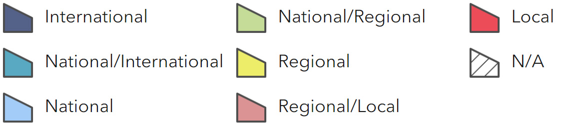
Main Beneficiaries Map
View Main Beneficiaries Map full screen in a new tab View Interactive Map HelpEcosystem service analysis
The following sections show the analysis used to determine key Ecosystem Service opportunities within the area. These opportunities have been combined with the analysis of landscape opportunities to create Statements of Environmental Opportunity. Please note that the following analysis is based upon available data and current understanding of ecosystem services. It does not represent a comprehensive local assessment. Quality and quantity of data for each service is variable locally and many of the services listed are not yet fully researched or understood. Therefore analysis and opportunities may change upon publication of further evidence and better understanding of the inter-relationship between services at a local level.
Note that numbers and figures in the body of the text are based on the 2014 profiles, unless otherwise stated.
Provisioning Services
Food provision
Assets/attributes: main contributors to service –
- Soils
- Livestock
- Particularly cattle
- Cereals
State – 54 per cent of agricultural land is classed as poor, Grades 4 and 5; 32 per cent is Grade 3; 2 per cent Grade 2; and 13 per cent Grade 1. The predominant farming type is pastoral accounting for about 63 per cent of farmed land use.
The most important livestock type is cattle (accounting for about 64 per cent) followed by pigs and sheep both at about 18 per cent.
Some arable farming, mainly cereals and oilseeds, takes place on sandier soils and the chalky slopes of Portsdown Hill. Within the Meon Valley where there are light, well- drained loams there are areas of intensive horticulture as well as garden centres and nurseries (The Hampshire Landscape: A Strategy for the Future, Hampshire County Council).
Main beneficiary – Local
Analysis – Agricultural practices are undergoing a profound change within the NCA. Horticultural businesses declined by 64 per cent and dairy farms by 44 per cent between 2000 and 2009. The fall in the number of dairy farms probably reflects the national downturn in dairy farming.
Historically the rural hinterland supplied Southampton with dairy and meat products, but now only about 38 per cent of the area is farmed. There is limited scope for increasing food production so specialising or producing for niche markets may be more profitable.
Grasslands are increasingly used for horse paddocks reflecting the difficulty of farming close to urban areas.
Because the character of the farmed landscape is predominantly pastoral, it is important to ensure future changes in farming practices do not have detrimental implications for grassland management, for example the undergrazing of chalk grassland on Portsdown Hill allowing scrub development.
Opportunities – Encourage good agricultural practices, soil and land management to ensure the long- term viability of food production, protect soils and improve water quality.
Encourage the development and promotion of supply chains and markets for local/regional produce especially within Southampton and Portsmouth, for example through Hampshire Fare.
Encourage the uptake of specialist or niche crops.
Support sustainable farming through agri-environment schemes and encourage the uptake of grassland and arable management options.
Principal services offered by opportunities –
- Food provision
- Biodiversity
- Sense of place/inspiration
- Regulating water quality
- Water availability
Timber provision
Assets/attributes: main contributors to service –
- Existing woodlands and conifer plantations
State – 75 per cent of woodland cover is broadleaved and 18 per cent is coniferous.
46 per cent of the woodland resource is ancient semi-natural woodland. 47 per cent of this is on ancient woodland sites replanted with trees not native to the area.
The Forestry Commission manages commercial timber production within the Forest of Bere. Their largest plantations are at Ampfield Wood, Creech Wood, Lords Wood and West Walk.
Main beneficiary – Regional
Analysis – Historically timber from the Forest of Bere supplied the ship-building industries of Southampton and Portsmouth (Hampshire County Integrated Character Assessment, Part 2 An Overview of the Hampshire Landscape, Hampshire County Council, Draft March 2010). Today it is still quite a strong timber-producing area. The wood is used for fencing, poles and some higher-quality firewood.
There is scope to increase production but this would need to be managed very sensitively. A high proportion of the woodlands within the NCA are designated as ancient semi-natural woodland and there is the potential to restore and strengthen this habitat. Any extension of timber production should avoid ancient woodland sites and prevent further fragmentation, for example by preventing the linking of ancient woodland sites with native trees or hedgerows.
If well planned, new areas of timber production could provide new access opportunities.
Opportunities – Promote a market for local timber products.
Ensure that timber production is managed to the best environmental standards to protect biodiversity, soil and water quality.
Encourage and support active sustainable wood and soil management practices to increase the resilience of woods to climate change.
Where possible replace coniferous plantations on ancient woodland sites with broadleaved trees native to the area.
Avoid new plantations of non-native trees on ancient woodland sites.
Avoid further fragmentation of ancient woodland sites.
Encourage appropriate new tree/woodland planting for environmental benefit and recreational provision.
Principal services offered by opportunities –
- Timber provision
- Biomass provision
- Biodiversity
- Climate regulation
- Sense of place/inspiration
- Tranquillity
Water availability
Assets/attributes: main contributors to service –
- Rainfall
- Chalk rivers
- Groundwater
State – The region is drained by several rivers including the Hamble, Itchen, Meon, and Test which have their sources in the Hampshire Downs and South Downs to the north and flow through the NCA to Southampton Water.
The River Hamble has water available for abstraction other than at low flows. The Meon and Test do not have water available other than at high flows. Abstraction on the Itchen is restricted even at high flows (East Hampshire Abstraction Licensing Strategy, Environment Agency, March 2013 & Test and Itchen Abstraction Licensing Strategy, Environment Agency, March 2013).
The NCA also overlies several minor aquifers, Central Hants Bracklesham Group, Central Hants Lambeth Group, South East Hants Bracklesham Group, East Hants Lambeth Group and the South Hants Lambeth Group.
All the aquifers apart from the East Hants Lambeth group aquifer have water available.
There is some abstraction by fish farms but these generally return the water after use so that there is no net consumption. Some water is also taken for agricultural use particularly by horticultural and nursery businesses within the Meon Valley.
The headwaters of the rivers are fed by the principal chalk aquifers in the Hampshire Downs and South Downs NCAs.
Some water for domestic consumption is abstracted at Testwood from the River Test and Gaters Mill from the River Itchen within the NCA.
Water abstracted from the River Test is exported to the Isle of Wight to supplement its water supply.
Main beneficiary – National
Analysis – The highly urban nature of the NCA means that there is a high demand for water mainly for domestic but also for commercial use. This is likely to grow as the population increases.
To maintain supplies of potable water, increasing water demand will need to be managed carefully. This can probably best be done through increasing water efficiency such as metering. However, managing the landscape sensitively, for instance by improving and linking the river meadows so that they can absorb water more efficiently, can also help improve water infiltration.
The Test, Itchen, Hamble and Meon all supply important internationally designated wetland sites for example the Solent and Southampton Water SPA. To maintain these wetlands in good ecological health it is important to maintain a sufficient water flow. Low flow levels in the rivers can also have consequences for the wildlife dependent on them including protected species such as Atlantic salmon and southern damselfly.
Opportunities – Promote and encourage the sustainable use and management of the area’s water resources among all user groups both within and outside the NCA.
Work with water authorities, local planning authorities and developers to ensure that any new development does not adversely impact on water resources.
Encourage water efficiency for all new development among developers and local authority planners as laid out in the Code for Sustainable Homes (Code for Sustainable Homes, Department for Communities and Local Government, 2006).
Encourage the linking, extension and good management of the river meadows to aid water infiltration.
Work with the Environment Agency and local water authorities to manage water abstraction from all the rivers so that low level flows do not adversely affect wildlife and wetland habitats.
Principal services offered by opportunities –
- Water availability
- Biodiversity
- Food provision
- Regulating water quality
- Climate regulation
- Regulating soil erosion
- Regulating soil quality
Genetic diversity
No information available.
Biomass energy
Assets/attributes: main contributors to service –
- Existing woodlands
State – The greatest potential for extending biomass provision within the NCA lies with provision of wood fuel.
Main beneficiary – Local
Analysis – Soils are predominantly heavy clays making miscanthus and short rotation coppice (SRC) crops unsuitable for some parts of the NCA.
Energy crops are best suited to the edge of urban areas and around new developments, both housing and industrial where they may bring landscape benefits by softening the interface between the rural and urban area. Well-designed plantations would benefit wildlife, landscape character as well as assist climate regulation.
Woodland cover is quite high at 18 per cent, three-quarters of which is broadleaved, providing a good potential source of wood fuel. The re- introduction of traditional management techniques such as coppicing, where these have been abandoned, would assist the expansion of biomass provision while improving the biodiversity interest of the woodlands and contributing to sense of place.
Opportunities – Encourage and promote SRC/miscanthus plantations at the edge of urban and industrial development to enhance the landscape and benefit wildlife.
Encourage a local market for wood fuel especially within Southampton, Portsmouth and Winchester.
Promote wood fuel production among owners and managers of broadleaved woodlands.
Encourage and support the re-introduction of traditional woodland management techniques through uptake of agri-environment/woodland grant schemes.
Principal services offered by opportunities –
- Biomass provision
- Biodiversity
- Climate regulation
- Sense of place/inspiration
Regulating Services
Climate regulation
Assets/attributes: main contributors to service –
- Peaty riverine soils
- Woodland
- Hedgerows
- Best practice land management techniques
State – The permeable seasonally wet soils prevalent in the NCA have a low carbon content of 0-5 per cent.
Woodland and hedgerows have the highest potential for carbon storage within the NCA.
Main beneficiary – Local
Analysis – Most soils within the NCA have little capacity to store high levels of carbon.
However, the rivers lay down beds of fen peat soils which have some potential for carbon sequestration. Improving, linking and extending the watermeadows/flood plains of the river valleys will increase their potential as a climate store.
Well-managed woodland (especially broadleaved), hedgerows and trees lock up carbon and produce humus rich soils, which are a good carbon store. Linking areas of woodland would increase their ability to act as a carbon store.
Changes in land management practices such as reduced tillage and reversion from arable to permanent grassland could benefit climate regulation through improved soil quality/structure and organic matter content.
The ability of urban areas to contribute to climate change mitigation could be increased by encouraging the adoption of energy efficiency measures in existing buildings and all new development.
The planting of new street trees, urban fringe woodlands and green roofs would also help climate regulation.
Opportunities – Extend, link and improve the condition of the river meadows along the chalk rivers to enhance their carbon absorption potential.
Link, extend and improve the semi-natural grassland cover to enhance its ability to sequester carbon.
Increase broadleaved woodland cover, link existing patches of woodland and restore the hedgerow network.
Encourage and support the restoration of coppice management for broadleaved woodlands linked to a market for biomass fuel and wood products.
Encourage the promotion and adoption of land management practices that maintain high levels of organic matter in soils and improve the soil structure to increase carbon storage through agri-environment schemes.
Encourage the adoption of energy efficiency measures in all new housing and industrial development as laid out in the Code for Sustainable Homes.
Promote the use of climate mitigation measures within Southampton and other urban areas such as the use of green roofs and street trees.
Encourage local planning authorities to provide non-motorised or public transport alternatives for all new medium-and larger-scale developments to minimise additional use of car transport.
Principal services offered by opportunities –
- Climate regulation
- Biodiversity
- Biomass energy
- Regulating soil quality
- Regulating soil erosion
Regulating coastal erosion and flooding
Assets/attributes: main contributors to service –
- Flood defences
- Intertidal mudflats and salt marsh
- North Solent Shoreline Management Plan
State – Most soils in the NCA are not at high risk of erosion. However the heavier clayey soils are not very permeable and run-off after heavy rainfall may cause erosion of fine manures.
Main beneficiary – Local
Analysis – The shoreline of Southampton Water within the NCA is heavily developed. Southampton docks stretch between the estuaries of the Test and the Itchen.
The recommendation of the North Solent Shoreline management plan – coastal defence policy is to ‘hold the line’ across most of the NCA to protect the port and city of Southampton.
The main exception is the Lower Test estuary. This is the least developed part of the Southampton Water shoreline within the NCA and incorporates the Lower Test Valley SSSI. Here it is recommended that no active intervention should take place.
Opportunities – Carry out research within the Lower Test Valley SSSI to help better understand the changes that may occur due to sea level rise and how the SSSI may best be managed to adapt to them.
Work with partners and stakeholders for the Lower Test Valley SSSI to agree climate change adaptation actions including managed intertidal habitat roll-back.
Principal services offered by opportunities –
- Regulating coastal erosion and flooding
- Biodiversity
- Sense of place/ inspiration
Regulating water quality
Assets/attributes: main contributors to service –
- Aquifers and groundwater
- Rivers
- Semi-natural habitats such as watermeadows and grass pasture
- Trees, woodland and hedgerows
- Test and Itchen Catchment Sensitive Farming Scheme
State – For information regarding the current state of water quality within this NCA, refer to the Environment Agency (Draft river basin management plan maps).
Main beneficiary – Regional
Analysis – Phosphates and nitrates from effluent and agricultural run-off although at permissible levels are showing an upward trend. These can promote algal blooms not only in the rivers themselves but also in sensitive wetlands sites such as Southampton Water when they are washed downstream. Algal blooms can have a harmful effect on estuarine and riverine wildlife by lowering oxygen levels. Any new development should ensure that measures are taken to avoid this.
Siltation of the rivers Test and Itchen particularly from agricultural run-off is also a matter for concern. When suspended in water sediment can affect the success of spawning in fish and has been linked to a recent decline in the numbers of salmon and brown trout.
The Test and Itchen Catchment Sensitive Farming Scheme is working with farmers to address these problems (Rivers Test, Itchen and Alresford Pond Diffuse Water Plan, December 2012)
Well-managed permanent grassland and meadows, buffer strips in arable, trees, woodland and hedgerows can help to filter and prevent run-off from agricultural land.
Opportunities – Work with partners, including the Environment Agency and water companies, to ensure that new development does not cause deterioration in water quality.
Work with farmers, land managers and industry along the whole of the river catchments to monitor and limit sources of diffuse and industrial pollution to the chalk rivers and flood plains.
Where appropriate, encourage the use of buffer strips to capture run-off.
Promote and implement measures to reduce diffuse pollution through good land management practices especially encouraging the careful use of herbicides, pesticides and fertilisers on farmland.
Extend, link and improve the quality of permanent grassland particularly flood meadows on arable land to absorb water pollution and reduce run-off.
Consider new woodland plantations and restoration of the hedgerow network where appropriate to prevent run-off from agricultural land.
Principal services offered by opportunities –
- Regulating water quality
- Water availability
- Regulating water flow
- Biodiversity
- Regulating soil quality
- Regulating soil erosion
- Food provision
- Sense of place/inspiration
Regulating water flow
Assets/attributes: main contributors to service –
- Semi-natural habitats particularly watermeadows, flood plain grassland and woodland
- Rivers
- Hedgerows
State – There are several flooding hotspots within the NCA around Romsey, Monks Brook, Eastleigh and Southampton (Test and Itchen Catchment Flood Management Plan Summary Report, Environment Agency, 2009).
Main beneficiary – Regional
Analysis – Any new development should be planned to minimise flooding risk and inappropriate development avoided on river flood plains. Even if not directly sited on a flood plain, development can reduce the capacity of the landscape to absorb water. To avoid increasing the flood risk, measures should be taken to prevent additional run-off, for instance by installing permeable pavements and sustainable urban drainage systems (SUDS).
Restoring meanders to previously straightened rivers where appropriate could help to slow water flow.
Existing semi-natural habitats such as grassland and the watermeadows of river flood plains provide some capacity to accommodate flooding. The grassland habitat is in many places is fragmented. Linking these and improving the management of river meadows will help their ability to moderate flood waters.
Planting and extending woodland in strategic places could help to stem overland flows.
Opportunities – Protect the flood plains along the chalk rivers and their tributaries from inappropriate development.
Encourage and promote the use of SUDS and green roofs, and create new flood storage areas within urban areas.
Link, extend and improve the management of semi-natural habitats such as river meadows and wetland areas along the rivers so that they function more effectively as flood plains and provide areas of temporary water storage.
Explore the potential for restoring straightened watercourses to their more natural meanders to help slow the flow of excess water.
Encourage and support the adoption of good agricultural practices such as the good management of soils on farmland to aid infiltration.
Explore whether new woodland plantations strategically placed might assist in stemming overland flow.
Principal services offered by opportunities –
- Regulating water flow
- Regulating water quality
- Biodiversity
- Regulating soil quality
- Regulating soil erosion
Regulating soil quality
Assets/attributes: main contributors to service –
- Soils
- Semi-natural habitats
- Woodlands and hedgerows
State – The soilscape for most of the NCA is slowly permeable seasonally wet slightly acid but base-rich loamy or clayey soils. This is interspersed with outcrops of sandstone which give rise to more acid sandy soils.
Main beneficiary – Local
Analysis – Many of the clayey or loamy soils within the NCA are at risk of diffuse pollution, sediment run-off and flooding because of poor water infiltration. Their structure can be easily damaged when wet. The increased high rainfall events predicted due to climate change may exacerbate soil quality problems in future.
Maintaining good structural condition through careful management of livestock to avoid poaching and adding organic matter where appropriate will aid water infiltration.
Opportunities – Improve infiltration by increasing the organic matter content of the soil where levels are low.
Promote, encourage and adopt good sustainable land, soil and water management practices for livestock and arable production which minimise damage to soil structure such as sensitive grazing, careful timing of cultivations and, minimum tillage techniques.
Encourage the use of winter stubbles, margins and the planting of more hedgerows and provision of permanent pasture.
Principal services offered by opportunities –
- Regulating soil quality
- Regulating water flow
- Regulating soil erosion
- Climate regulation
- Food provision
Regulating soil erosion
Assets/attributes: main contributors to service –
- Soils
- Hedgerows
- Buffer strips
- Woodland and trees
- Semi-natural habitats – grassland cover
- Riparian habitats
State – Most soils in the NCA are not at high risk of erosion. However the heavier clayey soils are not very permeable and run-off after heavy rainfall may cause erosion of fine manures.
Main beneficiary – Local
Analysis – Soil erosion is not a significant problem within the NCA, the exception being the slopes of Portsdown Hill where the chalky soils are shallower especially if under arable.
Some silt is washed into the rivers through agricultural run-off in adjacent NCAs such as the Hampshire Downs.
The Test and Itchen Catchment Sensitive Farming Scheme is working with local farmers to reduce the problems of sedimentation.
Opportunities – Prevent soil erosion by adopting good agricultural practices such as improving the hedgerow network, riparian habitat management and providing wide buffer strips in arable areas.
Encourage and promote reversion from arable to grassland for cultivated land on Portsdown Hill where soil erosion is a problem.
Principal services offered by opportunities –
- Regulating soil erosion
- Regulating soil quality
- Regulating water quality
- Regulating water flow
- Food provision
- Biodiversity
Pollination
Assets/attributes: main contributors to service –
- Semi-natural habitats
- Farmland
- Parks and gardens
- Hedgerows
- Watercourses
State – The semi-natural habitats, hedgerows and woodland together with the parks, gardens and greenspace within Southampton and other urban areas provide good habitat for pollinators.
Main beneficiary – Local
Analysis – The nutritional value of pastureland can be improved by the addition of clovers which are bee pollinated.
Around the Meon Valley, market gardening relies on pollinators particularly bees as do oilseed rape crops.
The semi-natural habitats and ancient woodland of the NCA hosts a good assemblage of pollinators such as the hoverfly colonies at Hook Heath meadows and butterfly assemblage at Waltham Chase meadows.
However, many semi-natural habitats within the NCA are highly fragmented. It is important that these habitats are extended and linked where possible to support pollinators and allow them easily to access crops.
Dense urban areas such as Southampton can act as a barrier to pollinators. This could be mitigated by reinforcing and expanding the green infrastructure in and around towns such as making greenspace attractive for pollinators and installing green roofs.
Transport routes can be used to help the movement of pollinators through the use of nectar-rich plants along road verges and edges.
Opportunities – Encourage the extension linking and better management of semi-natural habitats such as river meadows and ancient woodland as well as the restoration of hedgerows to support pollinators.
Encourage greater sward diversity to attract a greater range of pollinators.
Encourage the provision of flower-rich buffer strips in arable fields, good hedge bottom management and where appropriate reversion to grassland.
Raise awareness of the importance of all pollinators with land managers, woodland managers and the wider public.
Promote agri-environment schemes and good land management practices.
Encourage wildlife gardening for pollinators in urban areas such as Southampton, Waterlooville and Havant.
Promote the installation of green roofs in urban areas that will support pollinators.
Encourage the planting and management of flower-rich strips along the major road networks such as M3 and M27.
Principal services offered by opportunities –
- Pollination
- Biodiversity
- Food production
- Sense of place/inspiration
Pest regulation
Assets/attributes: main contributors to service –
- Hedgerows
- Woodland
- Parks and gardens
- Semi-natural habitats
- Farm land
State – The existing spread of semi-natural habitat within the NCA supports a range of pest predators. Some habitats are fragmented and this limits the extent to which predatory species are able to assist pest control on farmland.
Main beneficiary – Local
Analysis – Strong linked networks of semi-natural habitats with good connectivity including woodland, hedgerows and buffer strips provide good habitat for pest predators. For instance, Trodds Copse SSSI has a notable hoverfly fauna.
The fragmentation of farmland and increasing urban and industrial development can act as a barrier to biological/natural pest control. Better linked habitats would help allow the movement and spread of predators and support an increase in their numbers.
An increase in biological/natural control of pests may allow a decrease in the use of chemicals and pesticides on farmland.
Opportunities – Promote good farming practices through the uptake of agri-environment schemes that support pest predators such as beetle banks and improvement of the hedgerow network.
Encourage and promote the careful/reduced application of pesticides to limit their impact on pest predators.
Encourage the linking, network development and improved management of semi-natural areas to allow the movement of pest predators and help them maintain or increase their numbers particularly where this is adjacent to areas of horticultural farming.
Encourage local authorities to adopt more sensitive management and planting regimes in urban greenspace, for example grass cutting, planting of wild flower species to support more diverse invertebrates.
Principal services offered by opportunities –
- Pest regulation
- Food provision
- Biodiversity
- Pollination
Cultural Services
Sense of place/inspiration
Assets/attributes: main contributors to service –
- River valleys and flood plains
- Patchwork of small irregular fields bounded by hedgerows
- Historic Forest of Bere
- Historic buildings of Southampton and Romsey
- Views such as across Southampton Water
State – The NCA is highly urban in parts but it has many features which provide an escape from the pressures of city living such as the fast-flowing clear waters of the rivers in wide lush valleys which cut across the undulating farmed and well-wooded landscape.
The historic Forest of Bere is dominated by oaks and ancient woodland and the patches of woodland are distinctive and valued features.
The river valleys in places offer open views to the surrounding countryside and Portsdown Hill affords magnificent views across Portsmouth Harbour to the Isle of Wight.
Main beneficiary – Local
Analysis – The NCA has one of the highest rates of urbanisation within the country. Ensuring that sufficient greenspace is provided in any new development will help preserve the landscape character of the NCA and promote a sense of place. Preserving important views for instance within the river valleys and from Portsdown Hill.
In recent years, there has been considerable small-scale development in particular on the edge of the Forest of Bere which is having a detrimental effect on the landscape character of the Forest.
The NCA is close to several protected landscapes, the New Forest National Park, the South Downs National Park and Chichester Harbour AONB. The South Downs National Park runs along the NCA border from Otterbourne to Soberton Heath. Any development within the NCA should be carefully planned so that it does not have an impact on neighbouring protected landscapes, for instance through visual intrusion or light pollution.
Opportunities – Ensure that greenspace is provided within any new development to improve landscape character.
Encourage the use of neighbourhood plans to maintain rural character and inform planning control.
Encourage good design within development in Southampton so that it does not impinge on surrounding NCAs including visual disturbance such as views and light spill.
Ensure that the views within the river valleys are taken into consideration in any planning application and protected where possible.
Support and encourage the implementation of adjacent National Park management plans and consider effects on them of any development within the NCA.
Principal services offered by opportunities –
- Sense of place/inspiration
- Sense of history
Sense of history
Assets/attributes: main contributors to service –
- Forest of Bere
- Historic centre of Southampton
- Romsey Abbey
- Netley Abbey
- Palmerston Forts
- Scheduled Monuments
- Listed Buildings
- Historic field boundary patterns
- Archaeological features
State – There are 86 Scheduled Monuments.
Some of the earliest evidence for human occupation of the area comes from Portsdown Hill where there are the remains of Neolithic and bronze-age barrows.
Southampton has had a long history as an international port and has for many centuries exerted an influence on the surrounding landscape, for example trees from the New Forest and the Forest of Bere were harvested for use in the navy. It still retains important examples of early medieval domestic architecture and medieval walls.
Main beneficiary – Regional
Analysis – Portsdown Hill could be more widely promoted as a tourist destination. This would need to be done in a sustainable way in order to preserve the monuments but could help to promote a sense of place locally and strengthen the local economy.
Opportunities – Ensure the preservation and upkeep of prehistoric and historic monuments on Portsdown Hill such as the Neolithic barrows.
Promote awareness of the history of Portsdown Hill among local communities to promote a sense of place.
Encourage sustainable tourism to Palmerston forts and Southampton.
Principal services offered by opportunities –
- Sense of history
- Sense of place/inspiration
- Recreation
Tranquility
Assets/attributes: main contributors to service –
- Forest of Bere
- Chalk river valleys and estuaries
- Mixed farmland and well-wooded landscape
- Semi-natural habitats
- Parks and gardens
State – According to data from the CPRE most of the NCA (64 per cent) suffers disturbance and 29 per cent is urban. Only 7 per cent is now undisturbed.
Remaining pockets of tranquillity are to be found within the woodland in the Forest of Bere, for instance Creech Wood and West Walk, west of Waterlooville.
Main beneficiary – Local
Analysis – According to the CPRE map of tranquillity, the area within the NCA that can be considered undisturbed has declined from 38 per cent since the 1960s to 7 per cent.
The NCA is adjacent to two National Parks, the New Forest and the South Downs and is close to the Chichester Harbour AONB. To preserve the tranquillity of the neighbouring protected landscapes their settings should also be considered in any development within the NCA.
Opportunities – Protect the remaining tranquil areas within the Forest of Bere and river valleys for their importance to sense of wellbeing through careful planning of any new development.
Encourage new planting of trees, woodland and hedgerows, linking woodland to reinforce well-wooded character of farmland and buffer the fringes of Southampton/ urban areas and within the Forest of Bere to provide greater tranquillity.
Manage the expansion of and consider buffering major transport routes through shelterbelts for instance through new woodland creation.
Ensure that areas of greenspace especially within Southampton offer the maximum possible tranquillity.
Principal services offered by opportunities –
- Tranquillity
- Biodiversity
- Sense of place/inspiration
- Sense of history
Recreation
Assets/attributes: main contributors to service –
- Public rights of way
- Forest of Bere and woodland
- Southampton Water
- Portsdown
- Hill River valleys
- Urban greenspace
State – The NCA has 427 km of public rights of way at a density of 1.11 km2.
Only 8 per cent is classified as being publically accessible, the majority of which is within woodland.
Sites owned by the Forestry Commission, such as at Creech Wood and West Walk, are open for access by the public.
Southampton acts as a base for many water sports on Southampton Water and the Solent.
The Lower Hamble estuary is also a popular venue for sailing.
The NCA incorporates one of Hampshire’s largest country parks – Manor Farm Country Park.
The Test Way long-distance route allows access to the Test river valley.
The NCA has several Local Nature Reserves, the majority located in or close to Southampton.
Main beneficiary – Regional
Analysis – There are several good opportunities for recreation within the NCA including a country park at Manor Park and woodlands managed by the Forestry Commission. There is a large and growing urban population both within the NCA itself and in the adjacent NCA South Coast Plain.
Any new large-scale development should give consideration to providing good quality recreational opportunities.
The NCA has several sensitive sites such as the Solent and Southampton Water SPA. Heavy recreational use at Southampton Water could cause bird disturbance if not managed carefully. In order to avoid impacting adversely on designated sites, plans for new development should include provision for good quality alternative greenspace.
The Forestry Commission offer several opportunities for adventure activities within the woodland they manage such as natural play areas at West Walk and Creech Wood. There are also several private woodlands offering adventure play. These could potentially be expanded to offer an alternative to other more sensitive sites such as the Solent and Southampton SPA and the New Forest National Park while also supporting the local economy.
Opportunities – Promote understanding of the biodiversity importance of all the designated sites among all users.
Encourage adventure play within the Forest of Bere to promote enjoyment and appreciation of the natural environment without adversely affecting the areas of high biodiversity, landscape quality or tranquillity.
Principal services offered by opportunities –
- Recreation
- Biodiversity
Biodiversity
Assets/attributes: main contributors to service –
- Internationally designated sites including Solent and Southampton Water SPA, Solent and Southampton Water Ramsar, Solent Maritime SAC, River Itchen SAC and Emer Bog SAC
- SSSI
- Priority semi- natural habitats such as ancient woodland, unimproved lowland grassland, chalk grassland, flood plain grazing marsh, arable field margins, hedgerows and ponds.
State – The complexity of the estuarine system within Southampton Water and the double tides has allowed a wide variety of estuarine habitats to develop including mudflats and reedbeds. These support an important assemblage of breeding birds particular gulls and terns such as the little tern and sandwich tern and overwintering birds including the dark- bellied Brent goose.
The rivers Test and Itchen are internationally important examples of chalk river habitat. The Itchen has been notified as a SAC for its water- crowfoot vegetation and populations of southern damselfly and bullhead.
Emer Bog SAC has been notified with the NCA, as an example of rare lowland bog habitat. It supports several species of bog plants and important invertebrates.
Almost 3 per cent of the NCA area is designated as SSSI. Of these, only 78 per cent are judged to be favourable, 54 per cent are unfavourable, recovering, 6 per cent are unfavourable, no change and 8 per cent are unfavourable, declining.
The area has a high percentage (46 per cent) of ancient woodland cover.
Other priority habitats include flood plain grazing marsh and watermeadows which are suffering from fragmentation.
The farmed and well- wooded landscape with its small hedged fields also provides important wildlife habitats.
Main beneficiary – International
Analysis – The hinterland of Southampton Water houses a large urban population. As a popular sailing and watersports venue it also attracts a wealth of visitors. Heavy recreational use of the area can lead to the disturbance of the birds for which the estuary has been notified.
The provision of high quality alternative sites could help to reduce the pressure on the SPA.
Waders and Brent geese use areas outside the SPA for roosting and feeding.18 In order to minimise disturbance to the birds in these areas, this should be considered in relation to any new coastal development. Where appropriate more important roosting and feeding sites could be considered for Local Nature Reserve designation or other local site designation.
The rivers support many species of international importance including salmon, southern damselfly, white-clawed crayfish, brook lamprey, bullhead, water vole and otter. However, they face several issues including that of eutrophication from rising levels of phosphates and nitrates levels and that of invasive species such as Himalayan balsam, mink, signal crayfish and topmouth gudgeon.
Currently, both the rivers Itchen and Test as a whole are judged to be in an unfavourable but recovering condition.
Abstraction for water use also has to be managed carefully as periods of reduced flow can have a serious impact on riverine wildlife for instance in hindering the development of fish fry. The drier summers predicted due to climate change may make balancing water flow and water abstraction all the more difficult.
The area has a high proportion of ancient semi- ancient natural woodland which is predominantly oak with a hazel understory. The upper Hamble woodlands have examples of small-leaved lime and wych elm. They also show examples of succession from salt marsh on the edge of the estuary to full woodland. Botley Wood is nationally important for its butterfly species including purple emperor, silver washed fritillary and white admiral.
The high coverage of semi-natural ancient woodland means that there is a high potential for the restoration of ancient woodland within the NCA through the replanting of ancient woodland with non-native trees, with trees native to the area and improved linkages to other ancient woodland sites through new tree or hedgerow planting.
The flood plains of the main rivers have some important areas of species-rich flood plain grassland particularly in the Lower Test where there are examples of transition from neutral grassland through to brackish grassland, reedbed, fen and salt marsh.
Portland Hill is a key area of chalk downland. It is home to a rich fauna and flora including the endemic early gentian and chalk hill blue butterfly.
Scrub encroachment is an issue as there has been a movement away from traditional grazing management.
Heathland at one time was probably a much more significant habitat within the Forest of Bere. Some areas of heathland have survived, for instance at Baddesley Common and Netley Common. There could be scope for restoring and extending heathland around these remaining fragments.
Opportunities – Encourage research into use of the surrounding countryside by waders particularly Brent goose, for roosting and feeding.
Ensure roosting and feeding sites by Brent geese are taken into consideration for any new proposed development.
Where appropriate consider the designation of important Brent goose feeding sites as Local Nature Reserves.
Seek to improve water quality through the Catchment Sensitive Farming scheme for the biodiversity of the chalk rivers and to prevent algal blooms in Southampton Water.
Seek to manage and increase the areas of watermeadow alongside the rivers Test and Itchen to increase this habitat for pollinators and act as a buffer for the rivers from agricultural and industrial run-off.
Encourage the re-introduction of traditional grazing on watermeadows where possible.
Work with partners including the Environment Agency, angling groups, farmers and landowners to improve the riparian vegetation for fish and invertebrates and provide landscape and tranquillity benefits.
Work with the Environment Agency to improve the hydrology of the chalk rivers to benefit wildlife such as Atlantic salmon and damselflies.
Work with partners to improve the permeability of rivers to migratory fishes such as salmon and brown trout through the installation of fish ladders and the removal of impediments to fish migration.
Encourage the removal of conifers and other non-native species from ancient woodland sites where possible and replace with species native to the area.
Encourage the re-introduction and restoration of appropriate management for broadleaved woodland such as rotational coppicing to improve biodiversity.
Where possible seek to link areas of ancient woodland including through hedgerows and new plantations of native woodland to strengthen their resilience to climate change and enhance their biodiversity value.
Encourage the restoration and maintenance of the hedgerow network to improve connectivity.
Promote the importance of the chalk flora and fauna of Portsdown Hill among the wider population.
Explore the possibility of restoring and enhancing heathland such as that at Baddesley Common.
Principal services offered by opportunities –
- Biodiversity
- Regulating water flow
- Regulating water quality
- Sense of place/inspiration
- Biomass energy
- Tranquillity
- Timber provision
Geodiversity
Assets/attributes: main contributors to service –
- Bedrock geology
- Soils
- Portsdown Hill
State – There are no nationally or locally designated geological sites.
The NCA lies within the Hampshire Basin and the underlying bedrock is mostly Tertiary open marine, estuarine and freshwater sediments of sand and gravel.
The oldest exposure is Portsdown Hill, which was laid down during the Upper Cretaceous 83-74 million years ago.
Main beneficiary – Local
Analysis – There are currently no nationally or locally designated sites within the NCA. However, the area has a large population and a local geological site designated for educational purposes could be useful in explaining the evolution of the area.
Opportunities – Promote public awareness of local geology particularly at Portsdown Hill for instance through school visits, and interpretation boards.
Explore the possibility of creating a local geological site for educational purposes to explain the geological evolution of Portsdown Hill and the creation of Southampton Water/ Solent.
Principal services offered by opportunities –
- Geodiversity
- Sense of place/inspiration
- Sense of history